Exploration = Education
"Place" is universal, spanning disciplines, cultures, and nature, connecting us all to the surrounding world. Google Earth enables everyone to interpret and understand these relationships by visualizing locations, directions, geophysical features, and environmental changes. The more we engage with Google Earth, the better we understand our interdependent world, and the more equipped we are for a global future.


To learn more about Google Earth, visit the help center.
Discover India
Using the Search feature, you can easily learn more about places around the world by clicking open the related Knowledge Card. Within the card you will find detailed information and related places to explore.

Learn About India in a New Way
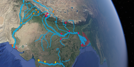
India Literacy Project (ILP) is a non profit organization dedicated to the cause of literacy in India, working in over 1,700 villages and 3,300 schools. In the past 10 years ILP created the Multi-Dimensional Learning Space (MDLS) initiative as a during-school and after-school program that provides opportunities for school children to experiment, discover, and learn in multiple ways. As a part of its MDLS program, ILP has been working with Google Earth to create interactive content for students to learn the Social Sciences (History & Geography).
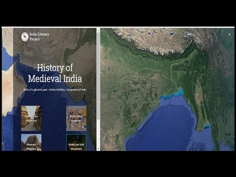
Using Google Earth, Google Maps, and Street View, the ILP team - including ILP-Youth volunteers - created interactive content that is mapped to the school curriculum of 4 states (Andhra Pradesh, Karnataka, Tamil Nadu and Telangana) for Grades 5 through 10.
This powerful education package shows historical sites, flows of rivers, and kingdoms of various rulers. Tailored content for each grade has enabled the teacher to navigate the curriculum in an easy manner and take their classrooms on virtual journeys that capture the imagination of young minds as they seek to understand and explore the world around them, both past and present.
~ Padmaja Sathyamoorthy ILP, Operations Coordinator