Wagontire Mountain L.O.

Oregon Lookouts

Location.

Bureau of Land Management – Burns District

Status.

Emergency; Currently standing

Estimated drive time from Portland, OR.

6 hours

Date visited.

June 18, 2022

Elevation.

6,510′

National Historic Lookout Register.

US 954;OR 126

Trip Report.

We tried to wake up early Saturday morning to give us as much time as possible to visit Wagontire Mountain, fondly referred to as Wagon-TEER by my partner. It was an unfortunately damp morning and looked like it would be a rainy day ahead. From Hines to the community of Wagontire is about 50 miles of highway driving that doesn’t include our drive out of the forest, the 5 miles of gravel to the gate, or the 6 miles of hiking we’d need to do round trip. We headed out of camp back towards Hines and out on HWY-20 towards Riley. From Riley, we turned on to HWY-395 to the community of Wagontire. We weren’t able to see the lookout from the highway since it was deep within a rain cloud. The road you will take to get to the lookout is unmarked. It will be the first right turn after mile post 29D outside of the community of Wagontire. None of the roads leading to the lookout in this area are marked at all and could be confusing without the proper directions. I had done some prior research and found detailed directions from an Ascent Trip Report by Paul McClellan on PeakBagger. It’s helpful to zero your odometer and follow his below directions.

  • 0.0 cross a cattle guard
  • 0.4 continue straight, right at the junction
  • 1.5 continue straight, right at the junction
  • 3.2 cross a dry creek bed. I’d barely consider this a creek bed and given that it was dry even during a wet spring makes me think it only flows when the snow melts.
  • 4.0 cross a cattle guard
  • 5.2 cross a cattle guard
  • 5.6 bear right at the junction, you should see the gate shortly after
  • 5.8 arrive at gate and park

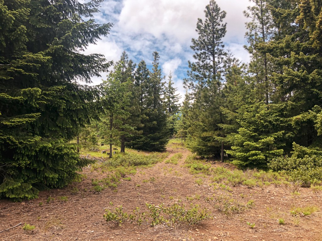
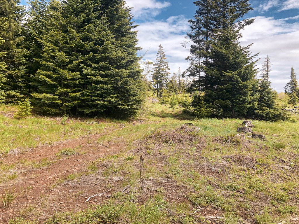
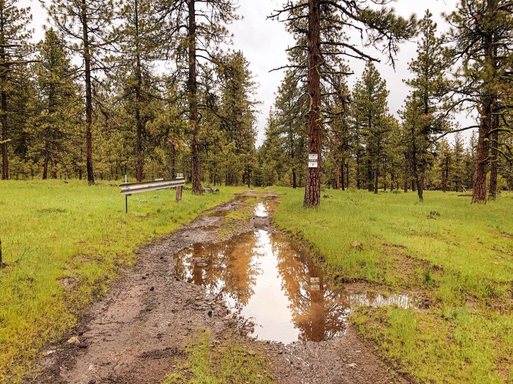
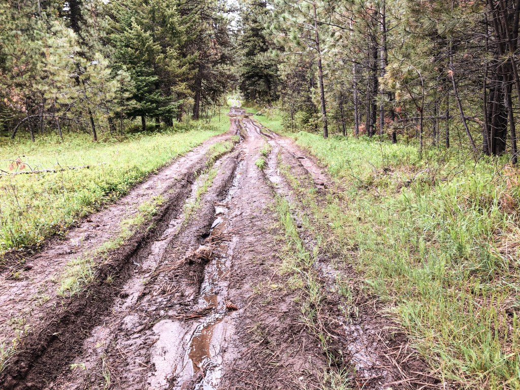
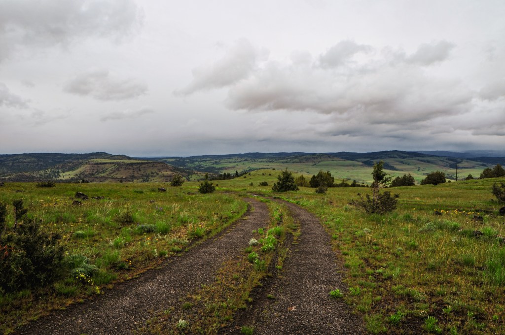
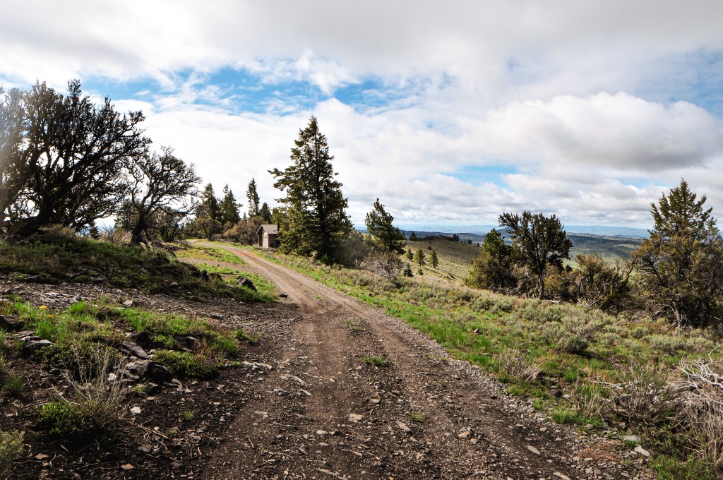
It seems in previous years the gate leading to the lookout has been locked, but it was open on our trip. The road just past the gate is overgrown and full of large rocks that I wouldn’t want to attempt even on a good day. We parked to start our 3-mile hike to the summit. The roads getting to the gate alternate between dirt and rock. The dirt sections were a bit slick after all the rain and the rocky sections would pose a threat to a lower clearance. I was once again thankful for the extra clearance provided by the HR-V and speculated if my Civic could handle this road too. I think if one was to attempt this in a lower clearance vehicle they would need to do this on a dry day with a lot of confidence.

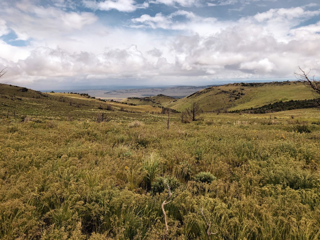
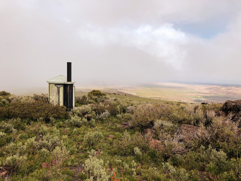
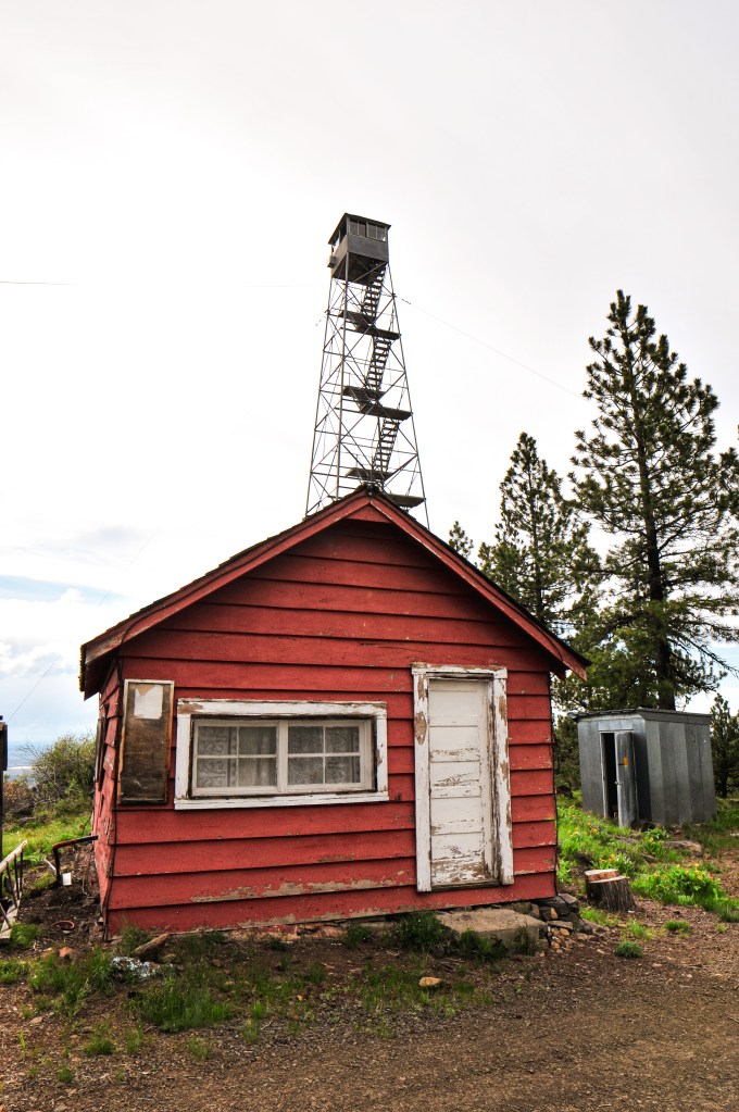
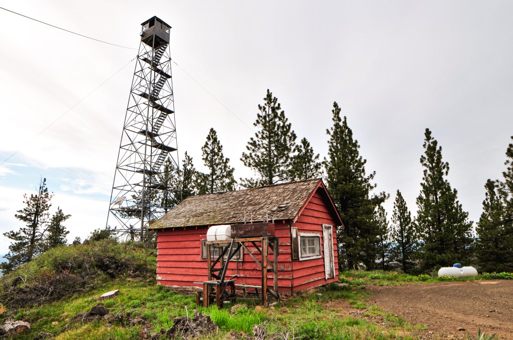
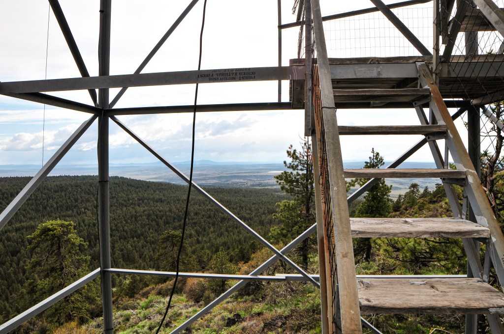
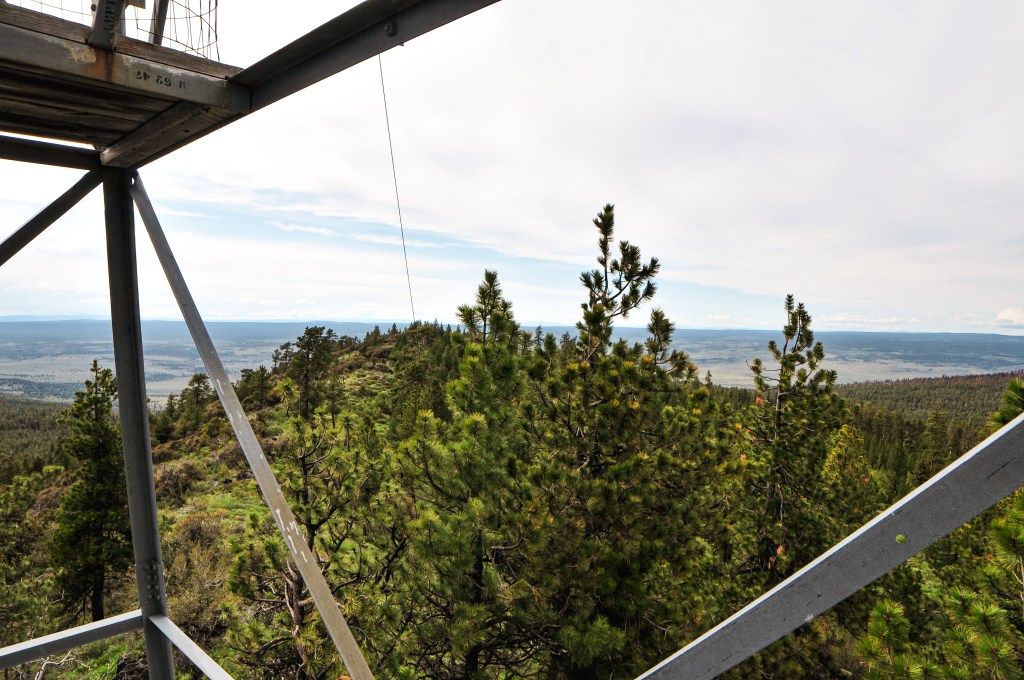
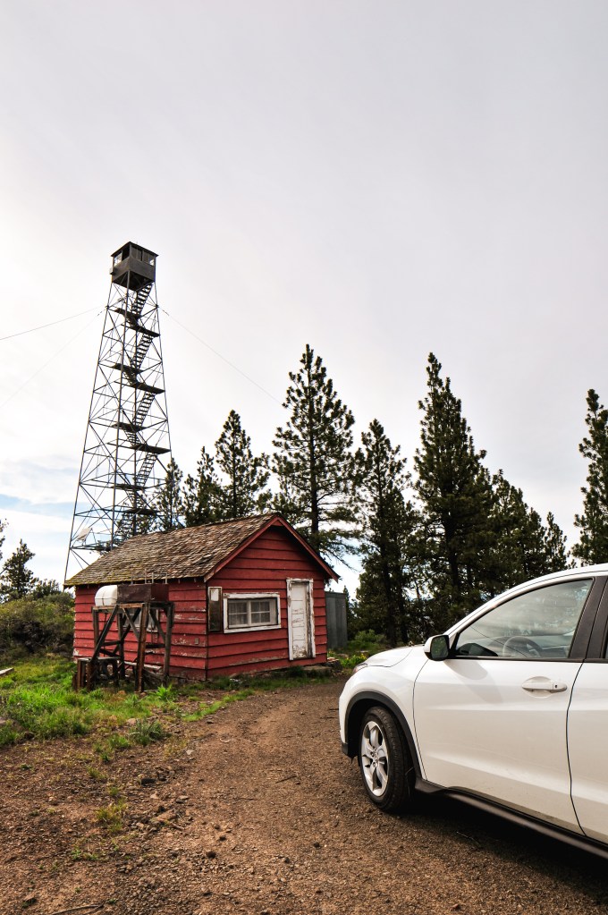
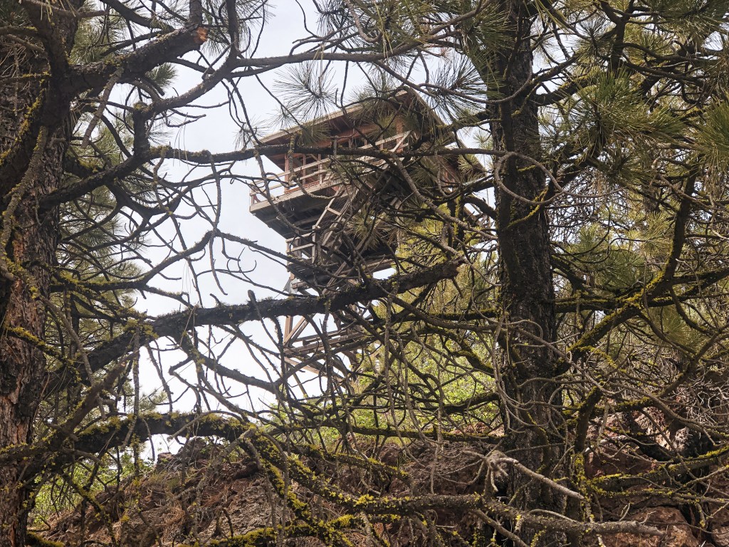
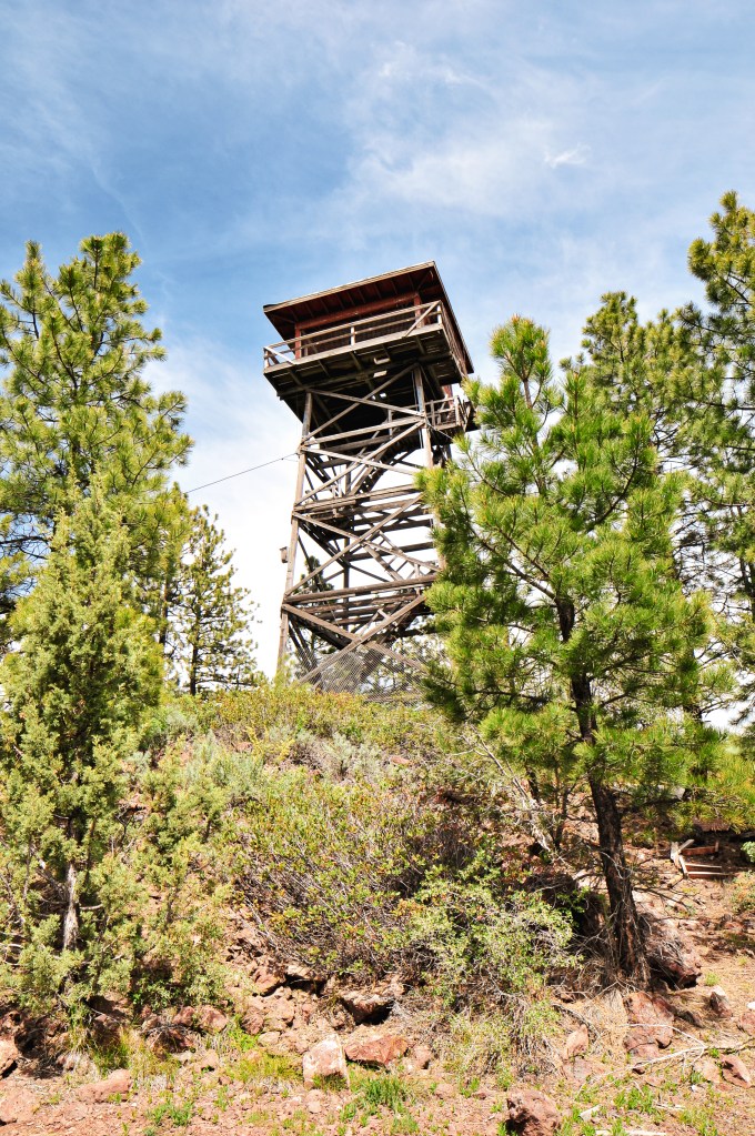
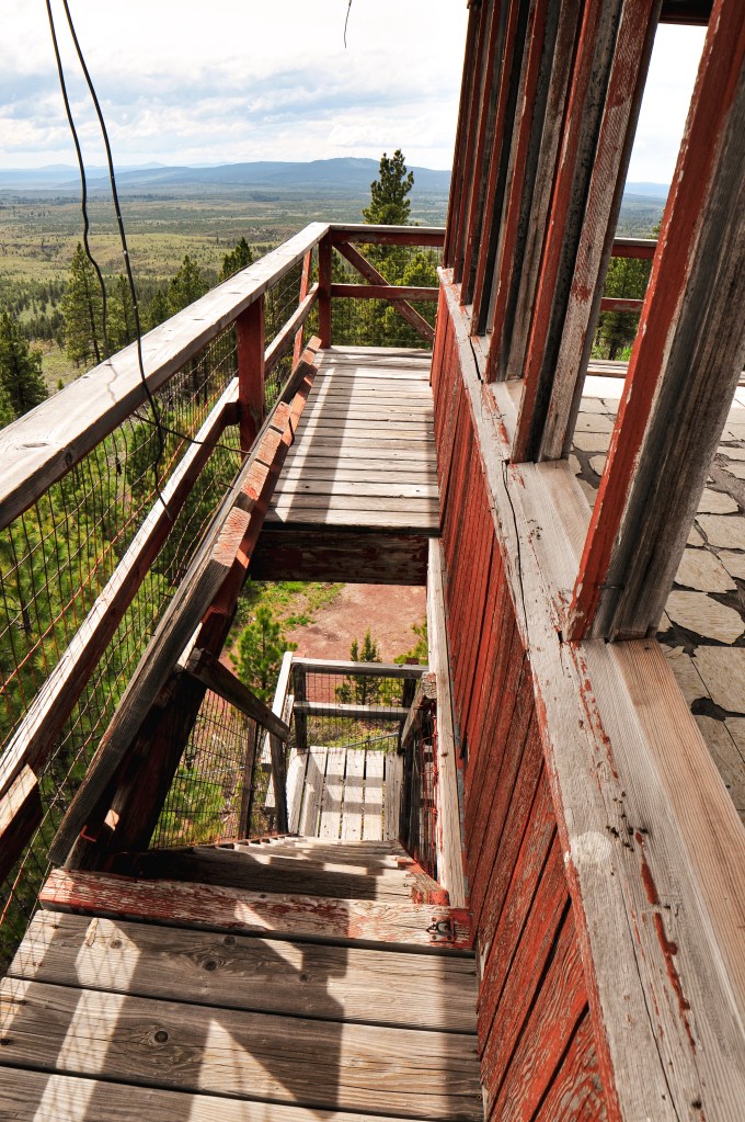
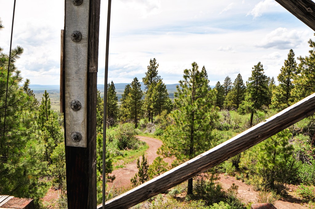
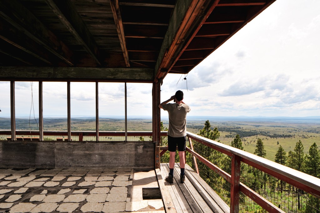
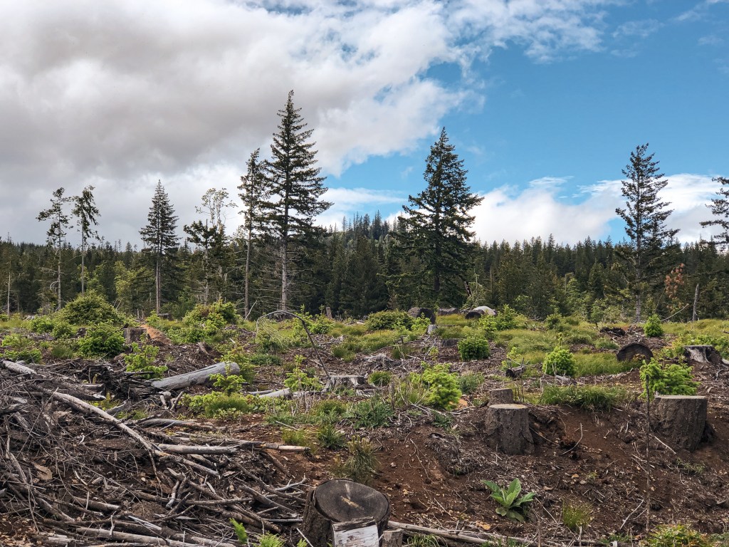
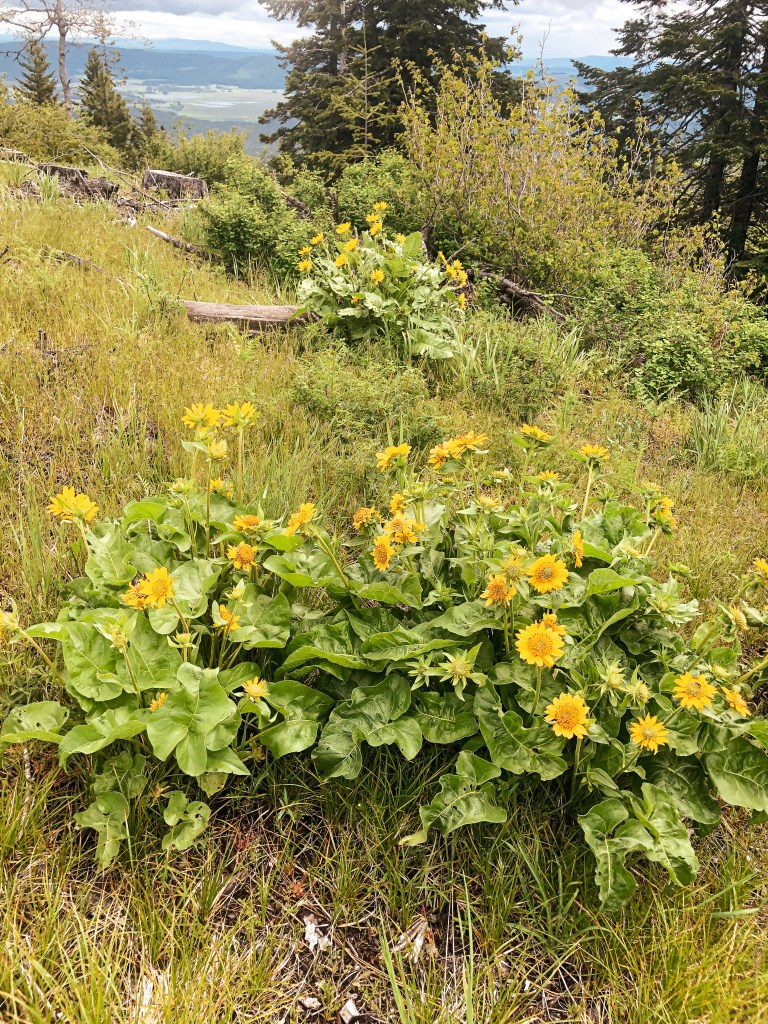
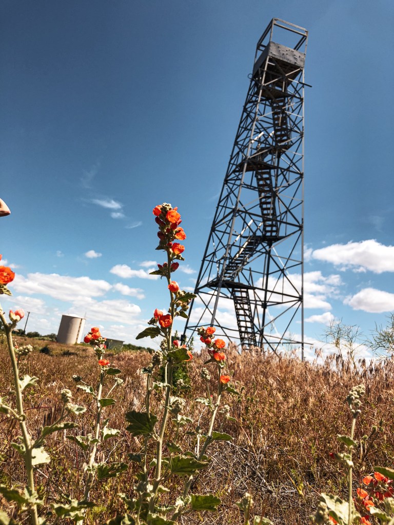
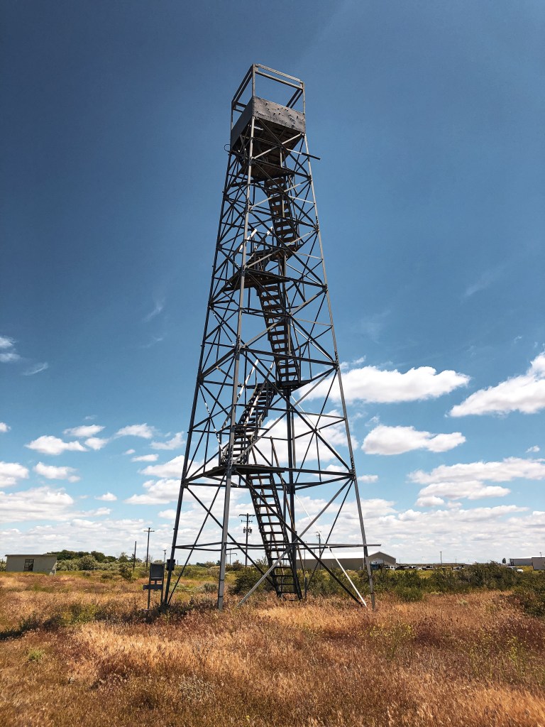
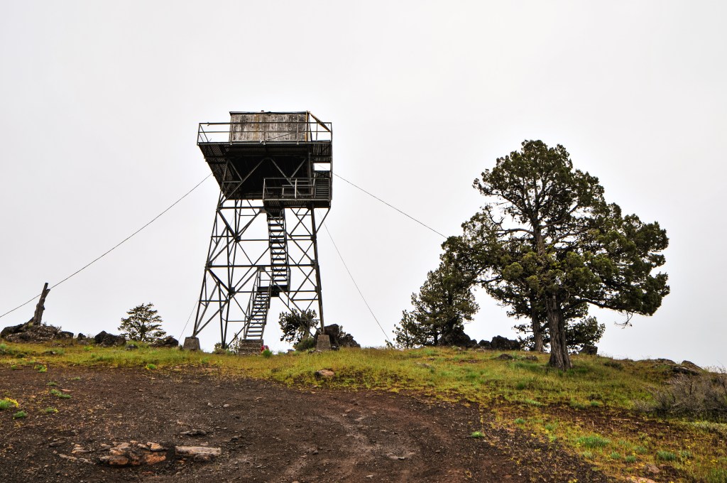
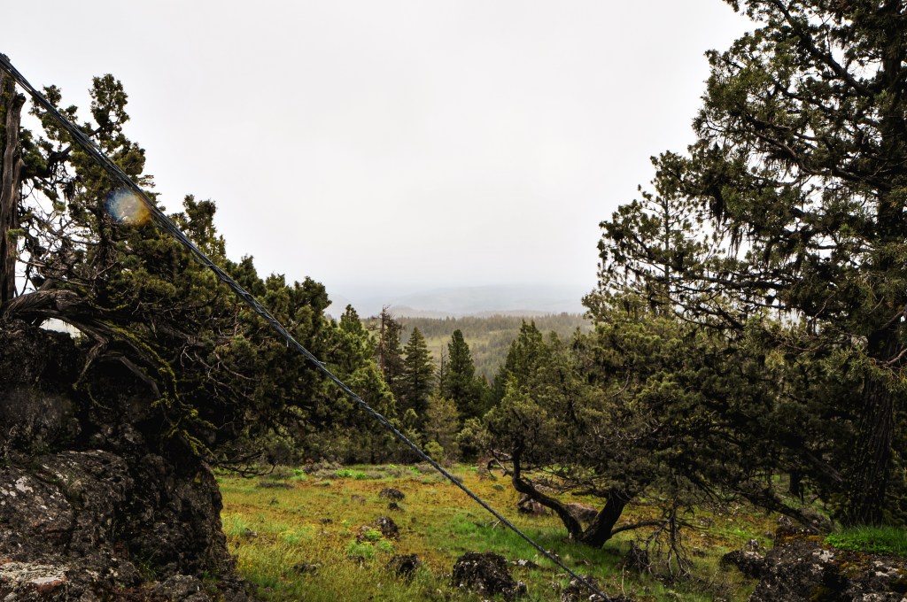
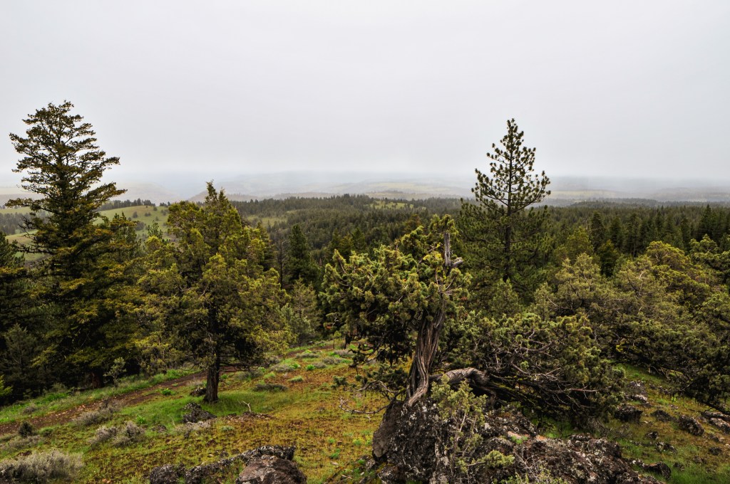
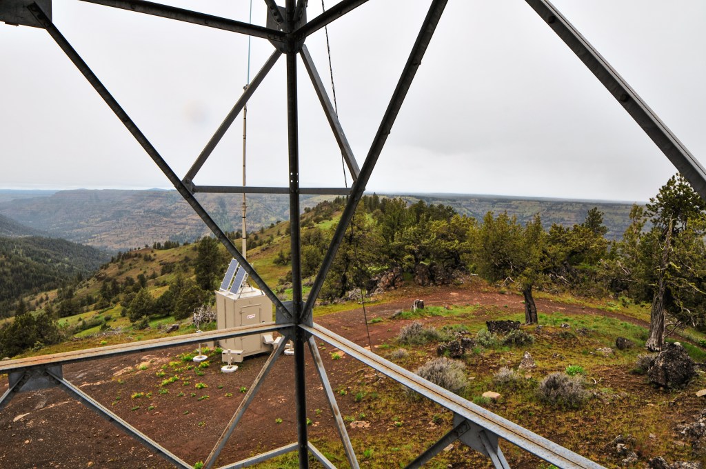
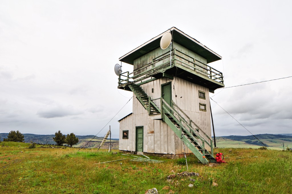
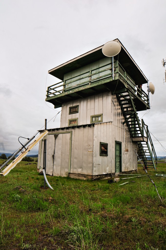
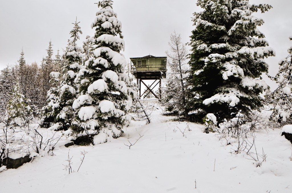
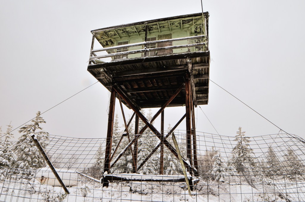
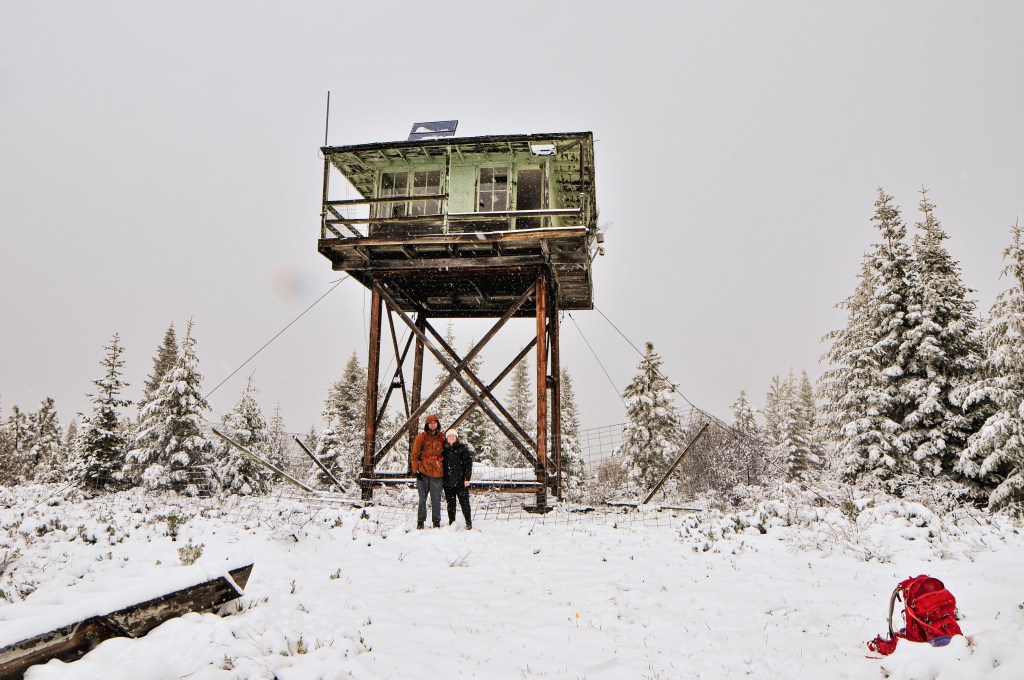
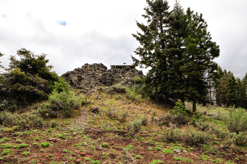
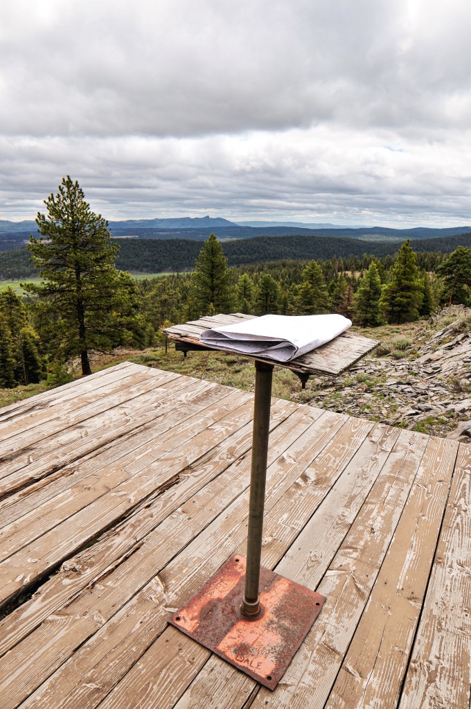
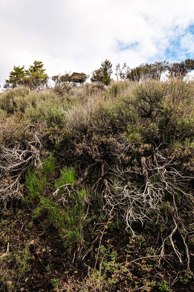
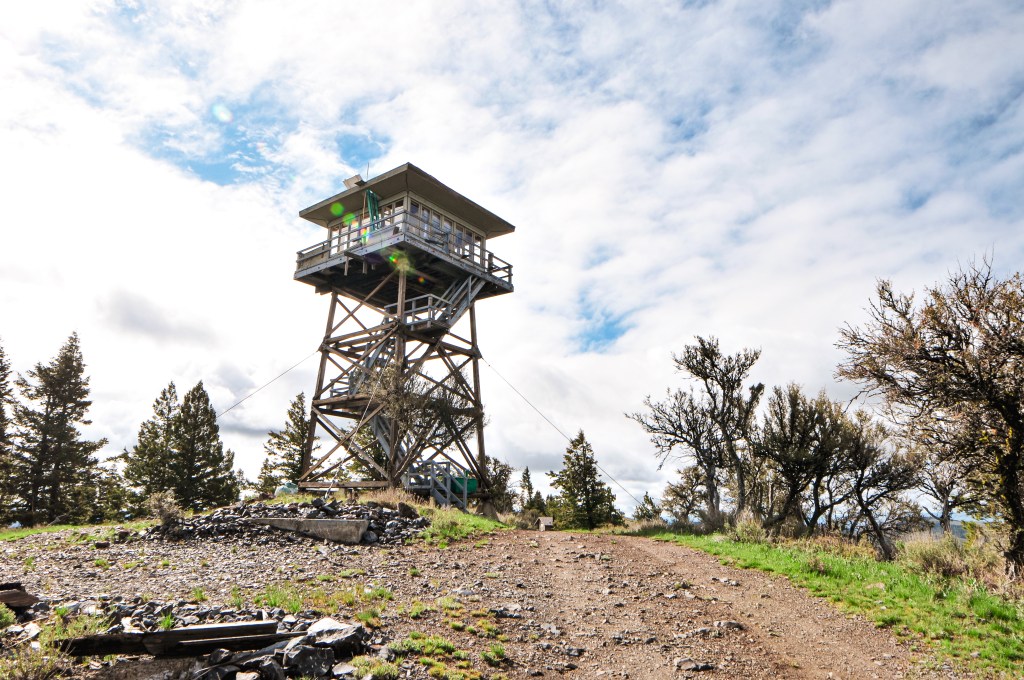
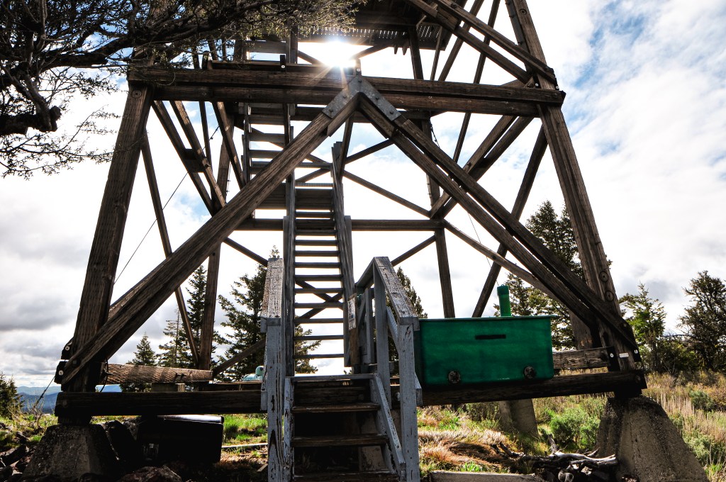
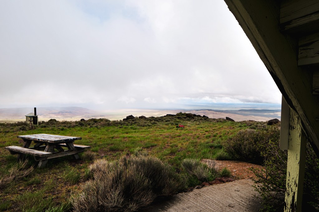
The hike up follows the road but was pleasant and it didn’t feel like much of a road walk at all. You will start up a hill that has signs of a more recent fire, possibly the Cinder Butte Fire in 2017. The rolling hills were covered in meadows with all sorts of different wildflowers. The weather even started to break for us and opened up to some views to the valleys below. Once on top of the hill you will follow a flat ridge for a while before heading up to the final high point. Similar to most lookouts, you will not be able to see Wagontire Mountain L.O. until you are almost there. This lookout is relatively new in comparison to most and was in great condition besides needing a fresh coat of paint. We enjoyed some snacks on the summit while the weather alternated between clear and cloudy. We would’ve stayed longer but we knew we still had a 3-mile hike back to the car and longer drive back to camp. It didn’t really start raining on us until we started to hike down. It was such a pretty road walk that I didn’t really mind the rain. It was crisp and refreshing, a literal breath of fresh air. I thought about how miserable those biking the Skull 120/60/30 must have been that day.

History.

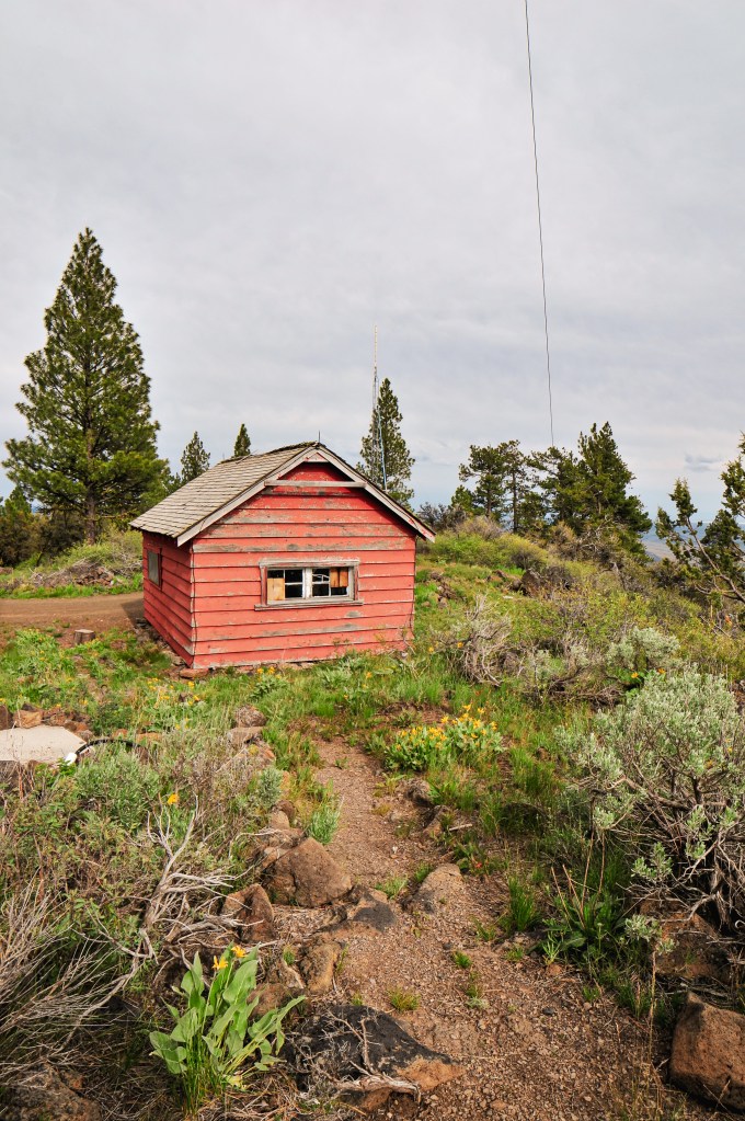
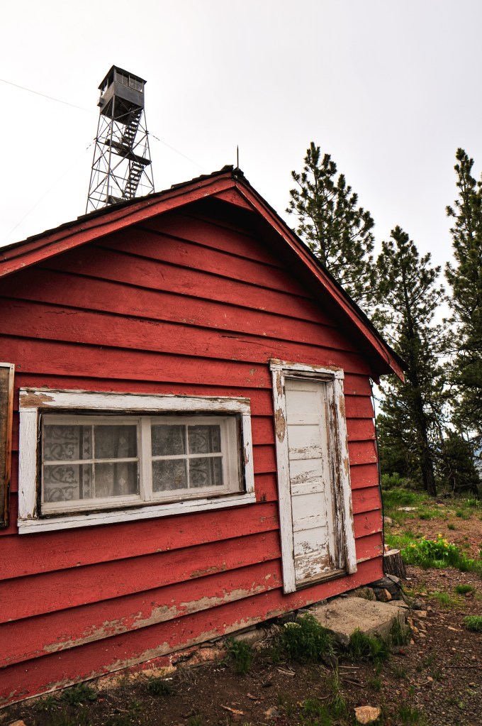
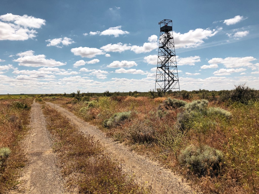
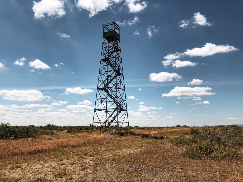
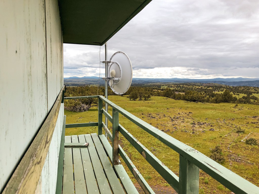
The existing lookout structure on the summit is a 2-story BLM style cab that was built in 1967. This is the first and only lookout that was built here. The name Wagontire comes from an immigrant wagon that was burned by indigenous people in the mid-1800s. Only one wheel was left behind and it remained on the slop until 1925.

Dry Mountain L.O.

Oregon Lookouts

Location.

Ochoco National Forest; Managed by Malheur National Forest

Status.

Emergency; Currently standing

Estimated drive time from Portland, OR.

6-1/2 hours

Date visited.

June 17, 2022

Elevation.

6,281′

National Historic Lookout Register.

US 426; OR 51

Trip Report.

After visiting Bald Butte L.O., we headed farther west along NF-41 until we reached NF-4120 off to the left. This road will take you all the way to the summit of Dry Mountain. There are a couple of junctions along this road that could be mistaken for the route if you’re not careful but it is all signed and should be easy to follow if you’re paying attention. From the Junction of NF-41 and NF-4120 it is 12 miles of gravel to reach the fire lookout. The first 8 miles of gravel are well maintained and passable to any vehicle. It’s a really pretty drive through a canyon and ponderosa forest. The last 4 miles are a bit rough and rocky that could potentially be hazardous to low clearance vehicles. I was thankful for the additional clearance on the HR-V during this section and it had no issues driving all the way. My partner and I speculated whether we would be able to drive this section in my Civic. I don’t think I would’ve enjoyed it but I think we could have made it with a lot of caution, getting out to move rocks, riding high lines, and slow driving. It’s definitely a road for the heartier 2WD adventurers.

On the summit, there is a cabin and Aermotor tower with a couple of communication buildings. The cabin is completely wood rat infested and I was only able to comfortably look inside from the frame of the un-locked door. My partner climbed all the way to the top of the Aermotor where he found a 2006 Burns Interagency Fire Zone Mobilization Guide and an old log book that the lookout attendants used. His mom and I only felt the need to climb part way up the tower to a few of the landings. You are basically on the edge of the forest and there is a lovely view into the valleys below. For some reason, there were a bunch of mosquitos in this area. It would be the only time we ran into them this trip but we all walked away with a few bites. They were so distracting that we even forgot to take our group picture with the lookout. My partner and I realized this after bumping down the road a ways but it was a bit too far to justify turning around. We were both pretty bummed even though it’s mostly for posterity.

After leaving Dry Mountain, we were able to find a nice camp with a view of Bald Butte and even enjoyed a camp fire. It wasn’t until we were getting ready to go to bed that it started raining on us. Yes, that’s right, more rain. Thunderstorms rolled in later that night and struck within less than a mile of our camp twice. My intrusive thoughts kept me up for most of the night after that. I ran through what I knew about thunderstorms and why or why not I would be its next target. Is being in a tent safe with metal poles? Does my air mattress act as a buffer since I’m not touching the ground? Is it more likely to hit the lightning rod on Bald Butte, the car, or the tree next to us? Is it better to be curled up or lay flat? Does moving around help or hinder? Does it matter if we’re on the highest point or not? Of course, the storm passed quickly and we were all fine, but it made me think about safety tips. There seems to be more thunderstorms on our recent trips and I’m sure there will continue to be more in the future as weather reaches more extremes and climates change.

Lightning Safety Outdoors

  1. The flash-to-bang method is the quickest way to calculate how close you are to a storm. It is calculated by how many seconds pass between the flash of lightning to the sound of thunder. You will then need to divide by 5 to estimate the distance it is in miles. I used to only count the seconds as the distance in miles which means some thunderstorms have been closer than I initially thought. If the time between lightning and thunder is less than 30 seconds, it is close enough to be dangerous.
  2. Minimize contact with the ground. Lightning is typically looking for the easiest path of least resistance to the ground. The best position to be in is crouched in a ball-like position with your head tucked and hands over your ears, avoid laying flat.
  3. Avoid elevated areas. If you’re on a peak or high point, attempt to reach lower ground and avoid sheltering under isolated trees. Lightning will most likely strike the tallest object.
  4. Avoid water and metal since both can carry an electrical current. If you’re in the water or on a boat, head to shore immediately.
  5. Find shelter. If going indoors is not an option, your hard-top vehicle with the windows rolled up or lower trees in a forest will work. Do not use a cliff or rocky overhang as shelter.
  6. Avoid open spaces. Avoid open vehicles and open structures since these will not sufficiently protect you from lightning.
  7. If you are in a group, separate. This will help reduce the number of injuries if lightning strikes the ground.

History.

In 1929, a platform was constructed near the top of a yellow pine tree making a 110′ crows nest. This was the highest platform occupied by a lookout on the Ochoco NF. A ground cabin was added in 1930 for the lookout’s living quarters. The existing 70′ Aermotor tower with 7’x7′ cab was built in 1932. It was moved to emergency use in the 1970s, but has been staffed more recently in the 2000s during extreme weather by the BLM. As of 2017, it has been listed for decommission by the Forest Service.

Bald Butte L.O. (Ochoco NF)

Oregon Lookouts

Location.

Ochoco National Forest; Managed by Malheur National Forest

Status.

Abandoned; Currently standing

Estimated drive time from Portland, OR.

6 hours

Date visited.

June 17th, 2022

Elevation.

5,920′

National Historic Lookout Register.

US 425; OR 50

Trip Report.

My partner, his mom, and I headed out on a 3-day camping trip to kick off her recent retirement. We left it up to her on what kind of trip she wanted to take, whether it be backpacking or car camping. She decided she was interested in visiting some fire lookouts with us and we set out to plan accordingly. Bald Butte, Dry Mountain (post), and Wagontire Mountain (post)were all lookouts we had planned for our road trip this summer. They were a bit farther out than the rest of our route and we figured it would make a decent 3-day trip instead. This way we could re-route our road trip to other fire lookouts farther south as well. We headed out early Friday morning towards Hines, Oregon. We decided to drive her Honda HR-V since it can fit three people plus camping gear more comfortably than my Civic. It also has the added benefit of additional clearance for the rougher Forest Service roads. From Hines, we headed into the forest via the Hines Logging Road that is right next to the Sinclair truck stop. It will eventually turn into NF-47 once you reach the boundary. Our plan was to visit Bald Butte and Dry Mountain (post) before setting up camp for two nights. You will want to take a left onto NF-41 after entering the forest to get to both of these. The turn is signed but it was hard to see from the approach out of Hines. We actually drove past it and had to turn around.

On our drive in we noticed there were interesting arrows and signage noting there would be bikes on the road tomorrow, June 18th. My partner and I joked that we always seem to run into these extreme races while out in the woods. It turns out we were right in assuming it was another one. We looked it up when we had service the next day and found the Skull 120/60/30, also considered America’s Gnarliest Gravel Race (site). It’s a gravel bike race hosted by Harney County to help showcase Eastern Oregon and help bring money into the county. There are three different lengths to the race you can sign up for; 38 miles, 65 miles, or the gnarliest 128 miles. We have also managed to stumbled upon the Baker City Cycling Classic during their Stage 4 Anthony Lakes Road Race in June of 2021 (site). We were driving home from a 9-day backpacking trip through the North Fork of the John Day Wilderness when we had to drive around the peloton. My partner was also passed by some racers from the America’s Toughest Race while camping in the Deschutes NF with his dad in May of 2021 (site). They even had a chance to talk to one of the racers and asked them where they were coming from to which they responded “a long ways away”. The America’s Toughest Race is a combination of foot travel, water travel, and cycle travel through rugged off trail routes. Everyone from your team must finish together otherwise you are disqualified. Anyway, it seems most of these races attract extreme masochists. It’s not what I would consider a fun time outside, but to each their own.

We were glad that we decided to do Bald Butte and Dry Mountain (post) on Friday instead of Saturday. It seemed that a lot of the bike route for the Skull 120/60/30 was along the roads we needed to take to get there. You will be able to see Bald Butte L.O. as you drive along NF-41. It is a surprisingly nice paved Forest Service road that I expected to be gravel. From NF-41, Bald Butte is less than a mile up NF-4117 off to the left. There is a sign but it is covered by trees and I wasn’t able to spot it until we were driving out. Luckily, even without the sign it is pretty obvious which road will take you to the summit. There are some deep washouts and water bars along NF-4117 that would make the drive difficult to impossible for lower clearance vehicles. I wasn’t comfortable driving the HR-V up the road, so we parked near the NF-050 spur and walked the remainder. It was a pleasant walk to the summit and the road had a lot of wildflowers along it. The lookout on Bald Butte, unfortunately, has seen better days. The tower seems to be standing strong but the cab has lost a supporting wall and a few support beams. I wouldn’t be surprised if the cab collapses under heavy snow within the next few years. I believe the glass was removed and salvaged by Howard Verschoor though. An assessment done by the Friends of the Blue Mountains Lookouts in 2021 found it to be too unstable for any additional salvage work. They even mentioned that it would be torn down later that year. We were happy to find that they were wrong and the lookout was still standing. There is a wire fence surrounding the base but someone had cut a hole in it and the trap door was open to the catwalk. Climb at your own risk. We savored the views and said our good-byes to the lookout before hiking down to the car and heading on to Dry Mountain (post).

History.

Established in 1931, Bald Butte originally had a 45′ pole tower with 8’x8′ cab. It was replaced in 1959 with the existing R-6 cab and 41′ treated timber tower. It was moved to emergency use in 1964 and on the emergency list up until the 1990s. As of 2017, it has been listed for decommission by the Forest Service.

Meadow Butte L.O.

Washington Lookouts

Location.

Washington State Division of Forestry

Status.

Abandoned; Currently standing

Estimated drive time from Portland, OR.

2 hours

Date visited.

June 11, 2022

Elevation.

3,620′

National Historic Lookout Register.

US 1550; WA 80

Trip Report.

The weather in the Pacific Northwest the last few weeks has been nothing but rain. This is good for our fire season but has been a bit depressing for finding motivation. It seems to not matter what corner of the state you look in, you will find rain in the forecast. It has been a much wetter spring than the past few years. According to The Oregonian, it’s the wettest spring we’ve had in the past 81 years. My partner and I have surrendered to the fact that we’re just going to have to do some things in the rain since staying home does little for our mental health. I am not one to let a little rain stop me but it is that time of year where I’m ready for some sun and clearer skies. We first looked farther south towards Wagontire Mountain L.O. (post) which seemed to have the least predicted precipitation for the weekend. We debated whether a one way 5-hour drive plus 6 miles RT hiking in potentially rainy weather was worth it for one night. On most weekends, this would be a yes from me but my motivation was severely drained. The area was also forecasted for windy conditions with potential thunderstorms. It was less than ideal after our Memorial weekend trip. On a whim I decided to look at the forecast for Meadow Butte. I was shocked to find a partly sunny forecast. This one had been on our list to revisit since our first failed attempt in November last year. We concluded that Wagontire Mountain (post) could wait and it was time for a redemption.

November 6th, 2021 – We attempted to visit Meadow Butte on a rainy fall day. Meadow Butte is a crows nest lookout and we figured there wouldn’t be any significant views from the summit. From Trout Lake, we took the right at a Y-intersection onto the Mount Adams Recreation HWY then another right onto Sunnyside Road. If you continue straight on Sunnyside Road it eventually turns into the Trout Lake HWY. The Trout Lake HWY will take you up out of the valley into a more forested area. Once in the forested area you will want to take a left on to S-1400. The wood road sign is small, weathered, and easy to miss. You will stay on S-1400 until you reach a 6-way junction. The roads out here are poorly marked, but you will want to continue straight at this junction onto S-4210. S-4210 isn’t as good of a road and has some road hazards for lower clearance vehicles. We parked in a pull out after an unmarked spur junction. The spur is off to the right and you will want to stay to the left. I think most of the road hazards could be navigated with caution if you have the determination to drive all the way in a low clearance vehicle. We walked up the road another 1/3 of a mile to where it ends. You will pass another unmarked spur on the left but you will want to keep to the right. Once at the end of the road you will need to start walking if you haven’t already. It was elk rifle season when we went so there were already a few trucks parked here. Make sure to wear something bright when hiking during hunting season and always be cautious of where you’re traveling. We wore blaze orange beanies to help us stand out. You will walk on old decommissioned roads all the way to the summit. It is roughly 2.5 to 3 miles from this point to the crows nest. We knew the weather wasn’t going to be good, but we didn’t expect it would be as bad as it was. It started snowing on us with significant wind shortly after we started hiking the decommissioned road. We were following directions and a map from Eric Willhite’s trip report (site). You should be able to see the crows nest from your road walk but our visibility was only about 100 yards. The roads out here are not marked either. We first headed up the fourth spur off to the left based on Whillhite’s map but it seemed to head away from the butte, so my partner and I decided to turn around. We then headed up the third spur from the left but as it headed up hill we still couldn’t see any signs of a lookout. We were both cold, frustrated, and tired of being pelted in the face by snow. We disappointedly surrendered to the weather and headed back to the car.

S-1400 sign
Start of S-1400 road
End of S-4210; Park here
Start of the hike
5-way junction; continue straight
Junction with 4th spur; Head left
View up the 4th spur road
1st junction off the spur; head left
View up the left turn
Overgrown junction across the meadow from the approach; Take a hard right between the trees
overgrown junction; head up the road between the trees
This road will take you to the summit

June 11th, 2022 – We parked our car before 11AM in another pull out on the same road and walked up the remainder of the way. Our drive over was wet but the forecast called for a break in weather closer to noon. The sun made an appearance shortly after we parked and decided to stick around this time. I even had to break out my sunscreen. The old road starts out fairly overgrown and opens up into an area that has been logged significantly. Once in the clear cut, we had a direct view of Meadow Butte. This made it much easier to determine where we were headed and if we were on the right roads. You will pass three roads off to the left before you reach the correct road. The first spur off to the left looks like it climbs steeply up to Quigley Butte. The second road is at a major 5-way junction where you will want to continue straight. The third road looks like it might head towards Meadow Butte but is not the route you want. The fourth spur off to the left is the correct road. You will lose sight of the crows nest before reaching this spur. It turns out we initially had the right road during our first attempt, we just didn’t continue far enough up. We were probably less than half of a mile from it. Once on this road you will meet a couple more junctions as you climb towards the summit. The first junction is with an overgrown road off to the right, you will want to stay left. The road to the left heads up the butte and eventually provides a view of the crows nest again. You will be very close from here and have the option to bushwhack to the summit or continue on the road. We decided to continue on the road which will appear to head away from the direction you need to go and drops down into a meadow. The road is faint here but continues across the meadow. At the end of the meadow the road meets a junction which makes a sharp right turn back towards the butte. This road will take you all the way to the summit. Once on the summit, we were surprised to get decent views towards Mount Adams and the Trout Lake valley. I believe on a clearer day you would be able to see most of the high peaks. We enjoyed a late lunch while taking pictures. It’s amazing how much of it is still here after being abandoned for over 60 years. We said our goodbyes to Meadow Butte and celebrated a successful redemption on our way back to the car. Despite some ominous clouds in the distance threatening to come our way, we didn’t get rained on at all during our hike.

History.

Meadow Butte was established in the early 1940s when an enclosed cab was built atop of a 86′ ponderosa pine tree. It was originally used to oversee railroad logging operations by the J. Neal Lumber Company until the Washington Division of Forestry took ownership in 1944. A cabin was built during this time for the lookout attendants to use as living quarters. It’s presumed they used a tent before this was built. The crows nest was abandoned in 1958 but is still standing strong. The cabin used for the living quarters was moved to the DNR compound in Glenwood and used as a storm shelter. There is also some sort of communication building and rod on the summit that look like a fairly recent addition.

Boardman L.O.

Oregon Lookouts

Location.

Boardman, OR

Status.

Beacon light; Currently standing

Estimated drive time from Portland, OR.

2-1/2 hours

Date Visited.

May 31, 2022

Elevation.

N/A

National Historic Lookout Register.

Not registered

Trip Report.

After a successful but unarguably wet camping trip for Memorial Weekend, we were headed back to Portland from the Umatilla NF. The weather had cleared off significantly and was supposed to be in the mid-70s. My partner informed me there was another fire lookout just off the highway in Boardman we could see on our way home. I figured what was one more to round out the weekend. You should be able to see it from the highway if you know what you’re looking for. From I-84, we took the exit for Tower Road just after Boardman, or before depending on which way you’re driving. You will want to head towards the Love’s Travel Stop and continue past on Tower Road. It should be very obvious from this point. We turned right on one of the first roads leading off to its relative direction and then left onto an unmarked access road. We were able to walk right up to it. It was another easy on and off. I used to drive past Boardman often when I would come home from college. I always remembered it for its tree farm, but had no idea there was a fire lookout here.

History.

My partner discovered this lookout from a post in the Oregon Fire Lookouts Facebook group by Howard Verschoor. All this information was provided by Howard and I was unable to confirm the validity of this information through additional online sources. He is the head of the FFLA Oregon Chapter, so I’d consider him a reliable source for information. I am unsure of its origin date or timeline. The Aermotor tower was originally moved from the Malheur National Wildlife Refuge. It was used by the US Navy Bombing Range to watch for fires after their bombing practice until it was converted into a beacon light for the Boardman Airport.

Bone Point L.O.

Oregon Lookouts

Location.

Umatilla National Forest

Status.

Emergency; Currently standing

Estimated drive time from Portland, OR.

4-1/2 hours

Date visited.

May 30, 2022

Elevation.

4,527′

National Historic Lookout Register.

US 1600; OR 132

Trip Report.

Before reaching the community of Dale, we passed a road marked Bone Point Road. Based on previous trip reports we knew this was not a direct route to the lookout despite the name. On a map it does look like it eventually connects after taking some roads through private land, but there is no guarantee that they are open roads for public access. Instead we continued past Dale to the NF-3963 road. It crosses the North Fork of the John Day before heading steeply into the forest. The first part of NF-3963 is riddled with pot holes that can be troublesome for lower clearance vehicles. We were able to navigate them in my Civic with caution. As we started to head up I let my partner take over driving. He is more confident on forest service roads especially ones shouldered by steep drop offs and road hazards. Yay, fear of heights! Yay, anxiety from our Tower Point attempt (post)!

You will stay on this forest service road for about 5 miles. Some of the spurs are signed such as NF-020 and NF-040, but the one leading to Bone Point L.O. is not. It’s supposed to be marked as NF-060 but the sign is long gone. After passing NF-040, there will be an un-marked spur off to the right. This is not the one you want to reach Bone Point. After this spur, you will pass a tree with the number 5 spray painted on it marking that you have made it 5 miles. The next un-marked road off to the right will be the correct one. You will know you are at the right junction when the road opens up and flattens out into a meadow. There is also a seasonal gate and dispersed camp spot off NF-060. If you hit the cattle guard you’ve gone too far. We were elated to find a camp spot close to where we wanted to be and set up camp around 7PM. The weather even seemed to be clearing off and provided a lovely evening sunset.

We woke up the next morning to even more cloudy conditions. We didn’t rush to get up since we weren’t moving camps and didn’t need to drive any farther to our destination for the day. Waffles were on the menu for breakfast. YUM! Bone Point was only a mile from our camp and we decided to walk there after breakfast. The seasonal gate on the road is closed to motorized vehicles from December 1st thru April 30th. The road is very mucky after any precipitation and has been rutted out due to people driving in wet conditions. Even if we had wanted to drive, my car would have never made it. It’s a relatively nice flat walk to the summit though. We even heard an owl hooting near by. The last section of road is very rocky and would need caution to navigate even in a high clearance vehicle. Once on the summit it started to sprinkle a mix of rain and snow. The forecast for today was supposed to be nicer than the last few days, but that proved to be wrong. We weren’t completely in a rain cloud yet and still managed to see some of the surrounding peaks while on the summit. There were some coyotes yipping off in the distance on a neighboring peak as well. It looked like at one point the stairs had been wrapped in barbed wire to prevent people from climbing it. Someone had moved this and cut a chunk out of the trap door to access the catwalk. The structure itself felt pretty sound, but I only went up to the first landing. The metal style lookout towers, besides Aermotors, are pretty uncommon in Oregon.

We were back at camp before noon and the rain had settled into a consistent shower. It continued to rain for 6 more hours with no end in sight. We spent the remainder of our time hiding in the car reading. We hoped it would clear off for a nice sunset again, or maybe in the morning, to return to Bone Point under better conditions. It unfortunately did not clear off until we were already out of the forest on our way back to Portland.

History.

Bone Point has had a few different types of lookouts on its summit during its fire detection years. In the 1920’s, a cupola cabin was used which was replaced in the 1930’s by a 40′ wooden live-in tower. In 1947, it was replaced by a 30′ steel live-in tower which in turn was replaced by the current structure. The existing lookout was built in 1961 as a 30′ all steel live-in tower. It is noted on standby for emergency use during high fire danger despite not being actively staffed for many years. Its last recorded use was in August 2003 when it was staffed by a district employee during a period of lightning storms.

Ritter Butte L.O.

Oregon Lookouts

Location.

Grant County

Status.

Fire Detection Camera; Currently standing

Estimated drive time from Portland, OR.

5 hours

Date visited.

May 29, 2022

Elevation.

4,204′

National Historic Lookout Register.

US 658; OR 109

Trip Report.

From the Malheur NF, we headed farther north on HWY-395 towards the community of Dale. On the drive, we contemplated whether it made more sense to stop at Ritter Butte today or back track to it tomorrow. We didn’t have much day left to search for a camp but Ritter Butte was along the way. Our decision was quickly made when we realized we could see Ritter Butte from HWY-395. We knew it was only about a half mile off the highway but seeing how close it was for ourselves made it an easy decision to stop. The turn will be marked as Old Ritter Lane on the left once you reach the highway summit for Ritter Butte. The access road is the first un-marked road off to the left. They recently added a gate to deter people from driving to the summit. We parked in a pull out on Old Ritter Lane and made the short hike up. The road was also made up of large rocks instead of fine gravel, so I wouldn’t have tried to drive up anyway.

The summit was filled with wildflowers that were beginning to bloom and we even had a small break in weather. There were newer power tools and fresh wood stored in the bottom shed portion of the lookout. It looked like they were working on replacing or updating the structure. We thought this was odd since it is no longer actively staffed, but speculated it needed to stay up to date for camera maintenance. Someone had completely removed the trap door for the catwalk and the second level was unlocked. We decided to take a quick look on the open catwalk since it seemed to be in somewhat decent shape. We once again didn’t stay too long on the summit due to time constraints. But this one is an easy on and off if you’re ever passing through the area. We quickly popped on HWY-395 again and continued on to the Umatilla NF. We were headed up towards Bone Point L.O. (post) and hoped there would be a dispersed camp spot somewhere along the road.

History.

The Ritter Butte L.O. is a 3-story enclosed ODF tower with live-in cab and was built in 1950. It was actively staffed into the 1980’s and then moved to emergency status. There are multiple sources stating that it was actively staffed again in 2012, but it is unclear if it was just for that season or for a few years after that as well. In 2017, similar to other ODF lookouts, a fire detection camera was installed and will be the main source for fire detection.

Black Butte L.O. (Malheur NF)

Oregon Lookouts

Location.

Malheur National Forest

Status.

Abandoned; Currently standing

Estimated drive time from Portland, OR.

5-1/2 hours

Date visited.

May 29, 2022

Elevation.

6,235′

National Historic Lookout Register.

US 951; OR 123

Trip Report.

We woke up to snow flurries in the morning. It was cold but a welcome drier form of precipitation. Due to our previous day pre-pack, we only had to pack up our tent and sleeping gear before heading out. We shoved a quick bagel in our mouths and drove out of the forest back to HWY-395. Our plan was to head farther north on HWY-395 past Mount Vernon to Black Butte L.O. on the Malheur NF. We knew there was a nice dispersed camp along the road to the lookout thanks to an online source. From HWY-395, we turned left on CR-88 just after leaving the Malheur NF and before reaching the community of Fox. There will be a sign for Black Butte L.O. from the turn on the highway. You will shortly re-enter the forest after you head down this road. From here you will turn left on NF-3955, left on NF-3956, and then left on NF-034 to reach the summit. As we started to gain elevation on the road we realized we would be hiking in snow today. I parked the car a little after the junction with NF-3955 and NF-3956 due to additional snow on the road. The camp we were originally planning on staying at for the night had a fresh blanket as well. We would need to revisit that plan once we were back at the car.

NF-3956 continues to the left

I was moving slower this morning and my partner had hiked ahead. I could still see him until he continued around a bend in the road. He had hesitated at a junction before continuing on straight. When I reached the junction myself I realized the road we needed continued to the left instead of straight. I headed straight to see if I could catch up with him but he was long gone. I mustered up all my lung power to call for him until he came back. Luckily, he wasn’t out of ear shot and was heading back shortly after I called out a few times. The road at the junction with NF-3956 is unmarked and can look like NF-3956 continues straight. There are road signs for NF-3956 though, so keep an eye out for those. If you reach the spur NF-146 on the right you have missed your turn. If you’re driving a grocery getter like me, you will want to park at this junction and walk the remaining 2 miles to the lookout. We couldn’t see the exact conditions of the road but even covered in snow it looked really bad with large rocks and wash outs.

These flowers weren’t expecting snow either

The fresh snow made the walking slow and we didn’t reach the summit until 2PM. It’s crazy to think just yesterday there was likely little to no snow here, but it now had at least 3 to 4 inches. Can you believe it’s the end of May?? As much as I complain, I know this precipitation is good for the east side and will hopefully delay the impending fire season. The lookout on Black Butte has seen better days. The solar panel is surprisingly still there, but they have removed the stairs and added a fence around it to help deter vandals. We briefly enjoyed the summit since it was cold and still snowing here and there. We once again said our good byes to Black Butte before hiking down since it is expected to be removed by the Forest Service. After 4 miles of cold feet, we decided camping in the snow sounded less than ideal. It seemed a bit ambitious to add Ritter Butte L.O. (post) to our agenda for the day, but we concluded our best bet for drier camp spots was to continue on to the Umatilla NF.

History.

Black Butte L.O. was constructed in 1933 as a 20′ tower with L-4 cab and still stands today. The tower legs, trap door, and roof were all replaced in the 1960’s. The foundation was later replaced in 1994. It was staffed during emergencies up until more recently. As of 2017, the structure has been listed as condemned and is slated to be removed by the Forest Service.

Crane Point L.O.

Oregon Lookouts

Location.

Malheur National Forest

Status.

Abandoned; Currently standing

Estimated drive time from Portland, OR.

7 hours

Date visited.

May 28, 2022

Elevation.

6,414′

Former Fire Lookout Site Register.

US 1057; OR 415

Trip Report.

We headed back out on NF-14 after visiting Antelope Mountain L.O. (post) until we reached NF-185. We were unsure how close we’d be able to get to Crane Point since we’d have to take three different three numbered roads. Three numbered roads in the forest are typically rough and best driven by high-clearance vehicles. Some were noted on the ranger district map as well maintained gravel, but I was skeptical. You will take NF-185 all the way to a major four way junction with NF-1450. From here you will turn right on to NF-1450, right on to NF-380, and then another right on NF-407 to get to Crane Point. We were able to drive all the way to NF-380 with no issues in my Civic. We made it about a mile down NF-380 before we decided to pull over and walk the remaining distance. The road was muddy and soft after all the recent rain. I think it would be a relatively drivable road in drier conditions for most.

I’d estimate we only walked a mile and a half to get to the platform. The road is signed for NF-407 but it would be easy to miss while driving. The platform used for Crane Point is still there along with the stand for the fire finder. It sits atop a rocky outcropping with views toward Monument Rock Wilderness and Strawberry Mountain Wilderness. We were even able to spot Antelope Mountain L.O. (post) and what we thought to be Table Rock L.O. in the distance. I was surprised to find the fire finder stand was not bolted down to anything and still there. It has a heavy metal base, but people will walk off with anything. The platform itself was still in decent condition minus a few boards that had signs of rot. We were lucky enough to get to enjoy this summit rain free as well. As we started our walk back to the car another storm rolled in and we were once again in a rain cloud. A couple out on their ATV even stopped to ask us if we were doing ok. I always think about how odd it must be to come upon a couple just walking down a random Forest Service road. We told them about the old lookout structure just up the road and continued on. They probably assumed we were lost or broken down initially, especially since we drove a Civic and parked it in a seemingly random spot. I personally have never seen another Civic or equivalent car in the nitty gritty of the forest driving around unless I’ve been at a trailhead.

We made it back to camp relatively early in the afternoon and I decided to take a nap in the tent. My partner chose to wonder down the spur road we were camping on to explore a bit more. Eventually the rain storm turned into a thunderstorm. I read a book in the tent for a while before I decided to check and see if he made it back. He was hiding out from the rain in the car by the time I checked. Neither of us were looking forward to cooking dinner in the rain. We waited in the car until what seemed like a break in the weather. Once we were out and cooking it started raining again. We enjoyed our dinner from the warmth of the car. It obviously wasn’t going to get any drier here, so we decided to pre-pack most things wet for tomorrow morning since we would be moving camps.

History.

Crane Point is listed on the Former Fire Lookout Site, but the platform and fire finder stand are still there. I would consider this an existing fire lookout site since the structure used is still partially there. It is also noted that fire crew’s will still use this area as a vantage point. The site was originally established in the 1930’s. The tent cabin used for the living quarters is no longer there. There is not much information on this lookout but based on older photos it was at least used up until the early 1960’s.

Antelope Mountain L.O.

Oregon Lookouts

Location.

Malheur National Forest

Status.

Active; Currently standing

Estimated drive time from Portland, OR.

7-1/2 hours

Date visited.

May 28, 2022

Elevation.

6,456′

National Historic Lookout Register.

US 913; OR 117

Our camp
Where the good gravel ends

Trip Report.

There are a surprising lack of dispersed camp spots off of the main four and two number roads in this area of the Malheur NF. We didn’t have a lot of day light left after visiting Dry Soda L.O. (post) and Frazier Point L.O. (post). Normally, we’d take the time to bump down every little spur that looked like it had potential until we found one that we both liked. We headed towards our next destinations in hopes that there would be a camp close to both. We eventually found one a few miles from the Antelope Mountain access road around 7:30PM and set up camp for the next two nights. After spending all day in a rain cloud, we were surprised that it had seemed to have cleared off for the evening. We were even able to muster up a nice camp fire before passing out. There was more rain in the forecast for tomorrow and we wanted to savor it while we could. My phone alarm abruptly woke us up the next morning at 6AM. I had forgotten to turn if off from the previous morning. We debated going back to bed for a few more hours but there were clear skies outside of our tent that told us to get up. We decided to catch the nice weather while it was here.

I made us a hearty breakfast of eggs, bacon, and potatoes to fuel us for the day ahead. Our plan was to head up to Antelope Mountain and Crane Point (post). We were camped very close to Antelope Mountain and it only took us a few minutes to reach the spur. The most direct route here is NF-14 to NF-1663 to NF-534. NF-534 is located just past the four way junction where NF-14 and NF-1663 meet. There is a sign for Antelope Mountain at the junction that makes it seem like you just need to continue straight on NF-1663 but you will need to turn right on to the first spur. The road up to Antelope Mountain was in great condition up until the last quarter mile. There seemed to be fresh gravel on this road as well. If you are driving a low clearance vehicle, you will want to park just before the fresh gravel ends and walk the remaining distance. There is no gate to stop you from continuing up the road, but the large rocks might.

We were surprised to see an SUV driving down the road when were parking to walk. We’ve hardly ever ran into anyone else while visiting fire lookouts unless they are off of a hiking trail or actively staffed. It was also still relatively early in the morning, we were on the summit before 9AM. Besides Steliko Point L.O. (post), where we were physically staying in the lookout, this is probably the earliest we’ve been able to reach a fire lookout. It looked like the Forest Service had been up here recently prepping the lookout for the season. The shutters had been removed and were still on the catwalk. A ladder was also on the catwalk to gain access to the solar panel. Antelope Mountain is quite a ways out there, you can even see the edge of where the forest ends from the summit. We appreciated the nice break in weather that provided some decent views, but didn’t stay too long. We wanted to head on to Crane Point (post) before anymore clouds rolled in for the day.

History.

Antelope Mountain L.O. was first established in 1930 when a 30′ tower and L-4 gable roofed cab. This original lookout was unique in that it didn’t have a catwalk. A 16’x18′ garage was constructed on the summit in 1934. An inspection of this lookout was done in 1966 which found many deficiencies that needed repair or replacement. In 1974, the Forest Service put out a bid for work to move the lookout structure from Lake Butte to Antelope Mountain and remove the existing. The lookout on Lake Butte was a 16’x16′ R-6 flat top cab with catwalk and 31′ tower. The work was awarded to the Emert Industrial Corp from Clackamas, OR. They were able to complete this work in the fall of 1974 by loading the tower on a lowboy and the house on a flatbed truck. They used an 80′ boom truck to lift the house back on the tower once they reached Antelope Mountain. The pictures from relocations are some of my favorites from the archives online. Nothing looks quite as out of place as a fully intact lookout cab on the back of a small truck. Antelope Mountain continues to be staffed every summer due to it being one of the most southern lookouts in the Malheur NF that covers the driest portions of the district.