

A Study Of Water And Sediment Quality As - TO THE TAR SANDS .ca
A Study Of Water And Sediment Quality As - TO THE TAR SANDS .ca
A Study Of Water And Sediment Quality As - TO THE TAR SANDS .ca

You also want an ePaper? Increase the reach of your titles
YUMPU automatically turns print PDFs into web optimized ePapers that Google loves.
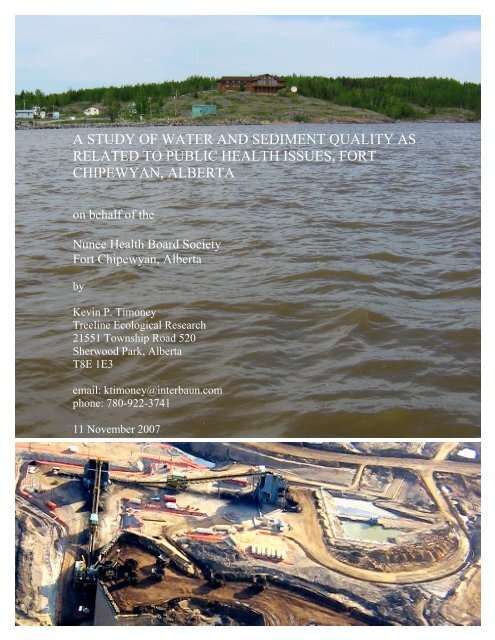
A STUDY OF WATER AND SEDIMENT QUALITY AS<br />
RELATED <strong>TO</strong> PUBLIC HEALTH ISSUES, FORT<br />
CHIPEWYAN, ALBERTA<br />
on behalf of the<br />
Nunee Health Board Society<br />
Fort Chipewyan, Alberta<br />
by<br />
Kevin P. Timoney<br />
Treeline Ecologi<strong>ca</strong>l Research<br />
21551 Township Road 520<br />
Sherwood Park, Alberta<br />
T8E 1E3<br />
email: ktimoney@interbaun.com<br />
phone: 780-922-3741<br />
11 November 2007<br />
1
DEDICATION<br />
This study is dedi<strong>ca</strong>ted to:<br />
the people of Fort Chipewyan, who have a right to a healthy future;<br />
and to my mom, Doris, who gave me a shovel on my fifth birthday and taught me to dig<br />
until I reached the bottom.<br />
Author’s Note<br />
Readers are invited to send relevant observations and to comment on points of fact or<br />
interpretation. I <strong>ca</strong>n be reached at ktimoney@interbaun.com.<br />
2
TABLE OF CONTENTS<br />
Section Page<br />
SUMMARY 4<br />
INTRODUCTION 6<br />
METHODS 13<br />
RESULTS AND DISCUSSION 21<br />
O<strong>THE</strong>R DATA and OBSERVATIONS 50<br />
CONCLUSIONS 68<br />
ACKNOWLEDGMENTS 73<br />
REFERENCES 74<br />
Appendix 1. Laboratory and Analyti<strong>ca</strong>l Methods 82<br />
3
SUMMARY<br />
This study examined water and sediment quality indi<strong>ca</strong>tors in the area of Fort<br />
Chipewyan, Alberta. Data were analyzed and discussed in the contexts of water and<br />
sediment quality guidelines, wildlife contaminants, and ecosystem and public health.<br />
Some of the findings of this study are:<br />
(1) The people and biota of the Athabas<strong>ca</strong> River Delta and western Lake Athabas<strong>ca</strong> are<br />
exposed to higher levels of some contaminants than are those upstream. Be<strong>ca</strong>use the<br />
ecosystem around Fort Chipewyan is dominated by deltaic and lacustrine processes, it is<br />
fundamentally different from the mainstem Athabas<strong>ca</strong> and Peace Rivers. Fort Chipewyan<br />
lies within a depositional basin in which metals and other contaminants tend to<br />
accumulate in fine-textured sediments.<br />
(2) Overall, the primary contaminants of concern may be arsenic, mercury, and<br />
polycyclic aromatic hydro<strong>ca</strong>rbons (PAHs). Concentrations of these contaminants, already<br />
high, appear to be rising.<br />
(3) People most at risk of adverse health effects are those who eat an abundance of<br />
country food and those who consume untreated surface water.<br />
(4) In water, chemi<strong>ca</strong>l constituents of concern include: arsenic, aluminum, chromium,<br />
cobalt, copper, iron, lead, phosphorus, selenium, titanium, and total phenols; the<br />
herbicides di<strong>ca</strong>mba, mcpa, bromacil, and triallate; and the pesticide lindane. Other<br />
possible constituents of concern include: ammonia, antimony, manganese, molybdenum,<br />
and nickel.<br />
(5) In sediment, constituents of concern include: arsenic, <strong>ca</strong>dmium, PAHs, and resin<br />
acids.<br />
(6) Mercury levels in fish used for human consumption present a serious concern. If US<br />
EPA standards are applied, all walleye (pickerel), all female whitefish, and ~ 90 % of<br />
male whitefish exceed subsistence fisher guidelines for mercury consumption. The<br />
human fetus is the most sensitive age-group.<br />
(7) An Alberta government sponsored report on the risk of <strong>ca</strong>ncer due to lifetime<br />
exposure to arsenic was reviewed. The report used questionable statisti<strong>ca</strong>l methods and<br />
assumptions and underestimated levels of arsenic in water and sediment and the fish<br />
consumption rate of many Fort Chipewyan residents. Higher arsenic levels in the lower<br />
Athabas<strong>ca</strong> River/western Lake Athabas<strong>ca</strong> than found elsewhere, coupled with the clear<br />
link between arsenic exposure and various diseases, <strong>ca</strong>ll for in-depth study.<br />
(8) When scientific data and traditional knowledge on fish deformities are considered<br />
together, they indi<strong>ca</strong>te that rates of fish abnormalities may be higher than expected, may<br />
be increasing, and may be related to declines in water quality. PAH and other<br />
contamination, changes in water and sediment quality, and changes to the food web may<br />
underlie the fish deformities.<br />
4
(9) A peer-reviewed epidemiologic and toxicologic study of disease rates and levels of<br />
exposure to environmental toxins in communities of the lower Athabas<strong>ca</strong> River is<br />
needed. A well-designed study would allow epidemiologists to control for factors such as<br />
time of residence in the lower Athabas<strong>ca</strong> River basin, diet, lifestyle, water supply, and<br />
demographic factors such that deviations in expected rates of disease could be detected if<br />
present. Toxicologists could quantify the level of risk associated with exposure to<br />
environmental toxins in the region.<br />
(10) For the seven parameters assessed in the fieldwork (arsenic, mercury and<br />
methylmercury, polycyclic aromatic hydro<strong>ca</strong>rbons, dioxins and furans, naphthenic acids,<br />
nitrogen, and coliform bacteria), the lo<strong>ca</strong>l water treatment plant appears to do a good job<br />
of removing impurities. For safety’s sake, a full chemi<strong>ca</strong>l profile of the treated water<br />
should be conducted with low detection limits.<br />
(11) Reports of increased algal growth, softer and watery fish flesh, and an apparent<br />
increase in total coliform levels lend support to the notion that increased water<br />
temperatures, perhaps coupled with adequate to high concentrations of nitrogen and<br />
phosphorus and changes in the aquatic food web, are bringing about aquatic changes.<br />
(12) There is a paucity of data available from near Fort Chipewyan and from western<br />
Lake Athabas<strong>ca</strong>. While there is a wealth of data available for river areas upstream of the<br />
Fort Chipewyan area, much of the Athabas<strong>ca</strong> River data has become privately held in<br />
recent years.<br />
(13) This study has likely underestimated the cumulative risk posed to the people and the<br />
ecosystem of the lower Athabas<strong>ca</strong> River and western Lake Athabas<strong>ca</strong>. More needs to be<br />
learned regarding the concentrations of many parameters in water, sediments, and<br />
wildlife, including mercury, arsenic, polycyclic aromatic hydro<strong>ca</strong>rbons, and naphthenic<br />
acids.<br />
(14) Concentrations of many parameters vary widely both in time and space, in some<br />
<strong>ca</strong>ses by factors of 10 to 100. This fact has three important impli<strong>ca</strong>tions. (a) a single<br />
measurement may mislead unless placed in context; (b) reliance on averages or medians<br />
as a means to interpret data may underestimate health risk; (c) short-term peaks in<br />
concentration (pollution events) may have a disproportionate effect on public and<br />
ecologi<strong>ca</strong>l health that is difficult to determine.<br />
(15) An environmental monitoring program independent of control by vested interests is<br />
needed. The program should be affiliated with a university and report regularly in open<br />
public forum to the people of Fort Chipewyan.<br />
5
INTRODUCTION<br />
Background<br />
Concern over the health of residents of Fort Chipewyan, Alberta has been rising<br />
in recent years. Health professionals and members of the general public have watched<br />
friends and family members grow sick with a variety of illnesses. At the same time,<br />
industrial developments on Lake Athabas<strong>ca</strong> and upstream of the community on the Peace<br />
River, and, in particular, on the Athabas<strong>ca</strong> River, have led many people to ask whether<br />
the illnesses in the community have an environmental <strong>ca</strong>use. Environmental and public<br />
health concerns have been expressed in Fort Chipewyan and in other northern<br />
communities that industrial developments are leading to declines in the quality of air and<br />
water (NRBS 1999; MRBB 2004).<br />
The need for a study of Ft. Chipewyan water and sediment quality is rooted in<br />
five facts: (1) The community is lo<strong>ca</strong>ted in a depositional basin downstream of major<br />
industrial developments known to release contaminants into the Athabas<strong>ca</strong> River. (2)<br />
Natural background levels of some riverborne contaminants may pose a risk to human<br />
health. (3) The Athabas<strong>ca</strong> River is the primary source of the community’s water supply.<br />
(4) There is a widespread perception among lo<strong>ca</strong>l people that rates of disease are above<br />
normal and are <strong>ca</strong>usally related to environmental contaminants. (5) The chief agency<br />
responsible for protection of public and environmental health, the Alberta Government,<br />
has a vested interest in oil sands development.<br />
Dr. John O’Connor was the first medi<strong>ca</strong>l professional to publicly <strong>ca</strong>ll attention to<br />
the question of elevated disease rates in the community. In radio interviews he stated that<br />
he had found abnormally high incidences of bile duct <strong>ca</strong>ncers (cholangio<strong>ca</strong>rcinomas),<br />
colon <strong>ca</strong>ncers, lymphomas, leukemia, autoimmune diseases such as lupus, thyroid<br />
<strong>ca</strong>ncers, overactive thyroid, and a host of skin rashes.<br />
In response, the government of Alberta conducted a study of disease incidence<br />
(Alberta Health and Wellness 2006). The government reported statisti<strong>ca</strong>l confidence<br />
intervals of expected disease rates and compared them to observed disease rates. It found<br />
elevated incidences of diabetes, hypertension, renal failure, and lupus in Fort Chipewyan.<br />
Injuries and poisoning accounted for 16.5% of deaths in Ft. Chipewyan compared to a<br />
provincial average of 3.8%. The overall Fort Chipewyan First Nations <strong>ca</strong>ncer rate was<br />
reportedly about 29% above the Alberta non-First Nations average. The government<br />
declined to conclude the <strong>ca</strong>ncer rate in Fort Chipewyan was elevated, perhaps due to the<br />
imprecise nature of its statisti<strong>ca</strong>l estimates.<br />
<strong>Study</strong> of the government report led Timoney (2007) to conclude that: (1) Due to<br />
the small population of Fort Chipewyan, statistics offered a blunt tool for detection of<br />
elevated rates of disease. Wide confidence intervals in a small population limit the power<br />
to detect elevated rates of disease. (2) Expected <strong>ca</strong>ncer rates are subject to variations<br />
related to statisti<strong>ca</strong>l assumptions and methods. For example, the upper 95 percent<br />
confidence interval for the expected number of <strong>ca</strong>ses of prostate <strong>ca</strong>ncer in the community<br />
was 28 by the Indirect Standardized Incidence Ratio (ISIR) method, 16 by the binomial<br />
method, and 13 by the Monte Carlo method. The ISIR method produced the highest<br />
upper confidence intervals of the three methods (see Alberta Cancer Board 2007) and<br />
was the method used by Alberta Health and Wellness. The fact that estimates of the upper<br />
confidence limit for the number of prostate <strong>ca</strong>ncer <strong>ca</strong>ses differed by more than 100%<br />
demonstrates the approximate nature of the statistics of small populations. For the<br />
6
concerned citizen of Fort Chipewyan it might raise the question: how <strong>ca</strong>n the Alberta<br />
government be certain that <strong>ca</strong>ncer rates are not elevated?<br />
This study seeks to provide timely answers to some of the questions that people<br />
have about water and sediment quality as it relates to public and environmental health. It<br />
is designed to be a short-term study focussed on water and sediment quality relevant to<br />
the community’s health. It is a beginning that will answer some questions, raise others,<br />
and recommend directions for the future.<br />
The <strong>Study</strong> Region<br />
Fort Chipewyan is lo<strong>ca</strong>ted at the west end of Lake Athabas<strong>ca</strong> in northern Alberta<br />
near the junction of the Peace and Athabas<strong>ca</strong> Rivers (Figure 1).<br />
MacKay<br />
7<br />
Figure 1. Fort Chipewyan<br />
(noted by arrow) and regional<br />
place names in northern Alberta<br />
and adjacent Saskatchewan and<br />
the Northwest Territories. WPP<br />
refers to Wildland Provincial<br />
Park. Map courtesy of Spatial<br />
Vision Group, Vancouver.
<strong>As</strong> of 2001, about 195,000 people lived in the Peace River watershed (MRBB<br />
2004). The three largest cities are Grande Prairie in Alberta and Ft. St. John and Dawson<br />
Creek in British Columbia. About 12% of the population was aboriginal. Upstream of<br />
Fort Chipewyan, there are two hydroelectric dams, one coal mine, and one gold mine.<br />
Large-s<strong>ca</strong>le forestry operations supply wood to numerous sawmills and fiber to six pulp<br />
and paper mills, five of which discharge waste into the Peace River and its tributaries<br />
(there is a zero-effluent mill in Chetwynd, BC; MRBB 2004). Agricultural land covers<br />
about 23% of the basin.<br />
More than 155,000 people lived in the Athabas<strong>ca</strong> River watershed as of 2001.<br />
Within the Municipality of Wood Buffalo (the lower Athabas<strong>ca</strong> River region), the<br />
population has more than doubled in the past 10 years to a 2006 total of 79,810 people, a<br />
growth of 114% (RMWB 2006). The largest cities in the watershed are Ft. McMurray,<br />
Hinton, and Whitecourt. About 13% of the population was aboriginal in 2001.<br />
Conventional oil and gas and oil sands industries cover much of the basin. There are<br />
three coal mines in the river’s upper reaches and the forest industry operates several<br />
sawmills and panelboard factories, four pulp and paper mills and one newsprint mill.<br />
Agricultural land covers about 12% of the basin.<br />
The primary environmental threat facing Fort Chipewyan’s future is that it lies<br />
downstream of signifi<strong>ca</strong>nt economic and industrial activity. Forest industry tenures have<br />
been granted to most public lands in northern Alberta. Oil and gas extraction and<br />
exploration and the forest industry have dissected and fragmented most of the lands<strong>ca</strong>pe<br />
of northern Alberta. Seismic lines, pipelines, industrial service roads, and registered roads<br />
in northern Alberta extend for a total distance in excess of hundreds of thousands of<br />
kilometers.<br />
Oil sands developments have impacted and will continue to impact the region<br />
(MRBB 2004). Impacts come from large-s<strong>ca</strong>le water consumption; land disturbance;<br />
cumulative impacts on wildlife, soil, and plant species, and contaminant effects on human<br />
and ecosystem health.<br />
During the extraction of bitumen from oil sands, large volumes of water<br />
contaminated with polycyclic aromatic hydro<strong>ca</strong>rbons, naphthenic acids, and salt are<br />
produced, stored in waste water ponds and reclaimed in aquatic systems (Dixon et al.,<br />
undated). Key contaminants of concern associated with the oil sands industry are PAHs,<br />
naphthenic acids, trace metals, and salinity. Chronic environmental toxicity of lands<br />
subjected to bitumen extraction has been most strongly associated with salinity and<br />
naphthenic acids.<br />
Contaminated dust, made airborne during oil sands mining operations, may have<br />
not only lo<strong>ca</strong>l and regional effects on air quality but also contribute to the contaminant<br />
burden of the Athabas<strong>ca</strong> River. This hypothesis requires study.<br />
Wastewater issues facing the lower Athabas<strong>ca</strong> River include the continued<br />
accumulation of tailings waters; releases of sewage, refinery effluent, cooling water, dyke<br />
seepage, industrial site drainage projects (of wetlands, overburden, mine runoff), mine<br />
depressurization water, and tailings release water (McEachern 2004).<br />
<strong>Water</strong> and <strong>Sediment</strong> <strong>Quality</strong> Parameters <strong>As</strong>sessed<br />
<strong>Water</strong> and sediment concentrations were determined for seven parameters of<br />
concern: arsenic, total mercury and methylmercury, polycyclic aromatic hydro<strong>ca</strong>rbons,<br />
dioxins and furans, naphthenic acids, total nitrogen and nitrate + nitrite, total coliform<br />
8
and fe<strong>ca</strong>l coliform bacteria. These data were placed in context by a review, and analysis<br />
where possible, of existing regional data for those parameters. Additionally, data on other<br />
parameters of concern or that have exceeded water or sediment quality guidelines were<br />
discussed. Data were discussed in the context of regional toxicologi<strong>ca</strong>l and exposure risk<br />
studies where possible.<br />
Arsenic<br />
Arsenic is a natural metallic element found in the Earth’s crust. It <strong>ca</strong>n enter water<br />
systems when geologi<strong>ca</strong>l deposits and soils leach the element. Humans increase the level<br />
of available arsenic through the burning of fossil fuels, oil sands, gold, and base metal<br />
mining, in agricultural pesticides and additives, and through the burning of waste.<br />
Across Canada, drinking water generally contains fewer than 5 µg/L of arsenic<br />
(Health Canada 2006a). For most Canadians, the primary exposure to arsenic is through<br />
food, followed by drinking water, soil, and air (Health Canada 2006a).<br />
Arsenic is a known <strong>ca</strong>rcinogen and has been linked with bile duct, liver, urinary<br />
tract, and skin <strong>ca</strong>ncers, vascular diseases, and Type II diabetes (Guo 2003; Merck 2003).<br />
Long-term adverse health effects of high levels of arsenic in drinking water include<br />
thickening and discoloration of the skin; nausea and diarrhea; decreased production of<br />
blood cells; abnormal heart rhythm and blood vessel damage; and numbness in hands and<br />
feet (Health Canada 2006a). Short-term exposure may result in gastro-intestinal<br />
disorders; muscular cramping or pain; rashes and weakness or flushing of skin;<br />
numbness, burning, or tingling in hands and feet; thickening of the skin on palms and<br />
soles of feet; and loss of movement and sensory responses (Health Canada 2006a).<br />
Exposure to arsenic is becoming a national issue, and potentially, a national crisis.<br />
Mercury<br />
Mercury is a natural metallic element that occurs in many forms. Natural sources<br />
of mercury include weathering of rocks and minerals, forest fires, vol<strong>ca</strong>noes, undersea<br />
vents, and hot springs. It is also released from flooded soils, a fact of direct relevance to<br />
people living in or near a delta. Humans have increased the amount of mercury in the<br />
environment through metal smelting, the burning of coal and other fossil fuels, municipal<br />
and hospital waste incineration, sewage release, cement manufacturing, and leaching of<br />
mercury waste from landfills or storage (Environment Canada 2005). Dental amalgam,<br />
used to fill <strong>ca</strong>vities, is an alloy of silver and mercury.<br />
The chemistry of mercury is complex and is related to reduction-oxidation<br />
potential, pH, organic content, sulfur content, and other characteristics of the water and<br />
sediments (Ullrich et al. 2001). Once released into the environment, inorganic mercury is<br />
converted to toxic methylmercury, the primary form of mercury in shellfish and fish (US<br />
EPA 2001). The ability of methylmercury to accumulate in fatty tissue and to bind to<br />
proteins makes it readily biomagnified by aquatic biota and may pose a threat to humans<br />
and other fish-eating animals. <strong>Sediment</strong>s <strong>ca</strong>n act as both a source and a sink of mercury<br />
and, once contaminated, <strong>ca</strong>n remain toxic to aquatic life for long periods (Ullrich et al.<br />
2001).<br />
Uncontaminated freshwater usually contains < 0.005 µg/L total mercury, of which<br />
up to about 30% may be methylmercury (Ullrich et al. 2001). The range in the methyl to<br />
total mercury ratio in Canadian freshwater is
Fish at the top of the food chain bioaccumulate methylmercury to levels 1-10<br />
million times greater than the concentration of methylmercury in the surrounding waters<br />
(US EPA 2001).<br />
Mammals with toxic levels of mercury exhibit abnormal behavior, eating<br />
disorders, loss of balance, lack of coordination, and paralysis of legs (Environment<br />
Canada 2005). Human exposure to mercury is associated with a variety of serious<br />
neurologi<strong>ca</strong>l and organic disorders whose nature depends on the species of mercury and<br />
the route and severity of the exposure.<br />
Children and pregnant women, those with impaired kidney function, and people<br />
who consume large amounts of fish and wild meat are most at risk of adverse health<br />
effects.<br />
Polycyclic Aromatic Hydro<strong>ca</strong>rbons (PAHs)<br />
PAHs are a large group of organic ring compounds that are found or formed in<br />
some geologic deposits (petrogenic, e.g., oil sands) and <strong>ca</strong>n be created during combustion<br />
(pyrogenic) or via microbial degradation. They are hydrophobic and tend to bind to<br />
organic matter and small particles in the water column and in sediments. PAHs <strong>ca</strong>n<br />
bioaccumulate in the food chain; they do not biomagnify.<br />
Pyrogenic PAHs are diverse but generally have a high concentration of<br />
unsubstituted parent compounds and/or molecular weights greater than C3<br />
dibenzothiophene (Page et al. 1993). They are released during bitumen production and<br />
wildfires, in cigarette smoke, in vehicle exhaust, from asphalt roads, from burning of coal<br />
and from residential wood burning, agricultural burning, municipal and industrial waste<br />
incineration, and from hazardous waste sites (ATSDR 1995). Around the home, PAHs<br />
are found in tobacco smoke, smoke from wood fires, creosote-treated wood, some foods,<br />
and contaminated milk. Cooking meat at high temperatures, such as during grilling or<br />
charring, increases the PAH content (ATSDR 1995). PAHs of pyrogenic origin in animal<br />
tissue and fe<strong>ca</strong>l samples in Alaska were dominated by unsubstituted phenanthrene,<br />
fluoranthene, and pyrene whereas those of petrogenic origin (fresh oil spill) were<br />
dominated by naphthalenes and alkylated naphthalenes (Murphy et al. 2003). Weathering<br />
of fresh petroleum usually results in losses of naphthalenes such that alkyl-substituted 3ring<br />
PAHs become dominant in older or weathered petroleum (J. Short, pers. comm.,<br />
October 2007)<br />
Generally, petrogenic PAHs are characterized by alkylated forms of their parent<br />
homologues. The chemistry of oil sands geologi<strong>ca</strong>l deposits near the Athabas<strong>ca</strong> River is<br />
variable. In one study, alkylated forms of phenanthrene and anthracene (217,000 µg/kg),<br />
dibenzothiophenes (158,500 µg/kg), fluoranthene and pyrene (32,400 µg/kg), fluorene<br />
(26,400 µg/kg), naphthalene (19,100 µg/kg), and benzo(a)anthracene and chrysene (9,300<br />
µg/kg) were dominant (Evans et al. 2002). In deposits with visible oil and bitumen, the<br />
PAH content <strong>ca</strong>n reach 7.7 to 216 million µg/kg (Akre et al. 2004). <strong>Sediment</strong> PAH<br />
concentrations in the lower Athabas<strong>ca</strong> River and its delta are generally about 1/100 the<br />
concentration found in oil sands deposits (Evans et al. 2002, their Figure 3). PAH<br />
concentrations of some sediments in Lake Athabas<strong>ca</strong> and Richardson Lake ranged from<br />
1259-1867 µg/kg (Evans et al. 2002). Oil sands mixtures eroding into the Athabas<strong>ca</strong><br />
River <strong>ca</strong>n be rich in 3- and 4-ring alkylated PAHs, a fact of considerable toxicologic<br />
importance.<br />
Be<strong>ca</strong>use PAHs <strong>ca</strong>n come from geologic and combustion sources, identifi<strong>ca</strong>tion of<br />
the source <strong>ca</strong>n influence decisions regarding the liability for cleanup and remedial<br />
10
options. Geologic deposits may differ in their ages, degree of weathering, and geologic<br />
source. Techniques are being developed that attempt to differentiate petrogenic sources of<br />
PAHs (e.g., Akre et al. 2004). Once released, PAHs may be subject to losses from<br />
evaporation, dissolution, microbial degradation and photo-oxidation, and hence the<br />
‘signature’ of a PAH source is subject to change over time.<br />
Shell Canada (2006) maintained that PAHs originating from industrial ‘oil sands<br />
developments’ <strong>ca</strong>n be differentiated from ‘natural petroleum sources’ through PAH<br />
ratios—viz., a phenanthrene:anthracene ratio > 5 and a fluoranthene:pyrene ratio < 1<br />
indi<strong>ca</strong>ted a ‘natural’ source. This view seems unlikely given the complex and dynamic<br />
nature of PAH assemblages. Liu et al. (2005) stated that a phenanthrene:anthracene ratio<br />
< 10 and a fluoranthene:pyrene ratio > 1 indi<strong>ca</strong>ted a pyrogenic rather than a petrogenic<br />
source and did not mention differentiation of ‘oil sands’ from natural petroleum sources.<br />
Benzothiophene, dibenzothiophene, and naphthobenzothiophene, which contain a sulfur<br />
atom, are important for discriminating among petroleum sources (J. Short, pers. comm.,<br />
October 2007). ‘Fingerprinting’ of PAH assemblages may prove of immense importance<br />
in the future if it <strong>ca</strong>n differentiate between natural and industrial sources in the lower<br />
Athabas<strong>ca</strong> River oil sands region.<br />
In an attempt to set water quality objectives for the lower Athabas<strong>ca</strong> River,<br />
Golder (2007) defined PAH groups with similar structures based on their toxic<br />
equivalency to benzo(a)pyrene. Toxic equivalents were based on data in US EPA (1993)<br />
and OMEE (1997). PAH groups 1-3 are <strong>ca</strong>rcinogenic. PAH Group 1 includes types with<br />
a toxicity equivalent to that of benzo(a)pyrene; PAH Group 2 includes types with a<br />
toxicity equivalent to one-tenth, and PAH Group 3 includes types with a toxicity<br />
equivalent to one-hundredth that of benzo(a)pyrene.<br />
Laboratory studies on animals have demonstrated that PAH exposure <strong>ca</strong>n lead to<br />
reproductive and birth defects and decreased body weight and harmful effects on skin,<br />
body fluids, and the immune system. Many PAHs are known or expected human<br />
<strong>ca</strong>rcinogens (ATSDR 1995). Fishes exposed to Athabas<strong>ca</strong> River PAHs <strong>ca</strong>n have elevated<br />
liver EROD, an indi<strong>ca</strong>tor of interference with estrogen metabolism (Sherry et al. 2006).<br />
Fish hatching alterations, increases in mortality, spinal malformations, reduced size,<br />
<strong>ca</strong>rdiac dysfunction, edema, and reduction in the size of the jaw and other craniofacial<br />
structures have been observed in fishes exposed to PAHs (Tetreault et al. 2003a;<br />
Colavecchia et al. 2004, 2006, 2007; In<strong>ca</strong>rdona et al. 2004).<br />
Dioxins and Furans<br />
Adsorbable organic halides, which include toxic chemi<strong>ca</strong>ls such as dioxins,<br />
furans, and chlorinated phenolics, are produced as industrial contaminants (often from<br />
pulp mills) and <strong>ca</strong>n be introduced via treated sewage and atmospheric deposition (MRBB<br />
2004). Incineration of municipal and medi<strong>ca</strong>l waste is the largest source of dioxins and<br />
furans in Canada (Health Canada 2001). Other sources include the backyard burning of<br />
garbage, especially plastics; the production of iron and steel; combustion of fuel and<br />
wood; and electri<strong>ca</strong>l power generation (Health Canada 2001).<br />
Dioxins and furans <strong>ca</strong>n travel long distances in the atmosphere and <strong>ca</strong>n<br />
bioaccumulate in the food chain. The major route of exposure for humans is ingestion of<br />
food such as meat, milk products, and fish, and smoking of tobacco (Health Canada<br />
2001).<br />
11
High levels of dioxins and furans have been documented in some fish species of<br />
the Athabas<strong>ca</strong> River (MRBB 2004). Dioxins and furans have been detected in Lake<br />
Athabas<strong>ca</strong> sediments (Evans 2000).<br />
There is strong evidence that dioxin exposure is linked to non-Hodgkin’s<br />
lymphoma and soft tissue sarcoma and good evidence that associates dioxin exposure<br />
with Hodgkin’s disease, stomach <strong>ca</strong>ncer, altered sex ratio, hormonal changes, menstrual<br />
disorders, and thyroid disorders (Janssen et al. 2004). Skin, liver, and immune system<br />
effects have been observed (Health Canada 2001).<br />
Naphthenic Acids<br />
Naphthenic acids are natural constituents of bitumen that have a relatively high<br />
solubility in water, a low affinity for soil particles, are found in oil sands deposits, and<br />
tend to persist in the water column (McMartin 2003). During bitumen extraction from oil<br />
sands, naphthenic acids are concentrated in tailings. Under natural conditions, naphthenic<br />
acids may enter surface waters through groundwater mixing and through erosion of oil<br />
sands deposits. In oil sand extraction areas, naphthenic acids may enter surface waters<br />
through tailings pond and pipeline leaks. Typi<strong>ca</strong>lly, naphthenic acid concentrations in<br />
industrial tailings ponds are about 100 to 3000 times greater than they are in the<br />
Athabas<strong>ca</strong> River.<br />
Since oil sand deposits <strong>ca</strong>n contain hundreds of kinds of naphthenic acids, it is not<br />
known at present which naphthenic acids are the most toxic. Toxicity is more a function<br />
of the content and complexity of the naphthenic acid mixture rather than one of<br />
concentration. Adverse health effects may result from repeated exposure of mammals to<br />
naphthenic acids (Rogers et al. 2002). Much more needs to be learned about the effects of<br />
long-term human exposure to naphthenic acids.<br />
Nitrogen<br />
Nitrogen is a naturally occurring essential element that exists in a variety of<br />
organic and inorganic forms in water. <strong>As</strong>similation of ammonia and nitrate by plants and<br />
microorganisms forms organic nitrogen. Nitrates and nitrites are formed in many ways,<br />
both natural and industrial. Among the natural pathways are nitrifi<strong>ca</strong>tion of ammonia and<br />
precipitation of nitric and nitrous oxides. Fertilizer use, release of industrial and<br />
municipal wastes, and leaching of farm animal wastes and septic tanks are major sources<br />
of nitrates. Nitrites <strong>ca</strong>n be formed from nitrates by denitrifi<strong>ca</strong>tion in sediments that lack<br />
oxygen.<br />
When total nitrogen is in excess it <strong>ca</strong>n contribute to eutrophi<strong>ca</strong>tion, odors, and<br />
harmful algal blooms. Nitrate in drinking water may affect human health in the general<br />
population at levels of 100-200 mg/L (McCasland et al., undated). Newborn babies are<br />
more susceptible to nitrite, which <strong>ca</strong>n bind to infant hemoglobin and <strong>ca</strong>use an oxygen<br />
transport deficit. Studies linking nitrate in drinking water with <strong>ca</strong>ncer have involved high<br />
nitrate levels (>/= 100-200 mg/L), much higher than observed in all but extremely<br />
polluted waters.<br />
Coliform Bacteria<br />
Coliform bacteria are common and widespread within both ecosystems and<br />
organisms. They are usually harmless. Fe<strong>ca</strong>l coliforms and Escherichia coli are coliforms<br />
whose presence indi<strong>ca</strong>te that water may be contaminated with human or animal wastes.<br />
12
Coliform bacteria are useful indi<strong>ca</strong>tors for the presence of pathogenic microorganisms<br />
associated with fe<strong>ca</strong>l contamination and waterborne illnesses (Ayebo et al. 2006).<br />
The lo<strong>ca</strong>tion of the sewage disposal and domestic water supply intake at Fort<br />
Chipewyan may be unique in Alberta. While the domestic water intake is normally<br />
‘upstream’ of the sewage outfall, this is not always the <strong>ca</strong>se. When water levels on the<br />
Peace River are higher than those at Lake Athabas<strong>ca</strong>, the Rochers River and other outlet<br />
channels cease to flow north. Instead a ‘flow reversal’ occurs and waters from the Peace<br />
River flow south. At that time, municipal sewage entering the Rochers River from<br />
Mission Creek flows south to Lake Athabas<strong>ca</strong> and may contaminate the waters around<br />
Fort Chipewyan. There is also concern that the town sewage treatment plant may be<br />
under-<strong>ca</strong>pacity for the size of the population. Another potential source of future<br />
contamination is sewage emptied into Lake Athabas<strong>ca</strong> from the Allison Bay settlement<br />
northeast of Fort Chipewyan.<br />
METHODS<br />
Field Methods<br />
<strong>Water</strong> and <strong>Sediment</strong> Samples<br />
The field crew was composed of Vanessa Phillips (University of Alberta), lo<strong>ca</strong>l<br />
guide Robert Grandjambe, and Kevin Timoney (Treeline Ecologi<strong>ca</strong>l Research).<br />
<strong>Water</strong> samples were gathered from four sites and sediment samples from three<br />
sites during the period 31 May to 1 June 2007 (Tables 1, 2 and Figures 2-6). <strong>Water</strong><br />
samples were gathered from below the water surface after triple rinsing the appropriate<br />
container with the water to be sampled.<br />
Due to unacceptably high detection limits for total mercury in water, a second set<br />
of total mercury samples was taken from the four sites on 28 August 2007.<br />
<strong>Sediment</strong>s were gathered with an Ekman grab sampler. The contents of the<br />
sampler were emptied into a clean glass tray and homogenized with a spatula prior to<br />
placing into containers. <strong>Sediment</strong>s gathered for metal analyses were homogenized with a<br />
plastic spatula while those gathered for organic analyses were homogenized with a metal<br />
spatula.<br />
Samples were stored overnight (31 May) in a cooler stored in a basement, then<br />
shipped by air to Edmonton and covered with bagged ice (1 June) for delivery to the ALS<br />
lab on the morning of 2 June.<br />
PAH and naphthenic acid sampling protocols did not <strong>ca</strong>ll for field preservation of<br />
water and sediment samples. Microbes may have used the PAHs and naphthenic acids as<br />
<strong>ca</strong>rbon sources, or both compounds may have adhered to sample container surfaces.<br />
Microbial degradation or adhesion to containers may have decreased the levels of PAHs<br />
and naphthenic acids below detection limits.<br />
Traditional Knowledge Interviews<br />
Elders with extensive knowledge of water were interviewed with a set of<br />
questions. Their responses were recorded digitally for later study. Each interview lasted<br />
from one-half hour to two hours.<br />
13
Interview questions<br />
1. Do you drink untreated water from the Athabas<strong>ca</strong> River and other rivers<br />
and lakes? If not, did you drink it in the past?<br />
2. If so, do you think the water tastes or smells differently than it<br />
used to?<br />
3. How does it taste differently? Saltier? Oily smell?<br />
4. When did you notice the change?<br />
5. Have you noticed oil slicks in the Athabas<strong>ca</strong> River? If so, when and where?<br />
5a. Do you have any photographs of oil spills or oiled animals?<br />
6. Have you noticed fish kills? If so, when and where?<br />
7. Have you noticed oiled birds? If so, when and where?<br />
8. Have you noticed oiled muskrats? Bloody noses? Die-offs? If so, when<br />
and where?<br />
8a. What happens to muskrats when they contact contaminants/oil?<br />
8b. What happens to waterfowl when they contact contaminants/oil?<br />
9. Have you noticed changes in the taste of meat, fish, waterfowl?<br />
If so, when, where, what changes?<br />
10. Have you noticed any changes in the abundance of waterfowl, rats, beavers, otters,<br />
mink, walleye, jackfish, whitefish, lake trout, burbot that might be related to<br />
water quality?<br />
11. Have you noticed any human diseases that did not occur in the past?<br />
Analyti<strong>ca</strong>l Methods<br />
<strong>Water</strong> and sediment analyses were conducted by the ALS Laboratory Group,<br />
Edmonton, Alberta with the exception of total mercury in water which were analyzed by<br />
Flett Research Ltd., Winnipeg, Manitoba. Details are provided in Appendix 1.<br />
Data gathered during this study were compared to pre-existing water and<br />
sediment quality data and to toxicologi<strong>ca</strong>l and pathologi<strong>ca</strong>l data from the region and<br />
placed in the context of existing water and sediment quality guidelines.<br />
14
Table 1. <strong>Water</strong> quality parameters and collection containers.<br />
Parameter Medium Container<br />
Total Coliforms (in water) 250 mL sterilized plastic bottle with<br />
sodium thiosulfate preservative<br />
Fe<strong>ca</strong>l Coliforms (in water) 250 mL sterilized plastic bottle with<br />
sodium thiosulfate preservative<br />
Total Coliforms (in sediment) whirlpack<br />
Fe<strong>ca</strong>l Coliforms (in sediment) whirlpack<br />
Mercury (total) (in water) 125 mL teflon bottle (with 0.4% HCl);<br />
bottle is rinsed repeatedly with sample<br />
water, then filled)<br />
Mercury (total) (in sediment) ziploc bag<br />
Methylmercury (in sediment) 125 mL jar<br />
Methylmercury (in water) 1 L amber jar<br />
Arsenic (total) (in water) 250 mL plastic bottle (with 5 mL of 20%<br />
nitric acid, from vial)<br />
Arsenic (total) (in sediment) ziploc bag<br />
PAHs (in water) 2x1 L amber glass bottles<br />
PAHs (in sediment) 125 mL amber jar<br />
Dioxins and<br />
Furans<br />
(in water) 2x1 L amber glass bottles<br />
Dioxins and (in sediment) 500 mL amber jar<br />
Furans<br />
Naphthenic Acids (in water) 1 L amber glass bottle<br />
Naphthenic Acids (in sediment) 125 mL amber glass jar<br />
Total Kjeldhahl N (in water) 500 mL plastic bottle (with 2 mL of 1:1<br />
sulfuric acid, in vial)<br />
Total N by<br />
combustion<br />
(in sediment) whirlpack<br />
Nitrate-Nitrite (in water) 500 mL routine bottle<br />
Table 2. Lo<strong>ca</strong>tion of the sample sites (UTM zone 12, NAD 27). See Figures 2-6.<br />
Site Easting Northing Comments<br />
Fletcher Channel 496635 6491684 site about 200 m south of the Canoe<br />
Portage – Fletcher Channel divergence;<br />
east side of thalweg; water depth 2.8 m<br />
Rochers River at Mission Creek 488649 6506892 site about 10 m north and 15 m west of<br />
the mouth of Mission Creek; water depth<br />
1.9 m<br />
<strong>Water</strong> Intake for Fort Chipewyan, 491666 6507606 site about 300 m south of Fort Chipewyan<br />
Lake Athabas<strong>ca</strong><br />
<strong>Water</strong> Treatment Plant in Fort<br />
Chipewyan<br />
15<br />
Lodge; water depth 6.0 m<br />
491139 6508410 treated water sample taken from tap inside<br />
of plant
Rochers<br />
River<br />
b<br />
d<br />
c<br />
Embarras<br />
River<br />
Figure 2. Overview of the study area with lo<strong>ca</strong>tion of the water and sediment samples. a.<br />
Fletcher Channel. b. Rochers River at Mission Creek. c. <strong>Water</strong> intake in Lake Athabas<strong>ca</strong>.<br />
d. <strong>Water</strong> treatment plant. The bidirectional red arrow signifies that the Rochers River <strong>ca</strong>n<br />
flow either north (the typi<strong>ca</strong>l direction) or south. Note the apparent sharp transition<br />
between Lake Athabas<strong>ca</strong>-origin water (light turquoise) and Athabas<strong>ca</strong> River-origin water<br />
(grayish brown) in this false colour image. Landsat 7 image, 10 September 2002,<br />
courtesy of Spatial Vision Group, Vancouver. Image: crop of<br />
rgb_321_L7_p43r19s00_2002sep10.tif.<br />
16<br />
Lake<br />
Athabas<strong>ca</strong><br />
a<br />
Fletcher<br />
Channel
a<br />
b<br />
Canoe Pass<br />
17<br />
Sample Site<br />
Figure 3. a. Lo<strong>ca</strong>tion of the Fletcher<br />
Channel sample, UTM NAD 27. b. View<br />
north from the sample site towards the<br />
divergence of Canoe Pass (Canoe<br />
Portage), left, and Fletcher Channel, right,<br />
1 June 2007.
a<br />
b<br />
Teapot<br />
Island<br />
Sample Site<br />
18<br />
Figure 4. a. Lo<strong>ca</strong>tion of the Rochers River<br />
/ Mission Creek sample, UTM NAD 27.<br />
b. View northeast from the sample site in<br />
the Rochers River towards the mouth of<br />
Mission Creek, 31 May 2007.
a<br />
b<br />
<strong>Water</strong> Treatment Plant<br />
<strong>Water</strong> Intake<br />
19<br />
Figure 5. a. Lo<strong>ca</strong>tion of the Fort<br />
Chipewyan Lake Athabas<strong>ca</strong> water intake<br />
sample and the raw water sample from the<br />
water treatment plant, UTM NAD 27. b.<br />
View north from the sample site near the<br />
water intake pipe in Lake Athabas<strong>ca</strong><br />
towards the Environment Dock and the<br />
Fort Chipewyan Lodge, 31 May 2007.
a<br />
b<br />
Figure 6. Lo<strong>ca</strong>tion of the water treatment plant and ponds, 12 August 2006.<br />
a. The water treatment plant. b. Two reservoir ponds. c. Backwash pond. d. Two sewage<br />
ponds.<br />
20<br />
c<br />
d
RESULTS and DISCUSSION<br />
1. Regulatory Guidelines and Pre-existing Regional Data<br />
Guidelines are prepared by government agencies as a means of summarizing<br />
information about water, sediment, air, food, or other natural or manufactured products.<br />
A guideline may be developed by a government agency as a regulatory limit used in<br />
enforcement of laws. A guideline may be developed to provide information to consumers<br />
as to what is safe to eat or drink. Alternatively, guidelines may be developed to inform<br />
the public about the levels of contaminants that would be expected to produce a given<br />
effect on an organism or a system.<br />
In any <strong>ca</strong>se, a guideline is subject to change over time and to differ among<br />
jurisdictions. <strong>As</strong> a general rule, the guideline for a particular water or sediment quality<br />
parameter tends to decrease over time as more information comes to light. For example,<br />
in 1978, the Canadian maximum acceptable concentration for arsenic in drinking water<br />
was 50 µg/L. By 2002, the Canadian environmental quality arsenic drinking guideline<br />
had fallen to 25 µg/L. Presently, Health Canada (2006b) proposes a maximum acceptable<br />
concentration of 5 µg/L arsenic.<br />
Similarly, if we compare a guideline across <strong>ca</strong>tegories or jurisdictions, a wide<br />
variation may be found. In the <strong>ca</strong>se of human consumption of fish containing mercury,<br />
the present Canadian mercury guideline is 0.5 mg/kg for general consumers, 0.2 mg/kg<br />
for subsistence fishers, while the US EPA mercury consumption guideline is 0.40 mg/kg<br />
for recreational fishers and 0.049 mg/kg for subsistence fishers.<br />
Guidelines then, are simply that—they are meant to guide discussion and to<br />
structure knowledge. Whether the value for a chemi<strong>ca</strong>l, biologi<strong>ca</strong>l, or physi<strong>ca</strong>l parameter<br />
is acceptable or not is subject to change over time and to vary between jurisdictions or<br />
between individual risk profiles.<br />
Nor should failure to exceed a guideline be interpreted as a ‘safe’ condition. Some<br />
people, e.g., babies and people with weakened immune systems, are<br />
b more susceptible to c contaminants than other people. The human<br />
body does not face a single contaminant or stressor in the course of a<br />
lifetime. Instead, we are immersed in a milieu of stressors that change over time and<br />
differ among people. One person might face a contaminant burden of stored, fat soluble<br />
organochlorine pesticides, PCBs, and dioxins. Another person might face a contaminant<br />
burden of arsenic, mercury, and lead. It could well be that neither person has<br />
concentrations of these toxins that exceed individual guidelines. Yet the combined<br />
contaminant burden in either person might result in an adverse health effect.<br />
Pre<strong>ca</strong>utionary common sense dictates, then, that responsible agencies should seek<br />
to minimize the overall contaminant burden faced by each person.<br />
Tables 3 and 4 list relevant current water and sediment quality guidelines.<br />
Table 5 provides a summary of some regional observations of relevant water and<br />
sediment quality data. These data, and others not included in Table 5, provide a context<br />
for discussion of the results. I apologize for the difficulty in reading Table 5 but I have<br />
tried to collate a large amount of data into one table.<br />
The primary challenge to making comparisons of regional water and sediment<br />
quality is the absence of standardized statisti<strong>ca</strong>l reporting. Many data are presented in<br />
reports in summary form without supporting raw data or information on the form of the<br />
statisti<strong>ca</strong>l distributions, means, medians, quartiles, percentiles, and other measures.<br />
21
Without raw data it <strong>ca</strong>n be difficult or impossible to generate or to compare homologous<br />
statistics. In one <strong>ca</strong>se, a study might report a 90 th percentile while another study might<br />
report a 95 th percentile. One study might report numeric values for observations while<br />
another study might report for the same parameter the number of sites in exceedence of a<br />
guideline, but not the actual values. Some studies report the number of observations,<br />
some studies do not. In some <strong>ca</strong>ses it is unclear whether the datum reported is a median<br />
or a mean.<br />
Some studies present novel statisti<strong>ca</strong>l measures that, while not without merit, may<br />
not be comparable to other studies. (Golder 2007, their Table 4.1) reported a maximum<br />
long-term average of the median background concentration [meaning unclear] of 0.034<br />
mg/L for naphthenic acids in the lower Athabas<strong>ca</strong> River (without site lo<strong>ca</strong>tions and<br />
number of samples). In comparison, Imperial Oil (2006, volume 6, their Table 5-23)<br />
reported a mean naphthenic acid concentration of 0.74 mg/L for the Athabas<strong>ca</strong> River<br />
(without site lo<strong>ca</strong>tions and number of samples). These summary values differ by a factor<br />
of 22. When it is realized that both these reports drew upon a host of other reports for<br />
their data, few of which received normal scientific peer review, it is difficult not to<br />
suspect that the message contained in the raw data has been muddled.<br />
In short, conducting a meta-analysis or even making meaningful comparisons is a<br />
challenge.<br />
22
Table 3. Canadian water and sediment quality guidelines as a context for the selected parameters.<br />
Guidelines <strong>Water</strong><br />
<strong>Sediment</strong><br />
Drinking <strong>Water</strong> Aquatic Life<br />
Total Coliforms 0 colonies/100 mL no guidelines no guidelines<br />
Fe<strong>ca</strong>l Coliforms 0 colonies/100 mL no guidelines no guidelines<br />
Mercury Total 1 µg/L MAC 0.013 µg/L acute<br />
0.005 µg/L chronic<br />
170 µg/kg ISQG<br />
Methylmercury no guidelines 0.001 µg/L chronic<br />
exposure<br />
no guidelines<br />
Arsenic Total 5 µg/L proposed<br />
MAC<br />
5 µg/L 5.9 mg/kg ISQG<br />
PAHs see Table 4 see Table 4 see Table 4<br />
Dioxins and Furans no guidelines no guidelines 0.85 ng TEQ/kg<br />
(PCDD/Fs)<br />
ISQG<br />
Naphthenic Acids no guidelines no guidelines no guidelines<br />
Nitrogen Total 10.0 mg/L 1.0 mg/L chronic<br />
(total inorganic and<br />
organic)<br />
no guidelines<br />
Nitrate+Nitrite 3.2 mg/L for 0.06 mg/L for no guideline<br />
nitrite; no guideline nitrite; no guideline<br />
for nitrate for nitrate<br />
items in red are from CCME (2002)<br />
MAC = max acceptable concentration<br />
IMAC = interim MAC<br />
ISQG = interim sediment quality guideline<br />
items in green are from Health Canada (2006b)<br />
items in blue are from Alberta Environment (1999)<br />
23
Table 4. Canadian water and sediment quality guidelines for selected PAHs.*<br />
Guidelines <strong>Water</strong> (µg/L)<br />
PAH Drinking<br />
<strong>Water</strong><br />
Aquatic Life<br />
Acenaphthene 5.8<br />
Acridine 4.4<br />
Anthracene 0.012<br />
Benzo(a)anthracene 0.018<br />
Benzo(a)pyrene 0.01 0.015<br />
Benzo(b)fluoranthene 5.8<br />
Fluoranthene 0.04<br />
Fluorene 3.0<br />
Naphthalene 1.1<br />
Phenanthrene 0.4<br />
Pyrene 0.025<br />
Quinoline 3.4<br />
Benzo(a)anthracene<br />
<strong>Sediment</strong> (µg/kg, ISQG)<br />
31.7<br />
Benzo(a)pyrene 31.9<br />
Chrysene 57.1<br />
Dibenzo(a,h)anthracene 6.22<br />
Fluoranthene 111.0<br />
Fluorene 21.2<br />
2-Methylnaphthalene 20.2<br />
Naphthalene 34.6<br />
Phenanthrene 41.9<br />
Pyrene<br />
* CCME (2002)<br />
53.0<br />
24
Table 5. A summary of some water and sediment quality observations from the region.<br />
Guidelines <strong>Water</strong> <strong>Sediment</strong> Lo<strong>ca</strong>tion, Date, N Reference<br />
Total Coliforms Mean 31 colonies / 100 mL, median 12, range 4-384 Fort Chipewyan water intake, n=103,<br />
all but three values between June 2001<br />
25<br />
and July 2007<br />
Fe<strong>ca</strong>l Coliforms Mean 5.1 colonies / 100 mL, median 4, range 4-44 Fort Chipewyan water intake, n=101,<br />
all but three values between June 2001<br />
Mercury Total: mean 0.0093 µg/L, median 0.0050 µg/L, 90 th tile 0.0200<br />
µg/L, max 0.0510 µg/L<br />
Total: mean 0.0126 µg/L, median 0.0050 µg/L, 90 th tile 0.0300<br />
µg/L, max 0.1300 µg/L (many values above aquatic life<br />
acute guideline of 0.013 µg/L)<br />
Total: 0.036 µg/L@; 0.10 µg/L@@ (above aquatic life acute<br />
guideline of 0.013 µg/L)<br />
Total: maxima, winter 1.3 µg/L, spring 0.05 µg/L, summer<br />
0.11 µg/L, fall 0.4 µg/L & (above aquatic life acute guideline<br />
of 0.013 µg/L)<br />
Mean (?)
Mean (?) 1 µg/L, “modelled background median” 0.9 µg/L,<br />
range 0.2-10 µg/L (upper values in range above MAC for<br />
drinking water of 5.0 µg/L)<br />
Mean (?) 0.5 µg/L, “modelled background median” 0.9 µg/L,<br />
range
maximum 5 mg/L; median 1 mg/L AR between Muskeg River and Fort Imperial Oil (2006,<br />
Creek, fall 1972-2003, n = 13 volume 3, Table 5-24)<br />
maximum < 1, 1,
2. <strong>Water</strong> and <strong>Sediment</strong> <strong>Quality</strong><br />
<strong>Water</strong> <strong>Quality</strong><br />
Arsenic<br />
Arsenic levels near Fort Chipewyan were 2.6 µg/L at the Lake Athabas<strong>ca</strong> water<br />
intake; 3.4 µg/L in the Rochers River near Mission Creek; and 1.6 µg/L in the Fletcher<br />
Channel. Arsenic was below the detection limit (0.4 µg/L) in treated tap water.<br />
Arsenic concentrations for untreated Lake Athabas<strong>ca</strong> water near Fort Chipewyan<br />
are relatively high in comparison to regional values. For the Peace River at Peace Point,<br />
the 90 th percentile for dissolved arsenic, 1989-2001, was 0.4 µg/L (Table 5).<br />
Modelled median arsenic concentrations for the Athabas<strong>ca</strong> River reaches<br />
“downstream of Steepbank River” and “upstream of Embarras River” were both 0.9 µg/L<br />
(ranges: 0.2-10 and
Comparison of the various datasets supports the view that levels of total arsenic in<br />
western Lake Athabas<strong>ca</strong> (Table 6) and in the lower Athabas<strong>ca</strong> River (Figure 7) are high<br />
relative to those in the region at large.<br />
Table 6. Total arsenic concentrations in western Lake Athabas<strong>ca</strong> over the period 1987-94<br />
in µg/L. Data file courtesy of R. Tchir, Alberta Environment “data for 07ma_07md.csv”.<br />
Site 0.5 km south of Fort Chipewyan water intake is Alberta Environment number<br />
AB07MD0010.<br />
Lake Athabas<strong>ca</strong> Arsenic Dataset Mean Median 95 th percentile n<br />
Values > detection limit (D.L.) 0.9 0.7 2.7 51<br />
All values ( D.L., at site 0.5 km south of LA 1.2 0.7 2.8 8<br />
water intake<br />
All values (/= 0.2 µg/L. In this graphs, stations* with values below detection<br />
limit were coded as missing. Y-axis is power-transformed 0.5. * Lower Athabas<strong>ca</strong> River Stations<br />
(Downstream of Fort McMurray), 07DA: 0190, AT OLD AOSERP DOCK MILE 26.3; 0400, U/S OF <strong>THE</strong> CONFLUENCE<br />
WITH MUSKEG RIVER MILE 34.5; 0410, U/S FROM <strong>THE</strong> CONFLUENCE WITH MUSKEG RIVER - RIGHT BANK; 0970,<br />
ABOVE <strong>THE</strong> FIREBAG RIVER - MILE 82.4; 1500, SITE 4 - MILE 19 – AOSERP; 1520, SITE 6 - MILEAGE 29.8 – AOSERP;<br />
1540, AT FORT MACKAY – AOSERP; 1550, BELOW CONFLUENCE WITH <strong>THE</strong> <strong>TAR</strong> RIVER - MILE 52.4 – AOSERP; 07DD:<br />
0010, AT OLD FORT - RIGHT BANK; 0020, 13.0 MILES BELOW CONFLUENCE WITH <strong>THE</strong> FIREBAG RIVER; 0040, AT<br />
EMBARRAS AIRPORT - AT WSC GAUGE ARC KM 111.3; 0105, D/S OF DEVILS ELBOW AT WINTER ROAD CROSSING;<br />
0150, EMBARRAS RIVER NEAR LAKE ATHABASCA; 0360, BIG POINT CHANNEL OUTLET - DELTA SITE – AOSERP.
Total Mercury<br />
Total mercury was 0.00139 µg/L at the Rochers River, 0.00161 µg/L at the Lake<br />
Athabas<strong>ca</strong> water intake, 0.00325 µg/L at the Fletcher Channel, and 0.00083 µg/L for<br />
treated tap water (Table 7). The total mercury level in the Fletcher Channel approaches<br />
the chronic exposure guideline for protection of aquatic life (0.005 µg/L, Table 3).<br />
Other data place the preceding mercury concentrations in context. Many observed<br />
mercury concentrations exceed aquatic life protection guidelines (Table 5).<br />
For the Athabas<strong>ca</strong> River above Embarras Portage the 90 th percentile mercury<br />
concentration was 0.02 µg/L with a maximum of 0.05 µg/L; for the Peace River at Peace<br />
Point, the 90 th percentile mercury concentration was 0.03 µg/L with a maximum of 0.13<br />
µg/L (Table 5; Donald et al. 2004).<br />
A lower Athabas<strong>ca</strong> River maximum of the median background concentration of<br />
0.036 µg/L was reported by Golder (2007). Maximum mercury concentrations for the<br />
Athabas<strong>ca</strong> River between Fort Creek and Embarras were: 1.3, 0.05, 0.11, and 0.4 µg/L<br />
for winter, spring, summer, and fall (Table 5). Modelled median mercury concentrations<br />
for the Athabas<strong>ca</strong> River reaches “downstream of Steepbank River” and “upstream of<br />
Embarras River” were 0.027 and 0.030 µg/L, respectively (ranges:
Polycyclic Aromatic Hydro<strong>ca</strong>rbons (PAHs)<br />
PAHs in water were below the detection limit of 0.01 µg/L in the 2007 sample<br />
(Table 7).<br />
For the lower Athabas<strong>ca</strong> River, Golder (2007) reported a “maximum... peak<br />
background concentration” (99.91 percentile) for PAH Group 2 of 0.034 µg/L and for<br />
PAH Group 3 of 0.016 µg/L (Table 5). The human health guideline for PAH groups 2<br />
and 3 is estimated at 0.0029 µg/L by Golder (2007). In the United States, concentrations<br />
of 0.004-0.024 µg /L of PAHs in drinking water have been observed (ATSDR 1995).<br />
Maximum peak background concentrations for PAH groups 2 and 3 in the lower<br />
Athabas<strong>ca</strong> River have exceeded human health guidelines. Unfortunately, be<strong>ca</strong>use the data<br />
in Golder (2007) were presented in summary form without statistics, it is not possible to<br />
determine how often the human health guidelines have been exceeded.<br />
Dioxins and Furans<br />
Penta, hepta, and octachlorinated dibenzo-dioxins were detected in the surface<br />
waters (Table 8). No furans were detected in surface waters (detection limits 0.1 to 0.2<br />
pg/L). Neither dioxins nor furans were detected in treated drinking water. The highest<br />
value observed was 7.9 pg/L for P5CDD at the Lake Athabas<strong>ca</strong> water intake. Overall, the<br />
dioxin concentrations would be considered low or very low (see Carey et al. 2004).<br />
Naphthenic Acids<br />
No naphthenic acids were detected in the four water samples (detection limit of<br />
0.01 mg/L). This result is surprising in that naphthenic acids are known to be present in<br />
the lower Athabas<strong>ca</strong> River (Table 5), albeit at concentrations of < 1 mg/L.<br />
Nitrogen<br />
The treated water nitrogen concentration was 0.2 mg/L (Table 7). Total nitrogen<br />
concentrations in the surface waters ranged from 0.6 to 1.0 mg/L, perhaps higher than<br />
typi<strong>ca</strong>l of total nitrogen concentrations in the lower Athabas<strong>ca</strong> and Peace Rivers (Tables<br />
5, 7). The possibility that total nitrogen levels are higher in the waters near Fort<br />
Chipewyan than in the rivers is supported by Hall et al. (2004) who found a mean total<br />
nitrogen concentration of 1.95 +/- 1.01 mg/L in lakes (n=57) as compared to 0.33 +/- 0.15<br />
mg/L in flowing rivers (n=9) of the Peace-Athabas<strong>ca</strong> Delta in October 2000.<br />
Median and mean values for total nitrogen in RAMP acid sensitive lakes (2002-<br />
2005) were 0.96 and 1.27 mg/L respectively (RAMP 2006). Median total nitrogen<br />
concentrations for the Athabas<strong>ca</strong> River between Fort Creek and Embarras(1968-2003)<br />
ranged from 0.4 to 0.6 mg/L (highest values in spring and summer) (Imperial Oil 2006).<br />
Nitrate + nitrite concentrations were all below detection limit (0.1 mg/L),<br />
consistent with mean concentrations of 0.08 mg/L and 0.07 mg/L observed on the<br />
Athabas<strong>ca</strong> and Peace Rivers (Table 5). Median and mean values for total nitrate + nitrite<br />
in RAMP acid sensitive lakes (2002-2005) were 0.003 and 0.024 mg/L respectively,<br />
while median and mean values in 348 regional lakes were 0.002 and 0.021 (RAMP<br />
2006). Median nitrate + nitrite concentrations for the Athabas<strong>ca</strong> River between Fort<br />
31
Creek and Embarras (1968-2003) ranged from 0.003 to 0.2 mg/L (highest in winter)<br />
(Imperial Oil 2006).<br />
The chronic exposure total nitrogen guideline for protection of aquatic life is 1.0<br />
mg/L (Table 3). The water quality data indi<strong>ca</strong>te that total nitrogen guidelines are<br />
commonly exceeded in the lakes of the Peace-Athabas<strong>ca</strong> Delta whereas nitrogen<br />
guidelines are not often exceeded in the region’s flowing rivers. It is not possible to<br />
determine whether nitrite guidelines are exceeded in the region since nitrite and nitrate<br />
are reported as one number in the available data.<br />
Levels of nitrogen in the water around Fort Chipewyan do not pose a direct<br />
concern for human health but may pose a concern for aquatic life and indirectly to<br />
humans who depend on wildlife. An abundance of nitrogen in warm and shallow water<br />
may affect humans through environmental nuisances such as odors, eutrophi<strong>ca</strong>tion, and<br />
algal blooms—which <strong>ca</strong>n in turn impact aquatic life and waterfowl used for human food.<br />
Coliform Bacteria<br />
Total coliforms were present in the three surface water samples (4-20<br />
colonies/100 mL) but absent in the treated tap water (Table 7). Fe<strong>ca</strong>l coliforms were<br />
present in only the Rochers River sample (5 colonies/100 mL).<br />
There are no CCME guidelines for total and fe<strong>ca</strong>l coliforms for protection of<br />
aquatic life. For direct contact recreation, the mean of >/= five samples over not more<br />
than a 30-day period should have a total coliform count < 1000 colonies/100 mL and a<br />
fe<strong>ca</strong>l coliform count of
The largest exceedences were for aluminum (2-60 times the guideline) and iron (3 to 59<br />
times the guideline).<br />
The pollution associated with uranium mining on Lake Athabas<strong>ca</strong> requires study<br />
(Evans et al. 2002). The Lorado Mine (closed in 1960) left 0.6 million tonnes of tailings;<br />
and the Beaverlodge Mine (closed in 1982) left six million tonnes (Sierra Club 2001).<br />
The tailings contain about 85% of the radiation in the original ore in the form of<br />
radioactive uranium, thorium, radium, and polonium, as well as heavy metals such as<br />
arsenic, copper, lead, nickel, and zinc. Gunnar (which operated from 1955 to 1964) left<br />
five million tonnes of tailings (SE 2006). Large amounts of tailings entered Langley Bay.<br />
Levels of radioactive uranium, radon and lead are reportedly much higher in the bay’s<br />
sediments and its whitefish than in ‘control’ areas also on Lake Athabas<strong>ca</strong> (SE 2006).<br />
The tailings at Lorado and Gunnar leach acids and heavy metals. At Gunnar, tailings<br />
entered Lake Athabas<strong>ca</strong> when the retainment dam was destroyed (SE 2006). At<br />
Beaverlodge, most of the tailings were dumped into Beaverlodge Lake (Sierra Club<br />
2001).<br />
Elevated levels of selenium and relatively high levels of growth deformities in<br />
fishes have been observed in Beaverlodge Lake (WUO 2005). Relatively high levels of<br />
uranium were observed in 2002 in Labrador tea (Ledum groenlandicum) and in lake<br />
whitefish from Lake Athabas<strong>ca</strong> near Uranium City (AWG 2002). The former Alberta<br />
Premier, Ralph Klein, referred to the situation at Uranium City in 1993 as one of<br />
Canada’s “worst environmental nightmares” (Sierra Club 2001). The cost of cleanup at<br />
Gunnar and surrounding satellite mines has been estimated at $23-24 million dollars over<br />
eight years (Saskatchewan Govt. 2004). Sierra Club (2001) stated that the actual cost<br />
may be nearer to $100-150 million dollars.<br />
The effects of agriculture on the Fort Chipewyan area are not well documented.<br />
Upstream, pesticides and fertilizers are applied in varying amounts to crops such as<br />
<strong>ca</strong>nola, oats, peas, and barley (Evans 2000). Over the period 1995 to 2002, five pesticides<br />
were found to exceed water quality guidelines in the Peace and Athabas<strong>ca</strong> River basins<br />
(<strong>And</strong>erson 2005). The herbicides di<strong>ca</strong>mba and mcpa exceeded irrigation water quality<br />
guidelines in 11% of samples in both rivers; bromacil exceeded guidelines in the<br />
Athabas<strong>ca</strong> River basin. Guidelines for the protection of aquatic life were exceeded for the<br />
persistent insecticide lindane and for the herbicide triallate. Pesticide concentrations were<br />
generally < 1 µg/L, with maximum concentrations of 2 to >6 µg/L in the Athabas<strong>ca</strong> River<br />
and 1 to 13.8 µg/L in the Peace River. Aquatic life protection guidelines were exceeded<br />
more often in the Peace River (3.8% of samples) than in the Athabas<strong>ca</strong> River (0.5% of<br />
samples). Lindane is banned for all agricultural uses in the United States but is still used<br />
in Canada.<br />
33
Table 7. Summary of water quality values for the four sites.<br />
Parameter Rochers River at<br />
Mission Creek<br />
LA <strong>Water</strong> Intake Fletcher Channel Tap <strong>Water</strong><br />
Arsenic Total 3.4 µg/L 2.6 µg/L 1.6 µg/L
Table 8. Concentrations of dioxins and furans from water at four sites near Fort<br />
Chipewyan. Values are in pg/L.<br />
Site T4CDD P5CDD H6CDD H7CDD O8CDD T4CDF P5CDF H6CDF H7CDF O8CDF<br />
Rochers R.<br />
at Mission<br />
Creek<br />
LA water<br />
intake<br />
Fletcher<br />
^ ND<br />
(0.3)<br />
ND<br />
(0.6)<br />
ND<br />
Channel (0.2)<br />
Tap water ND<br />
(0.3)<br />
2.2 ND (0.1) 1.1 3.7 ND<br />
(0.2)<br />
7.9 ND (0.2) ND<br />
(0.2)<br />
1.6 ND (0.2) ND<br />
(0.2)<br />
ND ND (0.1) ND<br />
(0.1)<br />
(0.2)<br />
3.4 ND<br />
(0.2)<br />
3.1 ND<br />
(0.1)<br />
ND (0.4) ND<br />
(0.1)<br />
35<br />
ND<br />
(0.1)<br />
ND<br />
(0.2)<br />
ND<br />
(0.1)<br />
ND<br />
(0.1)<br />
ND<br />
(0.1)<br />
ND<br />
(0.1)<br />
ND<br />
(0.1)<br />
ND<br />
(0.1)<br />
^ ND = not detected. The value in parentheses is the sample detection limit.<br />
Total Coliforms / 100 mL<br />
450<br />
300<br />
150<br />
14 Aug 2002<br />
0 30 60 90 120 150 180 210<br />
Observation Number<br />
ND<br />
(0.1)<br />
ND<br />
(0.2)<br />
ND<br />
(0.2)<br />
ND<br />
(0.1)<br />
ND<br />
(0.1)<br />
ND<br />
(0.2)<br />
ND<br />
(0.2)<br />
ND<br />
(0.2)<br />
Figure 8. Total coliform colonies per 100 mL in “raw water” at Fort Chipewyan, with<br />
“less than” values included, 3 Dec 1996 to 3 July 2007, n = 103 (100 values between 6<br />
June 2001 and 3 July 2007). Y-axis is power transformed (power = 0.1), line is a<br />
distance-weighted least squares regression, tension = 0.5. Data provided courtesy of<br />
Kathleen Pongar, Alberta Environment, 23 July 2007.
Table 9. Statistics for total and fe<strong>ca</strong>l coliform colonies per 100 mL in “raw water” at Fort<br />
Chipewyan (3 Dec 1996 to 3 July 2007, 100 values between 6 June 2001 and 3 July<br />
2007) and statistics for total coliforms (presence/absence, 3 Mar 2003 to 8 May 2007)<br />
and fe<strong>ca</strong>l coliform colonies per 100 mL in treated water at Fort Chipewyan (3 Mar 2003<br />
to 29 Apr 2003). Data provided courtesy of Kathleen Pongar, Alberta Environment, July<br />
and June 2007.<br />
<strong>Sediment</strong> <strong>Quality</strong><br />
Raw <strong>Water</strong> Treated <strong>Water</strong> (P/A,<br />
(coliforms / 100 mL) coliforms / 100 mL)<br />
Statistic Total Fe<strong>ca</strong>l Total Fe<strong>ca</strong>l<br />
Mean 31.0 5.1 0 0<br />
Median 12.0 4.0 0 0<br />
Minimum 4 4 0 0<br />
Maximum 384 44 0 0<br />
n 103 101 423 16<br />
To facilitate placing the sediment observations in context, I have included<br />
relevant sediment quality data from a previous study in Lake Athabas<strong>ca</strong> (Bourbonniere et<br />
al. 1996, Figure 9). In order to differentiate the data sources in this section, data from<br />
this study appear in italics.<br />
Figure 9. Sample site lo<strong>ca</strong>tions from the sediment study by Bourbonniere et al. (1996).<br />
36
Arsenic, Mercury, and Other Heavy Metals<br />
Arsenic<br />
Lake Athabas<strong>ca</strong> sediment arsenic concentrations observed by Bourbonniere et al.<br />
(1996) and in this study are in close agreement with mean of 9.04 mg/kg and a median of<br />
8.80 mg/kg (n = 10, Table 10). The Fletcher Channel sediment arsenic concentration was<br />
1.8 mg/kg. Seven of the ten Lake Athabas<strong>ca</strong> arsenic concentrations exceeded the interim<br />
sediment quality guideline of 5.9 mg/kg. Imperial Oil (2006) reported a median sediment<br />
arsenic concentration 4.5 mg/kg (maximum 6.6 mg/kg, n = 21) for the lower Athabas<strong>ca</strong><br />
River between Fort Creek and Embarras.<br />
Bourbonniere et al. (1996) noted that arsenic concentrations showed an increasing<br />
trend over time from 1970, starting at 2 mg/kg and increasing to 10 mg/kg by 1990. They<br />
noted that Allan (1979) had found a similar profile for arsenic in the central-west basin of<br />
Great Slave Lake, who suggested that surface enrichment may be related to processing at<br />
gold mines. The sediment arsenic concentration was high at one Langley Bay, Lake<br />
Athabas<strong>ca</strong> coring lo<strong>ca</strong>tion near uranium mining activities (Joshi et al. 1989). Uranium<br />
mining might partly explain some of the elevated arsenic values in Lake Athabas<strong>ca</strong>, but<br />
Bourbonniere et al. (1996) thought that the arsenic more likely originated from western<br />
Lake Athabas<strong>ca</strong>. They concluded that an east to west transport of arsenic in Lake<br />
Athabas<strong>ca</strong> was unlikely and another source must be invoked to explain higher recent<br />
values for arsenic.<br />
Mercury and Methylmercury<br />
The available data for total mercury and methylmercury in sediment near Fort<br />
Chipewyan are enigmatic (Table 10). In the Bourbonniere et al. data, most of the total<br />
mercury was in the form of methylmercury. In the sites near Fort Chipewyan (sites B, D,<br />
F, and G), total mercury ranged from 85.0 to 89.0 µg/kg while methylmercury ranged<br />
from 73.0 to 89.0 µg/kg. By comparison, total mercury was 60 µg/kg at the Rochers<br />
River site of this study but below detection limits at the other two sites (< 50 µg/kg).<br />
Methylmercury was found at two of the three sites, but at concentrations more than 100<br />
times lower than found by Bourbonniere et al.<br />
These differences may be due in part to laboratory methods. Recent sedimentation<br />
may be another factor that may help to explain the low methylmercury concentrations in<br />
this study. In the spring of 2007, a large amount of fresh sediment was deposited as a<br />
result of high discharge on the region’s rivers. There may have been too little time for<br />
methylation of the mercury in the sediment to proceed. Conversely, sediment<br />
methylmercury concentrations in excess of 1% total mercury may be unrealistic (Ullrich<br />
et al. 2001), which <strong>ca</strong>lls into question the accuracy of the methylmercury values reported<br />
by Bourbonniere et al. (1996) which accounted for most of the total mercury.<br />
Total mercury ranged from 42.5 to 200 µg/kg in the sediment of five lakes of the<br />
Athabas<strong>ca</strong> oil sands region; no data were provided for methylmercury (Shell Canada<br />
2006).<br />
Total mercury ranged from 11.1 to 33.0 µg/kg in the sediment of five lakes in<br />
Wyoming, while methylmercury ranged from 0.53 to 3.05 µg/kg, with methylmercury<br />
accounting for 1.8 to 11.0% of total mercury (Peterson and Boughton 2000).<br />
Further analyses of mercury contained in the sediments near Fort Chipewyan are<br />
needed.<br />
37
Other Heavy Metals<br />
Lead, chromium, copper, vanadium, and zinc, assessed by Bourbonniere et al.<br />
(1996) exhibited a nearly constant concentration with depth. Zinc and copper<br />
concentrations were relatively high over western Lake Athabas<strong>ca</strong>. Those authors noted<br />
that their concentrations for copper, zinc, arsenic, and total mercury agreed well with the<br />
results of Allan and Jackson (1978) from Lake Athabas<strong>ca</strong>. They concluded “that many of<br />
these metals have sources in the western part of the lake and probably move offshore<br />
according to grain size. An increasing trend from river to delta to lake for many of the<br />
same metals studied was reported by Allan and Jackson (1978).”<br />
Cadmium levels in all of the surface sediments (sites G, F, B, D, and I) exceeded<br />
the interim sediment quality guideline of 0.6 mg/kg by a factor to 3 to 4 times the<br />
guideline.<br />
Imperial Oil (2006, their Table 5-29) noted an exceedence for a maximum<br />
concentration of chromium (ISQG 37.3 mg/kg) of 61.3 mg/kg (Athabas<strong>ca</strong> River, between<br />
Fort Creek and Embarras, fall 1997-2003, n=21; and two of three observations during<br />
summer 1976-95 were also in excess of guideline: 54 and 85 mg/kg).<br />
Table 10. Heavy metal concentrations in 1992 surficial sediments in western Lake<br />
Athabas<strong>ca</strong> (from Bourbonniere et al. 1996, their Tables 6 and 7) compared to arsenic and<br />
mercury concentrations at three sites near Fort Chipewyan (this study). Values are in<br />
mg/kg (with exception of mercury for which values are in µg/kg). Note that the sites of<br />
Bourbonniere et al. are arranged in a westmost (site G, top of table) to eastmost (site S3)<br />
pattern.<br />
Site Arsenic Lead Cadmium Chromium Copper Vanadium Zinc Total Methyl-<br />
Mercury mercury<br />
G 8.5 8.8 1.8 26.5 23.1 36.2 98.2 86.0 86.0<br />
F 8.5 8.2 2.1 27.8 26.6 36.5 102.0 89.0 89.0<br />
B 3.1 7.4 2.2 28.8 24.3 32.6 98.5 83.0 73.0<br />
D 5 8.5 2.1 27.8 25.3 36.4 106.0 85.0 78.0<br />
I 22.9 10.9 2.5 30.6 23.2 40.4 100.0 74.0 63.0<br />
S1CB (0-6) 5.5 9.1 ND* 31.7 25.6 46.0 110.0 126 ND (20)<br />
S2CA (0-6) 9.5 7.2 ND* 35.5 22.7 46.4 87.1 83.3 21.3<br />
S3CB (0-6) 9.1 5.9 ND* 24.4 14.7 30.3 54.2 25 ND (20)<br />
Rochers R. at<br />
Mission Ck<br />
9.1 60 0.281<br />
LA <strong>Water</strong><br />
9.2 ND (50) 0.137<br />
Intake<br />
Fletcher<br />
Channel<br />
* detection level of 0.3 mg/kg<br />
1.8 ND (50) ND<br />
(0.050)<br />
38
Polycyclic Aromatic Hydro<strong>ca</strong>rbons (PAHs)<br />
PAHs were assessed by the GC/MS method. In order to place those values in<br />
context, PAH concentrations determined by the same method by Bourbonniere et al.<br />
(1996) are provided in Table 11. Those data indi<strong>ca</strong>te only one exceedence (for<br />
phenanthrene, 42 µg/kg at Bourbonniere’s site D). It is difficult to compare the data from<br />
this study with those of Bourbonniere et al. due to differences in detection limits. For<br />
those types of PAHs for which a comparison <strong>ca</strong>n be made, it appears that the levels of<br />
phenanthrene, pyrene, benzo(b)fluoranthene, and perhaps benzo(a)pyrene observed in<br />
this study were lower than those observed in 1992.<br />
Bourbonniere et al. (1996) detected 11 types of PAHs.<br />
Data from the lower Athabas<strong>ca</strong> River (reported by Imperial Oil 2006) indi<strong>ca</strong>te<br />
exceedences of sediment quality guidelines for naphthalene, acenaphthene,<br />
dibenzo(a,h)anthracene, benzo(a)pyrene, chrysene, phenanthrene, and pyrene (Table 12).<br />
<strong>Sediment</strong> samples from the lower Athabas<strong>ca</strong> River and major open-drainage lakes<br />
adjacent to Fort Chipewyan were studied for PAH concentrations by Evans et al. (2002)<br />
(Table 13). Evans et al. (2002) observed that PAH concentrations were variable in space<br />
and time. Overall, sediment quality guidelines were exceeded in 7 % of the samples.<br />
Concentrations of 2-methylnaphthalene exceeded guidelines in 35.6% of samples while<br />
those of naphthalene, benzo(a)anthracene, and chrysene exceeded guidelines in 6.8% of<br />
samples. Guidelines levels of fluoranthene and pyrene were exceeded only in “Fort<br />
Chipewyan Harbor”. Lower molecular weight PAHs tended to increase in concentration<br />
from upstream sources to downstream depositional areas. Bioassay toxicity testing was<br />
done on some sediment samples using the midge Chironomus tentans, the amphipod<br />
Hyalella azte<strong>ca</strong>, and the oligochaete worm Lumbriculus variegatus. In a 1999 Athabas<strong>ca</strong><br />
River Delta sample, survivorship was low for C. tentans (42%) and H. azte<strong>ca</strong> (72%).<br />
Growth of Lumbriculus was low in both 1999 (62%) and 2000 (53-58% in two samples).<br />
In the PERD lakes (exclusive of the RAMP river data), four of the PAHs<br />
exceeded guidelines: naphthalene (18.5% of samples), 2-methylnaphthalene (70.4% of<br />
samples), and fluoranthene and pyrene (both 3.7% of samples). Ratios of unsubstituted to<br />
alkylated PAHs in Athabas<strong>ca</strong> River are on the order of 0.05 to 0.4, indi<strong>ca</strong>ting that most<br />
PAHs in Athabas<strong>ca</strong> River sediments are from oil sands deposits rather than from<br />
combustion sources (Shell Canada 2006).<br />
Six PAHs exceeded guidelines in some sediment samples on the Peace and<br />
Athabas<strong>ca</strong> Rivers (phenanthrene, benzo(a)anthracene, benzo(a)pyrene, chrysene,<br />
fluoranthene, and pyrene) (Crosley 1996). The frequencies of exceedences were not<br />
reported, but inspection of the raw data indi<strong>ca</strong>ted that exceedences were uncommon.<br />
Taken together, the data indi<strong>ca</strong>te that concentrations of PAHs in the lower<br />
Athabas<strong>ca</strong> River and the adjacent delta and western Lake Athabas<strong>ca</strong> <strong>ca</strong>n vary greatly in<br />
time and space and may at times exceed guidelines.<br />
39
Table 11. Concentrations of PAHs from 1992 surficial sediments in western Lake<br />
Athabas<strong>ca</strong> (from Bourbonniere et al. 1996, their Table 5, by GCMS method) compared to<br />
those observed at three sites near Fort Chipewyan (this study). Abbreviations:<br />
Naphthalene (Npth); Fluorene (Fl); Phenanthrene (Ph); Fluoranthene (Fth); Pyrene (Py);<br />
Benzo(b)fluoranthene (B(b)Fth); Benzo(k)fluoranthene (B(k)Fth); Benzo(a)pyrene<br />
(B(a)Py); Benzo(ghi)perylene (B(ghi)Per). See Figure 9 for site lo<strong>ca</strong>tions. Values are in<br />
micrograms / kg ( = nanograms / g).<br />
Site Npth Fl Ph Fth Py B(b)Fth B(k)Fth B(a)Py B(ghi)Per<br />
G 4.8 *ND (0.5) 22 11 18 24 ND (0.5) ND (0.5) ND (0.5)<br />
B ^ tr (2.7) ND (0.5) 26 11 18 29 ND (0.5) 8.9 22<br />
D 8 ND (0.4) 42 12 21 35 ND (0.4) 15 30<br />
H tr (2.0) ND (0.6) 25 11 13 36 ND (0.6) ND (0.6) 29<br />
I tr (1.7) ND (1.0) 29.5 15 13.5 40.5 ND (1.0) 17.5 35<br />
Mission ** ^^ 20 NA 10 10 ND (10) ND (10) NA<br />
Creek ND (10) NA<br />
LA water ND (10) NA 10 NA ND (10) 10 ND (10) ND (10) NA<br />
intake<br />
Fletcher<br />
Channel<br />
ND (10) NA ND (10) NA ND (10) ND (10) ND (10) ND (10) NA<br />
^ trace values are greater than the method detection but less than the quantitation limit<br />
* ND values are less than the method detection limit (given in parentheses)<br />
** ND values are less than the method detection limit (given in parentheses)<br />
^^ NA = not assessed<br />
Table 12. Maximum concentrations of nine PAHs in the Athabas<strong>ca</strong> River between Fort<br />
Creek and Embarras, fall 1997 to 2003 (from Imperial Oil, 2006, volume 3, their Table 5-<br />
29). Exceedences of guidelines are bolded. PAH assay method was not specified.<br />
PAH Maximum<br />
Observed<br />
(µg/kg)<br />
Interim <strong>Sediment</strong><br />
<strong>Quality</strong> Guideline<br />
(CCME 2002,<br />
µg/kg)<br />
40<br />
N Comments<br />
Naphthalene 37 34.6 22<br />
Acenaphthene 11.3 ? 21 no CCME standard, but Imperial (2006)<br />
listed the maximum concentration as an<br />
exceedence<br />
Dibenzo(a,h)<br />
41.7 6.22 22<br />
anthracene<br />
Benzo(a)anthracene 27 31.7 22<br />
Benzo(a)pyrene 95 31.9 22<br />
Chrysene 1010 57.1 20<br />
Fluoranthene 65.5 111 22<br />
Phenanthrene 189 41.9 22<br />
Pyrene 435 53.0 22
Table 13. Exceedences of sediment quality guidelines for PAHs reported by Evans et al.<br />
(2002) from 73 study sites in Lake Athabas<strong>ca</strong> and the lower Athabas<strong>ca</strong> River. The 73<br />
sites included 46 Regional Aquatics Monitoring Program (RAMP) samples from the<br />
Athabas<strong>ca</strong>, Clearwater, Muskeg, and Mackay Rivers and McLean and Fort Creeks and 27<br />
Petroleum and Energy Development (PERD) samples from western Lake Athabas<strong>ca</strong>, the<br />
Athabas<strong>ca</strong> Delta, Mamawi Lake, and Lake Claire. PAH assay method was not specified.<br />
PAH Exceedences (%<br />
of observations<br />
in exceedence,<br />
range in<br />
exceedence<br />
values in µg/kg)<br />
Interim<br />
<strong>Sediment</strong><br />
<strong>Quality</strong><br />
Guideline<br />
(CCME<br />
2002,<br />
µg/kg)<br />
41<br />
Comments<br />
Naphthalene 6.8, 35-77 34.6<br />
2-Methylnaphthalene 35.6, 20-92 20.2 most common exceedence<br />
Fluorene 0 21.2<br />
Phenanthrene 4.1, 45-58 41.9<br />
Benzo(a)anthracene 6.8, 48-300 31.7 highest values in Donald and McLean Cks<br />
and in the AR upstream of Fort Ck<br />
Anthracene 0 46.9<br />
Chrysene 6.8, 142-900 57.1 highest values in Donald and McLean Cks<br />
and in the AR upstream of Fort Ck<br />
Fluoranthene 1.4, 131 111 one exceedence in “Fort Chipewyan Harbor”<br />
Pyrene 1.4, 118 53.0 one exceedence in “Fort Chipewyan Harbor”
Total PAHs in <strong>Sediment</strong>s<br />
Up to this point the results have focussed on concentrations of individual types of<br />
PAHs. What are the concentrations and trends for the total suite of PAHs in the<br />
sediments? Each of the four study sites, and the aggregate group, showed an apparent<br />
trend of increasing PAHs from 2001-2005 (Figure 10a, b). Mean concentrations for<br />
sediment PAHs in the Athabas<strong>ca</strong> Delta assayed over the period 2001-2005 have varied<br />
from 1 to 1.4 mg/kg.<br />
Total PAHs (mg/kg)<br />
1.7<br />
1.4<br />
1.1<br />
0.8<br />
2001 2002 2003 2004 2005<br />
Year<br />
Figure 10a. PAH concentrations from four sites in the Athabas<strong>ca</strong> River Delta (er =<br />
Embarras divergence; flc = Fletcher Channel, bpc = Big Point Channel, and gic = Goose<br />
Island Channel). Data re-analyzed from RAMP (2006). There are overlapping data<br />
points in four of five years. Lines are linear best fits.<br />
42<br />
STATION<br />
bpc<br />
er<br />
flc<br />
gic
Total PAHs (mg/kg)<br />
1.6<br />
1.5<br />
1.4<br />
1.3<br />
1.2<br />
1.1<br />
1.0<br />
Mean of 4 sites/year<br />
in Athabas<strong>ca</strong><br />
River Delta<br />
sediments<br />
0.9<br />
2001 2002 2003 2004 2005<br />
Year<br />
43<br />
Figure 10b. Mean sediment PAH<br />
concentrations from four sites in the<br />
Athabas<strong>ca</strong> River Delta (Embarras<br />
divergence; Fletcher Channel, Big Point<br />
Channel, and Goose Island Channel).<br />
Data re-analyzed from RAMP (2006).<br />
Total PAHs in sediment of the Athabas<strong>ca</strong> River along the reach from above<br />
Lesser Slave River to near Fort Mackay ranged from 0.637 to 2.233 mg/kg (mean 1.505<br />
mg/kg) and that for the Peace River from above the Little Smoky River to below Fort<br />
Vermilion ranged from 2.363 to 4.115 mg/kg in October 1994 (mean 2.985 mg/kg;<br />
Crosley 1996).<br />
RAMP (2001) reported total PAHs in sediment of 0.88, 1.59, 1.55 mg/kg for the<br />
Athabas<strong>ca</strong> River upstream of Embarras River, Big Point Channel, and Flour Bay,<br />
respectively, as of the year 2000. In comparison, a ‘histori<strong>ca</strong>l median’ (period 1976-99)<br />
total PAH concentration for the Athabas<strong>ca</strong> River Delta of 1.22 mg/kg was reported.<br />
RAMP (2001) concluded: “<strong>Sediment</strong>s from the lower Athabas<strong>ca</strong> River, including<br />
Athabas<strong>ca</strong> Delta, were found to be toxic to several species of invertebrates.” It is unclear<br />
why those data were not included in the RAMP (2006) report.<br />
<strong>Sediment</strong>s in almost all of the Athabas<strong>ca</strong> River Delta contained high levels of<br />
PAHs and metals (RAMP 2006). When the ARD observed values are normalized to 1%<br />
total organic <strong>ca</strong>rbon, the observed total PAH values approximate 100 mg/kg of sediment,<br />
which exceeds the mean probable effect concentration of 22.8 mg/kg suggested by<br />
Wisconsin DNR (2003).<br />
Are the lower Athabas<strong>ca</strong> River sediment PAH concentrations a <strong>ca</strong>use for<br />
concern? There are presently no Canadian guidelines for total PAHs in sediment. A study<br />
conducted for the US National Oceanic and Atmospheric Administration (Johnson 2000)<br />
recommended a threshold of 1 mg/kg dry weight of total PAHs in marine sediment for<br />
protection of estuarine fish populations. Above 1 mg/kg total PAHs, there was a<br />
substantial increase in the risk of liver disease, reproductive impairment, and potential<br />
effects on growth. Levels of total PAHs in sediments of the lower Athabas<strong>ca</strong> River<br />
exceed by a factor of about two the PAH threshold observed to induce liver <strong>ca</strong>ncers in<br />
fishes (Myers et al. 2003).
Levels of cytochrome P450 1A (CYP 1A) in fish livers collected from the<br />
Athabas<strong>ca</strong> River or its tributaries show large increases near tar sands mining sites<br />
(Colavecchia et al. 2006, 2007; Sherry et al. 2006, Tetreault et al. 2003b), as do fish liver<br />
cells exposed to lipophilic contaminants concentrated from the Athabas<strong>ca</strong> River (Parrott<br />
et al. 1996). These increases, indi<strong>ca</strong>tive of contaminant stress, are not evident at sites<br />
affected by natural erosion of tar sands bitumen (Tetreault et al. 2003a).<br />
Dioxins and Furans<br />
Minute levels of dioxins were detected in the 2007 sample (Table 14). The highest<br />
level of dioxin detected in this study was for O8CDD group at the Lake Athabas<strong>ca</strong> water<br />
intake (5.6 pg/g). Similarly, Bourbonniere et al. (1996) found that O8CDD group was the<br />
most abundant of the dioxins. Levels of dioxins and furans in sediments near Fort<br />
Chipewyan may have declined since 1992 (Table 14). No furans were detected in this<br />
study.<br />
Carey et al. (2004) noted an apparent decline in sediment concentrations of pulpmill<br />
related PCDDs and PCDFs in the Athabas<strong>ca</strong> River near Hinton over the period 1988-<br />
1995. They concluded that the Lake Athabas<strong>ca</strong> sediment dioxin and furan data indi<strong>ca</strong>ted<br />
long-range atmospheric transport and combustion seemed to be the primary sources of<br />
the contaminants. The major dioxin and furan congeners found are related to the<br />
fungicide pentachlorophenol used in western North Ameri<strong>ca</strong> during the 1970s and early<br />
1980s.<br />
Toxic equivalencies (TEQ), based on the assumption that a non-detection equals<br />
one-half the detection limit were: Mission Creek 0.17 ng/kg; LA water intake 0.30 ng/kg;<br />
Fletcher Channel 0.22 ng/kg. <strong>As</strong> the CCME (2002) TEQ interim sediment quality<br />
guideline is 0.85 ng/kg, there were no exceedences observed at the three sites.<br />
Naphthenic Acids<br />
Naphthenic acids were not detected in the sediments (Table 15), a result that may<br />
stem from the high detection limit of the laboratory (1 mg/L). No regional sediment data<br />
for naphthenic acids were found.<br />
Nitrogen<br />
Observed levels of total nitrogen (Table 15) in the three sediment samples (0.02,<br />
0.12, 0.14 %) are low to average for levels of percent nitrogen in subsoils in six Alberta<br />
ecoregions (0.06 to 0.19%) (Alberta Agriculture 2002).<br />
44
Table 14. Concentrations of dioxins and furans from 1992 surficial sediments in western<br />
Lake Athabas<strong>ca</strong> (from Bourbonniere et al. 1996, their Table 2, by GC/MS method)<br />
compared to those observed at three sites near Fort Chipewyan (this study). Values are in<br />
nanograms / kg ( = picograms / g).<br />
Dioxins Furans<br />
Site T4CDD P5CDD H6CDD H7CDD O8CDD T4CDF P5CDF H6CDF H7CDF O8CDF<br />
G 2.9 ^ ND (0.5) 2.4 5.6 16 0.9 ND (0.3) ND (0.6) ND (0.5) ND (0.7)<br />
F 11 5.9 5.3 2.7 7.2 0.6 ND (0.1) ND (0.2) ND (0.3) 0.7<br />
B 8.4 6.0 4.8 5.4 17 0.6 ND (0.2) ND (0.3) ND (0.3) ND (0.3)<br />
D 8.5 3.7 5.0 2.9 14 1.0 ND (0.1) 1.1 0.6 0.4<br />
H 11 3.4 4.4 4.1 10 1.6 ND (0.2) ND (0.2) 0.8 0.9<br />
I 6.4 4.4 5.9 8.8 23 2.1 ND (0.7) ND (1.1) ND (1.5) ND (1.9)<br />
* 1 8.8 5.6 4.3 4.4 12.9 1.5 ND (0.2) 0.6 0.7 0.9<br />
Rochers R. ^ ND ND (0.1) 1.4 ND (0.2) 3.9 ND ND (0.1) ND (0.1) ND (0.2) ND (0.2)<br />
at Mission<br />
Creek<br />
(0.1)<br />
(0.1)<br />
LA water ND ND (0.2) 1.6 ND (0.3) 5.6 ND ND (0.1) ND (0.2) ND (0.3) ND (0.4)<br />
intake (0.2)<br />
(0.1)<br />
Fletcher ND ND (0.1) ND (0.1) ND (0.2) ND (0.5) ND ND (0.1) ND (0.1) ND (0.2) ND (0.2)<br />
Channel (0.2)<br />
(0.1)<br />
^ ND = not detected. The value in parentheses is the sample detection limit, which for the<br />
Bourbonniere et al. (1996) data equaled three times the maximum peak detected on baseline runs.<br />
* Site 1 (of the ‘deep core’ sites, the nearest to Ft. Chipewyan) values are the average of sections<br />
0 to 1, 2 to 3, and 4 to 5 cm. For P5CDF, two-thirds of the values were below detection limits<br />
(ND), for H6CDF, H7CDF, and O8CDF, one-third of the values were ND.<br />
Coliform Bacteria<br />
Total coliforms were present in the three sediment samples at a level of four<br />
colonies per gram (Table 15). Fe<strong>ca</strong>l coliform colonies were not detected.<br />
Coliform populations in sediment near the shore of southern Lake Michigan were<br />
observed to vary over four orders of magnitude (Whitman et al. 2006). Multiple samples<br />
are needed to describe sediment coliform population variations in space and time.<br />
It is likely that the observed levels of coliform bacteria in the three sediment<br />
samples do not pose a risk to human health.<br />
Table 15. Naphthenic acid and nitrogen concentrations and coliform bacteria counts in<br />
the sediments near Fort Chipewyan.^<br />
Site Naphthenic<br />
Acids (mg/kg)<br />
Nitrogen<br />
Total (%)<br />
45<br />
Coliforms<br />
Total<br />
(MPN/g)<br />
Coliforms<br />
Fe<strong>ca</strong>l<br />
(MPN/g)<br />
Rochers R. at Mission<br />
Creek<br />
ND (1) 0.14 4 ND (3)<br />
LA water intake ND (1) 0.12 4 ND (3)<br />
Fletcher Channel ND (1) 0.02 4 ND (3)<br />
^ ND = not detected. The value in parentheses is the sample detection limit.
Other Pollutants<br />
Resin acids and chlorinated resin acids were detected in sediments at all the sites<br />
studied by Bourbonniere et al. (1996). Chlorinated resin acids do not occur in nature and<br />
are produced by pulp bleaching with chlorine (Carey et al. 2004). The westernmost site<br />
(site G, south of Fort Chipewyan) had the highest resin acid concentrations. Their<br />
presence may indi<strong>ca</strong>te that bleached kraft mill contaminants are reaching Lake Athabas<strong>ca</strong><br />
from the Athabas<strong>ca</strong> River. Levels of resin and chlorinated resin acids in sediment at sites<br />
on the Wapiti and upper Athabas<strong>ca</strong> Rivers declined from the late 1980s to 1995 due to<br />
changes in pulping methods (Carey et al. 2004).<br />
The elevated resin acid concentrations near Fort Chipewyan may be due to its<br />
sheltered lo<strong>ca</strong>tion relative to other sites and/or to winter freezing of ice to the bottom that<br />
might block removal of resin acids from the site (Bourbonniere et al. 1996). Resin acids<br />
and retene (a breakdown product of resin acids) may prove to be useful time markers in<br />
future sediment core studies (P. Hodson, pers. comm., November 2007).<br />
3. Traditional Ecologi<strong>ca</strong>l Knowledge<br />
Four elders were interviewed in person and recorded digitally. In the following,<br />
some of their observations are provided. Other observations are provided in sections on<br />
fish deformities and oil spills.<br />
The observations of the elders are remarkably consistent. They say that the river<br />
water tastes differently now—oily, sour, or salty. When the river water is boiled, it leaves<br />
a brown scum in the pot. Fish (and muskrat) flesh is softer now, and watery. Ducks,<br />
muskrats, and fishes taste differently now. There is now a slimy, sticky, or gummy<br />
material (algae?) in their fishing nets in winter; this started in perhaps the mid-1990s.<br />
There is inadequate information provided to the community by outside agencies about the<br />
state of the ecosystem and human health. They have noted increased rates of <strong>ca</strong>ncer,<br />
diabetes, and heart problems.<br />
John Piche, interviewed 31 May 2007 at his fish <strong>ca</strong>mp on the Rochers River.<br />
John Piche still drinks the river water, but it does not taste good. On the<br />
Athabas<strong>ca</strong> River, the water has an oily taste. He has seen oil seeping from the banks of<br />
the Athabas<strong>ca</strong> River. When tea or coffee is made, the lo<strong>ca</strong>l river and lake water leaves a<br />
coating in the pot and on cups. He has noted an oily film on top of the water.<br />
While he continues to drink from the river, he noted: “I know now it’s affecting<br />
me... I feel tired... <strong>Water</strong> from the tap tastes different, it’s a lot smoother, tastes better...<br />
but this water [the river],... I lose all my strength.”<br />
Regarding the Athabas<strong>ca</strong> River’s water quality, he noted that “No information is<br />
ever given to the people here, nothing, [they just keep saying] the water’s fine, the<br />
water’s fine.”<br />
He has seen many fish kills, especially in the spring time. Summer fish kills<br />
happen when the weather is hot.<br />
46
Ducks in the spring, beavers, and muskrats taste differently now. They have a<br />
watery taste and the meat is tougher after it’s cooked. Whitefish meat is softer now in<br />
summer.<br />
Muskrats that live along the rivers are smaller than they used to be. He has<br />
noticed that “frog water” along the shores of the rivers is more common in recent years.<br />
JP wondered if the “frog water” prevents the muskrats from reaching full size.<br />
Algal blooms are more common than they used to be. Fishing nets when pulled<br />
are nowadays often coated with a blackish slimy material, even in winter. He thought it<br />
might be algae.<br />
Ice is no longer blue in winter. It is slushy and weaker.<br />
The sky is lighter blue than it used to be, not deep blue. Sunsets are more red than<br />
they used to be.<br />
Regarding air pollution from the south he noted: “I’ve seen that in town... south<br />
wind... a black cloud... [you] see that in cities... been in San Francisco, I’ve seen smog. I<br />
know what it looks like, that’s what it was.”<br />
Johnny Courtereille, interviewed 1 June 2007, at his home in Fort Chipewyan.<br />
He does not drink unboiled water from the river anymore. “You have to boil the<br />
water now. Dip your cup into a pot of tea; the water coats the cup brown; it didn’t used to<br />
be like that.”<br />
“The water doesn’t tasted good anymore. It’s not sweet; there’s a sour taste to the<br />
water.”<br />
“There’s a gummy stuff that sticks to the nets in winter. It started at least 10 years<br />
ago; it’s worse now.”<br />
Some years ago John Weeks dug a well [near Jackfish village and the Richardson<br />
River, on the Athabas<strong>ca</strong> River and had the [ground]water tested. The results said the<br />
water was not fit to drink.<br />
“Muskrats taste different in the Otter Lake area [near the Embarras R]. They have<br />
an oily taste. The muskrats near Sweetgrass [north of Lake Claire] don’t taste oily.”<br />
Muskrat die-offs might have something to do with the water.<br />
Years ago his dad had a trapline. There was a nice slough off the Athabas<strong>ca</strong><br />
across from Kathy ? cInnes’s. “The river flooded into the slough and we thought there’d<br />
be lots of rats after the flood; no rats <strong>ca</strong>me; still today, no rats on that slough.”<br />
“Whitefish don’t taste as good as they used to; they taste ‘mossy’”.<br />
“Last spring there was a big fish die-off in Lake Claire; that water was so damn<br />
low in the winter.”<br />
“They take samples of water; we never hear nothing. They took some water<br />
samples from the Prairie River (about 20 years ago); still today, I never heard anything.”<br />
“TB was the number one disease in the past. Now more are diabetic, heart<br />
problems. Cancer... never heard of it long ago-- maybe one or two. Now, somebody gets<br />
sick and you hear it’s <strong>ca</strong>ncer; you never used to hear that.”<br />
“All the information never comes back to town; I think the government, they<br />
hide... they don’t tell you.”<br />
“Dr. O’Connor... he’s the first doctor that’s not hiding anything behind a bush.”<br />
Regarding the <strong>ca</strong>ncer rates... “Last year [2006] 22 people died here, half of<br />
<strong>ca</strong>ncer. There’s something wrong... There has to be something wrong....” [The Alberta<br />
47
Government’s view that Fort Chipewyan <strong>ca</strong>ncer rates are not statisti<strong>ca</strong>lly elevated<br />
(Alberta Health and Wellness 2006) is based on an incomplete set of <strong>ca</strong>ncer statistics that<br />
ends in 2004].<br />
What to do? “The Athabas<strong>ca</strong> River... There’s not too much we <strong>ca</strong>n do once they<br />
[oil companies] get their licence... The government gives them the license... All these<br />
problems they’re <strong>ca</strong>using, they should compensate the people; there’s lots of ways they<br />
<strong>ca</strong>n help...”<br />
Big Ray Ladouceur, interviewed 2 June 2007, at his home in Fort Chipewyan.<br />
He used to drink untreated water from the Athabas<strong>ca</strong> River. For the last 10 years<br />
he hasn’t. When he stopped drinking the water, he used to haul water from town to his<br />
<strong>ca</strong>bin. Now he drinks from a little ‘muskeg’ creek near his <strong>ca</strong>bin, or he digs a shallow<br />
well over an underground stream.<br />
There is a different taste and color to the Athabas<strong>ca</strong> River now. When you boil<br />
water, it leaves a scum on the pot; there is oily sheen on top. He has noticed an oily sheen<br />
on the surface of the river when the water is flowing smoothly and there is no wind.<br />
“They are really destroying the water... right from the farmer’s fields... we have<br />
things coming down, you know, after a rain...the highways, they have salt, that ends up<br />
here... the sewers, whatever they discharge... the pulp mills, the mines from the east...<br />
we’re collecting, we’re the dumping ground... It’s very dangerous to live here... I <strong>ca</strong>ll it a<br />
danger zone, a red zone in this area, we’ve lost so many people.”<br />
He talked about setting nets in the winter time. “Have a drink of that water, you<br />
<strong>ca</strong>n taste salt in there... dad said the same thing...This thing is salty, how come?” [Total<br />
dissolved solids, a measure of the ‘saltiness’ of the water varies seasonally. During the<br />
period 1997 to 2005 total dissolved solids in the Athabas<strong>ca</strong> River at Old Fort varied from<br />
a low of ~ 100-150 mg/L in early summer to a high of ~ 220 to 320 mg/L in the winter<br />
(RAMP 2006, their Figure 5.1-12).]<br />
<strong>Of</strong> setting a fishing net in winter in a side creek connected to the Athabas<strong>ca</strong> River<br />
... “After two nights or so in the river, the net is just brown... it’s a scum or<br />
something...dirty... years back... thirty, forty years ago, it wasn’t like that... sticky, slimy<br />
thing... brown.”<br />
“It’s killing the fish too... [About five years ago] Right here at Goose Island, one<br />
spring, after breakup, there were... maybe 10,000 fish floating on [Goose Island] creek...<br />
they went in there and they all died... don’t know what the <strong>ca</strong>use was... they were rotten,<br />
must have happened in the winter... there was whitefish, northern pike in there.”<br />
He has noticed many big die-offs of muskrats over the years. In the past (more<br />
than 10-15 years ago), when they would die-off, next year they’ be back. Now, when<br />
they come back, in the first winter they are dying again. “They just <strong>ca</strong>n’t increase, they<br />
keep dying.”<br />
He used to eat burbot liver, but hasn’t for some time since he heard the liver <strong>ca</strong>n<br />
make you sick.<br />
Ducks taste different now. <strong>And</strong> they pluck differently. Years ago you could pluck<br />
them. Now, the skin tears.<br />
Fish flesh is softer than it used to be; e.g, northern pike.. when you would cook it,<br />
it was hard in the past . Now it’s mushy.<br />
48
Air pollution. The other day, at Big Point, there was a south wind. The smell was<br />
really strong, like the smell at Suncor. He had to skidoo to Camsell Portage recently. A<br />
man there told him “they were getting the smell there too, from Suncor and all that, tar<br />
smell... damn strong”.<br />
Diseases: This new kind of <strong>ca</strong>ncer is killing the young people too. There’s more<br />
heart problems, and Alzheimer’s. He thought aluminum might be a factor in the<br />
Alzheimer’s. Years ago, you never heard about diabetes. People used to die of ‘old age.’<br />
Young people are getting diabetes now.<br />
“I think our main killer here is our water. That’s what I’ve been trying to tell<br />
these reporters... It’s too much chemi<strong>ca</strong>ls in our water, too much garbage in our water...<br />
The air and the water are very important, without that, we’re not going to exist... <strong>And</strong><br />
these people that’s more interested in money than life in this Earth... I don’t know, that’s<br />
just a piece of paper... Sure it’s nice to have money, but who are you destroying down<br />
below? See, McMurray’s not as affected as we are... they’re upstream... we’re getting<br />
everything from the Rockies on down, and from Saskatchewan... ”<br />
“Auntie Elsie, my uncle’s wife, has a list of the people who died here... from [the<br />
year] 2000, took the names of people who died... my mother was the 98 th one... more<br />
than that now...Must be at least a hundred now. Take all the names on that list and<br />
determine which ones died of <strong>ca</strong>ncer... out of those 98, maybe 50 or 60 of them died of<br />
that [<strong>ca</strong>ncer]... We’re losing people in way higher numbers [than in the cities to the<br />
south]... [the government’s number of <strong>ca</strong>ncer <strong>ca</strong>ses for Fort Chipewyan] don’t make<br />
sense...”<br />
“The oil companies they come here, they destroy the land... they’ll never put that<br />
land the way it was... just leave a heck of a mess... It’s gonna be another Sahara Desert.”<br />
“They have to watch what they’re discharging, that’s my main concern... and<br />
what they’re using out there in the fields, it’s been going on for years... without the<br />
people knowing in this part of the country... one of the beautifullest places to live... nice<br />
and quiet,... but one of the deadliest now... s<strong>ca</strong>red... how many more’s gonna die, when’s<br />
my turn?”<br />
A friend killed a moose. “It had an enlarged liver... white spots right through...”<br />
“If they don’t... reduce the pollution of this country... straight across North<br />
Ameri<strong>ca</strong>... we’re not gonna have anything to drink in the years to come.”<br />
Jumbo Fraser, interviewed 2 June 2007, at his home in Fort Chipewyan.<br />
He does not drink untreated surface water; he drinks water from the treatment<br />
plant. He does not drink bottled water.<br />
He oversaw the water treatment from about 1966. About then he stopped drinking<br />
the surface water (he saw that the water was dirty).<br />
When they go hunting, they haul water from town. If he uses surface water, he<br />
“boils the tar out of it.”<br />
He has noticed that boiled water leaves a brown or black scum around the pot. It<br />
is hard to get off the pot when cleaning.<br />
“The Alberta government is just as bad as the oil companies... all they’re looking<br />
for is that dollar... that’s not right... Think what this country is going to be like in 50 years<br />
from now; there’s just going to be a desert... All these tailings are going to be sitting<br />
there... Reclamation, they’ll never put nothing back...”<br />
49
He noted places where thick tar has seeped through the sands to the river. He<br />
compared these to the abandoned tailings ponds, and asked how it <strong>ca</strong>n be said that<br />
tailings water won’t seep through the ground to the river.<br />
He has heard people talk about oiled birds that couldn’t fly.<br />
He noted that there were thousands of pickerel in the spring 2007 kill in Lake<br />
Claire. He questioned whether it was winter-kill. If it were a winter-kill, where’s the rest<br />
of the fish, how come it was just pickerel? Thousands of them floating near Frog Creek.<br />
He has not seen oiled rats, nor has he seen bloody-nosed rats.<br />
His favorite meal used to be goose and duck. Now, it’s not his favorite meal<br />
anymore. He wondered why. Is the taste different? He doesn’t know why.<br />
He was filleting a walleye the other day and it was difficult to do, the flesh was<br />
too soft. Burbot are not like they used to be-- they used to be bigger.<br />
Diseases. “Seems like our biggest disease is <strong>ca</strong>ncer.” <strong>And</strong> heart disease. He had<br />
colon <strong>ca</strong>ncer in 1995. Not too many just die of old age. That doesn’t happen anymore.<br />
“Their [Alberta government’s] numbers [on <strong>ca</strong>ncer in the community] are not that<br />
good. They’ve got lots to hide.”<br />
“I would like to see a good study... What’s bringing the rare <strong>ca</strong>ncer?... Why?...<br />
Something like that, they should be really digging, and trying to figure out where in the<br />
heck that <strong>ca</strong>me from?”<br />
“They should also look at the stuff that comes out of Lake Claire... Lake<br />
Mamawi... that’s where we do most of our hunting... Whether it comes from the oil<br />
companies, or if it comes from up in the Birch Hills... the McIvor River... it would be<br />
nice to know if you could take a cup and go have a drink of this water... They say... drink<br />
tap water, don’t drink this water... but why?”<br />
If Lake Athabas<strong>ca</strong> becomes too polluted to use as a water source, “then what do<br />
we do have?... all be<strong>ca</strong>use of somebody wanting to make a whole bunch of money.”<br />
O<strong>THE</strong>R DATA and OBSERVATIONS<br />
1. Chronic and Acute Spills of Bitumen and Tailings<br />
Large and small oil and tailings spills have occurred in the basin, particularly in<br />
the oil sands area of the lower Athabas<strong>ca</strong> River. Finding information to document these<br />
spills is no small task. Some examples are provided below.<br />
A failure of a power plant at Suncor (Great Canadian Oil Sands) on 30 November<br />
1967 resulted in a spill to an Athabas<strong>ca</strong> River backwater (Shewchuk 1968). “The flare<br />
accumulator be<strong>ca</strong>me flooded with oil be<strong>ca</strong>use of the upset condition in the plant. The oil<br />
over flowed the accumulator into the flare pond and then over flowed the flare pond into<br />
a rather inaccessible heavily wooded slough area, unknown to operating personnel.<br />
Warm weather during the weeks of February 26 to March 7 resulted in heavy surface runoff<br />
<strong>ca</strong>rrying some of the oil to the Athabas<strong>ca</strong> River. It was not known how much oil was<br />
lost...” On 7 March 1968, the government received a complaint of oil in the Athabas<strong>ca</strong><br />
River; on 11 March, an investigation began. While the documentation is unclear, it<br />
appears that in late March, “a bituminous layer of oil under the ice was evident and the<br />
Oils and Grease concentration was estimated to be 20,000 mg/L... The west side of the<br />
50
iver was opened approximately ½ mile downstream from the Great Canadian Oil Sands<br />
plant and covered with a black layer of oil” (Shewchuk 1968).<br />
In June 1970, a Suncor pipeline break spilled ~ 19,123 barrels of oil [roughly 3<br />
million liters]. “Appreciable quantities did reach the river and were visible down to Lake<br />
Athabas<strong>ca</strong>... oil was... visible in certain sections of the west end of the lake for<br />
approximately six days” (Hogge et al. 1970) (Figure 11). Even allowing for the passage<br />
of time, the actions on the part of industry and government to contain, mitigate, and<br />
monitor the spill were perfunctory. A government report (Hogge et al. 1970) stated that:<br />
“a surface boom had been installed below the 28 th Base Line to contain free oil and the<br />
emulsion in Big Point Channel [date and lo<strong>ca</strong>tion not specified]... a boom was being<br />
constructed to prevent the flow of oil into Des Rochers River... appli<strong>ca</strong>tion of emulsifiers<br />
to Lake Athabas<strong>ca</strong> was discontinued be<strong>ca</strong>use of potential secondary effects and the oil<br />
appeared to have been dispersed by wind action... biologi<strong>ca</strong>l studies on aquatic life were<br />
being initiated to determine long term effects”. No studies of long-term effects were<br />
found in a library search.<br />
Due to conflicting reports, an independent biologist was hired by the<br />
Conservation Fraternity of Alberta to provide a biologi<strong>ca</strong>l assessment (Jakimchuk 1970).<br />
While the spill had occurred on 6 June 1970, as of 12 June, Jakimchuk found no evidence<br />
an effort had been made to stop the downstream flow of oil, during which time the slick<br />
had travelled some 240 km en route towards Lake Athabas<strong>ca</strong> and the vicinity of Ft.<br />
Chipewyan. During a meeting on 11 June, Great Canadian Oil Sands (Suncor) “stated<br />
that all necessary men and equipment would be moved to the Embarras [Airport] lo<strong>ca</strong>tion<br />
to stage a two front attack” (Hogge et al. 1970). The “attack” proved to be little more<br />
than a “low key” operation focussed on dispersing the oil with a chemi<strong>ca</strong>l emulsifier<br />
(Jakimchuk 1970). “Opportunities to minimize the ecologi<strong>ca</strong>l signifi<strong>ca</strong>nce of the spill<br />
have been lost with the entry of some oil into Lake Athabas<strong>ca</strong>... There is justifiable<br />
reason for the existing controversy and a need for further investigations... The actual<br />
impact of the spill remains to be seen” (Jakimchuk 1970).<br />
Figure 11. In June<br />
1970, a Suncor<br />
pipeline break spilled<br />
~ 19,123 barrels of<br />
oil [roughly 3 million<br />
liters]. “Appreciable<br />
quantities did reach<br />
the river and were<br />
visible down to Lake<br />
Athabas<strong>ca</strong>... oil<br />
was... visible in<br />
certain sections of<br />
the west end of the<br />
lake for<br />
approximately six<br />
days” (Hogge et al.<br />
1970). This is an<br />
aerial view of part of the oil slick that had reached the Peace-Athabas<strong>ca</strong> Delta on 16 June 1970<br />
(image from Hogge et al. 1970). The <strong>ca</strong>ption read: “Iridescence oil film on delta shore line.”<br />
51
Suncor Oil Spills (1981(?), 1982)<br />
Suncor experienced at least one, perhaps two, spills in the early 1980s.<br />
In 1981, “an oil spill in Fort McMurray affected the water and fish as far as Fort<br />
Chipewyan” (Brady 1985). No other documentation has been found to date.<br />
In March 1982 there was a large spill from Suncor. While it would seem a matter<br />
of some importance to environmental officials and to the public, there is a dearth of<br />
readily available documentation for the spill. A prolonged search in the Alberta<br />
Environment library, and online, uncovered only one document pertaining to the spill.<br />
Alberta Environment (1982) is a single page terms of reference to investigate the spill of<br />
oil and contaminants from Suncor into the Athabas<strong>ca</strong> River. The terms of reference,<br />
dated 17 March 1982, <strong>ca</strong>lled for an investigation of the failures that led to the flow of oil<br />
and contaminants into a wastewater pond and the subsequent discharge of the oil and<br />
contaminants into the Athabas<strong>ca</strong> River. If the study was ever <strong>ca</strong>rried out, there is no<br />
library record of it.<br />
With the assistance of the Alberta Environmental Law Centre, I provide an<br />
excerpt of some of information in their law library.<br />
From Judge Michael Horrocks’ decision:<br />
1. Be<strong>ca</strong>use of an earlier fire that had damaged a flare area, contaminated material es<strong>ca</strong>ped<br />
from a flare pond into the wastewater system. A major fire then took place on 21 January<br />
1982 in the wastewater pond; one witness described the flames as being three hundred<br />
feet high. [This pattern of fire at a flare pond facility followed by a spill to the Athabas<strong>ca</strong><br />
River was the same sequence in the 1967-68 Suncor spill.]<br />
2. Beginning on 17 February 1982 concentrations and volumes of oil and grease in the<br />
effluent rose above levels permitted in the Suncor license [420 kg/day]. Over the period<br />
17-25 February, 42,129 kg of oil and grease were released. It is noteworthy that this<br />
volume is a minimum, as discharge occurred both before and after the 17-25 February<br />
period (see item 3).<br />
3. On 16 February, an Alberta Fish and Wildlife <strong>Of</strong>ficer, T. A. Wendland, “saw a cloudy<br />
area and then we saw a sheen on the open water, an oil sheen on the open water.”<br />
4. “There is no evidence that in the initial period these increasing rates of emissions into<br />
the Athabas<strong>ca</strong> River gave any concern to the employees of Suncor.”<br />
From the Edmonton Journal, 19 October 1982 (Struzik 1982a):<br />
5. In the fall of the year, Suncor was in court to face the first two of 22 charges of<br />
spilling effluent into the Athabas<strong>ca</strong> River.<br />
6. “The charges were laid following spills last February which closed the commercial<br />
fishing season on Lake Athabas<strong>ca</strong> and allegedly <strong>ca</strong>used illnesses among natives in Fort<br />
Mackay.”<br />
7. Joe Kostler, an Alberta Environment engineer, told court he first learned of the spill<br />
through a conversation with a fish and wildlife officer, four days after the first major<br />
spill. “Under the Clean <strong>Water</strong> Act, the company is required to report such spills within 24<br />
hours.”<br />
8. Bob Martin, Suncor’s water environment manager, testified that he believed the sheen<br />
on the river to be an “esthetic problem.”<br />
52
From the Edmonton Journal, 23 October 1982 (Struzik 1982b):<br />
9. A federal contaminant expert, Otto Langer, “said a 20-tonne spill could be ‘extremely<br />
<strong>ca</strong>tastrophic’ to the river system”. A minimum of 42 tonnes were spilled.<br />
10. A provincial official, Joe Kostler, “was not of the opinion that the alleged spill would<br />
have an adverse effect on the river.”<br />
11. “The provincial official said the environmental standard was set to meet the<br />
technologi<strong>ca</strong>l <strong>ca</strong>pabilities of the oil sands plant in controlling pollution and not<br />
necessarily to control the impact on the environment.”<br />
12. Judge Michael Horrocks “asked Kostler why the department allowed Suncor to use a<br />
pollution monitoring device which was not standard or approved in the company’s<br />
license.”... “He also questioned why the department did not regularly check Suncor’s<br />
procedures for pollution monitoring, which are being challenged as unreliable evidence in<br />
the trial by the company’s lawyers. Kostler answered to both questions that he didn’t<br />
know.”<br />
No data on contaminants such as mercury and arsenic in the spill were found. Nor<br />
was a study found of the ecologi<strong>ca</strong>l and human health impacts. Whether there were<br />
“<strong>ca</strong>tastrophic” downstream effects on the ecosystem and the people, we may never know.<br />
<strong>As</strong> a result of this spill, commercial fishing by lo<strong>ca</strong>l people was <strong>ca</strong>ncelled due to an oily<br />
taste in the fish (Brady 1985).<br />
Has the situation improved in recent de<strong>ca</strong>des? That is difficult to tell due to the<br />
veil that has been drawn down over provincial river monitoring activities. In a recent<br />
book, Marsden (2007) noted that “Suncor admitted in 1997 that its Tar Island Pond...<br />
leaks approximately 1,600 cubic metres of toxic fluid into the Athabas<strong>ca</strong> River every<br />
day.” That volume is 1,600 tonnes, roughly 38 times the size of the big spill in 1982<br />
described above. If that statement is even remotely accurate, the Athabas<strong>ca</strong> River is in<br />
trouble. Perhaps most of the leakage is <strong>ca</strong>ptured and returned to Tar Island Pond—<br />
without publicly available data, the question is difficult to answer.<br />
Other Spills<br />
On about 20 October 1985 an estimated 10,000 gallons (about 45,000 litres) of<br />
fuel were spilled into Lake Athabas<strong>ca</strong> at Uranium City (Saskatchewan Legislature 1986).<br />
On 1 August 2000, one million liters of light crude oil were spilled into the Pine<br />
River, a tributary of the Peace River, from a ruptured pipeline (Oil Spill News, undated).<br />
Despite a concerted effort, I was unable to quantify the oil spill rate for the lower<br />
Athabas<strong>ca</strong> River. For the province as a whole from 1980-1997, there were 4,596<br />
hydro<strong>ca</strong>rbon pipeline releases of
hydro<strong>ca</strong>rbons (L. Noton, pers. comm., May 2006). Unfortunately, the latter analyses were<br />
not done until recently and are difficult to compare to earlier data. Secondly, datasets for<br />
the parameters of interest often contain large data gaps or too few observations for the<br />
data to be meaningful.<br />
Analysis of the data often raises troubling questions. One example should suffice:<br />
On 13 July 2000, in the Muskeg River, 2.2 miles northeast of Fort Mackay at the <strong>Water</strong><br />
Survey of Canada gauge, the extractable hydro<strong>ca</strong>rbon concentration (<strong>ca</strong>rbon chain C8 and<br />
up) was 100 mg/L (data file: atha ab07D organic2.csv, supplied by Alberta<br />
Environment). The data file note read: “PAH not collected. water clean and clear, slight<br />
yellow color, oily sheen on surface, good flow, lots of minnows”. Why was a PAH<br />
sample not collected? What <strong>ca</strong>used such a high hydro<strong>ca</strong>rbon concentration?<br />
Failure to consider earlier oil and grease data creates an institutional amnesia and<br />
limits the ability to assess change. If a threshold of 5 mg/L of oil and grease is used to<br />
indi<strong>ca</strong>te an oil spill (P. McEachern, pers. comm., May 2006), Athabas<strong>ca</strong> River spills took<br />
place on or around:<br />
28 June 1973 (176 mg/L) [Sometime around August 1973, Oliver Glanfield, a long-time<br />
resident of Fort Chipewyan, observed a large oil slick in the Athabas<strong>ca</strong> River while he<br />
flew at low elevation in an aircraft. He followed the slick upriver to the vicinity of the<br />
Steepbank River.]<br />
24 Aug. 1976 (5 mg/L)<br />
2 Sept. 1976 (7 mg/L)<br />
9 July 1980 (8.2 mg/L)<br />
and 30 March 1982 (5.9 mg/L).<br />
<strong>As</strong> about 89% of Alberta Environment data for lower Athabas<strong>ca</strong> River water<br />
quality pre-date the 1990s, the lack of more recent spills may be due, at least in part, to<br />
lack of data —this seems likely in light of the AEUB (1998) report.<br />
Chronic human-<strong>ca</strong>used pollution of the lower Athabas<strong>ca</strong> River and adjacent<br />
western Lake Athabas<strong>ca</strong> comes from licensed discharges; from above-ground and belowground<br />
pipeline leaks and breaks; and from tailings pond leaks that are not <strong>ca</strong>ptured and<br />
returned to the tailings ponds. There are thousands of kilometers of pipelines in the oil<br />
sands area and hundreds of stream crossings.<br />
Abandoned tailing ponds pose a major threat of oil sands contamination (P.<br />
McEachern, Alberta Government, pers. comm., May 2006). While a mine is in operation,<br />
monitoring and pumping of tailing pond leaks is continuous. No one knows what will<br />
happen when a mine has exhausted a site, shuts down it operation, and leaves. Tailings<br />
pond abandonment is an unproven technology whose success is predi<strong>ca</strong>ted on modeling<br />
rather than real world experience.<br />
Based on a study of tailings pond management around the world, Morgenstern<br />
(2001) concluded: “There are too many failures involving waste containment structures...<br />
The reliability of mine waste containment structures is among the lowest of earth<br />
structures and risk-taking on the part of all stake-holders is excessive... Closure design<br />
involves time frames that exceed the performance history of most engineered structures.”<br />
54
The Tar Island Dike is a hydraulic fill structure about 3.5 km long and up to 90 m high. It<br />
rests in part on a deep layer of alluvial clay and has demonstrated a unique history of<br />
lateral creep. The dike, which rests on a weak foundation, was never intended to reach its<br />
current height. The nearby main tailings dam at Syncrude is a closed containment<br />
structure, ~18 km long with a height of 40 to 88 m and appears to be the largest earth<br />
structure in the world. It rests on a foundation of high plasticity clay shales with<br />
extraordinarily low strength.<br />
On average, each oil sands company pumps 60 million cubic meters of water into<br />
tailings ponds each year. What will happen to the contaminated water? The McMurray<br />
Formation is known to be porous with active subsurface water movements. Billions of<br />
cubic meters of contaminated water soon will be sitting untended, with no active<br />
pumping, in abandoned ponds adjacent to the Athabas<strong>ca</strong> River.<br />
Observations by Elders<br />
Some years ago, John Piche worked for Syncrude. He once saw a leak from the<br />
lease that made an oil slick in the Athabas<strong>ca</strong> River. When he worked near Fort<br />
McMurray, he would sometimes go down to the Athabas<strong>ca</strong> River for a picnic. Near<br />
Suncor, the river water tasted bad; he could not drink it. He re<strong>ca</strong>lled the big oil spill of<br />
1981 and the shutting down of the fish plant in Fort Chipewyan due to oil pollution.<br />
Ray Ladouceur: “That [oil spill, early 1970s or late 1960s] buggered up our<br />
fishing... even the fish later on tasted like oil... God knows how much fish we lost...” He<br />
observed some oiled ducks.<br />
Johnny Courtereille remembered the big oil spill in spring 1968. People tried to<br />
clean up the oil. He was out spring hunting and shot a pintail duck that was sitting on the<br />
water. It was coated with oil. This was near the Embarras River, a distributary of the<br />
Athabas<strong>ca</strong> River.<br />
Jumbo Fraser remembered a couple of spills ... early 1970s? Straw bales were put<br />
along the shore of Lake Athabas<strong>ca</strong> to soak up oil. They had a big store of hay bales on the<br />
lake in Fort Chipewyan for a while in <strong>ca</strong>se of another spill.<br />
Big Ray Ladouceur remembered winter fishermen angling through the ice on<br />
Lake Athabas<strong>ca</strong> during the 1980s. When they punched holes in the ice, they observed oil<br />
in the water. This oil may have been from the October 1985 spill of fuel oil at Uranium<br />
City.<br />
About 15 years ago [in the 1990s], Jumbo Fraser was boating up the Athabas<strong>ca</strong> to<br />
McMurray. “There was a gush of real black looking stuff coming out of a pipe...up in a<br />
berm, quite a ways up above the river, ... gushing out... I didn’t have a <strong>ca</strong>mera... I<br />
continued on up and got a hold of the Coast Guard... We went right back down again [in<br />
Jumbo’s boat, with the Coast Guard] and they had shut it off [the flow from the pipe]... it<br />
was going down to the river...” He asked: “What better way to get rid of it” [discharge of<br />
oil sands fluid waste into the river]?<br />
Five or six years ago, Big Ray Ladouceur boated upriver to Fort McMurray for<br />
groceries. Right below Suncor, by Fort Mackay, for ten miles there was foam in the river.<br />
He wondered what has happening. “All of a sudden, I <strong>ca</strong>n see this foam coming out right<br />
about the middle of a river. There’s a pump house there... Suncor. These guys seen me<br />
getting close, they went inside [the pump house]... I was looking at them... They shut it<br />
down... I went right close to them and I pointed... They were discharging foam... Again,<br />
55
this spring [2007], there was all kinds of foam right after break-up... My cousin, Mike<br />
Cardinal, he took some of that foam, dried it for few hours, he lit it, just like gas it<br />
burned.” “What are they discharging into the river? ... we’re getting so much foam here<br />
[in the Athabas<strong>ca</strong> River Delta]... in the spring...”<br />
Based on the contaminant spill documentation, data, and observations of elders, it<br />
seems reasonable to conclude that inadvertent and intentional pollution events have and<br />
will continue to impact the aquatic health of the lower Athabas<strong>ca</strong> River and adjacent<br />
Lake Athabas<strong>ca</strong>.<br />
2. Contaminated Sites Within or Near Fort Chipewyan<br />
At least two contaminated sites are known within Fort Chipewyan: a diesel fuelcontaminated<br />
site west of The Northern store at a former generating station and on the<br />
grounds of the health clinic. At the former generating station (Figure 12), diesel fuel<br />
contamination has spread west through the deep sand towards Lake Athabas<strong>ca</strong>. The<br />
nearby fish processing plant will reportedly be moved in consequence of the fuel in the<br />
subsoil. For some reason, this site does not appear to be listed under the Federal<br />
Contaminated Sites Inventory.<br />
At the health clinic, in 1998 and 2000, about 620 cubic meters of soil<br />
contaminated with petroleum hydro<strong>ca</strong>rbons were removed as were underground and<br />
aboveground fuel tanks (Treasury Board of Canada 2005).<br />
There are three other contaminated sites within Fort Chipewyan, one at the High<br />
Island Beacon in Lake Athabas<strong>ca</strong>, one at Jackfish, a devegetated site with heavy metals<br />
on Bustard Island, and eight contaminated sites at Allison Bay. To date, little or no<br />
information is available on these sites (see Federal Contaminated Sites Inventory).<br />
The degree to which these sites have in the past affected, or continue to affect, the<br />
health of Fort Chipewyan residents is unknown.<br />
56<br />
Figure 12. Part of<br />
the ex<strong>ca</strong>vation to<br />
remove sands<br />
contaminated by<br />
diesel fuel in Fort<br />
Chipewyan. 2 June<br />
2007.
3. Mercury in Walleye (Pickerel) and Lake Whitefish<br />
Mercury concentrations in commonly consumed mature fish of the lower<br />
Athabas<strong>ca</strong> River pose a human health risk (Figures 13, 14). In September 2005, mean<br />
mercury concentrations in female and male walleye were 0.51 and 0.35 mg/kg while<br />
those in lake whitefish were 0.11 and 0.08 mg/kg (Table 16).<br />
Mean mercury concentrations were ~ 4-5 times higher in walleye than in<br />
whitefish for both sexes. There was a clear trend of increasing mercury concentration<br />
with increased size of walleye. Virtually all walleye longer than 40 cm or weighing more<br />
than 500 g contained more than 0.20 mg/kg of mercury, the Health Canada subsistence<br />
fisher guideline (RAMP 2006, their Figures 5.1-29 and -30).<br />
The Health Canada general consumer guideline for mercury was exceeded in ~ 30<br />
% of male and ~ 40 % of female walleye. The Health Canada subsistence fisher guideline<br />
for mercury was exceeded in all female walleye and ~ 70 % of male walleye. If the more<br />
stringent US EPA standards are applied, all walleye, all female whitefish and ~ 90 % of<br />
male whitefish exceeded subsistence fisher guidelines. These values constitute a human<br />
health concern.<br />
It is not known whether fishes <strong>ca</strong>ught in Lake Athabas<strong>ca</strong>, or near Fort Chipewyan<br />
in particular, have similar mercury concentrations to those near the Muskeg and<br />
Steepbank Rivers. It would seem likely, however, as mercury is readily transported on<br />
suspended sediments (Ullrich et al. 2001). If a fish bioaccumulation factor of 1 to 10<br />
million times (in keeping with US EPA 2001) is applied to the methylmercury<br />
concentrations observed near Fort Chipewyan in this study, predatory fishes in the lower<br />
Athabas<strong>ca</strong> River and adjacent Lake Athabas<strong>ca</strong> would be expected to contain about 0.12<br />
mg/kg to 1.34 mg/kg of mercury. Mercury concentrations in walleye (pickerel) in the<br />
lower Athabas<strong>ca</strong> River are indeed within this predicted range (mean 0.51 mg/kg in<br />
females, 0.35 mg/kg in males) while those in lake whitefish lie near the lower end of that<br />
range (mean 0.08 mg/kg in males and 0.11 mg/kg in females).<br />
RAMP (2006) stated that the fish mercury concentrations observed were<br />
“consistent with the natural range of concentrations observed in this region of northern<br />
Alberta”, but did not provide lo<strong>ca</strong>tions. RAMP (2006) further stated that signifi<strong>ca</strong>nt<br />
temporal trends in tissue mercury were not found, but only three years of data were<br />
available and no statistics were provided. See section 6 (below) for a discussion of trends<br />
in mercury concentration.<br />
Health Canada (2004) recommends that consumption of large predatory fish<br />
should not exceed one meal per week for adults. Pregnant women, women of childbearing<br />
age, and children should consume no more than one fish meal per month. The<br />
predominant form of mercury in fish is methylmercury, but quantitative data on the ratio<br />
of organic to inorganic mercury in fish is s<strong>ca</strong>nt due to the expense of analysis of<br />
individual mercury species. For the purposes of health risk assessments, it is assumed that<br />
all mercury in fish is in the form of methylmercury (Health Canada 2007).<br />
For protection of the fetus, the World Health Organization has recommended that<br />
daily methylmercury intake should not exceed 0.23 micrograms/kg body weight (Health<br />
Canada 2007). For a 50 kg pregnant woman, the daily limit would be 11.5 micrograms<br />
methylmercury/day. If a 50 kg pregnant woman consumed 500 g of lower Athabas<strong>ca</strong><br />
57
egion female walleye, she would consume, on average, 255 micrograms of mercury,<br />
roughly 22 times the recommended limit.<br />
Due to the nutritional value of fish, and the traditional-cultural and economic<br />
importance of fish to Fort Chipewyan residents (Figures 15, 16), the mercury levels<br />
observed pose a serious dilemma. It would be prudent to determine lo<strong>ca</strong>l mercury levels<br />
in fish species consumed in Fort Chipewyan and mercury levels in human volunteers<br />
from Fort Chipewyan—this <strong>ca</strong>n be done easily through hair samples.<br />
58
Mercury Concentration (mg/kg)<br />
0.8<br />
0.7<br />
0.6<br />
0.5<br />
0.4<br />
0.3<br />
0.2<br />
0.1<br />
0.0<br />
Female<br />
Male<br />
Lake lkwh Whitefish Walleye wall<br />
Species<br />
Figure 13. Health guidelines in relation to concentration of mercury (mg/kg, wet weight)<br />
in muscle of mature lake whitefish and walleye from the Athabas<strong>ca</strong> River (from the<br />
Muskeg and Steepbank River areas), September 2005. Data summarized from RAMP<br />
(2006, their Table 5.1-15). See Table 16 for details.<br />
Table 16. Concentration of mercury (mg/kg, wet weight) in muscle of mature lake<br />
whitefish and walleye (pickerel) from the Athabas<strong>ca</strong> River (from the Muskeg and<br />
Steepbank River areas), September 2005. Data summarized from RAMP (2006, their<br />
Table 5.1-15).<br />
Whitefish (Hg mg/kg) Walleye (Hg mg/kg)<br />
Male Female Male Female<br />
Mean 0.081 0.106 0.352 0.510<br />
Median 0.073 0.105 0.259 0.464<br />
Maximum 0.170 0.160 0.765 0.694<br />
Minimum 0.034 0.058 0.078 0.391<br />
S.D. 0.037 0.040 0.237 0.110<br />
95% CI, upper 0.101 0.133 0.478 0.595<br />
95% CI, lower 0.061 0.079 0.225 0.425<br />
Normality (p)* 0.445 0.850 0.246 0.709<br />
N 15 11 16 9<br />
* Kolmogorov-Smirnov one-sample normality test, two-tailed p<br />
59<br />
Health Guidelines<br />
Health Canada, General Consumer<br />
Health Canada, Subsistence Fisher<br />
US EPA, Subsistence Fisher
60<br />
Figure 14. Forage fish in<br />
the throat of a walleye. <strong>As</strong><br />
top predators, walleye<br />
effectively accumulate<br />
mercury. 31 May 2007<br />
Figure 15. Elder John Piche at his summer fish <strong>ca</strong>mp<br />
preparing a supper of jackfish fillets. Lo<strong>ca</strong>lly-<strong>ca</strong>ught<br />
fish form an important part of the diet of many<br />
people in Fort Chipewyan. 31 May 2007.<br />
Figure 16. Freshly-netted<br />
walleye, lake whitefish,<br />
and burbot <strong>ca</strong>ught by John<br />
Piche at his fish <strong>ca</strong>mp on<br />
the Rochers River. 31 May<br />
2007.
4. Fish Deformities<br />
Scientific Data<br />
Fish abnormalities include a number of internal and external deviations from a<br />
normal, healthy condition. Depending on the study, abnormalities may include fin<br />
erosion, the presence of parasites, lesions, skeletal deformities, and tumors (Figure 17).<br />
Observations on fish pathology types and rates vary widely between the various<br />
studies. Frequencies of abnormalities ranged from zero to 77% across a number of studies<br />
conducted from 1992 to 1994 in the Athabas<strong>ca</strong>, Peace, and Slave Rivers and Lake<br />
Athabas<strong>ca</strong> (Mill et al. 1997). Some of the variability in the frequency of abnormalities<br />
may be due to individual differences in classifi<strong>ca</strong>tion of pathologies.<br />
Mill et al. (1997) found: “Relatively low overall levels of gross pathology...” for<br />
most species,
Figure 17. These walleye <strong>ca</strong>ught in Lake Athabas<strong>ca</strong> in 2007 exhibit external tumors,<br />
lesions, deformed spines, bulging eyes, abnormal fins, and other defects. Credit: L.<br />
Carota, Vancouver, BC.<br />
Observations of Elders<br />
Ray Ladouceur: “There’s deformed pickerel in Lake Athabas<strong>ca</strong>... Pushed in faces,<br />
bulging eyes, humped back, crooked tails... never used to see that. Great big lumps on<br />
them... you poke that, it sprays water...” A friend <strong>ca</strong>ught a jackfish recently with two<br />
lower jaws... He had seen deformed jackfish before, but never one with two jaws.<br />
Ray Ladouceur: “The skins on the whitefish are starting to turn red. Before they used to<br />
be white...What’s in the water?... Even goldeyes... they’re red... never seen that before.<br />
The lake trout on Lake Athabas<strong>ca</strong>, great big heads and skinny little bodies... One of the<br />
healthiest lakes in Canada is now one of the deadliest lakes.”<br />
Ray Ladouceur: “About five years ago, ... two of those boxes full of deformed pickerel...<br />
we sent them out to fish and wildlife... they sat there over the weekend, everything was<br />
rotten... they never sent those fish out to get tested... They should have put them in the<br />
cooler... I think they did that on purpose. They didn’t want to get the feedback... They’re<br />
s<strong>ca</strong>red.”<br />
Johnny Courtereille: “Whitefish <strong>ca</strong>ught at Dog Camp... years back, they were white, no<br />
color; now they’re an orange color, a reddish color on the outside... red nose; sometimes<br />
they have one eye.”<br />
John Piche: Burbot liver used to be light brown, clean, and clear. Now the liver is spotted.<br />
He now longer eats the liver, but still eats the meat.<br />
Jumbo Fraser has noticed that walleyes have red bruises beneath the s<strong>ca</strong>les, but the meat<br />
beneath is okay. Some of the walleye have external growths.<br />
62
Possible Causes for the Fish Abnormalities<br />
Fish abnormalities are not necessarily related to water pollution or toxic<br />
discharges. Injury, disease, parasites, unusual water quality conditions (e.g., high<br />
temperatures), poor nutrition, and toxic algal blooms <strong>ca</strong>n also <strong>ca</strong>use abnormalities. In the<br />
Northern River Basins <strong>Study</strong>, high frequencies of pathologi<strong>ca</strong>l abnormalities were<br />
observed in fish near pulp mill effluents and in lake whitefish perhaps “related to<br />
physiologi<strong>ca</strong>l and behavioural responses to spawning” (Mill et al. 1997).<br />
Athabas<strong>ca</strong> River natural bitumen and oil-refining wastewater pond sediments<br />
<strong>ca</strong>used signifi<strong>ca</strong>nt hatching alterations and increases in mortality, malformations, and<br />
reduced size in young fathead minnows (Pimephales promelas) (Colavecchia et al. 2004).<br />
“Larval deformities included edemas, hemorrhages, and spinal malformations.” Fish<br />
embryos exposed to complex mixtures of petrogenic PAHs display a characteristic suite<br />
of abnormalities that include <strong>ca</strong>rdiac dysfunction, edema, spinal curvature, and reduction<br />
in the size of the jaw and other craniofacial structures (In<strong>ca</strong>rdona et al. 2004). Exposure<br />
to different PAH compounds leads to different and specific effects on young fishes<br />
(In<strong>ca</strong>rdona et al. 2004).<br />
Four metals appear to exceed fish protection threshold effects levels in Athabas<strong>ca</strong><br />
River walleye and lake whitefish: aluminum, selenium, silver, and vanadium (RAMP<br />
2006, their Table 5.1-17). <strong>Of</strong> these metals, selenium levels may present the largest risk to<br />
fish health (values of 0.46, 0.60 mg/kg in female and male walleye, and 0.45, 0.38 mg/kg<br />
in female and male lake whitefish). Selenium <strong>ca</strong>n contribute to reproductive failure,<br />
deformities, and death among aquatic organisms and water birds, and <strong>ca</strong>n adversely affect<br />
people (CRBSCF 1999).<br />
At Beaverlodge Lake, as a result of uranium mining, elevated levels of selenium<br />
and relatively high levels of growth deformities in fishes have been observed (WUO<br />
2005). Selenium levels are believed to be high enough to <strong>ca</strong>use signifi<strong>ca</strong>nt reproductive<br />
failure in fish populations over the next several de<strong>ca</strong>des.<br />
It is difficult at this time to draw general conclusions about spatial patterns or<br />
temporal trends in the fish deformities from the scientific data alone. When combined,<br />
the scientific data and traditional knowledge suggest that rates of fish abnormalities may<br />
be higher than expected, may be increasing, and may be related to changes in water<br />
quality.<br />
The changes in taste, texture, and deformities observed in the lo<strong>ca</strong>l fishes appear<br />
to signal ecologi<strong>ca</strong>l degradation. Some of the changes may be chemi<strong>ca</strong>lly-induced, but<br />
others may be a food-web effect. Soft, watery flesh noted in the traditional knowledge<br />
interviews might indi<strong>ca</strong>te starvation. Fish consume protein when starving and replace cell<br />
mass with water (P. Hodson, pers. comm., November 2007). Fishes with big heads and<br />
small bodies (“pinheads”) are clearly starving. Starving fish suggest: (a) reduced<br />
productivity of food organisms due to pervasive pollution effects; (b) a break in the food<br />
web (e.g., a pollution-related loss of a keystone species); or (c) direct toxicity effects (P.<br />
Hodson, pers. comm., November 2007). Research by fisheries biologists and<br />
toxicologists is needed.<br />
63
5. Cancer Risk and Arsenic Exposure<br />
Estimating the effect on <strong>ca</strong>ncer rates of lifetime exposure to even one<br />
contaminant, such as arsenic, is analyti<strong>ca</strong>lly challenging and sensitive to assumptions.<br />
Suncor (2005) concluded that lifetime exposure to arsenic in the Wood Buffalo region<br />
could result in 312-453 additional <strong>ca</strong>ses of <strong>ca</strong>ncer per 100,000 people depending upon<br />
levels of lo<strong>ca</strong>l fish and vegetable consumption. Alberta Health and Wellness (2007)<br />
responded to the Suncor report and concluded that lifetime exposure to arsenic could<br />
result in an additional 17 to 33 <strong>ca</strong>ses of <strong>ca</strong>ncer per 100,000 people. Both the Suncor and<br />
Alberta Health and Wellness estimates were in excess of the “acceptable” rate of<br />
additional <strong>ca</strong>ncers of 1 per 100,000 people.<br />
The Alberta Health and Wellness (2007) report concluded:<br />
“the current indigenous population is at little, if any, risk of developing<br />
<strong>ca</strong>ncer as a result of exposure to inorganic arsenic contributed by both naturallyoccurring<br />
sources and existing anthropogenic sources in the region via the<br />
exposure pathways examined as part of the work”<br />
Regarding the future, the government report concluded:<br />
“the current indigenous population is at essentially no risk of developing<br />
<strong>ca</strong>ncer as a result of exposure to any inorganic arsenic that might be contributed<br />
by projected future anthropogenic activity in the region via the exposure pathways<br />
examined. Added confidence is provided by the conservatism incorporated into<br />
the re-assessment.”<br />
The two reports are unlikely to settle the question of increased <strong>ca</strong>ncer risk due to<br />
arsenic exposure. Both reports are unpublished ‘gray literature’ that have not been<br />
subjected to impartial peer review. Both reports were modeling exercises that did not<br />
include fieldwork and interviews with the people of Fort Chipewyan. How realistic were<br />
assumptions about rates of exposure for commercial fishermen and traditional users who<br />
handle and clean many thousands of fish each year and consume more fish than assumed?<br />
The fact that the reports reached different conclusions only adds to the feelings of<br />
uncertainty about level of risk and demonstrate that risk assessment is sensitive to the<br />
assumptions used in the models.<br />
Models of contaminant exposure are only as good as the data input into those<br />
models. In the <strong>ca</strong>se of the Alberta Health and Wellness report (2007), the statistics used<br />
for arsenic levels in soil and water appear open to question on several points. These are:<br />
1. The model relied upon confidence limits of mean values of arsenic, but extreme values<br />
of a toxin may have disproportionate effects on human health.<br />
2. The model used statistics (upper confidence limits of the mean) that rely upon a normal<br />
statisti<strong>ca</strong>l distribution, yet the dissolved arsenic data for the Athabas<strong>ca</strong> River are<br />
decidedly non-normal. For example, for datasets of Athabas<strong>ca</strong> River dissolved arsenic<br />
(analyzed earlier in this report), the data are strongly non-normal. The effect on the<br />
<strong>ca</strong>lculation of <strong>ca</strong>ncer risk of using an incorrect statisti<strong>ca</strong>l distribution of arsenic<br />
concentrations should be addressed.<br />
3. There was unresolved uncertainty in the kinds of arsenic data in the government report<br />
(dissolved vs. total, organic vs. inorganic) which could affect the values used in the<br />
model. For example, mean dissolved arsenic values reported in RAMP (2006, their Table<br />
6.6-5) are roughly 84% the concentration of total arsenic.<br />
64
4. The arsenic levels assumed by the Alberta government for both water and sediment<br />
were underestimates (see respective sections in arsenic results). For water, the<br />
government used a mean arsenic concentration of 1 µg/L and an upper 95% confidence<br />
limit of the mean of 1.2 µg/L (n = 42). Depending on how the statistics were <strong>ca</strong>lculated<br />
and compared, the arsenic concentrations used by the government were 1.4-1.5 times<br />
lower than those relevant to the lower Athabas<strong>ca</strong> River and Lake Athabas<strong>ca</strong>.<br />
5. For sediment, a similar underestimate of arsenic concentration and exposure resulted.<br />
The government used a mean arsenic concentration of 0.85-1.1 mg/kg and an upper 95%<br />
confidence limit of the mean of 1.3 mg/kg (n = 62). Depending on how the statistics were<br />
<strong>ca</strong>lculated and compared, the sediment arsenic concentrations used by the government<br />
were 3.5 to 10.6 times lower than those relevant to the lower Athabas<strong>ca</strong> River and Lake<br />
Athabas<strong>ca</strong>.<br />
Why the government study reported lower levels of arsenic than those in this<br />
study is uncertain. The government study used RAMP Athabas<strong>ca</strong> River and Ells River<br />
water quality data from the years 2002-2004 while the sediment data were derived from<br />
eight areas in the oil sands region. Limiting the data to only three years within a fairly<br />
small upstream area characterized by coarse-textured parent materials may have resulted<br />
in a skewed sample in the government study.<br />
6. The government model of arsenic exposure was based on a wealth of assumptions<br />
about arsenic levels in wildlife and country food consumption rates that have s<strong>ca</strong>nt data<br />
to support them. Yet the results are presented without recognition of the uncertainties<br />
inherent in the model. Much of the uncertainty in the government report could have been<br />
eliminated had that study gathered actual data in Fort Chipewyan. Rather than estimate<br />
arsenic exposure based on assumptions, empiri<strong>ca</strong>l values for arsenic burdens in human<br />
tissue could have been determined.<br />
There is a disconnect between the government report assumptions and the reality<br />
of life in Fort Chipewyan. The report, e.g., considered the consumption of “sport fish”.<br />
People in Fort Chipewyan do not eat “sport fish” any more than they eat sport ducks and<br />
sport moose. Fish are a respected staple of the diet, not something to be dismissed as<br />
sport.<br />
Arsenic and its metabolites bioaccumulate (but do not biomagnify) in the tissues<br />
of aquatic organisms (EPA 2003). Bioconcentration factors based on laboratory studies<br />
were found to be far lower than the bioaccumulation factors observed in real-world field<br />
studies. The degree to which aquatic organisms accumulate arsenic varies widely across<br />
species groups in relation to foods consumed. Bioaccumulation factors for trophic level<br />
three and four fishes in lakes reported by EPA (2003) were in the range of 19 to 96 L/kg.<br />
Bioaccumulation factors for trophic level three and four brook trout and white suckers in<br />
rivers were in the range of 238 to 571 L/kg. In other words, these fishes accumulate<br />
arsenic in their bodies to levels about 19 to 571 times higher than the concentration of<br />
dissolved arsenic in the water column.<br />
About 85-90% of the arsenic in edible portions of marine fish and shellfish is in<br />
organic forms (such as arsenobetaine, arsenocholine, dimethylarsenic acid); about 10% is<br />
inorganic arsenic. Less is known about the forms of arsenic in freshwater organisms, but<br />
field data indi<strong>ca</strong>ted that 88-99% of the total arsenic in fishes were in organic forms (EPA<br />
2003). The fact that organic forms of arsenic constituted a far higher proportion of total<br />
65
arsenic than has been observed in laboratory settings indi<strong>ca</strong>tes that biomethylation in real<br />
world ecosystems may greatly exceed rates observed in the laboratory.<br />
Each form of arsenic differs in its toxicity; it is therefore important to estimate the<br />
levels of each arsenic form when attempting to assess the level of risk to human health of<br />
consumption of arsenic-contaminated wildlife (EPA 2003). The Alberta Health and<br />
Wellness (2007) report stated that organic forms of arsenic are less harmful to humans<br />
than is inorganic arsenic. That view is in need of revision. “Recent research indi<strong>ca</strong>tes that<br />
when compared to arsenite [inorganic arsenic], trivalent methylated arsenic metabolites<br />
exert a number of unique biologi<strong>ca</strong>l effects, are more cytotoxic and genotoxic, and are<br />
more potent inhibitors of the activities of some enzymes” (EPA 2003).<br />
The relevance of these results to the people of Fort Chipewyan is large. They<br />
mean that: (1) the concentration of dissolved arsenic in water is a poor predictor of actual<br />
arsenic exposure; (2) for people who eat lo<strong>ca</strong>lly-<strong>ca</strong>ught fish, the health risk from arsenic<br />
exposure may be greater than assumed previously.<br />
6. Are Levels of Arsenic, Mercury, and PAHs Rising?<br />
<strong>As</strong> noted earlier in the report, three contaminants of high concern are arsenic,<br />
mercury, and PAHs. Current levels of all three contaminants are sufficiently high to<br />
present a risk to either humans or wildlife. Are levels of these contaminants rising?<br />
While there are abundant data, the observations are spread among a variety of<br />
datasets, making time series analyses difficult to conduct. Clearly, answering this<br />
question is central to maintenance of public and ecosystem health and to future<br />
management, politi<strong>ca</strong>l, and legal actions. A concerted effort should be made to metaanalyze<br />
all the available data. In the interim, several observations (detailed below)<br />
indi<strong>ca</strong>te that, yes, concentrations of these contaminants appear to be rising above<br />
“histori<strong>ca</strong>l” levels. The increases in contaminant concentrations may prove to be<br />
underestimates given the fact that “histori<strong>ca</strong>l” (RAMP 2001) refers to a period that spans<br />
1976-87 (water) and 1976-99 (sediment), well within the oil sands industrial era.<br />
Mercury:<br />
(1) Levels of total mercury in sediments at Big Point Channel (80 µg/kg, in 2000), Flour<br />
Bay (90 µg/kg, in 2000) and in the Rochers River near Mission Creek (60 µg/kg, in 2007)<br />
were about 76%, 98%, and 32%, respectively, above the histori<strong>ca</strong>l median level of total<br />
mercury (45.5 µg/kg, 1976-99) reported in RAMP (2001).<br />
(2) Data in RAMP (2001, Table 5.9) suggest that mercury levels in the Athabas<strong>ca</strong> River<br />
upstream of the Embarras River and in the ARD have risen above the histori<strong>ca</strong>l median<br />
(1976-87).<br />
Arsenic:<br />
(1) Levels of total arsenic upstream of the Embarras River (
at the Fort Chipewyan water intake (2.6 µg/L), and in the Fletcher Channel (1.6 µg/L) are<br />
about 466%, 333%, and 167% above histori<strong>ca</strong>l levels.<br />
(3) Levels of arsenic in sediments at Big Point Channel (6.2 mg/kg, in 2000), Flour Bay<br />
(5.8 mg/kg, in 2000), in the Rochers River near Mission Creek (9.1 mg/kg, in 2007) and<br />
at the Fort Chipewyan water intake (9.2 mg/kg, in 2007) were about 44%, 35%, 112%,<br />
and 114%, respectively, above the histori<strong>ca</strong>l median level of sediment arsenic (4.3 mg/kg,<br />
1976-99) reported in RAMP (2001).<br />
PAHs:<br />
(1) Median PAH levels in Big Point Channel and Flour Bay have risen 14% and 6%<br />
above histori<strong>ca</strong>l levels (1976-99) while mean PAH levels for those areas have risen 42%<br />
and 29% above histori<strong>ca</strong>l levels (Table 17).<br />
Table 17. Concentrations of PAHs in sediments of the ARD from histori<strong>ca</strong>l data (1976-<br />
99) compared to concentrations in 2000 (data analyzed from RAMP 2001, their Table<br />
5.21).<br />
Concentration (µg /kg) Percent Change Percent Change<br />
@<br />
@@<br />
Big Flour ARD Big Flour Big Flour<br />
Point Bay<br />
Point Bay Point Bay<br />
Channel<br />
Channel Channel<br />
PAH 2000 2000 Histori<strong>ca</strong>l<br />
naphthalene 24 22 19 26 16 26 16<br />
C1 naphthalenes 40 47 35 14 34 14 34<br />
C2 naphthalenes 49 54 43 14 26 14 26<br />
C3 naphthalenes 48 50 54 -11 -7 -11 -7<br />
C4 naphthalenes
C1 fluoranthene / pyrene 59 63 43 37 47 37 47<br />
C2 fluoranthene / pyrene 110 110<br />
C3 fluoranthene / pyrene 100 89<br />
fluorene 4 5 3 33 67 33 67<br />
C1 fluorene
In water, chemi<strong>ca</strong>l constituents of concern include: arsenic, aluminum, chromium,<br />
cobalt, copper, iron, lead, phosphorus, selenium, titanium, and total phenols. The<br />
herbicides di<strong>ca</strong>mba, mcpa, bromacil, and triallate and the pesticide lindane are also of<br />
concern; they have exceeded guideline levels at various times and places, particularly in<br />
the Peace River sector.<br />
In sediment, the constituents of concern include: arsenic, <strong>ca</strong>dmium, a variety of<br />
PAHs, and resin acids.<br />
Aluminum, selenium, silver, and vanadium levels may present a risk for fish<br />
health in some areas.<br />
Mercury levels in fish used for human consumption present a serious concern.<br />
More needs to be learned regarding the lo<strong>ca</strong>l concentrations of mercury, arsenic,<br />
polycyclic aromatic hydro<strong>ca</strong>rbons, and naphthenic acids in water, sediments, and<br />
wildlife.<br />
The people and biota of the Athabas<strong>ca</strong> River Delta and western Lake Athabas<strong>ca</strong><br />
are exposed to higher levels of metals than those upstream. Higher arsenic levels than<br />
elsewhere, coupled with the clear link between arsenic exposure and various diseases,<br />
<strong>ca</strong>ll for in-depth study of the issue. Arsenic exposure is associated with bile duct, liver,<br />
urinary tract, and skin <strong>ca</strong>ncers, vascular diseases, and Type II diabetes. Rates of exposure<br />
to arsenic and the resultant estimates of risk of <strong>ca</strong>ncer in the Alberta Health and<br />
Wellness-commissioned report almost certainly underestimate the actual arsenic-related<br />
<strong>ca</strong>ncer risks facing the people of Fort Chipewyan.<br />
Adverse health effects from <strong>ca</strong>dmium exposure may occur at lower exposure<br />
levels than previously thought, primarily in the form of kidney damage (Järup 2003).<br />
There may be additional constituents of concern that were not addressed in this<br />
study, including ammonia, fluoride, antimony, molybdenum, and nickel (see McEachern<br />
2004). Levels of these constituents in the waters and sediments near Fort Chipewyan<br />
should be determined in the near future.<br />
Statistics for some constituents of concern (in water) have been summarized for<br />
Athabas<strong>ca</strong> River reaches downstream of the Steepbank River and for upstream of the<br />
Embarras River (Suncor 2005, their Tables 60 and 61). <strong>Of</strong> those parameters with<br />
sufficient data for evaluation, aluminum and manganese had medians that exceeded water<br />
quality guidelines.<br />
People most at risk of adverse health effects are those who eat an abundance of<br />
country food and those who do consume untreated surface water.<br />
For the seven parameters assessed in the fieldwork, the water treatment plant<br />
appears to do a good job of removing impurities. In light of the findings of this study, a<br />
full chemi<strong>ca</strong>l profile of the treated water should be conducted with low detection limits.<br />
Increasing temperatures may, in light of the levels of phosphorus and nitrogen in<br />
the water, encourage increased algal blooms, some of which may be toxic to wildlife and<br />
humans who depend on them. Fishermen are reporting that nets set in rivers in winter are<br />
becoming fouled with a dark greasy material that may be decomposing algae. Reports of<br />
softer fish flesh and the apparent increase in total coliform levels lend support to the<br />
notion that increased water temperatures are bringing about aquatic changes.<br />
69
Variability in Contaminant Levels<br />
The data presented, assembled from a variety of studies, demonstrate that levels<br />
of contaminants tend to vary widely both in space and time. This spatial and temporal<br />
variability is important to both environmental and public health.<br />
While the median and mean values of contaminants are useful measures,<br />
maximum values are often more important from a health perspective. The system is<br />
characterized by periods of ‘normal’ conditions punctuated by pulses of pollution.<br />
The pulses may derive from high discharge during break-up, storms, or from<br />
spills of contaminants related to oil sands industrial activities.<br />
What is the effect on human health of a brief pulse of pollution? Without a good<br />
human health monitoring program, it is impossible to determine the effect. But what is<br />
certain is that pulses of pollution do occur. For example, on 11 June 1980, the<br />
concentration of dissolved arsenic in the Athabas<strong>ca</strong> River mainstem near Ft. Mackay was<br />
27 µg/L, 45 times the median arsenic concentration in the river.<br />
Many water quality parameters on the Lower Athabas<strong>ca</strong> River follow a seasonal<br />
cycle with high concentrations during winter low discharge and low concentrations<br />
during the peak discharge of early summer.<br />
Spatial variation in the levels of contaminants in the region stem from a number<br />
of sources of variation, principally the depositional environment, the grain size<br />
distribution of the sediments, lo<strong>ca</strong>l parent materials, and point sources. Based on<br />
principal components analysis, RAMP (2006) recognized four regions with regards to<br />
water and sediment characteristics (their data did not include Lake Athabas<strong>ca</strong>). The<br />
majority of the Athabas<strong>ca</strong> River Delta, one-half of the Athabas<strong>ca</strong> River, and one-third of<br />
its western tributaries were characterized by high metal concentrations, high PAH<br />
concentrations showing little variability, and a high proportion of silts and clays with<br />
little sand.<br />
Coliform Bacteria<br />
Municipal water treatment at the plant produces drinking water safe from<br />
bacterial contamination. Currently surface waters around Fort Chipewyan have low<br />
populations of coliform bacteria.<br />
People travelling by boat in the vicinity of Fort Chipewyan, the Rochers River,<br />
and perhaps the Quatre Fourches River, should be made aware that drinking untreated<br />
surface water may not be safe as the water does contain both total and fe<strong>ca</strong>l coliform<br />
bacteria.<br />
During flow reversals on the Rochers River, municipal sewage entering the<br />
Rochers River from Mission Creek flows south to Lake Athabas<strong>ca</strong> and may contaminate<br />
the waters around Fort Chipewyan. There is also concern that the town sewage treatment<br />
plant may be under-<strong>ca</strong>pacity for the size of the population. Another potential source of<br />
future contamination is sewage emptied into Lake Athabas<strong>ca</strong> from the Allison Bay<br />
settlement northeast of Fort Chipewyan.<br />
Contaminant Burden<br />
The question of what proportion of the water and sediment contamination is due<br />
to natural sources vs. industrial activities is interesting if somewhat moot. What is not<br />
70
moot is that levels of some environmental contaminants have exceeded water and<br />
sediment quality guidelines.<br />
Contaminant guidelines for protection of human and ecosystem health are defined<br />
in isolation for each contaminant. People and other organisms living in real-world<br />
ecosystems are, however, exposed to a host of toxins in a lifetime. Thus, an assessment of<br />
the concentration of each toxin in isolation from others does not address the true<br />
contaminant burden. Humans in the Fort Chipewyan area are exposed to an array of<br />
toxins in their food, water, air, and soil. In some <strong>ca</strong>ses exposure is a matter of choice, as<br />
in smoking tobacco, but in the majority of <strong>ca</strong>ses the exposure is involuntary.<br />
Synergistic health effects of contaminants should be investigated. For example:<br />
Arsenic is a risk factor for development of Type II diabetes.<br />
The impaired kidney function typi<strong>ca</strong>l of people with diabetes places them<br />
at greater risk of adverse health effects from mercury exposure.<br />
Might kidney damage due to contaminant exposure be related to the<br />
elevated rates of renal failure and hypertension observed in Fort<br />
Chipewyan?<br />
Those who consume a signifi<strong>ca</strong>nt portion of their diet as country food, especially<br />
fish, may be exposed to a greater toxin burden than those who eat store-bought food.<br />
While this may seem counter-intuitive, the wildlife of the region live within a<br />
sedimentary basin that receives, bioaccumulates, and stores toxins originating within a<br />
large watershed.<br />
Future Monitoring and <strong>Study</strong><br />
The current situation in which the Regional Aquatics Monitoring Program<br />
(RAMP) gathers ‘private’ data subject to vetting is inadequate. The approach is:<br />
1. Analyti<strong>ca</strong>lly weak in that (a) the statisti<strong>ca</strong>l power to detect change is not addressed; (b)<br />
the temporal baseline proscribed for change detection is too short (5-9 years); (c) no<br />
effort is made to analyze relevant water quality and biologi<strong>ca</strong>l data; (d) no empiri<strong>ca</strong>l<br />
justifi<strong>ca</strong>tion is provided for delineation of “reference” sites and “potentially influencedoil<br />
sands sites”; (e) there is a paucity of comparisons with relevant study sites both within<br />
and outside the region; (f) references to the scientific literature are sparse— there is little<br />
or no context provided for the data.<br />
2. Biased. The steering committee, which acts as the funding source, is dominated by the<br />
oil industry and provincial government with a vested interest in oil sands development.<br />
3. Overly conservative. There is a tendency to dismiss exceedences of wildlife<br />
contaminant and water and sediment quality guidelines as anomalous or inconclusive.<br />
4. Subject to errors. There are errors of fact. The report, e.g., states that water<br />
withdrawals for oil sands operations in 2005 were 98.8 million cubic meters, when the<br />
actual withdrawal was over four times that amount.<br />
5. Inconsistent. The composition of the monitoring team varies over time. Continuity in<br />
monitoring personnel is criti<strong>ca</strong>l for change studies. Morever, continual changes in<br />
methods and means of presentation render the report of limited utility. <strong>Of</strong>ten there are<br />
unexpected and unacceptable data gaps. For example, in 2006 (RAMP 2007), there was<br />
no sampling of sediment quality, benthic invertebrate community, and fish tissues for the<br />
71
Athabas<strong>ca</strong> River mainstem. For the Athabas<strong>ca</strong> River Delta, RAMP (2007) conducted no<br />
sampling.<br />
Ad hoc reports, funded by the Alberta government or industry, do not attain the<br />
standard of impartiality and peer review that is required in matters of public health. <strong>And</strong><br />
finally, boards charged with overseeing or managing public concerns, such as the Energy<br />
Resources Conservation Board and the Cumulative Effects Management <strong>As</strong>sociation are<br />
hampered in their mandates by restrictive terms of reference and bureaucratic structures.<br />
The result is the appearance of monitoring and management of environmental concerns<br />
in the public interest. The reality is a lack of timely publicly available information and<br />
the perpetuation of business as usual.<br />
Synthetic aperture radar (SAR) and other techniques have proved useful in<br />
detection and monitoring of oil spills at sea. Similar techniques might prove useful for<br />
monitoring of bitumen and tailings spills on the Athabas<strong>ca</strong> River. Optimum wind speeds<br />
for oil spill detection are about 3-6 meters per second. These wind speeds create small<br />
waves (wavelets) on an oil-free water surface which makes it generate a larger<br />
backs<strong>ca</strong>tter than does an oil covered area. The contrast in backs<strong>ca</strong>tter from oil-free water<br />
vs. oil-covered water enables the detection of oil spills (Figure 18).<br />
Be<strong>ca</strong>use rivers are more sheltered than open sea, they may have few wavelets<br />
criti<strong>ca</strong>l for oils spill detection (J. van der Sanden, pers. comm., October 2007). <strong>As</strong> a first<br />
step, it might be useful to search databanks to determine dates of appropriate SAR<br />
imagery for the lower Athabas<strong>ca</strong> River. If images exist at the time of known spills, the<br />
imagery could be examined to assess how well it detects those spills. If the technique<br />
provides useful information it could be used to document future contaminant releases.<br />
Figure 18. A visible-band satellite image of the Athabas<strong>ca</strong> River and an adjacent Suncor<br />
tailings pond illustrates the dangerous juxtaposition of contaminated ponds (left) and the<br />
Athabas<strong>ca</strong> River (right). Note the bright, wave-textured surface of the Athabas<strong>ca</strong> River in<br />
comparison to the darker, smoother surface of the tailings pond. In a radar image, there<br />
could be a large contrast in the backs<strong>ca</strong>tter of the two water bodies. Image from Google<br />
Earth.<br />
72
The people of Fort Chipewyan deserve straight answers about their environmental<br />
health concerns. In order for the people to have timely and accurate information on water<br />
and sediment quality relevant to their health, a monitoring program independent of<br />
control by vested interests is needed. Such a program need not be large and expensive.<br />
The program should be designed to be cost-effective, focussed on information-rich<br />
parameters, and report regularly to the people of Fort Chipewyan. Ideally, the program<br />
would be designed by a<strong>ca</strong>demics, health professionals, and lo<strong>ca</strong>l people, funded<br />
independently, with data gathering and reporting done in cooperation with a university.<br />
The monitoring program should be sufficiently flexible such that research questions<br />
could be addressed that would facilitate the involvement of graduate students. Costs<br />
could be minimized through use of data gathered under pre-existing programs such as the<br />
National Pollution Release Inventory, assuming that the data could be accessed in a form<br />
amenable to analyses.<br />
It is unlikely that the controversy of elevated disease rates in the community will<br />
be settled without a proper and independent study. A peer-reviewed epidemiologic and<br />
toxicologic study of disease rates and levels of exposure to environmental toxins in<br />
communities of the lower Athabas<strong>ca</strong> River is needed. <strong>As</strong> of 2006, the Regional<br />
Municipality of Wood Buffalo was home to about 79,810 people. The much larger<br />
population in the municipality as compared to that of Fort Chipewyan (~ 1163 people as<br />
of June 2005) would allow for more powerful statisti<strong>ca</strong>l analyses than possible in the<br />
hamlet.<br />
A well-designed study would allow epidemiologists to control for factors such as<br />
time of residence in the lower Athabas<strong>ca</strong> River basin, diet, lifestyle, water supply, and<br />
demographic factors such that deviations in expected rates of disease could be detected<br />
with reasonable power. At the same time, toxicologists could quantify the level of risk<br />
associated with exposure to environmental toxins in the region. The explosive growth of<br />
the oil sands industry in northeastern Alberta poses risks to environmental and public<br />
health that demand immediate attention independent of provincial and industrial<br />
oversight.<br />
ACKNOWLEDGMENTS<br />
I thank Donna Cyprien who initiated the project, the Nunee Health Board Society,<br />
Elders John Piche, Johnny Courtereille, Big Ray Ladouceur, and Jumbo Fraser for their<br />
traditional knowledge, Drs. Suzanne Bayley, Malcolm Conly, Robert Flett, Xuimei Han,<br />
John Headley, Jon Martin, David Schindler, Jeff Short, Vincent St. Louis, Joost van der<br />
Sanden, and Eleanor Wein for scientific discussions or analyses of chemi<strong>ca</strong>l parameters,<br />
ALS Laboratories for analyti<strong>ca</strong>l testing, Fred Baehl and Desmond Flett for information<br />
about the Fort Chipewyan water treatment facilities, Kathleen Pongar for coliform data<br />
and Ron Tchir for chemi<strong>ca</strong>l parameter data, Zane Gulley for a Suncor report, staff of the<br />
Alberta Environmental Law Centre for information on the 1982 Suncor spill, and Robert<br />
Grandjambe and Vanessa Phillips for field assistance.<br />
Drs. David Schindler, Jeff Short, and Peter Hodson provided criti<strong>ca</strong>l reviews.<br />
73
REFERENCES<br />
AEUB (Alberta Energy and Utilities Board). 1998. Pipeline performance in Alberta 1980-1997.<br />
EUB Information Services, Calgary, AB.<br />
Akre, C. J., J. V. Headley, F. M. Conly, K. M. Peru, and L. C. Dickson. 2004. Spatial<br />
patterns of natural polycyclic aromatic hydro<strong>ca</strong>rbons in sediment in the lower<br />
Athabas<strong>ca</strong> River. Journal of Environmental Science and Health, Part A, 39 (5):<br />
1163 – 1176.<br />
Alberta Agriculture. 2002. Soil quality benchmark sites. Alberta Agriculture, Food<br />
and Rural Development. Edmonton, AB. organicmatter.pdf.<br />
Alberta Cancer Board. 2007. Confidence intervals of <strong>ca</strong>ncer incidence in Fort<br />
Chipewyan (1995-2005) – Report to Larry Svenson, Alberta Health and Wellness.<br />
Email correspondence received from Dr. Larry Svenson, 19 April 2007. Document:<br />
FortChip_CI_ACB_Response.pdf.<br />
Alberta Environment. 1982. Terms of reference for joint Alberta Environment – Energy<br />
Resources Conservation Board Inquiry into the recent Suncor incident. Sessional Paper<br />
503/82. Document held in Alberta Environment library, Edmonton, AB.<br />
Alberta Environment. 1999. Surface water quality guidelines for use in Alberta<br />
(November 1999). Alberta Environment, Edmonton. Alberta<br />
surface water quality guidelines.pdf.<br />
Alberta Environment. 2001. Overview of water quality in the Muskeg River basin July<br />
1972 to March 2001. Alberta Environment, Edmonton. 6622.pdf.<br />
Alberta Health and Wellness. 2006. Fort Chipewyan Health Data Analysis.<br />
Document: Fort Chipewyan presentation 25july2006(2).ppt.<br />
Alberta Health and Wellness. 2007. <strong>As</strong>sessment of the Potential Lifetime Cancer Risks<br />
<strong>As</strong>sociated with Exposure to Inorganic Arsenic among Indigenous People living in the<br />
Wood Buffalo Region of Alberta. Alberta Health and Wellness, Public Health<br />
Surveillance and Environmental Health, Edmonton, AB. arsenicreport.pdf.<br />
Allan, R. J. 1979. Heavy metals in bottom sediments of Great Slave Lake (Canada): A<br />
reconnaissance. Environmental Geology 3:49-58.<br />
Allan, R. and T. Jackson. 1978. Heavy metals in bottom sediments of the mainstem<br />
Athabas<strong>ca</strong> River system in the AOSERP study area. Alberta Oil Sands<br />
Environmental Research Program, Project HY 2.4. Edmonton, AB.<br />
<strong>And</strong>erson, A.-M. 2005. Overview of Pesticide Data in Alberta Surface <strong>Water</strong>s Since<br />
1995. Alberta Environment, Publ. No. T/772. Edmonton, AB.<br />
74
ATSDR. 1995. Public Health Statement for Polycyclic Aromatic Hydro<strong>ca</strong>rbons (PAHs).<br />
Agency for Toxic Substances and Disease Registry, US Center for Disease<br />
Control, Atlanta, GA USA. http://www.atsdr.cdc.gov/toxprofiles/phs69.html.<br />
AWG (Athabas<strong>ca</strong> Working Group). 2002. Uranium City, Athabas<strong>ca</strong> Working Group<br />
Environmental Monitoring Program 2002. www.cri.<strong>ca</strong>/common/pdfs/Uranium_City_<br />
2002.pdf.<br />
Ayebo, A., D. Plowman, and S. States. 2006. Nitrate, coliforms, and Cryptosporidium<br />
spp. as indi<strong>ca</strong>tors of stream water quality in western Pennsylvania. Journal of<br />
Environmental Health 69: 16-21.<br />
Bourbonniere, R. A., S. L. Telford, and J. B. Kemper. 1996. Depositional history of<br />
sediments in Lake Athabas<strong>ca</strong>: geochronology, bulk parameters, contaminants and<br />
biogeochemi<strong>ca</strong>l markers. Northern River Basins <strong>Study</strong> Project Report No. 72.<br />
Northern River Basins <strong>Study</strong>, Edmonton, AB.<br />
Brady, A. J. 1985. A History of Fort Chipewyan. Sponsored by Edu<strong>ca</strong>tion North, printed<br />
at Harmony Print Shop, Westlock, Alberta. Second edition.<br />
Carey, J. H., O. T. R. Cordeiro, and B. G. Brownlee. 2004. Distribution of contaminants<br />
in the water, sediment and biota in the Peace, Athabas<strong>ca</strong> and Slave River basins:<br />
present levels and predicted future trends. NREI (Northern Rivers Ecosystem<br />
Initiative), F. M. Conly (compiler), Collective Findings (cd-rom). Environment<br />
Canada, Saskatoon, SK. NRBS Contaminants report 3.pdf.<br />
CCME (Canadian Council of the Ministers of the Environment). 2002: Canadian<br />
Environmental <strong>Quality</strong> Guidelines, summary table, update 2002. www.ccme.<strong>ca</strong>/<br />
assets/pdf/e1_06.pdf.<br />
Colavecchia, M. V., S. M. Backus, P. V. Hodson, and J. L. Parrott. 2004. Toxicity of oil sands<br />
to early life stages of fathead minnows (Pimephales promelas). Environmental<br />
Toxicology and Chemistry 23: 1709-1718.<br />
Colavecchia, M.V., P. V. Hodson, and J. L. Parrott. 2006. CYP1A induction and blue sac disease<br />
in early life stages of white suckers (Catostomus commersoni) exposed to oil sands.<br />
Journal of Toxicology and Environmental Health Part A, 69: 967-994.<br />
Colavecchia, M.V., P. V. Hodson, and J. L. Parrott. 2007. The relationships among CYP1A<br />
induction, toxicity and eye pathology in early life stages of fish exposed to oil sands.<br />
Journal of Toxicology and Environmental Health Part A, 70:1542-1555.<br />
Cooley, M. and S. Davies. 2001. Phase 2 Techni<strong>ca</strong>l Memorandum for Red and <strong>As</strong>siniboine<br />
Ammonia Criteria <strong>Study</strong>. Winnipeg, MB. June 2001. fp-01-tm.pdf.<br />
CRBSCF (Colorado River Basin Salinity Control Forum). 1999. Supplemental Report<br />
on the 1999 review, <strong>Water</strong> <strong>Quality</strong> Standards for Salinity, Colorado River System.<br />
October 1999. ut_8_amend.pdf.<br />
75
Crosley, R. W. 1996. Environmental contaminants in bottom sediments, Peace and<br />
Athabas<strong>ca</strong> River basins, October, 1994 and May, 1995. Northern River Basins<br />
<strong>Study</strong>, Project Report No. 106. Northern River Basins <strong>Study</strong>, Edmonton.<br />
Dixon, G., R. Smith, B. Greenburg, L. Lee, G. Van Der Kraak, and M. Power. Undated.<br />
<strong>As</strong>sessing the Cumulative Impacts of Oil-Sands Derived Chemi<strong>ca</strong>l Mixtures on<br />
Aquatic Organisms in Alberta. Health Canada. http://www.hc-sc.gc.<strong>ca</strong>/sr-sr/<br />
finance/tsri-irst/proj/cumul-eff/tsri-144_e.html.<br />
Donald, D. B., W. Aitken, J. Syrgiannis, N. E. Glozier, F. G. Hunter, and M. R. Gilchrist. 2004.<br />
State of the Aquatic Environment Peace-Athabas<strong>ca</strong> Delta -- 2002. In: F. M. Conly<br />
(compiler), Northern Rivers Ecosystem Initiative: Collective Findings (cd-rom).<br />
Environment Canada, Saskatoon, SK.<br />
Environment Canada. 2005. Inorganic mercury and methylmercury. National<br />
Guidelines and Standards <strong>Of</strong>fice, Environment Canada.<br />
Gaag_mercury_wqg_e.pdf.<br />
EPA (Environmental Protection Agency). 2003. Techni<strong>ca</strong>l summary of information available<br />
on the bioaccumulation of arsenic in aquatic organisms. US Environmental Protection<br />
Agency, <strong>Of</strong>fice of Science and Technology. Tech-sum-bioacc.pdf.<br />
Evans, M. S. 2000. The large lake ecosystems of northern Canada. Aquatic Ecosystem<br />
Health and Management 3: 65-79.<br />
Evans, M.S., B. Billeck, L. Lockhart, J. P. Bechtold, M. B. Yunker, and G. Stern. 2002.<br />
PAH sediment studies in Lake Athabas<strong>ca</strong> and the Athabas<strong>ca</strong> River ecosystem<br />
related to the Fort McMurray oil sands operations: sources and trends. In: C. A.<br />
Brebbia (editor), Oil and Hydro<strong>ca</strong>rbon Spills III, Modelling, Analysis and<br />
Control. WIT Press, Southampton. Boston, MA. pp. 365-374.<br />
Golder. 2007. Reach-specific water quality objectives for the lower Athabas<strong>ca</strong> River.<br />
Techni<strong>ca</strong>l report submitted to Cumulative Effects Management <strong>As</strong>sociation.<br />
Golder <strong>As</strong>sociates, Calgary, AB. CEMA ARIO interim memo may 15.pdf.<br />
Guo, H. R. 2003. The lack of a specific association between arsenic in drinking water and<br />
hepatocellular <strong>ca</strong>rcinoma. Journal of Hepatology 39(3): 383-388.<br />
Hall, R., B. Wolfe, and T. Edwards (with 17 contributing researchers). 2004. A multi-century<br />
flood, climatic, and ecologi<strong>ca</strong>l history of the Peace-Athabas<strong>ca</strong> Delta, northern Alberta,<br />
Canada. BC Hydro, Burnaby, BC.<br />
Health Canada. 2001. Dioxins and Furans. It’s Your Health. Health Canada.<br />
Ottawa, ON. dioxins_e.pdf.<br />
Health Canada. 2004. Mercury and Human Health. It’s Your Health. Health Canada.<br />
Ottawa, ON. mercury2004_e.pdf.<br />
Health Canada. 2006a. Arsenic in Drinking <strong>Water</strong>. It’s Your Health. Health Canada.<br />
Ottawa, ON. arsenic_e.pdf.<br />
76
Health Canada. 2006b. Guidelines for Canadian Drinking <strong>Water</strong> <strong>Quality</strong> Summary<br />
Table (March 2006). Health Canada, Ottawa. water quality summary table.pdf.<br />
Health Canada. 2007. Human Health Risk <strong>As</strong>sessment of Mercury in Fish and Health<br />
Benefits of Fish Consumption. (March 2007). Bureau of Chemi<strong>ca</strong>l Safety, Food<br />
Directorate, Health Products and Food Branch, Health Canada, Ottawa.<br />
merc_fish_poission_e.pdf.<br />
Hogge, H. L., R. J. Allman, M. J. Paetz, R. E. Bailey, and E. E. Kupchanko. 1970. Alberta<br />
Government committee report on Great Canadian Oil Sands oil spill to Athabas<strong>ca</strong><br />
River, June 6, 1970. Alberta Environment, Edmonton, AB.<br />
Imperial Oil. 2006. Kearl Oil Sands Project – Mine Development. Appli<strong>ca</strong>tion and all<br />
supplemental information, August 2006. Submitted to Alberta Environment,<br />
Edmonton, AB.<br />
In<strong>ca</strong>rdona, J. P., T. K. Collier, and N. L. Scholz. 2004. Defects in <strong>ca</strong>rdiac function precede<br />
morphologi<strong>ca</strong>l abnormalities in fish embryos exposed to polycyclic aromatic<br />
hydro<strong>ca</strong>rbons. Toxicology and Applied Pharmacology 196 (2): 191-205.<br />
Janssen, S., G. Solomon, and T. Schettler. 2004. Chemi<strong>ca</strong>l contaminants and human disease:<br />
A summary of evidence. Spreadsheet available from: http://www.protectingourhealth.<br />
org/corethemes/links/environmentallinks.xls.<br />
Jakimchuk, R. D. 1970. A biologi<strong>ca</strong>l investigation of the Athabas<strong>ca</strong> River oil spill. Report<br />
to the Conservation Fraternity of Alberta (Confab). Report on file in Alberta<br />
Environment library, Edmonton, AB.<br />
Järup, L. 2003. Hazards of heavy metal contamination. British Medi<strong>ca</strong>l Bulletin 68:167-182.<br />
Johnson, L. 2000. An analysis in support of sediment quality thresholds for polycyclic<br />
aromatic hydro<strong>ca</strong>rbons (PAHs) to protect estuarine fish. US National Oceanic<br />
and Atmospheric Administration, National Marine Fisheries Service, Seattle,<br />
WA. pah7_2000.pdf<br />
Joshi, S.R., D.T. Waite and R.F. Platford. 1989. Verti<strong>ca</strong>l distribution of uranium mill<br />
tailings contaminants in Langley Bay, Lake Athabas<strong>ca</strong> sediments. Science of<br />
the Total Environment 87/88:85-104.<br />
Liu, G. Q., G. Zhang, X. D. Li, J. Li, X. Z. Peng, and S. H. Qi. 2005. <strong>Sediment</strong>ary record<br />
of polycyclic aromatic hydro<strong>ca</strong>rbons in a sediment core from the Pearl River<br />
Estuary, South China. Marine Pollution Bulletin 51: 912-921.<br />
Marsden, W. 2007. Stupid to the Last Drop: How Alberta is Bringing Environmental<br />
Armaggedon to Canada (<strong>And</strong> Doesn’t Seem to Care). Knopf Canada, Toronto, ON.<br />
McCasland, M., N. M. Trautmann, K. S. Porter, and R. J. Wagenet. Undated. Nitrate:<br />
Health Effects in Drinking <strong>Water</strong>. Cornell University, Cooperative Extension.<br />
http://pmep.cce.cornell.edu/facts-slides-self/facts/nit-heef-grw85.html.<br />
77
McEachern, P. 2004. <strong>Water</strong> quality issues for the oil sands and current management<br />
status. CONRAD <strong>Water</strong> Use Workshop, Calgary, Alberta, February 2004.<br />
<strong>Water</strong>_quality_issues_for_the_oil_sands_McEachern.pdf.<br />
McMartin, D. W. 2003. Persistence and fate of acidic hydro<strong>ca</strong>rbons in aquatic environments:<br />
naphthenic acids and resin acids. Ph.D. dissertation, University of Saskatchewan,<br />
Saskatoon, SK.<br />
Merck. 2003. Primary liver <strong>ca</strong>ncers (other). http://www.merck.com/mmhe/sec10/ch139/<br />
ch139e.html.<br />
Milburn, D., M. Stone, M. English, and T. Prowse. 2000. Observations on sediment chemistry<br />
of the Slave River Delta, Northwest Territories, Canada. In: M. Stone (editor), The Role<br />
of Erosion and <strong>Sediment</strong> Transport in Nutrient and Contaminant Transfer. Proceedings<br />
of a symposium, <strong>Water</strong>loo, ON. IAHS Publ. 263. pp. 203-209.<br />
Mill, T. A., P. Sparrow-Clark, and R. S. Brown. 1997. Fish distribution, movement and gross<br />
external pathology information for the Peace, Athabas<strong>ca</strong>, and Slave River Basins.<br />
Northern River Basins <strong>Study</strong>, Edmonton. Report 147.<br />
Morgenstern, N. 2001. Geotechnics and mine waste management – update. Seminar on Safe<br />
Tailings Dam Constructions. Swedish Mining <strong>As</strong>sociation and the European<br />
Commission, Director-General Environment. Gällivare, Sweden, 20-21 September 2001.<br />
Techni<strong>ca</strong>l Papers, pp. 54-67.<br />
MRBB (Mackenzie River Basin Board). 2004. State of the Aquatic Ecosystem Report 2003.<br />
Mackenzie River Basin Board Secretariat, Ft. Smith, NT.<br />
Murphy, S. M., J. M. Neff, T. J. Mabee, and J. S. Brown. 2003. Hydro<strong>ca</strong>rbon ingestion by<br />
black oyster<strong>ca</strong>tchers 12 years after the Exxon Valdez oil spill. Society of Environmental<br />
Toxicologists, Annual Meeting. 5_3_murphy_oyster<strong>ca</strong>tcher.pdf.<br />
Myers, M. S., L. L. Johnson, and T. K. Collier. 2003. Establishing the <strong>ca</strong>usal relationship between<br />
polycyclic aromatic hydro<strong>ca</strong>rbon (PAH) exposure and hepatic neoplasms and neoplasiarelated<br />
liver lesions in English Sole (Pleuronectes vetulus). Human and Ecologi<strong>ca</strong>l Risk<br />
<strong>As</strong>sessment 9(1): 67-94.<br />
NRBS (Northern River Basins <strong>Study</strong>). 1999. Northern River Basins Human Health<br />
Monitoring Program. Health Surveillance, Alberta Health. Edmonton, AB.<br />
Oil Spill News. Undated. Pipeline spills 1 million litres of light crude oil into the Pine River,<br />
British Columbia, Canada. www.oil-spill-web.com/news/latest.htm.<br />
OMEE (Ontario Ministry of Environment and Energy). 1997. Scientific Criteria Document for<br />
Multimedia Standards Development. Polycyclic Aromatic Hydro<strong>ca</strong>rbons (PAH). Part I:<br />
Hazard Identifi<strong>ca</strong>tion and Dose-Response <strong>As</strong>sessment. (Report authors: P. Muller,<br />
B. Leece, and D. Raha.) Toronto, ON.<br />
78
Page, D. S., P. D. Boehm, G. C. Douglas, and A. E. Bence. 1993. Identifi<strong>ca</strong>tion of<br />
hydro<strong>ca</strong>rbon sources in the benthic sediments of Prince William Sound and<br />
the Gulf of Alaska following the Exxon Valdez Oil Spill. In: P. G. Wells,<br />
J. N Butler, and J. S. Hughes (editors), Exxon Valdez Oil Spill: Fate and<br />
Effects in Alaskan <strong>Water</strong>s. Third Symposium on Environmental Toxicology<br />
and Risk <strong>As</strong>sessment, Atlanta, GA, 26-28 April 1993. pp. 41-83.<br />
Parrott, J. L., P. V. Hodson, D. E. Tillitt, D. T. Bennie, and M. E. Comba. 1996.<br />
Accumulation of fish mixed function oxygenase inducers by semipermeable<br />
membrane devices in river water and effluents, Athabas<strong>ca</strong> River, August and<br />
September, 1994. Northern River Basins <strong>Study</strong> Project Report No. 83,<br />
Northern River Basins <strong>Study</strong>, Edmonton, Alberta.<br />
Peterson, D. A. and G. K. Boughton. 2000. Organic Compounds and Trace Elements<br />
in Fish Tissue and Bed <strong>Sediment</strong> from Streams in the Yellowstone River Basin,<br />
Montana and Wyoming, 1998. <strong>Water</strong>-Resources Investigations Report 00-4190,<br />
National <strong>Water</strong>-<strong>Quality</strong> <strong>As</strong>sessment Program, US Geologi<strong>ca</strong>l Survey.<br />
wri004190.pdf.<br />
RAMP (Regional Aquatics Monitoring Program). 2001. Oil Sands Regional Aquatics<br />
Monitoring Program (RAMP) 2000, Volume I: Chemi<strong>ca</strong>l and Biologi<strong>ca</strong>l Monitoring.<br />
Golder <strong>As</strong>sociates, submitted to RAMP Steering Committee. 2000_RAMP_Vol_1.pdf.<br />
from www.ramp-alberta.org.<br />
RAMP (Regional Aquatics Monitoring Program). 2006. Regional Aquatics Monitoring<br />
Program, 2005 Techni<strong>ca</strong>l Report, Final. Prepared for the RAMP Steering Committee<br />
by the RAMP 2005 Implementation Team. April 2006. Ramp2005_Final_Techni<strong>ca</strong>l<br />
Report_Main.zip, from www.ramp-alberta.org.<br />
RAMP (Regional Aquatics Monitoring Program). 2007. Regional Aquatics Monitoring<br />
Program, 2006 Techni<strong>ca</strong>l Report, Final. Prepared for the RAMP Steering Committee<br />
by the RAMP 2006 Implementation Team. April 2007. Ramp2006_Final_Techni<strong>ca</strong>l<br />
Report_Main.zip, and Ramp2006_Final_Techni<strong>ca</strong>lReport_Appendices.zip from<br />
www.ramp-alberta.org.<br />
RMWB (Regional Municipality of Wood Buffalo). 2006. Municipal Census 2006. Regional<br />
Municipality of Wood Buffalo, Fort McMurray, AB. 2006_census.pdf.<br />
Rogers, V. V., M. Wickstrom, K. Liber, and M. D. MacKinnon. 2002. Acute and<br />
subchronic mammalian toxicity of naphthenic acids from oil sands tailings.<br />
Toxicologi<strong>ca</strong>l Sciences 66: 347-355. http://toxsci.oxfordjournals.org/cgi/<br />
content/full/66/2/347.<br />
Saskatchewan Govt. 2004. Saskatchewan makes recommendations on former uranium sites.<br />
News release, Northern Affairs #04-033. http://www.gov.sk.<strong>ca</strong>/newsrel/releases/2004/<br />
02/04-033.html.<br />
Saskatchewan Legislature. 1986. Saskatchewan Legislative <strong>As</strong>sembly Hansard.<br />
www.legassembly.sk.<strong>ca</strong>/hansard/20L5S/86-05-15.PDF.<br />
79
SE (Saskatchewan Environment). 2006. Athabas<strong>ca</strong> Land Use Plan, 5.0 Appendices.<br />
Saskatchewan Environment. http://www.se.gov.sk.<strong>ca</strong>/ecosystem/land%20use/<br />
Athabas<strong>ca</strong>/.<br />
Shell Canada. 2006. Albian Sands Energy Inc., Muskeg River Mine Expansion<br />
Project. Responses to Alberta Environment request for clarifi<strong>ca</strong>tion of<br />
supplemental information provided. EPEA Appli<strong>ca</strong>tion No. 004-20809.<br />
April 2006. MK-PRO-0026.pdf.<br />
Sherry, J., J. Parrott, C. Tinson, M. Colavecchia, and M. Baker. 2006. Measurement<br />
of vitellogenin like protein in feral Catostomus <strong>ca</strong>tostomus from upstream<br />
and downstream of oil sands operations on the Athabas<strong>ca</strong> River. Poster 345,<br />
27 th Annual Meeting of the Society of Environmental Toxicology and Chemistry<br />
North Ameri<strong>ca</strong>, 5-9 November 2006, Montréal, PQ.<br />
Shewchuk, P. G. 1968. Investigation of oil spill in Athabas<strong>ca</strong> River, March, 1968. Alberta<br />
Environment, Edmonton, AB.<br />
Sierra Club. 2001. <strong>TO</strong>XICanada: 13 good reasons to establish a clean Canada fund.<br />
A report by MiningWatch and the Sierra Club of Canada. http://sierraclub.<strong>ca</strong>/<br />
national/postings/toxi<strong>ca</strong>nada-july-2001.pdf.<br />
Stone, M., and I. G. Droppo. 1996. Distribution of lead, copper, and zinc in size-fractionated<br />
river bed sediment in two agricultural <strong>ca</strong>tchments of southern Ontario, Canada.<br />
Environmental Pollution 93(3): 353-362.<br />
Struzik, E. 1982a. Suncor lawyer challenges his client’s records. The Edmonton Journal,<br />
19 October 1982.<br />
Struzik, E. 1982b. Possible impact of Suncor spills cited. The Edmonton Journal,<br />
23 October 1982.<br />
Suncor. 2005. Voyageur Project. Project Appli<strong>ca</strong>tion and Environmental Impact <strong>As</strong>sessment and<br />
Environmental Setting Reports. Volume 3. Air <strong>Quality</strong>, Noise and Environmental Health.<br />
Distributed on cd by Suncor Energy Ltd. Relevant to <strong>ca</strong>ncer risk from arsenic exposure,<br />
see Appendix 1: Summary tables of exposure ratios for multi-media risk assessment.<br />
Appendix 1.pdf provided via email from Suncor Energy Ltd., Fort McMurray, AB.<br />
Tetreault, G. R., M. E. McMaster, D. G. Dixon, and J. L. Parrott. 2003a. Using reproductive<br />
endpoints in small forage fish species to evaluate the effects of Athabas<strong>ca</strong> oil sands<br />
activities. Environmental Toxicology and Chemistry 11:2775-2782.<br />
Tetreault, G. R., M. E. McMaster, D. G. Dixon, and J. L. Parrott. 2003b. Physiologi<strong>ca</strong>l and<br />
biochemi<strong>ca</strong>l responses of Ontario slimy sculpin (Cottus cognatus) to sediment from the<br />
Athabas<strong>ca</strong> oil sands area. <strong>Water</strong> <strong>Quality</strong> Research Journal of Canada 38:361-377.<br />
Timoney, K. 2006. An Ecosystem Model and Measures to <strong>As</strong>sess the Ecologi<strong>ca</strong>l Integrity<br />
of the Peace-Athabas<strong>ca</strong> Delta. Parks Canada, report. Ft. Smith, NT.<br />
Timoney, K. 2007. Brief Analysis of Cancer Statistics for Fort Chipewyan, Alberta.<br />
Prepared in the public interest. Treeline Ecologi<strong>ca</strong>l Research, Sherwood Park, AB.<br />
80
Treasury Board of Canada. 2005. Site 15808001 – Fort Chipewyan. Federal Contaminated Sites<br />
Inventory. http://www.tbs-sct.gc.<strong>ca</strong>/fcsi-rscf/site.aspx?Language=EN&sid=<br />
wu112153524180&qid=47&OrderKey=0.<br />
Ullrich, S. M., T. W. Tanton, and S. A. Abdrashitova. 2001. Mercury in the aquatic<br />
environment: a review of factors affecting methylation. Criti<strong>ca</strong>l Reviews<br />
in Environmental Science and Technology 31(3): 241-293.<br />
US EPA. 1993. Provisional Guidance for Quantitative Risk <strong>As</strong>sessment of Polycyclic Aromatic<br />
Hydro<strong>ca</strong>rbons. <strong>Of</strong>fice of Health and Environmental <strong>As</strong>sessment. Environmental Criteria<br />
and <strong>As</strong>sessment <strong>Of</strong>fice. EPA/600/R-93/089. Washington, DC.<br />
US EPA. 2001. Mercury Update: Impact on Fish Advisories. http://www.epa.gov/waterscience/<br />
fishadvice/mercupd.pdf.<br />
US EPA. 2003. EPA’s Draft Report on the Environment, Techni<strong>ca</strong>l Document.<br />
http://www.epa.gov/indi<strong>ca</strong>tors/roe/pdf/tdEco5-7.pdf.<br />
Whitman, R. L., M. B. Nevers, and M. N. Byappanahalli. 2006. Examination of the<br />
watershed-wide distribution of Escherichia coli along southern Lake Michigan: an<br />
integrated approach. Applied Environmental Microbiology 72(11): 7301–7310.<br />
Wisconsin DNR (Dept. of Natural Resources). Consensus-based <strong>Sediment</strong> <strong>Quality</strong> Guidelines.<br />
Recommendations for Use & Appli<strong>ca</strong>tion Interim Guidance. December 2003, WT-732<br />
2003. cbsqg_interim_final.pdf<br />
WUO (Wise-Uranium.Org). 2005. Beaverlodge mine decommissioning (Saskatchewan). CNSC<br />
issues waste facility operating licence for Beaverlodge mine and mill in spite of concern<br />
on observed environmental impacts. http://www.wise-uranium.org/udcdn.html.<br />
81
Appendix 1. Laboratory analyti<strong>ca</strong>l methods.<br />
Arsenic concentrations in water and sediment were determined by EPA 3015<br />
(preparation) and EPA 6020 (analysis).<br />
Mercury. The methylmercury analyses in water and soil employed cold vapor atomic<br />
fluorescence (EPA 1630).<br />
The total mercury in sediment analyses used the ICP-MS method (EPA 6020).<br />
The total mercury in water analyses, done by Flett Research Ltd., used the<br />
“Oxidation, Purge and Trap, and CVAFS (T00120 version 4) method. “Detection Limit:<br />
MDL = 0.04 ng Hg/L (based on 7 repli<strong>ca</strong>tes of analyti<strong>ca</strong>l blanks (99% confidence level)).<br />
The ML of 0.5 ng/L, as stated in Method 1631e, has been adopted for our laboratory to<br />
reflect oc<strong>ca</strong>sional elevated bottle blanks (< 0.5 ng/L) observed in reused acid-cleaned<br />
Teflon bottles. Estimated Uncertainty: The estimated uncertainty of this method has<br />
preliminarily been determined to be ± 14.7 % @ 95 % confidence at a concentration level<br />
of 0.2 - 50 ng/L.”<br />
PAH concentrations in water were determined by EPA 3510 (preparation) and analyzed<br />
by GCMS (gas chromatographic mass spectrometric, EPA 3510/8270-GC/MS).<br />
PAH concentrations in sediment were determined by EPA 3540/8270-GC/MS.<br />
Dioxin and furan concentrations in water and sediment were determined by EPA 1613<br />
Revision B.<br />
Naphthenic acid concentration in water and sediment was determined by FTIR,<br />
Syncrude, 1994.<br />
Total nitrogen concentration in water was determined by APHA 4500N-C –Dig.-Autocolorimetry.<br />
Total nitrogen in sediment was determined by combustion, SSSA (1996),<br />
pp. 973-974. Total nitrate-nitrite in water was determined by APHA 4500 NO3-H -<br />
Colorimetry. Total nitrate-nitrite in sediment was not requested.<br />
Total coliform counts in water were determined by APHA 9222B MF. Fe<strong>ca</strong>l coliform<br />
counts in water were determined by APHA 9222D MF. Total and fe<strong>ca</strong>l coliform counts<br />
in sediment were determined by HPB MFHPB-19; MFO-14.<br />
For sediment, concentrations were corrected for percent moisture. Moisture was<br />
determined by the oven dry 105C-Gravimetric method.<br />
82