

The ecology of Atlantic white cedar wetlands - USGS National ...
The ecology of Atlantic white cedar wetlands - USGS National ...
The ecology of Atlantic white cedar wetlands - USGS National ...

Create successful ePaper yourself
Turn your PDF publications into a flip-book with our unique Google optimized e-Paper software.
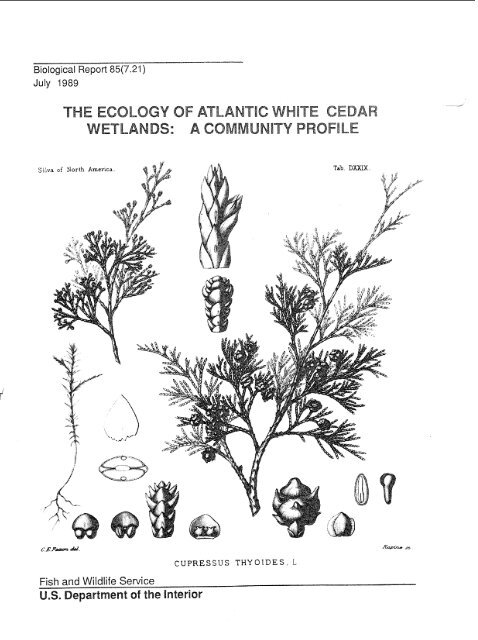
Biological Report 85(7.21)July 1989THE ECOLOGY OF ATLANTIC WHITE CEDARWETLANDS: A COMMUNITY PROFILEFish and Wildlife ServiceU.S. Department <strong>of</strong> the interiorCUPRESSUS THYOIDES. L
<strong>The</strong> mention <strong>of</strong> trade names does not constitute endorsement or recommendation for use by the FederalGovernment.Library <strong>of</strong> Congress Cahlqing-in-Publication DutuLaderman, Airnlee D.<strong>The</strong> <strong>ecology</strong> <strong>of</strong> <strong>Atlantic</strong> <strong>white</strong> <strong>cedar</strong> <strong>wetlands</strong>.(Biological report ; 85(7.21)"October 1988Bibliography: p.Supt. <strong>of</strong> Docs. no.: 149.89/2:85(7.21)1. Wetland <strong>ecology</strong>-<strong>Atlantic</strong> States. 2. <strong>Atlantic</strong> <strong>white</strong> <strong>cedar</strong>--<strong>Atlantic</strong> States. I. Brody, Michael. 11.Pendleton, Edward C. Ill. <strong>National</strong> Wetlands Research Center. IV. Title. V. Series: Biological report(Washington, D.C.) ; 85-7.21.QH104.5.AWl-34 1988 574.5'26325'097 88-600399This report may be cited as:Laderman, A.D. 1989. <strong>The</strong> <strong>ecology</strong> <strong>of</strong> the <strong>Atlantic</strong> <strong>white</strong> <strong>cedar</strong> <strong>wetlands</strong>: a community pr<strong>of</strong>ile. U.S. Fish Wtldl.Serv. Biol. Rep. 85(7.21). 114 pp.
PREFACEThis monograph on the <strong>ecology</strong> <strong>of</strong> <strong>Atlantic</strong> <strong>white</strong> <strong>cedar</strong> <strong>wetlands</strong> is one <strong>of</strong> a series <strong>of</strong> U.S. Fish and WildlifeService pr<strong>of</strong>iles <strong>of</strong> important freshwater wetland ecosystems <strong>of</strong> the United States. <strong>The</strong> purpose <strong>of</strong> the pr<strong>of</strong>ileis to describe the extent, components, functioning, history, and treatment <strong>of</strong> these <strong>wetlands</strong>. It is intendedto provide a useful reference to relevant scientific information and a synthesis <strong>of</strong> the available literature.<strong>The</strong>world range <strong>of</strong> <strong>Atlantic</strong> <strong>white</strong> <strong>cedar</strong> (Chamaecyparis thyoides) is limited to a ribbon <strong>of</strong> freshwater <strong>wetlands</strong>within 200 km <strong>of</strong> the <strong>Atlantic</strong> and Gulf coasts <strong>of</strong> the United States, extending from mid-Maine to mid-Floridaand Mississippi. Often in inaccessible sites and difficult to traverse, <strong>cedar</strong> <strong>wetlands</strong> contain distinctive suites<strong>of</strong> plant species. Highly valued as commercial timber since the early days <strong>of</strong> European colonization <strong>of</strong> thecontinent, the <strong>cedar</strong> and its habitat are rapidly disappearing.This pr<strong>of</strong>ile describes the <strong>Atlantic</strong> <strong>white</strong> <strong>cedar</strong> and the bogs and swamps it dominates or codominatesthroughout its range, discussing interrelationships with other habitats, putative origins and migration patterns,substrate biogeochemistry, associated plant and animal species (with attention to those that are rare,endangered, or threatened regionally or nationally), and impacts <strong>of</strong> both natural and anthropogenic disturbance.Research needs for each area are outlined. Chapters are devoted to the practices and problems <strong>of</strong>harvest and management, and to an examination <strong>of</strong> a large preserve recently acquired by the USFWS, theAlligator River <strong>National</strong> Wildlife Refuge in North Carolina.
CONVERSION FACTORSMetric to U.S. CustomaryMultiplymillimeters (mm)centimeters (cm)meters (m)meters (m)kilometers (km)kilometers (km)square meters (m2)square kilometers (km2)hectares (ha)liters (I)cubic meters (m3)cubic meters (m3)milligrams (mg)grams (g)kilograms (kg)metric tons (t)metric tons (t)kilocalories (kcal)Celsius degrees (OC)To Obtaininchesinchesfeetfathomsstatute milesnautical milessquare feetsquare milesacresgallonscubic feetacre-feetouncesouncespoundspoundsshort tonsBritish thermal unitsFahrenheit degreesU.S. Customary to Metricinchesinchesfeet (it)fathomsstatute miles (mi)nautical miles (nmi)square feet (ft2)square miles (mi2)acresgallons (gal)cubic feet (ft3)acre-feetounces (02)ounces (02)pounds (Ib)pounds (Ib)short tons (ton)British thermal units ptu)Fahrenheit degrees ( F)millimeterscentimetersmetersmeterskilometerskilometerssquare meterssquare kilometershectaresliterscubic meterscubic metersmilligramsgramskilogramsmetric tonsmetric tonskilocaloriesCelsius degrees
CONTENTSea9tl.PREFACE ................................................... iiiCONVERSION FACTORS ...........................................ivFIGURES ...................................................TABLES ............................................ VII V!ACKNOWLEDGMENTS ...........................................CHAPTER 1 INTRODUCTION1.1 General Features .......................................... 11.2 Classif~cation ............................................ 21.3 Relationshi with Adjacent Habitats ................................ 21.4 Origins ancf~i~ration <strong>of</strong> Chamaecyparis fhyories Forests .................... 4CHAPTER 2 REGIONAL OVERVIEW2.1 Introduction ............................................ 102.2 Glaciated Northeast ......................................... 102.3 <strong>The</strong> North Coastal Plain ...................................... 162.4 Virginia and the Carolinas .................................... 192.5 ~uni~er swamps <strong>of</strong> the southeast ................................. 22CHAPTER 3 CHAMAECYPARIS THYOIDES: LIFE HISTORY AND ECOLOGY3.1 Morpholo y ............................................. 263.2 Silvical ~ aits ............................................ 27CHAPTER 4 STRUCTURE AND FUNCTION OF THE SUBSTRATE4.1 Hdroloy .............................................. 304.2 dter ~Remistty .......................................... 314.3 Soils ................................................. 324.4 Production and Decom osition .................................. 334.5 Soil and plant Tissue cRmis3 .................................. 334.6 Interactions; Research Need .................................. 34CHAPTER 5 BIOLOGICAL COMPONENTS OF ATLANTIC WHITE CEDAR WETLANDS5.1 Adaptations to the Wetland Environment ............................. 365.2 Flora ................................................. 365.3 Fauna .............................................. 375.4 Fiesearch ~eeds .......................................... 45CHAPTER 6 MANAGEMENT AND HARVEST6.1 Impacts <strong>of</strong> Disturbance ....................................... 466.2 Management ............................................ 526.3 Commercial Use .......................................... 546.4 Management Guidelines ...................................... 576.5 <strong>The</strong> Federal Role .......................................... 616.6 Research Requirements ...................................... 61CHAPTER 7 A CASE STUDY: ATLANTIC WHITE CEDAR WETLANDS IN DARE COUNTY,NORTH CAROLINA by J.H. Moore and A.D. Laderman7.1 Overview .............................................. 677.2 Physical Characteristics 70......................................7.3 Vegetation .............................................. 727.4 Fauna ................................................ 767.5 Management Problems and Options ................................ 78REFERENCES .................APPENDIXES:A ~ssociated Flora: A Distribution Checklist by A.D. Laderman and D.B. Ward .......... 91B Associated Fauna .......................................... 108C Hydric Soils ............................................. 110D Personal Communications and Acknowledgments: Reference .................. 111viii
FIGURESNumberwDistrlb@i~n0fChamaecyperis~hy~id~s ..............................<strong>Atlantic</strong> wh#e <strong>cedar</strong> habitats in the palustrine system ........................<strong>Atlantic</strong>whtte <strong>cedar</strong> habkats in the d'verine system .........................Cumloden Swamp. Falmouth, ~~ssachusefis ............................Origlns<strong>of</strong> glacial kettleand outwash <strong>cedar</strong><strong>wetlands</strong> ........................ 5Origins<strong>of</strong> backswamp <strong>cedar</strong><strong>wetlands</strong> ............................... 5<strong>Atlantic</strong> whhe <strong>cedar</strong> logs in expos& freshwater peat underlying a salt marsh a . a . . . . . . . . 6<strong>Atlantic</strong>whHecdarmigrationroutes ................................ 8Macr<strong>of</strong>ossil sediment stratigraphy in glaciated <strong>cedar</strong> <strong>wetlands</strong> .................. 9Distribution <strong>of</strong> glacial moraines an& ice readvance localities in Northeastern United States ... 11Distribution <strong>of</strong> Chamaecyparis thyoides in towns <strong>of</strong> the glaciated Northeastern United States . 12Vegetation <strong>of</strong> the Hackensack Meadows 1819 - 1896 ....................... 17<strong>Atlantic</strong> <strong>white</strong> <strong>cedar</strong> in the Delmarva ................................ 18Presettlsment range <strong>of</strong> <strong>Atlantic</strong> <strong>white</strong> <strong>cedar</strong> in the Carolinas ................... 19Location <strong>of</strong> Great Dismal Swamp <strong>National</strong> Wildlife Refuge .................... 20Section and plan viws <strong>of</strong> a Qrollrra bay with <strong>Atlantic</strong> <strong>white</strong> <strong>cedar</strong>s ............... 23<strong>Atlantic</strong> <strong>white</strong> <strong>cedar</strong> In southeastern United States ........................ 24Cedar bordering a Florida sand-bottom creek .......................... 25Morphology <strong>of</strong> Chermaecyparis thyoides ............................. 28Radial annual growth curves <strong>of</strong> <strong>Atlantic</strong> <strong>white</strong> <strong>cedar</strong> ....................... 29Water levels in six Rhoda Island cdar swamps .......................... 31Substrate cross; section through a bog formerly dominated by Chamaecyparis thyoides .... 33Flow diagram <strong>of</strong> <strong>cedar</strong> wetland dynamics ............................. 35Composite illustrated flora: "Constant companions" <strong>of</strong> <strong>Atlantic</strong> <strong>white</strong> <strong>cedar</strong> ........... 38Effects <strong>of</strong> fire during hlgh water .................................. 47Effects <strong>of</strong> fire during low water ................................... 48Effects <strong>of</strong> permanent lowering <strong>of</strong> water level ........................... 49Effects <strong>of</strong> flood ........................................... 50Effects <strong>of</strong> windthrow ........................................ 51Hydrdogical effects <strong>of</strong> ditches ................................... 53Amphibious feller-buncher ..................................... 56<strong>cedar</strong> regeneration after hv@s€ .................................. 58........................................Management scheme 59Forest managemant ~~h~matic for the Great Dismal Swamp ................... 62Vegetation communhies <strong>of</strong> the Great Dismal: Current ...................... 64VegeQtian Communhles <strong>of</strong> the Gr-t dismal: 25-yr projection, no-action option ........ 65V~eBtion communhies <strong>of</strong> the Dismal: 100-yr projection, no-action option ....... 66Alligator River <strong>National</strong> Wildlife Refuge .............................. 68Soils <strong>of</strong> lmin'and Clare County ................................... 71Whit@ ~edar w@tlands<strong>of</strong> Dare county 74..........................
NumberTABLESEarliest records <strong>of</strong> <strong>Atlantic</strong> <strong>white</strong> <strong>cedar</strong> ............................... 7Chamaecyparis thyoides: A summary. <strong>of</strong> life history ....................... 26Physical characteristics <strong>of</strong> six Rho& Island <strong>cedar</strong> swamps ................... 32Water chemistry <strong>of</strong> <strong>cedar</strong> <strong>wetlands</strong> in New Jersey Pinelands ................... 32Plant tissue nutrient concentrations ................................ 34Plant species <strong>of</strong> special concern .................................. 41Bird species in two New Hampshire <strong>cedar</strong> swamps ........................ 42Birds breeding in Great Dismal <strong>cedar</strong> stands ........................... 43Breeding birds <strong>of</strong> Rhode Island <strong>cedar</strong> <strong>wetlands</strong> .......................... 44Production <strong>of</strong> <strong>Atlantic</strong> <strong>white</strong> <strong>cedar</strong>: 1899-1945 .......................... 54Recent estimates <strong>of</strong> <strong>Atlantic</strong> <strong>white</strong> <strong>cedar</strong> timber volume ..................... 55Vegetation cover in <strong>Atlantic</strong> <strong>white</strong> <strong>cedar</strong> stands in Dare County, NorUt Wins ........... 75Plant species associated with Atiantic <strong>white</strong> <strong>cedar</strong> in Dare County, North Carolina .......... 76Summer birds <strong>of</strong> Dare County. North Carolina <strong>white</strong> <strong>cedar</strong> habitats ............... 77vii
ACKNOWLEDGMENTSMany colleagues have generously shared their knowledge and data with me. <strong>The</strong>ir contributions arerecognized at pertinent points in the text as personal communications; Appendix D identifies each contributorand the primary geographic region or scientific field addressed.I also wish to thank all contributors to the data base that became the first Flora Checklist (Laderman and Ward1987), as noted in Appendix A, and the participants in the first <strong>Atlantic</strong> White Cedar Wetlands Symposium(Laderman 1987) which formed the basis for much <strong>of</strong> this pr<strong>of</strong>ile.I am particularly grateful to the botanists who identified and checked regional species <strong>of</strong> special concern (aslisted with Table 6). and to those colleagues who critically read sections <strong>of</strong> the manuscript, <strong>of</strong>fered suggestions,and generously provided additional data, including: A. Belling, V. Carter, P. Gammon, M.K. Garrett, andJ.H. Moore. Chapter 7 was co-authored by J.H. Moore, whodiligently researched much unpublished materialon Dare County <strong>cedar</strong> <strong>wetlands</strong>. D.B. Ward, co-author <strong>of</strong> the associated flora checklist (Appendix A), servedas botanical referee and advisor for this community pr<strong>of</strong>ile.All or parts <strong>of</strong> this manuscript were reviewed by the following: J. Allen, R. Andrews, A. Carter, F.Golet, S. Leonard, S. Little, D. Lowry, and L. Stith.I am grateful for much painstaking, attentive technical assistance: T. Laderman (Quincy, MA) and R. Golder(Photolab, Marine Biological Laboratory [MBL], Woods Hole, MA) prepared original illustrations; L. Golder(Photolab, MBL, Woods Hole, MA) Scientific Photographic Services (Edgewater, NJ) provided photographicservices; J. Laderrnanand I. Laderrnan (MuScan Inc., Quincy, MA) programmed and produced the data bases;I. Laderrnan prepared tables and organized the physical text. L. Bjorklund, M. Parkin, H. Sather, and J.Shoemaker <strong>of</strong> USFWS assisted in obtaining technical materials. <strong>The</strong> manuscript was greatly improved by E.Pendleton. M. Brody, G. Farris, and B. Vairin <strong>of</strong> the <strong>National</strong> Wetlands Research Center, Slidell, LA.viii
- CHAPTER 1 -INTRODUCTION1 .I GENERAL FEATURES<strong>Atlantic</strong> <strong>white</strong> <strong>cedar</strong> (Chamaecyparis thyoides)is geographically restricted to freshwater <strong>wetlands</strong> ina narrow band along the eastern coastal UnitedStates ranging from Maine to Mississippi (Figure 1).Cedar-dominated <strong>wetlands</strong> are most commonlycalled <strong>cedar</strong> swamps or <strong>cedar</strong> bogs, with a variety <strong>of</strong>other designations restricted to specific regions(e.g., "spungs" in the Pine Barrens [Moonsammy etal. 19871; "juniper lights" in the Great Dismal IKearney19011; "juniper bogs" throughout the south).Distinctive biotic assemblages dominatedby <strong>Atlantic</strong> <strong>white</strong> <strong>cedar</strong> grow under conditionstoo extremefor the majority <strong>of</strong> temperate-dwelling organisms.<strong>The</strong> shallow, dark, generally acid watersare low in nutrients and are buffered by complex organicacids (e.g., humates, fulvic acids). Surficialdeposits beneath <strong>cedar</strong> forests provide groundwaterstorage and discharge and recharge areas. Peatsadsorb and absorb nutrients and pollutants (Gorham1987),purifying and protecting ground and surfacewater with which they are in contact. In manyregions, <strong>cedar</strong> <strong>wetlands</strong> are refugia for species thatare rare, endangered, or threatened locally or nationally.<strong>The</strong> swamps form southern pockets for northernspecies at the geographic limits <strong>of</strong> their ranges, andsimilar northern pockets for southern species raylor191 5; New Jersey Pinelands Commission [NJPC]1980), but many locally common aquatic plants andanimals are absent from <strong>cedar</strong> swamps.GULF OF MEXICO0 I00 200KI LOMETLRMany species successful in these extremeenvironments have evolved unusual strategies forsurvival. <strong>The</strong> modest sum <strong>of</strong> research at the microscopiclevel in <strong>Atlantic</strong> <strong>white</strong> <strong>cedar</strong> <strong>wetlands</strong> revealsmany symbiotic relationships <strong>of</strong> varying degree, ex- Figure 1. Distribution <strong>of</strong> Chamaecyparis thyoides.otic pigment combinations, and a range <strong>of</strong> metabo- Records were compiled from field observations, her-Jic, morphological, and temporal adaptations barium records, published sources, and personal(Laderman 1980, 1987). However, the difficulty <strong>of</strong> communications. Counties in which <strong>Atlantic</strong> <strong>white</strong>gaining entry into <strong>cedar</strong> swamps, their limited geo- <strong>cedar</strong> has been found are inked in black (from Ladergraphicdistribution, and a general lack <strong>of</strong> awareness man 1982).
<strong>of</strong> the existence <strong>of</strong> the forests and their contents havediscouraged extensive investigation <strong>of</strong> this wealth <strong>of</strong>intriguing life strategies.European colonization and subsequent centuries<strong>of</strong> development have progressively so alteredthe landscape that much <strong>of</strong> the tree's original habitatwas destroyed. Those stands that remain were inmany cases protected only by the difficulty and highcost <strong>of</strong> penetrating the swamps. Cedar <strong>wetlands</strong> areincreasingly encroached upon. <strong>The</strong>y have beenlogged for their valuable lumber since the first explorersset foot in the New World (Emerson 1981;Frost, unpubl.; Kalm 1753-1761) and have beendrained for agriculture for more than two centuries(Frost 1987; Sipple 1971 -1 972). As areas becomemore heavily populated, industrial, commercial, andresidential uses displace <strong>cedar</strong> <strong>wetlands</strong> where theyare not protected by law (Laderman et al. 1987;Roman et al. 1987). Cedar peat is being experimentallymined as an energy source.Despite these multiple incursions, it is clearfrom the vigor <strong>of</strong> many stands that, with appropriateprotection and, in some cases, aggressive management,<strong>cedar</strong>s can successfully regenerate, and canrepopulate many former <strong>cedar</strong> sites as well.1.2 CLASSIFICATION<strong>Atlantic</strong> <strong>white</strong> <strong>cedar</strong> occurs almost exclusivelywith other hydrophytes on hydric soils inwetlarlds commonly known as swamps and bogs. Itis also found, though rarely, near established <strong>cedar</strong>stands as a colonizer where there are hydrophytesbut nonhydric soils. This may occur, for instance, atthe margins <strong>of</strong> new impoundments or excavationswhere hydric soils have not yet developed. <strong>Atlantic</strong><strong>white</strong> <strong>cedar</strong> forests may be composed exclusively <strong>of</strong>an even-aged monospecific stand <strong>of</strong> close-rankedtrees, which is <strong>of</strong>ten referred to in the literature as"typical" for C. thyoides. In forests successfullymanaged for harvest and regeneration, as well as inmany natural stands that originated after fire or flood,this is <strong>of</strong>ten the picture. However, in many natural orselectively harvested situations, <strong>cedar</strong>s grow in uneven-agedmixed stands which provide a greaterdiversity <strong>of</strong> habitats that support a more species-richfauna and flora. Animal and plant life, and thevariety<strong>of</strong> <strong>cedar</strong> landscapes they inhabit, are described inChapters 2, 5, and 7; the known flora and fauna arerecorded in Appendixes A and B respectively.Under the U.S. Fish and Wildlife Service(USFWS) classification system (Cowardin et al.1979) (Figures 2,3), most <strong>cedar</strong> <strong>wetlands</strong> key out as:SYSTEM PalustrineCLASS Forested WetlandSUBCLASS Needle-leaved EvergreenDOMINANCE TYPE Chamaecyparis thyoides; inmixed forests, common associates in the canopy arered maple (Acer rubrum), black gum (Nyssa sylvatica),sweet bay (Magnolia virginiana), and one ormore pine species: loblolly (Pinus taeda), <strong>white</strong> (P.strobus), or pitch pine (P. rigida)WATER REGIME Nontidal; Semipermanently orSeasonally Flooded, or SaturatedWATER CHEMISTRY Fresh-Acid; rarely, CircumneutralSOIL Organic; rarely, MineralA detailed classification <strong>of</strong> various <strong>cedar</strong><strong>wetlands</strong> is presented elsewhere (Laderman, unpubl.).Cedar swamps are situated shoreward <strong>of</strong>lakes, river or stream channels, or estuaries; on riverfloodplains; in isolated catchments; or on slopes.<strong>The</strong>y may also occur (rarely) on bars or islands inlakes or rivers. Slightly elevated hummocks dominatedby <strong>cedar</strong> are <strong>of</strong>ten interspersed with waterfilledhollows in a repeating pattern that forms areadily identified functionally interrelated landscape.1.3 RELATIONSHIP WITH ADJACENT HABITATS<strong>The</strong> USFWS (Cowardin et al. 1979) designatesthe upland limits <strong>of</strong> <strong>wetlands</strong> as (1) the boundarybetween land with predominantly hydrophytecover and land with predominantly mesophytic orxerophytic cover or (2) the boundary betweenpredominantly hydric and nonhydric soil. <strong>The</strong> lowerbounds <strong>of</strong> <strong>wetlands</strong>, both riverine and palustrine, lieat 2 m below low water or, if rooted plants growbeyond this depth, the border is at the deepwateredge <strong>of</strong> tree, shrub, or herbaceous emergent growth.In practice, however, consideration <strong>of</strong> theecosystem for management must go beyond technicallydefined borders. Indeed, the adjacent area maybe a critical determinant in the structure and function<strong>of</strong> the entire wetland. <strong>The</strong> hydrological regime <strong>of</strong> a<strong>cedar</strong> wetland is a major determinant <strong>of</strong> the biota inboth lotic (flowing) and lentic (nonflowing) systems.Mature <strong>Atlantic</strong> <strong>white</strong> <strong>cedar</strong>s are adapted to a widerange <strong>of</strong> water depths, but rapid, prolonged changein water depth kills seedlings outright and stresses orkills mature specimens (see Figure 4)(Little 1950;Laderman 1980). In streamside, lakeside, and estuarine-border<strong>cedar</strong> swamps, the depth <strong>of</strong> water adjacentto and contiguous with a wetland is a majorcontrolling influence on the wetland's water regime(Laderman, unpubl.). <strong>The</strong> impact <strong>of</strong> <strong>cedar</strong> <strong>wetlands</strong>on adjacent biota, hydrology, climate, etc., is at thistime a matter <strong>of</strong> interest, but there are insufficientdata for a clear vnderstanding <strong>of</strong> such effects.
TEMPORARLYSEASONALLY1I SATURATED1Figure 2. Cedar habitats in the Palustrine System. <strong>Atlantic</strong> <strong>white</strong> <strong>cedar</strong> forests usually occurin saturated (f) or temporarily flooded (a) zones on hummocks in freshwater wetland, in andbelow.upland seepages, and in wet upland slopes adjacent to existing stands. Isolated,sometimes stunted <strong>cedar</strong>s also emer e above a few saturated scrub-shrub or herbaceoussavannah-like Palustrine situations (a%apted from Cowardin et al. 1979).MQ( WATlER- AVLRAW WATERFigure 3. Cedar habitats in the Riverine System. <strong>Atlantic</strong> <strong>white</strong> <strong>cedar</strong> forests most frequentlyoccur as streamside swamps or backswamp <strong>wetlands</strong> In areas not subject to extensive orfrequent scouring. Cedars also colonize wet upland slopes adjacent to existing stands;isolated, sometimes stunted. <strong>cedar</strong>s also emerge above a few saturated scrub-shrub orherbaceous savannah-like sltuations adjacent to Streams (adapted from Cowardin et al.1 979).
1.4 ORIGINS AND MIGRATION OF CEDARFORESTS<strong>The</strong> advance and wasting <strong>of</strong> glaciers stronglyInfluenced the topography <strong>of</strong> the land both underrhs glaciers and over the entire continent's coastalarea, due to direct glacial action, isostatic crustalmovement, and major variations in sea level. Duringaariior Interglacial periods, the northeast coast <strong>of</strong> theUnited States has been as far as 72 km further inlandthan today's shore; during the Wisconsin glaciation,stscl Ievei was as much as 60 to 80 m lower than itscurrent height (Bloom 1983). <strong>The</strong> extent and timing<strong>of</strong> sea level rise and fall remains controversial (Bloom1 983).Glacial melting from 17,000 to 10,000 yearsbefore the present (B.P.) led tothe formation <strong>of</strong> glaciallakes and outwash beds <strong>of</strong> various sizes. Glaciallakebeds, kettleholes <strong>of</strong> the glacial moraine, and outwashplain streambeds are landscape features thatnow support <strong>cedar</strong> communities in the Northeast(Figure 5). Further south, glacial meltwaters filledrivers and streams, the remnants <strong>of</strong> which now formthe stream bank and backswamp <strong>wetlands</strong> (Figure 6)in the New Jersey Pine Barrens, the Delmarva peninsula,Florida, and elsewhere. Such environmentsprovide habitats for <strong>cedar</strong> growth. Conditionspeculiar to the mid-<strong>Atlantic</strong> region are discussed inthe Dare County case study (Chapter 7).Figure 4 Cumloden Swamp. Falmouth. Massachusetts. Permanent high water, the result <strong>of</strong> damming by a'~(iway, IS causing tho slow death <strong>of</strong> mature <strong>cedar</strong>s. This picture was taken fwe years after the road wasbuilt, and an@ year before the death <strong>of</strong> the last <strong>cedar</strong>s.
Stagnant,,- melting Icel Block d~agrams. very large vert~cal exaggeration l1NET EROSIONTertiary depositsTerminal moraineNET DEPOSITIONfanFigure 5. Origins <strong>of</strong> glacial kettle and outwash <strong>wetlands</strong>.Conditions close to the margin <strong>of</strong> an almoststagnant ice sheet are shown diagrammatically in theupper block diagram. <strong>The</strong> lower diagram shows thesame area after the ice is entirely gone. Cedar forestsdevelop in kettles and along outwash channels(adapted from Strahler 1966).Backswamp FIOO~ River meander\ basin /1.4.2 ~lishment and SurvivalSince the beginning <strong>of</strong> the current interglacialperiod, the long-term overall rise in sealevel, averaging about one mm per year due to glacialmelting and land subsidence, has played an importantrole in the development <strong>of</strong> many <strong>cedar</strong> <strong>wetlands</strong>.A. Redfield, (1965) in the context <strong>of</strong> a rising sea level,proposed a model for the development <strong>of</strong> coastal saltmarshes, which he extended to the development <strong>of</strong>coastal freshwater swamps (A. Redfield, pers.comm.). Redfield noted that near the seacoast, therising sea level more or less keeps pace with peat accumulationlifting the lens <strong>of</strong> freshwater above it.<strong>The</strong> effect <strong>of</strong> the rise in ground-water levels is that existing<strong>wetlands</strong> remain wet, promoting the continuouspresence <strong>of</strong> some <strong>cedar</strong> swamps for as muchas 6,800 years (Belling 1977).Along the coast, seawater inundated freshwater<strong>wetlands</strong>, giving rise to the accumulation <strong>of</strong>layers <strong>of</strong> saltmarsh peat superimposed on freshwaterpeat. Ample macr<strong>of</strong>ossil evidence <strong>of</strong> the killing <strong>of</strong><strong>cedar</strong> forests by saline incursion is found all along theNET DEPOSITIONriver meander beltY~lluvial fan<strong>of</strong> tributaryFigure 6. Origins <strong>of</strong> backswamp <strong>cedar</strong> <strong>wetlands</strong>. (a)When sea level was below the present position, theriver trenched its valley. (b) As sea level rose, glacialmeltwater poured down the river, creating a braidedstream choked with sand and gravel. (c) Deposits <strong>of</strong>today's meandering river, established at a yet highersea-level position, have buried the older braidedstream deposits. Cedar <strong>wetlands</strong> develop in backswampsand along small streambanks (adaptedfrom Long 1974).<strong>Atlantic</strong> seaboard (Figure 7). <strong>Atlantic</strong> <strong>white</strong> <strong>cedar</strong>trunks, sometimes in the same position as in life oras they fell hundreds <strong>of</strong> years earlier, may be seen atlow tides below saltmarsh turf on the coasts <strong>of</strong> NewHampshire, Massachusetts, New Jersey, Virginia,and elsewhere (Bartlett 1909; Heusser 1949, 1963;Belling 1977), and buried deep in <strong>of</strong>f-shore marinesediments (Redfield and Rubin 1962).
Figure 7. <strong>Atlantic</strong> <strong>white</strong> <strong>cedar</strong> logs in exposed freshwater peat underlying a salt marsh on Buzzard's Bay,Massachusetts. Note that many trunks and roots remain as they grew in the forest floor. Photo by I. Laderman.<strong>Atlantic</strong> <strong>white</strong> <strong>cedar</strong> appears to have movedsouthward to refugia on the Gulf Coastal Plain duringfull glaciation (Belling 1977; Delcourt and Delcourt1977). It probably began its northward migrationfrom the Gulf refugia during the late glacial period,between 17,000 and 10,000 years B.P (Belling 1977and unpubl.). Some evidence for this view is that<strong>cedar</strong> (Cupressaceae) pollen grains are found inNorth Carolina sediments that predate the mostrecent glaciation (25,000 yrs B.P.), but are absentduring the glacial epoch (21,000 to 10,000 yrs B.P).Cupressaceae pollen reappears there at 10,000 yrsB.P (the beginning <strong>of</strong> the present interglacial period),and is continuously recorded in the peats until thepresent time (Whitehead 1981 ).Dated macr<strong>of</strong>ossils <strong>of</strong> <strong>Atlantic</strong> <strong>white</strong> <strong>cedar</strong>from as early as 9500 yrs B.l? (Watts 1979) and 7700yrs B.P. (Psuty et al. I 983) were recorded from unglaciatedsites (Table 1; Figure 8). Mostpalynologists do not distinguish between the pollengrains <strong>of</strong> Thuja, Juniperus, and Chamaecyparis,which are all in the family Cupressaceae and are verysimilar in pollen morphology (see Figures 2 and 3).Belling (1977 and unpubl.) uses macr<strong>of</strong>ossilevidence in conjunction with pollen data to separatethe three genera and outlines a probable sequence<strong>of</strong> <strong>cedar</strong> migration in the glaciated region. Arrival <strong>of</strong>the species at specific sites during postglacial timewas determined by radiocarbon dating results forpeats containing both macr<strong>of</strong>ossil and pollen evidence.Belling (unpubl.) postulates that northwardmovement <strong>of</strong> <strong>Atlantic</strong> <strong>white</strong> <strong>cedar</strong> was influencedmore by the distance from the nearest refugium (i.e.,the seed source) and the availability <strong>of</strong> suitablegrowth sites than solely by warmer climate. <strong>The</strong>most suitable sites are those with a favorable waterregimen (discussed in Section 3.2 [silvical habits]and Section 4.1 [hydrology]) and a consolidatedpeat substrate.Basin depths range from 3 to 9 m in glacialsites; the build-up <strong>of</strong> peat is evidence <strong>of</strong> the rise inwater tables throughout the region. Belling (1977and unpubl.) noted that <strong>Atlantic</strong> <strong>white</strong> <strong>cedar</strong> was virtuallycontinuous in all sampled glaciated sites fromthe time <strong>of</strong> its establishment to the present.Peat contains an excellent record <strong>of</strong> eventsand biological succession. Sediment cores from<strong>cedar</strong> bogs in the glaciated region reveal a welldefinedvertical stratigraphy (Figure 9). At most sites,the overlying organic layer consists, in descendingSequence, <strong>of</strong> woody <strong>cedar</strong> peat, woody-fibrous or fibrousshrub peat, sedge peat, mossy peat (rarely),and finally gyttja formed from benthic and planktoniclake flora and fauna. <strong>The</strong> inorganic basal sedimentsare composed <strong>of</strong> sand and/or clay. Water layers mayinterrupt the sediments.
Table I. Earliest records <strong>of</strong> <strong>Atlantic</strong> <strong>white</strong> <strong>cedar</strong> in the United States.l ncation Physhg~@~y Source25,000 yr BP NC Whitehead 1981 a10,000 yr BP NC9500 yr BP NJ Coastal plain Watts 197ga7700 yr BP N J Coastal plain Psuty et al. 19836800 yr BP5400 yr BP4000 yr BP3800 yr BP3000 yr BP2300 yr BP2200 yr BP400 yr BP< 300 vrsWestboro MAPachaug RIAntrim NHGenessee RIWellfleet MASterling Forest NYBelleplain NJFairhili NHt NJPiedmontPiedmontAppalachianPiedmontCoastal plain: moraineAppalachianCoastal plainCoastal plainArq?dadanBelling 1 977ba Pollens were identified as Cupressaceae; macr<strong>of</strong>ossil and site evidence indicated C. thyoides.Pollens were identified as Chamaecyparis, corroborated by macr<strong>of</strong>ossil and site evidence.
WOODY PEATFlBROUII PEA1WOODY/FIBROSEDGE PEATMOSS PEATGYTTJASANDCLAYWATERCHARCOALCHAMAECYPARISMACROFOSSILS:igure 9. Macr<strong>of</strong>ossil sediment stratigraphy in glaciated <strong>cedar</strong> <strong>wetlands</strong> indicating <strong>Atlantic</strong> <strong>white</strong> ceda:migration patterns. Radiocarbon (R.C.) dates: See notes. Figure 8 (from Belling 1977, and unpubl.).
CHAPTER 2 -REGIONAL OVERVIEW2.1 INTRODUCTION<strong>The</strong> aspect <strong>of</strong> an <strong>Atlantic</strong> <strong>white</strong> <strong>cedar</strong> wetlandis so distinctive that the casual observer maythink that all <strong>cedar</strong> swamps are similar in physicalstructure and community composition. This is farfrom the truth when the <strong>cedar</strong> is examined over its entirerange from north to south, from sea level tomountain hollow, from acidic glacial kettle to boggyflatwood or seepage sandhill.Cedar <strong>wetlands</strong> will be most clearly understoodby examining what we know <strong>of</strong> each example.<strong>The</strong>refore, some typical or unusual sites aredescribed below, including those at the farthest extents<strong>of</strong> the <strong>cedar</strong>'s range, the highest elevation<strong>cedar</strong> swamp (altitude: 457 m), a domed bog,swamps with a dense great laurel (Rhododendronmaximum) understory, floating bog mats withdwarfed trees, a wetland in a deep fracture inbedrock, narrow stream-border Pinelands swamps,millponds, a Carolina bay, a sandhill seepage, and asandy stream terrace.2.2 GLACIATED NORTHEAST<strong>Atlantic</strong> <strong>white</strong> <strong>cedar</strong> <strong>wetlands</strong> dot a 130 kmwideband along the coastal region <strong>of</strong> the NortheasternUnited States from the southern extent <strong>of</strong>glaciation (Figure 10) along New York's Long Islandand New Jersey's Hackensack Meadows, north tomid-Maine at 44" north latitude (Figure 11).Charnaecyparis thyoides grows from sea level to457m elevation, but the great majority <strong>of</strong> stands arefound between sea level and 50 m. It is probable thatthe distribution <strong>of</strong> the species was always restrictedto sites too wet for most other northeastern trees.<strong>The</strong>re is standing water in many northern <strong>cedar</strong>swamps for half the growing season or longer(Laderman et al. 1987; Golet and Lowry 1987); thesoil is primarily organic; and ground water is highlyacidic (pH 3.1 - 5.5 [Laderman 1980; Golet and Lowry1 9871).<strong>The</strong> growing season <strong>of</strong> <strong>Atlantic</strong> <strong>white</strong> <strong>cedar</strong>in the glaciated northeast ranges from 139 days inMaine to 21 1 days in northern New Jersey. Summersare relatively cool and wet. Average maximumdaily temperatures in July range between 13 and 16"C. <strong>The</strong> extreme high temperatures, 39 to 41 "C, donot differ from those in the southernmost parts <strong>of</strong> the<strong>cedar</strong>s' range, although the total degree- days andaverage temperatures differ markedly. <strong>The</strong> lowesttemperatures in the glaciated <strong>cedar</strong> wetland arearange from -40 "C in Maine to -22 "C in New Jersey.Average annual precipitation is between 101 and 1 19cm (data from Ruffner and Bair 1981).Generally, Chamaecyparis decreases in abundancewith increasing distance from the coast. Lowtides and storms reveal <strong>cedar</strong> stumps buried undersaltmarsh peat near the coast from Kittery Point,Maine to New Jersey, evidence <strong>of</strong> the slow rise <strong>of</strong> sealevel in this region (Redfield and Rubin 1962). <strong>Atlantic</strong><strong>white</strong> <strong>cedar</strong> was far more plentiful in each <strong>of</strong> thesestates a few hundred years ago, but there is noevidence that its range ever extended significantly tothe west or north <strong>of</strong> its current extent.In New England, <strong>Atlantic</strong> <strong>white</strong> <strong>cedar</strong> is mostabundant in southeastern Massachusetts, Rhode Island,and eastern Connecticut (Golet and Lowry1987; Sorrie and Woolsey 1987; Laderman, unpubl.).Its distribution (Figure 11) appears to be closely relatedto glacial features such as moraine hollows, glacialkettles, or old lake beds.<strong>The</strong>re are 11 known Charnaecyparis standsin Maine (Eastman, unpubl.; B. Vickery, pers. comm.)and about twice that number in New Hampshire (H.Baldwin, pers. comm.; F. Brackley, pers. comm.; f?Auger, pers. comm.). In Massachusetts, <strong>cedar</strong>swamps are found in all but three <strong>of</strong> the 64 towns inBristol, Plymouth, and Barnstable (the State's threemajor southeast counties), and approximately 30
MAINEw NEW HAMPSHIRE-MASSACHUSETTSMorainesw Ice Readvances----- Inferred Glacial Margin~O*O Recessional MorainesCONNECTICUTFigure 10. Distribution <strong>of</strong> glacial moraines and ice readvance localities in the northeastern United States (fromLaderman et al. 1987, redrawn from Larson and Stone 1982).
stands are scattered north and west <strong>of</strong> Boston (Sorrieand Woolsey 1987). Rhode Island contains morethan 130 stands in four <strong>of</strong> the State's five counties (D.Lowry, pers. comm.). <strong>The</strong>re are records <strong>of</strong> 39 "C. thyoides<strong>wetlands</strong> extant in Connecticut (K. Metzler,pers. comm.); a half century ago Noyes (1939)counted 86 stands, 72% <strong>of</strong> them in the twoeasternmost counties <strong>of</strong> New London and Windham.Two small <strong>cedar</strong> bogs are all that remain in mainlandNew York State (Lynn 1984), but many stands persistin southeastern Long Island (J. Turner, pers. comm.).While extensive <strong>cedar</strong> <strong>wetlands</strong> are found south <strong>of</strong>the limit <strong>of</strong> glaciation in the Pine Barrens <strong>of</strong> southernNew Jersey, only seven are known from the glaciatedpart <strong>of</strong> the State (D. Snyder, pers. comm.). Earlyreports (e.g., John Bartram's 18th century letters[Darlington 18491; Kalm's 1753-1 761 diary [Benson19661) described rich <strong>cedar</strong> forests in the eastern tip<strong>of</strong> Pennsylvania at the New Jersey border, butChamaecyparis has been extirpated in Pennsylvaniafor many years (Illick 1928).Figure 11. <strong>The</strong> historical distribution <strong>of</strong> C. thyoides in towns <strong>of</strong> the glaciated northeastern United States (fronLaderman et al. 1987).12
Throughout the glaciated Northeast, only afraction <strong>of</strong> earlier stands remains. Information on thecurrent status and location <strong>of</strong> many sites is availablefrom the Natural Heritage Programs, the Nature Conservancy,and State natural diversity data bases.<strong>The</strong> following descriptions <strong>of</strong> stands areadapted from Laderman et al. (1987).Maine. <strong>The</strong> northern and eastern edges <strong>of</strong>the worldwide native ranae <strong>of</strong> C. thvoides are in thestate <strong>of</strong> Maine (~ossbach 1936). *Maine's eleven<strong>cedar</strong> stands are scattered from Knox County southwardto the New Hampshire border, generally within20 km, and never more than 48 km, from the <strong>Atlantic</strong>coast. <strong>The</strong>y are found among low hills, betweenridges, and along lakes and swampy valleys withmeandering streams (Eastman 1977).Appleton Bog, at 44" 20' north latitude thenorthernmost site <strong>of</strong> the tree's range, was discoveredin 1931 by Rossbach (1 936). <strong>The</strong> 92 ha site containswell-developed Sphagnum-carpeted hummock andhollow topography dominated by vigorouslyreproducing, healthy <strong>cedar</strong>s (Worley 1976). Hummocktops lie above the water table most <strong>of</strong> the growingseason; in droughts, the water table remainswithin afew centimeters <strong>of</strong> the surface <strong>of</strong> the hollows.<strong>The</strong>re are no streamcourses within the <strong>cedar</strong>dominatedarea, and there is neither inflow nor outflow<strong>of</strong> surface water. Sixteen hectares last logged inthe 1950's are vigorously regenerating. <strong>The</strong> <strong>cedar</strong>sform dense, pure stands, averaging 15 to 40 cm indiameter at breast height (dbh); the maximum heightseen was ca. 18 m (Worley 1976). Potamogeton confewoides,a pondweed rare in Maine, grew in a pondwithin the bog a decade ago but may have been recentlyextirpated as it has not been found in more recentexplorations (G. Rossbach, unpubl. letter).Northport, in Waldo County, at 69" 01 ' westlongitude is the easternmost location known for C.thyoides; it contains a strikingly different <strong>cedar</strong> sitejust a few km southeast <strong>of</strong> Appleton Bog. In 1930,Rossbach (1936) discovered stunted <strong>cedar</strong>s scatteredand chmped on a 0.5 km-wide bog mat floatingat one end <strong>of</strong> Knight's Pond. It has apparentlychanged little in this half century. Mature <strong>cedar</strong>s(some only 15 cm tall) share the tufted mat surfacewith stunted <strong>white</strong> pine (Pinus strobus), blackspruce (Picea mariana) , tamarack (Larix laricina),and a rich variety <strong>of</strong> ericaceous shrubs, carnivorousherbs, and Sphagnum mosses (B. Vickery and A.Laderman, unpubl. field notes).Saco Heath, northwest <strong>of</strong> Saco, York County,is the only domed bog known to containChamaecyparis thyoides, and is possibly thesouthernmost raised coalesced peatland in the easternUnited States. Saco is the only large Sphagnumbog in southern Maine, and is one <strong>of</strong> thesouthernmost <strong>Atlantic</strong> coast breeding sites knownfor the palm warbler (Dendroica palmarom) (H. Tylerand M. Michener, pers. comm.).<strong>The</strong> earliest reports <strong>of</strong> C. thyoides in Maine(Goodale 1861) indicated that it grew in York and Kitteryat the southernmost tip <strong>of</strong> Maine's seacoast,where now only gnarled stumps <strong>of</strong> a drowned <strong>cedar</strong>forest are sometimes visible at extreme low tide.New More than twenty <strong>Atlantic</strong><strong>white</strong> <strong>cedar</strong> stands are scattered through five <strong>of</strong>New Hampshire's ten counties (P. Auger, pers.comm.; H. Baldwin, pers. comm.). A few rare highaltitudeChamaecyparis swamps are found here.Robb Reservoir in Stoddard at 388 m is second in elevationonly to High Point, New Jersey. At leastseven stands are found above 250 m, six <strong>of</strong> themgrowing in Hillsborough County (Svenson 1929;Baldwin 1961, 1963, 1965, and pers. comm.; F.Brackley, pers. comm.). Little has been publishedabout the state's <strong>cedar</strong> <strong>wetlands</strong>; their continual lossis documented repeatedly in Baldwin's short notes(1961, 1963, 1965) and unpublished letters, and inunpublished records <strong>of</strong> the New England NatureConservancy and the Society for the Protection <strong>of</strong>New Hampshire's Forests.Massachusetts. In Massachusetts, <strong>Atlantic</strong><strong>white</strong> <strong>cedar</strong> is commonest south <strong>of</strong> Boston, particularlyin Plymouth and Bristol counties. Manyacres <strong>of</strong> <strong>cedar</strong> swamp still exist here, although theyare being encroached upon by urbanization. Cranberrybogs were <strong>of</strong>ten created from <strong>cedar</strong> <strong>wetlands</strong>,but it is difficult to determine how many acres historicallysupported <strong>Atlantic</strong> <strong>white</strong> <strong>cedar</strong>. Farther west,there are fewer <strong>wetlands</strong> and less optimal conditionsfor <strong>cedar</strong> growth. In some areas <strong>of</strong> western Massachusetts,in the Connecticut River valley and innorthern Worcester County, <strong>cedar</strong>s usually occurwithin black spruce and larch forests in a more borealsetting.On Cape Cod, <strong>cedar</strong> bogs are sparsely distributedfrom Provincetown to the Cape Cod Canal,primarily in glacial kettles. Diaries <strong>of</strong> early explorersand colonists (Archer 1602 and Brereton 1602 [inEmerson 19811; Emerson 1981) tell <strong>of</strong> many thick<strong>cedar</strong> stands on the Cape as well as on the adjacentElizabeth Islands, where only a single <strong>cedar</strong> swampremains today.Despite the <strong>white</strong> <strong>cedar</strong>'s historic abundancein Massachusetts, few studies <strong>of</strong> the state's<strong>cedar</strong> <strong>wetlands</strong> have been published. <strong>The</strong> MassachusettsNatural Heritage Program is currentlypreparing an inventory <strong>of</strong> the natural areas <strong>of</strong> the
state and is gathering data hitherto unavailable.Even as the information is collected, large tracts arebeing threatened by major development.Occurrences <strong>of</strong> <strong>cedar</strong> in the state may begrouped in three broad classes (1) pure forest standswith little other canopy vegetation (the most common<strong>cedar</strong> community <strong>of</strong> the mainland), (2) mixed stands,with <strong>cedar</strong> occurring among other wetland trees,primarily red maple, and (3) in kettles with an openbody <strong>of</strong> water surrounded by a succession <strong>of</strong> zonesin which <strong>cedar</strong> is one <strong>of</strong> the concentric rings <strong>of</strong>vegetation.An example <strong>of</strong> the vegetation sequence surroundinga kettle pond would be: a band <strong>of</strong> emergentswamp loosestrife (Decodon verticillatus) rimmedby a Sphagnum-based mat, on which there is a succession<strong>of</strong> narrow shrub zones starting with perhapssome dwarf huckleberry (Gaylussacia dumosa),leatherleaf (Chamaedaphne calyculata), blueberry(Vaccinium spp.), and swamD azalea(~hododendron~viscosurn), which sharply gradeinto <strong>Atlantic</strong> <strong>white</strong> <strong>cedar</strong>, and finally <strong>white</strong> pine, hemlock,and upland species. Somet~~ical plants <strong>of</strong>thewestern sections <strong>of</strong> Kent and Providence Counties(D. Lowry and F. Golet, pers. comm.) <strong>The</strong>re is very little<strong>cedar</strong> on the east side <strong>of</strong> the Bay, although placenames such as "Cedar Swamp" suggest that thespecies was more common there in the past.<strong>The</strong> largest stands <strong>of</strong> <strong>cedar</strong> occur within thestate's three largest <strong>wetlands</strong>, all <strong>of</strong> which aresituated on broad expanses <strong>of</strong> stratified drift less than30 m above sea level. Cedar forest covers 240 ha <strong>of</strong>the 870-ha Chapman Swamp in Westerly. <strong>The</strong>remainder <strong>of</strong> this highly diverse wetland includesdeciduous forest, shrub swamp, bog, marsh, andopen water. Two-thirds <strong>of</strong> the 390-halndian <strong>cedar</strong>Swamp in Charlestown supports <strong>cedar</strong>, but redmaple (Acerrubrum) is the dominant species in most<strong>of</strong> the stands in which <strong>cedar</strong> occurs. In the GreatSwamp, which occupies 1200 ha in SouthKingstown, Richmond, and Charlestown, <strong>cedar</strong>covers some 90 ha; the great majority <strong>of</strong> this wetlandconsists <strong>of</strong> deciduous forest and shrub swamp.Smaller stands <strong>of</strong> <strong>cedar</strong> are commonlyfound in glacial kettles (ice-block basins) whichformed in stratified drift or in thick deposits <strong>of</strong>Open Sphagnum =One would be pitcher plant (Sar- morainal material. A highly unusual stand <strong>of</strong> <strong>Atlantic</strong>racenia ~ur~urea), s~rldew (Drosera intermedia), <strong>white</strong> <strong>cedar</strong> occupies a kettle situated in omash atand occasional orchids such as rose ~ogonia the edge <strong>of</strong> Factory Pond, 9 m above sea level in(Pogonia o~hioglossoides) or grass pink South Kingstown. <strong>The</strong> trees in this 5-ha "forest" are(Calopogon pulchellus) .80 years old, but only 1-1.5 m tall. Bordered by theA variation <strong>of</strong> this vegetation type is found on pond On One side, the stand is separated from the ad-Cape Cod, where <strong>cedar</strong>s may occupy relatively flat- jacent upland by a moat <strong>of</strong> open water and a quakingsurfaced kettles rimmed by a moat slightly deeper mat low shrubs- <strong>The</strong> surface Of this dwarf <strong>cedar</strong>than the body <strong>of</strong> the wetland. <strong>The</strong> <strong>cedar</strong>s, <strong>of</strong>ten the bog is carpeted throughout with Sphagnum moss.sole canopytree, cluster on small hummocksthatare <strong>The</strong> Water table Stays within a few centimeters <strong>of</strong> thespotted over the entire basin. <strong>The</strong> concentricvegeta- surface all Year, and the pH <strong>of</strong> the soil water drops astion pattern is condensed on each hummock, with IOW as 3.1. <strong>The</strong> soil is a p00dy decomposed, fibricericaceous shrubs, sweet pepperbush (Clethra a/- Peat. Growing in association with the <strong>cedar</strong>s arenifolia), and ferns in tight array rising from a sphag- leatherleaf, cranberries (Vaccinium macrocarpon, V.nous carpet that continues into the water <strong>of</strong> the OXYCOCCOS)I cOtfongraSS (Erio~horum SP.)~ andhollows.pitcher plant. At its deepest point, this kettle contains9 m <strong>of</strong> peat.Species otherwise rare in southern NewEngland are found in Chamaecyparis <strong>wetlands</strong>, e.g.,dwarf mistletoe (Arceuthobium pusillum), a tinyflowering parasite that causes deformation anddeath <strong>of</strong> at least the branches <strong>of</strong> the black spruce onwhich it grows; and heartleaf twayblade (Listera tordata),a northern species at its southern limit in CapeCod (the only known extant location in the state).<strong>The</strong> northern parula warbler (Parula americana) inMassachusetts now breeds primarily in a few <strong>cedar</strong><strong>wetlands</strong>, as the hanging lichen Usnea, its favorednesting material, is fast disappearing outside the<strong>cedar</strong> swamps.Rhode. In Rhode Island, <strong>Atlantic</strong><strong>white</strong> <strong>cedar</strong> is most abundant west <strong>of</strong> NarragansettBay, particularly in Washington County and in the14Cedar <strong>wetlands</strong> along the Connecticut borderin western Rhode Island generally lie at elevationsranging from 90 to 180 m. Most <strong>of</strong> these havedeveloped over valley train deposits <strong>of</strong> stratified driftor in association with ice contact deposits. A verysmall percentage <strong>of</strong> these swamps lie directly onbedrock or on unstratified drift (more commonlyknown as glacial till). Most wetland basins in till orbedrock tend to be small, and peat deposits seldomexceed 2-3 m in thickness.Red maple and black gum (Nyssa sylvatica)are the two tree species most commonly associatedwith <strong>Atlantic</strong> <strong>white</strong> <strong>cedar</strong> throughout Rhode Island,but eastern hemlock (Tsuga canadensis) is animportant associate in many <strong>of</strong> the swamps lying
above 90 m. In a small number <strong>of</strong> <strong>wetlands</strong> in northwesternRhode Island, <strong>cedar</strong> grows in associationwith two boreal species, black spruce (Piceamariana) and larch (Larix larina) (R. Enser, pers.comm.).Great laurel (Rhododendron maximum), abroad-leaved evergreen shrub which is common inupland areas <strong>of</strong> the southern Appalachians (Fernald1950), is locally common as an understory species inboth deciduous and evergreen wetland forests insouthern Rhode Island and nearby Connecticut.This shrub grows to a height <strong>of</strong> 2.5 to 4.5 m and <strong>of</strong>tenforms such dense tangles that travel through theswamps is exceedingly difficult. As a result <strong>of</strong> thedeep shade created by a dense canopy <strong>of</strong> <strong>cedar</strong> anda thick understory <strong>of</strong> great laurel, herbs are scarce tononexistent in these swamps (Lowry 1984).A striking example <strong>of</strong> the <strong>Atlantic</strong> <strong>white</strong><strong>cedar</strong>-great laurel association can be seen in the EllPond-Long Pond Natural Areas Complex near theConnecticut line in Hopkinton. <strong>The</strong>re a dense, 90-year old <strong>cedar</strong> forest containing hemlock as well asgreat laurel borders the northern and western shores<strong>of</strong> Ell Pond, which lies in a deep fracture in the localbedrock. <strong>The</strong> surrounding relief is rugged andbedrock outcrops are numerous. Between the forestand the water's edge is a narrow bog mat dominatedby leatherleaf. Peat thickness ranges from 4 m in theforest interior to 8-9 m at the water's edge. <strong>The</strong> EllPond stand, which averages 13 m in height, is 98 mabove sea level. Ell Pond and its associated <strong>wetlands</strong>represent Rhode Island's only <strong>National</strong> NaturalLandmark. For further description <strong>of</strong> Rhode Islandsites, see Lowry (1 984) and Golet and Lowry (1987).Connecticut. Thirty-nine <strong>cedar</strong> <strong>wetlands</strong>, allbut six <strong>of</strong> them east <strong>of</strong> the Connecticut River, areknown to contain living <strong>cedar</strong> in Connecticut atpresent (K. Metzler, pers. comm.). Some sitesare reportedto be in near-pristine condition, some aretrampled and debris-strewn, and some are still beinglogged for <strong>cedar</strong>. A few are in public ownership, butmost have no active conservation manaaement. -Two <strong>cedar</strong> <strong>wetlands</strong> were designated as <strong>National</strong>Natural Landmarks in 1973: Chester CedarSwamp, and Pachaug Great Meadow in Voluntown.A <strong>cedar</strong> log walkway and marked trail traverse a section<strong>of</strong> the Pachaug preserve containing over 200 ha<strong>of</strong> <strong>cedar</strong> in an approximately 350 ha swamp-bogsedgemeadow complex (K. Metzler, pers. comm.)drained by the Pachaug River. Pachaug and at leasttwo other stands are known to contain sizable, vigorous,dense great laurel populations (LedyardCedar Swamp, and Bell Cedar Swamp in NorthStonington) (K. Metzler, pers. comm.). Creepingsnowberry (Gaultheria hispidula) is reputed to growin one privately-owned swamp. North WindhamPeat Bog contains a dense 30-ha <strong>white</strong> <strong>cedar</strong> swampwith black spruce, unusual in Connecticut. It is acombination not seen south <strong>of</strong> this point except in themontane Sterling Forest, New York and High Point,New Jersey forests (Laderman, unpubl.).Monographs by Nichols (1913) and Taylor(1915), and a master's thesis by Noyes (1939) constitutethe major sources <strong>of</strong> historical botanical dataabout Chamaecyparis in the state. <strong>The</strong> papers containlists <strong>of</strong> associated species, brief site descriptions,and maps, indicating that <strong>of</strong> 86 <strong>cedar</strong> standsknown at the time, 85% were east <strong>of</strong> the ConnecticutRiver.New York State. Before the agricultural andsuburban development <strong>of</strong> Long Island, <strong>cedar</strong>swamps were believed to form an almost continuouschain from Brooklyn to Montauk Point (Nichols1913), clustered along the southern edge <strong>of</strong> the terminalmoraine that forms the island's spine. As civilizationspread, <strong>cedar</strong> <strong>wetlands</strong> declined drastically(Torrey 1843; Harper 1907; Bicknell 1908; Taylor1916).<strong>The</strong> primary cause <strong>of</strong> <strong>cedar</strong> loss in NassauCounty was lowering <strong>of</strong> the water table when streamswere dammed to create reservoirs for the rapidly expandingpopulace. Nassau County today holds fewmature <strong>cedar</strong>s, with no evidence <strong>of</strong> regeneration (J.Turner, pers. comm.).In Suffolk County, earlier in this century,many <strong>wetlands</strong>were lumbered, drained, and clearedfor farming. Those remaining are being rapidlyredaced bv summer resorts and second homes.he county now contains only 11 known <strong>cedar</strong>stands, most <strong>of</strong> them quite small. SouthamptonTownship harbors the greatest abundance <strong>of</strong> <strong>cedar</strong>sin Long Island. <strong>The</strong> largest New York wetland complexcontaining Chamaecyparis is in a 40-ha area <strong>of</strong>Southampton's Cranberry Bog County Park, alongthe southern reaches <strong>of</strong> the Peconic River (J. Turner,pers. comm.).Outside Long Island, the only <strong>cedar</strong> standsremaining in the state are two small bogs in SterlingForest, each less than 0.5 ha (Lynn 1984; Lynn andKarlin 1985).New Jersey. Glaciated New Jersey has onlyseven known <strong>cedar</strong> stands, but it bears the distinction<strong>of</strong> harboring an <strong>Atlantic</strong> <strong>white</strong> <strong>cedar</strong> swamp inHigh Point at the greatest altitude recorded for thespecies. Its elevation <strong>of</strong> 457 m exceeds that <strong>of</strong> thenext highest stand (in New Hampshire) by 69 m.Only three northern New Jersey sites contain morethan a few trees at present: High Point andWawayanda in Sussex County in the far northwest
corner <strong>of</strong> the state, and Uttertown in adjacent PassaicCounty (D. Snyder, pers. comm.). At least eight othersites in glaciated New Jersey had once supported<strong>cedar</strong> (Britton 1889; Gifford 1896; Heusser 1963).<strong>The</strong> higher elevation areas show no evidence<strong>of</strong> the existence <strong>of</strong> earlier, more extensivestands. <strong>The</strong> Hackensack Meadows, however, wascovered by great <strong>cedar</strong> <strong>wetlands</strong> which were firstdescribed in botanical detail by Torrey and his coworkers(1 81 9). In the mid-eighteenth century, hugefires were set in these swamps to eliminate hidingplacesfor bandits terrorizing the region. At about thesame time, extensive systems <strong>of</strong> dikes, ditches, andtide-gates were built in a fruitless series <strong>of</strong> attemptsto cultivate the <strong>wetlands</strong>. Chamaecyparis is nowcompletely extirpated in the Hackensack Meadows.<strong>The</strong> region's original botanical richness and its subsequentdecline were recorded by a series <strong>of</strong> eminentnaturalists (reviewed and correlated by Sipple (1 971 -1972)(Figure 12).<strong>The</strong> high-elevation <strong>cedar</strong> swamp in HighPoint, protected by the State <strong>of</strong> New Jersey since1923, is now buffered by 51 6 ha <strong>of</strong> the Kuser NaturalArea (New Jersey Bureau <strong>of</strong> Forest Management1984). Its 4-6 ha <strong>of</strong> mixed dense coniferousdeciduousforest grow on a few dm <strong>of</strong> woody peat (Belling19771. Great laurel forms most <strong>of</strong> the dense undergro&hin deep shade; in more open sections, otherheath shrubs (primarily Ericaceae) predominate.Herbs are relatively rare and scattered (Niering 1953;Belling unpubl.).<strong>The</strong> <strong>cedar</strong> forests <strong>of</strong> glaciated New Jerseystrongly resemble the most northerly stands <strong>of</strong> thespecies. <strong>The</strong> only report for balsam fir (Abies balsamea)in the state, and its sole sighting in aChamaecyparis association outside <strong>of</strong> Maine is atHigh Point (Belling 1977). Larch, black spruce, andhemlock occur with C. thyoides only within theglaciated portion <strong>of</strong> the <strong>cedar</strong>'s range.2.3 THE NORTH COASTAL PLAINReviews <strong>of</strong> the literature and much detailedinformation about <strong>Atlantic</strong> <strong>white</strong> <strong>cedar</strong> in the JerseyPinelands are contained in the Pinelands <strong>National</strong>Reserve Management Plan (New Jersey PinelandsCommission [NJPC] 1980); Roman et al. (1987, andunpubl.); and Forman (1979). Buchholz and Good(1 982) prepared extensive annotated Pinelands bibliographieswith sections indexed for Chamaecyparis.Most <strong>of</strong> New Jersey's <strong>Atlantic</strong> <strong>white</strong> <strong>cedar</strong>swamps are located in the state's southernpinelands, historically called the Pine Barrens. Cedarstands presently occupy about 8,680 ha, 2% <strong>of</strong> this445,000 ha landscape (Roman and Good 1983). Accounts<strong>of</strong> Stone (191 I), Harshberger (1916) andWacker (1979) suggest that <strong>cedar</strong> swamp acreagehas been declining since European settlement. Historicalestimates, although widely variable, documentthe reduction from a maximum <strong>of</strong> 40,500 ha(Vermeule and Pinchot 1900; Cottrell1929; Fergusonand Meyer 1974).Southern New Jersey's coastal plain is characterizedby low relief with streams slowly flowingthrough an unconsolidated sandlgravel substrate.<strong>The</strong> <strong>cedar</strong> swamps generally form narrow borders onstreams from headwaters to tidal freshwater. Of 626discrete <strong>cedar</strong> swamp patches in the Pinelands, over90% are less than or equal to 40 ha. A few <strong>cedar</strong>swamps over 200 ha in area also occur (Zampella1 987).Poorly drained muck (fine organic) soilsusually underlie the Pinelands <strong>cedar</strong> swamps. Muckdepth, generally shallower than in northern glaciatedJersey, is <strong>of</strong>ten less than 1 m, ranging occasionallyto 3 m. (Waksman et al. 1943).Undisturbed mature Pinelands <strong>cedar</strong> standsare dense and even aged, with canopies 15-1 8 mhigh (McCormick 1979). Pitch pine (Pinus rigida) isan occasional codominant. <strong>The</strong> understory <strong>of</strong> redmaple, black gum (Nyssa sylvatica), and sweet bay(Magnolia virginiana) may be continuous, relativelysparse, or absent. Highbush blueberry (Vacciniumcotymbosum), dangleberry (Gaylussacia frondosa),swamp azalea (Rhododendron viscosum) , sweetpepperbush (Clethra alnifolia), fetterbush (Lyoniamariana), and bayberry (Myrica pensylvanica) arethe commonest species in the shrub layer. Hollowsare conspicuously carpeted with Sphagnum spp.<strong>The</strong> herbaceous flora is usually sparse, but diverse.Sundews (Drosera s pp.), bladderworts (Utriculariaspp.), pitcher plant, and chain fern (Woodwardia virginica)are the commonest herbs. In New Jersey, therare curly grass fern (Schizaea pusilla) is found onlyin the Pine Barrens.Disturbances such as fire, storms(windthrow, ice damage), cutting, flooding, deerbrowse on young stands, beaver damming, cranberrycultivation, and subsequent abandonment causeconsiderable variation in the vegetation structureand species composition <strong>of</strong> Pinelands <strong>cedar</strong>swamps. Such disturbances may be followed by thegrowth <strong>of</strong> <strong>cedar</strong>s in pure stands, in mixed <strong>cedar</strong>-
Cedar swampbottom (18961E x~rllng <strong>cedar</strong>swnmp(le$e)Schuylers Corn=Weehawhea HobokenCommun~pnw27QO feetNewark Meadows L>Figure 12. Vegetation <strong>of</strong> the Hackensack Meadows circa 1819-1 896. "Cedar swamp bottom" indicatesformer<strong>cedar</strong> land, or <strong>cedar</strong>s dying in 1896 (from Sipple 1971 -72, after Vermeule 1897).
hardwood stands, or as isolated trees or clusters in non-tidal fiver courses, with a few on pond marginsa shrubdominated landscape (tittle 1979; Forman and in isolated swamps. Cedar presence is closely1979). correlated with Delaware soil types (Seyfried 1985).e <strong>of</strong> c-.It must be emphasizedthat the general trend has been toward conversionto other wetland types. ln addition todisturbances noted earlier, the decline <strong>of</strong> thePinelands <strong>cedar</strong> <strong>wetlands</strong> has been hastened byrising sea level, flooding for cranberry production,creation <strong>of</strong> industry-related reservoirs and recreationallakes, and drainage for agricultureand residentialdevelopment (Roman et al. 1987).<strong>The</strong> harvest and management <strong>of</strong> <strong>Atlantic</strong><strong>white</strong> <strong>cedar</strong> in the Pinelands are discussed in detailin Chapter 6.2.3.2 Jhe Delmarva Peninsula<strong>Atlantic</strong> <strong>white</strong> <strong>cedar</strong> exists today on the DelmarvaPeninsula in remnant stands that representonly a fraction <strong>of</strong> the species' former geographicrange (Figure 13). For literature review and furtherdetail, see Dill et al. (1987) and Dill et af. (unpwbl.),from which the following discussion was extracted.Just 322 km long and only 11 3 km at itswidest, the Delmarva peninsula contains all threeDelaware counties, nine Eastern Shore Marylandcounties, and two Eastern Shore Virginia counties. Itis bounded on the north by Pennsylvania; on the eastby the Delaware River, Delaware Bay, and the <strong>Atlantic</strong>Ocean; and on the west by the Susquehanna Riverand Chesapeake Bay. <strong>The</strong>re are two distinct geographicprovinces: (1) the Piedmont Plateau, withrocky, wooded hillsides and rich alluvial stream valleysand (2) the <strong>Atlantic</strong> Coastal Plain, with soils <strong>of</strong>clays, silts, sands, and gravels.<strong>The</strong> average annual temperature is 13" C;average annual precipitation is 11 4.3 cm. For most<strong>of</strong> the year, winds are west to northwest, with a moresoutherly flow in summer.<strong>The</strong> Fall Zone cuts across the northern portion<strong>of</strong> the peninsula in a narrow northeast to southwestband. Here Piedmont streams tumble as muchas 42.7 m to the lnner Coastal Plain below. All <strong>Atlantic</strong><strong>white</strong> <strong>cedar</strong> sites in Delmarva are located belowthe Fall Zone, with a few stands on the lnner CoastalPlain, and none on the Piedmont Plateau.A catalog <strong>of</strong> 58 present and historic sites indicatesthat <strong>white</strong> <strong>cedar</strong> now grows in Kent and SussexCounties, Delaware; Kent, Queen Ann's, Talbot,Dorchester, Wicomico, and Worcester Counties,Maryland; and Accomac County, Virginia. Cedar<strong>wetlands</strong> are found in six watersheds draining intoDelaware Bay: three drain directly in the <strong>Atlantic</strong>Ocean, and five drain into the Chesapeake Bay. Allsites are associated with acid water (ca. pH 5) on theCoastal Plain, where <strong>cedar</strong> is found primarily alongfall zonepopulationFigure 13. <strong>The</strong> probable historical range <strong>of</strong> <strong>Atlantic</strong><strong>white</strong> <strong>cedar</strong> in the Delmarva peninsula,reconstructed from herbarium records and personalcommunications (from Dill el al. 1987).
Delma~a habitats are collectively characterizedby the presence <strong>of</strong> 16 plant taxa variouslynoted as rare in Delaware, Maryland, and Virginialists(see Chapter 5). Of particular interest is the association<strong>of</strong> several carnivorous plants; the nationally rareswamp pink (Helonias bullata); and the Delmarva endemic,seaside alder (Ainus maritima). Human impactshave extended over three centuries andinclude millpond construction, fire, siltation, drainageand channelization, bulkheading <strong>of</strong> riverfront property,pollution, and commercial timbering. Existingstands are seen as prime habitats for natural areaconservation.2.4 VIRGINIA AND THE CAROLINASOn the Virginia mainland, <strong>Atlantic</strong> <strong>white</strong><strong>cedar</strong> is found only in the Great Dismal Swamp.Virginia's Eastern Shore stands are considered withthe rest <strong>of</strong> the Delmarva area in Section 2.3.2. <strong>The</strong>historical range <strong>of</strong> Chamaecyparis in North andSouth Carolina has been documented by Frost (1 987and unpubl.)(Figure 14). Eastern North Carolina isthe subject <strong>of</strong> a case study, Chapter 7.2.4.1 <strong>The</strong> Great Dismal Swamp in Vir~ini andNorth Carolina<strong>The</strong> name "Dismal Swamp" originated incolonial days for the over 404,000 undrained hectaresbetween the James River in southeastern Virginiaand the Albemarle Sound in North Carolina(Oaks and Whitehead 1979). <strong>The</strong> Great DismalSwamp <strong>National</strong> Wildlife Refuge (GDSNWR), establishedin 1973, occupies a 43,000 ha rectangular remnant<strong>of</strong> the former swamp.Located approximately 48 km from the <strong>Atlantic</strong>Ocean, the refuge lies between the cities<strong>of</strong> Suffolkand Chesapeake inTidewater Virginia and withinGates, Camden, and Pasquotank Counties in NorthCarolina (Figure 15). It is delineated on the north byU.S. Route 58, on the south by U.S. Route 158, on theeast by Route 17, and on the west by the SuffolkScarp.Where no other source is indicated, the followingdiscussion is drawn from the draft environmentalimpact statement (EIS) for the Great DismalSwamp <strong>National</strong> Wildlife Refuge Master Plan(USFWS 1986b).A hha 1894A2 Ashe 1893II Byrd 1728E Elliott 1624H Hale 18830 Anon. 1907P Piachot b hhe 1897U Ruffin 1861W Bannister et al. 1903Y Wood C McCarthy 18861943 2 Hichaux 1857Figure 14. Historical range <strong>of</strong> <strong>Atlantic</strong> <strong>white</strong> <strong>cedar</strong> in the Carolinas. Letters in each county refer to sourcesin the literature, herbaria, or place names, as documented in Frost (1987, and unpubl.) (from Frost 1987).
<strong>cedar</strong> have comprised 40%-60% <strong>of</strong> the peat pollenpr<strong>of</strong>ile. (Chamaecyparis pollens were not countedseparately.)w. Temperatures, precipitation patterns, andhumidity are similar to that <strong>of</strong> Dare County, NorthCarolina (see Chapter 7). <strong>The</strong> Dismal Swamp lies onthe <strong>Atlantic</strong> Coastal Plain, between the Suffolk Scarpand the Deep Creek Swale. Elevations range from4.6 to 7.6 m. <strong>The</strong> topography slopes gently to theeast at the rate <strong>of</strong> 0.2 mlkm (Carter 1987).<strong>The</strong> geologic formation most intimately associatedwith the Dismal Swamp water budget,which accounts for the majority <strong>of</strong> water that upwellsin the swamp, is a shallow aquifer composed <strong>of</strong> coarsely-grainedto finely-grained old marine sands(Lichtler and Walker 1979). Formerly termed the NorfolkFormation (now recognized as the Shirley andTabb Formations [Carter 1987]), this is a water-bearinglayer through which water moves laterally.Figure 15. Great Dismal Swamp <strong>National</strong> WildlifeRefuge. Virginia and North Carolina (from USWS1986b).Q e v e l o P m e n t . Althoughpaleogeography <strong>of</strong> the <strong>Atlantic</strong> coast is still the subject<strong>of</strong> debate (e.g., Watts and Stuiver 1980; Bloom1983), it is generally believed that the Dismal Swampprobably first developed along coastal streams11,000 to 12,000 years ago (Oaks and Coch 1973;USFWS 1986b). Palynological evidence (Whitehead1965) indicates that full-glacial boreal spruce-pineforests were succeeded by pine-spruce forests and,toward the end <strong>of</strong> the late-glacial, by northernhardwood forests. During the early postglacialperiod, the forests were dominated by hardwoodsthat currently grow in the region. A variable cypressgumforest has characterized the Dismal Swamp forthe past 3500 years (Whitehead and Oaks 1979). <strong>The</strong>wetland expanded along watercourses, and peataccumulated until by 3,500 years B.P., peat had blanketedthe present-day Dismal Swamp. Whitehead(I 965) and Whitehead and Oaks (1 979) found thatcypress (Taxod/um) and <strong>cedar</strong> pollens first appear inthe peat about 6,500 yrs B.P., increasing to 60% <strong>of</strong>pollens by 3,000 yrs B.P. Since then, cypress andSails. <strong>The</strong> soils <strong>of</strong> the <strong>cedar</strong> swamps areblack, fine-grained, highly decomposed muckypeats characterized by poor drainage and highacidity, with mean annual soil temperatures between15 and 22 "C. Undecomposed logs and stumps areburied in the decomposed organicmaterial at depthsranging from a few centimeters to .5 (Lichter andWalker 1979; ,981). Permeabilihl variesthe composition <strong>of</strong> the subsoil.l&dmbgy. As the wetland district'shydrological functions are interrelated, and datarestricted to the <strong>cedar</strong> stands are unavailable, informationon the water regime <strong>of</strong> the entire DismalSwamp (Lichtler and Walker 1979; USFWS 1986b; I?Gammon, pers. comm.) is examined here.Infl~~. Ground water (a major influence)flows into the swamp from the west through permeablelayers that interface with the shallow "Norfolkaquifer. <strong>The</strong> average annual precipitation is 127 cm(U.S. Weather Bureau 1926-1975, quoted in USFWS1986b). Surface water inflow from the west along theSuffolk Scarp is a minor influence, with most <strong>of</strong> itmoving out rapicily through streams and ditches.W r Inss. Evapotranspiration (the combinedeffects <strong>of</strong> evaporation and transpiration) inareas upstream (i.e., west) <strong>of</strong> the swamp severelylimits inflow during summer months despite highrainfall. In the summer months, evapotranspirationprobably accounts for the biggest portion <strong>of</strong> water removalfrom the swamp ecosystem. It exceeds rainfallduring the growing season and causes a lowering
<strong>of</strong> water levels in the swamp throughout the summer.Surface water run<strong>of</strong>f through the swamp is also amajor output event. Over the last two centuriesnatural outflow att terns have been almost completelyobliterated, and surface water now drains from theswamp through channelized outlets. Ground-waterdischarge is significant: where the upper confininglayer is absent, freshwater wells up into the overlyingpeat and is removed by evapotranspiration; wherethe aquifer is breached, ground water drainsfrom theswamp as surface flow through outlet channels. Inthe latter case, the water is lost to the swamp; it maybe a major factor in the lowering <strong>of</strong> the swamp'sgeneral water level.<strong>The</strong> net effect <strong>of</strong> all the modifications to theswamp's surface and ground water systems is thatthe majority <strong>of</strong> the peat soils in the swamp are drierfor a longer period <strong>of</strong> the annual cycle than wouldoccur naturally (Lichtler and Walker 1979; USFWS1 986b).Surface. <strong>The</strong> water has a dark tanniccolor, low mineral content, and a pH <strong>of</strong> 3.5 - 6.7.Some areas have high iron and free carbon dioxidecontent. Sediment from upstream agricultural andtimber lands, run<strong>of</strong>f from hog operations, and fertilizersand pesticides used on corn, soybeans, andpeanuts are potential sources <strong>of</strong> surface water pollution.<strong>The</strong> proximity <strong>of</strong> the shallow aquifer to the surfacemakes it highly susceptible to contaminationfrom agricultural, industrial, and domestic run<strong>of</strong>f.Bigta. <strong>Atlantic</strong> <strong>white</strong> <strong>cedar</strong> covers 3,000 haor 7% <strong>of</strong> the refuge, primarily in the south central portion<strong>of</strong> the swamp, with a few stands north <strong>of</strong> LakeDrummond. At present, it is impossible to estimatethe area occupied by <strong>cedar</strong> a century or more earlier(A. Carter, pers. comm.). In the Great Dismal, <strong>cedar</strong>grows primarily either in pure, even-aged stands ormixed with red maple, black gum, sweet bay, and redbay (Persea borbonia) or pond pine (Pinus serotina).<strong>The</strong> Great Dismal contains three majorswamp forest communities in addition to the <strong>cedar</strong>stands:a. Maple-Gum, dominated by red maple and blackgum, <strong>of</strong>ten in association with red bay, sweet bay,sweet gum (Liquidambar styraciflua), and the tuliptree(Liriodendron tulipifera). Maple-gum nowcovers 60% <strong>of</strong> the Great Dismal, having increasedsignificantly in the past 40 years at the expense <strong>of</strong>both cypress-gum and <strong>cedar</strong> associations.b. Cypress-Gum, dominated by cypress ( Tdumdistichurn), tupelo gum (Nyssa aquatics), and blackgum. This was formerly the most extensive associationin the swamp.c. Pine, dominated by either loblolly or pond pine.Over time, the composition <strong>of</strong> the swampforest varied. In the Great Dismal, the continuing effects<strong>of</strong> human activities in the swamp now overridenatural influences on succession. Cedar has beenharvested on a large scale in the Dismal Swamp sincethe 18th century when the Dismal Swamp Land Companybegan operations. Loggers <strong>of</strong>ten cut the <strong>cedar</strong>but left the hardwoods to take over the site, or left somuch slash on the ground that <strong>cedar</strong> seedlings wereunable to develop in the resultant shade. Other importantfactors that have resulted in the gradual successionto hardwoods are suppression <strong>of</strong> wildfiresand changes in the water regime (see Chapter 6).Frost (1 987 and unpubl.) and Ward (unpubl.) discussGreat Dismal commercial <strong>cedar</strong> logging operationsin detail.Despite major disturbances, the swamp stillcontains typical historical communities whose existencepredates the extensive development <strong>of</strong> the1940's and 1950's. Many <strong>of</strong> the historical species inthe swamp appear to have survived, but their relativeabundance has changed. <strong>The</strong> five herbaceousspecies classified as rare or endangered in the <strong>cedar</strong><strong>wetlands</strong> <strong>of</strong> Virginia (Porter 1979) all occur exclusivelyin the Delmarva peninsula.<strong>The</strong> vascular flora associated with <strong>cedar</strong> inthe Great Dismal, currently consisting <strong>of</strong> 19 tree, 34shrub, and 7 herbaceous species (A. Laderman, unpubl.)is included in Appendix A; some frequentlyencountered species are illustrated in Figure 24.Wildlife on the refuge is discussed in Section 5.3. Alist <strong>of</strong> Great Dismal flora and fauna is maintained bythe Refuge staff; the tabulation <strong>of</strong> 1979-1980 is containedin the Refuge Master Plan (USFWS 1986b).Levy and Walker (1 979) examined forest dynamics inthe Great Dismal's <strong>cedar</strong> <strong>wetlands</strong>. Day and his coworkershave conducted a series <strong>of</strong> studies on communitystructure, biomass, productivity, and decompositionrates <strong>of</strong> a Great Dismal <strong>cedar</strong> wetlandfrom 1977 to the present (synthesized and summarizedin Day 1987 and unpubl.). Extensive discussions<strong>of</strong> all aspects <strong>of</strong> the Great Dismal, includingliterature reviews, appear in the proceedings <strong>of</strong> a1973 conference devoted to the subject (Kirk 1979)as well as in USRNS (1984a and 1986a,b). For furtherdiscussion <strong>of</strong> flora and fauna <strong>of</strong> the region, seeChapter 5.-. Burning, grazing, and loggingthat once maintained parts <strong>of</strong> the Great DismalSwamp in different stages <strong>of</strong> succession or climaxwere curtailed or eliminated when the Refuge was es-
tablished. Drainage from 224 krn <strong>of</strong> ditches and thesoil compaction and damming effect <strong>of</strong> 252 krn <strong>of</strong>roads, exacerbated by accelerating rates <strong>of</strong>upstream run<strong>of</strong>f, have seriously lowered the watertable in many areas and impounded and floodedothers. <strong>The</strong> net effect has been to progressivelyreplace the distinctive cypress and <strong>Atlantic</strong> <strong>white</strong><strong>cedar</strong> communities by a relatively uniform red mapleblackgum forest. An extensive master plan wasdeveloped by the U.S. Fish and Wildlife Service(USFWS 1986b) in an effort to reverse this trend. Keyaspects <strong>of</strong> the proposed management program (inreview at the time <strong>of</strong> this writing) are outlined in Chapter6.2.4.2 South CarolinaInformation on South Carolina <strong>cedar</strong> <strong>wetlands</strong>flora and its distribution was provided by J. Nelson(pers. comm.) and D.A. Rayner (pers. comm.).Early records <strong>of</strong> the botanical and logging history <strong>of</strong>North and South Carolina are described by Frost(1 987 and unpubl.) (Figure 14).Radford (1 976) lists five counties in SouthCarolina having populations <strong>of</strong> <strong>white</strong> <strong>cedar</strong>: Lexington,Kershaw, Chesterfield, Darlington, andMarlboro. Populations are also known from Horry,Geor~etown, Richland, and Sumter Counties, and itis very likely that <strong>white</strong> <strong>cedar</strong> is also present in AikenCounty. All but two <strong>of</strong> these counties are part <strong>of</strong> themidlands <strong>of</strong> South Carolina, where extensiveacreages <strong>of</strong> xeric sandhills are associated withpalustrine communities. Francis Marion <strong>National</strong>Forest contains a few small <strong>cedar</strong> stands.<strong>The</strong> South Carolina HeritageTrust data baseplaces Chamaecyparis habitats within the 'RtlanticWhite Cedar Bog" community. All the sites foundwithin sandhill areas are quite similar (J. Nelson, pers.comm.). <strong>The</strong>y always seem to be associated withcreek drainages and may extend for several milesnear the base <strong>of</strong> a slope at the creek edge. White<strong>cedar</strong> forms dense forest at times and sometimesmoves onto the sides <strong>of</strong> the adjacent hills, especiallyif there is a hardpan <strong>of</strong> ironstone near the top that forceswater out along the slopes as intermittentseepages. <strong>The</strong> water within the sandhill creeks iseither clear or tea-colored: its color appears to be relatedto the size <strong>of</strong> the stream itself and the distanceit has flowed from its headwaters.In very wet areas, abundant Sphagnum isfound with lady's slipper (Cyprepedium acaule), cinnamonfern (Osmunda cinnamomea), and sedges(especially Rhynchospora spp.). Golden club (Orontiumaquaticum), tuckahoe (Peltandra virginica), andpitcher plant (Sarracenia rubra) are also found.Shrubs in these bogs usually include fetterbush(Lyonia lucida), gallberries (Ilex spp.), blueberries(Vaccinium sp p.) , titi (Cyrilla racemiflora), andgreen brier (Smilax lsaurjfolia). Vaccinium sempervirens,a law shrub thought to be endemic to someLexington Carolina bays are a wetland type <strong>of</strong> unknownorigin primarily restricted to North and SouthCarolina. <strong>The</strong> bays, dominated by evergreen shrubs,form elongated elliptical depressions on a northwest,southeast axis (Richardson 1981).County drainages, co-occurs with <strong>Atlantic</strong><strong>white</strong> <strong>cedar</strong> (Rayner and Henderson 1980). Redmaple, red bay, loblolly bay (Gordonia lasianthus),sweet bay, and black gum are frequently seen treespecies which sometimes occur as large, branchedshrubs. Pond pine is occasionally present. Ingeneral, these bogs tend to have essentially thesame sort <strong>of</strong> vegetation as many <strong>of</strong> the pocosin sitesin South Carolina, but with a higher and thickercanopy, and perhaps a less diverse shrub layer.An unusual <strong>white</strong> <strong>cedar</strong> wetland, with a differentsuite <strong>of</strong> species, is found in Sumter County.<strong>The</strong>re is also at least one large Carolina bay in SouthCarolina (on the bombing range <strong>of</strong> an Air Force base)containing large <strong>white</strong> <strong>cedar</strong>s. Carolina bays are awetland type <strong>of</strong> unknown origin primarilyrestricted toNorth and South Carolina. <strong>The</strong> bays, dominated byevergreen shrubs, form elongated elliptical depressionson a northwest, southeast axis (Richardson1981). A cross section through a Carolina bay withChamaecyparis is shown in Figure 16.2.5 JUNIPER SWAMPS OF THE SOUTHEAST<strong>Atlantic</strong> <strong>white</strong> <strong>cedar</strong> reaches its southernmostdistributional limits in Florida and along thegulf coast <strong>of</strong> Alabama and Mississippi (Figure 17).<strong>The</strong> <strong>cedar</strong> <strong>of</strong> Mississippi, Alabama, and westernFlorida differs in some vegetative and reproductivecharacters from that in eastern Florida anorthward. Although controversy surroundstaxonomy (A. Gholson, pers. comm.; Li 1962),accepted designation is C. thyoides var. henryaeLittle 1966). Literature on <strong>Atlantic</strong> <strong>white</strong> <strong>cedar</strong> inFlorida and along the gulf coast is sparse. W(1963) and Collins et al. (1964) briefly describedtwo southernmost stands <strong>of</strong> the species, whichboth in peninsular Florida. Despite the fact thatlargest <strong>cedar</strong> living today grows in AlabSection 3.2.41, as <strong>of</strong> this writing scientific fite<strong>Atlantic</strong> <strong>white</strong> <strong>cedar</strong> in that state is virtuallistent. In 1791, Williamdescribed strange <strong>cedar</strong>s growing along tbia River, noting their similarity to, and differe
from, the <strong>white</strong> <strong>cedar</strong> <strong>of</strong> New Jersey. Eleuterius andJones (1972) examined <strong>white</strong> <strong>cedar</strong> stands in Mississippi,at the western edge <strong>of</strong> its range. A comprehensiveliterature review and a substantial body <strong>of</strong>hitherto unpublished data on the region's <strong>cedar</strong> <strong>wetlands</strong>were recently gathered by Clewell and Ward(1987) and Ward and Clewell (unpubl.), from whichmuch <strong>of</strong> the following information is drawn.Only two <strong>white</strong> <strong>cedar</strong> stands are known inthe state, both in west-central Georgia: one growsalong a tributary <strong>of</strong> Upatoi Creek in Talbot and MarionCounties; the other borders Whitewater Creek intayior County (W. Duncan, pers. comrn.). Bothstands are on sandy terraces in the east-west belt <strong>of</strong>Fall Line sandhills along streams that flow southwardinto the Apalachicola River.2.5.3 Florida<strong>The</strong> southernmost <strong>white</strong> <strong>cedar</strong> stand is innortheastern peninsular Florida, along JuniperCreek and its tributary, Morman Branch, in the Ocala<strong>National</strong> Forest, Marion County. About 45 km to thenorth, a second peninsular Florida stand lies alongDeep Creek in Putnam County. Both populationsflank spring-fed streams that discharge ultimatelyinto the St. Johns River. <strong>The</strong>se are the only standswithin Florida's Atfantic watershed. All other populations,including those in Georgia, are in the Gulf <strong>of</strong>Mexico drainage.In the central Florida panhandle, a cluster <strong>of</strong><strong>cedar</strong> stands is associated with streams largelywithin the watersheds <strong>of</strong> the Ochlockonee andApalachicola rivers. Another population center is locatedin the western Florida panhandle and Alabama,in association with several streams that independentlyflow to the gulf. <strong>The</strong> westernmost standslie along several streams in southern Mississippi.In its southern range, <strong>white</strong> <strong>cedar</strong> is conspicuousand <strong>of</strong>ten dominant wherever it grows.Paradoxically, populations are <strong>of</strong>ten small and isolated,even though the <strong>cedar</strong>'s typical habitats arerelatively widespread.m. Growth requirements for <strong>white</strong><strong>cedar</strong> in the Florida panhandle generally are similarto those <strong>of</strong> the <strong>Atlantic</strong> seaboard provinces, exceptwith regard to hydrology, fire, and pH (Clewell 1971,1981). White <strong>cedar</strong> in the south is found where thereis little flooding and siltation, on the banks <strong>of</strong> smallFigure 16. Section and plan views <strong>of</strong> a Carolina bay with <strong>Atlantic</strong> <strong>white</strong> <strong>cedar</strong>s, indicating morphologicalfeatures, soil pr<strong>of</strong>iles, and vegetation types. Single arrow points to clump <strong>of</strong> dead <strong>cedar</strong>s; double arrowspoint to living <strong>cedar</strong> forest (modified from Buell 1946).
perennial streams (Figure 18) and in the back Putnam and Marion Counties in peninsular FIswamps <strong>of</strong> larger streams, i.e., far from the main (Collins eta/. 1964; Clewell and Ward 1987).channel. Cedars are absent from large-stream flood-plains where alluvial deposits are heavy and seasonalwater level fluctuation is great.<strong>Atlantic</strong> <strong>white</strong> <strong>cedar</strong> in peninsular Floridaand west along the gulf coast is almost never foundin even-aged stands, although it <strong>of</strong>ten overtops associatedhardwoods and is frequently a dominantcomponent <strong>of</strong> the canopy. <strong>The</strong> uneven-aged, mixedspeciesstands typical <strong>of</strong> the southern <strong>white</strong> <strong>cedar</strong>forests are a consequence <strong>of</strong> gap succession(revegetation under openings in the canopy) in theabsence <strong>of</strong> fire (Clewell and Ward 1987).In contrast to the acid soils in whichChamaecyparis is usually found from North Carolinanorthward, soil pH <strong>of</strong> 6.6 to 7.5 has been recorded inFires are less frequent or at leadestructive than in the northern range <strong>of</strong> the sdue to the incised topography, the constantlysoils and leaf litter, and the intermixture <strong>of</strong> re1poorly burning vegetation <strong>of</strong> otherand Ward (1 987) believe that the re1structive fires in these southernmixed forest <strong>of</strong> <strong>white</strong> <strong>cedar</strong>,hardwood, and sometimes palm, rather thmonospecific stands <strong>of</strong> <strong>white</strong> <strong>cedar</strong>. Herbspecies are <strong>of</strong>ten much more numerousnorthern stands.Ward and Clewell (unpubl.) rlightning, which is particularly frequent inpeninsula, appears to be the major causedeath <strong>of</strong> mature <strong>cedar</strong>s there. No <strong>white</strong> <strong>cedar</strong>sbeen reported to survive a lightning strike.Figure 17. <strong>Atlantic</strong> <strong>white</strong> <strong>cedar</strong> in Southeastern United States, documented by herbarium specirnwork. Open circles represent stands <strong>of</strong> typical C. thyoides; solid circles represent C. fhyoides(modified from Clewell and Ward 1987).
acemiflora); further up the slope, farklebeky (Vacciniumarboreum), Elliot's blueberry (\I! elliottii), large Figure 18. <strong>Atlantic</strong> <strong>white</strong> <strong>cedar</strong> growing on the banksgallberry (Ilex coriacea), cassine (I. vomitoria), and <strong>of</strong> a Florida sand-bottom creek (photo courtesy <strong>of</strong> A.red bay were most abundant in the shrub story. Simmons).
- CHAPTER 3 -CHAMAECYPARIS THYOIDES: LIFE HISTORY AND ECOLOGY<strong>The</strong> morphology, growth, and <strong>ecology</strong> (or 3.1 MORPHOLOGYsilvics) <strong>of</strong> <strong>Atlantic</strong> <strong>white</strong> <strong>cedar</strong> have been examinedin detail by Korstian (1924), Korstian and Brush(1931), and Little (1950). Most work published on the 3.1.1subject since 1950 has been based on the data <strong>of</strong>these studies (e.g., Fowells 1965; Liffle and Garrett,<strong>Atlantic</strong> <strong>white</strong> <strong>cedar</strong> is a graceful, syminpress). Table 2 contains a summary <strong>of</strong> the life his- metrical conifer. <strong>The</strong> crown is formed <strong>of</strong> slender,tory <strong>of</strong> C. thyaides; morphology <strong>of</strong> its branchlets, horizontal branches with slightly pendant sprays <strong>of</strong>leaves, and reproductive structures is illustrated in twigs and branchlets. <strong>The</strong> flexible terminal shoot, orFigure 19.leader, <strong>of</strong>ten droops before the wind. In closedTable 2. Chamaecyparis thyoides: A summary <strong>of</strong> life history. Data from Harris (1974).m r n Common names Occurrence Uses<strong>Atlantic</strong> <strong>white</strong> <strong>cedar</strong>, Narrow coastal belt Timber production<strong>white</strong>-<strong>cedar</strong>, from southern Maine Habitat for wildlifeCupressus thyaides L. false-cypress, to northern Florida, Environmental forestryswamp-<strong>cedar</strong>,west to southernsouthern <strong>white</strong>-<strong>cedar</strong>, Mississippi.juniper.Phenol~gy <strong>of</strong> flowerina and fruitinq:Flowering Cone ripening Seed DispersalMarch-July September-October October 15 to March 1bluish-purple and very glaucous,finally red-brown.26
stands, the mature <strong>cedar</strong> has a long, clear, almostcyiindrical bole which rapidly tapers within a shortcrown. <strong>The</strong> crown in dense stands is typically shorl,narrow, and conical, usually covering the upper 30%<strong>of</strong> the trunk. Open-grown trees are more tapered,with longer crowns and more limbs than those growingin a dense stand (Korstian and Brush 1931).<strong>The</strong> root system <strong>of</strong> C. thyoides is shallowand spreading, penetrating only the upper 0.3 to 0.6rn <strong>of</strong> peat when the substrate is permanentlysaturated. Roots extend deeper when the watertable is not as near the surface.<strong>The</strong> mature leaves are flat, small, overlappingscales with a prominent resin gland andnumerous ring structures. <strong>The</strong> microscopic structure<strong>of</strong> cones, leaves, seeds, and pollen is describedby Belling (1 987).<strong>Atlantic</strong> <strong>white</strong> <strong>cedar</strong> is monoecious, but thestaminate (male) and pistillate (female) flowers areproduced on separate shoots. t lower buds areformed in spring in the Virginia-North Carolina area(Korstian and Brush 1931) and in summer in southernNew Jersey (Little 1941). When mature, the foursided,oblong, brown staminate flowers are about 3mm long. <strong>The</strong> pale green 3 mm-wide pistillateflowers are borne on short lateral branchlets <strong>of</strong> terminalshoots (Korstian and Brush 1931)(Figure 19).Pollen. Pollen grains are spheres 21 to 24pm in diameter with an outer sculptured wall. As thepollens <strong>of</strong> C. thyoides, arbor-vitae (l'huja occidentalis),and red <strong>cedar</strong> (Juniperusvirginiana) are superficiallyindistinguishable in form (Belling 1977, 1987),the three species have been recorded by palynologistsas "<strong>cedar</strong>" (Cupressaceae) despite their significantdifferences in habitat.<strong>The</strong> light-green angular six-sided cones maturein early autumn and become dark red-brown thefollowing year.Seeds. <strong>The</strong> 3 mm-long, flat, rounded seedsare encircled by a darker winged membranous margin.<strong>The</strong>re are ca. 1,014,000 seedslkg; the averageweight per thousand is 0.96 g.3.2 SILVICAL HABITS3.2.1 Seed Pr-. .-. <strong>The</strong> onset <strong>of</strong> seed productionvaries greatly with environmental conditions: theclimate, water level, substrate, and competition withother <strong>cedar</strong>s and other species. Little (1950) observedthat the onset <strong>of</strong> cone-bearing in New Jersey<strong>cedar</strong>s in natural stands ranged from 7 years on 0.24m trees through 22 years on 1.28 m trees. Nurserygrownfield transplants produce seed as early as 3years after germination.Little (1950) noted that trees growing in theopen tend to produce more cones than those inclumps, although dominant trees in clumps may beas prolific as open-grown trees <strong>of</strong> the same size. <strong>The</strong>amount <strong>of</strong> seed produced varies from year to year;abundant crops occur at about 2- or 3-year intervals(Cottrell 1929; Little 1 950).-. Seed dispersal is influencedby weather (temperature, relative humidity, rainfall,wind direction, and velocity), the height and diameter<strong>of</strong> the parent tree, and the density and height <strong>of</strong> surroundingvegetation. Seed dispersal starts in earlyautumn; most <strong>of</strong> the seed is released before the end<strong>of</strong> winter. In New Jersey, the peak <strong>of</strong> seedfall occursin a 2-week period in late October and early November(Little 1941).In seed-trapping experiments, Little (1950)confirmed that density and height <strong>of</strong> the surroundingvegetation can almost completely prevent thedispersal<strong>of</strong> seeds beyond the edge <strong>of</strong> a stand. Seedfall perunit area decreases greatly as distance from the treeincreases. Heavy rainfall causes complete closing <strong>of</strong>the cones; lighter rain reduces the rate <strong>of</strong> seedfall dueto the partial closure <strong>of</strong> cones (Little 1940). Highwinds increase the quantity <strong>of</strong> seeds falling; winddirection also greatly affects seed movement (Little1 940).-. Seed viability is highly variable.<strong>The</strong> most important factors appear to be theage, genetics, general health, and nutrition <strong>of</strong> theparent tree; climate; and weather. <strong>The</strong> first seedcrops <strong>of</strong> a tree have a lower average germination ratethan later production.m.. .Under natural conditions,much <strong>white</strong> <strong>cedar</strong> seed does not germinate until thestart <strong>of</strong> the 2nd or 3rd growing season after seed fall(G. Emerson 1846; Moore 1939; Little 1950). Overwinterstorage in a cool, moist medium, such as themoss and peat <strong>of</strong> a swamp floor, apparentlypromotes germination.
Ms&gua As early as 1923, Akermandescribed in detail the importance <strong>of</strong> swampmicrorelief in providing suitable <strong>cedar</strong> seedbed. Heobserved that only the logs, stumps, or hummocksthat are above water during the spring high-waterperiods form favorable seedbeds, but seediingsstarting there may die from lack <strong>of</strong> moisture duringlater dry periods. However, seedlings growing inlower places frequently drown during subsequenthigh-water periods. Akerman concluded that seedlingssprouting at intermediate positions had bettersurvival than those starting either at the highest orlowest spots. He found that root development by theend <strong>of</strong> the first growing season began to make seedlingsdrought-resistant, but they remained susceptibleto drowning until after the second growingseason, when many were more than 30 cm tall.<strong>The</strong>se observations have been repeatedly corroborated(e.g., Korstian and Brush 1931 ; Little 1950). Little(1950) determined experimentally that seedlingssurvive in hollows only when they are above the watertable.Suitable substrates include rottenwood, peat, and Sphagnum moss. Hardwood andshrub leaf littea and pine needles inhibit <strong>cedar</strong> germinationto less than one per cent. Seeds may germinatein mineral soil, but non-organic soil is not asfavorable as hardwood swamp peat, where rates areas high as 49% and dominant first-year seedlingsaremore than three times talier than on mineral substrate.<strong>The</strong> floor <strong>of</strong> a wetland previously supporting<strong>Atlantic</strong> <strong>white</strong> <strong>cedar</strong> is the most favorable substrate,Ligbi. Reiatively open conditions are necessaryfor healthy growth <strong>of</strong> C. thyoides seedlings, aCthough they may survive for 1 to 3 years under amature <strong>cedar</strong> canopy, where light intensew averages4% to 6% <strong>of</strong> full sunlight. Canopy thinning enables<strong>white</strong> <strong>cedar</strong> seedlings to live longer, but they are stillout-competed by shrubs and other trees. At a lightintensity <strong>of</strong> 77%, initial growth <strong>of</strong> seedlings wasdouble that at 16% light, and almost quadruple thatat 2% intensity (Little and Garrett, in press). Warmopen areas, such as cleaned clearcut <strong>cedar</strong> stands,abandoned cranberry bogs, recent burns over water-Figure 19. Morphology <strong>of</strong> Chamaecyparis thyoides. A, B, H, and Qare reduced in size; all others are ma(from Korstian and Brush 1931).A-C. Branchlet with pistillate flowers.D-G. Pistillate flowers (longitudinal and cross sections).H. Branchlet wrth staminate flowers.1. Tip <strong>of</strong> H, magnified.J-0. Anthers bearlng pollen sacs (surface and section views).I? Cross sect~on <strong>of</strong> stamen attached to filament.Q. Branchlet with mature fruit.R-X. Branchlet showing arrangement <strong>of</strong> leaves, glands on scales.Y Mature cones (top, side, and dissected views) with seeds intact and discharged.28
filled swamps, or peatlands partly draind after flood- observed no general relationship between watering, provide satisfactory conditions far <strong>white</strong> <strong>cedar</strong> regime and annual radial growth. Cedar growthreproduction (Korstian and Brush 1931; Liile 1950). seemed more closely linked to ground waterchemistry and forest stand characteristics than to the3.2.3 hydrological regime.Sfsdhgs. Little (1950) determined that -. In natural settings,early growth varies greatly with substrate and light<strong>cedar</strong> sometimes develops lateral or basal shootsconditions, with first year increments ranging fromatter injury. Seedlings repeatedly browsed by deer2.5 cm to as high as 25 cm. <strong>The</strong>reafter, seedlingsdevelop multiple stems through layering (Liile 1950;A. and J. Moore, unpubl. field notes).may grow than 0'3 annual'y On favorablesites. This results inHowever, layering stems appear to grow much more3 m saplings in 7 or 8 years inthe and in about years in southem New Jerslowlythan the original growth, and, unlike <strong>of</strong>tenhardwood sprouts fsey. On unfavorable substrate, growth in 15 yearshese stems never formmay be only 1.2 m.an imponent forest compor;ent (Lime 950).Mature. Korstian and Brush (1931) Almost from the time the species was firstpublished extensive life table data for natural- and described, it was known that <strong>Atlantic</strong> <strong>white</strong> <strong>cedar</strong>field-grown <strong>cedar</strong>s. In the single controlled study <strong>of</strong> propagates well from cuttings (letters <strong>of</strong> J. Bartram inmature <strong>Atlantic</strong> <strong>white</strong> <strong>cedar</strong> growth rates published, Darlington 1857). <strong>The</strong> preparation <strong>of</strong> seedbed, seed,Golet and Lowry (I 987) observed that <strong>cedar</strong>s in and cuttingsfor propagation, as well as the influenceRhode Island swamps grow an average <strong>of</strong> 0.79-1.79 <strong>of</strong> competing vegetation on seedling success are dismmlyrradially, primarily during March through cussed under management (Chapter 6).August (Figure 20). <strong>The</strong>y found that yearly variationsin growth within individual <strong>cedar</strong> swamps may be relatedto water level variations, but this relationship differsmarkedly from wetland to wetland. <strong>The</strong>y <strong>The</strong> <strong>Atlantic</strong> <strong>white</strong> <strong>cedar</strong> reaches its maximumsize in the southernmost part <strong>of</strong> its range. <strong>The</strong>"champion" tree now living is in Escambia County,Alabama, on a tributary <strong>of</strong> the Escambia River. Itmeasures 26.5 m tall and 150 cm dbh and is estimatedto be ca. 268 years old (Hunt 1986[measured in 19611; Hartman 1982; J. Arany, pers.comm. [measured in 19851). Trees approaching theAlabama champion in stature have been recentlyreported in Florida (Wills and Simmons 1984; Wardand Clewell, unpubl.).A M J J A S OMonthFigure 20. Annual radial growth Curves for <strong>Atlantic</strong><strong>white</strong> <strong>cedar</strong> in six Rhode Island swamps. Each pointrepresents the mean <strong>of</strong> three trees; each line representsone site (from Golet and Lowry 1987).Clewell and Ward (1987) report that directcounts <strong>of</strong> the annual rings <strong>of</strong> the largest trees havenot been possible, for increment tools fail topenetrate properly, and no record-sized trees havebeen recently cut. <strong>The</strong> largest trees in Mississippiand Florida are possibly 150 to 190 years old asextrapolated from the minimal data available ongrowth rates.<strong>The</strong> maximum size <strong>of</strong> Chamaecyparisdecreases from its mid-range northward, e.g., themaximum heights reported for North CarolinaNirginiawere 36.6 m; for southern New Jersey 21.3 m;and for New Hampshire only 12.5 m.
- CHAPTER 4 -STRUCTURE AND FUNCTION OF THE SUBSTRATE4.1 HYDROLOGY<strong>The</strong> hydrology <strong>of</strong> <strong>cedar</strong> <strong>wetlands</strong> is a controllingfactor in aeration <strong>of</strong> the root zone, availabilityand movement <strong>of</strong> nutrients, soil temperature regime,and the availability <strong>of</strong> moisture. Data on all quantitativeand functional aspects <strong>of</strong> <strong>cedar</strong> forest waterregimes are sparse and fragmentary. Some waterregime information is included in other studies on<strong>cedar</strong> <strong>wetlands</strong>, e,g., Laderman (1 975, 1980) for MA;Little (1950), Markley (1979), Schneider and Ehrenfeld(1987), and reviewed by Roman et al. (unpubl.)for NJ; Dill et a!. (unpubl.) for Delmatva; reviewed InUSRNS (1986b,c) for VA and NC; and Dunn et al.(1987) for FL. <strong>The</strong> most comprehensive informationavailable on hydrological functions in a <strong>cedar</strong> wetlandrelates ta the Great Dismal Swamp (see Section2.4,l).Although the natural water regime variesfrom y-ear to year, from site to site, and with thedevelopment <strong>of</strong> a stand, a summary <strong>of</strong> a generalizedannual cycle (Otte 1981 ; Golet and Lowry 1987)would be as follows:In late wintar and early spring, <strong>cedar</strong> swampwaters are highest, In late spring and early summer,evapotranspiration removes large quantities <strong>of</strong>water; the water table beglns to drop below theground surface in places. In autumn, swamps aredriest, with standing water and water tables at theirannual low point. Most water loss is via evapotranspiration.In flowing systems, dawnstream flowis reduced or absent. In the winter, with decliningtemperatures and reduced @vaPotranspiration, thewater table rises; in flowing systems, stream flowswells and lateral subsurface and surface flow increases.4.1.2 Classification <strong>of</strong> Water Reaime~Chamaecyparis thyoides usually grows onhummocks slightly elevated above and surroundedby hollows where water level may be up to 1.2 rndeep, or as low as 0.3 m below the surface. <strong>The</strong> hollowsare saturated or hold standing water for extendedperiods during the growing season. Cedarsthemselves are stressed and do not thrive when thebole is under water, but classification (USWS system,Cowardin et al. 1979) <strong>of</strong> <strong>cedar</strong>dominated <strong>wetlands</strong>is determined by the water regime in thehollows. <strong>Atlantic</strong> <strong>white</strong> <strong>cedar</strong>s are found with the followingwater regimes:a. Nontidal: Almost all <strong>Atlantic</strong> <strong>white</strong> <strong>cedar</strong>s growbeyond tidal movements. In the living swampswhere there is tidal influence (e.g., on the coastalfringes <strong>of</strong> New Jersey, Delaware, Maryland, NorthCarolina), tidal flux is very small and infrequent (seeSection 7.2.6).b. Seasonally Flooded: Surface water is present forextended periods especially early in the growingseason but is absent by the end <strong>of</strong> the season in mostyears. When surface water is absent, the water tableis near the land surface.c. Saturated: <strong>The</strong> substrate is saturated to the surfacefor extended periods during the growingseason, but surface water is seldom present. Cedarsgrowing on seepage slopes, or on slopes adjacentto hummock and hollow terrain, also fall in thiscategory.d. Semipermanently Flooded: Surface water persiststhroughout the growing season in most years.e. Permanently Flooded: Water covers the land surfacethroughout the year in all years.Some <strong>Atlantic</strong> <strong>white</strong> <strong>cedar</strong>s grow in artificial- .ly or naturally modified <strong>wetlands</strong> which are classifiedwith special modifiers to indicate their status: Excavated(with artificially altered channels or basins);Impounded (created by a barrier or dam made by
humans or beavers); Diked; Partly Drained (wherethe water level has been artificially lowered, but soilmoisture is sufficient to support hydrophytes).Water table activity varies considerablyamong <strong>cedar</strong> forests, and from year to year. Goletand Lowry's (1 987; Lowry 1984) 7-year study <strong>of</strong> thehydrological regimen <strong>of</strong> six Rhode Island <strong>cedar</strong>swamps is the first long-term research to be publishedon this subject (Figure 21). <strong>The</strong>y found the meanannual water level varied between It 3 cm above to 1 1cm below the ground surface (ave. 0.7 cm above).<strong>The</strong> forest surface was flooded from 18% to 76% <strong>of</strong>the growing season. Mean annual water table fluctuationranged from 17 cm to 75 cm, with great variationbetween swamps, Precipitation variationsaccounted for 85%-92% <strong>of</strong> water level variationduring the growing season. However, the effect <strong>of</strong>ground water inflow statistically outweighed that <strong>of</strong>precipitation in two sites. Cedar-dominated swampshave generally higher water levels than nearby redmaple swamps (Reynolds et al. 1982; Lowry 1984)and are flooded for longer periods (Lowry 1984).During the wettest year <strong>of</strong> Golet and Lowry'sstudy, when total precipitation was 157.4 cm, waterlevels in four <strong>of</strong> six sites studied were above the surfaceall year (Figure 21). In the driest years (97.0 and102.8 cm precipitationlyear) water levels were as lowas 100 cm below the surface at some sites. Depth <strong>of</strong>the water tables was related not only to precipitation,but also presumably to ground water flow, and percentand type <strong>of</strong> cover (and thus, to total transpiration),as weii as to soil properties, microtopography,and other watershed characteristics. Cedar growthrates are influenced by the water regime at individualsites, but no general relationship between them isdiscernible (Golet and Lowry 1987).4.2 WATER CHEMISTRY<strong>The</strong> water <strong>of</strong> <strong>Atlantic</strong> <strong>white</strong> <strong>cedar</strong> <strong>wetlands</strong>that are ombrotrophic (dependent on precipitationfor water and minerals, as in many glacial kettles) isgenerally deficient in ions, has low specific conductance,and is low in pH (Laderman 1980; Golet andLowry 1987)(Table 3); <strong>cedar</strong> stands that grow instream-side or stream-fed swamps (as in thePinelands [Schneider and Ehrenfeld 19871; Florida[Clewell and Ward 19871; and Mississippi [Eleuteriusand Jones 19721) or are subject to significant lateralRow (as in the Great Dismal [Bandle and Day 1985;USFWS 1986bj), are more minerotrophic (i.e., theirwater is enriched by mineral soils through which itpasses) and <strong>of</strong>ten have a more neutral pH (Table 4).<strong>The</strong> chemical compesition and pH <strong>of</strong> minerotrophicwetland water is closely tied to the chemistry <strong>of</strong> therock strata and the nature <strong>of</strong> the vegetation in theregion through which the source water flaws (Gorham1987).(3..... ." DIAMOND BOG - ---,-ROCKVILLE WOOD RIVERELL POND . . . . . . GREEN'S - HANNAH CLARKINFigure 21. Water levels in six Rhode Island Cedar Swamps Over a seven year period. Monthly precipitationis plotted for the period <strong>of</strong> sampling; annual precipitation values are shown in parentheses (from Golet andLowry 1 987).
ottomland-isolatedtill & bedrockupland-lakesideGreen's Swamp stratified drift bottomland-isolatedHannah Clarkin till & strat. drift upland-lakesidetill & strat, driftstratified drifta After Golet and Larson (1974).upland-isolatedbottomland-isolatedValues are for ground water.Table 4. Water chemistry <strong>of</strong> <strong>cedar</strong> <strong>wetlands</strong> iProtected i a !11.71+0.38 12.61+0.43 11 .95r 0.66 12.362 0.612.55+ 0.16 2.58k 0.14 4.362 0.23 3.202 0.174.69+ 0.19 15.24+ 1 .OO 4.502 0.23 12.81 +- 0.857.622 1 .54 43.572 7.66 10.34+ 2.41 34.38+ 5.8244.442 9.66 491.752 28.64 2.672 1.84 188.82k 27.474.3 SOILS<strong>Atlantic</strong> <strong>white</strong> <strong>cedar</strong>s grow primarily on organicsoils (Histosols commonly termed "pea!" or"muck") over a sand or sandlgravel base. In a fewriverside stands in Florida and Mississippi, <strong>cedar</strong>sgrow on exposed sandbars extending into the channel(Figure 18); in an unusual situation in Georgia,they grow on sandy terraces. Water usuallysaturates these soils for long periods <strong>of</strong> the growingseason, except where they are artificially drained.Histosols contain over 20% (by weight) organic rnatterif no clay is present, and over 30% organic matterif 50% clay is present in the upper 40 cm <strong>of</strong> the pr<strong>of</strong>ile(Leighty and Buol 1983) (Cowardin et al. 1 979:44-45lists slightly different criteria). Figure 22 depicts ageneralized pr<strong>of</strong>ile through the substrate <strong>of</strong> a bogformerly dominated by <strong>cedar</strong>.groups, based on theFibrists are slightly decmost fibrous; Sapristsginia, where decomposnorth. most <strong>cedar</strong>s are
a HUMlC POCOSIN PEA?FIBROUS WHITE CEDAR PEA?a PEATY SAND AND SANDPROFILES 1 HROUGH MAJOR PEAT BOG1 0.5 0 1 MILEFigure 22. Substrate cross section through a pocosin formerly dominated by <strong>Atlantic</strong> <strong>white</strong> <strong>cedar</strong> (Croatan<strong>National</strong> Forest, North Carolina) (modified from Otte 1981).<strong>The</strong> soil temperature regimes in which<strong>cedar</strong>s grow are Frigid (Maine); Mesic (NewHampshire to Delaware and Maryland); and <strong>The</strong>rmic(Virginia to Florida and Mississippi).Appendix C lists the criteria <strong>of</strong> the USDA SoilConservation Service for hydric soils and for distinguishingorganic from mineral soils. A complete list<strong>of</strong> hydric soils in "Hydric Soils <strong>of</strong> the United States"(USDA CS 1985a) includes information on thetemperature regime; drainage class; depth andmonths <strong>of</strong> high water table; and frequency, duration,and months <strong>of</strong> flooding. Soil unit maps suitable forfield work are prepared at the county level and maybe obtained from state Agricultural Experiment Stations,local <strong>of</strong>fices <strong>of</strong> the Soil Conservation Service,the Extension Service, and Soil and Water ConservationDistricts.Cedar histosols are high in organic content,cation exchange capacity, water holding capacity,and water content per unit volume, and low in ashcontent, bulk density, hydraulic conductivity, andavailable nutrients. Cedar peat is a rich red-brown.Aspects <strong>of</strong> the relevant characteristics <strong>of</strong> organicsoils are discussed by Gorham (1 987); Hemond et al.(1987); lngram and Otte (1981); Leighty and Buol(1983); Otte (1981); Richardson et al. (1978).4.4 PRODUCTION AND DECOMPOSITIONDay (1987) reviewed all research until 1984on organic production and decay in <strong>Atlantic</strong> <strong>white</strong><strong>cedar</strong> <strong>wetlands</strong>. This work was done primarily byDay and his colleagues (e.g., Dabel and Day 1977;Day 1982; Gomet and Day 1982) on a mixedChamaecyparislred maplelblack gum site in the Virginiasection <strong>of</strong> the Great Dismal Swamp.<strong>The</strong> total aboveground biomass, fine root biomass,and aboveground net primary productivityfor the four different Dismal Swamp forest cornmunitiesmeasured all exhibited intermediate valuesfor swamps in general ( for comparative data, seeDay, unpubl.). <strong>The</strong> annual foliage turnover (litterfall/biornass)for Chamaecyparis is 35%, a typicalconifer value. <strong>The</strong> relatively large litter mass, slowdecomposition rate <strong>of</strong> both <strong>cedar</strong> needles and totallitter, and high concentration <strong>of</strong> tannins (4.19%) andlignins (19.94%) in <strong>cedar</strong> foliage correlate well withthe observed accumulation <strong>of</strong> peat in <strong>cedar</strong> <strong>wetlands</strong>(Day 1987 and unpubl.) (Both lignins and tannins arebelieved to inhibit decay [Melillo et al. 1982; Cameronand LaPoint 1978) .)4.5 SOIL AND PLANT TISSUE CHEMISTRYWhigham and Richardson (1 988), in a recentstudy <strong>of</strong> the chemistry <strong>of</strong> a minerotrophic Maryland<strong>cedar</strong> wetland bordering a tidal creek, found <strong>cedar</strong>leaf tissue to be significantly higher in Ca, Al, Pb andSr - and poorer in N and P - than other plants associatedwith it (Jable 5). <strong>The</strong>se differences indicatedifferential uptake and exclusion mechanisms inChamaecyparis metabolism. Whigham andRichardson (1988) and Bandle and Day (1985) foundthat soil <strong>of</strong> <strong>cedar</strong>dominated <strong>wetlands</strong> has higher Ca,Mg, Al, and Fe levels, and lower P content than surrounding<strong>wetlands</strong>; Whigham and Richardson observedthat <strong>Atlantic</strong> <strong>white</strong> <strong>cedar</strong> sites are I? K, andpossibly N limited.Richardson (1985) showed that in acid <strong>wetlands</strong>oils, available P levels are apparently controlledby extractable Al and Fe. <strong>The</strong> suite <strong>of</strong> cations thus farfound in <strong>cedar</strong> soils is consonant with this view(Whigham and Richardson 1988).
Table 5. Mean August tissue nutrient concentrations<strong>of</strong> plant species in Maryland Coastal Plain <strong>wetlands</strong>.<strong>Atlantic</strong> <strong>white</strong> <strong>cedar</strong> site (n =48) compared to means( 2 1 standard error) <strong>of</strong> species at five non-<strong>cedar</strong> sites(n = 175). Data from Whigham and Richardson(1988) and Whigham, pers. comm.Nutrient <strong>Atlantic</strong> <strong>white</strong> <strong>cedar</strong> Other sites%N 1.61 f0.07 1.54 20.04%P 0.09 10.01 0.12 fO.01%K 1.18 f0.08 1.06 f0.04%ca 0.83 f0.05 0.70 k0.02%Mg 0.43 f0.04 0.27 kO.01%S 0.18 f0.01 0.17 fO.01Mn pg/g 432 f 36 281 215.5Fe pg/g 336 f 38 265 f26.2cu~g/g 6.7 f0.4 6.5 f0.19B pg/g 40.7 f3.0 35.3 fl.1Alvg/g 174 f 16 102 f4.9zn pg/g 53.5 f5.9 48.4 f3.5~rpg/g 59.8 f6.2 30.7 f1.6Pb pg/g 17.8 22.9 7.3 f0.3si pg/g 390 f18 342 f10.8chemistry (Figure 23). <strong>The</strong> active cation exchangeand adsorption capacity <strong>of</strong> peat (e.g., Gorham 1987),macromolecular aggregates, and Sphagnum mosses(e.g., Ciymo 1963) appearto combine with selectiveionic uptake by Chamaecyparis itself to controlthe water's nutrient content.Measurement <strong>of</strong> all physica! components <strong>of</strong><strong>cedar</strong> <strong>wetlands</strong> will be useful in clarifying the functionsthat control life in an unusual environment. Solittle data have been accumulated that virtually everyobservation would be <strong>of</strong> both theoretical interest and<strong>of</strong> utility in management. <strong>The</strong>re are great differencesbetween sites; until more is known, it is inappropriateto extrapolate information from one <strong>cedar</strong> site toanyothers.<strong>The</strong> scant research on the chemical composition<strong>of</strong> soils and vegetation <strong>of</strong> <strong>Atlantic</strong> <strong>white</strong><strong>cedar</strong> <strong>wetlands</strong> has not yet produced a clear picture<strong>of</strong> cause and effect. This is probably due to the intrinsiccomplexity <strong>of</strong> relationships which are further obscuredby the differing hydrogedogical, lithdogical,biotic, and anthropogenic components <strong>of</strong> the sitesexamined.4.6 INTERACTIONS; RESEARCH NEEDEDOther factors not yet measured in <strong>cedar</strong> <strong>wetlands</strong>also probably play roles in the soil and waterCedar wetland soil chemistry appears to differgreatly from its water chemistry. This may provideaclue to the depauperate chemical contents <strong>of</strong> <strong>cedar</strong>waters. <strong>The</strong> soil's active ion exchange, and adsorptionprocesses that remove cations from the watermay be part <strong>of</strong> the mechanism for the accumulation<strong>of</strong> minerals in Chamaecyparis soil and leaves.
High CEC*Colored WaterFigure 23. Cedar wetland dynamics. Flow diagram indicates proposed interrelationships <strong>of</strong> physical, chemical andbiological properties <strong>of</strong> <strong>Atlantic</strong> <strong>white</strong> <strong>cedar</strong> wetland waters (modified from Laderman 1980).
- CHAPTER 5 -BIOLOGICAL COMPONENTS OF ATLANTIC WHITE CEDAR WETLANDS5.1 ADAPTATIONS TO THE WETLAND ENVIRON-MENTPlant species growing with the <strong>Atlantic</strong> <strong>white</strong><strong>cedar</strong> manage to thrive in a waterlogged environmentwith a varying hydroperiod, and generallyacidic, nutrient-poor and <strong>of</strong>ten anaerobic soil andwater. Major physical and physiologic adaptationsto this suite <strong>of</strong> extreme conditions are a hallmark <strong>of</strong>the biota <strong>of</strong> the <strong>Atlantic</strong> <strong>white</strong> <strong>cedar</strong> community, butno quantitative work has been published on the subject.Waterlogging and its effects have been examinedin bottomland hardwoods (Wharton et al. 1982);physiological adaptation <strong>of</strong> cells to the acidic milieuis discussed by Levandowsky (1987). Both works includea review <strong>of</strong> the pertinent literature.5.2 FLORAA relatively accurate picture <strong>of</strong> <strong>cedar</strong> wetlandbiota may be given by consideration <strong>of</strong> a combination<strong>of</strong> the most constant species (those mostfrequently co-occurring with <strong>Atlantic</strong> <strong>white</strong> <strong>cedar</strong>);the total species richness (number <strong>of</strong> species); andthose few that are considered rare, endangered, or<strong>of</strong> other special regional concern. Plants that frequentlyco-occur are termed "constant companions"or "constant species" (Braun-Blanquet 1932; Braun-Blanquet and Pavillard 1930)."Frequency" and "constancy" as used hererefer only to the presence <strong>of</strong> a species in <strong>cedar</strong>dominatedassemblages and not to abundance <strong>of</strong> individualsor percent cover. Scientific and commonnames <strong>of</strong> all the reported associated vascular floraare recorded in Appendix A.<strong>The</strong> vertical structure and vegetational composition<strong>of</strong> <strong>cedar</strong> <strong>wetlands</strong> vary with the age <strong>of</strong> thestand, the history <strong>of</strong> natural and anthropogenic dis-turbance, latitude, altitude, the hydrological regime,geomorphology, and microtopography. In someareas (e.g., New York's Long Island, New Jersey'sHackensack Meadows) many sites are so disturbedthat species defined as constant companions <strong>of</strong><strong>cedar</strong>s decades ago are now no longer found with<strong>cedar</strong>s, or are themselves near extirpation (seeChapter 2).y co-domr-. A monospecific,dense, mature, even-aged stand may have a sparseto nonexistent subcanopy, shrub, herb, or reproductionlayer, except at breaks in the canopy, and at theedges <strong>of</strong> the stand (by definition, no other tree occupiesthe canopy). In mixed stands throughout the<strong>cedar</strong>'s range, the most frequently encounteredtrees are red maple and black gum.Additionally, in the northern states, graybirch (Betula populifolia), black spruce, <strong>white</strong> pine,and hemlock are most widely distributed. In the middle<strong>of</strong> the range, sweet bay and a series <strong>of</strong> oaks(Quercus) and pines (Pinus) supplant most northernspecies. Further south, bay (Gordonia lasianthus,Persea borbonia, t? palustris) and cypress are als<strong>of</strong>requent canopy or subcanopy associates.Shrub Relatively open-canopy <strong>cedar</strong>stands generally have a welldeveloped shrub layer.More <strong>cedar</strong>-associated shrubs are in the heath family(Ericaceae) than in any other. <strong>The</strong> most widely distributedshrubs (including woody vines) associatedwith <strong>Atlantic</strong> <strong>white</strong> <strong>cedar</strong> are red chokecherry (Aroniaarbutif<strong>of</strong>ia), sweet pepperbush, bitter gallberry (Ilexglabra), fetterbush (Leucothoe racemosa), swamphoneysuckle, poison ivy (Toxicodendron radicans),poison sumac (7: vernk), and highbush blueberry.w. <strong>The</strong> most abundant herbaceouscover is found with <strong>cedar</strong> on bog mats andas a temporary feature shortly after disturbance thateither eliminates the shrub layer or opens the canopy.
Where there is open water, submergd and emergentaquatics may be present. A continuous carpet <strong>of</strong>sphagnum mosses (Sphagnum spp.) is <strong>of</strong>ten seenwherever there is adequate light.<strong>The</strong> most widely distributed <strong>cedar</strong>-associatedherbs are: sedges (Carex spp.), roundleavedsundew (Drosera rotundifolia),partridge-berry (Mitchella repens), cinnamon fern,and royal fern (0. regalis). <strong>The</strong> complexity <strong>of</strong> distributionpatterns and the large numbers <strong>of</strong> speciespreclude a simple distribution summary <strong>of</strong> the shruband herbaceous layers. <strong>The</strong> complete geographicdistribution <strong>of</strong> each species is presented in AppendixA. <strong>The</strong> most frequently encountered associatedspecies are illustrated in Figure 24a, b, & c.5.2.3 Spec ies <strong>of</strong> Special ConcernTable 6 is an interim list <strong>of</strong> 89 <strong>cedar</strong>-associatedspecies and subtaxa (5 trees, 26 shrubs,and 58 herbs) considered as regionally rare,threatened, or endangered. A few plants haverecently been removed from some lists <strong>of</strong> specialconcern as populations increase or are discovered.Others have been locally extirpated. Individualnaturalists, staffs <strong>of</strong> the Great Dismal Wildlife Refugeand the New Jersey Pinelands Commission, the NatureConservancy, and state Natural HeritagePrograms monitor and update these rosters. Furtherinformation is presented in Chapter 2 and AppendixA.5.3 FAUNAInformation on animals and associatedvalues is far more limited and spotty than on plants,reflecting the paucity <strong>of</strong> research in this area.Habitat. A <strong>cedar</strong> forest managed for maximumwildlife habitat will contain a diverse mixture <strong>of</strong>old growth, mature, intermediate "pole", andregeneration areas (USFWS 1986b). Maximumvariation invertical stratification is <strong>of</strong> particular significanceto avifauna (Anderson 1979). <strong>The</strong> <strong>cedar</strong> <strong>wetlands</strong>can be considered as ecological islands.Large, connected natural areas are <strong>of</strong> greatest valuein promoting wildlife species diversFty because thereare more species per unit area than in separated islands,and there are fewer species lost due to geneticdrift (e.g., MacArthur and Wilson 1967; Pianka 1974).Large blocks <strong>of</strong> unbroken territory are important fornon-game bird species that nest on or near theground or in open areas, or for species that areobligate forest-interior inhabitants, migrate long distances,or are shy <strong>of</strong> humans (Robbins 1979).Excellent cover for deer, rabbits, and birds isprovided by C. thyoides thickets (Korstian and Brush1931). In the Northeast, a preferred winter browsefor <strong>white</strong>-tailed deer (Odocoileus virginianus) is<strong>white</strong> <strong>cedar</strong> foliage and twigs (Little et al. 1958). Cottontailrabbit (Sylwilagus floridanus) and meadowmouse (Microtus pennsylvanicus) feed on <strong>cedar</strong>seedlings (Lile 1950). In the Great Dismal, blackbear feed on blueberry (Vaccinium corymbosum)and blackberry (Rubus sp.) growing in recently-cut<strong>cedar</strong> stands (Meanley 1973). Ward and Clewell (unpubl.)reported bear marker trees with huge jaggedstrips <strong>of</strong> hanging bark in Florida <strong>cedar</strong> <strong>wetlands</strong>.Wildlife, including bear, beaver, otter, and deer, isabundant in high-altitude New Jersey <strong>cedar</strong> wildernessareas (W. Foley, pers. comm.).5.3.2 Birds<strong>The</strong> only published quantitative reports onanimal reproduction in <strong>cedar</strong> <strong>wetlands</strong> concernavifauna (Flaccus [I9511 and Miller et al. [I9871 forNew Hampshire; NJPC [I9801 for southern New Jersey;and Terwilliger [I9871 for the Great DismalSwamp).Miller et al. (1987) counted 13 species <strong>of</strong>breeding birds at an average density <strong>of</strong> 145 breedingpairs per 40.5 ha In one New Hampshire swamp(Table 7). <strong>The</strong> same area had supported 23 breedingpairs in 1951 at a density <strong>of</strong> 159 pairs per 40.5 ha(Flaccus 1951).Cedar stands in the Great Dismal <strong>National</strong>Wildlife Refuge supported the greatest bird density inconiferous forests censused in the eastern UnitedStates in 1981 (Terwilliger 1987). <strong>The</strong>se stands heldnearly twice as many birds per unit area as a surroundingmaple-gum forest (Table 8). Seven speciesbreed in <strong>cedar</strong> stands and not in maple-gum. Up to23 breeding species and 95 individuals were countedin single 7-ha stands in one year's tally (Table 8).Parulid warblers are the dominant avifaunain Great Dismal <strong>cedar</strong> stands; prairie, prothonototy,hooded and worm-eating warblers, ovenbirds, andyellowthroats comprised about three-fourths <strong>of</strong> thebreeding birds found. Prairie and worm-eatingwarblers appear to be particularly dependent on theGreat Dismal <strong>cedar</strong>s. An "over-mature" stand, onewith most trees over 100 years old, was particularlywell populated. <strong>The</strong>re are distinct species associationsalong vertical and temporal gradients, i.e.,different-aged trees and stands support different birdspecies at various heights in and under the canopyin different seasons (Terwilliger 1987).
Figure 24a. Companions: plants frequently associated with <strong>Atlantic</strong> <strong>white</strong> <strong>cedar</strong> in the Glaciated Northeast.TREES: 1. Acer rubrom 2. Nyssa sylvatica 3. Picea rnariana 4- Pinus strobus 5. Tsuga canadensisSHRUBS: 6. Chamaedaphne calyculata 7. Clethra alnifolia 8. Gaylussacia frondosa 9. //ex veflicillataO- Katmia angustifolia 1 I. Rhododendron viscos~m 12. Vaccinium corymbosum HERBS: 13. h m k x ~ve?cl!/atus 14. Drosera rotundifolia 15. Maianthemum canadense 16. Osrnunda ~innamoR?ea 17. <strong>The</strong>lyPsrmlJ/ata18. Woodwardia virginica38
Figure 24b. Companions: plants frequently associated wifh <strong>Atlantic</strong> <strong>white</strong> <strong>cedar</strong> in Virginia and theCarolinas. TREES: 1. Acer rubrum 2. Gordonia Iaslanthus 3. Magnolla Virginians 4. Nyssa sylvatica var.biflora 5. Persea borbonia. SHRUBS: 6. Clethra dn~fo~la 7- ?'rlIlaracemiflora 8. Ilexcoriacea 9. LyoniaIucida 10. Myrica cerifera 11. Sf'nila~ laurifo!ia 12- vaccinlum COWfnbosum HERBS: 13. Osmundaregalis 14. Patthenocissus guinq~ef~fo 15. Peltandra virginica 16- Woodwardia virginica39
Figure 24c. Companions: Plants frequently associated with <strong>Atlantic</strong> <strong>white</strong> <strong>cedar</strong> in the Southeast. TREES:1 Acer rubrum 2. Magnolia virginiana 3. Nyssa sylvatica var. biflora 4. Pinus elli<strong>of</strong>fi 5. Pinus taeda6. Taxodium disrichum SHRUBS: 7. Clethra alnifolia 8. Cliftonia monophylla 9. Cyrila racemiflora 10. //excoriacea 1 1. Kalmia latifolia 12. Leucothoe axillaris 13. Lyonia lucida 14. Vaccinium corymbosum
Table 6. Species <strong>of</strong> special concern: Flora. An interim list <strong>of</strong> species that are rare, threatened or endangeredin one or more states where they co-occurwith Chamaecyparis rhyoides. See Appendix A for common names.Sources are listed by state, North to South. Stars (*)I denote authorities who provided information and adviceon the list for each state; their affiliations are listed in Appendix D.Sources:ME: *Barbara Vickery; Eastman 1978.NH: *Frances Brackle ; New Hampshire Natural Heritage Inventory (unpubl.); Storks and Crow [No date].MA: *Bruce Sorrle anJ ~enry Woolsey; Sorrie 1985.RI: *Richard Enser. Church and Champiin 1978.CT: *Kenneth ~etzler; Connecticut Natural Diversity Database 1985.NY: LLong Island): *John Turner; Mitchell et at. 1980.NJ: David Sn der. Sn der 1984.MD, DE. VA: *&ormian bill and Arthur Tucker; Broome et al. 1979; Tucker et al. 1979; Porter 1979.NC: *Julie Moore; Sutter et al. 1983.SC: *John Nelson. "Douglas Rayner; Rayner et al. 1979.FL: *Damel Ward; hard 1978.-SmieslocationCyprepedium acauleSCLarix laricinaMagnolia virginianaPersea palustrisPinus serotinaSalix floridanaSHRUBSAlnus maritimaAndromeda glauco hyllaArceuthobium pusi P /urnCallicarpa americanaGaultheria hispidulaGaylussacc~a dumosa v. blgeloqanaaGaylussacc~a dumosa v. h~rtellaGaylussaccia mosieri//ex laev~gatalllicium parviflorumKalmia cuneataKalmia an ustifoliaKalmia latfolraKalmia polifoliaNemopanthus mucronatusPieris.phil1 reifolia~ha~~do~~~llumhystrixRhododendron canadenseRhododendron chapmaniiRhododendron maximumSmilax laurifaliaSmilax walteriiS mplocos tinctaria&us floridanaVaccinium oxycoccosVaccinium sempervirensHERBSArethusa bulbosaAsclepias rubraCalla palustrisCarex collinsiiChrysoma pauciflosculosaClelstes d~varicataCorallorhiza trifidaCornus canadensisDrosera rotundifoliaDE, MDRI Eleocharis equisetoides DE, MDNY Eleocharis robbinsii NY SCMD E igaea repensDE'MD t? r~ocaulon compressumVAFL Eriocaulon parkeri DE, MDEriocaulon septangulareMDEriopharum tenellumNJEupatorium resinosumNJDE, MD Helonias bul!atq NJ, DE, VARI, NJ Hudsonia errcoldes SCRI, NJ Iris prismatica DE, MDMD Juncus caesariensis NJRI, CT, NJ L~paris loeseliiNJRI Llstera australis NJSC Lisrera cordata MASC Lobelia canbyi N JME Lycopodium nund datum RIFL L copodium obscurum SCNC, SC dyriophyllum humile MDDE N mphordes cordata N JFL O!ypolis rigidipr v. ambigua DERl Pan~cum hemltomonN JRI Parnassia grandifolia FLFL Peltandra virginica MEFL Platanthera crliaris N JRI Potamogeton confervoides ME, NJFL Psilocarya nitens MDMA, CT Rhynchospora alba VA, SCNJ Rhynchospora cephalantha NJRhynchospora lomerata..MDMD Rhynchospora fnieskern11NJ, SCFL Sarracenia pur urea ssp. purpurea DE, MDN J Schiraea pusilg NJSC Sclrpus etuberculatus x s. subterminalis SCScrrpus subterm~nalrsSCSclerolepis unifloraNJ,MDSalidago strictaN JDE, VA Solida o verna SCN J <strong>The</strong>ly ?eris simulata DE, MD, VARI ~ole&a rracemosa NJ, SCDE, MD Utricular(a cornuta RISC Utricularia fibrosa MDN J Utricularia purpurea NJ, MDCT Utricularia resupinata N JRI Utricularia juncea DE, MDba Only G. dumosa is reco nized in NLSPN (1982 and the USVS wetland Plant List (Reed 1986). <strong>The</strong>varretfes b,geloviana and f!nfella are recognized Y local authorities.
?able 7. Comparison <strong>of</strong> bird species obsewed in a 5.87-ha <strong>Atlantic</strong> <strong>white</strong> <strong>cedar</strong> swamp study plotin Barrington, Mid, in 195hnd 1981. Migrants and birds visitin but not nesting in the plot areclassed as "seen in plot." Nomenclature follows the American 8 rnithoioglsts' Union Committeeon Classification and Nomenclature (1982). Data from Flaccus (1951) and Miller et al. (1987).mdina pairs Seen in PIO!Common name Scientific name 1951 1984 1951 1984Sharp-shinned hawkRed-shouldered hawkRuffed grouseBlack-billed cuckooGreat horned owlBarred owlCommon flickerPileated woodpeckerHairy woodpeckerDowny woodpeckerGreat crested flycatcherEastern peweeBlue jayAmerican crowBlack-capped chickadeeWhite-breasted nuthatchRed-breasted nuthatchBrown creeperGray catbirdAmerican robinWood thrushHermit thrushVeeryRuby-crowned kingletSolitary vireoRed-eyed vireoBlack-and-<strong>white</strong> warblerMagnolia warblerYellow-rumped warblerBlack-throated blue warblerBlack-throated green warblerBlackburnian warblerChestnut-sided warblerBay-breasted warblerOvenbirdNorthern waterthrushCommon yellowthroatWilson's warblerCanada warblerAmerican redstartScarlet tanagerRose-breasted grosbeakPurple finchAmerican goldfinchRufous-sided towheeWhite-throated sparrowNumber <strong>of</strong> speciesNumber <strong>of</strong> pairsDensitv per 100 acres (40.5 ha)Accipiter striatusButeo lineatusBonasa umbellusCoccyzus erythrophthalmusBubo virginianusStrix variaColaptes auratusDryocopus pileatusP icoides villosusPicoides pubescensMyiarchus crinitusContopus virensCyanocitta cristataCorvus brachyrhynchosParus atricapillusSitta carolinensisSitta canadensisCetfhia familiarisDumetella carolinensisTurdus migratoriusHylocichla mustelinaCatharus guttatusCatharus fuscescensRegulus calendulaVireo solitariusVireo olivaceusMniotilta variaDendroica magnoliaDendroica coronataDendroica caerulescensDendroica virensDendroica fuscaDendroica pensylvanicaDendroica castaneaSeiurus aurocapillusSeiurus noveboracensisGeothlypis trichasWilsonia pusillaWilsonia canadensisSetophaga ruticillaPiranga olivaceaP heucticus ludovicianusCarpodacus purpureusCarduelis tristisPipilo erythrophthalmusZonotrichia albicollis
Table 8. Species and number <strong>of</strong> breeding birds observed on <strong>cedar</strong> and maple-gum forest study sites in theGreat Dismal Swamp, based on the number <strong>of</strong> territorial birds, rounded to the nearest 0.5 territory. For marginalterritories having less than 25% <strong>of</strong> the territory within the study site, a "+" was assigned. FromTewilliger (1 987).Cedar StandsMaple-gum Stand1 site2Common Name Scientific Name '80 '81 '80 '81 '78 '79 '80Red-shouldered hawk Buteo lineatus + + +Mourning doveYellow-billed cuckooBarred owlPileated woodpeckerHairy woodpeckerDowny woodpeckerCommon flickerGreat crested flycatcherEastern wood peweeAcadian flycatcherBlue jayCarolina chickadeeTufted titmouseCarolina wrenGray catbirdWood thrushBlue-gray gnatcatcherRed-eyed vireoWhite-eyed vireoProthonotary warblerPine warblerPrairie warblerSwainson's warblerWorm-eating warblerHooded warblerCommon yellowthroatLouisiana waterthrushOvenbirdCardinalRufous-sided towheeChipping sparrowSummer tanagerZenaida macroura 2 + + + 1 1Coccpus arnericanus 3 2 2Strix varia t +Dryocopus pileatus 1 1 + + Picoides villosus + +Picoides pubescens + 2 2Colaptes auratus 1 +Myiorchus crinitus 2 2 3 2 2 7 4Contopus virens + 4 3Empidonax virescens 1 2 1Cyanocitta cristata 1 1 2 1Parus carolinensis 3 2 4 3 3 1 3Parus bicolor 3 1 2 1Thryothorus ludovicianus + 1 4 4 3Dumetella carolinensis 1 1 3 2Hylocichla mustelina 2 1 5 3 6 6 6Polioptila coerulea 1Vireo olivaceus 3 3 3 4 3Vireo griseus 2 2.5 2Protonotaria citrea 18 15 4 3 13 10 11Dendroica pinus 1Dendroica discolor 18 17 19 15Limnothlypis swainsonii 1 +Helrnitheros vermivorus 5 2 5 4Wilsonia citrina 13 10.5 12 12 5 6 5Geothlypis trichas 3 2.5 19 16 8 5 6Seiurus motacilla 5 5 4Seiurus aurocapillus 8 7 1 1 8 5 7 7Cardinalis cardinalis 1 1Pipilo erythrophthalmus + 2 4 2 Spizella passerina +-tPiranga rubra i-Total number <strong>of</strong> speciesTotal number <strong>of</strong> individualsDensity (per km2)
Meanley (1979) emphasized the importance<strong>of</strong> <strong>cedar</strong> as food source and habitat for winteringbirds; for example, he observed one Great Dismalstand containing 10,000 pine siskin feeding at once,the largest such gathering ever reported.Cooper's hawk vccipiter cooperi) (an endangeredspecies in New Jersey), the redshoulderedhawk (Buteo linelus), and the barred owl(Strixvaria) (listed as threatened in the State) inhabitPinelands <strong>cedar</strong> swamps (New Jersey PinelandsCommission [NJPC] 1980). <strong>The</strong> NJPC estimatesthat 39 bird species, including 11 nesters, currentlylive in the Pinelands <strong>cedar</strong> <strong>wetlands</strong>. <strong>The</strong> threatenedbarred owl and the hooded warbler (Wilsonia citrina)(now uncommon to rare in New Jersey) have beenrecorded as breeding in these swamps (Leck 1984;McCormick 1970). <strong>The</strong> northern parula (Parulaamericana), designated as extirpated in New Jersey,may be reestablishing itself as a breeder in thePinelands <strong>cedar</strong> swamps (NJPC 1980). <strong>The</strong> hoodedwarbler was once abundant in Cape May <strong>cedar</strong> <strong>wetlands</strong>(Stone 1894). <strong>The</strong> northern raven (Corvuscorax) formerly nested in Jersey <strong>cedar</strong> swamps, butit has not been known to breed in the region sincethe turn <strong>of</strong> the century (Bull 1964).Among the 19 bird species found nesting inRhode lsland <strong>cedar</strong> <strong>wetlands</strong> (R. Enser, pers. comm.)are 3 species that rarely nest in that state: the northerngoshawk, winter wren, and <strong>white</strong>-throated sparrow(Table 9).<strong>The</strong> larva <strong>of</strong> one butterfly reviewed by theUSFWS for endangered status feeds exclusively on6. thyoides (Cryan 1985). Hessel's hairstreak(Mitoura hesseli), a member <strong>of</strong> the FamilyLycaenidae which includes blues, coppers andhairstreaks, is an emerald-green butterfly which hasbeen found in <strong>cedar</strong> swamps <strong>of</strong> Long Island, NewYork (Cryan 1985), Connecticut (Maier 1986), Delmarva(Dill et al., unpubl.), the Great Dismal Swamp,Virginia and North Carolina (Beck and Gamett 1983)and Dare County, North Carolina (see Section 7.4).Maier (in prep., with literature review) reported a Connecticutsighting for the federally endangeredbanded bog skimmer dragonfly (Williamsonialintneri) (USFWS 1984b), whose few extant populationsare in or near <strong>Atlantic</strong> <strong>white</strong> <strong>cedar</strong> swamps inNew Jersey, New York, Rhode Island, Massachusetts,and New Hampshire.Table 9. Birds breeding in Rhode lsland <strong>wetlands</strong>.Data from R. Enser (pers. comm.).wood duckospreysharp-shinned hawkcooper's hawknorthern goshawkared-shouldered hawkbarred owlsaw-whet owldowny woodpeckerhairy woodpeckernorthern flickeramerican crowblack-capped chickadeered-breast* nuthatchwinter wrensolitary vireonorthern parula (very rare)canada warbler<strong>white</strong>-throated sparrowaa Birds that rarely nest in Rhode Island.Information on animals other than birds in<strong>Atlantic</strong> <strong>white</strong> <strong>cedar</strong> <strong>wetlands</strong> is scant and is generallynot quantitative beyond simple and incompletecensus data. Mammals, reptiles, and amphibiansare listed phylogenetically in Appendix B with bothcommon and scientific names.i3h&MmiI In addition to the eight mammalianand seven herptile species that have beenidentified to date as occurring in Rhode Island <strong>cedar</strong><strong>wetlands</strong>, it is suspected that the wood turtle and thesouthern bog lemming (rare in Rhode Island) wouldbe found on persistent investigation (R. Enser, pers.comm.).New.Jersev. Nineteen species <strong>of</strong>mammals are reported to be currently associatedwith <strong>cedar</strong> swamps in the Pine Barrens. <strong>The</strong> bobcat,Mack bear, and beaver have been extirpated from theregion; beaver has been reintroduced there and maynow be common in some parts <strong>of</strong> the Barrens. Fifteenspecies <strong>of</strong> fishes are considered characteristic<strong>of</strong> acid Pinelands streams. <strong>The</strong> ironcolor shiner iscommonly seen in small channels in <strong>Atlantic</strong> <strong>white</strong><strong>cedar</strong> swamps (NJPC 1980).<strong>The</strong> New Jersey Pinelands Commission(1 980) selected fourteen herptile species found in the
egion's <strong>cedar</strong> <strong>wetlands</strong> for intensive study because<strong>of</strong> their distribution patterns or declining populations.Among them are seven species classified by the NewJersey Division <strong>of</strong> Fish, Game, and Wildlife as endangered(the Pine Barrens treefrog, bog turtle, andtimber rattlesnake); threatened (the northern pinesnake and eastern mud salamander); or declining(the four-toed salamander and northern redsalamander). <strong>The</strong> status <strong>of</strong> the remaining species <strong>of</strong>special concern has not Yet been determined.&-amp.<strong>The</strong> Refuge staffgathered qualitative information on 49 animalspecies currently found in the <strong>cedar</strong> <strong>wetlands</strong> <strong>of</strong> theGreat Dismal. Vertical stratigraphy, percent cover,seasonal occurrence, and preferences for forest ageclass were recorded (USFWS 1986b). <strong>The</strong> list includes32 bird species (with 26 nesting in <strong>cedar</strong>swamps, including 2 waterfowl), 10 mammals (allnesting), and 7 herptiles (5 known breeding).5.4 RESEARCH NEEDSQualitative ptant surveys, while still incomplete,are abundant; quantitative information issparse and scattered. As many plants are at the extent<strong>of</strong> their ranges in <strong>cedar</strong> <strong>wetlands</strong>, or have a specialaffinity for such sites, multifactorial analysis <strong>of</strong>available data would help in assessing the factorsthat control tne distribution <strong>of</strong> flora both locally andin the larger biogeographic realm. This could be <strong>of</strong>particular value in the protection <strong>of</strong> rare, endangered,or threatened species.Prior to the introduction <strong>of</strong> new species, orthe reintroduction <strong>of</strong> extirpated natives, it is necessaryto census the extant community. Faunal surveysare essential as baseline information forenvironmental impact statements and for sensiblejudgment <strong>of</strong> the effects <strong>of</strong> any management technique<strong>of</strong> other potential impact on both plant andanimal populations.
- CHAPTER 6 -MANAGEMENT AND HARVEST6.1 IMPACTS OF DISTURBANCEWe shall first consider the impacts <strong>of</strong> disturbanceunder many conditions in the natural forest toattempt to explore the interrelationship <strong>of</strong> the multipiefactors that govern thefunctions' Abetter understanding <strong>of</strong> the <strong>cedar</strong> wetland's nativestate should provide a rational basis for its management.6.1 .I Fire and Water<strong>The</strong> major parameters <strong>of</strong> disturbance involvewater (its depth and the duration <strong>of</strong> flooding ordrought) and fire (its intensity and duration, which inturn depend on the velocity and direction <strong>of</strong> wind;water levels; available fuel, e.g., slash, brush, exposeddry peat; and other factors). Fire has both immediateand long-term impact. <strong>The</strong> destructiveness<strong>of</strong> a fire is inversely related to the amount <strong>of</strong> waterpresent. For instance, at lower water, more peatburns. <strong>The</strong>deeper the peat burn, the lowerthe possibilitythat viable seed will remain in the forest floor,and the lower the possibilitv that a new <strong>cedar</strong> standwill develop. ow ever, a light fire at high water tendseliminate shrubs and and favors <strong>cedar</strong> seedlinggermination and survival. For detailed discus&%,see Little (1946, 1950, 1953, 1979); Little etal. (1948a,b); and Windisch (1987).<strong>The</strong> relationship <strong>of</strong> <strong>Atlantic</strong> <strong>white</strong> <strong>cedar</strong>to fireand water appears paradoxical: <strong>cedar</strong> stands aredestroyed by fire, but light fire clears competitionfrom the substrate surface, permitting <strong>cedar</strong>reproduction. A very hot prolonged fire at low waterburns <strong>of</strong>f peat, which can result in more standingwater. Cedar seedlings are drowned by flooding;mature trees are stressed by permanent inundation.However, flooding severe enough to kill undergrowthprepares a seedbed favorable to <strong>cedar</strong>s, and highmoisture content is essential for <strong>cedar</strong> reproductionand growth.Other disturbances in the natural forest arecaused by storms (windthrow, damage, saltspray, saline water incursion). Deer browse candestroy young stands; herbivory by mice and rabbitshas less impact (Little 1958). <strong>The</strong> girdling and felling<strong>of</strong> <strong>cedar</strong>s by beaver are <strong>of</strong> minorpared to the major hydrological alterationsthat destroy or create <strong>cedar</strong> habitat. Currently, by farthe most significant influence on the creation and destruction<strong>of</strong> <strong>cedar</strong> <strong>wetlands</strong> by natural forces is theslow rise <strong>of</strong> sea level. <strong>The</strong> effects <strong>of</strong> the natural rise<strong>of</strong> sea level and <strong>of</strong> man-induced saline incursion arediscussed in Sections 1.4 and 2.2.2 (HackensackMeadowlands in northern New Jersey).In each episode <strong>of</strong> disturbance, history is intrinsicallya factor, as the <strong>cedar</strong> community at eachsite is adapted to a particular range <strong>of</strong> water, light,weather, etc., regimes. An abrupt change is, by itself,a stress factor. Flooding a dry site or drying aflooded site will shift the existing balance betweenspecies, whereas continuation <strong>of</strong> the same situationwill leave s~ecies ratios unaltered.A series <strong>of</strong> sketches and flow diagrams illustratessome <strong>of</strong>these interactions (Figures 25 - 29).6.1 .3Suburban. Studies in theNew Jersey Pinelands (Ehrenfeld 1983; Schneiderand Ehrenfeld 1987) indicate that suburbanizationeliminates the characteristic <strong>cedar</strong>-associatedspecies and erodes water quality. Residentialdevelopment is accompanied by an increase inspecies richness, with an initial increase in drier-sitespecies followed by a large increase in non-indigenousspecies as native plants disappear.Regional water chemistry is strongly influenced bysurface inflow <strong>of</strong> storm drainage carrying heavysedimentloads and by septic tank eutrophication. Water
- FreshwaterPeatGlacialrubblePure<strong>cedar</strong>standFire burns <strong>cedar</strong> crowns kllllng the <strong>cedar</strong>s. Shrubs and debrisburn; most peat, and <strong>cedar</strong> seed within it, remains unburned.'X-INext Growing SeasonLight and warmth reach the forest floor. With no interferingshrubs or debrls, seed stored in the upper layers <strong>of</strong> the peat germinates.w orEven-aged Monotypic Cedar ForestA second fire after germinationgenerally destroys the entire crop.Cedar will not regenerate.Figure 25. Effects <strong>of</strong> fire during high water in <strong>Atlantic</strong> <strong>white</strong> <strong>cedar</strong> <strong>wetlands</strong>.
FireBurnedtreesPeatGlacialrubble-Trees, shrubs, debris, and upper peat (with viable <strong>cedar</strong> seed) burn.<strong>The</strong> forest floor is lowered when peat burns.After a fire mature<strong>cedar</strong> does not resproutHardwood and pineresprout unlesswater exceeds 0.3 m.After a low-water fire, deep peat favors pine; mineral soil favors hardwood. A loweredforest floor may support a bog pond or shrub swamp.Figure 26. Effects <strong>of</strong> fire during low water in <strong>Atlantic</strong> <strong>white</strong> <strong>cedar</strong> <strong>wetlands</strong>.
PeatMineralsoilwaterA permanentreduction In waterlevel due to dammingupstream or breaching.Exposure <strong>of</strong> the peat to airincreases the risk <strong>of</strong> fire,causes degradation <strong>of</strong> thepeat to its mineral elements,and lowers soil elevation.Mature <strong>cedar</strong> may survive30 years, but do notreproduce.Cedar eventually isreplaced by mesicforest.*LAJFigure 27. Effects <strong>of</strong> desiccation in <strong>Atlantic</strong> <strong>white</strong> <strong>cedar</strong> <strong>wetlands</strong>.
Mixedhardwood& shrubsPeatGlacialrubblewaterBrief shallow 6 7floodng has little %*apparent effect onmature <strong>cedar</strong>s, butb *-young <strong>cedar</strong>s dk.all the trees.If the water eventually recedes,restocking is dependent on seed availability.W *-. rA disaster that kills seedlings eliminatesthe <strong>cedar</strong> forest unless an external seedsource is available.Mixed Non-Cedar StandFigure 28. Effects <strong>of</strong> flooding in <strong>Atlantic</strong> <strong>white</strong> <strong>cedar</strong> <strong>wetlands</strong>.
ShrubCedarseedlingDue to the <strong>cedar</strong>'s shallowroot system and to the spongynature <strong>of</strong> peat, many mature whit<strong>cedar</strong>s topple in violent storms.Pure<strong>cedar</strong>standSunlight reaches theHardwoodground where treeshave fallen. -\(-!-j!-SeedSource' I\Cedar seed Is plentiful. Cedar seed is light. Other seed savces are plentifulCedar restocks openings.Cedars, other trees, andshrubs sprout in openings.trees out-compete <strong>cedar</strong>in openhgs.Matures to uneven-aged Matures to mixed Matures to deciduouspure <strong>cedar</strong> stand. <strong>cedar</strong> stand. hardwood islands withinold <strong>cedar</strong> stand.Figure 29. Effects <strong>of</strong> high winds in <strong>Atlantic</strong> <strong>white</strong> <strong>cedar</strong> <strong>wetlands</strong>.
acidity is reduced, and ammonia, phosphates, andchlorides increase via subsurface routes. <strong>The</strong>greatest overall impact is created by direct run<strong>of</strong>f.Agriwhe. <strong>The</strong>draining <strong>of</strong> swamp lands forrow crop agriculture and damming to either floodcranberry bogs or fill reservoirs generally result in replacementby drier forest species (Little 1950; Laderman,unpubl.). Cultivation and draining level thehummock and hollow topography and may permanentlyand irreversibly destroy the soil microstructure(see Section 4.3).Silviculture has exerted pr<strong>of</strong>ound effects onforest composition, ranging from the complete localextirpation <strong>of</strong> <strong>Atlantic</strong> <strong>white</strong> <strong>cedar</strong> to the production<strong>of</strong> pure <strong>cedar</strong> stands. <strong>The</strong> results <strong>of</strong> clearcutting,selective harvest, post-harvest treatment, etc., areexplored with "harvest" elsewhere in this chapter.sour-. Both agricultureand suburban development add significantly to thenutrient, heavy metal, total solids, and nonbiodegradablecontent <strong>of</strong> the wetland water and soilinto which they drain. Peat acts as a sink for DDTandfor other similar non-biodegradable adsorbablemolecules (Gorham 1987). Fertilizer, pesticide, herbicide,and animal and human wastes contribute tothe non-point source load <strong>of</strong> ground and surfacewater.Emhmys. <strong>The</strong> long-term effects createdby roadbeds are not fully comprehended. Extensivestands <strong>of</strong> <strong>cedar</strong> are flooded or drained by the creation<strong>of</strong> roads throughout the <strong>cedar</strong>'s range. It is clearthat they temporarily act exactly as any dam whichRoods adjacent areas and prevents the free flow <strong>of</strong>water and nutrients downstream. In addition, the effecton water quality <strong>of</strong> roadbase materials and run<strong>of</strong>fmust be considered (Craul 1985 examines the impact<strong>of</strong> roadways on soils). Damage due to deerbrowse, winterkill, and windthrow are exacerbated atroad edges (Little 1950; T. Dilatush, pers. comm.),where the growth <strong>of</strong> competing subcanopy vegetationis stimulated by the additional light and nutrientinflow.On the other hand, increased light and heatfavor the germination and rapid growth <strong>of</strong> <strong>cedar</strong> seedlingsimmediately adjacent to road cuts, and thelocal increase in moisture due to the channeling <strong>of</strong>water has a similar effect. Thriving, dense, evenaged,monotypic Chamaecyparis stands <strong>of</strong>ten linedrainage ditches that accompany <strong>cedar</strong> forest roads.<strong>The</strong> complex hydrological effects <strong>of</strong>drainage ditches (illustrated diagrammatically in Figure30) have a major overall impact on <strong>Atlantic</strong> <strong>white</strong><strong>cedar</strong> forests. Normal water retention and slow subsurfacesheefflow are replaced by rapid channelizedsurface flowthrough <strong>of</strong> water made virtually unobtainableto the <strong>wetlands</strong>. This probsem is examinedin the case study <strong>of</strong> Dare County, NC (Chapter 7).6.2 MANAGEMENTIt would be expected that definitiveguidelines for management <strong>of</strong> a tree that has beenharvested since the first Europeans settled on thecontinent would have been developed long ago, yetthis is not so. As with many other plentiful resourcesin the early days <strong>of</strong> development, the supply <strong>of</strong> <strong>cedar</strong>seemed endless. When all <strong>cedar</strong> that was easy toremove was gone, the operators moved on. If lessdesirable <strong>cedar</strong>s remained, they were commonlytaken for fence posts, shingles, or even firewood.Fast-growing hardwoods <strong>of</strong>ten replaced <strong>cedar</strong>, andthe nature <strong>of</strong> the forest changed.In this century, the U.S. Department <strong>of</strong>Agriculture kept records <strong>of</strong> the amount <strong>of</strong> woodbeing produced and wood available for harvest. Asthe units used were too large for all but the most extensive<strong>Atlantic</strong> <strong>white</strong> <strong>cedar</strong> stands, Chamaecyparisthyoides was lumped with red <strong>cedar</strong> (Juniperus) andnorthern <strong>white</strong> <strong>cedar</strong> (Thuja), in effect leaving norecords for the species (Ward, unpubl.). Even theserecords were written in strictly merchandising terms:board feet and stumpage rather than numbers <strong>of</strong>trees or percent cover. <strong>The</strong>n came a time when <strong>Atlantic</strong><strong>white</strong> <strong>cedar</strong> was less important; western red<strong>cedar</strong>, easier to lumber and in greater supply, largelysupplanted its eastern swamp relative (Ward, unpubl.).Ironically, the advent <strong>of</strong> the conservationistethic signaled senescence for protected <strong>cedar</strong> lands,while unprotected swamps were, with the toss <strong>of</strong>nature's dice, given some chance for renewal as<strong>cedar</strong> stands. Early in the 20th century, fire suppressionbecame not only the forestry imperative, but anational ethic as well. As discussed earlier, fire orother catastrophe makes the regeneration <strong>of</strong> <strong>cedar</strong>stands possible. On managed lands, every effortwas made to prevent and suppress wildfire.Current real estate and silvical economicpractices discourage the regeneration <strong>of</strong> lands nowin <strong>cedar</strong>. Few lands commercially lumbered for <strong>Atlantic</strong><strong>white</strong> <strong>cedar</strong> are owned by the harvester.Private landowners and the State and Federalgovernments lease out the lumber rights, generallyon a 20-year basis, to timber companies. <strong>The</strong>y rentthe right to take out the timber for a set period; thereafterthey have no interest in the land. At present,there are no regulations governing the condition inwhich the land is to remain. Commonly, the onlyleasing stipulations and restrictions refer to the condition<strong>of</strong> roads and ditches (F! Garrett, pers. comm.).<strong>The</strong> timing and manner <strong>of</strong> harvest, handling <strong>of</strong> slash,
Figure 30. <strong>The</strong> effect <strong>of</strong> ditches on swamp surface and ground water (from USFWS 1986b).53
and condition <strong>of</strong> the soil surface after lumber removalare all options <strong>of</strong> the lumberman. <strong>The</strong>re is noeconomic incentive for the lumberman or landownerto prepare a seedbed, maintain seed sources andseedling stock, or to promote wildlife habitat andecosystem values.Chamaecyparis thyoides reaches merchantableage in 50 to 70 years, but the timber-leaseand marketing system prevents any feedback orpotential reward to the lumber company for policiespromoting regeneration <strong>of</strong> a tree that "pays <strong>of</strong>f afterhalf a century. Today's lumber company, like itspredecessors, moves on, this time to new leases. Topr<strong>of</strong>ia from his land, the landowner chooses a forestor agricultural crop with shorter maturation time andan assured market.In 1931 Korstian and Brush, whose work(together with that <strong>of</strong> Silas Little) remains a primarysource for sound information on Chamaecyparisthyoides, wrote: "<strong>The</strong> objective <strong>of</strong> good forestmanagement is to grow merchantable timber thefastest, most economical way." <strong>The</strong>ir thoughts reflectedthe straightforward historical objectives forthose studying the <strong>white</strong> <strong>cedar</strong> - objectives thatwere centered around commercial importance.Today, the charge to managers <strong>of</strong> ourprotected <strong>wetlands</strong> includes matters as diverse asthe prevention <strong>of</strong> habit degradation; the promotion<strong>of</strong> wildlife values and esthetics; provision for publicrecreation and education; protection <strong>of</strong> water resources,including water recharge, discharge, andquality; the maintenance <strong>of</strong> gene pools and speciesdiversity; and the preservation <strong>of</strong> rare and threatenedspecies. <strong>The</strong>se concerns coexist with the marketplace,both the market <strong>of</strong> <strong>cedar</strong>, and the market <strong>of</strong>land values.With the change in objectives, it is thereforenot surprising that we still find no simple, definlti~eguidelines for optimal management practices <strong>of</strong><strong>cedar</strong> <strong>wetlands</strong>.6.3 THE COMMERCIAL USE OF ATIANTICWHITE CEDARMuch <strong>of</strong> the following information on <strong>cedar</strong>harvest and merchandising was gathered by D. B.Ward (unpubl.), who treats the economic facets <strong>of</strong><strong>cedar</strong> harvest in detail.<strong>The</strong> most important contemporary commercialcutting <strong>of</strong> <strong>Atlantic</strong> <strong>white</strong> <strong>cedar</strong> is in NorthCarolina, with New Jersey and western panhandleFlorida as secondary centers (Tables 10, 11). <strong>The</strong>wood is used where its properties <strong>of</strong> light weight,resistance to decay, and fragrance are <strong>of</strong> value, assiding and paneling for houses, planking for small toTable 10. Prrxiuction <strong>of</strong> <strong>Atlantic</strong> <strong>white</strong> <strong>cedar</strong>: 1899-1945. From data gathered by D.B. Ward (unpubl.).Production(millionArea Ye@! bd itL,vr] nceME-NY 1925-1929 0.65 Brush 1931N J 1899 > 10 Steer 19481912 11914 101931 0.02ca1940 11925-1929 1.87 Brush 1931GreatDismal1914-1917 1921> 200.046VA + NCca1940 51920-1929 10.73 Brush 1931NC 1899-1945 2-51914-1917 7FLca1940 71907 8 Steer 1948AL1908-1945 k0.21910 13FL + AL1911-1945 0.3-51925-1929 2.45 Brush 1931Summary for NJ, VA, NC, FL, AL1899-1908 13-20 Steer 19481908-1916 20-321917-1945 6-141925-1929 15.7 Brush 1931medium sized boats, fencing, decking, and shingles,with smaller quantities used for such specialties aslawn furniture and duck decoys. Ward (unpubl.) calculatedthat the 1986 wholesale value <strong>of</strong> the manufacturedproducts was $1 0 million to $1 1.5 millionannually, with a forest inventory <strong>of</strong> standing trees <strong>of</strong>between 170 and 180 million board feet. Annualproduction is estimated at 19 million board feet (U.S.Forest Service, pers. comm. to D.B. Ward). "Boardfootn (W. ft.) is defined as 1 ft by 1 ft by 1 inch, butthe actual thickness is somewhat less.Large-scale harvest, as practiced in NorthCarolina where the great majority <strong>of</strong> <strong>cedar</strong> is cut, isdone with a gigantic amphibian feller-buncher (Figure31), a machine specifically developed for harvestingwetland <strong>cedar</strong>s. <strong>The</strong> machine's tractor-mountedarticulated arms seize the erect tree, shear it at thebase and place the cut trees in paralid rows. A manon foot then removes the tops and branches. A skidderseizes six to eight trees with its rear-mountedgrapple and, using the cut tops and branches fortraction, pulls the trunks to a roadway.
Tabie 1 1. Recent estimates <strong>of</strong> <strong>Atlantic</strong> <strong>white</strong> <strong>cedar</strong> timber volume.Standing timberME - NY 1986 4ft(combined with Thuja) AN J 197119865432 1985 900,000 - 1 millionN J-FNJ-FDelmarva 1986 3 AGreat Dismal 1986 40-50 AEast NC~ 1985 60 17 million ANC 1984 203 1984 15,321,000 USFSSC 1978 9 USFSFLFL + AL1986 4-8 A1980 240 1980 740,000 USFS1986 10-15 1985 400,000 - 600,000 ATOTALS 452 > 16 million USFS1 70-1 80 1985 19 million +-500,000 ATotal annual value $10 million - $1 1.5 million AAll data were collected by D.B. Ward (unpubl.) including that supplied by government sources as indicated.Considerable discrepancies exist between estimates <strong>of</strong> government, industry, and other sources.A: Survey <strong>of</strong> industry and government (other than U.S. Forest Service [USFS]).NJ-F: New Jersey Bureau <strong>of</strong> Forestry Management.USFS: U.S. Forest Service unpublished data.aExcluding Great Dismal Swamp; majority <strong>of</strong> trees are 70 years old.In stands <strong>of</strong> normal density a single operator but <strong>cedar</strong>s overtopped the shrubs by the fourth year.on a feller-buncher can cut and lay 400 to 500 trees By the seventh year an almost solid healthy stand <strong>of</strong>per day, while in the most dense stands this may <strong>cedar</strong> saplings covered the harvested area (A.D.reach 800 stems per day. <strong>The</strong> usual rate <strong>of</strong> cutting is Laderman and G. Henderson, unpubl. field notes). In0.4 ha per day per feller-buncher and support crew other nearby sites where dense slash remained,(G. Henderson, pers. comm.).<strong>cedar</strong> reproduction was almost nonexistent (J.Moore, J: Taylor, and A.D. Laderman, unpubl. fieldMost harvested trees are between 23 andcm diameter; few exceed 60 cm dbh' <strong>The</strong> fellernotes)(Figure 32). Selective cutting <strong>of</strong> <strong>cedar</strong> in abuncher cannot handle trunks larger than 1 m in mixed stand discourages successful <strong>cedar</strong> reproduction(LWe 1950).diameter. Such rare trees, missed in the harvests <strong>of</strong>the early 1900's, may be left standing. This processis most efficient in clear-cuttina stands laraer than6.3.3 lnRuencfour hectares, with densities <strong>of</strong>% least 5000 W. ft.,but preferablySlash left after lumbering severely reduces10~ooo'-9 per Oa4 ha (G' Henderson,pers. comm.).<strong>cedar</strong> seedling establishment (Akerman 1923;Korstian and Brush 1931 ; Little 1950). Cedar seedlingsform dense stands in cleared areas between6.3.2 -er Harvestmasses <strong>of</strong> slash. On loaaina -- - rollwavs from whichG. Henderson (pers. comm.) stated that theslash was removed, Korstian and ~ruih (1931) found100,000 to 2 million seedlings per 0.4 ha three yearsgreatest natural reproduction is achieved in Northafter harvest, and more than 30,000 saplings per 0.4Carolina when cutting is done on frozen earth in midhafie years later. Few seeds germinate, and fewerwinter. <strong>The</strong> feller-buncher clearcut method can allowsurvive under the 0.6 to 1.2 m <strong>of</strong> dense slash <strong>of</strong>ten leftfor healthy regeneration if slash is cleared sufficiently.after logging (Korstian and Brush 1931). HardwoodIn one North Carolina site. an abundant cover <strong>of</strong> fetterbush(Lyonia lucida) grew with the <strong>cedar</strong> initially,55
sprouts and shade-tolerant shrubs grow out overtheslash and are rapidly covered with vines to form a virtuallyimpenetrable mass.E3.r~~~se.d. <strong>The</strong> USDA recommendspretreatment <strong>of</strong> canes for extraction <strong>of</strong> seed (Harris1974) and placement <strong>of</strong> seeds in sealed containersif storage is necessary. Stratification (exposure <strong>of</strong>seeds to a moisture and temperature regimen) isbelieved to stimulate prompt seed germination, butoptimal nursery practice has not yet been defined experimentallyfor the species (Harris 1974). Fa11 planting<strong>of</strong> seed is recommended in New Jersey (Little1950).-. A protocol for propagationby cuttings recommended by T. Dilatush (pers.comm.) follows:Take cuttings in late autumn. Place in a halfpeavhalf sand growing medium, 20 crn deep, over arelatively poor-percolation clay base, in board-sidedbeds. After 2 years, most seedlings are 30-45 cm.Cut from the bed in 20 cm soil squares. <strong>The</strong>setransplant well into a rototilled sand/peat/clay"veneer" layer <strong>of</strong> improved soil over relatively imperviousclay, with periodic sprinkling. Some cloneshave considerably more rootmass than others. Ingeneral, better rooted clones provide more heightand girth in a shorter time.Dilatush noted signs <strong>of</strong> winter stress on thefaces <strong>of</strong> trees along road cuts through monotypic<strong>cedar</strong> stands following severe winters for many yearsafter the original roadcut. Populations similarly exposedin the untouched forest, such as along theriver edge face <strong>of</strong> a monotypic stand, do not appearFigure 31. Amphibious feller-buncher harvesting <strong>Atlantic</strong> <strong>white</strong> <strong>cedar</strong>. Photograph courtesy <strong>Atlantic</strong> ForestProducts, First Colony Farms, Edenton, NC.
stressed. Noting that such populations might bepreadapted to exposure, Dilatush recommendsselection <strong>of</strong> cuttings from them.6.4 MANAGEMENT GUIDELINESRecommendations for harvest and managementpublished prior to 1950 were reviewed by Liile(1950). <strong>The</strong> approaches ranged from selective cuttings<strong>of</strong> the largest trees (Ashe 18!34a), to shelterwoodcutting (where a few seed trees remain)(Pinchot and Ashe IN?), and clearcutting <strong>of</strong> manydimensions and rotation lengths to produce an evenagedmonoculture (e.g., Korstian and Brush 1931;Jemison 1945; Moore 1946).On the basis <strong>of</strong> extensive field and laboratoryobservations, Little (1950) proposed an approach to<strong>cedar</strong> management that has remained the standardfor the past three and a half decades. He made itclear that there were (as there still are) too many unknownsfor any simple formula and that each procedureshould be monitored and assessed for futureguidance. Little's recommendations for harvestregimen, management <strong>of</strong> developing and mixedstands, and restoration follow.6.4.2 Harvest Reghena. Manage <strong>cedar</strong> in even-aged tracts.b. Harvest by clearcutting.c. Remove or reduce slash.d. Control competing hardwoods.e. Control deer browse.f. Cedars should be cut in strips; width <strong>of</strong> the stri sshould be determined by stand conditions and t I: edistance <strong>of</strong> effective seeding (i.e., that which will resultin the establishment <strong>of</strong> several thousand seedlingsper hectare in a 5 - year eriod). Ideally, harvestedstrips should be no wi 8 er than 30-45 m. Inmixed stands (25 - 50% <strong>cedar</strong> ), maximum stripwidth should be 30-60-m. <strong>The</strong> densest pure <strong>cedar</strong>stands could be cut in 90 to 120 m strips.g. Delay subsequent harvests in adjacent standsuntil a 30- to 90-cm well-stocked stand is established.h. <strong>The</strong> maximum size <strong>of</strong> a single harvest should be4 ha. This maximum applies to stands <strong>of</strong> at least 40ha. <strong>The</strong> width <strong>of</strong> the cutting strips generally dictatesthe size <strong>of</strong> the harvested area.i. Control developing hardwood understory.j. Protect from wildfire - possibly by prescribed burningin areas surrounding selected stands.Silas Little pioneered in his approach tocleaning and thinning. He recommended the assiduousrepeated removals (cleanings) <strong>of</strong> competinghardwoods - by girdling or chemical treatment - untilonly pure <strong>cedar</strong> remained. He also generally opposedthe intermediate harvest (thinning) <strong>of</strong> young<strong>cedar</strong> because this practice promoted both <strong>cedar</strong>windthrow and the development <strong>of</strong> competing underbrushand hardwoods.Recommendations for stands containingless than 50% <strong>cedar</strong> are more complex andproblematical. In stands with 25% to 50% <strong>cedar</strong>, Littlesuggested:a. Clearcut in narrow strips, less than 30-60 m; aimfor a maximum number <strong>of</strong> <strong>cedar</strong> seed trees on theadjacent windward uncut edge.b. After seedlings on the clearcut reach 0.3-1 m,clearcut another narrow strip.In stands with less than 25% <strong>cedar</strong>:a. Remove hardwoods and spindling <strong>cedar</strong>s.b. Leave at least 10-20 <strong>cedar</strong>s with good-sizedcrowns per 0.4 ha.In all cases, removal <strong>of</strong> slash and repeated cleanings<strong>of</strong> hardwood are required.6.4.5 Restoration: Con- <strong>of</strong> H-Swamos<strong>The</strong> establishment <strong>of</strong> <strong>cedar</strong> where none currentlyexists is costly and will be decidedly limited inapplication. In hardwood swamps, all trees must befelled, girdled, or poisoned; the slash burned; andhardwood sprouts cleaned repeatedly. Further treatmentmay be necessary to prepare a suitableseedbed. Burning or flooding may be useful.Introduction <strong>of</strong> <strong>Atlantic</strong> <strong>white</strong> <strong>cedar</strong> may be accomlished by encouraging natural regeneration ifsee c!? sources are available, by seeding or plantingseedlings. Seeding is preferable to planting <strong>of</strong> seedlingsin most circumstances. <strong>The</strong> surface debris undera mature dense <strong>cedar</strong> stand is a good source <strong>of</strong><strong>cedar</strong> seed. Surface debris may be collected andsown from November to May with fair results; 50%germination may be expected (Little 1950).<strong>The</strong> role <strong>of</strong> <strong>white</strong> <strong>cedar</strong> in reforestinghardwood, non-<strong>cedar</strong> coniferous, shrub, and othertypes <strong>of</strong> wet sites is not yet well defined.
Figure 32. <strong>Atlantic</strong> <strong>white</strong> <strong>cedar</strong> regeneration after clearcut harvest <strong>of</strong> three different narrow cuts adjacent tomixed <strong>cedar</strong> forests, Dare County, North Carolina.A. Site 1. One year after harvest. Heavy slash, some shrubs cover open area. Regeneration prospects: poor.B. Site 2. Three to four years post-harvest. Heavy slash, shrubs, deciduous sprouts cover open area.Regeneration: poor to non-existent.C. Site 3. Approximately eight years post-harvest. Slash and shrubs were removed soon after harvest.Regeneration: vigorous, <strong>of</strong> mixed composition similar to adjacent stands.58
United States government guidelines stressprevention and control <strong>of</strong> wildfire, but controlledbums are an accepted management tool for forestresources (e.g., see memos <strong>of</strong> U.S. Fish and WildlifeService, Sept. 14,1981, April 22, 1982, and April 1 1,1983). S. Lile, a pioneer in the use <strong>of</strong> fire as a silviculturaltool (Lile et al. 1948a; Lile et al. 1948b; Lile1953) recommended burning slash during highwaterperiods shortly after clearcut harvests topromote <strong>cedar</strong> regeneration. Complete burning isunnecessary: a fire that consumes only dead foliageand fine branches provides suitable conditions for<strong>cedar</strong> regeneration (Lile and Somes 1961).6.4.7 Cedar Wetlands as Firebreaks<strong>The</strong> effect <strong>of</strong> a <strong>cedar</strong> swamp on a wildfirevaries considerably, depending primarily on thedepth <strong>of</strong> the water table, wind orientation in relationto the stand, wind velocity, and the width <strong>of</strong> the wetland.<strong>The</strong> majority <strong>of</strong> fires recorded in the New JerseyPinelands have been able to breach <strong>cedar</strong><strong>wetlands</strong> narrower than 300 m when impacted byhead fires oriented perpendicularly to them. Broaderswamps tend to act as firebreaks, especially whenthe water table is high (Little 1946, 1979; Windisch1987).In a <strong>cedar</strong> stand completely cleared <strong>of</strong>higher plants by natural forces or clearcut harvest,the major factors to consider when predicting thepotential success <strong>of</strong> <strong>cedar</strong> regeneration are the size,shape, orientation, age, condition, prior vegetationalcomposition, and hydrology <strong>of</strong> the wetland, and theforest type and deer population <strong>of</strong> the surroundingarea (Zampella 1987) (see Figure 33).A large, broad swamp <strong>of</strong>fers protection tothe interior from all border influences, both natural(including deer browse) and human. An adjacentmature <strong>cedar</strong> stand provides a seed source mosteffectively when it is to the windward. A stand olderthan 30 years provides the maximum quantity <strong>of</strong> seedstored in the top peat layer. Dense canopy suppressesthe growth <strong>of</strong> a heavy shrub layer whichwould in turn suppress and compete with <strong>cedar</strong>SIMPLIFIED ATLANTIC WHITE CEDAR MANAGEMENT SCHEMEFACTORS TOBE CONSIDEREDLeast Favorable ConditionsMANAGEMENTGRADIENTMost Favorable ConditionsSIZESmall swampLargeswampSHAPEORIENTATIONNamSeed source to leewardIZE OF HARVEST CUITINGBroadSeed source to windwardAGELess than 30 yrsGreater than 45 yrsCONDITIONOpen cano~hlowdownDense canowCOMPOSITIONGreater than 5046 hardwoodsPure <strong>cedar</strong> standHYDROLOGYAWACENT FOREST TYPEDry or floodedHardwood swampOF POST-HARVESTCH AS SLASH REDUCTIONSaturatd soilUpland pine or oak forestDEER POPULATION Highlpoor condition Lowlgood conditionFigure 33. Factors that should be considered in planning a harvest are presented along a conceptualmanagement gradient ranging from the least favorable to the most favorable conditions (adapted fromZampdla 1987).
sedhflings, conversely, canopy openings (existingprior to th~ciearc~f) srrmulneo tha growth <strong>of</strong> preexist"rng shr~tbsnd t1:2ref\iriclod mf>iings A saturated, butnot flooded, llurnnlocky substrate promotes Prmimtionand V~~OIQUS gro~h <strong>of</strong> <strong>Atlantic</strong> <strong>white</strong> <strong>cedar</strong>.Adjacent hardwod starpds supgy competing sour-Cos <strong>of</strong> s@&, which n~ces~itat~~ expensive, labor-intensivecleanings <strong>of</strong> hardwood saplings. Cedarswamp wouid be preferable to any other farest typeadjacent to a stand to tm cut, far it would serve as apotential <strong>cedar</strong> seed source and minimize the invasion<strong>of</strong> competing spscies.With the advice <strong>of</strong> Sllas Little, Zampelia(1987), Pirldands Cammlssjm scientist, outlined theoptlnlal principles and objectkes <strong>of</strong> <strong>cedar</strong> managementas fdlows.a PtiMic ownership and mnagemor~t is the mosteffective means <strong>of</strong> onsuring 1ong.term maintenance.b. Consider meintananc.ta objectives beforewonomic factors.c Manage for a dktersa cdar inventory <strong>of</strong> all ageclesrss.d. Prnctice active management (see above)throughout the Jifa cycla <strong>of</strong> a stand.e. Each entire <strong>cedar</strong> stand should be considered asa unit for mamgsmentf, Convert niixed stands or hardwood swamps toc&ar.g, Harvest only whcn it swveti maintenance objectives.h. Monitor to asssass the effactkeness <strong>of</strong> methodsused.<strong>The</strong> only arms for which cadar managementguidelines are prows& or in place are in the State<strong>of</strong> New Jersey, primarily in the Nw Jersey Pinelands(descirbsd in Section 2.3.1); and the Great DismalNatiomi WIdlSfe Refuge, Virginia and North Qrolina(Swtion 2.4.11.. T h New Jersey Pinelams Cornmlsdon(N JPC) I~or~rat@S n~st <strong>of</strong> Llttle's (I 950)recommendations in its management program(NJPC 1980; Zampetla $967; 6. Pierson, pers.comm.), as discuss@ in Sections 6.4.2 through6.4.9. <strong>The</strong> NJPC cWWM3fates with, and Is reviewedby, the New Jersey Bureau <strong>of</strong> Forest Management insuporvising timber harvest. It must prepare detailedforestry management plans using managementpractices that protect site quality and natural resources,specifically considering stream crossings,bank protection, soil erosion, tree regeneration, andsite treatment during and after harvest (NJPC 1980).GceatCZismaL In an effort to reverse the currenttrend in the Great Dismal Swamp, in which moremesic red maple and black gum are replacing the distinctivecypress and <strong>cedar</strong> stands (see Section2.4. I), the USFWS (1986b) proposed an extensivemanagement program. <strong>The</strong> most relevant portions<strong>of</strong> the plan are briefly outlined below.a. mw: Implement full water conservationto alleviate surface-water loss and groundwaterdischarge. Hold water in ditches using bothtemporary and permanent structures.b. k&&iUm: Use rotational forest management toemphasize the enhancement <strong>of</strong> natural diversity andwildlife benefits. Manage <strong>Atlantic</strong> <strong>white</strong> <strong>cedar</strong> on a100-year rotation (which does not allow for naturalstand senescence). Aim to convert about an additional1000 ha to <strong>cedar</strong> over 10 years. A sample <strong>of</strong>the implementation <strong>of</strong> the management schemethrough the year 2020 is shown in Figure 34.c. -: Monitoring will be geared tounderstanding function and successional dynamics,with priorities as follows:(1) develop a water budget model(2) monitor ground water quality and Row(3) survey understory vegetation to determine succession(4) evaluate value to migratory songbirds(5) monitor effects <strong>of</strong> resource management programon songbirds, wood ducks, black bear, deer,and endangered species.<strong>The</strong> overall plan Is to restore the originalhydrology as far as possible and to slowly transformthe present vegetation community (Figure 35) to onemore closely resembling the original swamp.Figures 36 and 37 depict the community projected in25 and 100 years if it remains unmanaged: in a century,<strong>cedar</strong> would virtually disappear, andcypresslgum would be drastically reduced. <strong>The</strong> entireprogram Is flexible, and depends on continualmonitoring and evaluation <strong>of</strong> the efficacy <strong>of</strong> the experimentalmanagement scheme. <strong>The</strong> completeplan, as well as alternative options and their impiications,pertinent legislation, and a bibliography arecontained in the Draft EIS <strong>of</strong> the Master Plan for theRefuge (USFWS 1986b) which is under review at thetime <strong>of</strong> this writing.
6.5 THE FEDERAL ROLEFour national forests containChamaecyparis thyoides: Croatan in North Carolina,Francis Marion in South Carolina, and Ocala andApalachicola in Florida. Pursuant to the Forest andRangeland Renewable Resources Planning Act(RPA) as amended by the <strong>National</strong> Forest ManagementAct (NFMA), the U.S. Forest Service preparedlong-range land and resource management plansforthe national forests.Morman Branch Botanical Area (Ocala <strong>National</strong>Forest) and Mud SwampINew River Wilderness(Apalachicola <strong>National</strong> Forest) contain about95% <strong>of</strong> the <strong>Atlantic</strong> <strong>white</strong> <strong>cedar</strong> in the national forestsin Florida. Management direction has not yet beendeveloped for these areas, nor was direction given inthe Final Land and Resource Management Plan.<strong>The</strong> charge <strong>of</strong> the <strong>National</strong> Park Service, U.S.Department <strong>of</strong> Interior, is to preserve and protecttheir lands while permitting use that does not adverselyaffect the resource. At present, their policy is touse active management only to reverse the effects <strong>of</strong>human disturbance or to mitigate the impact <strong>of</strong>natural disasters.<strong>The</strong> only <strong>National</strong> Park with <strong>Atlantic</strong> <strong>white</strong><strong>cedar</strong> is the Cape Cod <strong>National</strong> Seashore, Orleans,Massachusetts. <strong>The</strong> swamp, co-dominated in partby red maple, contains <strong>cedar</strong> <strong>of</strong> varying ages andsizes with a substantial Sphagnum and herbaceouscarpet. A boardwalk cuts through the <strong>cedar</strong> standwhich is maintained for public education and passiverecreation. <strong>The</strong> Service is currently conducting researchto determine if the area should be activelymanaged.<strong>The</strong> major <strong>National</strong> Wildlife Refuges (NWR)containing <strong>Atlantic</strong> <strong>white</strong> <strong>cedar</strong> are Great DismalSwamp (GDSNWR) in eastern Virginia and NorthCarolina (described in Section 2.4.1), and AlligatorRiver NWR in Dare County, North Carolina (to whichall <strong>of</strong> Chapter 7 is devoted). <strong>The</strong> management planfor GDSNWR is outlined in Section 6.4.10; the currentplan for Alligator River does not deal with <strong>cedar</strong>management (USFWS 1986~). A few small standsgrow along streams and below dams in SandhillsNWR, South Carolina (J. Nelson, pers. cornrn.).Prime Hook Creek NWR, one <strong>of</strong> Delaware's importantnatural areas, also contains at least one small<strong>cedar</strong> stand (N. Dill, pers. comm.). <strong>The</strong>re are no formalmanagement programs for the minor <strong>cedar</strong>areas. <strong>The</strong> Refuge system is administered by theU.S. Fish and Wildlife Service.6.5.4 OnState Private landsFederal support for private nonindustrialforestry is provided via grants to each state. Fundsare available for nursery, <strong>wetlands</strong>, and forestmanagement; the states are responsible for establishment<strong>of</strong> good management practice standards.New Jersey is currently the only state thathas an active management plan providing forregeneration <strong>of</strong> <strong>Atlantic</strong> <strong>white</strong> <strong>cedar</strong> (see Section 6.4[esp. 6.4.101). <strong>The</strong> program is in effect on Statelands, and in the entire Pinelands <strong>National</strong> Preserve(G. Pierson, pers. comm.).6.6 RESEARCH REQUIREMENTS<strong>The</strong> overall objectives <strong>of</strong> research needed inthe management <strong>of</strong> <strong>Atlantic</strong> <strong>white</strong> <strong>cedar</strong> <strong>wetlands</strong>are: 1) to define the biological, chemical, and physicalspatial and temporal patterns required for <strong>cedar</strong>wetland maintenance, restoration, and creation; 2) todetermine the most effective designs for restorationand creation <strong>of</strong> wetland functions; and 3) to developmethods to monitor and evaluate projects aimed atachieving these objectives.Synthesis <strong>of</strong> existing information and the fillingin <strong>of</strong> gaps in these data provide the framework forthe first objective. <strong>The</strong> development <strong>of</strong> techniquesto support the second and third aims is in its infancyand provides an opportunity for <strong>cedar</strong> wetlandworkers to make major contributions to the field <strong>of</strong>freshwater wetland creation and restoration.Brief outlines <strong>of</strong> selected biological andphysical research needs are at the end <strong>of</strong> Chapters4 and 5; Chapter 7 ends with requirements pertinentto the Alligator River NWR, many <strong>of</strong> which are applicableto other sites.<strong>The</strong> maintenance and revitalization <strong>of</strong> <strong>cedar</strong><strong>wetlands</strong> are both the opportunity and the imperativefor those entrusted with their management.
FORESTMANAGEMENTSCHEMAT I CLEGEND- Forest CompartmentBoundary- Study AreaBoundaryI:; Prev i ous ForestManagement Act i v i t i esREGENERATION AREAS :B Inter i m ManagementI!I Prescr i bed Burn i ngI Convers i onMai n t enanceFOREST MANAGEMENT ACTIVITIES<strong>The</strong> following sketches depict a possible schemefor forest management in Forest ManagementCompartment C. Forestry activities over selectedtarget years are shown at a scale <strong>of</strong> 1"=94,000'.1. Forest regeneration activities in year 1990. 2. Year 1995. illustrating activities which occurMaintenance involves up to 475 acres,at less than 10-year intervals. Pine underconversioninvolves up to 85 acres, and story burning recurs every 5 years. Releaseprescribed burning (limited to pine habitat) <strong>of</strong> seedlings from cornpetltion takes placeinvolves up to 2,000 acres. Regeneration 3 to 5 years following regeneration, ifactivities occur at 10-year intervals.needed.Figure 34. Detail <strong>of</strong> management plan for the Great Dismal Swamp <strong>National</strong> Wildlife Refuge aimed atpromoting <strong>cedar</strong> regeneration. See location map, Figure 15 (from USFWS 1986b).
3. Year 2000. Additional cut and regeneration 4. Year 2010, showing additional cut and reareasfor forest maintenance and conversiongeneration areas, with thinning now ocurringare shown encompassing similar acreage asin some <strong>of</strong> the 20-year old pine stands.management In 1990.5. Year 2020. lmber stand improvement occurson an interim basis in some <strong>of</strong> the 30-yearold stands.Forest management activities would continue at 10-year intervalsin Compartment C through the rotation cycle for ail forest types at similar acreages.
-.- Rsfupe BoundaryState BoundaryRoad/Di tch Corr idorHABITAT TYPE[ Men i c H~orduoodEvergreen ShrubFOREST AGE CLASS*1 R.g.norat i ve2 Intermsdiate3 nature- Ape C loss Boundary*A* clo . not m-siprud to"on-fw..t hobitmt .SOWLCE: Grwt Dismal 5wo.p VagmtatinCover nrrp by Virginia Cartar, U.S.G.S.md Patricia Gemon, U.S.F.U.S. from1978 NASA color infror.d pholoorqhy;md r.fu0. mt-ff.1 0 ? KILOMETERSUNITED STATESDEPARTRENT OF THE INTERIORFISH AND WILDLIFE SERVICEREGION FIVEFigure 35. Major vegetation community types, Great Dismal Swamp NWR (from USFWS 1986b).
Figure 36. Vegetation community d the Great Dismal Swamp NWR in 25 years, as projected by planners if nomanagement action is taken (from USFWS 1986b).
NATIONAL WILDLIFE RERX;EVirginia and North Carolina-. - Refuge BoundaryStote BoundaryRoad/Ditch CorridorHABITAT TYPERriuge HeadquurrcMamlenanee CompFOREST AGE CLASS*1 Reganar at i vaISMALSWAMP- Ago C l as* Boundary* Ao. cia.... not a..ipnod tonon-for..t hditmt.SOURCE R.Cug. St<strong>of</strong>f.UNITED STATESDEPARTMENT OF THE INTERIORFISH AND WILDLIFE SERVICEREGION FIVEFigure 37. Vegetation community <strong>of</strong> the Great Dismal Swamp NWR in 100 years, as projected by planners ifno management action is taken (from USNVS 1986b).66
- CHAPTER 7 -A CASE STUDY: ATLANTIC WHITE CEDAR WETLANDSIN DARE COUNTY, NORTH CAROLINAJulie H. Moore and Aimlee D. Laderman7.1 OVERVIEWMainland Dare County, in northeasternNorth Carolina, forms a northerly projection at thenortheastern end <strong>of</strong> the low-lying Albemarle-PamlicoPeninsula (Figure 38). It is bounded on the north byAlbemarle Sound, on the east by Croatan and PamlicoSounds, and on the west by the Alligator River,which is used as a section <strong>of</strong> the lntracoastal Waterway.<strong>The</strong> peninsula is separated from the <strong>Atlantic</strong>Ocean by a string <strong>of</strong> narrow barrier islands.Except as otherwise noted, data andanalyses are previously unpublished field observationsgathered by J.H. Moore while working on theUSFWS <strong>wetlands</strong> mapping project and serving assupervisor<strong>of</strong> the Natural Heritage Program Inventory <strong>of</strong>Dare and Tyrrell Counties (Lynch and Peacock 1982;Peacock and Lynch 1982).7.1.1 Historical PerspectbeA century ago, <strong>Atlantic</strong> <strong>white</strong> <strong>cedar</strong> was acommon tree <strong>of</strong> North Carolina's coastal <strong>wetlands</strong>extending inland to the Fall Line. W.W. Ashe (1 894a),in an inventory <strong>of</strong> the State's forest resources, estimatedthat <strong>white</strong> <strong>cedar</strong>, one <strong>of</strong> the most valuabletrees growing in the coastal plain, covered ca. 80,940ha in North Carolina. By that time, the huge supplies<strong>of</strong> <strong>white</strong> <strong>cedar</strong> in the Dismal Swamp had been harvested;the most extensive <strong>white</strong> <strong>cedar</strong> forests(16,000 ha) were located in North Carolina's Dare,Tyrrell, and Hyde counties. Today, only fragments <strong>of</strong>the once expansive <strong>cedar</strong> forests <strong>of</strong> this area remain.<strong>The</strong> most extensive <strong>white</strong> <strong>cedar</strong> forests extant inNorth Carolina, and probably in the world, are locatedin the Dare County peatlands east <strong>of</strong> the AlligatorRiver, in the Alligator River <strong>National</strong> WildlifeRefuge.White <strong>cedar</strong> in this region grows in two types<strong>of</strong> associations: in distinctive, pure, seemingly evenageddense stands, and in mixed forests with lowlandconifers (cypress, pond and loblolly pine) and hardwoods(black gum [Nyssa sylvatica var. biflora], redmaple, sweet bay). Black gum in this chapter refersonly to the variety biflora, also known locally asswamp black gum. Few old-growth pure standsremain because these forests are the most pr<strong>of</strong>itableto harvest. <strong>The</strong> oldest and largest <strong>white</strong> <strong>cedar</strong>s in thepeatlands occur as scattered individuals about 27 mtall with 0.6 m dbh within the mixed swamp forestassociation. <strong>The</strong> habitats supporting these two<strong>cedar</strong> communities and the species associated withthem are essentially the same. Fire and timberinghistories appear to be the major factors in determiningwhether a dense, essentially pure <strong>white</strong><strong>cedar</strong> stand develops or a mixed swamp with varyingdensities <strong>of</strong> <strong>cedar</strong> is established (Peacockand Lynch1 982).7.1.2 Timberina Historv<strong>The</strong> history <strong>of</strong> <strong>white</strong> <strong>cedar</strong> harvest in NorthCarolina is described in detail by Frost (1987 and unpubl.).McMullan (1 982) provides a comprehensiveaccount <strong>of</strong> harvest in the Alligator River Region.Major <strong>white</strong> <strong>cedar</strong> products in this region wereshingles, buckets, cooperage materials, andtelegraph and electric light poles (Ashe 1894a; Frost
Figure 38. Alligator River (North Carolina) <strong>National</strong> Wildlife Refuge including U.S. Air Force Dare CountyBombing Range (from USFWS 1986~).
1987). Although <strong>cedar</strong> had been harvested sincecolonial days in the Alligator River region, it was notuntil the development <strong>of</strong> steam-powered logging inthe mid-1 800's that large-scale harvesting began.Roper Lumber Company, Richmond Cedar Works,Dare Lumber Company, and many smaller companiesoperated here between 1865 and 1953. Followinathe Civil War, an extensive system <strong>of</strong> narrowgauge logging railroads opened up previously inaccessibleswamps to intensive harvest. Upon completinga harvest in one area, the rails were moved toanother location. As is the practice today, the dense<strong>cedar</strong> stands were clearcut. Ashe (1 894a) noted thatdue to access difficulty, <strong>white</strong> <strong>cedar</strong> down to thesmallest diameter possible (20 cm dbh) was cut.Today, stands with an average diameter <strong>of</strong> 25 cm dbhare considered the minimum size-class pr<strong>of</strong>itable toharvest.From timber cruise estimates, McMullan(1982) calculated that during World War 1 (1916-191 9), all available <strong>cedar</strong> was cut by numerousoperators on 64,750 ha. Only young hardwoods andsome pine pulpwood remained. White <strong>cedar</strong> timberproduction was not important again until about 1980(McMullan 1982).Throughout the period <strong>of</strong> intensive <strong>cedar</strong>harvest no attempts were made to encourage naturalregeneration, and harvest methods indicate littleconcern for future timber production. With the exception<strong>of</strong> a relatively small experiment from 1960 to1970 by Westvaco lumbermen, no efforts were madeto reestablish <strong>cedar</strong> forests following cutting (Mc-Mullan 1982).<strong>The</strong> intensive harvest <strong>of</strong> <strong>white</strong> <strong>cedar</strong> and theassociated swamp species prior to 1920 had amarked effect on the vegetation patterns that existtoday. <strong>The</strong> timbering practices determinedregeneration densities and species composition.However, the hydrology <strong>of</strong> the organic substrate wasapparently not substantially altered, for the use <strong>of</strong>oxen and, later, narrow gauge rails to move timberdid not necessitate elaborate permanent road constructionand ditching.Since the mid-1 970's, <strong>Atlantic</strong> <strong>white</strong> <strong>cedar</strong>has been the species with greatest marketable valuein the Alligator River region. An extensive system <strong>of</strong>roads, ditches, and canals was constructed to providedirect access to the pure, dense stands, particularlyin Dare County. <strong>The</strong> effects <strong>of</strong> altered localhydrology on <strong>white</strong> <strong>cedar</strong> regeneration in Dare Countyhave not yet been documented. It is known, however,that a shift towards drier soil conditions tendsto prevent the self-maintenance and recovery <strong>of</strong> theoriginal wetland vegetation types.Today all accessible larger size- class stands inDare County have been cut once again or are subjectto harvest under commercial timber contracts.Pure stands that remain are generally composed<strong>of</strong> c 23 cm diameter trees that have been rowingfor up to 70 years. Scattered clumps an d individuals<strong>of</strong> old growth trees still persist in the mixedswampforests.. .7.1.3 AUgator River Mona1 PYikMe Refug~tIn the mid-1970's, the North Carolina NatureConservancy initiated discussions about a donation<strong>of</strong> land (later known as Prulean Farms) on the DareCounty mainland to conserve a portion <strong>of</strong> theregion's unique peatlands that had been identified bythe North Carolina Natural Heritage Program.Prudential Life Insurance Company purchased theproperty and, in March 1984, donated 47,755 ha inDare and Tyrrell Counties to the U.S. Fish and WildlifeService (see Figure 38). Most <strong>of</strong> the donated land ison the Dare County mainland, with approximately2,430 ha in Tyrrell County west <strong>of</strong> the Alligator River.Timber rights to <strong>Atlantic</strong> whiie <strong>cedar</strong> stands on theselands are reserved until 1996 by <strong>Atlantic</strong> ForestProducts, a subsidiary <strong>of</strong> the Canadian lumber firm,McMillan Bloedell, Inc. All timber rights have beensubcontracted to the Alligator Timber Company. <strong>The</strong>area was designated as the Alligator River <strong>National</strong>Wildlife Refuge. In 1986, a draft 20-year master plan(USFWS 1986c) for the management <strong>of</strong> the Refugewas prepared, and is under review at the time <strong>of</strong> thiswriting. Within the boundaries <strong>of</strong> the Refuge is the1 8,867 ha U.S. Air Force Dare County Military Reservation(Figure 38), which consists <strong>of</strong> a 2,470 habombing range surrounded by 16,390 ha <strong>of</strong> bufferlands. <strong>The</strong> Westvaco lumber company retainedmineral rights, and <strong>Atlantic</strong> Forests Products retainedrights (later subcontracted to Alligator Timber) to harvesttracts <strong>of</strong> <strong>white</strong> <strong>cedar</strong> until 1989 (USFWS 1985b).<strong>The</strong> North Carolina Natural Heritage Programinitiated discussions with the U.S. Air Force in1983, recommending measures for the preservation<strong>of</strong> extensive natural areas.In 1986 negotiations culminated with theregistry by the North Carolina Department <strong>of</strong> NaturalResources and Community Development(NCDNRCD) <strong>of</strong> 7,690 ha as protected N.C. NaturalHeriige Areas. Over 4,045 ha are high-quality <strong>cedar</strong>swamp forest contiguous with swamps <strong>of</strong> theRefuge, containing both pure and mixed <strong>white</strong> <strong>cedar</strong>associations. <strong>The</strong>se Natural Areas will be managedby the U.S. Air Force for their natural values, with timberrights leased as noted above (USFWS 1985;Registry Agreement on file with NCDNRCD 1986).
Mainland Dare County is located on thePamlico Terrace and bordered by water on threesides with a land connection to the south. <strong>The</strong> peninsulais based on recent Quarternary deposits consisting<strong>of</strong> surficial organic materials <strong>of</strong> varyingthickness overlying undifferentiated and complexlyinterbedded layers <strong>of</strong> sand, silt, clay, and molluskshells (Heath 1975).<strong>The</strong> following discussion <strong>of</strong> recent geoiogicalprocesses follows Peacock and Lynch (1 982).<strong>The</strong> Pamlico Terrace is the lowest and youngest <strong>of</strong>the several generalized surfaces <strong>of</strong> the Coastal Plait1recognized as having been formed during periods <strong>of</strong>higher sea level. About 75,000 years B.l?, the edge<strong>of</strong> the sea lay inland to a point now marked by thesandy ridge <strong>of</strong> the Suffolk Scarp (Daniel 1981) located72 km to the west <strong>of</strong> the Dare mainland's currentshoreline. At the peak <strong>of</strong> the Wisconsinglaciation, the sea was far below its modern level. Aselsewhere in the <strong>cedar</strong>'s range, the complex cycle <strong>of</strong>marine transgressions and regressions produceddiffering effects upon the topography <strong>of</strong> the alternatelyexposed and submerged surfaces. Risingseas slowed stream erosion by raising stream baselevels, and planed <strong>of</strong>f the previous surface featuresor obscured them with silts and muds. Falling sealevel, in contrast, exposed areas <strong>of</strong> the continentalshelf and rejuvenated streams, increasing downcuttingand topographic relief.During the recent period <strong>of</strong> rising sea level,conditions favorable to peat formation haveprevailed in Dare County and throughout the NorthCarolina Coastal Plain. During the past 10,000 years,peat has been forining under swamp forests,pocosins, and marshes, in blocked drainages,Carolina bays, and river floodplains (Otte 1981). Extensivesampling <strong>of</strong> peat depths, in conjunction withsurveys <strong>of</strong> energy-grade peat deposits, indicate thepresence <strong>of</strong> a subpeat system <strong>of</strong> southeast tonorthwest oriented stream channels (Ingram andOtte 1981, 1982) which have not yet been exploredin detail.iigator River and also occupy prepeat drainage channelsin the interior <strong>of</strong> the county. Shallow histosolsgenerally adjoin deeper peats in the soilscape;mineral series occur in areas which were interstreamdivides, slightly more elevated on the prepeat surface.Prepeat topography is now thoroughly obscuredby organic deposits, as illustrated in Figure22, where a cross section shows the relationships <strong>of</strong>peat depth, underlying mineral sediments, and soilseries.In Dare County, <strong>Atlantic</strong> <strong>white</strong> <strong>cedar</strong> associationsare most frequently established on deep organicsoils <strong>of</strong> the Dare and Pungo Series or on theshallower histosols <strong>of</strong> the Ponter, Kilkenny, and Mattamuskeetseries. Pure and mixed stands are occasionallyassociated with the Roper and Pettigrewseries which are mineral soils with a histic epipedon(organic surface layer). In a few instances (e.g., west<strong>of</strong> the northern half <strong>of</strong> the bombing range), swampsincluding <strong>white</strong> <strong>cedar</strong> are found extending from organicsoils onto poorly drained mineral soils whichhave a thick black or very dark gray highly organicloam surface (Hyde and Cape Fear soil series).All <strong>of</strong> the soils <strong>of</strong> the region, classified as"hydric soils" by the Soils Conservation Service(USDA, SCS 1985a), are extremely wet year round,though water seldom pools on the surface. <strong>The</strong>y areacidic (pH 3.0-4.0) (Barnes, unpubl.) and have iargequantities <strong>of</strong> <strong>Atlantic</strong> <strong>white</strong> <strong>cedar</strong> and bald cypressroots, stumps, and logs throughout the pr<strong>of</strong>ile. Surfaceand subsurface accumulations <strong>of</strong> charcoal indicatea history <strong>of</strong> severe fires in parts <strong>of</strong> the region(Otte 1981).<strong>The</strong> transition zone between organic andmineral material averages less than 0.5 m, with littlesoil development in the underlying mineral layer (Ddmanand Buol1967). Daniels et al. (1 984) believe thatthe lack <strong>of</strong> a distinct soil beneath the histosols indicatesthat the soils <strong>of</strong> the region have been continuouslywet, with buildup <strong>of</strong> organic materialsduring wetter periods and loss during drier climatictimes.Soils suitable for <strong>white</strong> <strong>cedar</strong> establishmentappear to be abundant in many areas <strong>of</strong> the Darepeninsula, principally concentrated in the westernsector closest to the Alligator River.Soils <strong>of</strong> mainland Dare Countywere mapped <strong>The</strong> Dare mainland lies within the <strong>Atlantic</strong>for the first time by Barnes (1981, and unpubl.; Coastal Plain Physiographic Province and is charac-USACE 1982) (Figure 39). Organic soils terized by relatively flat terrain with elevations rangpredominate;the deepest histosds border the Al- ing from 3.7 to 0 m above mean sea level, declining
gradually from west to east. As a consequence, theMack-water stream systems that drain the pninsuiaare relatively short and slow-flowing.<strong>The</strong> development <strong>of</strong> extensive <strong>Atlantic</strong> <strong>white</strong><strong>cedar</strong> <strong>wetlands</strong> on the western sector <strong>of</strong> the DarePeninsula, rather than to the east where pocosfnvegetation dominates. appears to be related to thehistoric and contemporary flooding <strong>of</strong> the regionmther than to depth <strong>of</strong> pt,soil series, or fire history,since the latter parameters are quite similar in bothsections (Peacock and Lynch 1982). <strong>The</strong> complexinteractions <strong>of</strong> organic soils, water f!ow, and development<strong>of</strong> the distinctive nonalluvial swampforests <strong>of</strong> the peatlands, as condensed from Peacockand Lynch (1982). follow.Figure 39. General soil types <strong>of</strong> mainland Dare County (from USACE 1982).
<strong>The</strong> <strong>cedar</strong> swamp forests along the AlligatorRiver are nonalluvial in the sense that the Alligator isan estuary or embayed stream that neither transportsa heavy sediment load nor has frequent high overbankflows. <strong>The</strong> mainland Dare swamp forests arephysiognomically and hydrologically distinct fromswamps <strong>of</strong> brown-water river flood plains; however,they appear to be more similar to those distantriverine swamps than to the nearby pocosins (seeSection 7.3, esp. Section 7.3.4).Pocosins and pure and mixed <strong>cedar</strong> forestsare found on a similar range <strong>of</strong> peat depths. Charcoallayers sandwiched within forest peat pr<strong>of</strong>iles indicatethat fire has occurred in such swamps without subsequentpocosin development (Otte 1981). Otte concludesthat water-flow patterns are the majordifference between <strong>cedar</strong> swamp forest and pocosinsites. In these swamp forests, the water flow is primarilyinto and through the systems; in nearby areassupporting pocosins, the major flow is out <strong>of</strong> the system.A large amount <strong>of</strong> Dare County <strong>cedar</strong> swampwater comes in from surrounding high ground orthrough flowing streams that carry clay and dissolvednutrienls, whereas the major source <strong>of</strong>pocosin water is precipitation. Consequently, thepeat that supports swamp forests has a higheraverage mineral content than does peat underlyingpocosins (Otte 1981).<strong>The</strong> flat terrain, combined with the highevapotranspiration rate <strong>of</strong> the dense vegetation andthe low hydraulic conductivity <strong>of</strong> the organic soils <strong>of</strong>undisturbed <strong>cedar</strong> <strong>wetlands</strong>, causes water to movevery slowly, predominantly overland, and through therootllitter mat (Skaggs et al. 1980; USMS, unpubl.b). Historically, drainage patterns would have beenoverland to stream systems and thence into thenearest river or sound. However, the peninsula hasbeen altered by highway and canal constructionresulting in rapid drainage pathways generally lessthan 1.6 km long (USACE 1982). <strong>The</strong> pattern <strong>of</strong>hydrological change is very similar to that <strong>of</strong> theGreat Dismal (see Section 2.4.1), but the alterationsare not as drastic.<strong>The</strong> Albemarle-Pamlico peninsula has atem~erate climate with warm summers and mildwinters. Winter temperatures seldom fall below -12"C and summer temperatures <strong>of</strong>ten exceed 32 "C inJuly and August; humidity is usually high. <strong>The</strong>freeze-free season in mainland Dare County is 180 to220 days long (USACE 1982). Precipitationaverages from 114 to 137 cm per year, with peaksgenerally occurring July as a consequence <strong>of</strong> summerthunderstorm activity. Fall is usually the season<strong>of</strong> minimum rainfal!. Annual amounts may be as lowas 89 cm during dry years and as high as 203 duringunusually wet years (USACE 1982). Because theDare peninsula is surrounded by water, it is subjectedto a strong coastal sea breeze regime. Prevailingwinds are from the south-southwest, with averagespeeds <strong>of</strong> 14 to 17 km/hr (Copeland et at. t 983;USACE 1982).<strong>The</strong> Dare peninsula is largely protected fromthe influence <strong>of</strong> lunar tides by the coastal barrier islandsto the east, although dampened lunar tides <strong>of</strong>small magnitude do occur. Wind-generated tides arethe principal source <strong>of</strong> water-level fluctuation withinsounds, the Alligator River, and Milltail Creek. In theriver and creek, rising tides usually result from westnorthwestthrough east-southeast winds with fallingtides usually resulting from southwest through westsouthwestwinds. Mainland Dare is subject to tidal inundationonly under extreme conditions, and zones<strong>of</strong> flood-killed vegetation border the sounds wherethis has occurred (USACE 1982).7.3 VEGETATION<strong>Atlantic</strong> <strong>white</strong> <strong>cedar</strong> associations, particularlythe dense, monospecific stands, have interestedNorth Carolina botanists and ecologists forsome time (Ashe 1894a,b; Korstian 1924; Wells 1932;Buell and Cain 1943). However, it was not until theearly 1980's, when attention was focused on pocosinand peatland losses, that any descriptive material orquantitative data on the vast coastal <strong>cedar</strong> peatlandswas gathered. Natural area studies for mainlandDare, Hyde, and Tyrrell Counties (McDonald and Ash1981;Peacockand Lynch 1982;andLynchandPeacock 1982) are the principal published sources <strong>of</strong>information on <strong>white</strong> <strong>cedar</strong> associations <strong>of</strong> the peatlandregion. Unpublished substantiating data hasbeen provided by intensive vegetation sampling bythe USFWS Ecological Services Office. Wetlandmapping for Dare County as a part <strong>of</strong> the <strong>National</strong>Wetlands Inventory project (USFWS, progressreports) has provided additional information.Macr<strong>of</strong>ossils in the peat pr<strong>of</strong>ile indicate that<strong>white</strong> <strong>cedar</strong> has long been a component <strong>of</strong> the mixedswamp forests that dominate the western half <strong>of</strong> theDare mainland (Otte 1981). <strong>The</strong> role that spontaneousfires, lightning, saltwater flooding, and hurricanewindthrow played in originally opening habitatfor <strong>white</strong> <strong>cedar</strong> colonization is completely obscuredby the area's history <strong>of</strong> extensive timbering. <strong>The</strong>
<strong>white</strong> <strong>cedar</strong> stands upstream from Militail Lake, to thesoutheast <strong>of</strong> Sawyer Lake, and to the north andsoutheast <strong>of</strong> Whipping Creek Lake are the only oneson the Dare peninsula that are associated withstreams or bodies <strong>of</strong> water.<strong>The</strong> largest monospecific <strong>cedar</strong> stands <strong>of</strong>the region are relatively young. Generally they datefrom the period <strong>of</strong> intense timber harvest that endedbefore 1920; most <strong>of</strong> the stands that regenerated earlierthan the 1920's have been harvested again or areunder contract to be cut. <strong>The</strong> majority <strong>of</strong> the accessiblepure stands are composed <strong>of</strong> trees 23 cm orless in diameter; stands with an average diameter <strong>of</strong>less than 25 cm are not economical to harvest today.If they are within 425 m <strong>of</strong> a road, pure stands as smallas 4 ha are economical to harvest (G. Henderson,pers. comm.). Remnants <strong>of</strong> older age-class standsoccasionally border clear-cuts. <strong>The</strong> largest andoldest <strong>white</strong> <strong>cedar</strong>s in Dare County are found in maturenon-alluvial swamp forests, where they codominatethe canopy with the lowland conifers baldcypress, loblolly pine, and pond pine. Black gum isthe most important hardwood species <strong>of</strong> this associationin terms <strong>of</strong> frequency and percent cover.Individual <strong>cedar</strong>s range from 46 to 69 cm in diameterand from 24 to 27 m in height. At many sites, majesticstraight-trunked <strong>cedar</strong>s tower above the surroundingmixed hardwoodfconifer swamp forest.Recent establishment <strong>of</strong> the dense <strong>cedar</strong>stands here, as in other parts <strong>of</strong> the species' range,has commonly followed removal <strong>of</strong> competingvegetation by clearcutting <strong>of</strong> similar stands or <strong>of</strong>mixed swamp forest. <strong>The</strong> type <strong>of</strong> hydric soil, whethera deep or shallow histosol or mineral soil, does notappear to be a major limiting factor to <strong>cedar</strong> establishmentin western mainland Dare County. <strong>The</strong>hydrological patterns adjacent to the Alligator Riverseem to affect the development <strong>of</strong> swamp versuspocosin vegetation, rather than pure versus mixed<strong>cedar</strong> associations.Though old growth canopy specimenspredominate, subcanopy and juvenile <strong>cedar</strong> are alsopresent in the mixed swamp forest (Peacock andLynch 1982; USFWS 1982; S.W. Leonard and J.Moore, unpubl. field notes). Comparison <strong>of</strong> <strong>white</strong><strong>cedar</strong> <strong>wetlands</strong> on the Dare mainland as mappedusing 1976 aerial photography (USACE 1982) withthose mapped in 1984 by the <strong>National</strong> Wetlands Inventory(USFWS, progress reports) reveal the extensiveharvest that occurred during that period (Figure40). Cedar continues to be cut under long-term timbercontracts.7.3.2 Wetiands Classifisl;htier!Wetland mapping has been completed formainland Dare County through a cooperative effortbetween the <strong>National</strong> Wetlands inventory (USFWS)and the North Carolina Department <strong>of</strong> NaturalResources and Community Development.All <strong>cedar</strong> associations in the Dare region areclassified as palustrine <strong>wetlands</strong> with a saturatedmoisture regime (Cowardin et al. 1979; and see Section1.2). Water is at or near the surface during most<strong>of</strong> the growing season, but since standing water isnot necessarily present, the wetland character <strong>of</strong> the<strong>cedar</strong> forests is not always evident.Although some <strong>cedar</strong> stands do not occurover deep organic soils, the <strong>National</strong> Wetlands Inventorymaps use the descriptive symbol "g" (indicatingan organic substrate) to separate <strong>cedar</strong> forests fromother <strong>wetlands</strong> dominated by needle-leaved trees.On the <strong>wetlands</strong> map, pure and mixed <strong>cedar</strong> associationsas well as the variable canopy composition <strong>of</strong>mixed associations are reflected in the symbolswhich indicate the estimated ratio <strong>of</strong> evergreen todeciduous needle-leaved trees (bald cypress), or todeciduous hardwoods and occasionally, evergreenbroad-leaved trees (e. g., lobloll y bay [Gordonialasianthus] or sweet bay [Magnolia virginiana]).<strong>The</strong> dense, pure <strong>white</strong> <strong>cedar</strong> stands <strong>of</strong> allage classes are characterized by a distinctiveground-surface layer made up <strong>of</strong> a jumble <strong>of</strong> freshand partly decomposed <strong>cedar</strong> trunks and intertwinedgreenbrier (Smilax spp.). Access into the stands isdifficult; seemingly solid substrate may collapseunder full body weight. Surface water is only occasionallyevident, though the soil is almost constantlysaturated. Where the density <strong>of</strong> trees is lower, theground surface is less cluttered and more level, andshallow pools <strong>of</strong> water are present. A low diversity <strong>of</strong>associated species is characteristic. Few to nocanopy or subcanopy trees interrupt the continuousdark-green <strong>cedar</strong> foliage. Black gum and, infrequently,red maple extend into the canopy but aremore commonly a part <strong>of</strong> the subcanopy along withred bay, which varies greatly within and betweenstands both in height and density. Where the canopyis not completely closed, red bay may form a densesubcanopy above an evergreen shrub layer; occasionallyit is within the shrub layer (Peacock andLynch 1982). Generally the density <strong>of</strong> the shrub layeris determined by the maturity <strong>of</strong> the canopy, beingmost dense and impenetrable in the youngeststands. <strong>The</strong> shrub species present most consistentlyare fetterbush (Lyonia lucida), highbush blueberry
IPure <strong>Atlantic</strong><strong>white</strong> <strong>cedar</strong> standsy-J F:s;&rswampforest* Transectl%ZYAd&twen1976 and 1982AreasSCALE N ULES:-2 2 3.2SCALE N KlLMlETERSFigure 40. <strong>Atlantic</strong> <strong>white</strong> <strong>cedar</strong> <strong>wetlands</strong> <strong>of</strong> mainland Dare County, status in 1976 and in 1984, from aerialmapping (see text).74
(Vaccinium corymbosum), and bitter gallberry (Ilexglabra). <strong>The</strong> herbaceous layer is consistentlydepauperate. Sphagnum spp. are found sporadicallyin patches where water stands on the surface.Mats <strong>of</strong> partridge berry (Mitchella repens) occasionallycover stumps and fallen logs.p.Sampling <strong>of</strong> six <strong>cedar</strong>stands by line intercept (Canfield 1941) and quarterpoint (Cottam and Curtis 1956) methods in 1982 bythe USRNS (unpubl.) provides the only quantitativevegetation data available to date on Dare County<strong>white</strong> <strong>cedar</strong> (Table 12). Study sites are indicated onFigure 40. <strong>The</strong> average <strong>cedar</strong> dbh for six sitesranged from 13.7 to 32.5 cm. <strong>The</strong> largest diameterclassstand was harvested soon after sampling.Canopy cover <strong>of</strong> <strong>white</strong> Cedar ranged from40% to 86%; cover contributed by additional speciesin the canopy and subcanopy ranged from 13% to77%. Unpublished quarter point data delineating thecharacter <strong>of</strong> each site is on file with the Office <strong>of</strong>Ecological Services, USFWS, Raleigh, NC.Pooled or shallow standing water is <strong>of</strong>tenpresent on the surface <strong>of</strong> mixed <strong>cedar</strong> stands. <strong>The</strong>proportion <strong>of</strong> <strong>white</strong> <strong>cedar</strong> in the mixed lowland coniferand hardwood swamps varies greatly. <strong>The</strong> harvest<strong>of</strong> certain species, particularly bald cypress and<strong>cedar</strong>, has determined in part what species aredominant today. <strong>The</strong> high proportion <strong>of</strong> lowland conifersand the abundance <strong>of</strong> evergreen shrubs makethe physiognomy <strong>of</strong> these forests distinctly differentfrom that <strong>of</strong> the forest dominated by black gumand/or cypress in flood plains <strong>of</strong> brown-water riversystems. <strong>The</strong> principal canopy species occur here inproportions varying from site to site, with black gumthe dominant hardwood present. Either <strong>white</strong> <strong>cedar</strong>or loblolly pine may be codominant. <strong>The</strong> amount <strong>of</strong>cover contributed by these species is more variablethan that provided by black gum. White <strong>cedar</strong> isfound throughout the mature swamp forest stands asmajestic, straight-trunked, small crowned oldgrowthtrees. Individual <strong>cedar</strong>s range from 46 to over61 cm dbh. Loblollv ~ine is more scattered. but <strong>of</strong>tenattains comparable diameters and usually exceeds<strong>cedar</strong> in height- Emerging from the canopy at manyIn the largest size-class sampled (stand#041; dbh aver. 32.5 cm), <strong>white</strong> <strong>cedar</strong> contributed81 % <strong>of</strong> the cover. <strong>The</strong> four other species recorded in Sites are scattered old-growh bald cypress left bythe canopy or subcanopy were black gum, red loggers as cull trees. Bald cypress was probably amaple, pine, loblolly bay, and red bay. White <strong>cedar</strong> more significant Component <strong>of</strong> the Alligator Riverdiameters ranged from 15 to 53 cm, the average Swamps before selective timbering. Several otherbeing 32.5. <strong>The</strong> multiple subcanopy and shrub species reach the canopy, but are <strong>of</strong> far less imporlayersdominated by evergreen red bay and fetter- tance than the principal species. Red maple islocallybush under a tall canopy <strong>of</strong> <strong>white</strong> <strong>cedar</strong> was consis- dominant where cypress, <strong>cedar</strong>, and black gum havetent with observations by Peacock and Lynch (1982) been removed or thinned by logging. Pond pine andand by other wetland biologists mapping in stands <strong>of</strong> isolated large sweet bay are occasionally found in theharvestable size.canopy.Table 12. Vegetation cover. Summary <strong>of</strong> line-intercept data from six <strong>Atlantic</strong> <strong>white</strong> <strong>cedar</strong> stands in DareCounty, North Carolina showing the variations in cover ratios and sizes <strong>of</strong> <strong>cedar</strong>. From USWS, unpublishedHEP analysis data (1 982).Stand Ave-DBH Total % cover Total % cover other Total % cover Total % cover Soil# <strong>white</strong> <strong>cedar</strong> <strong>white</strong> <strong>cedar</strong> canopy-subpnopy shrub speciesa herb speciesa series(cm)species036 13.7 50 77 125 7 Pungo051 15.7 76 13 160 106 Pungo & Belhaven037 16.5 40 77 1 72 22 Pungo055 20.6 51 55 1 79 0 Pettigrew040 21.3 86 18 120 7 f3dhel&m041 32.5 81 36 1 66 71 Pungoa Percent cover may exceed 100% due to the presence <strong>of</strong> overlapping vegetative strata.75
Generally, the mixed swamp forest subcanopyis not well developed, co'nsisting <strong>of</strong> smallerindividuals <strong>of</strong> black gum and red maple with an occasionalsweet bay. <strong>The</strong> shrub layer is rather openand generally consists <strong>of</strong> one or two species. A talllayer <strong>of</strong> red bay is frequently present, ranging fromtall shrub to subcanopy height. <strong>The</strong> dominant lowshrubs are usually sweet pepperbush and fetterbush,with scattered gallberry and highbush blueberry.Fetterbush is less dense in mixed swamps than indense <strong>cedar</strong> stands. Ground cover is usually absentexcept for Sphagnum mats. <strong>The</strong> ground surfacemay be wet, with shallow standing water in scattereddepressions. Cypress knees and many fallen logsadd to the hummocky surface; however, the groundsurface <strong>of</strong> mixed swamp forests is more open thanthat <strong>of</strong> pure <strong>cedar</strong> stands.No quantitative data are available on mixedstands in which <strong>cedar</strong> is a codominant species.However, unpublished field notes <strong>of</strong> L. Peacock andM. Lynch (pers. comm.) describe several such sites.At a site near Milltail Creek Lake, <strong>white</strong> <strong>cedar</strong> andcypress form a closed canopy 21 to 27 m tall over asecond canopy <strong>of</strong> black gum with some red mapleand red bay about 12 m tall. Common shrubsrecorded are sweet pepperbush, fetterbush, and bittergallberry. Rotting stumps <strong>of</strong> cut cypress are common.Another mixed stand to the north, consideredrepresentative, contains <strong>white</strong> <strong>cedar</strong> 21 to 24 m tallwith an average dbh range <strong>of</strong> 36 to 40 cm. <strong>The</strong> codominanthardwood component consists <strong>of</strong> blackgum anci red maple. Widely scattered hollow, ddgrowthcypress protrude from the <strong>cedar</strong>-hardwoodcanopy. Sweet bay, red bay, and red maple composethe subcanopy. Peacock and Lynch (1982)noted that sweet gallberry is more common at thissite than elsewhere. Other shrubs they noted werefetterbush, maleberry (Lyonia ligustrina), bittergallberry, and blueberry.7.3.5 Unusuai or Rare P-To date, no rare plant species have beenfound within the <strong>Atlantic</strong> <strong>white</strong> <strong>cedar</strong> associations <strong>of</strong>the Dare mainland. <strong>The</strong> highly acidic and continuouslysaturated character <strong>of</strong> the substrate,coupled with dense shade from the overstory andshrub layers, limits the potential for a diversity <strong>of</strong> alllow-growing plants, as well as for unusual or rareones. <strong>The</strong> few herbaceous species that have beenfound within Dare <strong>cedar</strong> forests are listed in Table 13.Table 13. Plant species characteristically associatedwith <strong>Atlantic</strong> <strong>white</strong> <strong>cedar</strong> <strong>wetlands</strong> in DareCounty, North Carolina.Canopy and subcanopy layerAcer rubrumGordonia lasianthusMagnolia virginianaNyssa s lvatrca var. bifloraPersea KorbonraPrnus serotrnaPinus taedaTaxodium distichurnShrub la erkelanchier candensisClphra alnifo!rarrlla racemrfloraaylussac~a frondosallex cor~aceallex alabrallex ijpacaLeucothoe racemosaViburum nudumHerbaceous layerMitchella repensOsmunda regalisParthenocissus quinquefoliaPeltandra vir inicaRhus toxico8endronS ha num sp.&dwardia areqlqtaWoodwardla vrrgtnrcathe past few years. Until recently, limited road accessto the interior <strong>of</strong> the peninsuia and inhospitable conditionshave been major factors contributing to thebasic lack <strong>of</strong> understanding <strong>of</strong> the dynamics <strong>of</strong> theseunusual wetland habitats. A detailed summary <strong>of</strong>existing data on the fauna <strong>of</strong> the Dare mainland wasprepared by the USFWS (N<strong>of</strong>fsinger et al. 1984) in aFish and Wildlife Coordination Act report. <strong>The</strong> onlyadditional source <strong>of</strong> information for the area is fromClark et al. (1 985).<strong>The</strong> studies <strong>of</strong> Potter (1 982a, b) ; Braswell andWiley (1982); and Peacock and Lynch (1 982), combiningdata on the fauna <strong>of</strong> both pure and mixed<strong>cedar</strong> forests in Dare County, catalogue 24 mammalian,4 herptile, and 52 resident and breeding birdspecies (Appendix B and Table 14).7.4 FAUNA <strong>The</strong> southeastern five-lined skink, groundskink, and slimy salamander (Braswell and Wiley<strong>The</strong> fauna <strong>of</strong> mainland Dare County 1982), and carpenter frogs (Peacock and Lynchpalustrine <strong>wetlands</strong> has been investigated only in 1982) are the only herptiles thus far documented inresponse to the major land alteration proposals <strong>of</strong> various undisturbed <strong>cedar</strong> associations. Only six
Table 14. Summer blrds <strong>of</strong> mainland Dare County North Carolina <strong>white</strong> <strong>cedar</strong> habitats. Data sourcesfor habitat: L = Lynch (pers. comm.); PL Peacock and Lynch (1982); P = Potter (1982a).Status codes: PR = Permanent resident; SR = Summer resident; PV = Permanent visitor (nonbreeding);* non-breeding in this habitat.HabitatPure Cedar Mixed CedarlHardwood StatusGreen heronWood duckOspreyRed-shou ldered hawkBob<strong>white</strong>Mourning doveYellow-billed cuckooEastern screech-owlGreat horned owlBarred owlChimney swiftRuby-throated hummingbirdBelted kingfisherRed-bellied woodpeckerDowny woodpeckerHairy woodpeckerNorthern flickerPileated woodpeckerEastern wood-peweeAcadian flycatcherGreat crested flycatcherEastern kingbirdBlue jayAmerican crowFish crowCarolina chickadeeTufted titmouseBrown-headed nuthatchCarolina wrenBlue-gray gnatcatcherWood thrushGray catbirdWhite-eyed vireoRed-eyed vireoNorthern parulaBlack-throated reen warblerYellow-throate warblerPine warbler 2Prairie warblerBlack-and-<strong>white</strong> warblerProthonotary warblerWorm-eating warblerSwainson's warblerOvenbirdCommon yellowthroatHooded warblerNorthern cardinalIndigo buntingRufous-sided towheeCommon grackleBrown-headed cowbirdAmerican aoldf inchPL; PPL,PPL,PPL, PPPL,PPL, PPLPLPLLPL,PPL,PPLPL,PPLPL, PPL,PPLPL, PPL, PPL,PPL.PPL;PPL,PPL,PPL, PPPL,PPLPLPLSRPRPRPRSRPRPRPRSR*SRPV*PRPRPRPRPRSRSRSRSRPRPRPRPRPRPRPRSRSRPRSRSRSRSRSRPRSRSR
species <strong>of</strong> mammals are recorded by Clark et al.(1985) for pure <strong>white</strong> <strong>cedar</strong> forests: Virginia opossum,gray squirrel, long-tailed weasel, <strong>white</strong>-taileddeer, black bear, and the Dismal Swamp short-tailedshrew, which was previously thought endemic to theDismal Swamp. <strong>The</strong> other species listed (AppendixB) are found in mixed <strong>cedar</strong> swamps. Mainland DareCounty is one <strong>of</strong> the few remaining coastal areas inthe southeastern United States that currently harborsa substantial black bear population (N<strong>of</strong>fsinger et al.1 984).Breeding bird diversity in Alligator Riverswamps is considered by Lynch and Peacock (1982)and Potter (1982a) to be exceptional both because<strong>of</strong> the diverse habitats present and the structuraldiversity <strong>of</strong> the mixed swamp forests in particular.<strong>The</strong> wood warblers are especially well represented,with 10 species breeding in the <strong>cedar</strong> forest communities.<strong>The</strong> black-throated green warbler, a verylocal breeder in the coastal plain <strong>of</strong> North Carolina,is abundant in mature pure and mixed Dare County<strong>cedar</strong> stands. Two other uncommon to rare nestingspecies in the coastal plain, Swainson's and wormeatingwarblers, are also fairly common throughoutthe Alligator River <strong>cedar</strong> associations. Swainson'swarbler prefers shrub thickets within mature mixedswamp forests stands having a closed canopy; it wasnot recorded in pure <strong>white</strong> <strong>cedar</strong> stands. Wormeatingwarblers are less habitat specific, occurring inmature swamp growth, pure <strong>cedar</strong> stands and second-growthscrub (Peacock and Lynch 1982).Breeding bird species diversity in this areaexhibits an increase with increasing tree height, apparentlyas a consequence <strong>of</strong> the additional vegetationalstrata present (N<strong>of</strong>fsinger et al. 1984).Breeding species found in various <strong>cedar</strong> associationsare listed in Table 14.In winter the most abundant species observedby Potter (1 982a) in pure <strong>cedar</strong> stands arepileated woodpecker, Carolina chickadee, and pinesiskin. In mixed forests, robins are one <strong>of</strong> the mostcommon winter residents feeding extensively on fruit<strong>of</strong> red bay, and when that preferred source is scarce,on greenbriar berries (Potter 1982a).<strong>The</strong> rare Hessel's hairstreak butterfly(Mitoura hesselli), which is consistently found associatedwith <strong>white</strong> <strong>cedar</strong> throughout its range (seeSection 5.3.3), has been collected as recently as1980 at six <strong>white</strong> <strong>cedar</strong> dominated sites on the DareCounty mainland (North Carolina Natural HeritageProgram Data Base, unpubl.). Hessel's hairstreak islisted in North Carolina as a species <strong>of</strong> special concern.7.5 MANAGEMENT PROBLEMS AND OPTIONS<strong>The</strong> recent and ongoing <strong>white</strong> <strong>cedar</strong> harveston the Dare County mainland resulted from contractslet before the establishment <strong>of</strong> the Alligator RiverWildlife Refuge and registration <strong>of</strong> natural areas onthe U.S. Air Force Dare Bombing Range. To assurethat extensive <strong>cedar</strong> forests are once again a component<strong>of</strong> the wetland system, active management isnecessary for both thevegetation and the supportingabiotic systems.Baseline mapping covering the time andlocation <strong>of</strong> recent harvests and the size and density<strong>of</strong> timber removed, information essential for developinga management program, is available in therecords <strong>of</strong> <strong>Atlantic</strong> Forest Products (G. Henderson,pers. comm.). Selective timber harvest <strong>of</strong> <strong>cedar</strong> forperpetuation <strong>of</strong> older stands is not a pressing needat this time and probably will not be for50 to 75 years.As no documentation is yet available on the natural"break-upn or successional process in pure <strong>cedar</strong>stands in this region, monitoring the natural senescence<strong>of</strong> the few remaining older stands will be valuable.Extensive recently cut areas <strong>of</strong>fer theopportunity for comparison studies <strong>of</strong> wildlife habitatand vegetation succession patterns under a variety<strong>of</strong> management regimes for slash, competingvegetation, and water.Continuation <strong>of</strong> the U.S. Geological Surveyhydrological monitoring program should help clarifythe complex hydrodynamics <strong>of</strong> forested peatlands,while water levels essential for <strong>cedar</strong> growth are restoredand regulated. Although many aspects andproblems <strong>of</strong> the Alligator River NWR differ significantlyfrom that <strong>of</strong> the Great Dismal NWR, the hydrologicalplanning and experience in the Dismal(USFWS 1986b) may prove useful (see Section 2.4.1and 6.4.1 0).Fire is a major force in the development <strong>of</strong>vegetation types on the Dare mainland. Monitoringthe long-term effects <strong>of</strong> wildfire and controlled burns(see Sections 6.1 .l, 6.4.6, 6.4.7) will provideguidance for effective management.<strong>The</strong> multiple uncertainties <strong>of</strong> managementstrategy for <strong>cedar</strong> <strong>wetlands</strong>, the lack <strong>of</strong> understanding<strong>of</strong> basic processes that govern them, andthe patent paucity <strong>of</strong> hard data combine to forcefullydocument the urgent need for both basic and appliedresearch on the ecosystem and its components. <strong>The</strong>Alligator River <strong>National</strong> Wildlife Refuge affords an excellentlong-term observation and research site forthese purposes.
REFERENCESAkerman, A. 1923. <strong>The</strong> <strong>white</strong> <strong>cedar</strong> <strong>of</strong> the Dismal Barnes, J.S. Soils map <strong>of</strong> First Colony Farms lands,Swamp. Va. For. Publ. 30:l-21. Dare County, North Carolina (prepared 1981).First Colony Farms, Inc., Creswell, NC. Unpubl.American Ornithologists' Union (AOU) Committeeon Classification and Nomenclature. 1982. Thir- Bartlett, H. 1909. <strong>The</strong> submarine Chamaecyparisty-fourth supplement to the AOU checklist <strong>of</strong> bog at Woods Hole, Massachusetts. RhodoraNorth American birds. Auk 99(3, Suppl.):lcc- 11 :221-235.16cc.Beck, A.F., and W.J. Garnett. 1983. Distribution andAnderson, S.H. 1979. Habitat structure, succession, notes on the Great Dismal Swamp population <strong>of</strong>and bird communities. Management <strong>of</strong> North Mitoura hesseli Rawson and ZieglerCentral and Northeast forests for nongame (Lycaenidae). J. Lepid. Soc. 37:289-300.birds. U.S. For. Ser. Gen. Tech. Rep. NC-51.Ash, A.N., C.B. McDonald, E.S. Kane, and C.A.Pories. 1983. Natural and modified pocosins:literature synthesis and management options forfish and wildlife. U.S. Fish Wildl. Serv.FWSIOBS-83104. 156 pp.Ashe, W.W. 1894a. <strong>The</strong> forest lands and forestproducts <strong>of</strong> eastern North Carolina. N.C. Ged.Surv. Bull. 5. 128 pp.Belling, A.J. 1977. Postglacial migration <strong>of</strong>Chamaecyparis thyoides (L.) B.S.P. (SouthernWhiie Cedar) in the northeastern United States.Ph.D. Dissertation. New York University.Belling, A.J. Postglacial migration <strong>of</strong> <strong>Atlantic</strong> <strong>white</strong><strong>cedar</strong> into the glaciated Northeast. In A.D.Laderrnan, ed. Cedar <strong>of</strong> acid coastal <strong>wetlands</strong>:Chamaecyparis thyoides from Maine to Mississippi.UnpuM. MS.Ashe, W.W. 1894b. Forest fires: their destructivework, causes and prevention. N.C. Ged. Surv. Benson. A-9 ed- P753-17611 [1770-17711 [19371Bull. 7. 66 pp.1966. Peter Kalm's travels in North America.1937: Wilson Erickson, New York, NY. Reprint:Baldwin, H.I. 1961. Further notes onDover, New York, NY.Chamaecyparis thyoides in New Hampshire.Rhodora 63:281-285.Bickndl, E. P. 1W8. <strong>The</strong> <strong>white</strong> <strong>cedar</strong> in westernLong Island. Torreya 8:27-28.Baldwin, H.I. 1963. Outposts <strong>of</strong> the <strong>Atlantic</strong> <strong>white</strong><strong>cedar</strong>. For. Notes 77:8-9.Baldwin, H.I. 1965. Additional notes onChamaecyparis thyoides in New Hampshire.Rhodora 67:409-411.Bandle, B.J., and F.P. Day. 1985. Influence <strong>of</strong>species, season and soil on foliar macronutrientsin the Great Dismal Swamp. Bull. Toney Bot.Club 112:146-157.Barnes, J.S. 1981. Agricultural adaptability <strong>of</strong> wetsoils <strong>of</strong> the North Carolina coastal plain. Pages225-237 in C.J. Richardson, ed. Pocosin <strong>wetlands</strong>.Hutchinson Ross, Stroudsburg, PA.Bloom, A.L. 1983. Sea level and coastal morphology<strong>of</strong> the United States through the Late Wisconsinglacial maximum. Pages 21 5-229 in H.E.Wright, Jr., ed. Late-Quaternary environments <strong>of</strong>the United States. Wol.1. <strong>The</strong> Late Pleistocene.Stephen C. Porter, ed.] University <strong>of</strong> MinnesotaPress, Minneapolis.Braswell, A.L., and J.E. Wiley. 1982. Preliminarysurvey <strong>of</strong> the amphibians and reptiles <strong>of</strong> FirstCdony Farm's land on mainland Dare County.Pages 62-95 in E. Potter, ed. A survey <strong>of</strong> thevertebrate fauna <strong>of</strong> mainland Dare County, NorthCarolina. North Carolina Bid. Survey, Raleigh,NC.
Braun-Blanquet, J. [I 9321 1983. Plant sociology:the study <strong>of</strong> plant communities. 1932: McGraw-Hill, New York, NY. Reprint: Lubrecht & Cramer,Ltd., Forestburgh, NY. (G.D. Fuller and H.S.Conard, trans!.) 439 pp.Braun-Blanquet, J., and J. Pavillard. 1930.Vocabulary <strong>of</strong> plant sociology. CambridgeUniversity Press, Cambridge, England. 23 pp.Britton, N.L. 1889. Catalogue <strong>of</strong> plants found in NewJersey. Office <strong>of</strong> the Geological Survey <strong>of</strong> NewJersey, Final Report, State Geologist. 642 pp.Broome, C.R., J.L. Reveal, A.O. Tucker, and N.H. Dill.1979. Rare and endangered vascular plantspecies in Maryland. U.S. Fish Wildl. Serv., NewtonComer, MA.Buchholz, K., and R.E. Good. 1982. Compendium<strong>of</strong> New Jersey Pine Barrens literature. Center forCoastal and Environmental Studies, Division <strong>of</strong>Pinelands Research, Rutgers University, NewBrunswick, NJ. 316 pp.Buell, M.F. 1946. Jerome Bog, a peat-filled Cardinabay. Bull. Torrey Bot. Club 73:24-33.Buell, M.F., and R.L. Cain. 1943. <strong>The</strong> successionalrole <strong>of</strong> southern <strong>white</strong> <strong>cedar</strong>, Chamaecyparisthyoides, in southeastern North Carolina. Ecology2435-93.Bull, J. 119641 1975. Birds <strong>of</strong> the New York area.1964: Harper and Row, New York, NY. Reprint:Dover, New York, NY. Bull, J. [I9641 1975. Birds<strong>of</strong> the New York area. Dover Publications, NewYork, NY. Reprint. 576 pp.Bud, S.W. 1983. Soils <strong>of</strong> the southern states andPuerto Rico. South. Coop. Ser. Bull. 174. 105 pp.Cameron, G.N., and T.W. LaPoint. 1978. Effect <strong>of</strong>tannins on the decomposition <strong>of</strong> Chinese tallowleaves by terrestrial and aquatic invertebrates.Oecdogia 32:349-366.Canfield, R. 1941. Application <strong>of</strong> the line interceptmethod in sampling range vegetation. J.Forestry 39:388-394.Carter, V. 1987. Relation <strong>of</strong> hydrogeology, soils andvegetation on the wetland-to-upland transitionzone <strong>of</strong> the Great Dismal Swamp, Virginia andNorth Carolina. Ph.D. Dissertation. GeorgeWashington University, Washington, D.C.Church. G.L., and R.L. Ckamplin. 1978. Rare andendangered vascular plant species in RhodeIsland. U.S. Fish Wildl. Sew., Newon Corner,MA. 17 pp.Clark, M.K., D.S. Lee, and J.B. Funderburg, Jr. 1985.<strong>The</strong> mammal fauna <strong>of</strong> Carolina bays, pocosins,and associated communfties in NoFth Carolina:an overview. Brimleyana 11 :1-38.Clewell, A.F. 1971. <strong>The</strong> vegetation <strong>of</strong> theApalachicola <strong>National</strong> Forest: an ecologicalperspective. Report prepared under ContractNo. 38-2249, U.S. Forest Service, Tallahassee,FL. 152 pp.Clewell, A.F. 1981. Natural setting and vegetation <strong>of</strong>the Florida panhandle. U.S. Army Corps <strong>of</strong> Engineers,Mobile, AL. 773 pp.Clewell, A.F., and D.B. Ward. 1987. White <strong>cedar</strong> inFlorida and along the northern gulf coast. Pages69-82 in A.D. Laderman, ed. <strong>Atlantic</strong> <strong>white</strong> <strong>cedar</strong><strong>wetlands</strong>. Westview Press, Boulder, CO.Clayton, J. 1694. Account <strong>of</strong> Virginia; giving a shortdescription <strong>of</strong> the beasts and serpents there<strong>of</strong>.Philos. Trans. 1 8:121-135.Clymo, R.S. 1963. Ion exchange in Sphagnum andits relation to bog <strong>ecology</strong>. Ann. Bot. (Lond.)27:309-324.Collins, E., C.D. Monk, and R.H. Spielman. 1964.White <strong>cedar</strong> stands in northern Florida. Q. J. Fla.Acad. Sci. 27:107-110.Connecticut Natural Diversity Database. 1985.Connecticut's species <strong>of</strong> special concern: plantlist. Conn. Geol. and Nat. Hist. Surv., Dept. <strong>of</strong>Envir. Prot., Hactford. 39 pp.Copeland, B., R. Hodson, S. Riggs, and J. Easley.1983. <strong>The</strong> <strong>ecology</strong> <strong>of</strong> Albemarle Sound, NorthCarolina: an estuarine pr<strong>of</strong>ile. U.S. Fish Wildl.Serv., FWSIOBS-83/01. 68 pp.Cottam, G., and J. Curtis. 1956. <strong>The</strong> use <strong>of</strong> distancemeasures in phytosociological sampling. Ecology37:451-460.Cottrell, A.T. 1929. Some preliminary observationson the management and utilization <strong>of</strong> southern<strong>white</strong> <strong>cedar</strong> in the coastal plain <strong>of</strong> New Jersey.Master's <strong>The</strong>sis. Yale University, New Haven,CT. 37 pp.
Cowardin, L.M., V. Carter, F. Golet, and E.T. LaRoe.1979. Classification <strong>of</strong> <strong>wetlands</strong> and deepwaterhabitats <strong>of</strong> the United States. U. S. Fish Wildl.Sew. FWS/OBS-79/31. 1 03 pp.Craul, P.J. 1985. A description <strong>of</strong> urban soils andtheir desired characteristics. J. Arboric.1 (1 1) :330-339.Crawford, R.M.M. 1976. Tolerance <strong>of</strong> anoxiaand theregulation <strong>of</strong> glycolysis in tree roots. Pages 388-401 in M.G.R. Cannel, and F.T. Last, eds. Treephysiology and yield improvement. AcademicPress, New York, NY.Cryan, J.F. 1985. Hessd's hairstreak: endangered<strong>cedar</strong> swamp butterfly. Heath Hen 2(1): 22-25.Dabel, C.V. and F.P. Day. 1977. Structural comparisons<strong>of</strong> plant communities in the Great DismalSwamp, Virginia, USA. Bull. Torrey Bot.Club 104:352360.Danid, C., 111. 1981. Hydrology, geology and soils<strong>of</strong> pocosins: a comparison <strong>of</strong> natural and alteredsystems. Pages 69-108 in C. Richardson, ed.Pocosin <strong>wetlands</strong>. Hutchinson Ross,Stroudsburg, PA.Daniels, R.B., H.J. Kleiss, S.W. Bud, H.J. Byrd, andJ.A. Phillips. 1984. Soil systems in NorthCarolina. N.C. Agric. Res. Serv. Bull. 467. 77 pp.Darlington, P.J. 1957. Zoogeography: <strong>The</strong>geographical distribution <strong>of</strong> animals. Wiley, NewYork, NY.Darlington, W. 1849. Memorials <strong>of</strong> John Bartramand Humphry Marshall. Lindsay and Blakeston,Philadelphia, PA. 585 pp.Day, F.P. 1982. Lier decomposition rates in theseasonally flooded Great Dismal Swamp. Ecdo~ 63670-678.YDay. F.P. 1987. Production and decay in aChamaecyparis thyoides swamp in SouthernVirginia. Pages 123-132 jn A.D. Laderman. <strong>Atlantic</strong><strong>white</strong> <strong>cedar</strong> <strong>wetlands</strong>. Westview Press,Boulder, CO.Day, F.P. Primary productivity and organic tumoverin a Chamaecyparis thyoides swamp insouth-eastern Virginia. In A.D. Laderrnan, ed.Cedar <strong>of</strong> acid coastal <strong>wetlands</strong>: Chamaecyparisthyoides from Maine to Mississippi. UnpuM. MS.Delcourt, P.A., and H.R. Ddcourt. 1977. <strong>The</strong> TunicaHills, Louisiana-Mississippi: Late Glacial localitvfor spruce and deciduous forest species. ~uaiRes. 7:218-237.Dill, N.H., A.O. Tucker, J.C. Hull, and D.F. Whigham.<strong>Atlantic</strong> <strong>white</strong> <strong>cedar</strong> in the Delmarva Peninsulaand the Western Shore <strong>of</strong> Maryland. In A.D.Laderrnan, ed. War <strong>of</strong> acid coastal <strong>wetlands</strong>:Chamaecyparis thyoides from Maine to Mississippi.UnpuM. MS.Dill, N.H, A.O. Tucker, N.E. Seyfried, and R.F.C.Naczi. 1987. <strong>Atlantic</strong> <strong>white</strong> <strong>cedar</strong> on the DelmarvaPeninsula. Pages 41 -55 hA.D. Laderman, ed.<strong>Atlantic</strong> <strong>white</strong> <strong>cedar</strong> <strong>wetlands</strong>. Westview Press,Boulder, CO.Dolman. J.D., and S.W. Bud. 1967. A study <strong>of</strong>organic soils (Histosols) In the Tidewater region<strong>of</strong> North Carolina. N.C. Agric. Res. Serv. Tech.Bull. 181. 52 pp.Dunn, W.J., LN. Schwartz, and G.R. Best. 1987.Structure and water relations <strong>of</strong> the <strong>white</strong> <strong>cedar</strong>forests <strong>of</strong> north central Florida. Page 11 1 hA.D.Laderman, ed. <strong>Atlantic</strong> <strong>white</strong> <strong>cedar</strong> <strong>wetlands</strong>.Westview Press, Boulder, CO.Eastman, LM. 1978. Rare and endangered vascularplant species in Maine. U.S. Fish Wildl. Serv.,Newton Comer, MA. 33 pp.Eastman, L.M. [1977.] <strong>Atlantic</strong> <strong>white</strong> <strong>cedar</strong>(Chamaecyparis thyoides [L] BSP.) in Maineand its relevance to the Critical Areas Program.Planning report No. 38. A report for the CriticalAreas Program, Natural Resource PlanningDivision, Maine State Planning Office, MaineAudubon Society, Falmouth, ME. Unpubl. MS.EhrenfeM, J. 1983. <strong>The</strong> effects <strong>of</strong> changes in landuseon swamps <strong>of</strong> the New Jersey Pine Barrens.Bid. Conserv. 25:353375.Eleuterius, L.N., and S.B. Jones. 1972. Aphytosocidoglcal study <strong>of</strong> <strong>white</strong>-<strong>cedar</strong> in Mississippi.Castanea 37:67-74.Emerson, A.F. [I9351 1981. Early history <strong>of</strong>Naushon Island. 2nd ed. Howland and Go.,Boston, MA. 502 pp.Emerson, G.B. [1 8461 1875. Cupressus thyoides.Page 1 14 InTrees <strong>of</strong> Massachusetts. Dutton andWentworth, Boston, MA
Ferguson, R.H., and C.E. Meyer. 1974. <strong>The</strong> timberresources <strong>of</strong> New Jersey. U.S. For. Sew.Resour. Bull. NE-34. 58 pp.Fernald, M.L. 1950. Gray's manual <strong>of</strong> botany. 8thed. Van Nostrand Reinhold, New York, NY.1632 pp.Flaccus, E. 1951. A breeding bird census <strong>of</strong> asouthern <strong>white</strong> <strong>cedar</strong> (Chamaecyparis thyoides)swamp in Barrington, New Hampshire. Master's<strong>The</strong>sis. University <strong>of</strong> New Hampshire, Durham,52 PP.Fowells, H.A. 1965. Silvics <strong>of</strong> forest trees <strong>of</strong> theUnited States. U.S. Dep. Agric., Agric. Handb.271. 762 pp.Forman, R.T.T. 1979. Pine Barrens: ecosystem andlandscape. Academic Press, New York, NY. 601PP.Frost, C.C. 1987. Historical overview <strong>of</strong> <strong>Atlantic</strong><strong>white</strong> <strong>cedar</strong> in the Carolinas. Pages 257-264 inA.D. Laderman, ed. <strong>Atlantic</strong> <strong>white</strong> <strong>cedar</strong> <strong>wetlands</strong>.Westview Press, Boulder, CO.Frost, C.C. Early records <strong>of</strong> <strong>Atlantic</strong> <strong>white</strong> <strong>cedar</strong> inthe Cardinas. In A.D. Laderman, ed. Cedar <strong>of</strong>acid coastal <strong>wetlands</strong>: Chamaecyparis thyoidesfrom Maine to Mississippi. Unpubl. MS.Gifford, J. 1896. Report on forest fires for season <strong>of</strong>1895. Pages 157-1 82 in Annual report <strong>of</strong> NewJersey State Geologist for 1895. Trenton.Golet, F., and D.J. Lowry. 1987. Water regimes andtree growth in Rhode Island <strong>Atlantic</strong> <strong>white</strong> <strong>cedar</strong>swamps. Pages 91 -1 10 in A.D. Laderman, ed.<strong>Atlantic</strong> <strong>white</strong> <strong>cedar</strong> <strong>wetlands</strong>. Westview Press,Boulder, CO.Gomez, M., and F.P. Day. 1982. Lier, nutrientcontent and production in the Great DismalSwamp. Am. J. Bot. 69:1314-1321.Goodale, G.L. 1861. A catalogue <strong>of</strong> the floweringplants <strong>of</strong> Maine. Proc. Portland Soc. Nat. Hist.1 :37-63, 127-1 38.Gorham, E. 1987. <strong>The</strong> <strong>ecology</strong> andbiogeochemistry <strong>of</strong> Sphagnum bogs in centraland eastern North America. Pages 1-1 5 in A.D.Laderman, ed. <strong>Atlantic</strong> <strong>white</strong> <strong>cedar</strong> <strong>wetlands</strong>.Westview Press, Boulder, CO.Harper, R. M. 1907. A Long island <strong>cedar</strong> swamp.Torreya 7: 1 98-200.Harris, A.S. 1974. Chamaecyparis Spach (<strong>white</strong><strong>cedar</strong>). Seed production. U.S. Dep. Agric.,Agric. Handb. 450:316-320.Harshberger, J.W. [I9161 1970. <strong>The</strong> vegetation <strong>of</strong>the New Jersey Pine Barrens, an ecological investigation.Reprint. Dover, New York, NY. 329PP.Hartman, K. 1982. <strong>National</strong> register <strong>of</strong> big trees.Am. For. 88: 1 8-48.Heath, R. 1975. Hydrology <strong>of</strong> the Albemarle-Pamlicoregion, North Carolina: a preliminary reporton the impact <strong>of</strong> agricultural development. U.S.Geol. Surv. (Raleigh) Water Resour. Inves. 9-75.98 PP.Hemond, H., W. Nuttle, E. Nichols, D. Chen, K. Stolzenbach,M. Schaefer, and J. Knott. 1987.Hydrological technology for freshwater <strong>wetlands</strong>.Pages 113-121 in A.D. Laderman, ed.<strong>Atlantic</strong> <strong>white</strong> <strong>cedar</strong> <strong>wetlands</strong>. Westview Press,Boulder, CO.Heusser, C.J. 1949. History <strong>of</strong> an estuarine bog atSeeaucus, New Jersey. Bull. Torrey Bot. Club76:385-406.Heusser, C.J. 1963. Pollen diagrams from threeformer bogs in the Hackensack tidal marsh,northeastern New Jersey. Bull. Torrey Bot. ClubW16-28.Hull, J.C., and D.F. Whigham. 1987. <strong>Atlantic</strong> <strong>white</strong><strong>cedar</strong> in the Maryland Inner Coastal Plain and theDelmarva Peninsula. Pages 143-173 in A.D.Laderman, ed. <strong>Atlantic</strong> <strong>white</strong> <strong>cedar</strong> <strong>wetlands</strong>.Westview Press, Boulder, CO.Hunt, F.A. 1986. <strong>National</strong> register <strong>of</strong> big trees. Am.For. 92:21-52.Illick, J.S. 1928. Flora <strong>of</strong> Pennsylvania. Bull. Pa.Dept. For. 11 :237.Ingram, R.L., and L.J. Otte. 1981. Peat in NorthCarolina <strong>wetlands</strong>. Pages 125-134 in C. J.Richardson, ed. Pocosin <strong>wetlands</strong>. HutchinsonRoss, Stroudsburg, PA.Ingram, R.L., and L.J. Otte. 1982. Peat deposits <strong>of</strong>Pamiimarle Peninsula - Dare, Hyde, Tyrrell andWashington Counties, North Carolina. U.S.
Department <strong>of</strong> Energy and North Carolina EnergyInstitute. 36 pp.Jemison, G.M. 1945. Cutting practices for theCarolinas. Report <strong>of</strong> Cutting Practices Committee,Appalachian Section, Society <strong>of</strong> AmericanForesters. J. For. 43:861-870.Jones, S.B. 1967. An accessible location for <strong>white</strong><strong>cedar</strong>in Mississippi. Castanea 32:118.Kalm, P. 1753-1761. See Benson 1966.Kearney, T.H. 1901. Report on a botanical survey <strong>of</strong>the Dismal Swamp region. Contrib. U.S. Natl.Herb. 5:321-550.Kirk, P. W. 1979. <strong>The</strong> Great Dismal Swamp. UniversityPress <strong>of</strong> Virginia, Charlottesville, VA. 427 pp.Korstian, C. F. 1924. Natural regeneration <strong>of</strong>southern <strong>white</strong> <strong>cedar</strong>. Ecology 5:188-191.Korstian, C.F., and W.D. Brush. 1931. Southern<strong>white</strong> <strong>cedar</strong>. U.S. Dep. Agric. Tech. Bull. 251. 75PP.Laderman, A.D. 1975. Sediment deposition andgrowth irregularities in Chamaecyparis thyoideskettle bogs. Biol. Bull. 149:434.Laderman, A.D. 1980. Algal <strong>ecology</strong> <strong>of</strong> aChamaecyparis thyoides bog: an in situmicrocosm study. Ph.D. Dissertation. StateUniversity <strong>of</strong> New York at Binghamton. 208 pp.Laderman, A.D. 1982. Comparative commun'hystructure <strong>of</strong> Chamaecyparis thyoides bogforests: canopy diversity. Wetlands 2:216-230.Laderman, A. D. 1987. <strong>Atlantic</strong> <strong>white</strong> <strong>cedar</strong> <strong>wetlands</strong>.Westview Press, Boulder, CO. 401 pp.Laderman, A.D. Cedar <strong>of</strong> acid coastal <strong>wetlands</strong>:Chamaecyparis thyoides from Maine to Mississippi.Unpubl. MS.Laderman, A.D., and D.B. Ward. 1987. Species associatedwith Chamaecyparis thyoides: a checklistwith common synonyms. Pages 385-397 inA.D. Laderman, ed. <strong>Atlantic</strong> <strong>white</strong> <strong>cedar</strong> <strong>wetlands</strong>.Westview Press, Boulder, 60.Laderman, A.D., F.G. Golet, B.A. Sorrie, and H.L.Wwlsey. 1987. <strong>Atlantic</strong> <strong>white</strong> <strong>cedar</strong> in theglaciated Northeast. Pages 19-34 in A.D. Lader-man, ed. <strong>Atlantic</strong> <strong>white</strong> <strong>cedar</strong> <strong>wetlands</strong>.Westview Press, Boulder, CO.Leck, C.F. 1984. <strong>The</strong> status and distribution <strong>of</strong> NewJersey's birds. Rutgers University Press, NewBrunswick, NJ. 21 4 pp.Leighty, R.G., and S.W. Buol. [I9731 1983. Histosols- areas predominated by organic soils. Pages92-93 in S.W. Buol, ed. Soils <strong>of</strong> the southernstates and Puetto Rico. South. Coop. Ser. Bull.1 74.Levandowsky, M. 1987. Biochemical andphysiological adaptations <strong>of</strong> plant cells to acidenvironments. Pages 241 -253 in A.D. Laderman,ed. <strong>Atlantic</strong> <strong>white</strong> <strong>cedar</strong> <strong>wetlands</strong>.Westview Press, Boulder, CO.Levy, G.F., and S.W. Walker. 1979. Plant communities<strong>of</strong> the Great Dismal Swamp. Pages101-126 in P.W. Kirk, ed. <strong>The</strong> Great DismalSwamp. University Press <strong>of</strong> Virginia, Charlottesville.Li, H. 1962. A new species <strong>of</strong> Chamaecyparis. MorrisArbor. Bull. 13:43-46.Lichtler, W., and P. Walker. 1979. Hydrology <strong>of</strong> theDismal Swamp, Virginia-North Carolina. Pages140-168 in P.W. Kirk, ed. <strong>The</strong> Great DismalSwamp. University Press <strong>of</strong> Virginia, Charlottesville.Little, E. L 1966. Varietal transfers In Cupressus andChamaecyparis. Madrono 18:161-167.Little, S. 1940. Seed fall <strong>of</strong> <strong>Atlantic</strong> <strong>white</strong>-<strong>cedar</strong>. U.S.For. Serv. Allegheny For. Exp. Stn. Tech. Note26. 1 p.Little, S. 1941. Calendar <strong>of</strong> seasonal aspects forNew Jersey forest trees. For. Leaves31 :12, 1314.Little, S. 1946. <strong>The</strong> effects <strong>of</strong> forest fires on the standhistory <strong>of</strong> New Jersey's Pine Region. U.S. For.Serv. Manag. Pap. NE-2:1-43.Liile, S. 1950. Ecology and silviculture <strong>of</strong> <strong>white</strong><strong>cedar</strong> and associated hardwoods In southernNew Jersey. Yale Univ. Sch. For. Bull. 56. 103PP.Little, S. 1951. Observations on the minor vegetation<strong>of</strong> the Pine Barren swamps in southern NewJersey. Bull. Torrey Bot. Club 78353-160.
Littte, S. 1953. Prescribed burning as a tool <strong>of</strong> forestmanagement in the northeastern states. J. For.51 :496-500.Little, S. 1958. Forests and deer in the Pine Region<strong>of</strong> New Jersey. USDA For. Serv., Upper Darby,PA.Liile, S. 1979. Fire effects in New Jersey's PineBarrens. Frontiers 42:29-32.Liile, S., and P.W. Garrett. Chamaecyparis thyoides(L.) BSP. <strong>Atlantic</strong> <strong>white</strong> <strong>cedar</strong>. In Silvics <strong>of</strong> foresttrees <strong>of</strong> the United States. U.S. Dep. Agric.,Agric. Handb. In press.Little, S., and H.A. Somes. 1961. Prescribed burningin the pine regions <strong>of</strong> southern New Jersey andEastern Shore Maryland - a summary <strong>of</strong> presentknowledge. Northeast. For. Expt. Stn. Pap. 151.21 PP.Liile, S., J.P. Allen, and E.B. Moore. 1948. Contrdledburning as a dual-purpose tod <strong>of</strong> forestmanagement in New Jersey's Pine Region. J.For. 46:810-819.Lie, S., J.P. Allen, and H.A. Somes. 1948. Moreabout the technique <strong>of</strong> prescribed burning.Northeast. For. Expt. Sta., USDA For. Serv.,Upper Darby, PA. 4 pp.Little, S., G.R. Moorehead, and H.A. Somes. 1958.Forestry and deer in the Pine Region <strong>of</strong> NewJersey. USDA For. Sew. Res. Pap. NE-109. 33PP.Long, LE. 1974. Geology. McGraw-Hill, New York,NY. 526 pp.Lowry, D. 1984. Water regimes and vegetation <strong>of</strong>Rhode Island forested <strong>wetlands</strong>. Master's<strong>The</strong>sis. University <strong>of</strong> Rhode Island, Kingston.1 74 pp.Lynch, J.M., and S.L Peacock. 1982. Natural areasinventory <strong>of</strong> Hyde County, North Carolina. Dep.Nat. Resour. Commun. Dev. N.C. Coastal EnergyImpact Program (CEIP) Rep. 28.Lynn, LM. 1 984. <strong>The</strong> vegetation <strong>of</strong> little Cedar Bog,southeastem New York. Bull. Torrey Bot. Club1 11 (1):90-95.Lynn, LM., and E.F. Karlin. 1985. <strong>The</strong> vegetation <strong>of</strong>the low shrub bogs <strong>of</strong> northern New Jersey andadjacent New York: ecosystems at theirsouthern limit. Bull. Torrey Bot. Club 1 12:436-444.MacArthur, R., and E.O. Wilson. 1967. <strong>The</strong> theory <strong>of</strong>island biogeography. Princeton UniversityPress, Princeton, NJ. 203 pp.McCormick, J. 1970. <strong>The</strong> Pine Barrens: a preliminaryecological inventory. N.J. State Mus. Res.Rep. 2:l-103.McCormick, J. 1979. <strong>The</strong> vegetation <strong>of</strong> the NewJersey Pine Barrens. Pages 229-243 in R.T.T.Forman, ed. Pine Barrens: ecosystem andlandscape. Academic Press, New York, NY.McDonald, C.B., and A.M. Ash. 1981. Natural areasinventory <strong>of</strong> Tyrrell County, North Carolina. Dep.Nat. Resour. Commun. Dev. N.C. Coastal Energylmpact Program (CEIP) Rep. 8.McMullan, P.S. 1982. History <strong>of</strong> development <strong>of</strong> theAlbemarfe-Pamlico region with emphasis onDare, Hyde, and Tyrrell Counties. Appendix B(49 pp.) in U.S. Army Corps <strong>of</strong> Engineers DraftEnvironmental lmpact Statement, PruleanFarms, Inc., Dare County, North Carolina.Maier, C.T. 1986. First Connecticut record <strong>of</strong>Hessel's hairstreak (Mitoura hesseli). Nat. Hist.Notes 1 (2): 1 -2.Maier, C.T. A Connecticut record <strong>of</strong> the banded bogskimmer dragonfly, Williamsonia lintneri(Odonata, Corduliidae). Unpubl. MS.Markley, M.L. 1979 Soil series <strong>of</strong> the Pine Barrens.Pages 81-93 in R.T.T. Foreman, ed. Pine Barrens:ecosystem and landscape. AcademicPress, New York, NY.Meanley, 8. 1973. Swamps, riverbottoms, andcanebrakes. Barre Publishers, Barre, MA.142 pp.Meanley, 8. 1979. An analysis <strong>of</strong> the birdlife <strong>of</strong> theDismal Swamp. Pages 261 -276 in P. W. Kirk, ed.<strong>The</strong> Great Dismal Swamp. University Press <strong>of</strong>Virginia, Charlottesville.Melillo. J.M., J.D. Aber, and J.F. Muratone. 1982.~irogen and lignin control <strong>of</strong> hardwood leaf litterdecomposition dynamics. Ecology 63:621-626.Miller, D., L Gradischer, J. Orzel, W. Leak, and E.Miller. 1987. Changes in vegetation and breedingbird use <strong>of</strong> an <strong>Atlantic</strong> <strong>white</strong> <strong>cedar</strong> swamp
from 1951 to 1984. Pages 229-231 inA.D. Laderman,ed. <strong>Atlantic</strong> <strong>white</strong> <strong>cedar</strong> <strong>wetlands</strong>.Westview Press, Boulder, CO.Mississippi Natural Heritage Program. Special plantlist. (Courtesy L. Eleuterius). Unpubl.Mitchell, R.S., C.J. Sheviak, and J.K. Dean. 1980.Rare and endangered vascular plant species inNew York State. U.S. Fish Wildl. Serv., NewtonCorner, MA. 38 pp.Moonsammy, R. 2. 1987. Pinelands folklife. RutgersUniversity Press, New Brunswick, NJ.234 pp.Moore, E.B. 1939. Forest management in New Jersey.N.J. Dept. Conserv. Dev. 55 pp.Moore, E.B. 1946. Minimum forest practices recommendedfor the Allegheny Section territory.Report <strong>of</strong> the Committee on Forest Practice,Allegheny Section, Society <strong>of</strong> AmericanForesters. J. For. 44:597-599.NCDNRCD. See: North Carolina Department <strong>of</strong>Natural Resources and Community Development.New Hampshire Natural Heritage Inventory. Specialplants <strong>of</strong> New Hampshire. Concord. (CourtesyF. Brackley). Unpubl.New Jersey Bureau <strong>of</strong> Forest Management. [1984.]Forest resource plan for High Point State Park.New Jersey Department <strong>of</strong> EnvironmentalProtection, Division <strong>of</strong> Parks and Forestry, Trenton.Unpubl. Unpaginated.New Jersey Pinelands Commission (NJPC). 1980.Comprehensive management plan for thePinelands <strong>National</strong> Reserve and Pinelands area.New Jersey Pinelands Commission, New Usbon.446 pp.Nichols, G. E. 1913. <strong>The</strong> vegetation <strong>of</strong> Connecticut.Torreya 13: 89-1 12.Niering, W.A. 1953. <strong>The</strong> past and present vegetation<strong>of</strong> High Point State Park, New Jersey. Ecol.Monogr. 23: 1 27-1 48.NJPC. See: New Jersey Pinelands Commission.NLSPN. 1982. See: USDA Soil Conservation Service.1982. <strong>National</strong> list <strong>of</strong> scientificplant names.N<strong>of</strong>fsinger, R.E., R.W. Laney, A.M. Nichols, D. L.Steward, and D.W. Steffeck. 1984. PruleanFarms, Inc., Dare County, North Carolina, Fishand Wildlife Coordination Act Report. Office <strong>of</strong>Ecological Services, U.S. Fish Wildl. Serv.,Raleigh. 200 pp.North Carolina Department <strong>of</strong> Natural Resourcesand Community Development (NCDNRCD).1986. Cooperative agreement between theDepartment <strong>of</strong> Natural Resources and CommunityDevelopment, State <strong>of</strong> North Carolina,and the Seymour Johnson Air Force Base,United States Department <strong>of</strong> Defense, on designationand management <strong>of</strong> highly significantnatural area in the Dare Bombing Range bufferlands.North Carolina Natural Heritage Program Data Base.(1986.1 Raleigh. Unpubl.Noyes, J.H. 1939. Silvicultural management <strong>of</strong>southern <strong>white</strong> <strong>cedar</strong> in Connecticut. Master's<strong>The</strong>sis. Yale University, New Haven, CT. 31 pp.Oaks, R.Q., and N.K. Coch. 1973. Post-Miocenestratigraphy and morphology, southeastern Virginia.Bull. Va. Div. Miner. Resour. 82. 135 pp.Oaks, R.Q., and D.R. Whitehead. 1979. Geologicsetting and origin <strong>of</strong> the Dismal Swamp,southeastern Virginia and northeastern NorthCarolina. Pages 1-24 In P. W. Kirk, ed. <strong>The</strong> GreatDisrna! Swamp. University Press <strong>of</strong> Virginia,Charlottesville.Otte, L. 1981. Origin, development and maintenance<strong>of</strong> pocosin <strong>wetlands</strong> <strong>of</strong> North Carolina.NorthCarolina Department <strong>of</strong> Natural Resourcesand Community Development; Division <strong>of</strong> Parksand Recreation, North Carolina Natural HeritageProgram, Raleigh. 51 pp.Peacock, S., and J. Lynch. 1982. Natural areasinventory <strong>of</strong> mainland Dare County, NorthCarolina. Dep. Nat. Resour. Commun. Dev. N.C.Coastal Energy impact Program (CEIP) Rep. 27.Piinka, E.R. 1974. Evolutionary <strong>ecology</strong>. Harperand ROW, New York, NY. 356 pp.Pinchot, G., and W.W. Ashe. 1897. Timber trees andforests <strong>of</strong> North Carolina. N.C. Geol. Surv. Bull.6. 227 pp.
Porter, D.M. 1979. Rare and endangered vascularplant species in Virginia. U.S. Fish Wildl. Serv,,Newton Corner, MA. 52 pp.Potter, E.F. [1982a.] A survey <strong>of</strong> the vertebratefauna <strong>of</strong> mainland Dare County, North Carolina.Division <strong>of</strong> Ecological Services, U.S. Fish Wildl.Sew. Raleigh, NC. 169 pp. Unpubl.Potter, E.F. [1982b.] Wintering and breeding birds<strong>of</strong> pocosins and adjacent agricultural fields inDare County, North Carolina. Division <strong>of</strong>Ecological Services, U.S. Fish Wildl. Sew.Raleigh, NC. 94 pp. Unpubl.Psuty, N.P., L.D. Nakashima, P.A. Gares, and M.J.McCluskey. 1983. Late holocene sea leveltransgressions in coastal New Jersey. Bull. N.J.Acad. Sci. 28(1):22.Radford, A.E. 1976. Vegetation, habits, floras;natural areas in the southeastern United States:field data and information. Rev. ed. University<strong>of</strong> North Carolina Student Stores, Chapel Hill.289 pp.Rayner, D.A., and J. Henderson. 1980. Vacciniumsempervirens (Ericaceae), a new species from<strong>Atlantic</strong> whiie <strong>cedar</strong> bogs in the sandhills <strong>of</strong>South Carolina. Rhodora 82503-507.Rayner, D.A., and South Carolina Advisory Committeeon Endangered, Threatened and Rare Plants.1979 [and revisions]. Native vascular plants endangered,threatened, or otherwise in jeopardyin South Carolina. S.C. Mus. Comrn. Bull. No. 4.[Variously paginated].Redfield, A.C. 1965. Ontogeny <strong>of</strong> a salt marsh estuary.Science 147:50-55.Redfield, A. C., and M. Rubin. 1962. <strong>The</strong> age <strong>of</strong> saltmarsh peat and its relation to recent changes insea level at Barnstable, Massachusetts. Proc.Nat. Acad. Sci. U.S.A. 483 728-1 735.Reed, P.B. 1986. Wetland plant list: Northeastregion; Southeast region. <strong>National</strong> Wetlands Inventory,U.S. Fish Wildl. Sew., St. Petersburg,FL Unpaginated.Reyndds, P.E, W.R. Parrot, J.R. Maurer, and D.C.Hain. 1982. Computer mapping <strong>of</strong> seasonalgroundwater fluctuations for differing southernNew Jersey swamp forests. Pages 771-783 inT.B. Brann, LO. House, and H.G. Lund, eds.Proceedings, In-place resource inventories:principles and practtces. University <strong>of</strong> Maine,Orono. 1304 pp.Richardson, C.J., &. 1981. Pocosin <strong>wetlands</strong>.Hutchinson Ross, Stroudsburg, PA. 364 pg.Richardson, C.J. 1985. Mechanisms controlBingphosphorus retention capacity in freshwater<strong>wetlands</strong>. Science 228:1424-1427.Richardson, C.J., D.L Tilton, J.A. Kadlec, J.P.M.Chamie, and W.A. Wentz. 1978. Nutrientdynamics <strong>of</strong> northern wetland ecosystems.Pages 217-241 in R.E. Good, D.F. Whigham, andR.L. Simpson, eds. Freshwater <strong>wetlands</strong>.Academic Press, New York, NY.Robbins, C.S. 1979. Effect <strong>of</strong> forest fragmentationon bird populations. In Management <strong>of</strong> NorthCentral and Northeastern forests for nongamebirds. U.S. For. Serv. Gen. Tech. Rep. NC-51.Roman, C.T., and R.E. Good. 1983. Wetlands <strong>of</strong> theNew Jersey Pineland: values, functions and aproposed buffer delineation model. Division <strong>of</strong>Pinelands Research, Center for Coastal and EnvironmentalStudies, Rutgers University, NewBrunswick, NJ. 123 pp.Roman, C.T., R.E. Good, and S.B. Little. 1987. <strong>Atlantic</strong>whiie <strong>cedar</strong> swamps <strong>of</strong> the New JerseyPinelands. Pages 35-40 in A.D. Laderman, ed.<strong>Atlantic</strong> <strong>white</strong> <strong>cedar</strong> <strong>wetlands</strong>. Westview Press,Boulder, CO.Roman, C.T., R.E. Good and S.B. Lile. Ecology andmanagement <strong>of</strong> New Jersey Pinelands <strong>cedar</strong>swamps. In A.D. Laderman, ed. Cedar <strong>of</strong> acidcoastal <strong>wetlands</strong>: Chamaecyparis thyoides fromMaine to Mississippi. Unpubl. MS.Rossbach, G.P. 1936. Northeastern extensions inthe Maine flora. Rhodora 38:453-454.Rossbach, G.P. [I9841 [Letter to the Maine NatureConservancy staff] Letter on file at: Maine NatureConservancy, Topsham.Ruffner, J.A., and F.E. Bair, eds. 1981. <strong>The</strong> weatheralmanac, 3rd ed. Gale Research Co., Detroit, MI.801 PP-Schneider, J.P., and J.G. Ehrenfeld. 1987. Suburbandevelopment and <strong>cedar</strong> swamps: effects onwater quality, water quantity and plant communitycomposition. Pages 271-288 in A.D.
Laderman, ed. <strong>Atlantic</strong> <strong>white</strong> <strong>cedar</strong> <strong>wetlands</strong>. Svenson, H.K. 1929. Chamaecyparis thyoides inWestview Press, Boulder, CO. New Hampshire. Rhodora 31 :96-98.Seyfried, N.E. 1985. Predicting <strong>Atlantic</strong> <strong>white</strong> <strong>cedar</strong>sites in Delaware. Paper presented at the AlphaChi 1985 <strong>National</strong> Honor Society Convention,Louisville, KY.Sipple, W.S. 1971-72. <strong>The</strong> past and present floraand vegetation <strong>of</strong> the Hackensack Meadows.Bartonia 41 :4-56.Skaggs, R.W., J.W. Gilliam, T.J. Sheets, and J.S.Barnes. 1980. Effect <strong>of</strong> agricultural landdevelopment on drainage waters in the NorthCarolina tidewater region. Water Resources ResearchInstitute <strong>of</strong> the University <strong>of</strong> NorthCarolina, Raleigh. Rep. 159. 2974 pp.Snyder, D.B. 1984. New Jersey's threatened plantspecies. N.J. Dept. <strong>of</strong> Envir. Prot., Div. ParksandFor., Off. Nat. Lands Mgt., Trenton. 15 pp.Sorrie, B.A. 1985. Rare native plants <strong>of</strong> Massachusetts.Mass. Div. Fish. and Wildl. Publ.#14370-16-1000-3-86-C.R. 14 pp.Sorrie, B.A., and H.L. Woolsey. 1987. <strong>The</strong> status anddistribution <strong>of</strong> <strong>Atlantic</strong> <strong>white</strong> <strong>cedar</strong> in Massachusetts.Pages 135-142 in A.D. Laderman,ed. <strong>Atlantic</strong> <strong>white</strong> <strong>cedar</strong> <strong>wetlands</strong>. WestviewPress, Boulder, CO.Steer, H.B. 1948. Lumber production in the UnitedStates, 1799-1946. U.S. For. Serv., Misc. Publ.No. 669. 233 pp.Stone, W. 1894. Summer birds <strong>of</strong> the Pine Barrens<strong>of</strong> New Jersey. Auk 11:133140.Stone, W. 191 1. <strong>The</strong> plants <strong>of</strong> southern New Jerseywith special reference to the flora <strong>of</strong> the PineBarrens and the geographical distribution <strong>of</strong> thespecies. Pages 23-828 in New Jersey MuseumAnnual Report for 191 0. Trenton.Storks, I.M., and G.E. Crow. [No date]. Rare andendangered vascular plant species in NewHampshire. U.S. Fish Wildl. Serv., NewtonCorner, MA. 66 pp.Sutter, R.D., L. Mansberg, and J. Moore. 1983. Endangered,threatened and rare plant species <strong>of</strong>North Carolina: a revised list. AS6 (Assoc.Southeast. Biol.) Bull. 30:153163.Taylor, N. 1915. Flora <strong>of</strong> the vicinity <strong>of</strong> New York: acontribution to plant geography. Mem. N.Y. Bot.Gard. 5. 6!53 pp.Taylor, N. 1916. A <strong>white</strong> <strong>cedar</strong> swamp at Merrick,Long Island, and its significance. Mem. N.Y. Bot.Gard. 6:79-88.Terwilliger, K. 1987. Breeding birds <strong>of</strong> two <strong>Atlantic</strong><strong>white</strong> <strong>cedar</strong> stands in the Great Dismal Swamp.Pages 21 5-227 in A.D. Laderman, ed. <strong>Atlantic</strong><strong>white</strong> <strong>cedar</strong> <strong>wetlands</strong>. Westview Press, Boulder,CO.Torrey, J. 1843. A flora <strong>of</strong> the State <strong>of</strong> New York. 2vds. Albany, NY : John Torrey.Torrey, J., C.W. Eddy, and D.V. Knevels. 1819. Acatalogue <strong>of</strong> plants growing spontaneouslywithin thirty miles <strong>of</strong> the city <strong>of</strong> New York.Websters & Skinners, Albany, NY. 100 pp.Tucker, A.O., N.H. Dill, C.R. Broome, C.E. Phillips,and M.J. Maciarello. 1979. Rare and endangeredvascular plant species in Delaware.U.S. Fish Wildl. Serv., Newton Corner, MA.89 PP.USACE. See: U.S. Army Corps <strong>of</strong> Engineers.U.S. Army Corps <strong>of</strong> Engineers. 1982. Draft EnvironmentalImpact Statement, Prulean Farms, Inc.,Dare County. Wilmington District, RegulatoryFunctions Branch, Wilmington, NC.USDA, SCS. See: U.S. Department <strong>of</strong> Agriculture,Soil Conservation Service.U.S. Department <strong>of</strong> Agriculture, Soil ConservationService. 1982. <strong>National</strong> List <strong>of</strong> Scientific PlantNames (NLSPN). 2 vds. SCS-TP-159. U.S.Gov. Print. Off., Washington, DC. Unpaginated.U.S. Department <strong>of</strong> Agriculture, Soil ConservationService. 1985a. Hydric soils <strong>of</strong> the United States.In cooperation with the <strong>National</strong> Technical Committeefor Hydric Soils. U.S. Eov. Print. Off.,Washington, DC. Unpaginated.U.S. Department <strong>of</strong> Agriculture, Soil ConservationService. 1985b. Hydric soils <strong>of</strong> the states <strong>of</strong>:Pennsylvania, West Virginia, Virginia, Maryland,Delaware, New Jersey, New York, Connecticut,Massachusetts, Maine, New Hampshire. U.S.
Gov. Print. Off., Washington, DC. (Separatepapers for each state.)USWS. See: U.S. Fish and Wildlife Service.U.S. Fish and Wildlife Service. 1979. Public Usedevelopment plan, Great Dismal Swamp <strong>National</strong>Wildlife Refuge. Tech. rep. prep. by ~resnell-Kidd Assoc., Norfolk, VA.U.S. Fish and Wildlife Service. 1982. Catalog <strong>of</strong><strong>National</strong> Wetlands Inventory maps for the States<strong>of</strong> Massachusetts, Connecticut and Rhode 1sland.U.S. Fish and Wildlife Service, Region Fie.Newton Corner, MA. Unpaginated.U.S. Fish and Wildlife Service. 1984a. Land protectionplan for the Great Dismal Swamp <strong>National</strong>Wildlife Refuge in Suffolk and Chesapeake CTies,Virginia, and Camden, Gates and PasquotankCounties, North Carolina. U.S. Gov. Print. Off.,Washington, DC, Unpaginated.U.S. Fish and Wildlife Service. 1984th Endangeredand threatened wildlife and plants; review <strong>of</strong>invertebrate wildlife for listing as endangered orthreatened species. Fed. Reglster 49:216fj4-21 675.U.S. Fish and Wildlife Service. 1985. U.S. Fish andWildlife management plan for Dare County, U.S.Air Force Range, North Carolina. Office <strong>of</strong>Ecological Services, U.S. Fish Wildl. Serv.,Raleigh. 30 pp.U.S. Fish and Wildlife Service. 1986a. DismalSwamp Canal Study. Resources <strong>of</strong> the GreatDismal Swamp and potential impacts associatedwith alternatives for operation and maintenance<strong>of</strong> the Dlsmal Swamp Canal. Draft reportprepared for the U.S. Army Corps <strong>of</strong> Engineers,Norfdk District. VA. Unpaginated.U.S. Fish and Wildlife Service. 1986b. Draft environmentalimpact statement for the Great DismalSwamp <strong>National</strong> Wildlife Refuge Master Plan.U.S. Fish Wildl. Serv., Region Five, NewtonCorner, MA. Unpaginated.U.S. Fish and Wildlife Service. 1986c. Draft masterplan and environmental assessment, AlligatorRiver <strong>National</strong> Wildlife Refuge, Dare County,North Carolina. Office <strong>of</strong> Ecological Services,U.S. Fish Wildl. Serv., Raleigh. 96 pp.U.S. Fish and Wildlife Service. Refuge manual. Part7: Fire management. Natl. Wildl. Ref. Syst.Release 004, 14 Sep8. 1981 ; 004, 22 Apr. 1982;009, 4 Mov. 1983. U.S. Gov. Print. Off.,Washington, DC. Unpubl. Unpaginatd.U.S. Fish and Wildlife Service. Data collected April1982 for habitat evaluation procedures (HEP)study, Prulean Farms, Inc., Fish and WildlifeCoordination Act Report. Office <strong>of</strong> EcologicalServices, Raleigh, NC. Unpubl MS. Unpaginated.U.S. Fish and Wildlife Service. Progress reports <strong>of</strong><strong>National</strong> Wetlands lnventory maps for theSoutheast. U.S. Fish Wildl. Serv., Region 4. Atlanta,GA. Unpaginated.Vermeule, C.C., and G. Pinchot. 1900. <strong>The</strong> forests<strong>of</strong> New Jersey. Pages 13-1 01,137-1 72 in AnnualReport <strong>of</strong> New Jersey State Geologist for 1899.Trenton.Wacker, P.O. 1979. Human exploitation <strong>of</strong> the NewJersey Pine Barrens before 1900. Pages 3-23 inR.T.T. Forman, ed. Pine Barrens: Ecosystemand Landscape. Academic Press, New York,NY.Waksman, S.A., H. Shulh<strong>of</strong>f, C.A. Hickman,T.C. Gordon,and S.C. Stevens. 1943. <strong>The</strong> peats <strong>of</strong> NewJersey and their utilization. N.J. Dep. Conserv.Dev. Bull. 55(B). 278 pp.Ward, D.B. 1963. Southeastern limit <strong>of</strong>Chamaecyparis thyoides. Rhodora 65: 359-363.Ward, D.B., ed. 1978. Rare and endangered biota<strong>of</strong> Florida. Vol. 5. Plants. University Presses <strong>of</strong>Florida, Gainesviile. 175 pp.Ward, D.B. Commercial utilization <strong>of</strong> <strong>Atlantic</strong> <strong>white</strong><strong>cedar</strong> in the Southern States. hA.D. Laderman,ed. Cedar <strong>of</strong> acid coastal <strong>wetlands</strong>:Chamaecyparis thyoides from Maine to Mississippi.Unpubl. MS.Ward, D.B., and A.F. Clewell. <strong>Atlantic</strong> <strong>white</strong> <strong>cedar</strong> inthe Southern States. In A.D. Laderman, ed.Cedar <strong>of</strong> acid coastal <strong>wetlands</strong>: Chamaecyparisthyoides from Maine to Mississippi. Unpubl. MS.Watts, W.A. 1979. Late Quaternary vegetation <strong>of</strong>central Appalachia and the New Jersey CoastalPlain. Ecol. Monogr. 49:427-469.Watts, W.A., and M. Stuiver. 1980. Late Wisconsinclimate <strong>of</strong> northern Florida and the origin <strong>of</strong>
species-rich deciduous forest.210:325-327.ScienceStates. Princeton University Press, Princeton,NJ.Wells, B.W. 1932. <strong>The</strong> natural gardens <strong>of</strong> NorthCarolina. University <strong>of</strong> North Carolina Press,Chapel Hill. 458 pp.Wharton, C.H., W.M. Kitchens, E.C. Pendleton, andT.W. Sipe. 1982. <strong>The</strong> <strong>ecology</strong> <strong>of</strong> bottomlandhardwood swamps <strong>of</strong> the Southeast: a communitypr<strong>of</strong>ile. U.S. Fish Wildl. Serv. FWS/OBS-81/37. 133 pP.Whigham, D.F. 1987a. Water quality studies <strong>of</strong> sixbogs on the inner coastal plain <strong>of</strong> Maryland.Pages 85-90 in A.D. Laderman, ed. <strong>Atlantic</strong> <strong>white</strong><strong>cedar</strong> <strong>wetlands</strong>. Westview Press, Boulder, CO.Whigham, D.F. 1987b. Ecosystem processes andbiogeographical considerations in <strong>Atlantic</strong> <strong>white</strong><strong>cedar</strong> <strong>wetlands</strong>. Pages 371373 in A.D. Laderman,ed. <strong>Atlantic</strong> <strong>white</strong> <strong>cedar</strong> <strong>wetlands</strong>.Westview Press, Boulder, CO.Whigham, D.F., and C.J. Richardson. 1988. Soil andplant chemistry <strong>of</strong> an <strong>Atlantic</strong> <strong>white</strong> <strong>cedar</strong> wetlandon the Inner Coastal Plain <strong>of</strong> Maryland.Can. J. Bot. 66:568-576.Whitehead, D.R. 1965. Palynology and Pleistocenephytogeography <strong>of</strong> unglaciated eastern NorthAmerica. Pages 41 7-432 in H.E. Wright, Jr., andD.J. Frey, eds. <strong>The</strong> Quaternary <strong>of</strong> the UnitedWhitehead, D.R. 1981. Late-Pleistocene vegetationalchanges in northeastern North Carolina. Ecdo~ 51 Y 2451 -471.Whitehead, D.R., and R.Q. Oaks, Jr. 1979. Developmentalhistory <strong>of</strong> the Dismal Swamp. Pages25-43 in P. W. Kirk, ed. <strong>The</strong> Great DismalSwamp. University Press <strong>of</strong> Virginia, Chariottesville.WiIls,-P.C., and A.P. Simmons. 1984. Florida trees<strong>of</strong> record size. Office <strong>of</strong> Forest Education, Fla.Dept. Agric. and Cons. Serv., TalIaPlassee.Windisch, A.G. 1987. <strong>The</strong> role <strong>of</strong> stream lowlandsas firebreaks in the New Jersey Pine Plainsregion. Pages 313-316 jn A.D. Laderman, ed.<strong>Atlantic</strong> <strong>white</strong> <strong>cedar</strong> <strong>wetlands</strong>. Westview Press,Boulder, CO.Worley, Ian. 1976. Evaluation <strong>of</strong> Appleton Bog, Appieton,Maine, for eligibility for Registered <strong>National</strong>Landmark. University <strong>of</strong> Vermont,Burlington. 15 pp.Zarnpeila, R.A. 1987. <strong>Atlantic</strong> <strong>white</strong> <strong>cedar</strong> managementin the New Jersey Pinelands. Pages 295-31 1 in A.D. Ladennan, ed. <strong>Atlantic</strong> <strong>white</strong> <strong>cedar</strong><strong>wetlands</strong>. Westview Press, Boulder, CO.
APPENDIX A. Flora Associated with Chamaecyparis thyoides: A Distribution ChecklistCompiled by Aimlee D. Laderman and Daniel B. Ward.<strong>The</strong> following is a list <strong>of</strong> plants that have been observed growing in association with <strong>Atlantic</strong> <strong>white</strong> <strong>cedar</strong> ineach state <strong>of</strong> its range. <strong>The</strong>se records have been compiled from published studies <strong>of</strong> <strong>white</strong> <strong>cedar</strong> and itshabitats, from herbarium records, and from recent communications by those currently engaged in fieldobservation and research related to this species. A partial bibliography for the associated flora <strong>of</strong> each stateappears in Laderman (1982).' <strong>The</strong> <strong>National</strong> List <strong>of</strong> Scientific Plant Names (NLSPN) (USDA, SCS 1982) hasbeen used as the standard for botanical nomenclature wherever possible. Synonyms are included wheredifferent names have historically been used for the same plant. Common names follow Gray's Manual (Fernald1950) and the <strong>National</strong> Wetlands Inventory Plant List (Reed 1986), with modifications reflecting regional usage.<strong>The</strong> first Checklist (Laderman and Ward 1987) was a product <strong>of</strong> the first <strong>Atlantic</strong> White Cedar WetlandsSymposium (Laderman 1987). <strong>The</strong> process <strong>of</strong> producing the list stimulated new botanical investigation in<strong>cedar</strong> <strong>wetlands</strong> and provided encouragement and a working body <strong>of</strong> information for studies in progress.Addenda and alterations to the first Checklist are the fruit <strong>of</strong> such interaction and the resulting additional data.States are indicated by standard U.S. codes, listed North to South. MA-CC = Cape Cod; MA-W= Massachusettswest <strong>of</strong> Cape Cod. FL-E = peninsular East Florida; FL-W = "panhandle" West Florida.ACKNOWLEDGMENTS: <strong>The</strong> resources and cooperation <strong>of</strong> the staffs <strong>of</strong> the United States <strong>National</strong> Herbarium,Smithsonian Institution, Washington, DC; the Gray Museum and Library <strong>of</strong> the Marine Biological Laboratory,Woods Hole, MA; and the Library <strong>of</strong> the American Academy In Rome, Italy are gratefully acknowledged,Interaction with <strong>The</strong> Nature Conservancy and many state Natural Heritage Programs has been particularlyproductive. This list owes much to each <strong>of</strong> the participants In the <strong>Atlantic</strong> White Cedar Wetlands Symposium(Laderman 1987).<strong>The</strong> following authorities contributed significant additional material: ME: H. Tyler, B. Vickery, L. Wid<strong>of</strong>f; M:P. Auger, H. Baldwin, F. Brackiey, D. Miller; MA: M. DiGregorio, T. Rawinskl, B. Sorrie, H. Svenson, H, Woolsey;Bl: R. Enser, F. Golet, D. Lowry; GI: R. Goodwin, L. Mehrh<strong>of</strong>f, K. Metzler, W. Niering; M: J. Cryan, J. Turner;hL1: J. Ehrenfeld, L. Lynn, J. Schneider, D. Snyder; RE: N. Dill, A. Tucker; Me: N. Dill, J. Hull, W. Sipple, A,Tucker, D. Whigham; YA: N. Dill, A. Carter, P. Gammon, M.K. Garrett, A. Tucker; IS:M. Fuller, S. Leonard,J. Moore; S: J. Nelson, D.A. Rayner; liB: W. Duncan; EL: A. Clawell, A. Gholson, R.W. Simons; A: I.Eleuterius, A. Gholson; MS: L. Eleuterius. Affiliations <strong>of</strong> contributors are listed in Appendix 0.TREESScientific Name Common Name DistributionAbies balsarneaAcer rubrumAcer rubrum v. trilobumAsimina trilobaBetula alleghaniensisBetula lentaBetula papyriferaBetula populifollaCarpinus carolinianaChionanthus virginicusDjospyros virginianaBalsam-firRed MapleRed MaplePawpawYellow BirchCherry BirchWhite BirchGray BirchBlue BeechWhite FringetreeCommon PersimmonME NJME NH MA-CC MA-W CT RI NY NJMD DE VA NC FL MSNY NJ SCVANH MA-CC MA-W RI CT NJME RlNH MA-WME NH MA-CC MA-W RI CT NJMD VA NC FLVADE' Appendix references are inserted in the main text reference list.91
APPENDiX A. Flora: TreesScientific NameFagus grandifoliaFraxinus americanaFraxinus carolinianaFraxinus nigraFraxinus pennsylvanicaFraxinus pr<strong>of</strong>undaFraxinus sp.Gordonia lasianthusllex opacaJuniperus virginianaLarix laricinaLiquidambar styracifluaLiriodendron tulipiferaMagnolia grandifloraMagnolia virginianaMorus rubraNyssa aquaticaNyssa sylvaticaNyssa sylvatica v. bifloraOsmanthus americanusOstrya virginianaOxydendrum arboreumPersea borboniaPersea palustrisPicea rnarianaPicea rubensPinus elli<strong>of</strong>tiiPinus palustrisPinus rigidaPinus serotinaPinus sp.Pinus strobusPinus taedaPlnus virginianaPlatanus occidentalisPopulus balsamiteraPopulus heterophyllaPopulus sp.Populus trernuloidesPrunus serotinaQuercus albaQuercus bicolorQuercus falcataQuercus laurifoliaQuercus rnichauxiiQuercus nigraQuercrrs palustrisQuercus phellosQuercus prinusQuercus rubraQuercus sp.Quercus velutinaCommon Name DistributionBeechDE MD NCWhite AshNH MDWater AshVA NC FL-EBlack AshNH CT NJGreen AshDEPumpkin Ash FL-EAshCT DE MD VA NCLoMolly Bay NC SC FL-EAmerican Hdly MA-W NJ MD VA NC SC FL MS DERed CedarMD DE VALarchME NH MA-W RI NJ NYSweet GumNJ MD VA NC FL MSTulip-treeNJ DE VA NC SC FL-E FL-W MSBull BayFL-E FL-W MSSweet BayNY NJ DE MD VA NC SC GA FL-E FL-W MSRed Mulbeny FL-ECotton Gum VABlack GumME NH MA-CC MA-W RI CT NY NJ DE MDVA NC SC FLBlack GumMD VA NC SC GA FL-E FL-W MSWild OliveMS NC FL-E FL-W MSAmerican Hop Wombearn FLSouwoodVA NCRed BayDE MD VA NC SC MSSwamp BayDE MD FL-E FL-WBlack Spruce ME NH MA-W RI CT NJ NYRed SpruceME NH NYSlash PineFL-E FL-W MSLongleaf Pine SC FL-WPitch PineME NH MA-CC MA-W RI CT NJ MDPond PineDE MD VA NC SCPineMD DEWhite PineME NH MA-CC MA-W RI CT NJLoMdly Pine DE MD VA NC SC FL-E FL-W MSJersey PineDE FLSycamoreVABalsam Poplar MA-CC MA-WDowny Poplar NCPoplarCTQuaking Aspen ME NJBlack Cherry NJ DE MD VAWhite OakDE MD NCSwamp White Oak MA-WSouthem Red Oak NJ MD NCLaurel OakVA NC FL-E FL-WSwamp Chestnut Oak NCWater OakVA NC FL MSPin OakDEWillow OakNJChestnut Oak NJ MDRed OakNY NJ MDOakCTBlack OakNJ NC
APPENDIX A. Flora: Trees (6ontin~ed)Scientific Name Common Name DistributionQuercus virginianaSabal palmettoLive OakCabbage PalmFL-EFL-E MSSalk babylonicaSalk floridanaWeeping WillowFlorida WillowMA-CCFL-E FL-WSalix nigra Black Willow MDSalix sp. Willow CT DESassafras albidum Sassafras CT DE MDTaxodum ascendens Pond Cypress FL-WTawodium distichom Bald Cypress MD VA NC SC FL AL MSThuja occidentalis Arbor-vitae ME NYTsuga canadensis Hemlock ME NH MA-W CTRI NJ NYUlmus americana American Elm NH MA-W RIUlmus americana v. floridana Florida Elm FL-ESynonymSee: Accepted NameBetula luteasee: Betula alleghaniensisFraxinus pennsylvanica v. lanceolata see: Fraxinus pennsylvanicaFraxinus pennsylyanica v. subintegerrima see: Fraxinus pennsylvanicaPersea borbonia v. pubescens see: Persea palustrisPicea nigrasee: Picea marianaPinus australissee: Pinus palustrisPopulus trernula s. tremuloides see: Populus tremuhidesQuercus falcata v. pagodaefolia see: Quercus falcataQuercus montanasee: Quercus prinusQuercus virginiana v. maritima see: Quercus virginianaSalix longipessee: Salix floridanaTaxodium distichum v. nutanssee: Taxodium ascendensTaxodium imbricariumsee: Taxodium ascendensUlmus floridanasee: Ulmus arnericana v. floridanaSHRUBSScientific NameAgarista populifoliaAlbizia julibrissinAlnus maritimaAlnus rugosaAlnus serrulataAlnus sp.Amelanchier canadensisAmelanchier obovalisAmelanchier sp.Amelanchier X intermediaAmphicarpaea bracteataAndromeda g/aucophyllaApios americanaAralia spinosaArceuthobium pusillumAronia arbutifoliaCommon NamePipestemSil k-flowerSeaside AlderSpeckled AlderTag AlderAlderShadbushShad bushShadbushShadbushHog PeanutBog-rosemaryGroundnutHercules ClubMistletoeRed ChokecherryFL-EN JMD DEMA-W CT NY NJ GA FL-ENJ DE MD VA SC FL-E MSME NHMA-W NJ MD VA NCNJRI DE MD VANJ MD VA NCFL-EME MA-W RI NJ-NDE MDDE MD VARI NJMA-CC MA-W CT NY NJ MD DEVA NC SC GA FL-W
APPENDIX A. Flora: Shrubs (Continued)-Scientific Name Common Name DistributionAronia melanocarpaAronia prunifoliaAscyrum stans~accharis glomerulifloraBaccharis halimifoliaBerberis thunbergiiBerchemia scandensBignonia capreolataBumelia aff. lanuginosaCallicarpa americanaCalycanthus floridusCastanea pumilaCeltis occidentalisCephelanthus occidentalisCercis canadensisChamaedaphne calyculataClematis crispClefbra alnifoliaClethra alnifolia v. tomentosaCliftonia monophyllaCornus amomumCornus amomum s. obliquaCornus floridaCornus foeminaCornus sp.Cyrilla racemifloraDecumaria barbaraEmpetrum nigrumEpigaea repensEuonymus americanusFothergilla gardeniiGaultheria hispidulaGaultheria procumbensGaylussacia baccataGaylussacia dumosaGaylussacia frondosaGaylussacia mosierlGaylussacia sp.Gelsemium rankiniiGelsemium sempervirensHamamelis virginlanaHypericum brachyphyllumHypericum densiflorumHypericurn fasciculatumllex cassineIlex coriaceallex deciduallex glabrallex laevigataIlex montanallex myrtifoiiaBlack ChokecherryPurple ChokecherrySt. PeterswortGroundsel-treeGroundsel-treeJapanese BarberryRattan-vineCross-vineGum BumeliaBeauty-berryCarolina AllspiceChinquapinCommon HackberryButtonbushEastern RedbudLeat herfeafteatheflowerSweet PepperbushSweet PepperbushBlack TftiR d WlilowSilky DogwoodFlowering DogwoodStM CornelDogwoodTitiCllmblng HydrangeaBlack CrowberryTrailing ArbutusStrawberry-bushWitch AlderCreeplng SnowberryWintergreenBlack HuckleberryDwarf HuckleberryDangleberryHuckleberryHuckleberryYellow JessamineYellow JessamlneWitch HazelSt. John's-wortSt. John's-wortSt. John's-wortYaupon HollyLarge GallberryPossum-haw HdlyGallberrySmooth WinterberryMountain WinterberryMyrtle-leaved HdlyRIME MA-WRI NY DE MDMDFL-ENC DEMDFL-EVA NC SCFL-EMD FL-E FL-WMSMSVACT DE MD FL-ESCME NH MA-CC MA-W RI CT NJFL-ENH MA RI CT NY NJ MDDE VA NC GA FL-W MSSCFL-W MSMDNHCT DE VA GAFL-E FL-WCT DENC SC GA FL-W AL MSVA NC FL-EMENH DEDE MD FL-E FL-WSC GAME NH MA-CC MA-W RI CT NJNH MA-W CT NJ DE MD VA NCME MA-CC MA-W RI NJME MA-CC MA-W RI NJ SCMA-CC MA-W RI NY NJ MD NC SCSC FL-WDEFL-WVA NC FL-EMA-CC MA-W CT NY MSFL-WNJ MDFL-WFL-EVA NC SC GA FL-E FL-W MSVA NCMA-CC MA-W NY NJ MD DEVA NC SC FL-W MSME NH MA-CC MA-W RI NY NJ DE MD SCNJFL-E FL-W
APPENDIX A. Flora: Shrubs (Continued)Scientific NameRubus hispidusRubus sp.Salk discolorSambucus canadensisSchrankia uncinataSerenoa repensSmilax glaucaSmilax hispidaSmilax IaurifoliaSmilax pseudochinaSmilax rotundifoliaSmilax sp.Smilax walteriSpiraea latifoliaSpiraea tomentosaSlyrax americanaSymplocos tinctoriaTams floridanaToxicodendron radicansTavicodendron vemixVaccinium angustifoliumVaccinium arboreumVaccinium australeVaccinium caesarienseVaccinium corymbosumVaccinium elliottiiVaccinium macrocarponVaccinium oxycoccosVaccinium pallidumVaccinium sempervirensVaccinium sp.Vaccinium stamineumVaccinium vacillansViburnum cassinoidesViburnum dentatumViburnum lentagoViburnum nudumViburnum obovatumViburnum recognitumViburnum sp.Vitis aestivalisVitis labruscaVitis ripariaVitis rotundifoliaVitis sp.Zenobja pulverulenta- -Common Name DistributionTrailing Dewberry ME MA-W RI NY NJ DE MDBrambleNJ DE MD VAPussy Willow MAElderMA-CC MA-W CT NY NJ DE MD VA NCSenskiwe Brier FL-ESaw Palmetto FL-ESawbrierMA-CC NJ DE VA NC SC FL-E FL-WGreenbrierFL-ELaurel-leaved Greenbrier NJ DE MD VA NC SC FL-E FL-WChina-brierNJGreenbrierMA-CC MA-W NY NJ CT MD DE VA NC SCGreenbrierFL-EWalter's Greenbrier NJ MD DE VA NCMeadow-sweet ME MA-CC MA-W CT NJHardhackMA CT MDStoraxSC FL-W MSHorsesugarMD NC FL-WYewFL-WPolson IvyMA-CC MA-W RI CT NJ NY MDDE VA NC SC FL-E FL-WPoison Sumac ME MA-CC MA-W RI CT NY NJDE MD SC FL-E FL-WLowbush Blueberry NHFarMeberryMSBlueberrySCHighbush Blueberry NJHighbush Blueberry ME NH MA RI CT NY NJ DE MD VANC SC GA FL-E FL-WElliott's Blueberry FL-W MSAmerican Cranberry ME NH MA-CC MA-W RI CT NJ MDSmall Cranberry ME MA-CC MA-W RI NJBlueberryNJBlueberrySCBlueberryME DE MD VADeerbenyCTLow Blueberry NJWiherodME MA-CC MA-W NY NJ GASouthern Arrow-wood NY NJ MD DE VASweet Viburnum CTPossum-haw NJ DE MD VA NC GAWalter's Viburnum FL-EArrow-wood MA-CC MA-W CTArrow-wood CT SC FLSummer Grape NY MDFox GrapeVA NCRiver-bank Grape NH CTMuscadine Grape VA NC MD SC FL-E FL-WGrapeDE FL-WZenobiiNC
APPENDIX A. Flora: Shrubs (Continued)SynonymAmelanchier oblongifoliaAmpelothamnus phyllyreifoliusAmphicarpa bracteataAndromeda ligustrinaAnisostichus capreolataApios tuberosaAronia atropurpureaArsenococcus ligustrinusAzalea viscosaBenzoin aestivaleCassandra calyculataComptoniaCornus obliquaCornus strictaCuscutaDecodon verticillatusDioscoreaEubotrvs racemosa~aylussacia dumosa v. bigelovianaGavlussacia dumosa v. hirtella/lei lucidaLonicera chinensisMyrica carolinensisPhoradendron serotinumPleris nitidaPyrus arbutifoliaPyrus floribundaPyrus melanocarpaRhododendron nudiflorumRhododendron rhodoraRhododendron viscosum v. serrulatumRhus radicansRhus vernixRosa virginianaSmilax herbaceaSorbusVaccinium atlanticumVaccinium atrococcumVaccinlum fuscatumVaccinium oxycoccusXolisma foliosifloraZenobia cassinefoliasee: Accepted Namesee: Amelanchier canadensissee: Pieris phyllyreifoliasee: Armphicarpaea bracteatasee: Lyonia ligustrinasee: Bignonia capreolatasee: Apios americanasee: Aronia prunifoliasee: Lyonia ligustrinasee: Rhododendron viscosumsee: Lindera benzoinsee: Chamaedaphne calyculatasee: Myricasee: Cornus amomum s. obliquasee: Cornus foeminasee: HERBSsee: HERBSsee: HERBSsee: Leucothoe racemosasee: Gaylussacia dumosasee: Gavlussacia dumosasee: /lei coriaceasee: Lonicera laponicasee: Myrica pensylvanicasee: Phoradendron flavescenssee: Lyonia lucidasee: Aronia arbutifoliasee: Aronia prunifoliasee: Aronia melanocarpasee: Rhododendron periclymenoidessee: Rhododendron canadensesee: Rhododendron serrulatumsee: Toxicodendron radicanssee: Toxicodendron vernixsee: Rosa palustrissee: HERBSsee: Aroniasee: Vaccinium cotymbosumsee: Vaccinium corymbosumsee: Vaccinium corymbosumsee: Vaccinium oxycoccossee: Lyonia ligustrinasee: Zenobia pulverulentaHERBSScientific Name Common Name DistributionAcalypha rhomboideaAcorus calamusAgalinis linifoliaAgalinis purpureaAletris luteaAllium sp.Three-seeded Mercury VA NCSweet FlagDE MDAgalinisFL-WAgalinisMD FL-WColic-rootFL-E FL-WOnionSC
APPENDIX A. Fiora: Herbs (Continud)Scientific Name Common Name DistributionAllium vinealeAmaranthus cannabinusAndropogon glomeratusAndropogon sp.Andropogon ternariusAndropogon virginicusAnemone quinquefoliaApteria aphyllaAralia nudicaulisArethusa bulbosaArisaema triphyllumArisaema triphyllum s. pusillumArisaema triphyllurn s. stewardsoniiAristida srrictaAristida virgataAristolochia serpentariaArundinaria giganteaAsclepias incarnataAsclepias rubraAsclepias syriacaAsplenium platyneuronAster acuminatusAster carolinianusAster chapmaniiAster dumosusAster lateriflorus v. pendulusAster nemoralisAster novae-angliaeAster novi-belgiiAster simplexAster sp.Bacopa carolinianaBalduina unifloraBartonia paniculataBidens discoideaBidens mitisBidens sp.Bidens tripartitaBigelowia nudataBoehmeria cylindricaBotrychiurn sp.Brasenia schreberiBurmannia bifloraBurmannia capitataCacalia diversifoliaCalamagrostis canadensisCalamagrostis cinnoidesCalla palustrisCalopogon pallidusCalopogon sp.Calopogon tuberosusCampanula aparinoidesCardamine bulbosaField GarlicTidemarsh WaterhempBroomsedgeBroomsedgeBroomsedgeBroomsedgeWood AnemoneNodding NixieWild SarsparillaArethusaJack-in-the-pulpitJack-in-the-pulpitJack-in-the-pulpitWiregrassArrowfeather GrassVirgina SnakerootCaneSwamp MilkweedMilkweedMilkweedEbony SpleenwortWhorled Wood AsterClimbing AsterAsterAsterAsterBog AsterNew England AsterAsterAsterAsterLemon BacopaBaldwiniaSlender BartoniaBur-marigoldBur-marigoldBeggars-ticksBeggars-ticksRayless GoldenrodFalse NettleGrapefernWater-shieldNorthern BumanniaSouthern BumanniaIndian PlantainReed BentgrassReed BentgrassWild CallaGrass-pinkGrass-pinkGrass-pinkMarsh BellflowerSpring CressN JDENJ MD FL-WDEFL-WVA NC SC FL-WMA-CCFL-EME NH MA-CC MA-W CT NJ NYME MA-CC MA-W N J DE VACT NY NJ MDFL-EMA-WFL-WFL-WFL-ENC SC FL-E MSDE MDNJME MA-WFL-EFL-WMDN JMA-W NJRI CTMA-CC MA-W NJ MD SCNJDE MD VASCFL-WMA-W NJ MD SC FLDEMD FL-EMA-CC MA-WN JFL-WNJ MD DE FL-EMDDE SCSCSCFL-ENJMDMA-W RI CT NJFL-WN JMA-CC MA-W RI CT NJN JFL-E
APPENDIX A. Flora: Herbs (Continued)Scientific Name Common Name DistributionCarex alataCarex atlanticaCarex bullataCarex canescensCarex chapmaniiCarex collinsiiCarex comosaCarex crinitaCarex echinataCarex emoryiCarex howeiCarex intumescensCarex jooriiCarex lasiocarpaCarex leptaleaCarex littoralisCarex lonchocarpaCarex IuridaCarex rostrataCarex smallianaCarex spp.Carex strictaCarex trispermaCarex walteranaCarphephorus pseudoliatrisChamaelirium luteumChasmanthium ornithorhynchumChelone glabraChimaphila maculataChrysoma pauciflosculosaChrysosplenium americanumCicuta bulbiferaCicuta sp.Cinna arundinaceaCircaea alpinaCirsium aff. muticumCladium jamaicenseCladium mariscoidesCleistes divaricataClintonia borealisClintonia umbellulataCommelina sp.Coptis trifoliaCorallorrhka innataCorallorrhiza trifidaCoreopsis aff. leavenworthiiCornus canadensisCtenium aromaticumCuscuta cephalanthiCuscuta compactaCuscuta gronoviiCuscuta pentagonaCuscuta sp.SedgeNC VASednesedgeN JN JSedgeMA-CC MA-WSedgeFL-ESedgeRI NY NJ DE MD SCSedgeDESedgeMDSedgeSedgeMA-CC NJN JSedgeMA-CC MA-W NY NJSedgeMA-W MDSedgeFL-WHairy-fruited Sedge ME RI CTSedgeSedgeMA-W FL-ENJLong SedgeSedgeMA-W CT NY N J DE MDMA-WBeaked Sedge RI CTSedgeMA-WSedgeRI NJ MD DE VA SCSedgeThree-seeded SedgeMA-W CT NJMA-CC MA-W RI CT NJSedgeNJCarphephorus FL-WFairy-wandFL-EGrassWhite TurtleheadFL-EDESpotted Wintergreen CT DEFew-rayed Goldenrod SCGolden SaxifrageWater HemlockMA-WRIWater Hemlock DEWood Reedgrass MA-W MDEnchanter's Nightshade MA-CC MA-WThistleFL-ESaw-grassTwig RushFL-ERI MDOrchidClintoniaN JNHSpeckled Wood Lily MA-CCDayflowerMDGoldthreadME NH MA-W CT NJCoral-rootMA-WCoral-rootMA-WCoreopsisFL-WDwarf Cornel ME NH MA-W RI NJToothache Grass FL-WDodderN JDodderNJ MD FL-WDodderDE MDDodderDEDodderCT DE MD
APPENDIX A. Flora: Herbs (Continued)Scientific Name Common Name DistributionCyperus flavescensSedgeMDCypripediurn acaulePink Lady's-slipper NH MA-w CT QE scCypripediurn sp.Lad y's-slipper CTDecodon vetticillatusSwamp Looestrife ME MA-CC MA-W RI CT NJ DE MDDennstaedtia punctilobula Hay-scented Fern CTDichanthelium acuminatum Panic-grassFL-WDichanthelium dichotomurn c! er 7sifdiurnPanic-grassMDDichanthelium sabulorum Hemlock Panicum MDDichromena latifoliaSedgeFL-WDioscorea hitticaulisYamN JDioscorea sp.Wild YamMDDioscorea villosaWild YamNJ MDDioscorea villosa v. floridana Wild YamFL-EDrosera capillarisPink Sundew SCDrosera filiformisSundewNJ FL-WDrosera intermediaWater Sundew ME MA-CC MA-W CT NJ MD DE SCDrosera longifoliaSundewNJDrosera rotundifoliaRound-leaved Sundew ME NH MA-CC MA-WRI CT NJ DE MD SCDryopteris cristataCrested Wood Fern MA-W CT NJDwo~teris ludovicianaFlorida Shield Fern FL-E~Go~teris spinulosaSpinulose Wood Fern MA-CC NJDulichium arundinaceum Three-way Sedge MA-W CT NJ DE MD SCEclipta albaEcliptaN JEleocharis equisitoidesNorthern Jointed Spikerush MDEleocharis olivaceaSpikerushME MD DEEleocharis quadrangulata SpikerushDEEleocharis robbinsiiSpikerushNJ SCEleocharis smalliiSmall's Spikerush MEEleocharis sp.SpikerushNJ DE MDEleocharis tuberculosaSpikerushCT NJEpidendrum conopseumGreen-fly Orchid FL-EErechtites hieraciifoliaFireweedMDErianthus giganteusSugarcane Plumegrass MD SCEriocaulon compressomPipewortNJ DE MD VA SCEriocaulon decangularePipewortNJ FL-WEriocaulon parkeriPlpewortDE MDEriocaulon septangulareSeven-angled Pipewort ME MDEriocaulon sp.PipewortMD SCEriophorum sp.Cottongrass RI NJEriophorum spissumHare's-tailMA-WEriophorum tenellurnCotton-grass MA-CC MA-W NJ CTEriophorum virginicumCotton-grass ME MA-CC MA-W CT NJ MDEryngium integrifoliumBlue-flowered Eryngo SCEupatoriadelphus dubius Coastal Plain Joepyeweed DEEupatoriadeiphus fistulosus Joepyeweed FL-EEupatoriadelphus purpureus Joepyeweed CT MDEupatorium capiNifoliumDogfennel Joepyeweed MDEupatorium leucolepisBonesetN JEupatorium perfoliatumBonesetNJ MDEupatorium pilosumBonesetNJ MDEupatorium recurvansBonesetFL-WEupatorium resinosumBonesetN J
APPENDIX A. Flora: Herbs (Continued)Scientific Name Common Name DistributionEupatorium rotundifoliumEupatorium semiserratumEupatorium sp.Euphorbia maculataEuthamia galetorumEuthamia minorFimbristylis autumnalisFimbristylis castaneaFragaria virginianaFuirena sp.Fuirena squarrosaGalium palustreGalium sp.Galium tinctoriumGentiana saponariaGlyceria obtusaGlyceria striataGoodyera pubescensGratiola aureaHabenaria strictissima v. donto/ =talaHelenium autumnaleHelianthus floridanusHelonias bullataHepaticae spp.Hibiscus moscheutosHudsonia ericoidesHydroc<strong>of</strong>yle sp.Hydroc<strong>of</strong>yle umbellataHymenocallis sp.Hypericum canadenseHypericum denticulatumHypericum gentianoidesHypericum mutilumHypericum spp.Hypoxis hirsutaHypoxis leptocarpaImpatiens capensisImpatiens sp.lris prismaticalris sp.lris versicolorlsoetes flaccidaJuncus abortivusJuncus caesariensisJuncus canadensisJuncus effususJuncus marginatusJuncus militarisJuncus pelmarpusJuncus polycephalusJuncus sp.Justicia crassifoliaLachnanthes carolinianaLachnocaulon ancepsBonesetBonesetBonesetEyebaneFlat-topped GoldenrodFlat-topped GoldenrodSlender fimbristylisSedgeWild StrawberryUmbrella-grassUmbrella-grassBedstrawBedstrawClayton's BedstrawsoapwortMannagrassFowl-meadow GrassRattlesnake plantainGolden Hedge-hyssopOrchidSneezeweedSunflowerSwamp PinkLiverwortsSwamp RoseHeatherWater PennywortMarsh PennywortSpider-lilyCanada St. JohnswortSt. JohnswortPineweedDwarf St. JohnswortSt. JohnswortYellow-eyed-grassYellow-eyed-grassSpotted Touch-me-notTouch-me-notSlender Blue FlagFlagBlue FlagFlorida QuillwortBog RushRushCanada RushS<strong>of</strong>t RushShore RushRushRushMany-headed RushRushWater-willowRedrootHairy PipewortFL-WDEVA NCNJ MDFL-WMDFL-EN JDEDE MD SC FL-WCTDEMA-W MDMDMA-W RI CT NY DE MDMA-CC MA-WNCMDFL-EMDFL-WNJ DE VANH RI NJMDSCMDFL-EFL-EMD SCN JDE SCFL-WFL-EMA-W NJ DE MDMA-WCT NJ DE MDDE MD VAMA-W CT NJ DE MDFL-EMDN JCT NJ MDDE MDFL-WNJME RIFL-WMA-W DE MD SCFL-WFL-WSC FL-W
APPENDIX A. flora: Herbs (Continued)----- --- ---."-- --SciantHic Name common Name DistributionLactuca canadensisLeersia aryroidesLeersia sp.Leersia virginicaLemna sp.Liatds spicataLilitm canadenseLiliurn catesbaeiLinum virginianumListem australisListsra con~llarioidesListem cordateLobelia amoena v. glanduliferaLobalia canbyiLobelia cardinalisLotmiia floridanaLoblia nllMalliiLobcJIia pubeftllaLobsli'a sp.Lophio!a arnericanaLWigia alternifaliatwigiff linearisLWigia mlustrisLhigiln pilosaLudwigia sphaerocarpaLycoMium aiopscuroidesL ycoprxlium appressumLycopodium cerolinianumbycopodium clalwrumLycspodium comp/matumLycowium copslandiiLycopodium inundatumLycopasfium lucidulumLgrcapus amplectensLycopus cokeriLycclpus ruBollusLycopus sp,Lycopus unifbrusL ycopus virginicusLysimachia w.Lyslmachia terrssfrisMaianthemum canadenseMaimis spicataMenysnthes trJlr>liataMitchella r q~nsMonorropa unifloraPAohtenbargia unifloraMyriophyllum humileNarthcseim amsricanum"" -----Wjld Lettuce NJRice C%cJrass MA-W RI MD~ulgrascDEVirginla Cutgrass FL-EDuckweedDEBleuing-starFL-WCanada LityMA-W NY NJPina LiLFL- Wwdtand Flax DETmybladeNJ~rcred-lipped Twayblade NJ~mrtleaf Twayblade MA-CC MA-W R1LobelfaFL-ELobslhNJCardinal-flower MDL~bfiaFL-WLobeIiaNJ~owny Lobelia SCLobellaDE SCLophiolaNJ FL-WSeedboxMD VA NCFalse Loostrife FL- WFalse Loosetrifra FL-EFalse Loostrife FL- WGlobe-fruited Ludwigia MDFoxtail Clubmoss NJ FL-WSourhern Clubmosr; NJ DE MD SCCarolina Clubmoss NJ SC FL-WRunning Clubmoss CTRunning Groundpine CTClubmossNJBOQ Cl~rbmoss MA-CC MA-W RI CTShining Clubmoss MA-CC MA-W CT NYTree Ckabmoss MA-W CT SCBugleweedNJBugleweedSCStalked Water Hoarhound MDBugleweedRI MD DE VA~~f~hweed ME MA-W CT MDBugl%wesdNJLaosestrifeME RIEarth Loosestrife ME MDFabe Llty-<strong>of</strong>-thsvalley ME NH MA-CC MA-W RI CT NY NJMder's-mouth Orchid FL-Edog-mossSCIndian Cucumber-root MA-CC MA-W CTBogbeanRIPartridge Berry MA-CC MA-W CT NY NJDE MD VA NC FL-WIndian PipaMA-W CT NJ MDDr0p.sW-grass NJLow Watsrmilfoil MDAsphodelNJ
Scientific NameNasturtium microphyllumNasturtium <strong>of</strong>ficinaleNuphar luteum s. macrophyllumNuphar luteum s. variegatumNuphar sp.Pontederia cordataPonthieva racemosaPotamogeton confewoidesPotamogeton sp.Proserpinaca palustrisProserpinaca pectinataProserpinaca sp.Psilocarya nitensPteridium aquilinumRhexia alifanusRhexia marianaRhexia virginicaRhynchospora albaRhynchospora baldwiniiRhynchospora capitellataRhynchospora cephalanthaRhynchospora chalarocephalaRhynchospora chapmaniiRhynchospora corniculataRhynchospora filifoliaRhynchospora fuscaRhynchospora glomerataRhynchospora gracilentaRhynchospora inundataRhynchospora knieskerniiRhynchospora macrostachyaRhynchospora microcephalaRhynchospora miliaceaRhynchospora oliganthaRhynchospora plumosaRhynchospora rarifloraRhynchospora spp.Rhynchospora torreyanaRuellia caroliniensisSabatia difformisSabatia quadrangulaSagittaria engelmannianaSagittaria gramineaSagittaria lancifoliaSagittaria latifoliaSagittaria sp.Sagittaria subuiataSamolus pan4fIorusSarracenia flavaSarracenia flava x S. purpureaSarracenia psittacinaSarracenia purpureaSarracenia purpurea v. venosaAPPENC)IX A. Flora: Herbs (continued)-common NameDistributionWatercressFL-EWatercressDESpatterdockDE MD VASpatterdockME NJSpatterdockCTPickerelweed CT DE MD FL-EShadow-witch Orchid FL-EPondweedME NJPondweedCT DEMermaid-weed CT MDMermaid-weed MD SC FL-WMermaid-weed SCShort-leaved Bald rush MDBrackenfernCT NJ DE SC FL-EMeadow-beauty FL-WMeadow-beauty DE MDMeadow-beauty CT NJ DE MDWhitebeaked-rush ME MA-W NJ DE MD VA SCBaldwin's Beaked-rush FL-WBeaked-rush N JCapitate Beaked-rush NJ FL-WLooseheadd Beaked& N JChapman's Beakadrush FL-WHorned Beaked-rush FLWBristle-leaved Beaked-rush FL-WBrown Beaked-rush NJClustered Beaked-rush MDSlender Beaked-rush MD FL-WInnundated Beaked-rushFL-EBeaked-rush NJ SCHorned-rush DE MDCapitate Beaked-rush NJMillet Beaked-rush FL-EFew-flowered Beaked-rush NJPlumed Beaked-rush FL-WThread Beaked-rush FL-WBeaked-rush SCTorrey's Beaked-rush N JWild PetuniaFL-ESabathN JSabatiaFL-WArrowheadN JWater-plantain FL-WLandwed &w&& FL-EArrowheadMA-W RI CT NJ MDWater-plantain NJAwlleaf Arrowhead MDPineland Pimpernel FL-EPitcherplantSG FL-WPitcherplantSCPitcherplantFL-WPitcherpiantME MA-W RI CT NJ DE MD SCPitcherplantDE
APPENDIX A. Flora: Herbs (Continued)Scientific Name Common Name DistributionSarracenia rubra Pitcherplant SCSaururus cernuusSchizaea pusillaLizards-tailCurl y-grassDE MD VA NC FL-EN JScirpus americanus Olney's Bulrush MDScirpus cyperinus Bulrush MA-CC NJ MD DE VA FL-WScirpus etuberculatus BulrushScirpus etuberculatus x S. subterminalis BulrushSCSCScirpus subterminalis Swaying Rush ME NJ SCScleria baldwinii Nut-rush FL-WScleria reticularis Nut-rush FL-WSclerolepis unifloraScutellaria laterifloraSclerolepisMaddog ScutellariaNJ MDDE MDSelaginella apoda Spikemoss DE MD FL-ESenecio sp.Smilacina racemosaRagwortFalse Solomon's-sealDENYSmilacina trifolia False Solomon's-seal N JSmilax herbaceaSolanum dulcamaraCarrion FlowerFalse BittersweetMDN JSolidago nernoralis Goldenrod MDSolidago nuttallii Goldenrod N JSolidago patula Roughleaf Goldenrod SCSolidago rugosa Goldenrod NJ MDSolidago sempervirens Goldenrod FL-ESolidago spp. Goldenrod CT DE MDSolidago stricta Goldenrod N JSolidago uliginosa Swamp Goldenrod MA-W MDSolidago vernaSparganium androcladurnGoldenrodBurreedSCNJSparganiurn eurycarpum Burreed DESparganium sp. Burreed CT DESpiranthes cernua Ladies-tresses DESpiranthes praecox Ladies-tresses N JSymplocarpus foetidus Skunk-cabbage ME NH MA-W CT NY NJSyngonanthus flavidulus Pipewort FL-WTaraxacum <strong>of</strong>ficinaleThalictrum sp.DandelionMeadow-rueN JDE MD VA<strong>The</strong>lypteris noveboracensis<strong>The</strong>lypteris thelypteroidesNew York FernMarsh FernCT NJME MA-CC MA-W RI CT NJDE MD FL-E<strong>The</strong>lypteris simulata Massachusetts Fern MA-CC MA-W RI CT NY NJ DE MD VATillandsia bartramii Bartram's Wild-pine FL-ETillandsia usneoides Spanish-moss FL-ETipularia discolor Cranefly Orchid DE MD NCT<strong>of</strong>ieldia racemo.sa False Asphodel NJ SCTriadenum virginicum Marsh St. Johnswort MA-W RI CT NY NJ DE MDTriadenurn sp. St. Johnswort MDTrientalis borealis Star-flower NH MA-CC MA-W RI NY NJTrillium undulaturn Painted Trillium MA-WTrisetum pensylvanicum Swamp Oats MA-CC MA-WTypha angustifolia Cattail MD DETypha latifolia Common Cattail MA-W DE MDUtricularia biflora Bladderwort N JUtricularia cornuta Bladderwort ME RI NJ SC FL-W
APPENDIX A. Flora: Herbs (Continued)Scientific Name Common Name DistributionUtricularia fibrosaUtricularia geminiscapaUtricularia gibbaUtricularia junceaUtricularia macrorhizaUtricularia minorUtricularia purpureaUtricularia resopinataUtricularia spp.Utricularia subulataUvularia sessilifoliaVernonia noveboracensisViola blandaViola cucullataViola floridanaViola incognitaViola lanceolataViola pallensViola papilionaceaViola primulifoliaViola sp.Vittaria lineataWoodwardia areolataWoodwardia virginicaXerophyllum asphodeloidesXyris ambiguaXyris baldwinianaXyris carolinianaXyris difformisXyris elliottiiXyris fimbriataXyris montanaXyris smallianaXyris sp.Xyris strictaXyris tor&Zigadenus glaberrimusZirania aquaticaBladderwortBladderwortBladdewortBladderwortBladderwortBladderwortPurple BladdewortBladderwortBladderwortBladderwortBellwortNew York IronweedWhite VioletMarsh VioletFlorida VioletWhite VioletWhite VioletWhite VioletMarsh VioletPrimrose-leaved VioletVioletShoestring FernNetted Chain FernVirginia Chain FernXerophyilumYellow-eyed-grassYellow-eyed-grassYellow-eyed-grassCommon XyrisYellow-eyed-grassYellow-eyed-grassYellow-eyed -grassYellow-eyed-grassYellow-eyed-grassYellow-eyed-grassYellow-eyed-grassZigadenusWild RiceNJ MDME NJDE MDNJ DE MD SC FL-WDE MDMENJ MDN JME MA-CC NJ MDN JN JMDMA-CCMA-CC MA-WFL-EMA-CCNJ DEMA-W NYNYM A-WME CT NJ DE MDFL-EMA-CC MA-W CT NYNJ DE MD SC FL-E FL-WME MA-CC MA-W CTNY NJ MD DE NC FL-WNJFL-WFL-WCT NJ MDMEFL-WN JMEN JDE SCFL-WCT NJFL-WMD VASynonymAcnida cannabinaAndropogon virginicus v. abbreviatusArisaema acuminatumArnoglossum diversifoliumArundinaria tectaAsclepias incarnatus s. pulchraAspidium thelypterisAster novi-belgii v. laevigatusCalopogon pulchellusCarex cephalanthasee: Accepted Namesee: Amaranthus cannabinussee: Andropogon glomeratussee: Arisaema triphyllum s. pusillurnsee: Cacalia diversifoliasee: Arundinaria giganteasee: Asclepias incarnatasee: <strong>The</strong>lypteris thelypteroidessee: Aster novi-belgiisee: Calopogon tuberosussee: Carex echinata
APPENDIX A. Flora: Herbs (Continued)SynonymCarex filiformisCarex incompertaCarex lasiocarpa v. americanaCarex stellulataCarex stricta v. strictiorCarex subulataCarex trisperma v. billingsiiCarex walterana v. brevisCastalia odorataChondrophora nudataCoptis groenlandicaDioscorea floridanaDioscorea quaternataDryopteris palustrisDryopteris simulataEupatorium dubiumEupatorium fistulosumEupatorium purpureumEupatorium rotundifolium v.saundersiiEupatorium verbenifoliumFuirena hispidaGaultheria hispidulaGaultheria procumbensHabenariaHibiscus palustrisHypericum brachyphyllumHypericum densiflorumHypericurn fasciculatumHypericum virginicumImpatiens fulvaJuncus pelocarpus v. crassicaudexLilium canadense s. michiganenseLilium superbumLobelia glanduliferaLophiola aureaLorinseria areolataLycopodium adpressumLycopodium selago v. appressumMayaca aubletiiNuphar advenaOplismenus setariusOsmunda regalis v. spectabilisPanicularia obtusaPanicum ensifoliumParnassia grandifloraPeltandra glaucaPeltandra luteospadixSabatia lanceolataSagittaria longirostraScirpus rubricosusSelaginella apusSmilacina trifoliataSolidago rumifoliasee: Common Namesee: Carex lasiocarpasee: Carex atlanticasee: Carex lasiocarpasee: Carex echinatasee: Carex strictasee: Carex collinsiisee: Carex trispermasee: Carex walteranasee: Nymphaea odoratasee: Bigelowia nudatasee: Coptis trifoliasee: Dioscorea villosa v. floridanasee: Dioscorea villosasee: <strong>The</strong>lypteris thelypteroidessee: <strong>The</strong>lypteris simulatasee: Eupatoriadelphus dubiussee: Eupatoriadelphus fistulosussee: Eupatoriadelphus purpureussee: Eupatorium pilosumsee: Eupatorium pilosumsee: Fuirena squarrosasee: SHRUBSsee: SHRUBSsee: Platantherasee: Hibiscus moscheutossee: Shrubssee: Shrubssee: Shrubssee: Triadenum virginicumsee: Impatiens capensissee: Juncus abortivussee: Lilium canadensesee: Lilium canadensesee: Lobelia amoena v. glanduliferasee: Lophiola americanasee: Woodwardia areolatasee: Lycopodium appressumsee: Lycopodium appressumsee: Mayaca fluviatilissee: Nuphar luteum s. macrophyllumsee: Oplismenus hirtellussee: Osmundia regalissee: Glyceria obtusasee: Dichanthelium dichotomum v. ensifoliumsee: Parnassia grandifoliasee: Peltandra sagittifoliasee: Peltandra virginicasee: Sabatia difformissee: Sagittaria latifoliasee: Scirpus cyperinussee: Selaginella apodasee: Smilacina trifoliasee: Solidago rugosa
APPENDIX A. Flora: Herbs (Concluded)SynonymSolidago tenuifoliaSpathyema foetidaTaraxacum laevigatum<strong>The</strong>lypteris spinulosa<strong>The</strong>lypteris palustrisTrientalis americanaUnifoliumUtricularia vulgarisVagnera racemosaViola incognita v. forbesiiXerophyllum setifoliumXyris congdoniisee: Common Namesee: Euthamia galetorumsee: Symplocarpus foetidussee: Taraxacum <strong>of</strong>ficinalesee: Dryopteris spinulosasee: <strong>The</strong>lypteris thelypteroidessee: Trientalis borealissee: Maianthemumsee: Utricularia macrorhizasee: Smilacina racemosasee: Viola incognitasee: Xerophyllum asphodeloidessee: Xyris smalliana
APPENDIX B. FAUNA OF ATLANTIC WHITE CEDAR WETLANDSSites are listed from North to South. R = Rhode Island (R. Enser, pers, comm.); P = New Jerse PinelandsNJPC 1980 . He!pti!e 5 ecies were selected for intenshre stud by the New Jersey Pine!a?ds dbmrnission[NJPC) due 1 othelr dlstrlgutlon patterns or because their populat Y onsare known to be declln~n (NJPC 1980)L = Delmarva Peninsula (Dill ef al., unpubl.); G = Great Dismal Swam GDS . Vir inia and Worth ~arolinalGe = extirpated in the re ion; GQ = <strong>of</strong> special concern in GDS (lJS&k 1191j6b);% = Dare County, NorthCarolina (Braswell and Wi ? ey 1982. N<strong>of</strong>fsinger et at. 1984; Peacock a@ Lynch 1982). Scientific names are aswritten in the source, or as implied by the common name if no scientlf~c name IS noted ~n the source.Part 1. MammalsD Virginia o ossum Didelphus virginianaMasked s\rew Sorev crnereusD Southeastern shrew Sorex longirostrisD Dismal Swamp short-tailed shrew Blarina telmalestesD Eastern mole Scalopus aquaticusD Star-nosed mole Condylura cristataLittle brown bat Myotis lucifugusEastern pipistrelle PipistreNus subflavusBig brown bat Eptesicus fuscusD Red bat Lasiurus borealisD Evening bat N cticeius humeralisD Marsh rabbit B~vi~a~uspa~ustris.GEastern cotton&il Sylvilagus florrdanusSnowshoe hare Le us americanusGEastern chi munk lfamias striafusLRed squirrer Tamiascurus hudsonicusG D Gray squirrel Sciurus carolinensisSouthern flying squirrel Glaucomys volansBeaver Castor canadensisD Marsh rice rat Ofyromys alustrisD Eastern harvest mouse rQ eithrodontomys humulisG D White-footed mouse Peromyscus leucopusD Cotton mouse Peromyscus gossy inusG D Golden mouse Ochrotomys nuttal f iWoodland jumpin mouse Na eozapus insigniaD Hispid cotton rat 8lgmodon hg rdusSouthern red-backed vole Clet R rionomys gapperiD Meadow vole Microtus pennsylvanicusPine vole Pifymys inetorumD Muskrat Odatra dethicusGSouthern bog lemming Synaptomys cooperiMeadow umping mouse Zapus hudson~usGeGra wol / Canis lu usD ~edYfox ~u~pes vuPpesG D Gray fox Urocyon cine[eoargenteusG@ Black bear Ursus amencanusL D Raccoon Procyon lotorD Lon -tailed weasel Mustela frenataLin? Mustela visonL D River otter Lutra canadensisStriped skunk Mephitis mephitisG D Bobcat Felis rufusL G@ D White-tailed deer Odocoileus virginianus
APPENDIX B. Fauna (Concluded)Part 2. HerptilesDistributionR P L G DSpeciesRRRRRRRPPPPPPPPPPLLG D Five-lined skink Eumeces inex ectatusD Ground skink Scincella latera f isD Slim salamander Plethodon lutinosus~edkcked salamander Plet f don clnereusSpotted salamander Ambystoma maculatumFour-toed salamander Hemidactylium scutatumEastern mud salamander Pseudotriton m. montanusNorthern red salamander Pseudotriton r. ruberGRed-backed salamander Plethodon cinereusAmerican toad Bufo americanusGFowler's toad Bufo woodhousei fowleriDPPNorthern pine snake Pituophis m. melanoleucus aP Eastern k~ng snake Lampropeltis g. getulus bGEastern hognose snake Heterodon platyrhinosGSouthern copperhead Agkistrodon c. contortrisPTimber rattlesnake Crotalus horridus.Canebrake rattlesnake Crotalus homdus atricaudatusGa species has limited distribution in New Jersey; occurs only in the Pinelandsboccurs chiefly in the Pinelands; also found in surrounding areas
APPENDIX C. Hydric Soilsis a soil that in its undrained condition is saturated, flooded, orto develop anaerobic condit~ons that favor the growthCriteria for hydric soils (soil orders, groups, and types are defined in USDA, SCS 1985a):1. All Histosols except Folists, or2. Soils in Aquic suborders, Aquic subgroups, Albolls suborder, Salorthids great group, or Pell greatgroups <strong>of</strong> Vertisols that are:a. somewhat poorly drained and have water table less than 0.5 ft from the surface at sometime during the growing season, orb. poorly drained or very poorly drained and have either:i. water table at less than 1.0 ft from the surface at some time during the growingseason if permeability is equal to or greater than 6.0 inches/hr in all layerswithin 20 inches, orii.water taMe at less than 1.5 ft from the surface at some time during the growingseason if permeability is less than 6.0 incheslhr in any layer within 20 inches,or3. Soils that are ponded during any part <strong>of</strong> the growing season, or4. Soils that are frequently flooded for long duration during the growing season.pkhalh~ (from Cowardin et al. 1979):oH af_lblatarAcid < 5.5Circumneutral 5.5-7.4A1 kaline 7.4
APPENDIX D. Persorial CorrrmuniGations and Ackndedgmnts: ReferenceSources <strong>of</strong> unpublished data and others whose contributions are noted throughout the Pr<strong>of</strong>ile. NHP =Natural Heritage Program and Inventory; TNC - Ths Nature Conservancy; NWR = Natural Wildlife Refuge.Name Principal Area AffiliationArany, Joanne B. Record tree size Amer, Forestry Assn.Washington DC 20036Auger, Philip NH, Management Coop Ext. ServiceEpping NH 03042Baldwin, Henry I.Barnes, SteveBelling, AliceBrackley, FrancesCarter, AllenCarter, VirginiaClewell, AndreNH, BotanyNC, Peat, SoilsPaleobiologyNH, BotanyVA, ForestryRemote SensingFL, BotanyHillsboro NH 03244First Colony Farms, Cresswell NCJersey City NJ 07306NHP, Concord NH 03301Great Dismal Swamp NWRSuff olk VA 23434<strong>USGS</strong>, Reston VA 22092A.F. Clewell, Inc.Sarasota FL 33580Cryan, John NY, Ecology Dept. <strong>of</strong> Env. Consew.New York NY 10047DiGregorio, MarioDilatush. ThomasMA, BotanyHorticultureSabatia, Bourne MA 02532Dilatush NurseryRobbinsville NJ 08691Dill, Norman DE, MD, Botany Delaware State CollegeDover DE 19903Duncan, Wilbur H.Eleuterius, LionelGA, BotanyMS, BotanyUniversity <strong>of</strong> GeorgiaAthens GA 30602Gulf Coast Research Lab.Ocean Springs MS 39564Ehrenfeld, Joan NJ, Ecology Rutgers Univ.New Brunswlck NJ 08903Enser, RichardRI, Botany,WildlifeDept. <strong>of</strong> Envir. Mgt., NHPProvidence RI 02903Foley, William NJ, Management Wawayanda State ParkVernon NJ 07462
Frost, CecilFuller, ManleyFunk, DavidGammon, PatriciaGarrett, Mary KeithGarrett, PeterGholson, AngusGolet, Francis C.Goodwin, RichardHenderson, GeorgeHull, JamesKarlin, EricLeonard, StevenLile, SilasLowry, DennisLynch, MerrillLynn, LesMaier, ChrisMehrh<strong>of</strong>f, LeslieNC, SC, Earfy recordsNCForestryVA, CartographyHydrologyVA,NC, ForestryForestryFL,AL, BotanyRI, Ecology,OrnithologyCT, BotanyForestryMD, BotanyN JNC,FL, BotanyNJ, SilvicultureRI, EcologyNC, WildlifeNJ bogsEntomologyCT, BotanyUniv. <strong>of</strong> North CarolinaChapel Hill NC 27514Natl. Wildlife Fed.Raleigh NC 27605USDA Forest ServiceDurham NH 03824Great Dismal Swamp NWRSuffol k VA 23434Great Dismal Swamp NWRSuffolk VA 23434USDA Forest ServiceDurham NH 03824AKG HerbariumChattahoochee FL 32324Univ. <strong>of</strong> Rhode IslandKingston R1 02881Conservation and Research Found.New London CT 06320Alligator Timber Co.Manns Harbor NC 27953Towson State Univ.Towson MD 21 204Ramapo CollegeMahwah NJDept. Nat. ResourcesRaleigh NC 2761 1U.S. Forest Service (ret.)Moorestown NJ 08057IEP, Inc.Northboro MA 01 532NHP, Raleigh NC 2761 1Bergen Comm. CollegeParamus NJ 07652Conn. Agric. Expt. Sta.New Haven CT 06504Univ. <strong>of</strong> ConnecticutStorrs CT 06268
Melzler, Kenneth CT, Botany Dept <strong>of</strong> Env. Prot.Hartford CT 06106Michener, MartinNH, ME, BotanyNormandmu Assoc.Bedford NH 031 02Miller, DonaldNH, Fauna. Botany Dover NH 03820Moore. Julie M.Niering, WilliamNelson, JohnPeacock, LancePierson, George H.Rawinski, ThomasRayner, DouglasRedfield, AlfredSchneider, JohnSimmons, Albert P.Simons, Robert W.Sipple, WilliamNC, Fauna,Botany, EcologyCT, BotanySC, BotanyNC, WildlifeNJ, ManagementNH, BotanySC, BotanySuccessionNJFL, DistributionMD, NJ,BotanyDept. Nat. ResourcesRaleigh NC 2761 1Connecticut Cdl.New London CT 06320Wildl We Resources Dept.Columbia SC 29202NHP, Raleigh NC 2761 1Bureau <strong>of</strong> Forest Mgt.Trenton NJ 08625NHP, Boston MA 02108NHP, Columbia SC 29202Woods Hole Oceanographic Inst.Woods Hole MA 02543Sante Fe NM 87504Florida Dept. <strong>of</strong> Agric.Tallahassee FLGainesville FL 32601Env. Prot. AgencyWashington DC 20460Snyder, DavidSorrie, BruceSvenson, Henry K.NJ, Botany NHP, Trenton NJ 08608MA, Botany NHP, Boston MA 02202MA, Botany Osterville, MA 02655Tucker. NormanTurner, John L.Tyler, Harry R.Vickery, BarbaraDE, MD, BotanyNY, Ecology,BotanyME, BotanyME, BotanyDelaware State Coll.Dover DE 19903Suflolk Co. Park Dept.Critical Areas ProgramAugusta ME 04333TNC, Topsharn ME 04086
Ward, Daniel B.Whigham, DennisWid<strong>of</strong>f, LisaWoolsey, HenryZarnpella, RobertFL, BotanyMD, ChemistryME, BotanyMA, BotanyNJ, ManagementU&. <strong>of</strong> FloridaGaineville FL 3261 1Smithsonian Inst.Edgewater MD 21037THC, Topsham ME 04086NHP, Boston MA 02202pinelands CommissionNew Lisbon NJ 08064
50272 -101REPORT DOCUMENTATION / 3. Rectpsent's Accession NoI 1. REPORT NO.PAGE I 2.-.--- 1 -- Biological - Report 85(7.21) 1-. Tltle and Subtitle 5. Rcwrt Date<strong>The</strong> <strong>ecology</strong> <strong>of</strong> <strong>Atlantic</strong> <strong>white</strong> <strong>cedar</strong> <strong>wetlands</strong>: a community pr<strong>of</strong>ile 6.17. Author(%)Aimlee D. Laderman -9. Performing Organization Name and Address/ July 19891 rant(^) No.I-- -- -- --- - -- -- --. - --- -- -12. Spansorlns Organ~zat~on Name and AddressU.S. Fish and Wildlife Service<strong>National</strong> Wetlands Research Center101 0 Gause BoulevardSlidell, LA 70458I13. Type <strong>of</strong> Report 6 Period Covered16. Abstract (Limlt: 200 words)<strong>Atlantic</strong> <strong>white</strong> <strong>cedar</strong> (Chamaecyparis thyoides) is geographically restricted to freshwater<strong>wetlands</strong> in a narrow band along the eastern coastal United States from Maine to Mississippi.<strong>The</strong> shallow, dark, generally ac~d peatland waters are low in nutrients and are buffered bycomplex organic acids. Distinctive biotic assemblages grow under conditions too extreme forthe majority <strong>of</strong> temperate-dwelling organisms. In man regions, <strong>cedar</strong> <strong>wetlands</strong> are refugia forspecies that are rare, endangered, or threatened local or nationally. After centuries <strong>of</strong>development, the landscape has been so changed thaymuch <strong>of</strong> the tree's ori inal habitat isdestro ed. Major impacts include improper logging, draining, and substrate a 9 teration foragricuiure, and commercial construction. Stands can vigorously regenerate despite multipleincursions. With appropr~ate protection and aggressive management where necessary, <strong>Atlantic</strong><strong>white</strong> <strong>cedar</strong> can also be reintroduced to many former <strong>cedar</strong> sites.17. Document Analysis a. Descr~~forr-floraecolo?y hydro ogyfaunatrees<strong>Atlantic</strong> White Cedarfreshwater <strong>wetlands</strong>forest managementChamaecyparis thyoidesloggingforest reestablishmentc. COSATI FieldlGrouP18. Availability StatementUnlimited distribution(See ANSI-Z39.18)19. Securtty Class (Thir Rewrt)U n c l a wIF ;.i;.21. NO. <strong>of</strong> Pagesviii + 114ClayThis page> 22. Pricec asshedOPTIONAL FORM 272 (4-7n(Formerly NTIS-35)Dcparrmcnt <strong>of</strong> Commerce


