–
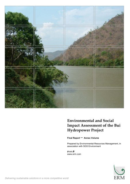
Environmental and Social Impact Assessment of the Bui ...
Environmental and Social Impact Assessment of the Bui ...
- No tags were found...

Create successful ePaper yourself
Turn your PDF publications into a flip-book with our unique Google optimized e-Paper software.
Environmental and Social<br />
Impact Assessment of the Bui<br />
Hydropower Project<br />
Final Report <strong>–</strong> Annex Volume<br />
Prepared by Environmental Resources Management, in<br />
association with SGS Environment<br />
January 207<br />
www.erm.com<br />
Delivering sustainable solutions in a more competitive world
FINAL REPORT<br />
Ministry of Energy/Bui Development Committee, Ghana<br />
Environmental and Social Impact Assessment Study of the<br />
Bui Hydroelectric Power Project <strong>–</strong>Annex Volume<br />
January 2007<br />
ERM Reference 0042911<br />
For and on behalf of<br />
Environmental Resources Management<br />
Approved by: Eamonn Barrett<br />
Signed:<br />
Position: Partner<br />
Date: 31 January 2007<br />
This report has been prepared by Environmental Resources<br />
Management the trading name of Environmental Resources<br />
Management Limited, with all reasonable skill, care and diligence<br />
within the terms of the Contract with the client, incorporating our<br />
General Terms and Conditions of Business and taking account of the<br />
resources devoted to it by agreement with the client.<br />
We disclaim any responsibility to the client and others in respect of<br />
any matters outside the scope of the above.<br />
This report is confidential to the client and we accept no responsibility<br />
of whatsoever nature to third parties to whom this report, or any part<br />
thereof, is made known. Any such party relies on the report at their<br />
own risk.
CONTENTS<br />
ANNEX A<br />
TERMS OF REFERENCE<br />
ANNEX B<br />
IMPACT TABLES<br />
ANNEX C<br />
LEGISLATIVE BACKGROUND TO THE BUI PROJECT<br />
ANNEX D<br />
BIBLIOGRAPHY<br />
ANNEX E<br />
HYDROLOGICAL ANALYSIS<br />
ANNEX F<br />
HYDROGEOLOGICAL ANALYSIS<br />
ANNEX G<br />
ANNEX H<br />
ANNEX I<br />
ANNEX J<br />
ANNEX K<br />
ANNEX L<br />
ANNEX M<br />
ANNEX N<br />
ANNEX O<br />
ANNEX P<br />
ANNEX Q<br />
REPORT ON GEOMORPHOLOGY SOILS AND LAND USE STUDY<br />
ADDITIONAL BIOLOGICAL INFORMATION<br />
SOCIAL SURVEY TOOLS<br />
RESULTS OF SOCIAL SURVEY<br />
HEALTH BASELINE<br />
HYDROLOGICAL MODELLING<br />
ARCHAEOLOGY BASELINE<br />
MINUTES OF NATIONAL AND LOCAL CONSULTATION<br />
MITIGATION TABLES<br />
DAM SAFETY<br />
PHOTOGRAPHS
Annex A<br />
Terms of Reference
A1<br />
BACKGROUND TO TERMS OF REFERENCE<br />
This Annex contains the Terms of Reference (TOR) for the Bui Hydroelectric<br />
Power Project Environmental and Social Impact Assessment Study. The TOR<br />
are essentially the same as those attached to the contract issued to<br />
Environmental Resources Management (ERM) by the Ministry of Energy in<br />
December 2005. The TOR attached to ERM’s contract were those developed by<br />
BKS Acres and annexed to a Scoping report that was drafted in 2001, but<br />
never submitted to EPA to comply with Ghanaian EIA Regulations. In<br />
comparison with the TOR prepared by BKS Acres, the changes that have been<br />
made to the TOR presented here are either:<br />
<br />
<br />
minor modifications agreed with the Bui Development Committee to<br />
reflect changed circumstances; or<br />
removal of references to the BKS Acres Scoping Report that are now<br />
irrelevant, and potentially misleading.<br />
A1.1 EXECUTIVE SUMMARY<br />
The main deliverable of the ESIA mandate is an EIS for the Bui Hydroelectric<br />
Power Project, prepared in conformity with Ghana’s environmental legislation<br />
and EIA procedures as well as those of international financial institutions, in<br />
particular the World Bank (WB) and the International Financial Corporation<br />
(IFC).<br />
Other deliverables of the ESIA mandate include the following management<br />
plans:<br />
<br />
<br />
mitigation/management program for the Bui project; and<br />
environmental monitoring plan.<br />
The Executive Summary will provide the following information summarising<br />
the ESIA mandate for the Bui project:<br />
<br />
<br />
<br />
<br />
<br />
concise description of the proposed project;<br />
brief account of the significant biophysical and socio-cultural<br />
environments;<br />
an outline of the significant impacts and findings of the ESIA;<br />
the principal mitigation measures; and<br />
the principal elements of the environmental monitoring plan.<br />
ENVIRONMENTAL RESOURCES MANAGEMENT<br />
A1<br />
GOVERNMENT OF GHANA
A2<br />
TERMS OF REFERENCE<br />
A2.1 INTRODUCTION<br />
The introduction will present relevant information to establish the context for<br />
the Bui project, including the following components:<br />
A2.1.1<br />
Project Justification<br />
According to the demand forecasts of Coyne and Bellier (1995) the total<br />
annual energy production required in Ghana to meet increasing domestic and<br />
industrial loads will rise from 7,235 GWh in 1997 to 11,953 GWh in 2020. To<br />
meet the peak demand, the installed capacity of the generation system will<br />
need to increase from 1067 MW in 1997 to 1899 MW in 2020. The present<br />
installed capacity of the VRA system is:<br />
Akosombo (without retrofit) 912 MW<br />
Kpong 160 MW<br />
Takoradi 300 MW<br />
The ESIA will examine the most recent demand forecasts and system planning<br />
studies in order to assess the need for the Bui Hydroelectric Power Project.<br />
The Bui Gorge was first identified as a potential hydroelectric generation site<br />
in the 1920s. Unlike thermal generation of electricity where there is often<br />
significant flexibility in the siting of the plant hydroelectric facilities rely on<br />
natural features of the landscape for optimum siting. Thus there is limited<br />
opportunity to select an alternate site on the Black Volta for hydro generation.<br />
A2.1.2<br />
Regulatory and Administrative Requirements<br />
Environmental legislation, policies and guidelines of Ghana and of the major<br />
international lending agencies will be assessed as to their relevance to the<br />
current project. These legislation policies and guidelines will provide a<br />
framework environmental framework around which the ESIA and subsequent<br />
project implementation will be conducted. Any additional relevant legislation,<br />
policies and guidelines will be added as identified.<br />
A2.1.3<br />
Scope of the ESIA<br />
This section will summarise the Terms of Reference for the ESIA, as agreed<br />
with the BDS and as approved by the Ghana Environmental Protection<br />
Agency.<br />
ENVIRONMENTAL RESOURCES MANAGEMENT<br />
A2<br />
GOVERNMENT OF GHANA
A2.2 DESCRIPTION OF THE PROPOSED PROJECT<br />
The EIS will contain a detailed description of the project focusing on those<br />
aspects that could potentially have an impact on the physical, biological or<br />
social environment. The development scheme as proposed by Coyne and<br />
Bellier (1995) will form the initial basis for the project description.<br />
Modifications to the scheme, which become apparent during the ongoing<br />
planning and design of the project, will be incorporated into the description.<br />
The Project description will be presented using maps, figures, tables and other<br />
graphics as necessary. It will highlight the following:<br />
<br />
Pre-construction activities: relocation of villages that will be<br />
inundated, removed from the park territory or otherwise displaced<br />
by the project;<br />
<br />
Construction activities: land clearing and site preparation;<br />
construction of access routes; construction of dam structures and<br />
related facilities; construction of transmission lines.<br />
<br />
Post-construction or operational activities: impounding, filling and<br />
maintenance of reservoir; operation and maintenance of the<br />
hydroelectric generating plant; commissioning and maintenance of<br />
transmission line facilities.<br />
A2.3 DESCRIPTION OF THE BASELINE ENVIRONMENT<br />
This section will initially include the identification of the areas of potential<br />
project impact that need to be considered in the ESIA; the data collection and<br />
inventory methods; and descriptions of existing environmental conditions.<br />
A2.3.1<br />
Areas of Potential Project Impacts<br />
The ESIA will be conducted for two major study areas. The primary zone<br />
where the effects of the development will be most obvious includes:<br />
<br />
<br />
<br />
<br />
<br />
<br />
<br />
<br />
the land and communities in the area that could be affected by the<br />
construction process or the presence of the dam, powerhouse and<br />
related facilities;<br />
the construction camp;<br />
the construction waste disposal area;<br />
aggregate borrow areas;<br />
lands to be flooded by the reservoir;<br />
the Black Volta for the dam site to Lake Volta and the lands and<br />
communities adjacent to it;<br />
the transmission line corridor from Bui through Teselima and on the<br />
to Sunyani and Kumasi; and<br />
the lands and communities where displaced people will be<br />
relocated/resettled.<br />
ENVIRONMENTAL RESOURCES MANAGEMENT<br />
A3<br />
GOVERNMENT OF GHANA
The secondary impact zone includes:<br />
<br />
<br />
the area of the Bui National Park with will not be flooded and<br />
additional lands that may be added to the park to compensate for<br />
land lost to flooding; and<br />
the communities adjacent to or in the vicinity of Bui National Park.<br />
A2.3.2<br />
Data Collection and Methods for Inventory<br />
A description of the existing physical, biological and socioeconomic<br />
environmental conditions will be prepared for the EIS, based on published<br />
information, discussions with knowledgeable individuals and field surveys.<br />
All relevant reports and pertinent information will be collected catalogued<br />
and reviewed to evaluate the state of the existing environmental conditions<br />
within the project study areas. Sources of information may include:<br />
<br />
<br />
<br />
<br />
<br />
<br />
<br />
previous reconnaissance, pre-feasibility and feasibility level and<br />
specific studies undertaken for the project (i.e. Halcrow & Partners.<br />
Hydroproject, SMEC. C&B. etc);<br />
central and regional government resources agencies and personnel;<br />
studies carried out in the project region or for the park specifically.<br />
E.g. University of Aberdeen Studies;<br />
data bases maintained by universities and academia. E.g.<br />
archaeological work near Banda;<br />
national and international scientific journals and publications;<br />
local and national non-governmental organisations that specialise in<br />
studies of the natural environmental and/or impact assessment; and,<br />
previous power planning studies completed for Ghana, with<br />
particular emphasis on the most recent studies.<br />
As required, further documentary research and focused interviews with key<br />
informants will be undertaken at the national, regional and district levels.<br />
At the completion of the data gathering process, environmental and project<br />
specific information will be compiled and evaluated to assess the extent and<br />
quality of that data the extent of data gaps and any other uncertainties that<br />
may be identified. The goal of this step will be to determine and document<br />
the quality and quantity of existing information. This will form the basis for<br />
identifying the requirements for field investigations and studies to obtain the<br />
data necessary to complete the various components of the ESIA. The precise<br />
scope of the field program will be directly related to the information needed<br />
for the initial screening and analysis of project alternatives.<br />
A key aspect of the scope of work for the field programs will be to assess the<br />
seasonal limitations and timing of specific studies so as to take advantage of<br />
either local conditions or specific behavioural responses (wildlife studies<br />
during the dry season when animals are more concentrated with the river<br />
channel and forested riverbank; fisheries studies during the wet season when<br />
ENVIRONMENTAL RESOURCES MANAGEMENT<br />
A4<br />
GOVERNMENT OF GHANA
fish are moving to spawning areas, etc). This exercise will document the<br />
programs required, the aerial extent and time lines associated with each<br />
program, and the logistics of implementation, as well as the program costs.<br />
Specific data requirements are discussed below.<br />
A2.3.3<br />
Physical Environment<br />
The description of the physical environment will include:<br />
<br />
<br />
<br />
<br />
<br />
<br />
<br />
<br />
<br />
<br />
Geology<br />
Seismicity<br />
Soils<br />
Erosion and Sedimentation<br />
Landscape<br />
Topography<br />
Climate<br />
Hydrology<br />
Hydrogeology<br />
Water Quality<br />
Much of the description of the physical environment will be based on existing<br />
data. Included among these data are:<br />
<br />
<br />
<br />
<br />
geological mapping and reports prepared by the Geological Survey<br />
of Ghana and those prepared for the earlier feasibility studies for the<br />
project;<br />
climate data from the closest government weather station;<br />
recent air photography and topographical mapping prepared for<br />
VRA (and as modified based on a program of calibration and datum<br />
checking of the stream flow gauge being carried out by VRA);<br />
hydrological records compiled by VRA; and borehole records from<br />
nearby communities.<br />
Some field investigations will be required in the following areas.<br />
<br />
<br />
<br />
characterisation of the soils associated with ‘hippo turf’;<br />
assessment of the erosion potential of soils along the future shoreline<br />
of the reservoir and along the tributaries entering the reservoir; and<br />
water quality analysis of the Black Volta and some of its tributaries to<br />
include nutrients, major ions, selected metals and suspended solids.<br />
Other studies to be conducted include estimation of flows from tributary<br />
streams downstream of Bui based on watershed area and rainfall records.<br />
This information will assist in determination of compensation flow<br />
requirements.<br />
The recent mapping carried out by VRA is being analysed to determine more<br />
accurately the area/storage elevation curve for the reservoir as well as the<br />
specific areas flooded at different elevations. This data will be indexed to<br />
ENVIRONMENTAL RESOURCES MANAGEMENT<br />
A5<br />
GOVERNMENT OF GHANA
satellite imagery where available to assist in determining loss of habitat and<br />
forest cover for various alternatives.<br />
A2.3.4<br />
Biological Environment<br />
Bui National Park primarily consists of Guinea savanna woodland and rich<br />
riparian gallery forest along the Black Volta River. Among the wildlife<br />
present in the park include hippopotami, buffalo, waterbuck, kob, oribi,<br />
dulkers, warthog, porcupine, four species of primates, serval, gent, civet and<br />
leopard. It also contains crocodiles, monitor lizards, turtles and a variety of<br />
snakes.<br />
The description of the existing biological environment will focus on the flora<br />
and fauna (mammals, migratory and resident birds, amphibians and reptiles)<br />
of the areas to be inundated and the along the new transmission line. In<br />
particular, field studies will focus on, but not be limited to, the riparian forests<br />
and hippopotami grazing areas (hippo turf) along the Black Volta in the<br />
reservoir are and upstream within the park.<br />
The studies will also focus on the aquatic ecology of the Black Volta in the<br />
park and downstream to Lake Volta. The design of aquatic field studies in<br />
dependent on the adequacy of existing data but will likely involve sampling of<br />
water quality, fish, invertebrates and aquatic vegetation and classification of<br />
critical aquatic habitats (e.g. fish spawning and nursery habitats).<br />
The most recent biological work in Bui National Park was conducted by<br />
Aberdeen University in the mid 1990s. The documentation will be reviewed<br />
and a field program developed to fill data gaps and expand our knowledge of<br />
the biological diversity of the National Park and Black Volta. The field<br />
program will consist of floral and faunal surveys and quantification of critical<br />
habitats. Satellite imagery and recent air photography will be used with<br />
sufficient ground truthing to characterise the habitats throughout the study<br />
area.<br />
The description of the biological environment will include an inventory of<br />
floral and faunal species, their conservation status and habitat requirements,<br />
measures of biodiversity and a quantification of critical habitats with will be<br />
lost due to construction and operation facility. In particular, the habitat loss<br />
will be assessed in the perspective of residual habitat left in the park (if any),<br />
and its ability to support the existing total population.<br />
A2.3.5<br />
Social Environment<br />
The general approach to the inventory of the social environment is based on<br />
rapid appraisal methods that seek to identify the critical social, economic and<br />
cultural conditions of the target groups that may be affected by the proposed<br />
project. These target groups include:<br />
<br />
communities or other groups that are affected directly by the project,<br />
for example, relocated villages and settlers, and communities<br />
ENVIRONMENTAL RESOURCES MANAGEMENT<br />
A6<br />
GOVERNMENT OF GHANA
directly impacts by construction activities or the downstream<br />
impacts of dam operation;<br />
communities or other groups that may be indirectly affected, for<br />
example, by induced socio-economic activities or development; and<br />
vulnerable or special-interest groups among those directly or<br />
indirectly affected by the project, such as women, the poor and<br />
youth.<br />
The inventory will encompass an overview of conditions in the Brong Ahafo<br />
and Northern regions and the districts affected by the project. The inventory<br />
will also provide more detailed socio-economic profiles of the target<br />
beneficiary groups in communities in the immediate environs of the project<br />
site. Information will be included on present conditions and all anticipated<br />
changed before the project commences. Data collection on existing socioeconomic<br />
conditions will focus on the following themes;<br />
<br />
<br />
<br />
<br />
demographic characteristics, including total population densities and<br />
distribution, population dynamics and growth, household<br />
characteristics, educational achievement and literacy;<br />
social systems and structures, including ethnicity and religious<br />
affiliation; the origins of communities and their traditional social and<br />
cultural systems; gender roles in household, economic and<br />
community affairs; community structure and organisations; and<br />
social relations;<br />
land management and use, including traditional and legal systems of<br />
land tenure and allocation dominant regional land uses, settlement<br />
form and development community infrastructure; and<br />
livelihood and production systems, including agricultural livelihood<br />
systems; non-agricultural economic activities, employment and labor<br />
markets; and household income and expenditure patterns.<br />
The preparation of the inventory will combine community consultation and<br />
participatory appraisal techniques, with other sources of information. In the<br />
districts where the project is located and the villages in the immediate<br />
environs of the projects site where most direct and indirect impacts are<br />
anticipated, quantitative and qualitative data will be collected through a<br />
multi-phase program of consultations using semi-structured interviews, focus<br />
groups and other participatory techniques:<br />
<br />
<br />
District Assemblies (DA): in Wenchi and Bole Districts, initial and<br />
follow-up consultations will be carried out with the District Chief<br />
Executive (DCE). District Coordinating Director (DCD) other<br />
members of the DA offices and elected representatives, to gather<br />
information about existing and projected economic, social and<br />
physical development conditions in the districts as well as<br />
perceptions and concerns about the Bui project;<br />
traditional and village leadership; the leadership of villages and<br />
traditional councils will be consulted for communities that will be<br />
displaces, may serve as host communities and/or will be directly and<br />
ENVIRONMENTAL RESOURCES MANAGEMENT<br />
A7<br />
GOVERNMENT OF GHANA
indirectly affected by the location and implementation of the project.<br />
These consultations will provide and/or validate information about<br />
demographic, social structures and relations, land use, settlement,<br />
livelihood and cultural conditions in these communities; attitudes<br />
about social change, use of environmental resources and economic<br />
development; as well as issues of concern regarding the proposed<br />
development; and<br />
community members: in these same villages that will be directly<br />
affected, targeted consultations will be carried out with different<br />
segments of the community, e.g. women, older people or youth, to<br />
obtain information and define issue that area particular to the needs,<br />
absorptive capacities and development objectives of different<br />
community groups.<br />
This consultation program forms part of a larger stakeholder consultation for<br />
the ESIA. As such, it will be developed to ensure that it is responsive to the<br />
needs of the affected communities, for instance, in terms of the timing of<br />
consultations in rural agricultural communities, linguistic and literacy<br />
conditions and appropriate feedback to communities.<br />
Baseline data will also be developed and social issues identified through a<br />
series of semi-structures interviews and meetings with key informants about<br />
socio-economic policies and programs, including various national and<br />
regional government representatives, domestic and international NGOs and<br />
other qualified experts. The most recent available census data and other<br />
information about socio-economic conditions in Ghana and the study area will<br />
be obtained from the appropriate government sources; and, all available,<br />
relevant policy documents, project reports and other analyses will be<br />
reviewed. A succinct text will be prepared describing the existing social<br />
environment, accompanied, as appropriate, by maps and other graphic<br />
presentations.<br />
A2.3.6<br />
Public Health Environment<br />
The inventory of the baseline conditions of the public health environment will<br />
focus on the following information:<br />
<br />
<br />
<br />
at national, regional and district levels, a review of the principal<br />
public health indicators, for example, life expectancy, crude birth and<br />
death rates, reproductive health, children’s health and the incidence<br />
of major health problems;<br />
at the district and local levels, a review of public health services and<br />
facilities, identifying the distribution of types and levels of services;<br />
the physical, financial and personnel resources of existing facilities;<br />
and, factors influencing the use of services and facilities, such as<br />
availability and attitudes; and<br />
at the district and local levels, particularly in the communities most<br />
directly affected by the project, a review of the existing public health<br />
conditions and the incidence of disease. The focus will be on existing<br />
ENVIRONMENTAL RESOURCES MANAGEMENT<br />
A8<br />
GOVERNMENT OF GHANA
conditions related to water-related diseases, contagious diseases, STD<br />
and other public health issues that may be affected by the project,<br />
although the inventory will also include a summary of other public<br />
health issues in these communities.<br />
The same approach identified for the collection of baseline data on the social<br />
environment will be used to collect data on public health conditions, including<br />
target beneficiary groups and the use of rapid participatory appraisal<br />
methods. During community groups, special attention will be paid to<br />
gathering information about public health conditions, diseases and strategies<br />
used by local authorities and communities to address these issues. Semistructured<br />
interviews will be carried out with key informant from national<br />
and regional government, NGOs and other qualified experts and<br />
documentary sources reviewed, to provide information on public health<br />
statistics, polices and programmes and lessons learned from other<br />
development similar to the proposed project.<br />
A2.3.7<br />
Archaeology<br />
The study area is located just north of an historic trade route. Archaeological<br />
investigations in the study area have uncovered historical European artefacts<br />
dating to the 18 th century and prehistoric archaeological material dating as far<br />
back as 2000 BC.<br />
Work associated with preparing a description of the existing archaeological<br />
environment will be conducted in two phases. In the first phase, now<br />
underway archaeological reports will be reviewed and a reconnaissance visit<br />
to the site conducted in order to identify locations in the park where<br />
archaeological materials might be found. In the second phase test pits will be<br />
dug at locations identified in the first phase to verify the presence of<br />
archaeological material.<br />
A2.4 ASSESSMENT OF PROJECT IMPACTS AND BENEFITS<br />
The overall impacts and benefits of the Bui project will be determined during<br />
this task for pre-construction, construction and post-construction phases of the<br />
project. The potential impacts and benefits include negative and positive<br />
effects, direct and indirect effects, immediate and long-term effects as well as<br />
those that are unavoidable, reversible or residual. In addition, any<br />
opportunities for multiple uses will be identifies as appropriate.<br />
As far as possible, all the identified impacts and benefits will be quantified<br />
and assessed for significance based on magnitude, extent, duration,<br />
reversibility, etc. From the assessment of impacts and benefits, the necessary<br />
mitigation and enhancement actions will be prescribed. Wherever possible,<br />
design or implementation of the project will be altered accordingly.<br />
ENVIRONMENTAL RESOURCES MANAGEMENT<br />
A9<br />
GOVERNMENT OF GHANA
A2.4.1<br />
Physical impacts and Benefits<br />
Physical impacts of project implementation include the creation of a reservoir,<br />
which will alter the physical and chemical characteristics of the river waters as<br />
well as sediment transport processes within that reach of the Black Volta.<br />
River subject to inundation. It will also regulate the river flows and will<br />
change the hydrology and flow/sedimentation patterns in the river reach<br />
downstream to Lake Volta but would also provide a source of water for other<br />
uses. Creation of the reservoir would also result in local changes to<br />
groundwater and possibly the microclimate adjacent to the reservoir the<br />
stability of the reservoir banks and stress conditions at depth (i.e seismic<br />
conditions). The severity and extent of many of these impacts or benefits will<br />
depend on the physical and geologic conditions comprising the reservoir and<br />
surrounding area final water level elevation chosen for the reservoir and the<br />
operational strategy selected for the development.<br />
The assessment of impacts and benefits will utilise appropriate techniques and<br />
expert judgement to determine the significance of changes to the physical<br />
environment. Models will be employed as appropriate to provide predictions<br />
of future conditions, particularly with respect to seasonal and daily water<br />
level and flow fluctuations. The study team of international and local experts<br />
will assess the significance to predicted changes based on their previous<br />
experience with similar projects within Ghana and around the world. The<br />
upgraded mapping will provide the data needed to determine bank slopes,<br />
and the underwater bathymetry of the new reservoir which data will be<br />
directly useful for planning any prefilling reservoir work and for assessing<br />
lacustrine habitat.<br />
Bank stability will focus on any areas of substantial slope either in or above<br />
the reservoir, where soil conditions will be reviewed. Given the substantial<br />
fetch that will be available the wave climate will be checked to assess the<br />
potential for wind generated erosion along the banks.<br />
A2.4.2<br />
Biological Impacts and Benefits<br />
Biological impacts of the project arise primarily from the loss of the riverine<br />
forest ecosystem within the reservoir inundation area, with the accompanying<br />
loss of terrestrial, floodplain and aquatic habitat, and displacement of existing<br />
wildlife and aquatic communities. Potential benefits of the project include the<br />
provision of long-term funding to develop and implement and management<br />
plan for the park and the proposed buffer zones.<br />
The assessment of impacts and benefits will rely on the detailed information<br />
collected during the terrestrial and aquatic environment field programs, and<br />
will utilise currently recognised biodiversity and environmental quality<br />
indices to assess and evaluate that information. Again, the study team will<br />
utilise their technical knowledge and experience to formulate predictions of<br />
impact/benefit, and will evaluate and assess their significance on the<br />
terrestrial and aquatic environments of the study area.<br />
ENVIRONMENTAL RESOURCES MANAGEMENT<br />
A10<br />
GOVERNMENT OF GHANA
Of particular importance during the evaluation of the effects of the project are<br />
the following:<br />
<br />
<br />
<br />
<br />
<br />
<br />
<br />
quantification of the loss of critical habitats, particularly riparian<br />
forest and ‘hippo turf’;<br />
potential changes in the fish community due to impoundment and<br />
the creation of a barrier to migration;<br />
productivity changes in the reservoir;<br />
creation of habitats favourable to disease vectors such as that of snails<br />
(an intermediate host for schistosoiasis);<br />
the potential of the unaffected areas of the park to absorb wildlife<br />
displaced by the reservoir;<br />
the potential for changes in vegetation/habitat in the areas<br />
immediately upstream of the reservoir as a result of sedimentation,<br />
and whether new desirable habitat can be encouraged; and<br />
the environmental effects of displaced/resettled communities on<br />
their new local environment (fishing, hunting, etc)<br />
A2.4.3<br />
Social Impacts and Benefits<br />
The anticipated social benefits and impacts of the Bui project are directly<br />
related to key economic social and cultural issues. The assessment of the<br />
effects for the Bui project on the social environment will encompass but may<br />
not be limited to the following these and issues:<br />
<br />
Population resettlement: Based on currently available information,<br />
previous assessments of the nature and extent of the resettlement<br />
impacts of the Bui project should be updated and validated. This<br />
includes confirmation of the population and household<br />
characteristics of the affected villages and other affected households;<br />
and quantitative and qualitative information on affected assets (land,<br />
building, etc.) land tenure, livelihood systems and social<br />
organisations of households and the community.<br />
<br />
Socio-economic development: direct, project-related employment and<br />
economic activity included employment and economic activity,<br />
impacts and benefits for the local economy, benefits in the provision<br />
of community infrastructure and pressures on their use: pressures on<br />
natural resource: and long-term sustainable development within the<br />
region; and<br />
<br />
Social and cultural change: impacts and benefits affecting family and<br />
village organisation, social integration, monetarisation of livelihood<br />
and production systems and social and cultural change among<br />
specific target groups.<br />
ENVIRONMENTAL RESOURCES MANAGEMENT<br />
A11<br />
GOVERNMENT OF GHANA
A2.4.4<br />
Public Health<br />
The assessment of the public health impacts of the Bui project will encompass<br />
direct and indirect impacts related to the health and well-being of people<br />
living and working in the region of influence of the project. These impacts<br />
include:<br />
<br />
<br />
<br />
<br />
vector-borne, particularly, water-related diseases, including increases<br />
and declines in the incidence of existing water-related diseases and<br />
the introduction of new disease vectors;<br />
sexually transmitted diseases (STD), including increases and other<br />
changes in the incidence of HIV/AIDS and other STD;<br />
health conditions and well-being in local communities including the<br />
direst and indirect effects of the project on water and sanitation<br />
conditions as well as the physical and emotional well-being of<br />
people; and<br />
occupational health and safety; potential effects of the project<br />
construction and operation on the health and safety of workers.<br />
A2.4.5<br />
Archaeological and Cultural Resources<br />
Archaeological or cultural resources could be destroyed or lost due to flooding<br />
by the reservoir or by other construction activities. Based on the<br />
archaeological and cultural surveys any sites of significance that could be<br />
destroyed by the project will have been identified. The importance of the sites<br />
will be assessed and the need for moving or cataloguing will be determined.<br />
A2.4.6<br />
Cumulative Effects<br />
When an environmental component is impacts by a project bit is already or<br />
will be affected by past or reasonably probable future development or<br />
activities, these impacts are considered cumulative effects. During the ESIA,<br />
the study team will identify current, past and probable future development<br />
and activities that may impact on the environmental components of the study<br />
area and identify those impacts of the Bui Hydroelectric Power.<br />
A2.4.7<br />
International Effects<br />
Although the Black Volta River originates in Burkina Faso and forms the<br />
border between Ghana and Cote d’lvoire, these countries are upstream of the<br />
Bui area of influence at a FSL of 183m or less. Downstream of Bui, the Black<br />
Volta and Volta Rivers remain within the borders of Ghana. Consequently,<br />
impacts on Cote d’Ivoire or Burkina Fasa are not anticipated. One of the FSL<br />
options investigated by Coyne et Bellier (1995) was 197m FSL. This option was<br />
subsequently eliminated due in part to the inundation of territory in Cote<br />
d’Ivoire.<br />
ENVIRONMENTAL RESOURCES MANAGEMENT<br />
A12<br />
GOVERNMENT OF GHANA
A2.5 ANALYSIS OF ALTERNATIVES<br />
A2.5.1<br />
Alternatives to the Project<br />
An initial screen and analysis of alternatives to the project will be undertaken<br />
using broad economic, environmental, and social indicators based on existing<br />
information (master plans, project feasibility studies, etc). Alternatives to be<br />
investigated will include:<br />
<br />
<br />
<br />
thermal power;<br />
alternative energy sources (e.g., wind, solar power, other<br />
hydropower and industrial cogeneration); and<br />
demand side management (implementation of conservation and<br />
efficiency measures).<br />
This evaluation will take into account the regional context, including the<br />
potential for import/export to adjacent countries and the sources of fuel (oil<br />
and gas) for thermal power plants, both existing and proposed.<br />
A2.5.2<br />
Alternative Project Developments<br />
These will include variations in the design of Bui including various full supply<br />
level (FSL) elevations and a run-of-river cascading scheme with two or three<br />
plants with small headponds. Only those schemes will be examined that have<br />
potential to be economically viable in the contexts of the Ghana system.<br />
The results of this process will be documented and summarised in tabular<br />
form. A rating system will be developed and applied to the environmental<br />
components to provide a means of directly comparing benefits or impacts<br />
associated with each alternative.<br />
This task will conclude with a reduced list of 2 or 3 preliminary preferred<br />
alternatives for the detailed impact assessment. These alternatives will then<br />
be re-screened (and possibly modified) as the study progresses to arrive at a<br />
final preferred alternative that is the preferred trade off between economic<br />
and environmental and social impacts. The ESIA will clearly indicate the<br />
reasons for the selection made.<br />
A2.6 MITIGATION AND ENVIRONMENTAL MANAGEMENT PLAN<br />
The environmental mitigation/management plan for the Bui Hydroelectric<br />
Power Project will identify the mitigation and enhancement measures that will<br />
most effectively address concerns associated with the project and provide the<br />
detail needed to implement the plan. Any residual impacts that cannot be<br />
mitigated will also be identified and a proposed course of action (i.e.<br />
compensation or other measure as appropriate) to deal with those impacts<br />
will be identified. It is anticipated that the plan will address such issues as:<br />
<br />
downstream compensation flows;<br />
ENVIRONMENTAL RESOURCES MANAGEMENT<br />
A13<br />
GOVERNMENT OF GHANA
limitations on rates of drawdown, if warranted;<br />
reservoir rule curves;<br />
flow re-regulation downstream, if required;<br />
habitat replacement;<br />
wildlife rescue during reservoir filling; and<br />
improvement to local services.<br />
The plan will identify time lines and other details associated with its<br />
implementation and will identify the agencies (government, NGO and<br />
affected groups) that will be providing input or support to the plan. The plan<br />
will also identify personnel training requirements for the various<br />
environmental impacts that are being addressed. In addition, the plan will<br />
outline specific goals and review periods that will serve to refocus the<br />
direction of management and mitigation measures as required. Key features<br />
of the Mitigation and Environmental Management Plan would include the<br />
following:<br />
A2.6.1<br />
Resettlement Planning Framework<br />
Successful strategies for resettlement and restoration of livelihood systems<br />
require and integrated, participatory planning framework. Some of the<br />
critical issues include:<br />
compensation strategies for lost assets that take into account the<br />
nature and composition of households as well as the assets managed<br />
by different members of households (men, women, youth);<br />
social and cultural aspects of relocation, including appropriate<br />
strategies related to fetishes, sacred sites and burial grounds;<br />
strategies for restoration of livelihoods that take into account the<br />
subsistence and income generating activities of men, women and<br />
youth in affected households;<br />
strategies to integrate resettlers successfully into host communities,<br />
in terms of social, economic and cultural impacts; and<br />
development planning for resettlers and host communities that target<br />
training needs, economic development initiatives, access to credit,<br />
infrastructure and social service requirements.<br />
A planning framework for resettlement should also identify strategies for the<br />
participation of affected and host communities throughout the resettlement<br />
process requirements for pre-project interventions to strengthen the capacities<br />
of communities to participate and guidelines for resettlement monitoring and<br />
evaluation.<br />
A2.7 MONITORING PLAN<br />
Monitoring plans will be developed for three stages of the project i.e. preconstruction,<br />
construction and operation.<br />
ENVIRONMENTAL RESOURCES MANAGEMENT<br />
A14<br />
GOVERNMENT OF GHANA
Pre-construction<br />
A pre-construction monitoring plan typically includes measures to ensure the<br />
following:<br />
<br />
<br />
<br />
<br />
<br />
<br />
<br />
EPA environmental approval of the project;<br />
completion of baseline monitoring (if not completed during the<br />
ESIA);<br />
environmental mitigation is incorporating into tender specifications<br />
as appropriate;<br />
wildlife have been relocated to suitable alternative habitat areas, as<br />
necessary;<br />
land acquisitions are completed;<br />
archaeological excavations (if required) have been completed; and<br />
a complete pre-construction photographic record is taken around<br />
construction site facilities prior to construction.<br />
Construction<br />
A construction monitoring program will be prepared that addresses tree<br />
clearing and other vegetation removal, blasting activities, erosion and<br />
sedimentation control, drainage, control of public access, waste disposal,<br />
control of hunting/poaching, fuel/oil storage, site rehabilitation, etc.<br />
Operation<br />
An operational monitoring plan will be developed that will allow an<br />
assessment of the effectiveness of mitigation measures and to verify<br />
predictions of the ESIA. The monitoring program will be developed though<br />
discussion with VRA and government agencies.<br />
A2.8 CONTINGENCY PLAN<br />
If during the construction or operation of the station, unforeseen impacts<br />
become apparent, there will need to be a plan that will initiate a response to<br />
address the issue. This contingency plan will identify procedures to be<br />
followed and management roles and responsibilities so that a quick response<br />
to the unforeseen event can be initiated.<br />
A2.9 STAKEHOLDER AND PUBLIC CONSULTATION<br />
Stakeholder and public consultation is an important component of the ESIA<br />
work. It is planned to meet further with directly affected people and other<br />
stakeholders in the Bui area and in Accra. These meetings will be both formal<br />
(e.g. workshops) and informal gatherings. The main intent of the consultation<br />
is to inform the interest groups of the project, to determine the issues that are<br />
of particular concern to them and to provide feedback on the findings of the<br />
ESIA.<br />
ENVIRONMENTAL RESOURCES MANAGEMENT<br />
A15<br />
GOVERNMENT OF GHANA
The consultation will include a multi-phase consultation program to be<br />
carried out with direct stakeholders in Wenchi and Bole districts. The<br />
objectives of this program are to obtain quantitative and qualitative data from<br />
stakeholders about existing environmental, socio-economic, cultural and<br />
health conditions in this region; and, to explore with district authorities and<br />
community representatives a range of issues related to current biophysical,<br />
social, economic, cultural and health conditions, as well as perceptions,<br />
concerns and issues related to the proposed development of the Bui<br />
hydroelectric project and Bui National Park.<br />
The direct stakeholders in Wenchi and Bole districts included in this<br />
consultation program include the following:<br />
<br />
<br />
<br />
<br />
<br />
<br />
representatives of the District Assemblies (DA) and DA offices;<br />
representatives of government departments, NGOs and other<br />
organisations that are actively working in the areas of conservation,<br />
socio-economic development, rural development, public health or<br />
other related areas;<br />
paramount chiefs for the principal indigenous ethnic groups in the<br />
region (Banda, Mo, Gonja);<br />
village leadership of communities to be resettled, or directly or<br />
indirectly impacted by the proposed project (13-14 villages);<br />
specific target groups (women, youth etc) in communities to be<br />
resettled and those communities that will be most directly affected<br />
during project construction (6-7 villages); and<br />
village leadership and target groups in those areas/communities<br />
preliminarily identified as potential areas for the<br />
relocation/resettlement of displaced communities.<br />
In general, the approach and methods used in the consultation program are<br />
based on semi-structural meetings with stakeholders. For meeting with<br />
traditional and village leadership, the chief will convene several members of<br />
the leadership with one person nominated as the principal spokesperson<br />
interacting with the study team, although many residents of the village may<br />
attend the meeting and contribute comments that are relayed by the<br />
spokesperson. The study team prepares meeting guides for these<br />
consultations in order to identify a range of issues and information being<br />
sought. However, the scope of discussions remains responsive to the issues<br />
and information raised by stakeholders during the course of the consultation.<br />
In some instances small focus groups or individual interviews may be carried<br />
with community representatives with knowledge and information on specific<br />
issues, in parallel with or following the consultation with the leadership.<br />
In the proposed consultations with specific target groups, the same general<br />
approach and methods will be adopted. In addition, a number of<br />
participatory rapid appraisal (PRA) methods will be employed to explore<br />
some issues in more detail. These methods include mapping and ranking<br />
exercises as well as preparation of seasonal calendars and other techniques.<br />
ENVIRONMENTAL RESOURCES MANAGEMENT<br />
A16<br />
GOVERNMENT OF GHANA
The range of issues to be addressed included the gender roles and<br />
responsibilities in household, agricultural and community activities; natural<br />
resource utilisation, orientations and aspirations of young people, in relation<br />
to the larger community, family and community management of public<br />
health, and material and social well being of the communities.<br />
Consultations with representatives of the DA, regional government agencies,<br />
NGOs and other organisations active in socio-economic and pubic health will<br />
generally take the form of individual semi-structured interviews and small<br />
focus groups.<br />
The first phase of this consultation was carried out in May 2001 and involved<br />
initial discussions with representatives of the DA offices in Wenchi and Bole,<br />
as well as the village leadership in three villages that will be resettled<br />
(Dokoyena, Bui and Battor Akame). During these consultations, permission<br />
was requested to return at a later date to pursue more detailed consultations.<br />
A second phase of consultations will be planned in consultation with<br />
stakeholders and carried out during the summer 2001. The purpose will be to<br />
continue the process of data collection, as well as exploration of community<br />
issues related to present socio-economic and public health conditions and the<br />
impact of the proposed project. It will include the traditional leadership in the<br />
region, village leadership in other villages within the study area and targeted<br />
consultations with specific community groups, and further consultations with<br />
DA and other regional representatives. The third phase of the consultation<br />
will provide feedback to the districts and communities and will entail the<br />
participation of representatives of the DA and traditional and village<br />
leadership in regional consultations to review the evaluation of impacts and<br />
proposals for mitigation and environmental management. These regional<br />
consultations will be carried out in Wenchi and Bole and will likely occur<br />
during the fall 2001.<br />
In parallel with the consultations in Wenchi and Bole Districts similar<br />
consultations will be occurring in Accra or other centres, as necessary, with<br />
key government and non-government organisations and other informed<br />
individuals (eg university staff) who have a specific interest or mandate<br />
within the study.<br />
ENVIRONMENTAL RESOURCES MANAGEMENT<br />
A17<br />
GOVERNMENT OF GHANA
Annex B<br />
Impact Tables
Table.1<br />
Construction Impacts<br />
Issue Potential Impacts Receptors Significance Mitigation measures<br />
Water availability Reservoir filling following construction will restrict<br />
downstream flow releases for an extended period.<br />
Water used in the construction process will likely be drawn<br />
from the river and/or local watercourses<br />
• Downstream surface<br />
water resources<br />
• Downstream<br />
riverine habitats<br />
• Downstream water<br />
users<br />
• As above Negligible to<br />
minor<br />
Major • Design of partially seasonal compensation release<br />
regime (if feasible)<br />
• Strict adherence to agreed compensation flow<br />
release regime<br />
• Regular (preferably continuous) flow monitoring<br />
downstream of dam<br />
• Careful selection of abstraction points<br />
• Consider using imported (tankered) supply<br />
during droughts<br />
Localised dewatering for foundation construction and/or water<br />
supply boreholes for construction camps may place temporary<br />
stress on local groundwater resources<br />
• Local groundwater<br />
resources<br />
• Local communities<br />
Negligible to<br />
minor<br />
• Careful siting of construction camp boreholes<br />
• Regular monitoring of borehole yields in any<br />
adjacent community wells<br />
Surface water quality<br />
Pollution risk from potential spillage of fuels, lubricants or<br />
chemicals at construction sites. Also, increased sediment load<br />
and turbidity as construction activities disturb soils and<br />
exacerbate erosion.<br />
Inadequate treatment and disposal of waste and wastewater<br />
from worker compounds could adversely affect water quality<br />
and aquatic and terrestrial flora and fauna<br />
• Downstream surface<br />
water resources<br />
• Terrestrial habitats,<br />
fauna and vegetation<br />
• Aquatic habitats,<br />
fauna and vegetation<br />
• Downstream water<br />
users<br />
Minor to<br />
moderate<br />
• Develop and implement construction site<br />
environmental management guidelines, to<br />
include on-site waste and wastewater<br />
management plans<br />
• Install wastewater treatment facilities for worker<br />
compounds and other construction facilities;<br />
• Install oil and grease separators in all surface<br />
drains before discharge to adjacent water courses<br />
• Regular training for construction workers in the<br />
use of guidelines<br />
• Utilize secondary containment measures in areas<br />
where POLs are used, and at consolidated POL<br />
storage sites<br />
• Install culverts where upgraded site access roads<br />
cross streams
Issue Potential Impacts Receptors Significance Mitigation measures<br />
Soil erosion and land<br />
Minor to<br />
degradation<br />
moderate<br />
Land take<br />
Disruption to local<br />
drainage patterns<br />
Construction activities on the river bed, sand excavation, and<br />
construction of the main dam will disturb soils and may lead to<br />
soil erosion and compaction and increased turbidity and<br />
sedimentation downstream.<br />
Permanent land-take for reservoir, dam and related structures<br />
and access roads, and temporary land-take for construction<br />
camps and borrow pits.<br />
Localised disruption to water users and riverine habitats as<br />
existing channel is re-routed around dam construction site.<br />
Riverine habitat alteration Construction of the dam will result in disturbance of instream<br />
aquatic habitat within the impounded reach.<br />
• Land resources<br />
• Terrestrial habitats<br />
• Aquatic habitats<br />
• Land resources<br />
• Terrestrial ecology<br />
• Local riverine<br />
habitats<br />
• Local water users<br />
Aquatic habitats, fauna<br />
and vegetation<br />
Major •<br />
Minor (in context<br />
of overall scale of<br />
works)<br />
• Develop and implement construction site<br />
environmental management guidelines, to<br />
include site erosion control measures<br />
• Installation, monitoring of, and regular emptying<br />
of sediment traps in surface drains in around<br />
roads and construction areas<br />
• Sand excavation from the riverbed should be<br />
limited to the dry season when flows are low to<br />
limit the amount of sedimentation downstream<br />
• Minimise removal or disturbance of the riverine<br />
forest at the dam site and in the reservoir area<br />
until inundation begins, and maintain vegetative<br />
buffer zones alongside river and drainage<br />
channels<br />
• Minimise soil disturbance and excavation during<br />
wet season<br />
• (Where necessary) facilitate access to re-routed<br />
channel for existing users<br />
-Major • Minimise footprint of riverbed and shoreline<br />
disturbance [incorporate into CMP].<br />
Construction of the dam and diversion reach will result in<br />
disturbance of instream aquatic habitat downstream of the dam<br />
and diverted reach<br />
Aquatic habitats, fauna<br />
and vegetation<br />
-Moderate<br />
As above<br />
Effects on vegetation<br />
Direct loss and/or disturbance of vegetation will occur as a<br />
result of :<br />
1) Equipment operations and clearing for storage areas and<br />
administrative space<br />
2) Construction of the four transmission lines<br />
3) Upgrading the site access roads<br />
4) Inundation of the reservoir<br />
Terrestrial habitats,<br />
fauna and vegetation;<br />
Aquatic habitats<br />
- Major • Minimise removal or disturbance of vegetation<br />
around construction areas<br />
• Replant native vegetation in disturbed areas<br />
immediately following construction<br />
• Implement education programmes for<br />
construction workers about minimising the<br />
footprint of construction camp and work areas<br />
• Minimise width of construction ROW<br />
• Purchase a suitable offset area and place under<br />
national protection
Issue Potential Impacts Receptors Significance Mitigation measures<br />
Sand mining/construction will create dust, which can build up<br />
on vegetation and stunt vegetative growth<br />
Terrestrial habitats and<br />
vegetation;<br />
Aquatic vegetation<br />
- Minor • Develop and implement dust management plan<br />
Effects on fauna -<br />
displacement<br />
Effects on fauna <strong>–</strong> direct<br />
mortality<br />
Construction-related noise and increased human activity (influx<br />
of workers), will result in temporary displacement of<br />
disturbance-sensitive fauna.<br />
The worker camps near the dam site will displace and disturb<br />
fauna in affected areas.<br />
Forested islands formed in the reservoir and floodplain during<br />
inundation will limit the movement of individual animals as<br />
well as individual/ population interactions.<br />
Inundation will displace territorial and gregarious animals,<br />
such as ungulates, which could cause disorganisation of the<br />
social structure of these herds.<br />
Inundation will displace animals from reservoir area into<br />
surrounding habitats, causing crowding (i.e., “Crowding of the<br />
Arc effect”<br />
The temporary diversion dam and main dam will block<br />
migration of potadromous fish species.<br />
Construction activities will cause direct mortality of less mobile<br />
wildlife through interaction with construction equipment or<br />
humans.<br />
Displaced animals could face increased hunting pressure from<br />
construction workers and villagers<br />
Upgraded site access roads could increase human access (in<br />
addition to construction workers) to the park, thereby<br />
increasing wildlife disturbance and hunting pressure.<br />
Inundation will result in displacement or drowning of animals.<br />
Terrestrial habitats and<br />
fauna<br />
Terrestrial habitats and<br />
fauna<br />
Terrestrial habitats and<br />
fauna<br />
Terrestrial habitats and<br />
fauna<br />
Terrestrial habitats and<br />
vegetation<br />
- Major • Develop and implement a Protected Area<br />
Management Plan (PAMP) for Bui National Park<br />
• Locate camp outside Bui National Park in<br />
already disturbed habitat if possible<br />
• Implement noise minimisation measures for<br />
construction<br />
• Develop and implement camp management plan<br />
- Major • Develop and implement a PAMP for Bui<br />
National Park [to include control of poaching and<br />
burning, wildlife awareness and education].<br />
• Locate camp outside Bui National Park in<br />
already disturbed habitat if possible.<br />
- Moderate • Develop and implement wildlife<br />
rescue/management plan<br />
• Selective harvesting of tall trees prior to<br />
inundation<br />
- Minor • Purchase a suitable offset area and place under<br />
national protection<br />
- Moderate • Purchase a suitable offset area and place under<br />
national protection<br />
• Develop and implement wildlife<br />
rescue/management plan<br />
Aquatic fauna - Minor • Implement fish passage facilities in dams.<br />
Terrestrial fauna<br />
Aquatic fauna<br />
- Minor • Implement wildlife awareness training<br />
programme for workers<br />
Terrestrial fauna - Major • Develop and implement a PAMP for Bui<br />
National Park [to include control of poaching and<br />
burning, wildlife awareness and education].<br />
Terrestrial habitats,<br />
fauna and vegetation;<br />
Aquatic fauna<br />
Terrestrial habitats,<br />
fauna;<br />
Aquatic fauna<br />
- Moderate • Prohibit development of spur roads off main<br />
access roads.<br />
• Develop and implement site access plan to<br />
prohibit public access on site access roads<br />
- Moderate • Develop and implement wildlife<br />
rescue/management plan [including rescue and<br />
fire management]
Issue Potential Impacts Receptors Significance Mitigation measures<br />
• Begin inundation after the dry season once<br />
hibernating have species have emerged<br />
Effects on fauna <strong>–</strong><br />
fragmentation of habitats<br />
Secondary impacts from<br />
displacement of people<br />
Presence of the dam and reservoir will fragment and alter<br />
aquatic and terrestrial habitats in the vicinity of the project,<br />
resulting in reduced habitat quality and effectiveness for<br />
aquatic and terrestrial wildlife<br />
Resettlement (human movement and resettling) will result in<br />
loss of terrestrial habitats and mortality or displacement of<br />
wildlife species that are intolerant of human disturbance.<br />
Terrestrial habitats,<br />
fauna and vegetation;<br />
Aquatic habitats, fauna<br />
and vegetation<br />
Terrestrial habitats,<br />
fauna and vegetation<br />
- Moderate • Purchase a suitable offset area and place under<br />
national protection<br />
- Moderate • Develop and implement a PAMP for Bui<br />
National Park<br />
• Purchase a suitable offset area and place under<br />
national protection<br />
• Incorporate environmental criteria into site<br />
selection criteria for resettlement areas.
Table1. 2<br />
Operation Impacts<br />
Issue Potential Impacts Receptors Significance Mitigation measures<br />
Changes in river flow<br />
regime<br />
Water levels in the<br />
reservoir<br />
Surface water quality<br />
Flow regulation will create an un-seasonal flow (and hence<br />
water level) regime in the river downstream, with generally<br />
increased low (base) flows and reduced flood flows. Rapid<br />
variation in flows and levels may also occur with sluice gate<br />
operation.<br />
Operation of the reservoir (magnitude and duration of water<br />
level fluctuations) will affect the species composition and<br />
density of vegetation communities in the littoral zone.<br />
In addition to being a navigation hazard, submerged vegetation<br />
may deplete reservoir oxygen levels and promote algal and<br />
weed growth, damaging fisheries and impairing dam operation<br />
and navigation. It could also result in hydrogen sulphide<br />
production, which may corrode turbines, harm aquatic<br />
organisms and produce noxious odours.<br />
Although the reservoir is not considered to be at risk of<br />
eutrophication under present conditions, it would capture<br />
nutrient runoff from any future uncontrolled agricultural<br />
development upstream, possibly promoting algal and weed<br />
growth (eg water hyacinth) in the future. There is also a risk of<br />
the bioaccumulation of pesticides within the reservoir if these<br />
are used extensively.<br />
Increased water temperature in the reservoir, particularly<br />
during the dry season when inputs are minimal, could decrease<br />
dissolved oxygen concentrations and impact the composition of<br />
• Downstream<br />
surface water<br />
resources<br />
• Downstream<br />
riverine habitats<br />
• Downstream water<br />
users (including<br />
floodplain<br />
agriculture)<br />
• Terrestrial habitats,<br />
fauna and<br />
vegetation<br />
• Aquatic habitats,<br />
fauna and<br />
vegetation<br />
• Reservoir fisheries<br />
• Dam infrastructure<br />
• Downstream<br />
aquatic habitats<br />
• Local communities<br />
• Reservoir fisheries<br />
• Dam infrastructure<br />
Aquatic habitats and<br />
fauna<br />
Moderate • Design of partially seasonal operational release<br />
regime (if feasible)<br />
• Avoid rapid fluctuations in downstream flow<br />
(e.g. through safety and awareness programme)<br />
• Regular (preferably continuous) flow monitoring<br />
downstream of dam<br />
• Replenish nutrients in floodplain agricultural<br />
areas with controlled application of fertilisers<br />
• Consider alternative livelihoods for floodplain<br />
farmers<br />
+ or <strong>–</strong> Moderate • Develop and implement operational plan that<br />
includes managing the reservoir drawdown to<br />
optimise native vegetative growth in littoral zone.<br />
• Planting of Setaria and other species in the littoral<br />
zone [at FSL] to increase fodder available for<br />
hippos and other wildlife<br />
Minor-moderate • Reduce the biomass that will be flooded by<br />
selective forest clearing and the commercial<br />
salvage of forest products<br />
• Detailed dam design to minimise release of<br />
anoxic bottom waters<br />
• Monitor nutrient (N & P) concentrations in<br />
reservoir<br />
Minor <strong>–</strong><br />
moderate<br />
- Minor As above<br />
• Maintain and strengthen management of Bui<br />
National Park, to act as a nutrient buffer zone for<br />
reservoir<br />
• Monitor and promote improved land<br />
management practices in upper watershed<br />
(forestry conservation, prevention of overgrazing,<br />
fertiliser and pesticide misuse etc)<br />
• Include watershed management measures as part<br />
of the development of Bui PAMP<br />
• Above WQ monitoring to include pesticides<br />
• Include ‘nuisance’ plant monitoring programme<br />
as part of Bui PAMP
Issue Potential Impacts Receptors Significance Mitigation measures<br />
Sedimentation and<br />
erosion<br />
aquatic flora and fauna.<br />
Continued elevation of pollution concentrations from<br />
motorized vehicles could increase polluted runoff<br />
Increased human population will discharge new wastestreams<br />
to the reservoir.<br />
The reservoir will retain sediment that is transported from<br />
upstream tributaries, causing increased turbidity (reduced light<br />
penetration) in the water column and increased silt deposition<br />
on the bottom of the reservoir.<br />
Poor catchment management practices in upper watershed<br />
could increase soil erosion and sedimentation in the reservoir.<br />
Uncontrolled activities on reservoir margin could increase bank<br />
erosion, increasing sedimentation in the reservoir.<br />
• Terrestrial habitats,<br />
fauna and<br />
vegetation<br />
• Aquatic habitats,<br />
fauna and<br />
vegetation<br />
Terrestrial habitats,<br />
fauna and vegetation;<br />
Aquatic habitats, fauna<br />
and vegetation<br />
Aquatic habitats, fauna<br />
and vegetation<br />
• Dam infrastructure<br />
(reservoir lifespan)<br />
- Minor • Include watershed management measures as part<br />
of the development of Bui PAMP<br />
-Minor • Include watershed management measures as part<br />
of the development of Bui PAMP<br />
- Moderate • Include watershed management measures as part<br />
of the development of Bui PAMP.<br />
Minor-moderate • Maintain and strengthen management of Bui<br />
National Park to act as a buffer zone for the<br />
reservoir;<br />
• Monitor and promote improved land management<br />
practices in upper watershed (forestry<br />
conservation, prevention of overgrazing etc.);<br />
• Initiate and maintain sustained sediment transport<br />
monitoring programme.<br />
• As above Minor<strong>–</strong>moderate • Prohibit anthropogenic activity around water’s<br />
edge.<br />
Groundwater quality and<br />
yield<br />
Sediment free releases from dam will change river morphology<br />
downstream, affecting turbidity and flow velocities, and<br />
reducing nutrient replenishment on floodplain. Depletion of<br />
coarse substrate due to reduced sediment load will also reduce<br />
fish spawning habitat and substrate for invertebrates.<br />
Raised water table around reservoir (and possibly<br />
downstream) could result in chemicals leaching into<br />
groundwater (and hence affected community supplies) from<br />
the soil, e.g. manganese, iron, calcium and sodium.<br />
• Downstream surface<br />
water resources<br />
• Downstream<br />
riverine habitats<br />
• Downstream water<br />
users (including<br />
floodplain<br />
agriculture)<br />
• Local groundwater<br />
resources<br />
• Local communities<br />
Moderate • Develop and implement plan to enhance<br />
downstream habitat measures downstream of the<br />
dam<br />
• Replenish nutrients in floodplain agricultural<br />
areas with controlled application of fertilisers;<br />
• Consider alternative livelihoods for floodplain<br />
agriculturalists<br />
Minor to<br />
moderate<br />
• Monitor groundwater chemistry in representative<br />
selection of community wells<br />
Raised water table may increase local borehole yields. • As above Minor (positive) • None<br />
Raised water table could result in soil salinisation and/or ironpan<br />
• Land resources Minor to • Relocation of affected farmers and/or promotion<br />
formation in low-lying areas around reservoir and<br />
moderate<br />
of good soil and water conservation<br />
techniques
Issue Potential Impacts Receptors Significance Mitigation measures<br />
downstream, degrading and reducing fertility of soils. • Agricultural soils and practices in affected areas.<br />
Ecological changes<br />
Presence of the reservoir will change habitat conditions from<br />
riverine to lacustrine, causing a reduction in numbers and<br />
diversity of riverine fish, algae, and macroinvertebrates and an<br />
increase the number and diversity of lacustrine species<br />
(phytoplankton, zooplankton, lacustrine fish and<br />
macroinvertebrates).<br />
The reservoir will increase the perimeter of the shoreline,<br />
thereby increasing littoral habitat.<br />
Terrestrial habitats,<br />
fauna and vegetation;<br />
Aquatic habitats, fauna<br />
and vegetation<br />
Terrestrial habitats,<br />
fauna and vegetation<br />
+ or <strong>–</strong> Moderate • Develop and implement long-term wildlife and<br />
vegetation monitoring programme as part of Bui<br />
PAMP.<br />
+Moderate • No mitigation measures necessary<br />
Effects on fauna<br />
The reservoir will provide habitat for aquatic vegetation and<br />
flood-tolerant plants, including non-native (and potentially<br />
invasive) aquatic species.<br />
Presence of the reservoir and enhanced (year-round) baseflow<br />
downstream of the dam will raise the water table and alter the<br />
micro-climate in the areas immediately surrounding the<br />
reservoir<br />
Presence of the reservoir could provide a breeding ground for<br />
insect disease vectors.<br />
Regulated flows downstream of the dam will alter species<br />
composition and density of aquatic and terrestrial fauna and<br />
vegetation.<br />
Alteration of the natural annual flood regime downstream of<br />
dam will alter input of organic material and coarse debris in the<br />
floodplain.<br />
Riparian wetlands could become uplands due to lack of<br />
flooding reducing the terrestrial and aquatic fauna that spawn,<br />
rear and/or breed in riparian wetlands.<br />
Soils will become more acidic downstream due to depleted<br />
organic matter, which could alter the vegetation species<br />
composition and density.<br />
The change in habitat condition from riverine to lacustrine will<br />
alter the aquatic and terrestrial habitat and species composition<br />
associated with the reservoir<br />
Aquatic vegetation + or <strong>–</strong> Moderate • Develop and implement operational plan that<br />
includes managing the reservoir drawdown to<br />
optimise native vegetative growth in littoral zone<br />
• Plant Setaria and other species in the littoral zone<br />
[at FSL] to increase fodder available for hippos<br />
and other wildlife<br />
• Include ‘nuisance’ plant monitoring programme<br />
as part of Bui PAMP<br />
Terrestrial habitats,<br />
fauna and vegetation<br />
Terrestrial habitats,<br />
fauna and vegetation;<br />
Aquatic habitats, fauna<br />
and vegetation<br />
Terrestrial habitats,<br />
fauna and vegetation;<br />
Aquatic habitats, fauna<br />
and vegetation<br />
Terrestrial habitats,<br />
fauna and vegetation;<br />
Aquatic habitats, fauna<br />
and vegetation<br />
Terrestrial habitats,<br />
fauna and vegetation<br />
Terrestrial habitats,<br />
fauna and vegetation;<br />
Aquatic habitats, fauna<br />
+ Minor • No mitigation measure necessary <strong>–</strong> collection of<br />
met. data to monitor any changes in microclimate.<br />
Minor • Regular monitoring and implementation of<br />
chemical control programme if necessary<br />
- Major • Adapt flow regimes to mimic the natural<br />
seasonal flooding regime<br />
• Apply continuous minimum downstream flow.<br />
- Moderate • Annually deposit nitrate rich fertiliser along<br />
floodplain downstream of dam<br />
- Minor -<br />
Moderate<br />
- Minor <strong>–</strong><br />
Moderate<br />
• Purchase a suitable offset area and place under<br />
national protection.<br />
• Develop and implement a PAMP for Bui<br />
National Park<br />
• Annually deposit nitrate rich fertiliser along<br />
floodplain downstream of dam.<br />
- or + Moderate • Develop and implement long-term wildlife and<br />
vegetation monitoring programme as part of Bui<br />
PAMP
Issue Potential Impacts Receptors Significance Mitigation measures<br />
and vegetation<br />
Reduced land area within the park (due to inundation of 21% of Terrestrial habitats, - Moderate • Purchase a suitable offset area and place under<br />
the land area) will cause increased inter- and intra-specific fauna and vegetation<br />
national protection<br />
competition in remaining habitats or displacement of wildlife<br />
outside of the park<br />
• Develop and implement a PAMP for Bui<br />
National Park<br />
Secondary impacts from<br />
displacement of people<br />
and new land use<br />
practices<br />
Climate related impacts<br />
Transboundary issues<br />
Submerged tree trunks and other flooded vegetation in the<br />
reservoir could increase the habitat available for benthic<br />
macroinvertebrates and fish, and increase nutrients available to<br />
the aquatic fauna.<br />
The project will increase the amount of water in the river and<br />
associated tributaries immediately upstream of the reservoir,<br />
increasing the availability of aquatic habitats for aquatic and<br />
terrestrial wildlife.<br />
The reservoir and continuous flows downstream of dam will<br />
provide a year-round water source for aquatic and terrestrial<br />
wildlife.<br />
Resettled people and associated land uses (farming, hunting,<br />
fishing, burning, harvesting of forest product) will place<br />
increased pressure on natural resources in and round<br />
resettlement areas and Bui National Park<br />
Elevated year-round humidity will occur around the reservoir,<br />
creating a micro-climate that may affect local vegetation and<br />
create breeding ground for insect disease vectors.<br />
The emission of greenhouse gases from reservoirs due to<br />
rotting vegetation and carbon inflows from the catchment may<br />
be a significant source of global GHG emissions<br />
Changes in land-use in the upstream catchment above Ghana,<br />
such as large-scale agricultural development, unmanaged<br />
deforestation etc could exacerbate any water quality and/or<br />
sedimentation impacts discussed above.<br />
The construction of a future water supply dam upstream in<br />
Burkina Faso may reduce the viability of Bui at the current<br />
planned operating level.<br />
Aquatic habitats, fauna<br />
and vegetation<br />
+Negligible-<br />
Minor<br />
• Although biomass should be reduced by selective<br />
forest clearing <strong>–</strong> a substantial amount of<br />
vegetation should be retained and flooded<br />
Terrestrial habitats,<br />
fauna and vegetation;<br />
Aquatic habitats, fauna<br />
and vegetation<br />
+ Minor • No mitigation measure necessary<br />
Terrestrial fauna + Moderate • No mitigation measure necessary<br />
Terrestrial habitats,<br />
fauna and vegetation;<br />
Aquatic fauna<br />
-- Minor-<br />
Moderate<br />
• Develop and implement a PAMP for Bui<br />
National Park<br />
• Purchase a suitable offset area and place under<br />
national protection.<br />
• Incorporate environmental criteria into site<br />
selection criteria for resettlement areas.<br />
• Local terrestrial<br />
ecology<br />
• Local communities<br />
Minor • Environmental health monitoring<br />
• Global climate Minor • Consider selected clearance of vegetation prior to<br />
inundation<br />
• Reservoir fisheries<br />
• Dam infrastructure<br />
Moderate • Promote and support improved land<br />
management practices in upper watershed (see<br />
above) including via the Water Authorities<br />
Commission for Ghana and Burkina Faso<br />
• Dam infrastructure Minor • Promote and support integrated water resources<br />
management and cooperation through above<br />
Commission
Social Impacts<br />
Ref Issue Potential Impacts Receptors Significance Mitigation measures<br />
CONSTRUCTION PHASE<br />
Major: (Bungasi, Gyama,<br />
Banda Nkwanta)<br />
Loss of land and<br />
natural resources<br />
from:<br />
• Construction of<br />
saddle dam,<br />
quarries and<br />
burrow pits<br />
• Upgrading of<br />
roads and<br />
construction of<br />
transmission line<br />
• Creation of<br />
presence of<br />
reservoir<br />
• Loss of income from<br />
forest products and<br />
hunting<br />
• Livelihood impacts<br />
from loss of farmland<br />
and grazing areas<br />
• Livelihood impacts<br />
from loss of standing<br />
crops<br />
• Health impacts of loss<br />
of medicinal plants<br />
• Increase in<br />
malnutrition<br />
• Construction of saddle<br />
dam, quarries and<br />
burrow pits: Bungasi and<br />
Banda Ahenkro:<br />
• Road: Bamboi , New<br />
Longoro, Carpenter,<br />
BandaNkwanta and<br />
Gyama<br />
• Transmission line:<br />
Gyama and Teselima<br />
• Creation of reservoir:<br />
Bungasi, Gyama, Banda<br />
Nwanta, Banda Ahenkro<br />
Banda Ahenkro, Gyama,<br />
Banda Nkwanta, Bongasi and<br />
other (i.e. communities not<br />
being resettled).<br />
Moderate: (Teselima)<br />
Minor: (Banda Ahenkro)<br />
Minor/Negligible: (Bamboi,<br />
New Longoro, Carpenter)<br />
• Identify alternative areas<br />
where forest product<br />
collection can be restored<br />
• Develop and implement a<br />
PAMP for Bui NP that<br />
includes collaborative buffer<br />
zone management with<br />
communities to manage<br />
forest resources.<br />
• Minimise removal or<br />
disturbance of vegetation<br />
along ROW, around<br />
construction camps, etc<br />
• Identify alternative farming<br />
and grazing areas that are<br />
accessible and of comparable<br />
productivity. Refer to the<br />
Resettlement Policy<br />
Framework.<br />
• Provide compensation for<br />
loss of crops. Refer to the<br />
Resettlement Policy<br />
Framework.<br />
• See measure above for loss of<br />
forest products.<br />
Moderate • Establishment of programme<br />
to support intensification of<br />
small-scale agriculture<br />
table
Ref Issue Potential Impacts Receptors Significance Mitigation measures<br />
Loss of culturally<br />
significant sites<br />
(shrines, graves,<br />
archaeological areas)<br />
e.g. Banda ancestral<br />
village<br />
• Impacts to local<br />
communities sense of<br />
place, history and<br />
culture<br />
All villages to be relocated<br />
and those that will lose<br />
significant areas of farmland<br />
(Gyama, Banda Nkwanta and<br />
all Banda villages)<br />
Major • Excavate and relocate<br />
cemeteries/ cultural sites<br />
where possible or perform<br />
necessary rites before<br />
inundation. Refer to the<br />
Resettlement Policy<br />
Framework.<br />
Resettlement of<br />
villages due to the<br />
creation of the<br />
reservoir<br />
• Loss of natural<br />
resource dependent<br />
livelihoods (eg<br />
agriculture, fishing)<br />
Bui, Bator, Dam Site,<br />
Brewohodi, Dokokyina,<br />
Lucene, Agbegikro<br />
Major<br />
Refer to the Resettlement Policy<br />
Framework.<br />
Interaction of the<br />
community with the<br />
workforce and inmigration<br />
of casual<br />
• Loss of other<br />
livelihoods (eg<br />
trading)<br />
• Loss of household<br />
and community<br />
assets (schools,<br />
healthcare)<br />
• Disruption of social/<br />
economic networks<br />
• Access to amenities<br />
(eg markets.<br />
healthcare)<br />
• Loss of cultural<br />
property (graveyards)<br />
• Impacts on host<br />
communities<br />
• Disruption of Social<br />
networks<br />
Banda Ahenkro, Gyama,<br />
Banda Nkwanta, Bungasi and<br />
other (i.e. communities not<br />
being resettled)<br />
Moderate<br />
Major<br />
Moderate to major<br />
Moderate<br />
See Section 9.<br />
Moderate<br />
Major • Local employment and<br />
sourcing policy to discourage<br />
in migration including no<br />
employment of casual
Ref Issue<br />
workers<br />
Potential Impacts Receptors<br />
Migrants<br />
Workforce<br />
Workforce Family<br />
Commercial Sex Workers<br />
Significance Mitigation measures<br />
migrants at the construction<br />
gate but rather in designated<br />
offices in local area, Accra<br />
and Sunyani<br />
• Communicate employment<br />
and procurement<br />
opportunities widely to<br />
minimise the influx of<br />
opportunity seekers.<br />
• Ensure that camp is managed<br />
(not open). Develop and<br />
enforce “Code of conduct”<br />
for camp workers containing<br />
regulations governing<br />
behaviour in the local<br />
communities.<br />
• Engage NGO to prepare<br />
community institutions for<br />
influx of migrants (e.g.<br />
developing by-laws and<br />
community policing systems<br />
for larger numbers of<br />
migrants).<br />
• Pressure on Social<br />
Infrastructure from<br />
influx of causal<br />
migrants<br />
• Pressure on Social<br />
Infrastructure from<br />
influx of workers<br />
Major • Provide electricity, build<br />
additional schools, water<br />
facilities, upgrade roads, bus<br />
services, etc, for communities<br />
absorbing itinerant migrants<br />
• Build adequate facilities at<br />
construction camp (schools,<br />
water facilities, electricity,<br />
recreation facilities etc for
Ref Issue Potential Impacts Receptors Significance Mitigation measures<br />
workers and their families)<br />
• Changes to local<br />
livelihoods <strong>–</strong><br />
increased economic<br />
opportunities<br />
• Changes to local<br />
livelihoods <strong>–</strong> pressure<br />
on natural resource<br />
based livelihoods<br />
Major • Engage NGO to build<br />
capacity of community<br />
groups to save and leverage<br />
increased income (e.g.<br />
through micro-credit and<br />
small businesses).<br />
Major • Develop and implement a<br />
PAMP for Bui NP that<br />
includes collaborative buffer<br />
zone management with<br />
communities to manage<br />
forest resources.<br />
• Develop and enforce a Code<br />
of conduct for camp workers<br />
that include no hunting or<br />
buying of bush meat<br />
regulations.<br />
• Local price inflation Major • Ensure no employment of<br />
casual migrants at the<br />
construction gate but rather<br />
in offices in local area, Accra<br />
and Sunyani<br />
• Changes or<br />
introduction of new<br />
communicable<br />
diseases such as<br />
Acute Respiratory<br />
Infections, TB,<br />
HIV/AIDS and other<br />
STDs due to in<br />
Minor (ARIs)<br />
Major (STDs, TB, Avian<br />
Influenza etc)<br />
• Ensure pre employment<br />
screening for TB, malaria, flu<br />
etc<br />
• Enforce a strict code of<br />
worker conduct.<br />
• Conduct regular fitness and<br />
medical tests on the<br />
workforce.
Ref Issue Potential Impacts Receptors Significance Mitigation measures<br />
migration, poverty,<br />
prostitution etc.<br />
• Poor housing and<br />
sanitation in<br />
unplanned<br />
settlements leading to<br />
increase in skin<br />
diseases and<br />
diarrhoea and<br />
increased pressure on<br />
the healthcare<br />
facilities<br />
Major<br />
• Ensure adequate housing<br />
and provision of adequate<br />
nutrition for the workforce.<br />
• Ensure workforce have<br />
access to free healthcare<br />
treatment and preventative<br />
treatments such as condoms<br />
and prophylactic drugs and<br />
impregnated mosquito nets.<br />
• Provide health awareness<br />
training to the workforce, in<br />
particular regarding the<br />
transmission of STDs.<br />
• Support Community Health<br />
education on the causes and<br />
spread of HIV/AIDS<br />
• Support local Voluntary<br />
Counselling and Testing<br />
(VCT) programmes<br />
• Cultural sensitisation to<br />
know how to handle and<br />
deal with visitors, etc so as to<br />
avoid infection<br />
• Long-term surveillance and<br />
control<br />
• Support local healthcare<br />
facilities ie training of local<br />
healthcare professionals,<br />
local authorities and existing<br />
local programmes such as<br />
mother and child, nutrition,<br />
HIV/AIDS awareness,<br />
hygiene and immunisation
Ref Issue Potential Impacts Receptors Significance Mitigation measures<br />
Workforce healthcare<br />
requirements<br />
• Pressure on health<br />
infrastructure in the<br />
non resettled<br />
communities<br />
Increased traffic • Increase in traffic<br />
accidents<br />
• Banda Ahenkro, Gyama,<br />
Banda Nkwanta, Bongasi<br />
and other (i.e.<br />
communities not being<br />
resettled)<br />
• Workforce<br />
• Communities along<br />
roadside from Bamboi to<br />
Gyama New Longoro,<br />
Bamboi, Teselima,<br />
Carpenter, Banda<br />
Nkwanta, Gyama.<br />
• Other road users<br />
Minor (assuming project will<br />
provide its workforce with<br />
healthcare)<br />
Major<br />
• Provide workforce with<br />
access to healthcare on site.<br />
• Ensure healthcare<br />
professionals recruited do<br />
not deplete the existing local<br />
resources.<br />
• Strictly monitor/enforce<br />
road safety standards.<br />
• Promote road safety<br />
awareness within the<br />
workforce.<br />
• Support the local road<br />
agencies to promote to road<br />
safety awareness amongst<br />
the communities.<br />
• Improve quality of roads<br />
being used by the project.<br />
• Increased incidence of<br />
respiratory illnesses<br />
or allergies<br />
Moderate<br />
• Monitor dust emission close<br />
to settlements<br />
• Spray roads regularly with<br />
water to suppress the dust.<br />
• Minimise major construction<br />
or traffic routes close to<br />
settlements<br />
Construction related<br />
activities<br />
• Increased respiratory<br />
health incidence and<br />
eye infections<br />
All communities near dam<br />
site (Bongasi) and quarries<br />
Moderate • Spray construction areas<br />
regularly with water to<br />
suppress the dust.<br />
• Monitor dust emissions in
Ref Issue Potential Impacts Receptors Significance Mitigation measures<br />
settlements close by to<br />
activities<br />
• Hearing impairment<br />
Moderate<br />
• Monitor decibel levels in<br />
close by settlements<br />
• Ensure loudest construction<br />
activities are conducted<br />
during working hours.<br />
• Ensure sound proof walls<br />
are built around blast sites<br />
etc<br />
• Accidents<br />
Moderate<br />
• Consult with the local<br />
communities to inform them<br />
of any major activities in<br />
advance.<br />
• Ensure construction activity<br />
best practice is followed,<br />
fencing off dangerous areas.<br />
• Increased incidence of<br />
malaria<br />
Major<br />
• Indoor spraying of<br />
insecticides in workforce<br />
areas<br />
• Personal protection measures<br />
for workforce<br />
• Larva control in local project<br />
area<br />
• Ensure construction activity<br />
best practice is followed, ie<br />
manage open /uncovered<br />
pits etc to mitigate mosquito<br />
breeding grounds increasing.<br />
• Prevent creation of stagnant
Ref Issue Potential Impacts Receptors Significance Mitigation measures<br />
water or other breeding<br />
areas for mosquitoes<br />
Reduced availability<br />
of water for<br />
population near dam<br />
and downstream due<br />
to construction use<br />
Construction<br />
sediment entering<br />
river system<br />
downstream<br />
OPERATION<br />
Change in reservoir<br />
ecology upstream<br />
from dam<br />
Flow regime changes<br />
downstream and<br />
sediment load<br />
reduces<br />
• Decline in local<br />
standard of living due<br />
to reduced<br />
availability of water<br />
• Reduced quality of<br />
water downstream<br />
affecting community<br />
fishing and drinking.<br />
Increase in fishery<br />
productivity and fishing<br />
related incomes<br />
• Decrease in fishing<br />
and farming incomes<br />
• Lack of water for<br />
drinking,<br />
faming/fishing<br />
Downstream communities:<br />
Agbelikame South,<br />
Abofoakure/Ahomansia,<br />
Obaa Akurase, Agbelikame<br />
North, Alfred Village,<br />
Tainaboi, Mempeasem,<br />
Dodovi, Bamboi and others<br />
Future fishing communities if<br />
these are allowed to fish in<br />
new reservoir<br />
Downstream communities:<br />
Agbelikame South,<br />
Abofoakure/Ahomansia,<br />
Obaa Akurase, Agbelikame<br />
North, Alfred Village,<br />
Tainaboi, Mempeasem,<br />
Dodovi, Bamboi and others<br />
Moderate • Provide downstream<br />
communities with water<br />
boreholes.<br />
• Identify water sources that<br />
will not impact local water<br />
supply and ensure that<br />
construction processes<br />
minimises use of water.<br />
Moderate • Ensure that construction<br />
process minimise the entry of<br />
sediment into river system.<br />
• Provide downstream<br />
communities with water<br />
boreholes.<br />
Moderate • National Park and Reservoir<br />
management authorities<br />
should ensure that all fishing<br />
activity is controlled and<br />
sustainable.<br />
Major • Engage NGO to establish<br />
programme to support<br />
intensification of small-scale<br />
agriculture<br />
Major • Ensure that dam construction<br />
engineers allow adequate<br />
flow of water even when<br />
dam is filling.<br />
Changes in water • Increase in Bilharzia Banda Ahenkro, Gyama, Major Bilharzia
Ref Issue Potential Impacts Receptors Significance Mitigation measures<br />
ecology upstream<br />
and disease vector<br />
populations<br />
• Increase in<br />
tryanosomias (sleeping<br />
sickness)<br />
• Increase in guinea<br />
worm and intestinal<br />
worms<br />
• Decrease ochocerciasis<br />
(river blindness)<br />
Banda Nkwanta, Bongasi and<br />
other (i.e. communities not<br />
being resettled).<br />
Fishermen and other river<br />
/lake users<br />
Moderate (positive)<br />
• community health education<br />
• safe supply of drinking water<br />
• adequate healthcare facilities<br />
• suitable diagnosis and<br />
treatment<br />
• control of the intermediate<br />
hosts (freshwater snails)<br />
Trapanosomiasis<br />
• regular active surveillance,<br />
case detection and treatment<br />
• tsetse fly control<br />
• systematic screening of<br />
identified communities (in<br />
the form of mobile clinics or<br />
fixed screening centres)<br />
Intestinal and Guinea worm<br />
• Improved water supply in<br />
communities,<br />
• Improved personal hygiene<br />
and sanitation in the<br />
communities,<br />
o<br />
o<br />
Well organised solid waste<br />
collection services,<br />
Waste stabilisation ponds<br />
for liquid wastes treatment<br />
• Treatment of skin infections<br />
• Regular mass de-worming<br />
programmes in the<br />
communities, and<br />
• Community water<br />
purification education at<br />
household levels.<br />
• Support local health<br />
education and health<br />
authorities in screening and
Ref Issue Potential Impacts Receptors Significance Mitigation measures<br />
awareness and programmes<br />
• Regular active disease<br />
surveillance<br />
• Support local health<br />
programmes eg Volta River<br />
Authority (VRA), WHO,<br />
GoG and others<br />
Termination of<br />
construction work<br />
Increased tourism in<br />
relation to the lake<br />
itself or rejuvenated<br />
National park<br />
In-migration of<br />
casual migrants due<br />
to year round<br />
availability of water<br />
from the dam<br />
Depression of local<br />
economy and out<br />
migration of workers and<br />
local population<br />
Long term positive impact<br />
on the local economy<br />
• Pressure on health<br />
infrastructure in non<br />
resettled communities<br />
• Changes/introduction<br />
of new communicable<br />
diseases such<br />
HIV/AIDS and others<br />
due to in migration.<br />
• Poor housing and<br />
sanitation leading to<br />
increase in infectious<br />
diseases.<br />
All project area communities Major • Engage NGO to prepare<br />
communities for outmigration<br />
of workers (e.g. by<br />
saving, helping businesses<br />
sell elsewhere).<br />
All project area communities Minor • Ensure the Bui NP PAMP<br />
includes working with<br />
communities to maximise<br />
tourism opportunities (e.g.<br />
selling goods and services).<br />
Banda Ahenkro, Gyama,<br />
Banda Nkwanta, Bongasi and<br />
other (i.e. communities not<br />
being resettled)<br />
Opportunity seekers<br />
Major • Support local healthcare<br />
facilities ie training of local<br />
healthcare professionals,<br />
supply of regular medical<br />
supplies and updated<br />
equipment?<br />
Major • Support local healthcare<br />
facilities ie local programmes<br />
such as mother and child,<br />
nutrition, HIV/AIDS<br />
awareness, hygiene and<br />
immunisation.<br />
• Promote health awareness<br />
within the settlements<br />
affected by in migration.
Annex C<br />
Legislative Background to<br />
the Bui Project
C1<br />
LEGISLATIVE BACKGROUND<br />
C1.1 OVERVIEW OF ENVIRONMENTAL LEGISLATION IN GHANA<br />
Environmental legislation and guidelines, which are considered to be of relevance to<br />
the proposed development are listed below and discussed in detail in Sections 1.3.2<br />
and 1.3.3.<br />
C1.1.1<br />
Legislation<br />
<br />
The Environmental Protection Agency Act (1994), establishes the authority,<br />
functions, structure and funding of the EPA.<br />
Environmental Assessment Regulations 1999 (LII652, sets out the<br />
requirements for environmental permitting, Environmental Impact<br />
Assessment (EIA), the production of preliminary environmental reports<br />
(PERs) and subsequent Environmental Impact Statements (EISs),<br />
environmental certificates, Environmental Management Plans (EMPs) and<br />
reclamation bonding.<br />
<br />
<br />
<br />
<br />
<br />
<br />
<br />
Explosive Regulations (1970) LI 666 sets out the requirements for conveyance<br />
after landing, storage and permit to purchase etc., explosives.<br />
Forestry Commission Act 571 (1999) confirms the constitutional position of the<br />
Forestry Commission and reaffirms it as the sole implementing agency of<br />
government policy in the forestry sector.<br />
Water Resources Commission Act (1996) establishes the Water Resources<br />
Commission (WRC) and provides for its composition and functions in the<br />
regulation and management of the utilization of water resources in Ghana,<br />
and for related matters.<br />
Wild Animals Preservation Act (1961) provides for the protection of selected<br />
animals through restrictions on export and hunting of scheduled species. It<br />
also provides for the creation of Wildlife Reserves.<br />
Wildlife Reserve Regulation (1971) L1710 establishes a toted of six wildlife<br />
Reserves in which animals must not be captured or killed. In addition fires,<br />
polluting of waters, littering and cultivation are also prohibited. Subsequent<br />
Amendments to the Regulations have designated a further 10 Reserves.<br />
Wildlife Conservation Regulations 1971 LI 685 provide schedules of animal<br />
species with varying degrees of legal protection. In addition, they provide<br />
restrictions for the granting of Game Licenses and Game and Trophy Export<br />
Permits.<br />
National Museums Decree, NLCD 387 (1969) which has provision that<br />
include:<br />
ENVIRONMENTAL RESOURCES MANAGEMENT GOVERNMENT OF GHANA<br />
C1
Permit to export, inspection, Permit to excavate, and Permission to remove<br />
artefacts in Ghana.<br />
Permit to Excavate.<br />
Authorisation of excavation or other similar operation search for any<br />
antiquity by a permit issued by the Board;<br />
Confirmation that the applicants for permits are competent by training and<br />
experience, and has the financial or other support of an institution of good<br />
repute to carry out the operations for which the permit is required.<br />
Controls on removal of any antiquity from its original site.<br />
Procedures for notification of discovery.<br />
C1.1.2<br />
Policy Documents<br />
<br />
<br />
Forest and Wildlife Policy (l994) provides the basis for development of a<br />
national forest estate giving the full range of benefits required by society, in a<br />
manner that is ecologically sustainable and conserves the environmental and<br />
cultural heritage of Ghana.<br />
National Land Policy (1999) provides land policy, a background to land<br />
administration and land delivery system in Ghana, problems and constraints<br />
of the land sector, the policy framework, guidelines, and actions.<br />
C1.1.3<br />
Guidelines<br />
<br />
<br />
<br />
<br />
<br />
<br />
Environmental Assessment in Ghana, A Guide (1996) produced by the EPA<br />
provides detailed guidance on the procedures to be adhered to when<br />
undertaking an EA.<br />
Environmental Impact Assessment Procedures (1995) produced by the EPA<br />
details the procedures to be adhered to when undertaking an EA.<br />
Environmental Quality Guidelines for Ambient Air (EPA) provides advice on<br />
maximum permissible levels of a variety of air pollutants.<br />
Environmental Quality Guidelines for Ambient Noise (EPA) provides advice<br />
on the maximum permissible noise levels.<br />
Ghana's Mining and Environmental Guidelines (1994) provides guidance on<br />
environmental factors that should be considered by mine operators. It<br />
includes guidance on EIA/EIS content, EMP production and the contents of a<br />
Reclamation and Decommissioning Plan. The Guidelines do not address<br />
mining in a Forest Reserve.<br />
Sector Specific Effluent .Quality Guidelines for Discharges into Natural Water<br />
Bodies (EPA) provides maximum permissible effluent discharge<br />
concentrations for a number of parameters. Two sets of guidelines exist, i.e.<br />
general and sector specific, the latter including specific milling and mineral<br />
processing discharge standards.<br />
ENVIRONMENTAL RESOURCES MANAGEMENT GOVERNMENT OF GHANA<br />
C2
C1.2 ENVIRONMENTAL IMPACT ASSESSMENT IN GHANA<br />
Environmental Impact Assessment (EIA) in Ghana can be traced back to the<br />
establishment of the Environmental Protection Council (EPC), now the<br />
Environmental Protection Agency (EPA), in 1974. The creation of the EPC brought<br />
together, for the first time in Ghana, all issues relating to the protection of the<br />
environment. The mandate of the EPC was to be advisory, coordinating,<br />
investigatory and educational in scope.<br />
Although legislation had not been passed, the EPC took the initiative to institute EIA<br />
with respect to industries, [n 1985, the EPC set up the EIA Committee, which was<br />
responsible EIA examining how EIA could be set up in the country and to develop<br />
guidelines.<br />
A government directive in 1989 stated that the EPC was to be consulted formally on<br />
all development proposals and issue a "Certificate of Clearance" stating either that no<br />
damaging environmental impact will result from the implication of the project or that<br />
"adequate provisions have been made in project proposals to contain potential<br />
adverse environmental impacts". In July 1989, the EPC published the first draft<br />
Guidelines for EIA. In December 1994, the Environmental Protection Act 490 was<br />
passed and the Environmental Protection Agency (EPA) replaced the EPC. The<br />
passing of this Act provided further support for the formalization of EIA in Ghana.<br />
In [994 Ghana's Mining and Environmental Guidelines were published, which provided<br />
guidance on environmental factors that should be considered by mine operators,<br />
including guidance on EIS content, EMP production and the contents of Reclamation<br />
and Decommissioning Plans. In June 1995, the EP A published Ghana's<br />
Environmental Impact Assessment Procedures, which was followed in 1996 by a<br />
guide providing further guidance on the process. Environmental Impact Assessment<br />
was finally formalized in Ghana in June 1999 by the implementation of LI 1652<br />
Environmental Assessment Regulations, 1999.<br />
An outline of the history of EIA in Ghana is sUlIul1arised in Table 1.2.1 below<br />
Table 1.2.1: Outline History of EIA in Ghana<br />
Year Event<br />
1974 Establishment of Environmental Protection Council (EPC)<br />
1985 EPC set up an internal EIA committee, tasked with setting up EIA in Ghana<br />
1988 Environmental issues feature in the annual budget of the Government of Ghana<br />
1988 First official attempt for EIA in Ghana<br />
Government directive issued, stating EPC to be formally consulted on all<br />
development proposals and that a "Certificate of Clearance" be provided stating<br />
that, my potential environmental impacts were considered to be acceptable.<br />
1989 EPC publish Draft Guidelines for EIA<br />
1991 - 2000 National Environmental Action Plan (1991 - 200) was implemented, requiring<br />
EIA to<br />
be undertaken for all new investments that could potentially impact on the<br />
ENVIRONMENTAL RESOURCES MANAGEMENT GOVERNMENT OF GHANA<br />
C3
environment<br />
1994 The Environmental Protection Agency Act 490 (1994) was passed and the<br />
Environmental Protection Agency (EPA) replaced EPC<br />
1994 Ghana's Mining and Environmental Guideline. I' were published by the Minerals<br />
Commission and the EPC<br />
June 1995 EP A publishes Ghana's EIA Procedures<br />
December<br />
EP A publishes EIA in Ghana - A Guide<br />
1996<br />
24 June 1999 EIA legislation came into force in Ghana, 1652 Environmental Assessment<br />
Regulations<br />
Environmental Protection Agency (EIA) (December 1996) Environmental Assessment<br />
in Ghana - A Guide E.P.A, Accra, Ghana<br />
C1.2.1<br />
Environmental Impact Assessment Procedures in Ghana<br />
Environmental impact Assessment is legislated in Ghana through LI 1652<br />
Environmental Assessment Regulations. 1999 (see also Section 1.3.1). The legislation<br />
falls under the responsibility of the Ministry of Environment, Science and Technology<br />
under whom the EPA are the regulatory body responsible for the implementation of<br />
EIA procedures in Ghana.<br />
Schedule I of the Regulations lists all undertakings that require EIA; with Section 5<br />
s6pulating mining as one such undertaking. This is applicable to all metal and nonmetal<br />
mines. Any undertaking listed in Schedule I, is required to be registered, an<br />
EIA submitted and approved, and an Environmental Permit issued by the EPA before<br />
the undertaking can commence.<br />
The standard process for obtaining an Environmental Permit in Ghana can be<br />
summarized as follows:<br />
(a) An application for an Environmental Permit must be formally submitted to the<br />
EPA, using either form EAI or EA2, dependent on the size and magnitude of the<br />
proposed development. Form EA2 is applicable to larger projects and those for<br />
mining projects where in almost all instances an EIA would be required.<br />
(b) On receipt of the application, the EPA screens the application and confirms<br />
whether the application is; approved, objected to, requires submission of<br />
Preliminary Environmental Report (PER), or requires the submission of an<br />
Environmental Impact Statement (EIS). The purpose of a PER is to provide the<br />
EPA with more information from which the need for an EIS would be evaluated.<br />
Where the EPA approves an application, an Environmental Permit would be<br />
issued. Where either a PER or EIS is required, this will be notified to the applicant<br />
within 25 days.<br />
(c) Where an EIS is required, the first undertaking is to produce a scoping report<br />
outlining the extent and terms of reference, including the essen6al issues to be<br />
addressed in the EIA. The scoping report is submitted to the EPA who in turn will<br />
notify the applicant, within 25 days, whether the report has been approved.<br />
Should the report not be approved, the applicant may revise and re-submit.<br />
ENVIRONMENTAL RESOURCES MANAGEMENT GOVERNMENT OF GHANA<br />
C4
(d) Where the EPA accepts the scoping report, the applicant is required to:<br />
give notice of the proposed undertaking to the relevant Ministries,<br />
government department and organizations of relevance to the<br />
undertaking;<br />
advertise in at least one national paper;<br />
make the scoping report available for inspection by the public in the<br />
locality of the proposed undertaking.<br />
An EIS is also required based on this approved report. The EIS comprises the<br />
following sections:<br />
<br />
<br />
<br />
<br />
EA Report (the EIA);<br />
Environmental Management Plan (EMP);<br />
Reclamation Plan;<br />
Provisional Decommissioning Plan.<br />
(e) Twelve copies of the completed draft £IS should be submitted to the EPA, and<br />
other Agencies as directed by the EP A, for review.<br />
(f) On receipt of the draft ElS the EP A will, in accordance with Schedule 4 of LI 1652,<br />
publish notice of the report in the mass media. The cost is borne by the applicant.<br />
Where it is considered necessary by the EP A, a public hearing will also be held.<br />
(g)<br />
The draft E1S is then subject to review by the EP A, and recommendations<br />
arising from the public hearing would be considered. The applicant is notified<br />
whether the report is acceptable or whether it needs to be revised or additional<br />
surveys undertaken. Where the draft E1S is accepted, the Environmental Permit<br />
win be issued on receipt of electronic and eight hard cover copies of the<br />
approved E1S report. .<br />
(h) The period to determine an application for an Environmental Permit shall take<br />
no more than 90 days, except where a public hearing is held or a PER is required.<br />
The 90 days also excludes the time taken to prepare and submit the E1S. Also at<br />
this stage, for mining projects, the EPA requires a reclamation bond to be posted<br />
based on the Costed Reclamation Plan within the E1S.<br />
(i)<br />
Where an Environmental Permit is granted, it is valid for 18 months and failure<br />
to commence the operation of the undertaking within this time would render the<br />
permit invalid. For mining projects, operations are considered to be the<br />
commencement of the construction phase.<br />
(j) Where activities are initiated, an environmental certificate is required within 24<br />
months of the date of commencement of the operations. An environmental<br />
certificate requires the following to be submitted to the EPA:<br />
<br />
<br />
<br />
evidence of the commencement of operations;<br />
acquisition of other permits and approvals where appropriate;<br />
compliance with mitigation commitments stipulated in the E1S;<br />
ENVIRONMENTAL RESOURCES MANAGEMENT GOVERNMENT OF GHANA<br />
C5
a certificate fee.<br />
(k)<br />
For mining project the EPA also required the following for the duration of the<br />
operations:<br />
<br />
<br />
<br />
monthly monitoring returns;<br />
an annual environmental report, initially every twelve months after the<br />
commencement of operations and thereafter, every calendar year;<br />
an EMP, eighteen months after the commencement of operations and<br />
thereafter every three years.<br />
(l)<br />
The EPA may suspend or revoke an environmental permit or certificate, if it is<br />
necessary.<br />
ENVIRONMENTAL RESOURCES MANAGEMENT GOVERNMENT OF GHANA<br />
C6
C2<br />
REVIEW OF NATIONAL LEGISLATION, REGULATIONS, AND PROCEDURES<br />
PERTINENT TO LAND ACQUISITION, ADMINISTRATIVE PROCEDURES, AND<br />
LAND TENURE<br />
C2.1 TYPES OF TENURE (LAND USE RIGHTS)<br />
C2.1.1<br />
Land Law and Land Use Rights<br />
C2.1.2 State Lands<br />
Land in Ghana may be owned by the State, a stool (or a skin), a clan, a family,<br />
an individual (including a corporate body) or a group of individuals. The<br />
stool (referred to as such among most of the Akan ethnic groups in southern<br />
Ghana) or skin (used among the ethnic groups in Northern Ghana) constitutes<br />
the sovereign authority of traditional areas in Ghana. Stool or skin lands were<br />
traditionally acquired by conquest of previously occupied lands or by original<br />
occupation or settlement of virgin land. Under the 1992 Constitution of<br />
Ghana 1 , "All Stool lands in Ghana shall vest in the appropriate Stool on behalf<br />
of and in trust for the subjects of the Stool”. Clans and families typically<br />
acquire land by occupation or by gift. Individuals usually acquire land by<br />
occupation as subjects of stools, members of clans or families, by purchase or<br />
by gifts while corporate bodies acquire land mostly by purchase and<br />
sometimes by way of gift.<br />
State (or public) lands are lands compulsorily acquired by the State for public<br />
purposes or in the public interest. Allocation of State lands is in the form of<br />
leaseholds and licences as follows:<br />
# Category Land Use type Maximum No. of<br />
years use allowed<br />
1 Ghanaian<br />
Residential development<br />
99 years<br />
Industrial/Commercial<br />
development<br />
50 years<br />
2 Non-Ghanaians<br />
Poultry rearing and cultivation of<br />
cereals<br />
Ranching or the cultivation of mixed<br />
or permanent crops<br />
All types of land uses<br />
Poultry rearing and cultivation of<br />
cereals<br />
Ranching or the cultivation of mixed<br />
or permanent crops<br />
10 years<br />
50 years<br />
50 year lease<br />
10 years<br />
50 years<br />
(1) 1 Article 267(1)<br />
ENVIRONMENTAL RESOURCES MANAGEMENT GOVERNMENT OF GHANA<br />
C7
C2.1.3 Customary Lands<br />
The term ‘customary land’ is used in this report to represent all the different<br />
categories of rights and interests held within traditional systems and which<br />
includes stool lands, skin lands, clan lands, and family lands. These were<br />
traditionally acquired by conquest of previously occupied lands or by original<br />
occupation or settlement of virgin land.<br />
Customary land in Ghana is, in general, communally owned. The communities<br />
may be families or clans, or they may be represented by Stools or Skins as<br />
symbols of traditional authority. The occupier of a Stool or Skin is the sovereign of<br />
a political region or territory, the largest of such territories being usually referred<br />
to as paramouncy. There may be sub-stools or sub-skins occupied by sub-chiefs<br />
and in some cases family and clan Stools.<br />
C2.2 INTERESTS IN LAND AND LAND USE RIGHTS<br />
A complex series of rights and interests exist in Ghanaian lands. The Land Title<br />
Registration Act 1986 (PNDCL 152) 2 recognizes the following five interests in land<br />
as registrable for purposes of securing title to land:<br />
(a)<br />
(b)<br />
(c)<br />
(d)<br />
(e)<br />
allodial title;<br />
customary law freehold;<br />
freehold estate under common law;<br />
leasehold interest; and<br />
lesser interests in land (share-cropping or other customary tenancy<br />
arrangement).<br />
Land use rights in Ghana can therefore be divided into two broad categories<br />
namely, customary and common law rights often co-existing in the same piece of<br />
land and in a hierarchical order with the allodial right at the apex within the<br />
customary set up. In the case of customary law, specific arrangements governing<br />
land ownership and use differ from community to community.<br />
C2.2.1<br />
Common Law Land Rights<br />
Common law land rights recognized under Ghanaian law include:<br />
(i) Freehold acquired under common law<br />
This comprises the common law freehold estate, which is superior to a<br />
(2) 2 Section 17<br />
ENVIRONMENTAL RESOURCES MANAGEMENT GOVERNMENT OF GHANA<br />
C8
leasehold interest and which is junior only to the allodial title. Under the 1992<br />
Constitution of Ghana, no freehold interest can be created in any stool land 3 .<br />
In respect of non-stool lands, non-Ghanaians cannot hold a freehold interest 4 .<br />
(ii)<br />
Leasehold<br />
A leasehold interest is an interest created under a lease on terms (duration,<br />
rent, etc) and conditions agreed by the parties. Under the 1992 Constitution of<br />
Ghana, non- Ghanaians cannot hold leasehold in land for more than 50 years<br />
at any one time 5 . Interests lesser than leaseholds such as sub-leases, licenses,<br />
and easements could be granted by a lessee to a third party within the limits<br />
of his leasehold rights and with the prior consent and concurrence of the<br />
lessor.<br />
C2.2.2<br />
Customary Rights and Interests<br />
Customary rights and interests comprise:<br />
(i)<br />
The allodial title<br />
The allodial title is the absolute title in land in Ghana whose holder has no restriction<br />
on his rights of user or obligations, other than any obligations or restrictions imposed<br />
by the laws of Ghana generally. The allodial title refers to the control over the use and<br />
occupation of land in a sense which is not secondary or derivative. It is held by stools<br />
or skins, families and clans, depending on the social and political organization of the<br />
community.<br />
(ii)<br />
Customary freehold<br />
Where lands are recognized as stool lands and the allodial title is vested in the stool,<br />
families or groups who are members of the group have an inherent right to occupy<br />
any portion of the land not already in occupation by any other person (without<br />
prejudice to the allodial title of the land-owning stool. Where development of a<br />
permanent nature, e.g. a building, is contemplated, they have to obtain formal<br />
authorization from the stool. Similarly, family or clan lands are accessible to their<br />
individual members.<br />
Title which the individual subject acquires under the traditional system is not<br />
allodial, but derivative in nature. Land so acquired is limited in size and is<br />
inheritable. The derivative title to which a subject is entitled as of right has<br />
accordingly to be distinguished from that which is enjoyed by non-subjects or nonmembers<br />
of the aboriginal group or community, often referred to as aliens or<br />
(3) 3 Article 267 (5)<br />
(4) 4 Article 266 (1)<br />
(5) 5 Article 266 (4)<br />
(6)<br />
ENVIRONMENTAL RESOURCES MANAGEMENT GOVERNMENT OF GHANA<br />
C9
strangers. Customary freehold in land comprises rights to land subject only to such<br />
restrictions or obligations as may be imposed upon a subject of a stool/skin or a<br />
member of a family who has taken possession of land of which the stool or family is<br />
the allodial owner either without consideration or upon payment of a nominal<br />
consideration in the exercise of a right under customary law to the free use of that<br />
land.<br />
(iii)<br />
Share cropping<br />
The law also recognizes ‘lesser interests in land’ by virtue of any right under<br />
contractual or share-cropping or other customary tenancy arrangements. These also<br />
include alienation holdings <strong>–</strong> land acquired outright by a non-member of the land<br />
owning community usually for agricultural purposes, communal property rights <strong>–</strong><br />
rights to secondary forest produce, rights to water, rights to common grazing<br />
grounds, etc, and other derived or secondary rights.<br />
In a typical sharecropping arrangement, the owner of land grants farming privileges<br />
to an individual for an agreed period of time on the understanding that crops<br />
produced will be divided between the landlord and the farmer on agreed principles.<br />
The two share cropping systems are known locally as abunu and abusa. Under the<br />
abunu tenancy, the proceeds from the harvest or the farm may be divided equally<br />
between the tenant and the landowner. Before this division, the harvest from cover<br />
crops such as plantain and cocoyam is shared equally, usually after sales, between the<br />
landowner and the farmer. During the division of the proceeds, the landowner has<br />
the first choice of the products as divided.<br />
In the case of the abusa arrangement, the ratio of the tenant farmer's land size to that<br />
of the landowner is two to one. As part of the agreement, the sharecropper is<br />
responsible for acquiring and planting the agreed tree crop. Prior to division of land,<br />
sharecroppers have use of all food crops harvested and generally do not split any<br />
proceeds generated from sale of food crops. In a food crop land tenancy growing, for<br />
example, maize and cassava, the agreement is usually renewed on a yearly basis. It is<br />
the landowner who has first choice, and in a large number of cases he takes care of<br />
the farm and harvests the crops himself. In some cases, however, the tenant farmer is<br />
employed to harvest the crop and take care of the farm for one-third of the harvest. In<br />
other cases, an entirely new person may be hired to take care of the farm under<br />
similar terms. An important feature of the share cropping agreement is the relative<br />
contributions of labour and capital by the tenant farmer and the landowner. In the<br />
case of abunu, the landowner is expected to contribute labour, capital, and seedlings.<br />
This varies, however, with individual agreements. In the case of abusa, however, the<br />
landowner contributes nothing apart from the tract of land; the share cropper is<br />
expected to use one-third of the harvested crop to finance the cost of operations on<br />
the farm and the other one-third as his personal remuneration, while the landowner<br />
receives one-third as his rent for the land. Under the share cropping tenancy, the<br />
tenant farmer is not free to cultivate any crop he likes without the consent of the<br />
landowner.<br />
A caretaker, in contrast, is someone who has been employed by either a landlord or<br />
sharecropper to take care of a particular field (e.g., a cocoa plantation). The caretaker<br />
usually resides on or near the field, and in exchange for cultivating the field, receives<br />
a share of the proceeds from the sale of crops, typically a one-third share. The three<br />
tenure types do not connote mutually exclusive groups. A given household may be a<br />
landlord of one field, a sharecropper of another and a caretaker of a third.<br />
ENVIRONMENTAL RESOURCES MANAGEMENT GOVERNMENT OF GHANA<br />
C10
C2.3 CUSTOMARY LAND OWNERSHIP IN THE BUI DAM AREA<br />
The Bui Dam project area falls largely within the Brong Ahafo 6 and Northern Regions<br />
of Ghana. It falls within the Mo traditional area and includes skins such as Bamboi,<br />
Talisma, Carpenter, etc. The traditional arrangement is a confederation of<br />
autonomous traditional authorities. The Bamboi Kuoro is the President of the<br />
Traditional Council.<br />
Land ownership comprises predominantly skin lands with pockets of family lands as<br />
owners of the allodial title. Members of the land-owning skins and families have the<br />
customary freehold in the lands. Migrants and other non-members of the landowning<br />
skins and families access land through the various traditional methods such<br />
as renting, share cropping, etc.<br />
The Bui dam area lies mainly in the Bui National Park which was declared a reserve<br />
and vested in the State pursuant to the Wildlife Reserves Regulations of 1971 (L.I. 710<br />
of 1971) 7 . The constitution of the Bui National Park did not make any provision for<br />
the payment of compensation. When the dam is to be constructed however, the land<br />
has to be re-acquired under an instrument that makes provision for the prompt<br />
payment of compensation. If the land is acquired by the State then all subsisting<br />
interests will be extinguished and every user of the land, will have to obtain a lease or<br />
other interest from the State. If however, the land is not acquired by the State and the<br />
existing customary rights are to be formalised then subsisting rights and interests will<br />
have to be inventoried and documented in their current form or re-defined in the case<br />
of share cropping to increase the number of years available for cultivation. In each<br />
situation it is appropriate that plans (cadastral/site) are prepared for clear<br />
demarcation of the extent of land owned and which can then be registered.<br />
In order to avoid the situation that occurred with the Volta River Authority<br />
resettlement schemes in the Volta lake area where the occupiers were not granted any<br />
defined property rights, it is important that the Lands Commission is involved in the<br />
planning and development of the resettlement locations. The Commission can then<br />
grant proper titles to the occupiers which will then be registered. Again it is<br />
important that any resettlement plan should take into account the livelihoods of the<br />
people such that persons with interests in the land are not made worse off by the<br />
proposed project.<br />
6 Brong-Ahafo Region is nationally recognized to be Ghana’s “breadbasket”. The Region supplies about<br />
30% of the nation’s food. Within Brong-Ahafo Region, Asutifi District stands out for the predominance<br />
of agriculture in its economy. About 75% of the District’s employed population work in the agriculture<br />
sector. [Source: Newmont Ghana Gold Limited Validation Draft Agricultural Improvement and Land<br />
Access Program Ahafo South Project (April 2006)<br />
http://www.newmont.com/en/operations/projectpipeline/ahafo/docs/supdoc/Validation_Draft_Ag<br />
ricultural_Improvement_and_Land_Access_Program.pdf]<br />
(1)<br />
(2) 7 regulation 1<br />
ENVIRONMENTAL RESOURCES MANAGEMENT GOVERNMENT OF GHANA<br />
C11
C2.3.1<br />
National Legislation on Eminent Domain<br />
The 1992 Constitution of Ghana guarantees private property ownership, free from<br />
interference from others. Under Article 18 (1) of the Constitution, “Every Person has<br />
the right to own property either alone or in association with others’. Under Article 18<br />
(2):<br />
“No person shall be subjected to interference with the privacy of his home, property,<br />
correspondence or communication except in accordance with law and as may be<br />
necessary in a free and democratic society for public safety or the economic well being of<br />
the country, for the protection of the rights and freedoms of others”.<br />
The State does not primarily own any land as of right. Every land needed for socioeconomic<br />
development by the State therefore has to be acquired from the customary<br />
authorities (stools, skins, clans), families or individuals by the exercise of the powers<br />
of eminent domain. The State may exercise powers of eminent domain over any<br />
private property in Ghana in the public interest or for a public purpose. There are two<br />
main approaches the State uses to exercise its right of eminent domain namely,<br />
expropriation of property rights in land in favour of the State, and vesting of<br />
customary land in the State.<br />
In Ghana, the terms ‘compulsory acquisition’ and ‘expropriation’ are commonly<br />
applied to the exercise of the power of eminent domain. Land so acquired is termed<br />
State or public land. The basic legal framework for the exercise of the power of<br />
eminent domain is the 1992 Constitution of the Republic of Ghana of which Article 20<br />
(1) through (3) are of particular relevance and significance in the case of the Bui Dam<br />
Project. Article 20 (1) provides that:<br />
‘no property of any description, or interest in or right over any property shall be<br />
compulsorily taken possession of or acquired by the State unless the following conditions<br />
are satisfied:-<br />
(i) the taking of possession or acquisition is necessary in the interest of defence,<br />
public safety, public order, public morality, public health, town and country<br />
planning or the development or utilization of property in such a manner as to<br />
promote the public benefit; and<br />
(ii) the necessity for the acquisition is clearly stated and is such as to provide<br />
reasonable justification for causing any hardship that may result to any person<br />
who has an interest in or right over the property.”<br />
Article 20 (2) states that compulsory acquisition of property by the State shall only be<br />
made under a law which makes provision for:-<br />
(i)<br />
(ii)<br />
the prompt payment of fair and adequate compensation; and<br />
a right of access to the High Court by any person who has an interest<br />
in or right over the property whether direct or on appeal from any<br />
other authority, for the determination of his interest or right and the<br />
amount of compensation to which he is entitled.<br />
ENVIRONMENTAL RESOURCES MANAGEMENT GOVERNMENT OF GHANA<br />
C12
Article 20 (3) provides that where a compulsory acquisition or possession of land<br />
effected by the State in accordance with Article 20 (1) of this article involves<br />
displacement of any inhabitants, the State shall resettle the displaced inhabitants on<br />
suitable alternative land with due regard for their economic well-being and social and<br />
cultural values. The Constitution further provides that any property compulsorily<br />
taken possession of or acquired in the public interest or for a public purpose shall be<br />
used only in the public interest or for the public purpose for which it was acquired.<br />
Where the property is not used in the public interest or for the purpose for which it<br />
was acquired, the owner of the property immediately before the compulsory<br />
acquisition, shall be given the first option for acquiring the property and shall on such<br />
re-acquisition refund the whole or part of the compensation paid to him as provided<br />
for by law or such other amount as is commensurate with the value of the property at<br />
the time of the re-acquisition. 8<br />
In practice, the exercise of the powers of eminent domain is governed by four main<br />
pieces of legislation namely the State Lands Act, 1962 (Act 125), the Administration of<br />
Lands Act, 1962 (Act 123), the Land (Statutory Wayleaves) Act, 1963 (Act 186), and<br />
the Public Conveyancing Act, 1965 (Act 302). While all of the above enactments are<br />
used to compulsorily acquire private property, the principal enactment commonly<br />
used is the State Lands Act, 1962 (Act 125).<br />
(i) Acquisition under the State Lands Act, 1962 (Act 125)<br />
Act 125 empowers the President, where it appears to him to be in the public interest<br />
so to do, to declare any land so specified 9 to be required in the public interest. The<br />
President’s declaration is required to be made by Executive Instrument (EI) published<br />
in the Gazette.<br />
Upon the publication of the Executive Instrument the land becomes vested in the<br />
President in trust for all the people of Ghana free from all encumbrances and without<br />
any further assurances. All subsisting legal and equitable rights and interests in the<br />
land are extinguished and converted into rights eligible for compensation. A lumpsum<br />
compensation is payable when this instrument is used for compulsory acquisition. After<br />
the publication of an EI in this regard, it becomes lawful for any one acting on the<br />
authority of the EI to enter the land in question, subject to a month’s notice in writing,<br />
for any purpose incidental to the declaration so made 10 . The Lands Commission may<br />
also grant a lease or a licence in respect of any land acquired under this Act. 11<br />
(ii) Vested Lands under the Administration of Lands Act, 1962 (Act 123)<br />
(3) 8 Article 20 clauses 5 & 6.<br />
(4) 9 Excludes land subject to the Administration of Lands Act, 1962 (Act 123) unless under special circumstances<br />
(5) 10 Act 125, section 1(1)<br />
(6) 11 Act 125, section 5<br />
ENVIRONMENTAL RESOURCES MANAGEMENT GOVERNMENT OF GHANA<br />
C13
The Administration of Lands Act, 1962 (Act 123) is used to exercise the power of<br />
eminent domain at relatively no cost to the State. Its use is restricted to the acquisition of<br />
stool and skin lands only. Under this Act, the President is entitled, where it appears<br />
to him to be in the public interest so to do, to declare by an Executive Instrument that<br />
land belonging to any stool is to be vested in him in trust for the stool and its subjects.<br />
Once the Executive Instrument is published, it becomes lawful for the President to<br />
execute any deed or do any thing in relation to the land in his capacity as trustee. 12<br />
Once land becomes vested in the President under this Act, the legal interest in the<br />
land is transferred to the State while the beneficial/equitable interest in the land<br />
remains in the Stool. The implication is that the relevant stool/skin continues to have<br />
a beneficial interest in revenues accruing from the land so vested. All revenues<br />
accruing as a result of the disposal of vested lands is required to be paid to the Mister<br />
with responsibility for lands who is in turn required to pay such moneys into a<br />
statutory account called the Stool Lands Account 13 . 10% of this amount is to be paid<br />
to the Office of the Administrator of Stool Lands to cover its administrative expenses.<br />
The balance of such revenues is to be is disbursed according to the statutory formula:<br />
(i)<br />
(ii)<br />
(iii)<br />
25% of the remainder to the stool through the traditional authority for the<br />
maintenance of the stool in keeping with its status;<br />
20% to the traditional authority; and<br />
55% to the District Assembly, within the area of authority of which the stool<br />
lands are situated. 14<br />
The President may authorise the occupation and use of any stool/skin land for any<br />
purpose which, in his opinion, is conducive to the public welfare or the interest of the<br />
State 15 . The authorisation is required to be by a notice published in the Gazette, giving<br />
particulars of the land, the use to which it is intended to be put, and any payments<br />
which it is intended to make under this section in respect of that use of the land. 16<br />
The President may pay compensation into the appropriate account, moneys granted<br />
by vote of Parliament based on the President’s determination of what annual sums<br />
are appropriate having regard on the one hand to the value of the land and, on the<br />
other hand, to the benefits derived by the people of the area in which the land is<br />
situated from the use of the land. Disbursements are to be made in accordance with<br />
the statutory provisions cited above. 17 A person who suffers ‘special loss’ by reason of<br />
disturbance as the result of a President’s authorisation under this section, is entitled<br />
to be paid compensation out of moneys granted by Parliament as is determined by<br />
(7) 12 Act 123. Section 7 (1)<br />
(8) 13 13 Act 123. Section 7 (2), Section 18<br />
(9) 14 Article 267 (6) of the 1992 Constitution. Same has been reproduced in section 8 of the Office of the<br />
Administrator of Lands Act, 1994 (Act 481).<br />
(10) 15 Act 123, section 10 (1)<br />
(11) 16 Act 123, Sections 10 (2)<br />
(12) 17 Act 123, Section 10 (1)<br />
ENVIRONMENTAL RESOURCES MANAGEMENT GOVERNMENT OF GHANA<br />
C14
the Minister with responsibility for lands or, on appeal, an appeal tribunal 18 . What is<br />
meant by ‘special loss’ is not defined. A person dissatisfied with the failure of the<br />
Minister to grant compensation or with the amount of such compensation may<br />
appeal to the appeal tribunal 19 . Appeals are lodged with the Minister for transmission<br />
to the tribunal within three months of publication of the President’s notice in the<br />
Gazette 20 .<br />
(iii) Acquisition under the State Property and Contracts Act, 1960 (CA 6)<br />
Under the State Property and Contracts Act, 1960 (CA 6), the President may acquire<br />
any property by notice in the Gazette where such property is required for the Public<br />
Service upon payment of consideration in money, or for some other property in<br />
exchange of the property so required 21 . Title in the property becomes vested in the<br />
President in trust for the Public Service of Ghana upon payment of such agreed<br />
compensation. A person with an interest or claim in the property has a period of three<br />
months from the date of the publication of the acquisition to inform the Chief Lands<br />
Officer in writing, of the extent or otherwise of his interest or claim in the property 22 .<br />
(iv) Acquisition under the Public Conveyancing Act, 1965 (Act 302)<br />
The Public Conveyancing Act, 1965 (Act 302) is also used to exercise the power of<br />
eminent domain. The President is allowed whenever he finds it in the public interest so to<br />
do, to declare by Executive Instrument, any area of state or stool land to be a selected<br />
area. Where the land has not previously been held in trust by the President under Act<br />
123, the declaration of the President under Act 302 vests the land in the President in<br />
trust for the respective stool or skin 23 . Lands declared as selected area under this Act<br />
can only be granted to the following specified persons 24 :<br />
<br />
<br />
<br />
<br />
<br />
<br />
Persons deprived of the use of land by reason of a natural catastrophe;<br />
Persons deprived of the use of land by reason of the application of the provisions<br />
of any other enactment;<br />
Persons deprived of the use of land in the town of Tema and resettled in the Tema<br />
acquisition area;<br />
Persons desirous of settling in a planned irrigation area;<br />
Persons deprived of the use of land by reason of a slum clearance scheme;<br />
Persons affected by re-adjustment of boundaries of land within an area under any<br />
enactment relating to town and country planning;<br />
(13) 18 Act 123, Section 9 empowers the President (after consultation with the Chief Justice) to appoint, by executive instrument, a<br />
tribunal to hear appeals under this Act. The tribunal is to consist of three members, each of whom shall be a Judge of the Supreme<br />
Court, the High Court or the Circuit Court or a lawyer of at least five years' standing. The decision of the tribunal on any appeal shall<br />
be final as to fact but the tribunal may reserve for the consideration of the Supreme Court any question of law.<br />
(14) 19 Act 123, Section 10 (4)<br />
(15) 20 Act 123, Section 10 (5)<br />
(16) 21 section 4<br />
(17) 22 Section 8<br />
(18) 23 Act 302, Section 1<br />
(19) 24 Act 302, Section 2(1)<br />
ENVIRONMENTAL RESOURCES MANAGEMENT GOVERNMENT OF GHANA<br />
C15
Persons desirous of acquiring land within a planned housing area;<br />
Persons desirous of settling in a land reclamation area; and<br />
Persons desirous of carrying out husbandry, including animal husbandry in<br />
planned land area.<br />
(iv) Acquisition under the Land (Statutory Wayleaves) Act, 1963 (Act 186)<br />
The Land (Statutory Wayleaves) Act, 1963 (Act 186) is used to acquire land for the<br />
creation of statutory wayleave for the public interest. 25 A statutory wayleave creates a<br />
right of way over or right of entry into land and may be created for the purpose of<br />
work on any highway or on structures or works for the purpose of or in connection<br />
with any public utility service 26 . Where any person suffers loss or damage as a result<br />
of the operation of this Act, compensation is payable.<br />
Summary of Legal Regime on Eminent Domain and Legal Effect of the Exercise of Eminent<br />
Domain, with Particular Reference to Eminent Domain<br />
With the exception of lands vested in the President under the State Lands Act (Act<br />
123) and the Public Conveyancing Act, 1965 (Act 302), in all cases of the exercise of<br />
eminent domain, all subsisting interests in land including the allodial rights are<br />
extinguished and the legal and beneficial title in the land becomes vested in the State<br />
absolutely and free from all encumbrances.<br />
The 1992 Constitution frowns on the exercise of eminent domain without providing<br />
for the prompt payment of adequate compensation. The Bui dam lies mainly in the<br />
Bui National Park which is already vested in the State 27 . The constitution of the<br />
National Park did not make any provision for the payment of compensation. When<br />
the dam is to be constructed however, the land will have to be re-acquired under an<br />
instrument that makes provision for the prompt payment of compensation. Currently<br />
the only instrument that can be used for the acquisition of the land that meets the<br />
Constitutional provision is the State Lands Act, 1962 (Act 125). In order to avoid the<br />
difficulties that were encountered with the acquisition of the land for the Volta River<br />
Project (dam construction at Akosombo) <strong>–</strong> where the lands were inundated with<br />
water before they could be valued for the payment of compensation <strong>–</strong> it is strongly<br />
recommended that the lands within the approximate limits of the lake to be created behind the<br />
dam be assessed for compensation, and all conflicting interests be resolved before the dam is<br />
constructed.<br />
(20) 25 Section 1 of Act 186<br />
(21) 26 For purposes of this Act, a public utility service is defined as service provided by the Republic,<br />
any local authority or statutory corporation for supplying electricity, water or gas, or for supplying<br />
sewerage, transport, or telecommunication facilities connected with the operation of any port, railway,<br />
tramway or airport.<br />
(22) 27 L.I. 710 of 1971<br />
ENVIRONMENTAL RESOURCES MANAGEMENT GOVERNMENT OF GHANA<br />
C16
C2.4 LEGISLATION RELEVANT TO FOREST RESERVES AND NATIONAL PARKS, AS RELEVANT TO<br />
THE PRESENT PROJECT (E.G., PRESENT USE OF FOREST AND PARK RESOURCES)<br />
Areas of land established as reserves (forest or wildlife) and national parks in Ghana<br />
are covered by legislation. Legislation for forest and wildlife conservation are the<br />
Forestry Commission Act, 1999, (Act 453), the Timber Resources Management Act,<br />
1997 (Act 547) 28 , the Timber Resources Management Regulations 1998 (L.I. 1649), and<br />
the Wild Animals Preservation Act (1961) (Act 43) 29 .<br />
Activities within the Bui National Park as reserved under L.I. 710 are subject to<br />
restrictions. Particularly:<br />
<br />
<br />
<br />
<br />
<br />
entry into the park area is an offence unless authorized by the Chief Game and<br />
Wildlife Officer and subject to such conditions as he may determine 30 ;<br />
hunting, capture, or destruction of any animal or collection or destruction of any<br />
plant within the park area is not allowed, except with the written consent of the<br />
Chief Game and Wildlife Officer which consent is to be given only for<br />
conservation and management purposes 31 ;<br />
bringing into the park area any equipment or apparatus which may be used to<br />
hunt, capture or destroy any animal is prohibited 32 ;<br />
taking any animal or plant out of the park area without the written consent of the<br />
Chief Game and Wildlife Officer is prohibited 33 ;<br />
lighting or fire, polluting any water, abandoning any litter or unwanted articles or<br />
without the written consent of the Chief Game and Wildlife Officer, clear or<br />
cultivate any area within the park area is disallowed.<br />
Forestry activities within the national park are also subject to supervision by the<br />
Forestry Commission. The Commission is mandated to allocate Timber Utilisation<br />
Contracts for the harvesting of timber which is defined as the felling, cutting,<br />
collecting or otherwise disposing of timber from land which was previously subject to<br />
timber rights, which is unallocated public or stool land suitable for timber operations<br />
in timber production areas, or land acquired by a person through an outright sale of<br />
the land by the owner. Section 11 of the Wild Animals Preservation Act 1961 (Act<br />
43) 34 mandates the Minister on the advice of the Forestry Commission to make<br />
regulations for the administration of that Act and in particular for the:<br />
(23) 28 As amended by the Forestry Commission Act, 1999 (Act 571) and the Timber Resources<br />
Management (Amendment) Act, 2002 (Act 617)<br />
29 As amended by the Wild Animals Preservation (Amendment) Law, 1983 (PNDCL 55) and the Forestry<br />
Commission Act, 1999 (Act 571)<br />
(1)<br />
(2) 30 regulation 2<br />
(3) 31 regulation 3 (a)<br />
(4) 32 regulation 3 (b)<br />
(5) 33 regulation 3 (c)<br />
(6)<br />
(7)<br />
ENVIRONMENTAL RESOURCES MANAGEMENT GOVERNMENT OF GHANA<br />
C17
(a)<br />
(b)<br />
(c)<br />
(d)<br />
establishment of close seasons with the view to facilitate the rearing of young<br />
animals;<br />
application of measures for preventing the transmission of contagious diseases<br />
from domestic to wild animals;<br />
destruction of the eggs of crocodiles, poisonous snakes, and pythons;<br />
prohibition of the hunting and destruction of the animals whose protection,<br />
whether owing to their rarity or threatened extermination, may be considered<br />
necessary 35 ;<br />
(e) prohibition of the hunting and destruction of certain young animals 36 ;<br />
(f)<br />
(g)<br />
(h)<br />
prohibition of the hunting and destruction of certain species when accompanied<br />
by their young 37 ;<br />
prohibition, to a certain extent, of the destruction of any females, when they can<br />
be recognised as such 38 ;<br />
prohibition of the hunting and destruction, except in limited numbers, over a<br />
limited area and for a limited period of time, of certain animals 39 ;<br />
35 Birds (birds used in the plumage trade, egrets, marabouts, owls, oxpeckers (buphagus),<br />
secretary-bird, crested or crowned cranes, whale-headed stork or shoe-bill, bald-headed ibis,<br />
white-breasted guinea fowl, bare-headed rock fowl (picathartes gymnocephalus), and<br />
mammals (Chimpanzee—PAN, colobid Monkeys—Colobus Procolobus, aardvaark—<br />
Orycteropus, Senegal Hartebeest—Damaliscus, Elephant—Loxodonta—with tusks below a<br />
total weight of 5 kilogrammes, Hippopotamus—Hippopotamus, Water Chevrotain—<br />
Hyemoschus, and Manatee—Trichechus)<br />
(1)<br />
36 All Bovoid Ungulates specifically mentioned above, and in addition Antelopes, Gazelles,<br />
Duikers, Buck and Buffalo, all Pholidont Pangolins of the genus Manis (= Uromanis.<br />
Phataginus), and all Cercopithecoid Monkeys with the exception of the Baboon - PAPIO.<br />
(1)<br />
37 Elephant—Loxodonta, all Bovoid Ungulates as specified above, all Pangolins as in above, all<br />
Cercopithecoid Monkeys with the exception of the Baboon - PAPIO as above<br />
(1)<br />
38 Rodents, lions, leopards, poisonous snakes, pythons (Python Sebae), crocodiles, hunting<br />
dog (Lycaon). any other animal whose numbers rise to a level sufficient to threaten<br />
agriculture or to constitute a danger to the human population, may be reduced in numbers at<br />
the discretion of the Game Warden.<br />
(1)<br />
39 1. Carnivora (Ratel or Honey Badger—Mellivora), Clawless Otter—Aonyx, Lynx—Caracal,<br />
Serval Cat—Leptailurus, Golden Cat—Profelis, Jackal—Thos, Cheetah—Acinonyx<br />
(=Cynaelurus)<br />
ENVIRONMENTAL RESOURCES MANAGEMENT GOVERNMENT OF GHANA<br />
C18
(i)<br />
(j)<br />
(k)<br />
(l)<br />
(m)<br />
(n)<br />
(o)<br />
(p)<br />
(q)<br />
(r)<br />
prohibition of the hunting of wild animals by any persons except holders of<br />
licences issued by the competent Government authority on such terms as shall by<br />
the regulations be prescribed;<br />
restriction or prohibition of the use of nets, pits or enclosures, gins, traps or snares<br />
or of set guns and missiles containing explosives for hunting animals;<br />
application of measures for effecting the sufficient reduction of the numbers of<br />
certain species of animals (specified in (g) above;<br />
establishment of reserves within which it shall be unlawful to hunt, capture, or<br />
kill any bird or other wild animal except those which shall be specially exempted<br />
from protection;<br />
imposition of export duties, on, and the prohibition of the sale or exportation of,<br />
any trophy;<br />
prohibition of hunting or killing young elephants and the confiscation of all<br />
elephant tusks weighing less than twenty-five pounds;<br />
the protection and preservation of reserves and of the animals therein;<br />
prohibition of the use of dazzling lights, flares, poison or poisoned weapons for<br />
hunting animals;<br />
protection of eggs of such birds as may be specified in the regulations made<br />
under this section; and<br />
the imposition of penalties not exceeding ¢2million or imprisonment with or<br />
without hard labour for a term not exceeding twelve months or to both for breach<br />
of any regulation so made.<br />
2. Primates (Lorisiformes of the genera Galagoides. Galago—Bush Babies, Perodictucus—<br />
Potto, Monkeys of the Genera Cercopithecus — Diana, Spot-nosed, Mona. Green, etc.,<br />
Erythrocebus—Patas, Cercocebus—Mangabey<br />
3. Pholidonta—Pangolins of the genus Manis (—Uromanis Phantagnus).<br />
4. Glives (Lagomorpha of the Genus Lepus—Togo Hare, Rodents of the Genera (i)<br />
Anomalurus—Flying Squirrel, Hystrix—Crested Porcupine, Atherura—Brush Tailed<br />
Porcupine.<br />
5. Ungulata (Paeungulata - Procavia Dendrohyrax—Tree Bear), Hyrax, Loxodonta—Elephant<br />
in which the tusks exceed 5 kilogrammes in weight, Paraxonia—Suiformes ( Phacocoerus—<br />
Wart Hog, Potamochoerus—Bush Pig, Hylochoerus—Forest Hog, Paraxonia—Ruminantia—<br />
Bovoidea (Strepsiceros (=Tragelaphus) Bush Buck, Taurotragus—Bongo, Syncerus—Bush<br />
Cow or Buffalo, Cephalophus—Black, Bay, Red Flank Duikers,etc, Sylvicapra—Crowned<br />
Duiker, Philatomba—Maxwell Duiker, Redunca—(=Ceruicapra)—Reedbuck, Hippotragus—<br />
Roan Antelope, Alcephalus—(=Bubalis)—Hartebeeste, Kobus—Waterbuck, Adenota—Kob,<br />
Ourebia—Oribi, Neotragus—Royal Antelope, Gazella—Gazelle.<br />
(1)<br />
ENVIRONMENTAL RESOURCES MANAGEMENT GOVERNMENT OF GHANA<br />
C19
Wildlife Reserves Regulations, 1971 (L.I. 710): Schedule<br />
Bui National Park<br />
Boundary Description<br />
Boundary Pillar 1, the point of commencement lies on the west side of the Bamboi-Bole (N.T. 23) Road<br />
at a distance of 120 chains in a generally northwesterly direction from the junction of the Bamboi-Bole<br />
Road with the Halcrows Road from Banda-Nkwanta to Jema in the village of Banda-Nkwanta.<br />
Thence on a cut line on a bearing of 23° for a distance of 450 chains to B.P. 2. Thence on a cut line on a<br />
bearing of 245° for a distance of 420 chains to B.P. 3 which lies on the northern bank of the Black Volta<br />
River. Crossing the river to B.P. 4. Thence on a cut line on a bearing of 215° 45' for a distance of 170.25<br />
chains to B.P. 5,. Thence on a cut line on a bearing of:<br />
233° 45' for a distance of 195.60 chains to B.P. 6<br />
133° 45' for a distance of 90.00 chains to B.P. 7<br />
187° 15' for a distance of 58.24 chains to B.P. 8<br />
237° 30' for a distance of 65.00 cliains to B.P. 9<br />
213° 45' for a distance of 75.50 chains to B.P. 10<br />
232° 45' for a distance of 95.72 chains to B.P. I I<br />
216° 45' for a distance of 73.74 chains to B.P. 12<br />
Thence on a cut line on a bearing of—<br />
123° 45' for a distance of 2.80 chains to B.P. 13<br />
227° 00' for a distance of 56.27 chains to B.P. 14<br />
179° 30' for a distance of 42.40 chains to B.P. 15<br />
223° 00' for a distance of 62.75 chains to B.P. 16<br />
206° 45' for a distance of 17.75 chains to B.P. 17<br />
221° 45' for a distance of 40.00 chains to B.P. 18<br />
213° 00' for a distance of 196.00 chains to B.P. 19<br />
211° 30' for a distance of 20.67 chains to B.P. 20<br />
188° 30' for a distance of 297.00 chains to B.P. 21<br />
301° 30' for a distance of 25.83 chains to B.P. 22<br />
202° 30' for a distance 283.33 chains to B.P. 23<br />
125° 00' for a distance of 21.93 chains to B.P. 24<br />
Following the left bank of the River Chen up stream. Thence on a cut line on a bearing of:<br />
18° 00' for a distance of 172.60 chains to B.P. 25<br />
31° 00' for a distance of 119.03 chains to B.P. 26<br />
356° 00' for a distance of 321.66 chains to B.P. 27<br />
13° 30' for a distance of 363.95 chains to B.P. 28<br />
296° 00' for a distance of 552.00 chains to B.P. 29<br />
2° 00' for a distance of 364.00 chains to B.P. 30<br />
Following the boundary of the Frontier. Thence along the Ghana-Ivory Coast International Boundary<br />
for a distance of 2,545.50 chains to B.P. 31 on the southern bank of the Black Volta, west of the Seri-<br />
Black Volta confluence. Thence in a generally easterly direction for a distance of 118 chains following<br />
the southern bank of the Black Volta to the confluence of the Seri-Black Volta Rivers. Thence in a<br />
generally north-easterly direction following the southern bank of the Seri River for a distance of 576<br />
chains to the confluence of the Seri-Donjayiri Rivers. Thence a cut line on a bearing of 150° for a<br />
distance of 1.667 chains to B.P. 32. Thence on a cut line on a bearing of 149° for distance of 238 chains to<br />
B.P. 33. Thence along the west side of the Bamboi-Bole Road in a generally south-easterly direction for<br />
290 chains to B.P. 34. Thence a cut line on a bearing of 208° for a distance of 100 chains to B.P. 35.<br />
Thence a cut line on a bearing of 105° for a distance of 140 chains to B.P. 36. Thence along the west side<br />
of Bomboi-Bole Road in a generally south-westerly direction for a distance of 125 chains to B.P. 37.<br />
Thence a cut line on a bearing of 184° for a distance of 80 chains to B.P. 38. Thence a cut line on a<br />
bearing of 92° for a distance of 70 chains to B.P. 139. Thence along the west side of the Bamboi-Bole<br />
Road in a generally south-easterly direction for a distance of 310 chains to the point of commencement.<br />
All bearings are approximate and refer to True North. All distances are more or less.<br />
C20<br />
ENVIRONMENTAL RESOURCES MANAGEMENT GOVERNMENT OF GHANA
C2.4.1<br />
Legal Requirement for an Offset if Part of a Park is Subsequently Taken for Other<br />
Purposes<br />
The designation of areas as national parks is the preserve of the Minister with<br />
responsibility for forestry matters (on the advice of the Forestry Commission)<br />
pursuant to section 11 of the Wild Animals Preservation Act, 1961 (Act 43) 40 . The<br />
designation of the Bui National Park under L.I. 710 was pursuant to Act 43. Neither<br />
Act 43 not L.I. 710 provide for a requirement to compensate for any part of a park<br />
taken away for other purposes. As indicated in section 1.3 of this Report, however,<br />
entry onto a national park or other reserve so designated by law may be restricted<br />
and is unlawful except with the consent of the Chief Game and Wildlife Officer on<br />
conditions he may determine.<br />
If part of a national park is acquired by the State under the powers of eminent<br />
domain, Article 20 (3) of the 1992 Constitution requires the resettlement of displaced<br />
inhabitants on suitable alternative land with due regard for their economic well-being<br />
and social and cultural values.<br />
C2.4.2<br />
Legal Guidance on the Agency that will Manage the Future Lake, i.e., BDS/VRA,<br />
Wildlife Department or Other)<br />
The Bui National Park was constituted in 1971 by Legislative Instrument No. 710.<br />
Government’s proposal to develop a dam in the area was to be coordinated by the<br />
Volta River Authority (VRA). In 2002, however, the Bui Development Committee<br />
(BDC) was established by the President to take over the management of and<br />
supervision of the proposed dam project. The BDC is not a statutory or corporate<br />
body. It currently operates with supervision of the Ministry of Energy. It is currently<br />
unclear whether the BDC will remain in place and if so in what form. It is also unclear<br />
what the future role of the BDC will be especially in relation to the future lake.<br />
Other agencies of government would appear to have some oversight in relation to the<br />
future lake. The Water Resources Commission was established under the Water<br />
Resources Commission Act, 1996 (Act 522) to regulate and manage the utilisation of<br />
water resources, and for the co-ordination of any policy in relation to them.<br />
Particularly, it is required to propose comprehensive plans for the utilisation,<br />
conservation, development and improvement of water resources, among other things.<br />
Furthermore, section 2 of the Forestry Commission Act, 1999 (Act 571) mandates the<br />
Forestry Commission to regulate the utilisation of forest and wildlife resources, the<br />
conservation and management of those resources, and the co-ordination of policies<br />
related to them 41 . The Commission is also required to manage the nation’s forest<br />
reserves and protected areas by among other things:<br />
40 As Amended by the Wild Animals Presevation (Amendment) Law, 1983 (PNDCL 55) and<br />
the Forestry Commission Act, 1999 (Act 571).<br />
(1) 41 The Forestry Services Division, the Timber Industry Development Division, and the<br />
[Department of Game and Wildlife/Wildlife Division] also have duties in relation to the<br />
management of forest resources and wildlife.<br />
ENVIRONMENTAL RESOURCES MANAGEMENT GOVERNMENT OF GHANA<br />
C21
(i)<br />
(ii)<br />
(iii)<br />
(iv)<br />
(v)<br />
(vi)<br />
proper planning for the protection, harvesting and development of forest and<br />
wildlife resources in a sustainable manner;<br />
monitoring the condition and extent of the nation's forest and wildlife<br />
resources;<br />
controlling the harvesting of forest and wildlife products;<br />
making recommendations to the Minister on the grant of timber rights and<br />
wildlife licences;<br />
advising the Minister on forest and wildlife policy with particular regard to<br />
management practices that sustain resources and improve productivity;<br />
assist the private sector and the other bodies with the implementation of forest<br />
and wildlife policies by<br />
<br />
<br />
<br />
advising and the provision of technical services with regard to matters of<br />
resource protection, management and development and of market<br />
intelligence pertaining to the timber and wildlife industries;<br />
co-operating and liaising with national and international bodies and<br />
organisations on forestry and wildlife conservation and utilisation;<br />
supporting the development of forest plantations for the restoration of<br />
degraded forest reserves, the increased production of industrial timber<br />
and the expansion of the country’s protected forest cover.<br />
The dam as a resource will derive a lot of benefits from the National Park in the form<br />
of protection from farming and other land use activities that could potentially cause<br />
siltation of the dam. It is therefore necessary that the Wildlife Division of the Forestry<br />
Commission also benefit from the management of the Dam.<br />
The Minister of Agriculture also has power to make regulations for various purposes,<br />
including "requiring, regulating and controlling afforestation or reforestation of land,<br />
protection of slopes, banks of streams and rivers and of dams, construction, repair<br />
and maintenance of contour banks, ridges, terraces or other anti-erosion barriers,<br />
repairing of gullies and maintenance and repair of artificial dams, reservoirs or other<br />
water conservation devices." 42<br />
In conclusion, a few government agencies have supervisory responsibilities over<br />
parts of the dam project. It is unclear at this stage which agency would have the<br />
overall mandate to manage the dam project. The volta lake project is however<br />
instructive in that a separate agency, the Volta River Authority (VRA) was<br />
established as a statutory corporation to own and manage the project. The Volta River<br />
Development Act, 1961 (Act 46) provided for:<br />
(2) 42 Section 11 of Land Planning and Soil Conservation Ordinance, 1953 (No. 32 of 1953) as amended by the Land Planning and Soil<br />
Conservation (Amendment) Act, 1957 (Act 35)<br />
ENVIRONMENTAL RESOURCES MANAGEMENT GOVERNMENT OF GHANA<br />
C22
“ the establishment of an Authority charged with the duties of generating<br />
electricity by means of the water power of the river Volta, and by other means, and<br />
of supplying electricity through a transmission system; for the construction of a<br />
dam and power station near Akosombo, and for the creation of a lake by the<br />
damming of the river; for giving the Authority power to administer certain lands<br />
liable to be inundated and lands adjacent thereto, and for dealing with the<br />
resettlement of people living in the lands to be inundated; for charging the<br />
Authority with certain incidental responsibilities; and for purposes connected<br />
with the matters aforesaid.”<br />
An agency should be established with powers similar to those of the VRA mandated<br />
to own and manage the project. Whatever agency is mandated to do this, it is<br />
important to clarify its role especially as it relates to the roles of other government<br />
agencies that might have powers in relation to the project. For instance, there must be<br />
strong collaboration between the Wildlife Division of the Forestry Commission and<br />
the management authority/agency. While the Wildlife Division need not be part of<br />
the management the Dam, the dam as a project should have an overall management<br />
plan for the national park so as to sustain the benefits the dam will derive from the<br />
park. This should be at the cost of the dam project. Furthermore, a policy for<br />
collaborative community-based wildlife management has also been formulated by the<br />
Wildlife Division of the Forestry Commission. The policy recognises the importance<br />
of the involvement of local communities and local management structures in the<br />
sustainable management of wildlife resources. This should be reflected in the<br />
management arrangements for the future lake.<br />
C2.5 DETAILS OF THE LEGAL AND ADMINISTRATIVE PROCEDURES INVOLVED IN<br />
EXPROPRIATION OF LAND,STRUCTURES AND OTHER IMMOVABLE ASSETS<br />
The legal and administrative procedures involved in expropriation of land, structures<br />
and other immovable assets have been outlined in the diagram below. The 1992<br />
Constitution provides that compulsory acquisition of property by the State shall only<br />
be made under a law which makes provision for the prompt payment of fair and<br />
adequate compensation. 43 The following broad principles laid down under the 1992<br />
Constitution apply to State acquisition of land and compensation:<br />
(i) prompt payment of fair and adequate compensation to those affected 44 ;<br />
(ii) a right of access to the High Court by any person who has an interest in or<br />
right over the property whether direct or on appeal from any other authority,<br />
for the determination of his interest or right and the amount of compensation<br />
to which he is entitled 45 ;<br />
(iii) where compulsory acquisition or possession of land effected by the State<br />
involves displacement of any inhabitants, the State shall resettle the displaced<br />
(3) 43 Article 20 clause 2<br />
(4) 44 Article 20 (1)<br />
(5) 45 Article 20 (1)<br />
ENVIRONMENTAL RESOURCES MANAGEMENT GOVERNMENT OF GHANA<br />
C23
inhabitants on suitable alternative land with due regard for their economic<br />
well-being and social and cultural values 46 .<br />
The main legislation used for compulsory acquisition of land or expropriation is the<br />
State Lands Act, 1962 (Act 125). Act 125 provides for all the above principles. The<br />
process under this legislation is as shown in the flow diagram below:<br />
The acquisition process is coordinated by the Lands Commission, which serves as the<br />
Secretary to the Permanent Site Advisory Committee (PSAC) and the Site Advisory<br />
Committee (SAC). 47 What is clear from the membership of the Site Advisory<br />
Committee is that the land owners are not represented in the acquisition process. Up<br />
to the point where an Executive Instrument is signed, decision-making lies entirely<br />
with the political authority. Thereafter the Lands Commission and the Land<br />
Valuation Board (LVB) take over and handle the operational aspects of the process.<br />
The most important part of the acquisition process is the serving of notices of the<br />
acquisition. Copies of the Executive Instrument are required to be served as follows 48 :<br />
(i) personally on any person having an interest in the land; or<br />
(ii) left with any person in occupation of the land; and<br />
(iii) served on the traditional authority of the area of acquisition which shall request<br />
the chief to notify the people of the area concerned; and<br />
(iv) affixed at a convenient place on the land; and<br />
(v) published on three consecutive occasions in a newspaper circulating in the<br />
district where the land is situated and in such other manner as the minister<br />
may direct.<br />
It is only after the instrument has been published that the affected owners can submit<br />
claims for compensation. The entire process is long and winding and sometimes takes<br />
up to two years or more to complete. The various claims for which an expropriated<br />
owner may be compensated are:<br />
(i) market value of the land taken; or<br />
(ii) replacement value of the land taken; and<br />
(iii) cost of disturbance; and<br />
(iv) other damage (severance and injurious affection); or<br />
(v) grant land of equivalent value. 49<br />
(6) 46 Article 20 (3)<br />
(7) 47 Membership of the SAC include the District Chief Executive of the district in which the<br />
land is situated, representative each of the following ministries: Lands, Forestry and Mines,<br />
Health, Water Resources, Works and Housing, representative each of the Town and Country<br />
Planning Department, Ghana Water Company, Electricity Company of Ghana, the acquiring<br />
authority and the Lands Commission (Secretary).<br />
(8) 48 Section 2 of Act 125 as amended by AFRCD 62.<br />
(9) 49 State Lands Act, 1962 section 4. Item v. is alternative to items (i) to (iv)<br />
ENVIRONMENTAL RESOURCES MANAGEMENT GOVERNMENT OF GHANA<br />
C24
Compulsory Land Aquisition Procedure (Act 125)<br />
Acquiring authority applies to Regional Minister/PSAC of the region<br />
where land is situated<br />
Regional Minister sets up and refers application to SAC to consider<br />
whether:<br />
a. sufficient funds are available to implement proposed use of<br />
SAC inspects site and makes recommendation to Regional Minister<br />
Regional Minister approves/disapproves application and refers<br />
application to LC<br />
LC prepares E.I. for acquisition and forwards same to Minister for MLFM for<br />
execution<br />
E.I. is signed and acquisition is publicised in Gazette and newspapers<br />
Notices of acquisition served<br />
in accordance with S. 2 of the<br />
Acquiring authority applies<br />
to LC for Lease or CoA<br />
Expropriated owners submit claims<br />
for compensation to LVB<br />
Lease/CoA prepared and<br />
LVB prepares proprietary plans for<br />
acquisition<br />
Compensatio<br />
n determined<br />
and paid<br />
Conflicting<br />
claims/<br />
Claimant<br />
ti fi d<br />
Lands<br />
Tribunal<br />
High<br />
Court<br />
Claimant<br />
satisfied<br />
Conflicts resolved<br />
and compensation<br />
id<br />
C2.5.1<br />
Rights and Interests Eligible for Compensation<br />
The rights and interests in land that are currently eligible for compensation are the<br />
allodial interest vested in the head of the land-owning community, freeholds, and<br />
leaseholds. Freeholds and leaseholds usually present little or no compensation<br />
ENVIRONMENTAL RESOURCES MANAGEMENT GOVERNMENT OF GHANA<br />
C25
problems as long as the affected holders are able to establish their interests (often<br />
with supporting documents). Compensation for communally-owned land is paid to<br />
the head of the land-owning community. Currently no compensation is paid directly<br />
to holders of customary rights such as the customary freehold. All such holders are<br />
expected to be compensated by the head of the land-owning community to whom the<br />
compensation for the allodial interest is paid. Compensation is largely paid in cash<br />
except in cases where land of equivalent value is given to the expropriate owner. The<br />
latter case usually happens where the expropriated owner is resettled, as is likely to<br />
happen under the Bui dam project. The process and procedures are long and winding<br />
and involves resettlement on either part of an already acquired land or land yet to be<br />
acquired for the purpose of resettlement of persons to be displaced. This will require<br />
going through the acquisition procedures all over again as outlined above.<br />
Informal occupancy and derived rights are currently not recognised by the existing<br />
law as being rights eligible for compensation. Owners of such rights therefore are not<br />
entitled to compensation as of right. However Ghana’s Development Partners (donor<br />
agencies) have insisted that such rights should be recognised and paid compensation<br />
any time such rights are lost through compulsory acquisition. Payments made will<br />
therefore be ex-gratia and not backed by any law. It is therefore difficult to have a<br />
basis for determination.<br />
In the case of the Bui Dam project, it is likely that those qualified to submit claims and<br />
receive compensation will be the allodial owners namely stools for the stool land<br />
portion and families for the family land portions. Farmers who have specific grants<br />
from the land owners and can support such grants with documents will also be<br />
entitled to compensation. However since farming activities are not allowed in a<br />
national park it is unlikely that there will be such claimants. If settlements are<br />
engulfed then there will have to be a resettlement package which will include<br />
alternative land that provides for both their accommodation and livelihood. This may<br />
be land already acquired by the State or yet to be acquired.<br />
C2.5.2<br />
Procedure for Claiming Compensation<br />
On the publication of the E.I. for an acquisition, any person claiming a right or having<br />
an interest in the land subject to the instrument or whose right or interest in any such<br />
land is affected in any manner, is entitled to submit a claim within six months from<br />
the date of the publication of the E.I. specifying the following:<br />
(i) particulars of claim or interest in the land;<br />
(ii) the manner in which the claim or interest has been affected;<br />
(iii) the extent of damage done; and<br />
(iv) the amount of compensation claimed and the basis of the calculation. 50<br />
The claims are usually prepared and submitted on behalf of the claimants by<br />
professional valuers. Claims must be submitted within six months of the publication<br />
(10) 50 State Lands Act, 1962 section 4<br />
ENVIRONMENTAL RESOURCES MANAGEMENT GOVERNMENT OF GHANA<br />
C26
of the instrument of the acquisition. 51 The claims are submitted to the Land Valuation<br />
Board (LVB), the Agency that acts for government.<br />
Upon receipt of the claims, the LVB prepares a proprietary plan, which is a composite<br />
plan on which each claim submitted is plotted. By so doing, conflicting and<br />
overlapping claims as well as the extent of conflicts are ascertained. The LVB is<br />
required to make an assessment of fair and adequate compensation payable under<br />
the claim 52 . In so doing, the LVB is to have regard to the following principles:<br />
(a)<br />
the market or replacement value of the land;<br />
(b) the cost of disturbance or any other damage suffered thereby;<br />
(c)<br />
(d)<br />
the benefits to be derived by the people of the area in which the land is<br />
situated from the use for which the land is acquired;<br />
no account is to be taken of any improvement on the land made within two<br />
years prior to the date of publication of the EI unless the improvement was<br />
made in good faith and not made in contemplation of acquisition 53 .<br />
In practice, compensation tends to be based largely on the market value of the<br />
affected land i.e. the sum of money which the land might have been expected to<br />
realise if sold in the open market by a willing seller at the time of the declaration by<br />
EI. Where the property under compulsory acquisition is one that cannot easily be sold<br />
on the market, the replacement value may be used as the basis of valuation. This has<br />
been defined as the value of the land where there is no demand or market value for<br />
the land by reason of the situation or of the purpose for which the land was devoted<br />
at the time of the declaration made under section 1 of the State Lands Act, 1962, and<br />
is the amount required for the reasonable re-instatement equivalent to the condition<br />
of the land at the date of the said declaration. 54 Other principles underlying the<br />
valuation of land for compulsory acquisition are that the value to be assessed should<br />
be that accruing to the owner of the land and not the acquiring authority. The<br />
valuation cannot therefore take into account the intended benefits that the acquired<br />
land would bring to the acquiring authority.<br />
Where compensation for land is assessed but cannot be paid owing to a dispute,<br />
Government is required to lodge the accrued amount in an interest-yielding escrow<br />
account pending the final determination of the matter. The lodged amount plus<br />
interest thereon is payable to the person so entitled upon the final determination of<br />
the matter. 55<br />
(11) 51 State Lands (Amendment) Decree 1979 (AFRCD 62)<br />
(12) 52 State Lands Act, 1962 9Act 125) section 4 (2)<br />
(13)<br />
(14) 53 Act 125, section 4 (3), (5) and (6)<br />
(15) 54 Act 125, section 7<br />
(16) 55 Act 125, section 4 (6)<br />
ENVIRONMENTAL RESOURCES MANAGEMENT GOVERNMENT OF GHANA<br />
C27
Where the acquisition involves displacement of any inhabitants, the LVB or other<br />
agency designated by the President will be required to settle the displaced<br />
inhabitants on suitable alternative land with due regard for the economic well-being and<br />
social and cultural values of the inhabitants concerned 56 .<br />
The State Property and Contracts Act, 1960 (CA 6) provides for rules to be followed in<br />
determining the amount of compensation to be awarded for property acquired under<br />
that Act. Compensation is to be awarded in respect of:<br />
(a)<br />
the market value of the property acquired which is deemed to be the amount<br />
which the property might have been expected to realize if sold in the open<br />
market by a willing seller at the date of the declaration of the acquired land;<br />
(b)<br />
any damage sustained at the time of and by reason of the acquisition by any<br />
person with an interest in the property acquired by reason of the severing of<br />
such property from any other property of such person;<br />
(c)<br />
any damage sustained at the time of and by reason of the acquisition by any<br />
person with an interest in the property acquired by reason of such acquisition<br />
injuriously affecting any other adjoining property in which such person has<br />
an interest;<br />
(d)<br />
(e)<br />
the reasonable expenses incidental to any changes of residence or place of<br />
business of any person with an interest in the property acquired made<br />
necessary by the acquisition;<br />
the reasonable expenses incurred in the employment of a person qualified in<br />
land valuation and costing of buildings.<br />
The court is also allowed to consider:<br />
<br />
<br />
that where the property is, and but for the acquisition would continue to be,<br />
devoted to a purpose of such a nature that there is no general demand or market<br />
for property for that purpose, the compensation may, if the Court is satisfied that<br />
reinstatement in some other place is bona fide intended, be assessed on the basis<br />
of the reasonable cost of equivalent reinstatement, and in every such case<br />
compensation is not to be awarded under the provisions of (a) or (d) above, but<br />
where the circumstances permit, under the provisions of (b) and (c) above;<br />
in determining the compensation to be awarded, the Court is not to take into<br />
consideration any increase in the market value of the property acquired, by<br />
reason of any improvements made to it within a period of two years immediately<br />
preceding the date of the declaration of the acquisition, unless it is proved that<br />
such improvement was made bona fide and not in contemplation of proceedings<br />
being taken for the acquisition of the property under the Act 57 .<br />
(17) 56 Act 125, section 4 (4)<br />
57 Section 11<br />
(1)<br />
ENVIRONMENTAL RESOURCES MANAGEMENT GOVERNMENT OF GHANA<br />
C28
Under the State Lands Act (Act 125), compensation is payable in the event that there<br />
are no conflicts in the claim submitted and the amount claimed is acceptable to<br />
government, or after successful negotiation between the claimants and the<br />
government. Recent government directives require the LVB to submit details of<br />
claims and claimants to the Serious Fraud Office (SFO) for vetting and clearance<br />
before payment. This is to avoid payment of fraudulent claims. Payments are<br />
therefore made only when the SFO clears the claims, and the claimants. As already<br />
indicated earlier in this report, Article 20 (2) required that compensation for<br />
compulsory State acquisition of property should be prompt, fair and adequate.<br />
C2.5.3<br />
Procedure for Involuntary Resettlement<br />
As indicated above, where the acquisition involves displacement of any inhabitants,<br />
the LVB or other agency designated by the President will be required to settle the<br />
displaced inhabitants on suitable alternative land with due regard for the economic wellbeing<br />
and social and cultural values of the inhabitants concerned 58 .<br />
Under the Volta River Development Act, the Minister responsible for social welfare<br />
was charged with the duty of taking all reasonable measures to assist in the<br />
resettlement of the people inhabiting lands liable to be inundated and lands adjacent<br />
thereto which are needed by the Volta River Authority for the discharge of its<br />
functions. It was the responsibility of the Minister to ensure, so far as was practicable,<br />
that no person suffered undue hardship or is deprived of necessary public amenities,<br />
as a result of his resettlement.<br />
The Land Planning and Soil Conservation Ordinance, 1953 (No. 32 of 1953) 59 provides<br />
for the power of land planning committees where they were of the opinion that land<br />
within their planning areas could be used for other or more suitable purposes,<br />
recommend the transfer of any farmer occupying the land to any planning area<br />
within the designated area or to any other land within the planning area. A ‘farmer’<br />
for purposes of this law means a person whose sole or principal occupation is the<br />
utilization of land for agriculture or animal husbandry and includes a farm worker<br />
and the dependents of a farmer. On approval by the Minister, any affected farmer<br />
could (with farmer’s consent) be transferred with any movable property belonging to<br />
him and be re-settled as a farmer within the designated area on any land made<br />
available for the purpose. The actual cost of any such transfer and re-settlement could<br />
be borne out of the Consolidated Fund upon recommendation of the planning<br />
committee.<br />
(2) 58 Act 125, section 4 (4)<br />
(3) 59 as amended by the Land Planning and Soil Conservation (Amendment) Act, 1957 (Act 35) Section7B<br />
ENVIRONMENTAL RESOURCES MANAGEMENT GOVERNMENT OF GHANA<br />
C29
Annex D<br />
Bibliography
D1<br />
BIBLIOGRAPHY<br />
D1.1 MAIN STUDIES AND REPORTS<br />
Sir Willian Halcrow & Partners. Report to the Preparatory Commission, 1965<br />
S.J. Zhuk Hydropowerproject (Moscow). Bui Hydroelectric Station on the<br />
Black Volta River, Republic of Ghana. USSR State Committee on Power<br />
Engineering and Electrification, 1964.<br />
Snowy Mountains Engineering Corporation. Bui Hydroelectric Project,<br />
Feasibility Study, 1976.<br />
BKS Acres International Limited. Ghana Generation Planning Study, January<br />
1985.<br />
Coyne and Bellier. Bui Hydroelectric Development Feasibility Study Update,<br />
1995.<br />
BKS Acres, Bui Hydroelectric Power Project, Environmental Impact<br />
Assessment, Scoping Report, July 2001.<br />
D1.2 BIOLOGICAL -REFERENCES<br />
D1.2.1<br />
Baseline:<br />
Abedi-Lartey, M. Search for compensatory riverine forest outside Bui<br />
National Park. Forestry Commission, Ghana Wildlife Division, Biological<br />
Monitoring Unit. April 2005.<br />
Bennett, D. and B. Basuglo. 1998. Final Report of the Black Volta Expedition<br />
1997.<br />
Dowsett <strong>–</strong> Lemaire, F., Dowsett, R.J. 2005. Ornithological Surveys in Bui<br />
National Park.<br />
Gorden, C., J.K. Amatekpor, K. Koranteng, and T. Annang. 2003. Aquatic<br />
Ecology Component, Bui Hydroelectric Power Project<br />
Lawson, T.B. 2006. The Ghana Butterfly Fauna and its Contribution to the<br />
Objectives of the Protected Areas System<br />
Ofori-Amanfo, R. 2005. Hippopotamus Census in Bui National Park. Ghana<br />
Wildlife Division.<br />
Owusu, H.E., D.K. Attuquayefio, R. Kreremanteng, L. Enu-Kwesi, A.<br />
Asamoah, D.T. Daramani, and V. Vordzogbe. 2005. Baseline Terrestrial<br />
Ecological Survey of Bui National Park, Bui Hydroelectric Power Project.<br />
ENVIRONMENTAL RESOURCES MANAGEMENT<br />
D1<br />
GOVERNMENT OF GHANA
D1.2.2<br />
Impact Assessment<br />
Bierregaard, R.O. T.E. Lovejoy, V. Kapos, A. dos Santos, and R.W. Hutchings.<br />
1992. The biological dynamics of tropical rain forest fragments. BioScience.<br />
42:859-866.<br />
Dowsett <strong>–</strong> Lemaire, F., Dowsett, R.J. 2005. Ornithological Surveys in Bui<br />
National Park.<br />
Drew, M.C. 1997. Oxygen deficiency and root metabolism: Injury and<br />
acclimation under hypoxia and anoxia, Annual review of Plant Physiology 48,<br />
223-250<br />
Estes, R.D. 1991. The behaviour guide to African mammals: including hoofed<br />
mammals, carnivores, and primates. University of California Press. 611 pp.<br />
Farmer, A.M. 1993. The effects of dust on vegetation <strong>–</strong> A review.<br />
Environmental Pollution. 79(1):63-75.<br />
Freeman, P.H. 1974. Environmental aspects of a large tropical reservoir: a case<br />
study of Volta Lake, Ghana. Office of International and Environmental<br />
Programmes, Smithsonian Institution, Washington<br />
Gorden, C., J.K. Amatekpor, K. Koranteng, and T. Annang. 2003. Aquatic<br />
Ecology Component, Bui Hydroelectric Power Project<br />
Harcourt, A.H., and D.A. Doherty. 2005. Species<strong>–</strong>area relationships of<br />
primates in tropical forest fragments: a global analysis. Journal of Applied<br />
Ecology. 42, 630<strong>–</strong>637.<br />
Harper, K.A., S.E. MacDonald, P.J. Burton, J. Chen, K.D. Brosofske, S.C.<br />
Saunders, E.S. Euskirchen, D. Roberts, M.S. Jaiteh, and P. Esseen. 2005. Edge<br />
Influence on Forest Structure and Composition in Fragmented Landscapes.<br />
Conservation Biology 768-782.<br />
Hill, J.L., and P.J. Curran. 2003. Area, shape and isolation of tropical forest<br />
fragments: effects on tree species diversity and implications for conservation.<br />
Journal of Biogeography, 30, 1391<strong>–</strong>1403.<br />
Jones, C.R. (1973) Health component in the Volta Lake research project. Report<br />
on project results, conclusions and recommendations, World Health<br />
Organisation.<br />
Le Maitre, D., Scott, D.F., Colvin, C. (1999) A review of information on<br />
interactions between vegetation and groundwater. Water SA, 25, No. 2, 137-<br />
152<br />
ENVIRONMENTAL RESOURCES MANAGEMENT<br />
D2<br />
GOVERNMENT OF GHANA
Lewison, R. & Carter, J. (2004) Exploring behaviour of an unusual<br />
megaherbivore: a spatially explicit foraging model of the hippopotamus.<br />
Ecological Modelling 171, 127 -138<br />
Maisels, F., E. Keming, M. Kemei and C. Toh. 2001. The extirpation of large<br />
mammals and implications for montane forest conservation: the case of the<br />
Kilum-Ijim Forest, North-west Province, Cameroon. Oryx 35 (4) 322-331.<br />
Mbora, D.N.M. and D.B. Meikle. 2004. Forest fragmentation and the<br />
distribution, abundance and conservation of the Tana river red colobus<br />
(Procolobus rufomitratus). Biological Conservation. 118, 67<strong>–</strong>77<br />
McNully, P. 2002. Flooding the Land, Warming the Earth: Greenhouse<br />
Emissions from Dams. International Rivers Network<br />
Monkeys (Colobus guereza) in the Kakamega Forest, Kenya. American Journal<br />
of Primatology 45, 281<strong>–</strong>290<br />
Naumberg, E. Mata-Gonzalez, R., Hunter, R.G., Mclendon, T. (2005)<br />
Environmental Management, 35, No. 6, 726-740<br />
New Zealand Ministry for the Environment (2001) Good practice guide for<br />
assessing and managing the environmental effects of dust emissions. ISBN 0-<br />
478-24038-4.<br />
Ofori-Amanfo, R. 2005. Hippopotamus Census in Bui National Park. Ghana<br />
Wildlife Division.<br />
Onderdonk, D.A., and C.A. Chapman. 2000.Coping with Forest<br />
Fragmentation: The Primates of Kibale National Park, Uganda International<br />
Journal of Primatology, 21 (4).<br />
Owusu, H.E., D.K. Attuquayefio, R. Kreremanteng, L. Enu-Kwesi, A.<br />
Asamoah, D.T. Daramani, and V. Vordzogbe. 2005. Baseline Terrestrial<br />
Ecological Survey of Bui National Park, Bui Hydroelectric Power Project.<br />
Pierce, P.C. (1971) Aquatic weed development. Impact and control at Volta<br />
Lake 1967 <strong>–</strong> 71. USAID Project 641-11-190-028<br />
Von Hippel, F.A (1998) Use of Sleeping Trees by Black and White Colobus<br />
(Colobus guereza) in the Kakamega Forest, Kenya. American Journal of<br />
Primatology 45:281<strong>–</strong>290 (1998)<br />
ENVIRONMENTAL RESOURCES MANAGEMENT<br />
D3<br />
GOVERNMENT OF GHANA
Annex E<br />
Hydrological Analysis
UNIHYDRO LIMITED<br />
P.O.BOX C.T. 1954<br />
CANTONMENTS<br />
ACCRA<br />
REPORT:<br />
HYDROGEOLOGICAL SURVEY<br />
AT BUI HYDROELECTRIC POWER<br />
SITE<br />
PREPARED BY:<br />
UNIHYDRO LIMITED<br />
APRIL 2006<br />
BUI EIA STUDY <strong>–</strong> HYDROLOGY. APRIL 2006<br />
I
TABLE OF CONTENTS<br />
1.0 INTRODUCTION 4<br />
1.1 OBJECTIVES 4<br />
1.2 TERMS OF REFERENCE 4<br />
2.0 MAJOR PLAYERS IN THE WATER SECTOR 7<br />
2.1 THE MINISTRIES,DEPARTMENTS AND AGENCIES (MDAS) 7<br />
2.1.1 Ministry of Water Resources Works and Housing 7<br />
2.1.2 Ministry of Food and Agriculture 8<br />
2.1.3 The Other Key Ministries with Bearing on Water Resources 9<br />
2.2 Commissions 9<br />
2.2.1 Water Resources Commission 9<br />
2.2.2 Public Utilities and Regulatory Commission 11<br />
2.3 RESEARCH AND SCIENTIFIC INSTITUTIONS 11<br />
2.4 WATER USE AGENCIES 11<br />
2.5 OTHER INSTITUTIONS 11<br />
2.6 NGOS 12<br />
3.0 WATER QUALITY AND SUSPENDED SEDIMENT LOAD ASSESSMENT 14<br />
3.1 WATER QUALITY 14<br />
3.2 SEDIMENT TRANSPORT 16<br />
4.0 ASSESSMENT OF DOWNSTREAM WATER LEVELS OF PROPOSED DAM 19<br />
5.0 REFERENCES 23<br />
ANNEXES 26<br />
List of Tables<br />
Table 1: Historical Water Quality Data for Selected Points Along the Black Volta, Volta Lake and Lower Volta 8<br />
Table 2: Water Quality Ranges of Selected Parameters in the Black Volta 8<br />
Table 3: Maximum and Minimum Suspended Sediment Concentration of the Black Volta at Lawra and Bamboi 9<br />
Table 4: Computed Sediment Load for Lawra and Bamboi 10<br />
Table 5: Hydroelectric Development Characteristics 11<br />
List of Figures<br />
Figure 1: Bui Monthly Flows (1954 <strong>–</strong> 2005) 11<br />
Figure 2: Bui Monthly Discharges(Various Scenarios) 12<br />
BUI EIA STUDY <strong>–</strong> HYDROLOGY. APRIL 2006<br />
II
BUI EIA STUDY <strong>–</strong> HYDROLOGY. APRIL 2006<br />
III
1.0 INTRODUCTION<br />
The Government of Ghana (GoG) through the Bui Development Secretariat (BDS) is implementing the Bui<br />
Hydroelectric Power Project. The project seeks to establish a 400MW hydroelectric generation plant at Bui<br />
located at about 400km north-west of Accra the Capital of Ghana and about 300km and 330km of the<br />
existing hydroelectric power generation plants at Akosombo and Akuse respectively. Bui is located in the<br />
Tain District of the Brong Ahafo Region of Ghana.<br />
The Bui Hydroelectric power project will require the damming of the Bui gorge on the Black Volta River, one<br />
of the major tributaries of the Volta Lake. The Black Volta River Basin is interstate and occurs in about four<br />
(4no) countries namely Ghana, Burkina Fasso, Cote d’Ivoire and Mali, with Ghana as the most downstream<br />
state with 24% of the catchment area. The river in Ghana stretches from the Jaman South District (Brong<br />
Ahafo Region) in the south to Lawra District (Upper West Region) in the north showing two distinct<br />
vegetative zones, the moist semi-deciduous forest and interior savanna respectively. The proposed Bui<br />
dam will have environmental as well as socio-economic consequences for Ghana and the other riparian<br />
countries.<br />
In line with the requirements of the Ghana Environmental Protection Agency (EPA) Act 1994, Act 490 and<br />
Environmental Assessment Regulation 1999, LI 1652 as well as to meet international financing<br />
requirements for the project, an Environmental and Social Impact Assessment (ESIA) Study is being carried<br />
out by Messrs ERM of UK and SGS Environment, Ghana.<br />
This report constitutes a rapid hydrological assessment study of the proposed Bui Hydroelectric Power<br />
Project as per the Terms of Reference (ToR) submitted to Messrs AY & A Consult Ltd.<br />
1.1 OBJECTIVES<br />
The main objective of the study is to assess the potential environmental and social impacts associated with<br />
the construction and operation of the Bui Hydroelectric Power Project. The specific objective of this<br />
assessment is to provide recent data on the upstream, downstream and the immediate catchment of the<br />
proposed dam for the purposes of preparing the Environmental and Social Impact Assessment (ESIA)<br />
Report.<br />
1.2 TERMS OF REFERENCE<br />
The scope of work as provided in the Terms of Reference (ToR) comprised:<br />
A description of the major players in the water resources management in Ghana and their relative roles<br />
and responsibilities, including but not limited to the Ministry of Water Resources , Works and Housing,<br />
the Volta River Authority, Water Resources Commission, Water Research Institute and the Hydrological<br />
Services Division, including an indication of which institution holds what relevant data and where the<br />
relevant data may be most expeditiously sourced from;<br />
Water quality data, including suspended sediment load, for the catchment upstream and downstream of<br />
the proposed Bui dam site;<br />
BUI EIA STUDY <strong>–</strong> HYDROLOGY. APRIL 2006 4
An assessment of how the new water quality data may influence the results of the original<br />
sedimentation transport studies as reported in the original Coyne and Bellier feasibility study; and<br />
An assessment of downstream water levels associated with the major discharge operations of power<br />
generation from the proposed dam and a comparison with typical natural dry and wet season flow<br />
regimes.<br />
BUI EIA STUDY <strong>–</strong> HYDROLOGY. APRIL 2006 5
BUI EIA STUDY <strong>–</strong> HYDROLOGY. APRIL 2006 6
2.0 MAJOR PLAYERS IN THE WATER SECTOR<br />
The Ghana Water Policy being developed by the Water Resources Commission (WRC) gives support to the<br />
use of Environmental Impact Assessment (EIA) to assist in the protection and conservation of water<br />
resources and encourages its application to all water usage. The document also projects the rational<br />
allocation of water resources through Water Demand Management (WDM), which offers the possibility of<br />
improving the efficiency and sustainability of the use of water resources, taking into account economic,<br />
social, environmental, national and regional considerations.<br />
The multipurpose nature of water resources and more so the Volta River System that includes fisheries,<br />
navigation, drinking water, irrigation and tourism uses has necessitated the expansion of the players in the<br />
sector although the role of some are very minimal.<br />
The relevant major players in the water sector of the country include the following Ministries, Departments<br />
and Agencies (MDAs) as well as some commissions, research institutions and non-governmental<br />
organizations (NGOs).<br />
Ministries including (1) Ministry of Water Resources, Works and Housing (MWRWH), (2) Ministry of<br />
Local Government and Rural Development (MLGRD), (3) Ministry of Lands, Forestry and Mines<br />
(MLFM), Ministry of Education and Sports (MoES) through the Ghana Education Service (GES), (4)<br />
Ministry of Food and Agriculture (MOFA) and Ministry of Tourism and Modernisation of the Capital City.<br />
Commissions including (1) Water Resources Commission (WRC), and (2) Public Utility Regulatory<br />
Commission (PURC).<br />
Research and Scientific Institutions such as Water Research Institute (WRI) of the Council for Scientific<br />
and Industrial Research (CSIR) and Agriculture Research Stations (ARS);<br />
Water User Agencies including Volta River Authority (VRA), Ghana Water Company Limited (GWCL),<br />
Irrigation Development Authority (IDA) and Community Water and Sanitation Agency (CWSA).<br />
Complementary Agencies with roles in information gathering and protection such as Meteorological<br />
Services Agency (MSA), Hydro Services Division (HSD) and Environmental Protection Agency (EPA).<br />
Others including NGOs and those with oversight responsibilities for the water shed and riparian area<br />
such as the District, Municipal and Metropolitan Assemblies.<br />
2.1 THE MINISTRIES,DEPARTMENTS AND AGENCIES (MDAS)<br />
2.1.1 Ministry of Water Resources Works and Housing<br />
The Ministry of Water Resources Works and Housing (until recently Ministry of Works and Housing) has as<br />
its main functions the formulation and co-ordination of policies and programmes for the systematic<br />
development of the country's infrastructure requirements in respect of Works, Housing, Water Supply and<br />
Sanitation, and Hydrology. The Ministry co-ordinates and supervises, by way of monitoring and evaluation<br />
of the performance of both public and private agencies responding to and participating in the realisation of<br />
the policy objectives established for the sector.<br />
BUI EIA STUDY <strong>–</strong> HYDROLOGY. APRIL 2006 7
The importance of water resources to the ministry and the current worldwide trend necessitated the<br />
inclusion of water resources in the original name. There has recently been established with DANIDA<br />
support a Water Directorate at the ministry to coordinate all activities in the sector. Among the agencies and<br />
departments that work under the directorate are Hydro Services Division (HSD), Ghana Water Company<br />
Limited (GWCL), and Community Water and Sanitation Agency (CWSA).<br />
The ministry is the principal water sector ministry responsible for overall policy formulation, planning,<br />
coordination, collaboration, monitoring and evaluation of programmes for water supply and sanitation. The<br />
Water Directorate is the focal point for coordination of the water and water-related sanitation sector for<br />
policy harmonization, sector-wide monitoring and evaluation of Growth and Poverty Reduction (GPRS)<br />
outcomes and Millennium Development Goals (MDGs) targets as well as coordination for foreign /donor<br />
assistance.<br />
Ghana Water Company limited (GWCL)<br />
The Ghana Water Company Limited (GWCL) formerly Ghana Water and Sewerage Corporation (GWSC) is<br />
responsible for overall planning, managing and implementation of urban water supply. Their roles,<br />
responsibilities and mandates are set in the Ghana Water Company Limited (GWCL) establishment Act<br />
1999 (Act 461) ceding the sewerage functions to the district assemblies as part of the water sector reforms.<br />
By virtue of its functions of producing potable water for the nation in urban areas its Regional and Treatment<br />
Plant Laboratories have been collecting raw water quality information at its various intake points to facilitate<br />
its operations.<br />
Community Water and Sanitation Agency<br />
In 1994, the Government of Ghana formally launched the National Community Water and Sanitation<br />
Programme, and was followed in 1998 by an Act of Parliament, which enacted the Community Water and<br />
Sanitation Agency (CWSA) Act, Act 564. The Act set up the CWSA as an autonomous public institution<br />
responsible for the facilitation of safe water and related sanitation delivery to rural communities and small<br />
towns in Ghana. The CWSA has some rich data on groundwater resources of the country through its<br />
borehole development programmes.<br />
Hydro Services Division<br />
The Hydrology Division of the Architectural and Engineering Services Limited (AESL), which is a semiautonomous<br />
national consultancy body attached to the MWRWH has responsibility for Ghana’s hydrometric<br />
network and data collection. The department is responsible for programming and co-ordination of coastal<br />
protection and major drainage works and the monitoring and evaluation of surface water bodies in respect of<br />
floods.<br />
2.1.2 Ministry of Food and Agriculture<br />
Although the MOFA does not have direct oversight responsibility for water resources, there are some<br />
Agriculture Research Stations (ARS) and the Irrigation Development Agency (IDA) who are involved in<br />
BUI EIA STUDY <strong>–</strong> HYDROLOGY. APRIL 2006 8
meteorology data collection and use of water for farming purposes. The roles of some of these agencies<br />
are as follows:<br />
Agriculture Research Stations (ARS)<br />
The Agriculture Research Stations (ARS) involved in hydro data collection and assessment are mostly<br />
Agrometeorological Stations or Experimental Stations for supporting crop research such as the Cocoa<br />
Research Station at Tafo and Oil Palm Research Station at Kusi all in the Eastern Region of Ghana. Some<br />
of the AS in the Volta basin are located at Ejura, and Mampong in the Ashanti Region, and Bui in the Brong<br />
Ahafo region.<br />
Irrigation Development Authority (IDA)<br />
The IDA is responsible for the design, planning and development of irrigation projects in Ghana and<br />
therefore serves as a water use agency. Its functions involve a broad spectrum of interest including water<br />
resources development (often dams), land use planning and soil surveying as well as livestock improvement<br />
(through watering) and fish farming. It was created in 1977 as a semi autonomous body with emphasis on<br />
the development of large scale irrigation projects for the cultivation of rice to ensure self sufficiency and to<br />
avert the over dependence of rain fed agriculture in the country.<br />
2.1.3 The Other Key Ministries with Bearing on Water Resources<br />
Ministry of Local Government and Rural Development<br />
The Ministry of Local Government and Rural Development (MLGRD) has among other oversight<br />
responsibilities for implementing the Environmental Sanitation Policy including management and regulation<br />
of solid and liquid wastes by local government bodies viz. Metropolitan, Municipal and District Assemblies<br />
(MMDAs).<br />
The MMDAs are the basic unit of Government at the local level and is the statutory deliberative and<br />
legislative body for the determination of broad policy objective of the development process. District<br />
Assemblies are responsible for water supply and sanitation in rural and small towns not covered under the<br />
urban management arrangement. The detail functions and mandates of Metropolitan, Municipal and District<br />
Assemblies (MMDAs) are define in Local Government Act, 1993 (Act 462) and establishment instruments of<br />
the Assemblies (Legislative Instruments).<br />
Ministry of Lands, Forestry and Mines (MLFM), Ministry of Tourism and Modernisation of the Capital City<br />
and Ministry of Education and Sports (MoES) through the Ghana Education Service (GES)<br />
These three ministries though not major players in the sector continue to implement projects that have<br />
bearing on water conservation and sustainable development of Ghana’s water resources.<br />
2.2 Commissions<br />
2.2.1 Water Resources Commission<br />
BUI EIA STUDY <strong>–</strong> HYDROLOGY. APRIL 2006 9
The Water Resources Commission (WRC) Act 1996, Act 522 establishes and mandates the WRC as the<br />
sole agent responsible for the regulation and management of water resources and for the co-ordination of<br />
any policy in relation to them, and provides a focal point in fostering coordination and collaboration among<br />
the various actors involved in the water resources sector. The WRC does this through the granting of water<br />
rights to potential water users such as DAs/CWSA/Communities etc.<br />
As part of its mandate, water use regulations and procedures for the issuance of rights to water uses by<br />
means of permits was prepared by the WRC and passed by parliament in 2001 i.e. Water Use Regulation<br />
(WUR) 2001, LI 1692. Data and information on the country’s water resources is managed by specialized<br />
institutions i.e. WRI, HSD and MSA and coordinated by the WRC.<br />
The composition of the WRC is made up of technical representatives of all the main stakeholders involved in<br />
the development and utilization of water resources i.e., Hydrological Services, Water Supply, Irrigation<br />
Development, Water Research, Environmental Protection, Forestry, Minerals and other interest parties such<br />
as traditional rulers, NGOs and Women.<br />
BUI EIA STUDY <strong>–</strong> HYDROLOGY. APRIL 2006 10
2.2.2 Public Utilities and Regulatory Commission<br />
The Public Utilities Regulatory Commission (PURC) is an independent body established under the PURC<br />
Act 1997 (Act 538) to regulate and oversee the provision of utility services in Ghana. The mandate of the<br />
PURC covers regulation of the standard of service including the quality, reliability and accessibility of<br />
drinking water provided by the GWCL and also the tariff set by the company for urban water supply. Its<br />
functions include the following:<br />
to protect the interest of consumers and providers of utility services;<br />
to monitor standards of performance for provision of utility services; and<br />
to initiate and conduct investigations into standards of quality of services given to consumers.<br />
2.3 RESEARCH AND SCIENTIFIC INSTITUTIONS<br />
Water Research Institute (WRI)<br />
The Water Research Institute (WRI) is one of the 13 institutions of the Council for Scientific and Industrial<br />
Research (CSIR). It was formed in 1996 from the merger of the erstwhile Institute of Aquatic Biology (IAB)<br />
and the Water Resources Research Institute (WRRI), all of the CSIR. WRI has a mandate to conduct<br />
research into water and related resources. In pursuance of this mandate, WRI generates and provides<br />
scientific information, strategies and services towards the rational development, utilisation and management<br />
of the water resources of Ghana in support of the socio<strong>–</strong>economic advancement of the country, especially in<br />
the agriculture, health, industry, energy, transportation, education and tourism sectors.<br />
2.4 WATER USE AGENCIES<br />
Volta River Authority (VRA)<br />
The Volta River Authority (VRA) was established under the Volta River Development Act 1961, Act 46 and<br />
operates as power generation, transmission and distribution utility in the country and also to neighbouring<br />
countries such as Togo and Benin. The VRA now operates a total installed electricity generation capacity of<br />
1,322MW made up of two hydro power plants at Akosombo (912MW) and Kpong (160MW), a diesel plant at<br />
Tema (30MW) and a Thermal Plant at Aboadze near Takoradi (330MW). The hydro power plants installed<br />
capacity is 1072MW.<br />
Apart from power generation and transmission, VRA is also responsible for providing facilities and<br />
assistance for the socio-economic development of the Volta Basin with the establishment of the following<br />
subsidiaries (1) Volta Lake Transport Company (VLTC), (2) Kpong Farms Limited (KFL), and (3) Akosombo<br />
Hotels Limited (AHL). These subsidiaries have transport, communications, tourism and agricultural<br />
functions.<br />
VRA also has oversight responsibilities in the management of the Akosombo and Akuse Townships.<br />
2.5 OTHER INSTITUTIONS<br />
Environmental Protection Agency (EPA)<br />
BUI EIA STUDY <strong>–</strong> HYDROLOGY. APRIL 2006 11
The role of the Environmental Protection Agency (EPA) covers among others protection of water sources<br />
and regulation of activities within catchment areas including setting effluent standards among others. The<br />
functions of EPA are set out in the Environmental Protection Agency (EPA) Act 1994 (Act 490)<br />
The Environmental Protection Agency (EPA) Act 1994, Act 490 establishes and mandates the EPA to seek<br />
and request information on any undertaking that in the opinion of the Agency can have adverse<br />
environmental effects and to instruct the proponent to take measures to prevent any adverse impacts. The<br />
Environmental Assessment Regulations (EAR) 1999, LI 1652 list such activities for which an Environmental<br />
Assessment (EA) is mandatory. The Environmental Assessment (Amendment) Regulations 2002, LI 1703<br />
establishes the charges to be taken by EPA for review and issuance of a permit.<br />
The EPA works in close collaboration with the WRC on all water related issues.<br />
Meteorological Services Agency (MSA)<br />
The Ghana Meteorological Agency (GMA) formerly Meteorological Services Department (MSD) has now<br />
been transformed to operate as a self sustaining organization whilst meeting clearly focused national<br />
objectives. The GMA has the sole responsibility for Ghana’s climate and rainfall networks. A number of<br />
stations though have been installed for mining, hydrological assessment and agricultural purposes.<br />
2.6 NGOS<br />
Most of the NGOs under the water sector have formed an umbrella organization known as the Coalition of<br />
NGOs in Water and Sanitation (CONIWAS). Apart from CONIWAS the major NGOs in the country<br />
operating in the water sector include Water Aid, Church of Christ, ISODEC, World Vision etc. So far<br />
CONIWAS membership is about 39.<br />
BUI EIA STUDY <strong>–</strong> HYDROLOGY. APRIL 2006 12
BUI EIA STUDY <strong>–</strong> HYDROLOGY. APRIL 2006 13
3.0 WATER QUALITY AND SUSPENDED SEDIMENT LOAD ASSESSMENT<br />
Water Quality and Suspended Sediment data on the Volta system and for that matter the Black Volta is very<br />
scanty and limited. Data acquisition over the years have been segmented and organized for particular<br />
projects and durations (Larmie & Annang, 1996).<br />
Impacts on water quality which often occur following the impoundment of water in reservoirs include thermal<br />
stratification, oxygen depletion of bottom water, generation of hydrogen sulphide and euthrophication, and<br />
will depend on (1) reservoir depth (2) retention time (3) decomposition of flooded vegetation (4) runoff of<br />
agriculture fields and other land uses.<br />
Pure water does not exist in nature since rain water collects impurities in the atmosphere and the resultant<br />
runoff also gets contaminated by land based activities such as agricultural fields and through industrial<br />
effluent and sewage discharges.<br />
3.1 WATER QUALITY<br />
As a major river basin in Ghana, the Volta River water quality is impacted by the geology, agriculture,<br />
industrial and other activities resulting from human settlements along its course. The relief, land uses and<br />
the minerals in the Daboya and Buipe Areas area i.e. Brine, Barite and Limestone as well as activities in the<br />
riparian areas have implications for the Volta River water quality. Historical data is available within the Volta<br />
Basin but they varied greatly in terms of period and time when they were studied.<br />
The major environmental concerns of the Volta River basin as far as water quality is concerned include:<br />
degradation of the quality of trans-boundary water resources through the introduction of toxic<br />
chemicals, nutrients, pathogens, oxygen-demanding wastes, sediment and solid waste; and<br />
explosive growth of waterweeds, manifestation of eutrophication which results from the excessive and<br />
improper use of chemical fertilizers as well as the inadequate treatment and disposal of domestic and<br />
animal waste that is discharged into the river.<br />
The water quality data for the Black Volta basin is largely based on the following studies of which extracts of<br />
the quality data for the upstream (Bamboi) and downstream (Buipe) portion of Bui as well as the Volta Lake<br />
at Kpong and downstream of the lake (Lower Volta at Amedeka) is provided in Table 1:<br />
Larmie and Annang (1996) in Water Resources Management Studies (Information Building Blocks) Vol<br />
II Information in the Volta Basin System;<br />
AY & A Consult (1998), Environmental Impact Assessment Study <strong>–</strong> Buipe Clinker/Cement Project for<br />
Messrs Savacem Ltd; and<br />
Kankam-Yeboah and Mensah (1997), NARP Rice Programme.<br />
The Ghana Raw Water Quality Criteria and Guidelines issued by the CSIR-WRI in 2003 has the following<br />
quality ranges for the entire Black Volta Basin as shown in Table 2.<br />
BUI EIA STUDY <strong>–</strong> HYDROLOGY. APRIL 2006 14
Table 1: Historical Water Quality Data for Selected Points Along the Black Volta, Volta Lake and Lower Volta<br />
Parameter<br />
Sampling Point (Black Volta Basin)<br />
Bamboi* Buipe** Volta Lake, Kpong*** Lower Volta, Amedeka*<br />
pH<br />
Alkalinity<br />
Turbidity, (NTU)<br />
Conductivity, (µS/cm)<br />
Total Dissolved Solids (TDS)<br />
Total Suspended Solids (TSS)<br />
Dissolved Oxygen (DO)<br />
Biochemical Oxygen Demand (BOD)<br />
Calcium<br />
Magnesium<br />
Iron<br />
Chloride<br />
Sulphate<br />
Bicarbonate<br />
Nitrate<br />
Phosphate<br />
Silica<br />
Total Hardness<br />
7.0<br />
53.8<br />
-<br />
201.0<br />
-<br />
-<br />
11.2<br />
3.8<br />
10.1<br />
8.3<br />
-<br />
7.0<br />
7.0<br />
-<br />
0.20<br />
0.6<br />
-<br />
44.1<br />
6.6<br />
38.0<br />
435.0<br />
70.6<br />
-<br />
354.0<br />
-<br />
-<br />
8.0<br />
3.9<br />
There is not much variation in the physico-chemical constituents of the Black Volta. Slightly acidic to slightly<br />
alkaline conditions exist in the Black Volta proper with values ranging from 6.7 to 7.5. The alkalinity values<br />
i.e. 27.0mg/l <strong>–</strong> 69.0mg/l with a mean value of 51.7 suggest that the waters of the Black Volta are buffered<br />
and thus not easily susceptible to changes in pH.<br />
Calcium, Magnesium, Chloride and Sulphate showed similar trend as conductivity with decreasing<br />
concentrations downstream. The pH in the basin showed slightly acidic to slightly alkaline conditions.<br />
The high conductivity value at Amedeka is confirmation of seawater intrusion which is a regular feature in<br />
the Lower Volta which results in high salinity levels.<br />
The high turbidity (435.0NTU) of the Black Volta at Buipe suggests transport of higher amounts of<br />
suspended matter during seasonal floods occasioned by high velocity flows as against 14.7NTU of the Volta<br />
Lake at Kpong.<br />
3.2 SEDIMENT TRANSPORT<br />
Sediment transport is a function of both river discharge and sediment concentration. The data on sediment<br />
transport have been accessed from studies conducted by Amisigo and Akrasi in 1996. The range of<br />
suspended sediment concentration computed for the Black Volta at Lawra and Bamboi upstream and<br />
downstream of Bui respectively is provided in Table 3, and studies conducted in 1964 by Hydroproject of<br />
USSR at Bui is also provided. It should be noted that the conditions at Bamboi about 30km south east of<br />
Bui is close enough to represent the Bui conditions.<br />
Table 3: Maximum and Minimum Suspended Sediment Concentration of the Black Volta at Lawra and Bamboi<br />
Station Minimum, mg/l Maximum, mg/l Rating Equation<br />
Lawra*<br />
Bamboi*<br />
Bui**<br />
34.0<br />
20.0<br />
4.4<br />
470.0<br />
568.0<br />
208.0<br />
Qs = 3.687Qw 1.191<br />
Qs = 0.484Qw 1.476<br />
-<br />
*…………. Amisigo & Akrasi, 1996 **………… Hydroproject, 1964 as in Amisigo and Akrasi (1996)<br />
Where: Qs = suspended sediment discharge in tones/day<br />
Qw = water discharge in m3/s<br />
Further studies carried out during the WRMS yielded similar rating equations for Lawra and Bamboi, and the<br />
computed Specific Annual Suspended Sediment Yield considering 10% contribution of Annual Bed Load are<br />
as shown in Table 4.<br />
Table 4: Computed Sediment Load for Lawra and Bamboi<br />
Station Catchment Area Gross Annual Suspended<br />
Sediment Yield, tonnes/yr<br />
Specific Annual Suspended<br />
Sediment Yield, tonnes/yr/km 2<br />
Rating Equation<br />
BUI EIA STUDY <strong>–</strong> HYDROLOGY. APRIL 2006 16
Lawra<br />
Bamboi<br />
8,9608<br />
127,268<br />
1,079,175.2<br />
1,018,029.9<br />
12.0<br />
8.0<br />
Qs = 3.687Qw 1.191<br />
Qs = 0.482Qw 1.477<br />
Source: Opoku-Ankomah, 1996 as in WRMS<br />
Amisigo and Akrasi (1993) confirmed the low suspended sediment concentrations for the lower Volta River<br />
except at Anyanui where there is a market with bare ground. This has been attributed to the dams at<br />
Akosombo and Kpong that serve as effective sediment traps for sediment carried by the Violta River<br />
upstream of the dams. Thus little of the sediment gets through the dams to contribute to sediment load<br />
downstream by (1) the regulated discharge (2) the overgrown short bushes and grass serving as traps in the<br />
plains of the banks of the lower Volta.<br />
Thus the reservoir operations at Akosombo and Kpong and the action of tides have regulated the flow of the<br />
water downstream of the dams and the amount of sediment carried by the flow is also being controlled by<br />
these reservoirs.<br />
The computed specific annual suspended sediment yield for lawra and Bamboi suggest that some of the<br />
suspended matter in the upper most portion of the river gets deposited in the river bed probably due to<br />
sluggish flow hence the reduced yield for Bamboi, which represents 67% of that for Lawra.<br />
Hydroproject (1964) and C & B (1993) estimated the annual suspended sediment yield at Bui to be<br />
800,000tonnes/yr and 760,000tonnes/yr respectively. Opoku-Ankomah (1996) had estimated for Bamboi<br />
with catchment area of 127,268km 2 to be 1,018,029.9tonnes/yr. Applying the area ratio method and<br />
assuming similar conditions exist for Bui and Bamboi, then the Bui sediment yield is expected to be about<br />
968,000tonnes/yr.<br />
BUI EIA STUDY <strong>–</strong> HYDROLOGY. APRIL 2006 17
BUI EIA STUDY <strong>–</strong> HYDROLOGY. APRIL 2006 18
4.0 ASSESSMENT OF DOWNSTREAM WATER LEVELS OF PROPOSED DAM<br />
The Hydroelectric development characteristics of the proposed Bui Dam and the two operating dams at<br />
Akosombo and Kpong have been assessed in the Water Resources Management Studies (WRMS) of 1996,<br />
and are as shown in Table 5.<br />
Table 5: Hydroelectric Development Characteristics<br />
Location<br />
Installed<br />
Capacity<br />
(MW)<br />
Gross<br />
Head<br />
(m)<br />
Full<br />
Supply<br />
Level<br />
(m)<br />
Reservoir<br />
Min<br />
Operating<br />
Level (m)<br />
Tail<br />
Water<br />
Level<br />
(m)<br />
Reservoir<br />
Area<br />
(km 2 )<br />
Total<br />
Reservoir<br />
Volume<br />
(m 3 x10 6 )<br />
Live<br />
Storage<br />
Volume<br />
(m 3 x10 6 )<br />
Dam<br />
Height<br />
(m)<br />
Daily<br />
Average<br />
Discharge<br />
(m 3 /s)<br />
Bui 400 80 183 167 103 432 12,350 5,620 110 217 600<br />
Akosombo 912 69.81 84.73 73.15 14.92 8,482 154,000 59,800 112.78 1,200 265<br />
Kpong 148 11.75 14.75 14.25 3 12 194 25 18.25 1,160 385<br />
Rated<br />
Discharge<br />
(m 3 x10 6 )<br />
The total reservoir volume at Bui will be only 8% that of Akosombo suggesting that the impact on<br />
downstream conditions will be minimal since about 80m 3 /s of regulated discharge will be allowed into the<br />
downstream portion of the river when impounded.<br />
The Bui monthly flows and the historic hydrograph for 1954 to 2005 have been provided in the Annex. The<br />
10-year mean annual discharges for 1956 <strong>–</strong> 1965, 1966 <strong>–</strong> 1975, 1976 <strong>–</strong> 1985, 1986 <strong>–</strong> 1995, 1996 <strong>–</strong> 2005<br />
are respectively 237.2m 3 /s, 201.5m 3 /s, 164.3m 3 /s, 193.2m 3 /s, 222.7m 3 /s which suggest that discharges for<br />
the past ten years have improved after the droughts of the early eighties. Monthly, September has the<br />
highest discharges whiles the least occurs in March depicting the peaks of the rainy and dry periods<br />
respectively showing a wide variation in riverflow that ranges from 8m 3 /s to 848m 3 /s. Nick van de Giesen et<br />
al, 2001 showed that there is a surprisingly strong correlation between yearly rainfall and riverflow in the<br />
Volta Basin.<br />
An assessment of the monthly discharges at Bui shows that 94% of the total discharges in a year occurs<br />
between June and November, peaking in September which is depicted in Figure 1.<br />
BUI EIA STUDY <strong>–</strong> HYDROLOGY. APRIL 2006 19
Figure 1: Bui Monthly Flows (1954 - 2005), m3/s<br />
900<br />
848<br />
800<br />
Flows, m3/s<br />
700<br />
600<br />
500<br />
400<br />
300<br />
200<br />
100<br />
28 13 8 10<br />
31<br />
88<br />
193<br />
430<br />
593<br />
171<br />
64<br />
0<br />
JAN FEB MAR APR MAY JUN JUL AUG SEP OCT NOV DEC<br />
Month<br />
Again, the yearly discharge data at Bui confirms that about 18% of annual inflows into the Volta Lake come<br />
from the Black Volta. It is expected that discharges from the proposed dam downstream will be constant at<br />
217m 3 /s when the powerhouse is operational and reduce to 80m 3 /s when not operational. The regulated<br />
flow will cause a reduction in sediment transport and eliminate the seasonal flooding associated with the<br />
Black Volta.<br />
The natural dry and wet weather flows of the Black Volta associated with the immediate catchment between<br />
Bui and Akosombo will also be eliminated at such constant flows when the dam is constructed (see Figure<br />
2).<br />
BUI EIA STUDY <strong>–</strong> HYDROLOGY. APRIL 2006 20
Figure 2: Bui Monthly Discharges - Various Scenarios<br />
900<br />
800<br />
Discharge, m3/s<br />
700<br />
600<br />
500<br />
400<br />
300<br />
200<br />
100<br />
0<br />
JAN FEB MAR APR MAY JUN JUL AUG SEP OCT NOV DEC<br />
Month<br />
Current Situation When Pow erhouse is in Full Operation When Pow erhouse is not Operational<br />
BUI EIA STUDY <strong>–</strong> HYDROLOGY. APRIL 2006 21
BUI EIA STUDY <strong>–</strong> HYDROLOGY. APRIL 2006 22
5.0 REFERENCES<br />
ERM (2006), Baseline and Scoping Report <strong>–</strong> Environmental and Social Impact Assessment of the Bui<br />
Hydropower Project.<br />
MWRWH (2005), National Water Policy (Draft for Discussion).<br />
CSIR-WRI (2003), Ghana Raw Water Quality Criteria and Guidelines <strong>–</strong> Raw Water Quality Data<br />
Assessment, Volta River System, 1 st Edition.<br />
AY & A Consult (1998), Environmental Impact Assessment Study <strong>–</strong> Buipe Clinker/Cement Project for<br />
Messrs Savacem Ltd.<br />
KanKam Yeboah K & Mensah F K (1997), NARP Rice Project: Improved Water Management Systm for<br />
Irrigated Rice <strong>–</strong> Current Water Management of the Kpong ARS, Water Resources Research Institute CSIR.<br />
Larmie & Annang (1996), Surface and Ground Water Quality as in Water Resources Management Study<br />
(WRMS): Information Building Blocks Vol II Information in the Volta Basin System by Nii Consult.<br />
Opoku Ankomah Y (1996), Surface Water Resources as in Water Resources Management Study (WRMS):<br />
Information Building Blocks Vol II Information in the Volta Basin System by Nii Consult.<br />
Amisigo B A & Akrasi S A (1996), Sediment Loads of the Volta River Basin, Water Resources Research<br />
Institute (CSIR).<br />
Coyne & Bellier (1995), Bui Hydroelectric Development Feasibility Study Part II <strong>–</strong> Hydrology.<br />
Amisigo B A & Akrasi S A (1993), Sediment Loads of the Lower Volta River, Water Resources Research<br />
Institute (CSIR).<br />
Freshwater 2004 <strong>–</strong> Ghana, obtained from the website:<br />
http//www.un.org/esa/agenda21/natlinfo/country/Ghana/waterghanao4f.pdf<br />
Nick van de Giesen, Marc Andreini, Annette van Edig & Paul Vlek (2001), Competition of Water Resources<br />
of the Volta Basin, obtained from the Website:<br />
http//www.glowa-volta.de/publications/printed/competition_in_the_volta_basin.pdf<br />
Annette van Edig, Stefan Engel, Wolfram Laube, (2003) Ghana’s Water Institutions in the Process of<br />
Reform: from the International to the Local Level, obtained from the website:<br />
http//www.glowa-volta.de/publications/printed/van_edig_etal_2003.pdf<br />
Ghana Government Website: www.ghana.gov.gh<br />
BUI EIA STUDY <strong>–</strong> HYDROLOGY. APRIL 2006 23
BUI EIA STUDY <strong>–</strong> HYDROLOGY. APRIL 2006 24
BUI EIA STUDY <strong>–</strong> HYDROLOGY. APRIL 2006 25
D1<br />
ANNEXES<br />
BUI EIA STUDY <strong>–</strong> HYDROLOGY. APRIL 2006 26
Annex F<br />
Hydrogeological Analysis
Table of Contents<br />
Section Heading Page<br />
1 Introduction 1<br />
2 Objectives 1<br />
3 Methodology 2<br />
4 Geology of Project Area 4<br />
4.1 The Regional Syncline 4<br />
4.2 Rock Weathering 5<br />
4.3 Faulting 7<br />
4.4 Jointing 8<br />
4.5 Overburden Formations 8<br />
5 Hydrogeology of Project Area 8<br />
5.1 Groundwater Occurrence & Flow 8<br />
5.2 Groundwater Quality 11<br />
5.3 Groundwater Usage 12<br />
5.4 Groundwater Monitoring 12<br />
6 Conclusions 13<br />
7 Recommendations 13
Unihydro LIimited Hydrogeological Survey at Bui Hydroelectric Power Plant site<br />
1.0 Introduction<br />
The government of Ghana has initiated the process to construct and operate a<br />
hydroelectric Power Dam at the Bui Gorge on the Black Volta River in the Brong<br />
Ahafo Region (figure 1). Various studies into the viability of such a project have<br />
been conducted since 1925. In a more recent study being carried out by ERM<br />
(Environmental Resource Management), it is required that an analysis of the<br />
current Hydrogeological conditions in the Black Volta River Catchment of the<br />
dam site be instituted. The anticipated useful data sources include<br />
Hydrogeological mapping, Geological Survey Department Reports and earlier<br />
feasibility reports. Unihydro Limited was engaged to conduct a Hydrogeological<br />
survey to address the above mentioned requirements.<br />
This report presents a preliminary assessment of the prevailing Hydrogeological<br />
environment and projections of the impact from Dam Construction.<br />
2.0 Objectives<br />
The objectives of the assignment as enumerated in the terms of reference are<br />
listed below.<br />
To provide a basic description of the hydrogeology of the area of interest.<br />
To describe current groundwater usage and yields in the area of interest,<br />
including uses for irrigation, drinking water, livestock watering etc.<br />
To describe and identify potential impact of the dam and impoundment on<br />
groundwater levels and groundwater quality within the area of interest;<br />
and<br />
To make recommendations for future data acquisition and analyses to<br />
update and supplement the data and analyses presented in Coyne & Bellier<br />
report and the existing EIA Scoping report.<br />
1<br />
REPORT PREPARED FOR SGS LABORATORIES GHANA LIMITED <strong>–</strong> ENVIRONMENT DIVISION
Unihydro LIimited Hydrogeological Survey at Bui Hydroelectric Power Plant site<br />
3.0 Methodology<br />
To address the above-mentioned objectives, a systematic approach was defined.<br />
Taking cognisance of the 13-day period allocated to the survey, all available<br />
reports were studied to design the field reconnaissance and ground-truthing of<br />
relevant reportage.<br />
The field visit was made in the period of April 4 th to April 8 th 2006. Within the<br />
period, rock outcrops were examined within the catchment, interviews were held<br />
with community members, existing boreholes identified and GPS coordinates<br />
recorded. These were done to help collate relevant data from executing agencies<br />
on these boreholes to fill data gaps and form a baseline databank. These were to<br />
be assessed on pre- and post- dam construction basis to clearly define direct<br />
impact of construction.<br />
Probable locations of additional monitoring boreholes were examined with a view<br />
of having full coverage of the catchment.<br />
In the discussions with community members, an attempt was made to understand<br />
their current perception of seasonal water quality and water level variations noted<br />
through taste changes or non-functioning boreholes during dry seasons. Locations<br />
of boreholes were also examined to determine the best sited ones for monitoring,<br />
e.g. on clear inferred lineaments where impacts would be earlier felt.<br />
It must be noted that the survey period was inadequate to remove handpumps,<br />
measure water levels and take samples for water quality analysis. This activity is<br />
to form the basis for designing an adequate monitoring network for groundwater<br />
level and quality.<br />
2<br />
REPORT PREPARED FOR SGS LABORATORIES GHANA LIMITED <strong>–</strong> ENVIRONMENT DIVISION
Unihydro LIimited Hydrogeological Survey at Bui Hydroelectric Power Plant site<br />
Figure 1: Location map of project area in Ghana<br />
3<br />
REPORT PREPARED FOR SGS LABORATORIES GHANA LIMITED <strong>–</strong> ENVIRONMENT DIVISION
Unihydro LIimited Hydrogeological Survey at Bui Hydroelectric Power Plant site<br />
4.0 Geology of Project Area<br />
A number of geological study reports have been compiled and the Coyne &<br />
Bellier report documents this chronological succession of these. There is a<br />
progressive support and confirmation of earlier works carried out. A cursory<br />
survey along transects in the catchment confirms earlier reports. A summary of<br />
that report is presented here as a backdrop to the Hydrogeological assessment;<br />
4.1 The Regional Syncline<br />
The Tarkwaian and the underlying Birrimian Sedimentary Formations that<br />
constitute the entire bedrock of the whole region are locally infolded in the<br />
vicinity of the project area, to form a deep synclinal trough. The Bui Gorge is<br />
located in the northern limb of this syncline. The axis of which is 5 km<br />
downstream of the proposed main dam alignment. The synclinal structure trends<br />
NE-SW and pitches slightly to the south-west<br />
The structural NE-SW direction of the strata generated a typical regional<br />
geomorphology with a succession of parallel ridges due to lithological<br />
differences. These form the Banda Hills. The highest ridges of Dakomiran Ridge<br />
and the Bui Ridge, occur in the area of Bui.<br />
The basal formation of the regional stratigraphical sequence is the Quartzophyllitic,<br />
of Birrimian origin and Tarkwaian quartzitic sandstones.<br />
The bedrock of the site is composed of alternated series of sandstones that vary<br />
from metric strata of fine-grained facies to beds of coarse-grained and<br />
conglomeratic type.<br />
4<br />
REPORT PREPARED FOR SGS LABORATORIES GHANA LIMITED <strong>–</strong> ENVIRONMENT DIVISION
Unihydro LIimited Hydrogeological Survey at Bui Hydroelectric Power Plant site<br />
4.2 Rock Weathering<br />
The chemical weathering of the rock foundation has low development due to the<br />
high quartzitic content. Only some of the rock exposures may be very<br />
superficially friable. However sericite has developed from feldspar alteration.<br />
Non-negligible clay content may be locally present in the matrix composition.<br />
This phyllitic content is likely to be related to the decomposition of the micaceous<br />
minerals that are a usual fraction of sandstone composition. It occurs as a fringe at<br />
the surface of the rock exposures and along the different planes of discontinuities<br />
where rock is superficially weathered. Its colour is light brown due to the<br />
associated concentrations of iron oxides (limonite) that typically characterize the<br />
chemical weathering effects.<br />
Similar local concentrations of iron oxides have more deeply been encountered in<br />
the rock foundation as iron staining in joints.<br />
5<br />
REPORT PREPARED FOR SGS LABORATORIES GHANA LIMITED <strong>–</strong> ENVIRONMENT DIVISION
Unihydro LIimited Hydrogeological Survey at Bui Hydroelectric Power Plant site<br />
Figure 2: Geological Map of Project Area<br />
6<br />
REPORT PREPARED FOR SGS LABORATORIES GHANA LIMITED <strong>–</strong> ENVIRONMENT DIVISION
Unihydro LIimited Hydrogeological Survey at Bui Hydroelectric Power Plant site<br />
The mechanical weathering of the local bedrock is prominent as compared with<br />
the chemical weathering. It is influenced by the dense jointing sets, the planes of<br />
which are often open at the surface of the rock foundation. Opened fissuration is<br />
developed along cleavage joints and stratification planes.<br />
4.3 Faulting<br />
The ancient tectonic events that generated folded structures such as the regional<br />
Banda-Nkwanta Syncline also induced faulting. According to the field<br />
observations and photo-geological interpretation, this faulting is of medium<br />
importance and no faulted zone with mylonite and breccia was evidenced in the<br />
project area. The main directions of these tectonic discontinuities are either<br />
parallel or perpendicular to the strike of the syncline.<br />
The fault planes have most generally been evidenced as vertical or steep dipping.<br />
These discontinuities do not appear to have caused any great displacement either<br />
of outcrops or of the ridges.<br />
In the Project area, only a few faults were identified, the main one of which is<br />
thought to be aligned N-S, perpendicularly to the Bui Ridge, through the Bui<br />
Camp Saddle.<br />
There is no evidence of such a fault zone in conformity with the direction of the<br />
Bui Gorge. The strike gullies, are perpendicular to the river channel, that are<br />
located on both banks of the gorge, upstream and downstream of the proposed<br />
dam axis were evidenced as only intense tectonic jointing zones in connection<br />
with probable reverse strike faults.<br />
7<br />
REPORT PREPARED FOR SGS LABORATORIES GHANA LIMITED <strong>–</strong> ENVIRONMENT DIVISION
Unihydro LIimited Hydrogeological Survey at Bui Hydroelectric Power Plant site<br />
4.4 Jointing<br />
The Tarkwaian sandstones are remarkably well jointed following several sets that<br />
are fairly constant and affect every facies of the local Tarkwaian sandstones.<br />
Open tectonic joints and stratification planes are both favourable to infiltration<br />
and development of weathering; they induce local weakness and high<br />
permeability.<br />
4.5 Overburden Formations<br />
Locally overlying bedrock is various types of loose deposits and accumulations<br />
that resulted from erosion effects on the upstream and local bedrock formations.<br />
The slopes are superficially covered by slope wash deposits (eluvium) that<br />
correspond to sandy-clayey soils with fragments and blocks of the underlying<br />
sandstones. The banks are generally characterised by Talus deposits and Alluvium<br />
Floodplain.<br />
5.0 Hydrogeology of Project Area<br />
5.1 Groundwater Occurrence & Flow<br />
The hydrogeology of the area is controlled primarily by the presence of fracture<br />
zones in the bedrock and a thick weathered zone along the river bank. Where<br />
there are well-developed fracture zones, the bedrock has a high secondary<br />
permeability. The boreholes in the catchment may have intercepted some of such<br />
fractured zones. The thick weathered zone (especially along the bank) represents<br />
the main storage capacity of the aquifer, as this is where the rocks have been<br />
leached by weathering processes, resulting in an enhanced porosity where<br />
infiltrating water can be stored.<br />
8<br />
REPORT PREPARED FOR SGS LABORATORIES GHANA LIMITED <strong>–</strong> ENVIRONMENT DIVISION
Unihydro LIimited Hydrogeological Survey at Bui Hydroelectric Power Plant site<br />
The recharge to the aquifer is mainly by vertical infiltration from precipitation<br />
excess. Where the Volta River and associated streams are in hydraulic continuity<br />
with the aquifer, induced recharge can occur. Groundwater levels are generally a<br />
reduced replica of topography. This scenario seems to be the case, as it is reported<br />
by Coyne & Bellier that the data gathered by HYDROPROJECT indicates that<br />
waterlevels always rise away from the river.<br />
It is assumed that there will be significant contributions to the abstracted<br />
groundwater by induced recharge from the Black Volta and its adjacent tributaries<br />
due to reversed gradient. The recharge area lies within the Birrimian system and<br />
the upstream section drains the granites of the Bole District (figure 2).<br />
Groundwater flow is generally perpendicular to contours down gradient. An<br />
attempt has been made to define surface water inundation area and by extension<br />
groundwater impact zone post dam construction. The highest reservoir design<br />
level of 198m has been used to simulate catchment’s inundation area (figure 3).<br />
To define the groundwater impact zone the following assumptions have been<br />
made;<br />
This is a hardrock and multiple aquifer environment; and it will be<br />
simplistic to base reverse gradient flow direction only on measured<br />
static Water Levels. It is therefore assumed that aquifer water levels up<br />
to 60m (common target drilling depths) may be impacted (i.e.<br />
elevation of 243m).<br />
Density driven flow is not considered.<br />
Homogeneity and isotropism is assumed, as there is high density of<br />
jointing and fissuration.<br />
Conduit or Preferential fracture flow is ignored.<br />
9<br />
REPORT PREPARED FOR SGS LABORATORIES GHANA LIMITED <strong>–</strong> ENVIRONMENT DIVISION
Unihydro LIimited Hydrogeological Survey at Bui Hydroelectric Power Plant site<br />
Figure 3: Map of inundation area & Groundwater impact zone.<br />
10<br />
REPORT PREPARED FOR SGS LABORATORIES GHANA LIMITED <strong>–</strong> ENVIRONMENT DIVISION
Unihydro LIimited Hydrogeological Survey at Bui Hydroelectric Power Plant site<br />
5.2 Groundwater Quality<br />
The water quality data on boreholes identified in the field is yet to be acquired,<br />
even though acquisition procedures have been set in motion. Geology controls the<br />
natural distribution of chemicals in the environment; particular chemicals are<br />
associated with particular rock types and it may be possible to estimate the<br />
likelihood of occurrence of certain chemicals on the basis of underlying geology.<br />
From experience gathered in similar environments, the common quality problems<br />
associated with the Birrimian formation is elevated Iron, Manganese, low<br />
pH(aggressive groundwater) and turbidity levels. In the Granite areas it is<br />
normally Fluoride, Brackish water and low pH that are sources of concern. It<br />
should be noted that trace elements like Se, As, Cd, Ni, Cr, Pb and Al which are<br />
undesirable in excessive amounts (MacDonald et al 2005); are not routinely tested<br />
for in groundwater development projects thus data on these are lacking.<br />
In mini-discussions held with community members there is generally relative<br />
perception that certain boreholes are brackish in town. It would be interesting to<br />
compare the yields of these boreholes to determine whether the degree of flushing<br />
has had significant effect. It was noticed that communities located directly south<br />
of the saddles (e.g. Bungasi) perceived all borehole water to be fresh/sweet. The<br />
basic concept is that they are located on North-South trending lineaments and<br />
hence groundwater is easily flushed with the attendant lower residence times.<br />
Observed seepage phases show iron staining, which is expected with the presence<br />
of iron oxides. Surface water quality spot tested in Lawra and Buipe show<br />
increasing concentration of Iron from 0.3 to 1.6 mg/l (Coyne & Bellier). This is<br />
obviously due to longer residence and leaching time within the iron rich Birrimian<br />
formation. It is envisaged that with damming there will even be a longer residence<br />
time and inferredly impact groundwater quality with effluent flow.<br />
11<br />
REPORT PREPARED FOR SGS LABORATORIES GHANA LIMITED <strong>–</strong> ENVIRONMENT DIVISION
Unihydro LIimited Hydrogeological Survey at Bui Hydroelectric Power Plant site<br />
Envisaged large area flooding of the game reserve upstream would invariably lead<br />
to biomass decomposition under anaerobic conditions which favours generation<br />
of hydrogen sulphide gas (Appello and Postma, 1993). Groundwater in such<br />
environment is very offensive (rotten egg smell).<br />
The downstream lowering of groundwater levels due to damming engenders<br />
larger cone of depression around boreholes, transition from aerobic to anaerobic<br />
conditions thus triggering further geochemical reactions which bring trace metals<br />
into solution.<br />
Illegal use of pesticides in fishing has been reported in the Black Volta. This<br />
lower quality water would also deteriorate groundwater quality with the expected<br />
reversed gradients and contaminant paths.<br />
5.3 Groundwater Yields and Usage<br />
Information gathered from field observation and community interaction indicates<br />
that the prime use of groundwater is for drinking and washing. Groundwater is not<br />
being used for irrigation in the project area. There is also no large scale livestock<br />
watering. Livestock are home fed from spilled water that collects in extended<br />
soak-away on concrete plinth.<br />
Borehole yields in the Birrimian and associated granite range from 0.41<strong>–</strong><br />
29.8m 3 /hr averaging 10.5 m 3 /hr (Dapaah Siakwan and Gyau Boakye, 2000).<br />
5.4 Groundwater Monitoring<br />
The Coyne & Bellier report recommended collation of Hydrogeological baseline<br />
data on boreholes at Kwamikwesi, Banda Nkwanta, Bungasi, Banda and Bamboi.<br />
This is rather inadequate for full spatial coverage. It would be important to install<br />
monitoring wells in the western fringes of the inundation area (especially along<br />
12<br />
REPORT PREPARED FOR SGS LABORATORIES GHANA LIMITED <strong>–</strong> ENVIRONMENT DIVISION
Unihydro LIimited Hydrogeological Survey at Bui Hydroelectric Power Plant site<br />
the extended groundwater impact zone) for early warning purposes. Uncontrolled<br />
cross border impact could lead to international dispute. The limitation to the<br />
design reservoir level is reported to be the surface water spillage into Ivory Coast.<br />
Groundwater impact zone was not considered.<br />
The biannual monitoring schedule as recommended in the Coyne & Bellier report<br />
is temporally inadequate. But for financial constraints, monthly measurements<br />
over one hydrological year would generate enough data to separate background<br />
effects and determine direct impact variations.<br />
6.0 Conclusions<br />
Having carried out the required assignment according to the defined scope of work in the<br />
terms of reference the following preliminary conclusions have been made;<br />
The groundwater quality and level will be affected by dam construction in<br />
both upstream and down stream sections.<br />
The extent of groundwater impact by dam construction would be significant in<br />
Ivory Coast.<br />
The most probable chemical parameters to be elevated are Iron, Manganese,<br />
low pH(aggressive groundwater), Fluoride, turbidity levels; and Brackish<br />
water. Offensive groundwater is also anticipated from biomass decomposition.<br />
Transition from aerobic to anaerobic conditions will trigger further<br />
geochemical reactions which may bring trace metals into solution.<br />
7.0 Recommendations<br />
Borehole siting should be conducted to determine suitable sites for<br />
constructing four monitoring wells along preferential directions of<br />
groundwater flow towards Ivory Coast.<br />
13<br />
REPORT PREPARED FOR SGS LABORATORIES GHANA LIMITED <strong>–</strong> ENVIRONMENT DIVISION
Unihydro LIimited Hydrogeological Survey at Bui Hydroelectric Power Plant site<br />
Monthly groundwater levels and quality measurements should be instituted<br />
over one hydrological year pre and post dam construction.<br />
References<br />
Coyne and Bellier. (1995) Bui Hydroelectric Development Feasibility Study<br />
Update: Final Report.<br />
Dapaah Siakwan, S and P. Gyau-Boakye. 2000. “Hydrogeologic Framework and<br />
and Borehole yields in Ghana”. Hydrogeology Journal 8: 405-406<br />
Appello C.A.J., D. Postma (1993) Geochemistry, Groundwater and Pollution.<br />
Balkema, Rotterdam p261<br />
MacDonald A., Davies J., Calow R., and J. Chilton. 2005. “Developing<br />
Groundwater <strong>–</strong> A Guide for Rural Water Supply” p261.<br />
14<br />
REPORT PREPARED FOR SGS LABORATORIES GHANA LIMITED <strong>–</strong> ENVIRONMENT DIVISION
Annex G<br />
Report on Geomorphology,<br />
Soils and Land Use Study
Land use<br />
The Bui Hydropower Project area fall within the Guinea Savanna woodland<br />
ecological zone under the influence of Sudanese climate characterized by<br />
pronounced wet and dry seasons. Such conditions dictate the land use pattern<br />
within the area. Majority of the people are farmers producing crop such as<br />
yam, maize, cassava, tobacco, groundnut, rice, legumes, millet, guinea corn,<br />
cotton, tiger nuts, vegetables and cashew nuts.<br />
The system of farming is predominantly shifting cultivation or land rotation<br />
cultivation on mostly subsistence basis. A piece of land is cultivated for 2 or<br />
3 years and then left under fallow to build-up soil fertility for up to 8 years.<br />
Most farm holdings are less than two hectares. Farms of five hectares or more<br />
are rare. There are two systems of cultivation, the permanent compound<br />
farming around houses and the shifting cultivation or land rotation away<br />
from the villages. The compound farming receive household refuse to<br />
maintain soil fertility. Millet and guinea corn and leafy vegetables are mostly<br />
grown.<br />
Animal husbandry is practiced throughout the area. Cattle, sheep and goat are<br />
kept in most villages. The cattle, mostly West Africa short horn and the<br />
N’dama breeds are herded by hired Fulanis or children of the cattle owners.<br />
There are no cultivated pastures but feed on free range basis. Cattle are<br />
seldom slaughtered for home consumption but are used as index of social<br />
status and for the payment of dowry. Lately, there have been influx of cattle,<br />
mostly Sokoto breeds, from Burkina Faso and even Mali and Niger by Fulani<br />
herdsmen into the area especially during the long dry season.<br />
Sheep and goats are kept by nearly every family within the project area and<br />
are often killed for home consumption or sold.<br />
The sparsely inhabited lands, the forest reserves and the Bui National Park as<br />
well as the riverain woodlands along the Black Volta and its tributary rivers<br />
and streams, harbour limited number of game where hunters visit especially<br />
in the nights to poach the games and prepare the carcases for sale in the local<br />
markets or those of big towns away from the project area. The available game<br />
hunted for includes, monkeys, buffalos, duikers, antelopes, birds reptiles etc.<br />
Fishing within the Black Volta is lucrative business by immigrant fishermen<br />
from southern Ghana mostly the Ewes from the Volta Region who settle along<br />
the river and operate along the navigable stretches of the Black Volta using<br />
dug-out canoes. Fishing nets, cord, twine and hooks are used. The fish are<br />
generally smoked or salted and sold at riverside markets from where they are<br />
sent to other consuming areas.<br />
Poultry, mostly guinea fowls, chickens, ducks and doves are kept in mainly<br />
homes for mostly home consumption. Large scale commercial poultry<br />
production is absent within the project area.<br />
ENVIRONMENTAL RESOURCES MANAGEMENT<br />
G1<br />
GOVERNMENT OF GHANA
The major plantation land use within the area is cashew nut plantation. This<br />
occur extensively within the Banda and Ntereso area. Plantation sizes of more<br />
than 30 hectares are common. Fruit trees such as mangoes, citrus and coconut<br />
are around settlements for local consumption. Production of charcoal and<br />
collection of fuelwood for household energy are practiced throughout the area<br />
mostly by women. Some of these are heaped in the villages by the major<br />
roads for sale.<br />
Trees like Anogeissus leiocarpus, Detarium microcarpum, Daniella oliveri, Afzelia<br />
Africana and Khaya senegalensis and even economic species like Parkia filicoidia<br />
and Butyrospermum parkii are used. These practices have caused extensive<br />
deforestation of the vegetation of the project area and have resulted in soil<br />
erosion, formation of ironapn in the subsoils and decline in soil fertility.<br />
Drainage<br />
The project area is drained into the Volta Lake by the Black Volta and its<br />
numerous tributaries of different sizes and lengths. The Black Volta entres the<br />
project area from Burkina Faso and forms the frontier between Ghana and<br />
Cote d’Ivoire near Ntereso. The Black Volta flows directly south until its<br />
reaches the Bui gorge (Dam site) where it forms a big loop north-eastwards to<br />
join the Volta Lake near Mpaha. The major tributaries are dendritic in pattern<br />
and feed the Black Volta from surrounding hills and ridges. These tributaries<br />
include the Tain, Chiridi, Jahol, Tombe Fanko Diapoli, Gbungbun, and Yoko.<br />
Apart from the Tain River, the tributaries dry out early in the dry season<br />
forming discontinuous pools along their courses. The volume of the Black<br />
Volta itself reduces drastically during this period, forming disconnected pools<br />
separated by dry stretches of sandy deposits and rock boulders along the river<br />
course.<br />
Sudden rise of water levels occur during the rainy season and the rivers and<br />
streams may overflow their banks, suggesting that there is considerable<br />
surface run off within the project area during heavy rainfall.<br />
Soil erosion<br />
Most parts of the area are susceptible to accelerated soil erosion and scars of<br />
erosion features are evident throughout the area. The erosion hazards are due<br />
to the light textured nature of the topsoils which ranges from loam, sandy<br />
loam, to pure sand, deforestation and overgrazing. The very steep-sided and<br />
precipitous Banda Hills complex and the inselbergs and ridges have<br />
experienced severe erosion resulting in total removal of the earthy materials<br />
leaving behind bare surface with rock boulders. The footslope deposits with<br />
slight concave tallus have slopes rangings from 12-25% and experiences very<br />
severe sheet and gully erosion.<br />
ENVIRONMENTAL RESOURCES MANAGEMENT<br />
G2<br />
GOVERNMENT OF GHANA
The sandy recent levees and terraces immediately adjacent to the Black Volta<br />
course are liable to severe gully erosion. This is evident in places along the<br />
rivers where the vegetation and the soils have been disturbed by both humans<br />
and livestock. These are mostly points of crossing, fetching of water from the<br />
river for household uses and livestock drinking where severe gully and sheet<br />
erosion are evidence. At Ntereso crossing point where the slope is 12% the<br />
sandy clay loam levee has been eroded severely by sheet and gully erosion.<br />
These conditions are true for almost all the crossing points and near<br />
settlements along the Black Volta and its major streams.<br />
At a point on the river near Batoo, 4 km from Bui valleys which form a<br />
crossing point for the Hippos, with 20% and sandy loam surface texture,<br />
severe sheet and gully erosion have taken place and wide gully channels exist.<br />
At a point on the river before the abandoned Kasa village, 23.5 km from Bui<br />
village where Hippos cross the riverbanks to feed in the plains, severe erosion<br />
features mark their tracks on the light textured river banks. Within the<br />
floodplains and depressional bottoms above the levees and terraces along the<br />
Black Volta, soil erosion is not prominent. Slight sheet and rill erosion<br />
features are witnessed. These sites have slopes of 1 to 2%. On the plains<br />
which are predominantly gently undulating with slopes mostly not exceeding<br />
5%, characteristics of the landscape of Guinea savanna woodlands, erosion is<br />
slight. Stream river banks and tracks may show moderate to severe gully<br />
erosion, so also are sides of few steep-sided ridges and inselbergs. In areas of<br />
intensive cultivation, deforestation and livestock grazing, as around<br />
settlements, severe sheet and gully erosion occurs exposing the subsoils which<br />
harden to form sheets or ironpan and boulders, as observed near Teselima,<br />
Bongasi, Banda Ahenkro and some settlements within the area. Such sites<br />
have the ironpan close to the soil surface or even exposed making the sites not<br />
suitable for crop production but are left for livestock grazing.<br />
ENVIRONMENTAL RESOURCES MANAGEMENT<br />
G3<br />
GOVERNMENT OF GHANA
SOIL RESOURCES OF THE BUI HYDROPOWER<br />
PROJECT AREA<br />
By<br />
Dr. R.D Asiamah<br />
The Soil resources of the project Area have been formed through the<br />
interaction of the factors of soil formation including climate, parent materials,<br />
fauna and flora relief or topography, drainage conditions and time or age<br />
during which these factors have been in operation. The soils have been<br />
developed to their present states through the actions of climate mostly rainfall<br />
and temperature an existing geological materials with the active participation<br />
of flora and fauna on different relief and drainage conditions over various<br />
periods of time.<br />
The soils are similar in general appearance to those developed within much of<br />
the Guinea Savanna ecological zone.<br />
The upland soils are developed in-situ, often shallow, reddish or brownish in<br />
colour with relatively thin humous-stained topsoils. They often contain<br />
ironstone and quartz gravels and stone in the subsoils and overlie either<br />
undurated ironpan and/or weathered rock. Characteristically, the soils<br />
contain very little weathered minerals within the rooting zone. The organic<br />
matter contents are very low. The annual burning practices over large tracts<br />
of the area reduce the potential amount of plant nutrients. The subsoils are<br />
massive.<br />
The middle to lower slopes are occupied by colluvial soils which are<br />
moderately to imperfectly drained, with gray surface soils. The subsoils are<br />
pale or yellowish in colour with seepage concretions or pan. Colour mottlings<br />
increase with depth. The poorly drained soils occupy the lower slopes and<br />
bottom lands and are gray in colour with the subsoils being light gray and<br />
strongly mottled bright orange or yellowish brown. Th4 alluvial soils of the<br />
broad valleys are deep, gray, poorly drained and strongly mottled with<br />
shallow ground watertable.<br />
The soils of the project area have been developed over weathering products of<br />
a number of geological formations including Tarkwaian, Birimian, Voltaian,<br />
Granitic rocks and sediments of the Black Volta and its major tributaries.<br />
ENVIRONMENTAL RESOURCES MANAGEMENT<br />
G4<br />
GOVERNMENT OF GHANA
SOIL DEVELOPED OVER TARKWAIAN ROCKS<br />
These soils occur extensively within the western and north western portions of<br />
the project are extending from the Banda Ahenkro and Bungare areas across<br />
the Black Volta into Jama, Banda Nkwanta and Teselima areas. The major soil<br />
associations of these formations are the Banda-Bungase and Laura Farmang or<br />
the Banda Hill Soil Associations. The associations consist of Banda, Bungase,<br />
Kanka, Laura Farmang, Gradow and Ngre soil series.<br />
The summits upper and middle slopes the hills have been subjected to severe<br />
erosion, leaving the sites bare of rocks. Shallow stony and gravelly soil<br />
materials occur at few places and within cracks and crevaces in between rock<br />
boulders (Lithic Leptosols). The footslopes of these steep-sided hills are<br />
covered by tallus of unconsolidated soil materials with creep rock boulders<br />
and stones (Regosols).<br />
The peneplain drift soils of these associations consists of Laura and Farmang<br />
series while the Gradau and Ngre series form the colluvial colluvio-alluvial<br />
drift soils.<br />
Banda series (Ferric Luvisol)<br />
The soil are deep, well drained concretionary and gravelly with many ironpan<br />
boulders. On undulating topography with slopes of 2-5%. They have 20-25<br />
cm humous, grayish brown loamy sand, friable, topsoils with frequent<br />
ironstone concretions and quartz gravels. The subsoils are thick, brown to<br />
yellowish brown in colour, sandy loam to clay loam, with quartz stones,<br />
gravels and boulders of ironpan and underlain by weathered quartzite.<br />
Bungase series (Ferric Luvisol)<br />
These are deep, well drained, gravelly soils on upper slopes of gently<br />
undulating topography with moderately thick (22-25 cm) humous, grayish<br />
brown, sandy loam topsoils containing frequent to abundant ironstone<br />
concretions, quartz gravels and stones with thick (140-150 cm) reddish brown<br />
to reddish yellow, clay loam subsoils with disintegrated ironpan fragments.<br />
Kanka series (Dystric Leptosol)<br />
These are shallow brashy soils on summits and upper slopes of steep-sided<br />
hills. They have 20-25 cm pinkish gray to brown, humous, sandy loam<br />
topsoils over thick (150 cm) reddish brown to reddish yellow sandy loam to<br />
sandy clay loam subsoils with abundant quartz gravels and boulders<br />
underlain by rocky brash.<br />
ENVIRONMENTAL RESOURCES MANAGEMENT<br />
G5<br />
GOVERNMENT OF GHANA
Laura series (Chromic Luvisol)<br />
The soils are deep, non-concretionary sandy loam, well drained red, piedmont<br />
drift on upper slopes. They are extensive and consist of 10-15 cm of dark to<br />
strong brown, humous, loamy sand topsoils with weak medium granular<br />
structure free of gravels and concretions underlain by thick (120-150 cm)<br />
yellowish red, mottled reddish, clay loam weak medium and coarse<br />
subangular blocky massive and firm subsoils which may have few ironstone<br />
and quartz gravels.<br />
Farmang series (Ferric Luvisol)<br />
They are deep, moderately well drained, soils on upper and middle slopes of<br />
gently undulating topography with moderately thick (12-18 cm) dark brown<br />
sandy loam, friable, weak fine granular topsoils over thick (100 cm) dark<br />
reddish brown to yellowish red, clay loam, weak medium subangular blocky<br />
structure subsoils with frequent quartz gravels and few ironstone concretions<br />
on disintegrated quartzite or ironpan.<br />
Gradaw series (Dystric Plinthosol)<br />
They are deep, moderately well to imperfectly drained, colluvial soils in lower<br />
slopes underlain by decomposed quartzite or plinthite. They consist of thin<br />
(10-15 cm), humous, dark gray to gray, loamy fine sand, weak fine granular,<br />
loose topsoils over very thick (180-200 cm) pale brown, to pale yellow, mottled<br />
olive gray and yellow fine sand to clay loam overlying pale brown mottled<br />
olive gray and yellowish plinthite.<br />
Ngre series (Dystric Plinthosol)<br />
There are shallow colluvial soils on lower slopes overlying sheet ironpan.<br />
They have thin (12-15 cm) grayish brown to light grayish brown, humous<br />
loamy fine sand, loose, weak fine granular, topsoils on thin (30 <strong>–</strong> 40 cm),<br />
pinkish gray, loamy fine sand subsoils with rare iron and manganese dioxide<br />
concretions, pieces of ironpan overlying sheet ironpan.<br />
ENVIRONMENTAL RESOURCES MANAGEMENT<br />
G6<br />
GOVERNMENT OF GHANA
SOILS DEVELOPED OVER BIRIMIAN ROCKS<br />
The soils developed over weathered products of the Birimian rocks consist of<br />
two major soil associations. These are the sampa soil association and the<br />
Baulifoli, Bamkpama soil association. The sampa soil association occurs<br />
within the north western portions of the area mostly between the Black Volta<br />
and the Ghana cote d’Ivoire frontier. The Baulifoli-Bamkpama soil association<br />
covers the areas northwards from Bamboi to areas around Seripe and<br />
westwards from Bamboi-Bole main road to the Black Volta.<br />
The main soil series members of the sampa soil association are Duadaso, Mole,<br />
Sampa, Nsawkaw, Drobo and Debibi series.<br />
Duadaso series (Haplic Lixisol)<br />
The soils are very deep (150-200 cm) well drained, dark grey to yellowish<br />
brown peneplain soils on flat summits. The topsoils are moderately thick (15-<br />
20 cm), dark grayish brown, clay loam, weak fine granular non-sticky, non<br />
plastic, friable, loose topsoil underlain by thick (150-170 cm) dull brown to<br />
yellowish brown, clay loam, to clay, weak medium subangular blocky, sticky,<br />
plastic, firm, massive subsoils over gray mottles and ironpan at great depths.<br />
Morle series (Lithic Plinthosol)<br />
They are shallow (18 - 30 cm) well drained, gravelly brown to yellowish<br />
brown, clay loam, peneplain drift soils with sheet ironpan at shallow depths.<br />
Sampa series (Ferric Acrisol)<br />
The soils are deep (150- 160 cm), well drained, reddish brown, clay loam,<br />
peneplain drift soils on upper slopes of gently undulating topography. They<br />
have thick (20-25 cm), dark reddish brown humous clay loam, gravelly, weak<br />
medium granular, friable, loose topsoils on thick (145 <strong>–</strong> 160 cm) reddish<br />
brown, light clay, moderate medium subangular blocky, slightly sticky,<br />
slightly plastic, firm, hard subsoils with abundant quartz gravels and<br />
ironstone gravels and concretions. Indurated ironpan is at the base of the<br />
profile.<br />
Nsawkaw series (Ferric Acrisol)<br />
They are deep, (175 <strong>–</strong> 185), well drained, grayish brown, clay gravelly,<br />
peneplain drift soils on middle and lower slopes. They have moderately thick<br />
(20-25 cm), grayish brown, silty clay, humous, strong medium granular with<br />
frequent quartz and ironstone gravels sticky plastic topsoils over thick (170-<br />
185 cm) brown, mottled red, clay, massive firm subsoils with frequent quartz<br />
and ironstone gravels and ironpan at base of profile.<br />
ENVIRONMENTAL RESOURCES MANAGEMENT<br />
G7<br />
GOVERNMENT OF GHANA
Drobo series (Ferric Acrisol)<br />
The soils are deep (140-155 cm), well drained, clay reddish brown, gravelly<br />
soils on upper slopes of gently undulating topography with moderately thick<br />
(15-20 cm) dark brown to reddish brown, humous light clay, strong, medium<br />
granular, gravelly, slightly sticky, slightly plastic topsoils over thick (160-180<br />
cm) yellowish red to red, mottled yellowish, clay, sticky, plastic, firm, hard<br />
subsoils with strong medium subangular blocky and frequent ironstone<br />
quartz gravels and concretions.<br />
Debibi series (Ferric Acrisol)<br />
These soils are deep (170-190 cm), moderately well drained, orange brown,<br />
clay, gravelly sedentary soils on middle slopes of gently undulating<br />
topography. They have thin (12-15 cm), brown, humous, light clay, moderate<br />
medium granular slightly sticky, slightly plastic, friable gravelly topsoils on<br />
thick (170-190 cm) yellowish red, mottled brown, red and gray, clay loam,<br />
firm, massive moderate medium subangular blocky, sticky, plastic, subsoils<br />
with frequent quartz gravels and stones and ironstone gravels. They have no<br />
indurated layer.<br />
The soil series members of the Baulifoli - Bamkpama association and<br />
Dorimon, Baulifoli, Bamkpama, Bianya and Pale series<br />
Dorimon series (Plinthic Luvisol)<br />
The soils are moderately deep (50-80 cm), well drained reddish brown,<br />
gravelly, sandy clay on upper slopes of gently undulating peneplain drift,<br />
over sheet ironpan or plinthite at moderate depths. The topsoils are<br />
moderately thick (12-20 cm), brown to strong brown, humous, sandy loam to<br />
clay loam, weak medium granular friable, loose non-sticky, non-plastic, with<br />
frequent ironstone gravels over moderately thick (70-85 cm), reddish brown to<br />
yellowish red, clay, massive hard, strong medium subangular blocky, sticky<br />
and plastic subsoils with frequent ironstone and quartz stones and gravels.<br />
Balifoli and Bamkpaka series (Chromic Luvisol)<br />
These soils are very deep, (180-220 cm) well to moderately well drained,<br />
reddish brown to red, clay loam to sandy clay loam, piedmont drift soils at the<br />
foot of slopes. Balifoli series occur on upper slopes of relatively flat terrain<br />
while Bankpama occur on adjoining middle slopes.<br />
Bianya series (Eutric Plinthosol)<br />
ENVIRONMENTAL RESOURCES MANAGEMENT<br />
G8<br />
GOVERNMENT OF GHANA
The soils are moderately deep (65 <strong>–</strong> 75 cm) imperfectly drained, brownish<br />
yellow, sandy loam to clay colluvial soils on middle slopes on iron pan.<br />
They have moderately thick (15 <strong>–</strong> 20 cm), yellowish brown, slightly humous,<br />
fine sandy loam, friable, loose, non-sticky, non-plastic, weak medium granular<br />
topsoils overlying thin (45 <strong>–</strong> 55 cm), brownish yellow mottled, yellowish red,<br />
sandy loam, strong medium, subangular blocky, slightly sticky, slightly<br />
plastic, massive, hard, few to frequent ironstone concretions subsoils.<br />
Pale series (Eutric Gleysol)<br />
They are very deep (over 200 cm), poorly drained, cracking silty clay alluvial<br />
soils within valleys and depressional bottoms. They soils are dark gray to<br />
gray strongly mottled brown, yellow or orange.<br />
The topsoils are moderately thick (20 -25 cm) humous, dark gray mottled<br />
reddish yellow, clay moderate medium granular, sticky, plastic firm, with<br />
rusted root channels. The thick subsoils are light brownish gray, strongly<br />
mottled yellow, silty clay, sticky, plastic, firm, massive and structureless.<br />
ENVIRONMENTAL RESOURCES MANAGEMENT<br />
G9<br />
GOVERNMENT OF GHANA
SOILS DEVELOPED OVER VOLTAIAN SEDIMENTARY ROCKS<br />
These soils have been developed over weathered products of sandstones,<br />
shales and mudstones. The sandstone soils within the area are Damongo,<br />
Murugu, Yaroyii, Techiman, Kintampo and Tanoso series.<br />
Damongo series (Ferric Lixisol)<br />
The soils are very deep (over 200 cm), red, well drained, medium textured,<br />
piedmont drift on upper slopes of gently undulating topography. They have<br />
moderately thick (18 <strong>–</strong> 20 cm), dark reddish brown, sandy loam, weak<br />
medium granular, friable, non-sticky, non-plastic, non-gravelly topsoils<br />
underlain by thick (160 <strong>–</strong> 200 cm), reddish brown to dark red, clay loam, weak<br />
medium subangular blocky, slightly sticky, slightly plastic, firm and nongravelly<br />
subsoils.<br />
Murugu series (Haplic Luvisol)<br />
They are very deep, (Over 200 cm) moderately well to imperfectly drained,<br />
brown to reddish brown, free sandy loam to clay loam, light textured,<br />
colluvial soils on middle and lower slopes of gently undulating topography.<br />
They consists of thin (8-15 cm) brown, sandy loam, friable, loose, non-sticky,<br />
non-plastic, gravel-free topsoils over thick (180-200 cm), reddish brown to<br />
bright reddish brown, sand loam to clay loam, weak to moderately medium<br />
subangualr blocky, slightly sticky, slightly plastic subsoil with few ironstone<br />
concretions.<br />
Yaroyili series (Eutric Gleysol)<br />
These soils are very deep (180-200 cm), poorly drained grayish brown,<br />
strongly mottled yellowish brown sandy loam soils within stream valley<br />
bottoms liable to seasonal flooding and waterlogging. They have thick (20-25<br />
cm) dark grayish brown to pale brown mottled yellowish brown, loamy fine<br />
sand, friable, loose, non-sticky, non-plastic, gravel free topsoils over thick (180<br />
<strong>–</strong> 200 cm), light yellowish brown strongly mottled yellow, sandy loam<br />
structureless subsoils free of concretions and gravels.<br />
Techiman series (Ferric Lixisol)<br />
The soils are moderately deep (80 <strong>–</strong> 120 cm), well drained gravelly and stony<br />
in-situ developed, reddish brown sedentary soils on upper slopes. The<br />
topsoils are moderately thick (18 <strong>–</strong> 20 cm), reddish brown, sandy loam,<br />
moderately medium granular, friable, loose, non-sticky, non-plastic, gravelly<br />
and stony, overlain by thick moderately thick (80 <strong>–</strong> 120 cm), reddish brown,<br />
compact, structureless, with abundant pieces of ferruginised sandstone and<br />
ironstone gravels.<br />
ENVIRONMENTAL RESOURCES MANAGEMENT<br />
G10<br />
GOVERNMENT OF GHANA
Kintampo series (Lithic Leptosol)<br />
These are shallow (25-30 cm), well drained, brown, sandy loam on moderately<br />
steep slopes on uplands.<br />
Tanoso series (Dystric Gleysol)<br />
The soils are deep (150 <strong>–</strong> 180 cm), poorly drained, gray to pinkish gray,<br />
strongly mottled, yellowish brown to brownish yellow, loamy sand alluvial<br />
sols free of gravels and liable to flooding and waterlogging. These soils have<br />
thick (30-60 cm), dark brown to light brown, loamy sand, weak medium<br />
granular, friable, loose, non-gravelly topsoils over thick 160-180 cm, light<br />
brown to pinkish gray mottled yellowish brown to brownish yellow, loamy<br />
sand, structureless, loose, non-sticky, non-plastic, non-gravelly subsoils.<br />
ENVIRONMENTAL RESOURCES MANAGEMENT<br />
G11<br />
GOVERNMENT OF GHANA
SOILS DEVELOPED OVER VOLTAIAN SHALES AND MUDSTONES<br />
These are the soils developed within the almost flat groundwater laterites.<br />
They have plinthite and sheets of ironpan which impede drainage making the<br />
soils waterlogged during the wet season.<br />
The major soils are Kpelesawgu, Changnalili, Lima and Volta series.<br />
Kpelesawgu series (Dystric Plinthosol)<br />
These soils are shallow (25-30 cm), imperfectly drained, yellowish brown,<br />
mottled, sandy loam to silty clay, gravelly and stony, structureless with<br />
exposed ironstone boulders and plinthic materials on almost flat to very<br />
gently undulating, lower slope topography. They have thin (8-10 cm) dark<br />
grayish brown, humous, sandy loam, weak fine granular, non-sticky, nonplastic<br />
topsoils with frequent ironstone concretions. The subsoils are light<br />
yellowish brown to light gray, strongly mottled yellowish red, clay loam,<br />
structureless hard, sticky, plastic, tightly packed irregular-shaped ironstone<br />
concretions.<br />
Changnalili series (Lithic Plinthosol)<br />
The soils are moderately deep, poorly drained, colluvial groundwater laterite<br />
developed on lower slopes with exposed ironpan boulders. The topsoils are<br />
thin (8-15 cm), light brownish gray to pale brown, sandy loam, weak fine and<br />
medium granular, slightly hard, non-sticky, non-plastic, overlying moderately<br />
thick (60-70 cm), pale brown mottled yellowish brown, clay loam to clay, weak<br />
medium subangular blocky, very hard, slightly sticky, slightly plastic, subsoil<br />
with few to common soft ironstone concretions and gravels. They are liable to<br />
waterlogging during the wet season.<br />
Lima series (Dystric Planosol)<br />
The soils are deep (150-170 cm), poorly drained, light brownish gray to<br />
pinkish gray, sandy loam to silty clay, albic, liable to waterlogging during the<br />
wet season. They have thick (50 <strong>–</strong> 60 cm) brownish grey to pinkish gray,<br />
sandy loam to loamy sand, weak fine granular loose, on-sticky, non-plastic<br />
topsoils with frequent polished ironstone gravels and concretions. Overlying<br />
thick abruptly gray silty clay very thick (180-210 cm) subsoils which are<br />
compact, plastic and massive when wet with many polished ironstone gravels<br />
and concretions and large calcium carbonate nodules.<br />
Volta series (Eutric Fluvisols)<br />
ENVIRONMENTAL RESOURCES MANAGEMENT<br />
G12<br />
GOVERNMENT OF GHANA
These are the major bottom soils. These alluvial soils are poorly drained and<br />
have simple profiles consisting of a thin (12 <strong>–</strong> 15 cm) grayish brown, slightly<br />
mottled yellowish, porous, silty clay, humous, massive, hard, sticky and<br />
plastic topsoils. They are liable to flooding and waterlogging during most of<br />
the year.<br />
ENVIRONMENTAL RESOURCES MANAGEMENT<br />
G13<br />
GOVERNMENT OF GHANA
Soils developed over Volta aluvium<br />
These hydromorphic soils occur along the immediate banks (levees)<br />
floodplains and the terraces of the Black Volta and lower reaches of the major<br />
tributaries. The levee soils are very deep, yellowish brown loose sand<br />
(Kunkwa series) above the river bed are gray mottle yellowish brown porous<br />
silty loam soils (Lagare series). On the floodplain are very deep, olive brown,<br />
silty clay soils (Siare series) with pockets of deep, dark gray to black silty clays<br />
(Pani series). The immediate terrace soils are very deep, moderately to well<br />
drained sandy to clay loam soils (Sirru series) and its brown, well drained<br />
equivalent (Lapliki series).<br />
The light terrace soils are remnants of the very old river terrace and consist of<br />
reddish brown, well drained, silty clays with many pebbles which may be<br />
cemented together to form conglomerate ironpan (Ntereso series) and its<br />
brown less well drained associate (Zaw series).<br />
Kunkwa series (Gleyic Arenosol)<br />
These are river levee soils occurring along the Black Volta and its tributaries.<br />
They are very deep over (200 cm), yellowish brown, loose fine sand, free,<br />
moderately well drained, structureless, friable, mottled at depth. They have<br />
thin (8-10 cm), very dark grayish brown, humous, loose fine sand weak fine<br />
granular, non-sticky, non-plastic topsoils over very thick (180-200 cm)<br />
yellowish brown, brown or reddish yellows, loose fine sand structureless with<br />
mottlings at depth.<br />
Dagare series (Eutric Fluvisol)<br />
These are alluvial soils formed by the periodic deposition of silt and clay<br />
materials when the river overflows its band and occur irregularly on the high<br />
banks or levees. Groundwater table is reached below 120 cm and are stratified<br />
with layers (lenses) of coarse sand of varying thickness. They are moderately<br />
well drained.<br />
The soils have very thick (35 <strong>–</strong> 41 cm) pale brown to light yellowish brown,<br />
sandy clay, strong medium granular, slightly sticky, slightly plastic topsoils<br />
with rusty root channels. The subsoils are very thick (over 200 cm), pale<br />
brown to brownish yellow strongly mottled light gray to yellowish brown,<br />
clay, strucutreless firm, hard with frequent manganese dioxide stains.<br />
Siare series (Vertic Fluvisol)<br />
These soils occur on almost flat floodplains. They are very deep (over 200 cm)<br />
poorly drained, heavy clay soils that have wide and deep cracks during the<br />
dry season. These soils have moderately thick (16-18 cm), dark grayish<br />
ENVIRONMENTAL RESOURCES MANAGEMENT<br />
G14<br />
GOVERNMENT OF GHANA
own, humous, clay, strong medium granular, massive firm, hard, sticky and<br />
plastic topsoils over very thick (160-180 cm) light brownish brown to pale<br />
yellow strongly mottled light brownish gray and reddish yellow, clay,<br />
massive hard, sticky, plastic, structureless subsoils with frequent manganese<br />
dioxide stains.<br />
Pani series (Eutric Vertisol)<br />
These are poorly drained heavy clay alluvial soils within broad depressions<br />
between the levees and adjoining uplands and commonly within abandoned<br />
ox-bow sites. They crack wide and deep during the dry season. The topsoils<br />
are thick (40-45 cm), very dark gray, humous, silty clay, strong coarse<br />
granular, firm, hard, sticky, plastic topsoils with rusted root channels. The<br />
subsoils are thick (over 200 cm), dark gray, strongly mottled brown, silty clay<br />
massive firm hard, structureless, sticky, plastic, cracking into large blocks on<br />
drying.<br />
Sirru series (Dystric Fluvisol)<br />
The soils are moderately deep (160-180 cm), free, moderately well drained,<br />
Black Volta alluvium, light textured, on gently undulating terraces. They have<br />
thick (30-45 cm) brown to yellowish brown, fine sand, humous, weak fine<br />
granular, friable, loose, non-sticky, non-plastic topsoils underlain by thick (160<br />
<strong>–</strong> 180 cm) reddish yellow, mottled pale yellow and reddish yellow, loamy<br />
sand, friable, firm, non-sticky, non-plastic structureless subsoils.<br />
Lapliki series (Plinthic Fluvisol)<br />
These are terrace soils between the floodplains and the light terraces. They are<br />
moderately to well drained. They are very deep (180-200 cm), light gray to<br />
yellowish brown mottled red, loamy fine sand to sandy clay with plinthic<br />
materials. The topsoils are thick (30-35 cm), grayish brown to light gray,<br />
sandy loam, weak medium granular, friable, slightly loose, non-sticky, nonplastic,<br />
while the subsoils are thick (120-150 cm) yellowish red and reddish<br />
brown, clay loam, massive firm, slightly sticky, slightly plastic, with few soft<br />
iron-manganese concretions.<br />
Ntereso series (Dystric Leptosol)<br />
The soils are shallow (50-70 cm), well drained pebbly, old terrace soils on<br />
middle slopes of gently undulating topography. They have thin (8-10 cm)<br />
dark brown, slightly humous, sandy loam weak fine granular, slightly sticky,<br />
slightly plastic, friable topsoils full of quartz and ironstone gravels and<br />
concretions. The subsoils are moderately thick (50-60 cm), strongly brown,<br />
sandy loam, massive, firm full of frequent quartz and ironpans grand stones<br />
and conglomerates. The profile is underlain by massive compact ironpan.<br />
ENVIRONMENTAL RESOURCES MANAGEMENT<br />
G15<br />
GOVERNMENT OF GHANA
Zaw series (Dystric Leptosol)<br />
They occur on lower slopes of bench terraces with exposed rock. They are<br />
shallow (30-40 cm) brown, well drained, pebbly and severely eroded or<br />
dissected.<br />
ENVIRONMENTAL RESOURCES MANAGEMENT<br />
G16<br />
GOVERNMENT OF GHANA
SOILS DEVELOPED OVER GRANITIC ROCKS<br />
Varempere series (Plinthic Luvisol)<br />
These soils are very deep (150-20 cm), well drained acidic, brownish yellow to<br />
yellowish red, light textured sandy clay loam to clay loam, developed in-situ<br />
on summits to upper slopes of gently undulating topography. The topsoils<br />
are moderately thick (12-16 cm), brown fine loamy sand, weak fine granular,<br />
non-sticky, non-plastic with few ironstone and manganese concretions and<br />
gravels overlying thick (140-200 cm), brownish yellow and yellowish red,<br />
mottled, sandy clays, sticky, plastic firm, few ironstone manganese and quartz<br />
gravels subsoils with massive plinthic horizon.<br />
Wenchi series (Lithic Plinthosol)<br />
These are very shallow soil with massive ironpan less than 30 cm from the soil<br />
surface or even exposed at the surface. The ironpan is hardened from<br />
plinthite when the soil is exposed to the atmosphere during the dry hot<br />
season.<br />
Hilum series (Plinthic Luvisol)<br />
The soils are very deep, well drained, reddish brown to red, sandy loam to<br />
clay loam, gravelly, fine weak granular to medium coarse subangular blocky<br />
developed on flat summits with thin (5 cm) dark brown, humous, sandy loam,<br />
weak fine granular, gravelly topsoils and thick (150 <strong>–</strong> 210 cm) red, clay loam,<br />
massive, structureless subsoils with abundant ironstone, quartz and<br />
manganese gravels in clay and plinthic matrix.<br />
Tafali series (Haplic Luvisol)<br />
These soils are deep (150-200 cm), imperfectly drained, light yellowish brown<br />
to brownish yellow, sandy loam to clay, massive, weak fine granular to weak<br />
medium subangular blocky, gravelly on middle slopes of very gently<br />
undulating topography. They have thick (25-40 cm) very dark gray to dark<br />
grayish brown, sandy loam, weak fine granular, friable, soft non-sticky, nonplastic,<br />
topsoils with few rounded ironstone and manganese concretions.<br />
Pusiga series (Haplic Leptosol)<br />
These soils are shallow (less than 30 cm), light olive brown to yellowish<br />
brown, well drained coarse sandy loam on gentle upper slopes and summits<br />
in low-lying topography, containing frequent quartz stones which also form<br />
stone pavement on the ground surface. The thin topsoils (10-12 cm) are light<br />
olive brown, humous, loamy coarse sand, granular, porous, friable with<br />
ENVIRONMENTAL RESOURCES MANAGEMENT<br />
G17<br />
GOVERNMENT OF GHANA
frequent quartz and ironstone concretions over thin (10-15 cm), yellowish<br />
brown, sandy loam with frequent quartz gravels and decomposed rock.<br />
Pu series (Gleyic Leptosol)<br />
They are moderately shall (20-40 cm), imperfectly drained, brownish gray<br />
loamy sand to sandy loam liable to be eroded exposing weathered rocks and<br />
gravels near stream and valley edges. They usually consist of 30 cm of light<br />
brownish gray loamy coarse sand containing frequent quartz gravels,<br />
ironstone concretions and pieces of rock brash overlying highly feldspathic,<br />
clayey, incompletely weathered rock. They have thin (6-8 cm) light brownish<br />
gray, humous, loamy sand fine weak granular, non-sticky, non plastic topsoils<br />
full of angular quartz stones and gravels and feldspars on thin (15-30 cm) light<br />
brownish gray, strongly mottled, firm, structureless, subsoils with<br />
decomposing biotite granite.<br />
Puga series (Ferric Luvisol)<br />
The soils are deep (90 <strong>–</strong> 130 cm), moderately well drained, pale brown to pale<br />
yellow, sandy loam to clay, gravelly on low summits and upper slopes with<br />
thick (16-20 cm), humous pale brown, loamy fine sand, friable loose, soft<br />
gravelly topsoils over thick (90 <strong>–</strong> 150 cm), pale yellow, sandy loam to clay,<br />
massive, firm, weak medium subangular blocky sticky, plastic subsoils with<br />
frequent ironstone, quartz and manganese gravels and weathered granite.<br />
Kolingu series (Sodi-Eutric Planosol)<br />
They are extensive soils within the zone occurring on broad, almost flat<br />
summits and middle slopes of gently undulating topography. They are<br />
imperfectly to moderately well drained dark brown to yellowish brown soils<br />
with loamy sand and sandy loam topsoil abrupthy overlying sandy clay and<br />
clay subsoils with moderately high sodicity. The soils are used for sorghum,<br />
millet and groundnuts production.<br />
Pani series (Eutric Gleysol)<br />
These are very deep (160-200 cm), poorly drained, dark gray and gray<br />
strongly mottled, alluvial soils within sloughs and broad depressions and in<br />
silted ox-bows. The topsoils are moderately thick (10-12cm), very dark gray,<br />
silty clay, strong medium granular, firm, sticky, plastic underlain by thick 100<br />
<strong>–</strong> 120 cm, dark gray mottled brown, silty clay massive structureless subsoils<br />
that crack into 5-sided blocks on drying. The soils become seasonally flooded<br />
and remain waterlogged for a long time. Water table is usually reached at 120<br />
cm. Rice, vegetables and legumes are grown seasonally on these soils.<br />
ENVIRONMENTAL RESOURCES MANAGEMENT<br />
G18<br />
GOVERNMENT OF GHANA
Relief and Geomorphology<br />
The relief and geomorphology of the project area clearly indicate that the land<br />
has been uplifted and degraded several times in the past with the result that<br />
there are certain areas where the relief and soils have been inherited from<br />
previous cycles of erosion. These areas are believed to have once formed part<br />
of extensive peneplains which were later eroded away, leaving isolated<br />
remnants behind. The several hills of the area with almost bare and ironcapped<br />
summits are indicative of this process in the past.<br />
The major relief and geomorphological features are the high elongated Banda<br />
Hills, deep and wide valleys of the Black Volta River, few inselbergs and<br />
ridges and the gentle undulating topography of the interfluves and the<br />
piedmont drift slopes.<br />
The Banda Hills originate from near Banda Ahenkro in the Banda district of<br />
Brong Ahafo Regions and runs NE-SW direction to near Jama township in the<br />
Bole district in the Northern Region. The hills have been incised deep by the<br />
Black Volta between townships of Jama and Bui, forming deep gorge to be the<br />
site of the Dam. The Banda hills reaches heights of 250 m to 350 m above sea<br />
level in some places but drops steeply and precipitously to 250 m above sea<br />
level. At the foot of the hills are near convex tallus deposits from falling large<br />
rock boulders, stones, gravels with deep and unconsolidated earthy materials<br />
with slopes of 8 to 15%. Creeping of materials from the tops of the hills occurs<br />
frequently to the footslope especially during the rainy season. The Black<br />
Volta, with its striking deep and wide valley, meanders through central<br />
portions of the landscape of the project area from near Ntereso village close to<br />
the Ghana <strong>–</strong> Cote d’Ivoire border to the already formed Volta Lake near<br />
Mpaha at upstream of Buipe. Existing along both banks of the Black Volta are<br />
successive features of well developed terraces, levees and alluvial flats with<br />
variable widths. The heights of the river valley bottom above sea level ranges<br />
from nearly 200 m at Ntereso to 90 m at Babato. The major tributaries have<br />
deeply incised v-shaped valleys with steep slopes of 25-30%. In the northern<br />
western portions of the area, however, the tributaries have wide flat valley<br />
bottoms with very steep slopes. The north eastern parts of the project area<br />
have series of ridges and inselberges reaching up to 250 and 300m above sea<br />
level with usually very steep elongated slopes. The general terrain conditions<br />
made up of the interfluves and the piedmont drift from the uplands are<br />
generally gently undulating with few deeply incised stream valleys.<br />
Recommendations<br />
There is not much information on soils, and geomorphological features of the<br />
Project area. The few information available are scanty and scattered. The few<br />
reports available on the soil resources are at detailed reconnaissance level and<br />
ENVIRONMENTAL RESOURCES MANAGEMENT<br />
G19<br />
GOVERNMENT OF GHANA
maps are at the scale of 1:250,000. Only soil association units are described.<br />
For a project of this nature, a detailed soil investigations are necessary for<br />
detailed description of the soil units at series level (pedons). Such<br />
investigations must include soil physical and chemical properties including<br />
soil reaction, fertility and contents of heavy metals. There is also the need to<br />
study the vegetation and land use pattern of the area in detail. Such studies<br />
will be ideal to map them separately. Soil, vegetation and land use maps must<br />
be produced at the scale of 1:100,000 or larger. The authentic boundaries of<br />
the project area need to be established.<br />
ENVIRONMENTAL RESOURCES MANAGEMENT<br />
G20<br />
GOVERNMENT OF GHANA
Annex H<br />
Additional Biological<br />
Information
H1<br />
ADDITIONAL BASELINE INFORMATION FOR BIOLOGICAL<br />
RESOURCES<br />
H1.1 AQUATIC RESOURCES<br />
H1.1.1<br />
Table H1.1<br />
Aquatic vegetation communities<br />
Surveys identified several small patches of Vallisneria sp. in the main river<br />
channel; few stands of Polygonum sp., Ludwigia sp., Brachiara sp., and Mimosa<br />
pigra along the fringes of the river; and small patches of Nymphaea sp. in the<br />
riparian zone outside the main river channel Table H1.1.<br />
Aquatic and Semi-Aquatic Vegetation Species Observed in the Study Area<br />
Growth Habit Species observed Comment<br />
Submerged Vallisneria sp. Vallinsneria sp is the second most dominant submerged<br />
macrophyte in the Volta system.<br />
Emergent Polygonum sp<br />
Ludwigia sp.<br />
Mimosa pigra<br />
Brachiara sp.<br />
Observed in patchy stands on fringes of the river in the<br />
rainy season. Ludwigia was absent during surveys<br />
conducted in the dry season.<br />
Floating Nymphaea sp. Observed in riparian zone outside the main river channel.<br />
Source: Gordon et al, 2003<br />
H1.2 TERRESTRIAL RESOURCES<br />
H1.2.1<br />
Insects<br />
Table H1.2 lists the total numbers of insects collected and the key families<br />
observed in each of these five orders during surveys undertaken in 2001 and<br />
2002.<br />
Table H1.2 Most Abundant Insect Orders Documented in the Study Area in 2001-2002<br />
Order<br />
Number of Insects Key Families<br />
Recorded<br />
August 2001 February 2002<br />
Hymenoptera 792 648 Formicidae, Scolebyhidae, Vespidae,<br />
Scelionidae, Halictidae, Braconidae,<br />
Ichneumonidae, Challididae, Spheadae,<br />
Gasteruptiidae<br />
Diptera 620 824 Simulidae, Tabanidae, Tipulidae,<br />
Chironomidae, Cecidemyiidae, Muscidae<br />
Coleoptera 146 164 Cupecidae, Tenebrionidae, Scarabaedae,<br />
Chrysomelidae, Carabeaidae,<br />
Coccinellidae, Cleridae<br />
Orthoptera 56 111 Pygomorphidae<br />
Lepidoptera 42 29 Papilionidae, Nymphalidae, Pieridae,<br />
Lycaenidae, Satyridae, Hespiradae<br />
Source: Kyeremanten et al. (2001, 2002) as presented in Owusu et al., 2005<br />
H1.2.2<br />
Birds<br />
Table H1.3 lists the little-known species observed in the Bui National Park by<br />
Dowsett and Dowsett (2005) that are not common elsewhere in Ghana.<br />
ENVIRONMENTAL RESOURCES MANAGEMENT<br />
H1<br />
GOVERNMENT OF GHANA
Table H1.3<br />
Bird Species of Interest Documented in Bui National Park<br />
Species observed<br />
White-backed Night Heron<br />
(Gorsachius leuconotus)<br />
African Barred Owlet<br />
(Glaucidium leuconotus)<br />
Fiery-necked (Blackshouldered)<br />
Nightjar<br />
(Caprimulgus pectoralis)<br />
Plain Nightjar<br />
(Caprimulgus pectoralis)<br />
Freckled (Rock) Nightjar<br />
(Caprimulgus tristigma)<br />
Red-billed Hornbill<br />
(Tockus erythrorhynchus)<br />
Golden-tailed Woodpecker<br />
(Campethera abingoni)<br />
Dorst’s Cisticola<br />
(Cisticola guinea)<br />
Puvel’s Illadopsis<br />
(Illadopsis puveli)<br />
Brown Sunbird<br />
(Anthreptes gabomicus)<br />
Greater Blue-eared Starling<br />
(Lamprotornis chalybaeus)<br />
Yellow-billed Oxpecker<br />
(Buphagus africanus)<br />
Source: Dowsett and Dowsett, 2005<br />
Comment on broader context in Ghana<br />
Resides in thick riparian forest, few recorded sightings in Ghana.<br />
Previously (2004) unrecorded in Ghana. In 2004 it was discovered<br />
at 7 sites during country-wide surveys; Bui is the eighth locality<br />
where the species has been observed.<br />
Previously (2004) unknown in Ghana <strong>–</strong> there are only two records<br />
of the species, in addition to the sighting at Bui.<br />
This species’ ecology is poorly known and there are no breeding<br />
records from Ghana. The vocal activity of the birds heard at Bui<br />
was indicative of breeding and breeding habitat appears to consist<br />
of open woodland with pebbly or rocky ground.<br />
Thought to be confined to the north of the country, this species<br />
was common on the escarpment in the southwest portion of Bui.<br />
Previously known only from the far north, an important<br />
population is present in Bui in the Accacia-dominated woodland.<br />
Bui is one of four new sites where the species has been found. The<br />
species is widespread in Bui, although in small numbers.<br />
Bui is a new locality for this Sudanian woodland endemic species.<br />
Poorly known species, widespread along the Volta.<br />
Finding this rare species at Bui is of particular interest because it<br />
was assumed to breed only in mangroves or coastal thickets.<br />
This species is the rarest of glossy starlings in Ghana, and is the<br />
only observation of this species in the country, apart from one<br />
sighting in Accra.<br />
Bui is one of the few locations in Ghana where this species is still<br />
recorded, albeit rarely.<br />
ENVIRONMENTAL RESOURCES MANAGEMENT<br />
H2<br />
GOVERNMENT OF GHANA
H1.2.3<br />
Mammals<br />
Table H1.4 gives a summary of the hunting aspects of focus group sessions undertaken in April 2006 in Kwame kwesi, Gyama<br />
and Banda Nkwanta.<br />
Questions Focus Group 1 (Kwame Kwesi) Focus Group 2 (Gyama) Focus Group 3 (Banda Nkwanta)<br />
General Profile of Hunters<br />
1. How many serious hunters<br />
are there in this community?<br />
2. How much is self<br />
consumed and how much is<br />
for commercial sale?<br />
3. Which are the most<br />
commonly hunted animals?<br />
4. Which animals do you get<br />
the most income from? Do<br />
these vary from season to<br />
season?<br />
5. Besides hunting, how<br />
many of you do other<br />
activities to earn money or<br />
obtain things for household<br />
consumption? What are these<br />
activities? Do these change<br />
according to the season?<br />
<br />
<br />
<br />
<br />
<br />
<br />
<br />
<br />
<br />
<br />
<br />
<br />
<br />
<br />
No one in the community engaged in<br />
hunting as primary occupation.<br />
60% self consumed<br />
40% is sold.<br />
Grass cutter<br />
Squirrel<br />
Monkeys<br />
Antelopes<br />
Bush buck<br />
Partridge<br />
Rabbits<br />
Grass cutter (high demand)<br />
Wet season- not much from hunting<br />
(high growth of the grass, difficult to<br />
locate the animals).<br />
Dry season (September-April)- most<br />
game.<br />
All the hunters combine hunting with<br />
farming.<br />
15 serious hunters in the village- hunting<br />
(primary profession).<br />
20 men (primary profession).<br />
Most are Mo (10) some are Dagarti (5).<br />
- 20% self consumed<br />
80% is sold.<br />
<br />
<br />
<br />
<br />
<br />
<br />
<br />
Grass cutter<br />
Small antelope<br />
Buffalo<br />
Large antelopes<br />
Bush pig<br />
Monitor lizard<br />
Monkeys<br />
<br />
<br />
<br />
<br />
<br />
<br />
<br />
<br />
<br />
<br />
<br />
<br />
<br />
Buffalo<br />
Water buck<br />
Antelopes<br />
Rabbit<br />
Squirrels<br />
Grasscutter<br />
Warthog<br />
Wild duck<br />
Bush turkey<br />
Rat<br />
Partridge,<br />
Harter beast<br />
Water birds<br />
Dry season- main hunting season. Porcupines<br />
Warthog (most sought after in community)<br />
Dry season- most prey.<br />
Wet season-rabbits, antelopes, buffalos, harter beast,<br />
water buck and Kob found.<br />
<br />
<br />
<br />
Most hunters also farm.<br />
Hunting contributes less and less income<br />
(national park and fewer animals than<br />
before).<br />
Dry season- main hunting.<br />
<br />
<br />
All hunters also farm.<br />
During the raining season when hunting is dormant.<br />
6. Are there any species that Python, Hippopotamus (found in the hunting area not
are not hunted because of<br />
traditions, customs, or<br />
beliefs?<br />
Hunting Locations, techniques and availability.<br />
1. Where do you typically<br />
hunt?<br />
2. Have you been compelled<br />
to change your hunting sites<br />
in the last several years?<br />
3. What methods do you use<br />
to hunt (and % of use) <strong>–</strong> dogs,<br />
guns, rope snares and traps,<br />
steel traps?<br />
4. Do hunting methods differ<br />
between wet and dry<br />
seasons?<br />
5. How much time is spent<br />
on a typical hunting<br />
expedition?<br />
<br />
<br />
<br />
Tortoise<br />
”Mampam”<br />
Endangered species<br />
Northern part of the community (Kui), a<br />
valley with a stream.<br />
15 miles away from community.<br />
<br />
<br />
All over.<br />
Best near the river where vegetation thickest.<br />
At Kui since time in memorial. Less in the park (hassle from the game and<br />
wildlife staff).<br />
<br />
Tools, weapons, clubs, guns and<br />
machetes.<br />
Dry season- all methods used.<br />
Wet season- club and machete.<br />
<br />
<br />
Serious hunters- guns and dogs.<br />
Farmers only use traps (wire snares).<br />
3 days and nights (6am to 12 pm) 4 days<br />
Travel 8 miles a day<br />
<br />
<br />
<br />
<br />
<br />
<br />
<br />
<br />
<br />
hunted, endangered species, protected by the<br />
Wildlife Division, guns are not powerful enough).<br />
Crocodiles (belief they preserve water bodies from<br />
drying up).<br />
Eastern side of the Community (‘Yeride’).<br />
15 miles from the community.<br />
Used to hunt on western side of the Community<br />
(‘Lanka’), now the forest reserve.<br />
Hunting guns (single barrel)<br />
Cutlasses<br />
Dry season- clubs and dogs.<br />
Wet season- traps, dogs and guns.<br />
5-7 days<br />
6. Has the time you spend<br />
hunting changed in the last<br />
several years (more time, less<br />
time, same)? If so, what do<br />
you think has caused this<br />
change?<br />
7. Besides hunting, how<br />
many of you do other<br />
activities to earn money or<br />
obtain things for household<br />
consumption? What are these<br />
activities? Do these change<br />
according to the season?<br />
Animal Hunted<br />
1. What have been the trends<br />
in animal populations -over<br />
last few years?<br />
<br />
<br />
<br />
<br />
<br />
<br />
More time spent hunting recently<br />
(decrease in the population of the game).<br />
Drastic increase in the number of<br />
hunters.<br />
Hunters from Banda Nkwanta,<br />
Bonbonte, Nuoyiri, Dikpa, Gbelimkpe,<br />
Wasipe and Tinga all hunt at Kui.<br />
All hunters combine hunting with<br />
farming.<br />
Farming mostly during the wet<br />
season(from May <strong>–</strong>August).<br />
Decreased, due to the increasing<br />
number of hunters.<br />
<br />
<br />
<br />
Still hunting as much as before- even if they<br />
catch less.<br />
Farm to supplement income.<br />
Farm more in the rainy season.<br />
<br />
Not significant change.<br />
Fewer animals than before. Fewer animals than before.
2. Where in the park is<br />
animal abundance the<br />
highest? Lowest?<br />
3. Have you seen the<br />
following species in the last<br />
five years? How do you<br />
know?<br />
Lion?<br />
Spotted hyena?<br />
Dwarf crocodile?<br />
Do not hunt in and around the park. Most abundant in the gallery forest close to<br />
the river in the park.<br />
<br />
<br />
<br />
<br />
Hyena,<br />
Buffalo<br />
Crocodile<br />
Elephant dung sighted<br />
Livelihood and Potential Effects of the Bui Dam Project on Hunting<br />
1. What are the key problems<br />
with hunting?<br />
2. Do you think that hunting<br />
of animals might<br />
significantly increase with inmigration<br />
construction<br />
workers and displacement of<br />
animals from the inundated<br />
area?<br />
Non Timber Forest Products<br />
1. List the main products that<br />
are collected from the land<br />
that is not farmed?<br />
<br />
<br />
<br />
Lion (direct sighting)<br />
Spotted hyena (direct sighting)<br />
Dwarf crocodiles (direct sighting)<br />
Overgrazing of the forest by cattle Game and wildlife hassle hunters.<br />
Decline in animal populations.<br />
<br />
Unsure, Bui dam will not negatively<br />
affect their hunting activities (usual<br />
hunting place is not close to the<br />
River/Reserve).<br />
<br />
No, hunters will be negatively affected by the<br />
dam since it will flood the best areas for<br />
hunting.<br />
<br />
<br />
<br />
<br />
<br />
<br />
<br />
<br />
Most abundant in the reserve (specific area cannot<br />
tell, not allowed to go there or hunt there).<br />
Lion (direct sighting)<br />
Spotted hyena<br />
Crocodiles<br />
Leopards<br />
Decline in animal populations.<br />
Overgrazing of the forest by cattle.<br />
Yes, the dam will impact positively on their<br />
livelihood (get jobs from the project and the<br />
community will also get electricity).<br />
Sheanuts<br />
Shea nut<br />
Dawadawa<br />
Blackberries<br />
“Mmaa Kube”.<br />
”Mangologo”<br />
”Nakpame”<br />
”Kantuame”<br />
”Kali”<br />
“Lucie”.<br />
2. From where is this<br />
Farm lands and the forest. Farm lands and the forest.<br />
collected <strong>–</strong> farmland or<br />
forest?<br />
3. Who collects this? Do Women Women and children.<br />
certain ethnic groups<br />
specialise in collecting certain<br />
products?<br />
4. Does this change from Dawadawa and Sheanut-seasonally.<br />
Most are seasonal.<br />
season to season?<br />
“Mmaa Kube” - throughout the year.<br />
NTFP- throughout the year.<br />
5. Which products are used Sheanut<br />
Sheanut<br />
for subsistence?<br />
Dawadawa<br />
Dawadawa<br />
6. Which products are sold in Sheanut Sheanut
the market? Dawadawa Dawadawa
H1.3 SPECIES OF CONSERVATION CONCERN RECORDED WITHIN THE STUDY AREA<br />
The species of conservation concern fall into three types of classification<br />
systems:<br />
1) World Conservation Union (IUCN) Red List of Threatened Species<br />
(IUCN 2004);<br />
2) Convention on International Trade in Endangered Species (CITES);<br />
and<br />
3) Draft Ghana Wildlife Act (2005), which comprises a list of nationally<br />
protected species in Ghana.<br />
The following sections provide further details of these three classification<br />
systems.<br />
H1.3.1<br />
IUCN Red List of Threatened Species<br />
The IUCN Red List of Threatened Species provides taxonomic, conservation<br />
status, and distribution information on taxa that have been globally evaluated<br />
using the IUCN Red List Categories and Criteria. This system is designed to<br />
determine the relative risk of extinction, and its main purpose is to identify<br />
those taxa that face a higher risk of global extinction (i.e., those listed as<br />
Critically Endangered, Endangered and Vulnerable).<br />
The IUCN Red List also includes information on taxa that are categorised as<br />
Extinct or Extinct in the Wild; on taxa that cannot be evaluated because of<br />
insufficient information (i.e. are Data Deficient); and on taxa that are either<br />
close to meeting the threatened thresholds or that would be threatened were it<br />
not for an ongoing taxon-specific conservation program. The IUCN categories<br />
and their definitions for the IUCN Red List 2005 are outlined in Box H1.1<br />
Box G1.1 IUCN Categories and Definitions (IUCN, 2000)<br />
<br />
<br />
<br />
<br />
<br />
<br />
<br />
<br />
Extinct (EX): No reasonable doubt that the last individual has died.<br />
Extinct in the wild (EW): Known only to survive in cultivation, in captivity or as a naturalized<br />
population (or populations) well outside the past range.<br />
Critically endangered (CR): Best available evidence indicates that it is facing an extremely high<br />
risk of extinction in the wild.<br />
Endangered: Best available evidence indicates that a species faces a very high risk of extinction<br />
in the wild.<br />
Vulnerable (VU): Best available evidence indicates that a species faces a high risk of extinction<br />
in the wild.<br />
Near threatened (NT): Species that do not qualify for Critically Endangered, Endangered or<br />
Vulnerable now, but are close to qualifying for or is likely to qualify for a threatened category<br />
in the near future.<br />
Least concern (LC): Species that do not qualify for Critically Endangered, Endangered,<br />
Vulnerable or Near Threatened. Widespread and abundant taxa are included in this category.<br />
Data deficient (DD): Inadequate information exists to make a direct, or indirect, assessment of<br />
the risk of extinction based on species distribution and/or population status. Not a category of<br />
threat.<br />
ENVIRONMENTAL RESOURCES MANAGEMENT<br />
H5<br />
MINISTRY OF ENERGY,GOVERNMENT OF GHANA
Box X lists the current IUCN Red List categories, which were developed in<br />
2000 and implemented in 2001 (IUCN, 2000). A number of species in the<br />
IUCN database have been classified using the old category system. Hence the<br />
following “old” criteria have been used to classify some of the species<br />
identified in the study area:<br />
<br />
Lower Risk (LR): Species that do not satisfy the criteria for any of the<br />
categories Critically Endangered, Endangered or Vulnerable. Taxa<br />
included in the Lower Risk category can be separated into three<br />
subcategories:<br />
Conservation Dependent (cd): Taxa that are the focus of a continuing<br />
taxon-specific or habitat-specific conservation program.<br />
Near Threatened (nt): Taxa that do not qualify for Conservation<br />
Dependent, but which are close to qualifying for Vulnerable.<br />
Least Concern (lc): Taxa that do not qualify for Conservation<br />
Dependent or Near Threatened.<br />
H1.3.2<br />
Convention on International Trade in Endangered Species (CITES)<br />
The ‘Washington’ Convention on International Trade in Endangered Species<br />
of Wild Fauna and Flora, known as CITES, aims to protect certain plants and<br />
animals by regulating and monitoring their international trade to prevent<br />
them from reaching unsustainable levels. CITES regulates international trade<br />
in over 30,000 species, of which approximately 25,000 are plants.<br />
CITES categorizes species into three appendices:<br />
<br />
<br />
<br />
Appendix I: Species that may be threatened with extinction and which are<br />
or may be affected by international trade.<br />
Appendix II: Species that are not considered to be under the same threat as<br />
those in Appendix I, but which may become so if trade is not regulated.<br />
Appendix III: Species that are not threatened on a global level, but that are<br />
protected within individual states where that state has sought the help of<br />
CITES Parties to control international trade in that species.<br />
H1.3.3<br />
National Conservation Criteria (Schedule I-III of the Ghana Wildlife<br />
Regulation)<br />
Ghana’s wildlife laws (Ghana Wildlife Conservation Regulations, 1971; Ghana<br />
Wildlife Conservation (Amendment) Regulations, 1988, 1995; draft Wildlife<br />
Act, 2005) categorize animal species into Schedules based on the level of<br />
protection required for a particular species. The Schedules outlined in the<br />
most recent Ghanaian Wildlife law, the draft Wildlife Act (2005), categorize<br />
species as follows:<br />
<br />
<br />
Schedule I: Species completely protected throughout Ghana (i.e. their<br />
hunting, capture or destruction is absolutely prohibited at all times);<br />
Schedule II: Species considered exempt from this law and so are not<br />
protected, except where they occur in a designated protected area,<br />
Community Resource Management Area (CREMA) or on private lands.<br />
ENVIRONMENTAL RESOURCES MANAGEMENT<br />
H6<br />
MINISTRY OF ENERGY,GOVERNMENT OF GHANA
An exempt species may only be hunted, captured or destroyed by a<br />
Ghanaian citizen for use by himself or his dependents, and may not be<br />
traded except with a wildlife trade permit.<br />
The draft Wildlife Act (2005) also states that animals not listed in Schedules I<br />
and II are categorised as “partially protected” animals throughout Ghana.<br />
Table H1.5<br />
Species of Conservation Concern Recorded Within the Study Area<br />
Scientific Name Common Name Ghana IUCN CITES<br />
HERPETOFAUNA<br />
Varanus nilotocus Nile Monitor Schedule I Appendix II<br />
Varanus exanthematicus Savanna Monitor Appendix II<br />
Python regius Royal Python Appendix II<br />
Python sebae African Python Appendix II<br />
Crocodylus niloticus Nile Crocodile Schedule I VU<br />
Crocodylus cataphractus Slender-snouted Crocodile Schedule I DD<br />
Osteolaemus tetraspis Dwarf Crocodile Schedule I VU<br />
SMALL MAMMALS<br />
Thrynonomys<br />
Grasscutter Schedule II<br />
swinderianus<br />
Cricetomys gambianus Gambian Giant Rat Schedule II<br />
BIRDS<br />
Falco naumanni Lesser Kestrel Schedule I VU<br />
Cisticola guinea Dorst’s Cisticola DD<br />
Aviceda cuculoides African Cuckoo Hawk Schedule I<br />
Macheiramphus alcinus Bat Hawk Schedule I<br />
Polyboroides typus African Harrier Hawk Schedule I<br />
Gypohierax angolensis Palm-nut Vulture Schedule I<br />
Gyps africanus White-backed Vulture Schedule I<br />
Trigonoceps occipitalis White-headed Vulture Schedule I<br />
Circaetus cinereus Brown Snake Eagle Schedule I<br />
Aquila wahlbergi Wahlberg's Eagle Schedule I<br />
Hieraaetus spilogaster African Hawk Eagle Schedule I<br />
Polemaetus bellicosus Martial Eagle Schedule I<br />
Butastur rufipennis Grasshopper Buzzard Schedule I<br />
Kaupifalco<br />
Lizard Buzzard<br />
Schedule I<br />
monogrammicus<br />
Buteo auguralis Red-necked Buzzard Schedule I<br />
Falco alopex Fox Kestrel Schedule I<br />
Falco ardosiaceus Grey Kestrel Schedule I<br />
Tyto alba Barn Owl Schedule I<br />
Otus senegalensis African Scops Owl Schedule I<br />
Otus (Ptilopsis) leucotis N. White-faced Owl Schedule I<br />
Bubo africanus Spotted Eagle Owl<br />
Schedule I<br />
cinerascens<br />
Bubo lacteus Verreaux's Eagle Owl Schedule I<br />
Scotopelia peli Pel's Fishing Owl Schedule I<br />
Glaucidium perlatum Pearl-spotted Owlet Schedule I<br />
Glaucidium capense. Barred Owlet Schedule I<br />
Strix woodfordii Wood Owl Schedule I<br />
Bubulcus ibis. Cattle Egret Schedule I<br />
Egretta garzetta Little Egret Schedule I<br />
Nycticorax nycticorax Black-crowned Night Heron Schedule I<br />
Gorsachius leuconotus White-backed Night Heron Schedule I<br />
Ardeola ralloides Squacco Heron Schedule I<br />
Butorides striata Green-backed Heron Schedule I<br />
ENVIRONMENTAL RESOURCES MANAGEMENT<br />
H7<br />
MINISTRY OF ENERGY,GOVERNMENT OF GHANA
Scientific Name Common Name Ghana IUCN CITES<br />
Ardea cinerea Grey Heron Schedule I<br />
Scopus umbretta Hamerkop Schedule I<br />
Eupodotis melanogaster Black-bellied Bustard Schedule I<br />
Poicephalus robustus Brown-necked Parrot Schedule I<br />
Poicephalus senegalus Senegal Parrot Schedule I<br />
LARGE MAMMALS<br />
Colobus polykomos Black-white Colubus Schedule I LR/nt Appendix II<br />
Cercopithecus mona Mona Monkey Schedule I Appendix II<br />
Cercopithecus petaurista Spot-nosed Monkey Schedule I Appendix II<br />
Crcopithecuss aethiops Green Monkey Appendix II<br />
Erythrocebus patas Patas (Red) Monkey Appendix II<br />
Cercocebus torquatos White-crown Mangabey LR/nt Appendix II<br />
Papio cynocephalus Baboon Appendix II<br />
Galago senegalensis Senegal Galago/Bushbaby Schedule I Appendix II<br />
Galagoides demidoff Demidoff’s Galago Schedule I Appendix II<br />
Mellivora capensis Honey badger/ ratel Schedule I Appendix III<br />
Galerella Slender Mongoose Appendix III<br />
Crossarchus obscurus Cusimanse Appendix III<br />
Mungos gambianus Gambian Mongoose Appendix III<br />
Atilax paludinosus Marsh Mongoose Appendix III<br />
Civettictis civetta African Civet Appendix III<br />
Profelis aurata Golden Cat Schedule I VU Appendix II<br />
Panthera pardus Leopard Schedule I Appendix I<br />
Phataginus tricuspis Tree Pangolin Schedule I Appendix II<br />
Uromanis tetradactyla Long-tailed Pangolin Schedule I Appendix II<br />
Smutsia gigantean Giant Pangolin Schedule I Appendix II<br />
Orycteropus afer Aardvark Schedule I<br />
Hippopotamus amphibus Hippopotamus Schedule I Appendix II<br />
Syncercus caffer nanus African Buffulo Schedule I LR/cd<br />
Cephalophus dorsalis Bay Duiker Schedule I LR/nt Appendix II<br />
Cephalophus niger Black Duiker Schedule I LR/nt<br />
Cephalophus rufilatus Red-flanked Duiker LR/cd<br />
Cephalophus silvicultor Yellow-backed Duiker Schedule I LR/nt<br />
Alcelaphus buselaphus Hartebeest LR/cd<br />
Kobus kob Kob LR/cd<br />
Kobus ellipsiprymnus Waterbuck Schedule I LR/cd<br />
Redunca redunca Bohor Reedbuck Schedule I LR/cd<br />
Hippotragus equinus Roan Antelope Schedule I LR/cd<br />
Neotragus pygmaeus Royal Antelope LR/nt<br />
Ourebia ourebi Oribi Schedule I<br />
ENVIRONMENTAL RESOURCES MANAGEMENT<br />
H8<br />
MINISTRY OF ENERGY,GOVERNMENT OF GHANA
Annex I<br />
Social Survey Tools
I1<br />
GUIDE QUESTIONS FOR DISCUSSION WITH CHIEF AND VILLAGE<br />
ELDERS<br />
Note to team: Pls note down the following<br />
1. Date<br />
2. Name of village<br />
3. Names of Participants (and their occupation)<br />
4. Names of Team members conducting the discussion<br />
Introduce yourselves and the project and explain the purpose of the inquiry. Explain<br />
that you are carrying out a survey in the community as part of the plans for the Bui<br />
dam.<br />
I1.1 HISTORICAL PROFILE<br />
1.Where did you come from, when and why?<br />
2.How has the decision to build a dam here affected the community?<br />
I1.2 DEMOGRAPHY/GENERAL PROFILE<br />
1. How many people are there in the village?How many households are<br />
there?<br />
2. How many different ethnic groups are there in this village?Can you tell<br />
me what the main nationalities/ethnicities are?<br />
3. Which one of these was the group that founded the village?<br />
4. What proportion of the village are natives?What proportion of the village<br />
are settlers?<br />
5. What are the main religions in your community?<br />
6. Has the population of the village increased or decreased in the last 10<br />
years?Why?<br />
7. Has there been migration into the area?Where have these people come<br />
from and why?<br />
ENVIRONMENTAL RESOURCES MANAGEMENT<br />
I1<br />
GOVERNMENT OF GHANA
I1.3 ADMINISTRATION /LEADERSHIP<br />
1. Which Paramount chief do you report to?Do you report to another chief?<br />
Or do other chiefs come under you?<br />
2. Who represents the government administration at village level?<br />
3. Are there any groups, associations or cooperatives in the village?What are<br />
these?(e.g. women’s savings groups? Hunters association?Etc). What is<br />
the role of the chiefs in these groups?<br />
4. Are there any specific areas on your land that you regard as sacred? Probe<br />
for shrines, graves or sacred forests (according to traditional African religions)<br />
5. Does your district have a development plan that you know of?Have you<br />
been consulted about it?<br />
I1.4 LOCAL ECONOMY/LIVELIHOODS<br />
1. What are the main jobs that people in the community do?H erding,<br />
agriculture, fishing, trading.<br />
2. Do certain ethnic groups specialise in certain jobs?Which of the ethnic<br />
groups do certain jobs?<br />
3. How many people in the village are in formal employment with a salary?<br />
4. How many people in the village run a business (trader, hairdresser,<br />
tailor/seamstress, carpenter, etc)?<br />
I1.5 FOREST RESOURCES/LAND OWNERSHIP<br />
1. Do people in the village own land?Is this a formal or informal agreement<br />
and with whom?<br />
2. Can people inherit land? Does this vary according to which ethnic group<br />
you are from?<br />
3. How does this differ for settlers?Can se ttlers plant trees on the land they<br />
farm?<br />
ENVIRONMENTAL RESOURCES MANAGEMENT<br />
I2<br />
GOVERNMENT OF GHANA
4. What happens if you don’t use your land for several years?Does the chief<br />
take it back?<br />
5. Do women have rights over land?What are these?<br />
6. Is land rented out to others?How is renting of land arranged?Are they<br />
formal or informal agreements?With whom?<br />
7. Are any farm labourers employed in village?Where are they from?How<br />
are they paid?<br />
I1.6 POTENTIAL EFFECTS OF THE BUI DAM PROJECT<br />
1. How will the Dam affect your village? Probe for expectations and<br />
concerns.<br />
I1.7 RESETTLEMENT (FOR COMMUNITIES TO BE RESETTLED ONLY)<br />
1. If your community has to move, where would you like to move to and<br />
why?<br />
2. What are your expectations and concerns about resettlement?<br />
I1.8 KEY SOCIAL PROBLEMS AND DEVELOPMENT ISSUES<br />
1. If you could have 4 things to develop in your community, which are<br />
the four things you would choose and in what order?<br />
ENVIRONMENTAL RESOURCES MANAGEMENT<br />
I3<br />
GOVERNMENT OF GHANA
ENVIRONMENTAL RESOURCES MANAGEMENT<br />
I4<br />
GOVERNMENT OF GHANA
I2<br />
CHECKLIST FOR FGD WITH FARMERS (MEN AND WOMEN)<br />
Note to team: Pls note down the following<br />
5. Date<br />
6. Name of village<br />
7. Names of Participants (and their occupation)<br />
8. Names of Team members conducting the discussion<br />
Introduce yourselves and the project and explain the purpose of the inquiry. Explain<br />
that you are carrying out a survey in the community as part of the plans for the Bui<br />
dam.<br />
I2.1 PROFILE OF PEOPLE ENGAGED IN FARMING<br />
1. What percentage of the households in the village is engaged in farming as a<br />
primary source of income?(1/4?½?¾?)<br />
2. Besides farming, how many of you do other activities to earn money or obtain<br />
things for household consumption?What are these activities?Do these change<br />
according to the season?<br />
3. Are some ethnic groups more engaged in farming more than others?Which<br />
ones are these?<br />
4. Which are the main crops? Do these change from season to season?<br />
5. Which is the main farming season? Take the farmers though a farming calendar<br />
starting in January through to December.<br />
6. What are the activities that women do in farming?What are the jobs that men<br />
do in farming?<br />
7. Do women have their own land?What proportion of women in the village<br />
have their own lands?Are these women married or single?<br />
8. Is the produce used for self consumption or selling in market?What portion?<br />
Does this differ from crop to crop?<br />
9. Where are the fields located? Indicate distance and radius from the village.<br />
ENVIRONMENTAL RESOURCES MANAGEMENT<br />
I5<br />
GOVERNMENT OF GHANA
I2.2 FARMING INPUTS<br />
1. What farming implements are used?<br />
2. How do farmers get water for their fields?<br />
3. Where do you get your seeds?<br />
4. Do you use any fertilisers or pesticides? Where do you get them from?<br />
5. If farmers need credit, is it possible for them to get this?Where do they go<br />
for this?What proportion of farmers use credit?<br />
6. Do farming extension workers come to train farmers in the village?If so,<br />
how often?What else do the extension workers help with?<br />
7. How many farmers in your village studied agriculture at school?<br />
8. Are there any farming associations in the village?What are the benefits of<br />
being a member of these associations?<br />
I2.3 FLOODING (ASK IN VILLAGES THAT ARE DOWNSTREAM FROM THE DAM)<br />
1. Are any farms flooded by the river during the rainy season?<br />
2. What proportion of the farms in your village benefit from flooding by the<br />
river?<br />
3. What are the different benefits of flooding?<br />
4. How does the value and productivity of land vary between floodplains<br />
and land away from the river?<br />
5. Are their any specific crops grown in floodplains?Which are these?<br />
ENVIRONMENTAL RESOURCES MANAGEMENT<br />
I6<br />
GOVERNMENT OF GHANA
I2.4 LAND TENURE &USE<br />
1. Do people in the village own land?Is this a formal or informal agreement<br />
for using land and with whom?How does this differ for settlers and<br />
natives?<br />
2. Can settlers plant tree crops?Do they need to make a payment for using<br />
the land?How often and to whom?<br />
3. What are the agreements between farmers regarding using land, rotation of<br />
fields etc?Is this formal or informal?<br />
4. Can people inherit land? Does this vary according to which ethnic group<br />
you are from?<br />
5. What happens if you don’t use your land for several years?Does the chief<br />
take it back?<br />
6. Do women have rights over land?What are these?<br />
7. What is the average land holding in the village?<br />
8. What is the minimum land size to support an average family size?<br />
9. Is there any sharecropping?Or renting of land for cultivation?How many<br />
such families?Does this vary depending on your ethnic group?<br />
10. How is renting of land arranged?Are they formal or informal agreements?<br />
With whom?<br />
11. Are any farm labourers employed in village?How are they paid?<br />
ENVIRONMENTAL RESOURCES MANAGEMENT<br />
I7<br />
GOVERNMENT OF GHANA
I2.5 LIVESTOCK<br />
1. Which are the main livestock in the village? (sheep, goats, chickens, etc)<br />
2. Where is grazing done? Identify distance and radius around the village.<br />
3. What proportion of families raise livestock?<br />
4. Are some ethnic groups more dependent on livestock than others?<br />
5. What other jobs do these groups do?<br />
6. Is livestock produce mainly for subsistence or for sale?<br />
I2.6 GATHERING OF NON-TIMBER FOREST PRODUCTS<br />
1. List the main products that are collected for the land that is not farmed?<br />
2. From where is this collected <strong>–</strong> farmland or forest? Identify distance and<br />
radius around the village.<br />
3. Does this change from season to season?<br />
4. Which products are used for subsistence?<br />
5. Which products are sold in the market?<br />
I2.7 MARKETS/TRANSPORT/SUPPLY CHAIN<br />
1. What are the various crops/produce that farmers sell?(explore crops and<br />
livestock/animals)<br />
2. Where do they sell these?Why do you prefer this location?<br />
3. What kind of transport do they use to get these to the market (private or<br />
public transport?)<br />
4. Who is responsible for selling? (Probe for roles of men, women)<br />
ENVIRONMENTAL RESOURCES MANAGEMENT<br />
I8<br />
GOVERNMENT OF GHANA
5. Is selling done in groups or by individuals.<br />
I2.8 CHALLENGES TO FARMING<br />
1.What are the main challenges facing all the activities we have discussed<br />
for the farmers in your village?<br />
I2.9 SOCIAL PROBLEMS AND DEVELOPMENT ISSUES<br />
2. If you could have 4 things to develop in your community, which are the<br />
four things you would choose and in what order?<br />
I2.10 POTENTIAL EFFECTS OF THE BUI DAM PROJECT<br />
1. What affect with the Dam project have on your livelihood? Probe for<br />
positives and negatives.<br />
2. How do you think your livelihood will be affected by: Probe for the<br />
following.<br />
An increase in population in the area (due to in migration or<br />
resettlement of other village into this village)<br />
Better transportation links to other villages<br />
Loss of farmland (Only ask for these villages: Gyama, Banda Nkwanta,<br />
Bangasi, Bamboi) or fisheries (Only ask for these villages: all downstream<br />
communities)<br />
ENVIRONMENTAL RESOURCES MANAGEMENT<br />
I9<br />
GOVERNMENT OF GHANA
ENVIRONMENTAL RESOURCES MANAGEMENT<br />
I10<br />
GOVERNMENT OF GHANA
I3<br />
CHECKLIST FOR FISHING COMMUNITY<br />
Note to team: Pls note down the following<br />
9. Date<br />
10. Name of village<br />
11. Names of Participants (and their occupation)<br />
12. Names of Team members conducting the discussion<br />
Introduce yourselves and the project and explain the purpose of the inquiry. Explain<br />
that you are carrying out a survey in the community as part of the plans for the Bui<br />
dam.<br />
I3.1 GENERAL PROFILE<br />
1. In the fishing carried out by the village <strong>–</strong> What are the responsibilities of<br />
the men?What are the responsibilities of the women?<br />
2. What proportion of people in the village are involved in fishing?<br />
(number of men, number of women)<br />
3. Is fishing carried out by specific ethnic groups in the community? Or a<br />
specific age group of people?<br />
4. Besides fishing, how many of you do other activities to earn money or<br />
obtain things for household consumption?What are these activities?Do<br />
these change according to the season?<br />
ENVIRONMENTAL RESOURCES MANAGEMENT<br />
I11<br />
GOVERNMENT OF GHANA
I3.2 LOCATION AND AVAILABILITY OF FISH<br />
1. Where do you typically fish? Depict primary fishing areas on map.<br />
2. Can anyone fish anywhere they like?If not, where are the boundaries<br />
of where the people from this village are allowed to fish?<br />
3. Do the places you fish change depending upon the season?<br />
4. Have you been compelled to change your primary fishing area in the<br />
last several years? If so, why?<br />
5. Are there alternative areas for fishing that you could go to if you were<br />
no longer able to fish here?Are these as productive?<br />
6. Has fish availability changed in the last ten years?<br />
7. Are there any fish species that were previously present in the River but<br />
no longer occur?If so, what sp ecies and why do you think they<br />
disappeared?<br />
8. Which fish varieties are currently available in the river?<br />
9. What size fish do you typically catch (need to define ranges for small,<br />
medium and large)?<br />
10. Has the size of that fish that you catch changed over the last ten years?<br />
11. How much does a fisherman catch in an average week?(weight)<br />
12. Are there any seasonal variations in the amount of catch? Take the<br />
fishermen though a fishing calendar starting in January through to December<br />
13. What proportion of an average catch is eaten by the fisherman’s family<br />
and how much of it is sold out?( assess to what extent fishing is<br />
subsistence versus for sale e.g. if you catch 100 kg how much would be sold? )<br />
14. Weekly, how much money to the household comes from fishing?<br />
(name the amount in Cedis)<br />
15. What proportion of total household income is this in a week?(Half the<br />
money?¾of the money?) How much money comes from the other<br />
jobs that the household does?<br />
ENVIRONMENTAL RESOURCES MANAGEMENT<br />
I12<br />
GOVERNMENT OF GHANA
16. Does this vary from season to season?<br />
I3.3 FISHING METHODS<br />
1. What are the fishing methods (nets, traps, hooks, other)?Where did you<br />
get these from?<br />
2. Do any fisherman in the area use chemicals to fish?<br />
3. Do fishing methods differ by season?<br />
4. Are there group fishing activities? Do you fish during dry-season<br />
spawning migrations?<br />
5. How much time is spent on a typical fishing expedition? Has this changed<br />
in the past ten years?<br />
I3.4 FISHING SUPPLY CHAIN<br />
1. Who in the household sells the fish?To whom and where?<br />
2. How is fish transported to the place where it is sold?<br />
3. Is fish preserved?What methods are used?Who does the preservation?<br />
4. What percentage is sold preserved?What percentage is sold fresh?Does<br />
this change from season to season?<br />
I3.5 CHALLENGES<br />
2. What are the key problems with fishing in your village?<br />
ENVIRONMENTAL RESOURCES MANAGEMENT<br />
I13<br />
GOVERNMENT OF GHANA
I3.6 LIVELIHOOD AND POTENTIAL EFFECTS OF THE BUI DAM PROJECT<br />
1. How will the Dam affect your fishing activities?<br />
I3.7 RESETTLEMENT (FOR COMMUNITIES TO BE RESETTLED ONLY)<br />
3. If your community has to move, where would you like to move to and<br />
why?<br />
4. What are your expectations and concerns about resettlement?<br />
I3.8 KEY SOCIAL PROBLEMS AND DEVELOPMENT ISSUES<br />
3. If you could have 4 things to develop in your community, which are the four<br />
things you would choose and in what order?<br />
ENVIRONMENTAL RESOURCES MANAGEMENT<br />
I14<br />
GOVERNMENT OF GHANA
ENVIRONMENTAL RESOURCES MANAGEMENT<br />
I15<br />
GOVERNMENT OF GHANA
I4<br />
GUIDE QUESTIONS FOR DISCUSSION WITH HUNTING COMMUNITY<br />
Note to team: Pls note down the following<br />
13. Date<br />
14. Name of village<br />
15. Names of Participants (and their occupation)<br />
16. Names of Team members conducting the discussion<br />
Introduce yourselves and the project and explain the purpose of the inquiry. Explain<br />
that you are carrying out a survey in the community as part of the plans for the Bui<br />
dam.<br />
I4.1 GENERAL PROFILE OF HUNTERS<br />
1. How many serious hunters are there in this community?(People for<br />
whom hunting is a primary occupation? (assess extent of dependence on<br />
hunting)<br />
2. How much is self consumed and how much is for commercial sale?<br />
3. Which are the most commonly hunted animals?Which animals do you<br />
get the most income from?Do these vary from season to season?<br />
4. Besides hunting, how many of you do other activities to earn money or<br />
obtain things for household consumption?What are these activities?Do<br />
these change according to the season?<br />
5. Are there any species that are not hunted because of traditions, customs,<br />
or beliefs?<br />
I4.2 HUNTING LOCATION,TECHNIQUES, AND AVAILABILITY<br />
1. Where do you typically hunt?Do you hunt in different areas in the wet<br />
and dry seasons? Indicate distance from village.<br />
2. Have you been compelled to change your hunting sites in the last<br />
several years? Why?<br />
3. What methods do you use to hunt (and % of use) <strong>–</strong> dogs, guns, rope<br />
snares and traps, steel traps? Do hunting methods differ between wet<br />
and dry seasons?<br />
4. How much time is spent on a typical hunting expedition?<br />
ENVIRONMENTAL RESOURCES MANAGEMENT<br />
I16<br />
GOVERNMENT OF GHANA
5. Has the time you spend hunting changed in the last several years (more<br />
time, less time, same)? If so, what do you think has caused this change?<br />
6. Besides hunting, how many of you do other activities to earn money or<br />
obtain things for household consumption?What are these activities?Do<br />
these change according to the season?<br />
I4.3 ANIMALS HUNTED<br />
1. What are the most frequently hunted animals?<br />
2. How does seasonality affect the abundance of animals in your area?<br />
3. What have been the trends in animal populations -over last few years?<br />
Are there more animals now or less?Why?<br />
4. Where in the park is animal abundance the highest? Describe location eg<br />
near gallery forest along Bui river.<br />
5. Have you seen the following species in the last five years?<br />
o Lion?How do you know?( sighting, tracks, vocalization,<br />
scat/dung, nest, feeding sign, or reliable report)<br />
o Spotted hyena?How do you know?( sighting, tracks,<br />
vocalization, scat/dung, nest, feeding sign, or reliable report)<br />
o Dwarf crocodile?How do you know?( sighting, tracks,<br />
vocalization, scat/dung, nest, feeding sign or reliable report)<br />
I4.4 NON TIMBER FOREST PRODUCTS<br />
1. List the main products that are collected for the land that is not farmed?<br />
2. From where is this collected <strong>–</strong> farmland or forest? Note approximate distance<br />
from the village.<br />
3. Who collects this?Do certain ethnic groups specialise in collecting certain<br />
products?<br />
4. Does this change from season to season?<br />
5. Which products are used for subsistence?<br />
ENVIRONMENTAL RESOURCES MANAGEMENT<br />
I17<br />
GOVERNMENT OF GHANA
6. Which products are sold in the market?<br />
I4.5 LIVELIHOOD AND POTENTIAL EFFECTS OF THE BUI DAM PROJECT<br />
3. What are the key problems with hunting in your village?<br />
4. How will the Dam affect your hunting fishing and farming activities?Do<br />
you think that hunting of animals might significantly increase with inmigration<br />
construction workers and displacement of animals from the<br />
inundated area?<br />
I4.6 KEY SOCIAL PROBLEMS AND DEVELOPMENT ISSUES<br />
4. If you could have 4 things to develop in your community, which are the<br />
four things you would choose and in what order?<br />
ENVIRONMENTAL RESOURCES MANAGEMENT<br />
I18<br />
GOVERNMENT OF GHANA
ENVIRONMENTAL RESOURCES MANAGEMENT<br />
I19<br />
GOVERNMENT OF GHANA
I5<br />
FGD DISCUSSION WITH WOMEN (INCLUDING HEALTH)<br />
Note to team: Pls note down the following<br />
17. Date<br />
18. Name of village<br />
19. Names of Participants (and their occupation)<br />
20. Names of Team members conducting the discussion<br />
Introduce yourselves and the project and explain the purpose of the inquiry. Explain<br />
that you are carrying out a survey in the community as part of the plans for the Bui<br />
dam.<br />
I5.1 QUALITY OF LIFE<br />
1. Do you have a say in decisions at the household level?What kind of<br />
decisions?(say in case of marriag e, children, other family issues)<br />
2. What types of roles are acceptable for women willing to get involved in<br />
village level issues and politics?How do they compare with the<br />
aspirations of women folk?<br />
3. Is it acceptable for girls to access formal education?Till what level?How<br />
does it compare with boys?<br />
I5.2 OCCUPATION /LIVELIHOOD<br />
1. Which are the main economic activities undertaken by women? On the<br />
farm?Fishing?Hunting?Gathering of non-timber forest products?Please<br />
describe the special roles of women.<br />
2. What significant changes have taken place in women’s role since previous<br />
generations? Why?Will change again in the future?Why?<br />
3. What roughly is women’s contribution to family income?<br />
4. Are there any women headed households?<br />
5. Are there households where men or other family members who migrate<br />
seasonally or annually for work?<br />
6. What are their main problems faced by women/girls in general?Are they<br />
different in case of women headed households?<br />
ENVIRONMENTAL RESOURCES MANAGEMENT<br />
I20<br />
GOVERNMENT OF GHANA
I5.3 HEALTH<br />
I5.4 MORBIDITY<br />
1. What are the main health problems suffered by people in your<br />
community?A sk the group to prioritise the top three. Probe whether these are<br />
different for men, women and children. Eg blood in urine disease,<br />
malaria/fever, skin rash/itches, stomach/watery stool/diarrheoa,<br />
guineaworm<br />
2. Have there been any serious disease outbreaks in your community in the<br />
past year?<br />
I5.5 MORTALITY<br />
1. What are the main causes of death in your community?Why?what<br />
groups (men, women, children) and why they think this is?eg Road traffic<br />
accidents, malaria, measles, malnutrition .<br />
I5.6 LIFESTYLE<br />
1. Is smoking common within your community?If so, how many, on<br />
average per day?Is it mainly men?What age groups?<br />
2. Is drinking common within your community?If so, on what level?Is<br />
it mainly men?What age groups?<br />
I5.7 HEALTHCARE FACILITIES <strong>–</strong> QUALITY AND ACCESS<br />
1. Where do you access your healthcare?<br />
2. What type of facility is it?<br />
3. How far is it from the community? Indicate distance and time taken to travel.<br />
4. Are you satisfied with the levels of healthcare available to you and your<br />
family? Understand why or why not.<br />
ENVIRONMENTAL RESOURCES MANAGEMENT<br />
I21<br />
GOVERNMENT OF GHANA
5. What do you think are the problems with the clinic or health facility you<br />
visit? There may be issues around distance to a good facility, long waiting lines,<br />
opening hours, condition of hospital or clinic, medical supplies, out of date<br />
equipment, language barriers with doctors.<br />
6. How could your health centre be improved?<br />
7. Can everyone in the community afford healthcare treatment?<br />
8. Are there some groups that cannot?Which groups are these?<br />
9. If not, who cannot?<br />
10. What do they do if they fall sick?<br />
11. Have you or your family received any vaccinations from the local<br />
healthcare facilities. If so, for what?<br />
12. Do you or a member of your family ever visit a traditional medicine<br />
practitioner? Is it common within your community? Who are the main users?<br />
For what particular ailments are traditional medicine used and for whom?<br />
I5.8 LIVELIHOOD AND POTENTIAL EFFECTS OF THE BUI DAM PROJECT<br />
5. How will the Dam affect your community?<br />
I5.9 RESETTLEMENT (FOR COMMUNITIES TO BE RESETTLED ONLY)<br />
5. If your community has to move, where would you like to move to and<br />
why?<br />
6. What are your expectations and concerns about resettlement?<br />
I5.10 KEY SOCIAL PROBLEMS AND DEVELOPMENT ISSUES<br />
5. If you could have 4 things to develop in your community, which are the<br />
four things you would choose and in what order?<br />
ENVIRONMENTAL RESOURCES MANAGEMENT<br />
I22<br />
GOVERNMENT OF GHANA
ENVIRONMENTAL RESOURCES MANAGEMENT<br />
I23<br />
GOVERNMENT OF GHANA
I6<br />
SHORT TOOL FOR SMALL FISHING (& FARMING) VILLAGES:<br />
DISCUSSION WITH CHIEF AND RESIDENTS (MEN AND WOMEN)<br />
Note to team: Pls note down the following<br />
21. Date<br />
22. Name of village<br />
23. Names of Participants (and their occupation)<br />
24. Names of Team members conducting the discussion<br />
Introduce yourselves and the project and explain the purpose of the inquiry. Explain<br />
that you are carrying out a survey in the community as part of the plans for the Bui<br />
dam.<br />
I6.1 HISTORICAL PROFILE<br />
1. Where did you come from, when and why?<br />
I6.2<br />
2. What proportion of the village are natives?What proportion of the<br />
village are settlers?<br />
I6.3<br />
I6.4 DEMOGRAPHY/GENERAL PROFILE<br />
8. How many people are there in the village?How many households are<br />
there?<br />
9. How many different ethnic groups are there in this village?Can you tell<br />
me what the main nationalities/ethnicities are?<br />
10. Which one of these was the group that founded the village?<br />
11. Which neighbouring villages have close ties with your community?<br />
Whatkind of relationship is this?<br />
12. What are the main religions in your community?<br />
13. Has the population of the village increased or decreased in the last 10<br />
years?Why?<br />
14. Has there been migration into the area?Where have these people come<br />
from and why?<br />
ENVIRONMENTAL RESOURCES MANAGEMENT<br />
I24<br />
GOVERNMENT OF GHANA
I6.5 ADMINISTRATION /LEADERSHIP<br />
1. Which chief do you report to?<br />
2. Are you part of an association?What is it called?(e.g. women’s savings<br />
groups?Hunters association?etc). What are the benefits of being a<br />
member?<br />
3. Do you pay a rent to live here?To whom and how often?<br />
I6.6 LOCAL LIVELIHOODS<br />
5. What are the main jobs that people in the community do? Herding, farming,<br />
fishing, trading. List these in order of importance.<br />
6. Besides fishing, how many of you do other activities to earn money or obtain<br />
things for household consumption?What are these activities?Do these change<br />
according to the season?<br />
7. What proportion of your income comes from fishing?What proportion of your<br />
income comes from farming?What prop ortion comes from other activities?<br />
[estimate over a year] Does this vary from season to season?<br />
8. How many people in the village are in formal employment with a salary?<br />
9. How many people in the village run a business (trader, hairdresser,<br />
tailor/seamstress, carpenter, etc)?<br />
ENVIRONMENTAL RESOURCES MANAGEMENT<br />
I25<br />
GOVERNMENT OF GHANA
I6.7 FISHING<br />
I6.8 FISHING PROFILE<br />
1. How many people in the village are involved in fishing? (number of men,<br />
number of women)<br />
2. Is fishing carried out by specific ethnic groups in the community? Or a<br />
specific age group of people?<br />
3. What are the fishing methods (nets, traps, hooks, other)?Where do you get<br />
these from?<br />
4. Do fisherman in the area use chemicals to fish?<br />
5. Do fishing methods differ by season?<br />
6. Is fishing done in groups or individually?<br />
7. Do you fish during dry-season spawning migrations?<br />
8. How much time is spent on a typical fishing expedition? Has this changed in<br />
the past ten years?<br />
I6.9 LOCATION AND AVAILABILITY OF FISH<br />
17. Where do you typically fish? Describe and indicate approx distance upstream and<br />
downstream from the village.<br />
18. Can anyone fish anywhere they like?If not, where are the boundaries of where<br />
the people from this village are allowed to fish?<br />
19. Do the places you fish change depending upon the season?<br />
20. Are there alternative areas for fishing that you could go to if you were no<br />
longer able to fish here?Are these as productive?<br />
21. Has fish availability changed in the last ten years?<br />
22. Which fish varieties are currently available in the river?<br />
ENVIRONMENTAL RESOURCES MANAGEMENT<br />
I26<br />
GOVERNMENT OF GHANA
23. Has the size of that fish that you catch changed over the last ten years?<br />
24. How much does a fisherman catch in an average week?(weight)<br />
25. Are there any seasonal variations in the amount of catch?Indicate lean and<br />
peak seasons for fishing activity throughout the year. Take the fishermen though<br />
a fishing calendar starting in January through to December.<br />
26. What proportion of an average catch is eaten by the fisherman’s family and<br />
how much of it is sold out?( assess to what extent fishing is subsistence versus for<br />
sale e.g. if you catch 100 kg how much would be sold? )<br />
I6.10 FISHING SUPPLY CHAIN<br />
5. Who in the household sells the fish?To whom and where?<br />
6. How is fish transported to the place where it is sold?<br />
7. Is fish preserved?What methods are used?Who does the preservation?<br />
8. What percentage is sold preserved?What percentage is sold fresh?Does<br />
this change from season to season?<br />
I6.11 OTHER ACTIVITIES SUCH AS FARMING<br />
I6.12 FARMING<br />
1. What proportion of the community is involved in farming?<br />
2. Which are the main crops? Do these change from season to season?<br />
3. Are some ethnic groups more engaged in farming than others?Which<br />
ones are these?<br />
4. Is the produce used for home consumption or selling in market?What<br />
portion? Does this differ from crop to crop?<br />
I6.13 FLOODING (ASK IN VILLAGES THAT ARE DOWNSTREAM FROM THE DAM)<br />
6. Are any farms flooded by the river during the rainy season?<br />
ENVIRONMENTAL RESOURCES MANAGEMENT<br />
I27<br />
GOVERNMENT OF GHANA
7. What proportion of the farms in your village benefit from flooding by the<br />
river?<br />
8. What are the different benefits of flooding?<br />
9. How does the value and productivity of land vary between floodplains<br />
and land away from the river?<br />
10. Are their any specific crops grown in floodplains?Which are these?<br />
11. If the farmlands were no longer to be flooded how would they affect your<br />
crops?<br />
I6.14 NON TIMBER FOREST PRODUCTS<br />
6. List the main non timber forest products that are collected for the land that<br />
is not farmed?<br />
7. From where is this collected <strong>–</strong> farmland or forest?How close is this to the<br />
river? Note approximate distance.<br />
8. Which products are used for subsistence?<br />
9. Which products are sold in the market?<br />
I6.15 LIVELIHOOD AND POTENTIAL EFFECTS OF THE BUI DAM PROJECT<br />
6. What are the key problems with fishing and farming in your village?<br />
7. How will the Dam affect your fishing and farming activities?<br />
I6.16 RESETTLEMENT (FOR COMMUNITIES TO BE RESETTLED ONLY)<br />
7. If your community has to move, where would you like to move to and<br />
why?<br />
8. What are your expectations and concerns about resettlement?<br />
ENVIRONMENTAL RESOURCES MANAGEMENT<br />
I28<br />
GOVERNMENT OF GHANA
I6.17 KEY SOCIAL PROBLEMS AND DEVELOPMENT ISSUES<br />
6. If you could have 4 things to develop in your community, which are<br />
the four things you would choose and in what order?<br />
ENVIRONMENTAL RESOURCES MANAGEMENT<br />
I29<br />
GOVERNMENT OF GHANA
I7<br />
GUIDE QUESTIONS FOR DISCUSSION WITH TEACHERS<br />
Note to team: Pls note down the following<br />
25. Date<br />
26. Name of village<br />
27. Names of Participants (and their occupation)<br />
28. Names of Team members conducting the discussion<br />
Introduce yourselves and the project and explain the purpose of the inquiry. Explain<br />
that you are carrying out a survey in the community as part of the plans for the Bui<br />
dam.<br />
I7.1 DEMOGRAPHY<br />
1. How many different ethnic groups are there in this village?Can you tell<br />
me what the main nationalities/ethnicities are?Which are the main<br />
religions?(and population distribution)<br />
2. Has the population of the village increased or decreased in the last 10<br />
years?Why?<br />
3. What are the differences different the ethnic groups in terms of <strong>–</strong><br />
The work they do<br />
How well off they are<br />
How well educated they are<br />
Who determines their access to forests, land or fishing resources<br />
Health issues<br />
I7.2 KEY SOCIAL PROBLEMS AND DEVELOPMENT ISSUES<br />
1. If you could have 4 things to develop in your community, which are the<br />
four things you would choose and in what order?<br />
2. Are their specific development issues affecting women? What are these?<br />
3. Are their specific development issues affecting specific ethnic groups in<br />
the village?What are these?<br />
4. Are there any groups, associations or cooperatives in the village?What<br />
are these?(e.g. women’s savings grou ps?Hunters association?Etc). What<br />
is the role of the chiefs in these groups?<br />
ENVIRONMENTAL RESOURCES MANAGEMENT<br />
I30<br />
GOVERNMENT OF GHANA
I7.3 STATUS OF EDUCATION<br />
1. What school do you teach at and where?How far is it from the village<br />
(km)?<br />
2. How many pupils attend your school?<br />
3. How many pupils are there per class room on average?<br />
4. How many other schools are in the local area?What types of facilities are<br />
they (primary, secondary, technical colleges, vocational training etc)<br />
5. How many go on to further education (rough percentage)?<br />
6. Are you satisfied with the quality of equipment available, school<br />
infrastructure, and teacher training (if any)?<br />
7. If you could improve anything in the school what would it be?<br />
8. What difficulties does the school face?<br />
9. Would you say that girls tend to leave school earlier than boys?If so, why<br />
is this?<br />
10. Would you say that there are people in your community who cannot read<br />
and write? Why is this?<br />
11. What proportion (male and female)?<br />
12. Who are these people?Mostly women/immigrants/other?<br />
ENVIRONMENTAL RESOURCES MANAGEMENT<br />
I31<br />
GOVERNMENT OF GHANA
I7.4 VILLAGE INFRASTRUCTURE/VILLAGE PROPERTY<br />
1. How does the community obtain water?E.g. piped<br />
water/well/pump/river?Is the water treated?<br />
2. What types of sanitation facilities does the community have?eg pit<br />
latrines. How many of the houses in the village have a pit latrine?(All?<br />
Half?None?)<br />
3. How/where does the community dispose of its rubbish?<br />
4. What proportion of houses in the village have electricity?<br />
5. What fuel do people use to cook?<br />
6. What recreational facilities are there in the village?List these -<br />
(playground, table tennis, football pitch, etc)<br />
7. How many communal water wells/boreholes are there in the village?<br />
8. How many churches and mosques does the village have?<br />
9. Is there a graveyard near the village?<br />
10. What form of public transportation exists?<br />
11. Does the village have a clinic or health centre?What type and how many?<br />
I7.5 POTENTIAL EFFECTS OF THE BUI DAM PROJECT<br />
1. What affect with the Dam project have on the community?livelihood?<br />
Probe for positives and negatives.<br />
2. How do you think your livelihood will be affected by:<br />
An increase in population in the area (due to in migration or<br />
resettlement of other village into this village)<br />
Better transportation links to other villages<br />
Loss of farmland (Only ask for these villages: Gyama, Banda Nkwanta,<br />
Bangasi, Bamboi) or fisheries (Only ask for these villages: all downstream<br />
communities)<br />
ENVIRONMENTAL RESOURCES MANAGEMENT<br />
I32<br />
GOVERNMENT OF GHANA
ENVIRONMENTAL RESOURCES MANAGEMENT<br />
I33<br />
GOVERNMENT OF GHANA
I8<br />
KEY INFORMANT INTERVIEW WITH TRADERS<br />
Note to team: Pls note down the following<br />
29. Date<br />
30. Name of village<br />
31. Names of Participants (and their occupation)<br />
32. Names of Team members conducting the discussion<br />
Introduce yourselves and the project and explain the purpose of the inquiry. Explain<br />
that you are carrying out a survey in the community as part of the plans for the Bui<br />
dam.<br />
I8.1 GENERAL PROFILE<br />
When did you start your business?What do they sell? Ask participants one by<br />
one.<br />
1 What proportion of the village trade as their main occupation and<br />
secondary occupation?<br />
2 What proportion comes from trading?Do es this vary through the year and<br />
why?<br />
3 What proportion of traders in the village are men and women?<br />
4 Are there some ethnic groups that focus on trading more than others?<br />
5 What proportion of traders in the community are permanent or temporary?<br />
6 What proportion of traders have a fixed place in the market?How is this<br />
decided?<br />
7 Are they members of an association?What are the benefits of being a<br />
member?<br />
I8.2 SUPPLY CHAIN<br />
1. Where do they get their goods from?<br />
2. Who do they sell to?People in the c ommunity only or also from outside the<br />
community?If outside the community <strong>–</strong> from where?<br />
ENVIRONMENTAL RESOURCES MANAGEMENT<br />
I34<br />
GOVERNMENT OF GHANA
3. How do they transport their goods?Type of vehicle and whether public or<br />
private?<br />
I8.3 PRICING AND EXPENDITURE<br />
1. How do you price the goods?<br />
2. Do you pay a toll, how often and how much and to whom?<br />
3. How many people do you employ?<br />
4. What value of goods do you sell per week (turnover)?<br />
I8.4 COMPETITION<br />
1. Do you have a fixed set of customers or do these vary?Why do these<br />
vary?<br />
2. Do you sell the same things as may other traders?<br />
3. In your opinion do you sell more or less that other traders who sell the<br />
same goods?Why?<br />
4. How do you compare yourself to your colleague who sells the same<br />
goods?<br />
5. How much of your shop’s income do you save for reinvestment into<br />
the business?<br />
I8.5 CHALLENGES<br />
1. What are the key problems with trading in your village?<br />
I8.6 ATTITUDE TOWARDS THE DAM PROJECT<br />
1. What do think will be the positives and negatives of the Dam Project?<br />
ENVIRONMENTAL RESOURCES MANAGEMENT<br />
I35<br />
GOVERNMENT OF GHANA
2. How do you think your business will be affected by:<br />
An increase in population in the area (due to in migration)<br />
Better transportation links to other villages<br />
Loss of farmland (Only ask for these villages: Gyama, Banda Nkwanta,<br />
Bangasi, Bamboi) or fisheries (Only ask for these villages: all downstream<br />
communities)<br />
I8.7 RESETTLEMENT (FOR COMMUNITIES TO BE RESETTLED ONLY)<br />
9. If your community has to move, where would you like to move to and<br />
why?<br />
10. What are your expectations and concerns about resettlement?<br />
I8.8 KEY SOCIAL PROBLEMS AND DEVELOPMENT ISSUES<br />
7. If you could have 4 things to develop in your community, which are<br />
the four things you would choose and in what order?<br />
ENVIRONMENTAL RESOURCES MANAGEMENT<br />
I36<br />
GOVERNMENT OF GHANA
ENVIRONMENTAL RESOURCES MANAGEMENT<br />
I37<br />
GOVERNMENT OF GHANA
I9<br />
KEY INFORMANT INTERVIEW WITH CHARCOAL BURNERS<br />
Note to team: Pls note down the following<br />
33. Date<br />
34. Name of village<br />
35. Names of Participants (and their occupation)<br />
36. Names of Team members conducting the discussion<br />
Introduce yourselves and the project and explain the purpose of the inquiry. Explain<br />
that you are carrying out a survey in the community as part of the plans for the Bui<br />
dam.<br />
I9.1 GENERAL PROFILE<br />
1. For how long have you been doing this <strong>–</strong> no of years? Ask each participant<br />
one by one.<br />
2. How many people in the village are charcoal burners?<br />
3. In general is this their main occupation and secondary occupation?<br />
4. What other jobs do they do?How does this vary during the year?<br />
5. What proportion of charcoal burners in the village are men and women?<br />
6. What do men do?What do women do?<br />
7. Are there some ethnic groups that focus on charcoal burning more than<br />
others?<br />
8. What proportion of their household income comes from charcoal<br />
burning?Does this vary through the year and why? Take them through a<br />
seasonal calendar.<br />
9. How many bags do you produce in a week?What is the price per bag?<br />
ENVIRONMENTAL RESOURCES MANAGEMENT<br />
I38<br />
GOVERNMENT OF GHANA
I9.2 SOURCING AND MARKETS<br />
1. Where do you get the wood from? Household farmland, unallocated farmland,<br />
forest?<br />
2. How far do go to get the wood?<br />
3. How do you arrange to get it?Who do you have to pay?<br />
4. Do you pay money for the rights to practise their trade in the community?To<br />
whom?How often?How much?<br />
5. Who are your buyers?Are these regular customers or do your customers vary?<br />
6. How do you transport the charcoal and to where?<br />
7. Has the demand for charcoal increased or decreased in the past 15 years?<br />
Why?<br />
8. Are your buyers from within the village or outside?<br />
I9.3 AVAILABILITY OF RAW MATERIALS<br />
1. What type of trees do you cut? Are these from farmlands or from the<br />
forest?<br />
2. Has the availability of wood decreased or is it the same over the past 10<br />
years?<br />
3. If declined <strong>–</strong> what will they do in the future?<br />
4. Have some species disappeared or become rare?What are these and why?<br />
I9.4 ATTITUDE TOWARDS THE DAM PROJECT<br />
3. What do think will be the positives and negatives of the Dam Project?<br />
4. How do you think your business will be affected by:<br />
An increase in population in the area (due to in migration)<br />
Better transportation links to other villages<br />
ENVIRONMENTAL RESOURCES MANAGEMENT<br />
I39<br />
GOVERNMENT OF GHANA
Loss of farmland<br />
I9.5 KEY SOCIAL PROBLEMS AND DEVELOPMENT ISSUES<br />
8. If you could have 4 things to develop in your community, which are the<br />
four things you would choose and in what order?<br />
ENVIRONMENTAL RESOURCES MANAGEMENT<br />
I40<br />
GOVERNMENT OF GHANA
ENVIRONMENTAL RESOURCES MANAGEMENT<br />
I41<br />
GOVERNMENT OF GHANA
I10<br />
GUIDE QUESTIONS FOR DISCUSSION WITH HERDSMAN (INCLUDING<br />
FULANI)<br />
Note to team: Pls note down the following<br />
37. Date<br />
38. Name of village<br />
39. Names of Participants (and their occupation)<br />
40. Names of Team members conducting the discussion<br />
Introduce yourselves and the project and explain the purpose of the inquiry. Explain<br />
that you are carrying out a survey in the community as part of the plans for the Bui<br />
dam.<br />
I10.1 GENERAL PROFILE<br />
1. What are the types of herders that live in the village? Nomadic herders that<br />
bring that livestock OR resident caretakers of local livestock. Indicate any other<br />
types and estimate their numbers.<br />
I10.1.1<br />
For Nomadic Herders bringing their own livestock<br />
1. At what time of the year do nomadic herders come to the village, from<br />
where?<br />
2. How long do you stay in the village?( indicate average no of weeks, months,<br />
years PER trip)<br />
3. Do you always visit the same village? If not which are the other villages<br />
do you go to?How do you decide which place/ village to go to?<br />
4. How many such herders are there in the village?From which ethnic<br />
groups are they?<br />
5. Do the herders have a leader?What is his role?<br />
6. Are they members of an association?What are the benefits of being a<br />
member?<br />
7. Which types of livestock do they herd?(cattle, sheep, goats)?<br />
8. Where do the herders take their livestock for grazing? Indicate distance<br />
and radius around the village.<br />
9. How do you know where you can herd, are areas identified for you?By<br />
whom?<br />
ENVIRONMENTAL RESOURCES MANAGEMENT<br />
I42<br />
GOVERNMENT OF GHANA
10. How long do they spend on an average grazing trip?<br />
11. Do you need to get permission to be in the village?Do you need to get<br />
permission to graze?From whom do you need to get permission?<br />
12. Do you have to pay to live in the village or graze your livestock?How<br />
much, how often and to whom?<br />
13. Has the availability of land for grazing changed over the past 15 years?<br />
Why?<br />
14. Are there any conflicts between your group and the people in the<br />
village?Why? Probe for any conflicts over use of land.<br />
I10.1.2 For Caretaker Herders taking care of the native population’s livestock<br />
1. How many caretaker herders are there in the village?Where are they from<br />
(native or settler)?<br />
2. Is this their main job? Describe their role. How cattle are managed. How many<br />
cows on average per heard?Who owns these cattle?<br />
3. Besides livestock herding do they do any other activities to earn money?<br />
What are these activities?Do thes e change according to the season?<br />
4. How are they paid?How often?<br />
5. Which types of livestock do they herd?(cattle, sheep, goats)<br />
6. Has the availability of land for grazing changed over the past 15 years?<br />
How?Why?<br />
7. Are there any conflicts between your group and the people in the village?<br />
Why? Probe for any conflicts over use of land.<br />
8. Do the herders have a leader?What is his/her role?<br />
9. Are they members of an association?What are the benefits of being a<br />
member?<br />
ENVIRONMENTAL RESOURCES MANAGEMENT<br />
I43<br />
GOVERNMENT OF GHANA
I10.1.3<br />
Potential Effects of the Bui Dam Project<br />
1. What affect with the Dam project have on your livelihood? Probe for<br />
positives and negatives.<br />
2. How do you think your livelihood will be affected by:<br />
An increase in population in the area (due to in migration or<br />
resettlement of other village into this village)<br />
Better transportation links to other villages<br />
Loss of farmland (Only ask for these villages: Gyama, Banda Nkwanta,<br />
Bangasi, Bamboi) or fisheries (Only ask for those villages: all downstream<br />
communities)<br />
I10.2 KEY CHALLENGES<br />
1.What are the key problems with trading in your village?<br />
I10.3 SOCIAL PROBLEMS AND DEVELOPMENT ISSUES<br />
9. If you could have 4 things to develop in your community, which are the<br />
four things you would choose and in what order?<br />
ENVIRONMENTAL RESOURCES MANAGEMENT<br />
I44<br />
GOVERNMENT OF GHANA
Annex J<br />
Results of Social Survey
J1<br />
SHORT TOOL FOR SMALL FISHING (& FARMING) VILLAGES:<br />
DISCUSSION WITH CHIEF AND RESIDENTS (MEN AND WOMEN)<br />
Note to team: Pls note down the following<br />
1. Date:20/03/06 Start:9:30am<br />
2. Name of village:Tainaboi End:11:17am<br />
Names of Participants Occupation<br />
Aku Nuale Samabia(Acting Chief) Fisherman/Farmer/hunter/livestock<br />
keeper<br />
Kobla Emmanuel Fisherman/Farmer<br />
Dakonia Fish monger/Farmer<br />
Salomey samabia Fisherman/Farmer<br />
Adza Fisherman/Farmer<br />
Kwame Samabia Fisherman<br />
Emmanuel Samabia Fisherman/Petty trader/Piggery<br />
Eric Samabia Fisherman/Farmer<br />
Norvinyo Samabia Fish monger/Farmer<br />
Facilitator: Kofi Recorder: Mac-Donald<br />
Introduce yourselves and the project and explain the purpose of the inquiry. Explain<br />
that you are carrying out a survey in the community as part of the plans for the Bui<br />
dam.<br />
J1.1 HISTORICAL PROFILE<br />
1. Where did you come from, when and why?<br />
The community was founded in 1962 at the time the Akosombo dam was<br />
being constructed. The dam project adversely affected their fishing activities<br />
especially at Sogakope and Manfi Adidome and as a result they relocated to<br />
the community to continue their fishing activities.<br />
2. What proportion of the village are natives? What proportion of the<br />
village are settlers?<br />
All the inhabitants in the community are settlers.<br />
J1.2 DEMOGRAPHY/GENERAL PROFILE<br />
1. How many people are there in the village? How many households are<br />
there?<br />
The total population of the village is 205. It is made up of 85 adults and 120<br />
children; all the children of school going age are at Bamboi attending school<br />
except 13 who are living with their parents in the community. There are 11<br />
households who are mostly relatives.<br />
2. How many different ethnic groups are there in this village? Can you tell<br />
ENVIRONMENTAL RESOURCES MANAGEMENT<br />
J1<br />
GOVERNMENT OF GHANA
me what the main nationalities/ethnicities are?<br />
The community is made up of only Ewes.<br />
3. Which one of these was the group that founded the village?<br />
The Ewes founded the community.<br />
4. Which neighbouring villages have close ties with your community?<br />
What kind of relationship is this?<br />
The people have social ties with Alfred andMempeasem villages. They<br />
usually fish, mobilise to undertake communal labour and have funeral rites<br />
together. They usually go home together every 2 years to celebrate<br />
Asafoatse festival.<br />
5. What are the main religions in your community?<br />
Christianity and Traditional religion are common in the community with<br />
Christianity (80%) being the dominant religion.<br />
6. Has the population of the village increased or decreased in the last 10<br />
years? Why?<br />
The population has decreased over the years because children of school<br />
going age have to leave the community to Bamboi to attend school; others<br />
have left because the fishing business is no longer lucrative.<br />
7. Has there been migration into the area? Where have these people come<br />
from and why?<br />
There has not been any migration into the community.<br />
J1.3 ADMINISTRATION /LEADERSHIP<br />
1. Which chief do you report to?<br />
The chief in the community is under the Juboi chief.<br />
2. Are you part of an association? What is it called? (e.g. women’s savings<br />
groups? Hunters association? etc). What are the benefits of being a<br />
member?<br />
The community members are affiliated to an Ewe Community Association<br />
at Bamboi and this association assists its members in times of need thus in<br />
sickness, bereavement and also provide them with loan facility.<br />
3. Do you pay a rent to live here? To whom and how often?<br />
Nobody in the village pays rent.<br />
J1.4 LOCAL LIVELIHOODS<br />
1. What are the main jobs that people in the community do? Herding, farming,<br />
fishing, trading. List these in order of importance.<br />
The main occupations in the community are fishing and farming.<br />
ENVIRONMENTAL RESOURCES MANAGEMENT<br />
J2<br />
GOVERNMENT OF GHANA
2. Besides fishing, how many of you do other activities to earn money or obtain<br />
things for household consumption? What are these activities? Do these change<br />
according to the season?<br />
All the adults combine fishing activities with farming. Fishing is actively done<br />
between January and march while April to December is devoted to farming.<br />
3. What proportion of your income comes from fishing? What proportion of your<br />
income comes from farming? What proportion comes from other activities?<br />
[estimate over a year] Does this vary from season to season?<br />
About 80% of their income comes from fishing while the rest (20%) is from<br />
farming and hunting.<br />
4. How many people in the village are in formal employment with a salary?<br />
No one in the community is in formal employment.<br />
5. How many people in the village run a business (trader, hairdresser,<br />
tailor/seamstress, carpenter, etc)?<br />
There is only one petty trader in the community.<br />
J1.5 FISHING<br />
J1.5.1<br />
Fishing Profile<br />
1. How many people in the village are involved in fishing? (number of men,<br />
number of women)<br />
About 44 people are involved in fishing in the community. This comprises 33<br />
men and 11 women who sell the catch.<br />
2. Is fishing carried out by specific ethnic groups in the community? Or a<br />
specific age group of people?<br />
All the fisher folks are Ewes. They are between the ages of 8 and 50.<br />
3. What are the fishing methods (nets, traps, hooks, other)? Where do you get<br />
these from?<br />
Fishing methods used in the community are nets, hooks and traps. These<br />
implements are procured from Kumasi and Accra.<br />
4. Do fisherman in the area use chemicals to fish?<br />
Fishermen in the community do not use chemicals in fishing.<br />
5. Do fishing methods differ by season?<br />
All the fishing methods thus nets, traps and hooks are used between January<br />
and March (Lean season) and the trap is used from April to December (peak<br />
season)<br />
6. Is fishing done in groups or individually?<br />
Fishing in the community is done in groups.<br />
7. Do you fish during dry-season spawning migrations?<br />
8. How much time is spent on a typical fishing expedition? Has this changed in<br />
the past ten years?<br />
ENVIRONMENTAL RESOURCES MANAGEMENT<br />
J3<br />
GOVERNMENT OF GHANA
During the lean season (January <strong>–</strong>March) fishing is done between 3pm and 8pm<br />
or 7pm and 10am, at the peak season, the fishermen set their traps around 3pm<br />
and go back to inspect them the following morning around 6am.<br />
More time is spent on fishing these days because the fish population has<br />
decreased.<br />
J1.5.2<br />
Location and Availability of Fish<br />
1. Where do you typically fish? Describe and indicate approx distance upstream and<br />
downstream from the village.<br />
Fishing is done at both the upstream and downstream. At upstream they fish to<br />
about 30 miles and at the downstream they used to fish as far as Gbadago, which<br />
is about 50 miles from the community.<br />
2. Can anyone fish anywhere they like? If not, where are the boundaries of where<br />
the people from this village are allowed to fish?<br />
At the upstream, beyond the 30 mile point is the reserve where they are not<br />
allowed to fish. At the downstream, the people of Gbadago have refused them<br />
entry because they do not want settlers to fish there.<br />
3. Do the places you fish change depending upon the season?<br />
The fish in these places throughout the year.<br />
4. Are there alternative areas for fishing that you could go to if you were no<br />
longer able to fish here? Are these as productive?<br />
The fishermen in the community do not have alternative areas to fish.<br />
5. Has fish availability changed in the last ten years?<br />
The fish stock in the river has reduced.<br />
6. Which fish varieties are currently available in the river?<br />
The varieties of fish caught in the river are; Labeo Cubie, Tilapia, Heterotus<br />
Niloticus, Distichodus Restratus, Cltharinus Citherus, Mud fish,Bagrus<br />
Docmac,Synidores Clarias,Alestes Nurse, Tiger Fish,Mymrusrume,Tilapia,Alestes<br />
Macroleepidotus,Auchenoglanis Ocidentalis,carotes latlceps,Hyperopisus<br />
Bebe,Mormyrus Deliciosus,Polyterus Senegalrus,Labeo Coubie,Electric<br />
Fish,Tetraodon Fahaka,clarias Lazera,Pelmantocromis Guintry,Heptexis Odoe<br />
andGnathonemus Tamandua<br />
7. Has the size of that fish that you catch changed over the last ten years?<br />
The size of the fish has reduced as compared to the previous years.<br />
8. How much does a fisherman catch in an average week? (weight)<br />
An average catch per week is worth about 2,5million cedis during the peak season<br />
and about 100,000 cedis is realised during the lean season.<br />
9. Are there any seasonal variations in the amount of catch? Indicate lean and<br />
peak seasons for fishing activity throughout the year. Take the fishermen though<br />
a fishing calendar starting in January through to December.<br />
-<br />
10. What proportion of an average catch is eaten by the fisherman’s family and<br />
how much of it is sold out? (assess to what extent fishing is subsistence versus for<br />
sale e.g. if you catch 100 kg how much would be sold? )<br />
The family consumes about 10% of the catch and the rest (90%) is sold out.<br />
ENVIRONMENTAL RESOURCES MANAGEMENT<br />
J4<br />
GOVERNMENT OF GHANA
J1.5.3<br />
Fishing Supply Chain<br />
1. Who in the household sells the fish? To whom and where?<br />
The fishermen sell their catch to their wives who also sell it in the market. The<br />
women send the fish to the Bamboi market where other women from Kumasi,<br />
Sunyani, Wenchi, Sampa, Akim Oda and Techiman come to buy.<br />
2. How is fish transported to the place where it is sold?<br />
Fish is transported from the community to the Market by canoe and in baskets<br />
3. Is fish preserved? What methods are used? Who does the preservation?<br />
The main method of preserving fish in the community is by smoking and this<br />
is done by the women.<br />
4. What percentage is sold preserved? What percentage is sold fresh? Does<br />
this change from season to season?<br />
About 80% of the fish is sold smoked and the rest (20%) is sold fresh.<br />
J1.6 OTHER ACTIVITIES SUCH AS FARMING<br />
J1.6.1<br />
Farming<br />
1. What proportion of the community is involved in farming?<br />
All the adults in the 11 households in the community farm.<br />
2. Which are the main crops? Do these change from season to season?<br />
The main crops cultivated are yam, cassava, maize, groundnut, pepper,<br />
Agushie, Okro, tomatoes, garden eggs and beans. The crops that are<br />
grown every season are yam, cassava and maize but the rest of the crops<br />
change from season to season.<br />
3. Are some ethnic groups more engaged in farming than others? Which<br />
ones are these?<br />
-<br />
4. Is the produce used for home consumption or selling in market? What<br />
portion? Does this differ from crop to crop?<br />
About 20% of the farm produce is consumed by the farmers and the rest is<br />
(80%) sold.<br />
J1.6.2<br />
Flooding (ask in villages that are downstream from the Dam)<br />
1. Are any farms flooded by the river during the rainy season?<br />
Vegetable farms, which are usually planted along the river bank, are<br />
destroyed every two years by the floods.<br />
2. What proportion of the farms in your village benefit from flooding by the<br />
river?<br />
About 40% of their farms (vegetable farms) benefit from the flooding. After the<br />
floods, the farm land becomes fertile and as a result has higher yields.<br />
3. What are the different benefits of flooding?<br />
ENVIRONMENTAL RESOURCES MANAGEMENT<br />
J5<br />
GOVERNMENT OF GHANA
-<br />
4. How does the value and productivity of land vary between floodplains<br />
and land away from the river?<br />
The land in the community has equal value. The type of crop one wants to<br />
cultivate will determine the type of land to use.<br />
5. Are their any specific crops grown in floodplains? Which are these?<br />
-<br />
6. If the farmlands were no longer to be flooded how would they affect your<br />
crops?<br />
According to the farmers, their farm land along the river banks will lose its<br />
fertility if the floods cease.<br />
J1.6.3<br />
Non Timber forest products<br />
1. List the main non timber forest products that are collected for the land that<br />
is not farmed?<br />
Sheanut is the only non timber forest product collected in the community<br />
2. From where is this collected <strong>–</strong> farmland or forest? How close is this to the<br />
river? Note approximate distance.<br />
It is collected from both farmlands and the forest. The distance from the river to<br />
where the sheanut is collected ranges from less than a mile to 2 miles.<br />
3. Which products are used for subsistence?<br />
Sheanut is processed into shea butter and used for both subsistence and<br />
commercial purposes.<br />
4. Which products are sold in the market?<br />
-<br />
J1.6.4<br />
Livelihood and Potential Effects of the Bui Dam Project<br />
1. What are the key problems with fishing and farming in your village?<br />
Some fishermen around the community use chemicals in fishing which<br />
kills most of the fish stock in the river. Again the use of cast net by these<br />
fishermen also traps the fingerlings in the river and as result destroys their<br />
reproduction cycle. This invariably has reduced the fish stock in the river.<br />
2. How will the Dam affect your fishing and farming activities?<br />
According the fishermen, the construction of the dam will reduce the<br />
water flow downstream and as a result fishing activities will be affected.<br />
They explained that the higher the water level, the greater the population<br />
of fish in the river.<br />
Again the dam will deny them of the biannual flooding of their farmlands<br />
which fertilizers the land and increases their yields.<br />
J1.7 RESETTLEMENT (FOR COMMUNITIES TO BE RESETTLED ONLY)<br />
1. If your community has to move, where would you like to move to and<br />
why?<br />
ENVIRONMENTAL RESOURCES MANAGEMENT<br />
J6<br />
GOVERNMENT OF GHANA
The people said they would like to be resettled in their various hometowns<br />
because as one of them put it “it is better to go through hardship of life at<br />
one’s own hometown rather than somewhere else, after all home sweet<br />
home”.<br />
2. What are your expectations and concerns about resettlement?<br />
1. Provision of accommodation<br />
2. Provision of capital to start life all over again<br />
J1.8 KEY SOCIAL PROBLEMS AND DEVELOPMENT ISSUES<br />
1. If you could have 4 things to develop in your community, which are<br />
the four things you would choose and in what order?<br />
1. Construction of motorable road in the community<br />
2. Provision of credit facility to expand their fishing and<br />
farming activities<br />
3. Establishing basic school in the community<br />
4. Provision of clinic<br />
ENVIRONMENTAL RESOURCES MANAGEMENT<br />
J7<br />
GOVERNMENT OF GHANA
ENVIRONMENTAL RESOURCES MANAGEMENT<br />
J8<br />
GOVERNMENT OF GHANA
J2<br />
SHORT TOOL FOR SMALL FISHING (& FARMING) VILLAGES:<br />
DISCUSSION WITH CHIEF AND RESIDENTS (MEN AND WOMEN)<br />
Note to team: Pls note down the following<br />
3. Date:19/03/06 Start:9:56am<br />
4. Name of village:Agbegikro End:11:26am<br />
Names of Participants Occupation<br />
Kodjo Nyalor Fishing/Farming/Livestock rearing<br />
Emmanuel Torvon Fishing/Farming<br />
Lucy Dotse Fishmonger/Farming<br />
S.K.Tigua Herbalist/Farming<br />
Emmauel Torgbadza Carpenter/Fishing/Farming<br />
Diana Kale Fishmonger/Farming<br />
Joana Adza Fishmonger/Farming<br />
Lydia Adzarago Fishmonger/Farming<br />
Hanna Acheampong Petty trading/Farming<br />
Torgbeza Michael fishing /farming/Local gin distiller<br />
Facilitator: Kofi Recorder: Mac-Donald<br />
Introduce yourselves and the project and explain the purpose of the inquiry. Explain<br />
that you are carrying out a survey in the community as part of the plans for the Bui<br />
dam.<br />
J2.1 HISTORICAL PROFILE<br />
3. Where did you come from, when and why?<br />
The village was founded by one Agbegi from the Volta Region of Ghana in<br />
1962.He was working with the Volta River Authority (VRA) at Dam site and<br />
on his retirement settled down at the present day Agbegikro.<br />
4. What proportion of the village are natives? What proportion of the<br />
village are settlers?<br />
The natives are about 5 % of the total population and the settlers make up<br />
the rest, 95%.<br />
J2.2 DEMOGRAPHY/GENERAL PROFILE<br />
8. How many people are there in the village? How many households are<br />
there?<br />
The total population of the community is 190(90 adults and 100 children)<br />
with 16 households.<br />
9. How many different ethnic groups are there in this village? Can you tell<br />
me what the main nationalities/ethnicities are?<br />
There are two main ethnic groups in the community. These are the Mos<br />
who are the natives and the Ewes from the Volta Region.<br />
ENVIRONMENTAL RESOURCES MANAGEMENT<br />
J9<br />
GOVERNMENT OF GHANA
10. Which one of these was the group that founded the village?<br />
The Ewes founded the village<br />
11. Which neighbouring villages have close ties with your community?<br />
What kind of relationship is this?<br />
The Ewes in the community have social ties with the people at Dam site.<br />
They all come from the same places in the Volta Region (Adidome,<br />
Sogakope, Ho and Manfi-Zongo).They perform funeral rites together and<br />
see themselves as relatives.<br />
12. What are the main religions in your community?<br />
Christianity is the main religion in the community. The only church in the<br />
community is the Evangelical Church.<br />
13. Has the population of the village increased or decreased in the last 10<br />
years? Why?<br />
According to the people the population has increased over the years as a<br />
result of births and immigration into the community.<br />
14. Has there been migration into the area? Where have these people come<br />
from and why?<br />
Mostly people from the Volta Region especially, men migrate to the<br />
community for fishing activities.<br />
J2.3 ADMINISTRATION /LEADERSHIP<br />
4. Which chief do you report to?<br />
The community has a chief, an Ewe who is under the Gyama chief.<br />
5. Are you part of an association? What is it called? (e.g. women’s savings<br />
groups? Hunters association? etc). What are the benefits of being a<br />
member?<br />
There is a women’s association known as Groundnut Growers Association<br />
which comprises 10 women. Each member of the Association is provided<br />
with an amount of 200,000 cedis and a maxi bag of groundnuts to cultivate<br />
by the Northern Empowerment Association (NEA) from Carpenter. During<br />
harvest each member gives back to NEA three maxi bags of groundnuts of<br />
which one bag is kept as a seed for the next planting season.<br />
6. Do you pay a rent to live here? To whom and how often?<br />
None of the community members pays rent.<br />
J2.4 LOCAL LIVELIHOODS<br />
6. What are the main jobs that people in the community do? Herding, farming,<br />
fishing, trading. List these in order of importance.<br />
The major occupations in the Community are fishing and farming.<br />
7. Besides fishing, how many of you do other activities to earn money or obtain<br />
things for household consumption? What are these activities? Do these change<br />
according to the season?<br />
Apart from fishing almost all the adults in the community are into farming. There<br />
ENVIRONMENTAL RESOURCES MANAGEMENT<br />
J10<br />
GOVERNMENT OF GHANA
is only one herbalist and a carpenter who also combine their activities with<br />
farming.<br />
8. What proportion of your income comes from fishing? What proportion of your<br />
income comes from farming? What proportion comes from other activities?<br />
[estimate over a year] Does this vary from season to season?<br />
Generally, about 80% of income in the community comes from fishing, while the<br />
rest comes from farming activities.<br />
9. How many people in the village are in formal employment with a salary?<br />
None of the community members is into formal employment<br />
10. How many people in the village run a business (trader, hairdresser,<br />
tailor/seamstress, carpenter, etc)?<br />
There is a carpenter, a herbalist and a petty trader in the community<br />
J2.5 FISHING<br />
J2.5.1<br />
Fishing Profile<br />
9. How many people in the village are involved in fishing? (number of men,<br />
number of women)<br />
Fishing in the Community is predominantly a male occupation. About 40<br />
men, all Ewes are into fishing.<br />
10. Is fishing carried out by specific ethnic groups in the community? Or a<br />
specific age group of people?<br />
The Ewes are predominantly fisher folks. The age at which the people start<br />
fishing ranges between 8 and 60+ years.<br />
11. What are the fishing methods (nets, traps, hooks, other)? Where do you get<br />
these from?<br />
Fishing methods commonly used in the community are nets, hooks and traps.<br />
These implements are purchased from Kumasi.<br />
12. Do fisherman in the area use chemicals to fish?<br />
None of the fishermen use chemicals<br />
13. Do fishing methods differ by season?<br />
During the wet season, the trap (Joko) is usually used. All the methods are<br />
however, used during the dry season.<br />
14. Is fishing done in groups or individually?<br />
Fishing in the community is done individually<br />
15. Do you fish during dry-season spawning migrations?<br />
-<br />
16. How much time is spent on a typical fishing expedition? Has this changed in<br />
the past ten years?<br />
The fishermen spend about 8 hours in a typical fishing expedition. Fishing is<br />
done both in the mornings and the evenings. In the morning fishing normally<br />
starts from 5am -1pm whereas in the evening it starts from 4pm to 11pm.<br />
ENVIRONMENTAL RESOURCES MANAGEMENT<br />
J11<br />
GOVERNMENT OF GHANA
According to the fishermen less time is spent on fishing expeditions these days as<br />
compared to some time ago when they used to have bumper harvest.<br />
J2.5.2<br />
Location and Availability of Fish<br />
11. Where do you typically fish? Describe and indicate approx distance upstream and<br />
downstream from the village.<br />
Fishing is done at both upstream and downstream. At both sides, the fish to<br />
about 5 miles away from the community,<br />
12. Can anyone fish anywhere they like? If not, where are the boundaries of where<br />
the people from this village are allowed to fish?<br />
Beyond 5 miles upstream is the reserve where they are not allowed to fish.<br />
13. Do the places you fish change depending upon the season?<br />
NO<br />
14. Are there alternative areas for fishing that you could go to if you were no<br />
longer able to fish here? Are these as productive?<br />
There is no alternative places of fishing available to the fishermen in the<br />
community.<br />
15. Has fish availability changed in the last ten years?<br />
It was revealed that the stock of fish in the river has decreased due to the<br />
increased number of fishermen in and around the community.<br />
16. Which fish varieties are currently available in the river?<br />
There are eleven varieties of fish currently available in the river and these are,<br />
Lates Nilticus, Mymrusrume,Mud fish,Syndores Clarias,Tilapia,Alestes nurse,<br />
Tiger Fish,Labeo Cubie,Distichodus Restratus,Carotes Laticeps and Bagrus<br />
Docmac<br />
17. Has the size of that fish that you catch changed over the last ten years?<br />
There have not been changes in the sizes of the fish caught in the river over the<br />
years.<br />
18. How much does a fisherman catch in an average week? (weight)<br />
An average catch per week during the peak season is estimated at 1.5 million<br />
cedis whereas about 50,000 cedis is realised during the lean season.<br />
19. Are there any seasonal variations in the amount of catch? Indicate lean and<br />
peak seasons for fishing activity throughout the year. Take the fishermen though<br />
a fishing calendar starting in January through to December.<br />
The peak fishing season starts from August through to march annually<br />
20. What proportion of an average catch is eaten by the fisherman’s family and<br />
how much of it is sold out? (assess to what extent fishing is subsistence versus for<br />
sale e.g. if you catch 100 kg how much would be sold? )<br />
The fishermen sell about 80% of their catch and the rest(20%) is self consumed<br />
ENVIRONMENTAL RESOURCES MANAGEMENT<br />
J12<br />
GOVERNMENT OF GHANA
J2.5.3<br />
Fishing Supply Chain<br />
5. Who in the household sells the fish? To whom and where?<br />
The fishermen sell their catch to their wives who also sell it in the community.<br />
Women from Bongase, Gyama, Banda Ahenkro, Banda Nkwanta and Bui<br />
Camp come to buy from the community.<br />
6. How is fish transported to the place where it is sold?<br />
The fish mongers at Agbegikro sell the fish in baskets .The women who come<br />
from the other communities to buy the fish come by public vehicles and with<br />
baskets.<br />
7. Is fish preserved? What methods are used? Who does the preservation?<br />
Smoking is the main method of fish preservation and is always done by the<br />
women(wives of fishermen)<br />
8. What percentage is sold preserved? What percentage is sold fresh? Does<br />
this change from season to season?<br />
About 60% of the fish is sold fresh while the other 40% is sold<br />
preserved(smoked)<br />
J2.6 OTHER ACTIVITIES SUCH AS FARMING<br />
J2.6.1<br />
Farming<br />
5. What proportion of the community is involved in farming?<br />
Almost all the adults in the community are farmers<br />
6. Which are the main crops? Do these change from season to season?<br />
Main crops cultivated are yam, cassava, groundnuts, Agushie, pepper and<br />
cashew.<br />
7. Are some ethnic groups more engaged in farming than others? Which<br />
ones are these?<br />
The Mos are predominantly farmers as compared to the Ewes who<br />
combine farming with fishing.<br />
8. Is the produce used for home consumption or selling in market? What<br />
portion? Does this differ from crop to crop?<br />
About 60% of the farm produce is consumed by the household. However,<br />
this varies between the crops. 20% of the cassava, agushie and groundnut<br />
are consumed at home respectively and all the cashew is sold.<br />
J2.6.2<br />
Flooding (ask in villages that are downstream from the Dam)<br />
7. Are any farms flooded by the river during the rainy season?<br />
Vegetable farms which are mostly cultivated along the banks of the river are<br />
usually flooded and destroyed during the rainy season<br />
8. What proportion of the farms in your village benefit from flooding by the<br />
river?<br />
The people do not see any benefit from flooding, they rather see it as a<br />
nuisance.<br />
ENVIRONMENTAL RESOURCES MANAGEMENT<br />
J13<br />
GOVERNMENT OF GHANA
9. What are the different benefits of flooding?<br />
-<br />
10. How does the value and productivity of land vary between floodplains<br />
and land away from the river?<br />
All the land in the community have the same value and its productivity<br />
depends on the type of crop one wants to cultivate for example vegetables<br />
such as pepper ,agushie and garden eggs are planted along the river bank<br />
while the yam and the cashew are planted on the farm lands.<br />
11. Are their any specific crops grown in floodplains? Which are these?<br />
-<br />
12. If the farmlands were no longer to be flooded how would they affect your<br />
crops?<br />
It will not negatively affect their crops.<br />
J2.6.3<br />
Non Timber forest products<br />
5. List the main non timber forest products that are collected for the land that<br />
is not farmed?<br />
The main non timber forest products are shea nut and dawadawa<br />
6. From where is this collected <strong>–</strong> farmland or forest? How close is this to the<br />
river? Note approximate distance.<br />
They are collected from the forest about a mile away from the community.<br />
7. Which products are used for subsistence?<br />
Sheanut nut is processed into sheabutter for both subsistence and commercial<br />
purposes. Although the dawadawa is also used as subsistence it is usually<br />
consumed by the Mos.<br />
8. Which products are sold in the market?<br />
Sheanut<br />
J2.7 LIVELIHOOD AND POTENTIAL EFFECTS OF THE BUI DAM PROJECT<br />
3. What are the key problems with fishing and farming in your village?<br />
Fishing nets are not readily available in the community, they have to travel<br />
long distances to acquire them which are also expensive.<br />
Some fishermen outside the community use chemicals to fish and as result<br />
kill most of the fish in the river and deplete the fish stock.<br />
Again the use of cast net (“harrow”) draws the fingerlings in the river and<br />
depletes their stock.<br />
The farmers complained of insects destroying their vegetable farms.<br />
4. How will the Dam affect your fishing and farming activities?<br />
Construction of the dam will reduce the water flow at their end and this<br />
will affect their fishing activities. They were however of the view that the<br />
dam project will not affect their farming activities as most of their farm<br />
lands are not close to the river.<br />
ENVIRONMENTAL RESOURCES MANAGEMENT<br />
J14<br />
GOVERNMENT OF GHANA
J2.8 RESETTLEMENT (FOR COMMUNITIES TO BE RESETTLED ONLY)<br />
3. If your community has to move, where would you like to move to and<br />
why?<br />
The people said that if they have to move from their present place of<br />
residence, they would like to resettle at Gyama, which is closer to the<br />
village in order to continue with their farming activities.<br />
4. What are your expectations and concerns about resettlement?<br />
The main concerns and expectations are that they should be provided with<br />
accommodation, potable water, toilet facilities and alternative livelihoods.<br />
J2.9 KEY SOCIAL PROBLEMS AND DEVELOPMENT ISSUES<br />
2. If you could have 4 things to develop in your community, which are<br />
the four things you would choose and in what order?<br />
1. Basic school<br />
2. Clinic<br />
3. Electricity<br />
4. Credit facility<br />
5. Potable water<br />
ENVIRONMENTAL RESOURCES MANAGEMENT<br />
J15<br />
GOVERNMENT OF GHANA
ENVIRONMENTAL RESOURCES MANAGEMENT<br />
J16<br />
GOVERNMENT OF GHANA
J3<br />
SHORT TOOL FOR SMALL FISHING (& FARMING) VILLAGES:<br />
DISCUSSION WITH CHIEF AND RESIDENTS (MEN AND WOMEN)<br />
Note to team: Pls note down the following<br />
5. Date:19/03/06 Start:2:25pm<br />
6. Name of village:Agbelekame North End:4:15pm<br />
Names of Participants Occupation<br />
Yaa Lopo Farming<br />
Mansah Fishmonger<br />
Sheitu Musa Chop bar operator<br />
Mariama Farming/Porridge seller<br />
Zakariah Abubakari Farming<br />
Abokana Maiga Farming<br />
Kasmel Bombiezu Farming<br />
Botse Alfred Fisherman<br />
Sasu Antere Farming<br />
Akua Botse Farming<br />
Akua Davi Botse Housewife<br />
Dormenya Boronyor Fisherman<br />
Akua Dogotse Farming<br />
Ama Lobi Farming<br />
Adjoa Nafa Farming<br />
Steven Botse(Chief) Fisherman/carpenter<br />
Facilitator: Kofi Recorder: Mac-Donald<br />
Introduce yourselves and the project and explain the purpose of the inquiry. Explain<br />
that you are carrying out a survey in the community as part of the plans for the Bui<br />
dam.<br />
J3.1 HISTORICAL PROFILE<br />
5. Where did you come from, when and why?<br />
The village was established by the Ewes in 1947.They came from Tefle in the<br />
Volta Region of Ghana for fishing activities.<br />
6. What proportion of the village are natives? What proportion of the<br />
village are settlers?<br />
About 25% of the population are natives and the rest (75%) are settlers.<br />
ENVIRONMENTAL RESOURCES MANAGEMENT<br />
J17<br />
GOVERNMENT OF GHANA
J3.2 DEMOGRAPHY/GENERAL PROFILE<br />
15. How many people are there in the village? How many households are<br />
there?<br />
The total population of the community is 702 comprising 70 households.<br />
16. How many different ethnic groups are there in this village? Can you tell<br />
me what the main nationalities/ethnicities are?<br />
The major ethnic groups in the community are the Mos, the Ewes,<br />
Dargartis, Bandas (Pantra), Waala, Gonja, Lobis (From Ivory Coast),<br />
Zambarama and Wangara.<br />
17. Which one of these was the group that founded the village?<br />
The Ewes<br />
18. Which neighbouring villages have close ties with your community?<br />
What kind of relationship is this?<br />
The Ewes in the community have close ties with their compatriots at<br />
Agbelekame South. They were all living together in the community but<br />
some of them left to establish Agbelekame South after a massive flood in<br />
the community. They organise funerals and church services together.<br />
Children from the community attend school at Agbelekame south.<br />
19. What are the main religions in your community?<br />
Christianity, Islam and traditional religion are the main religions in the<br />
community. There are few atheists. The Christians are in the majority<br />
followed by the Moslems<br />
20. Has the population of the village increased or decreased in the last 10<br />
years? Why?<br />
The population over the years has increased through immigration.<br />
21. Has there been migration into the area? Where have these people come<br />
from and why?<br />
The immigrants are mostly from the dominant ethic groups in the<br />
community. They relocate to the community for fishing and farming<br />
activities.<br />
J3.3 ADMINISTRATION /LEADERSHIP<br />
7. Which chief do you report to?<br />
The chief of the Community, an Ewe, is under the Gyama chief.<br />
8. Are you part of an association? What is it called? (e.g. women’s savings<br />
groups? Hunters association? etc). What are the benefits of being a<br />
member?<br />
There are two women groups in the community 1.Groundnut Growers<br />
Association which is made up of 10 members who are all women. Each<br />
member of the group receives an amount of 200,000 cedis and a maxi bag of<br />
groundnuts from the Northern Empowerment Association (NEA) to<br />
cultivate .At harvest, each group member gives back to NEA three maxi<br />
bags of groundnuts of which one bag is used as seed for the next farming<br />
season.<br />
2. The Christian Mothers Association which has 25 members provide<br />
ENVIRONMENTAL RESOURCES MANAGEMENT<br />
J18<br />
GOVERNMENT OF GHANA
assistance to the sick, the poor and the needy in the community .They also<br />
assist their own members in times of need.<br />
9. Do you pay a rent to live here? To whom and how often?<br />
No one in the community pays rent.<br />
J3.4 LOCAL LIVELIHOODS<br />
11. What are the main jobs that people in the community do? Herding, farming,<br />
fishing, trading. List these in order of importance.<br />
The major occupations in the community are farming, fishing, animal rearing and<br />
trading. The farmers are in the majority followed by the fishermen.<br />
12. Besides fishing, how many of you do other activities to earn money or obtain<br />
things for household consumption? What are these activities? Do these change<br />
according to the season?<br />
Almost all the fishermen as well as the traders are engaged in farming.<br />
13. What proportion of your income comes from fishing? What proportion of your<br />
income comes from farming? What proportion comes from other activities?<br />
[estimate over a year] Does this vary from season to season?<br />
More than 60% of the income in the community comes from farming, followed by<br />
fishing which used to be the major source of income in the community.<br />
14. How many people in the village are in formal employment with a salary?<br />
None of the community members is in formal employment.<br />
15. How many people in the village run a business (trader, hairdresser,<br />
tailor/seamstress, carpenter, etc)?<br />
Businesses in the community are; Trading (24people), Carpentry (8people),<br />
Hairdressing (3 people) and dressmaking (2 people).<br />
J3.5 FISHING<br />
J3.5.1<br />
Fishing Profile<br />
17. How many people in the village are involved in fishing? (number of men,<br />
number of women)<br />
Fishing is basically a male dominated occupation. In all about 53 men are<br />
into fishing. Out of this number the Ewes constitute the majority (37) and the<br />
other 16 are from the other ethnic groups engaged in fishing activities.<br />
18. Is fishing carried out by specific ethnic groups in the community? Or a<br />
specific age group of people?<br />
Fishing is mostly done by the Ewes, followed by Wangaras, Zambaramas<br />
and Dargartis.The people start fishing from age 8 to 60+.<br />
19. What are the fishing methods (nets, traps, hooks, other)? Where do you get<br />
these from?<br />
ENVIRONMENTAL RESOURCES MANAGEMENT<br />
J19<br />
GOVERNMENT OF GHANA
The fishing methods commonly used in the community are the line and cast nets,<br />
hooks and traps. The implements are mostly procured from Kumasi.<br />
20. Do fisherman in the area use chemicals to fish?<br />
According to the fishermen chemicals are not used in fishing.<br />
21. Do fishing methods differ by season?<br />
The nets and the hooks are mostly used from January through to March thus<br />
the lean season and the trap is used from June to January (peak season).<br />
22. Is fishing done in groups or individually?<br />
Fishing is done on individual basis.<br />
23. Do you fish during dry-season spawning migrations?<br />
-<br />
24. How much time is spent on a typical fishing expedition? Has this changed in<br />
the past ten years?<br />
During the peak season, fishing is done from either 3am to 10 am or 4am to<br />
12pm.In the lean season, they normally fish throughout the night. According to<br />
the people, more time is spent on fishing these days as compared to the previous<br />
years because of the depletion of the fish stock in the river. This was confirmed<br />
by a fisherman who intimated that” when I was small(younger), My father told<br />
me that, they used fish to trap fish but now we do not have enough fish to eat let<br />
alone using it as a bait”<br />
J3.5.2<br />
Location and Availability of Fish<br />
21. Where do you typically fish? Describe and indicate approx distance upstream and<br />
downstream from the village.<br />
Fishing is done at both upstream and down stream at all seasons. At down stream<br />
Bamboi is their fishing boundary while Akanyakrom, is their boundary upstream.<br />
22. Can anyone fish anywhere they like? If not, where are the boundaries of where<br />
the people from this village are allowed to fish?<br />
Although the fishermen can fish any where within the boundaries stated, 60% fish<br />
upstream and the others downstream. Beyond Akayakrom is the reserve where<br />
they are not allowed to fish.<br />
23. Do the places you fish change depending upon the season?<br />
No<br />
24. Are there alternative areas for fishing that you could go to if you were no<br />
longer able to fish here? Are these as productive?<br />
There are no alternative places of fishing for the fishermen in the community.<br />
25. Has fish availability changed in the last ten years?<br />
The people acknowledge reduction of the fish stock in the river but cannot explain<br />
the reason for this.<br />
26. Which fish varieties are currently available in the river?<br />
Some of the common varieties of fish available in the river are mud fish, Tiger<br />
fish, Distichodus Restractus, Cltharinus Citherus, Lates Niloticus, Bagrus Docmac,<br />
Synidores Clarias and Mymrusrume.<br />
27. Has the size of the fish that you catch changed over the last ten years?<br />
ENVIRONMENTAL RESOURCES MANAGEMENT<br />
J20<br />
GOVERNMENT OF GHANA
They believe the size of fish they catch these days is not as big as those their<br />
parents were catching. According to them, although their parents used nets with<br />
bigger holes as compared to the nets they are using now, they were able to catch a<br />
lot of fish. Most of the fish caught these days escape from the nets.<br />
28. How much does a fisherman catch in an average week? (weight)<br />
During the peak season a fisherman on the average makes about 2 million cedis a<br />
week and as low as 50,000 cedis in the lean season.<br />
29. Are there any seasonal variations in the amount of catch? Indicate lean and<br />
peak seasons for fishing activity throughout the year. Take the fishermen though<br />
a fishing calendar starting in January through to December.<br />
The peak season starts from August through to march while the lean season is<br />
from April to July.<br />
30. What proportion of an average catch is eaten by the fisherman’s family and<br />
how much of it is sold out? (assess to what extent fishing is subsistence versus for<br />
sale e.g. if you catch 100 kg how much would be sold? )<br />
About 60% of the catch is sold and 40% is consumed<br />
J3.5.3<br />
Fishing Supply Chain<br />
9. Who in the household sells the fish? To whom and where?<br />
The fishermen sell their catch to their wives who also sell in the market to<br />
make profit. Women usually come from Berekum, Banda Nkwanta, Kumasi<br />
and Sunyani to buy from the community. The wives of the fishermen send the<br />
fish to Bamboi, Techiman, Banda Nkwanta and Sunyani market.<br />
10. How is fish transported to the place where it is sold?<br />
The major means of transportation of the fish is by public transport (Taxis and<br />
Trotros).<br />
11. Is fish preserved? What methods are used? Who does the preservation?<br />
Smoking is the main method of preserving the fish which is usually done by<br />
the women.<br />
12. What percentage is sold preserved? What percentage is sold fresh? Does<br />
this change from season to season?<br />
During the peak season, about 60% of the fish is sold smoked; however, 80%<br />
of the fish is sold fresh during the lean season.<br />
J3.6 OTHER ACTIVITIES SUCH AS FARMING<br />
J3.6.1<br />
Farming<br />
9. What proportion of the community is involved in farming?<br />
Almost all the adults in the community are involved in farming.<br />
10. Which are the main crops? Do these change from season to season?<br />
The main crops cultivated are cassava, groundnut, yam, sorghum bambara<br />
beans, beans, maize, millet and Agushie.<br />
11. Are some ethnic groups more engaged in farming than others? Which<br />
ones are these?<br />
ENVIRONMENTAL RESOURCES MANAGEMENT<br />
J21<br />
GOVERNMENT OF GHANA
The Dargartis are more into farming than all the other ethnic groups. They<br />
are followed by the Waalas and the Lobis.<br />
12. Is the produce used for home consumption or selling in market? What<br />
portion? Does this differ from crop to crop?<br />
About 20% of all the farm produce is consumed while 80% is sold.<br />
J3.6.2<br />
Flooding (ask in villages that are downstream from the Dam)<br />
13. Are any farms flooded by the river during the rainy season?<br />
The last time they had flood was in 1992, and majority of their farms were<br />
destroyed.<br />
14. What proportion of the farms in your village benefit from flooding by the<br />
river?<br />
They do not benefit from flooding<br />
15. What are the different benefits of flooding?<br />
-<br />
16. How does the value and productivity of land vary between floodplains<br />
and land away from the river?<br />
There is no variation in the value of the land in the community. The<br />
productivity of the land depends on the type of crop cultivated.<br />
17. Are their any specific crops grown in floodplains? Which are these?<br />
Vegetables are normally grown along the banks of the river.<br />
18. If the farmlands were no longer to be flooded how would they affect your<br />
crops?<br />
The intimated that if their farm lands were not flooded their crops would not<br />
be destroyed.<br />
J3.6.3<br />
Non Timber forest products<br />
9. List the main non timber forest products that are collected for the land that<br />
is not farmed?<br />
The main non timber forest products collected in the community are shea nut<br />
dawadawa and “Kuka”.<br />
10. From where is this collected <strong>–</strong> farmland or forest? How close is this to the<br />
river? Note approximate distance.<br />
They are collected on both farms and forest. The distance between the river and<br />
where the non timber products are gathered is about a mile.<br />
11. Which products are used for subsistence?<br />
All the three non-timber forest products are for subsistence<br />
12. Which products are sold in the market?<br />
About 80% of the sheanut is sold in the market.<br />
J3.7 LIVELIHOOD AND POTENTIAL EFFECTS OF THE BUI DAM PROJECT<br />
5. What are the key problems with fishing and farming in your village?<br />
ENVIRONMENTAL RESOURCES MANAGEMENT<br />
J22<br />
GOVERNMENT OF GHANA
Fishing nets and0 canoes are not readily available and they have to travel<br />
long distances to Techiman and Kumasi before they can get these<br />
materials.<br />
On farming, lack of credit facilities to expand their farms is the major<br />
problem facing the farmers.<br />
6. How will the Dam affect your fishing and farming activities?<br />
The dam will reduce the water flow downstream which will invariably<br />
affect their fishing activities. As a result of this most of the people will<br />
leave the community.<br />
J3.8 RESETTLEMENT (FOR COMMUNITIES TO BE RESETTLED ONLY)<br />
5. If your community has to move, where would you like to move to and<br />
why?<br />
-<br />
6. What are your expectations and concerns about resettlement?<br />
-<br />
J3.9 KEY SOCIAL PROBLEMS AND DEVELOPMENT ISSUES<br />
3. If you could have 4 things to develop in your community, which are<br />
the four things you would choose and in what order?<br />
1. Providing the community with a basic school<br />
2. Clinic<br />
3. Credit facilitities<br />
4. Provision of both fishing and farming implements<br />
ENVIRONMENTAL RESOURCES MANAGEMENT<br />
J23<br />
GOVERNMENT OF GHANA
ENVIRONMENTAL RESOURCES MANAGEMENT<br />
J24<br />
GOVERNMENT OF GHANA
J4<br />
SHORT TOOL FOR SMALL FISHING (& FARMING) VILLAGES:<br />
DISCUSSION WITH CHIEF AND RESIDENTS (MEN AND WOMEN)<br />
Note to team: Pls note down the following<br />
7. Date:20/03/06 Start:12:21pm<br />
8. Name of village:Mempeasem End:1:45pm<br />
Names of Participants Occupation<br />
Kodjo Emmanuel Fishing/Farming<br />
Kofi Agbodzalo Fishing/Farming/Animal rearing<br />
Mary Agbodzalo Fishmonger/Farming<br />
Yaa Fishmonger/Farming<br />
Martin Pesiwa Farming<br />
Facilitator: Kofi Recorder: Mac-Donald<br />
Introduce yourselves and the project and explain the purpose of the inquiry. Explain<br />
that you are carrying out a survey in the community as part of the plans for the Bui<br />
dam.<br />
J4.1 HISTORICAL PROFILE<br />
7. Where did you come from, when and why?<br />
The people of Mempeasem are predominantly Ewes who founded the<br />
village in the early 1960s when the Akosombo Dam was being constructed.<br />
It adversely affected their fishing activities and they moved from Adidome<br />
in the Volta Region of Ghana to their present settlement.<br />
8. What proportion of the village are natives? What proportion of the<br />
village are settlers?<br />
All the inhabitants in the community are settlers.<br />
J4.2 DEMOGRAPHY/GENERAL PROFILE<br />
22. How many people are there in the village? How many households are<br />
there?<br />
The total population of the community is 25 with 4 households. There are<br />
14 adults and 11 children. Eight of the children attend school at Bamboi and<br />
visit their parents during the weekends.<br />
23. How many different ethnic groups are there in this village? Can you tell<br />
me what the main nationalities/ethnicities are?<br />
All the community members are Ewes except one Dargarti man who<br />
recently relocated to the community.<br />
24. Which one of these was the group that founded the village?<br />
The Ewes<br />
ENVIRONMENTAL RESOURCES MANAGEMENT<br />
J25<br />
GOVERNMENT OF GHANA
25. Which neighbouring villages have close ties with your community?<br />
What kind of relationship is this?<br />
They have social ties with the people of Bamboi and Tainaboi.They perform<br />
funeral rites and all other social activities at Bamboi which are always<br />
supported by the people of Tainaboi.<br />
26. What are the main religions in your community?<br />
There is no religious group in the community.<br />
27. Has the population of the village increased or decreased in the last 10<br />
years? Why?<br />
The population of the community has decreased due to the dwindling<br />
fortunes of the fishing industry and also most of the people who were<br />
displaced by the massive floods about 4 years ago have not returned to the<br />
community.<br />
28. Has there been migration into the area? Where have these people come<br />
from and why?<br />
Only one person from the Upper West Region has so far moved into the<br />
community to undertake farming activities.<br />
J4.3 ADMINISTRATION /LEADERSHIP<br />
10. Which chief do you report to?<br />
The community does not have a chief but a leader, he is however under the<br />
chief of Bamboi.<br />
11. Are you part of an association? What is it called? (e.g. women’s savings<br />
groups? Hunters association? etc). What are the benefits of being a<br />
member?<br />
The Ewes are affiliated to the Ewe Community Association at Bamboi.The<br />
association provides welfare support to its members.<br />
12. Do you pay a rent to live here? To whom and how often?<br />
No one in the community pays rent<br />
J4.4 LOCAL LIVELIHOODS<br />
16. What are the main jobs that people in the community do? Herding, farming,<br />
fishing, trading. List these in order of importance.<br />
Fishing, farming and hunting are the main occupations in the community.<br />
17. Besides fishing, how many of you do other activities to earn money or obtain<br />
things for household consumption? What are these activities? Do these change<br />
according to the season?<br />
Besides fishing all the adults in the community are into farming.<br />
18. What proportion of your income comes from fishing? What proportion of your<br />
income comes from farming? What proportion comes from other activities?<br />
[estimate over a year] Does this vary from season to season?<br />
ENVIRONMENTAL RESOURCES MANAGEMENT<br />
J26<br />
GOVERNMENT OF GHANA
About 60% of the community’s income comes from fishing and the rest (40%) is<br />
mostly from farming.<br />
19. How many people in the village are in formal employment with a salary?<br />
None of the community members is in formal employment.<br />
20. How many people in the village run a business (trader, hairdresser,<br />
tailor/seamstress, carpenter, etc)?<br />
None of the community members runs a business<br />
J4.5 FISHING<br />
J4.5.1<br />
Fishing Profile<br />
25. How many people in the village are involved in fishing? (number of men,<br />
number of women)<br />
There are 8 fishermen and 7 fishmongers(females)<br />
26. Is fishing carried out by specific ethnic groups in the community? Or a<br />
specific age group of people?<br />
All the fisher folks are Ewes and between the ages of 25 and 50.At times their<br />
children help them in the fishing expeditions.<br />
27. What are the fishing methods (nets, traps, hooks, other)? Where do you get<br />
these from?<br />
The main fishing methods used in the community are the hooks, traps and nets.<br />
These implements are purchased from Kumasi and Accra.<br />
28. Do fisherman in the area use chemicals to fish?<br />
The fishermen in the community do not use chemicals in fishing.<br />
29. Do fishing methods differ by season?<br />
During the peak season (rainy season), the trap is mostly used. All the other<br />
methods are used in the lean season (Dry season).<br />
30. Is fishing done in groups or individually?<br />
Fishing in the community is done individually.<br />
31. Do you fish during dry-season spawning migrations?<br />
-<br />
32. How much time is spent on a typical fishing expedition? Has this changed in<br />
the past ten years?<br />
The fishermen usually cast their nets between 3pm and 7pm and go back to check<br />
the nets the following morning between 5am and 10am. Fishing is also done in<br />
the night from 7pm to 7am. Sometimes a typical fishing expedition takes them<br />
away from home for about 3 months. According to them, more time is spent on<br />
fishing these days because it takes them long time before they have a catch.<br />
J4.5.2<br />
Location and Availability of Fish<br />
31. Where do you typically fish? Describe and indicate approx distance upstream and<br />
downstream from the village.<br />
ENVIRONMENTAL RESOURCES MANAGEMENT<br />
J27<br />
GOVERNMENT OF GHANA
Fishing is mostly done at the downstream because there are a lot of fishermen<br />
upstream. At downstream they fish up to Gbadago which is about 50 miles from<br />
the community .At the upstream Ahomansia which is about 15 miles from the<br />
community is their boundary.<br />
32. Can anyone fish anywhere they like? If not, where are the boundaries of where<br />
the people from this village are allowed to fish?<br />
They are not allowed to fish beyond Gbadago which is the forest reserve.<br />
33. Do the places you fish change depending upon the season?<br />
No<br />
34. Are there alternative areas for fishing that you could go to if you were no<br />
longer able to fish here? Are these as productive?<br />
There is no alternative place of fishing apart from these places.<br />
35. Has fish availability changed in the last ten years?<br />
The population of the fish in the river has decreased as a result of the increased<br />
number of fishermen in the area.<br />
36. Which fish varieties are currently available in the river?<br />
The varieties of fish commonly found in the river are; Tilapia, Tiger<br />
Fish,Distichodus Restrators,Hyperopisus Bebe,Cltharinus Citherus and Labeo<br />
Cubie<br />
37. Has the size of that fish that you catch changed over the last ten years?<br />
It was revealed that the size of the fish has not changed but the big species caught<br />
previously are no longer available in the river.<br />
38. How much does a fisherman catch in an average week? (weight)<br />
At the peak season, the fishermen are able to make an average of 2,000,000 cedis a<br />
week and about 100,000 cedis during the lean season.<br />
39. Are there any seasonal variations in the amount of catch? Indicate lean and<br />
peak seasons for fishing activity throughout the year. Take the fishermen though<br />
a fishing calendar starting in January through to December.<br />
-<br />
40. What proportion of an average catch is eaten by the fisherman’s family and<br />
how much of it is sold out? (assess to what extent fishing is subsistence versus for<br />
sale e.g. if you catch 100 kg how much would be sold? )<br />
About 20% of the catch is consumed by the fishermen while the rest (80%) is sold.<br />
J4.5.3<br />
Fishing Supply Chain<br />
13. Who in the household sells the fish? To whom and where?<br />
The fishermen sell the fish to their wives on credit basis, who in turn sell it at<br />
the Bamboi market. Mostly, women from Kumasi, Wenchi and Sunyani come<br />
to buy the fish.<br />
14. How is fish transported to the place where it is sold?<br />
Fish is put in baskets and transported in Canoes .Others also carry the fish on<br />
their heads in baskets and walk to Bamboi.<br />
15. Is fish preserved? What methods are used? Who does the preservation?<br />
Smoking is the main method of preserving fish and this is mostly done by the<br />
women.<br />
ENVIRONMENTAL RESOURCES MANAGEMENT<br />
J28<br />
GOVERNMENT OF GHANA
16. What percentage is sold preserved? What percentage is sold fresh? Does<br />
this change from season to season?<br />
About 80% of the fish is sold smoked especially during the peak season and at<br />
the lean season all the fish is sold fresh because they do not get enough fish to<br />
preserve.<br />
J4.6 OTHER ACTIVITIES SUCH AS FARMING<br />
J4.6.1<br />
Farming<br />
13. What proportion of the community is involved in farming?<br />
All the 14 adults in the community are into farming.<br />
14. Which are the main crops? Do these change from season to season?<br />
The main crops mostly cultivated by the men are yam, cassava and maize.<br />
The women grow groundnuts pepper and okro.<br />
15. Are some ethnic groups more engaged in farming than others? Which<br />
ones are these?<br />
Almost all the inhabitants in the community are Ewes and they are all into<br />
fishing and farming.<br />
16. Is the produce used for home consumption or selling in market? What<br />
portion? Does this differ from crop to crop?<br />
About 40% of the farm produce is consumed at the household level and<br />
the rest (60%) is sold out.<br />
J4.6.2<br />
Flooding (ask in villages that are downstream from the Dam)<br />
19. Are any farms flooded by the river during the rainy season?<br />
The annual flooding destroys crops such as maize, cassava, pepper and<br />
plantain which are usually planted along the river banks.<br />
20. What proportion of the farms in your village benefit from flooding by the<br />
river?<br />
About 20% of farms in the community benefit from flooding.<br />
21. What are the different benefits of flooding?<br />
The flooding according to the people fertilises and renews the farm land.<br />
22. How does the value and productivity of land vary between floodplains<br />
and land away from the river?<br />
All land in the comminty have equal value. But the type of crop one wants to<br />
cultivate determines where one has to farm.<br />
23. Are their any specific crops grown in floodplains? Which are these?<br />
maize, cassava, pepper and plantain<br />
24. If the farmlands were no longer to be flooded how would they affect your<br />
crops?<br />
The said “If there were no flooding, the farm lands would not be fertile, they<br />
would be depleted and could not sustain any farming activity.”<br />
ENVIRONMENTAL RESOURCES MANAGEMENT<br />
J29<br />
GOVERNMENT OF GHANA
J4.6.3<br />
Non Timber forest products<br />
13. List the main non timber forest products that are collected for the land that<br />
is not farmed?<br />
Shea nut and dawadawa are the main non timber forest products in the<br />
community<br />
14. From where is this collected <strong>–</strong> farmland or forest? How close is this to the<br />
river? Note approximate distance.<br />
These products are collected on farm lands and the forest. The closest location of<br />
the products is about ½ a mile from the river and the farthest is about 3 miles.<br />
15. Which products are used for subsistence?<br />
Both sheanut and dawadawa are for subsistence and commercial purposes.<br />
16. Which products are sold in the market?<br />
-<br />
J4.7 LIVELIHOOD AND POTENTIAL EFFECTS OF THE BUI DAM PROJECT<br />
7. What are the key problems with fishing and farming in your village?<br />
The use of cast net and chemicals by a group of fishermen living outside<br />
the community depletes the fish stock in the river and has subsequently<br />
affected their fishing business.<br />
Poor rainfall pattern, according to the farmers, has adversely affected<br />
their productivity level in recent years.<br />
8. How will the Dam affect your fishing and farming activities?<br />
The dam project will reduce the water flow downstream as well as the fish<br />
population in the river, which will impinge negatively on their fishing<br />
industry.<br />
They also anticipate there will not be enough water for their crops along<br />
the river banks and the will also be denied the annual floods which<br />
fertilizes their land.<br />
J4.8 RESETTLEMENT (FOR COMMUNITIES TO BE RESETTLED ONLY)<br />
7. If your community has to move, where would you like to move to and<br />
why?<br />
In case of resettlement the people intimated that they would like to be<br />
resettled at Bamboi in order to engage in trading. They believe Bamboi<br />
will provide them access to market<br />
8. What are your expectations and concerns about resettlement?<br />
On their expectations and concerns they enumerated, housing, land to<br />
construct fish ponds and capital to start up businesses.<br />
ENVIRONMENTAL RESOURCES MANAGEMENT<br />
J30<br />
GOVERNMENT OF GHANA
J4.9 KEY SOCIAL PROBLEMS AND DEVELOPMENT ISSUES<br />
4. If you could have 4 things to develop in your community, which are<br />
the four things you would choose and in what order?<br />
1. Tractor services for their farming activities<br />
2. Credit facility<br />
3. Motorable road<br />
4. Basic school in their community<br />
Note: The people revealed that during the Akosombo dam project, the<br />
parents were not covered in the resettlement programme hence they<br />
moved to their present settlement .They were a bit apprehensive and<br />
doubtful about being covered in any possible resettlement.<br />
ENVIRONMENTAL RESOURCES MANAGEMENT<br />
J31<br />
GOVERNMENT OF GHANA
ENVIRONMENTAL RESOURCES MANAGEMENT<br />
J32<br />
GOVERNMENT OF GHANA
J5<br />
SHORT TOOL FOR SMALL FISHING (& FARMING) VILLAGES:<br />
DISCUSSION WITH CHIEF AND RESIDENTS (MEN AND WOMEN)<br />
Note to team: Pls note down the following<br />
9. Date:21/03/06 Start:8:30am<br />
10. Name of village:Agbelekame South End:10:55am<br />
Names of Participants Occupation<br />
Thomas Amedza (Chief)<br />
Tomkpo Borkor Fishing/Farming<br />
Nyikpa Voado “<br />
Lotami Raphael Teaching/Farming<br />
Dickson Afeke Fishing /Farming<br />
Boye Leku Farming<br />
Kwame Kubata Farming<br />
Akosua Kra Fishmonger/Farming<br />
Janet Ndekor “<br />
Afia Amedza “<br />
Ama Kpakpa “<br />
Facilitator: Kofi Recorder: Mac-Donald<br />
Introduce yourselves and the project and explain the purpose of the inquiry. Explain<br />
that you are carrying out a survey in the community as part of the plans for the Bui<br />
dam.<br />
J5.1 HISTORICAL PROFILE<br />
9. Where did you come from, when and why?<br />
The people of Agbelekame South migrated from Agbelekame North in 1968<br />
as a result of a massive flood.<br />
10. What proportion of the village are natives? What proportion of the<br />
village are settlers?<br />
The natives are about 3% of population and the rest (97%) are settlers.<br />
J5.2 DEMOGRAPHY/GENERAL PROFILE<br />
29. How many people are there in the village? How many households are<br />
there?<br />
According to the people, the total population of the village is about 500<br />
with 70 households.<br />
30. How many different ethnic groups are there in this village? Can you tell<br />
me what the main nationalities/ethnicities are?<br />
Ethnic groups found in the community are the Bandas or Pantras (natives),<br />
ENVIRONMENTAL RESOURCES MANAGEMENT<br />
J33<br />
GOVERNMENT OF GHANA
Ewes, Dargartis, Gonjas, Lobis (Ivory Coast), Mos, Gurushies and<br />
Chumurus.<br />
31. Which one of these was the group that founded the village?<br />
The Ewes founded the community.<br />
32. Which neighbouring villages have close ties with your community?<br />
What kind of relationship is this?<br />
The people have close ties with Abofour Akurase and Agbelekame North.<br />
They trade, have funerals and at times have church services together<br />
.Children from Agbelekame North attend school in the village.<br />
33. What are the main religions in your community?<br />
Christianity (60%) and traditional religion (20%) are the dominant religions<br />
in the community. The rest are Atheists.<br />
34. Has the population of the village increased or decreased in the last 10<br />
years? Why?<br />
There has been an increase in the population through high birth rate and<br />
immigration.<br />
35. Has there been migration into the area? Where have these people come<br />
from and why?<br />
Most of the migrants come from Volta Region for fishing activities and the<br />
others who migrate to the community for farming activities come from<br />
Banda Ahenkro, Bongase and Fawomang. Also, the Dargartis from upper<br />
West Region come to the community to farm.<br />
J5.3 ADMINISTRATION /LEADERSHIP<br />
13. Which chief do you report to?<br />
The chief in the community who is an Ewe, reports to the Bui chief.<br />
14. Are you part of an association? What is it called? (e.g. women’s savings<br />
groups? Hunters association? etc). What are the benefits of being a<br />
member?<br />
The people do not belong to any association.<br />
15. Do you pay a rent to live here? To whom and how often?<br />
None of the community members pays rent.<br />
J5.4 LOCAL LIVELIHOODS<br />
21. What are the main jobs that people in the community do? Herding, farming,<br />
fishing, trading. List these in order of importance.<br />
The man occupations in the community are farming, fishing, animal rearing, Gari<br />
processing and trading.<br />
22. Besides fishing, how many of you do other activities to earn money or obtain<br />
things for household consumption? What are these activities? Do these change<br />
according to the season?<br />
Besides fishing, which is a male dominated occupation, almost all the people are<br />
engaged in farming activities.<br />
ENVIRONMENTAL RESOURCES MANAGEMENT<br />
J34<br />
GOVERNMENT OF GHANA
23. What proportion of your income comes from fishing? What proportion of your<br />
income comes from farming? What proportion comes from other activities?<br />
[estimate over a year] Does this vary from season to season?<br />
About 60% of income in the community comes from fishing, the rest comes from<br />
farming, trading and the few small scale enterprises.<br />
24. How many people in the village are in formal employment with a salary?<br />
There are only three people who are in formal employment with the Ghana<br />
Education Service as basic education teachers.<br />
25. How many people in the village run a business (trader, hairdresser,<br />
tailor/seamstress, carpenter, etc)?<br />
Ten people run businesses in the community .Some of these people are into<br />
hairdressing, dressmaking and carpentry. The others are into food stuff, alcoholic<br />
beverages, provisions (grocery), Kerosene and cooked food businesses.<br />
J5.5 FISHING<br />
J5.5.1<br />
Fishing Profile<br />
33. How many people in the village are involved in fishing? (number of men,<br />
number of women)<br />
Fifty men are engaged in fishing.<br />
34. Is fishing carried out by specific ethnic groups in the community? Or a<br />
specific age group of people?<br />
The Ewes are predominantly into fishing. Those into fishing are between the<br />
ages of nine and seventy years.<br />
35. What are the fishing methods (nets, traps, hooks, other)? Where do you get<br />
these from?<br />
Fishing methods commonly used are traps, nets and hooks. These implements<br />
are procured from Kumasi and Accra except the trap which is locally made from<br />
Bamboo.<br />
36. Do fisherman in the area use chemicals to fish?<br />
The fishermen in the community do not use chemicals to fish.<br />
37. Do fishing methods differ by season?<br />
The trap is mainly used for fishing from June to October which is the peak<br />
season. The net (both line and throwing nets) and the hook are used between<br />
October and February (lean season).<br />
38. Is fishing done in groups or individually?<br />
Fishing is done on individual basis.<br />
39. Do you fish during dry-season spawning migrations?<br />
-<br />
40. How much time is spent on a typical fishing expedition? Has this changed in<br />
the past ten years?<br />
Between June and October fishing is normally done between 6am and 10 am and<br />
from October to February the people fish from 4pm <strong>–</strong> 7am.More time is spent on<br />
ENVIRONMENTAL RESOURCES MANAGEMENT<br />
J35<br />
GOVERNMENT OF GHANA
fishing these days because it is difficult to get fish. “It is difficult to get fish these<br />
days, we can even spend three days on the water without getting fish”, they<br />
intimated.<br />
J5.5.2<br />
Location and Availability of Fish<br />
41. Where do you typically fish? Describe and indicate approx distance upstream and<br />
downstream from the village.<br />
Fishing is done at both upstream and down stream. At the upstream, they fish up<br />
to Akanyakrom which is about 9 miles from the community. The down stream<br />
has no boundary and at times they fish up to Bamboi which is quite a distance.<br />
42. Can anyone fish anywhere they like? If not, where are the boundaries of where<br />
the people from this village are allowed to fish?<br />
At the upstream they are allowed to fish to Akanyakrom after which is the<br />
reserve.<br />
43. Do the places you fish change depending upon the season?<br />
The identified places of fishing do not change from season to seasons.<br />
44. Are there alternative areas for fishing that you could go to if you were no<br />
longer able to fish here? Are these as productive?<br />
They at times go to Wa in the upper West Region and Bole in the Northern Region<br />
for fishing. They explained that though those places are far they are more<br />
productive because there are few fishermen there.<br />
45. Has fish availability changed in the last ten years?<br />
The fish population has reduced in recent times.<br />
46. Which fish varieties are currently available in the river?<br />
Varieties of fish stock usually found in the river are; Lates Niloticus, Distichodus<br />
Restratus, Mud fish, Tiger Fish, Begraus Docmac, Labeo Cubie and Tilapia.<br />
47. Has the size of that fish that you catch changed over the last ten years?<br />
Though they claim the size of their catch has reduced these days, they could not<br />
assign any reason. They also revealed that some varieties which were commonly<br />
found in the river some years back are no longer available.<br />
48. How much does a fisherman catch in an average week? (weight)<br />
During peak season, an average catch per week is estimated to cost two million<br />
cedis and at times fifty thousand cedis is realised during lean season.<br />
49. Are there any seasonal variations in the amount of catch? Indicate lean and<br />
peak seasons for fishing activity throughout the year. Take the fishermen though<br />
a fishing calendar starting in January through to December.<br />
-<br />
50. What proportion of an average catch is eaten by the fisherman’s family and<br />
how much of it is sold out? (assess to what extent fishing is subsistence versus for<br />
sale e.g. if you catch 100 kg how much would be sold? )<br />
About 80% of the catch is sold and the rest is consumed. At times the fishermen<br />
exchange fish for foodstuff from the farmers.<br />
ENVIRONMENTAL RESOURCES MANAGEMENT<br />
J36<br />
GOVERNMENT OF GHANA
J5.5.3<br />
Fishing Supply Chain<br />
17. Who in the household sells the fish? To whom and where?<br />
The fishermen sell the fish to their wives on credit who then sell in the market.<br />
The women send the fish to Kintampo, Sampa, Wenchi, Dormaa Ahenkro and<br />
Sunyani to sell. Others also come from Bongase, Banda Ahenkro, Wenchi,<br />
Techiman and Kumasi to buy fish from the community.<br />
18. How is fish transported to the place where it is sold?<br />
The fish mongers convey the fish in baskets and transport them in canoes to<br />
Bongase to pick public transport to the various market centres to sell.<br />
19. Is fish preserved? What methods are used? Who does the preservation?<br />
Smoking is the main method of fish preservation and it is mostly done by<br />
women.However, if the fishermen go on fishing expedition for more than nine<br />
days, they smoke the fish before they return to the community.<br />
20. What percentage is sold preserved? What percentage is sold fresh? Does<br />
this change from season to season?<br />
About 60% of the fish is sold smoked and about 40% of the fish is sold fresh<br />
throughout the year.<br />
J5.6 OTHER ACTIVITIES SUCH AS FARMING<br />
J5.6.1<br />
Farming<br />
17. What proportion of the community is involved in farming?<br />
Over 60% of the adult population is engaged in farming.<br />
18. Which are the main crops? Do these change from season to season?<br />
The main crops cultivated by the men are yam, cassava, cashew, agushie<br />
and maize. The women also grow agusie, okro, pepper, beans,<br />
groundnuts, cassava, yam and cashew. These crops do not change from<br />
season to season.<br />
19. Are some ethnic groups more engaged in farming than others? Which<br />
ones are these?<br />
The Dargartis are mostly engaged in farming as compared to the other<br />
ethnic groups.<br />
20. Is the produce used for home consumption or selling in market? What<br />
portion? Does this differ from crop to crop?<br />
In general, 60% of farm produce in the community is sold and 40%<br />
consumed.However, 80% of the groundnuts and all the cashew are sold.<br />
While 20% of the maize and the yam are consumed the same percentage of<br />
both crops is preserved as seed.<br />
J5.6.2<br />
Flooding (ask in villages that are downstream from the Dam)<br />
25. Are any farms flooded by the river during the rainy season?<br />
Flooding is experienced in the community once a while. The last flood<br />
occurred in 1999.<br />
ENVIRONMENTAL RESOURCES MANAGEMENT<br />
J37<br />
GOVERNMENT OF GHANA
26. What proportion of the farms in your village benefit from flooding by the<br />
river?<br />
The people said that they do not derive any benefits from flooding. About 60%<br />
of the farms along the river banks are destroyed by the floods.<br />
27. What are the different benefits of flooding?<br />
-<br />
28. How does the value and productivity of land vary between floodplains<br />
and land away from the river?<br />
All land in the community has equal value.<br />
29. Are their any specific crops grown in floodplains? Which are these?<br />
Vegetables, Cassava and Maize are some of the crops planted along the river<br />
bank.<br />
30. If the farmlands were no longer to be flooded how would they affect your<br />
crops?<br />
It will not negatively affect their crops.<br />
J5.6.3<br />
Non Timber forest products<br />
17. List the main non timber forest products that are collected for the land that<br />
is not farmed?<br />
Sheanut, Dawadawa and Mango are the main non timber forest products<br />
collected in the community.<br />
18. From where is this collected <strong>–</strong> farmland or forest? How close is this to the<br />
river? Note approximate distance.<br />
The NTFPs are collected from both the farmlands and the forest, few are found<br />
in the community. The farthest distance from the river to where the products<br />
are collected is about two miles.<br />
19. Which products are used for subsistence?<br />
The sheanut is used as both subsistence and for commercial purposes. The<br />
dawadawa is mostly used by the Dargartis as subsistence.<br />
20. Which products are sold in the market?<br />
The sheanut is processed into shea butter and sold.<br />
J5.7 LIVELIHOOD AND POTENTIAL EFFECTS OF THE BUI DAM PROJECT<br />
9. What are the key problems with fishing and farming in your village?<br />
Nonavailability of fishing implements in the whole Region compels the<br />
fishermen to travel long distances to acquire them.<br />
According to the farmers, lack of capital to buy farm imputs is their major<br />
problem.<br />
10. How will the Dam affect your fishing and farming activities?<br />
The people believe that the dam project will not affect their livelihood<br />
negatively but expressed fear of the community including their farms<br />
being flooded any time the water at the dam site is opened.<br />
ENVIRONMENTAL RESOURCES MANAGEMENT<br />
J38<br />
GOVERNMENT OF GHANA
J5.8 RESETTLEMENT (FOR COMMUNITIES TO BE RESETTLED ONLY)<br />
9. If your community has to move, where would you like to move to and<br />
why?<br />
In case of resettlement, the people said they would like to be resettled two<br />
miles south of the community because they do not want to leave the<br />
fishing territory.<br />
10. What are your expectations and concerns about resettlement?<br />
Expectations and concerns raised about resettlement are; provision of<br />
accommodation, potable water, school and paying compensation on their<br />
cashew farms if they are destroyed.<br />
J5.9 KEY SOCIAL PROBLEMS AND DEVELOPMENT ISSUES<br />
5. If you could have 4 things to develop in your community, which are<br />
the four things you would choose and in what order?<br />
1. Motorable road<br />
2. School building<br />
3. Potable water<br />
4. Health facility<br />
ENVIRONMENTAL RESOURCES MANAGEMENT<br />
J39<br />
GOVERNMENT OF GHANA
Village profile for [BATOR AKENYAKROM]<br />
ENVIRONMENTAL RESOURCES MANAGEMENT<br />
J40<br />
GOVERNMENT OF GHANA
Village GPS reading: 023 Elevation 416 ft N 08º 17.279’ W 02º 16.655’<br />
Written By: Joseph Boateng Agyenim &Kofi Adusei<br />
Dated: 01:05:2006<br />
Section 1: Background<br />
Section 1A: Administration/leadership<br />
Traditionally the village is under the Banda Ahenkro Paramount Chief. The<br />
village is headed by a chief who reports directly to the Bui chief. The village’s<br />
Unit Committee represent the government administration at the village level.<br />
The village is under the Tain District which was established in 2004. The<br />
village is not aware of any development plan for the district and have not<br />
been consulted in the drafting of any in the past.<br />
Table 1<br />
Background Information<br />
1. Name of Chief Togbe Emmanuel Kpakpa Afbesi<br />
2. Name of District Assembly Member They could not tell the name<br />
3. Name of Unit Committee Member Mr. Agbalo Mathew<br />
4. Name and village of Paramount chief<br />
(state which village he lives in)<br />
Nana Kwadwo Sito I, Banda Ahenkro<br />
He lives in Banda Ahenkro<br />
Section 1B: Historical profile and how dam has affected community<br />
Their forefathers migrated from Tefle (near Sogakope) in the Volta Region and<br />
settled at Bator Akenyakrom in 1927 to engage in fishing in the Black Volta.<br />
Three generations have lived in the village since it was founded. They were<br />
made aware of the construction of the Bui Dam as far back as 1962. In 1972 a<br />
very great portion of the land around the village and beyond was demarcated<br />
as a forest reserve by the government. The decision to build the dam,<br />
according to the elders would greatly affect the community in three (3) ways:<br />
- Their main livelihood which is fishing would be disrupted.<br />
- Where they would be resettled may not be suitable for them in terms<br />
of their livelihoods.<br />
- How to start life all over again at new location: The replanting of tree<br />
crops <strong>–</strong> and the sustainability of the land for the cultivation of major<br />
crops like yam, okra, pepper, cassava etc. have engage their thoughts.<br />
Section 1C: Types of institutions or networks<br />
ENVIRONMENTAL RESOURCES MANAGEMENT<br />
J41<br />
GOVERNMENT OF GHANA
The fishermen in the village have an association called “Tosihabobo”. The<br />
chief mediates in any dispute which affects the “Tosihabobo” Fishermen<br />
Association. There are two (2) churches in the village namely Roman Catholic<br />
and Pentecost. It was the Roman Catholic Church which established the only<br />
school in the village. There are also the Akenyakrom Youth association as well<br />
as fish mongers associations.<br />
Section 2: Demographics<br />
Section 2A Demography/General profile<br />
There are 670 people in the village and there are about 45 households. The<br />
different ethnic groups are Ewe, Banda, and Grushie (who are just four). Out<br />
of these groups the Ewes founded the village. The languages spoken are Ewe,<br />
Nafaarna, Akan and Grushie.<br />
The population over the last 10 years has increased because of:<br />
- marriages from neighbouring villages<br />
- high birth rate<br />
- influx of people from Volta Region and Navrongo in the Northern<br />
Region to engage in fishing.<br />
Table 2<br />
Demographics<br />
5. Total village population 670<br />
6. Total number of households 45<br />
7. No of men (adults <strong>–</strong> above 16)<br />
8. No of women (adults <strong>–</strong> above 16)<br />
9. No of children <strong>–</strong> 16 and below<br />
10. Ethnic groups, number of people in each group (approx) Ewe 79%, Grushie 1% , Banda 20%<br />
11. Religions (indicate proportions of Moslem, traditional religion<br />
and Christian)<br />
Christians 98% Traditionalists<br />
2%<br />
12. No of disabled people 9<br />
13. What is the native ethnic group that founded the village? Ewes founded the village but the<br />
natives are the Banda<br />
Section 3: Livelihoods<br />
Section 3A: Overview - Local Economy/livelihoods<br />
The main jobs of the people are fishing, farming and petty trading but the<br />
Ewes are predominantly in fishing. There are ten formal employees in the<br />
village <strong>–</strong> two teachers and eight Game and Wild Life employees. The other<br />
ENVIRONMENTAL RESOURCES MANAGEMENT<br />
J42<br />
GOVERNMENT OF GHANA
categories of workers in the village are carpenters, tailor, seamstress,<br />
hairdressers, masons, craftsmen, bicycle repairers, shoe repairer, and petty<br />
traders. The economic activities undertaken also include processing of cassava<br />
into gari and cassava dough, processing fish and non-timber forest products<br />
(e.g. shea nuts into oil for soap making).<br />
Table 3<br />
Primary occupations/ livelihoods<br />
14. Farming (indicate approx. no of people for whom 5%<br />
this is a primary occupation)<br />
15. Fishing (indicate approx. no of people for whom this 90%<br />
is a primary occupation)<br />
16. Hunting (indicate approx. no of people for whom 1%<br />
this is a primary occupation)<br />
17. Trading (indicate approx. no of people for whom this 4%<br />
is a primary occupation )<br />
18. Formal employment (government OR private)<br />
(indicate approx. no of people)<br />
Teacher 3<br />
Health worker 1 health volunteer<br />
Church worker 2 (1 for R.C and 1 for Pentecost<br />
church )<br />
Other Government employee 3 game and wildlife staff<br />
Private company employee -<br />
19. Unemployed (no of people)<br />
20. No of people in village with following skills<br />
Carpentry 2<br />
<br />
Plumber<br />
Mechanic 1<br />
Electrician -<br />
Welder 2<br />
<br />
Typist<br />
Seamstress/tailor 6/1<br />
Other: hair dressers 2<br />
Barber 2<br />
Section 3B: Women<br />
Roles in the household, village politics<br />
Occupations and livelihoods/problems<br />
In the farm, the women do weeding, mulching and staking yam, planting of<br />
cassava, tomatoes, pepper, and carriage of farm produce to the house and<br />
preparing food for family and labour force if there is any. Other economic<br />
activities of woman include the processing of cassava into gari and cassava<br />
dough, processing (smoking, frying or salting) and marketing of fish,<br />
gathering of non-timber forest products such as shea nut and dawadawa, and<br />
the processing of shea nut into oil and for soap making. There have been<br />
significant changes in the role of women from previous generations.<br />
ENVIRONMENTAL RESOURCES MANAGEMENT<br />
J43<br />
GOVERNMENT OF GHANA
Formally, women mainly processed and marketed fish which was in<br />
abundance but when the forest reserve was created, entry into part of the river<br />
up-stream which had lots of fish was prohibited so women got into farming<br />
for subsistence. Women nowadays look to the future with the hope of<br />
educating the girl children in trades like, hairdressing, sewing and higher<br />
education for those who could aspire to that level.<br />
There are women leaders in the village because men are not opposed to<br />
women getting involved in politics. However, many women do not aspire to<br />
such positions as assembly members or unit committee members because of<br />
the fact that they are not able to cope with the accusations and the hustles that<br />
go with those positions from the community members.<br />
Women contribute about 40% to family income. There are eight women<br />
headed households in the village.<br />
Section 3D: Fishing<br />
<br />
General profile<br />
Fishing is the main activity carried out in the village. About 100 men and<br />
equal number of women are involved in fishing in the village. The<br />
responsibilities of the fishermen are casting of nets, mending of torn nets,<br />
making of fish traps with raffia palm branches, use of hooks to fish, mending<br />
damaged canoes, and using of line net to fish. The women in the village also<br />
complement the fishermen’ efforts with the following responsibilities: the<br />
carriage of fish from the river-side to the home, smoking, frying and salting,<br />
and packaging of fish for market. The Ewes are those who are seriously<br />
engaged in fishing. The fishing age is from 16 years and above. The oldest<br />
fisherman in the village is 80 years.<br />
<br />
Location/availability of fish<br />
Since there are no boundaries their fishing expeditions stretch downstream up<br />
to Bamboi. Their fishing areas change according to seasons. Sometimes sizes<br />
of fish caught are about 2 metres. They are sometimes compelled to change<br />
their fishing areas when messages are received from other fishing<br />
communities that a particular species of fish have surfaced there. They are<br />
also not allowed to fish at forest reserved areas upstream.<br />
ENVIRONMENTAL RESOURCES MANAGEMENT<br />
J44<br />
GOVERNMENT OF GHANA
In fact, availability of fish has really decreased over the last ten years in both<br />
sizes and quantities. Sizes of fish that are caught have reduced about 5 times<br />
in comparison with what used to be ten years ago. Species which have<br />
disappeared are Shrimps (crayfish), “Abobo” komfo, “Gada”, “Kokote”, and<br />
“Kwesinapia”. The use of dangerous chemicals by some unscrupulous people<br />
has also contributed to the depletion of the above mentioned species.<br />
Varieties of fish currently available are “Yaha” (“Jeprapa” <strong>–</strong> Akan), “Avoo”,<br />
“Akaw” (Akan), “Akpa” (Tilapia), “Apetri”, “Adaw”, “Yarefo” (“oheneba” <strong>–</strong><br />
Akan), and “Chichi”<br />
Crocodiles are sometimes caught when they accidentally get into their nets.<br />
They are not allowed to kill them intentionally.<br />
<br />
Fishing methods<br />
Methods of fishing differ from season to season: hooks are used all year<br />
round; traps are utilised most from August to November; the nets are mainly<br />
used from November to January. They use cast nets, traps, hooks and line<br />
nets. The different types of nets used are 2”, 3”, 4”, 5” and a ¼”. The fishermen<br />
obtain their inputs (nets and hooks) from Kumasi and Accra. The traps which<br />
are made from local materials are obtained from the locality<br />
It was established that none of the fishermen in the area use chemicals to fish.<br />
The fishing expedition has changed over the past 10 years. It is now between<br />
one to four days unlike formally when it could last days and up to a month.<br />
There was enough fish to keep them fishing and selling for days before<br />
returning to their village.<br />
<br />
Supply chain<br />
Often the fresh fish is sold to the wife who then processes it and sells it either<br />
in the village and nearby villages like Bui, Bongase and Banda Ahenkro<br />
during the lean season (when buyers come to village to purchase) or take it to<br />
any of the market centres in Wenchi (99km away), Techiman (128 km),<br />
Sampa, and Sunyani. The fish are packaged as head loads and carried to Bui<br />
camp to be transported in trucks. However, when there is abundant fish some<br />
buyers may go to the village in trucks to buy.<br />
They preserve fish by smoking, frying or salting. The preservation is done by<br />
the women.<br />
35% of fish caught is sold fresh and 65% is processed. In the lean season<br />
almost all fish caught (about 99.5%) is sold fresh and 0.5% is consumed<br />
<br />
Challenges<br />
ENVIRONMENTAL RESOURCES MANAGEMENT<br />
J45<br />
GOVERNMENT OF GHANA
Some of their challenges are outlined below:<br />
- Wooden boards for canoes are very expensive<br />
- Good quality tree species for making canoes are all extinct<br />
- Kumasi and Accra where they acquire fishing inputs are too far away.<br />
Drag net operators destroy their line fishing nets<br />
Section 3F: Gathering of Non-timber forest products and Forest Resources<br />
<br />
General profile<br />
Non-timber forest products that collected by the villagers include shea nut,<br />
pestles, and thatch. Thatch and pestles are mainly collected by mails but shea<br />
nut is gathered primarily by females. Shea nuts are processed into oil and<br />
subsequently for soap making. Less than 1% of the people in the village do<br />
occasional hunting. Hunting is mainly for subsistence but because hunting in<br />
the national park is illegal many will not want to talk about what is hunted<br />
for, the methods/ techniques used location and availability. It appears the<br />
most hunted animal is the grass cutter.<br />
Section 4: Infrastructure and Assets<br />
Section 4A: Village Infrastructure/Village property<br />
The community has a borehole which is just a year old. Source of water,<br />
formally was direct from the Black Volta River. There are two pit latrines used<br />
by the community in addition to two toilets used by the school in the village.<br />
There is no electricity in the village. The only recreational facility, in the<br />
village is a football field. There is no health centre in the village but the people<br />
utilise the services of the clinic at Bui Camp (about six kilometres away). The<br />
community owns a large fish pond which provides additional source of fish to<br />
them.<br />
Public Infrastructure<br />
21. Health centre/ health post/ clinic/health volunteer/ traditional<br />
herbalist<br />
[indicate which one available in village OR if not name of village<br />
where they go instead]<br />
No clinic, health centre or health post. There<br />
are 6 herbalists, one TBA, one health<br />
volunteer.<br />
22. No of communal wells/ hand pumps No community well, one hand pump. They<br />
also use the Black Volta River.<br />
23. Mosque/ church/ other religious places No mosques, 2 churches (Roman Catholic and<br />
Pentecost)<br />
24. Graveyard/other sacred locations (e.g sacred forest areas) 2 graveyards: one for Christians and one for<br />
traditionalists<br />
25. Police station [indicate if in village OR if not name of village where<br />
they go instead]<br />
None, they utilize the services of Banda<br />
Ahenkro Police station<br />
26. Football field/ play ground/ other playing area <strong>–</strong> pls specify one football field, one Summer hut for ludo<br />
and oware playing and for meetings<br />
ENVIRONMENTAL RESOURCES MANAGEMENT<br />
J46<br />
GOVERNMENT OF GHANA
27. No of Village Restaurant/ road side food seller (places where food is<br />
prepared on the premises and sold fresh)<br />
No village restaurant. 20 road side food sellers<br />
(kenkey, bambara beans, ,fufu, porridge, and<br />
doughnuts)<br />
28. Town Hall/ Community centre No town hall. They meet at the “Akenyakrom<br />
tourist centre- a summer hut.<br />
29. Village shop [indicate what type of goods they sell] <strong>–</strong> places where<br />
food is sold that is packaged or prepared elsewhere.<br />
30. Does the village have a permanent market, no of stalls?<br />
Four village shops (rice, sugar, biscuits,<br />
canned tomatoes, gari)<br />
No market<br />
Do they have market days, which days, no of stalls?<br />
Which other markets do they go to <strong>–</strong> in which villages are these<br />
located?<br />
31. Bank [indicate if in village OR if not name of village where they go<br />
instead]<br />
32. Means of Public transportation<br />
Types of transport (bus, lorry, taxi, etc) State number of each<br />
vehicle that services the village.<br />
Wenchi (Thursdays) Teachiman (Friday)<br />
Banda Nkwanta (Mondays)<br />
None. They go to Wenchi<br />
One urvan bus, 3 Asian buses, long bus), one<br />
Benz bus (207)<br />
Regularity (how often?) One bus leaves at 5am and comes back at 6pm<br />
everyday except Sunday.<br />
Route (from village to where) Bui Camp <strong>–</strong> Bongase - Wenchi<br />
Cost to go to Wenchi ¢ 17,000 for Asian bus, ¢ 18,000 for urvan bus.<br />
33. List other community assets<br />
Eg agricultural processing equipment (cassava grater) <strong>–</strong> This does not<br />
include assets owned by individuals that they charge the community<br />
to use.<br />
Household Assets<br />
34. Type of livestock in the village<br />
Cows/Goats/Chickens/Pigs/Dicks<br />
35. Type and number of vehicles<br />
Car/ motor bike/ bicycle/ boats/ lorry/ bus/other<br />
Irrigation machine, a fish pound, Roman<br />
Catholic Primary (1-6), contributed money<br />
towards hand pumps.<br />
Constructed the road from Bongase to<br />
Akanyakrom ,2 long drop toilets<br />
Fowls, sheep, goats, ducks, guinea fowls<br />
Others<br />
Household Facilities - include assets owned by individuals that they<br />
charge the community to use.<br />
36. Does the village have electricity? Where does this come from? No<br />
37. Type of cooking fuel: gas/ kerosene/ fuel wood/ charcoal Fuel wood, charcoal<br />
No cars or motor bikes (80% of people in the<br />
village have bicycles)<br />
38. Source of water for cooking/ washing/ bathing: well/ hand pump/<br />
river<br />
39. Type of toilets: flushing/ long drop/ open pit/ river/ other <strong>–</strong> are<br />
these for an individual household or community use?<br />
40. Means of garbage disposal<br />
Indicate if there this is done in designated location/s OR anywhere<br />
1 hand pump for drinking and cooking Black<br />
Volta for bathing and washing<br />
2 long drop toilets but about 50% also go to<br />
the bush (free range)<br />
2 designated places for garbage disposal<br />
Section 4B: Status of Education<br />
The name of the only school in the village is Akenyakrom Roman Catholic<br />
Primary School. It was established in 1951, on the western side of the village<br />
but the 1963 flood caused it to be relocated to its present location. The number<br />
of pupils in the school is 91. The school runs primary 1 <strong>–</strong> 6 but uses only three<br />
(3) class rooms.<br />
Primary Class No. of Pupil No. of Rm. Shared<br />
ENVIRONMENTAL RESOURCES MANAGEMENT<br />
J47<br />
GOVERNMENT OF GHANA
1<br />
20<br />
1<br />
2<br />
17<br />
3<br />
14<br />
1<br />
4<br />
12<br />
5<br />
15<br />
1<br />
6<br />
13<br />
Total 91 3<br />
The nursery (K.G) which does not have an attendant and no registered<br />
number of pupils is attended to by any of the three teachers in the school. The<br />
teachers mentioned that almost 100% of all those who complete primary six<br />
continue their education at Bui Camp Junior Secondary School.<br />
The quality of equipment at the school needs urgent attention. The school<br />
building which was built with sticks, mud and bamboo is in a very deplorable<br />
state. The furniture is inadequate and there are no teaching aids. The<br />
enrolment is poor and no teachers are posted there. The girls have the zeal to<br />
continue their education. The boys even though go fishing with their parents<br />
and sometimes on their own, they still attend school. Those who cannot read<br />
and write are grown-ups who are above 45 years. The women are in the<br />
majority though.<br />
41.<br />
School<br />
Primary School [indicate if in village OR if not<br />
name of village where they go instead] How<br />
many class rooms? How many pupils?<br />
<br />
<br />
Junior Secondary School (JSS) [indicate if in<br />
village OR if not name of village where they go<br />
instead] How many class rooms? How many<br />
students?<br />
Senior Secondary School (SSS) [indicate if in<br />
village OR if not name of village where they go<br />
instead] How many class rooms? How many<br />
students?<br />
Bator Roman Catholic Primary school, 1<br />
kindergarten but the KG children join class 1<br />
and 2. There are three classrooms. The number<br />
of pupils in the school is 91. The school runs<br />
primary 1 <strong>–</strong> 6 but uses only three (3) class<br />
rooms.<br />
None. they go to Bui Camp Local Authority JSS<br />
1-3<br />
No SSS in village; they go to Wenchi, sunyani<br />
or Techiman<br />
Section 4C: Status of Health<br />
Morbidity<br />
The main health problems suffered by the people are: Malaria, stomach<br />
problems, diarrhoea, eye problems from black flies, hernia. Apart from the eye<br />
problems which affect the men most due to frequent contact with black flies<br />
when fishing all other sicknesses affect both sexes. There have not been any<br />
serious disease outbreaks in the community in the past year.<br />
ENVIRONMENTAL RESOURCES MANAGEMENT<br />
J48<br />
GOVERNMENT OF GHANA
Mortality<br />
The community has not realised a particular cause of death in the village.<br />
Lifestyle<br />
Smoking is basically the reserve of men in the community. There are no<br />
women smokers. On the average one out of every four men smokes but it<br />
is difficult to estimate the number of sticks per day. This is so because the<br />
men smoke often when they visit the toilet or when they are going on<br />
fishing expedition. Drinking is quite common among the men. Some<br />
women occasionally drink during funerals. Drinking is pronounced<br />
among the adult; just a few of the youth are involved<br />
<br />
Healthcare facilities <strong>–</strong> quality and access<br />
The people attend clinic at Bui Camp- about six kilometres from the<br />
community. The clinic is manned by health assistants. In severe cases sick<br />
people are referred to Wenchi hospital for treatment which is about 100 km<br />
away. The people are satisfied with the healthcare received because the staff<br />
give them prompt attention anytime they visit and there are no long waiting<br />
lines and no language barriers with the assistants because the assistants are<br />
indigenes. The only problem they encounter is when they are referred to<br />
Wenchi which is too far coupled with the poor nature of the road. Only a few,<br />
about six people in the village are said not to be able to pay for health service.<br />
Section 5: Potential Issues and Development Needs<br />
Section 5A: Potential effects of the dam on the community<br />
Attitudes<br />
Effects<br />
It is anticipated that the project will generate employment opportunities for<br />
the youth in the area. It is also expected that there will be the availability of<br />
electricity and improvement of road network which may improve the local<br />
economy. Better price for both fishing and farming produce are expected to<br />
increase the incomes of farmers and fishermen.<br />
Despite these it may bring about increase in social vices, increase in diseases<br />
like STDs and HIV/AIDS. There could be the disruption of social<br />
interrelationships which might have effect on productivity as well as<br />
maintenance of law and order.<br />
Section 5B: Resettlement issues<br />
ENVIRONMENTAL RESOURCES MANAGEMENT<br />
J49<br />
GOVERNMENT OF GHANA
The village would want to be settled between BONGASE and BANDA<br />
AHENKRO but closer to the Black Volta in other not to lose their livelihood.<br />
Their concerns include the fact that they could suffer a kind of food shortage<br />
in the early years of their resettlement. They are also concerned about the type<br />
of accommodation to be provided in terms of numbers and comfortabilty as<br />
well as the relocation of cemetery and reburial of their ancestors.<br />
Section 5C: Key social problems/development issues<br />
The communities can improve their lot with the provision of the following<br />
facilities and services:<br />
- Community Health Post to provide First Aid since the community has<br />
already trained a Health Volunteer and a Traditional Birth Attendant.<br />
- School Building to accommodate the pupils in their respective<br />
classrooms, and<br />
- Provision of Boreholes for potable drinking water.<br />
ENVIRONMENTAL RESOURCES MANAGEMENT<br />
J50<br />
GOVERNMENT OF GHANA
Village profile for [BONGASE]<br />
Village GPS reading: 021 Elevation 596ft N 08º 14.325’ W 02º 16.555’<br />
Written By: Joseph Boateng Agyenim &Kofi Adusei<br />
Dated: 01:05:2006<br />
Section 1: Background<br />
Section 1A: Administration/leadership<br />
The village is headed by a chief who reports to the Banda Ahenkro paramount<br />
chief. The government is represented at the village level by an assembly<br />
member and a unit committee. The Gyasehene determines the one who gets<br />
access to land and where. Settlers, however, pay some token (30 tubers of<br />
yams and a cock to the chief during annual festival) for use of land.<br />
Table 1<br />
Background Information<br />
42. Name of Chief Nana Kwabena Alaboi<br />
43. Name of District Assembly Member Mr. Sampson Donkor<br />
44. Name of Unit Committee Member Mr. Emmanuel Billey<br />
45. Name and village of Paramount chief<br />
(state which village he lives in)<br />
Nana Kwadwo Sito I <strong>–</strong> Banda Ahenkro<br />
He lives in Banda Ahenkro<br />
Section 1B: Historical profile and how dam has affected community<br />
The elders could not give any meaningful historical account of how the village<br />
was established. The community is earnestly looking forward to the building<br />
of the dam as soon as possible since they expect it to change the fortunes of<br />
the village<br />
Section 1C: Types of institutions or networks<br />
There are several groups in the village. These include the 31 st December<br />
Women’s Movement (which has only four members), Dagarti Farmers<br />
Association, Sissala Charcoal Burners Association, Dagarti Youth<br />
Association, Cashew Farmers Co-operative Society, Yam Farmers<br />
Association, Cassava Farmers Group, Cattle Owners Group, and Parent<br />
Teachers Association<br />
ENVIRONMENTAL RESOURCES MANAGEMENT<br />
J51<br />
GOVERNMENT OF GHANA
Section 2: Demographics<br />
Section 2A Demography/General profile<br />
The different ethnic groups in the village are Dagarti, Grushie, Sissala, Fulani,<br />
Banda Ligbie, and Gonja. The Ligbie tribe is the wealthiest because they own<br />
all the means of transport (cars, lorries and buses) in the village, but<br />
surprisingly, they are the least educated. The Nafaanas (Banda) are the most<br />
well educated people in the village.<br />
There are three main religious groups namely: Christians, Moslems, and<br />
Traditionalists. The Christian denominations are Roman Catholic,<br />
Presbyterian, Pentecost, New Apostolic, and Community Church. The<br />
religious groups help the community by preaching against social vices. The<br />
population has increased over the past ten years because of the increase in<br />
birth rate and immigrants especially Fulani herdsmen.<br />
Table 2<br />
Demographics<br />
46. Total village population 2000<br />
47. Total number of households 347<br />
48. No of men (adults <strong>–</strong> above 16) 500<br />
49. No of women (adults <strong>–</strong> above 16) 700<br />
50. No of children <strong>–</strong> 16 and below 800<br />
51. Ethnic groups, number of people in each group<br />
(approx)<br />
52. Religions (indicate proportions of Moslem,<br />
traditional religion and Christian)<br />
53. No of disabled people 30<br />
54. What is the native ethnic group that founded Banda<br />
the village?<br />
Banda 60%, Ligbie 20%, Dagarti 10%, Sissala<br />
10%, Gonja 8%, Grushie 1.5% & Fulani 0.5%<br />
Christians 70%, Moslems 29%, Traditional<br />
worship 1%<br />
Section 3: Livelihoods<br />
Section 3A: Overview - Local Economy/livelihoods<br />
The Fulani are cattle headers and the Sissala are noted for charcoal making.<br />
All the other ethnic groups are farmers. Other economic activities carried out<br />
in the village include the following hairdressing, dressmaking (by tailors &<br />
seamstress), carpentry, petty trading and masonry.<br />
Table 3<br />
Primary occupations/ livelihoods<br />
ENVIRONMENTAL RESOURCES MANAGEMENT<br />
J52<br />
GOVERNMENT OF GHANA
55. Farming (indicate approx. no of people for whom<br />
this is a primary occupation)<br />
56. Fishing (indicate approx. no of people for whom this<br />
is a primary occupation)<br />
57. Hunting (indicate approx. no of people for whom<br />
this is a primary occupation)<br />
58. Trading (indicate approx. no of people for whom this<br />
is a primary occupation )<br />
59.<br />
77%<br />
No fisherman<br />
1%<br />
22% (includes charcoal makers<br />
and petty trader)<br />
Formal employment (government OR private)<br />
(indicate approx. no of people)<br />
Teacher 7 (primary and kindergarten)<br />
Health worker 2 community based surveillance<br />
staff<br />
Church worker 5 (1 pastor each for 5 churches)<br />
<br />
Other Government employee<br />
Private company employee 7 drivers, 3 roadside food<br />
workers<br />
60. Unemployed (no of people) ?<br />
61. No of people in village with following skills<br />
Carpentry 16<br />
Plumber -<br />
Mechanic 6 bicycle repairers, 1 motor bike<br />
repairer, 1 radio repairer<br />
Electrician -<br />
Welder -<br />
Typist -<br />
Seamstress/tailor 6/ 4<br />
Other: Masons 8<br />
Hair dressers 7<br />
Section 3B: Women<br />
Roles in the household, village politics<br />
Women in the village have a say in decisions at household level. These are<br />
issues pertaining to children’s education, hiring of labour to expand farm,<br />
undertaking economic ventures, and building a house. Women in the village<br />
have the aspiration and desire for village level issues and politics but they are<br />
handicapped by lack of education. They presume their girl children would<br />
change the tide through education. Girls are therefore encouraged to access<br />
formal education to the highest level as boys provided their parents have the<br />
finances.<br />
<br />
Occupations and livelihoods/problems<br />
The main economic activities undertaken by women are “Chop bar” operation<br />
(roadside food vendors), kenkey production, hairdressing, sewing<br />
(seamstress), and gathering of non-timber forest products (dawadawa and<br />
shea nut) which they process and sell. In farming the activities include<br />
ENVIRONMENTAL RESOURCES MANAGEMENT<br />
J53<br />
GOVERNMENT OF GHANA
mulching of yam mounds, harvesting of crops, cooking food and fetching<br />
water, conveyance of yam seeds to farm and harvested produce to the village.<br />
They also cultivate their on own tomato, okra, groundnut, egushie and/or<br />
pepper farms.<br />
The contribution of women to family income is high. Men provide about onethird<br />
of the daily housekeeping money leaving the woman to look for the bulk<br />
of their expenditure (two-thirds). The irresponsible nature of men in the<br />
village compels women to migrate to the urban areas to engage in all kinds of<br />
work. They leave their young children in the care of their older daughters or<br />
mothers.<br />
The main problems faced by women and girls in the community in general are<br />
that there are no role models to inspire and encourage young girls, forced<br />
marriages do not help the girls to unearth /utilise their potentials and the<br />
illiteracy of the older women put in a disadvantage position in the society.<br />
Section 3C: Farming<br />
<br />
Profile<br />
The main crops cultivated are yam, cassava, maize, millet, egushie,<br />
groundnut, beans, garden eggs, okra, tomatoes, calabash, cashew, and<br />
tobacco. Women cultivate crops like egushie, groundnut, tomatoes, pepper<br />
and garden eggs for subsistence and for sale.<br />
The men prepare the land, raise yam mounds, plant yam and stake yam, and<br />
uproot tree stumps and harvest of yam.<br />
<br />
Inputs<br />
Farming implements used by the farmers are cutlass, hoe, and earth chisel.<br />
The farmers rely mainly on rain water. A few who practise dry season<br />
vegetable farming, along the banks of the stream Lopo use watering cans to<br />
water their crops.<br />
With regards to inputs the farmers obtain their seeds from previous harvests<br />
and from the open market at Wenchi and Techiman. Chemical fertilizers are<br />
sparingly used. Pesticides are used on beans and cashew.<br />
Obtaining credits from the banks have been frustrating because procedures for<br />
obtaining them are too cumbersome. As such farmers are unable to meet their<br />
(banks) criteria. Some farmers are forced to resort to borrowing monies from<br />
women traders who come to the village to buy their produce, especially those<br />
ENVIRONMENTAL RESOURCES MANAGEMENT<br />
J54<br />
GOVERNMENT OF GHANA
who purchase yam. But after harvest these women dictate prices for the<br />
indebted farmers. Agricultural extension officers do not pay regular visits due<br />
to transportation problems. Their last visit was over a year ago.<br />
<br />
Flooding issues<br />
No portion of farm land is flooded during the rainy season. However, there<br />
are crops like tomatoes, garden eggs, okra, pepper and maize which grow well<br />
in the valleys of river Lopo.<br />
Land Tenure<br />
All land in the area belongs to the Banda Ahenkro paramount chief. Nobody<br />
owns land in the village and nobody inherits land. Only crops can be<br />
inherited. Settlers consult their landlords who in turn see the chief for the<br />
release of land. Settlers only give gifts to the chief and are not allowed to<br />
plant tree crops like cashew and oil palm. Consequently the land is basically<br />
used for annuals. Shifting cultivation is practised but if land is left to fallow<br />
for a long time it reverts back to the chief and as such anybody could be<br />
allowed to farm on it. Land holding in the village is between one (1) to twenty<br />
(20) acres. The average land holding is about 4 acres. The minimum land size<br />
to support an average family size is between four (4) to five (5) acres. There is<br />
a “Nnoboa” group in the village which farmers use on rotational basis to weed<br />
their farms at a reduced rate. Women have equal rights for the use of land as<br />
men.<br />
Livestock<br />
The main and common livestock in the village are sheep, goats, cows and<br />
poultry. Groups of cattle owners in the community put their cows together in<br />
one kraal and employ a Fulani herdsman to send them for grazing within<br />
three (3) kilometres radius of the village. As part of their remuneration the<br />
herders keep the milk from the cows to themselves. There is a cattle owners<br />
association in the village which apart from seeing to the welfare of members,<br />
contribute to pay the Fulani herdsmen. Cattle are raised mainly for sale.<br />
<br />
Markets<br />
Crops that farmers sell are cassava, yam, groundnut, beans and egushie. They<br />
send them to Techiman and Kumasi because the prices there are attractive.<br />
The produce is transported by privately owned KIA trucks. Women normally<br />
send the farm produce to the market centres for sale. Generally, two-thirds<br />
ENVIRONMENTAL RESOURCES MANAGEMENT<br />
J55<br />
GOVERNMENT OF GHANA
(2/3) of produce is consumed while one-third (1/3) is sold. However, cashew<br />
has got ready market in the village because buyers travel down to purchase<br />
them. British American Tobacco Company supports tobacco growers. They<br />
have built kilns for curing harvested leaves which they later purchase.<br />
Middlemen also come to the village to buy tobacco for resale. Farmers sell<br />
100% of all tobacco produced.<br />
Challenges<br />
The main challenge to farmers is how to access credit for farming activities<br />
and to find an alternative source of livelihoods during lean farming<br />
period/season. If the dam is built the other challenge will be how to increase<br />
productivity on the limited/reduced land area in order to support the higher<br />
population that will be in the area.<br />
Section 3F: Gathering of Non-timber forest products and Forest Resources<br />
<br />
Location/techniques and availability/Hunting Rights<br />
Products collected from land that is not cultivated by the farmers include shea<br />
nut, dawadawa, herbs, honey, “koka”, kapok (for pillow), thatch, chewing<br />
stick, and pestles for pounding fufu. Dawadawa and shea nut are both for<br />
subsistence and for sale when collected in large quantities. Shea nut is<br />
processed into oil which is subsequently used for soap making.<br />
<br />
Challenges<br />
All NTFPs are collected within one to one-and-half kilometres radius around<br />
the village.<br />
The challenges that may face the villages are how to make for incomes lost as<br />
a result of the loss of NFTP<br />
Section 3H: Charcoal Burners<br />
There are only 11 men who are engaged in charcoal burning as their principal<br />
occupation. These do not undertake any other business activity. All their<br />
income is from charcoal burning. The Sissala dominate the charcoal burning<br />
enterprise, followed by the Banda. Charcoal burning is done only by men.<br />
However, their wives assist them to package the charcoal into sacks for sale.<br />
They produce between 8 and 15 bags a week and a bag of charcoal in the<br />
community costs 25,000 cedis.<br />
ENVIRONMENTAL RESOURCES MANAGEMENT<br />
J56<br />
GOVERNMENT OF GHANA
Sourcing and markets<br />
Wood used in the charcoal burning is acquired from farm lands which are<br />
located between a mile and 5 miles. The charcoal burners arrange with farm<br />
owners and pay between 150,000 and 600,000 cedis per farm, depending on<br />
the size of the farm, to harvest wood for charcoal making.<br />
The burners pay 50,000 cedis per mini truck load and 150,000 cedis per big<br />
truck load of charcoal they produce in the community to the chief and his<br />
elders.<br />
The charcoal is transported to Kumasi and Accra to their customers and any<br />
other charcoal seller who may need them. Trucks are mostly used to transport<br />
the charcoal. Some quantity is sold within the village but not in large<br />
amounts. Many people are now into charcoal burning and therefore it appears<br />
it is in abundance. As a result charcoal burners think that the demand has<br />
gone down.<br />
<br />
Availability of raw materials<br />
The availability of wood used in producing charcoal has decreased over the<br />
years. Some of the species (in Sissala) in use are Kinde”, ”Horte”,” Kunlo”,<br />
”Besiko”, ”Busuamu”, ”Kou” and “Domangwe”. If the species of wood that is<br />
used is no longer available, their business will collapse yet they maintain that<br />
they will begin to think about what to do when that stage is with them. None<br />
of the species they use has disappeared yet.<br />
Section 3I: Herders/Fulani<br />
General profile<br />
There are two main types of herders found in the community. These are the<br />
resident caretakers of local livestock and the nomadic herders who bring their<br />
livestock to graze in the community.<br />
The nomadic herders are usually about 50 in number who are nationals of<br />
Niger. They usually come to the community between January and April and<br />
stay in the community for two to three months. They have been visiting the<br />
village for about 12 years now, but they did not visit this year. The herders<br />
normally have a leader who negotiates with community leaders for grazing<br />
grounds for their animals (cattle and sheep). According to the “krontihene”<br />
(the sub-chief with the highest authority after the chief), the herders give them<br />
“drinks” as their tradition demands and they are allowed to graze their<br />
livestock. They usually graze along the Black Volta about 4 miles from the<br />
community. The grazing grounds are assigned them by the community<br />
leaders. They spend between three and seven days on an average grazing trip.<br />
There are no nomadic herders in the community.<br />
There are only two caretaker herders from Mali in the community. They take<br />
care of 85 cattle owned by individual inhabitants of the community. The main<br />
role of the herders is to send the cattle out to graze and make sure they do not<br />
destroy people’s property. They take care of 85 cattle owned by individual<br />
inhabitants of the community. At the end of the month each herder is paid<br />
2,000 cedis per cow he takes care of.<br />
ENVIRONMENTAL RESOURCES MANAGEMENT<br />
J57<br />
GOVERNMENT OF GHANA
According to the cattle owners their grazing places have not changed over the<br />
years. During the rainy season, the cattle are allowed to graze on the fields in<br />
the community but in the dry season they graze around the Black Volta River.<br />
<br />
Challenges<br />
The main challenge is the conflicts that erupt between the herders and the<br />
farmers in the community especially when the cattle destroy their crops. In<br />
such instances the herders are made to pay for the cost of crops destroyed but<br />
there remains some tension between the members of the community and the<br />
herdsmen.<br />
Section 4: Infrastructure and Assets<br />
Section 4A: Village Infrastructure/Village property<br />
The community has about 9 boreholes. Water from these boreholes is quite<br />
clean. This has reduced the incidence of guinea worm infestation than when<br />
they were drinking from the Black Volta.<br />
The community with a population of over 2000 has only one (1) toilet which<br />
serves both males and females. The school, however, has its own toilets. The<br />
community’s only recreational facility is a football field. There are also private<br />
transport owners within the community.<br />
Public Infrastructure<br />
62. Health centre/ health post/ clinic/health<br />
volunteer/ traditional herbalist<br />
[indicate which one available in village OR if not<br />
name of village where they go instead]<br />
2 health volunteers, 2 TBAs and 10 herbalists.<br />
No clinic in the community; they go to Bui Camp Clinic.<br />
63. No of communal wells/ hand pumps No communal well, 9 hand pumps (3 not functioning)<br />
64. Mosque/ church/ other religious places 2 mosques (1 yet to be completed), 5 churches <strong>–</strong><br />
Presbyterian Church, New Apostolic church, Roman<br />
Catholic Church, Church of Pentecost, Community<br />
Church<br />
65. Graveyard/other sacred locations (e.g. sacred forest<br />
areas)<br />
66. Police station [indicate if in village OR if not name<br />
of village where they go instead]<br />
67. Football field/ play ground/ other playing area <strong>–</strong><br />
pls specify<br />
68. No of Village Restaurant/ road side food seller<br />
(places where food is prepared on the premises and<br />
sold fresh)<br />
3 graveyards <strong>–</strong> 1 for Christians, 1 for Moslems, 1 for<br />
Traditional worshippers<br />
None, they utilize the services of the Banda Ahenkro<br />
police station<br />
2 football fields - 1 at primary school and 1 at the new<br />
clinic site<br />
1 village restaurant (fufu, porridge) 52 roadside food<br />
sellers (kenkey, fufu, banku, bread, rice, porridge)<br />
69. Town Hall/ Community centre None. They meet under a mango tree near the chief’s<br />
house<br />
70. Village shop [indicate what type of goods they sell]<br />
<strong>–</strong> places where food is sold that is packaged or<br />
prepared elsewhere.<br />
71. Does the village have a permanent market, no of<br />
stalls?<br />
2 drug (medicine) shops, 8 provision shops, and 4<br />
drinking bars<br />
No.<br />
ENVIRONMENTAL RESOURCES MANAGEMENT<br />
J58<br />
GOVERNMENT OF GHANA
Do they have market days, which days, no of stalls? They had one but surrounding villages don’t bring goods<br />
due to the nature of the road.<br />
Which other markets do they go to <strong>–</strong> in which Wenchi market and Techiman market<br />
villages are these located?<br />
72. Bank [indicate if in village OR if not name of village<br />
where they go instead]<br />
None, they go to Wenchi and/or Techiman<br />
73. Means of Public transportation<br />
Types of transport (bus, lorry, taxi, etc) State 3 “Asian” buses, 1 Benz bus, 1 urvan bus, 2 KIA pickups<br />
number of each vehicle that services the village.<br />
Regularity (how often?) The cars leave at 5am and come back at 6pm all days<br />
except Sundays<br />
Route (from village to where) Bongase to Banda Ahenkro to Wenchi toTechiman<br />
Cost to go to Wenchi 20,000<br />
74. List other community assets<br />
3 long drop toilets, Bongase Primary school<br />
Eg agricultural processing equipment (cassava<br />
grater) <strong>–</strong> This does not include assets owned by<br />
individuals that they charge the community to use.<br />
Household Assets<br />
75. Type of livestock in the village<br />
Cows, goats, sheep, fowls, ducks.<br />
Cows/Goats/Chickens/Pigs/Dicks<br />
76. Type and number of vehicles<br />
Car/ motor bike/ bicycle/ boats/ lorry/ bus/other<br />
80% have bicycles, 4 motorbikes,<br />
1 urvan bus, 1 Benz bus (207)<br />
3 “Asian” buses, 2 KIA Pickups<br />
Others<br />
Household Facilities - include assets owned by<br />
individuals that they charge the community to use.<br />
77. Does the village have electricity? Where does this No, the village has no electricity<br />
come from?<br />
78. Type of cooking fuel: gas/ kerosene/ fuel wood/ They use charcoal, kerosene, and firewood<br />
charcoal<br />
79. Source of water for cooking/ washing/ bathing:<br />
well/ hand pump/ river<br />
80. Type of toilets: flushing/ long drop/ open pit/<br />
river/ other <strong>–</strong> are these for an individual household<br />
or community use?<br />
81. Means of garbage disposal<br />
Indicate if there this is done in designated<br />
location/s OR anywhere<br />
Hand pump and a stream, Lopo, which dries up in the<br />
dry season<br />
3 long drop toilets for the community<br />
6 long drop toilets for Bongase primary school<br />
40% of village defecate in the bush ( free range)<br />
5 designated place for garbage disposal<br />
Section 4B: Status of Education<br />
The Bongase Primary School which was established in 1961 is located at the<br />
outskirts of the village. It has seven (7) teachers. The district assembly has put<br />
up a new building for the primary school. The nursery is however housed in<br />
a small shed with thatch. The population of the school is three hundred and<br />
thirty three (333) pupils with the breakdown indicated in the table below.<br />
Distribution of Pupils<br />
Primary Class<br />
No. of Pupils<br />
1 40<br />
2 39<br />
ENVIRONMENTAL RESOURCES MANAGEMENT<br />
J59<br />
GOVERNMENT OF GHANA
3 25<br />
4 17<br />
5 21<br />
6 21<br />
Nursery 1 & 2 170<br />
Total 333<br />
The percentage of those who qualify to progress to Junior Secondary School<br />
(JSS), according to the teachers, is about 81% and these have to walk a distance<br />
of 1.6 kilometres daily to the Bui camp JSS. More of the girls continue to the<br />
JSS level than the boys because the boys prefer travelling to the cities (Kumasi,<br />
Accra) to work to buy personal effects like furniture and clothing to schooling.<br />
The parents on the other hand coerce the healthy boys to work on their farms<br />
and later encourage them to own their own farms rather than sending them to<br />
school. However, on the average, the females are less literate than the males<br />
because the dropout rate at the SSS level is very high for the females.<br />
The teachers were satisfied with the quality of equipment in the school,<br />
though they would wish to have more teaching aids, accommodation for<br />
teachers, school building for the Nursery (KG), more trained teachers and<br />
bicycles for the teachers.<br />
82.<br />
School<br />
Primary School [indicate if in village OR if not name<br />
of village where they go instead] How many class<br />
rooms? How many pupils?<br />
<br />
<br />
Junior Secondary School (JSS) [indicate if in village<br />
OR if not name of village where they go instead]<br />
How many class rooms? How many students?<br />
Senior Secondary School (SSS) [indicate if in village<br />
OR if not name of village where they go instead]<br />
How many class rooms? How many students?<br />
Bongase local Authority primary and<br />
kindergarten. The population of the<br />
school is three hundred and thirty<br />
three (333) pupils (including 170<br />
kindergarten 1&2 pupils).<br />
None. They go to Bui Camp<br />
None, they go to Wenchi or Techiman<br />
Section 4C: Status of Health<br />
Morbidity<br />
The main health problems suffered by people in the village are malaria, waist<br />
pain, diarrhoea, and skin rashes. There haven’t been any serious disease<br />
outbreaks in the community within the past year.<br />
Mortality<br />
The main cause of death in the community is ceasure “Asensen” which affects<br />
both men and women.<br />
ENVIRONMENTAL RESOURCES MANAGEMENT<br />
J60<br />
GOVERNMENT OF GHANA
Lifestyle<br />
Smoking is common among boys and men and they smoke on the average,<br />
about six (6) sticks of cigarettes a day. No woman smokes in the village.<br />
Alcohol is strongly abused by the men while the women drink occasionally<br />
during funerals.<br />
<br />
Healthcare facilities <strong>–</strong> quality and access<br />
The community accesses health care at the Bui Camp Clinic. The distance from<br />
the village to Bui camp clinic is 1.6 kilometres away. The healthcare is<br />
considered quite satisfactory to the women because the staff sometimes treat<br />
them on credit.<br />
Some of the problems facing the clinic are lack of electricity and facilities to<br />
store some drugs. In addition there are inadequate staffs at the clinic (only<br />
three). Things that would improve the health centre are storage facility for<br />
drugs and electricity or generator.<br />
Majority of the inhabitants can afford healthcare treatment. The category of<br />
people the women referred to as the very poor in their community are those<br />
who cannot afford health care. Consequently they go for herbs themselves or<br />
they visit the traditional healers (Herbalists) in the community. There are two<br />
(2) Traditional Birth Attendants (TBA) and one herbalist in the village but<br />
their services are scarcely solicited.<br />
They cannot remember the last time any vaccination occurred in their village.<br />
Section 5: Potential Issues and Development Needs<br />
Section 5A: Potential effects of the dam on the community<br />
Attitudes<br />
Effects<br />
The construction of the Dam is likely to promote economic activities in the<br />
area; bring about road network improvement; create ready market for farm<br />
produce; provide job opportunities for the youth and extend electricity to the<br />
village.<br />
It may bring about behavioural changes due to exposure to different cultures.<br />
This is likely to result in increase in social vices like prostitution (due to influx<br />
of people of all kinds to look for employment) and the incidence of diseases<br />
such as HIV/AIDS and STDs. The loss of and decrease in farm lands may lead<br />
to scarcity of food.<br />
Section 5B: Resettlement issues<br />
ENVIRONMENTAL RESOURCES MANAGEMENT<br />
J61<br />
GOVERNMENT OF GHANA
The community may lose some farmlands but no individual will have to be<br />
relocated.<br />
Section 5C: Key social problems/development issues<br />
From the various focus group discussions the community needs the under<br />
listed to develop:<br />
- improvement of road network<br />
- provision of boreholes (potable water)<br />
- provision of toilet facilities<br />
- provision of teachers quarters<br />
- improving facilities at the clinic<br />
- installation of communication network<br />
- provision of Vocational Training and<br />
- Development of markets<br />
ENVIRONMENTAL RESOURCES MANAGEMENT<br />
J62<br />
GOVERNMENT OF GHANA
Village profile for BUI<br />
Village GPS reading: 041 Elevation 428ft N 08º 16.527’ W 02º 1 5.765’<br />
Written By: Joseph Boateng Agyenim &Kofi Adusei<br />
Dated: 01:04:2006<br />
Section 1: Background<br />
Section 1A: Administration/leadership<br />
(Type in information from Chief’s/short tool FGD & Teachers FGD)<br />
Enter a short summary describing any specific points about the village. Insert all data from<br />
Village profile sheet into the table below.<br />
The village reports to the Banda Ahenkro Paramount Chief. Chiefs of Bator<br />
Akenyakrom, Dam Site, Bui Camp and Agbelekame are all under the Bui<br />
chief.<br />
The village is under the newly created Tain district. The unit committee<br />
represents the government at the village level. The village does not know of<br />
the district’s Development Plan though they have been registered for the<br />
provision of a borehole. At the outskirt of the village is a sacred area which<br />
houses a god called POLOGYARE “downhill”. The other sacred area is a<br />
cemetery.<br />
There are no associations in the village.<br />
Table 1<br />
Background Information<br />
83. Name of Chief Nana Yaw Manu I<br />
84. Name of District Assembly Member Only at Bui Camp<br />
85. Name of Unit Committee Member Edward Koro<br />
86. Name and village of Paramount chief Nana Kodjo Sito I, Banda Ahenkro<br />
(state which village he lives in)<br />
Section 1B: Historical profile and how dam has affected community (Type in<br />
information from Chief’s/short tool FGD) Enter a short summary.<br />
Bui people are Mos. They came from Loga. Mr. Lo Kwaina established the<br />
village but they could not tell or agree on the date he settled there. They<br />
settled to do hunting and farming.<br />
The community has been considering the effects of the project since they are<br />
aware that it will lead to their resettlement. They feel that though it may bring<br />
some benefits to the paramount area Bui in particular may suffer a lot of<br />
inconvenience.<br />
Section 1C: Types of institutions or networks<br />
Type in information on all the groups present in the village: Church group/Farmers group/Fishermen’s<br />
group/NGO/ cooperatives, others, pls add on<br />
ENVIRONMENTAL RESOURCES MANAGEMENT<br />
J63<br />
GOVERNMENT OF GHANA
The only institutions in the community are the religious groups. These are<br />
Christians, Moslems and the Traditionalists.<br />
Section 2: Demographics<br />
Section 2A Demography/General profile (Type in information from Chief’s/short<br />
tool/Teachers FGD) Enter a short summary describing any specific points about the village.<br />
Insert all demographic numbers into the table below.<br />
The main ethnic groups are the Mos and Bandas. The Mos are considered to<br />
be well off than the Banda. There are three hundred and fifty people and 40<br />
households in the village. The people of Bui have close ties with Bongase,<br />
Bator Akenyakrom and Brewohodi. The population of the village has<br />
increased over the last ten years due to:<br />
- Marriages outside the village<br />
- Birth rate increase<br />
Table 2<br />
Demographics<br />
87. Total village population 350<br />
88. Total number of households 40<br />
89. No of men (adults <strong>–</strong> above 16) 80<br />
90. No of women (adults <strong>–</strong> above 16) 120<br />
91. No of children <strong>–</strong> 16 and below 150<br />
92. Ethnic groups, number of people in each group (approx) Banda 10% , Mo 90%<br />
93. Religions (indicate proportions of Moslem, traditional religion<br />
and Christian)<br />
94. No of disabled people 2<br />
95. What is the native ethnic group that founded the village? Mo<br />
Christian 75%, Moslems 5% ,<br />
Traditionalists 20%<br />
Section 3: Livelihoods<br />
Section 3A: Overview - Local Economy/livelihoods (Type in information overview from<br />
Chiefs FGD/Short tool FGD) Enter a short summary describing any key livelihoods in the<br />
village and the balance between these. Also indicate any difference between different ethnic<br />
groups.<br />
Insert all numbers (where applicable and available) into the table below.<br />
ENVIRONMENTAL RESOURCES MANAGEMENT<br />
J64<br />
GOVERNMENT OF GHANA
The main jobs are farming, fishing, and trading. None of the two ethnic<br />
groups have specialised in any job. They all do all kinds of jobs but women are<br />
those who do most of the trading. There are five formal employees in the<br />
village.<br />
- Game and Wild Life Reserve - 3<br />
- NCCE - 1<br />
- Teacher - 1<br />
There is also a Health Volunteer and a Traditional Birth Attendant (TBA) in<br />
the village.<br />
Table 3<br />
Primary occupations/ livelihoods<br />
96. Farming (indicate approx. no of people for whom<br />
this is a primary occupation)<br />
97. Fishing (indicate approx. no of people for whom<br />
this is a primary occupation)<br />
98. Hunting (indicate approx. no of people for whom<br />
this is a primary occupation)<br />
99. Trading (indicate approx. no of people for whom<br />
this is a primary occupation )<br />
100. Formal employment (government OR private)<br />
100% are farmers but each has a<br />
second job<br />
3 fishermen<br />
10 hunters<br />
6 traders<br />
(indicate approx. no of people)<br />
Teacher 1 for kindergarten<br />
Health worker 1 nurse who works at Bui camp<br />
Church worker 1<br />
Other Government employee 3 game and wildlife staff, 1 nonformal<br />
supervisor<br />
Private company employee -<br />
101. Unemployed (no of people) -<br />
102. No of people in village with following skills<br />
Carpentry 1 who lives in Techiman but<br />
comes over to work sometimes<br />
Plumber<br />
Mechanic 1<br />
Electrician -<br />
Welder 2<br />
<br />
Typist<br />
Seamstress/tailor 2 /no tailor<br />
Other: mason<br />
Driver<br />
Barber<br />
Hair dresser 3<br />
2<br />
2<br />
3<br />
Section 3B: Women (Type in information from women’s interview and farming, fishing<br />
FGDs)<br />
Roles in the household, village politics<br />
ENVIRONMENTAL RESOURCES MANAGEMENT<br />
J65<br />
GOVERNMENT OF GHANA
Women are involved in decision making at the household level. Some of the<br />
issues they are involved in deciding are; children’s education, marriage and<br />
their farming activities. However, the final decision rests with the men. At the<br />
extended family level they are involved in planning funeral rites. In the<br />
community, they are involved in issues that are of concern to the women such<br />
as provision of potable water in the community.<br />
The women have aspirations of becoming teachers, nurses, assembly members<br />
but their low level of education prevents them from realising these<br />
aspirations. Apart from the ascribed roles in the community especially<br />
traditional leadership, the women are allowed to play any role in the<br />
community issues or politics. The women believe that the men are superior to<br />
them. Women contribute about 40% to the household income.<br />
<br />
Occupations and livelihoods/problems<br />
The main economic activities of the women are farming and trading. The<br />
crops mostly grown by women are groundnuts, agushie, sorgum, cassava,<br />
beans, okro, yam, millet, maize and cashew. Some of the women’s livelihoods<br />
have changed over time. According to the women, farming was a preserve of<br />
the men while the women stayed at home to spin cotton but now the women<br />
have stopped cotton spinning due to the influx of textile factories and have<br />
joined their male counterparts in farming.<br />
The women do not have any alternative livelihood apart from farming.<br />
According to the women, they do not have capital to engage in other<br />
economic activities.<br />
The women also revealed that, they walk long distances (1½ miles) to mill<br />
their food items at Bui Camp.<br />
Section 3C: Farming (where applicable) (Type in information from Chief’s interview/ FGD)<br />
Profile<br />
Three-quarters of people in the village are farmers and one-quarter are<br />
engaged in other businesses. Other activities besides farming are: fishing,<br />
trading, distilling of akpeteshie (local gin), brewing of pito (local fermented<br />
drink). The Mos are more engaged in farming than the Banda. Crops grown<br />
are, yam, cassava, egushie, maize, orange, bambara beans, okro, pepper,<br />
tomatoes and cashew.<br />
Major season for te various farming activities are:<br />
Yam - planting <strong>–</strong> December <strong>–</strong> February<br />
Cassava - “ - April <strong>–</strong> August<br />
Pepper - “ - May<br />
Maize - “ - April<br />
Minor season<br />
Maize <strong>–</strong> planting: August <strong>–</strong> September<br />
Inputs<br />
Implements used are hoes, cutlass, and earth chisel. Fertilizers are used on<br />
crops like maize, yam, tomatoes and calabash because soil fertility has<br />
ENVIRONMENTAL RESOURCES MANAGEMENT<br />
J66<br />
GOVERNMENT OF GHANA
declined. Pesticides are used on tomatoes, garden eggs and pepper. Irrigation<br />
is not practiced, but some few farmers use water cans to irrigate their<br />
vegetables.<br />
Flooding issues<br />
Only those whose farms are close to the banks of the river get their crops like<br />
okro, tomatoes, and pepper flooded. After flooding has subsided, crops<br />
planted do well.<br />
Land Tenure (If this is similar across villages do not repeat <strong>–</strong> just indicate<br />
differences.) Summarise from Chiefs and farmers FGD)<br />
The chief owns all the land in the village. No one inherits land in Bui. Land is<br />
given out free to all natives. Settlers consult the chief for farmlands. They<br />
contribute thirty tubers of yam to the chief and ¢100,000.00 per annum to the<br />
stool lands administration. Anybody who leaves his land to fallow for a long<br />
time without any tree crops like cashew or oil palm on it loses it to any other<br />
potential farmer or the land is taken by the chief.<br />
Livestock<br />
The main livestock are goat, sheep, and ducks. The animals are kept on free<br />
range basis. Almost everybody keep some livestock for subsistence. For<br />
commercial purposes less than 1% are involved<br />
Markets<br />
Crops sent to the market centres are yam, cassava, egushie, maize, bambara<br />
beans, okra, pepper, groundnut, tomatoes, cashew, goat, sheep, and ducks.<br />
Buyers also come to the village to buy the produce or the women send them<br />
to, Banda Nkwanta, Techiman and Wenchi. This is because the prices are<br />
quite good and competitive there. Private transport owners transport these<br />
commodities. Farmers’ wives do the selling individually.<br />
Challenges (including those from the proposed dam)<br />
Credit is not easy to come by. Attempts by farming groups to obtain loan from<br />
banks have failed because they hardly meet banks’ criteria. Most farmers get<br />
credit from women buyers. Other challenges are the low prices of farm<br />
produce, bad transportation system, pests that destroy crops, the inability of<br />
agric extension officers to visit farmers and the fact that farmers may have to<br />
increase production on limited lands that will be available after the dam has<br />
taken over some lands.<br />
Section 3F: Gathering of Non-timber forest products and Forest Resources (where<br />
applicable) (Type in information from Chief’s interview and Hunting, other FGD)<br />
General profile<br />
The main products collected from forest and/ or farmlands are shea nut,<br />
dawadawa, baobab, honey, mushroom, ropes for roofing, thatch, pestle for<br />
pounding fufu, chewing stick and ‘saah’ (green wild leaves for making soup).<br />
These products are mainly collected from January <strong>–</strong> March.<br />
Dawadawa <strong>–</strong>March<br />
Shea nut <strong>–</strong> April<br />
Ropes <strong>–</strong> any time<br />
ENVIRONMENTAL RESOURCES MANAGEMENT<br />
J67<br />
GOVERNMENT OF GHANA
Thatch <strong>–</strong> rainy season<br />
Location/techniques and availability<br />
These are collected from their farms and in the forest, less than 3.2 km<br />
away from the village.<br />
<br />
Challenges (including those from the proposed dam)<br />
The communities will be deprived of these products and may find it difficult<br />
getting replacement.<br />
Section 4: Infrastructure and Assets<br />
Section 4A: Village Infrastructure/Village property (Type up information from Teachers<br />
FGD and Village Profile)<br />
Public Infrastructure<br />
103. Health centre/ health post/ clinic/health volunteer/ traditional<br />
herbalist<br />
[indicate which one available in village OR if not name of village<br />
where they go instead]<br />
No clinic or health post they go to Bui<br />
camp<br />
1 health volunteer , 5 herbalists,<br />
2 TBA, 2 community based surveillance<br />
104. No of communal wells/ hand pumps No communal wells or hand pumps<br />
They use Black Volta<br />
105. Mosque/ church/ other religious places No mosque, Moslems pray at their homes<br />
1 Roman catholic church building<br />
106. Graveyard/other sacred locations (e.g sacred forest areas) 1 graveyard with separate sections for<br />
Christians ,Moslems and traditionalists<br />
107. Police station [indicate if in village OR if not name of village where<br />
they go instead]<br />
None, they utilize the services of the<br />
Banda Ahenkro Police station<br />
108. Football field/ play ground/ other playing area <strong>–</strong> pls specify 1 football field near the kindergarten<br />
109. No of Village Restaurant/ road side food seller (places where food is<br />
prepared on the premises and sold fresh)<br />
No village restaurant<br />
9 roadside food sellers (porridge, banku<br />
and pito)<br />
110. Town Hall/ Community centre None, they meet under a mango tree near<br />
the chief’s house<br />
111. Village shop [indicate what type of goods they sell] <strong>–</strong> places where<br />
food is sold that is packaged or prepared elsewhere.<br />
112. Does the village have a permanent market, no of stalls?<br />
Do they have market days, which days, no of stalls?<br />
Which other markets do they go to <strong>–</strong> in which villages are these<br />
located?<br />
113. Bank [indicate if in village OR if not name of village where they go<br />
instead]<br />
114. Means of Public transportation<br />
Types of transport (bus, lorry, taxi, etc) State number of each<br />
vehicle that services the village.<br />
1 petty shop (gari, sugar, milk, matches,<br />
canned tomatoes)<br />
No<br />
Techiman market, Banda Nkwanta<br />
market and Wenchi market<br />
None, they go to Wenchi or Nsokor<br />
Urvan / “Asia” buses<br />
Regularity (how often?) 4am -4pm everyday except Sundays<br />
Route (from village to where) Bui-Camp<strong>–</strong>Wenchi (they walk to Bui<br />
camp)<br />
ENVIRONMENTAL RESOURCES MANAGEMENT<br />
J68<br />
GOVERNMENT OF GHANA
Cost to go to Wenchi ¢ 20,000<br />
115. List other community assets<br />
1 kindergarten<br />
Eg agricultural processing equipment (cassava grater) <strong>–</strong> This does not<br />
include assets owned by individuals that they charge the community<br />
to use.<br />
Household Assets<br />
116. Type of livestock in the village<br />
Fowls, goats, sheep, guinea fowls<br />
Cows/Goats/Chickens/Pigs/Dicks<br />
117. Type and number of vehicles<br />
3 canoes, 1 motor bike, 13 bicycles<br />
Car/ motor bike/ bicycle/ boats/ lorry/ bus/other<br />
Others<br />
Household Facilities - include assets owned by individuals that they<br />
charge the community to use.<br />
118. Does the village have electricity? Where does this come from? None<br />
119. Type of cooking fuel: gas/ kerosene/ fuel wood/ charcoal Firewood<br />
120. Source of water for cooking/ washing/ bathing: well/ hand pump/ Black Volta<br />
river<br />
121. Type of toilets: flushing/ long drop/ open pit/ river/ other <strong>–</strong> are<br />
these for an individual household or community use?<br />
2 long drop toilet <strong>–</strong> 1 for men and 1 for<br />
women<br />
122. Means of garbage disposal<br />
1 designated place for garbage disposal<br />
Indicate if there this is done in designated location/s OR anywhere<br />
Section 4B: Status of Education<br />
Type in information summary description from Teachers FGD and Village profile and insert<br />
relevant data into the table<br />
The village has a preschool called Bui KG. It has 26 pupils. The primary<br />
school is at Bui camp and is called Bui National LA primary. Below is the<br />
enrolment<br />
Class Boys Girls Total<br />
1 15 10 25<br />
2 20 10 30<br />
3 19 11 30<br />
4 ` 12 06 18<br />
5 09 10 19<br />
6 06 08 14<br />
Total 81 55 136<br />
Facilities in the school are textbooks, furniture, cupboards, containers for<br />
water, football field. Pupils continue senior secondary school at Wenchi when<br />
they complete the junior secondary school. About 40% are able to further<br />
their education. The school has only one trained teacher. Improvement of the<br />
school can be brought about through the supply of adequate numbers of<br />
textbooks, trained teachers, water basins, and first aid boxes.<br />
ENVIRONMENTAL RESOURCES MANAGEMENT<br />
J69<br />
GOVERNMENT OF GHANA
The difficulties they face in the school are inadequate teachers, leaking roofs;<br />
lack of recreational facilities and equipment for sports. The dropout rate for<br />
girls is higher than that for boys because of teenage pregnancy and poverty.<br />
About 3/5 men and 2/5 women cannot read and write.<br />
123.<br />
School<br />
Primary School [indicate if in village OR if not name<br />
of village where they go instead] How many class<br />
rooms? How many pupils?<br />
Junior Secondary School (JSS) [indicate if in village<br />
OR if not name of village where they go instead]<br />
How many class rooms? How many students?<br />
<br />
Senior Secondary School (SSS) [indicate if in village<br />
OR if not name of village where they go instead]<br />
How many class rooms? How many students?<br />
1 Bui local Authority Kindergarten - 1<br />
classroom with 26 Pupils<br />
None, they go to Bui Camp<br />
None, they go to Wenchi or Bole<br />
Section 4C: Status of Health (Type information from women’s FGD)<br />
Morbidity<br />
The main health problems prevalent in the community are head ache, fever,<br />
epilepsy, chicken pox especially among children and waist pains. The<br />
community experienced an outbreak of chicken pox 10 years ago.<br />
Mortality<br />
The main cause of death in the community is swollen stomach.<br />
Lifestyle<br />
According to the women, smoking is not common in the community. The<br />
most common alcoholic drinks in the community are “pito” and “Akpeteshie”<br />
(local gin). It was noted that the women drink more alcohol than the men.<br />
Women start drinking from 18years while the men start at 20 years. In general,<br />
40% of the population drink alcohol.<br />
<br />
Healthcare facilities <strong>–</strong> quality and access<br />
The people access health care at Bui Camp Clinic. The clinic is 1½ miles from<br />
the community. Generally, the community members are satisfied with the<br />
services provided by the clinic because they are able to treat them of their<br />
ailments.<br />
The women are of the view that the clinic is not equipped to handle<br />
emergencies that require surgery. They believe the clinic can be improved if a<br />
theatre is provided.<br />
Generally the cost of health care is affordable. There are no specific groups<br />
which cannot afford healthcare in the community. However, there are times<br />
when people do not have enough money to pay the full cost of medical care or<br />
do not have money to attend the clinic at all. In the case of the former they are<br />
given time to settle the bill by instalments.<br />
ENVIRONMENTAL RESOURCES MANAGEMENT<br />
J70<br />
GOVERNMENT OF GHANA
Section 5: Potential Issues and Development Needs<br />
Section 5A: Potential effects of the dam on the community (Type overall summary<br />
from all the FGDs including Teachers FGD)<br />
Attitudes<br />
Effects<br />
- Road network will be improved<br />
- A better equipped clinic may be obtained<br />
- Electricity for other development activities<br />
- Employment creation for the youth<br />
- Prices of foodstuff would rise.<br />
- Scarcity of food due to increase in population<br />
- Increase in social vices like crime and prostitution and diseases <strong>–</strong><br />
HIV/AIDS, STDs<br />
- Migration to other places to farm<br />
- Livestock may not have the free range opportunities it used to have<br />
Section 5B: Resettlement issues (Type overall summary from the Chiefs, fishing, women,<br />
short tool, traders, FGDs)<br />
The people of Bui want to be resettled beyond Brewohodi, towards<br />
Agbelikame because it is part of their land and flooding of the river may not<br />
affect them.<br />
Their expectations are that:<br />
- Good accommodation will be provided<br />
- Good road network will be maintained<br />
- Better educational facilities will be provided<br />
- Hygienic toilets will be made available at the new settlement<br />
- Will be settled where land to produce the same quantity of food as<br />
they get now.<br />
Their concerns for resettlements are:<br />
- That their expectations may not materialise<br />
- It may take a long time before they reorganise themselves in their new<br />
environment<br />
Section 5C: Key social problems/development issues (Type overall summary from all<br />
the FGDs)<br />
- School<br />
- Upgrading of Bui Camp Clinic<br />
ENVIRONMENTAL RESOURCES MANAGEMENT<br />
J71<br />
GOVERNMENT OF GHANA
- Potable water (boreholes)<br />
- Modernise Agriculture.<br />
ENVIRONMENTAL RESOURCES MANAGEMENT<br />
J72<br />
GOVERNMENT OF GHANA
Village profile for Dokokyina<br />
Village GPS reading:<br />
Written By: Joseph Boateng Agyenim & Kofi Adusei<br />
Dated: 08: 05: 2006<br />
Section 1: Background<br />
Section 1A: Administration/leadership<br />
(Type in information from Chief’s/short tool FGD & Teachers FGD)<br />
Enter a short summary describing any specific points about the village. Insert all data from<br />
Village profile sheet into the table below.<br />
The chief at the village reports to the Paramount Chief at Banda Ahenkro.<br />
There is a small hamlet called Kordior consisting of one family (one man with<br />
his wife and 2 children) who are Dagarti and lives 18 km away from<br />
Dokokyina, right on the border with Cote d’Ivoire. They were sent to live<br />
there by our Chief to stop people from Cote d’Ivoire settling on the land.<br />
At the village level the government is represented by the Unit Committee<br />
member.<br />
Table 1<br />
Background Information<br />
124. Name of Chief Nana Kofi Ansah II<br />
25 Name of District Assembly Member Alex Kwame Krah<br />
26 Name of Unit Committee Member<br />
125. Name and village of Paramount chief<br />
(state which village he lives in)<br />
Nana Kwadwo Sito I, Banda Ahenkro<br />
He lives in Banda Ahenkro<br />
Section 1B: Historical profile and how dam has affected community (Type in<br />
information from Chief’s/short tool FGD) Enter a short summary.<br />
They are Mo. They cannot exactly tell where they came from since it is a long<br />
time ago, but there have been more that 6 chiefs since the village was<br />
established. They have been here for more than 200 years. They were<br />
wondering all over the place for many years due to war before they finally<br />
settled at Dokokyina.<br />
The decision to build the dam has not affected the community in any way up<br />
until now.<br />
Section 1C: Types of institutions or networks<br />
Type in information on all the groups present in the village: Church group/Farmers group/Fishermen’s<br />
group/NGO/ cooperatives, others, pls add on<br />
There are three associations in the village viz:<br />
- Roman Catholic Labour Group<br />
ENVIRONMENTAL RESOURCES MANAGEMENT<br />
J73<br />
GOVERNMENT OF GHANA
- Roman Catholic Christian Mothers Association<br />
- Moslem Labour Group<br />
Section 2: Demographics<br />
Section 2A Demography/General profile (Type in information from Chief’s/short<br />
tool/Teachers FGD) Enter a short summary describing any specific points about the village.<br />
Insert all demographic numbers into the table below.<br />
There are no settlers in the village. Everyone is a Mo. The Fulani cattle herders<br />
pass through once a year but they never settle because the villagers chase<br />
them and their cattle away. People come from Cote D’Ivoire (Lobi’s) and<br />
Sampa (large Banda town/market to the south of Bui National Park) to buy<br />
agricultural produce (yam, cassava, melon seeds) and to work on their farms<br />
for a few weeks but not to settle.<br />
Table 2<br />
Demographics<br />
126. Total village population 350<br />
27 Total number of households 45<br />
28 No of men (adults <strong>–</strong> above 16)<br />
29 No of women (adults <strong>–</strong> above 16)<br />
30 No of children <strong>–</strong> 16 and below<br />
127. Ethnic groups, number of people in each group (approx) Mo 348, Banda 1, Lobi 1<br />
128. Religions (indicate proportions of Moslem, traditional religion<br />
and Christian)<br />
129. No of disabled people -<br />
130. What is the native ethnic group that founded the village? Banda<br />
Christians 60%, Moslems 25%,<br />
Traditionalists 15%<br />
Section 3: Livelihoods<br />
Section 3A: Overview - Local Economy/livelihoods (Type in information overview from<br />
Chiefs FGD/Short tool FGD) Enter a short summary describing any key livelihoods in the<br />
village and the balance between these. Also indicate any difference between different ethnic<br />
groups.<br />
Insert all numbers (where applicable and available) into the table below.<br />
The main jobs in the village are Farming, hunting and trading (small shops).<br />
There are no charcoal burners and no fishing since the village is over 10 km<br />
from the river. Main farming crops grown are: yam, maize, cassava, egushie,<br />
groundnut, pepper, okro and cashew<br />
Table 3<br />
Primary occupations/ livelihoods<br />
131. Farming (indicate approx. no of people for whom this is a primary<br />
occupation)<br />
31 Fishing (indicate approx. no of people for whom this is a primary<br />
occupation)<br />
132. Hunting (indicate approx. no of people for whom this is a primary<br />
occupation)<br />
99%<br />
No fisherman<br />
< 1%<br />
ENVIRONMENTAL RESOURCES MANAGEMENT<br />
J74<br />
GOVERNMENT OF GHANA
133. Trading (indicate approx. no of people for whom this is a primary
Finance has always been a problem. Some farmers are pre-financed by market<br />
women who are their customers but these tend to dictate prices of produce to<br />
the disadvantage of the farmers.<br />
Flooding issues<br />
No flooding experienced because village is about 10km from the river.<br />
Land Tenure (If this is similar across villages do not repeat <strong>–</strong> just indicate<br />
differences.) Summarise from Chiefs and farmers FGD)<br />
The land belongs to the Banda Ahenkro paramount chief. Shifting cultivation<br />
is not practised due to the target of farmers to get cashew farms<br />
Average land holding was difficult to obtain but farmers agree that more than<br />
one-third of farm land available have been used. There is no formal<br />
agreement with the chief of Banda but during his yam festival celebration the<br />
village send a sheep to him.<br />
<br />
Livestock<br />
This is not on commercial basis. Only a few sheep, goats and fowls can be<br />
found in the village. There are no cattle there.<br />
Markets<br />
Buyers come to the village to purchase all types of produce. Women<br />
sometimes send their produce to markets at Techiman, Sampa, Subinso,<br />
Wenchi, to sell at prevailing market price. Goods are transported in cargo<br />
trucks by the men to selling centres. Sometimes there is mutual agreement<br />
and one person is delegated to go and sell the products on behalf of other<br />
farmers.<br />
Challenges (including those from the proposed dam)<br />
Agriculture in the village depends on erratic rainfall pattern<br />
Finance is a problem<br />
Very, very poor road through forest reserve to village<br />
Labour is virtually difficult to come by<br />
No agriculture extension officer has ever visited Dokokyina.<br />
Section 3D: Fishing (where applicable) (Type in information from Chief’s interview/ FGD)<br />
General profile<br />
No fishing is done in the village since the village is far from the river.<br />
Section 3E: Hunting (where applicable) (Type in information from Chief’s interview/ FGD)<br />
General profile<br />
Location/techniques and availability<br />
Hunting Rights/ land useage (If this is similar across villages do not repeat <strong>–</strong> just<br />
indicate differences.) Summarise from Chiefs and Hunting FGD)<br />
Animals hunted<br />
Challenges (including those from the proposed dam)<br />
ENVIRONMENTAL RESOURCES MANAGEMENT<br />
J76<br />
GOVERNMENT OF GHANA
Section 3F: Gathering of Non-timber forest products and Forest Resources (where<br />
applicable) (Type in information from Chief’s interview and Hunting, other FGD)<br />
<br />
General profile<br />
Products collected are Sheanut, dawadawa, baobab seed, sticks for building,<br />
and thatch. None of these collected forest products are sold. They are<br />
processed and used in the homes.<br />
<br />
Location/techniques and availability<br />
They are collected in the farmlands as well as in the forest. They are all<br />
seasonal except the collection of sticks.<br />
Hunting Rights/ land useage (If this is similar across villages do not repeat <strong>–</strong> just<br />
indicate differences.) Summarise from Chiefs and Hunting FGD)<br />
Since the village is right in the protected area they are forbidden to hunt but<br />
some sort of illegal hunting goes on.<br />
Challenges (including those from the proposed dam)<br />
They will be deprived of those products they could have collected free.<br />
Section 3G: Traders (where applicable) (Type in information from Chief’s interview/ FGD)<br />
General profile<br />
Only two inhabitants are involved in petty trading.<br />
Section 3H: Charcoal Burners (where applicable) (Type in information from Chief’s<br />
interview/ FGD)<br />
General profile<br />
There are no charcoal burners in the community.<br />
Section 3I: Herders/Fulani<br />
General profile (Resident herders)<br />
No herders.<br />
Section 4: Infrastructure and Assets<br />
Section 4A: Village Infrastructure/Village property (Type up information from Teachers<br />
FGD and Village Profile)<br />
There are two (2) toilets in the village but some go free range. The community<br />
through self help has bought a generator. The only recreational centre is a<br />
football field. The village has a mosque and a cemetery which has been<br />
demarcated for the three (3) religious groups.<br />
Public Infrastructure<br />
ENVIRONMENTAL RESOURCES MANAGEMENT<br />
J77<br />
GOVERNMENT OF GHANA
137. Health centre/ health post/ clinic/health volunteer/ traditional herbalist<br />
[indicate which one available in village OR if not name of village where they go<br />
instead]<br />
1 health volunteer, 1 TBA , 1<br />
herbalist<br />
No health centre they go to<br />
Gyama or Bui camp<br />
32 No of communal wells/ hand pumps Two communal wells. No hand<br />
pumps they use river Mua<br />
33 Mosque/ church/ other religious places 1 mosque, 2 churches <strong>–</strong>Roman<br />
catholic and Living Water<br />
church<br />
34 Graveyard/other sacred locations (e.g sacred forest areas) 1 graveyard for the community<br />
35 Police station [indicate if in village OR if not name of village where they go<br />
instead]<br />
138. Football field/ play ground/ other playing area <strong>–</strong> pls specify 1 football field<br />
139. No of Village Restaurant/ road side food seller (places where food is prepared<br />
on the premises and sold fresh)<br />
140. Town Hall/ Community centre None<br />
141. Village shop [indicate what type of goods they sell] <strong>–</strong> places where food is sold<br />
that is packaged or prepared elsewhere.<br />
No police station, they utilize the<br />
services of that of Banda<br />
Ahenkro<br />
No village restaurant or roadside<br />
food seller<br />
2 village shops. One sells<br />
medicines the other sells gari,<br />
sugar, milk, canned tomatoes,<br />
and matches<br />
No<br />
142. Does the village have a permanent market, no of stalls?<br />
Do they have market days, which days, no of stalls?<br />
No market days<br />
Which other markets do they go to <strong>–</strong> in which villages are these located? They go to Sampa market<br />
(Mondays), Wenchi (Saturdays),<br />
Subinso and Techiman on<br />
Fridays<br />
143. Bank [indicate if in village OR if not name of village where they go instead] No bank, they save with banks<br />
in Wenchi<br />
144. Means of Public transportation<br />
Types of transport (bus, lorry, taxi, etc) State number of each vehicle that Bicycles and KIA trucks<br />
services the village.<br />
4 Regularity (how often?) Once a while the KIA trucks<br />
come to the village<br />
Route (from village to where) Dokokyina <strong>–</strong> Wenchi - Subinso<br />
Cost to go to Wenchi ¢ 19,000<br />
145. List other community assets<br />
Eg agricultural processing equipment (cassava grater) <strong>–</strong> This does not include<br />
assets owned by individuals that they charge the community to use.<br />
Household Assets<br />
146. Type of livestock in the village<br />
Cows/Goats/Chickens/Pigs/Dicks<br />
147. Type and number of vehicles<br />
Car/ motor bike/ bicycle/ boats/ lorry/ bus/other<br />
Dokokyina primary School, 1<br />
generator<br />
Sheet, goats, fowls, pigs<br />
One motor bicycle, 95% of<br />
people in the village own<br />
bicycles<br />
Others<br />
Household Facilities - include assets owned by individuals that they charge<br />
the community to use.<br />
148. Does the village have electricity? Where does this come from? No<br />
36 Type of cooking fuel: gas/ kerosene/ fuel wood/ charcoal Kerosene and firewood<br />
37 Source of water for cooking/ washing/ bathing: well/ hand pump/ river River Mua (which has dried up<br />
so they have dug wells<br />
ENVIRONMENTAL RESOURCES MANAGEMENT<br />
J78<br />
GOVERNMENT OF GHANA
149. Type of toilets: flushing/ long drop/ open pit/ river/ other <strong>–</strong> are these for an<br />
individual household or community use?<br />
150. Means of garbage disposal<br />
Indicate if there this is done in designated location/s OR anywhere<br />
2 long drop toilets for men.<br />
Women go to the bush (free<br />
range)<br />
3 designated places for garbage<br />
disposal<br />
Section 4B: Status of Education<br />
Type in information summary description from Teachers FGD and Village profile and insert<br />
relevant data into the table<br />
The only school in the village is Dokokyina Local Authority Primary with a<br />
population of 50 pupils- 15 girls and 35 boys<br />
Class 1 - 29<br />
Class 2 - 9<br />
Class 3 - 7<br />
Class 4 - 4<br />
Total - 50<br />
The school was established ten (10) years ago <strong>–</strong> 1996 and as such the illiteracy<br />
rate in the village is over 80%.<br />
The facilities in the school are 3 chairs, 3 tables and 23 desks. Some pupils go<br />
to school with their own chairs whiles others sit on the bare floor. Quality of<br />
equipments in the school is very poor. Those who want to continue their<br />
education travel to lodge with other people at Gyama, Bator Akenyakrom or<br />
Bui Camp. Many girls drop out of school due to difficulties encountered at<br />
such places.<br />
151.<br />
School<br />
Primary School [indicate if in village OR if not name<br />
of village where they go instead] How many class<br />
rooms? How many pupils?<br />
<br />
Junior Secondary School (JSS) [indicate if in village<br />
OR if not name of village where they go instead]<br />
How many class rooms? How many students?<br />
One in Dokokyina <strong>–</strong> Dokoyina local<br />
Authority Primary School 1-4 with 50<br />
pupils<br />
They continue JSS at Gyama or at Bui<br />
camp<br />
<br />
Senior Secondary School (SSS) [indicate if in village<br />
OR if not name of village where they go instead]<br />
How many class rooms? How many students?<br />
They go to secondary school at<br />
Wenchi, Techiman or Sunyani<br />
Section 4C: Status of Health (Type information from women’s FGD)<br />
Morbidity<br />
Mortality<br />
Lifestyle<br />
Healthcare facilities <strong>–</strong> quality and access<br />
ENVIRONMENTAL RESOURCES MANAGEMENT<br />
J79<br />
GOVERNMENT OF GHANA
Section 5: Potential Issues and Development Needs<br />
Section 5A: Potential effects of the dam on the community (Type overall summary<br />
from all the FGDs including Teachers FGD)<br />
Attitudes<br />
Effects<br />
They have not had time to think about the effects of the dam since they have<br />
no idea where it will be. They have no idea where the water will come to and<br />
queried if it will get to their cashew plantations.<br />
Section 5B: Resettlement issues (Type overall summary from the Chiefs, fishing, women,<br />
short tool, traders, FGDs)<br />
They are worried about their cashew plantations since the water (flooding)<br />
may destroy them. However they think that the dam may bring them lots of<br />
jobs and also the possibility of enjoying electricity in their new village after<br />
they have been resettled.<br />
They have not decided where to be resettled but they are ready to move to<br />
anywhere the Banda paramount chief agrees to send them on condition that<br />
there will be enough land for their farming activities.<br />
Section 5C: Key social problems/development issues (Type overall summary from all<br />
the FGDs)<br />
The main problems they have are:<br />
Water <strong>–</strong> there is no water here in the dry season. All the streams dry up and<br />
they have no borehole.<br />
Clinic <strong>–</strong> there is no clinic in the village. Even if you are ill, you have to walk to<br />
Bui Camp for treatment.<br />
Road <strong>–</strong> The road to the village is very bad and no vehicles goes there. No one<br />
in the village has a car or even a motorbike. They have to ride a bicycle to<br />
Adadiem (18 miles away via Cote d’Ivoire) and then take a taxi to Sampa.<br />
School <strong>–</strong> They have started building a school and have stacked up some<br />
blocks but they have no water for the cement. They are not sure if they<br />
should build the school now since they may be asked to leave.<br />
Electricity <strong>–</strong> They need power supply.<br />
ENVIRONMENTAL RESOURCES MANAGEMENT<br />
J80<br />
GOVERNMENT OF GHANA
Village profile for Bamboi<br />
Village GPS reading: ?<br />
Written By: Joseph Boateng Agyenim &Kofi Adusei<br />
ENVIRONMENTAL RESOURCES MANAGEMENT<br />
J81<br />
GOVERNMENT OF GHANA
Dated: 25:04:2006<br />
Section 1: Background<br />
Section 1A: Administration/leadership<br />
(Type in information from Chief’s/short tool FGD & Teachers FGD)<br />
Enter a short summary describing any specific points about the village. Insert all data from<br />
Village profile sheet into the table below.<br />
The paramount chief lives in Bamboi <strong>–</strong> do not believe that they come under<br />
the Bole Paramount.<br />
Politically, there is a district assembly member and unit committee members<br />
who represent the government at the local level<br />
Table 1<br />
Background Information<br />
152. Name of Chief Nana Dapaah represented by Nana Adamah<br />
Salia.<br />
153. Name of District Assembly Member<br />
154. Name of Unit Committee Member George Lamptey<br />
155. Name and village of Paramount chief<br />
(state which village he lives in)<br />
Nana Dapaah of Bamboi.<br />
(Resides in USA)<br />
Section 1B: Historical profile and how dam has affected community (Type in<br />
information from Chief’s/short tool FGD) Enter a short summary.<br />
Not available<br />
Section 1C: Types of institutions or networks<br />
Type in information on all the groups present in the village: Church group/Farmers group/Fishermen’s<br />
group/NGO/ cooperatives, others, pls add on<br />
1. There is a women traders’ association whose members contribute money to<br />
support themselves when the need arises.<br />
2. Groundnut Farmers Association, a women’s group supported by an NGO<br />
called Northern Empowerment Association (NEA). They provide the women<br />
with an amount of 200,000 Cedis and a maxi bag of groundnut seeds to<br />
cultivate. The farmers after harvest give back three maxi bags of groundnut to<br />
the NGO of which a bag is reserved as a seed for the next planting season.<br />
3. Real Kids Africa supports parents to send their wards to school. The parents<br />
make monthly contributions depending on how much they can afford.<br />
Parents go for the money when they need money to support their children’s<br />
education.<br />
4. Gari processing group comprising women.<br />
ENVIRONMENTAL RESOURCES MANAGEMENT<br />
J82<br />
GOVERNMENT OF GHANA
5. Farming Associations include:<br />
Cashew Farmers Association. They have obtained credit from<br />
government. Teak growers are still expecting help from<br />
government<br />
Teak Growers Association<br />
Yam Growers Association. The yam growers practice the<br />
“Nnoboa” system (Farmers receive assistance in a form of<br />
labour from the group members on rotational basis).<br />
Section 2: Demographics<br />
Section 2A Demography/General profile (Type in information from Chief’s/short<br />
tool/Teachers FGD) Enter a short summary describing any specific points about the village.<br />
Insert all demographic numbers into the table below.<br />
There are sixteen ethnic groups in the town. These include Fulanis, Sissalas,<br />
Gonjas, Lobis, Mos, Dagartis, Waalas, Ewes, Kokombas, Krobos and Akans.<br />
The foreigners among the ethnic groups are the Moshi (Burkina Faso), Ewes<br />
from Togo, Dutch from Holland and Nigerians. There are three main<br />
religions, Christianity, Islam and traditionalist. The Christians consist of the<br />
Roman Catholics, Pentecostals, Methodists, Presbyterians, and Anglicans etc.<br />
Moslems also consists of Ahmadiyas and the orthodox.<br />
There has been an increase in population over the past 10 years as a result of<br />
child birth, marriages and immigration for trading, fishing and farming<br />
activities.<br />
The Ewes are noted for fishing, Fulanis for herding, Mos and Dagartis for<br />
farming and trading. The Sissalas are the charcoal burners, Zamramas are<br />
traders, the Ewes from Togo are the illegal gold miners (Galamsey) and the<br />
Kokombas are also into yam farming.<br />
The Ewes are the wealthiest because they own a lot of properties such as<br />
cattle, fishing equipment and big shops. They are followed by the Mos who<br />
also own cars and houses. The Dagartis brew Pito (locally made alcoholic<br />
beverage), cultivate yam and guinea corn.<br />
The Mos, Dagartis and the Ewes are the most educated groups because they<br />
have interest and can afford it.<br />
ENVIRONMENTAL RESOURCES MANAGEMENT<br />
J83<br />
GOVERNMENT OF GHANA
Table 2<br />
Demographics<br />
156. Total village population 13,000?? (2679 in 2000 census)<br />
157. Total number of households<br />
158. No of men (adults <strong>–</strong> above 16)<br />
159. No of women (adults <strong>–</strong> above 16)<br />
160. No of children <strong>–</strong> 16 and below<br />
161. Ethnic groups, number of people in each group (approx) Dagarti 10% Ewe 50%, Mo 20%,<br />
Ssisala 10% , Malians 10%<br />
162. Religions (indicate proportions of Moslem, traditional religion<br />
and Christian)<br />
Christians 60% Moslems 30%<br />
Traditional worship10%<br />
163. No of disabled people 8<br />
164. What is the native ethnic group that founded the village? The Mos founded the village<br />
Section 3: Livelihoods<br />
Section 3A: Overview - Local Economy/livelihoods (Type in information overview from<br />
Chiefs FGD/Short tool FGD) Enter a short summary describing any key livelihoods in the<br />
village and the balance between these. Also indicate any difference between different ethnic<br />
groups.<br />
Insert all numbers (where applicable and available) into the table below.<br />
Farming, fishing, and trading are the main jobs. People undertake a<br />
combination of livelihood activities: only farming, farming & fishing, farming<br />
and trading. The Dagarti are noted for farming only. Other ethnic groups<br />
undertake combination of activities farming/ fishing and trading.<br />
Very few people in the community are in formal employment. These are<br />
teachers and doctors who are themselves natives<br />
Table 3<br />
Primary occupations/ livelihoods<br />
165. Farming (indicate approx. no of people for<br />
whom this is a primary occupation)<br />
166. Fishing (indicate approx. no of people for whom<br />
this is a primary occupation)<br />
167. Hunting (indicate approx. no of people for<br />
whom this is a primary occupation)<br />
168. Trading (indicate approx. no of people for whom<br />
this is a primary occupation )<br />
169. Formal employment (government OR private)<br />
(indicate approx. no of people)<br />
Teacher<br />
90%<br />
4%<br />
2%<br />
4%<br />
20 (12 for kindergarten and primary<br />
school and 8 for junior school)<br />
Health worker 8 - 4 (nurses 1 medical assistant, 1<br />
guinea worm officer, 1 records<br />
Assistant and 1 securing man for the<br />
clinic<br />
Church worker 4<br />
ENVIRONMENTAL RESOURCES MANAGEMENT<br />
J84<br />
GOVERNMENT OF GHANA
Other Government employee 34<br />
Private company employee 7<br />
170. Unemployed (no of people) 0<br />
171. No of people in village with following skills<br />
Carpentry 8<br />
<br />
Plumber<br />
Mechanic 2<br />
<br />
<br />
Electrician<br />
Welder<br />
Typist 1<br />
Seamstress/tailor 20/4<br />
Other 4 hair dressers,<br />
1 cobbler<br />
1 straw mattress maker<br />
Section 3B: Women (Type in information from women’s interview and farming, fishing<br />
FGDs)<br />
<br />
Roles in the household, village politics<br />
About 60% of the women are involved in decision making on issues such as<br />
child welfare, marriage and resource allocation in the household. In most<br />
cases, the final decision rests with the men.<br />
The women aspire to be involved in local issues and politics such as District<br />
Assembly membership, Unit committee membership and sanitary health<br />
inspection in the community, but their low level of education deters them<br />
from participating in those activities. It is however acceptable in the<br />
community for women to occupy those positions provided they have some<br />
level of education to champion the cause of the community members.<br />
Occupations and livelihoods/problems<br />
The major activities the women engage in are; farming, fish mongering and<br />
trading. In farming, women mostly cultivate groundnuts and bambara beans.<br />
They prepare the farm land through to the harvesting of the crops.<br />
Dawadawa and sheanut are gathered and processed by the women for both<br />
subsistence and commercial purposes.<br />
There have been significant changes in the roles of women over the period. In<br />
the past cotton spinning and pottery were the main economic activities of the<br />
women. The advent of factories especially those that produce textiles and<br />
cooking utensils have rendered those activities unprofitable. The women are<br />
now engaged in farming activities.<br />
It is the expectation of the women to have money to hire labourers to work for<br />
them on their farms so they will have time to engage in other economic<br />
activities.<br />
ENVIRONMENTAL RESOURCES MANAGEMENT<br />
J85<br />
GOVERNMENT OF GHANA
They also anticipate a situation where their husbands will assist them in the<br />
household chores.<br />
The women contribute about 60% of the household income. Most of them<br />
provide children’s school fees, health care needs, feeding and clothing. In<br />
general they take care of their children’s welfare and themselves.<br />
About 80% of the households are headed by women because their husbands<br />
are old and cannot work. Those who work are mostly farmers and the<br />
frequent poor harvest as a result of poor rainfall pattern has greatly affected<br />
their income.<br />
There are some forms of seasonal migration by the young women to Kumasi<br />
to undertake menial jobs after the planting season and return during the<br />
harvesting of crops.<br />
The main problem the women face is lack of capital to enter into income<br />
generating activities and also to expand their businesses to earn more income.<br />
The women had ‘’tie and dye’’, soap making and gari processing groups but<br />
due to the break down of their machines and lack of capital, they have all<br />
collapsed.<br />
Section 3C: Farming (where applicable) (Type in information from Chief’s interview/ FGD)<br />
Profile<br />
80% of the population in the town engage in farming as their main source of<br />
income<br />
The dominant farming groups are the Mos and Dagartis.<br />
The main crops grown are, yam, rice, cassava, groundnut, millet, cashew,<br />
maize, teak, pigeon pea, garden eggs, okro, water melon, agushie, pepper and<br />
onion.<br />
YAM: Land preparation starts from November and planting is done in<br />
November - December. Weeding is done three times between March and<br />
August.<br />
The farmers have two harvesting seasons for their yam<br />
The main harvest is in October<br />
The minor harvest is from July <strong>–</strong> August.<br />
MILLET: Planting <strong>–</strong>July. Harvesting - November<br />
GROUNDNUT: Planting <strong>–</strong> April. Harvesting - August<br />
CASSAVA: Planting - July. Harvesting - June<br />
The farms are located from 0.8km to 9.6km away from the community.<br />
<br />
Inputs<br />
ENVIRONMENTAL RESOURCES MANAGEMENT<br />
J86<br />
GOVERNMENT OF GHANA
Farming implements used are, cutlass, Willington-boots, hoe and earth chisel.<br />
Irrigation is not prominent however, those who plant water melon, pepper<br />
and garden eggs use watering cans to water their crops.<br />
Apart from maize which is bought from the Ministry of Food and Agriculture<br />
(MOFA) for planting, all other seeds for planting are from previous harvest or<br />
bought at the open market.<br />
Farmers in the community do not apply chemical fertilizers because they can<br />
not afford it.<br />
Credit has not been easy because farmers cannot meet collateral security<br />
required by banks. Credit from money lenders and market women are<br />
secured at exorbitant interest rates.<br />
Agriculture Extension Officers do not visit farmers’ farms. Most farmers also<br />
do not request t assistance from the Agric Extension Officers.<br />
Six farmers studied Agriculture at an agriculture institute.<br />
<br />
Flooding issues<br />
Vegetable farms cultivated along the bank of the river get flooded. Rice farms<br />
in general benefit from the floods. Flooded lands become fertile for farming<br />
activities. Vegetable growers and rice farmers get better yields for their crops<br />
at the flooded plains.<br />
<br />
Land Tenure (If this is similar across villages do not repeat <strong>–</strong> just indicate<br />
differences.) Summarise from Chiefs and farmers FGD)<br />
Land belongs to the paramount chief and cannot be inherited by individuals.<br />
Settlers are not allowed to plant tree crops. No rent is paid for land usage but<br />
one is expected to donate 20 tubers of yam and a cock to the chief at the<br />
annual yam festival if one is a settler.<br />
Just as their male counterparts, women have the right to cultivate their own<br />
farms.<br />
The largest farm size is a 30 acre teak plantation. The smallest farm size in the<br />
community is one acre. The minimum land size to sustain an average family<br />
size is 5 to 6 acres.<br />
Sharecropping is not practised in the community.<br />
The terms of payment for labourers vary from daily wage to contract basis.<br />
Payment is by cash or in kind (using farm produce).<br />
<br />
Livestock<br />
The main livestock in the village are, cattle, goat, sheep, fowls, pigs and grass<br />
cutter rearing. About 10% of the population own livestock. The Ewes lead in<br />
ENVIRONMENTAL RESOURCES MANAGEMENT<br />
J87<br />
GOVERNMENT OF GHANA
cattle rearing and fishing. Livestock is mainly for sale. Others also engaged in<br />
bee keeping.<br />
Grazing is done on free range lands which are between one to two kilometres<br />
radius around the community.<br />
<br />
Markets<br />
Crops such as, yam, rice, cassava, groundnut, millet, cashew, maize, teak,<br />
pigeon pea, okro, watermelon, agushie, pepper and the following animals<br />
cattle, goat, and sheep are usually cultivated and raised respectively for<br />
commercial purposes. These farm produce are sent to market towns like,<br />
Kintampo, Techiman and Subinso where prices are attractive and ready<br />
market exist for them.<br />
To maximize profit farmers group themselves in twos and threes and hire<br />
trucks to convey their produce to the market. Mostly, selling of these produce<br />
are done by the women on individual basis.<br />
<br />
Challenges (including those from the proposed dam)<br />
The main challenges faced by the farmers are:<br />
Erratic rainfall pattern,<br />
Financial constraints,<br />
Lack of storage facilities and<br />
Poor road network to convey their produce from the farm to the<br />
market.<br />
Section 3F: Gathering of Non-timber forest products and Forest Resources (where<br />
applicable) (Type in information from Chief’s interview and Hunting, other FGD)<br />
General profile<br />
Kapok (from Ceiba pendentra), dawadawa, sheanut, baobab fruit and<br />
mushroom are the main NTFPs.<br />
<br />
Location/techniques and availability<br />
They are seasonal and gathered around June and July from both farmlands<br />
and the forest. Mushrooms are mainly for consumption. Baobab and kapok<br />
seeds are processed and used as spices while the Sheanut is processed into<br />
sheabutter for commercial purpose.<br />
Section 3G: Traders (where applicable) (Type in information from Chief’s interview/ FGD)<br />
General profile<br />
About 5% and 15% of the people trade as their main and secondary<br />
occupations respectively. For those who trade as main occupation, over 90% of<br />
their incomes come from trading. The traders are made up of 70% women and<br />
ENVIRONMENTAL RESOURCES MANAGEMENT<br />
J88<br />
GOVERNMENT OF GHANA
30% men. The Mos and Bators are the dominant groups in trading. 40% of<br />
traders reside at Bamboi town, while 60% come from neighbouring villages on<br />
the market day <strong>–</strong> Saturday.<br />
Very few traders have fixed places in the market where they sell; only 30%<br />
have market stalls.<br />
All the traders belong to associations:<br />
- Hairdressers Association<br />
- Seamstress and Tailors Association<br />
- Yam Sellers Association<br />
- Drug sellers association (Chemical shop operators).<br />
The associations have bye-laws which govern their operations. They assist<br />
their members to access credit.<br />
<br />
Supply chain<br />
Foodstuff like yam, beans, and cassava sellers get their supplies from<br />
neighbouring cottages and hamlets. The drug sellers and hair dressers obtain<br />
their supplies from Sunyani, Wenchi, Techiman and Kumasi. Non-alcoholic<br />
and alcoholic beverages are obtained from Kumasi, Techiman and Sunyani.<br />
The foodstuff like are sold to people in the community as well as those from<br />
outside the community (Techiman and Subinso). All others are sold mainly to<br />
people in the community and the surrounding villages.<br />
The traders convey their goods in cargo trucks.<br />
<br />
Pricing and Expenditure<br />
Charges from tailors are,<br />
- Trousers - ¢15,000.00<br />
- Shorts - ¢10,000.00<br />
- Long sleeve shirt - ¢15,000.00<br />
- Short sleeve shirt - ¢10,000.00<br />
The yam sellers as well as the other traders regulate the prices of their goods<br />
and services as a group.<br />
The traders pay market toll to the District Assembly. Tailors however, pay<br />
quarterly income tax of ¢50,000.00 to Internal Revenue Service. Drug sellers<br />
also pay income tax.<br />
Artisans like tailors, hairdressers, masons do not employ people but engage<br />
them as apprentices. The drug seller employs only one person. A’ chop bar<br />
operator’ (eatery) employs 3 or 4 people at a time but on daily basis.<br />
ENVIRONMENTAL RESOURCES MANAGEMENT<br />
J89<br />
GOVERNMENT OF GHANA
Turnover<br />
-The tailors and seamstress - ¢400,000.00 per week during festive<br />
occasions like Christmas and Easter periods and as low as ¢50,000.00 when<br />
work declines.<br />
-Hairdressers - ¢500,000.00/ week <strong>–</strong> peak season<br />
¢30,000.00/ week <strong>–</strong> low sales<br />
-Yam Seller - 500 tubers of yam/ week <strong>–</strong> peak season<br />
200 tubers of yam / week <strong>–</strong> low sales<br />
-Groundnut - 10 bags/week sales at Techiman<br />
- 2 bags/week at Bamboi<br />
-Beans - 10 <strong>–</strong> 15 bags/week in Techiman<br />
- ½ bag/week in Bamboi<br />
<br />
Competition<br />
Most foodstuff sellers do not have fixed customers because they sell along the<br />
highway and depend on passengers who ply the road. Seamstress/tailors,<br />
hairdressers tend to deal often with fixed customers with occasional new ones.<br />
Chemical sellers do not have fixed customers but vary according to the people<br />
who fall sick in the community though some households may be buying from<br />
a particular chemical shop.<br />
Traders in the same association often sell the same goods and services.<br />
One selling more than one’s competitor depends on:<br />
- patience for customers<br />
- good customer care<br />
- quality of goods<br />
- ability to keep secrets (confidentiality) in the case of the chemical<br />
sellers.<br />
For the yam sellers, truthfulness is of utmost importance in the selection of<br />
yam for customers.<br />
Cooked food sellers’ neatness attracts more customers.<br />
Investments in businesses<br />
Tailors: 60% of profit is reinvested in business<br />
Hairdressers & Drug store operators- 50% reinvestment in business<br />
ENVIRONMENTAL RESOURCES MANAGEMENT<br />
J90<br />
GOVERNMENT OF GHANA
Seamstress do not reinvest in their business because they depend on the<br />
customers for the materials for their work.<br />
Yam sellers reinvest about 80% of their income in their business.<br />
<br />
Challenges<br />
- Inadequate credit to expand business.<br />
- No electricity to operate hair dryer so customers send hair rollers away<br />
and most of them get missing.<br />
- Selling by roadside has a lot of health and safety risks.<br />
Section 4: Infrastructure and Assets<br />
Section 4A: Village Infrastructure/Village property (Type up information from Teachers<br />
FGD and Village Profile)<br />
The village has potable water, pit latrines, refuse containers to dispose off<br />
garbage, Mosques and Chapels. The recreational facilities in the community<br />
are community centre and a football pitch.<br />
Public Infrastructure<br />
172. Health centre/ health post/ clinic/health volunteer/ traditional<br />
herbalist<br />
[indicate which one available in village OR if not name of village<br />
where they go instead]<br />
1 clinic and 2 herbalists in the<br />
community.<br />
173. No of communal wells/ hand pumps 4 communal wells and 4 hand pumps<br />
174. Mosque/ church/ other religious places 2 mosques, 4 churches (Roman Catholic<br />
,Presbyterian ,Seventh day Adventist<br />
and Christ Apostolic churches)<br />
175. Graveyard/other sacred locations (e.g sacred forest areas) 3 graveyards <strong>–</strong> 1 for the Dagartis<br />
1 for the Ewes and a public cemetery.<br />
176. Police station [indicate if in village OR if not name of village where 1 Police station.<br />
they go instead]<br />
177. Football field/ play ground/ other playing area <strong>–</strong> pls specify 3 Football fields (for the primary, the JSS<br />
and the Bamboi football team).<br />
178. No of Village Restaurant/ road side food seller (places where food is<br />
prepared on the premises and sold fresh)<br />
179. Town Hall/ Community centre 1 community centre<br />
180. Village shop [indicate what type of goods they sell] <strong>–</strong> places where<br />
food is sold that is packaged or prepared elsewhere.<br />
30 roadside food sellers (tea sellers ,fried<br />
yam sellers, egg sellers ,fried fish sellers)<br />
18 village shops (grocery, pub and<br />
cosmetics.)<br />
181. Does the village have a permanent market, no of stalls? 1permanent market and 50 stalls<br />
ENVIRONMENTAL RESOURCES MANAGEMENT<br />
J91<br />
GOVERNMENT OF GHANA
Do they have market days, which days, no of stalls? Saturdays are market days in the<br />
community.<br />
Which other markets do they go to <strong>–</strong> in which villages are these Tinga ,Techiman and Kintampo markets<br />
located?<br />
182. Bank [indicate if in village OR if not name of village where they go N/A<br />
instead]<br />
183. Means of Public transportation<br />
3 pickup trucks, 4 mini buses, 1 Benz bus<br />
Types of transport (bus, lorry, taxi, etc) State number of each<br />
vehicle that services the village.<br />
Regularity (how often?) Leave at 5am and comes back at 6am<br />
every day except Sundays<br />
Route (from village to where) From Bamboi to Techiman, Tinga,<br />
Kintampo and Wenchi.<br />
Cost to go to Wenchi ¢ 18.000<br />
184. List other community assets<br />
Eg agricultural processing equipment (cassava grater) <strong>–</strong> This does not<br />
include assets owned by individuals that they charge the community<br />
to use.<br />
Household Assets<br />
185. Type of livestock in the village<br />
Cows/Goats/Chickens/Pigs/Dicks<br />
186. Type and number of vehicles<br />
Car/ motor bike/ bicycle/ boats/ lorry/ bus/other<br />
1 primary school, 1 junior secondary<br />
school, 4 long drop toilets, 1 market<br />
Cows, goats, sheep, fowls, ducks, pigs,<br />
3 KIA mini trucks, 4 mini buses<br />
4 buses.<br />
6 motor bicycles<br />
80 canoes<br />
Uncountable number of bicycles<br />
Others<br />
Household Facilities - include assets owned by individuals that they<br />
charge the community to use.<br />
187. Does the village have electricity? Where does this come from? No electricity. (They have a generator but<br />
has broken down.)<br />
188. Type of cooking fuel: gas/ kerosene/ fuel wood/ charcoal Fuel wood ,charcoal<br />
189. Source of water for cooking/ washing/ bathing: well/ hand pump/ 4 boreholes and the Black Volta(river)<br />
river<br />
190. Type of toilets: flushing/ long drop/ open pit/ river/ other <strong>–</strong> are 4 long drop toilets<br />
these for an individual household or community use?<br />
191. Means of garbage disposal<br />
4 designated locations and 4 big<br />
Indicate if there this is done in designated location/s OR anywhere containers provided by the District<br />
Assembly.<br />
Section 4B: Status of Education<br />
Type in information summary description from Teachers FGD and Village profile and insert<br />
relevant data into the table<br />
There are three Early Childhood Development Centres, three primary schools<br />
(two public and one private) and one JSS and a vocational school. The average<br />
total enrolment of each of the primary school is 368, 187 girls and 181 boys.<br />
The JSS has 144 boys and 106 girls.<br />
About 40% are able to further their education to senior secondary school or<br />
vocational training.<br />
ENVIRONMENTAL RESOURCES MANAGEMENT<br />
J92<br />
GOVERNMENT OF GHANA
The teachers are satisfied with the teaching/learning materials in the schools<br />
but the inadequate textbooks and furniture situation. To improve their schools<br />
teachers would like to have adequate textbooks for pupils, accommodation for<br />
teachers and encourage parents to support their wards.<br />
Generally, pupils go to school late because of difficulty in getting water and<br />
child labour.<br />
More girls dropout from school than boys especially at the JSS level. This is the<br />
situation because of teenage pregnancy and lack of parental care. About 40% of<br />
the men and 60% of the women of people in the community cannot read and<br />
write.<br />
192.<br />
School<br />
Primary School [indicate if in village OR if not name<br />
of village where they go instead] How many class<br />
rooms? How many pupils?<br />
Junior Secondary School (JSS) [indicate if in village<br />
OR if not name of village where they go instead]<br />
How many class rooms? How many students?<br />
1 Kindergarten (1&2)<br />
1primary school (Primary1-6)<br />
1 Junior School (1-3)<br />
<br />
Senior Secondary School (SSS) [indicate if in village<br />
OR if not name of village where they go instead]<br />
How many class rooms? How many students?<br />
N/A. They go to Wenchi and Bole<br />
Section 4C: Status of Health (Type information from women’s FGD)<br />
Morbidity<br />
The main health problems in the community are eye diseases, malaria, fever,<br />
asthma and waist pains. These diseases affect all categories of people in the<br />
community.<br />
Cerebrum Spinal Meningitis (C.S.M.) epidemic is very common. There was an<br />
outbreak of C.S.M last year.<br />
<br />
Mortality<br />
Stomach diseases and measles (among children) are the two main causes of<br />
death in the community.<br />
<br />
Lifestyle<br />
About 60% of the men from 30 years and above smoke cigarette and 80% of<br />
the population drink alcohol. Girls in the community start drinking at age 12<br />
and the boys start around 14 years. Most of the women take alcohol during<br />
funeral rites.<br />
<br />
Healthcare facilities <strong>–</strong> quality and access<br />
ENVIRONMENTAL RESOURCES MANAGEMENT<br />
J93<br />
GOVERNMENT OF GHANA
The people access health care service at the Health Centre in the community.<br />
They expressed general satisfaction with the services provided by the health<br />
centre.<br />
The main problem of the health centre is its inability to provide all the drugs<br />
(medication) the patients need. Patients at times buy medication with<br />
prescription from the local chemists’ shops. They believe provision of medical<br />
laboratory services and surgical theatre at the centre will improve the services<br />
provided.<br />
Generally, the cost of treatment at the centre is affordable but in few cases,<br />
patients are not able to afford medical services at the centre. There are no<br />
specific groups in the community who cannot afford the cost of health<br />
services. Patients who are not able to pay for the full cost of medical care are<br />
given some time to pay the balance by instalments.<br />
However, there are others who cannot afford the cost of medical services at<br />
the centre and therefore buy medication from chemists or seek herbal<br />
treatment.<br />
The children in the community are vaccinated against childhood killer<br />
diseases yearly.<br />
Most of the people visit Traditional herbal practitioners with problems such<br />
as fractures and boils.<br />
Section 5: Potential Issues and Development Needs<br />
Section 5A: Potential effects of the dam on the community (Type overall summary<br />
from all the FGDs including Teachers FGD)<br />
<br />
Attitudes<br />
Positives<br />
- Electricity would be extended to the town.<br />
- Industries or factories of different kinds would emerge<br />
- Migration to cities like Kumasi and Sunyani would cease or reduce<br />
- Government would generate more revenue for development<br />
- Road network will improve<br />
- Security will be improve<br />
- Higher demand for goods services leading to more income<br />
Negatives<br />
- Increase in social vices e.g. Prostitution, teenage pregnancy, crime,<br />
Stealing.<br />
- Diseases <strong>–</strong> HIV/AIDS, STDs<br />
- High cost of living.<br />
ENVIRONMENTAL RESOURCES MANAGEMENT<br />
J94<br />
GOVERNMENT OF GHANA
Effects<br />
1. The construction of the dam will deny the people their main source of<br />
water. Though the Community has boreholes most of the people prefer<br />
water from the Black Volta because it tastes better than the water from the<br />
boreholes which they claim is hard water.<br />
2. The dam project will reduce food production in the community.<br />
Farmlands for cultivating Crops such as water melon, pepper, cassava and<br />
maize along the banks of the river will be lost.<br />
3. Availability of fish in the river will decrease and the fishermen will lose<br />
their livelihood.<br />
Section 5C: Key social problems/development issues (Type overall summary from all<br />
the FGDs)<br />
5. Electricity for cottage industries and preservation of their fish<br />
6. Credit facility to be able establish or expand their businesses<br />
7. Provision of potable water<br />
8. Alternative livelihood for the men in the community<br />
9. Senior Secondary School in the Community<br />
6. Improved road network<br />
7. Hospital<br />
8. Police station<br />
9. Irrigation facility<br />
Village profile for Banda Nkwanta<br />
Village GPS reading: Way point 025 Elevation 721ft<br />
N 08 0 21.116' W 02 0 08.173'<br />
Written By: Joseph Boateng Agyenim &Kofi Adusei<br />
Dated: 25:04:2006<br />
ENVIRONMENTAL RESOURCES MANAGEMENT<br />
J95<br />
GOVERNMENT OF GHANA
Section 1: Background<br />
Section 1A: Administration/leadership<br />
(Type in information from Chief’s/short tool FGD & Teachers FGD)<br />
Enter a short summary describing any specific points about the village. Insert all data from<br />
Village profile sheet into the table below.<br />
The Bole Wura (Chief of Bole) is the Paramount Chief. Although there is an<br />
over all chief in the community, all the other ethnic groups have their chiefs.<br />
Both the District Assembly member and the Unit Committee member<br />
represent the government at the village level.<br />
The community is consulted in drafting of the District Assembly’s<br />
development plan<br />
Table 1<br />
Background Information<br />
193. Name of Chief DUA Wura Joseph Kali Sakara<br />
194. Name of District Assembly Member Mbema Yakubu<br />
195. Name of Unit Committee Member Dawuda Yakubu<br />
196. Name and village of Paramount chief<br />
(state which village he lives in)<br />
Gbeyadese (Bole Wura)<br />
He lives in Bole.<br />
Section 1B: Historical profile and how dam has affected community (Type in<br />
information from Chief’s/short tool FGD) Enter a short summary.<br />
Banda Nkwanta was formerly called DUA. The first settler was a Sissala man<br />
who was driven down by war in the north and was later joined by a Dagarti<br />
friend. They decided to settle to do farming and hunting. The exact date the<br />
community was established is not known but speculated to be before the<br />
Second World War.<br />
The name DUA was changed to ‘Nkwanta’ (meaning junction in Akan)<br />
because it became a trading junction where cattle were bought and sold. It was<br />
a junction to Banda.<br />
The decision to build the dam has affected the expectation of the community<br />
because:<br />
They expect employment opportunities for their youth<br />
The elders of the community wish to see its commencement before<br />
they die because it is long over due.<br />
Section 1C: Types of institutions or networks<br />
ENVIRONMENTAL RESOURCES MANAGEMENT<br />
J96<br />
GOVERNMENT OF GHANA
Type in information on all the groups present in the village: Church group/Farmers group/Fishermen’s<br />
group/NGO/ cooperatives, others, pls add on<br />
Cashew Farmers Association, Justice Parliament Association, Ghana United<br />
Nations,Association,Badzawudi Moslem Youth Association, Banda Nkwanta<br />
Farmers’ Association, Yam sellers Association, Roman catholic Youth<br />
Association, Dagaaba Youth Association, Groundnut Women Growers<br />
Society.<br />
Section 2: Demographics<br />
Section 2A Demography/General profile (Type in information from Chief’s/short<br />
tool/Teachers FGD) Enter a short summary describing any specific points about the village.<br />
Insert all demographic numbers into the table below.<br />
There are 15 ethnic groups in the village. These are Fulani, Sissala, Gonja,<br />
Lobis, Moh, Pantrah(Banda), Dagati/Waala, , Wangara, Moshi, Dagomba,<br />
Kagala, Zamramba, Grushi, Defi and Akans. There are also other nationalities<br />
who are from La Cote D’Ivoire. Three religions exist in the community. These<br />
are Islam, Christianity and traditional.<br />
There has been an increase in population over the last ten years. This is as a<br />
result of immigration mostly by the Fulani herdsmen, Zamrama from Niger,<br />
Lobis and Dagartis as well as high birth rate.<br />
The difference in the different ethnic groups in terms of the work they do is<br />
that the Fulanis are the herdsmen, Zamrama are the “shoulder” traders (these<br />
are petty traders dealing in garments/fabrics), the Sissalas are the charcoal<br />
burners and the other ethnic groups are the farmers and the petty traders. The<br />
Fulanis are better off because of their cattle. The next well off ethnic group is<br />
the Sissalas. The last in terms of wealth is the yam sellers who are from all the<br />
other ethnic groups.<br />
The ethnic group that goes to school most is the Dagarti followed by the Lobis,<br />
Sissala, Pantrah and the Gonja. The Gonjas are the custodians of the land.<br />
ENVIRONMENTAL RESOURCES MANAGEMENT<br />
J97<br />
GOVERNMENT OF GHANA
Table 2<br />
Demographics<br />
197. Total village population 2,096<br />
198. Total number of households 259<br />
199. No of men (adults <strong>–</strong> above 16) 1105<br />
200. No of women (adults <strong>–</strong> above 16) 991<br />
201. No of children <strong>–</strong> 16 and below<br />
202. Ethnic groups, number of people in each group (approx) Gonja dagarti Sissala<br />
Mo Moshi Wangara<br />
Ligbie Pantara Vagla<br />
Fulani Ashanti Lobi<br />
Zamarama waala Nafaana<br />
203. Religions (indicate proportions of Moslem, traditional religion<br />
and Christian)<br />
Christian - 25% Moslems <strong>–</strong> 56%<br />
Traditionalist - 19%<br />
204. No of disabled people 12<br />
205. What is the native ethnic group that founded the village? Sissala and Dagarti Settlers<br />
Section 3: Livelihoods<br />
Section 3A: Overview - Local Economy/livelihoods (Type in information overview from<br />
Chiefs FGD/Short tool FGD) Enter a short summary describing any key livelihoods in the<br />
village and the balance between these. Also indicate any difference between different ethnic<br />
groups.<br />
Insert all numbers (where applicable and available) into the table below.<br />
The main occupations in the community are, farming, trading and hunting.<br />
There is no special job for any particular ethnic group,however the Sissalas<br />
are dominant in charcoal burning.<br />
The total number of people in formal employment is 120, made up of<br />
Teachers, Nurses, National Commission for Civic Education Staff (NCCE) and<br />
National Disaster Management Organization Staff (NADMO).<br />
Those running businesses in the informal sector are:<br />
Carpenters - 3<br />
Blacksmith - 2<br />
Tailors - 7<br />
Seamstress - 6<br />
Hairdressers - 5<br />
Barbers - 5<br />
Welders - 1<br />
Vulcanizers - 2<br />
Corn mill operators - 9<br />
Wireless repairers - 3<br />
Butchers - 5<br />
ENVIRONMENTAL RESOURCES MANAGEMENT<br />
J98<br />
GOVERNMENT OF GHANA
Soap makers - 10<br />
Auto mechanics - 3<br />
Drivers - 6<br />
Masons - 5<br />
Electricians - 2<br />
‘Chop-bar’ operators - 20<br />
Table 3<br />
Primary occupations/ livelihoods<br />
206. Farming (indicate approx. no of people for whom<br />
this is a primary occupation)<br />
207. Fishing (indicate approx. no of people for whom<br />
this is a primary occupation)<br />
208. Hunting (indicate approx. no of people for whom<br />
this is a primary occupation)<br />
209. Trading (indicate approx. no of people for whom<br />
this is a primary occupation )<br />
210. Formal employment (government OR private)<br />
(indicate approx. no of people)<br />
Teacher<br />
70%<br />
10%<br />
15%<br />
5%<br />
11 teachers<br />
( 3 for Raman catholic<br />
Kindergarten,<br />
5 in Primary,<br />
3 in JSS.<br />
Health worker 3 health volunteers, 5 Community<br />
based surveillance workers<br />
Church<br />
2 (1 for roman catholic, 1 for<br />
Seventh Day Adventist)<br />
Other Government employee 1 National Disaster management<br />
staff<br />
1 non-formal education staff.<br />
100 people employed in<br />
government forestation project<br />
<br />
Private company employee<br />
6 ‘Chop-bar’ workers and<br />
8 commercial vehicle drivers.<br />
211. Unemployed (no of people)<br />
212. No of people in village with following skills 1<br />
Carpentry 2<br />
Plumber -<br />
Mechanic 1<br />
Electrician -<br />
Welder 1<br />
Typist -<br />
Seamstress/tailor 2/7<br />
Other 3 hair dressers<br />
6 bicycle repairers<br />
3 radio repairers<br />
1 vulcaniser<br />
Section 3B: Women (Type in information from women’s interview and farming, fishing<br />
FGDs)<br />
ENVIRONMENTAL RESOURCES MANAGEMENT<br />
J99<br />
GOVERNMENT OF GHANA
Roles in the household, village politics<br />
The women are involved in decision making at household level especially on<br />
issues like marriage of their children and their children’s education, but the<br />
final decision rests with their husbands. It is only in few cases that women’s<br />
views contrary to their husbands prevail.<br />
On the extended family level women are involved in decision making<br />
especially on issues such as planning of funeral rites which they are expected<br />
to play a crucial role.<br />
Women are not represented at village level politics. They perceive education<br />
as the means of getting involved in local politics but because majority of them<br />
do not have formal education they see themselves as not qualified.<br />
Although there is a Queen in the traditional politics, her role is limited to<br />
organising the women for communal activities.<br />
It is acceptable for girls in the community to have formal education to any<br />
level that can offer them sustainable incomes, yet majority of the girls are not<br />
able to achieve this due to teenage pregnancy and child betrothal which is a<br />
common practice in the area.<br />
<br />
Occupations and livelihoods/problems<br />
Majority of the women are groundnut farmers. While their husbands<br />
prepare the land to cultivate yam, the women plant their groundnuts on<br />
their husband’s farms and help them to harvest the crops.<br />
Women also gather non timber forest products like shea nut, dawadawa,<br />
and black berries. Some of these products are processed for both domestic<br />
and commercial purposes. The most common non-timber forest product is<br />
shea nut which is processed into shea butter.<br />
The women’s role has not changed significantly over the years except in<br />
few areas that the advent of technology has reduced the time and energy<br />
spent in undertaking them. They used to pound dry cassava cakes into<br />
cassava flour but now grinding mill is used to process cassava and maize<br />
into flour and corn dough respectively.<br />
Sometime ago, they woke up early (wee hours of the morning) and<br />
walked long distances to fetch water but the construction of boreholes in<br />
the community has relieved them of that ‘arduous’ task.<br />
They believe some of the traditional roles of women will change significantly<br />
if their daughters have formal education.<br />
The contribution of women to the household income is significant in the<br />
community. Although the quantum of their contribution vary depending<br />
on the age, income status and the health condition of their husbands, on<br />
the average, they contribute more than 60% of the house hold income.<br />
ENVIRONMENTAL RESOURCES MANAGEMENT<br />
J100<br />
GOVERNMENT OF GHANA
About 57% of the households in the community are headed by females. They<br />
provide food, health care, children’s education and the general up keep of the<br />
home.<br />
Unavailability of job opportunities in the community has made some of<br />
the young men and women emigrate to Techiman and Kumasi to look for<br />
work and return to celebrate Ramadan (Muslim festival).Some of these<br />
emigrants come back home with capital to farm in the community whilst<br />
the others go back to the towns and cities after the Ramadan.<br />
The main problems faced by the women are: lack of job opportunities,<br />
market for their goods as a result of poor road network which prevents<br />
people from plying the road, credit facilities and teenage pregnancy.<br />
Banda Nkwanta has water problem which affects women. They have to stand<br />
in long queues. It is a contributing factor to pupils’ lateness to school. The<br />
absence of electricity also affects women because it retards growth in their<br />
small scale businesses.<br />
Section 3C: Farming (where applicable) (Type in information from Chief’s interview/ FGD)<br />
Profile<br />
About 90% of the population engage in farming as their main source of<br />
income.<br />
. The Dagartis are the dominant group in farming activities.<br />
The main crops grown are: yam, maize, cassava, beans, cashew, teak,<br />
groundnut, rice, pepper, agushie and tomatoes.<br />
The farming calendar is as follows:<br />
January -Feb - raising of mounds<br />
March- April - planting of cereals<br />
May - harvesting of bambara beans<br />
June - first weeding<br />
July - second weeding<br />
August - Oct. - weeding and burning<br />
November <strong>–</strong> Dec. - harvesting of millet<br />
Yam is an annual crop so its activities span from November to December the<br />
following year. Those who harvest yam in June are said to be facing financial<br />
difficulties. Millet takes five months to mature. Cassava is harvested all year<br />
round.<br />
About 20% of both married and unmarried women own farm lands.<br />
Sixty percent of harvested yam is consumed while 40% is sold, but in the case<br />
of the Dagartis they consume 30% of their produce and rest sold. This may be<br />
because of their large farm sizes, some of the proportion of produced<br />
consumed or sold are provided below:<br />
Cassava - 20% self consumed<br />
- 80% sold.<br />
ENVIRONMENTAL RESOURCES MANAGEMENT<br />
J101<br />
GOVERNMENT OF GHANA
Groundnut - 1% self consumed and preserved as seed for planting.<br />
- 99% sold.<br />
Some farms can be located within half kilometre from the community.<br />
<br />
Inputs<br />
Implements used are hoe, cutlass, Willington-boots and earth chisel.<br />
Farmers depend solely on rain fed agriculture. Irrigation is not practised.<br />
Seeds for planting are usually from the produce of their previous harvest.<br />
Fertilizer usage is not common among the farmers because they claim the<br />
land is still fertile. Pesticides are used on beans. Inputs are bought from the<br />
open market in Wenchi.<br />
Credit availability is a great challenge to the farmers. Only 10% get credit from<br />
financial institutions. Only two groups have benefited from Agric<br />
Development Bank credit facility because the defaulting rate in loan<br />
repayment among farmers is high.<br />
Agric Extension Officers visit those farmers who contact them for advice.<br />
. No farmer had any formal training in agriculture.<br />
<br />
Flooding issues<br />
No farm is close to the water. They are separated from the river by the<br />
reserve.<br />
<br />
Land Tenure (If this is similar across villages do not repeat <strong>–</strong> just indicate<br />
differences.) Summarise from Chiefs and farmers FGD)<br />
Individuals do not own land and therefore, land is not inherited. The chief<br />
collect seven bowls of millet each year from settlers. Natives are not obliged<br />
to give such contributions.<br />
Settlers inform the chief before tree crops like cashew is planted. No payment<br />
is made for using the land.<br />
They pay an annual contribution of 30 tubers and a cock (fowl) during<br />
festivals to the chief. If land is left unused it is taken back by the chief.<br />
Women have the right to make their own farms but the Dargati and Lobi<br />
women do not have that right because of their custom.<br />
The largest farm size is 30 acres and the smallest is less than half of an acre.<br />
Farm size to support an average family is six acres. No sharecropping<br />
practised<br />
Farm labourers are available and they are paid in cash.<br />
ENVIRONMENTAL RESOURCES MANAGEMENT<br />
J102<br />
GOVERNMENT OF GHANA
Building plot cost ¢25,000.00.<br />
<br />
Livestock<br />
The main livestock are: guinea fowl, cattle, goats and sheep.<br />
In the case of cattle, all the cattle in the community are put in one kraal and<br />
taken care of by a Fulani herdsman.<br />
During the dry season the cattle graze as far as five kilometres away from the<br />
village. In rainy season they graze within less than a kilometre away.<br />
About 70% of the people have livestock in the community.<br />
The Fulani herders’ only occupation is cattle herding.<br />
Apart from the cattle, all the other livestock are mainly for subsistence<br />
<br />
Markets<br />
Foodstuff and livestock sold include, Yam, maize, cassava, beans, cashew,<br />
groundnut, rice, pepper, agushie, tomatoes, goats and cattle.<br />
The market outlets are, Wenchi, Bole, Techiman and Kumasi. Those places<br />
have ready market and better prices for their goods.<br />
Commercial trucks, buses and cars convey the people and the goods to the<br />
market centres.<br />
Mostly selling is done by the women on individual basis.<br />
<br />
Challenges (including those from the proposed dam)<br />
Lack of credit, poor rainfall pattern, lack of ready market for produce (and at<br />
reasonable prices).<br />
Section 3E: Hunting (where applicable) (Type in information from Chief’s interview/<br />
FGD)<br />
General profile<br />
There are 20 men whose primary occupation is hunting, however, almost all<br />
the men in the community know how to hunt and for that matter hunt in one<br />
way or the other.<br />
About 80% of the game is sold to the public and the rest (20%) is self<br />
consumed<br />
ENVIRONMENTAL RESOURCES MANAGEMENT<br />
J103<br />
GOVERNMENT OF GHANA
The hunters get more income from the buffalos followed by the antelopes,<br />
water buck, Harter beast and warthog. The most sought after animals are<br />
porcupines and Warthog in the community.<br />
Apart from hunting all the hunters in the community are into farming. This is<br />
mostly carried out during the raining season when hunting is dormant. Most<br />
of the animals are found during the dry season but in the wet season, only<br />
rabbits, antelopes, buffalos, hater beasts, water buck and Korb are mostly<br />
found.<br />
Hippopotamus are commonly found in the hunting areas but they are not<br />
hunted, they are endangered species and protected by the Wildlife Division.<br />
On the other hand, the hunting guns used by the hunters are not powerful<br />
enough to hunt them.<br />
Crocodiles are not frequently hunted in the community because they have the<br />
belief that they preserve water bodies from drying up.<br />
<br />
Location/techniques and availability<br />
The hunters hunt on the eastern side of the Community (‘Yeride’) which is<br />
about 15 miles away.<br />
They used to hunt on the western side (‘Lanka’) but the site has been<br />
converted into forest reserve.<br />
The commonly used methods of hunting in the community during dry season<br />
are, hunting guns (single barrel), cutlasses, clubs and dogs. Traps, dogs and<br />
guns are mostly used in the wet season. The most commonly used weapon is<br />
the gun.<br />
A typical hunting expedition varies between 5-7 days especially during the<br />
dry season. There has not been any significant change in the time of hunting<br />
over the years.<br />
<br />
Animals hunted<br />
Animals commonly hunted in the community are buffalo, water buck,<br />
Antelopes, Rabbits, Squirrels, Grasscutter, Warthog, Wild duck, Bush turkey,<br />
Rat, Patriarch, Harter beast and water birds.<br />
The population of the animals has decreased significantly due to the<br />
destruction of the habitat of the animals by human activities and overgrazing<br />
by the cattle of the Fulani herders. This has made the game (animals) run into<br />
the Mole park<br />
When asked about the specific place in the park where animals are in<br />
abundance the hunters replied that they know that the animals are more<br />
abundant in the reserve but as to the specific area they cannot tell because<br />
they are not allowed to go there let alone hunt there.<br />
The hunters have sighted a Lion at ‘Yeride’ (eastern part). They believe that<br />
the Lions come from the Mole Park. The lions are not hunted because there is<br />
the understanding between themselves, “a hunter does not hunt a hunter”,<br />
ENVIRONMENTAL RESOURCES MANAGEMENT<br />
J104<br />
GOVERNMENT OF GHANA
which means they regard the lion as a hunter in the animal kingdom and for<br />
that matter should not be hunted.<br />
Other animals sighted by the hunters are spotted hyena found at both<br />
‘Yeride’ and ‘Lanka’. Crocodiles are sighted at both areas. Leopards have also<br />
been sighted at ‘lanka’.<br />
The hunters once trapped a wolf that was hunting their cattle in the<br />
community.<br />
<br />
Challenges (including those from the proposed dam)<br />
The decreased population of the animals in the community has made<br />
hunting not profitable in recent times. They unanimously showed their<br />
displeasure at the rate at which the cattle of the Fulani herdsmen are<br />
destroying the vegetation. This “wanton destruction” of the vegetation<br />
has made their prey run into the mole park.<br />
Section 3F: Gathering of Non-timber forest products and Forest Resources (where<br />
applicable) (Type in information from Chief’s interview and Hunting, other FGD)<br />
General profile<br />
The main non timber forest products collected in the community are Shea nut,<br />
Black berries, Mushroom, dawadawa and honey. The non timber forest<br />
products are mostly collected by women and children from all the ethnic<br />
groups in the community.<br />
<br />
<br />
Sheanut is collected from April to May.<br />
Honey (seasonal) - February and March<br />
<br />
Location/techniques and availability<br />
The NTFPs are collected from the community, farm lands and the forest. The<br />
farthest one can find them is about 2 miles away from the community.<br />
Although most of them are seasonal, one can get NTFP in the community<br />
throughout the year.<br />
Shea nut (which is processed into shea butter), dawadawa, mushroom and<br />
edible leaves are used for subsistence in the community.<br />
The honey and sheanut are mainly for sale.<br />
Section 3G: Traders (where applicable) (Type in information from Chief’s interview/ FGD)<br />
General profile<br />
ENVIRONMENTAL RESOURCES MANAGEMENT<br />
J105<br />
GOVERNMENT OF GHANA
About 30% of the adult population are into trading as their main occupation<br />
and about 10% trade as their secondary occupation.<br />
Trading activities bring in about 75% of the traders’ total income. In the dry<br />
season the economy of the community booms due to the mining activities<br />
(gallamsey). This increases the sales of goods and services in the community.<br />
There are more women in trading than the men. The ratio is 10 is to 1<br />
All the ethnic groups are engaged in trading.<br />
About 90% of the traders have fixed places of selling their goods. Such places<br />
are identified and chosen /selected by the traders themselves.<br />
<br />
Supply chain<br />
The grocery shop owners purchase their goods from Techiman and Kumasi.<br />
The fuel sellers get their stock from Wenchi and Techiman and the chemical<br />
sellers get their supplies from Techiman. The yam sellers get their stock from<br />
the community and the nearby cottages and hamlets.<br />
The traders sell to both the inhabitants and outsiders.<br />
Goods are transported in public vehicles (Trucks, Buses and Taxis).<br />
<br />
Pricing and Expenditure<br />
The prices of the goods are determined by the cost of the goods, the expenses<br />
made on them such as transportation and a small profit margin is added.<br />
Some of the traders pay toll to the District Assembly. Although the actual<br />
amount paid varies depending on the type of goods sold, it ranges between<br />
10,000 and 25,000 Cedis per annum.<br />
The traders employ 1-2 people to help them in their businesses.<br />
The grocery shops make about four million Cedis, yam sellers- one million<br />
Cedis, fuel sellers- seven million Cedis and the chemical sellers also make<br />
three million Cedis as gross sales per week respectively.<br />
<br />
Competition<br />
Some of the traders have fixed customers. Any one buys from them provided<br />
they have what the buyers need.<br />
Most of the traders in similar business sell almost the same goods.<br />
The yam seller explained that she sells more than her colleagues because she<br />
has been in the business for 30 years and has a lot of customers. According to<br />
the chemical seller most of his time is devoted to the business so his shop is<br />
ENVIRONMENTAL RESOURCES MANAGEMENT<br />
J106<br />
GOVERNMENT OF GHANA
always opened as compared to his competitor who normally closes the shop<br />
for farming activities.<br />
The grocery shop owner as well as yam seller reinvests about 60% of their<br />
income in their business and the chemical shop owners as well as fuel<br />
operator reinvest 50% of their income in their business.<br />
<br />
Challenges<br />
Key challenges of trading are low sales especially during the rainy season<br />
when most people concentrate all their resources on their farming activities.<br />
The high cost of transportation reduces their profit margins and finally they<br />
lack credit facility to expand their businesses.<br />
Section 4: Infrastructure and Assets<br />
Section 4A: Village Infrastructure/Village property (Type up information from Teachers<br />
FGD and Village Profile)<br />
Public Infrastructure<br />
213. Health centre/ health post/ clinic/health volunteer/ traditional<br />
herbalist<br />
[indicate which one available in village OR if not name of village<br />
where they go instead]<br />
1 (Community-based Health Planning<br />
Service)<br />
1 community health nurse with 3<br />
students on practicals. 2 health<br />
volunteers. 1 TBA, 5 herblists<br />
214. No of communal wells/ hand pumps<br />
215. Mosque/ church/ other religious places 9 Mosque - 2 churches <strong>–</strong> Roman catholic<br />
and seventh Day<br />
Adventist church<br />
216. Graveyard/other sacred locations (e.g sacred forest areas) 1 grave yard <strong>–</strong> 2 separate sections, 1 for<br />
Moslem and Christians and the other<br />
section for traditionalist<br />
217. Police station [indicate if in village OR if not name of village where<br />
they go instead]<br />
218. Football field/ play ground/ other playing area <strong>–</strong> pls specify 4 football fields<br />
219. No of Village Restaurant/ road side food seller (places where food is<br />
prepared on the premises and sold fresh)<br />
N/A. They go to Bamboi or Bole police<br />
station<br />
12 roadside food sellers (fufu, rice<br />
,porridge, kenkey, 2 tea sellers)<br />
220. Town Hall/ Community centre N/A. They meet in the chiefs house<br />
221. Village shop [indicate what type of goods they sell] <strong>–</strong> places where<br />
food is sold that is packaged or prepared elsewhere.<br />
7 grocery shops (tinned tomatoes soap,<br />
tooth paste, sugar, milk, gari etc.)<br />
222. Does the village have a permanent market, no of stalls?<br />
Yes, 106 stalls<br />
Do they have market days, which days, no of stalls?<br />
Every Monday,106 stalls<br />
ENVIRONMENTAL RESOURCES MANAGEMENT<br />
J107<br />
GOVERNMENT OF GHANA
Which other markets do they go to <strong>–</strong> in which villages are these<br />
located?<br />
223. Bank [indicate if in village OR if not name of village where they go<br />
instead]<br />
224. Means of Public transportation<br />
Types of transport (bus, lorry, taxi, etc) State number of each<br />
vehicle that services the village.<br />
Techiman market on Wednesdays and<br />
,Thursdays<br />
N/A. They go to Bole, Wenchi ,Techiman<br />
1 KIA mini truck, mini bus,<br />
3 Benz(medium) buses,1 big DAF bus (‘’S<br />
T C’’) .<br />
2 taxis<br />
Regularity (how often?) 9am <strong>–</strong> 5pm everyday<br />
except Sundays<br />
Route (from village to where) Techiman ,Wenchi, Bamboi<br />
Tinga, Gyama, Bole<br />
Cost to go to Wenchi ¢ 20,000<br />
225. List other community assets<br />
Eg agricultural processing equipment (cassava grater) <strong>–</strong> This does not<br />
include assets owned by individuals that they charge the community<br />
to use.<br />
Household Assets<br />
226. Type of livestock in the village<br />
Cows/Goats/Chickens/Pigs/Dicks<br />
227. Type and number of vehicles<br />
Car/ motor bike/ bicycle/ boats/ lorry/ bus/other<br />
Others<br />
6 hand pumps, 1 kindergarten<br />
1 primary and I JSS.<br />
Goat, cows, fowls, pigs, sheep, turkey,<br />
ducks<br />
3 Benz buses, I KIA mini truck, 1 DAF<br />
bus, 2 taxis.<br />
Household Facilities - include assets owned by individuals that they<br />
charge the community to use.<br />
228. Does the village have electricity? Where does this come from? No electricity.<br />
I generator owned by an individual.<br />
229. Type of cooking fuel: gas/ kerosene/ fuel wood/ charcoal Charcoal, firewood, kerosene<br />
230. Source of water for cooking/ washing/ bathing: well/ hand pump/ 6 hand pumps, 2 wells(dried up) and<br />
river<br />
Banda Nkwanta dam which dries up in<br />
the day season<br />
231. Type of toilets: flushing/ long drop/ open pit/ river/ other <strong>–</strong> are<br />
these for an individual household or community use?<br />
232. Means of garbage disposal<br />
Indicate if there this is done in designated location/s OR anywhere<br />
2 long drop toilets for the community (1<br />
out of order).<br />
5 Designated containers for<br />
garbage disposal.<br />
Section 4B: Status of Education<br />
Type in information summary description from Teachers FGD and Village profile and insert<br />
relevant data into the table<br />
Primary JSS<br />
Class Boys Girls Total Class Boys Girls Total<br />
1 36 24 60 1 24 3 27<br />
2 35 22 57 2 31 3 34<br />
3 16 14 30 3 13 3 16<br />
4 17 10 27 77<br />
5 20 5 25<br />
6 31 11 42<br />
ENVIRONMENTAL RESOURCES MANAGEMENT<br />
J108<br />
GOVERNMENT OF GHANA
248<br />
Students continue their education at Damango, Bole or Wa. Those who do not<br />
qualify go to Kumasi as traders. The pupils who qualify to senior secondary<br />
are about 48%.<br />
The teachers are not satisfied with the teaching/learning materials and the<br />
facilities. They do not have chalkboards, charts and recreational ground.<br />
Provision of furniture, textbooks, and other teaching and learning materials<br />
will improve the facility situation at the school.<br />
Poor school attendance and academic performance are the major problems<br />
faced by the school.<br />
Girls’ dropout is due to teenage pregnancy, perception of parents about girls’<br />
education and early marriage.<br />
About 80% of the population is illiterate because they have no interest in<br />
education. In all, 95% of the illiterates are women and 5% are men.<br />
233.<br />
School<br />
Primary School [indicate if in village OR if not name<br />
of village where they go instead] How many class<br />
rooms? How many pupils?<br />
1 primary (1-6) with 3 classroom and<br />
170 pupils<br />
<br />
<br />
Junior Secondary School (JSS) [indicate if in village<br />
OR if not name of village where they go instead]<br />
How many class rooms? How many students?<br />
Senior Secondary School (SSS) [indicate if in village<br />
OR if not name of village where they go instead]<br />
How many class rooms? How many students?<br />
1 kindergarten -248 children<br />
1 Junior Secondary School (1 -3) with 3<br />
classrooms and 77 pupils<br />
N/A. they go to Bole Wa, Techiman,<br />
Kumasi and Sunyani.<br />
Section 4C: Status of Health (Type information from women’s FGD)<br />
Morbidity<br />
The five major health problems prevalent in the community are: Malaria,<br />
measles (which affects children), headache and cerebrum Spinal Meningitis<br />
(CSM).<br />
<br />
Mortality<br />
Jaundice is the main cause of death in the community.<br />
<br />
Lifestyle<br />
About 40% of the men who are 20 years and above smoke cigarette.<br />
Alcoholism is not a major problem in the community because it is<br />
predominantly a Muslim community. However, about 20% of the<br />
population (especially the males) drink alcohol.<br />
<br />
Healthcare facilities <strong>–</strong> quality and access<br />
ENVIRONMENTAL RESOURCES MANAGEMENT<br />
J109<br />
GOVERNMENT OF GHANA
The people access health care in the community. Community Health Planning<br />
Services (CHPS)<br />
There is general satisfaction of the health care services provided at the facility<br />
because the staffs are able to diagnose and prescribe appropriate medication<br />
to meet their health needs. A participant said “I tried the drug store (chemist)<br />
and the traditional healer when my child was sick but they did not work, it<br />
was the hospital (CHPS) that helped me.”<br />
Some of the problems of the facility include, lack of ward facilities and<br />
enough space to accommodate large numbers of patients.<br />
The general belief is that if the facility is expanded and ward facilities<br />
provided it will go a long way to improve the health care services.<br />
Health care services are generally affordable but patients who do not have<br />
adequate money to settle their bills are treated and given time to settle the<br />
remaining bill by instalments<br />
There is no specific group that normally cannot afford health care services at<br />
the CHPS.<br />
In instances where people are not able to afford the cost of medical services,<br />
they resort to herbs especially in treating fever.<br />
Twice in a year, children in the community are vaccinated against childhood<br />
killer diseases.<br />
Section 5: Potential Issues and Development Needs<br />
Section 5A: Potential effects of the dam on the community (Type overall summary<br />
from all the FGDs including Teachers FGD)<br />
Attitudes<br />
There will be job opportunities for the young men and women. They do not<br />
envisage any negative effects of the dam.<br />
The traders believe the influx of people into the community will increase<br />
their market share and invariably their sales. They also believe better<br />
transportation links to other villages will open up their community to<br />
other communities and create market for their goods. The yam sellers will<br />
also have easy access to the communities to buy their goods.<br />
There would not be any loss of farm land because the farms are not near<br />
the river.<br />
<br />
Effects<br />
The construction of the dam will not negatively affect their livelihood in any<br />
way because the river (Black Volta) is closer to the reserve in the western side<br />
of the community where they are not allowed to hunt or work.<br />
ENVIRONMENTAL RESOURCES MANAGEMENT<br />
J110<br />
GOVERNMENT OF GHANA
They however believe that the Dam Project will impact positively on their<br />
livelihood because most of them will get jobs from the project and the<br />
community will also get electricity.<br />
Section 5C: Key social problems/development issues (Type overall summary from all<br />
the FGDs)<br />
10. Potable water<br />
11. Upgrading of the CHPS to a health post<br />
12. Provision of a senior secondary school<br />
13. Electricity<br />
14. Tarring of the main road in the Community.<br />
15. Access to credit facility.<br />
16. School building.<br />
Village profile for Kwame Kwesi ( Kaman Kpesi)<br />
Village GPS reading: 026 Clew 54 8ft<br />
N 08% 28 .317.w02% 10.607ft<br />
Written By: Joseph Boateng Agyenim &Kofi Adusei<br />
Dated: 25:04:2006<br />
ENVIRONMENTAL RESOURCES MANAGEMENT<br />
J111<br />
GOVERNMENT OF GHANA
Section 1: Background<br />
Section 1A: Administration/leadership<br />
(Type in information from Chief’s/short tool FGD & Teachers FGD)<br />
Enter a short summary describing any specific points about the village. Insert all data from<br />
Village profile sheet into the table below.<br />
The BoleWura is the paramount chief. All chiefs under his jurisdiction reports<br />
to him<br />
The unit committee member represents the village in government.<br />
The community is not consulted on the Development Plans of the District.<br />
Table 1<br />
Background Information<br />
234. Name of Chief Alidu Gonja<br />
235. Name of District Assembly Member<br />
236. Name of Unit Committee Member Fabian Bole<br />
237. Name and village of Paramount chief<br />
(state which village he lives in) Bolewura-Gwedses, Bole<br />
Section 1B: Historical profile and how dam has affected community (Type in<br />
information from Chief’s/short tool FGD) Enter a short summary.<br />
The actual name of the village is Kaman Kpesi <strong>–</strong> (meaning there is “hunger<br />
here” in Moshi language). Over the years those who could not pronounce<br />
Kaman Kpesi adulterated it to sound as Kwame Kwesi.<br />
The first settlers were Moshi man and his Banda friend. They arrived at the<br />
village around 1930 to do farming.<br />
The decision to build the dam has rather brought joy to the community<br />
because they expect that when the dam is constructed they would no longer<br />
have the water problems they now face.<br />
Section 1C: Types of institutions or networks<br />
Type in information on all the groups present in the village: Church group/Farmers group/Fishermen’s<br />
group/NGO/ cooperatives, others, pls add on<br />
ENVIRONMENTAL RESOURCES MANAGEMENT<br />
J112<br />
GOVERNMENT OF GHANA
The only association in the village is the Christian Women Association. They<br />
contribute money and brew Pito to sell and use the proceeds to help each<br />
other in times of need.<br />
The men also have an association called Sonta. They also help their members<br />
to harvest their produce at no cost but non members pay a reduced fee as<br />
compared to labour cost in the community.<br />
Catholic Youth Organisation (CYO) is a youth group in the Catholic Church.<br />
There is a community based organisation (CBO) called EQUALLS which is<br />
involved in non formal education. They teach children who are about to enrol<br />
in formal school the Dagarti language and also provide adult education in the<br />
evening to the adults.<br />
Section 2: Demographics<br />
Section 2A Demography/General profile (Type in information from Chief’s/short<br />
tool/Teachers FGD) Enter a short summary describing any specific points about the village.<br />
Insert all demographic numbers into the table below.<br />
There are 351 people in the village. Below is the breakdown<br />
Adult (men) - 74<br />
Adult (female) - 80<br />
Children (male) - 88<br />
Children (female) - 109<br />
Total - 351<br />
There are 40 households in the village.<br />
There are five ethnic groups in Kaman Kpesi namely; Dargati, Gonja, Sissala,<br />
Fulani (recently arrived), Fanti. They are all Ghanaians except the Fulani who<br />
are Malians<br />
A Moshi and a Banda founded the community.<br />
The Gonja people are the natives. Their population stands at 15 (4.3%).<br />
There are two religious groups in the village; Moslems (30%), Christians<br />
(70%).<br />
The population of the village over the last 10 years has been decreasing<br />
gradually because farm land is becoming scarce; people have started moving<br />
out in search of farm lands.<br />
Apart from the Fulani herdsmen from Mali, there are no other migrants. They<br />
are not regarded as settlers because of their nomadic attitude.<br />
ENVIRONMENTAL RESOURCES MANAGEMENT<br />
J113<br />
GOVERNMENT OF GHANA
Table 2<br />
Demographics<br />
238. Total village population 351<br />
239. Total number of households 40<br />
240. No of men (adults <strong>–</strong> above 16) 74<br />
241. No of women (adults <strong>–</strong> above 16) 80<br />
242. No of children <strong>–</strong> 16 and below 197<br />
243. Ethnic groups, number of people in each group (approx) Gonja 4% Dagati 90% Sisala 3%<br />
Fulani 2% fanti 1%<br />
244. Religions (indicate proportions of Moslem, traditional religion<br />
and Christian) Christians 70% Moslems 30%<br />
245. No of disabled people 2<br />
246. What is the native ethnic group that founded the village? Gonja<br />
Section 3: Livelihoods<br />
Section 3A: Overview - Local Economy/livelihoods (Type in information overview from<br />
Chiefs FGD/Short tool FGD) Enter a short summary describing any key livelihoods in the<br />
village and the balance between these. Also indicate any difference between different ethnic<br />
groups.<br />
Insert all numbers (where applicable and available) into the table below.<br />
The main livelihoods are farming. Crops grown are: Yam, cassava, maize,<br />
beans, cashew, rice, and millet.<br />
The Fulanis specialise in cattle rearing and the Dagartis in yam production.<br />
10 people are in formal employment; three teachers and seven Game and<br />
Wild Life workers.<br />
Other business activities are, tailoring -1, seamstress -2, driving -1.<br />
Table 3<br />
Primary occupations/ livelihoods<br />
247. Farming (indicate approx. no of people for whom this is a primary 95%<br />
occupation)<br />
248. Fishing (indicate approx. no of people for whom this is a primary No fisherman<br />
occupation)<br />
249. Hunting (indicate approx. no of people for whom this is a primary 15%<br />
occupation)<br />
250. Trading (indicate approx. no of people for whom this is a primary 5%<br />
occupation )<br />
251. Formal employment (government OR private) (indicate approx. no of 3 teachers<br />
people)<br />
Teacher<br />
Health worker 1 health<br />
volunteer<br />
Church worker 1 (roman<br />
catholic church)<br />
Other Government employee 7(Game and<br />
wildlife staff)<br />
ENVIRONMENTAL RESOURCES MANAGEMENT<br />
J114<br />
GOVERNMENT OF GHANA
Private company employee 1(driver)<br />
252. Unemployed (no of people) -<br />
253. No of people in village with following skills -<br />
Carpentry -<br />
Plumber -<br />
Mechanic 1<br />
Electrician -<br />
Welder -<br />
Typist -<br />
Seamstress/tailor 3 tailors<br />
Other 1<br />
Section 3B: Women (Type in information from women’s interview and farming, fishing<br />
FGDs)<br />
Roles in the household, village politics<br />
As part of Dargarti tradition, women are not involved in decision making<br />
at household and community levels. Men normally take decisions.<br />
Although the women aspire to be part of the community leadership, they<br />
are not able to do so because as their custom demands they assist their<br />
husbands in their occupation. They are therefore always found working<br />
for their husbands especially on the farm at the expense of their other<br />
activities and aspirations.<br />
Occupations and livelihoods/problems<br />
The major occupation of the women is farming. While the women<br />
cultivate their own farms from land preparation stage to the harvesting of<br />
the crops, they also help their husbands to mulch their yam farms.<br />
The crops the women cultivate include groundnuts, vegetables, beans and<br />
Bambara beans.<br />
The women also gather and process non timber forest products like<br />
sheanut and<br />
Dawadawa for subsistence and commercial purposes.<br />
Some of the major problems faced by the women in the community are<br />
lack of adequate sources of potable water, health care facilities and<br />
capital to expand their businesses and farms.<br />
There is only one borehole that supplies the entire community with<br />
water. The women then have to queue for long hours before they get<br />
water.<br />
The nearest health care facility is at Tinga which is about 9 miles away,<br />
the women always walk or ride bicycles to send their children for medical<br />
care any time they fall sick.<br />
The female headed households have additional burden of providing food<br />
stuff to feed their families.<br />
Section 3C: Farming (where applicable) (Type in information from Chief’s interview/ FGD)<br />
Profile<br />
ENVIRONMENTAL RESOURCES MANAGEMENT<br />
J115<br />
GOVERNMENT OF GHANA
95% of the population engaged in farming as their primary source of income.<br />
The Dargatis are more into farming than the others.<br />
Crops grown are: Millet, maize, bambara beans, yam, groundnut, rice,<br />
cassava.<br />
The main farming seasons are:<br />
January - preparation of land for yam<br />
February <strong>–</strong>April - land preparation and planting of cassava and maize<br />
May <strong>–</strong> June - weeding<br />
July <strong>–</strong> August - harvesting of groundnut<br />
September - harvesting of maize<br />
October - no serious farming activity<br />
November - harvesting of millet<br />
December - harvesting of yam<br />
The farm produce are for both self consumption and sale. Consumption and<br />
sales rate for the various crops differ from crop to crop.<br />
Millet: 70% sales, 30% consumption; Yam: 70% sales, 30% consumption;<br />
Beans: 90% sales, 10% consumption; Groundnut: 90% sales, 10% consumption<br />
The farm fields are located between 3.2km to 12.8km away from the village.<br />
<br />
Inputs<br />
Farming implements mainly used are hoes and cutlasses. They depend on<br />
rainfall for their farming activities.<br />
Seeds are got from previous farm produce or obtain from neighbours or<br />
market.<br />
Chemical fertilizers and pesticides are not used in the community.<br />
The farmers do not benefit from any form of credit nor services from the<br />
Agriculture Extension Officers.<br />
None of the farmers has studied agriculture at any institution.<br />
<br />
Flooding issues<br />
The community does not experience floods.<br />
<br />
Land Tenure (If this is similar across villages do not repeat <strong>–</strong> just indicate<br />
differences.) Summarise from Chiefs and farmers FGD)<br />
The land belongs to the Gonjas. No formal agreement is made for use of farm<br />
land. The informal arrangement is that after harvest one bowl of millet,<br />
groundnut, maize etc. are presented to the land owner (the chief) who in turn<br />
sends part to the Bole Wura. Natives are however, not bound by the<br />
arrangement.<br />
The planting of tree crop such as cashew has just been introduced and settlers<br />
are also allowed to plant tree crops.<br />
ENVIRONMENTAL RESOURCES MANAGEMENT<br />
J116<br />
GOVERNMENT OF GHANA
If land is left fallow for a long time the chief takes back the land.<br />
The irony of the condition of farming in the community is that nobody inherits<br />
land. Land left to fallow automatically reverts to the chief and anybody can<br />
have access to it.<br />
Women in the community do not own their own farms (yam farms). They<br />
however have vegetable farms.<br />
Farm size in the village ranges from two acres to fifteen acres. The minimum<br />
farm size that can sustain an average family size is about five acres. No share<br />
cropping is practised and nobody rents land.<br />
Labourers who are employed in the village collect a daily wage of ¢15,000.00<br />
apart from feeding.<br />
<br />
Livestock<br />
The main livestock in the village are: Cows, pigs, goats and sheep.<br />
Gazing is done about 3.2km to 11.2km away from the village. All the<br />
households in the village keep some form of livestock; but if a woman owns a<br />
livestock it belongs to her husband.<br />
The Fulanis who recently settled in the community depend on livestock as the<br />
only livelihood.<br />
Livestock are kept both for consumption and for sale.<br />
<br />
Markets<br />
The farmers send their produce individually to Techiman where there is ready<br />
market and better prices for them in privately owned (hired) cargo trucks. The<br />
women mostly sell the farm produce and it is done on individual basis.<br />
<br />
Challenges (including those from the proposed dam)<br />
Challenges facing farmers are:<br />
Destruction of farms by goats, sheep and cattle.<br />
Insects like termites destroy crops<br />
Non-availability of farm inputs<br />
Invasion of Black flies from July to September. Most people relocate<br />
during this period and return after September.<br />
Section 3E: Hunting (where applicable) (Type in information from Chief’s interview/ FGD)<br />
General profile<br />
There is no one in the community who is engaged in hunting as primary<br />
occupation.<br />
Out of the total game they hunt 60% is self consumed and the rest is sold.<br />
.<br />
ENVIRONMENTAL RESOURCES MANAGEMENT<br />
J117<br />
GOVERNMENT OF GHANA
All the hunters in the community combine hunting with farming, because of<br />
the continuous decrease in the animal population in the area.<br />
Python and tortoise are not hunted in the community because they want to<br />
preserve them for posterity (endangered species).<br />
<br />
Location/techniques and availability<br />
Hunting is done at the Northern part of the community (Kui). It is about 15<br />
miles away from the community. They have been hunting at Kui since time<br />
immemorial.<br />
Weapons mostly used are clubs, hunting guns and machetes. The club is<br />
mostly used because they usually hunt small animals. During the dry season<br />
all the methods are used but in the wet season the club and the machete are<br />
mostly used.<br />
Hunting is done early in the morning from 6am to 12 pm; at times a typical<br />
hunting expedition takes 3 days and nights. More time is spent on hunting in<br />
recent times as compared to the past because of a decrease in the population<br />
of the game. There has been a drastic increase in the number of hunters in and<br />
around the community who hunt at the same place, hunters from Banda<br />
Nkwanta, Bonbonte, Nuoyiri, Dikpa, Gbelimkpe, Wasipe and Tinga all hunt at<br />
Kui.<br />
Hunting Rights/ land usage (If this is similar across villages do not repeat <strong>–</strong><br />
just indicate differences.) Summarise from Chiefs and Hunting FGD)<br />
The hunters have the liberty to hunt at the northern parts of the community. They are<br />
not allowed to farm at the reserved sites.<br />
<br />
Animals hunted<br />
The most commonly hunted animals in the community are Grasscutter,<br />
Squirrel, Monkeys, Antelopes, Bush buck, Patriarch and Rabbits. The grass<br />
cutter fetches more income than the rest because it is on high demand.<br />
In the wet season not much is got from hunting because of the high growth of<br />
the grass and the rains which makes it difficult to locate the animals.<br />
However, the most commonly hunted animals in the wet season are the<br />
rabbits and the patriarchs. There is more game during the dry season<br />
(September-April).<br />
<br />
Challenges (including those from the proposed dam)<br />
The major problem faced by the hunters is the overgrazing of the forest by<br />
cattle of the Fulani herdsmen which has made the game (animals) to run to the<br />
Mole Park (restricted area).<br />
The hunters believe that the Bui Dam project will not negatively affect their<br />
hunting activities, because Kui, their usual hunting place is not close to the<br />
River/Reserve and for that matter will not disturb the ecology of the place.<br />
ENVIRONMENTAL RESOURCES MANAGEMENT<br />
J118<br />
GOVERNMENT OF GHANA
Section 3F: Gathering of Non-timber forest products and Forest Resources (where<br />
applicable) (Type in information from Chief’s interview and Hunting, other FGD)<br />
General profile<br />
The common non timber forest products in the community are sheanut and<br />
Dawadawa .<br />
Both the Sheanut, which is processed into sheabutter and the Dawadawa are<br />
for subsistence and commercial purposes.<br />
<br />
Location/techniques and availability<br />
These products are collected in the community, farm lands and the forest.<br />
Some are collected as far as a mile away from the community.<br />
Women usually collect the non timber forest products. They are collected<br />
seasonally, especially, in the dry season.<br />
Section 4: Infrastructure and Assets<br />
Section 4A: Village Infrastructure/Village property (Type up information from Teachers<br />
FGD and Village Profile)<br />
Public Infrastructure<br />
254. Health centre/ health post/ clinic/health volunteer/ traditional N/A. They go to Tinga Health Centre.<br />
herbalist<br />
[indicate which one available in village OR if not name of village<br />
where they go instead]<br />
255. No of communal wells/ hand pumps 1 hand pump<br />
256. Mosque/ church/ other religious places No mosque, I Church (Roman Catholic<br />
Church).<br />
257. Graveyard/other sacred locations (e.g sacred forest areas) I graveyard for Moslems Christians and<br />
traditionalists<br />
258. Police station [indicate if in village OR if not name of village where N/A. They go to Bole police station<br />
they go instead]<br />
259. Football field/ play ground/ other playing area <strong>–</strong> pls specify I football field<br />
260. No of Village Restaurant/ road side food seller (places where food is<br />
prepared on the premises and sold fresh)<br />
No village restaurants. 2 road side food<br />
sellers.(They sell cooked rice ‘turban’,<br />
‘Kose’, ‘Banku’)<br />
261. Town Hall/ Community centre N/A. They meet under a tree near the<br />
chief’s house.<br />
262. Village shop [indicate what type of goods they sell] <strong>–</strong> places where<br />
food is sold that is packaged or prepared elsewhere.<br />
3 grocery shops<br />
(soap,sugar,cigarette,gari, milks etc )<br />
263. Does the village have a permanent market, no of stalls?<br />
No<br />
Do they have market days, which days, no of stalls?<br />
No<br />
ENVIRONMENTAL RESOURCES MANAGEMENT<br />
J119<br />
GOVERNMENT OF GHANA
Which other markets do they go to <strong>–</strong> in which villages are these<br />
located?<br />
They go to Banda Nkwanta to (Mondays)<br />
ting Fridays)markets<br />
264. Bank [indicate if in village OR if not name of village where they go<br />
instead]<br />
N/A. They go to Bole.<br />
265. Means of Public transportation<br />
Types of transport (bus, lorry, taxi, etc) State number of each<br />
vehicle that services the village.<br />
1 KIA mini truck<br />
Regularity (how often?) 9am-5pm everyday except Sundays<br />
Route (from village to where) Kwame Kwesi <strong>–</strong> Techiman ,Wa<br />
Cost to go to Wenchi ¢19,000<br />
266. List other community assets<br />
Eg agricultural processing equipment (cassava grater) <strong>–</strong> This does not<br />
include assets owned by individuals that they charge the community<br />
to use.<br />
I hand pump,kindargaten and primary<br />
school<br />
Household Assets<br />
267. Type of livestock in the village<br />
Cows, goats, fowls, pigs, ducks, sheep<br />
Cows/Goats/Chickens/Pigs/Dicks<br />
268. Type and number of vehicles<br />
1 KIA mini truck.<br />
Car/ motor bike/ bicycle/ boats/ lorry/ bus/other<br />
Others<br />
Household Facilities - include assets owned by individuals that they<br />
charge the community to use.<br />
269. Does the village have electricity? Where does this come from? N/A<br />
270. Type of cooking fuel: gas/ kerosene/ fuel wood/ charcoal Firewood, charcoal, kerosene<br />
271. Source of water for cooking/ washing/ bathing: well/ hand pump/ I hand pump<br />
river<br />
272. Type of toilets: flushing/ long drop/ open pit/ river/ other <strong>–</strong> are 5 long drop toilets for game and wildlife<br />
these for an individual household or community use?<br />
staff only. The community members do<br />
not have toilet facility.<br />
273. Means of garbage disposal<br />
Indiscriminate disposal of garbage<br />
Indicate if there this is done in designated location/s OR anywhere<br />
Section 4B: Status of Education<br />
Type in information summary description from Teachers FGD and Village profile and insert<br />
relevant data into the table<br />
Kwame Kwesi Roman Catholic primary<br />
Class Boys Girls Total<br />
KG 26 38 64<br />
1 27 28 55<br />
2 09 16 25<br />
3 08 07 15<br />
4 ` 06 07 13<br />
5 06 02 08<br />
6 04 03 07<br />
Total 86 101 198<br />
ENVIRONMENTAL RESOURCES MANAGEMENT<br />
J120<br />
GOVERNMENT OF GHANA
EQUALLS (Non-formal education)<br />
Children - 65 Adults - 25<br />
About 5% of the children are able to further their education.<br />
The facilities they have in the school are cardboards, furniture, pencils, rule,<br />
and textbooks. The teachers are satisfied with the teaching/learning aids,<br />
equipment and school infrastructure.<br />
To improve the school the teachers will like to have good drinking water and<br />
accommodation for teachers.<br />
The teachers are not trained (professional) teachers.<br />
Girl dropout rate is about 20% and the cause is poverty and peer pressure.<br />
They leave the village for big towns for greener pastures.<br />
People in the village who cannot read and write are mainly the Gonjas and<br />
Sissalas. The ratio of men to women is about 2:3.<br />
274.<br />
School<br />
Primary School [indicate if in village OR if not name<br />
of village where they go instead] How many class<br />
rooms? How many pupils?<br />
Junior Secondary School (JSS) [indicate if in village<br />
OR if not name of village where they go instead]<br />
How many class rooms? How many students?<br />
1 ( Roman Catholic primary (1-6) with<br />
KG) 6 classrooms and 187 pupils<br />
N/A. They go to Ayripa, Wa,<br />
Nadowle, Bole<br />
<br />
Senior Secondary School (SSS) [indicate if in village<br />
OR if not name of village where they go instead]<br />
How many class rooms? How many students?<br />
N/A<br />
Section 4C: Status of Health (Type information from women’s FGD)<br />
Morbidity<br />
The main health problems in the community are malaria, fever, stomach pains<br />
and skin diseases (as a result of the black fly bites). Children are mostly<br />
affected by skin diseases. There has not been any outbreak of disease in the<br />
community in the past years.<br />
Mortality<br />
There is very low rate of mortality in the community .Among the very few<br />
cases, the cause of death is not known.<br />
Lifestyle<br />
About 60% of the men from 25 years and above smoke cigarette and the same<br />
Percentage (60%) of men, from 20 years and above take alcohol on moderate<br />
levels. During festive occasions most of the men really get drunk.<br />
ENVIRONMENTAL RESOURCES MANAGEMENT<br />
J121<br />
GOVERNMENT OF GHANA
Healthcare facilities <strong>–</strong> quality and access<br />
The people access health care service from Tinga Health Centre which is about<br />
9miles from the community. Occasionally, they visit the Bamboos Health<br />
Centre.<br />
Generally, they are satisfied with the health care services provided by the<br />
centre because they get treatment any time they visit. They at times do not get<br />
medication from the centre which they have to buy from chemical sellers with<br />
prescription. They sometimes wait in queues for long periods before they are<br />
attended to.<br />
They are of the view that, if the Centre could be furnished with drugs<br />
(medication) it will help them to get health care service at one point instead of<br />
paying medical bills at the centre and buying medication from chemical stores<br />
Health care services are generally affordable. There are no specific groups that<br />
cannot afford the cost of health care services in the community but in some<br />
cases, people may fall ill but might not have money to visit the health centre.<br />
Those who do not have money to visit the health centre when they fall sick<br />
either borrow money from relatives / neighbours or buy medication from the<br />
chemical seller in the community .Some also use herbal medicine.<br />
Vaccination is always provided for the children against the childhood killer<br />
diseases yearly.<br />
Section 5: Potential Issues and Development Needs<br />
Section 5A: Potential effects of the dam on the community (Type overall summary<br />
from all the FGDs including Teachers FGD)<br />
Attitudes<br />
Effects<br />
They believe that the construction of the dam will not negatively affect<br />
their livelihood because their farm lands and hunting site are far away<br />
from the river. The land around the river is the reserve which they are not<br />
allowed to work there.<br />
They anticipate that the dam project will rather bring along alternative sources<br />
of income to them as more people will come to the area which will expand<br />
their market share and also give the men jobs.<br />
Other include,<br />
- Irrigation for continuous all year round farming<br />
- Employment opportunities for the youth<br />
- Better prices for farm produce<br />
- Electricity for lighting and for economic activities<br />
- Improved road network for easy movement of people and goods<br />
Concerns<br />
ENVIRONMENTAL RESOURCES MANAGEMENT<br />
J122<br />
GOVERNMENT OF GHANA
- Theft cases would increase with increase in population<br />
- crime rate and social vices might be introduced in the area<br />
- cost of living will be high because the concentration of jobs will be<br />
around the dam at the expense of farming.<br />
Section 5C: Key social problems/development issues (Type overall summary from all<br />
the FGDs)<br />
17. Provision of potable water<br />
18. Clinic<br />
19. Access to credit facility to expand farms and businesses<br />
20. Supplementary feeding for their school going children. Parents<br />
normally leave home early to their farms and return late in the<br />
evening, so there is no one in the community to cook for the<br />
children who stay at home to attend school.<br />
21. Tarred Road<br />
22. Electricity.<br />
7. Place of convenience (toilet).<br />
Village profile for [Banda Ahenkro]<br />
Village GPS reading: 043 Elevation 917ft N 08º 9.7961’’ W 02º 21.392’’<br />
Written By: Joseph Boateng Agyenim & Kofi Adusei<br />
Dated: 24: 05: 2006<br />
ENVIRONMENTAL RESOURCES MANAGEMENT<br />
J123<br />
GOVERNMENT OF GHANA
Section 1: Background<br />
Section 1A: Administration/leadership<br />
(Type in information from Chief’s/short tool FGD & Teachers FGD)<br />
Enter a short summary describing any specific points about the village. Insert all data from<br />
Village profile sheet into the table below.<br />
Table 1<br />
Background Information<br />
1. Name of Chief Nana Kwadwo Sito I<br />
38 Name of District Assembly Member Mr. Ishmael Gabriel<br />
39 Name of Unit Committee Member Kofi Manu (secretary), Yaw Kuma (chairman )<br />
2. Name and village of Paramount chief Nana Kwadwo Sito I He lives at Banda Ahenkro<br />
(state which village he lives in)<br />
Section 1B: Historical profile and how dam has affected community (Type in<br />
information from Chief’s/short tool FGD) Enter a short summary.<br />
Section 1C: Types of institutions or networks<br />
Type in information on all the groups present in the village: Church group/Farmers group/Fishermen’s<br />
group/NGO/ cooperatives, others, pls add on<br />
The organised groups in the village are Cashew Farmers Association, Brodi<br />
Credit Union, Local Council of Churches Association, and Banda Coop<br />
Distillers & Retailers Society. The various Christian organisations in the<br />
community are Catholics, Methodists, Presbyterians, Seventh Day Adventists<br />
(S.D.A), New Apostolic, African Faith Tabernacle, Apostolic Church Ghana,<br />
Pentecost, Community Church.<br />
There are two Moslem groups in the community namely; the Asunas and the<br />
Tijanis<br />
Section 2: Demographics<br />
Section 2A Demography/General profile (Type in information from Chief’s/short<br />
tool/Teachers FGD) Enter a short summary describing any specific points about the village.<br />
Insert all demographic numbers into the table below.<br />
ENVIRONMENTAL RESOURCES MANAGEMENT<br />
J124<br />
GOVERNMENT OF GHANA
The main ethnic groups in the village are Dagarti, Bandas (Nafaanra), Sissila,<br />
Brongs (Akans), Ewes.<br />
Table 2<br />
Demographics<br />
3. Total village population 4,000<br />
40 Total number of households<br />
41 No of men (adults <strong>–</strong> above 16) 1,300<br />
42 No of women (adults <strong>–</strong> above 16) 1,6000<br />
43 No of children <strong>–</strong> 16 and below 2,100<br />
44 Ethnic groups, number of people in each group (approx) Banda 98% Dagarti, Ewe, lobi,<br />
Ashanti, and Waala- all these ethnic<br />
groups make up 2%<br />
4. Religions (indicate proportions of Moslem, traditional religion<br />
and Christian)<br />
5. No of disabled people 10<br />
6. What is the native ethnic group that founded the village? Banda (Na<br />
Christians 75% Moslems 13%<br />
Traditionalist 12%<br />
Section 3: Livelihoods<br />
Section 3A: Overview - Local Economy/livelihoods (Type in information overview from<br />
Chiefs FGD/Short tool FGD) Enter a short summary describing any key livelihoods in the<br />
village and the balance between these. Also indicate any difference between different ethnic<br />
groups.<br />
Insert all numbers (where applicable and available) into the table below.<br />
About 95% of the populations do farming as their main job and 5% do other<br />
jobs like, teaching, trading, masonry, bicycle repairs, and farm labourers.<br />
When rains are favorable, income from farming is about 75% of total<br />
household income. But in poor weather, only 20% of income comes from<br />
farming. In such situation men migrate to neighboring villages and towns to<br />
do menial jobs.<br />
Table 3<br />
Primary occupations/ livelihoods<br />
7. Farming (indicate approx. no of people for<br />
whom this is a primary occupation)<br />
45 Fishing (indicate approx. no of people for<br />
whom this is a primary occupation)<br />
46 Hunting (indicate approx. no of people for<br />
whom this is a primary occupation)<br />
47 Trading (indicate approx. no of people for<br />
whom this is a primary occupation )<br />
48 Formal employment (government OR private)<br />
(indicate approx. no of people)<br />
a. Teacher<br />
95%<br />
No fishermen<br />
< 1%<br />
4%<br />
34 teachers (9 teachers for Roman Catholic<br />
Primary and 3 nursery teachers 1 for<br />
African faith preparatory school, 1 private<br />
school (Lander) has 2 teachers for KG and<br />
primary, 6 for Banda Local Authority<br />
junior secondary school, 8 for Presby<br />
primary, 4 for RC JSS, 2 for Banda SSS<br />
ENVIRONMENTAL RESOURCES MANAGEMENT<br />
J125<br />
GOVERNMENT OF GHANA
Health worker 1 senior ward assistant 1 health volunteer<br />
and a security<br />
Church worker 8<br />
Other Government employee<br />
Private company employee 6 drivers employed by individual car<br />
owners<br />
8.<br />
9.<br />
Unemployed (no of people)<br />
No of people in village with following skills<br />
Carpentry 8<br />
Plumber -<br />
Mechanic<br />
Welder 1<br />
Typist 1<br />
Seamstress/tailor<br />
Other<br />
3 radio repairers<br />
6/8<br />
1 bicycle repairer<br />
25 hair dressers and barbers<br />
Section 3B: Women (Type in information from women’s interview and farming, fishing<br />
FGDs)<br />
Roles in the household, village politics<br />
Occupations and livelihoods/problems<br />
Women have equal rights to land as men. About 45% of women (married and<br />
single) in the community own farms. They also plant cashew.<br />
Problems like complications during pregnancy and delivery and lateness to<br />
school due to water problem are the issues affecting women and girls. These<br />
problems affect all the ethnic groups.<br />
Section 3C: Farming (where applicable) (Type in information from Chief’s interview/ FGD)<br />
Profile<br />
The main crops grown are yam, cashew, calabash, agushie, maize, cassava,<br />
beans, and tobacco. Women in the village depend on groundnut, pepper,<br />
okro, tomatoes and garden eggs for subsistence and for income. The activities<br />
that women do on the farm are planting of cash crops, conveyance of yam<br />
seeds, to the farm for planting, mulching yam mounds to protect the seed<br />
from direct sunlight, harvesting of cassava, conveyance of produce from farm<br />
to the house, and preparing food for husband and labourers (if any) on the<br />
farm.<br />
The men do the preparation of land for planting, planting, initial weeding of<br />
farm, weeding of old farm, raising yam mounds, threshing of harvested millet,<br />
harvesting yam, and cashew.<br />
<br />
Inputs<br />
ENVIRONMENTAL RESOURCES MANAGEMENT<br />
J126<br />
GOVERNMENT OF GHANA
Implements used are hoe, cutlass, and earth chisel. Fertilizers are used on<br />
crops like maize, yam, tomatoes and calabash because soil fertility has<br />
declined. About 35% of farmers use fertilizer which is bought from the open<br />
market at Wenchi and Techiman.<br />
Tobacco farmers get their fertilizers from British American Tobacco Company.<br />
Pesticides are used on tomatoes, garden eggs and pepper.<br />
Irrigation is not practiced, but some few farmers use water cans to irrigate<br />
their vegetables.<br />
Yam and calabash seeds are got from previous farm. Cashew (modern variety)<br />
seed is supplied by Agric Development Bank at ¢28,000.00 per kilo.<br />
Credit is not easy to come by. Attempts at forming groups to obtain loan from<br />
banks have failed because they hardly meet banks’ criteria. Most farmers get<br />
credit from women buyers.<br />
Flooding issues<br />
Flooding is not an issue in this community since it is far away from any river.<br />
<br />
Land Tenure (If this is similar across villages do not repeat <strong>–</strong> just indicate<br />
differences.) Summarise from Chiefs and farmers FGD)<br />
All land in the village belongs to the Banda Ahenkro Paramount Chief: Nana<br />
Sito. Settlers consult the town planning committee for land for building<br />
purposes. They also settle all land disputes. But settlers are not allowed to<br />
plant tree crops like cashew or any permanent crops. Settlers who rear cattle<br />
have to consult the chief.<br />
Shifting cultivation is practised. Land is normally left to fallow after<br />
intercropping. The problem with land now is the increase in population.<br />
Farmers are now getting interested in tree crops but land is getting too far<br />
away from the village.<br />
<br />
Livestock<br />
Sheep, goats, fowls are mainly kept but not on commercial scale. Cattle<br />
owners have grouped their cattle together in one kraal and given to one Fulani<br />
ENVIRONMENTAL RESOURCES MANAGEMENT<br />
J127<br />
GOVERNMENT OF GHANA
herdsman to take care of. The herdsmen extract the milk free, and in addition<br />
paid and fed.<br />
<br />
Markets<br />
Crops sent to the market centres (Techiman, Sampa, Wenchi) are yam,<br />
groundnut, agushie. Market women also come to the village to purchase yam<br />
direct from farmers. Private transport owners transport these commodities.<br />
Farmers’ wives do the selling individually.<br />
<br />
Challenges (including those from the proposed dam)<br />
Section 3D: Fishing (where applicable) (Type in information from Chief’s interview/ FGD)<br />
General profile<br />
Nobody does fishing in the community.<br />
Section 3E: Hunting (where applicable) (Type in information from Chief’s interview/ FGD)<br />
General profile<br />
Location/techniques and availability<br />
Hunting Rights/ land useage (If this is similar across villages do not repeat <strong>–</strong> just<br />
indicate differences.) Summarise from Chiefs and Hunting FGD)<br />
Animals hunted<br />
Challenges (including those from the proposed dam)<br />
Section 3F: Gathering of Non-timber forest products and Forest Resources (where<br />
applicable) (Type in information from Chief’s interview and Hunting, other FGD)<br />
General profile<br />
Products gathered are: sheanut, dawadawa, wild honey, mushroom, pestle for<br />
pounding fufu, sticks for building houses, thatch, and edible herbs.<br />
Women normally collect the sheanut and dawadawa. The men go for honey<br />
harvesting. Irrespective of ethnicity, everybody have access to these products.<br />
Section 3G: Traders (where applicable) (Type in information from Chief’s interview/ FGD)<br />
General profile<br />
Supply chain<br />
Pricing and Expenditure<br />
Competition<br />
Challenges<br />
ENVIRONMENTAL RESOURCES MANAGEMENT<br />
J128<br />
GOVERNMENT OF GHANA
Section 3H: Charcoal Burners (where applicable) (Type in information from Chief’s<br />
interview/ FGD)<br />
General profile<br />
Sourcing and markets<br />
Availability of raw materials<br />
Section 3I: Herders/Fulani<br />
General profile (Resident herders)<br />
General profile (Fulani)<br />
Challenges<br />
Section 4: Infrastructure and Assets<br />
Section 4A: Village Infrastructure/Village property (Type up information from Teachers<br />
FGD and Village Profile)<br />
Even though there is a Water and Sanitation Committee, it is not functioning.<br />
The community has three toilets. Only five households have their own toilets.<br />
Facility Type No. in use No. out of<br />
Total<br />
use<br />
Water<br />
Borehole<br />
4<br />
6<br />
10<br />
Toilet<br />
Pit-latrine<br />
3<br />
-<br />
3<br />
Only one-third (1/3) of houses in the town enjoy electricity. The community<br />
has a cultural Centre and three (3) football fields, a Police Station, a Clinic<br />
(which is manned by one medical assistant and one Ward Assistant). There<br />
are three (3) cemeteries; one each for Christians, Moslems and the<br />
traditionalists.<br />
Public Infrastructure<br />
10. Health centre/ health post/ clinic/health volunteer/<br />
traditional herbalist<br />
[indicate which one available in village OR if not name<br />
of village where they go instead]<br />
1 clinic, 1 senior ward assistance, 1 health volunteer, 3 TBA,<br />
10 herbalists<br />
49 No of communal wells/ hand pumps No communal wells, 9 hand pumps (4 not working)<br />
ENVIRONMENTAL RESOURCES MANAGEMENT<br />
J129<br />
GOVERNMENT OF GHANA
50 Mosque/ church/ other religious places 4 mosques (2 for individuals and<br />
2 Public ones under construction), 7 churches (Roman<br />
Catholics, Presbyterian, Methodist African Faith<br />
Tabernacle, New Apostolic, Seven Day Adventist,<br />
Pentecost, The Apostolic Church of Ghana and Community<br />
Church<br />
51 Graveyard/other sacred locations (e.g sacred forest 3 graveyards, 1 for each religion<br />
areas)<br />
11. Police station [indicate if in village OR if not name of 1- Banda Ahenkro Police station<br />
village where they go instead]<br />
12. Football field/ play ground/ other playing area <strong>–</strong> pls<br />
specify<br />
13. No of Village Restaurant/ road side food seller (places<br />
where food is prepared on the premises and sold fresh)<br />
3 football fields- 1 for Roman Catholic primary, 1 for<br />
presby primary, 1 for the Junior Secondary school<br />
No villages restaurants, 7 road side food sellers<br />
(porridge, kenkey beans ,rice ,fried yam)<br />
52 Town Hall/ Community centre No town hall. there is one community Centre <strong>–</strong> Banda<br />
Ahenkro cultural center<br />
53 Village shop [indicate what type of goods they sell] <strong>–</strong><br />
places where food is sold that is packaged or prepared<br />
elsewhere.<br />
14. Does the village have a permanent market, no of stalls?<br />
Do they have market days, which days, no of stalls?<br />
Which other markets do they go to <strong>–</strong> in which villages<br />
are these located?<br />
15. Bank [indicate if in village OR if not name of village<br />
where they go instead]<br />
16. Means of Public transportation<br />
Types of transport (bus, lorry, taxi, etc) State<br />
number of each vehicle that services the village.<br />
6 village shops <strong>–</strong> provision shops (sugar ,gari ,milk<br />
,biscuits)<br />
2 medical shops<br />
Yes. 2 stalls and 2 large tables<br />
Tuesdays<br />
Wenchi on Thursdays and Techiman on Fridays<br />
No bank they save with Wenchi banks<br />
2 urvan buses, 4 KIA buses<br />
Regularity (how often?) The buses leave at 5 am and come back at 3pm except<br />
Sundays.<br />
Route (from village to where) Banda Ahenkro <strong>–</strong> Wenhi- Techiman, Sampa , or Kumasi<br />
Cost to go to Wenchi ¢ 15,000<br />
17. List other community assets<br />
Eg agricultural processing equipment (cassava grater) <strong>–</strong><br />
This does not include assets owned by individuals that<br />
they charge the community to use.<br />
Household Assets<br />
54 Type of livestock in the village<br />
Cows/Goats/Chickens/Pigs/Dicks<br />
55 Type and number of vehicles<br />
Car/ motor bike/ bicycle/ boats/ lorry/ bus/other<br />
Others<br />
Household Facilities - include assets owned by<br />
individuals that they charge the community to use.<br />
18. Does the village have electricity? Where does this come<br />
from?<br />
56 Type of cooking fuel: gas/ kerosene/ fuel wood/<br />
charcoal<br />
57 Source of water for cooking/ washing/ bathing: well/<br />
hand pump/ river<br />
58 Type of toilets: flushing/ long drop/ open pit/ river/<br />
other <strong>–</strong> are these for an individual household or<br />
community use?<br />
19. Means of garbage disposal<br />
Indicate if there this is done in designated location/s OR<br />
anywhere<br />
Roman catholic primary and junior secondary school<br />
5 hand pumps<br />
Data Collected<br />
Goats, sheep, fowls, cows, guinea fowls<br />
8 motor bikes, 80% own bicycles Approximately 20 cars for<br />
tico, KIA pickups, urvan buses<br />
Yes. National grid<br />
Charcoal, fuel wood, kerosene<br />
1 lady uses gas<br />
Hand pump but they also use river Fini sometimes<br />
4 long drop toilets for men<br />
4 long drop toilet for women<br />
Some individual have toilets at home.<br />
3 designated places for garbage disposal<br />
ENVIRONMENTAL RESOURCES MANAGEMENT<br />
J130<br />
GOVERNMENT OF GHANA
Section 4B: Status of Education<br />
Type in information summary description from Teachers FGD and Village profile and insert<br />
relevant data into the table<br />
There are seven schools in the community. All the schools are located in the<br />
village except, the Senior Secondary School (S.S.S.) which is 1.5 kilometres<br />
away.<br />
No. School No. of Teachers Population<br />
1<br />
Local Authority JSS<br />
6<br />
130<br />
2<br />
Roman Catholic JSS<br />
4<br />
98<br />
3<br />
Presbyterian Primary<br />
8<br />
274<br />
4<br />
Roman Catholic Primary & KG<br />
9<br />
427<br />
5<br />
Lander Preparatory School<br />
2<br />
25<br />
6<br />
African Faith Prep.<br />
1<br />
54<br />
7<br />
Bandaman Sen. Sec.<br />
2<br />
25<br />
Total 32 1.033<br />
The oldest school in the village is the Presbyterian Primary. It was established<br />
in 1943.<br />
Furniture in the schools is inadequate. There is also the problem of<br />
understaffing of teachers in the various schools. All the schools have sufficient<br />
textbooks for each pupil.<br />
30 <strong>–</strong> 37% of pupils go beyond JSS and 20 <strong>–</strong> 25% goes beyond SSS level. The<br />
community Senior Secondary School <strong>–</strong> Bandaman Senior Secondary School<br />
which collapsed has been reopened. The dropout rate for girls is high due to<br />
weak parental control. Literacy of parents is another contributory factor<br />
because most parents do not appreciate the need for education.<br />
There are no workshops to train pupils in trades of their choice. Workshop<br />
tools have disappeared or stolen. There is no electricity in any of the<br />
classrooms.<br />
Mobility is a problem for the teachers. Allowances are not paid to teachers<br />
who use their personal bicycles.<br />
Toilet facilities are not available.<br />
ENVIRONMENTAL RESOURCES MANAGEMENT<br />
J131<br />
GOVERNMENT OF GHANA
20.<br />
School<br />
Primary School [indicate if in village OR if not name<br />
of village where they go instead] How many class<br />
rooms? How many pupils?<br />
Junior Secondary School (JSS) [indicate if in village<br />
OR if not name of village where they go instead]<br />
How many class rooms? How many students?<br />
<br />
Senior Secondary School (SSS) [indicate if in village<br />
OR if not name of village where they go instead]<br />
How many class rooms? How many students?<br />
1 Roman catholic Kindergarten<br />
1 African faith kindergarten<br />
1 private school (Lander preparatory<br />
1 Roman catholic primary<br />
1 Roman catholic Junior Secondary School<br />
1 Banda Ahenkro local Authority Junio<br />
school<br />
1 Bandaman Senior Secondary school<br />
Section 4C: Status of Health (Type information from women’s FGD)<br />
Morbidity<br />
Mortality<br />
Lifestyle<br />
Healthcare facilities <strong>–</strong> quality and access<br />
Section 5: Potential Issues and Development Needs<br />
Section 5A: Potential effects of the dam on the community (Type overall summary<br />
from all the FGDs including Teachers FGD)<br />
Attitudes<br />
Effects<br />
The positive effects are that:<br />
Road network would be improved<br />
Employment avenues would be created<br />
Better prices for produce may be available<br />
Migration would reduce<br />
The negative effects would be<br />
- High cost of living<br />
- Social vices (eg stealing and prostitution) may increase<br />
- Diseases like STDs, HIV/AIDS and T.B. may also spread<br />
Section 5B: Resettlement issues (Type overall summary from the Chiefs, fishing, women,<br />
short tool, traders, FGDs)<br />
Not applicable<br />
Section 5C: Key social problems/development issues (Type overall summary from all<br />
the FGDs)<br />
The four (4) things the community chose for development are<br />
- Good drinking water,<br />
- Toilet facilities<br />
ENVIRONMENTAL RESOURCES MANAGEMENT<br />
J132<br />
GOVERNMENT OF GHANA
- Improved road network<br />
- Increase in transportation system<br />
Village profile for Gyama<br />
Village GPS reading: ??<br />
Written By: Joseph Boateng Agyenim &Kofi Adusei<br />
Dated: 25:04:2006<br />
Section 1: Background<br />
ENVIRONMENTAL RESOURCES MANAGEMENT<br />
J133<br />
GOVERNMENT OF GHANA
Section 1A: Administration/leadership<br />
(Type in information from Chief’s/short tool FGD & Teachers FGD)<br />
Enter a short summary describing any specific points about the village. Insert all data from<br />
Village profile sheet into the table below.<br />
They are under the Bamboi paramount chief. Under them are several settler<br />
communities including<br />
Agbelikame north <strong>–</strong> (Ewe, Malians and Mo)<br />
Agbegikurom <strong>–</strong> Ewe and Mo<br />
Lucene/Loga <strong>–</strong> Dagarti and<br />
Demienu.<br />
They have a Unit Committee member and a district assembly member who<br />
represent the government at the village.<br />
Table 1<br />
Background Information<br />
21. Name of Chief Nana Kodjo Pambo II<br />
22. Name of District Assembly Member Jabi K Robert<br />
23. Name of Unit Committee Member Thomas Kwame Addae<br />
24. Name and village of Paramount chief<br />
(state which village he lives in)<br />
Section 1B: Historical profile and how dam has affected community (Type in<br />
information from Chief’s/short tool FGD) Enter a short summary.<br />
Not available.<br />
Section 1C: Types of institutions or networks<br />
Type in information on all the groups present in the village: Church group/Farmers group/Fishermen’s<br />
group/NGO/ cooperatives, others, pls add on<br />
There are many associations in the community. These include:<br />
Cashew farmers Association<br />
Groundnut growers Association (mostly made up of women)<br />
Afforestation Committee<br />
Cooperative farmers group<br />
Dancing Group<br />
Older Women’s cultural Group<br />
There are also two “Susu” (money saving) Groups<br />
Christian Mothers Association<br />
Moslem Youth Association<br />
Pana Dancing Group for Men (traditional religion Group)<br />
Any group that wants to meet has to beat the village gong-gong to call for a<br />
meeting and therefore must inform the chief about the meeting and its<br />
purpose before they are allowed to use the gong-gong.<br />
The groups have carried out several community projects inn the village<br />
including construction of:<br />
The primary school and the Junior Secondary School (JSS)<br />
ENVIRONMENTAL RESOURCES MANAGEMENT<br />
J134<br />
GOVERNMENT OF GHANA
The village road<br />
A clinic (the chief donated his house to be converted into the clinic). It<br />
was equipped and upgraded by the Northern Empowerment<br />
Association which is a local NGO.<br />
A water borehole (paid for by household contributions)<br />
The community library <strong>–</strong> this is the latest village project underway.<br />
Section 2: Demographics<br />
Section 2A Demography/General profile (Type in information from Chief’s/short<br />
tool/Teachers FGD) Enter a short summary describing any specific points about the village.<br />
Insert all demographic numbers into the table below.<br />
Demographics<br />
25. Total village population 1500<br />
26. Total number of households 154<br />
27. No of men (adults <strong>–</strong> above 16)<br />
28. No of women (adults <strong>–</strong> above 16)<br />
29. No of children <strong>–</strong> 16 and below<br />
30. Ethnic groups, number of people in each group (approx) Asantes, Gonjas, Mos Valaga<br />
Malians Bandas Dagartis, and<br />
Ewes<br />
31. Religions (indicate proportions of Moslem, traditional religion<br />
and Christian)<br />
Christians- 60% Moslems- 30%<br />
Traditionalists- 10%<br />
32. No of disabled people 1<br />
33. What is the native ethnic group that founded the village? Mos<br />
Table 2<br />
Section 3: Livelihoods<br />
Section 3A: Overview - Local Economy/livelihoods (Type in information overview from<br />
Chiefs FGD/Short tool FGD) Enter a short summary describing any key livelihoods in the<br />
village and the balance between these. Also indicate any difference between different ethnic<br />
groups.<br />
Insert all numbers (where applicable and available) into the table below.<br />
ENVIRONMENTAL RESOURCES MANAGEMENT<br />
J135<br />
GOVERNMENT OF GHANA
Main jobs in order of priority are: Farming, Trading, Hunting and Fishing.<br />
Hunting has declined because of the National Park’s regulations. Fishing is<br />
mostly done by the Malians and the Ewes.<br />
There are 15 teachers in the village and one health worker. There are many<br />
small businesses (small shops)<br />
Table 3<br />
Primary occupations/ livelihoods<br />
34. Farming (indicate approx. no of people for<br />
whom this is a primary occupation)<br />
35. Fishing (indicate approx. no of people for whom<br />
this is a primary occupation)<br />
36. Hunting (indicate approx. no of people for<br />
whom this is a primary occupation)<br />
37. Trading (indicate approx. no of people for whom<br />
this is a primary occupation )<br />
38. Formal employment (government OR private)<br />
(indicate approx. no of people)<br />
Teacher<br />
92%<br />
N/A<br />
7%<br />
1%<br />
15 (8 for Kindergarten and primary<br />
school and 7 for junior secondary<br />
school )<br />
Health worker 2 (1 nurse, 1 health volunteer who is<br />
also the records keeper and<br />
community based surveillance<br />
Church worker 4 pastors (I for each church)<br />
Other Government employee<br />
Private company employee 2 drivers<br />
39. Unemployed (no of people)<br />
40. No of people in village with following skills<br />
Carpentry 4<br />
Plumber<br />
Mechanic 3<br />
<br />
<br />
<br />
Electrician<br />
Welder<br />
Typist<br />
Seamstress/tailor 2 seamtresses/2. tailors<br />
Other 2 hairdressers<br />
Section 3B: Women (Type in information from women’s interview and farming, fishing<br />
FGDs)<br />
Roles in the household, village politics<br />
The women are consulted before a major decision is taken but the final<br />
decision rests with the men. At the household level the women are consulted<br />
on issues relating to children’s education and farming activities.<br />
The women believe that village level issues and politics are the preserve of the<br />
men.<br />
The Queen mother is consulted when there is an issue concerning women or<br />
when the chief returns from a trip and has something to share with her.<br />
<br />
Occupations and livelihoods/problems<br />
ENVIRONMENTAL RESOURCES MANAGEMENT<br />
J136<br />
GOVERNMENT OF GHANA
The activities/tasks undertaken by the women on the farm include<br />
planting and harvesting. In fishing activities they go to Agbelekame and<br />
Agbegikuro to buy fish and sell in the community.<br />
The women gather and process non timber forest products such as shea<br />
nut and wild pepper.<br />
There has not been any significant change in the role of women in the<br />
community except in few households where the men do the cooking<br />
when their wives were to fall sick or when the husbands return home<br />
earlier from the farms and are hungry.<br />
It is not the expectation of the women to see any significant change in<br />
their role in the near future because those roles are assigned by society.<br />
The women contribute about 33% of the family income which is mainly<br />
used for feeding, payment of children’s education, health and clothing.<br />
About 20% of the households are headed by women as a result of death of<br />
husband or divorce.<br />
The women do not have alternative livelihoods apart from farming which<br />
is seasonal and also done on small scale (peasant farming). They are not<br />
economically active in most parts of the year and are more prone to<br />
poverty.<br />
Section 3C: Farming (where applicable) (Type in information from Chief’s interview/ FGD)<br />
Profile<br />
The main crops grown are: Yam, cassava, egushie, groundnut, maize<br />
guinea corn, beans, cashew, teak tree, pepper, oil palm, and millet. The<br />
activities of the women include hiring labourers, conveyance of yam<br />
seedlings for planting, mulching of yam mounds, cooking, searching for<br />
firewood, and planting of groundnut and egushie. The men do the land<br />
preparation, planting, weeding, making mounds and harvesting.<br />
Women do not have joint farms with their husbands. It is accepted that the<br />
entire yam belongs to the man. The women own the groundnut farms<br />
which they harvest and use to help pay school fees of children. All<br />
produce are used both for self consumption and for sale.<br />
<br />
Inputs<br />
Farming implements used are hoe, cutlass, axe and earth chisel. They depend<br />
on rainfall for their agricultural activities.<br />
Seeds from the previous harvest are preserved and used for the next farming<br />
season. Those entering farming for the first time obtain their seeds from<br />
neighbours or purchase them from the market.<br />
The use of chemical fertilisers is not common.<br />
Credit facility is not available in the community. Market women however,<br />
offer some credit facility to farmers but this is tied up with purchasing their<br />
farm produce at ridiculously low price at harvest.<br />
ENVIRONMENTAL RESOURCES MANAGEMENT<br />
J137<br />
GOVERNMENT OF GHANA
Agric extension services are not available to the farmers. One person has been<br />
trained by the Ministry of Agriculture to administer drugs to his birds.<br />
<br />
Flooding issues<br />
No flooding is experienced at Gyama because their farm lands are far away<br />
from the Black Volta.<br />
<br />
Land Tenure (If this is similar across villages do not repeat <strong>–</strong> just indicate<br />
differences.) Summarise from Chiefs and farmers FGD)<br />
The Gyama lands belong to the chief of Gyama. Settlers consult the chief with<br />
drinks (Schnapps) for release of land. They pay between ¢45,000.00 to<br />
¢50,000.00 per annum for use of land and in addition give 20 tubers of yam<br />
and one cock(fowl) to the chief during yam festival. .<br />
Tree crops are deemed as property of the farmer but not the land. Land is<br />
now not allowed to fallow for 10 years or more. If land is not used for several<br />
years it reverts to the chief.<br />
The minimum land size to support an average family size is 4-5acres.<br />
Farm labourers work on daily basis or on contract basis and are paid by cash.<br />
<br />
Livestock<br />
Animals such as sheep, goats, fowls, pigs, and cattle are kept by the<br />
inhabitants of the village. There is free range grazing within just a kilometre<br />
radius around the settlement. During the dry season cattle rearers go as far as<br />
3km away from the community to graze their animals. Almost everybody<br />
raises livestock but majority are for self consumption.<br />
<br />
Markets<br />
Farm produce are sent to Techiman, Wenchi, Bamboi, Bole, Banda Nkwanta,<br />
and Tinga markets by the women because they obtain relatively better prices.<br />
The marketing is done on individual basis.<br />
The farm produce are transported in cargo trucks. Owners of these trucks<br />
come from Teselima about six kilometres away. The table below shows the<br />
proportion of crops produced that are sold<br />
Crop % Sold % Consumed<br />
Groundnut<br />
Cassava<br />
Maize<br />
Beans<br />
Millet<br />
Guinea corn<br />
Agushie<br />
98<br />
95<br />
80<br />
80<br />
80<br />
90<br />
90<br />
2<br />
5<br />
20<br />
20<br />
20<br />
10<br />
10<br />
ENVIRONMENTAL RESOURCES MANAGEMENT<br />
J138<br />
GOVERNMENT OF GHANA
Yam 30 70<br />
<br />
Challenges (including those from the proposed dam)<br />
Challenges faced by the farmers are, unavailability of credit facility,<br />
irregular rainfall pattern and lack of ready market for their produce.<br />
Section 3D: Fishing (where applicable) (Type in information from Chief’s interview/ FGD)<br />
General profile<br />
Fishing is done by a few Malians and Ewes.<br />
Location/availability of fish<br />
Fishing rights (If this is similar across villages do not repeat <strong>–</strong> just indicate<br />
differences.) Summarise from Chiefs and Fishing FGD)<br />
Fishing methods<br />
Supply chain<br />
Challenges<br />
Section 3E: Hunting (where applicable) (Type in information from Chief’s interview/ FGD)<br />
General profile<br />
There are 15 serious hunters in the village who consider hunting their primary<br />
profession. Most of the hunters are Mo (10 people) though some are Dagarti (5<br />
people).<br />
Professional settler hunters MUST get permission from the chief before they<br />
set out to hunt and must give the chief a portion of anything they catch no<br />
matter how small.<br />
Most hunters also farm. Hunting contributes less and less income these days<br />
because of the national park and the fact that there are fewer animals than<br />
before. Even for a serious hunter, farming now gives him about a third of his<br />
total income (30%).<br />
<br />
Location/techniques and availability<br />
They hunt all over the area but the best hunting is done near the river where<br />
the vegetation is thickest i.e. inside the park. Outside the park one can only<br />
find grass cutters. Sometimes they even cross the river onto Banda land inside<br />
the park. They are hunting less and less in the park because of the hassle from<br />
the game and wildlife staff.<br />
The dry season is the main hunting season. Then it is easier to hunt near water<br />
courses where the animals go to drink.<br />
There are fewer animals than before. This is because of the population<br />
increase, more land being farmed and more and more hunters moving to the<br />
area (there are more hunters in Banda Nkwanta and Teselima). Animals are<br />
most abundant in the gallery forest close to the river in the park.<br />
Serious hunters use guns and dogs. Farmers only use traps (wire snares) on<br />
their farms.<br />
ENVIRONMENTAL RESOURCES MANAGEMENT<br />
J139<br />
GOVERNMENT OF GHANA
Hunters travel as much as 8 miles in a day and may go on a 4 day hunting<br />
expedition. They will travel in groups of 5 with extra labourers to carry the<br />
game.<br />
They have all seen lion (direct sighting), spotted hyena (direct sighting) and<br />
dwarf crocodiles (direct sighting) in the last five years. They don’t know of<br />
any large bat colonies.<br />
<br />
Hunting Rights/ land useage (If this is similar across villages do not repeat <strong>–</strong> just<br />
indicate differences.) Summarise from Chiefs and Hunting FGD)<br />
All hunters whether indigenes or not, must give the village chief a portion of<br />
their hunt if they catch certain large animals (antelope or larger). Indigenes<br />
don’t need permission to hunt. Settlers don’t need permission for animals they<br />
catch incidentally, but must still give the chief a portion of their larger kills<br />
even if they are incidental.<br />
<br />
Animals hunted<br />
Mostly grass cutter and small antelope but sometimes buffalo, large antelopes,<br />
bush pig, monitor lizard and monkeys are the target of hunting.<br />
<br />
Challenges (including those from the proposed dam<br />
Section 3F: Gathering of Non-timber forest products and Forest Resources (where<br />
applicable) (Type in information from Chief’s interview and Hunting, other FGD)<br />
<br />
General profile<br />
The NTFPs collected are: sheanut and dawadawa.<br />
<br />
Location/techniques and availability<br />
They are collected from the farms and the forest. Although they grow in the<br />
wild, they are seasonal products. Dawadawa and the sheanut, which is<br />
processed into sheabutter, are for both subsistence and commercial purposes.<br />
Section 3G: Traders (where applicable) (Type in information from Chief’s interview/ FGD)<br />
General profile<br />
Supply chain<br />
Pricing and Expenditure<br />
Competition<br />
Challenges<br />
Section 4: Infrastructure and Assets<br />
ENVIRONMENTAL RESOURCES MANAGEMENT<br />
J140<br />
GOVERNMENT OF GHANA
Section 4A: Village Infrastructure/Village property (Type up information from Teachers<br />
FGD and Village Profile)<br />
Public Infrastructure<br />
41. Health centre/ health post/ clinic/health volunteer/ traditional<br />
herbalist<br />
[indicate which one available in village OR if not name of village<br />
where they go instead]<br />
1 clinic<br />
1 health volunteer<br />
2 TBA<br />
2 Herbalists<br />
42. No of communal wells/ hand pumps No communal wells<br />
7 hand pumps<br />
43. Mosque/ church/ other religious places 2 mosques 1 under construction<br />
4 churches (Roman catholic, Christ<br />
Apostolic, Methodist and Presbyterian<br />
church)<br />
44. Graveyard/other sacred locations (e.g sacred forest areas) 1 graveyard with separate sections for<br />
Christians Moslems and traditionalists<br />
45. Police station [indicate if in village OR if not name of village where<br />
they go instead]<br />
None. They utilize the services of the<br />
Bamboi Police Stations<br />
46. Football field/ play ground/ other playing area <strong>–</strong> pls specify 1 football field at the primary school<br />
compound. No playground.<br />
47. No of Village Restaurant/ road side food seller (places where food is<br />
prepared on the premises and sold fresh)<br />
3 wayside food sellers (who sell banku,<br />
kenkey and porridge)<br />
48. Town Hall/ Community centre N/A. They meet under a mango tree near<br />
the chief’s house.<br />
49. Village shop [indicate what type of goods they sell] <strong>–</strong> places where<br />
food is sold that is packaged or prepared elsewhere.<br />
50.<br />
Does the village have a permanent market, no of stalls?<br />
Do they have market days, which days, no of stalls?<br />
Which other markets do they go to <strong>–</strong> in which villages are these<br />
located?<br />
51. Bank [indicate if in village OR if not name of village where they go<br />
instead]<br />
52. Means of Public transportation<br />
Types of transport (bus, lorry, taxi, etc) State number of each<br />
vehicle that services the village.<br />
1 kerosene shop, 1 chemical (drug) shop,<br />
1 drinking bar (pub), 8 provision<br />
(grocery) shops.<br />
N/A<br />
N/A<br />
Banda Nkwanta (Mondays), Techiman<br />
(Thursdays, Wednesdays), Bamboi<br />
(Saturdays)<br />
N/A. They go to Wenchi or Bole<br />
1 Benz bus and a KIA mini truck.<br />
Regularity (how often?) The vehicles set off at 5am and return at<br />
6pm everyday except Sundays.<br />
Route (from village to where) Gyama- Banda Nkwanta- Techiman<br />
Cost to go to Wenchi ¢ 25,000<br />
53. List other community assets<br />
1 battery for generating solar energy<br />
Eg agricultural processing equipment (cassava grater) <strong>–</strong> This does not<br />
include assets owned by individuals that they charge the community<br />
to use.<br />
Household Assets<br />
54. Type of livestock in the village<br />
Pigs, goats fowls, cows, ducks<br />
Cows/Goats/Chickens/Pigs/Dicks<br />
55. Type and number of vehicles<br />
1 KIA mini truck, 1 Benz bus, 5 motor<br />
Car/ motor bike/ bicycle/ boats/ lorry/ bus/other<br />
bicycles and 90 bicycles<br />
Others<br />
ENVIRONMENTAL RESOURCES MANAGEMENT<br />
J141<br />
GOVERNMENT OF GHANA
Household Facilities - include assets owned by individuals that they<br />
charge the community to use.<br />
56. Does the village have electricity? Where does this come from? Solar energy powered by batteries.<br />
57. Type of cooking fuel: gas/ kerosene/ fuel wood/ charcoal Fuels wood, kerosene<br />
58. Source of water for cooking/ washing/ bathing: well/ hand pump/<br />
river<br />
59. Type of toilets: flushing/ long drop/ open pit/ river/ other <strong>–</strong> are<br />
these for an individual household or community use?<br />
60. Means of garbage disposal<br />
Indicate if there this is done in designated location/s OR anywhere<br />
6 hand pumps<br />
3 long drop toilets for the community<br />
6 places designated for garbage disposal<br />
Section 4B: Status of Education<br />
Type in information summary description from Teachers FGD and Village profile and insert<br />
relevant data into the table<br />
61.<br />
School<br />
Primary School [indicate if in village OR if not name<br />
of village where they go instead] How many class<br />
rooms? How many pupils?<br />
Junior Secondary School (JSS) [indicate if in village<br />
OR if not name of village where they go instead]<br />
How many class rooms? How many students?<br />
1 Primary School (primary 1 <strong>–</strong> 6) and a<br />
Kindergarten.<br />
1 Junior secondary school (J.S.S 1 <strong>–</strong> 3)<br />
<br />
Senior Secondary School (SSS) [indicate if in village<br />
OR if not name of village where they go instead]<br />
How many class rooms? How many students?<br />
N/A. They go to Bole, Techiman or<br />
Sunyani.<br />
Section 4C: Status of Health (Type information from women’s FGD)<br />
Morbidity<br />
Cholera outbreak is frequently experienced in the community especially<br />
in August, during the rainy season.<br />
<br />
Mortality<br />
The main causes of death in the community are fever and convulsion<br />
(among the children).<br />
<br />
Lifestyle<br />
Smoking is not a common phenomenon in the community. About 40 men,<br />
from age 25 and above smoke cigarette.<br />
About 80% of the population, from 25 years and above drink alcohol. Some<br />
of the adolescents however, take alcohol during funeral rites. Others<br />
habitually take alcohol before meals.<br />
<br />
Healthcare facilities <strong>–</strong> quality and access<br />
ENVIRONMENTAL RESOURCES MANAGEMENT<br />
J142<br />
GOVERNMENT OF GHANA
The community has a Health Post with maternity services.<br />
Although they patronise the facility, they are not satisfied with the services<br />
provided there because there is no doctor or Medical Assistant at the Post,<br />
lack of essential drugs and lack of refrigerators to store some of the essential<br />
drugs.<br />
Generally, the cost of health care services is affordable in the community.<br />
Majority of the people are able to afford health care services at the health post.<br />
There is no specific group that cannot afford health care services.<br />
Occasionally, those who cannot afford heath care services at the health post<br />
buy drugs from the chemist or resort to herbal medicine.<br />
From time to time health workers visit the community to vaccinate the<br />
children against childhood killer diseases.<br />
Section 5: Potential Issues and Development Needs<br />
Section 5A: Potential effects of the dam on the community (Type overall summary<br />
from all the FGDs including Teachers FGD)<br />
Attitudes<br />
Expectations about the dam are high. This is demonstrated by the following<br />
statements from the community members: People will get lots of<br />
employment; roads will be tarred; Farmers will get better markets for their<br />
foodstuff; Many people will come to buy and sell and this will improve the<br />
economy. On the other hand, land will be lost and much disease will come,<br />
but the benefits outweigh the negatives. They know they will loose some land<br />
but they think it will not be too much. The chief thinks most of it will be his<br />
own family land.<br />
“When will the project happen? We have been waiting for a long time”.<br />
<br />
Effects<br />
Construction of the dam has both positive and negative effects on their<br />
livelihood. The dam when constructed will give them access to electricity but<br />
on the other hand, some members of the community will lose their farm lands.<br />
Section 5B: Resettlement issues (Type overall summary from the Chiefs, fishing, women,<br />
short tool, traders, FGDs)<br />
In terms of where they would like people to move to, they have not yet<br />
decided where the settlers will be moved to but they have some ideas. They<br />
don’t think it will be problematic since the settlers are not many. The<br />
Lucene/Loga people will be resettled next to other Dagarti people already<br />
living in Gyama. The Ewe’s will be moved together to another location<br />
elsewhere on the river (downstream?). The Mos will come back to Gyama.<br />
ENVIRONMENTAL RESOURCES MANAGEMENT<br />
J143<br />
GOVERNMENT OF GHANA
Section 5C: Key social problems/development issues (Type overall summary from all<br />
the FGDs)<br />
<br />
<br />
<br />
<br />
<br />
<br />
<br />
<br />
Electricity<br />
Support for farming <strong>–</strong> The youth no longer want to farm because it<br />
involves too much labour. Mechanisation would make farming more<br />
attractive.<br />
Road improvement <strong>–</strong> their road is bad.<br />
Poverty alleviation fund <strong>–</strong> to help people enlarge their farms<br />
Health clinic staff <strong>–</strong> at the moment it has no staff and is a white elephant.<br />
Repair broken down bridge that leads to the village<br />
Provision of credit facilities to farmers<br />
Provision of potable water<br />
Village profile for Wasipe<br />
Village GPS reading: Way point 030 Elevation 657ft<br />
N 08 0 32.562'<br />
W 02 0 12.437'<br />
Written By: Joseph Boateng Agyenim &Kofi Adusei<br />
Dated: 25:04:2006<br />
Section 1: Background<br />
ENVIRONMENTAL RESOURCES MANAGEMENT<br />
J144<br />
GOVERNMENT OF GHANA
Section 1A: Administration/leadership<br />
(Type in information from Chief’s/short tool FGD & Teachers FGD)<br />
Enter a short summary describing any specific points about the village. Insert all data from<br />
Village profile sheet into the table below.<br />
The chief of Wasipe reports to the Bole Na (Paramount chief of Bole).Wasipe<br />
chief does not have sub chiefs because he does not have the power to enskin a<br />
chief.<br />
The Tinga Assembly member represents the community (Wasipe) at the<br />
District Assembly (Bole-Bamboi District).There is however, a unit committee<br />
member in the community.<br />
The chief is consulted on the District development plans or projects.<br />
Table 1<br />
Background Information<br />
62. Name of Chief Mahama Langa<br />
63. Name of District Assembly Member -<br />
64. Name of Unit Committee Member William Daplah<br />
65. Name and village of Paramount chief Bole Naa, Bole<br />
(state which village he lives in)<br />
Section 1B: Historical profile and how dam has affected community (Type in<br />
information from Chief’s/short tool FGD) Enter a short summary.<br />
The Wasipe land belongs to the Gonjas.The Dargartis settled on the land<br />
around 1945 from Jirapa for farming activities.<br />
The dam project will not negatively affect livelihoods because the people do<br />
not work around the river.<br />
Section 1C: Types of institutions or networks<br />
Type in information on all the groups present in the village: Church group/Farmers group/Fishermen’s<br />
group/NGO/ cooperatives, others, pls add on<br />
The Catholic Christian Mother’s Association and the Christ Apostolic<br />
Women’s Fellowship are the main groups in the community.<br />
Section 2: Demographics<br />
Section 2A Demography/General profile (Type in information from Chief’s/short<br />
tool/Teachers FGD) Enter a short summary describing any specific points about the village.<br />
Insert all demographic numbers into the table below.<br />
The total population of Wasipe is 300 with 20 households.<br />
There are four main ethnic groups comprising;<br />
ENVIRONMENTAL RESOURCES MANAGEMENT<br />
J145<br />
GOVERNMENT OF GHANA
Gonjas-7(It is only the chief and his household who are the Gonjas in the<br />
community)<br />
Dargartis-243<br />
Lobis (from the Ivory Coast)-30<br />
Fulanis (from Burkina Faso)-20<br />
The village was established by the Gonjas but they left to Daboya and the<br />
Dargartis settled there after the World War II. Only 2.3% of the population of<br />
the community are natives. The rest (97.7%) are settlers.<br />
The three major religions in the community are; Christianity, Islam and<br />
Traditional religion. Christianity has over 100 followers followed by the<br />
Islam (27) and the traditionalists (20).<br />
The population has decreased over the years because the inhabitants are<br />
migrants who keep on moving from place to place for farming activities.<br />
The Fulani herdsmen from Niger occasionally come to the community in<br />
search of grazing grounds for their cattle and spend some few months.<br />
Table 2<br />
Demographics<br />
66. Total village population 300<br />
67. Total number of households 20<br />
68. No of men (adults <strong>–</strong> above 16) 70<br />
69. No of women (adults <strong>–</strong> above 16) 90<br />
70. No of children <strong>–</strong> 16 and below 140<br />
71. Ethnic groups, number of people in each group (approx) Gonja <strong>–</strong> 7 Dagarti -243<br />
72. Religions (indicate proportions of Moslem, traditional religion<br />
and Christian)<br />
73. No of disabled people -<br />
74. What is the native ethnic group that founded the village? Gonja<br />
Lobi - 30 Fulani -20<br />
Christians (84%) Traditional religion<br />
(9%) and Moslems (6.6%)<br />
Section 3: Livelihoods<br />
Section 3A: Overview - Local Economy/livelihoods (Type in information overview from<br />
Chiefs FGD/Short tool FGD) Enter a short summary describing any key livelihoods in the<br />
village and the balance between these. Also indicate any difference between different ethnic<br />
groups.<br />
Insert all numbers (where applicable and available) into the table below.<br />
ENVIRONMENTAL RESOURCES MANAGEMENT<br />
J146<br />
GOVERNMENT OF GHANA
Farming and herding of cattle are the main occupations in the community.<br />
The Dargartis dominate in the farming activities although few of them have<br />
cattle. The Fulanis are mostly cattle herders.<br />
Table 3<br />
Primary occupations/ livelihoods<br />
75. Farming (indicate approx. no of people for whom this is 98%<br />
a primary occupation)<br />
76. Fishing (indicate approx. no of people for whom this is a N/A<br />
primary occupation)<br />
77. Hunting (indicate approx. no of people for whom this is 1%<br />
a primary occupation)<br />
78. Trading (indicate approx. no of people for whom this is 1%<br />
a primary occupation )<br />
79. Formal employment (government OR private) (indicate 6(primary school teachers)<br />
approx. no of people)<br />
Teacher<br />
Health worker I health volunteer<br />
Church worker 2 ( 1 for Roman catholic and<br />
1 for Christ Apostolic church)<br />
Other Government employee<br />
Private company employee 1 (commercial vehicle driver)<br />
80. Unemployed (no of people) -<br />
81. No of people in village with following skills<br />
N/A<br />
Carpentry N/A<br />
Plumber N/A<br />
Mechanic N/A<br />
Electrician N/A<br />
Welder N/A<br />
Typist N/A<br />
Seamstress/tailor 1 tailor<br />
Other 1 hairdresser and 2 barbers.<br />
Section 3C: Farming (where applicable) (Type in information from Chief’s interview/ FGD)<br />
<br />
Profile<br />
All lands in the community belong to the Bole Na and the Wasipe chief is the<br />
custodian. Land is not sold in the community to either the natives or the<br />
settlers. There is an informal agreement on the use of land between Wasipe<br />
chief and the land users. At the end of the year the land users give a certain<br />
quantity of their proceeds or produce to the chief as an appreciation for the<br />
use of the land.<br />
Section 4: Infrastructure and Assets<br />
Section 4A: Village Infrastructure/Village property (Type up information from Teachers<br />
FGD and Village Profile)<br />
ENVIRONMENTAL RESOURCES MANAGEMENT<br />
J147<br />
GOVERNMENT OF GHANA
Public Infrastructure<br />
82. Health centre/ health post/ clinic/health volunteer/ traditional<br />
herbalist<br />
[indicate which one available in village OR if not name of village<br />
where they go instead]<br />
N/A.<br />
They go to Tinga health centre<br />
1 health volunteer<br />
83. No of communal wells/ hand pumps 1 hand pump ( has broken down so they<br />
use stream, ‘Yerede’)<br />
84. Mosque/ church/ other religious places No mosque. 2 churches (A Roman<br />
Catholic and Christ apostolic churches)<br />
85. Graveyard/other sacred locations (e.g sacred forest areas) 3 graveyards.<br />
86. Police station [indicate if in village OR if not name of village where<br />
they go instead]<br />
N/A. They go to the Bamboi Police<br />
station.<br />
87. Football field/ play ground/ other playing area <strong>–</strong> pls specify 1 football field and 1 playground near the<br />
chief’s house.<br />
88. No of Village Restaurant/ road side food seller (places where food is<br />
prepared on the premises and sold fresh)<br />
No village restaurant. 5 road side food<br />
sellers.<br />
89. Town Hall/ Community centre No town hall/community centre<br />
They meet at the chief’s house or the<br />
school.<br />
90. Village shop [indicate what type of goods they sell] <strong>–</strong> places where<br />
food is sold that is packaged or prepared elsewhere.<br />
91.<br />
Does the village have a permanent market, no of stalls?<br />
Do they have market days, which days, no of stalls?<br />
Which other markets do they go to <strong>–</strong> in which villages are these<br />
located?<br />
92. Bank [indicate if in village OR if not name of village where they go<br />
instead]<br />
93. Means of Public transportation<br />
Types of transport (bus, lorry, taxi, etc) State number of each<br />
vehicle that services the village.<br />
3 grocery shops (they sell detergents,<br />
stationery, provisions, batteries,<br />
cigarettes etc.)<br />
Yes with 3 Stalls.<br />
Monday and Fridays 3 stalls<br />
They also got to Tinga market (Fridays)<br />
and Techiman (Tuesday to Fridays)<br />
markets.<br />
N/A. They save with Bole bank and the<br />
Roman Catholic Credit Union at Tinga<br />
1 (Datsun) mini bus<br />
Regularity (how often?) 8am-5pm everyday except Sundays<br />
Route (from village to where) Wasipi <strong>–</strong> Tinga<br />
Cost to go to Wenchi ¢ 20,000<br />
94. List other community assets<br />
Eg agricultural processing equipment (cassava grater) <strong>–</strong> This does not<br />
include assets owned by individuals that they charge the community<br />
to use.<br />
Household Assets<br />
95. Type of livestock in the village<br />
Cows/Goats/Chickens/Pigs/Dicks<br />
96. Type and number of vehicles<br />
Car/ motor bike/ bicycle/ boats/ lorry/ bus/other<br />
Others<br />
3 bedroom teachers quarters, chief’s<br />
palace, 1 hand pump.<br />
Cows, goats, sheep, pigs, fowls, guinea<br />
fowl, ducks,<br />
1 Datsun mini bus, 1 motor bike. 99% of<br />
villagers have bicycles<br />
Household Facilities - include assets owned by individuals that they<br />
charge the community to use.<br />
97. Does the village have electricity? Where does this come from? No electricity. They sometimes use solar<br />
light.<br />
98. Type of cooking fuel: gas/ kerosene/ fuel wood/ charcoal Firewood kerosene ,charcoal<br />
ENVIRONMENTAL RESOURCES MANAGEMENT<br />
J148<br />
GOVERNMENT OF GHANA
99. Source of water for cooking/ washing/ bathing: well/ hand pump/<br />
river<br />
100. Type of toilets: flushing/ long drop/ open pit/ river/ other <strong>–</strong> are<br />
these for an individual household or community use?<br />
1 hand pump (broken down). They use<br />
stream water for cooking, drinking,<br />
washing and bathing .<br />
No toilet facility in the community. 1<br />
long drop toilet for the school.<br />
101. Means of garbage disposal<br />
Indicate if there this is done in designated location/s OR anywhere<br />
Garbage is disposed off anywhere<br />
available.<br />
Section 4B: Status of Education<br />
Type in information summary description from Teachers FGD and Village profile and insert<br />
relevant data into the table<br />
102.<br />
School<br />
Primary School [indicate if in village OR if not name<br />
of village where they go instead] How many class<br />
rooms? How many pupils?<br />
Junior Secondary School (JSS) [indicate if in village<br />
OR if not name of village where they go instead]<br />
How many class rooms? How many students?<br />
1 primary School (P1 <strong>–</strong>P6), 3<br />
classrooms, no kindergarten.<br />
No Junior School. They go to Tinga<br />
Junior Secondary School.<br />
<br />
Senior Secondary School (SSS) [indicate if in village<br />
OR if not name of village where they go instead]<br />
How many class rooms? How many students?<br />
No Senior Secondary School. They go<br />
to Bole<br />
Section 5: Potential Issues and Development Needs<br />
Section 5A: Potential effects of the dam on the community (Type overall summary<br />
from all the FGDs including Teachers FGD)<br />
<br />
Effects<br />
They do not expect any negative effects on their livelihoods because all their<br />
farm lands are not close to the river. The land around the river is a forest<br />
reserve where they are not allowed to encroach.<br />
They however anticipate that the dam project will bring along a lot of people<br />
to the area which invariably will open up the place for rapid development.<br />
Section 5C: Key social problems/development issues (Type overall summary from all<br />
the FGDs)<br />
Some of the key issues the people enumerated which could speed up the<br />
development of the community are;<br />
23. Provision of Potable water: lack of potable water in the<br />
community deprives them of teaching staff at the basic school<br />
because none of the teachers wants to live in a community<br />
where there is no water. This affects their children’s education.<br />
ENVIRONMENTAL RESOURCES MANAGEMENT<br />
J149<br />
GOVERNMENT OF GHANA
The only stream in the community dries up during the dry<br />
season and the women and children always have to dig the<br />
water way to scoop water from the ground.<br />
24. Construction of dam for irrigation. The rainfall pattern in the<br />
area is generally poor and to be able to cultivate large areas of<br />
the land all year round, they need a dam.<br />
25. Electricity<br />
26. Farm implements(Tractors and spraying machines)<br />
ENVIRONMENTAL RESOURCES MANAGEMENT<br />
J150<br />
GOVERNMENT OF GHANA
J6<br />
SHORT TOOL FOR SMALL FISHING (& FARMING) VILLAGES:<br />
DISCUSSION WITH CHIEF AND RESIDENTS (MEN AND WOMEN)<br />
Note to team: Pls note down the following<br />
Date: March 21, 2006<br />
1. Name of village: Abofoakura/Ahomansia<br />
Names of Participants: Osei Yaw <strong>–</strong> Chief, Fatawo Sisala, Nana Kwabena<br />
Yeboah , Kofi Woduzo, Alewu Dasiamo, Kodjoe Samabia, Bob Sedi,<br />
Yaw Datoo, George Napadel, ethus Saanazaa, Kwaku Siama, Kojo<br />
Peryere, Bilbi Tokoliya, Kwaku John (operator), Effia Dagati, Afia<br />
Comfort, Mumuni Sissala, Djanabu Abu, Kwame Abodjese, Kojo<br />
Kyereme, Akusua Maanu.<br />
Names of Team members conducting the discussion: J. Boateng Agyenim & J.<br />
K. E. Kowfie<br />
Introduce yourselves and the project and explain the purpose of the inquiry. Explain<br />
that you are carrying out a survey in the community as part of the plans for the Bui<br />
dam.<br />
J6.1 HISTORICAL PROFILE<br />
11. Where did you come from, when and why?<br />
The village was founded by Kwabina Bofoah, a Banda who came from<br />
Banda Ahenkro in 1978. He was a hunter and a farmer. He settled there<br />
primarily to do hunting hence the name of the village Abofoakura (the<br />
village of hunters).The two villages were treated as one because they have<br />
the same chief and they consider themselves as one community. The fisher<br />
folks use 6” nets when the river is at high tide, that is why the place is<br />
referred to as “Ahomansia”.<br />
J6.2<br />
12. What proportion of the village are natives? What proportion of the<br />
village are settlers?<br />
J6.3<br />
About one third (1/3) 32% of the population are natives and two-thirds<br />
(2/3) are settlers.<br />
J6.4 DEMOGRAPHY/GENERAL PROFILE<br />
36. How many people are there in the village? How many households are<br />
there?<br />
ENVIRONMENTAL RESOURCES MANAGEMENT<br />
J151<br />
GOVERNMENT OF GHANA
The population of the village is 115. There are twenty-eight households.<br />
These are<br />
- Banda - 7<br />
- Ewe - 5<br />
- Dagarti - 13<br />
- Sissala - 3<br />
Total Households 28<br />
37. How many different ethnic groups are there in this village? Can you tell<br />
me what the main nationalities/ethnicities are?<br />
There are four different ethnic groups in the village (Banda, Ewe, Sissala<br />
and Dagarti). They are all Ghanaians.<br />
38. Which one of these was the group that founded the village?<br />
Banda founded the village<br />
39. Which neighbouring villages have close ties with your community?<br />
What kind of relationship is this?<br />
The village has close ties with the people of Fawoman. For some it is just<br />
because of proximity; for others it is because of family relations.<br />
40. What are the main religions in your community?<br />
Religion: Moslem -10%; Christians -80% (Roman Catholics-50% and<br />
African Faith Tabernacle- 30%); Traditionalists - 10%<br />
41. Has the population of the village increased or decreased in the last 10<br />
years? Why?<br />
The population of the village has increased over the last ten years due to<br />
- Influx of Dagarti relatives<br />
- Increase in birth rate<br />
42. Has there been migration into the area? Where have these people come<br />
from and why?<br />
Dagarti relatives have come from the North to farm there.<br />
J6.5 ADMINISTRATION /LEADERSHIP<br />
16. Which chief do you report to?<br />
They report to Nana Sito I <strong>–</strong> Chief of Banda Ahenkro (the paramount chief<br />
of Banda).<br />
17. Are you part of an association? What is it called? (E.g. women’s savings<br />
groups? Hunters association? Etc). What are the benefits of being a<br />
member?<br />
The association in the village is a Pito Brewers group. There are only three<br />
members in the association. They are able to fix the price of their product<br />
like a cartel.<br />
ENVIRONMENTAL RESOURCES MANAGEMENT<br />
J152<br />
GOVERNMENT OF GHANA
18. Do you pay a rent to live here? To whom and how often?<br />
Natives pay contribution as citizens of Banda and settlers pay rent to the<br />
Lands Department. Settlers also donate thirty (30) tubers of yam and one<br />
cock during yam festivals.<br />
J6.6 LOCAL LIVELIHOODS<br />
26. What are the main jobs that people in the community do? Herding, farming,<br />
fishing, trading. List these in order of importance.<br />
The main jobs of the people are farming, fishing, charcoal burning, and trading<br />
27. Besides fishing, how many of you do other activities to earn money or obtain<br />
things for household consumption? What are these activities? Do these change<br />
according to the season?<br />
Besides farming and fishing other activities are:<br />
- Traders - 14<br />
- Hairdressers - 1<br />
- Seamstress - 1<br />
- Tailor - 1<br />
- Bicycle repairer - 1<br />
- Chain saw operator 1<br />
28. What proportion of your income comes from fishing? What proportion of your<br />
income comes from farming? What proportion comes from other activities?<br />
[estimate over a year] Does this vary from season to season?<br />
For fishermen they get 60% of their income from fishing while the farmers have<br />
90% of their income from farming.<br />
How many people in the village are in formal employment with a salary?<br />
There is no one in formal employment in the village<br />
29. How many people in the village run a business (trader, hairdresser,<br />
tailor/seamstress, carpenter, etc)?<br />
Traders - 14<br />
Hairdressers - 1<br />
Seamstress - 1<br />
Tailor - 1<br />
Bicycle repairer - 1<br />
Chain saw operator 1<br />
ENVIRONMENTAL RESOURCES MANAGEMENT<br />
J153<br />
GOVERNMENT OF GHANA
J6.7 FISHING<br />
J6.7.1<br />
Fishing Profile<br />
41. How many people in the village are involved in fishing? (number of men,<br />
number of women)<br />
There are ten (10) fishermen in the village. Livestock in the village are goats,<br />
sheep and pigs.<br />
42. Is fishing carried out by specific ethnic groups in the community? Or a<br />
specific age group of people?<br />
One specific group do the fishing. These are Ewes.<br />
43. What are the fishing methods (nets, traps, hooks, other)? Where do you get<br />
these from?<br />
They use line and cast net. They use traps to fish around August to November.<br />
Hooks are used all year round.<br />
Sizes of nets are 2” and 3”. When the river is at high tide they use a 6” net that is<br />
why they got the name “Ahomansia” for the village. Fishing<br />
inputs are bought at Kumasi.<br />
44. Do fisherman in the area use chemicals to fish?<br />
Fishermen here do not use chemicals<br />
45. Do fishing methods differ by season?<br />
They use traps to fish around August to November. Hooks are used all year<br />
round.<br />
46. Is fishing done in groups or individually?<br />
Every canoe has about three (3) people. They also fish with their children. There<br />
is also one-man-fisherman.<br />
47. Do you fish during dry-season spawning migrations?<br />
On a smaller scale<br />
48. How much time is spent on a typical fishing expedition? Has this changed in<br />
the past ten years?<br />
Fishermen fish overnight. Formerly the fishing expedition could last more than<br />
week.<br />
J6.7.2<br />
Location and Availability of Fish<br />
51. Where do you typically fish? Describe and indicate approx distance upstream and<br />
downstream from the village.<br />
Downstream, they fish up to Bamboi and upstream up to Bator Akenyakrom<br />
52. Can anyone fish anywhere they like? If not, where are the boundaries of where<br />
the people from this village are allowed to fish?<br />
They fish anywhere except in the protected park<br />
ENVIRONMENTAL RESOURCES MANAGEMENT<br />
J154<br />
GOVERNMENT OF GHANA
53. Do the places you fish change depending upon the season?<br />
Dry season fishing is limited to where the river is deep enough for easy<br />
movement of their canoe or else traps are mainly use.<br />
54. Are there alternative areas for fishing that you could go to if you were no<br />
longer able to fish here? Are these as productive?<br />
There are no alternatives to where they arefishing.<br />
55. Has fish availability changed in the last ten years?<br />
The catch of fish has reduced drastically over the last ten (10) years by half of what<br />
was caught.<br />
56. Which fish varieties are currently available in the river?<br />
Varieties of fish caught are: akaw, brukusu, electric fish, odo, pitre, eduakokor,<br />
abadie, abongo, apatre, obro, crocodile, kokochidhi.<br />
The fishermen sometimes consume all their catch during lean season<br />
57. Has the size of that fish that you catch changed over the last ten years?<br />
Now the fishes caught are smaller in sizes than it was 10 years ago.<br />
58. How much does a fisherman catch in an average week? (weight)<br />
Peak season for catching fish is from January <strong>–</strong> February. About ¢8,000,000.00 per<br />
week could be the catch during this period.<br />
In March to May lean season about ¢300,000.00 per week may be the income.<br />
59. Are there any seasonal variations in the amount of catch? Indicate lean and<br />
peak seasons for fishing activity throughout the year. Take the fishermen though<br />
a fishing calendar starting in January through to December.<br />
Peak season for catching fish is from January <strong>–</strong> February. About ¢8,000,000.00 per<br />
week could be the catch during this period.<br />
In March to May lean season about ¢300,000.00 per week may be the income.<br />
60. What proportion of an average catch is eaten by the fisherman’s family and<br />
how much of it is sold out? (assess to what extent fishing is subsistence versus for<br />
sale e.g. if you catch 100 kg how much would be sold? )<br />
The fishermen sometimes consume all their catch during lean season but during<br />
the peak season the family may consume one-fifth of catch<br />
J6.7.3 Fishing Supply Chain<br />
21. Who in the household sells the fish? To whom and where?<br />
The women resell the catch after having bought the fish from their husbands.<br />
They send them to markets in Bamboi on Saturday, Subinso, Wenchi and<br />
Fawoman on Wednesdays.<br />
22. How is fish transported to the place where it is sold?<br />
Smoked fish is transported in trucks to the marketing centres but this must be<br />
conveyed by head loads or bicycles to Fawoman before finding a truck to<br />
transport it to the centres<br />
ENVIRONMENTAL RESOURCES MANAGEMENT<br />
J155<br />
GOVERNMENT OF GHANA
23. Is fish preserved? What methods are used? Who does the preservation?<br />
The women normally smoke and fry the fish. Spoilt ones are usually salted.<br />
24. What percentage is sold preserved? What percentage is sold fresh? Does<br />
this change from season to season?<br />
J6.8 OTHER ACTIVITIES SUCH AS FARMING<br />
J6.8.1<br />
Farming<br />
21. What proportion of the community is involved in farming?<br />
75% of the people engage in farming as the primary source of their income.<br />
25% depend on other livelihood support system (LSS). All the tribes<br />
engage in farming. The Sissalas are charcoal burners and the Ewes are<br />
noted for fishing.<br />
22. Which are the main crops? Do these change from season to season?<br />
Crops grown include yam, maize, pepper, okra, egushie and cassava<br />
23. Are some ethnic groups more engaged in farming than others? Which<br />
ones are these?<br />
Dagarti are more involved in farming than the others.<br />
24. Is the produce used for home consumption or selling in market? What<br />
portion? Does this differ from crop to crop?<br />
For both consumption and for selling: yam-40% for consumption and 60%<br />
for sale; 30% of maize for consumption and 70% for selling; 10% of pepper<br />
for consumption and 90% for selling. Cassava and okra are mainly for<br />
consumption but 80% of egushie is sold<br />
J6.8.2<br />
Flooding (ask in villages that are downstream from the Dam)<br />
31. Are any farms flooded by the river during the rainy season?<br />
Flooding normally affect crops which are near the banks of the river.<br />
32. What proportion of the farms in your village benefit from flooding by the<br />
river?<br />
Average farm land affected by flood is two-thirds (2/3).<br />
33. What are the different benefits of flooding?<br />
Even though floods destroy crops when it subsides, crops planted there have<br />
higher yields than those planted uplands.<br />
ENVIRONMENTAL RESOURCES MANAGEMENT<br />
J156<br />
GOVERNMENT OF GHANA
34. How does the value and productivity of land vary between floodplains<br />
and land away from the river?<br />
35. Are their any specific crops grown in floodplains? Which are these?<br />
Maize, okra and pepper<br />
36. If the farmlands were no longer to be flooded how would they affect your<br />
crops?<br />
The production of such crops will go down and even the productivity will be<br />
negatively affected<br />
J6.8.3<br />
Non Timber forest products<br />
21. List the main non timber forest products that are collected for the land that<br />
is not farmed?<br />
Shea nut, dawadawa, honey and thatch<br />
22. From where is this collected <strong>–</strong> farmland or forest? How close is this to the<br />
river? Note approximate distance.<br />
From farmlands and forest about 2km from the river<br />
23. Which products are used for subsistence?<br />
Portion of shea nut, dawadawa and thatch are for subsistence<br />
24. Which products are sold in the market?<br />
Honey and portion of shea nut<br />
J6.9 LIVELIHOOD AND POTENTIAL EFFECTS OF THE BUI DAM PROJECT<br />
11. What are the key problems with fishing and farming in your village?<br />
- No credit to purchase fishing inputs and farming inputs.<br />
- Poor access roads<br />
12. How will the Dam affect your fishing and farming activities?<br />
Positives<br />
- market for produce<br />
- electricity for commercial activities<br />
- school<br />
- road network improvement<br />
- borehole<br />
Negatives<br />
- Thieves would frequent the communities<br />
- Diseases like HIV/AIDS, STDs will be on the increase<br />
ENVIRONMENTAL RESOURCES MANAGEMENT<br />
J157<br />
GOVERNMENT OF GHANA
J6.10 RESETTLEMENT (FOR COMMUNITIES TO BE RESETTLED ONLY)<br />
11. If your community has to move, where would you like to move to and<br />
why?<br />
NA<br />
12. What are your expectations and concerns about resettlement?<br />
NA<br />
J6.11 KEY SOCIAL PROBLEMS AND DEVELOPMENT ISSUES<br />
6. If you could have 4 things to develop in your community, which are<br />
the four things you would choose and in what order?<br />
- Road<br />
- School<br />
- Borehole<br />
- Clinic<br />
ENVIRONMENTAL RESOURCES MANAGEMENT<br />
J158<br />
GOVERNMENT OF GHANA
J7<br />
SHORT TOOL FOR SMALL FISHING (& FARMING) VILLAGES:<br />
DISCUSSION WITH CHIEF AND RESIDENTS (MEN AND WOMEN)<br />
Note to team: Pls note down the following<br />
11. Date: March 20, 2006<br />
12. Name of village: Brewohodi<br />
Names of Participants : Nana Kobina Tawiah, Victor Kotonu, Senyor<br />
Dogon, Effia Dagarti, Theresa Dagarti, Ugen Kundor, Philip Kundor,<br />
13. Names of Team members conducting the discussion: J. Boateng Agyenim<br />
& J. K. E. Kowfie<br />
Introduce yourselves and the project and explain the purpose of the inquiry. Explain<br />
that you are carrying out a survey in the community as part of the plans for the Bui<br />
dam.<br />
J7.1 HISTORICAL PROFILE<br />
13. Where did you come from, when and why?<br />
J7.2 THEY CAME FROM BUI TO SETTLE AND DO FARMING OVER 65 YEARS AGO<br />
(AROUND 1941).<br />
14. What proportion of the village are natives? What proportion of the<br />
village are settlers?<br />
J7.3 ONLY ONE PERSON (A BANDA) IS A NATIVE;63(EWES AND DAGARTIS) ARE<br />
SETTLERS<br />
J7.4 DEMOGRAPHY/GENERAL PROFILE<br />
43. How many people are there in the village? How many households are<br />
there?<br />
There are sixty-four (64) people in the village and fifteen (15) households<br />
44. How many different ethnic groups are there in this village? Can you tell<br />
me what the main nationalities/ethnicities are?<br />
The ethnic groups are: Ewe, Banda, and Dagarti. They are all Ghanaians.<br />
45. Which one of these was the group that founded the village?<br />
The Bandas founded the village<br />
46. Which neighbouring villages have close ties with your community?<br />
What kind of relationship is this?<br />
They have close ties with Bui, Bongase, Bator Akenyakrom, and<br />
Agbelekame South. Some have family ties and others have married from<br />
there. They celebrate festivals together and are also involved in doing<br />
funerals together<br />
47. What are the main religions in your community?<br />
There are 95% Christians [Roman Catholics and Anglicans] and 5% idol<br />
ENVIRONMENTAL RESOURCES MANAGEMENT<br />
J159<br />
GOVERNMENT OF GHANA
Worshippers<br />
48. Has the population of the village increased or decreased in the last 10<br />
years? Why?<br />
The population has increased due to marriages and immigration by people<br />
looking for farm lands.<br />
49. Has there been migration into the area? Where have these people come<br />
from and why?<br />
People have come from Bui Akenyakrom and Agbelekame south to farm<br />
J7.5 ADMINISTRATION /LEADERSHIP<br />
19. Which chief do you report to?<br />
The people of Brewohodi report to the Bui Chief, Nana Yaw Manu IV<br />
20. Are you part of an association? What is it called? (e.g. women’s savings<br />
groups? Hunters association? etc). What are the benefits of being a<br />
member?<br />
There are no associations in the village.<br />
21. Do you pay a rent to live here? To whom and how often?<br />
They pay rent of ¢100,000.00 per annum to the Lands department and also<br />
contribute thirty (30) tubers of yam and a cock to Bui Chief, during annual<br />
festivals<br />
J7.6 LOCAL LIVELIHOODS<br />
30. What are the main jobs that people in the community do? Herding, farming,<br />
fishing, trading. List these in order of importance.<br />
The people of Brewohodi are both farmers and fishermen. Crops grown are: Yam,<br />
cassava, garden egg, okro, egushie, groundnut and beans.<br />
31. Besides fishing, how many of you do other activities to earn money or obtain<br />
things for household consumption? What are these activities? Do these change<br />
according to the season?<br />
They engage in farming, petty trading, distilling of “akpeteshie” (local gin), and<br />
do masonry. These are carried out often during the lean season for fishing.<br />
32. What proportion of your income comes from fishing? What proportion of your<br />
income comes from farming? What proportion comes from other activities?<br />
[estimate over a year] Does this vary from season to season?<br />
For the Ewes who do fishing 80% of their income comes from fishing and 20%<br />
from farming. The others do not receive anything from fishing but receive 100% of<br />
their income from farming.<br />
How many people in the village are in formal employment with a salary?<br />
There are no formal employees in the village.<br />
ENVIRONMENTAL RESOURCES MANAGEMENT<br />
J160<br />
GOVERNMENT OF GHANA
33. How many people in the village run a business (trader, hairdresser,<br />
tailor/seamstress, carpenter, etc)?<br />
Only two women engage in trading<br />
J7.7 FISHING<br />
J7.7.1<br />
Fishing Profile<br />
49. How many people in the village are involved in fishing? (number of men,<br />
number of women)<br />
Three men are engaged in fishing<br />
50. Is fishing carried out by specific ethnic groups in the community? Or a<br />
specific age group of people?<br />
The Ewes are the fishermen. They fish up to Agbelekame down stream and Bator<br />
Akenyakrom up stream<br />
51. What are the fishing methods (nets, traps, hooks, other)? Where do you get<br />
these from?<br />
Fishing methods used are: nets (2”, 3” ¼ “, 4” & 5”), hooks, traps, and line nets<br />
52. Do fisherman in the area use chemicals to fish?<br />
No chemical are used in fishing<br />
53. Do fishing methods differ by season?<br />
From November <strong>–</strong> January, line nets are used. From May hooks and traps are<br />
used<br />
54. Is fishing done in groups or individually?<br />
Fishing is done individually ( at times with their children).<br />
55. Do you fish during dry-season spawning migrations?<br />
Fishing is done but not on a scale as large as those done in rainy season<br />
56. How much time is spent on a typical fishing expedition? Has this changed in<br />
the past ten years?<br />
This can last between one day and three days. In the past it could even last for a<br />
week or ten days.<br />
J7.7.2<br />
Location and Availability of Fish<br />
61. Where do you typically fish? Describe and indicate approx distance upstream and<br />
downstream from the village.<br />
They fish up to Agbelekame down stream and Bator Akenyakrom up stream.<br />
62. Can anyone fish anywhere they like? If not, where are the boundaries of where<br />
the people from this village are allowed to fish?<br />
They can fish anywhere except in the protected areas i.e. upstream where the<br />
reserved park is.<br />
63. Do the places you fish change depending upon the season?<br />
During rainy season there is no change but in the dry season it is limited to areas<br />
where there is enough water in the river.<br />
ENVIRONMENTAL RESOURCES MANAGEMENT<br />
J161<br />
GOVERNMENT OF GHANA
64. Are there alternative areas for fishing that you could go to if you were no<br />
longer able to fish here? Are these as productive?<br />
No other area unless we are settled close to Tain river but the catch could be less<br />
than what could have been caught in the Black Volta<br />
65. Has fish availability changed in the last ten years?<br />
The influx of more fishermen has decreased the stock of fish. Again other ethnic<br />
groups who did not formally fish are now engaged in the fishing business.<br />
The use of small wire mesh size is also responsible for depleting the fish stock.<br />
66. Which fish varieties are currently available in the river?<br />
pitre, gearbox (kokochichi), akweibi, electric fish, yerefo, dod, akaw, akosombo,<br />
abadiea.<br />
67. Has the size of that fish that you catch changed over the last ten years?<br />
They are now catching smaller sizes of fish<br />
68. How much does a fisherman catch in an average week? (weight)<br />
In the peak season from November <strong>–</strong> March the catch per week could be<br />
¢2,000,000.00. In the lean season from April <strong>–</strong> August the catch per week could be<br />
¢200,000.00<br />
69. Are there any seasonal variations in the amount of catch? Indicate lean and<br />
peak seasons for fishing activity throughout the year. Take the fishermen though<br />
a fishing calendar starting in January through to December.<br />
Same as above<br />
70. What proportion of an average catch is eaten by the fisherman’s family and<br />
how much of it is sold out? (assess to what extent fishing is subsistence versus for<br />
sale e.g. if you catch 100 kg how much would be sold? )<br />
The fishermen consume 40% of their catch and sell 60%.<br />
J7.7.3<br />
Fishing Supply Chain<br />
25. Who in the household sells the fish? To whom and where?<br />
The fishermen sell their catch direct to buyers from Sunyani, Wenchi,<br />
Techiman and Banda Ahenkro. Sometimes the men sell the fish to their wives<br />
who in turn send the fish to the market centres to look for better prices<br />
26. How is fish transported to the place where it is sold?<br />
It is transported in KIA pick up cars from the village to the market centres<br />
27. Is fish preserved? What methods are used? Who does the preservation?<br />
Fish is preserved by smoking. This is done by both men and women.They only<br />
salt fish when it is going bad.<br />
28. What percentage is sold preserved? What percentage is sold fresh? Does<br />
this change from season to season?<br />
In the lean season all is sold fresh but in the peak season greater portion is<br />
smoked.<br />
J7.8 OTHER ACTIVITIES SUCH AS FARMING<br />
J7.8.1<br />
Farming<br />
25. What proportion of the community is involved in farming?<br />
ENVIRONMENTAL RESOURCES MANAGEMENT<br />
J162<br />
GOVERNMENT OF GHANA
About fifteen people (23.4%) are seriously involved in farming. Livestock<br />
are not reared in the village.<br />
26. Which are the main crops? Do these change from season to season?<br />
Yam, cassava, garden egg, okro, egushie, groundnut and beans.<br />
27. Are some ethnic groups more engaged in farming than others? Which<br />
ones are these?<br />
The Dagartis are more engaged in farming than the Ewes and Banda<br />
28. Is the produce used for home consumption or selling in market? What<br />
portion? Does this differ from crop to crop?<br />
Produce % Consumption % Sales<br />
Yam<br />
Groundnut<br />
Cassava<br />
Pepper<br />
Egushie<br />
Okro<br />
33 ½<br />
40<br />
40<br />
10<br />
15<br />
100<br />
67<br />
60<br />
60<br />
80<br />
85<br />
0<br />
J7.8.2<br />
Flooding (ask in villages that are downstream from the Dam)<br />
37. Are any farms flooded by the river during the rainy season?<br />
Flooding does not affect their farms although some of the lands get flooded<br />
during the rainy season. Such lands are cultivated after the floods.<br />
38. What proportion of the farms in your village benefit from flooding by the<br />
river?<br />
39. What are the different benefits of flooding?<br />
40. How does the value and productivity of land vary between floodplains<br />
and land away from the river?<br />
41. Are their any specific crops grown in floodplains? Which are these?<br />
J7.8.3<br />
Crops like okro, pepper do well near the river (the floodplains after the<br />
floods).<br />
42. If the farmlands were no longer to be flooded how would they affect your<br />
crops?<br />
The yield of the crops grown there will go down.<br />
Non Timber forest products<br />
25. List the main non timber forest products that are collected for the land that<br />
is not farmed?<br />
Products gathered are: sheanut, dawadawa, honey, mushroom, wild gardeneggs.These<br />
products can be collected by anybody provided those are not picked<br />
ENVIRONMENTAL RESOURCES MANAGEMENT<br />
J163<br />
GOVERNMENT OF GHANA
from somebody’s farm.<br />
26. From where is this collected <strong>–</strong> farmland or forest? How close is this to the<br />
river? Note approximate distance.<br />
Both forest and farmlands<br />
27. Which products are used for subsistence?<br />
Sheanut: - 10% is consumed; 90% is sold<br />
Dawadawa - 30% is consumed; 70% is sold<br />
Honey - 60% is sold; 40% consumed<br />
28. Which products are sold in the market?<br />
See above<br />
J7.9 LIVELIHOOD AND POTENTIAL EFFECTS OF THE BUI DAM PROJECT<br />
13. What are the key problems with fishing and farming in your village?<br />
Problems of Fishing<br />
- torrents capsize canoes often<br />
- use of chemicals by non-fishermen to catch fish<br />
- illegal miners pollute the river which affect fish catch<br />
Problems of Farming<br />
-<br />
14. How will the Dam affect your fishing and farming activities?<br />
- There would be influx of people which would bring value to farm<br />
produce<br />
- Easy access to the other side of the river<br />
- Employment opportunities for the youth.<br />
- Stealing<br />
- Prices of foodstuff would rise<br />
J7.10 RESETTLEMENT (FOR COMMUNITIES TO BE RESETTLED ONLY)<br />
13. If your community has to move, where would you like to move to and<br />
why?<br />
The people of Brewohodi want to be resettled at Bongase which is just 1.6<br />
km away from where they are now. This is to enable them engaged in both<br />
farming and fishing<br />
14. What are your expectations and concerns about resettlement?<br />
Starting life all over again at a different location is not a welcomed news<br />
Provision of accommodation may not be as expected (timeliness)<br />
New relationships to be created at the new environment may not be easy.<br />
ENVIRONMENTAL RESOURCES MANAGEMENT<br />
J164<br />
GOVERNMENT OF GHANA
J7.11 KEY SOCIAL PROBLEMS AND DEVELOPMENT ISSUES<br />
7. If you could have 4 things to develop in your community, which are<br />
the four things you would choose and in what order?<br />
- Farming and fishing equipments should be available<br />
- Chemicals to control crop pests<br />
- Borehole (potable water)<br />
- Road network<br />
ENVIRONMENTAL RESOURCES MANAGEMENT<br />
J165<br />
GOVERNMENT OF GHANA
J8<br />
SHORT TOOL FOR SMALL FISHING (& FARMING) VILLAGES:<br />
DISCUSSION WITH CHIEF AND RESIDENTS (MEN AND WOMEN)<br />
Note to team: Pls note down the following<br />
2. Date : March 20, 2006<br />
3. Name of village: Dam Site<br />
Names of Participants: Felecia Nyaayor , Grace Tobogye, Mansa Dodovi,<br />
Charity Nyaayor, Kodjoe Adoble ,Kofi Nyaayor<br />
4. Names of Team members conducting the discussion: J. Boateng Agyenim<br />
& J. K. E. Kowfie<br />
Introduce yourselves and the project and explain the purpose of the inquiry. Explain<br />
that you are carrying out a survey in the community as part of the plans for the Bui<br />
dam.<br />
J8.1 HISTORICAL PROFILE<br />
15. Where did you come from, when and why?<br />
They migrated from Bope near the reserve about 60 years ago (around 1946).<br />
They came to do fishing but they now do subsistence farming.<br />
J8.2<br />
16. What proportion of the village are natives? What proportion of the<br />
village are settlers?<br />
J8.3<br />
They are all settlers<br />
J8.4 DEMOGRAPHY/GENERAL PROFILE<br />
50. How many people are there in the village? How many households are<br />
there?<br />
There are forty-two (42) people in the village comprising five (5)<br />
households.<br />
51. How many different ethnic groups are there in this village? Can you tell<br />
me what the main nationalities/ethnicities are?<br />
One ethnic group- all Ewes<br />
52. Which one of these was the group that founded the village?<br />
The Ewes founded the village.<br />
53. Which neighbouring villages have close ties with your community?<br />
What kind of relationship is this?<br />
They have close ties with neighbouring villages like Bui <strong>–</strong> who are their<br />
ENVIRONMENTAL RESOURCES MANAGEMENT<br />
J166<br />
GOVERNMENT OF GHANA
landlords; Agbegikuro <strong>–</strong> their relatives and Brewohodi who are their closest<br />
neighbours (about 0.4km away). They have cordial relationship because<br />
they socialise together.<br />
54. What are the main religions in your community?<br />
The inhabitants are all Christians but there is no church building there. tho<br />
Their denominations are:<br />
Presbyterians (they fellowship at Bui Camp)<br />
Apostolic (they fellowship at Agbegikuro)<br />
55. Has the population of the village increased or decreased in the last 10<br />
years? Why?<br />
Their population has decreased because most have left for their home town<br />
56. Has there been migration into the area? Where have these people come<br />
from and why?<br />
There have not been any migrations into the area.<br />
J8.5 ADMINISTRATION /LEADERSHIP<br />
22. Which chief do you report to?<br />
They report to Nana Kojo Nyaayor of Agbegikuro but their landlord is<br />
the Bui Chief (Banda).<br />
23. Are you part of an association? What is it called? (e.g. women’s savings<br />
groups? Hunters association? etc). What are the benefits of being a<br />
member?<br />
They have two (2) associations in the village: Fishermen Association and<br />
Groundnut Growers Association<br />
24. Do you pay a rent to live here? To whom and how often?<br />
They do not pay rent to the Bui Chief but the lands department collect<br />
¢100,000.00 per annum from them<br />
J8.6 LOCAL LIVELIHOODS<br />
34. What are the main jobs that people in the community do? Herding, farming,<br />
fishing, trading. List these in order of importance.<br />
They mainly fishermen but do subsistence farming<br />
35. Besides fishing, how many of you do other activities to earn money or obtain<br />
things for household consumption? What are these activities? Do these change<br />
according to the season?<br />
ENVIRONMENTAL RESOURCES MANAGEMENT<br />
J167<br />
GOVERNMENT OF GHANA
Besides fishing the do petty trading, process cassava into gari, kenkey making,<br />
seam stressing.<br />
36. What proportion of your income comes from fishing? What proportion of your<br />
income comes from farming? What proportion comes from other activities?<br />
[estimate over a year] Does this vary from season to season?<br />
Two-thirds (2/3) of their income come from fishing and one-third (1/3) from<br />
farming. In the lean season of fishing, though the catch goes down the proportion<br />
of income does not change because they don’t sell most of their produce.<br />
37. How many people in the village are in formal employment with a salary?<br />
There is no formal employee in the village, but a lady has been casually engaged<br />
by Meteorological Service to read their rain-gauge instrument.<br />
38. How many people in the village run a business (trader, hairdresser,<br />
tailor/seamstress, carpenter, etc)?<br />
Other businesses engaged in are:<br />
- Hairdresser - 1<br />
- Seamstress - 1<br />
J8.7 FISHING<br />
J8.7.1<br />
Fishing Profile<br />
57. How many people in the village are involved in fishing? (number of men,<br />
number of women)<br />
There are three (3) men including their wives and three (3) children who are<br />
involved in fishing.<br />
58. Is fishing carried out by specific ethnic groups in the community? Or a<br />
specific age group of people?<br />
They are all Ewes and all do fishing<br />
59. What are the fishing methods (nets, traps, hooks, other)? Where do you get<br />
these from?<br />
Fishing methods used are: line net, cast net, hooks, traps.<br />
60. Do fisherman in the area use chemicals to fish?<br />
No chemical is used to fish in the village.<br />
61. Do fishing methods differ by season?<br />
From May <strong>–</strong> June traps are normally used in fishing, when the river volume<br />
has increased. When the river subsides they use line net.<br />
62. Is fishing done in groups or individually?<br />
Fishing is done individually and not in groups.<br />
ENVIRONMENTAL RESOURCES MANAGEMENT<br />
J168<br />
GOVERNMENT OF GHANA
63. Do you fish during dry-season spawning migrations?<br />
64. How much time is spent on a typical fishing expedition? Has this changed in<br />
the past ten years?<br />
Maximum time spent on fishing expedition is about five (5) days. This is shorter<br />
than it used to be. When there was abundant fish they could go on fishing for<br />
two weeks or more ,stay in a nearby village fish and sell the catch before<br />
returning to their village<br />
J8.7.2<br />
Location and Availability of Fish<br />
71. Where do you typically fish? Describe and indicate approx distance upstream and<br />
downstream from the village.<br />
They fish down stream up to Bamboi and upstream up to Bator Akenyakrom.<br />
They do not go beyond Bator because of the forest reserve.<br />
72. Can anyone fish anywhere they like? If not, where are the boundaries of where<br />
the people from this village are allowed to fish?<br />
Anyone can fish anywhere except in the protected park<br />
73. Do the places you fish change depending upon the season?<br />
During rainy season they fish anywhere. But during the dry season the river cuts<br />
into ponds so fishing is limited to where the volume of water in the river is<br />
enough for the easy movement of their canoe. They sometimes go where there are<br />
big fishes and spend about three (3) days.<br />
74. Are there alternative areas for fishing that you could go to if you were no<br />
longer able to fish here? Are these as productive?<br />
We may be able to fish near Bamboi downstream. But we will limited because we<br />
may not have the option of moving from Bamboi when the catch is not enough.<br />
75. Has fish availability changed in the last ten years?<br />
76. Which fish varieties are currently available in the river?<br />
Species of fishes currently available are: akeavi, yerefo (nsomuhene), akew ‘avoo’,<br />
odo, agbesene, takra, ekuaadjoa.<br />
77. Has the size of that fish that you catch changed over the last ten years?<br />
Sizes have reduced but the fishermen could not really explain why sizes of fishes<br />
have decreased over the last ten years.<br />
78. How much does a fisherman catch in an average week? (weight)<br />
Peak season <strong>–</strong> catch per week - ¢10,000,000 (Nov <strong>–</strong> Feb.)<br />
Lean season <strong>–</strong> catch per week - ¢100,000.00 (March <strong>–</strong> July)<br />
ENVIRONMENTAL RESOURCES MANAGEMENT<br />
J169<br />
GOVERNMENT OF GHANA
79. Are there any seasonal variations in the amount of catch? Indicate lean and<br />
peak seasons for fishing activity throughout the year. Take the fishermen though<br />
a fishing calendar starting in January through to December.<br />
See above<br />
80. What proportion of an average catch is eaten by the fisherman’s family and<br />
how much of it is sold out? (assess to what extent fishing is subsistence versus for<br />
sale e.g. if you catch 100 kg how much would be sold? )<br />
The fishermen and their families consume one-third (1/3) and sell two-thirds (2/3)<br />
of their catch and sometimes (during lean season) they consume all depending on<br />
the catch.<br />
J8.7.3<br />
Fishing Supply Chain<br />
29. Who in the household sells the fish? To whom and where?<br />
If the catch is brought home from a fishing expedition it is sold to the wife<br />
who sells it fresh or processes it, transports it and sell at market centre. In<br />
some cases the men sell the catch before they return from the expedition. The<br />
women either make profits & losses. If profit is made it is used to support<br />
family upkeep.<br />
30. How is fish transported to the place where it is sold?<br />
It is transported by trucks from the village to the market centres like Wenchi<br />
and Sampa.<br />
31. Is fish preserved? What methods are used? Who does the preservation?<br />
Fish is preserved by smoking or salting. This is often done by the women.<br />
32. What percentage is sold preserved? What percentage is sold fresh? Does<br />
this change from season to season?<br />
In the lean season almost all are sold fresh but in the peak season a greater<br />
portion is smoked<br />
J8.8 OTHER ACTIVITIES SUCH AS FARMING<br />
J8.8.1<br />
Farming<br />
29. What proportion of the community is involved in farming?<br />
They are all involved in subsistence farming.<br />
30. Which are the main crops? Do these change from season to season?<br />
Crops grown are maize, cassava, groundnut, yam, okra and tomatoes.<br />
31. Are some ethnic groups more engaged in farming than others? Which<br />
ones are these?<br />
All are Ewes<br />
32. Is the produce used for home consumption or selling in market? What<br />
portion? Does this differ from crop to crop?<br />
They do not sell any of these products except groundnuts which about<br />
ENVIRONMENTAL RESOURCES MANAGEMENT<br />
J170<br />
GOVERNMENT OF GHANA
90% are sold<br />
J8.8.2<br />
Flooding (ask in villages that are downstream from the Dam)<br />
43. Are any farms flooded by the river during the rainy season?<br />
Flooding, when it does occur, destroys their crops during rainy season. But<br />
they do not farm very close to the river so flooding farms is minimal<br />
44. What proportion of the farms in your village benefit from flooding by the<br />
river?<br />
45. What are the different benefits of flooding?<br />
The land gets enough water so even in the dry season some farming can still<br />
go on in the floodplain<br />
46. How does the value and productivity of land vary between floodplains<br />
and land away from the river?<br />
47. Are their any specific crops grown in floodplains? Which are these?<br />
48. If the farmlands were no longer to be flooded how would they affect your<br />
crops?<br />
J8.8.3<br />
Non Timber forest products<br />
29. List the main non timber forest products that are collected for the land that<br />
is not farmed?<br />
Products collected are: sheanut, dawadawa<br />
30. From where is this collected <strong>–</strong> farmland or forest? How close is this to the<br />
river? Note approximate distance.<br />
These are collected from farmlands about 3.2 km <strong>–</strong> 4.8km away from the<br />
settlement.<br />
31. Which products are used for subsistence?<br />
They are used purely for subsistence.<br />
32. Which products are sold in the market?<br />
J8.9 LIVELIHOOD AND POTENTIAL EFFECTS OF THE BUI DAM PROJECT<br />
15. What are the key problems with fishing and farming in your village?<br />
- Some portion of the river is really rough which poses a serious<br />
threat to life<br />
ENVIRONMENTAL RESOURCES MANAGEMENT<br />
J171<br />
GOVERNMENT OF GHANA
- Hippopotamus threaten fishermen<br />
- Crocodiles destroy fishing nets<br />
16. How will the Dam affect your fishing and farming activities?<br />
- More fish would be caught<br />
- Farmlands would be destroyed<br />
J8.10 RESETTLEMENT (FOR COMMUNITIES TO BE RESETTLED ONLY)<br />
15. If your community has to move, where would you like to move to and<br />
why?<br />
The people of Dam Site would want to be resettled close to Agbegikuro<br />
due to the family ties between them.<br />
16. What are your expectations and concerns about resettlement?<br />
Their expectations are that<br />
- Transportation problem facing them would ease<br />
- Employment avenues would be created<br />
- Better educational facilities provided<br />
- But relocation itself is painful.<br />
J8.11 KEY SOCIAL PROBLEMS AND DEVELOPMENT ISSUES<br />
8. If you could have 4 things to develop in your community, which are<br />
the four things you would choose and in what order?<br />
- Borehole (potable water)<br />
- School<br />
ENVIRONMENTAL RESOURCES MANAGEMENT<br />
J172<br />
GOVERNMENT OF GHANA
J9<br />
SHORT TOOL FOR SMALL FISHING (& FARMING) VILLAGES:<br />
DISCUSSION WITH CHIEF AND RESIDENTS (MEN AND WOMEN)<br />
Note to team: Pls note down the following<br />
Date: March 19, 2006<br />
5. Name of village: Loga (Lucena)<br />
Names of Participants: Kwaku Mwinbong, Dikunmeni Tingabong,<br />
Nebasibg beyuwo, Marcellius kampopare, Madamasori zu,<br />
Tanselie ba<br />
Names of Team members conducting the discussion: J. Boateng Agyenim & J.<br />
K. E. Kowfie<br />
Introduce yourselves and the project and explain the purpose of the inquiry. Explain<br />
that you are carrying out a survey in the community as part of the plans for the Bui<br />
dam.<br />
J9.1 HISTORICAL PROFILE<br />
17. Where did you come from, when and why?<br />
J9.2<br />
They are all settlers who came from Jirapa about 20 years ago (around 1986).<br />
The real name of the village is Loga. The first man who came to settle there<br />
is called Lucena who is over 80 years old and still alive. He has now moved<br />
to Tinga. The most elderly person in the village now is Tanselie Bayo who is<br />
over 75 years old. They came purposely for farming.<br />
18. What proportion of the village are natives? What proportion of the<br />
village are settlers?<br />
J9.3<br />
They are all settlers<br />
J9.4 DEMOGRAPHY/GENERAL PROFILE<br />
57. How many people are there in the village? How many households are<br />
there?<br />
There are forty three (43) people in the village with six (6) households.<br />
58. How many different ethnic groups are there in this village? Can you tell<br />
me what the main nationalities/ethnicities are?<br />
The only ethnic group is the Dagarti.<br />
59. Which one of these was the group that founded the village?<br />
Dagarti<br />
ENVIRONMENTAL RESOURCES MANAGEMENT<br />
J173<br />
GOVERNMENT OF GHANA
60. Which neighbouring villages have close ties with your community?<br />
What kind of relationship is this?<br />
They have close ties with the people of Gyama (Jama) who are their<br />
landlords.<br />
61. What are the main religions in your community?<br />
The inhabitants are all Christians <strong>–</strong> Roman Catholics.<br />
62. Has the population of the village increased or decreased in the last 10<br />
years? Why?<br />
The population has decreased over the last ten (10) years because people in<br />
the village have migrated due to decreasing farming lands.<br />
63. Has there been migration into the area? Where have these people come<br />
from and why?<br />
No<br />
J9.5 ADMINISTRATION /LEADERSHIP<br />
25. Which chief do you report to?<br />
The people of Lucena (Loga) report to the Gyama chief<br />
26. Are you part of an association? What is it called? (e.g. women’s savings<br />
groups? Hunters association? etc). What are the benefits of being a<br />
member?<br />
There are no associations in the village.<br />
27. Do you pay a rent to live here? To whom and how often?<br />
The initial rent they were paying was c 10,000.00 per annum but this amount<br />
has increased over the years to the present annual rate of c60, 000.00. There<br />
is the anticipation of a further increase. Additionally, they give twenty (20)<br />
tubers of yam and a cock to the chief of Gyama during his annual yam<br />
festival.<br />
J9.6 LOCAL LIVELIHOODS<br />
39. What are the main jobs that people in the community do? Herding, farming,<br />
fishing, trading. List these in order of importance.<br />
The main job is farming; other jobs are hunting, pito brewing, and shea butter<br />
extraction. Five (5) people do temporary hunting.<br />
40. Besides fishing, how many of you do other activities to earn money or obtain<br />
things for household consumption? What are these activities? Do these change<br />
according to the season?<br />
See above<br />
ENVIRONMENTAL RESOURCES MANAGEMENT<br />
J174<br />
GOVERNMENT OF GHANA
41. What proportion of your income comes from fishing? What proportion of your<br />
income comes from farming? What proportion comes from other activities?<br />
[estimate over a year] Does this vary from season to season?<br />
How many people in the village are in formal employment with a salary?<br />
There are no formal employees in the village.<br />
42. How many people in the village run a business (trader, hairdresser,<br />
tailor/seamstress, carpenter, etc)?<br />
Other businesses are;<br />
Hairdresser - 1<br />
Seamstress - 2<br />
These people come to work in the village during occasions like Christmas and<br />
Easter and Yam festivals.<br />
J9.7 FISHING<br />
J9.7.1<br />
Fishing Profile<br />
65. How many people in the village are involved in fishing? (number of men,<br />
number of women)<br />
No fisherman in this community<br />
66. Is fishing carried out by specific ethnic groups in the community? Or a<br />
specific age group of people?<br />
NA<br />
67. What are the fishing methods (nets, traps, hooks, other)? Where do you get<br />
these from?<br />
68. Do fisherman in the area use chemicals to fish?<br />
NA<br />
69. Do fishing methods differ by season?<br />
NA<br />
70. Is fishing done in groups or individually?<br />
NA<br />
71. Do you fish during dry-season spawning migrations?<br />
NA<br />
72. How much time is spent on a typical fishing expedition? Has this changed in<br />
the past ten years?<br />
NA<br />
ENVIRONMENTAL RESOURCES MANAGEMENT<br />
J175<br />
GOVERNMENT OF GHANA
J9.7.2<br />
Location and Availability of Fish<br />
81. Where do you typically fish? Describe and indicate approx distance upstream and<br />
downstream from the village.<br />
NA<br />
82. Can anyone fish anywhere they like? If not, where are the boundaries of where<br />
the people from this village are allowed to fish?<br />
83. Do the places you fish change depending upon the season?<br />
84. Are there alternative areas for fishing that you could go to if you were no<br />
longer able to fish here? Are these as productive?<br />
85. Has fish availability changed in the last ten years?<br />
86. Which fish varieties are currently available in the river?<br />
87. Has the size of that fish that you catch changed over the last ten years?<br />
88. How much does a fisherman catch in an average week? (weight)<br />
89. Are there any seasonal variations in the amount of catch? Indicate lean and<br />
peak seasons for fishing activity throughout the year. Take the fishermen though<br />
a fishing calendar starting in January through to December.<br />
90. What proportion of an average catch is eaten by the fisherman’s family and<br />
how much of it is sold out? (assess to what extent fishing is subsistence versus for<br />
sale e.g. if you catch 100 kg how much would be sold? )<br />
J9.7.3<br />
Fishing Supply Chain<br />
33. Who in the household sells the fish? To whom and where?<br />
NA<br />
34. How is fish transported to the place where it is sold?<br />
35. Is fish preserved? What methods are used? Who does the preservation?<br />
36. What percentage is sold preserved? What percentage is sold fresh? Does<br />
this change from season to season?<br />
ENVIRONMENTAL RESOURCES MANAGEMENT<br />
J176<br />
GOVERNMENT OF GHANA
J9.8 OTHER ACTIVITIES SUCH AS FARMING<br />
J9.8.1<br />
Farming<br />
33. What proportion of the community is involved in farming?<br />
The entire community is engaged in farming.<br />
34. Which are the main crops? Do these change from season to season?<br />
Crops grown are; yam, cassava, maize, millet, beans, groundnut, egushie,<br />
rice and cashew. These crops are planted every year.<br />
35. Are some ethnic groups more engaged in farming than others? Which<br />
ones are these?<br />
They are all Dagarti<br />
36. Is the produce used for home consumption or selling in market? What<br />
portion? Does this differ from crop to crop?<br />
Maize - 30% consumption, 70% for selling<br />
yam - 50% consumption, 50% for selling<br />
cashew -100% for selling<br />
It differs from crop to crop.<br />
J9.8.2<br />
Flooding (ask in villages that are downstream from the Dam)<br />
49. Are any farms flooded by the river during the rainy season?<br />
The village is flooded during the rainy season and most houses are destroyed.<br />
When flooding does not occur in a particular year, crops really do well.<br />
Examples, millet, maize, egushie and tomatoes.<br />
Rice in particular does well during flooding.<br />
50. What proportion of the farms in your village benefit from flooding by the<br />
river?<br />
If flooding occurs almost all farms are flooded<br />
51. What are the different benefits of flooding?<br />
It gives high yields.<br />
52. How does the value and productivity of land vary between floodplains<br />
and land away from the river?<br />
53. Are their any specific crops grown in floodplains? Which are these?<br />
Millet, maize, rice, egushie and tomatoes.<br />
54. If the farmlands were no longer to be flooded how would they affect your<br />
crops?<br />
The production of these four crops will be negatively affected but the other<br />
crops (yam, cassava, beans, groundnut and cashew) are going to be better and<br />
yields will improve<br />
ENVIRONMENTAL RESOURCES MANAGEMENT<br />
J177<br />
GOVERNMENT OF GHANA
J9.8.3<br />
Non Timber forest products<br />
33. List the main non timber forest products that are collected for the land that<br />
is not farmed?<br />
The main products are, dawadawa, shea nut, and thatch<br />
These products are not sent outside the village for sale.<br />
34. From where is this collected <strong>–</strong> farmland or forest? How close is this to the<br />
river? Note approximate distance.<br />
These are collected from farms within about three (3) kilometre radius of the<br />
village.<br />
35. Which products are used for subsistence?<br />
Dawadawa and shea nut are for both subsistence and for selling. Thatch is for<br />
subsistence.<br />
36. Which products are sold in the market?<br />
Which one gets to the market depends on the yield in a particular year. If much<br />
is gathered then some are sold. In such situations buyers come to the village to<br />
buy them.<br />
J9.9 LIVELIHOOD AND POTENTIAL EFFECTS OF THE BUI DAM PROJECT<br />
17. What are the key problems with fishing and farming in your village?<br />
The key problem facing farmers in the village is the erratic rainfall pattern<br />
18. How will the Dam affect your fishing and farming activities?<br />
There will be ready market for farm products.<br />
If irrigation is included in the project then there could be all year round<br />
farming<br />
Access roads improvement<br />
Better treated drinking water<br />
Employment opportunities for the youth<br />
Electricity for other productive activities in the area to reduce poverty<br />
levels<br />
J9.10 RESETTLEMENT (FOR COMMUNITIES TO BE RESETTLED ONLY)<br />
17. If your community has to move, where would you like to move to and<br />
why?<br />
The people of Lucena are prepared to be resettled anywhere they can still<br />
do their farming.<br />
18. What are your expectations and concerns about resettlement?<br />
Lost of all cashew which will take a lot years to establish again<br />
Provision of appropriate accommodation at the right time should be given<br />
priority.<br />
It will be hard resettling in a new environment to establish new<br />
relationships<br />
ENVIRONMENTAL RESOURCES MANAGEMENT<br />
J178<br />
GOVERNMENT OF GHANA
J9.11 KEY SOCIAL PROBLEMS AND DEVELOPMENT ISSUES<br />
9. If you could have 4 things to develop in your community, which are<br />
the four things you would choose and in what order?<br />
Potable water (borehole)<br />
Access road.<br />
ENVIRONMENTAL RESOURCES MANAGEMENT<br />
J179<br />
GOVERNMENT OF GHANA
J10<br />
SHORT TOOL FOR SMALL FISHING (& FARMING) VILLAGES:<br />
DISCUSSION WITH CHIEF AND RESIDENTS (MEN AND WOMEN)<br />
Note to team: Pls note down the following<br />
6. Date : March 21, 2006<br />
7. Name of village: Obaah Akurase<br />
8. Names of Participants: Eta Dagarti, Jato Dagarti , Kwabena Krah, Ekua<br />
Dagarti<br />
Names of Team members conducting the discussion: J. Boateng Agyenim &<br />
J.K.E. Kwofie<br />
Introduce yourselves and the project and explain the purpose of the inquiry. Explain<br />
that you are carrying out a survey in the community as part of the plans for the Bui<br />
dam.<br />
J10.1 HISTORICAL PROFILE<br />
19. Where did you come from, when and why?<br />
J10.2 ONE MR. OBAAH ESTABLISHED THE VILLAGE TO ENGAGE IN FARMING ABOUT<br />
40 YEARS AGO <strong>–</strong> 1966. HE CAME FROM BANDA AHENKRO AND WAS LATER JOINED<br />
BY OTHER BANDAS.<br />
20. What proportion of the village are natives? What proportion of the<br />
village are settlers?<br />
J10.3 THERE ARE 44.1% (15) NATIVES AND 55.9% (19) SETTLERS.<br />
J10.4 DEMOGRAPHY/GENERAL PROFILE<br />
64. How many people are there in the village? How many households are<br />
there?<br />
There are thirty-four (34) people in the village with seven (7) households,<br />
65. How many different ethnic groups are there in this village? Can you tell<br />
me what the main nationalities/ethnicities are?<br />
There are three (3) ethnic groups namely:<br />
- Banda - 15 (male :4 fe: 4 chn: 7 )<br />
- Dagarti - 18 (m: 3 f: 2 chn: 13)<br />
- Sissala - 1 (m: 1 f: 0 chn: 0)<br />
66. Which one of these was the group that founded the village?<br />
The Bandas founded the village<br />
67. Which neighbouring villages have close ties with your community?<br />
What kind of relationship is this?<br />
They have close ties with Bongase and Banda Ahenkro. Some have relatives<br />
and others married from those communities. They celebrate funerals and<br />
festivals with them<br />
ENVIRONMENTAL RESOURCES MANAGEMENT<br />
J180<br />
GOVERNMENT OF GHANA
68. What are the main religions in your community?<br />
All the inhabitants are traditionalists.<br />
69. Has the population of the village increased or decreased in the last 10<br />
years? Why?<br />
The population has decreased over the last ten (10) years due to high death<br />
rate and the departure of other inhabitants to their home towns as a result<br />
of disturbances from floods.<br />
70. Has there been migration into the area? Where have these people come<br />
from and why?<br />
There has been emigration due to disturbances from floods<br />
J10.5 ADMINISTRATION /LEADERSHIP<br />
28. Which chief do you report to?<br />
Obaah Akurase is under the paramount chief of Banda Ahenkro <strong>–</strong> Nana<br />
Sito II.<br />
29. Are you part of an association? What is it called? (e.g. women’s savings<br />
groups? Hunters association? etc). What are the benefits of being a<br />
member?<br />
There are no associations in the village.<br />
30. Do you pay a rent to live here? To whom and how often?<br />
The settlers pay rent of c20, 000.00 to the lands department per annum.<br />
J10.6 LOCAL LIVELIHOODS<br />
43. What are the main jobs that people in the community do? Herding, farming,<br />
fishing, trading. List these in order of importance.<br />
The main job in the village is farming<br />
44. Besides fishing, how many of you do other activities to earn money or obtain<br />
things for household consumption? What are these activities? Do these change<br />
according to the season?<br />
Besides farming two (2) women brew pito and one man is an electrician but<br />
does not practise it. Even though they are just 100m away from the black volta<br />
they do not fish.<br />
45. What proportion of your income comes from fishing? What proportion of your<br />
income comes from farming? What proportion comes from other activities?<br />
[estimate over a year] Does this vary from season to season?<br />
About 98% of income is from farming and 2% from pito brewing<br />
46. How many people in the village are in formal employment with a salary?<br />
ENVIRONMENTAL RESOURCES MANAGEMENT<br />
J181<br />
GOVERNMENT OF GHANA
Nobody in the village is in formal employment<br />
47. How many people in the village run a business (trader, hairdresser,<br />
tailor/seamstress, carpenter, etc)?<br />
One bicycle repairer and one pit brewer<br />
J10.7 FISHING<br />
J10.7.1<br />
Fishing Profile<br />
73. How many people in the village are involved in fishing? (number of men,<br />
number of women)<br />
NA<br />
74. Is fishing carried out by specific ethnic groups in the community? Or a<br />
specific age group of people?<br />
75. What are the fishing methods (nets, traps, hooks, other)? Where do you get<br />
these from?<br />
76. Do fisherman in the area use chemicals to fish?<br />
77. Do fishing methods differ by season?<br />
78. Is fishing done in groups or individually?<br />
79. Do you fish during dry-season spawning migrations?<br />
80. How much time is spent on a typical fishing expedition? Has this changed in<br />
the past ten years?<br />
J10.7.2<br />
Location and Availability of Fish<br />
91. Where do you typically fish? Describe and indicate approx distance upstream and<br />
downstream from the village.<br />
92. Can anyone fish anywhere they like? If not, where are the boundaries of where<br />
the people from this village are allowed to fish?<br />
93. Do the places you fish change depending upon the season?<br />
94. Are there alternative areas for fishing that you could go to if you were no<br />
longer able to fish here? Are these as productive?<br />
95. Has fish availability changed in the last ten years?<br />
ENVIRONMENTAL RESOURCES MANAGEMENT<br />
J182<br />
GOVERNMENT OF GHANA
96. Which fish varieties are currently available in the river?<br />
97. Has the size of that fish that you catch changed over the last ten years?<br />
98. How much does a fisherman catch in an average week? (weight)<br />
99. Are there any seasonal variations in the amount of catch? Indicate lean and<br />
peak seasons for fishing activity throughout the year. Take the fishermen though<br />
a fishing calendar starting in January through to December.<br />
100. What proportion of an average catch is eaten by the fisherman’s family and<br />
how much of it is sold out? (assess to what extent fishing is subsistence versus for<br />
sale e.g. if you catch 100 kg how much would be sold? )<br />
J10.7.3<br />
Fishing Supply Chain<br />
37. Who in the household sells the fish? To whom and where?<br />
38. How is fish transported to the place where it is sold?<br />
39. Is fish preserved? What methods are used? Who does the preservation?<br />
40. What percentage is sold preserved? What percentage is sold fresh? Does<br />
this change from season to season?<br />
J10.8 OTHER ACTIVITIES SUCH AS FARMING<br />
J10.8.1<br />
Farming<br />
37. What proportion of the community is involved in farming?<br />
The entire community is involved in farming<br />
38. Which are the main crops? Do these change from season to season?<br />
Crops grown are: Groundnut, Bambara beans, Millet, Maize, Yam,<br />
Cassava, Egushie, Cashew, Beans, Pepper, Okra.<br />
Main crops are yam, cassava and egushie<br />
39. Are some ethnic groups more engaged in farming than others? Which<br />
ones are these?<br />
Farming is the major for every group there.<br />
40. Is the produce used for home consumption or selling in market? What<br />
portion? Does this differ from crop to crop?<br />
Crops grown are for consumption and for sale.<br />
Yam: two-thirds for sale; One-third for consumption<br />
ENVIRONMENTAL RESOURCES MANAGEMENT<br />
J183<br />
GOVERNMENT OF GHANA
Maize: two-thirds for sale; One-third for consumption<br />
Egushie: 100% sale<br />
J10.8.2<br />
Flooding (ask in villages that are downstream from the Dam)<br />
55. Are any farms flooded by the river during the rainy season?<br />
Yes, Flooding made them leave the previous settlement for the present place<br />
when their houses were totally destroyed.<br />
56. What proportion of the farms in your village benefit from flooding by the<br />
river?<br />
During flooding one <strong>–</strong>third of maize and vegetable farms are taken over by<br />
water<br />
57. What are the different benefits of flooding?<br />
When the floods subsides crops grow better on the floodplains<br />
58. How does the value and productivity of land vary between floodplains<br />
and land away from the river?<br />
Maize and egushie output from the floodplains are higher than land away<br />
from the river.<br />
59. Are their any specific crops grown in floodplains? Which are these?<br />
Yes, maize, egushie and vegetables (okra and pepper)<br />
60. If the farmlands were no longer to be flooded how would they affect your<br />
crops?<br />
Yam, cassava, groundnut, okra, and cashew may do better but the yields of<br />
pepper, maize and egushie may go down drastically<br />
J10.8.3<br />
Non Timber forest products<br />
37. List the main non timber forest products that are collected for the land that<br />
is not farmed?<br />
Products collected are: sheanut, honey, mushroom, pestles for pounding<br />
fufu, thatch and snails.<br />
38. From where is this collected <strong>–</strong> farmland or forest? How close is this to the<br />
river? Note approximate distance.<br />
From both farmlands and from the forest about 3km radius<br />
39. Which products are used for subsistence?<br />
Mushroom, thatch, snails<br />
40. Which products are sold in the market?<br />
Sheanut and honey<br />
J10.8.4<br />
Livelihood and Potential Effects of the Bui Dam Project<br />
19. What are the key problems with fishing and farming in your village?<br />
Problems with farming are: Pest infestation which affect beans and<br />
egushie, Poor prices for produce due to remoteness of the village and<br />
ENVIRONMENTAL RESOURCES MANAGEMENT<br />
J184<br />
GOVERNMENT OF GHANA
inadequate credit.<br />
20. How will the Dam affect your fishing and farming activities?<br />
Good pricing for farm produce anticipated<br />
Employment avenues will be created<br />
Linkage of road to other villages may lead to higher production<br />
J10.8.5<br />
Resettlement (for communities to be resettled ONLY)<br />
19. If your community has to move, where would you like to move to and<br />
why?<br />
To be close to Bongase or Banda Ahenkro. That will be sendig us to our<br />
roots and for some us just to enable us have access to land for our farming<br />
activities.<br />
20. What are your expectations and concerns about resettlement?<br />
Moving away from old familiar place is not easy. Going to restart life in a<br />
different environment can be destabilising.<br />
But we expect that proper provision for accommodation will be provided<br />
The project may open up the place for other development projects<br />
J10.8.6<br />
Key Social Problems and Development Issues<br />
10. If you could have 4 things to develop in your community, which are<br />
the four things you would choose and in what order?<br />
Road<br />
Water (borehole)<br />
Farm inputs<br />
ENVIRONMENTAL RESOURCES MANAGEMENT<br />
J185<br />
GOVERNMENT OF GHANA
Annex K<br />
Health Baseline
K1.1 DISEASE DESCRIPTIONS<br />
K1.1.1<br />
Malaria<br />
Malaria is the leading cause of morbidity among the riparian communities to<br />
be affected by the proposed dam project. Caused by a parasite Plasmodium<br />
falciparum, malaria is transmitted from person to person by the female of the<br />
Anopheles which breeds in clear standing pools of water.<br />
K1.1.2<br />
Schistosomiasis (bilharzias)<br />
Schistosomiasis is caused by digenetic blood trematodes. The three main<br />
species infecting humans are Schistosoma haematobium, S. japonicum, and S.<br />
mansoni. Two other species, more localized geographically, are S. mekongi and<br />
S. intercalatum. The geographic distribution and pathophysiology of<br />
schistosomiasis reflect the unique life cycle of these parasites. Schistosomes<br />
infect particular species of susceptible freshwater snails in endemic areas. The<br />
infected snails release cercariae, which are fork-tailed free-swimming larvae<br />
approximately 1 mm in length. The cercariae survive in freshwater up to 48<br />
hours, during which time they must attach to human skin or to that of another<br />
susceptible host mammal or die.<br />
K1.1.3<br />
Onchocerciasis (River Blindness)<br />
Onchocerciasis is a parasitic disease transmitted by the bite of small black flies<br />
that breed in rapidly flowing streams and rivers; hence the common name of<br />
the disease, "river blindness." The parasites, which are small thread-like<br />
worms, cause intense itching, skin discoloration, rashes, and eye disease.<br />
Many bites are needed for infection to occur.<br />
Infected people harbour larva in their blood, which develop into adult worms,<br />
which produce thousands of offspring called microfilaria. The female black fly<br />
bites in search of a blood meal needed for the production of her eggs, and in<br />
the process she sucks microfilaria from the skin of an infected person. While in<br />
the fly, the microfilariae develop into infective larva, which are introduced to<br />
the next victim during the fly's next blood meal.<br />
K1.1.4<br />
Trypanosomiasis (Sleeping sickness)<br />
The parasite that causes sleeping sickness is called the trypanosome. It is<br />
transmitted to humans through the bite of a tsetse fly of the genus Glossina.<br />
Human trypanosomiasis is therefore a vector-borne parasitic disease. The<br />
vector is found only in Africa, between the fifteenth parallels north and south.<br />
Its favoured habitat is the vegetation along watercourses and lakes, forest<br />
edges and gallery forests, extending to vast areas of scrub savannah.<br />
The tsetse fly feeds on the blood of animals and humans. Once inoculated by<br />
an infected fly, the trypanosomes proliferate and gradually invade all the<br />
ENVIRONMENTAL RESOURCES MANAGEMENT<br />
K2<br />
GOVERNMENT OF GHANA
organs of the host. Most of the parasites are effectively destroyed by the host's<br />
natural defences, but some trypanosomes manage to evade the immune<br />
system by modifying their surface membrane, a process known as antigenic<br />
variation. The trypanosome can express thousands of variants, multiplying<br />
with each new surface change.<br />
.<br />
K1.1.5<br />
Skin Diseases<br />
Water-washed disease occurs when water is not available for washing and<br />
personal hygiene. Without enough water, skin and eye infections are easily<br />
spread.<br />
K1.1.6<br />
Guinea-worm and Intestinal worms<br />
Guinea worn disease or dracunculiasis is by a parasite known as (Dracunculus<br />
medinensis). Humans are infected when they drink water containing infected<br />
copepods. Human intestinal parasitic worms infect the air, food, water, etc.,<br />
and cause constipation, stomach bloating, disease health problems. Other<br />
symptoms include anaemia, asthma, diarrhoea, digestive disorders, fatigue,<br />
low immune system, nervousness and skin rash.<br />
K1.1.7<br />
Malnutrition<br />
Malnutrition can occur because of the lack of a single vitamin in the diet, or it<br />
can be because the person isn't getting enough food. Starvation is a form of<br />
malnutrition. Malnutrition can also occur when nutrients are adequately<br />
consumed in the diet, but one or more nutrients are not digested or absorbed<br />
properly. Malnutrition may be mild enough to show no symptoms or so<br />
severe that the damage it has done is irreversible even though the individual<br />
may be kept alive.<br />
K1.2 NATIONAL LEVEL<br />
K1.2.1<br />
Health status<br />
Health indicators<br />
According to recent WHO figures, life expectancy in Ghana (58.0 years) is high<br />
compared to Nigeria (45.0 years) and South Africa (49.0 years). One could<br />
assume that Ghana’s as a whole is among the relatively healthier ones in the<br />
developing world, with lower mortality rates than those of South Africa and<br />
Nigeria. Table K1.1 provides more detail on selected national health indicators<br />
for the three countries.<br />
Table K1.1 National Health Indicators (1)<br />
Indicator\Country Ghana Nigeria South Africa<br />
Total life expectancy at birth (years) 58.0 45.0 49.0<br />
(1) WHO Country profiles, 2003<br />
ENVIRONMENTAL RESOURCES MANAGEMENT<br />
K3<br />
GOVERNMENT OF GHANA
Male life expectancy at birth (years) 57.0 45.0 48.0<br />
Female life expectancy at birth (years) 60.0 46.0 50.0<br />
Male child mortality (per 1,000)* 99 200 70<br />
Female child mortality (per 1,000) 92 197 61<br />
Male adult mortality (per 1,000)** 352 511 642<br />
Female adult mortality (per 1,000) 295 470 579<br />
* Probability of dying under five years of age<br />
** Probability of dying between 15 and 59 years of age<br />
Despite life expectancies in men and women improving during the last<br />
decade, national health statistics show morbidity levels are still high (1) .<br />
In 2003 the Ghana Demographic and Health Survey (GDHS) reported 111<br />
deaths per 1,000 live births between 1999 and 2003, implying one in every nine<br />
child born in Ghana died before reaching their fifth birthday.<br />
Communicable Diseases<br />
As detailed in Table K1.2, the incidence of these five diseases has increased<br />
from 1995 to 2001. Communicable diseases are still widespread throughout<br />
Ghana, the most common ones reported in both in and outpatient<br />
departments in 2001 include (2) :<br />
1. malaria (3,044,844 cases);<br />
2. skin diseases (308,535 cases);<br />
3. diarrhoeal diseases (283,961 cases);<br />
4. intestinal worms (184,065 cases); and<br />
5. measles (75,339 cases).<br />
As detailed in Table K1.2, the incidence of these five diseases has increased<br />
from 1995 to 2001.<br />
Table K1.2 The Burden of Communicable/Infectious Diseases in Ghana (3)<br />
DISEASE\YEAR 1995 1997 1998 1999 2000 2001<br />
Malaria 1,710,401 2,020,267 2,001,378 2,259,027 2,570,234 3,044,844<br />
Skin Diseases 274,233 242,571 241,921 266,491 312,729 308,535<br />
Diarrhoeal Diseases 199,422 211,188 221,718 250,728 249,265 283,961<br />
Intestinal Worms 120,740 111,818 121,323 131,372 158,468 184,065<br />
Measles 38,826 44,934 46,864 57,336 67,395 75,339<br />
Chicken Pox 23,781 24,419 17,561 17,106 20,538 20,687<br />
Typhoid Fever 11,261 14,688 12,520 13,653 14,891 14,635<br />
Bilharzia 9,178 8,905 8,197 9,101 7,338 8,623<br />
Tuberculosis 8,388 8,127 7,890 7,877 6,905 8,495<br />
Yaws 6,980 7,930 7,672 7,191 6,595 8,412<br />
Onchocerciasis 5,631 6,490 6,437 6,584 5,041 3,876<br />
Whooping Cough 1,946 5,947 2,593 2,494 4,899 3,611<br />
Mumps 1,770 3,576 2,154 1,218 1,721 2,056<br />
Guinea Worm 1,301 3,015 1,038 1,164 982 988<br />
Meningitis 1,054 1,474 1,021 1,061 937 746<br />
Leprosy 577 622 346 999 533 529<br />
(1) Ghana Living Standards Survey (GLSS) 4, 2000<br />
(2) Centre for health statistics, KTH, Accra, 2006<br />
(3) Centre for health statistics, KTH, Accra, 2006<br />
ENVIRONMENTAL RESOURCES MANAGEMENT<br />
K4<br />
GOVERNMENT OF GHANA
Overall, malaria remains the number one cause of ill health in Ghana with<br />
3,044,844 cases treated in 2001 (1) almost double of that in 1995. From Table K1.2<br />
it is clear that malaria is the main cause of morbidity and mortality,<br />
accounting for the majority of childhood hospital admissions and 22 percent<br />
of childhood mortality (2) .<br />
Guinea worm disease is another serious public health problem in Ghana. As<br />
the season coincides with peak farming, this often results in significant<br />
suffering and reductions in food production to the poor. The majority of<br />
guinea worm disease cases come from 15 districts within three regions<br />
(Northern, Brong Ahafo and Volta).<br />
TB is also major public health problem, with 8,495 cases detected nationally in<br />
2001. This is primarily due to the WHO DOTs program (Directly Observed<br />
Treatment) not being implemented in certain districts.<br />
Skin and diarrhoeal disease figures are also high. In fact, in 2001, these<br />
constituted the second and third most common diseases nationally, with<br />
308,535 and 283,961 cases respectively. These figures suggest food and water<br />
contamination still threatens the public system.<br />
The HIV/AIDS epidemic in Ghana is progressing slowly, the Government of<br />
Ghana estimating the number of adults and children living with HIV (as of<br />
2004) at 404,000 (3) . The prevalence is generally higher in urban areas, mining<br />
and border towns, and along main transportation routes. The infection levels<br />
are highest in middle income and educational groups, with the poor and<br />
unemployed less affected. High risk populations include sex workers,<br />
transport workers, prisoners, sexual partners of people living with HIV/AIDS,<br />
and men who have sex with men and their female sexual partners.<br />
Non Communicable Diseases<br />
Key non communicable issues reported in 2001 include:<br />
1. respiratory infections (529,888 cases);<br />
2. accidents (248,169 cases);<br />
3. gynaecological issues (166,690 cases);<br />
4. eye infections (161,400 cases); and<br />
5. hypertension (136,286 cases).<br />
Road traffic injuries and fatalities are also increasing in Ghana; they are<br />
responsible for approximately 1,300 deaths and 10,000 injuries annually (4) .<br />
The majority of the fatalities and injuries occurring on roads in rural areas.<br />
Furthermore, pedestrians constitute the majority of deaths among road users;<br />
primarily in urban areas in the southern half of the country (5)<br />
(1) Centre for health statistics, KTH, Accra, 2006<br />
(2) http://www.who.int/countries/en/cooperation_strategy_gha_en.pdf<br />
(3) USAID Ghana health profile, http://www.usaid.gov/our_work/global_health/aids/Countries/africa/ghana_05.pdf<br />
(4) http://www.who.int/countries/en/cooperation_strategy_gha_en.pdf<br />
(5) Pattern of road traffic injuries in Ghana: Implications for control, Afukaar et al, 2003.<br />
ENVIRONMENTAL RESOURCES MANAGEMENT<br />
K5<br />
GOVERNMENT OF GHANA
In addition, it is clear from Table K1.3 there was a steady increase in the<br />
frequency of mental disorders during the period between 1995 and 2001 from<br />
10,145 cases to 14,491. However in general there is an absence of real<br />
community-based data for mental illness in Ghana at present as current<br />
estimates are based upon projections.<br />
Other growing diseases include diabetes, chronic renal diseases and cancer.<br />
There is also an increase in tobacco, alcohol and other substance abuse.<br />
Malnutrition (including wasting, stunted growth, underweight in children<br />
and obesity in adults) is also an emerging national issue, increasing from<br />
13,665 cases in 1995 to 19,601 cases in 2001 as seen in Table K1.3.<br />
Table K1.3 The Burden of Non Communicable Diseases in Ghana (1)<br />
DISEASE\YEAR 1995 1997 1998 1999 2000 2001<br />
Respiratory Infections 355,808 380,087 383,125 431,562 471,291 529,888<br />
Accidents/ Burns/ Fractures 174,916 187,992 178,813 205,286 202,453 248,169<br />
Pregnancy 148,855 143,675 150,829 193,307 167,782 203,884<br />
Gynaecological Disorders 78,903 93,650 113,223 127,335 137,289 166,690<br />
Acute Eye Infection 77,762 87,849 97,980 119,666 117,573 161,400<br />
Hypertension 73,501 79,349 92,686 116,595 113,684 136,286<br />
Rheumatism / Joint Pains 66,149 73,408 79,849 97,693 101,603 131,305<br />
Anaemia 55,230 71,007 71,383 94,481 93,941 127,425<br />
Diseases of Oral Cavity 44,121 50,698 55,125 79,748 78,891 82,566<br />
Ear Infection 41,032 47,212 54,450 63,700 73,807 81,333<br />
Pneumonia 31,157 34,427 24,403 19,248 34,310 25,891<br />
Pyrexia of Unknown Origin 27,197 26,841 19,484 18,156 27,895 25,265<br />
Malnutrition 13,665 20,588 16,225 16,467 19,175 19,601<br />
Gonorrhoea 12,102 15,683 13,477 16,381 17,122 16,707<br />
Mental Disorders 10,145 13,745 11,720 11,468 14,152 14,491<br />
Other Heart Diseases 10,075 13,103 11,294 10,892 10,236 13,901<br />
Infectious Hepatitis 9,554 10,766 10,066 9,418 9,327 9,715<br />
Cataract 9,392 10,745 8,466 9,314 9,076 9,325<br />
Neonatal Tetanus 459 393 346 363 393 266<br />
Tetanus 447 305 298 341 324 84<br />
Acute Poliomyelitis 349 223 72 41 8 8<br />
In 1999 access to safe water was estimated at 56 percent with an urban/rural<br />
distribution of 76 percent/46 percent. Access to safe waste disposal was 55<br />
percent with urban/rural distribution of 62 and 44 percent (2) . As a result,<br />
diarrhoeal diseases are still a major cause of mortality as reflected in Table<br />
K1.2.<br />
According to WHO many of the recent reported sanitation advances have<br />
been made in urban areas and not in rural communities where the majority of<br />
the population lives (3) .<br />
(1) Centre for health statistics, KTH, Accra, 2006<br />
(2) Common Country Assessment. Ghana, 1999<br />
(3) http://countrystudies.us/ghana/55.htm<br />
ENVIRONMENTAL RESOURCES MANAGEMENT<br />
K6<br />
GOVERNMENT OF GHANA
Finally, the immunisation coverage for 2001 in Ghana was reportedly<br />
relatively good (1) . However, there are significant disparities in coverage by<br />
region and locality with rates generally much higher in urban areas.<br />
K1.3 Health Care Services<br />
The healthcare system in Ghana follows a decentralized structure in line with<br />
the local government structure in Ghana. The current system has a 3-tier<br />
matrix.<br />
1. National Level. The Ministry of Health occupies the first tier and is<br />
responsible for policy formulation, monitoring and evaluation of progress,<br />
allocation of resources and the creation of partnerships with the private<br />
sector.<br />
2. Regional Level. There are ten regional health administrations which<br />
occupy the second tier and serve as the link between the national and<br />
district levels, allocating resources within the region.<br />
3. District Level. The district health directorates form the base tier ;<br />
concerned with operational planning and the implementation of the health<br />
facilities; hospital, health centers, posts and clinics within each district.<br />
Under this decentralised system, the health sector in Ghana has undergone<br />
considerable institutional reforms, especially within the past decade. These<br />
reforms have been part of government's programme to restructure the public<br />
administration system to increase effectiveness and outputs, as contained in<br />
the Vision 2020 programme.<br />
Nationally, there are 756 health facilities currently serving 19 million people:<br />
three teaching hospitals;<br />
eight regional hospitals;<br />
48 district hospitals;<br />
39 private hospitals; and<br />
592 health centres (2) .<br />
Of this total, 23 are solely government funded. It is important to note that<br />
these health facilities are not evenly distributed.<br />
In addition to these facilities, there are many unregistered maternity homes,<br />
traditional and faith-based healing centres.<br />
K1.4 DISTRICT AND LOCAL LEVEL<br />
(1) BCG 91.0%, DPT3 76.0% and measles 81.0%<br />
(2) Ministry of Health, Ghana, 1999 Annual Report<br />
ENVIRONMENTAL RESOURCES MANAGEMENT<br />
K7<br />
GOVERNMENT OF GHANA
Table K1.4<br />
District Level Morbidity Prevalence of Communicable Issues<br />
Condition Wenchi District Bole District Tain District<br />
Total population 92,165 61,429 96374<br />
Bilharzia 3 0 68<br />
River blindness 1 -- 23<br />
Sleeping sickness 0 0 0<br />
Malaria 16,296 22,071 20,617<br />
Guinea worm 0 4 0<br />
Measles 0 0 0<br />
Diarrhoea 698 3,839 1,998<br />
Skin diseases 643 1,742 999<br />
Intestinal worms 759 979 1,004<br />
TB 23 13 0<br />
TB 23 13 0<br />
Typhoid fever 38 38 4<br />
Hepatitis 76 66 41<br />
Meningitis 9 9 2<br />
Chicken pox 55 -- 136<br />
Gonorrhoea 74 74 143<br />
HIV/AIDS 192 --- 0<br />
Syphilis 0 0 4<br />
Genital ulcers 8 7 78<br />
Table K1.5<br />
District Level Morbidity Prevalence of Non Communicable Issues<br />
Condition Wenchi District Bole District Tain District<br />
Total population 92,165 61,429 96,374<br />
Malnutrition 20 22 36<br />
Anaemia 620 954 451<br />
Hypertension 1,351 151 513<br />
Accidents 654 654 790<br />
Snake bite 142 142 121<br />
Rheumatism 442 -- 345<br />
RTA 508 473 218<br />
Acute eye infection 1,029 489 317<br />
Acute ear infection 43 144 295<br />
Table K1.6<br />
District Level Healthcare Service Indicators<br />
Healthcare service data Wenchi District Bole District Tain District<br />
Number of communities 113 n/a 152<br />
Number of outreach points 88 n/a 83<br />
Number of Community 113 411 138<br />
Based Surveillance<br />
Number of Traditional Birth 83 112 87<br />
ENVIRONMENTAL RESOURCES MANAGEMENT<br />
K8<br />
GOVERNMENT OF GHANA
Attendants<br />
Number of Pharmacies 83 50 n/a<br />
Number of faith healers 3 28 n/a<br />
Number of health facilities 7 13 8<br />
Total number of health<br />
facility employees<br />
164 n/a 58<br />
Table K1.7<br />
Wenchi District Healthcare Service Personnel<br />
Wenchi District<br />
facilities<br />
Subinso<br />
health<br />
post<br />
Nchiraa<br />
health<br />
centre<br />
Droboso<br />
health<br />
centre<br />
Emil<br />
memorial<br />
hospital<br />
Nyaase<br />
health<br />
centre<br />
Ampaabeng<br />
health<br />
centre<br />
Methodist<br />
hospital<br />
Type of facility Public Public Public Private Private Private Mission<br />
Medical Assistant 1 2<br />
Medical Officer 1 2<br />
General nurse 1 16<br />
Community Health 1 1 2<br />
Nurse<br />
Ward assistant 1 2 1 3 1 37<br />
Field technician 1 2<br />
MRA 1 1<br />
Dispensing technician 1 1<br />
Watchman 1 1 1 5<br />
Casuals 1 1 1 1 28<br />
Midwife 1 1 2 1 6<br />
Senior registered<br />
1<br />
nurse<br />
X Ray technician 1 3<br />
Lab technician 1 6<br />
Qualified registered<br />
1 1<br />
nurse<br />
Expert 1<br />
Accounts 7<br />
Administration 4<br />
Stores 5<br />
Medical records 5<br />
Total 10 5 3 13 4 2 127<br />
Table K1.8<br />
Tain District Healthcare Service Personnel<br />
Tain District facilities Nsawkaw<br />
health<br />
centre<br />
Debibi<br />
health<br />
centre<br />
Namasa<br />
rural<br />
clinic<br />
Seikwa<br />
health<br />
centre<br />
Sabiye<br />
health<br />
centre<br />
Banda<br />
ahenkro<br />
rural<br />
clinic<br />
Bui<br />
rural<br />
clinic<br />
Medical Assistant 1 1 1<br />
General nurse 2 1 1<br />
Community Health 1 1 1 1 1<br />
Nurse<br />
Ward assistant 3 5 2 2 1 2 1 1<br />
Field technician 2 1 1 1 1<br />
MRA 1 1<br />
Watchman 1 1 1 1 1<br />
Casuals 2 3 3 2 2<br />
Midwife 1 1 1 1 1<br />
Total 13 14 2 10 6 2 2 9<br />
Badu<br />
health<br />
centre<br />
ENVIRONMENTAL RESOURCES MANAGEMENT<br />
K9<br />
GOVERNMENT OF GHANA
Annex L<br />
Hydrological Modelling
L1<br />
BACKGROUND<br />
The Government of Ghana is considering a hydroelectric dam project located<br />
on the Black Volta River in western Ghana, with a generation capacity of 400<br />
MW, known as the Bui Hydroelectric Power Project. It is being overseen by<br />
the “Bui Development Secretariat” (BDS).<br />
ERM has been contracted by BDS to carry out an Environmental and Social<br />
Impact Assessment (ESIA) Study. The objective of the study is to assess the<br />
potential environmental and social impacts associated with the construction<br />
and operation of the Bui Project. The study draws on a set of existing<br />
information, including the feasibility study for the project (completed in 1995<br />
by Coyne and Bellier), and an EIA Scoping Study and initial baseline surveys<br />
for the EIA (completed in 2001 by an earlier consultancy). The ERM-led study<br />
commenced on 2nd January 2006, and is anticipated to continue until 31st July<br />
2006.<br />
L1.1 SCOPE OF HYDRAULIC MODELING STUDIES<br />
From ERM’s recently issued Scoping Report, potential water quality and<br />
sedimentation impacts in the reservoir, and an un-seasonal water level regime<br />
in the river downstream were identified as issues that warrant further<br />
investigation. Therefore, this assessment undertakes basic reservoir and<br />
downstream river modeling studies to quantify (as far as the data allow) the<br />
nature and extent of these potential impacts for presentation in the final EIA<br />
report.<br />
The level of detail and outputs that are achieved with these modeling studies<br />
are based upon the data available. These data and analyses are described in<br />
the following sections.<br />
ENVIRONMENTAL RESOURCES MANAGEMENT<br />
L1<br />
GOVERNMENT OF GHANA
L1.2 WATER QUALITY ASSESSMENT<br />
The water quality assessment of the proposed Bui Reservoir is based on<br />
phosphate data collected between 1977 and 2003 throughout the Black Volta<br />
River Basin as listed in Table L1.<br />
Table L1. Phosphate Loading Data Summary<br />
Date Source Location Phosphate, mg/l<br />
1977 (Aug)<br />
1977 (Oct)<br />
1977 (Dec)<br />
1978 (Jan)<br />
1978 (Feb)<br />
Coyne et Bellier (1984) Bamboi 2.1<br />
0.5<br />
0<br />
0.2<br />
0.1<br />
1996 Larmie and Annang (1996) Bamboi<br />
Lower Volta<br />
0.6<br />
0.2<br />
1997 Kankam-Yeboah and<br />
Mensah (1997)<br />
Volta Lake, Kpong 0.03<br />
1998 AY & A Consult (1998) Buipe 0.21<br />
2002 (wet?)<br />
2003 (dry?)<br />
Aquatic Ecology Working<br />
Group for BSK ACRES (2003)<br />
BV1 <strong>–</strong> BV7<br />
0.13 <strong>–</strong> 1.69<br />
0.09 <strong>–</strong> 0.74<br />
natural background<br />
levels<br />
0.02<br />
The available phosphate data show a high degree of variability, with a mean<br />
phosphate concentration of 0.47 mg/l and a standard deviation of 0.65 mg/l.<br />
The mean value of this small data set is used in the assessment. Since<br />
phosphorus is derived mainly from watershed runoff, it is not unusual to see<br />
higher phosphate concentrations during the rainy season. Therefore, this<br />
analysis also uses a wet season (July-Nov) phosphate concentration of 1 mg/l<br />
and a dry season (Dec-June) phosphate concentration of 0.2 mg/l based on the<br />
values that indicate their date of sampling. At the concentration levels<br />
considered in this assessment, phosphate comprises approximately 50% of the<br />
Total Phosphorus (TP). Therefore, the TP values input to trophic status models<br />
are twice the phosphate values.<br />
Nitrogen is also a key indicator of the possible trophic state of Bui Reservoir.<br />
The datasets show nitrate and nitrite concentrations ranging from 0 to 2.7<br />
mg/l.<br />
The Nitrogen: Phosphorus ratio for Bui ranges from unity to 5, which often<br />
indicates that nitrogen will be the limiting nutrient. Nonetheless, the OECD-<br />
ENVIRONMENTAL RESOURCES MANAGEMENT<br />
L2<br />
GOVERNMENT OF GHANA
Vollenweider approach used in this analysis is still appropriate and robust<br />
enough to account for the shift in nutrient dependency.<br />
Bui Reservoir’s long-term trophic status is determined using the empirical<br />
relationship developed by R. Vollenweider and the Organization for<br />
Economic Cooperation and Development (OECD). The relationship is based<br />
on total phosphorus concentrations and corresponding chlorophyll-a (Chl-a)<br />
concentrations in lakes world-wide. This analysis uses the full pond elevation,<br />
183 m, with a surface area of 432 x 10 6 m 2 and a volume of 12350 x 10 6 m 3 .<br />
Computations are based on the influent TP concentrations (twice 0.47, 1.0, and<br />
0.2 mg/l), the physical characteristics of the reservoir (average depth,<br />
retention time, etc), and the mean annual river flow rate. The results of this<br />
analysis are listed in Table L2.<br />
Table L2. OECD-Vollenweider Scale<br />
Flow rate, m 3 /s TP, mg/l Chl-a, µg/l Trophic State<br />
Annual<br />
Average<br />
Dry Season<br />
(Dec <strong>–</strong> June)<br />
Wet Season<br />
(July <strong>–</strong> Nov)<br />
217 0.21 48 Hypereutrophic<br />
34.6 0.13 29 Hypereutrophic<br />
447 0.25 55 Hypereutrophic<br />
An additional computation was made with a reduced water surface elevation<br />
for the dry season (results not shown in Table 2). The lowered elevation was<br />
set as 170 m, surface area = 308 x 10 6 m 2 , and volume = 7515 x 10 6 m 3 , and<br />
resulting TP = 0.15mg/l and Chl-a = 34 µg/l. The resulting TP and Chl-a<br />
concentrations were 20% higher than the full pond / dry season values.<br />
Yet another variation of the analysis is to exclude the two arms at the<br />
downstream end of the Bui Reservoir. These areas of the reservoir are out of<br />
the main path of flow through the reservoir. Exclusion of approximately 90%<br />
of the storage volume and area that these arms comprise produces a shorter<br />
detention time, but the TP load and the long-term equilibrium concentration<br />
of TP and Chl-a in the remaining parts of the reservoir are virtually<br />
unchanged.<br />
This type of reservoir trophic assessment primarily depends on an annual TP<br />
input rate. Errors in the TP rate can arise in the measurement of phosphorus,<br />
seasonal fluctuations, variations due to flow rate, and variation due to location<br />
of the measurements, as shown by a standard deviation of 0.65 mg/l on a<br />
phosphate mean concentration of 0.47 mg/l. Also, the equations themselves<br />
show much variation as evidenced by the scatter in Figure 1.<br />
Predictive models are not perfect and neither are the data used as input to the<br />
models. Total phosphorus and nitrogen should be measured continuously to<br />
capture annual variation in loading rates at this site. The model used here is<br />
steady state and “fully mixed” or uniform throughout the reservoir. Neither of<br />
theses assumptions is good, as local spatial variations and seasonal temporal<br />
ENVIRONMENTAL RESOURCES MANAGEMENT<br />
L3<br />
GOVERNMENT OF GHANA
variations will occur. Other factors in Bui Reservoir that could have an effect<br />
on its trophic status are other nutrients, light penetration, zooplankton<br />
grazing, and species of plankton. The presence or absence of macrophytes and<br />
fish also affect the apparent trophic response. Macrophytes can act as nutrient<br />
pumps to feed plankton, and fish can reduce zooplankton predation. Lastly,<br />
peculiar flow regimes and selective (elevation) withdrawals will affect the<br />
trophic status of Bui Reservoir. More detailed computations using timevarying<br />
multi-dimensional models can be used to address many of these<br />
issues.<br />
The FAO report of 1997 describes Lake Volta as “mesotrophic” with in-lake<br />
phosphorus levels of 0.5 mg/l. This analysis shows Bui Reservoir will have<br />
long-term phosphorus levels between 0.13 and 0.25 mg/l, similar to those at<br />
Lake Volta, therefore Bui should present similar mesotrophic characteristics.<br />
Actual trophic behavior at Lake Volta is the strongest indicator of the potential<br />
trophic behavior at Bui, and there is no reason to believe that Bui will behave<br />
any differently than Lake Volta. However, poor catchment management in the<br />
future (e.g. intensive agricultural development and deforestation) could<br />
provide Bui Reservoir with an increased nutrient supply, such as phosphorus<br />
and nitrogen, which could push the reservoir into a higher eutrophic state.<br />
ENVIRONMENTAL RESOURCES MANAGEMENT<br />
L4<br />
GOVERNMENT OF GHANA
Figure L1. OECD-Vollenweider Trophic Status Relationships<br />
ENVIRONMENTAL RESOURCES MANAGEMENT<br />
L5<br />
GOVERNMENT OF GHANA
L1.3 SEDIMENT TRANSPORT ASSESSMENT<br />
The sediment transport assessment of the proposed Bui Reservoir is based on<br />
sediment data collected throughout the Black Volta River Basin in the form of<br />
yields (tonnes/year), concentrations (mg/l), and sediment rating equations, as<br />
listed in Table L3.<br />
TableL 3. Sediment Yield Data Summary<br />
Source Location Sediment Yield<br />
Coyne et Bellier Bui 550000 tonnes/yr<br />
610000 tonnes/yr<br />
760000 tonnes/yr<br />
ERM Bui 968000 tonnes/yr<br />
Hydroproject Bui 666000 tonnes/yr<br />
Opoku Ankomah WRMS Lawra 1079175 tonnes/yr<br />
Opoku Ankomah WRMS Bamboi 1018030 tonnes/yr<br />
Opoku Ankomah WRMS Bui 968000 tonnes/yr<br />
A & A Consult Lawra 34 to 470 mg/l<br />
A & A Consult Bamboi 20 to 568 mg/l<br />
Hydroproject Bui 4.4 to 208 mg/l<br />
Opoku Ankomah WRMS Lawra Q s = 3.678 Q w<br />
1.191<br />
Opoku Ankomah WRMS Bamboi Q s = 0.482 Q w<br />
1.477<br />
Q sediment in tonnes/day and Q water in m 3 /s<br />
The range of sediment yield values in Table L3 is 550000 to 968000<br />
tonnes/year at Bui (84 to 148 mg/l). A range of values is used in this<br />
assessment because the data set is so small. Since sediment transport consists<br />
of bedload, suspended sediment, and watershed runoff, it is not unusual to<br />
see higher sediment concentrations during the rainy, high flow season. It is<br />
unknown, however, what time of the year the available sediment yield rates<br />
represent.<br />
Bui Reservoir’s long-term sediment yield is determined using a mass balance<br />
approach. This analysis uses the full pond elevation, 183 m, with a surface<br />
area of 432 x 10 6 m 2 and a volume of 12350 x 10 6 m 3 . Computations are based<br />
on 100% capture of the influent sediment, the physical characteristics of the<br />
reservoir (average depth, retention time, etc), and the mean annual river flow<br />
rate at Bui. The results of this analysis are listed in Table L4, where sediment is<br />
ENVIRONMENTAL RESOURCES MANAGEMENT<br />
L6<br />
GOVERNMENT OF GHANA
assumed to weigh 1.3 tonnes per m 3 . The sediment rating equations produced<br />
similar results, averaging 913000 tonnes/yr at Lawra and 752000 tonnes/yr at<br />
Bamboi based on monthly river flow rates at Bui from 1954 to 2001.<br />
Since no sediment storage volume has been allocated for Bui Reservoir, this<br />
analysis evaluates how much of the total volume will be filled in 100 years. At<br />
the high sediment rate, only 0.6% of the reservoir will fill with sediment,<br />
covering an 11-meter thick layer. While the percent of total volume filled is<br />
linear with time, the depth filled is not because the volume-elevation<br />
relationship is not linear.<br />
Table L4 Sediment Yield Results<br />
Sediment yield,<br />
tonnes/yr<br />
Volume,<br />
m 3 /yr<br />
Depth filled<br />
after 100-yrs<br />
Percent of total<br />
volume filled after<br />
100-years<br />
High 968000 745000 11 m 0.6%<br />
Mid 759000 584000 9 m 0.5%<br />
Low 550000 423000 6 m 0.4%<br />
A plan view of the Black Volta River (Figure L2) shows the river slope is steep<br />
(0.11% and 0.27%) through the reservoir site and the Bui National Park.<br />
Upstream and downstream of the reservoir site, slopes are much flatter<br />
(upstream = 0.02% and downstream = 0.04% and 0.01%). Steeper sections of<br />
the river have more capacity to carry sediment. The proposed reservoir will<br />
decrease sediment concentrations in the river downstream from the dam by<br />
flattening the river slope through the Bui National Park and trapping the<br />
sediment flowthrough. The water released from the dam will likely be<br />
“sediment hungry”, but will be unable to pick up sediment by eroding the<br />
downstream reaches because the slope there is flat.<br />
A qualitative description of the riverbed is available from the BSK ACRES<br />
(May 2003) Report. The river bed at the sampling site upstream of the dam is<br />
described as “soft with gravels” and “sandy with gravel”. This is in the<br />
upstream, flat-sloped area. At the steep dam site, the riverbed is described as<br />
“sub-strata rocky”, “bottom rocky”, “rocky bottom”, “sandy bottom”, “ partly<br />
rocky”, “muddy bottom”, and “muddy”. The rockier river bed is indicative of<br />
a steeper river with higher velocities. The descriptions of “muddy” are just<br />
downstream from a tributary which may explain that condition. Downstream<br />
of the dam site, the river is described as having “very swift currents”, “wide<br />
across”, and “muddy with gravel”. Here, the river flattens out and drops<br />
much of its sediment load. The river widens to carry more flow with less<br />
gradient. Figures L3 and L4 are provided for reference of the dam site and<br />
river topography. Figure L4 shows the Black Volta River widening and<br />
developing a braided river regime, whereas the central, steep sections are<br />
straight with no islands. The date and river flow rates shown in the images are<br />
unknown, but the images provide qualitative support to the characterizations<br />
based on the river slope.<br />
ENVIRONMENTAL RESOURCES MANAGEMENT<br />
L7<br />
GOVERNMENT OF GHANA
Construction of the Bui Reservoir will likely reduce the long-term sediment<br />
yield of the Black Volta River downstream of the dam, mostly by capturing<br />
and settling the load entering the reservoir and by removing the steep portion<br />
of the river as a sediment source. The reach downstream of the dam may<br />
experience some erosion, but energy dissipators at the dam should be able to<br />
control it.<br />
Several factors have not been considered in this assessment, such as river bed<br />
sediment characteristics and the geology over which the river flows. Also,<br />
watershed geology and land use have not been considered. Upstream from<br />
the dam, changes in land use, such as deforestation, could increase sediment<br />
loads to the reservoir. Changes in land use along the reach downstream of the<br />
dam could lead to changes in erosion and accretion, as could the alteration of<br />
flow rates by the dam.<br />
Figure L 2 Black Volta River at Bui - Profile View<br />
ENVIRONMENTAL RESOURCES MANAGEMENT<br />
L8<br />
GOVERNMENT OF GHANA
Black Volta River<br />
Bamboi Bridge<br />
Dam Site<br />
Figure L3 Bui Reservoir plan view<br />
Upstream Section: Slope =0.02%<br />
Dam Site<br />
Reservoir Sections:<br />
0.27% and 0.11%<br />
Downstream Sections: 0.04% and 0.01%<br />
Figure L4 Bui Reservoir, inclined view, with river slopes<br />
L1.4 WATER SURFACE ELEVATION ASSESSMENT<br />
The assessment of water surface elevation effects in the reach downstream<br />
from the proposed Bui Reservoir is based on channel cross section data taken<br />
from contour maps, dam design drawings, and anecdotal information on the<br />
bridge at Bamboi. The contour map provides good quality cross sections, but<br />
extends only 10 km downstream from the dam. Cross sections beyond 10 km<br />
ENVIRONMENTAL RESOURCES MANAGEMENT<br />
L9<br />
GOVERNMENT OF GHANA
are extrapolated from the contour map<strong>–</strong>derived cross sections and sloped<br />
according to the slopes shown on the dam design drawing (Figure L2).<br />
Working in the upstream direction, the cross sections start at the bridge near<br />
Bamboi (XS 18) and end at the downstream face of the dam (XS 50), covering a<br />
distance of 32 km. Figure L5 shows the six cross sections taken from the base<br />
contour map.<br />
Figure L5. Contour Map with cross sections<br />
The steady river flow rate is the other key input to assessing water surface<br />
elevation in the reach. Mean monthly flows for the Bui site with and without<br />
the dam were assembled by C&B and are listed in Table L5. The regulated<br />
flows consist of flow through the turbines and spillage over the dam.<br />
Table L5 Monthly mean flow rates at Bui (C&B)<br />
Month<br />
Natural<br />
Flow, m 3 /s<br />
Regulated<br />
Flow, m 3 /s<br />
Percent<br />
Difference, %<br />
ENVIRONMENTAL RESOURCES MANAGEMENT<br />
L10<br />
GOVERNMENT OF GHANA
Jan 29.63 190.40 +543<br />
Feb 13.71 187.58 +1268<br />
Mar 8.51 172.70 +1928<br />
Apr 9.65 168.76 +1648<br />
May 26.86 159.95 +495<br />
June 74.98 155.89 +108<br />
July 175.75 158.54 -10<br />
Aug 394.59 155.10 -61<br />
Sep 849.78 221.89 -74<br />
Oct 649.49 310.39 -52<br />
Nov 189.55 289.75 +53<br />
Dec 70.18 242.83 +246<br />
The months of March and September show the greatest upward and<br />
downward percentages of change in flow rates. This comparison represents<br />
the most extreme general shift in water surface elevation and river<br />
environment due to the dam. Use of the individual months with the highest<br />
and lowest flows, however, would not represent the general shift. For<br />
example, the lowest natural monthly flow at Bui (according to C&B) was 0.26<br />
million m 3 per month, while the regulated flow for that same month would be<br />
zero m 3 per month. That severe drought month occurs with and without the<br />
dam. On the other extreme, the highest natural monthly flow at Bui (according<br />
to C&B) was 6357 million m 3 per month, while the regulated flow for that<br />
same month would be 5990 million m 3 per month, only a 5.8% difference. That<br />
flood still occurs with and without the dam.<br />
The software used to develop the water surface elevations is HEC-RAS by the<br />
U.S. Army Corps of Engineers. It is a basic backwater computation tool. The<br />
executable code is a public domain software package.<br />
Besides cross sections, other variables used in the model are Manning<br />
roughness = 0.10 in the overbanks and 0.04 in the main channel, bed slope =<br />
0.04% between the dam and Bamboi Bridge, and bed slope = 0.01%<br />
downstream of Bamboi Bridge.<br />
The limiting information for the HEC-RAS calculations are the cross sections.<br />
They were taken from a contour map at 2 km intervals for the first 10 km, and<br />
then extrapolated downstream another 20 km at 5-6 km intervals. The Bamboi<br />
Bridge offers a good location to make any downstream corrections, but the<br />
data there are also sketchy. The level of detail in each cross section is<br />
compatible to the other assumptions made in extrapolating the cross sections.<br />
Testing the sensitivity of the roughness factors will shift both the pre- and<br />
post-dam construction water surface profiles. Field verification of typical<br />
water depths would strengthen the modeled results and the conclusions.<br />
ENVIRONMENTAL RESOURCES MANAGEMENT<br />
L11<br />
GOVERNMENT OF GHANA
Results of the simulations for March are shown in Table L6 and Figure L6. The<br />
difference in flow rates is from 8.51 to 172.7 m 3 /s. Water surface elevations in<br />
the reach are higher by 1.4 to 3.2 meters along the profile from the dam (XS 50)<br />
to Bamboi Bridge (XS 18). Generally, river top widths are three times wider,<br />
depending on the side slope at each cross section, and velocities in the main<br />
channel are doubled with the new flow rate.<br />
Results of the simulations for September are shown in Table L7 and Figure L7.<br />
Water surface elevations are lower by 2.0 to 3.5 meters along the profile from<br />
the dam to Bamboi Bridge. Generally, river top widths are narrower<br />
depending on the side slope at each cross section, and velocities in the main<br />
channel are lower with the new flow rate.<br />
Attached as an Appendix are cross sectional profile views for stations XS 50<br />
(dam) to XS 39.5 (the cross sections based on contour map information) for the<br />
March and September comparisons.<br />
The regulation of flows from the Bui Reservoir will alter the long-term flow<br />
regime and water surface elevations of the Black Volta River downstream of<br />
the dam. The reservoir serves to even out the flow rate through the year,<br />
effectively reducing the peaks and increasing the lows. The new water surface<br />
elevations, however, are within the range of elevations that the reach already<br />
experiences.<br />
Table L6 Model Results for March<br />
XS Profile Q Total Min Ch El W.S. Elev Vel Chnl Flow Area Top Width<br />
(m3/s) (m) (m) (m/s) (m2) (m)<br />
50 Mar - natural 8.51 99 99.67 0.17 50.04 148.38<br />
50 Mar - regulated 172.7 99 101.04 0.51 339.51 221.73<br />
48.3 Mar - natural 8.51 98.5 99.14 0.28 30.61 94.98<br />
48.3 Mar - regulated 172.7 98.5 100.5 0.57 371.03 446.08<br />
46.2 Mar - natural 8.51 97.8 98.46 0.17 48.68 147.26<br />
46.2 Mar - regulated 172.7 97.8 100.08 0.3 576.46 492.41<br />
44.2 Mar - natural 8.51 97 97.74 0.34 24.8 66.81<br />
44.2 Mar - regulated 172.7 97 99.62 0.87 198.75 99.72<br />
42.3 Mar - natural 8.51 96 96.99 0.25 34.13 69.13<br />
42.3 Mar - regulated 172.7 96 98.98 0.62 280.02 144.91<br />
39.5 Mar - natural 8.51 95 95.97 0.36 23.49 48.47<br />
39.5 Mar - regulated 172.7 95 97.81 0.88 197.32 140.47<br />
34.5 Mar - natural 8.51 92.6 93.53 0.31 27.18 58.29<br />
34.5 Mar - regulated 172.7 92.6 95.65 0.62 277.68 151.3<br />
30 Mar - natural 8.51 90.4 91.6 0.37 23.3 38.98<br />
30 Mar - regulated 172.7 90.4 93.91 0.86 201.26 114.57<br />
24 Mar - natural 8.51 88 89.15 0.34 24.89 43.21<br />
24 Mar - regulated 172.7 88 92.01 0.57 301.76 150.01<br />
18 Mar - natural 8.51 86 87.52 0.29 28.97 38.06<br />
18 Mar - regulated 172.7 86 90.75 0.6 289.05 137.49<br />
ENVIRONMENTAL RESOURCES MANAGEMENT<br />
L12<br />
GOVERNMENT OF GHANA
102<br />
100<br />
98<br />
Bui Extremes Sensitivty Plan: extremes 5/15/2006<br />
Black Volta Dam to Bamboi<br />
Legend<br />
WS Mar - regulated<br />
WS Mar - natural<br />
Ground<br />
96<br />
Elevation (m)<br />
94<br />
92<br />
90<br />
88<br />
86<br />
84<br />
0 10000 20000 30000 40000 50000 60000<br />
Figure L6 Model Results for March<br />
Main Channel Distance (m)<br />
Table L7 Model Results for September<br />
XS Profile Q Total Min Ch El W.S. Elev Vel Chnl Flow Area Top Width<br />
(m3/s) (m) (m) (m/s) (m2) (m)<br />
50 Sep - natural 849.8 99 103.2 1.03 822.19 225.33<br />
50 Sep - regulated 221.9 99 101.25 0.57 386.8 222.09<br />
48.3 Sep - natural 849.8 98.5 102.86 0.64 1812.58 734.08<br />
48.3 Sep - regulated 221.9 98.5 100.72 0.59 469.63 477.97<br />
46.2 Sep - natural 849.8 97.8 102.67 0.45 1982.43 633.66<br />
46.2 Sep - regulated 221.9 97.8 100.35 0.31 713.49 501.15<br />
44.2 Sep - natural 849.8 97 102.37 1.32 1114.81 420.73<br />
44.2 Sep - regulated 221.9 97 99.94 0.96 230.59 101.62<br />
42.3 Sep - natural 849.8 96 101.64 1.24 764.04 256.76<br />
42.3 Sep - regulated 221.9 96 99.28 0.69 322.93 146.39<br />
39.5 Sep - natural 849.8 95 100.47 1.39 621.63 209.27<br />
39.5 Sep - regulated 221.9 95 98.08 0.94 236.85 150.39<br />
34.5 Sep - natural 849.8 92.6 98.64 1.15 738.83 157.27<br />
34.5 Sep - regulated 221.9 92.6 95.97 0.68 326.19 151.94<br />
30 Sep - natural 849.8 90.4 97.12 1.16 729.61 213.49<br />
30 Sep - regulated 221.9 90.4 94.23 0.93 238.86 124.81<br />
24 Sep - natural 849.8 88 95.58 1.01 844.54 154.47<br />
24 Sep - regulated 221.9 88 92.41 0.61 362.16 150.52<br />
18 Sep - natural 849.8 86 94.65 0.7 1205.71 332.52<br />
18 Sep - regulated 221.9 86 91.23 0.61 361.04 161.56<br />
ENVIRONMENTAL RESOURCES MANAGEMENT<br />
L13<br />
GOVERNMENT OF GHANA
105<br />
100<br />
Bui Extremes Sensitivty Plan: extremes 5/15/2006<br />
Black Volta Dam to Bamboi<br />
Legend<br />
WS Sep - natural<br />
WS Sep - regulated<br />
Ground<br />
95<br />
Elevation (m)<br />
90<br />
85<br />
80<br />
0 10000 20000 30000 40000 50000 60000<br />
Figure L7 Model Results for September<br />
Main Channel Distance (m)<br />
ENVIRONMENTAL RESOURCES MANAGEMENT<br />
L14<br />
GOVERNMENT OF GHANA
L1.5 REFERENCES<br />
Marshall, B.E. 1984. Predicting ecology and fish yields in African reservoirs<br />
from preimpoundment physico-chemical data. Food and Agriculture<br />
Organization of The United Nations, Series title: CIFA Technical Papers -<br />
CIFA/T12. 42 pg. ISBN: 9250021550<br />
Coyne et Bellier. 1995. Republic of Ghana, Volta River Authority, Bui<br />
Hydroelectric Development Feasibility Study Update Final Report.<br />
Janus, L.L., and R.A. Vollenweider. 1981. The OECD Cooperative Programme<br />
On Eutrophication. Summary Report. Canadian Contribution. Canada Center<br />
for Inland Waters, Burlington.<br />
Kerekes, J. 1983. Predicting Trophic Response to Phosphorus Addition in a<br />
Cape Breton Island Lake. Proc. N.S. Inst. Sci. 33:7-18.<br />
Mandaville, S.M. 2000. Limnology- Eutrophication and Chemistry, Carrying<br />
Capacities, Loadings, Benthic Ecology, and Comparative Data. Project F-1, Soil<br />
& Water Conservation Society of Metro Halifax. xviii, Synopses 1, 2, 3, 13, and<br />
14. 210p.<br />
Vollenweider, R.A. 1976. Advances in Defining Critical Loading Levels for<br />
Phosphorus in Lake Eutrophication. Mem. Ist. Ital. Idrobiol. 33:53-83.<br />
Vollenweider, R.A., and Kerekes, J. 1982. Eutrophication of waters.<br />
Monitoring, assessment and control. OECD Cooperative programme on<br />
monitoring of inland waters (Eutrophication control), Environment<br />
Directorate, OECD, Paris. 154 p.<br />
http://lakes.chebucto.org/TPMODELS/OECD/oecd.html<br />
Bui Hydroelectric Power Project Environmental Assessment Aquatic Ecology<br />
Component. May 2003. Prepared by the Aquatic Ecology Working Group for<br />
BSK ACRES on behalf of the Volta River Authority, Accra Ghana.<br />
(ERM’s local hydrologist’s study) Bui EIA Study <strong>–</strong> Hydrology. April 2006<br />
United Nations Environment Programme, Division of Technology, Industry,<br />
and Economics. 1999. Planning and Management of Lakes and Reservoirs: An<br />
Integrated Approach to Eutrophication. (UNEP-IETC: Tech. Pub. Series 11.<br />
Report of the 5th Session of the Working Party on Pollution and Fisheries -<br />
Accra, Ghana, 16-19 December 1997. Series title: Food and Agriculture<br />
Organization of The United Nations. Fisheries Reports - R587. 1998. 32 pg.<br />
X0579/E.<br />
Graf, W.G. 1971. Hydraulics of Sediment Transport. McGraw Hill Book Co.<br />
New York.<br />
Leopold, L.B., M.G.Wolman, J.P.Miller. 1964. Fluvial Processes in<br />
Geomorphology. W.H.Freeman and Co. San Francisco.<br />
HEC-RAS River Analysis System, Version 3.1.3 May 2005. Developed by the<br />
U.S. Army Corps of Engineers, Hydrologic Engineering Center. Davis CA.<br />
<br />
Hydroproject. 1964. USSR.<br />
Opoku-Ankomah as in WRMS (1996)<br />
Amisigo & Akrasi Consult. 1996.<br />
Larmie and Annang. 1996.<br />
Kankam-Yeboah and Mensah. 1997.<br />
AY & A Consult. 1998.<br />
ENVIRONMENTAL RESOURCES MANAGEMENT<br />
L15<br />
GOVERNMENT OF GHANA
Appendix <strong>–</strong> Water Surface Elevations - Cross sections from XS50 to XS39.5<br />
150<br />
Bui Extremes Sensitivty Plan: extremes 5/15/2006<br />
Riv er = Black Volta Reach = Dam to Bamboi RS = 50 50<br />
.1 .04 .1<br />
Legend<br />
WS Sep - natural<br />
140<br />
130<br />
WS Sep - regulated<br />
WS Mar - regulated<br />
WS Mar - natural<br />
Ground<br />
Bank Sta<br />
Elevation (m)<br />
120<br />
110<br />
100<br />
90<br />
0 500 1000 1500 2000 2500 3000 3500<br />
Station (m)<br />
140<br />
130<br />
Bui Extremes Sensitivty Plan: extremes 5/15/2006<br />
Riv er = Black Volta Reach = Dam to Bamboi RS = 48.3 48.3<br />
.1 .04 .1<br />
Legend<br />
WS Sep - natural<br />
WS Sep - regulated<br />
WS Mar - regulated<br />
WS Mar - natural<br />
Ground<br />
Bank Sta<br />
120<br />
Elevation (m)<br />
110<br />
100<br />
90<br />
0 500 1000 1500 2000 2500 3000 3500<br />
Station (m)<br />
ENVIRONMENTAL RESOURCES MANAGEMENT<br />
L16<br />
GOVERNMENT OF GHANA
140<br />
130<br />
Bui Extremes Sensitivty Plan: extremes 5/15/2006<br />
Riv er = Black Volta Reach = Dam to Bamboi RS = 46.2 46.2<br />
.1 .04 .1<br />
Legend<br />
WS Sep - natural<br />
WS Sep - regulated<br />
WS Mar - regulated<br />
WS Mar - natural<br />
Ground<br />
Bank Sta<br />
120<br />
Elevation (m)<br />
110<br />
100<br />
90<br />
0 1000 2000 3000 4000 5000<br />
Station (m)<br />
140<br />
130<br />
Bui Extremes Sensitivty Plan: extremes 5/15/2006<br />
Riv er = Black Volta Reach = Dam to Bamboi RS = 44.2 44.2<br />
.1 .<br />
0<br />
4<br />
.1<br />
Legend<br />
WS Sep - natural<br />
WS Sep - regulated<br />
WS Mar - regulated<br />
WS Mar - natural<br />
Ground<br />
Bank Sta<br />
120<br />
Elevation (m)<br />
110<br />
100<br />
90<br />
0 500 1000 1500 2000 2500 3000 3500<br />
Station (m)<br />
ENVIRONMENTAL RESOURCES MANAGEMENT<br />
L17<br />
GOVERNMENT OF GHANA
200<br />
180<br />
160<br />
Bui Extremes Sensitivty Plan: extremes 5/15/2006<br />
Riv er = Black Volta Reach = Dam to Bamboi RS = 42.3 42.3<br />
.1 .04 .1<br />
Legend<br />
WS Sep - natural<br />
WS Sep - regulated<br />
WS Mar - regulated<br />
WS Mar - natural<br />
Ground<br />
Bank Sta<br />
Elevation (m)<br />
140<br />
120<br />
100<br />
80<br />
0 500 1000 1500 2000 2500<br />
Station (m)<br />
200<br />
180<br />
160<br />
Bui Extremes Sensitivty Plan: extremes 5/15/2006<br />
Riv er = Black Volta Reach = Dam to Bamboi RS = 39.5 39.5<br />
.1 .04 .1<br />
Legend<br />
WS Sep - natural<br />
WS Sep - regulated<br />
WS Mar - regulated<br />
WS Mar - natural<br />
Ground<br />
Bank Sta<br />
Elevation (m)<br />
140<br />
120<br />
100<br />
80<br />
0 200 400 600 800 1000 1200 1400 1600 1800<br />
Station (m)<br />
ENVIRONMENTAL RESOURCES MANAGEMENT<br />
L18<br />
GOVERNMENT OF GHANA
Annex M<br />
Archaeology Baseline
REPORT ON THE SURVEY OF THE ARCHAEOLOGICAL AND CULTURAL<br />
HERITAGE RESOURCES OF THE BUI HYDRO POWER PROJECT AREA.<br />
BY J. AKO OKORO<br />
Department of Archaeology,<br />
University of Ghana, Legon.<br />
Submitted to SGS Environment, Accra.<br />
May 2006.<br />
SUMMARY OF REPORT<br />
The findings in this report are based on data obtained from a field archaeological and<br />
cultural survey of the proposed Bui hydroelectric power project area from April 4<br />
to17, 2006. The project area straddles a number of ecological zones but also two<br />
regions of Ghana (Brong Ahafo and Northern), and two District administrative areas<br />
Tain (with the capital at Nsorkor) and Bole (capital at Bole). The report seeks to<br />
provide baseline data for assessing areas or spots that are archaeologically relevant or<br />
culturally sensitive to the people in the project area (especially in the areas of<br />
inundation and Bui National Park extension), and for the management of Ghana’s<br />
heritage in the light of the Bui hydropower project.<br />
A total of twenty-seven communities, in the project area and several archaeological<br />
sites were investigated. Five of the settlements (namely Kanka, Dompofie, Sangwa,<br />
Makala, Saase and Kaburono) in the Banda Ahenkro area were briefly studied at a<br />
reconnaissance level. Field archaeological surveys were carried out both within and<br />
outside areas of the contemporary human habitations and in non-occupied areas. This<br />
exercise led to the discovery of ancient sites such as Gladao located south of Bungasi.<br />
Other archaeological sites were found in the Lusina/Loga area on the left bank of the<br />
Black Volta between Dakonmira Mountain on the west and Bojel Mountain on the<br />
east in the Bole District. This falls within the area of inundation. Bojel Mountain<br />
extends southward to meet Kpoloo (or Polu) Mountain to form the gorge serving as<br />
the site of the proposed power generation plant.<br />
The findings show that the Black Volta River and its basin is an important ecological<br />
niche and a significant habitat for several ethnic groups and cultures in West Africa in<br />
the past as well as in present times. There are over a dozen ethnic and linguistic<br />
groups in the project area with a good measure of inter-ethnic habitation, marriages<br />
and interactions. Most of the settlements surveyed are multiple-ethnic --that is, they<br />
consist of three or more ethnic groups living in the same village or town. An example<br />
is the village of Agbelikame North that has a population (determined from a quick<br />
census carried out during the survey) of 176 people but is made up of five ethnic<br />
groups: Ewe, Banda, Gonja, Lobi and Dagarti. Other settlements can be described as<br />
strictly single-ethnic communities. Examples are Tainaboi, Dokokyina and Dam Site.<br />
There are a few villages evolving from single-ethnic to dual-ethnic communities.<br />
Examples are Agbegikrom with three Mo persons (a man, his wife and child) in a<br />
dominantly Ewe settlement and Bui (with two Banda persons in a dominantly Mo<br />
settlement),<br />
The Black Volta River serves as the dividing line between two regions (Brong Ahafo<br />
and Northern Region) as well as two districts (Tain and Bole). This administrative<br />
2
line separates people of the same ethnicity, common history, beliefs, aspirations, and<br />
value systems. Agbelikame North or #1(in the Northern Region) and Agbelikame<br />
South or #2 (in the Tain district of the Brong Ahafo Region), are two Ewe fishing<br />
communities in the project area consisting of the same people with a common history.<br />
Archaeological resources in the area are found in relatively flat to undulating<br />
topographies and not on the mountains and hills that dominate the area. A few<br />
settlements such as the old sites of Banda Ahenkro, in the Bui area, extend from the<br />
low-lying areas to the lower slopes of the Bui Mountain. The sites documented<br />
during the surface survey date from the Late Stone Age or Neolithic to the Iron Age<br />
through the Portuguese period (ca. A. D. 1000-1637) to the later historic periods of<br />
the 18 th and 19 th centuries. The later sites are represented by lots of local pottery, a<br />
few imported smoking pipes, glass/bottles and ceramics. There is evidence of<br />
extensive iron smelting in several places on both banks of the Black Volta River.<br />
Evidence was obtained during the survey from the Bui village area sites, the<br />
Lusina/Lorga area, Ntereso on the left bank of the Black Volta in the Northern region.<br />
Other places are Gyama, Banda Nkwanta and near the fishing village of Tainaboi.<br />
Iron smelting evidence takes the form of slag collections, heaps and mounds. No<br />
complete furnace or tuyeres were found in situ-or in well-preserved forms. Few<br />
fragmented pieces of walls remains from these smelting units were found and<br />
collected. Though fragmented these pieces are useful for determining the design and<br />
dimensions of the units used for the production of iron from locally available iron ore<br />
resources.<br />
Only a few surface metal artefacts were found and these are recent ones. Individual<br />
and clusters of mounds dominate the archaeological sites. These indicate former<br />
households and village formations as well as refuse dumps. Old and ancient<br />
cemeteries formed a part of the archaeological resources investigated. A feature of<br />
the archaeological landscape is the baobab tree. These are useful markers of human<br />
habitation in the Black Volta Basin. The number of baobab trees associated with sites<br />
varies. At Bui, 11 (eleven) baobab trees stand on the archaeological landscape, while<br />
7 are found at the Lusina/Lorga archaeological site. Ethnographic evidence from the<br />
Dagarti section of Abofuakura, (on the right bank of the Black Volta River), and also<br />
at Maluwe, on the Bole-Bamboi road, shows that baobabs are deliberately cultivated<br />
near settlements. People in the study area derive food from the leaves, fruits and<br />
seeds and herbal medicine from the bark, roots and leaves.<br />
No full-scale evidence of Neolithic or early village settlement sites (called Kintampo<br />
Complex in Ghana) were found from the survey. Late Stone Age refers to cultural<br />
and technological evolutionary stages of Ghana associated with the use of small-sized<br />
well-shaped utility and specialized stone implements, within settlement forms that<br />
were sedentary. It differs from the Iron Age in the lack of making and use of iron<br />
tools and material culture. The closest evidence to prove this culture was found<br />
during a survey of two places namely Gyama and near Tainaboi. At Gyama, a piece<br />
of ground stone axe, commonly called Nyame Akuma was found on the surface of an<br />
eroded landscape of ancient settlements in the southern part of the town. Local<br />
informants indicated their seeing many of such “stones” in the bush. In the eastern<br />
areas of Tainaboi, there is evidence of large-scale erosion of low-lying river-valleys<br />
and interfluves leading to the exposure of old pottery over a wide area that may have<br />
served as the settlement areas of Late Stone Age people. However, no Kintampo<br />
3
stone tools such as the famous “Nyame Akuma” were found. This is in the area of the<br />
proposed Bui National Park extension.<br />
The presence of this Neolithic cultural development in the project area cannot be<br />
doubted following the finding of Kintampo Complex artefacts in the form of a<br />
bifacially-groundstone axes (and oral confirmation of its presence) at Gyama. The<br />
Late Stone Age of Ghana dates from before 4000 bp to less than 3000 bp, with a<br />
clustering of dates between 3000 and 3500 bp. One of the earliest fully defined Late<br />
Stone Age settlement was discovered in the area of the village of Ntereso on the left<br />
bank of the Black Volta by Oliver Davies in the early 1960’s. The survey found<br />
undisputable evidence of iron smelting in the area of Ntereso. This finding is<br />
important because, until now, iron technology at Ntereso was considered as a<br />
transitional development whose real parameters were not clearly defined from the<br />
excavations done by Oliver Davies.<br />
Cultural heritage of significance has been recorded in the project area. These include<br />
the shrines, old and contemporary cemeteries and burials inside homes or in open<br />
spaces in the settlement. The cultural landscape shows that the people in the project<br />
area have a strong attachment to historical traditions, idols (mainly collections of<br />
stones/boulders) and interaction with ancestors. The relationship between the people<br />
and of their natural and cultural environment is one of hope, fear and/or reverence.<br />
This is a factor that should be appreciated and properly understood in the evaluation<br />
of the reactions and responses of communities as they moved into new locations. The<br />
land on which communities are living now is accorded a spirituality that is regularly<br />
propitiated and worshipped.<br />
The establishment of sacred groves around cemeteries, shrines, mountains and other<br />
elements in the project area serves to protect and sustain the cultural value of those<br />
grounds. Cemeteries and other burial points, and shrine spots are the most important<br />
cultural heritage sites of the people. The value of old settlement sites varies among<br />
the communities. Such sites are not sacred areas and farming occurs on these lands.<br />
Most archaeological sites have therefore been impacted upon adversely by farming<br />
especially yam cultivation that involves the making of mounds. Despite this, some<br />
communities do visit ancient sites to perform rituals.<br />
This survey shows that in Banda Ahenkro, and Bungase, the sacredness of public<br />
cemeteries is relatively low or non-existent. Whenever the cemetery land is needed<br />
for other projects, the land is taken and the cemetery relocated. Lands delineated for<br />
burial does not remain so forever, transformations occur and this is dictated by local<br />
residential development projects of the people.<br />
All the settlements investigated have adequate historical accounts of their past. They<br />
had also lived in other locations within the project area. After migrations from far<br />
places to the project area, there has been at least one re-location of all the settlements.<br />
Oral and archaeological evidence on Bui village shows two phases of re-location<br />
occurring within a radius of two kilometres in the project area. The old site of Bui is<br />
about four kilometres to the northwest of the present settlement, across the Black<br />
Volta in the Northern region. The founding group of Banda Ahenkro originated from<br />
the Bui area and moved to their present location in the early part of the first<br />
millennium A.D. The Bui area is also the ancestral home of the people of Bungase,<br />
4
Makala, Sanwa and Dompofie. The archaeological sites of Gladao and Kasaa are<br />
examples of settlements founded by people who moved from Banda Ahenkro to<br />
establish new settlements in the later part of the 19 th century. Kasa was abandoned<br />
following their ejection by the Game and Wildlife authorities and Gladao declined<br />
after the expected death of a powerful leader.<br />
The hilly and mountainous features of the project area have been and continue to be<br />
used for different purposes. On the slopes of the Banda hill is found one of sacred<br />
groves of Banda Ahenkro. In the people of Banda fled to the hills in times of trouble<br />
or external attacks. They sought refuge in caves or on mountaintops. Other groups<br />
also took refuge in the Banda Hills. Small hamlets tucked in the hills would have<br />
been relatively secure and easily obscured from view in time of troubles. For the<br />
people of Bui village, the Bui Mountain (locally called Kpoloo and officially written<br />
as Polu) is a residence of their god. The leadership of the community go up the<br />
Mountain to offer sacrifice and perform ritual is their god.<br />
The importance of rivers and streams in the cultural heritage of the project area<br />
derives from the location of all the villages near these natural resources. Both<br />
deserted, archaeological and present day settlements demonstrated this ecological<br />
feature. Surface running water (located near villages) sustains life in the project area.<br />
The Black Volta River has continued to be the lifeline for water supply in the project<br />
area. However, Stone Age and Iron Age settlements and even early to mid 20 th<br />
century settlements were placed at a reasonable distance of 1km or more from the<br />
river. Several factors may account for this form of spatial distribution of settlements.<br />
It placed settlements a sufficient enough distance to reduce or eliminate the effect of<br />
mosquitoes and other insects. More importantly, these were settlements of farming<br />
communities for whom the river was a source livelihood and subsistence. The<br />
concentration of fishing communities very close (and sometimes right at the edge of<br />
the river valley is something that started in middle to late 20 th century.<br />
A FRAMEWORK FOR RELOCATION SCHEME AND FOR CONTINUOUS<br />
ASSESSMENT OF ADVERSE IMPACT LIKELY TO OCCUR TO SHRINES,<br />
CEMETERIES ARE RELEVANT AND THIS SHOULD BE CENTERED CHIEFS,<br />
ELDERS AND ORDINARY PEOPLE. HOWEVER, IT IS ADVISED THAT EACH<br />
COMMUNITY SHOULD BE EVALUATED INDIVIDUALLY AND ACCORDING TO<br />
THEIR HISTORICAL EXPERIENCES, AND INDIGENOUS CULTURAL LIFE-<br />
WAYS. THE LEADERSHIP (INCLUDING THE PRIEST AND PRIESTESS)<br />
SHOULD BE SEEN AS PARTNERS IN THIS ENDEAVOUR AND NOT<br />
OTHERWISE. EXPENDITURE INVOLVED IN HANDLING CULTURE-RELATED<br />
ISSUES MAY REQUIRE DRINKS FOR LIBATION, ANIMALS FOR SACRIFICE,<br />
PURIFICATION AND PACIFICATION.<br />
FROM THE ARCHAEOLOGICAL POINT OF VIEW THE DESTRUCTION OF<br />
ANCESTRAL SITES, INDIGENOUS IRON PRODUCTION CENTERS, FEATURES<br />
AND MATERIAL REMAINS DUE TO THEIR INUNDATION IS IRREPLACEABLE<br />
LOSS. A FEW SUGGESTIONS ARE NECESSARY. BEYOND THE LEVEL OF THE<br />
RECONNAISSANCE SURVEY CARRIED OUT BY THIS PRESENT<br />
INVESTIGATION, RESCUE OR SALVAGE ARCHAEOLOGY PROVIDES AN<br />
OPPORTUNITY TO OBTAIN AN ADEQUATE KNOWLEDGE OF A SELECTED<br />
NUMBER OF AREAS FOR INCLUSION IN THE DATABASE ON GHANA’S PAST<br />
HERITAGE. MORE SURVEY AND TEST EXCAVATIONS AT THE<br />
ARCHAEOLOGICAL SITES IN THE BUI VILLAGE AREA AND ON THE<br />
5
OPPOSITE SIDE OF THE RIVER OFF LUSINA AND LORGA ARE NEEDED.<br />
ALSO SUGGESTED IS A RECONNAISSANCE SURVEY IN THE STRETCH OF<br />
LAND TO BE USED FOR ERECTING TRANSMISSION LINES FROM THE<br />
EASTERN SIDE OF THE POWER STATION THROUGH GYAMA TO LINK UP<br />
WITH THE MAIN LINES ON THE BOLE-BAMBOI ROAD.<br />
SCOPE OF WORK<br />
A scope of work for archaeological and cultural heritage survey was provided by<br />
SGS as follows:<br />
A literature review of the Project area with reference to its Archaeological and<br />
cultural heritage.<br />
Discussions with traditional and administrative leaders of the Project area<br />
with reference to the area’s Archaeological and cultural heritage.<br />
Investigation of maps of the Project area for sites of archaeological and<br />
cultural significance.<br />
A physical survey of the Project area to identify any local archaeological or<br />
cultural heritage features of significance.<br />
Classification of all identified sites according to their local, national or<br />
international Archaeological or Cultural Heritage significance (may be<br />
tabulated).<br />
Development of a recognized procedure for the removal, transfer or<br />
protection of sites of archaeological and cultural significance.<br />
Provision of GPS positions for all sites identified.<br />
Compilation of a report describing all the items listed above and including a<br />
list and classification of sites of Archaeological and Cultural significance<br />
identified within the Project.<br />
METHODOLOGY<br />
The methodology used for this study and survey is as follows:<br />
1. A courtesy call was paid to all the traditional leaders (or their representatives)<br />
of the selected communities to explain the survey.<br />
2. Because the area defined for inundation by the Bui Hydro project is vast and<br />
the impacts varied in relation to the kinds of activities to be performed the<br />
area was stratified into zones along the following lines shown in table 1<br />
below:<br />
This stratification enabled the reconnaissance survey of the cultural heritage<br />
and archaeological sites of adequate number of sites and settlements in each<br />
zone within the relatively short time available for the research. For example,<br />
it was possible to determine whether a settlement like Maluwe located<br />
completely out of the inundation area was likely to suffer any cultural loses<br />
following the construction of the project and the subsequent inundation.<br />
Similarly, the village of Ntereso (located to the north of Dokokyina and on<br />
the left bank) was investigated although it was several kilometers outside the<br />
immediate inundation area. Banda Ahenkro for example is not listed as<br />
being under any threat from inundation but following a study in zone 5, it<br />
was seen that like Bungasi, the inundation of the lands in the Bui village area<br />
would lead to the loss of all the ancestral homes and ritual sites of these two<br />
6
settlements. Gyama is located both outside the inundation area and the<br />
proposed Bui National park extension. It is however, found in an area<br />
through which transmission lines of the power station will pass to join the<br />
main grid at Banda Nkwanta. The impact that clearance of vegetation,<br />
digging and the movement of heavy vehicles/machinery will have on the<br />
cultural and archaeological sites needs be known.<br />
Table 1. Table showing the stratification of the research area into zone<br />
Zone #<br />
Description<br />
1 Non-inundation settlements and archaeological sites on the right bank of<br />
the Black Volta, e.g. Banda Ahenkro, Bungase, Gladao,<br />
2 Inundation settlements and archaeological sites on the right bank of the<br />
Black Volta River Bui, e. g. Akanyakrom, Bator, Kasaa and Dokokyina.<br />
3 Non-inundation settlements and archaeological sites on the left bank of the<br />
Black Volta River, e. g. Gyama, Maluwe, Wakawaka, Wasipe and Banda<br />
Nkwanta<br />
4 Inundation settlement and archaeological sites on the left bank of the Black<br />
Volta River, e.g. Lusina, Lorga, Ntereso.<br />
5 Bui National Park Extension settlements and archaeological sites on the<br />
right bank of the Black Volta River, e.g. dam Site, Brewohodi,<br />
Aborfuakura, Obakurase, Agbelikam South, Ahomansia.<br />
6 Bui National Park Extension settlements and archaeological sites on the<br />
left bank of the Black Volta River<br />
4. In line with customary practice, libation was poured at relevant villages and<br />
cultural sites to request the gods to bless the people and promote<br />
development projects in the area.<br />
5. Oral history and information on cultural traditions, values and worldviews of<br />
each village and their associated sites were captured on cassettes tapes that<br />
were later transcribed. At the end of each interview, part of the tape and in<br />
field notebooks was replayed to the hearing of interviewees. This allowed<br />
the informants to make additions or corrections they deemed necessary.<br />
6. Visit to the cultural sites mentioned in the oral sources.<br />
7. All sites visited had their GPS position marked and photographs taken when<br />
permitted. The few paces for which no GPS positions were obtained were<br />
due to a problem with the instrument.<br />
8. In all the zones, the focus was on studying the contemporary people and<br />
villages ethnoarchaeologically and ethnohistorically as well as surveying the<br />
bushes with my assistants and local people for early<br />
settlements/archaeological sites. Ethnographic observations of local<br />
practices, belief systems, burial forms and practices were done to enable<br />
better understanding of the archaeological findings. The archaeological<br />
survey involved walking in the bush to find sites and walking over identified<br />
sites to determine their topography, nature, size and surface artifacts and<br />
features such as mounds, baobab and other trees. The relationship<br />
7
archaeological sites and surface water resources was also studied. The<br />
distances between the points of location of archaeological sites were noted in<br />
addition to that of contemporary villages. Bearings and distances of sites<br />
were noted and artifacts seen on the surfaces were collected and properly<br />
bagged.<br />
9. The laboratory analyses of the archaeological finds collected followed the<br />
standard procedure of sorting, washing, labelling, and categorization prior to<br />
a detailed study of the features, composition, design, form, chronology and<br />
cultural indications. The information obtained from this study was useful for<br />
placing sites within better time frames (in the interim) and in understanding<br />
the dynamics of origin, evolution, movements, interactions of peoples and<br />
cultures in the Black Volta Basin.<br />
FINDINGS FROM THE INVESTIGATION OF THE MAP OF THE AREA<br />
The study of the map of the project area by the consultant was done to<br />
determine the location and distribution of contemporary settlements for<br />
understanding the dynamics of old habitation areas to be recorded in the<br />
survey. It was also to provide insights on the settlement history of the<br />
communities studied and the relationships between the people and their<br />
natural environment.<br />
<br />
<br />
<br />
The results showed that all the settlements under investigation are placed near<br />
the second-class route. The construction of motorable roads is an important<br />
factor in the movements of some towns and villages from former sites to their<br />
present locations.<br />
The contour lines show several areas of high elevation and mountains with<br />
some rising to about 1300 meters above sea level. Findings from the map<br />
show that settlements in the Banda traditional area do not take advantage of<br />
the tops of mountain and hill or the steep slopes. Rather, flat lowlands rising<br />
to 750m above sea level are preferred. The Bui settlement is located away<br />
from the Bui or Kpoloo Mountain. The ancient settlement sites of the people<br />
were established just at the lower slopes of the Kpoloo Mountain. The<br />
Mountain features in the life of the present people as the abode of the local<br />
god. In the area of the left bank of the Black Volta, the town of Gyama is<br />
placed on the low-lying area off the Bojel Mountain that extends in a<br />
Northeast-south west direction. In the southwest, the mountain forms the east<br />
face of the Bui gorge selected for the Hydroelectric Project. This mountain<br />
rises to a height of about 1250m above sea level. Gyama is located on the<br />
550m contour line of the local topography.<br />
The study of the map of the project area also revealed the presence of a<br />
settlement of Ntereso located to the north of Dokokyina and on the left bank<br />
of the Black Volta River. Though located outside the area of inundation and<br />
not mentioned for study by the consultant, the location of this village on the<br />
banks of the Black Volta necessitated a rapid survey. With the damming of<br />
the river in the Bui area, episodes of seasonal flooding in the Black Volta are<br />
likely to increase in intensity and spatial coverage. Ntereso may have to be<br />
8
elocated further away from the present site near the river to a safer ground in<br />
the neighbourhood a few years following the construction of the Hydroelectric<br />
project at Bui.<br />
<br />
<br />
<br />
<br />
An important observation seen from the investigation of the map was the<br />
relationship between settlements and surface water resources (rivers and<br />
streams). During the survey, oral and physical data was collected to<br />
understand the cultural and ecological implications of this relationship. The<br />
importance of water bodies in the form of rivers and streams to the people in<br />
the project area is seen in the use of such water for drinking and other water<br />
sometimes in the presence of borehole water supply. It is also seen in the<br />
sitting of shrines near such water sources at Bui and Ntereso.<br />
The cartographic data also shows that as late as the 1970’s, people did not<br />
place their villages too close to the Black Volta River. This contrasts with the<br />
evidence from the survey and also on the more recent maps. Bator is shown<br />
on the pre-1970 map as being in existence but located about 1km from the<br />
Black Volta River. Similarly, the village of Bui was placed at a distance of<br />
over 1km from the Black Volta. Old sites such as Kasaa and Bagbiape (the<br />
old settlement of the Boope people at Gyama) were placed at a distance of<br />
about 1km from the river.<br />
The maps also carry evidence of people having moved out of the immediate<br />
river valley zone in the 1970’s and others (mainly Ewe fisher-folks, Sissala<br />
and Dagarti) moving into the area between the down side of the proposed dam<br />
site and the confluence of River Tain and the Black Volta River. A map<br />
drawn from the results of Air photography taken by Hunting Surveys Ltd in<br />
November 1968, November 1969 and December 1969, and also by Meridian<br />
Airmaps Ltd in November 1971 (for the Survey Department of Ghana) did not<br />
show any of the villages presently dotting the riverbanks. For example,<br />
villages such as Tainaboi, Aborfuakura, and Obakurase did not appear.<br />
Air photography taken by Fairey Surveys Ltd, in November and Decemeber<br />
1965 and field completion by Survey Department in July 1977 showed Bui,<br />
Bator, Kasaa and Dokokyina. On the right bank, it showed Bagbiapi or Boope<br />
that has been confirmed by oral tradition gathered as having been<br />
contemporary with Kasaa. The people of Boope deserted their settlement and<br />
migrated to Gyama where they have formed one of the sections of the town<br />
that carries the name Boope. Plans to follow the results of the map and oral<br />
history study with an archaeological survey did not materialize because I<br />
could not get any member of the community willing to do the ten kilometre<br />
round trip walking journey to the site and back. An elderly person who<br />
seemed willing was too old and weak to be able to accomplish that feat<br />
without endangering his health. Oral information gathered on Kasaa at Banda<br />
Ahenkro showed that Kasaa was deserted in 1977. This desertion occurred<br />
after the month of July 1977 because during that month of the year, the Survey<br />
Department of Ghana did field survey and recorded that Kasaa was in<br />
existence.<br />
9
A LITERATURE REVIEW OF THE PROJECT AREA WITH REFERENCE<br />
TO ITS ARCHAEOLOGICAL AND CULTRAL RESOURCES<br />
THE BLACK VOLTA BASIN HAS NOT RECEIVED GREATER ATTENTION WITH<br />
REGARD TO ARCHAEOLOGICAL AND CULTURAL RESOURCES RESEARCH.<br />
ONE OF THE REASONS FOR THIS LACK OF ATTRACTION HAS TO DO WITH<br />
PROBLEMS OF MEETING THE ENORMITY OF FUNDING NEEDED FOR SUCH<br />
DISTANT SITES. THE BASIN HAS EVIDENCE OF TOWNS AND LARGE-SCALE<br />
CENTRALIZED POLITIES, IRON SMELTING SITES, EARLY AND<br />
CONTEMPORARY VILLAGE SETTLEMENTS THAT SHOULD SERVE AS A<br />
MAJOR ATTRACTION TO HISTORIANS, SOCIOLOGISTS, ANTHROPOLOGIST<br />
AND ARCHAEOLOGISTS. THE FEW ATTEMPTS AT INVESTIGATIONS BY HAVE<br />
YIELDED INTERESTING RESULTS.<br />
THE FLOODING TO FOLLOW THE CONSTRUCTION OF THE AKOSOMBO<br />
DAM NECESSITATED RESCUE ARCHAEOLOGY IN THE NORTHERN VOLTA<br />
BASIN OF GHANA (OKORO, 2003). THE FOCUS OF THE RESCUE RESEARCH<br />
WAS IN PLACES LIABLE TO BE FLOODED IN CENTRAL GONJA. BUIPE AND<br />
PLACES NEARBY WERE HURRIEDLY SURVEYED AND TEST EXCAVATED BY<br />
ARCHAEOLOGISTS ATTACHED TO THE VOLTA BASIN RESEARCH. THE<br />
BLACK VOLTA BASIN OF WEST GONJA (NOW IN THE BOLE DISTRICT) WAS<br />
NOT INCLUDED IN AREAS UNDER THREAT.<br />
FOLLOWING THE GOOD RESULTS OBTAINED FROM HIS SURFACE SURVEYS<br />
IN THE INUNDATION ZONE OF THE AKOSOMBO DAM, OLIVER DAVIES, AN<br />
ARCHAEOLOGIST WORKING UNDER THE VOLTA BASIN RESEARCH<br />
PROJECT ATTEMPTED TO SURVEY AS MANY SITES AS POSSIBLE ALL OVER<br />
GHANA. HIS REPORTS AND PUBLICATION SHOW THAT HE INVESTIGATED<br />
VERY FEW SITES IN THE BLACK VOLTA BASIN (DAVIES, 1970). IN MARCH<br />
1964, DAVIES SURVEYED THE BUI FERRY SITE THAT WAS LOCATED ON THE<br />
NORTH BANK (THAT IS THE LEFT BANK OR THE NORTHERN REGION SIDE<br />
OF THE RIVER) FOR ARCHAEOLOGICAL EVIDENCE. HE FOUND LOW<br />
MOUNDS COVERED BY A THICKET AND THREE BAOBAB TREES BUT NO<br />
POTTERY (DAVIES, 1970:17). FINDINGS FROM THE PRESENT RESEARCH<br />
CONFIRM THE OBSERVATION DAVIES MADE ABOUT BAOBAB TREES AS AN<br />
IMPORTANT FEATURE OF THE ARCHAEOLOGICAL SITES OF THE BLACK<br />
VOLTA BASIN. LOW MOUNDS ALSO FORM AN IMPORTANT FEATURE OF<br />
THE ARCHAEOLOGICAL SITES IN THE BASIN. THE PRESENCE OF BAOBAB<br />
TREES NEAR SETTLEMENTS SHOWS THE SELECTION OF THIS TREE FOR<br />
PLANTING AND PROTECTION TO DERIVE ITS MANY ESSENTIAL FOODS AND<br />
MEDICINAL RESOURCES.<br />
THE BUI FERRY SITE MENTIONED BY DAVIES IS AN IRON AGE SITE. BUT<br />
DAVIES ALSO RECORDED FINDING NEAR THE TOP OF THE SLOPE, FROM<br />
THE FERRY SITE, SOME MICROLITHS AND A FEW SCATTERED PEBBLES ON<br />
THE SURFACE UP TO 30CM ABOVE THE RIVER. THIS MEANS DAVIES ALSO<br />
FOUND LATE STONE AGE SITES (WHICH REFERS TO CULTURAL<br />
DEVELOPMENTS ASSOCIATED WITH THE USE OF SMALL-SIZED WELL-<br />
SHAPED UTILITY AND SPECIALIZED STONE IMPLEMENTS, WITHIN<br />
SETTLEMENT FORMS THAT WERE SEDENTARY).<br />
10
DAVIES’ SURVEY IN THE BUI AREA CONCENTRATED ON THE FERRY POINT<br />
AND ADJACENT AREAS. THIS IS THE ONLY REFERENCE AVAILABLE ON THE<br />
ARCHAEOLOGY OF THE BUI AREA UNTIL THE 1990’S WHEN AHN STAHL (OF<br />
THE STATE UNIVERSITY OF NEW YORK) COMMENCED HER SURVEYS AND<br />
EXCAVATIONS IN THE BANDA AREA. SHE STARTED A SERIES OF FIELD<br />
ARCHAEOLOGY DESIGNED TO PROVIDE DATA FOR UNDERSTANDING THE<br />
POLITICAL ECONOMY OF BANDA FROM 1700 TO 1925. IN JUNE 1994, AND<br />
ALSO MAY AND JULY 1995, EXCAVATIONS WERE DONE OLD SITES OF<br />
MAKALA (LOCALLY CALLED MAKALA KATAA AND KUOLO KATAA).<br />
MAKALA KATAA WAS DETERMINED TO BE A LATE 18 TH TO EARLY 19 TH<br />
CENTURY SITE (STAHL, 1998). DATA RECOVERED FROM THE EXCAVATION<br />
INCLUDED LOCAL CERAMICS, ZOOARCHAEOLOGICAL,<br />
ARCHAEOBOTANICAL REMAINS, COWRIE SHELLS, EUROPEAN SMOKING<br />
PIPES, GLASS/BOTTLES, BEADS AND IRON ITEMS.<br />
THE CONCLUSIONS WERE THAT PEOPLE OF THE BANDA AREA OPERATED<br />
THEIR ECONOMIES WITHIN THE FRAMEWORK OF THE LOCAL AND<br />
INTERNATIONAL RELATIONS OF THE TIME. THE COMMUNITIES OF THE<br />
BLACK VOLTA AREA WERE TIED TO THE INDUSTRIAL AND TRADING<br />
DEVELOPMENTS AT BEGHO WHICH WAS AN IMPORTANT, WEALTHY AND<br />
FAMOUS ENTREPORT IN THE NORTHWESTERN PART OF THE BRONG<br />
AHAFO REGION. ATLANTIC CONNECTIONS IN THE BANDA AREA WERE<br />
SUGGESTED BY THE PRESENCE OF SMOKING PIPES, EUROPEAN GLASS<br />
BEADS, GLASS AND BOTTLES.<br />
AT NTERESO, OLIVER DAVIES FOUND EVIDENCE OF THE EARLIEST<br />
SEDENTARY VILLAGES IN GHANA BUT HIS DATA AND KNOWLEDGE ON THE<br />
PARAMETERS OF IRON TECHNOLOGY WAS LIMITED TO WHAT HE FOUND<br />
IN HIS EXCAVATION. THE EVIDENCE OF SLAG HEAPS SHOWING WELL<br />
DEVELOPED IRON-PRODUCING CULTURES LIVING OR OPERATING NEAR<br />
NTERESO WAS NOT FOUND (DAVIES, 1980; OKORO, 1989).<br />
11
12
THE SURVEY FINDINGS<br />
A summary of the findings from the survey of settlements and archaeological sites is<br />
in the six zones is as shown below<br />
Table 2: Table showing the contemporary and archaeological sites<br />
Zone # Settlements<br />
Archaeological<br />
sites/resources<br />
1 Banda Ahenkro, Bungase, Bui, Gladao,<br />
2 Bui, Akanyakrom, Dokokyina, Bui Camp Bui Sites, Bator, Kasaa<br />
3 Gyama, Maluwe, Wakawaka, Wasipe, Gyama, Kpoghunor Bhiang,<br />
Banda Nkwanta.<br />
4 Lusina, Loga, Ntereso, Loga Sites,<br />
Ntereso,<br />
Bagbiape/Boope Site,<br />
Fujubulma, Sindi,Sites of<br />
Maluwe.<br />
5 Agbegikrom, Agbelikame North, Tainaboi Tainaboi South West Site<br />
6 Brewohodi, Dam Site, Agbelikame South, Agbelikame South Site,<br />
Borfuakura, Ahomansia,<br />
Aborfuakura South Sites<br />
Ahomansia South site<br />
Brewohodi Sites<br />
13
ZONE 1: NON-INUNDATION SETTLEMENTS AND ARCHAEOLOGICAL SITES ON THE<br />
RIGHT BANK OF THE BLACK VOLTA<br />
14
BANDA AHENKRO<br />
(i) Informants<br />
Name Position Age<br />
Osabarima Okochridom Kwaduo Sito 1 Paramount Chief of Banda Ahenkro -<br />
Okyeame Sie Kwadjo Maristo Senior Linguist 46<br />
Nana Malllam Alhassan Watara Guantuahene 66<br />
Nana Sie Taki Tannor Palace Museum Officer 54<br />
Yaw Gbokor Elder 78<br />
Wuro Abuatea Bamuhene 72<br />
Kwame Donkor Tufuhene 60<br />
Kweku Dapaa Elder 67<br />
Name Position Age<br />
Paul Koo Mossi Palace member 53<br />
Bema Beatrice Sito Queen mother 42<br />
(ii) Water resources<br />
(a) Borehole: 9 (5 functioning 4 out of use).<br />
(b) River/Stream: Fini (that is has water in the year<strong>–</strong>round).<br />
Saylor (dry by December).<br />
Jinnay (dry by January).<br />
(iii) Ethnic and Religious composition<br />
Ethnicity<br />
Religion<br />
a. Nafana (Banda)<br />
(indigenous group).<br />
b. Akan (civil servants,<br />
police officers).<br />
(b)<br />
(a) Christianity (Pentecost, Apostolic,<br />
Presbyterian, Catholic, Community<br />
and Faith Church).<br />
(c)<br />
Traditional worship based on shrines<br />
in the Chief’s Palace and 2 others in<br />
the village.<br />
Islam.<br />
(iv) Historical and other aspects<br />
The original name of the settlement was Serminakuo meaning “groups of grasses.”<br />
This name was changed to Banda, which is a corruption of “Woanda” meaning “they<br />
did not sleep.” Ancestors of Banda Ahenkro were allies of the Asante kingdom<br />
during wars and they provided a strong military force that virtually refused to<br />
“sleep’ during at war times. Later, “woanda” was also corrupted by the Brong<br />
neighbours to become Banda. The settlement evolved to become the chief town or<br />
“Ahenkro” within a collection of Nafana communities. A large number of towns,<br />
villages and isolated households come under Banda Ahenkro. These are:<br />
Kofiye Bungase Obuasi<br />
Weywa Akanyakrom Fawoman<br />
Kaburuno Agbelikame (South) Nyirey<br />
Kanka Dokokyina Dorbow<br />
Sasse Dompofie Portee<br />
Makala Serbiye Tainaboi<br />
Sangwa Beyma Gbaw<br />
15
The ancestral home of the founding members of Banda said is traced to the Bui<br />
village area near the Black Volta River. A linguist who joined the team to Bui was<br />
able to show the ancestral grounds.<br />
(v). Old settlements and archaeological sites<br />
Banda Amanfow (N8. 27389 W2. 25591)<br />
This is the name given to the ancestral site of Bnada Ahenkro at the Bui area. The<br />
site is about 15km from Banda Ahenkro and it is located in the area of Bui village. It<br />
is about 800m south of the Bui village. The site extends from the foot of the Bui<br />
Mountain to the lower slopes. It consists of a collection of mounds representing<br />
compound houses that were probably enclosed on one side. The largest mounds<br />
measure 8m in its longest axis and rise to heights of between 40-60cm.<br />
The surfaces of the mounds are marked by pottery and zooarchaeological remains.<br />
The site is located at about a kilometer and a half away off the Black Volta River. The<br />
Puyi River is located to the west and north west of Banda Amanfow. The Puyi River<br />
was dry at the time of the visit but in the wet season, it could serve as a source of<br />
water to the site. The dimension of the widely space mounds distribution is about<br />
90m from east to west. No baobab trees were found on the site.<br />
(vi). Cemeteries<br />
Old ones<br />
a) Bahmu (Royal Mausoleum) (N8. 22963 W2 30174)<br />
This is a cemetery that currently has only one burial. The establishment of this<br />
cemetery followed the cessation of royal burials at Kaburuno near Kanka. The grave<br />
on this site is that of a queen mother who decreed her burial there. The cemetery<br />
will be the burial place for the Paramount Chiefs, the Queen mothers and heads of<br />
the clans of Banda Ahenkro.<br />
With the establishments of this cemetery, the land in the area has assumed a spiritual<br />
character that naturally serves to eliminate farming activities nearby. The evolution<br />
of a sacred grove in the area is ongoing.<br />
b. Old public cemetery for Christians and Traditionalists (N8. 16773 W2. 35422)<br />
Presently, this site has assumed the position of a residential area. It is located on the<br />
left hand side as one drives towards Bungase. Formerly, this cemetery was in the<br />
bush and far enough from the area of settlement. With the expansion of the town,<br />
following the building of more houses towards the direction of the old cemetery,<br />
burial was terminated and a new site was established further ahead. The old<br />
cemetery carried burial in the town from its inception until the 1960’s when burials<br />
were terminated. Two old tombs were found on the site with one marked 21-9-1951.<br />
Houses have been built on the old cemetery site and residents have no problem or<br />
worries with living on top of graves. This suggests that as time passes, burials in<br />
Banda Ahenkro reduce in value and relevance and burial grounds can give way to<br />
private house projects considered pressing and necessary.<br />
(c) Banda Ahenkro old Muslim cemetery (N8. 16737 W2. 35388)<br />
This used to be the cemetery of the Muslims in Banda Ahenkro until the cemetery<br />
land was relocated to the Roman Catholic Church for the purpose of building of a<br />
Church. The number of burials at the time of the transfer of ownership was only 5.<br />
16
Due to the absence of land tenure in the town, the Muslims who are indigenous<br />
Banda people agreed and were given a new land space. The foundation of the<br />
Church has been built, however, the building has been sited away from the graves.<br />
The area of the graves is to serve as a parking space or play ground in front of the<br />
church premises.<br />
d) Banda Ahenkro contemporary cemetery (N8. 17397 W2. 35099)<br />
This is located further ahead of the old public cemetery. In line with the traditional<br />
perception of distances, the cemetery has been moved to about 200m north of Banda<br />
Ahenkro toward the direction of the Bungase. It is a large area of land holding<br />
distinct zones of burials for Muslims, Christians and Traditionalists respectively.<br />
Erection of tombs is common in this cemetery.<br />
(vii) Shrines, gods and sacred groves<br />
(a) Trajara Shrine (N8. 16505 W2. 35392)<br />
This is one of the two village shrines of Banada Ahenkro. The shrine is in the form of<br />
a single stone boulder measuring 15cm on its longest axis and standing at a height of<br />
about 15cm. Though ordinarily looking, this shrine requires that families of deceased<br />
persons should sacrifice an animal to pacify the gods and purify the land after the<br />
burial. Animals sacrificed by the shrine priest are prepared and cooked (in water<br />
with only salt), and consumed on the spot. No part of the meat is supposed to be<br />
taken home.<br />
(b) Senyo Kupo Shrine (N8. 16677 W2. 35418)<br />
This shrine was obtained from Gonjaland in Northern Ghana, (that is the vast area to<br />
the left bank of the Black Volta). It is a shrine that was carried from the Banda<br />
ancestral site (or Banda Amanfow at Bui) to Banda Ahenkro. It is found a few meters<br />
from the junction of the Banda community center towards Bungase. Senyo Kupo is<br />
an important shrine with the responsibility of providing spiritual protection and care<br />
for the whole town, its people, animals, and farms. This shrine is under the care of<br />
the Sumankwahene of Banda Traditional Council. Unlike Trajara, Senyo Kupo is<br />
associated with a festival during which prayers or libation as well as sacrifices are<br />
made to the shrine. This occurs on the second Friday in the month of April every<br />
year. Each family head provides an animal (sheep or goat) and the chief also gives a<br />
sheep. Cooking of meat occurs near the shrine on a hearth set with 3 boulders. Meat<br />
is cooked in water with salt only. The shrine itself consists of a collection of 10<br />
stones/boulders placed under a tree and consumed at the shrine ground.<br />
c) Jalor Sacred Grove (N8. 16242 W2. 36821)<br />
This is the grove that provides the grounds on which the most important festival of<br />
Banda Ahenkro called the Yam Festival is held. The chief is carried to this site for<br />
rituals to be is performed. Activities such as the cutting and collection of wood,<br />
farming, sand-winning, as well as trapping and hunting of animals are strictly<br />
prohibited at Jalor. Enforcement of this prohibition is policed by powers of the<br />
spiritual realm who mete out stiff punishment (including death). The site is serene.<br />
d) Taplapor Sacred grove (site not visited, no GPS position available)<br />
According to informants this grove is located on the Banda hills or Jumbu Mountain<br />
at about 15km from the settlement informants maintained. There is a small village<br />
on this site. A perennial stream flows nearby on which ritual and traditional<br />
performances are done. Because the site is on the mountain, it was not possible to<br />
get informants who were willing to take the consultant there.<br />
17
GLADAO (Archaeological site) (N8. 22963 W2. 30174)<br />
This is an archaeological site that used to be the settlement of a group of Banda<br />
people. It is located at a distance of 9.7km from Banda Ahenkro but closer to<br />
Bungase. Though not threatened by inundation it is reported on as part of the<br />
archaeological resources of the Bui Hydro Electric Project Area. Because it is to the<br />
Banda Ahenkro to Bungase road, any future expansion of the road especially to the<br />
to north side will destroy portions of the site.<br />
Data gathered on the archaeology and culture history of this site provides insight for<br />
understanding settlement behaviors and processes of people in the project area. This<br />
is useful for the design of programs for resettling people and for understanding<br />
concerns that are cultural than economic.<br />
Archaeological survey was done on the site following its discovery on April 5, 2006.<br />
On April 15, 2006 a woman who was born at Gladao and had lived all her life there<br />
was located in Banda for the collection of oral history on the site. This aspect of the<br />
report combined Archaeology, Ethnoarchaeology and Ethnohistory<br />
(i) Informants<br />
Name Position Age<br />
Adjoa Fordjour (alias Adjoa Gladao) Former resident of Gladao<br />
now living in Banda Ahenkro<br />
75<br />
(ii) Water sources<br />
Borehole: -Nil<br />
River/Stream: (a) Bonnu River. This provided the lifeline for water because it<br />
carries water throughout the year. Located further away from<br />
Gladao to the west across the Chuli Mountain.<br />
(b) Lapla River: This is found to the west side of the<br />
archaeological site and flows in a north-south direction.<br />
Though very close to the site, water in this river dries up a few<br />
months into the dry season when water is most needed.<br />
(iii) Ethnic and Religious composition<br />
Ethnicity<br />
Religion<br />
Nafana/Banda<br />
Traditionalists<br />
Islam (one person)<br />
(iv) Historical and other background<br />
The informant who provided the oral account of Gladao mentioned that there are<br />
currently only four people (including herself) left as the remnants of residents of the<br />
archaeological site. These are Kofi Ansuma (now blind), Kofi Blango (very old and<br />
weak), Adjoa Fordjour (also known as Adjoa Gladao the informant) and her senior<br />
sister also called Adjoa Gladao (who was not available at the time of the survey). All<br />
these people were born at Gladao. The founders of Gladao were formerly living in<br />
Banda Ahenkro before they relocated to establish the settlement.<br />
18
The Age estimate of Adjoa Fordjour was 75 and she is the youngest of the four. This<br />
pushes the existence of the site to 1931. The mother of Ajoa Forjour was sent to<br />
Gladao as a young girl. Assuming Adjoa’s Fordjours mother lived for about 10 years<br />
at Glador before giving birth to Kofi Ansuma (with an age estimate of 83 years) we<br />
have at least 93 years period back into the past. This extends the existence of Gladao<br />
to 1913. We therefore have a settlement that existed in the 19 th century or even<br />
earlier.<br />
The site was deserted not as a result of flood, fire accident, disease or epidemic, but<br />
just because of the death of the leader at the time called Kwesi Gladao. Kwesi<br />
provided leadership and inspiration to the people thus his death created a vacuum<br />
that destabilized the status quo and sent the people packing and moving back to<br />
Banda Ahenkro.<br />
A strong desire to return is visible in the oral accounts collected. In 2000, the former<br />
residents attempted to relocate back to Gladao. Kofi Asumah, the oldest member<br />
initiated a move to resettle but the plan never materialized because progressively his<br />
eyes failed him. Today he is blind. The old and weak have never given up the hope<br />
of resettling at the ancestral site one day.<br />
(v) The archaeological features<br />
The site of Gladao had the former footpath (now a road) running through the<br />
southern part where it separated one household from the rest. The survey shows<br />
that there were 5 households at Gladao. Four of these were on the northern or left<br />
side of the road facing Bungase and one on the Southside off the right side of the<br />
road. The house walls were made of clay that have all been reduced into low<br />
mounds and have subsequently been ploughed into yam mounds. Only the corner<br />
wall of a house remains on the site. Roofing was by thatch.<br />
The site is currently under cultivation. Part of it has been turned into a cashew farm<br />
ant the rest forms part of a yam farm. There are 4 baobab trees, two of which are<br />
sizeable and measure 6m in diameter at the base. The other two are small measuring<br />
3.5 in diameter at the stem. A maximum of one and a half centuries of growth<br />
explains the size of the largest baobab on the site. The residents planted all the<br />
baobab trees. In the recent past, the women remnant members at Banda Ahenkro<br />
visited the Gladao archaeological site to harvest the leaves of the baobab tress on the<br />
Artefacts collected from the survey were pottery and glass/bottles.<br />
BUNGASE<br />
(i) Informants<br />
Name Position Age<br />
Opanin Jack Moro Elder 72<br />
Nuhu Abdulai Elder 53<br />
H.Q. Acheampong Abusuapanin 65<br />
Mohammed Tijani Elder 50<br />
Mohammed Abdulai Elder 53<br />
Salia Abudulai Elder 72<br />
19
Kofi Nsiah Priest of Jafo Shrine 55<br />
(ii) Water sources<br />
Boreholes: 7 (3 out of use)<br />
River/Stream: Naja River,<br />
Lupo River, (River Lupo last longer than Naja).<br />
Black Volta (locally called Adrer and located 3km away).<br />
iii) Ethnic and Religious composition<br />
Ethnicity<br />
Religion<br />
(a) Banda<br />
(a) Christianity (Pentecost, Methodist, Presbyterian)<br />
(b) Ligby<br />
(b) Islam (associated with the Ligby ethnic group)<br />
(c) Dagarti<br />
© Traditional (centered on the older folks who are 60 years<br />
plus and based on the Jafo Shrine).<br />
(iv) Historical and other aspects<br />
The name of the town derives from the compounding of two words: “Bongrer”<br />
(groundnut), and “Se” (farm). Bongrerse was later changed to Bungase. Bungase is<br />
therefore, a groundnut farm that evolved into a township. The ancestors of Bongreso<br />
were resident at Bui but walked daily to their groundnut farms in an area that they<br />
considered very fertile. Temporary shelters, farm huts and resting places became<br />
permanent households and subsequently the cause for the relocation from the Bui<br />
area<br />
The traditional land area of Bungase is big and extends to the Bui camp area (that is<br />
about 1 km from Bungase). The people speak the Nafana language and form one of<br />
about two-dozen settlements (of various sizes) that compose the Banda traditional<br />
area.<br />
(v) Old settlements and archaeological sites<br />
Like Banda Ahenkro, therefore the indigenous people of Bungase trace their ancestry<br />
to the area of Bui village. Informants indicated that their ancestors lived for a long<br />
time at Bui. They descried ancient Bui as a big settlement with many houses and full<br />
of people and activities. Unlike Banda, informants were not able to accompany the<br />
consultant (at short notice) to the Bui village area to show location of the Bungase<br />
ancestral site.<br />
(vi) Cemeteries:<br />
Old cemetery (N8 23986 W2. 27498)<br />
This served the Muslim and Traditional members of the population in the past. This<br />
was at a time Christianity had not been established in the settlement. The cemetery<br />
is located under a tree on the right side of the road leading out of the village towards<br />
Bui Camp. Burials did not have cement-block tombs and the heaps of soil raised<br />
over burials have vanished from the lands surface long ago. It is highly impossible<br />
for one to see or predict the presence of a cemetery in the location. This cemetery<br />
used to be way out of the area of settlement. Today, it has become part of the<br />
settlement and indeed a terrain on which people walk, sit or play without any<br />
inhibition or fear.<br />
(b) Contemporary Cemeteries<br />
20
Christian Cemetery (N8. 23494 W2. 27869),<br />
Traditional cemetery (N8. 23371 W2. 27841),<br />
Muslim cemetery (N8. 23468 W2. 27480). )<br />
With the expansion of the settlement to the north side of the town, the old cemetery<br />
was relocated to the southern and southeastern side. There are 3 areas of burial<br />
clearly separated from each other and belonging to Traditionalists, Christians and<br />
Muslims respectively. Heaping of soil over graves is the most common practice.<br />
Informants indicated that there are plans to relocate the Traditional and Christian<br />
cemeteries elsewhere to release the cemetery lands for houses to be built. This shows<br />
that like Banda Ahenkro, the sacredness of cemeteries in Bungase is relatively low or<br />
non-existent. Whenever the cemetery land is needed for other projects, the land is<br />
taken and the cemetery is easily relocated. Land delineated for burial does not<br />
remain so forever because transformations (dictated by local residential development<br />
projects) impact on them adversely.<br />
(vii) Shrines, gods and sacred groves<br />
Shrine and idol worship is on a decline in Bungase. It is concentrated on the adult<br />
members of the community aged 60 years and above. There are 8 clans forming the<br />
community, and each has a clan leader (Abusuapanin) and a black stool. There are<br />
therefore, 8 black stools in the custody of clan heads.<br />
Jafo Shrine (N8. 23876 W2. 27807)<br />
Jafo literally means “the owner/holder of power.” It is the shrine for the village<br />
overseen by a 55 years old man called Kofi Nsiah. The shrine is located under a tree<br />
on the western outskirts of the town. It is also the focus of individual rituals<br />
performed through the priest. The shrine consists of a collection of 8 boulders (with<br />
one being a laterite boulder). Next to the collection is a flat-surfaced boulder set on<br />
the ground to serve as the seat for the priest.<br />
The skull of cow and bloodstains from a recent sacrifice was seen at the time of the<br />
visit. During the third week of April, a town level ceremony occurs involving the<br />
killing of cows, sheep and fowl to the Jafo Shrine. All animals sacrificed and are<br />
prepared, cooked (in a water and salt only) and consumed on site. The shrine area is<br />
not sacred and farming activity was seen about 5meters from the tree under which<br />
the shrine was kept.<br />
ZONE 2: INUNDATION SETTLEMENNTS AND ARCHAEOOGICALSITES ON<br />
THE RIGHT BANK OF THE BLACK VOLTA<br />
BUI<br />
(i) Informants<br />
Name Position Age<br />
Nana Yaw Bediako Chief 75<br />
Kojo Kantinka Samakwahene 82<br />
Yaw Bediako Nkwankwahene 58<br />
Kwesi Nagoli Akyeamehene 80<br />
(ii) Water sources:<br />
21
Borehole: None.<br />
River/Stream: Black Volta River (Adrer) only<br />
(iii) Ethnic and Religious composition<br />
Ethnicity<br />
Religion<br />
(a) Mo<br />
Christians (Catholic and Presbtyterian)<br />
(b) Nafana (Banda) Traditional (based on two shrines and headed by two<br />
different priests)<br />
Islam (2 practitioners only)<br />
(iv) Historical and other aspects<br />
The name Bui is a Mo word that means “mountain.” The ancestral home of this<br />
village is traced to Lorga (normaly spelt Loga) that is across and on the left bank of<br />
the Black Volta. Oral tradition indicates that in the past, the people of Bui operated<br />
on both sides of the river and crossed the river as quickly, easily and often as<br />
possible. It takes less than 10 minutes to cross in a canoe using the two hands as the<br />
paddle.<br />
A visitor to Bui is often shocked at the smallness of the village that he or she is told<br />
that is all that there is for Bui of all places. There are 22 households, 2 shelters<br />
serving as places of worship (one for the Roman Catholic and the other one for the<br />
Presbyterian Church) and another shed for the kindergarten school of the village. A<br />
rough count gave a population of 172 people.<br />
The archaeological survey produced evidence to show that the general area of Bui<br />
village is the remnant of a former huge settlement that covered several acres of land<br />
and was home to a diverse number of ethnic groups. Oral traditions of Bungase<br />
points to this area as the ancestral home. In the case of Banda Ahenkro the oral<br />
informants went a step further to actually show the ancient site for study. Banda<br />
Ahenkro and several other Nafana settlements such as Makala, Dumpofie, and<br />
Sangwa are some of the settlements founded following relocation from the Bui area.<br />
(v) Old settlement and archaeological sites<br />
(a) The Bui archaeological site<br />
The rough layout of the site can be defined by the following GPS positions:<br />
(N8. 27389 W2. 25591)<br />
(N8. 27303 W2. 25999)<br />
(N8. 27835 W2. 26216)<br />
(N8. 27560 W2. 26246)<br />
What is referred to as the Bui Archaeological Site in this report is a huge site<br />
measuring about 700 meters North- South and 850 East-West. The site surrounds the<br />
Bui village in all directions. The full parameters of the site features and dimensions<br />
as well as the zonations in artifact and feature distinctions was not established by the<br />
reconnaissance survey done in this research.<br />
The historical traditions gathered from Banda Ahenkro, Bungase and Bui village<br />
suggests a dual or multi-ethnic settlement community. The eastern limits of the site<br />
did not reach the Black Volta riverbank. There is a distance of about 200m from the<br />
river to the edge of the site. The southeast limits of the site climbs the lower slopes of<br />
the Kpoloo Mountain (Bui Mountain).<br />
22
Old houses on the site are represented by mounds ranging in height from 30cm and<br />
100cm. The spatial arrangement of some mounds suggests compounds of many<br />
rooms. Some mounds stand in isolation suggesting compounds with fewer or single<br />
rooms. Although many of the mounds occur over the landscape, there is evidence of<br />
wider spacing of mounds. Distances of 20m to 80m separate compounds. It shows a<br />
big settlement that was not actually heavily parked in all areas. A few spindle<br />
whorls were also found in some places of the sites. This suggest local weaving done<br />
at the household level. The most numerous artifacts are pottery distributed all over<br />
the surfaces of the mounds and also in spaces between the mounds. Other material<br />
culture remains are glass beads cowries and fragments of European smoking pipes.<br />
Glass and bottle occur but these are in fragmented forms<br />
The baobab tree is represented on the Bui archaeological site only in the area to the<br />
east and northeast of the Bui Village. In this area, the spacing of mounds is between<br />
20 and 50 meters. Eleven baobab trees were counted and the position of some of the<br />
trees suggested that they were growing near house/compounds.<br />
That this site extended into the 18 th and early 19 th century cannot be disputed given<br />
the finding of imported European artifacts. Also that sections of the settlement<br />
found on the site continued into the last century and even to the present one is in no<br />
doubt. The oral traditions of Bui village suggest an autochthonous development.<br />
What is left are the following: an archaeological proof of the evolutionary processes<br />
of Bui Village, determination of the antiquity of the Bui archaeological site and the<br />
manner in which settlements in Banda relate to the site archaeologically and<br />
culturally.<br />
(b) Banda Amanfow Archaeological site (N8. 27389 W2. 25591)<br />
This site is located in the area of Bui village. It is about 800m south of the Bui village.<br />
The site extends from the foot of the Bui Mountain to the lower slopes. It is closer to<br />
the spot where rituals are performed for the Kpoloo Shrine of the Bui people. The<br />
site consists of a collection of mounds representing compound houses that were<br />
probably enclosed on one side. The largest mounds measure 8m in its longest axis<br />
and rise to heights of between 40-60cm.<br />
The surfaces of the mounds are marked by pottery and zooarchaeological remains.<br />
The site is located at about a kilometer and a half away off the Black Volta River. The<br />
Puyi River is located to the west and north west of Banda Amanfow. The Puyi river<br />
was dry at the time of the visit but in the dry season, it could serve as a source of<br />
water to the site. The dimension of the widely space mounds distribution is about<br />
150m from east to west. No baobab trees were found on the site.<br />
(vi) Cemeteries<br />
Contemporary Cemetery (N8. 27613 W2. 26160)<br />
There is a cemetery area in the bushes on the northern outskirts (on the<br />
archaeological site) where three different burial grounds are found. One ground is<br />
for Muslims, another for both Christians (Presbyterian and traditional worshippers,<br />
and the third is for Roman Catholic Church members.<br />
(vii) Shrines, gods and sacred groves<br />
There is no idol or shrine inside the present settlement area of Bui but the village has<br />
two major shrines that are associated with the two most outstanding physical<br />
23
features of the landscape. These are the Mountain in the south and the Black Volta<br />
River in the east. These shrines are all located far away from the village.<br />
(a) Kpoloo or Bui Mountain god and shrine (N8. 27198 W2. 25564)<br />
The Bui Mountain or Kpoloo (Polu on maps) located to the south of the village is an<br />
important god for the people. “Kpoloo” in Mo language means “a big or huge<br />
thing.” Thus, the size of the mountain and its features (plants, animals, rocks and<br />
soil) is considered in the religious, spiritual and values systems of the people as the<br />
embodiment of an enormous power that is revered and adored by the people.<br />
A spot on the middle slopes of the mountain has been designated as a ritual ground<br />
where sacrifices are made to Kpoloo. This event occurs a few days after the<br />
celebration of the annual yam festival. Kpoloo exists to eliminate or provide<br />
directions and remedies for major natural disasters. It is said to be helpful in dealing<br />
with problem of rainstorms (especially serious ones that ripe off roofs, pulls down<br />
trees and pushes down houses). Cows and sheep are offered for sacrifice. The meat<br />
is cooked (in water with salt only) and feasted upon on the mountain.<br />
(b) Adrer Shrine (N8. 2773 W2. 25263)<br />
This is a shrine named after the Black Volta River. The shrine takes the form of a<br />
collection of 7 stones (6 sandstone boulders and 1 laterite boulder) placed underneath<br />
a shrub plant. It is located at a distance of only 50m from the river valley. The Adrer<br />
Shrine is consulted in cases of sickness, epidemics and contagious diseases such as<br />
cough. In the case of cough, for example, rituals (involving the use of fowls) are<br />
performed at the shrine and a quantity of water is collected from the river to be drunk<br />
and used for bathing by all the children of the village to terminate or eliminate the<br />
problem.<br />
In cases of guinea worm infections, patients are normally brought from elsewhere<br />
(because there are no cases in Bui village) to the shrine. They are required to provide<br />
one egg to the priest for ritual sacrifice to the shrine. Water from Adrer is collected<br />
and used to wash the infected area. The patient drinks some of the water and it is said<br />
that he/she gets relieve in the next few days, The egg is left on the shrine spot. At the<br />
time of the survey, three of such eggs were counted in addition to broken eggshells.<br />
There is a different priest in charge of the Adre Shrine of Bui.<br />
(c) Kpoloo (Bui Mountain) sacred grove: (N8. 27198 W2. 25564)<br />
This grove is on the western slopes of the mountain. This sacred grove derives from<br />
the association of the mountain with the habitation of gods and ancestral spirits.<br />
Farming is prohibited in this area. According to popular belief in the village, people<br />
who venture to farm on the land will go mad. There are traditions of people who<br />
developed mental and spiritual problems because they farmed on the area of the Bui<br />
mountain sacred grove.<br />
AKANYAKROM<br />
(i) Informants<br />
Name Position Age<br />
Kpoto Morfe Elder 66<br />
Shikpo Sikor Elder 58<br />
24
(ii) Water sources<br />
Borehole: The village is the process of getting one constructed.<br />
River/ Stream: Black Volta River (Adrer)<br />
Rainwater harvesting: Actively done.<br />
(iii) Ethnic and Religious composition<br />
Ethnicity<br />
Religion<br />
Ewe (Anlo)<br />
Christianity (Pentecost, Catholic)<br />
Ewe (Terfler)<br />
Muslim: Nil<br />
Dagarti<br />
Traditionalists: not worshipping any<br />
Grusi<br />
idols but do not go to church)<br />
(iv) Historical and other aspects<br />
The people of this village trace their homeland to the Volta region of Ghana. The<br />
founding members led by Akyanya migrated after they were ejected from an earlier<br />
settlement following the creation of the Volta dam. They settled at Bator in the<br />
1960’s and made a living by fishing on the river and doing little farming.<br />
The Ewes, Dagartis and Grusis in the village have been neighbours for along time.<br />
The Dagarti and Grusi have never worked as fishermen. The Dagarti are<br />
traditionally farmers and have never worked as fishermen. Formerly they did a lot<br />
of hunting for meat for sale and for consumption. The establishment of Bui National<br />
Park in the area in 1976 has forced the Dagarti and Grusi to stop hunting and<br />
concentrate on farming.<br />
From the study of the maps of the Black Volta basin, Akanyakron is a pioneer Ewe<br />
fishing settlement in the area. Pre-1970 maps include Bator but do not show the<br />
many fishing villages that now form the focus of cultural, social surveys and impact<br />
assessment studies. The people of Agbelikame North and Agbelikame South trace<br />
their roots to Akanyakrom and by extension to Bator.<br />
The people of the village call their settlement Akanyakrom (Akanya’s town) after the<br />
first leader. However, their Mo and Nafana (Banda) neighbors prefer to call them<br />
Bator, which has become a generic name for Ewe fisher folks of the Black Volta<br />
Basin.<br />
(v) Old settlements and archaeological sites<br />
Bator (N8. 29356 W2. 28774)<br />
The old settlement of Akanyakrom is Bator. It is a few kilometers away from<br />
Akanyakrom towards Dokokyina. A river flooding of the Black Volta River in 1963<br />
is the immediate cause of the abandonment of the old site. The flood destroyed all<br />
houses forcing the people to look elsewhere for habitat.<br />
The area of Bator (which is now an archaeological site) has been impacted upon<br />
negatively by the building of a campsite on the land for the game wardens. All the<br />
house structures in the area have been reduced into low mounds and soil except for a<br />
few walls that are still standing. Survey of the area documented many recent objects<br />
such as dry cell, rubber sandals, flash light cases, and cans of tomatoes, milk sardines<br />
25
used by the game wardens. The area of settlement at the old site is smaller and<br />
suggests a settlement that had houses being closer to each other. Wider Spacing is<br />
evident in the new settlement of Akanyakrom.<br />
(vi) Cemeteries<br />
Contemporary cemetery (N8. 28724 W2. 27439)<br />
This is located to the eastern side of the village close to the road. This location is<br />
similar to that of Dokokyina. There are two sections of the cemetery. The eastern side<br />
is for the burial of Christians (Pentecost and Roman Catholic members) and the<br />
western side for people who cannot be described as Traditionalist but who do not go<br />
to any of the two churches in the village. So the churches goers have their section and<br />
non-Church goers also have theirs.<br />
(vii) Shrines, gods and sacred groves<br />
The available data shows that most Ewe settler communities such as Akanyakrom do<br />
not celebrate any indigenous festivals that are often engineered by the need for<br />
sacrifice, libation and worship of one sort or another. And with the acceptance of<br />
Christianity issues of shrines, gods, and sacred groves have been pushed to the<br />
background. Christmas and Easter are the main festivals. Members of the village<br />
who desire do travel to their hometowns annually to participate in the celebration of<br />
Hogbetsotsoza. This is held in December each year.<br />
BATOR (An Archaeological site: (N8. 29356 W2. 28774)<br />
The site is currently in use as a base/camp for forest guards. It is located close to the<br />
main road running North-South between Bui and Dokokyina. There are the remains<br />
of three houses still standing on the site. One of these is a single room that has been<br />
reduced to a height of about 1m. The other one is a four-roomed house that has<br />
been reduced to about 3m high. The room size is 3.5m by 4m.The broken walls of<br />
these houses have started forming mound in the places where they fall. The area of<br />
the site is about 140m by 100m.<br />
The site is interesting in terms of the trees seen. There are many Neem trees, five Silk<br />
Cotton trees (that were intentionally planted on the site). Silk cotton trees were not<br />
seen on the drive to the site. The other tree is the baobab. Those on the site are not<br />
big and this shows that they were planted no long ago.<br />
Because the site has been settled upon by the game wardens, material remains that<br />
were seen on the site are recent. They include old dry cell, rubber sandals, tomatoes<br />
and sardine cans. These are items brought to the site by the warden for the<br />
preparation of meals (probably bush meat). An old mortar for pounding yam into<br />
fufu is standing on the site in front of the house of the wardens. There is a hearth that<br />
had been used for cooking a few moments before the team visited the site. Fuel<br />
wood was still burning in the hearth.<br />
KASAA ARCHAEOLOGICAL SITE (N8. 37768 W2. 37102)<br />
The survey has provided archaeological and ethnohistorical information on a site<br />
called Kasaa that is in the inundation zone on the right bank of the Black Volta River<br />
and located between Bator and Dokokyina.<br />
26
The area of occupation of this site is large and measures about 300m E-W and 150-<br />
200m N-S. There are 8 baobab trees on the site with some being big. The baobab<br />
trees are widely distributed on the site and in between the baobab trees are<br />
settlement mounds. The most prominent mound on the site has a baobab to North<br />
East side and second one to the South East side.<br />
There is evidence of standing house wall remains. One is about 20cm thick. There is<br />
also evidence of a few walls that are yet to be reduced into soil or earth/ mounds.<br />
The observation is that this settlement was nucleated showing where households<br />
were closer together. Distances of about 10-15 m separate the mounds from each<br />
other<br />
The site should have about 6 mounds representing houses of people who lived there.<br />
Mounds rise up to about 100cm (as the highest) but most are 60-80 cm high. The<br />
length ranges between 6m and 25m. This suggests single-roomed as well as other that<br />
had lines of 4 to 6 rooms.<br />
Artifacts on surface are pottery, glass, bottles, old metal chamber pots and sardine<br />
cans. These are recent things.<br />
The ethnohistorical data on the site was obtained from a former resident of Kassa<br />
now blind and living in Banda Ahenkro. According to this source Kasaa was a<br />
Nafana/Banda settlement that was abandoned in 1976 following their evacuation by<br />
the by the Bui National Park personnel. The site dates from the late 19 th to 1976.<br />
DOKOKYINA<br />
(i) Informants<br />
Name Position Age<br />
Kojo Ofori Krontihene 82<br />
Zack Ali Opinion leader 46<br />
Kobena Ofori Opinion Leader 49<br />
Steven Kusi Bedu Teacher 50<br />
Sampson Dormakaa Student 22<br />
Kwame Bedu Shrine Priest 68<br />
Patrick Akrasi Teacher 20<br />
(ii) Water sources<br />
Borehole: None.<br />
River/ Stream: Mua and Fayom streams (these stream dry up early).<br />
Water holes: 3 in the valley of Mua stream.<br />
(iii) Ethnic and Religious composition<br />
Ethnicity<br />
Religion<br />
Mo (only) (a) Christianity (Catholic and<br />
Community Church)<br />
(b) Islam<br />
(c)Traditional religion<br />
(iv) Historical background<br />
27
The origin of the people who established Dokokyina is traced to a place called Chila<br />
in Northern Ghana. The oldest member of the community aged 82 years did not live<br />
at this ancestral site. This suggests that they have been resident in the present site for<br />
over a century.<br />
The village derives its name from a tree near the path leading into the village. It is<br />
said that in the past, trading and social interaction occurred underneath the tree.<br />
People told their neighbors to go to the place underneath the tree (“Doker” that is<br />
“go to” and “chana” “the tree”). This saying was later corrupted into the present<br />
spelling and sound of Dokochina or Dokokyina.<br />
(v) Old settlements and archaeological sites<br />
The old settlement of Dokokyina is said to be about 25km to the west of the present<br />
settlement. The survey done in the immediate area of the village did not produce<br />
any old site. But informants indicated that they have seen old sites belonging to<br />
people they do not know or have any linkage with, in the remote areas from the<br />
settlement. They confirmed seeing slag, house mounds and pottery. A full-scale<br />
survey of two or three days is needed to document the archaeological sites in the<br />
area. Attempt to get the oldest man to lead the team to see the ancient settlements<br />
were cancelled because the journey was to be done by foot. Since the vehicle the<br />
team was using could not go there, it was considered not realistic to cause an<br />
82years-old-man to walk such a distance in the scorching.<br />
(vi) Cemeteries<br />
Contemporary (N8. 36655 W2. 43091)<br />
Only one cemetery has been in use since the village was established in the area<br />
probably in the late 19 th century or early 20 th . The cemetery is located out of the<br />
village on the dirt road leading into Dokokyina from the direction of Bui. There are<br />
three divisions of the cemetery: one for the Catholic, and the Community Church, the<br />
other for Muslim, and the third for the burial of traditional practitioners.<br />
vii) Shrines, gods, and sacred groves<br />
Senyo Kupo Shrine (N. 36541 W2. 43129)<br />
This is a shrine for the whole village of about 350 people. The shrine is in the form of<br />
a collection of stones numbering 21 pieces gathered under a Mango tree. Only one of<br />
the stones is laterite, the rest are sandstone. The size of the stones is about 15-20cm<br />
long and 10-12cm wide.<br />
Rituals involve the killing of sheep, goat and fowl. The meat is cooked like soup but<br />
no pepper, salt or tomato is added. Women are not allowed to eat this meat and<br />
members present are required to consume every piece of meat on site. Left over<br />
meat is kept near the shrine under the tree for consumption the following day. Parts<br />
of the meat offered to the shrine include the liver, intestines and heart.<br />
This Shrine serves as the protector of members of the village from natural, climatic<br />
and health problems.<br />
(vii) Shrines, gods and sacred groves<br />
28
There is no shrine for the village although individuals have small idols that they<br />
worship in their rooms. Because they are settlers on Gyama traditional land, the<br />
people of Agbegikrom have no sacred groves.<br />
ZONE 3: NON-INUNDATION SETTLEMENTS AND ARCHAEOLOGICAL STES<br />
ON THE LEFT BANK THE LEFT BLACK VOLTA<br />
GYAMA<br />
(i) Informants<br />
Name Position Age<br />
Nana Kwadjo Pambo II Paramount Chief 70<br />
Nana Kyiame Tenten Senior Linguist 65<br />
Kwabena Dorpre Elder 63<br />
Kojo Bannier Clan Head 68<br />
Kweku Asante Chief Priest 66<br />
(ii) Water sources<br />
Borehole: 5 (2 out of use)<br />
River/ Stream: Jerchide<br />
Chrodo (an important dry season water source).<br />
Water Harvesting: Activity done but storage is limited.<br />
(iii) Ethnic and Religious composition<br />
Ethnicity<br />
Mo (farming)<br />
Dagarti (farming<br />
Banda (farming<br />
Malian (fishers)<br />
Ewe (fishers)<br />
Akan (trading and farming)<br />
Religion<br />
(a) Christianity (Catholic, Christ<br />
Apostolic, Methodist, Presbyterian and<br />
Christ Evangelical Church).<br />
(b) Islam<br />
(c) Traditionalists based on one major<br />
shrine.<br />
Historical background<br />
The Mo people who are the indigenous group trace their origin from Gyang in the<br />
North. On migration to the Black Volta Basin, they first settled at Kpoghunuu from<br />
where they moved to the present site. Former settlers from Bhiang, Charaa and<br />
Nyamala in the south and western part of Gyama relocated to Gyama. Though no<br />
longer occupied, Bhiang is still recognized as important to the residents living at<br />
Gyama. Villages such as Agbelikame North are living on Bhiang traditional land<br />
and they accordingly respect Bhaing values regarding groves and land use.<br />
Two attempt to visit and survey Bhiang. The persons leading the team to see shrines<br />
and old sites did not accept an invitation to continue to Bhiang. A distance of about<br />
five kilometers of footpath journey was involved. At Agbelikame, people were<br />
willing to do the 3-4 kilometers walk but expressed the need to seek permission from<br />
Gyama.<br />
Gyama is also the home of all the Mo members of an archaeological site on the left<br />
bank of the Black Volta shown on old maps as Bagbiape. The people from Bagbiape<br />
29
are commonly referred to as Boopey (which s a corrupted version of Bagbiape) by<br />
their neighbours.<br />
(v) Old settlements and archaeological sites<br />
The old settlement of Gyama in the project is called Kpoghonuu. This site was<br />
shifted to the Gyama-Agbegikrom road when it was constructed in the 1950’s.<br />
Today, houses have extended to occupy former compounds and spaces of<br />
Kpoghunuu. Potsherds therefore occur in heavy concentrations and are widely<br />
distributed on the compounds and in walls of houses in the southeastern part of<br />
Gyama.<br />
Large portions of present day Gyama are therefore standing on archaeological sites.<br />
The mounds of the former houses provide clay soil for building house walls. The<br />
Kpoghonuu archaeological site, measures about 300m North-South and 200m in its<br />
east-west alignment. It marked by low house mounds that stand at 60-80cm high,<br />
and 30-60cm long. These represent collapse house walls of compounds. It is<br />
estimated that about 50 of such mounds exist in the area. The GPS positions of the<br />
archaeological sites recorded in Gyama are shown below:<br />
GPS Positions of archaeological sites in noted in Gyama<br />
Site # Description and Location GPS Position<br />
1 House mound (Kpoghonuu, Old Gyama site) N8. 30204 W2. 17599<br />
2 House mound (Kpoghonuu, Old Gyama site) N8. 30182 W2. 17624<br />
3 House mound (Kpoghonuu, Old Gyama site) N8. 30139 W2.17642<br />
4 House mound (Kpoghonuu, Old Gyama site) N8. 30123 W2. 17628<br />
5 House mound (Kpoghonuu, Old Gyama site) N8. 30127 W2. 17613<br />
6 House mound (Kpoghonuu, Old Gyama site) N8. 30107 W2. 17662<br />
7 House mound (Kpoghonuu, Old Gyama site) N8. 30173 W2.17812<br />
8 House mound (Kpoghonuu, Old Gyama site) N8. 30153 W2. 17855<br />
Cemeteries (N8. 29897 W2. 24388)<br />
The present cemetery has served as the burial ground for both the old settlement,<br />
Kpoghonuu and Gyama. Although there are three main religious belief systems in<br />
the town, the cemetery has only two divisions. There is an area for Muslim burial<br />
and another for both Christians and Traditionalists. The cemetery is in the southern<br />
side of the settlement.<br />
(vii) Shrines, gods and sacred groves (N8. 30192 W2. 17621)<br />
Shrines, gods and scared groves feature prominently in the culture of the people of<br />
Gyama. A third of the population believes in shrines and idols. Some Christians<br />
also do believe in the local shrine called Tiao. A 62 years-old man identified with the<br />
title Hareti (land owner) plays the role of the overseer and priest of the Tiao.Shrine.<br />
The Tiao shrine is however owned by the Chief of Gyama.<br />
Gyama appears to be a settlement that is strict and serious in discharging traditional<br />
religious values. Before the team visited the shrine site, drink was collected for<br />
libation. No red dresses were allowed and all slippers, boots and sandals are<br />
forbidden in the 20-30m perimeter of the shrine. Visitors are therefore made to walk<br />
30
arefooted (or in socks) as they walk to the shrine that is in the form of clay mould<br />
set in the open with a few boulders placed near it. The area of the shrine is a sacred<br />
site and farming is not allowed.<br />
The Mo people in Gyama who trace their ancestry to Bhiang have belief systems that<br />
require visit to the old site of Bhiang some 5 kilometers away for rituals. Libation<br />
and the slaughter of sheep and fowls form part of the ritual that enables revival of<br />
the spiritual foundations of the present community.<br />
MALUWE<br />
AS INDICATED ABOVE, THE RESEARCH AREA WAS STRATIFIED INTO 6<br />
ZONES WITH ZONE 3 BEING DEFINED AS THE NON-INUNDATION AREAS ON<br />
THE LEFT BANK OF THE BLACK VOLTA RIVER. A SAMPLE OF ALL THE<br />
VILLAGES FROM BAMBOI TO BOLE WAS RANDOMLY MADE. THIS<br />
SELECTED WAKAWAKA, WASIPE, BANDA NKWANTA AND MALUWE. THE<br />
OTHER SETTLEMENT IN THIS ZONE IS GYAMA THAT IS OFF THE MAIN<br />
BOLE-BAMBOI ROAD. THESE SETTLEMENTS WERE OUT OF DANGER<br />
REGARDING THE FLOODING OF THEIR AREAS OF RESIDENCE AND MAY BE<br />
FARMING.<br />
THE SURVEY WANTED TO TEST WHETHER ANY OF THESE ROAD SIDE<br />
TOWNS HAS ITS ANCESTRAL SETTLEMENT IN THE AREA OF INUNDATION<br />
THAT IS LOCATED ABOUT12 TO 18KILOMETERS TO THE WEST SIDE. THE<br />
FINDING SHOWS THAT MALUWE IS THE TOWN THAT STANDS TO LOSE ITS<br />
ANCIENT SITES INUNDATION SHOULD OCCUR. ACCORDINGLY, MALUWE<br />
IS INCLUDED IN THIS REPORT.<br />
(I) INFORMANTS<br />
NAME POSITION AGE<br />
WUREPEWURA<br />
CHIEF 78<br />
SAMANI<br />
ASMAH SULEMANA NKWANKWAHENE 72<br />
MUMUNI EWURA ELDER 76<br />
HALIDU SUMANI ASSEMBLYMAN 39<br />
YAKUBU SEIDU RESIDENT 42<br />
MAMMA SEIDU OPINION LEADER 45<br />
(II) WATER SOURCES<br />
BOREHOLE: 1 IN USE, 3 UNDER CONSTRUCTION..<br />
RIVER/STREAM: MALUWE (THIS RIVER NEVER DRIES UP).<br />
(III) ETHNIC AND RELIGIOUS COMPOSITION<br />
ETHNICITY<br />
RELIGION<br />
GONJA (MAJORITY)<br />
MUSLIMS (IN THE MAJORITY)<br />
DAGARTI (NEXT IN SIZE) CHRISTIANS (DAGARTI) PENTECOST,<br />
LOBI (THE THIRD LARGEST CATHOLIC, PRESBYTERIAN.<br />
GROUP)<br />
TRADITIONALISTS.<br />
SISSALA (THE FOURTH AND<br />
LAST)<br />
(IV) HISTORICAL AND OTHER ASPECTS<br />
31
THE GONJA WORD FOR A RIVER THAT NEVER FINISHES IS “MALUWE” AND<br />
THIS IS THE NAME GIVEN TO THE SETTLEMENT THAT WAS ESTABLISHED IN<br />
THE AREA BECAUSE OF THE PERENNIAL SUPPLY OF WATER FROM THE<br />
RIVER NEARBY THAT THEY NAMED MALUWE. TODAY, THE RIVER DRIES UP<br />
DURING SEVERE DRY SEASONS BUT THANKS TO THE PRESENCE OF A<br />
BOREHOLE THE RESIDENTS ARE ABLE TO SURVIVE THE DRY SEASON.<br />
THERE CAME A TIME WHEN THE ANCESTORS OF MALUWE WANTED TO<br />
MOVE AWAY FROM THE BLACK VOLTA RIVER PROPER. THE CONCERN WAS<br />
WITH GETTING A SITE THAT HAS YEAR ROUND WATER SUPPLY LIKE THEY<br />
WERE USED TO WHEN THEY LIVED NEAR THE LACK VOLTA RIVER. THE<br />
RIVER IN THE PRESENT AREA WAS SEEN AS APPROPRIATE FOR WATER<br />
SUPPLY SO THE SETTLEMENT WAS SITED NEAR IT.<br />
(V) OLD SETTLEMENTS AND ARCHAEOLOGICAL SITES<br />
THE OLD SETTLEMENTS NEAR THE BLACK VOLTA RIVER ARE FUJUBULMA<br />
AND SINDI (THAT IS SEPARATED FROM THE LATTER BY A DISTANCE OF<br />
8KILOMETERS ALONG THE BLACK VOLTA VALLEY). THESE SITES ARE<br />
LOCATED 12 KILOMETERS FROM MALUWE. ACCORDING TO THE<br />
INFORMANTS THE SITES HAVE BAOBAB TREES STANDING ON THEM AND<br />
POTTERY SCATTERED ON THE SURFACES OF THE MOUNDS. THE OLD SITE<br />
IS SAID TO AT THE TOP OF DOKOKYINA BUT ON THE LEFT BANK OF THE<br />
BLACK VOLTA RIVER VALLEY. A VISIT TO THE PLACE COULD NOT BE<br />
ARRANGED IMMEDIATELY. MORE TIME WAS NEEDED FOR THEM TO<br />
PREPARE FOR SUCH A VISIT. HOWEVER, THE INFORMANTS NOTED THAT<br />
THE SITES HAD A CEMETERY FOR ORDINARY MEMBERS OF THE VILLAGE.<br />
OLDER PERSONS WERE BURIED AT HOME.<br />
ZONE 4: INUNDATION SETTLEMENTS AND ARCHAEOLOGICAL SITES ON<br />
THE LEFT BANK OF THE BLACK VOLTA<br />
LUSINA AND LOGA (Contemporary settlements and archaeological sites)<br />
A cultural and archaeological survey was conducted in the area know as Lucene<br />
(Lusina) and Loga (or Lorga) in the inundation zone on the left bank of the Black<br />
Volta River in the Bole District of the Northern Region. The area investigated is<br />
found between Dakonmira Mountain on the east and Bojel Mountain on the west.<br />
This area will be referred to as Logaland in this report. There are a few Dagarti<br />
compounds that are widely spaced apart. The rest of the area is marked by deserted<br />
settlements, some recently as 2002 and other several centuries ago as archaeological<br />
sites.<br />
(i) Informants<br />
Name Position Age<br />
Nana R. B. Donwaah Overseer of Logaland 58<br />
Kweku Dagarti Settler/Fisherman 56<br />
Gbaryuo Tansilai Settler/Farmer 78<br />
Serezu Sinya Settler/farmer 60<br />
Marcelem Kamporpare Settler/farmer 66<br />
(ii) Water sources<br />
Borehole: -Nil<br />
32
River/Stream: Two sources found; these are the Black Volta River and the Mane<br />
River, which flows into the former. The Black Volta River is the main<br />
source of water for the settlers on Logaland.<br />
iii) Ethnic and Religious composition<br />
Ethnicity<br />
Dagarti<br />
Religion<br />
Traditionalists<br />
Four compounds belonging to Dagarti settlers were documented in addition to the<br />
deserted house of Lusina. Three of the family heads were farmers. One was a<br />
fisherman who had his compound about 80 meters from the Black Volta. (This is the<br />
only Dargarti fisherman recorded in the survey. The Dagarti people of Logaland<br />
believe in traditional worship, although they also profess to be Christians who do<br />
not have access to church. None was a Muslim.<br />
The other people documented in the area are involved in small-scale gold mining<br />
using traditional as well as modern technologies to extract gold from the sand beds<br />
and rocks of the Black Volta. The group is a mixed one in which can be found<br />
Banda, Ewe, Mo, Gonja, Lobi, Akans, Dargarti, Sissala, Malian, Beninois and Ivorian<br />
people. Men and women alike are present with the later providing food and other<br />
social services.<br />
(iv) Historical background<br />
Dargarti settlements in Logaland date to about 40 years ago and the most<br />
acknowledged settler is known as Lusina. (which is mentioned by his Dagarti<br />
neighbours as Lushina). The Dagarti settlers describe each of their isolated<br />
households as a village. Thus, they have Lusina akura, Gbaryuo akura, Sinya akura,<br />
and Kamporpare akura.<br />
Lusina is maintained as one of the earliest settlers in the area who also introduced<br />
others persons from his hometown in Jirapa (Upper West Region of Ghana) to<br />
livelihood and habitation of the Black Volta Basin. From the early 1940’s to around<br />
1966, a small Dagarti village called Logbia (spelt on maps as Lobia, and pronounced<br />
ordinarily by the people as Loga) existed in Logaland. This change in the sound and<br />
spelling of name is similar to the corruption of the name of an archaeological site like<br />
Bagbiapi to Boopey. The “gb” phoneme is dropped and replaced with a ‘g’ or ‘b’<br />
sound.<br />
Since its desertion, the name Lorga has been maintained and used to refer to the area<br />
in general. Later in time, another Dargrti settler called “Lushina,” made his home<br />
near the Black Volta and did farming alongside fishing. Lushina (spelt Lucene) on<br />
maps moved out of Logaland in 2002 to settle at Tinga. One of the present settlers<br />
called Serezu Sinya has lived in Logaland for 17 years. The oldest settler Tansilai<br />
Gbaryuo aged 78 years settled in the area in the mid 1960’s.<br />
(v) Old settlements and archaeological sites<br />
Interestingly, the abandoned settlement (house structure) of Lushina is considered<br />
by this survey as an archaeological site of historical and cultural value. This is close<br />
to the river. The walls have collapsed but low wall remains show evidence of two<br />
rooms. The old site of Lushina has been converted into a settlement for local miners.<br />
Twenty-six temporary structures of the miners made old sticks, grass and plastic<br />
33
sheets, were counted in this is an emerging mining “township.” The GPS positions<br />
of the contemporary households on Logaland are shown below:<br />
GPS positions of household at Logaland<br />
Site # Description GPS Position<br />
1 Kweku Dagarti Akura N8. 28476 W2. 24388<br />
2 Gbaryuo akura N8. 28376 W2. 24609<br />
3 Lusian akura N8. 28164 W2. 24761<br />
4 Sinya akura N8. 28187 W2. 25522<br />
5 Kamporpare akura N8. 28499 W2. 24882<br />
The people of Bui traced their old ancestral home to both Bui and Loga. In the past<br />
the Black Volta River was running through Bui and Loga as one area of settlement of<br />
the people of Bui. It takes less than 10 minutes to cross over from one end to the<br />
other. Today, the use of the river as a form of demarcation between two regions has<br />
placed the eastern part of this land under Northern Region and the western-side<br />
under Brong Ahafo region.<br />
Archeological survey in Logaland yielded useful findings. Two centers of ancient<br />
habitations sites (Lorgaland Settlement Area 1 (LSA 1) and LSA 2) were plotted at a<br />
distance of 2 km from the river (moving in a westward direction). Moving in linear<br />
traverse, 12 mound sites were recorded for LAS 1. A space of about 700 meters<br />
separated LAS 1 from LAS 2 as the alignment of the traverse line was maintained.<br />
LSA 2 is a large archaeological site covering an area of 300m North-South by 250m<br />
East-West, There are several baobab trees growing on the site. The GPS positions of<br />
these sites are shown below:<br />
Site # Description GPS Position<br />
1 Iron smelting/house mound site N8. 28518 W2.25422<br />
2 Iron smelting/house mound site N8. 28548 W2. 25431<br />
3 Iron smelting/house mound site N8. 28575 W2. 25433<br />
4 Iron smelting/house mound site N8. 28616 W2. 25449<br />
5 Iron smelting/house mound site N8. 28640 W2. 25462<br />
6 Iron smelting/house mound site N8. 28653 W2. 25422<br />
7 Iron smelting/house mound site N8. 28681 W2. 25419<br />
8 Iron smelting/house mound site N8. 28784 W2. 25384<br />
9 Iron smelting/house mound site N8. 28832 W2. 25345<br />
10 Iron smelting/house mound site N8. 28838 W2. 25350<br />
11 Iron smelting/house mound site N8. 28853 W2. 25338<br />
12 Iron smelting/house mound site N8. 28878 W2. 25322<br />
13 Iron smelting/house mound site N8. 28934 W2. 25316<br />
14 Iron smelting/house mound site N8. 29448 W2. 25169<br />
15 Iron smelting/house mound site N8. 29475 W2. 25184<br />
The other significant find was the evidence of iron technology. From a total of 15<br />
sites that were investigated (given the time available) only 4 did not have slag<br />
remains. The rest had solid proof of indigenous iron smelting using ore that was<br />
collected as lumps from the land surfaces or blocks broken from laterite boulders<br />
projecting on the land surface. Most mounds are between 30 and 60cm. The highest<br />
mound stood at 1.1m high and measured 60m long and 32m wide. This suggests a<br />
34
long house structure with a line of rooms. The evidence of iron smelting suggests a<br />
people who smelted iron near the homes. They may have done the forging and<br />
working of the bloom into tools, weapons, ornaments and equipments. This can be<br />
determined by further investigation and through excavation. The iron smelting<br />
evidence occurs on both LSA 1 and 2.<br />
The relationship between these archaeological sites (and many more that remain to<br />
be discovered using more traverses) and archaeological and cultural evidence at Bui<br />
archaeological needs to be understood once the various parameters of these sites are<br />
clearly defined. Slag is found at Bui but there are not in the form seen at Lorgaland.<br />
The Bui slag are single pieces with smoothed side for some type of grinding activity.<br />
The material culture of Bui included European imports of smoking pipe, glass beads<br />
and glass or bottle. There is evidence of weaving (spindle whorls) at Bui but none<br />
was seen at the Logaland site. In terms of chronology Lorgaland does not seem to be<br />
a settlement that continued into the 15 th Century. The evidence of iron slag<br />
accumulations near homes shows an industry that was done by indigenous<br />
metallurgists using family labour and perhaps hired ones as well. The element of the<br />
use of slave labour cannot be determined using data available.<br />
NTERESO<br />
(i) Informants<br />
Name Position Age<br />
Issifu Andam Chief 780<br />
Ama mahama Elder woman 66<br />
Gbolo Ansuma Linguist 48<br />
Nuhu ewura Opinion leader 32<br />
Adama issifu Jr. Chief’s son 30<br />
(ii) Water sources<br />
Borehole: -Nil<br />
River/ Stream: Black Volta River<br />
Water Harvesting: Nil<br />
(iii) Ethnic and Religious composition<br />
Ethnicity<br />
Religion<br />
Gonja<br />
Traditionalists (Gonja and Ewe)<br />
Dagarti<br />
Muslims (Gonja, and also the dominant religion<br />
Ewe<br />
Christians (Dagarti)<br />
(iv) Historical background<br />
The narrators of the ethnohistory of Ntereso indicated that the name of the village<br />
means “riverside.” According to this source, the ancestors of the people of the<br />
village evolved in-situ. That is they evolved right in the place of their settlement.<br />
There is archaeological evidence from research in the 1960’s by Oliver Davies (1980)<br />
that Late Stone Age people lived at Ntereso and developed one of the earliest<br />
villages in Ghana. The archaeological remains points to people who combined<br />
farming with other economic pursuits such as crop cultivation and hunting. Ntereso<br />
joins Bui as the two settlements among the many surveyed that did not evolve from<br />
35
somewhere. What remains unanswered is the ethnic, historical or cultural<br />
relationship between the present people, their Iron Age ancestor and the Late Stone<br />
Age people.<br />
Radiocarbon dates available place the chronological boundaries of the Late Stone<br />
Age in Ghana from 4000BP to less than 3000BP, with a clustering between 3000 and<br />
3500 BP. This implies that Ntereso has been in existence since the last 4000 years.<br />
This historical fact makes Ntereso an important cultural and archaeological site not<br />
only in Ghana but also in West Africa.<br />
The Gonjas of Ntereso form the indigenous people and the majority group, with the<br />
Dagarti and Ewe being settlers. The Gonjas are predominantly farmers. A few do<br />
fishing in addition to farming. The Dargartis are farmers who do no fishing.<br />
v) Old settlements and archaeological sites<br />
Because the oral tradition says the people evolved from where they are, Ntereso<br />
people do not point to any location as their ancestral home. However, archaeological<br />
survey in the area produced very interesting results in the form of 2 settlement<br />
mounds on the south east of the village. One of these mounds has been exploited of<br />
clay soil to make bricks for house construction in the village.<br />
A survey was done in the east (the river is on the west side of the village to a<br />
distance of about one kilometer) and 4 iron smelting sites were encountered. This<br />
finding is a surprise because the main association established for Ntereso is with the<br />
Later Stone Age. The smelting sites had lots of slag, but very few furnaces and<br />
tuyere remains that were scattered on the land surface. These have been determined<br />
from the pottery analysis to be food serving and eating bowls, soup bowls and cups<br />
as well as water pots. The local pottery therefore throws light on the storage, eating<br />
and drinking behaviors of the iron smelters of Ntereso. Six smelting sites (the largest<br />
measuring were surveyed with the largest measuring 80km long and x 80km wide)<br />
were also surveyed. The positions of the archaeological sites are as follows:<br />
GPS positions of Ntereso archaeological sites<br />
Site # Description and Location GPS Position<br />
1 House mound (Southeast of the village) N8. 78565 W2. 57714<br />
2 House mound (Southeast of the village) N8. 78653 W2.57754<br />
3 Iron smelting site/house mound (East of N8. 78912 W2.56860<br />
village)<br />
4 Iron smelting site/house mound (East of village N8. 78694 W2.57132<br />
5 Iron smelting site/house mound (East of village N8.78661 W2.57110<br />
6 Iron smelting site/house mound (East of village N8. 78652 W2. 57067<br />
(vi) Cemetery<br />
The cemetery of Ntereso is to the southern part of the settlement. There is division<br />
no the basis of religion beliefs and practices. People (Muslim, Christian and<br />
Traditionalists) can be buried in any part of the cemetery. The cultural importance of<br />
this cemetery is that it has been the one in use of several years.<br />
(vii) Shrines, gods and sacred groves<br />
(a ) Frenobore Shrine: (N8. 78704 W2. 57805)<br />
36
This is the only shrine inside the village and in the area of habitation area of<br />
settlement. The others are outside. Frenobore Shrine is in the form of a conically<br />
shaped clay mound that is about 80cm wide at the base and 80cm high at the pointed<br />
top, To prevent the clay from eroding away, a plastering of cement has been put on<br />
it.<br />
This shrine is the watchdog of the people. It sees, repels or arrests evil forces or<br />
powers that seek to impact negatively on the welfare of the people.<br />
(b) Lorr (The River) Shrine: (N8. 78632 W2. 58269)<br />
This shrine is located underneath a tree. The shrine is in the form of a stone that has<br />
been worked upon or has been polished on one side. The location of the shrine is<br />
close to the valley of the Black Volta. However, informants mentioned that when the<br />
river overflows its banks it never climbs over to the side of the shrine to destroy it.<br />
The shrine is the focus of an annual celebration during which a sheep or cow is<br />
sacrificed to it. The fishermen in the village play a lead role. These people indicated<br />
that they do not seek any assistance or direction from any shrine except the Lorr<br />
Shrine. There is a priest who receives vows and offerings for the shrine. This is the<br />
chief of the village.<br />
(c) Niko Shrine (The Rock Shrine) (N8. 78867 W2. 58340)<br />
This shrine is located further away from the river. It is a big natural boulder<br />
projecting on the lands surface at a height of about 1.3m and measures about 3m<br />
long. It has hollowed as many as 62 surfaces most of which are oval-shaped. Niko<br />
Shrine is said to be senior to the Lorr Shrine. It is consulted by those looking for<br />
success in a venture, a journey or a relationship for which spiritual guidance,<br />
direction and support is deemed necessary.<br />
(d) Ntereso Sacred Grove<br />
This consists of an area of about 10 acres that was declared a sacred site by the<br />
ancestor of the people of Ntereso. No farming or hunting is allowed on the land.<br />
Contravention of rule is punishable by blindness.<br />
Zone 5: BIU NATIONAL PARK EXTENSION SETTLEMENTS AND<br />
ARCHAEOLOGICL SITES ON THE RIGHT BANK OF TH BLACK VOLTA<br />
BREWOHODI<br />
(i) Informants<br />
Name Position Age<br />
Kofi Dari Nkwankwahene 40<br />
Kofi Che Elder 48<br />
(ii) Water sources<br />
Borehole: Nil<br />
River/Stream:<br />
(iii) Ethnic and Religious composition<br />
Ethnicity<br />
Dagarti<br />
Ewes<br />
Religion<br />
Christians (Catholics, Presbyterian)<br />
No Muslims<br />
37
Banda<br />
No traditional worship<br />
(iv) Historical background<br />
This is a small settler village of 45 persons. The village was formerly in the area of<br />
Dam site closer to the Black Volta. It was relocated following a major river flooding<br />
that occurred in 2000. All the houses of the riverside settlements were destroyed and<br />
this forced people to migrate.<br />
Brewohodi is a phrase which means “eat from your sweat.” The first settler on the<br />
site cautioned newcomers coming into the village about the need for hard work and<br />
individual achievement. Although Brewohodi is the name of the village that appears<br />
on maps and other documents, the most popular name for the village is Kootaa-Ano.<br />
This is a compound of English and Akan. “Kootaa” refers to a tarred road and<br />
“Ano” means “end point.” In other words, the village is sited at the point where the<br />
tarred road from Bungase ends.<br />
(v) Old settlements and archaeological sites<br />
There are 15 houses in Brewohodi and two of these are unoccupied. One belongs to<br />
a deceased man and the other to a family that left the village. In the center of the<br />
village, one house wall showed pottery inclusions. The soil for the wall was traced<br />
to the mound of an old settlement. The GPS positions of the archaeological sites in<br />
and around Brewohodi are presented below:<br />
GPS positions of archaeological site found in and around Brewohodi<br />
Site # Description and Location GPS Position<br />
1 House mound (Inside village) N8. 27013 W2. 23601<br />
2 House mounds (South East of village) N8. 26615 W2. 23485<br />
3 House mounds (South East of village) N8. 26902 W2. 23471<br />
4 House mounds (South East of village) N8. 27061 W2.23320<br />
5 House mounds (South East of village) N8. 27086 W2. 23331<br />
6 House mounds (South East of village) N8 27226 W2. 23360<br />
7 House mounds (South East of village) N8. 27307 W2. 23419<br />
The present people are therefore not the first group to settle on the site.<br />
Archaeological survey on the outskirts produced old sites. To the south of the<br />
village is found the remains of a compound of 4 rooms. Aside from the mentioned<br />
above, seven pre-Brewohodi compounds were recorded in the survey in the South<br />
east part of the village. Oral traditions show that these were homes of Banda people<br />
who lived and farmed the land in the area. They abandoned their settlements in the<br />
1960[s and moved back to Banda Ahenkro.<br />
(vi) Cemeteries<br />
(a ) Old cemetery<br />
The cemetery location of the pre-1960 settlement at Brewohodi could not be located.<br />
Vegetation growth, and the possibility of the cemetery land having no mound<br />
features or tombs made search difficult. However, there is the strong possibility of a<br />
cemetery never being found given the nature of the wide spacing of houses and the<br />
culture of home or compound burial noted from the research.<br />
(vii) Contemporary Cemetery<br />
38
Brewohodi has a cemetery located to the south of the village. It is close to a baobab<br />
tree. It has been divided into two parts to cater for Muslim burials on one hand, and<br />
Christian burials on the other. The Christian area has a further subdivision into an<br />
area for Catholic members and another for Presbyterians.<br />
(viii) Shrines, gods and sacred groves<br />
Like other settler communities, the attachment of the people of Brewohodi to the<br />
land lacks a spiritual/ritual commitment. Traditional belief and worship is absent in<br />
the village. Consequently there are no idols or shrines. The settlers cannot by<br />
themselves declare a place or places as sacred. They will however, respect<br />
prohibitions established by the indigenous people and their rulers at Banda<br />
Ahenkro.<br />
DAM SITE<br />
(i) Informants<br />
Name Position Age<br />
Akua Ahetor Fishmonger 40<br />
(ii) Water sources<br />
Borehole: -Nil<br />
River water harvesting: Done (water used for washing utensils)<br />
(iii) Ethnic and Religious composition<br />
Ethnicity<br />
Religion<br />
Ewe<br />
Christians (Worship at Brewohodi Churches)<br />
(iv) Historical background<br />
This is a typical fishing community located about 50m from the banks of the Black<br />
Volta. It has only 7 house structures and a population of 26 people. They are the<br />
remnants of a larger community of Ewes and a few Dagartis who normally face the<br />
problem of flooding when the level of water in the river rises within the months of<br />
July to September each year. It has been the normal practice for people to move to<br />
higher grounds temporarily when there is flooding and to return when it subsides.<br />
But often reaction to this problem of seasonal flooding varies from family to family.<br />
Some families do not return to Dam Site. Brewohodi was created in the year 2000<br />
when a major flood caused the movement of families that refused to return.<br />
(v) Old settlements and archaeological sites<br />
The survey did not produce old or archaeological sites. This may be attributed to the<br />
potential danger of flooding associated with such close proximity to the river. This<br />
confirms the findings from the study of the map of the project area that old<br />
settlements and archaeological sites are located further away from the river at a good<br />
distance.<br />
(vi) Cemeteries<br />
There is no cemetery at the Dam Site village. Corpses are sent to the Brewohodi<br />
cemetery mentioned elsewhere for burial. This means the two communities share<br />
the same cemetery.<br />
(vii) Shrines, gods, and sacred groves<br />
39
THE COMMUNITY DESCRIBES ITSELF AS CHRISTIAN. THERE IS NO SHRINE<br />
THAT IS WORSHIPPED. THE MEMBERS HAVE NO SACRED GROVE SET ASIDE<br />
BY THEM. ON THE OTHER HAND, THERE IS NO LAND AREA IN OR NEAR<br />
SETTLEMENT AREA DECLARED BY CHIEF OF BANDA FOR THEM TO COMPLY<br />
WITH.<br />
AGBELIKAMR SOUTH<br />
(i) Informants<br />
Name Position Age<br />
Thomas Kobla Amerdza Oldest person 76<br />
Isiaiah Gbornu Youth leader 29<br />
Kwame Amerdza Linguist 25<br />
Fredrick Lotame Unit Committee member 27<br />
(ii) Water sources<br />
Borehole: None.<br />
River/Stream: Black Volta River Water.<br />
Water Harvesting: Done by few for washing.<br />
(iii) Ethnic, Work and Religious composition<br />
Ethnicity Work Religion<br />
Ewe Fishing<br />
Banda<br />
(iv) Historical background<br />
The homeland of the Ewe group that founded the village is Tefler in the Volta<br />
Region. But the most recent place of residence is Agbelikame North or #1 that is in<br />
the Northern Region across the Black Volta. But like the people of Agblelikame<br />
North, Akanyakrom is their earliest Black Volta Basin settlement.<br />
The founding of this village is explained by the requirement for fishermen to have<br />
temporary landing or lodging points along the Black Volta River for extended stay<br />
away from home during the peak fishing season. A temporary habitat at<br />
Agbelikame North was turned into a permanent one with the movement of families<br />
of the fishermen from Akanyakrom. But the immediate cause of the founding of<br />
Agbelikame South is the problem of flooding that faces Agblelikame North.<br />
Flooding is said to occur each year during the months of July, August and<br />
September. Though informants mentioned 1953 as the time of the migration from<br />
Akanyakrom to Agbelikame North, analysis shows that the date fits rather into that<br />
of the founding of Old Bator. A man aged 25 years was born at Agbelikwame South.<br />
With 1976 as the date of the ejection of people from Bator to Akanyakrom, the<br />
founding of Agbehkame North occurred after 1976.<br />
The Banda members moved to the village as a result of marriage and the Dagarti are<br />
in the village as farmers. It is, however, important to note that marriage between Ewe<br />
and Dagarti is not permitted in the village.<br />
40
The Dagarti live in two small settlements of their own in the southern part of the<br />
village. A description of the membership of Agbelikame as including Dagarti may<br />
not reveal this lack of bonding between the two ethnic groups. The rough count of<br />
people in area of Agbelikame South gave a figure of 176 people.<br />
(vi) Old settlements and archaeological sites<br />
The old settlements of Agbelikame South are Agbelikame North, Akanyakrom and<br />
Bator all in the Black Volta Basin. Accordingly, the members had nothing in the<br />
neighborhood to show as historically and archaeologically valuable. The survey work<br />
done in the area however provided data on the archaeological resources.<br />
There is an archaeological site located about 150m south of Agbelikame South. The<br />
site measures 90m East-West and 120m North-South. The surface of the site is<br />
marked by slag accumulations in many places. Fragmented remains of furnace and<br />
tuyeres are found. The evidence points to an indigenous iron production industry<br />
activity in the Black Volta Basin south of the Bui area.<br />
There are settlement mounds on the site and they stand at a height of 80cm. There are<br />
3 baobab trees growing on the site. The oldest tree measures 11m in diameter at the<br />
base. This suggests a site that may be up to 600 years old. Pottery on the site shows<br />
evidence of eroded or weathered surfaces confirming a site that is old. Iron smelting<br />
in Ghana dates to 500 AD as the earliest. As recently as the 1940’s, iron smelting was<br />
seen in operation in the Upper East Region of Ghana (Pole, 1974; Okoro, 1989).<br />
What is emerging is a community that specialized in producing iron using local iron<br />
ore in factories that were within the area of their homes. Though located about 200m<br />
from the riverbank, the houses on this settlement were placed on raised lands.<br />
(vi) Cemeteries<br />
a) Old: Following their pattern of settlement, deceased members and ancestors<br />
of Agbelikame are buried in three places in the Black Volta River Basin<br />
(Bator, Akanyakrom and Agbelikame North)<br />
b) Contemporary: There is a cemetery just at the edge of the last house on the<br />
southern part of the village. It is divided into two sections: one area for<br />
Christians and the other for non-Christians,<br />
(vii) Shrines, gods and sacred groves<br />
Through the Catholic faith, Christianity has made in roads regarding conversion of<br />
people but it has not as yet succeeded in converting all members of Agbelikame<br />
South. There are a few followers of traditional religion and they have a leader called<br />
Tewukpe Bukor. There is no village shrine. The traditionalists have their individual<br />
idols but as a group they meet and pour libations at such gathering. There is no<br />
sacred grove in the area.<br />
41
BORFUAKURA<br />
(i) Informants<br />
Name Position Age<br />
Osei Yaw Chief 70<br />
(ii) Water sources<br />
Borehole: Nil<br />
River/Stream: Black Volta River<br />
Water Harvesting: Activity done but shortage is limited<br />
(iii) Ethnic and Religious composition<br />
Ethnicity Work Religion<br />
Banda Farmers<br />
Christians<br />
Dagarti Farmers<br />
Muslims (1 Banda person)<br />
Sissala Charcoal producers Traditional (Dagarti and Sissala<br />
(iv) Historical and other aspects<br />
This is a village of two parts: a Banda section and a where Dargarti and Sissala<br />
people live. The distance from the borfuakura to the river is about 800m. The village<br />
began when Opanin Borfu moved from Banda Ahenkro to settle in the area to<br />
pursue his farming work. Because he was a hunter his relocating into an area of little<br />
or no immediate settlements was useful for his hunting pursuits. The Dagarti<br />
originate from the Upper West Region of Ghana and have established themselves as<br />
the most mobile ethnic group in the Black Volta Basin. Like the Sissala, the Dagarti<br />
prefer moving into out-country places of major towns. They have a high preference<br />
for associating with pre-existing group although they tend to place their home at a<br />
good enough distance from the indigenous or earlier settlers.<br />
(iv) Old settlements and archaeological sites<br />
None of the members of the two sections of the present settlement has an old<br />
settlement in the area. However, archaeological survey showed the presence of two<br />
sites of past human settlement. The first is in an area about 1kilometer to the village<br />
along the road leading into Borfuakura and Ahomansia. This is an Iron Age site that<br />
has pottery scattered on the surface. The site is quite sizable and crosses the valley of<br />
river Mundaleble, and extends about 600m to Borfuakura.<br />
The second site is located about 90m to Borfuakura. A third site is located at about<br />
80-100m to Ahomansia. It is placed to the right side of the path towards Ahomansia.<br />
The features of the third site consist of low mounds representing former thatched<br />
roofed houses). Pottery is scattered on the surfaces of the mound and in spaces in<br />
between. There is a baobab tree and three Kapok trees growing on the site. These<br />
trees are more likely to be trees intentional cultivated and protected by the former<br />
residents for the benefit of their shade, food, and medicinal properties. Young<br />
baobab trees were seen growing in front or near houses of the Sissala residents of<br />
Borfuakura.<br />
AHOMANSIA<br />
(i) Informants<br />
Name Position Age<br />
42
Alorgba Siama Local head 65<br />
Kweku Siama Youth head of village 25<br />
Kojo Sermerbea Elder 52<br />
(ii) Water sources<br />
Borehole: None<br />
River/Stream: Black Volta River.<br />
(iii) Ethnic, Work and Religious composition<br />
Ethnicity Work Religion<br />
Bator<br />
Fishing and farming<br />
Mo<br />
Fishing and farming<br />
Christians<br />
Banda<br />
Fishing and farming<br />
(iv) Historical background<br />
This is a small and typical “Bator” fishing community of only nine houses. It is<br />
separated from the Sissala section of Borfuakura by about 150m and located on a hill<br />
overlooking the river.<br />
There are two names for this village and both have meanings. The first and more<br />
popular one is Ahomansia. This name is a description of the greater depth of the<br />
bottom of the valley of the Black Volta within in the area of the settlement. It is said<br />
that fishing in that section of the river requires nets that reach up to “6 ropes” with a<br />
rope measuring 2meters. Ahomansia means 6” ropes” which is the estimated depth<br />
of the bottom of the Black Volta. The other name is “Wodormeabra” which is Akan<br />
language and literally means “come to me if you like me.” This is a mane often<br />
adopted by settlements that are remote and out of the line of main settlement areas.<br />
The founder of Ahomansia came from Tainaboi that is also a “Bator” fishing village<br />
in the Jogboi area on the left bank of the Black Volta River. The founder and his<br />
followers moved from Tainaboi to get away from frequent misunderstanding,<br />
quarreling and fights. The beginning of the settlement is dated to about 12years ago<br />
(that is 1994). The Ewe residents trace their homeland to Sukpey in the Sagakope<br />
area of the Volta Region. The Mo and Banda members are women married to the<br />
Ewe men. This adds to evidence at Agbelikame South and a few other places, of the<br />
intermarriages between Ewes and the indigenous people (Banda and Mo) of the Black<br />
Volta Basin. Marriage relationship between Ewe and Dargarti people or between<br />
Ewe and Sissala is low or non-existent.<br />
(iv) Old settlements and archaeological sites<br />
Like the other members of Borfuakura, Ahomansia has no old settlements in the<br />
area. There is however, an archaeological site located about 90m from the Ahomansia<br />
mentioned above. This site has Kapok trees and low mounds. Pottery was not<br />
widely distributed over the site and on the mounds. This looks like an earlier<br />
settlement of people who used less pottery or were better at handling using pottery<br />
with minimal breakages. The site may be about 80 to 100 years old because they do<br />
43
not appear as occupation spots in maps whose data collection and preparation<br />
occurred about 50 years ago.<br />
ZONE 6: BUI NATIONAL PARK EXTENSION SETTLEMENTS AND<br />
ARCHAEOLOGICAL SITES ON THE LEFT BANK OF THE BLACK VOLTA<br />
AGBEGIKROM<br />
(i) Informants<br />
Name Position Age<br />
Kojo Nyayor Chief 66<br />
Atsu Agbeji Son of former Chief 37<br />
Kwesi Anane Elder 48<br />
Oscar Torgbadza Elder 51<br />
Emmanuel Torvor Opinion leader 40<br />
(ii) Water sources<br />
Borehole: -None.<br />
River/ Stream: Black Volta River.<br />
Water Harvesting: Not done.<br />
(iii) Ethnic and Religious composition<br />
Ethnicity<br />
Religion<br />
Ewe<br />
Christianity (Catholic, Apostolic, and Community Church)<br />
Mo (one family of 3 Traditionalism (privately practiced)<br />
persons.<br />
Muslim (None)<br />
(iv) Historical background<br />
Agbegikrom is a fishing settlement established by a man called Agbegi who<br />
originated from Mafe-Adidome in the Volta Region of Ghana. Agbegi lived and<br />
worked at Bui Camp with the Game and Wildlife Department. After his retirement,<br />
Agbegi decided to remain in the area by establishing his own settlement. He crossed<br />
the river to the left bank and established a village in the Gyama traditional area of<br />
the Bole District, in the Northern Ghana. This occurred in the early 1990’s. Other<br />
Ewe families join Agbegi and his village expanded in size and population.<br />
A rapid counting during the survey showed that there are 86 people in the village<br />
with 61 of them being children. The village was later selected as a crossing point on<br />
the Black Volta. The Gyama Chief on whose land Agbegikrom is founded, delegated<br />
a man (and his family) to settle in the village and be in charge of crossing people.<br />
This man has been resident at Agbegikrom since 1999. He and his family of 2<br />
represent the only different linguistic group from the Ewe group.<br />
(v) Old settlements and archaeological sites<br />
No old settlement was found from survey of the area of Agbegikrom. There was no<br />
archaeological site in the immediate area of the village.<br />
(vi) Cemeteries (N8. 27604 W2. 23224)<br />
There is a cemetery for the village located in the northern part on the settlement off<br />
the lorry road. There is no division in places of burial in this cemetery. Christians<br />
44
and non-Christians (that is privately based traditional worshipers) are buried in he<br />
same cemetery.<br />
(vii) Shrines, gods and sacred groves<br />
There is no shrine for the village although individuals have “small” idols that they<br />
worship in their private homes. Because they are settlers on land belonging to the<br />
chief of Gyama they cannot have their sacred grove of their own without the<br />
permission of the Chief.<br />
AGBELIKAME NORTH (or Agbelikame # 1)<br />
(i) Informants<br />
Name Position Age<br />
Steven Yaw Gbortser Leader of village 37<br />
Amedernyor Korsi Gbortser Elder 60<br />
John Avorkliya Linguist 31<br />
(ii) Water sources<br />
Borehole: -1 under construction (work started from March 2006).<br />
River/Stream: Black Volta River.<br />
Water harvesting: Done by a few and water used for washing.<br />
(iii) Ethnic, Work and Religious composition<br />
Ethnicity Work Religion<br />
Ewe<br />
Fishing<br />
Dagarti<br />
Farming<br />
Christianity<br />
Banda<br />
Farming<br />
Islam<br />
Gonja<br />
Farming<br />
Traditional worship<br />
Mali<br />
Fishing<br />
Mo<br />
Farming<br />
Lobi<br />
Farming<br />
Historical background<br />
The earliest settlements of the Ewe who founded this village is Akanyakrom, near<br />
Bui on the right bank of the Black Volta River. Oral tradition mentions that the<br />
group that founded Akanyakrom was ejected from the Akosombo dam area in 1944.<br />
Although the story of the cause of their migration may be true, the same cannot be<br />
said of the date they have quoted. The date seems to be incompatible with the 1960’s<br />
date for ejections and resettlement in the Akosombo dam area.<br />
The name the informants mentioned for their village is “Gborlekamer.” According<br />
to this source, when the founders of this village were asked by the paramount Chief<br />
of Gyama on whose land they live to suggest a name for their village, they<br />
mentioned Gborlekamer. Gborlerkamer is Ewe and it means “a goat in a rope.” This<br />
was in reference to a goat that had been tied in readiness for sacrifice and ritual by<br />
the Gyama Chief and his elders. The name has become corrupted to Agbelikame.<br />
The geographical location that later became the village was selected by some<br />
fishermen who used to come along the Black Volta River from Akanyakrom during<br />
the peak fishing season. Later, the site was developed into a permanent settlement<br />
45
when the group concerned relocated to this place. The addition of members of other<br />
ethnic groups to the population of the village increased both the socio-economic<br />
activity and population. Unlike Agbelikame South (#2), the Ewe members of<br />
Agbelikame North or #1 have a value system that allows for intermarriages with the<br />
other six ethnic groups in the village. Agbelikame North is about twice the size of<br />
Agbelikame South which has a population roughly counted as 176. It was not<br />
possible to count the number of people in Agbelikame North.<br />
(v) Old settlements and archaeological sites<br />
The old settlements of the people of Agbelikame are on the right bank to the Black<br />
Volta, in the Brong Ahafo region. Informants mentioned the presence of ancient<br />
settlements in their present area of location. They mentioned Bhiang whose former<br />
inhabitants are now living in Gyama. Requests for someone to lead the team to<br />
Bhiang was not honoured because the leader of the village and his elders considered<br />
it traditionally appropriate for them to seek clearance from the Chief of Gyama.<br />
(vi) Cemeteries<br />
Members of this village recollect burials of their ancestors in Akanyakrom and<br />
elsewhere. The cemetery of Agbelikame North has five sections defined by religion<br />
and ethnicity. These are the Ewe (Traditional), Muslim, Dagarti, Banda/Mo/Gonja,<br />
and Ewe (Christian). There is no high sense of attachment by members of this village<br />
to their cemetery grounds. Consequently, illegal miners, who are temporary<br />
residents in the village, have been allowed to clear the vegetation on portions of the<br />
cemetery and build their temporary houses there.<br />
(vii) Shrines, gods and sacred groves<br />
There is no shrine for the village in the same way as it is in Gyama, Bungase or Bui.<br />
Ewe and other ethnic members who practice traditional religion depend it on<br />
personal and private idols they have in their rooms or houses. There is however, a<br />
leader for Traditional religious believers.<br />
With regard to sacred lands or groves, there is none in the village or even<br />
immediately nearby. Rather, people are aware of the sacredness of the Bhiang<br />
archaeological/ancestral site of the Bhiang people of Gyama.<br />
TAINABOI<br />
(i) Informants<br />
Name Position Age<br />
Aku Samabia Linguist 43<br />
Emmanuel Samabia Youth 27<br />
Agbenyerga Samabia Youth 25<br />
(ii) Water sources:<br />
Borehole: None.<br />
River/stream: Black Volta River.<br />
(iii) Ethnic and religious composition<br />
Ethnicity<br />
Ewe (only)<br />
Religion<br />
Traditional (Majority)<br />
46
Christianity (Church of Pentecost)<br />
(IV) HISTORICAL AND OTHER ASPECTS<br />
THIS IS A SMALL FISHING COMMUNITY CONSISTING OF ONLY EWE WHO<br />
ARE ALSO MEMBERS OF ONE FAMILY AS THE SURNAMES LISTED ABOVE<br />
SHOWS. A ROUGH CENSUS SHOWED THAT THERE ARE 85 PEOPLE (MADE<br />
UP OF 27 PARENTS AND 58 CHILDREN). THERE ARE 11 SINGLE-ROOM<br />
HOUSE STRUCTURES.<br />
THE PEOPLE OF THE VILLAGE ARE FROM SUKPEY NEAR SOGAKOPE IN THE<br />
VOLTA REGION OF GHANA. THE NAME TAINABOI IS A DESCRIPTION OF<br />
THE CONFLUENCE OF THE BLACK VOLTA RIVER AND THE TAIN RIVER. THE<br />
ORAL TRADITION SHOWS THAT THEY MOVED FROM AN EARLIER SITE<br />
ALSO CALLED TAINABOI LOCATED IN THE UPSTREAM IN 1990. THE<br />
RELOCATION WAS CAUSED BY FLOODING. SOME PEOPLE WENT TO<br />
AHOMANSIA AND OTHERS SETTLED IN THE PRESENT LOCATION WHERE<br />
THEY CONTINUE TO USE THE NAME OF THE FORMER SETTLEMENT.<br />
RESIDENTS OF TAINABOI HAVE THEIR MAIN HOMES AT BAMBOI WHERE<br />
THEY HAVE KEPT THEIR SCHOOL-GOING CHILDREN. TAINABOI,<br />
THEREFORE, ASSUMES THE FORM OF A WORK CAMP WHERE MEMBERS<br />
LIVE FOR AT LEAST A WEEK AND RETURN TO THEIR PERMANENT HOMES<br />
AT THE WEEKEND OR WHEREVER THE NEED ARISES. FOR INSTANCE,<br />
DURING CHRISTMAS CELEBRATIONS AND FESTIVITIES, PEOPLE MOVE TO<br />
BAMBOI AND LEAVE THE VILLAGE TOTALLY DESERTED.<br />
(V) OLD SETTLEMENTS AND ARCHAEOLOGICAL SITES<br />
THE PEOPLE OF TIANABOI HAVE NO OLD SETTLEMENTS OF THEIR OWN IN<br />
THE AREA. ARCHAEOLOGICAL SURVEY IN THE AREA DISCOVERED AN<br />
ANCIENT SITE (HEREIN REFERRED TO AS TAINABOI NORTHWEST SITE, TNW<br />
SITE) IN THE NORTHWEST AT ABOUT 800 METERS FROM THE VILLAGE.<br />
THE SITE HAS A TALL BAOBAB TREE THAT MEASURES 4.72M AT THE BASE.<br />
THE MOST COMMON ARTIFACTS ARE POTTERY ALTHOUGH THE<br />
CONCENTRATION IS NOT AS HIGH AS AT OTHER PLACES SUCH AS BUI OR<br />
LORGALAND. THE EVIDENCE SHOWS A VILLAGE OF THREE COMPOUNDS<br />
WITH THE BAOBAB TREE WAS GROWING NEAR THE VILLAGE.<br />
THE TNW SITE HAS BEEN DISTURBED BY THE ACTIVITIES OF YAM FARMERS.<br />
THE PEOPLE OF TAINABOI DO NOT CLAIM ANY LINKAGE WITH THIS SITE.<br />
THE ORAL INFORMATION GIVEN MENTIONED THAT THE SITE IS OLDER<br />
THAN BAMBOI AND BELONG TO PEOPLE IN THE VILLAGE CALLED JOGBOI<br />
NEAR BAMBOI<br />
(VI) CEMETERIES<br />
THERE IS NO CEMETERY AT TAINABOI ALTHOUGH THERE HAVE BEEN<br />
DEATHS IN THE VILLAGE. ALL DECEASED MEMBERS ARE SENT TO BAMBOI<br />
FOR BURIAL.<br />
(VII) SHRINES, GODS AND SACRED GROVES<br />
THERE ARE PEOPLE IN TAINABOI WHO BELIEVE IN ANCESTRAL AND IDOL<br />
WORSHIP. THESE PEOPLE ARE IN THE MAJORITY. THERE IS NO SHRINE<br />
FOR THE VILLAGE BUT THERE IS A MAN CALLED ALUWA LIMAN (THAT IS<br />
THE ONLY PERSON WITH A DIFFERENT SURNAME) IN THE VILLAGE WHO<br />
ACTS AS A FETISH AND ASSISTS TRADITIONAL BELIEVERS RESOLVE THEIR<br />
SPIRITUAL PROBLEMS. THERE IS NO AREA IN THE NEIGHBOURHOOD<br />
DEMARCATED AS A SACRED GROVE. THERE IS NO CHURCH BUILDING IN<br />
THE VILLAGE.<br />
47
CONCLUSIONS AND RECOMMENDATIONS<br />
The period available for the survey can never enable a full coverage of an area as<br />
huge as the Black Volta Basin. However, within the limits of time, equipment and<br />
personnel a good insight of the cultural and archaeological resources of the areas of<br />
potential project impact has been provided.<br />
Cultural heritage of significance has been recorded in the project area. These include<br />
the shrines, old and contemporary cemeteries and burials inside homes or in open<br />
spaces in the settlement. The cultural landscape shows that the people in the project<br />
area have a strong attachment to historical traditions, idols (mainly collections of<br />
stones/boulders) and interaction with ancestors. The relationship between the<br />
people and of their natural and cultural environment is one of hope, fear and/or<br />
reverence. This is a factor that should be appreciated and properly understood in the<br />
evaluation of the reactions and responses of communities as they moved into new<br />
locations. The land on which communities are living now is accorded a spirituality<br />
that is regularly propitiated and worshipped.<br />
This survey shows that in Banda Ahenkro, and Bungase, the sacredness of public<br />
cemeteries is relatively low or non-existent. Whenever the cemetery land is needed<br />
for other projects, the land is taken and the cemetery relocated. Lands delineated for<br />
burial does not remain so forever, transformations occur and this is dictated by local<br />
residential development projects of the people.<br />
Culturally, two categories of people are identified regarding attachment and<br />
commitment to the natural environment. These are the indigenous people and the<br />
settler people. The spiritual worldviews of settlers are more likely to be much more<br />
easier to handle than indigenous people. For example, the people of Bui who<br />
worship the mountain and derive so much good returns are likely to lose much of<br />
their cultural heritage than the people of Brewohodi.<br />
There is a spatial organization that is evident among settler communities near the<br />
Black Volta river that has implications for understanding inter ethnic relationships<br />
and interaction. An example is the Ewe/Banda community and their Dagarti<br />
neighbors at Agbelikame South. There is a distance not only in the location between<br />
the two parts but also in marriages. In resettlement schemes, this particular case<br />
ethnic grouping and spatial locations at Agbelikame South should be maintained in<br />
order not disturb the level of together.<br />
Archaeological sites abound on both side of the Black Volta Basin. Stone Age and<br />
Iron Age sites and features are represented. Archaeological resources in the area are<br />
found in relatively flat to undulating topographies and not on the mountains and hills<br />
that dominate the area. A few settlements such as the old sites of Banda Ahenkro, in<br />
the Bui area, extend from the low-lying areas to the lower slopes of the Bui Mountain.<br />
The sites documented during the surface survey date from the Late Stone Age or<br />
Neolithic to the Iron Age through the Portuguese period (ca. A. D. 1000-1637) to the<br />
later historic periods of the 18 th and 19 th centuries. The later sites are represented by<br />
lots of local pottery, a few imported smoking pipes, glass/bottles and ceramics. There<br />
is evidence of extensive iron smelting in several places on both banks of the Black<br />
48
Volta River. Evidence was obtained during the survey from the Bui village area sites,<br />
the Lusina/Lorga area, Ntereso on the left bank of the Black Volta in the Northern<br />
region. Other places are Gyama, Banda Nkwanta and near the fishing village of<br />
Tainaboi. Iron smelting evidence takes the form of slag collections, heaps and<br />
mounds. No complete furnace or tuyeres were found in situ-or in well-preserved<br />
forms. Few fragmented pieces of walls remains from these smelting units were found<br />
and collected. Though fragmented these pieces are useful for determining the design<br />
and dimensions of the units used for the production of iron from locally available iron<br />
ore resources.<br />
The archaeological sites to be destroyed also include those belonging to people who<br />
no longer live in the direct basin area nor are to be affected by any inudation. An<br />
example is the town of Maluwe whose Gonja residents described the old sites namely,<br />
Fujubulma and Sindi found north of Dokokyina but on the left bank. Today, a<br />
distance of about 15km separates Maluwe from its ancestral river bank settlement.<br />
The archaeological findings show that in the last 200-300 years settlements in the<br />
Black Volta Basin have developed and declined. Floods, establishment of a National<br />
Park, quarrels, arguments and misunderstanding as well as the sheer desire to<br />
venture out and start life elsewhere are listed. Unexpected deaths of leaders (as in<br />
the case of Gladao), and proximity to roads are other reasons for the abandonment o<br />
old settlements. If people are relocated following the implementation of this project,<br />
it may seem familiar with almost all villages in the Basin to be affected except for a<br />
few. The villages that will be experiencing relocation for the first time in the last two<br />
to three centuries include Bui and Ntereso. These have evolved and developed in<br />
their present positions over several centuries. Relocation will be a new phenomenon<br />
in the life of the people who will for once be leaving behind their land, shrines and<br />
sacred places, to start it all over again on land they may not have a spiritual<br />
attachment.<br />
The Bui Mountain or Kpoloo (Polu on maps) located to the south of the village is an<br />
important god for the people. The size of the mountain and its features (plants,<br />
animals, rocks and soil) is considered in the religious, spiritual and values systems of<br />
the people as the embodiment of an enormous power that is revered and adored by<br />
the people.<br />
Ethnohistorical data gathered on Gladao shows that though it was deserted several<br />
years ago (when people voluntarily left the site) the aged and weak remnants have<br />
never abandoned the desire to resettle. It shows an important aspect of human<br />
nature that cannot be taken for granted. Loss of land, cultural and archaeological<br />
resources will follow the inundation, but the dynamism of thought processes and<br />
feeling in the people to be affected, regarding their former settlement as well as<br />
ancestral homes, will linger on for a long while. The process of relocation and<br />
rehabilitation should therefore be as dynamic, pragmatic, forward-looking and<br />
humane as possible.<br />
The survey has brought to the fore the Bui factor in the culture history and<br />
development of settlements in Bandaland as well as in the entire Black Volta Basin.<br />
The Bui Village and the archaeological site in the area are significant for Banda<br />
culture history. The site is evolving as the ancestral home of major ethnic and<br />
49
cultural groups in Bandaland. The Mo and Nafana groups have been noted from the<br />
survey. Aside from Banda Ahenkro, and Bungase (that were surveyed) other<br />
settlements such as Makala, Kaburono, and Sangwa may trace their roots to the<br />
ancient site of Bui.<br />
Due to the central position that the Bui archaeological site is assuming in Bandaland<br />
a detailed collection of oral traditions is required as a prelude to any systematic<br />
survey and test excavation. But Bui traditions connect Logaland thus there is the<br />
need for a similar further work in that area. These two sites hold a lot of promise in<br />
providing useful information for understanding Cultural achievements in prehistoric<br />
(Stone Age and Iron Age) and historic period in the Black Volta Basin.<br />
Relocation of fishing communities away from the riverbank should take into<br />
consideration the proximity to water that these person require. As much as possible<br />
typical fishing communities need to be housed closer to the Black Volta River.<br />
The relocation involves moving people away from a readily available water supply<br />
like the Black Volta to a dependence on boreholes. Dependence on borehole will<br />
change the water collection regime of the people, for once from a free collection (no<br />
payment) to queuing and its attendant arguments and quarrels and petty-fighting.<br />
Boreholes do breakdown or the do produces poor quality water under some<br />
circumstances. Nearness of resettled villages to rivers and streams is important<br />
because in cases like the above scenario the people can rely on the surface water<br />
sources. Proximity to rivers will afford the opportunity for people who need water<br />
for “other purposes” such as house building to do so from river sources. The<br />
borehole water is clean water which is not necessarily the best water for some<br />
purposes such as building for example. River and stream water is better. In Banda<br />
Ahenkro it is not permissible to use borehole water for building purposes because it<br />
represents an improper use of potable water in a rural area.<br />
Reconnaissance survey and possibly test excavations is needed in the strip of land<br />
expected to be used for construction the transmission lines. This will not only enable<br />
the determination of the archaeological resources but also the identification of any<br />
valuable historical or cultural resources of the people for proper management and<br />
documentation. For example, lands belong to the Gyama and Bhiang members of<br />
Gyama have traditional lands several kilometers in size. The impact of constructing<br />
the lines on these lands has to be assessed.<br />
REFERENCES<br />
AMEYAW, K.1965.TRADITIONS OF BANDA. IN: TRADITIONS FROM BRONG<br />
AHAFO, NOS 1-4 PP. 1-15. INSTITUTE OF AFRICAN STUDIES, UNIVERSITY OF<br />
GHANA, LEGON.<br />
DAVIES, O.1970. FIELD NOTES PART 2: NORTHERN GHANA. DEPARTMENT<br />
OF ARCHAEOLOGY, UNIVERSITY OF GHANA, LEGON.<br />
DECORSE, C. R. 1998.ARTIFACT TYPOLOGIES FOR COASTAL GHANA.<br />
UNIVERSITY OF SYRACUSE, SYRACUSE.<br />
50
DAVIES, OLIVER. 1980.THE NTERESO CULTURE OF GHANA. IN: WEST<br />
AFRICA CULTURAL DYNAMICS, EDS. B. K. SWARTZ AND E. DUMOND. P.<br />
205-225, MOUTON, THE HAGUE.<br />
MCNUTTY, R. H. 1972.COMMOM BEVERAGE BOTTLES: THEIR PRODUCTION<br />
USE AND FORMS IN SEVENTEENTH AND EIGHTEENTH NETHERLANDS.<br />
JOURNAL OF GLASS STUDIES. VOL. XIII.<br />
STAHL, AHN B.1998. FINAL REPORT OF NATIONAL SCIENCE FOUNDATION<br />
GRANT SBR 9140726 “THE POLITICAL ECONOMY OF BANDA, GHANA, 1700-<br />
1925. DEPARTMENT OF ARCHAEOLOGY, UNIVERSITY OF GHANA, LEGON.<br />
OKORO, J. A.2003. AN ARCHAEOLOGICAL RESEARCH IN SALAGA. THE<br />
GHANAIAN TIMES.APRIL 8. P6, ACCRA: NEW TIMES CORPORATION.<br />
OKORO, J. A. 1989.AN INVESTIGATION OF IRON SMELTING SITE IN<br />
GAMBAGA AND THE IMPLICATIONS OF THE FINDINGS FOR IRON AGE<br />
STUDIES IN GHANA. MPHIL. DISSERTATION. DEPARTMENT OF<br />
ARCHAEOLOGY, UNIVERSITY OF GHANA, LEGON.<br />
POLE, L. M.1974.IRON SMELTING IN NORTHERN GHANA. NATIONAL<br />
MUSEUM OF GHANA OCCASIONAL PAPERS, NO 6-8, P.1-40.<br />
51
Annex N<br />
Minutes of National and<br />
Local Consultation
A REPORT ON<br />
The Environmental and Social Impact<br />
Assessment of the Bui Hydropower<br />
Project<br />
NATIONAL STAKEHOLDERS<br />
CONSULTATION MEETING<br />
Organised by:<br />
BUI DEVELOPMENT SECRETARIAT<br />
/ ENVIRONMENTAL RESOURCES<br />
MANAGEMENT<br />
in association with<br />
SGS ENVIRONMENT<br />
on<br />
25 TH APRIL, 2006<br />
at<br />
THE GNAT HALL, ADABRAKA, ACCRA.
Introduction<br />
On the 25 th of April 2006, a National Stakeholders Consultation Meeting was held at the<br />
GNAT Hall (The Theatre) Accra involving 121 participants drawn from NGOs/CBOs/CSOs,<br />
the Media, the Public Service, the Academia and the Private Sector. The theme for the<br />
meeting was “Environmental & Social Impact Assessment Study of the Proposed Bui<br />
Hydro electric Power Project.”<br />
The participants were seated by 9.30 am and the workshop was started with the<br />
introduction of the Chairman for the function - Professor Ebenezer Laing of the Botany<br />
Department of the University of Ghana. He started with a welcome address in which he<br />
stressed the need for the country to increase its sources of hydro-electricity in order to<br />
meet the demand of consumers.<br />
Background to the workshop<br />
Professor Laing invited Mr. Eamonn Barrett, the director of the Bui Hydro-electric Power<br />
Project ESIA, to give the background to the meeting. In his delivery, Mr. Barrett explained the<br />
overall purpose of the meeting. This was:<br />
“to present the Bui Dam project and potential environmental and social impacts in order to<br />
understand stakeholder concerns. These would be recorded and incorporated into<br />
information used to identify measures to reduce the negative impacts and enhance the<br />
positive impacts of the dam.”<br />
He urged participants to provide objective independent opinions, drawing attention to the<br />
handouts given to participants. He said with some help from Ghanaian colleagues, they<br />
have been able to put together a comprehensive study of the Bui project area.<br />
This was followed by three presentations:<br />
Project description - Doug Smith<br />
Environmental aspects _Julia Tims and Chris Gordon<br />
Social aspects <strong>–</strong> Tunde Morakinyo and Mr. Joe Agyenim-Boateng<br />
Please see the presentation attached in Annex X<br />
N1.1.1<br />
The questions and answers session began with a recap of the purpose of the meeting by Mr.<br />
Tunde Morakinyo which led to opening the floor to discussion by the participants. Please see<br />
their questions and the responses given below.<br />
Mr. Barrett summed up the meeting with topics discussed. He said all comments would be<br />
drafted into the final report. He said the local level communities survey will continue to<br />
ensure an effective approach to the project. He indicated that there would be second<br />
consultation at a national level for participants to find out more about the ESIA<br />
recommendations.<br />
The Chairman congratulated all participants and hoped that contributions so far gathered<br />
would be incorporated into the final ESIA report.<br />
3
QUESTIONS/CONTRIBUTIONS/COMMENTS<br />
1. How will the project deal with the people’s<br />
loss of land and resettlement?<br />
2. How are we sure that recommendations made<br />
by the ESIA report will be implemented by the<br />
government?<br />
3. What is the source of funds for the<br />
compensation package for resettlement?<br />
4. Communities in the project area rely on<br />
biodiversity for a host of things including<br />
medicinal plants. How will we quantify their<br />
loss of Non-Timber Forest Products and how<br />
will we compensate them for this?<br />
5. Why does the project refer to settlers?<br />
Everyone in Ghana is a settler since Ghana is<br />
an artificial creation. It is unfair to<br />
discriminate between settlers and natives.<br />
How will we make sure that there is fair<br />
treatment for all regardless of where they are<br />
from?<br />
6. What are the potential invasive species<br />
expected?<br />
7. Any agreement with Burkina Faso on dam<br />
construction since the dam lies on the<br />
international border?<br />
8. What are the plans to mitigate any accidents<br />
during the construction of the Dam?<br />
ANSWERS FROM THE TEAM<br />
A survey is being carried out to make<br />
sure that resettlement is done fairly to<br />
all individuals affected. This will be<br />
developed into a Resettlement<br />
Planning framework.<br />
The government by be commended for<br />
voluntarily commissioning an<br />
international standard ESIA without<br />
being required to do so. This shows<br />
they are committed to doing the right<br />
thing.<br />
The government will be handling this.<br />
The project found that forest products<br />
were important to the communities.<br />
While it will be hard to quantify the<br />
loss of these, the resettlement action<br />
plan will deal with this by outlining<br />
measures to ensure that people are<br />
resettled on to land of similar quality to<br />
that they were moved from so they<br />
continue to have access to the forest<br />
products they were using in their<br />
previous locations.<br />
The WB requires that all people are<br />
compensated for their losses regardless<br />
of their origin. The Resettlement<br />
Planning framework will be written<br />
according to World Bank guidelines.<br />
At the moment only water hyacinth are<br />
the main invaders to be concerned<br />
about. Recommendations are being put<br />
together for this.<br />
Future upstream developments<br />
especially in Burkina Faso are being<br />
considered.<br />
Accidents could occur on two levels,<br />
(1). Dam failure which is not likely to<br />
occur. (2) small scale accidents. The<br />
project will consider designs and plans<br />
to ensure good construction practices.<br />
(1) Expected accidents will be taken<br />
care of by outlining safety measures<br />
according to international best practice.<br />
(2) Unforeseen accidents will also be<br />
4
9. Have the options of Solar and other energy<br />
sources been considered?<br />
10. We are concerned that the scoping report only<br />
contains qualitative information on the<br />
communities.<br />
considered and recommendations will<br />
be made in the management plans as<br />
part of the ESIA.<br />
Other forms of energy will be explored<br />
in the “Analysis of Alternatives”<br />
section of the report.<br />
Quantitative surveys are now being<br />
undertaken for the resettlement aspect<br />
of the project. These are underway<br />
now.<br />
11. How is the project taking gender into account? The project has specifically met with<br />
groups of women in all the project<br />
villages. It will continue to consult with<br />
women throughout and will ensure<br />
there are special measures to deal with<br />
gender issues.<br />
12. We are worried about the use of the term<br />
“alternative livelihoods”. Studies have shown<br />
the introducing new livelihoods into<br />
communities’ rarely works.<br />
13. How is the process making sure that the<br />
affected communities have enough<br />
information on how the project is going to<br />
destroy their livelihood? How have they been<br />
consulted with?<br />
14. What will happen to those communities<br />
downstream when they would have to change<br />
their lifestyle and livelihood because of the<br />
project?<br />
15. When is the possible date for the take off<br />
(project)?<br />
The project is aware of these issues. As<br />
far as possible efforts will be made to<br />
build upon things that people are<br />
already doing.<br />
The project has had extensive<br />
consultation with communities through<br />
the collection of the social baseline<br />
data. Further consultation is planned<br />
for the resettlement surveys and<br />
through meetings to be chaired by the<br />
EPA.<br />
All people to be resettled will be<br />
adequately compensated irrespective of<br />
their background. Those who have to<br />
be moved physically will be totally<br />
compensated. Those who lose only<br />
economically will be given a different<br />
package after due assessment.<br />
Our role is to be independent<br />
consultants and we do not have the<br />
answer to this question. However our<br />
feasibility studies may help the project<br />
to begin sooner.<br />
16. Do we need hydro power at this point at all? Other alternatives continue to be<br />
explored.<br />
17. What plans have been put in place to ensure<br />
that all facilities needed in the proposed<br />
resettlement communities are provided?<br />
18. The project consultants should make use of<br />
technicians and specialists who have<br />
The villagers have been contacted and<br />
a needs assessment survey is being<br />
undertaken.<br />
A large number of the Team’s survey<br />
personnel are made up of Ghanaian<br />
5
experiences with other projects eg. Kpong and<br />
Akosombo projects.<br />
19. Issues of gender should be addressed<br />
because in cases like what is actually<br />
happening women and the aged are the<br />
most affected.<br />
20. Community members should be involved<br />
in the development of indicators for<br />
monitoring and evaluating the Bui<br />
hydropower project.<br />
21. There are mitigation measures that are best<br />
implemented by NGOs and CBOs. Have we<br />
considered this?<br />
22. The Reports for discussion at this meeting<br />
were supposed to be posted on the internet,<br />
however, this was not so.<br />
23. Why there is no re-settlement for communities<br />
whose farms will be flooded not their homes?<br />
24. What plans are afoot to rescue animals that<br />
would be displaced by the project?<br />
25. How many households will be affected by the<br />
construction of the Dam?<br />
26. Change is difficult for individuals as well as<br />
communities. So I suggest that intensive<br />
and extensive counselling be done for the<br />
people to adapt to the situation they may<br />
find themselves in.<br />
27. With the increase in population due to the<br />
work force during the construction period,<br />
I would like to appeal to authorities to put<br />
in place measures to minimize the spread<br />
of malaria, STDs, and HIV/AIDS.<br />
28. All those who are going to lose their<br />
buildings, crops, economic trees, as well as<br />
the lands will be compensated first before<br />
the acquisition is made under Act 125 <strong>–</strong> State<br />
Lands Act 125.<br />
experts some of whom are from the<br />
VRA and this has enhanced our<br />
collective output.<br />
During the survey, all vulnerable<br />
groups, especially women were<br />
specifically contacted in the focus<br />
groups with reference to their<br />
livelihood changes.<br />
This is a good point and will be taken<br />
into consideration when developing<br />
the M and E for the project.<br />
During the implementation, all<br />
stakeholders including<br />
NGOs/CBOs/CSOs will be required to<br />
help.<br />
Reports have now been made available<br />
on the internet. If there are any<br />
problems let us know.<br />
Everyone affected will be compensated.<br />
Plans will consider how stranded<br />
animals can be rescued.<br />
Between 1,000 and 1,500 households.<br />
We agree. This is an example where<br />
NGOs may be able to assist.<br />
This is important and will require<br />
several measures including health<br />
education, better health facilities and<br />
an increase in the public awareness on<br />
HIV and other diseases.<br />
We will consider all relevant legislation<br />
when putting together the Resettlement<br />
Planning Framework for the project.<br />
6
N1.1.2 APPENDIX 1<br />
PARTICIPANTS’ LIST<br />
NAME ORGANISATION TEL. NO. FAX NO. E-MAIL<br />
1<br />
Gaisie Jackson Pipe Radio 027 3160213 piperadio@yahoo.co<br />
m<br />
2 Adusei Bodene 020 802700 021 667211<br />
3 Al-hassan Adam Civic Response 0244 208184 spahassan@yaohoo.<br />
com<br />
4 Charles Benoni Okine Daily Graphic 684024<br />
5 Doris Hann Channel R 514404 510399 dividadi@hotmail.co<br />
m<br />
6 Dr. K. Twerefou Univ. of Ghana 0244 603676 501485 twcocfou@yahoo.co.<br />
uk<br />
7 E. O. Tagoe BS/ Concord 0288 501951 232446 concord@yahoo.com<br />
8 Eyram Dey Crusading Guide 0242 198953<br />
9 Gifty Lartey GBC Radio 0244 877180 St_sheilaus@yahoo.<br />
com<br />
10 Koryekpor Freeman People & Places 226492<br />
11 Lin Tamafoi TWN Africa 021 511189 environment@twnafri<br />
ca.org<br />
12 Marian Asubonteng The Chronicle 0243 825446 asurie@yahoo.com<br />
13 Micheal Mawugbe Eastern Fm<br />
Koforidua<br />
0244 883575 081 2332 petithmawu@yahoo.c<br />
om<br />
14 Mike Adu-Nsiah Wildlife Division 664654 mike@wd.fchana.com<br />
15 Philip Osei Annor The Tribune 0277 346895<br />
16 R.D.Asiamah Soil Research<br />
Institute<br />
051 50060 051 50308 soils@africaonline.<br />
com<br />
17 Roxanne Robert CIDA 0244 322014 roxamerobert@intern<br />
ational.gc.com<br />
18 S. K. Asare Bui Secretariat 0277 408700 022 306847 asaresk@ghana.com<br />
19 Samuel Intrid B D<br />
20 Samuel Kofi Nyame IUCN 0244 321439 Samuel.kofi.nyame@i<br />
ucn.org<br />
21 Solace Amankwa Ghanaian Voice 0243 246374<br />
22 Lin Aishong SINO HYDRO 020 109931<br />
7
23<br />
Matilda Ntowa Bissah Centre for Africa 0244 584582 021 512837 cudmat@yahoo.co.uk<br />
Wetlands<br />
24<br />
Noah Nimafo TV Africa 239538<br />
25 A Hester SGS Environ. 0244 312792 andrewhester@sgs.co<br />
m<br />
26 Alberta Banson Botany Dept. UG 0244 047534 botany@ug.edu.gh<br />
27 Ama Kudom- Agyemang Environmental<br />
Consultant<br />
0244 567888 kudomagyemang@ya<br />
hoo.com<br />
28 Amparbeng Emmanuel G T V<br />
29 Angela Afotey The Moment 0243731229<br />
30 Angela K. Larbi Student<br />
31 Atubrey Annan G T V<br />
32 Ayitey Armah CSIR - Inst 0243 958495<br />
33 Balertey Gormey Green Earth<br />
Organization<br />
020 8504225 bgormey2000@yahoo.<br />
com<br />
34 Ben A Sackey V. R. A. 0251 20313 0251 20687 bsackey@akosombo.v<br />
ra.com<br />
35 Bridget Asante-Addae Bui Dev. Sec 0244 630925 021 257816 asbridget@yahoo.<br />
com<br />
36 C. C Amankwah Wildlife Division ccamankwah@yahoo.<br />
com<br />
37 C.D.K Kudiabor Bui Committee 774449<br />
38 Candy Adantor Earth Service 0244 536650 candyadantor@yahoo<br />
.co.uk<br />
39 Charles Owusu G T V<br />
40 Charles Wiafe Gh. Sch.of Law 0243 133453<br />
41 Cindy Agyeman Earth Service 0244 798292<br />
42 Cliff Ekuful Ghanaian Times 0277 140507 cliffff86@yahoo.com<br />
43 Daniel Appah Channel R Fm 0243 951953<br />
44 David Acheampong GNAT 0244 646216<br />
45 Dr. Erasmus Owusu Ghana Wildlife<br />
Society<br />
46 Duodua Nartey TV Africa 239538<br />
0244 656359 erasmus67@yahoo.c<br />
m<br />
47 E. Appah-Sampong E P A 027 7163050 esampong@epaghana<br />
.org<br />
48 E. M. Attua GEO & RES Devt. 0244 664913 021 500310 emattua@ug.edu.gh<br />
49 E.H. Owusu Consultant 665197<br />
50 E.K. Annan Nexans 0244 312543<br />
8
51 Eamonn Barret ERM +44020<br />
74657200<br />
+44020<br />
7465 7272<br />
eamonn.barrett@erm.<br />
com<br />
52 Edmund Smith-Asante The Independent 0243 324828 853153 esmith_asante@yaho<br />
o.com<br />
53 Edwin Dodoo Unihydro 0244 770115 022 410497 edwindodoo@hotmai<br />
l.com<br />
54 Elizabeth A. Boateng C.M.A 021 247961 chrismascs@44.com<br />
55 Elizabeth Annan The Insight 020 926500 mackeray@yahoo.<br />
com<br />
56 Emmanuel Ansah Youfardes 027 6135580 230455 emansah@yahoo.<br />
com<br />
57 Emmanuel K. Kwarteng Fed.<br />
0243 268036 kwarteng@email.com<br />
Environmental<br />
Journalist<br />
58 Enu-Kwesi Botany Dept. UG 0243 334660 botany@ug.edu.gh<br />
59 Eric Akotia Free Press 0243 688945 ogonors@yahoo.com<br />
60 Eric Sam Energy<br />
Commission<br />
0243 907384 021 813756 ericsam202003@yaho<br />
o.cm<br />
61 Ernest Boateng The Point 0244 034681<br />
62 Felicia Fiebor Free Press 0243 113432 felisbor@yahoo.com<br />
63 Felix Asante I.S.S.E.R 0244 635190 fasant@ug.edu.gh<br />
64 Felix Brown F S D 0288 275675<br />
65 Fortune Alimi Daily Guide 020 8172186<br />
66 Francis Tuffour Ghanaian Times 0244 785601 asamoahtuffour@yah<br />
oo.com<br />
67 Frank Amposah Crusading Guide 0244 571413<br />
68 G. K. Dankyi ADRA Ghana 0244 843552 gabdankyi2000@yaho<br />
o.cm<br />
69 G.D Boateng Bui Dev’t Sec. 0244 601693 021 257816 buisec@gh.com<br />
70 Godfred Sey Peace FM 0244 293191 024 406531 godfredsey@yahoo.<br />
com<br />
71 Gytha Nunoo F. C. / FONZ 021 223275 decathlon@ghana.co<br />
m<br />
72 Hann Aloeng Free Press 0242 336565 hann93connexion@ya<br />
hoo,fr<br />
73 Hannah Owusu-<br />
Koranteng<br />
WACAM 0244 701793 kowusu75@yahoo.<br />
com<br />
74 I. B. Freeman Ghanaian Voice 314939<br />
75 J. Ako Okoro Univ. of Ghana 0244 735158 akookoro@yahoo.co<br />
m<br />
76 J. Boateng Agyenim Centre for Dev.<br />
Studies<br />
77 J. Fobil Consultant 027 6833560<br />
020 8182442 jbagyenim@yahoo.co<br />
m<br />
9
78 J. K. Amatekpor Consultant 020 8420590<br />
79 J. V. Ferguson Christina<br />
Chronicle<br />
240772<br />
80 James K. Aminatry V. B. D. F 0244 577321<br />
81 Jane Cacounis ERM +44 7801699473<br />
82 Joshua Awuku-Apaw Earth Service 0244 797638 awukapaw@yahoo.co<br />
.uk<br />
83 Josiah Ankrah TV Africa 239538<br />
84 Kapmii Atyfori The Statesman 0242 385374<br />
85 Kofi Adusei Univ of Ghana 0244 273190 keadusei@yahoo.com<br />
86 Kofi Kwafo G.T.V 221159 221149 k.kwafo@yahoo.com<br />
87 Lovelace Opoku- Freelance<br />
02442 020173<br />
Agyemang<br />
Journalist<br />
88 Lydia Larbie The Evening 020 9198416<br />
Tribune<br />
89 Mabel Abotsivia Spectator 0243 546421 fliplady2@yahoo.com<br />
90 Mark Ahu<br />
91 Mark Ahuur<br />
92 Meister Afriyie V R A/ Ghana 7011073 7011076 mafriyie@gmail.cm<br />
93 Millicent Atuguba Hot Fm 0244 643341 aguwine@yahoo.co.u<br />
k<br />
94 Morkpokpor Vuasi<br />
Public Agenda 0242 148246 mork@yaho.com<br />
95 Naa Norley The Chronicle 0244 451103 GIGIE96@yahoo.com<br />
96 Nana Akroma-Ampem Earth Service 0243 526277<br />
97 Nelson Sekpey Jr Unihydro 022 410498 022 410497 unihydro@ghana.co<br />
m<br />
98 Osahene Kwaku<br />
Aterkyi II<br />
BDC 020 8139060<br />
257816<br />
99 Osei Acheampong Youfardes 027 6135580 230455<br />
100 Owusu-Afram The ENVOY 0244 440484<br />
101 Philip Sosu FS D 0244 619057<br />
102 Pro E. Laing Univ. of Ghana 502056<br />
103 Prof E. S. Ayensu CSIR 0244 354570 eayensu@gh.com<br />
104 Professor Chris Gordon Centre for African 0244 264767 021 512837 cgordon@ug.edu.gh<br />
Wetlands<br />
105 Rebecca Brobbey ADRA Ghana<br />
106 Richard Koranteng V.B.D.F 0244 451023 rtwumus@yahoo.com<br />
10
107 Richmond Yeboah AY&A Consult 0244 721603 021 772153 richmond.amoako@a<br />
Amoako<br />
Ltd<br />
yaconsult.com<br />
108 Roland P. Addo Free Press 0242 950941 raa@yahoo.com<br />
109 Rosina Dugan SMO Safe<br />
Motherhood<br />
110 Rosina Kyeremateng Zoology Dept.<br />
U/G<br />
0244 444127<br />
0244 266086 021 512837 rkyeremateng@ug.ed<br />
u.gh<br />
111 Samuel Gbologa G. I. L 0277 074766 sgbologa@yahoo.<br />
com<br />
112 Samuel Mccarthy The Evening<br />
Tribune<br />
0243 339530 samcooo02@yahoo.co<br />
m<br />
113 Sarah Agbey SNV <strong>–</strong>Ghana 021 772858 021 786286 nagbey@snvworld.<br />
org<br />
114 Teo A Annang V B RP.Botany UG 020 8362522 niiyemah@yahoo.co<br />
m<br />
115 Theresa Ayiku A Rocha Ghana 0244 531773 ghana@arocha.org<br />
116 Togbe Adom Drayi II Ghana TUC 0244 653301 togbe60@yahoo.com<br />
117 Victoria Kunbour WANEP 021 221318 wanep@wanep.org<br />
vkumbour@wanep.or<br />
g<br />
118 Y. N. Opong Bui Dev. Com. 021 257816 021 257816<br />
119 Yaw Kwakye FSD 771690<br />
120 Okyeame Ampadu Conservation Intl. 780906 Oampaduagyei@conservation.o<br />
rg<br />
121 Frank Boakye-Dankwa GAPVOD 020-8231759 frabodank@yahoo.co.<br />
uk<br />
11
Appendix 2<br />
BUI DAM DEVELOPMENT TEAM<br />
E. S. AYENSU & ASSOCIATES<br />
NAME ADDRESS TEL:<br />
1. Professor E. Ayensu E. S. Ayensu & 0244-354070<br />
Associates 021 <strong>–</strong> 778677<br />
2. Professor Kwabena Tuffour Tuffuhene Forestry 020-811447<br />
Consults 0244 <strong>–</strong> 804884<br />
3. Mr. Edward Nsenyire Ministry of Envt. 021 666049<br />
And Science<br />
4. Ms. Elsie Addo Law fields 0244 - 708743<br />
Consultancy 021 <strong>–</strong> 240649<br />
5. Mr. Joshua Awuku-Apaw Earth Service 0244 - 797638<br />
12
Annex O<br />
Mitigation Tables
Table 1.1<br />
Mitigation Table<br />
Issue/ Impact Potential Mitigation Technical Feasibility Cost Contractor /<br />
Operator<br />
requirements<br />
CONSTRUCTION AND INUNDATION PHASE<br />
Change in water quality<br />
Pollution from spillage of<br />
fuels, lubricants, and<br />
chemicals at construction sites,<br />
roads, and lay-down areas<br />
Pollution from inadequate<br />
treatment and disposal of<br />
waste and wastewater from<br />
worker compounds<br />
Increase in turbidity<br />
downstream of dam<br />
Increased erosion and<br />
disturbance of soils<br />
Construction activities will<br />
disturb soils leading to soil<br />
erosion and compaction and<br />
Prepare and implement site<br />
construction and waste<br />
management plans (CMP<br />
and WMP) [should include<br />
delivery of appropriate<br />
training for construction<br />
workers].<br />
Construct wastewater<br />
treatment facilities to treat<br />
wastewater from worker<br />
compounds.<br />
Install treatment facilities to<br />
remove oil and grease from<br />
drainage water before<br />
discharge to adjacent water<br />
courses.<br />
Installation of culverts where<br />
new site access roads cross<br />
streams<br />
Implement erosion control<br />
measures as part of a CMP.<br />
Technically feasible.<br />
Plans can be based on<br />
industry specific<br />
standard documents.<br />
Standard wastewater<br />
treatment<br />
technologies should<br />
be appropriate.<br />
Contract conditions<br />
should specify<br />
standards/<br />
environmental<br />
performance criteria.<br />
Specific treatment<br />
facilities not feasible <strong>–</strong><br />
should rely on<br />
construction<br />
management plans to<br />
define procedures for<br />
spillage and clean up.<br />
Technically feasible <strong>–</strong><br />
simple to install.<br />
Technically feasible.<br />
Plans can be based on<br />
industry specific<br />
standard documents.<br />
Implementation of<br />
plans should be a<br />
contractual<br />
requirement,<br />
therefore no<br />
incremental cost.<br />
Implementation of<br />
plans should be a<br />
contractual<br />
requirement,<br />
therefore no<br />
incremental cost.<br />
High up-front cost<br />
if specific facilities<br />
installed but low<br />
incremental cost if<br />
incorporated in<br />
management<br />
plans.<br />
Moderate upfront<br />
cost for<br />
construction,<br />
minor incremental<br />
cost for<br />
maintenance.<br />
Contractual<br />
requirement - low<br />
upfront cost, no<br />
incremental cost<br />
Contractor<br />
responsibility to<br />
prepare and<br />
implement plans.<br />
Contractor<br />
responsibility for<br />
installation and<br />
implementation.<br />
Contractor<br />
responsibility for<br />
installation and<br />
implementation.<br />
Contractor<br />
responsibility to<br />
supply culverts and<br />
skilled labour for<br />
installation.<br />
Contractor<br />
responsibility to<br />
prepare and<br />
implement plans.<br />
Institutional/<br />
government<br />
requirements<br />
Training/ capacity<br />
building may be<br />
required to evaluate<br />
contractor’s plans<br />
and monitor<br />
performance.<br />
Training/ capacity<br />
building may be<br />
required to evaluate<br />
contractor’s plans<br />
and monitor<br />
performance.<br />
Training/ capacity<br />
building may be<br />
required to evaluate<br />
contractor’s plans<br />
and monitor<br />
performance.<br />
Training/ capacity<br />
building may be<br />
required to evaluate<br />
contractor’s plans<br />
and monitor<br />
performance.<br />
Training/ capacity<br />
building may be<br />
required to evaluate<br />
contractor’s plans<br />
and monitor<br />
Effectiveness<br />
<br />
<br />
X
Issue/ Impact Potential Mitigation Technical Feasibility Cost Contractor /<br />
Operator<br />
requirements<br />
increased turbidity and<br />
sedimentation downstream.<br />
Riverine habitat alteration<br />
Construction will result in<br />
disturbance of instream<br />
aquatic habitat within and<br />
immediately upstream and<br />
downstream of the diverted<br />
reach<br />
Effects on vegetation<br />
Construction camps,<br />
equipment, storage areas and<br />
administrative space will<br />
remove and/or disturb<br />
vegetation in affected areas.<br />
Use and regular<br />
maintenance of sediment<br />
traps alongside roads and<br />
around construction areas.<br />
Sand excavation should be<br />
limited to the dry season to<br />
limit the amount of<br />
sedimentation downstream.<br />
Minimise removal or<br />
disturbance of riverine forest<br />
at dam site and in reservoir<br />
area until inundation.<br />
Minimise footprint of<br />
riverbed and shoreline<br />
disturbance [incorporate into<br />
CMP].<br />
Minimise removal or<br />
disturbance of vegetation<br />
around construction camps,<br />
equipment, storage and<br />
administrative space.<br />
Replant native vegetation in<br />
disturbed areas immediately<br />
following construction.<br />
Investigate potential for local<br />
plant nursery.<br />
Technically feasible <strong>–</strong><br />
simple to install.<br />
Technically feasible<br />
but needs to be<br />
incorporated into<br />
construction schedule<br />
Technically feasible<br />
but needs to be<br />
incorporated into<br />
construction<br />
schedule.<br />
Technically feasible <strong>–</strong><br />
simple to implement<br />
once plans are in<br />
place.<br />
Technically feasible<br />
Technically feasible<br />
through consultation<br />
with local experts<br />
regarding species and<br />
planting techniques.<br />
Contractual<br />
requirement <strong>–</strong> low<br />
upfront cost , no<br />
incremental cost<br />
Contractual<br />
requirement <strong>–</strong> low<br />
upfront cost , no<br />
incremental cost<br />
Contractual<br />
requirement <strong>–</strong> low<br />
upfront cost , no<br />
incremental cost<br />
Contractual<br />
requirement - low<br />
upfront cost, no<br />
incremental cost.<br />
Contractual<br />
requirement - low<br />
upfront cost , no<br />
incremental cost<br />
Low cost for<br />
implementation<br />
and monitoring.<br />
Contractor<br />
responsibility to<br />
supply and install<br />
sediment traps and<br />
provide labour for<br />
installation and<br />
maintenance.<br />
Contractual<br />
responsibility to<br />
incorporate into<br />
construction<br />
schedule<br />
Contractual<br />
responsibility to<br />
monitor and<br />
minimise impacts.<br />
Contractual<br />
responsibility to<br />
monitor and<br />
minimise impacts.<br />
Contractual<br />
responsibility to<br />
monitor and<br />
minimise impacts.<br />
Contractor<br />
responsibility for<br />
oversight and<br />
monitoring.<br />
Training/ capacity<br />
Institutional/<br />
government<br />
requirements<br />
performance.<br />
Training/ capacity<br />
building may be<br />
required to evaluate<br />
contractor’s plans<br />
and monitor<br />
performance.<br />
Training/ capacity<br />
building may be<br />
required to evaluate<br />
contractor’s plans<br />
and monitor<br />
performance.<br />
Training/ capacity<br />
building may be<br />
required to evaluate<br />
contractor’s plans<br />
and monitor<br />
performance.<br />
Training/ capacity<br />
building may be<br />
required to evaluate<br />
contractor’s plans<br />
and monitor<br />
performance.<br />
Training/ capacity<br />
building may be<br />
required to evaluate<br />
contractor’s plans<br />
and monitor<br />
performance.<br />
Training/ capacity<br />
building may be<br />
required to evaluate<br />
contractor’s plans<br />
and monitor<br />
Effectiveness
Issue/ Impact Potential Mitigation Technical Feasibility Cost Contractor /<br />
Operator<br />
requirements<br />
building may be<br />
required using local<br />
vegetation experts.<br />
Construction of the new<br />
transmission line and<br />
upgrading access roads will<br />
result in loss of vegetation<br />
Inundation will result in the<br />
direct loss of vegetation<br />
through submergence or<br />
removal.<br />
Sand mining/construction will<br />
cause dust/ particulate<br />
pollution which can stunt<br />
Implement education<br />
programmes for construction<br />
workers about minimising<br />
the footprint of construction<br />
camp and work areas.<br />
Minimise width of<br />
construction ROW.<br />
Replant native vegetation in<br />
disturbed or denuded areas<br />
post construction.<br />
Select a suitable offset area<br />
and place under national<br />
protection.<br />
Undertake<br />
comprehensive analysis<br />
of potential offset to<br />
inform site selection;<br />
Develop and implement<br />
a Protected Area<br />
Management Plan<br />
‘PAMP’ for the offset<br />
area.<br />
Develop and implement dust<br />
management plan (e.g.<br />
wetting disturbed areas to<br />
Technically feasible<br />
Technically feasible.<br />
Plans can be based on<br />
industry specific<br />
standard documents.<br />
Technically feasible<br />
through consultation<br />
with local vegetation<br />
experts.<br />
Technically feasible<br />
with input from local<br />
and international<br />
experts.<br />
Technically feasible<br />
but depends upon<br />
water availability and<br />
Low cost for<br />
implementation<br />
and monitoring<br />
Contractual<br />
requirement <strong>–</strong> low<br />
upfront cost , no<br />
incremental cost<br />
Low cost for<br />
implementation<br />
and monitoring.<br />
Moderate cost for<br />
site selection<br />
analysis,<br />
delineation of<br />
land, and longterm<br />
land<br />
management.<br />
Moderate cost for<br />
water supply,<br />
application,<br />
Training/ capacity<br />
building may be<br />
required for<br />
contract staff to<br />
implement<br />
education<br />
programmes.<br />
Contractor<br />
responsibility to<br />
ensure to adhere to<br />
ROW width<br />
prescribed in<br />
contract.<br />
Contractor<br />
responsibility for<br />
oversight and<br />
monitoring.<br />
Training/ capacity<br />
building using local<br />
vegetation experts.<br />
None.<br />
Contractor<br />
responsibility to<br />
supply equipment<br />
Institutional/<br />
government<br />
requirements<br />
performance.<br />
Training/ capacity<br />
building may be<br />
required to monitor<br />
performance.<br />
Training/ capacity<br />
building may be<br />
required to evaluate<br />
contractor’s plans<br />
and monitor<br />
performance.<br />
Training/ capacity<br />
building may be<br />
required to evaluate<br />
contractor’s plans<br />
and monitor<br />
performance.<br />
Wildlife Division<br />
will need to provide<br />
input and oversight<br />
for site analysis<br />
study and<br />
development and<br />
implementation of<br />
PAMP.<br />
Training/ capacity<br />
building may be<br />
required to evaluate<br />
Effectiveness
Issue/ Impact Potential Mitigation Technical Feasibility Cost Contractor /<br />
Operator<br />
requirements<br />
vegetative growth. minimise dust) equipment for<br />
application<br />
Effects on fauna <strong>–</strong><br />
displacement<br />
Worker camp and construction<br />
at the dam site will displace<br />
and disturb fauna in affected<br />
areas.<br />
Construction-related noise and<br />
increased human activity will<br />
result in temporary<br />
displacement of disturbancesensitive<br />
fauna.<br />
Develop and implement a<br />
PAMP for Bui National Park<br />
[to include control of<br />
poaching and burning,<br />
wildlife awareness and<br />
education].<br />
Locate camp outside Bui<br />
National Park in already<br />
disturbed habitat if possible.<br />
Use of models of<br />
compressors, generators,<br />
pumps fitted with properly<br />
lined and sealed acoustic<br />
covers or enclosures; fitting<br />
of mufflers or silencers;<br />
housing of noise emitting<br />
equipment which is required<br />
to run continuously in<br />
suitable acoustic enclosures.<br />
Maintain construction plant<br />
in good working condition<br />
to minimise extraneous<br />
sounds arising from<br />
mechanical vibration.<br />
Use barriers (e.g. site huts,<br />
acoustic sheds or partitions)<br />
to reduce levels of noise<br />
wherever possible.<br />
Develop and implement<br />
camp management plan that<br />
includes wastewater<br />
management, waste<br />
Technically feasible<br />
with input from local<br />
and international<br />
experts.<br />
Technically feasible<br />
through consultation<br />
with local land use<br />
experts.<br />
Technically feasible<br />
through of use of<br />
specialised high-tech<br />
equipment and<br />
materials.<br />
Technically feasible <strong>–</strong><br />
simple to apply.<br />
Technically feasible<br />
Technically feasible<br />
through consultation<br />
with local land use<br />
experts.<br />
equipment and<br />
labour.<br />
Low upfront cost<br />
to develop plan<br />
and moderate<br />
incremental cost<br />
for<br />
implementation.<br />
Contractual<br />
requirement <strong>–</strong><br />
moderate upfront<br />
cost, no<br />
incremental cost.<br />
Moderate cost<br />
depending on<br />
availability of<br />
equipment and<br />
materials.<br />
Contractual<br />
requirement - low<br />
upfront cost, no<br />
incremental cost.<br />
Contractual<br />
requirement - low<br />
upfront cost, no<br />
incremental cost.<br />
Minor up-front<br />
cost for<br />
development of<br />
plan and<br />
and labour.<br />
Training and<br />
capacity building of<br />
contractor to help<br />
implement plan.<br />
Contractual<br />
responsibility to<br />
consult with local<br />
experts during site<br />
selection.<br />
Contractual<br />
responsibility to<br />
supply appropriate<br />
silencing equipment<br />
and materials.<br />
Contractual<br />
responsibility to<br />
ensure good<br />
working order of<br />
equipment.<br />
Contractual<br />
responsibility to<br />
include noise<br />
minimisation as<br />
part of CMP.<br />
Contractual<br />
responsibility to<br />
develop and<br />
implement plan.<br />
Institutional/<br />
government<br />
requirements<br />
contractor’s plans<br />
and monitor<br />
performance.<br />
Wildlife Division<br />
responsibility to<br />
develop, oversee<br />
and implement<br />
plan.<br />
Training/ capacity<br />
building may be<br />
required to evaluate<br />
contractor’s plans<br />
for site selection.<br />
Training/ capacity<br />
building may be<br />
required to monitor<br />
performance.<br />
Training/ capacity<br />
building may be<br />
required to monitor<br />
performance.<br />
Training/ capacity<br />
building may be<br />
required to monitor<br />
performance.<br />
Training/ capacity<br />
building may be<br />
required to evaluate<br />
contractor’s plans<br />
Effectiveness<br />
<br />
<br />
X
Issue/ Impact Potential Mitigation Technical Feasibility Cost Contractor /<br />
Operator<br />
requirements<br />
Islands formed in the<br />
floodplain during inundation<br />
will limit the movement of<br />
individual animals<br />
Inundation will displace<br />
territorial and gregarious<br />
animals - could cause<br />
disorganisation of these herds.<br />
Inundation will displace<br />
animals from reservoir into<br />
surrounding habitat, causing<br />
crowding<br />
disposal, water supply and<br />
land use management<br />
measures.<br />
Develop and implement<br />
wildlife rescue/management<br />
plan [including rescue and<br />
fire management].<br />
Selective harvesting of tall<br />
trees prior to inundation.<br />
Select a suitable offset area<br />
and place under national<br />
protection.<br />
Undertake<br />
comprehensive analysis<br />
of potential offset to<br />
inform site selection;<br />
Develop and implement<br />
a Protected Area<br />
Management Plan<br />
‘PAMP’ for the offset<br />
area.<br />
Develop and implement<br />
wildlife rescue/management<br />
plan [including rescue and<br />
fire management].<br />
Technically feasible<br />
through consultation<br />
with local experts.<br />
Technically feasible <strong>–</strong><br />
simple to apply.<br />
Technically feasible<br />
with input from local<br />
and international<br />
experts.<br />
Technically feasible<br />
through consultation<br />
with local experts.<br />
moderate<br />
incremental cost<br />
for<br />
implementation.<br />
Low upfront cost<br />
for developing<br />
plan. High<br />
upfront and<br />
incremental cost<br />
for implementing<br />
plan throughout<br />
inundation.<br />
Moderate upfront<br />
cost. No<br />
incremental cost.<br />
Moderate cost for<br />
site selection<br />
analysis,<br />
delineation of<br />
land, and longterm<br />
land<br />
management.<br />
Low upfront cost<br />
for developing<br />
plan. High<br />
upfront and<br />
incremental cost<br />
Training/ capacity<br />
building may be<br />
required to develop<br />
and implement<br />
camp management<br />
plans and monitor<br />
performance.<br />
Training and<br />
capacity building of<br />
contractors will be<br />
required to support<br />
government staff<br />
with implementing<br />
plan.<br />
Training/ capacity<br />
building of<br />
contractor will be<br />
required to manage<br />
timber contractor<br />
[e.g. tree selection]<br />
None.<br />
Training and<br />
capacity building of<br />
contractors will be<br />
required to support<br />
government staff<br />
Institutional/<br />
government<br />
requirements<br />
and monitor<br />
performance.<br />
Wildlife Division<br />
responsibility to<br />
develop, oversee<br />
and implement<br />
plan.<br />
Training/ capacity<br />
building may be<br />
required to monitor<br />
the process.<br />
Wildlife Division<br />
will need to provide<br />
input and oversight<br />
for site analysis<br />
study and<br />
development and<br />
implementation of<br />
PAMP.<br />
Wildlife Division<br />
responsibility to<br />
develop, oversee<br />
and implement<br />
plan.<br />
Effectiveness
Issue/ Impact Potential Mitigation Technical Feasibility Cost Contractor /<br />
Operator<br />
requirements<br />
Effects on fauna <strong>–</strong> direct<br />
morality<br />
The temporary diversion dam<br />
and main dam will block<br />
migration of fish and other<br />
migratory aquatic species.<br />
Construction activities will<br />
cause direct mortality of less<br />
mobile wildlife through<br />
interaction with machinery,<br />
equipment, or humans<br />
Displaced animals could face<br />
increased hunting pressure<br />
from construction workers and<br />
villagers<br />
Select a suitable offset area<br />
and place under national<br />
protection.<br />
Undertake<br />
comprehensive analysis<br />
of potential offset to<br />
inform site selection;<br />
Develop and implement<br />
a Protected Area<br />
Management Plan<br />
‘PAMP’ for the offset<br />
area.<br />
Implement fish passage<br />
facilities in dams.<br />
Implement wildlife<br />
awareness training<br />
programme for workers<br />
(including rare species<br />
training).<br />
Develop and implement a<br />
PAMP for Bui National Park<br />
[to include control of<br />
poaching and burning,<br />
wildlife awareness and<br />
Technically feasible<br />
with input from local<br />
and international<br />
experts.<br />
Technically feasible<br />
with high-tech<br />
equipment. Potential<br />
for success in Africa<br />
unknown and<br />
effectiveness limited<br />
by low numbers of<br />
migratory fish in<br />
project area.<br />
Technically feasible<br />
Technically feasible<br />
with input from local<br />
and international<br />
experts.<br />
for implementing<br />
plan throughout<br />
inundation.<br />
Moderate cost for<br />
site selection<br />
analysis,<br />
delineation of<br />
land, and longterm<br />
land<br />
management.<br />
High upfront and<br />
incremental cost.<br />
Low upfront and<br />
incremental cost<br />
for developing<br />
and implementing<br />
programme.<br />
Low upfront cost<br />
to develop plan<br />
and moderate<br />
incremental cost<br />
for<br />
with implementing<br />
plan.<br />
None.<br />
Contractor<br />
requirement to<br />
consult local and<br />
international<br />
experts regarding<br />
potential for<br />
inclusion of fish<br />
passage facilities.<br />
Contractual<br />
responsibility.<br />
Training/ capacity<br />
building may be<br />
required for<br />
contract staff to<br />
implement<br />
education<br />
programmes.<br />
Training and<br />
capacity building of<br />
contractor to help<br />
implement plan.<br />
Institutional/<br />
government<br />
requirements<br />
Wildlife Division<br />
will need to provide<br />
input and oversight<br />
for site analysis<br />
study and<br />
development and<br />
implementation of<br />
PAMP.<br />
Training/ capacity<br />
building may be<br />
required to evaluate<br />
contractor’s plans<br />
and monitor<br />
performance.<br />
Training/ capacity<br />
building may be<br />
required to monitor<br />
performance.<br />
Wildlife Division<br />
responsibility to<br />
develop, oversee<br />
and implement<br />
plan.<br />
Effectiveness<br />
<br />
X
Issue/ Impact Potential Mitigation Technical Feasibility Cost Contractor /<br />
Operator<br />
requirements<br />
education].<br />
implementation.<br />
Upgraded site access roads<br />
could increase human access<br />
to the park, thereby increasing<br />
wildlife disturbance and<br />
hunting pressure<br />
Inundation will result in<br />
displacement or drowning of<br />
animals.<br />
Effects on fauna <strong>–</strong> fragmentation<br />
of habitats<br />
The dam and reservoir will<br />
fragment aquatic and<br />
terrestrial habitats, resulting in<br />
reduced habitat quality<br />
Prohibit development of<br />
spur roads off main access<br />
roads.<br />
Develop and implement site<br />
access plan to prohibit public<br />
access on site access road<br />
from Banda Nkwanta to the<br />
Dam site<br />
Develop and implement<br />
wildlife rescue/management<br />
plan [including rescue and<br />
fire management].<br />
Begin inundation after the<br />
dry season once hibernating<br />
have species have emerged.<br />
Select a suitable offset area<br />
and place under national<br />
protection.<br />
Undertake<br />
comprehensive analysis<br />
of potential offset to<br />
inform site selection;<br />
Develop and implement<br />
a Protected Area<br />
Management Plan<br />
Technically feasible<br />
through monitoring<br />
and spur road closing<br />
if necessary.<br />
Prohibiting public<br />
access will be difficult<br />
to enforce.<br />
Managing/<br />
‘minimising’ public<br />
access is feasible<br />
Technically feasible<br />
through consultation<br />
with local experts.<br />
Technically feasible<br />
through consultation<br />
with local experts to<br />
determine most<br />
appropriate timing.<br />
Technically feasible<br />
with input from local<br />
and international<br />
experts.<br />
No upfront cost.<br />
Low incremental<br />
cost for<br />
monitoring and<br />
disciplinary action<br />
if necessary.<br />
Low upfront cost<br />
to establish site<br />
access plan. Low<br />
incremental cost<br />
to implement plan<br />
Low upfront cost<br />
for developing<br />
plan. High<br />
upfront and<br />
incremental cost<br />
for plan<br />
implementation<br />
throughout<br />
inundation.<br />
Subject to<br />
scheduling so no<br />
upfront or<br />
incremental cost.<br />
Moderate cost for<br />
site selection<br />
analysis,<br />
delineation of<br />
land, and longterm<br />
land<br />
management.<br />
Contractual<br />
responsibility to<br />
monitor and<br />
execute action.<br />
Contractual<br />
responsibility to<br />
develop and<br />
implement site<br />
access plan.<br />
Training and<br />
capacity building of<br />
contractors will be<br />
required to support<br />
government staff<br />
with implementing<br />
plan.<br />
Contractual<br />
responsibility to<br />
coordinate with<br />
local experts<br />
regarding<br />
scheduling.<br />
None.<br />
Institutional/<br />
government<br />
requirements<br />
Government<br />
responsibility to<br />
take action to<br />
prohibit<br />
development of<br />
spur roads.<br />
Training/ capacity<br />
building may be<br />
required to evaluate<br />
contractor’s plans<br />
and monitor<br />
performance.<br />
Wildlife Division<br />
responsibility to<br />
develop, oversee<br />
and implement<br />
plan.<br />
Training/ capacity<br />
building may be<br />
required to evaluate<br />
contractor’s plans<br />
and monitor<br />
performance.<br />
Wildlife Division<br />
will need to provide<br />
input and oversight<br />
for site analysis<br />
study and<br />
development and<br />
implementation of<br />
PAMP.<br />
Effectiveness
Issue/ Impact Potential Mitigation Technical Feasibility Cost Contractor /<br />
Operator<br />
requirements<br />
Secondary impacts from<br />
displacement of people<br />
Resettlement will result in loss<br />
of terrestrial habitats and<br />
wildlife species that are<br />
intolerant of human<br />
disturbance.<br />
OPERATIONAL PHASE<br />
Change in water quality<br />
Continued elevation of<br />
pollution concentrations from<br />
motorized vehicles could<br />
increase polluted runoff<br />
Introduction of lacustrine<br />
habitat could cause<br />
eutrophication in the reservoir.<br />
‘PAMP’ for the offset<br />
area.<br />
Develop and implement a<br />
PAMP for Bui National Park<br />
[to include control of<br />
poaching and burning,<br />
wildlife awareness and<br />
education].<br />
Select a suitable offset area<br />
and place under national<br />
protection.<br />
Undertake<br />
comprehensive analysis<br />
of potential offset to<br />
inform site selection;<br />
Develop and implement<br />
a Protected Area<br />
Management Plan<br />
‘PAMP’ for the offset<br />
area.<br />
Incorporate environmental<br />
criteria into site selection<br />
criteria for resettlement<br />
areas.<br />
Include watershed<br />
management measures as<br />
part of the development of<br />
Bui PAMP.<br />
Include watershed<br />
management measures as<br />
part of the development of<br />
Technically feasible<br />
with input from local<br />
and international<br />
experts.<br />
Technically feasible<br />
with input from local<br />
and international<br />
experts<br />
Technically feasible <strong>–</strong><br />
simple to apply.<br />
Technically feasible<br />
with input from local<br />
and international<br />
experts.<br />
Technically feasible<br />
with input from local<br />
and international<br />
Low upfront cost<br />
to develop plan<br />
and moderate<br />
incremental cost<br />
for<br />
implementation.<br />
Moderate cost for<br />
site selection<br />
analysis,<br />
delineation of<br />
land, and longterm<br />
land<br />
management<br />
Low up-front cost<br />
for development<br />
of environmental<br />
criteria.<br />
None <strong>–</strong><br />
incorporated into<br />
cost for<br />
developing and<br />
implementing the<br />
Bui PAMP.<br />
None <strong>–</strong><br />
incorporated into<br />
cost for<br />
Training and<br />
capacity building of<br />
contractor to help<br />
implement plan.<br />
None.<br />
None<br />
Training and<br />
capacity building of<br />
Operator to help<br />
implement plan.<br />
Training and<br />
capacity building of<br />
Operator to help<br />
Institutional/<br />
government<br />
requirements<br />
Wildlife Division<br />
responsibility to<br />
develop, oversee<br />
and implement<br />
plan.<br />
Wildlife Division<br />
will need to provide<br />
input and oversight<br />
for site analysis<br />
study and<br />
development and<br />
implementation of<br />
PAMP<br />
Government<br />
responsibility to<br />
incorporate criteria<br />
into resettlement<br />
site selection<br />
criteria. Training/<br />
capacity building<br />
may be required.<br />
Wildlife Division<br />
responsibility to<br />
develop and<br />
implement plan.<br />
Wildlife Division<br />
responsibility to<br />
develop and<br />
Effectiveness
Issue/ Impact Potential Mitigation Technical Feasibility Cost Contractor /<br />
Operator<br />
requirements<br />
Bui PAMP. experts. developing and implement plan.<br />
implementing the<br />
Bui PAMP.<br />
Increased human population<br />
will discharge new<br />
wastestreams into the<br />
reservoir<br />
Increased erosion and<br />
sedimentation<br />
Water releases downstream of<br />
the dam will have significantly<br />
reduced sediment load which<br />
will reduce fish spawning<br />
habitat and substrate for<br />
invertebrates.<br />
The reservoir will retain<br />
sediment that is transported<br />
from upstream tributaries,<br />
causing increased turbidity in<br />
the water column and<br />
increased silt deposition on the<br />
bottom of the reservoir.<br />
Reduce the biomass that will<br />
be flooded by selective forest<br />
clearing and the commercial<br />
salvage of forest products.<br />
Include ‘nuisance’ plant<br />
monitoring programme as<br />
part of the development and<br />
implementation of Bui<br />
PAMP.<br />
Include watershed<br />
management measures as<br />
part of the development of<br />
Bui PAMP.<br />
Develop and implement plan<br />
to enhance downstream<br />
habitat measures<br />
downstream of the dam<br />
[cobble and woody debris<br />
placement].<br />
Include watershed<br />
management measures as<br />
part of the development of<br />
Bui PAMP.<br />
Technically feasible <strong>–</strong><br />
simple to apply.<br />
Technically feasible<br />
with input from local<br />
and international<br />
experts.<br />
Technically feasible<br />
with input from local<br />
and international<br />
experts.<br />
Technically feasible <strong>–</strong><br />
but would require<br />
high levels of<br />
manpower to<br />
implement.<br />
Technically feasible<br />
with input from local<br />
and international<br />
experts.<br />
Low upfront cost<br />
for contractor<br />
[logging]<br />
oversight.<br />
None <strong>–</strong><br />
incorporated into<br />
cost for<br />
developing and<br />
implementing the<br />
Bui PAMP.<br />
None <strong>–</strong><br />
incorporated into<br />
cost for<br />
developing and<br />
implementing the<br />
Bui PAMP.<br />
Low upfront cost<br />
to develop plan,<br />
moderate<br />
incremental cost t<br />
implement.<br />
None <strong>–</strong><br />
incorporated into<br />
cost for<br />
developing and<br />
implementing the<br />
Bui PAMP.<br />
None.<br />
Training and<br />
capacity building of<br />
Operator to help<br />
implement plan.<br />
Training and<br />
capacity building of<br />
Operator to help<br />
implement plan.<br />
None<br />
Training and<br />
capacity building of<br />
operator to help<br />
implement plan.<br />
Institutional/<br />
government<br />
requirements<br />
implement plan.<br />
Training/ capacity<br />
building may be<br />
required to evaluate<br />
contractor’s plans<br />
and monitor<br />
performance.<br />
Wildlife Division<br />
responsibility to<br />
develop and<br />
implement plan.<br />
Funds to develop<br />
and implement plan<br />
should be built into<br />
Contractor contract.<br />
Wildlife Division<br />
responsibility to<br />
develop and<br />
implement plan.<br />
Wildlife Division<br />
responsibility to<br />
develop and<br />
implement plan.<br />
Wildlife Division<br />
responsibility to<br />
develop and<br />
implement plan.<br />
Effectiveness
Issue/ Impact Potential Mitigation Technical Feasibility Cost Contractor /<br />
Operator<br />
requirements<br />
Riverine habitat alteration -<br />
change from riverine to<br />
lacustrine<br />
Habitat conditions will change<br />
from riverine to lacustrine,<br />
causing a reduction in riverine<br />
species.<br />
Breakdown of vegetation in<br />
the reservoir could result in<br />
emissions of greenhouse<br />
gasses and toxic compounds.<br />
Presence of the reservoir could<br />
provide a breeding ground for<br />
insect disease vectors.<br />
Riverine habitat alteration <strong>–</strong><br />
change in river flow<br />
downstream of dam<br />
Regulation of flows will create<br />
an unseasonal flow regime<br />
downstream of the dam,<br />
altering species composition<br />
and density.<br />
Develop and implement<br />
long-term wildlife and<br />
vegetation monitoring<br />
programme as part of the<br />
PAMP for Bui National Park.<br />
Reduce the biomass that will<br />
be flooded by selective forest<br />
clearing and the commercial<br />
salvage of forest products.<br />
Regular monitoring and<br />
implementation of chemical<br />
control programme if<br />
necessary.<br />
Adapt flow regimes to<br />
mimic the natural seasonal<br />
flooding regime<br />
(environmental flow<br />
requirements).<br />
Apply continuous minimum<br />
downstream flow.<br />
Technically feasible<br />
with input from local<br />
and international<br />
experts.<br />
Technically feasible <strong>–</strong><br />
simple to apply.<br />
Technically feasible.<br />
Plans can be based on<br />
industry specific<br />
standard documents.<br />
Not technically<br />
feasible due to very<br />
high outflow<br />
requirement in order<br />
to mimic natural<br />
floods.<br />
Technically feasible -<br />
intake structure for<br />
releasing downstream<br />
flows is already<br />
incorporated into the<br />
dam design<br />
None <strong>–</strong><br />
incorporated into<br />
cost for<br />
developing and<br />
implementing the<br />
Bui PAMP.<br />
Low upfront cost<br />
for contractor<br />
[logging]<br />
oversight.<br />
Low upfront cost<br />
to develop plan<br />
and to implement<br />
monitoring plan,<br />
incremental cost<br />
will depend on<br />
follow up actions<br />
necessary.<br />
High cost in<br />
power generation.<br />
Low upfront cost<br />
during<br />
construction. Low<br />
incremental cost <strong>–</strong><br />
due to lost power<br />
during the dry<br />
season.<br />
Training and<br />
capacity building of<br />
Operator to help<br />
implement plan.<br />
None<br />
Training/ capacity<br />
building of<br />
Operator will be<br />
required to monitor<br />
and manage<br />
programme.<br />
Operator<br />
responsibility to<br />
follow flow regime<br />
as defined in permit<br />
for project<br />
Operator<br />
requirement to<br />
implement predetermined<br />
flow<br />
regime as per<br />
government permit.<br />
Institutional/<br />
government<br />
requirements<br />
Wildlife Division<br />
responsibility to<br />
develop and<br />
implement plan.<br />
Training/ capacity<br />
building may be<br />
required to evaluate<br />
contractor’s plans<br />
and monitor<br />
performance.<br />
Training/ capacity<br />
building may be<br />
required to develop<br />
plans and monitor<br />
performance.<br />
None <strong>–</strong> Operator<br />
would build on<br />
lessons learnt from<br />
NPong and<br />
Akasombo dams to<br />
determine<br />
appropriate flow<br />
regime.<br />
None <strong>–</strong> Operator<br />
would build on<br />
lessons learnt from<br />
NPong and<br />
Akasombo to<br />
determine<br />
appropriate<br />
minimum flow.<br />
Effectiveness<br />
Timing of annual riparian Annually deposit nitrate rich Technically feasible Low incremental Operator Government <br />
<br />
<br />
<br />
X
Issue/ Impact Potential Mitigation Technical Feasibility Cost Contractor /<br />
Operator<br />
requirements<br />
flooding downstream of dam<br />
will alter input of organic<br />
material and coarse debris in<br />
the floodplain.<br />
Presence of the reservoir and<br />
enhanced baseflow will raise<br />
the water table and alter the<br />
micro-climate around the<br />
reservoir and surrounding<br />
area.<br />
Effects on vegetation<br />
The reservoir will provide<br />
habitat for aquatic vegetation<br />
and flood tolerant plants,<br />
including non-native (and<br />
potentially invasive) species<br />
Riparian wetlands could<br />
become uplands due to lack of<br />
flooding reducing the<br />
fertiliser along floodplain<br />
downstream of dam.<br />
No mitigation measure<br />
necessary<br />
Develop and implement<br />
operational plan that<br />
includes managing the<br />
reservoir drawdown to<br />
optimise native vegetative<br />
growth in littoral zone.<br />
Planting of Setaria and other<br />
species in the littoral zone [at<br />
FSL] to increase fodder<br />
available for hippos and<br />
other wildlife.<br />
Include ‘nuisance’ plant<br />
monitoring programme as<br />
part of the development and<br />
implementation of Bui<br />
PAMP.<br />
Select a suitable offset area<br />
and place under national<br />
protection.<br />
but will require high<br />
levels of manpower<br />
to cover the area.<br />
Technically feasible<br />
with input from local<br />
experts.<br />
Technically feasible<br />
with input from local<br />
experts.<br />
Technically feasible<br />
with input from local<br />
and international<br />
experts.<br />
Technically feasible<br />
with input from local<br />
and international<br />
cost for<br />
implementation.<br />
Undetermined<br />
incremental cost<br />
based on effect on<br />
power generation.<br />
Moderate upfront<br />
cost for planting<br />
when operation<br />
commences, low<br />
incremental cost<br />
for management<br />
and monitoring.<br />
None <strong>–</strong><br />
incorporated into<br />
cost for<br />
developing and<br />
implementing the<br />
Bui PAMP.<br />
Moderate cost for<br />
site selection<br />
analysis,<br />
requirement to<br />
implement.<br />
Training and<br />
capacity building of<br />
operator to develop<br />
a programme, and<br />
train workers.<br />
Operator<br />
requirement.<br />
Training/ capacity<br />
building of<br />
Operator to develop<br />
and implement<br />
operational plan.<br />
None<br />
Training and<br />
capacity building of<br />
Operator to help<br />
implement plan.<br />
None.<br />
Institutional/<br />
government<br />
requirements<br />
responsibility to<br />
ensure that project<br />
is being<br />
implemented<br />
according to<br />
operational permit.<br />
Government<br />
responsibility to<br />
ensure that project<br />
is being<br />
implemented<br />
according to<br />
operational permit.<br />
Wildlife Division<br />
responsibility for<br />
management and<br />
monitoring of Bui<br />
PAMP.<br />
Wildlife Division<br />
responsibility to<br />
develop and<br />
implement plan.<br />
Funds to develop<br />
and implement plan<br />
should be built into<br />
Contractor contract.<br />
Wildlife Division<br />
will need to provide<br />
input and oversight<br />
Effectiveness
Issue/ Impact Potential Mitigation Technical Feasibility Cost Contractor /<br />
Operator<br />
requirements<br />
terrestrial and aquatic fauna<br />
that spawn, rear and/or breed<br />
in riparian wetlands.<br />
Soils will become more acidic<br />
downstream due to depleted<br />
organic matter, which could<br />
alter the vegetation species<br />
composition and density.<br />
Effects on wildlife<br />
Change in habitat from<br />
riverine to lacustrine will alter<br />
aquatic and terrestrial habitat<br />
and species composition<br />
The reservoir will increase the<br />
perimeter of the shoreline,<br />
increasing the littoral habitat<br />
for wildlife<br />
Reduced land area within the<br />
park will cause increased<br />
inter- and intra-specific<br />
competition in remaining<br />
habitats or displace wildlife<br />
Undertake<br />
comprehensive analysis<br />
of potential offset to<br />
inform site selection;<br />
Develop and implement<br />
a Protected Area<br />
Management Plan<br />
‘PAMP’ for the offset<br />
area.<br />
Develop and implement a<br />
PAMP for Bui National Park.<br />
Annually deposit nitrate rich<br />
fertiliser along floodplain<br />
downstream of dam.<br />
Develop and implement<br />
long-term wildlife and<br />
vegetation monitoring<br />
programme as part of the<br />
PAMP for Bui National Park.<br />
No mitigation measures<br />
necessary<br />
Select a suitable offset area<br />
and place under national<br />
protection.<br />
Undertake<br />
comprehensive analysis<br />
experts<br />
Technically feasible<br />
with input from local<br />
and international<br />
experts<br />
Technically feasible<br />
but will require high<br />
levels of manpower<br />
to cover the area.<br />
Technically feasible<br />
with input from local<br />
and international<br />
experts.<br />
Technically feasible<br />
with input from local<br />
and international<br />
experts<br />
delineation of<br />
land, and longterm<br />
land<br />
management<br />
Low upfront cost<br />
to develop plan<br />
and moderate<br />
incremental cost<br />
for<br />
implementation.<br />
Low incremental<br />
cost for<br />
implementation.<br />
None <strong>–</strong><br />
incorporated into<br />
cost for<br />
developing and<br />
implementing the<br />
Bui PAMP.<br />
Moderate cost for<br />
site selection<br />
analysis,<br />
delineation of<br />
land, and long-<br />
Training/ capacity<br />
building of<br />
Operator required<br />
to help implement<br />
plan.<br />
Operator<br />
requirement to<br />
implement.<br />
Training and<br />
capacity building of<br />
operator to develop<br />
a programme, and<br />
train workers.<br />
Training and<br />
capacity building of<br />
Operator to help<br />
implement plan.<br />
None.<br />
Institutional/<br />
government<br />
requirements<br />
for site analysis<br />
study and<br />
development and<br />
implementation of<br />
PAMP.<br />
Wildlife Division<br />
responsibility to<br />
develop and<br />
implement plan.<br />
Government<br />
responsibility to<br />
ensure that project<br />
is being<br />
implemented<br />
according to<br />
operational permit.<br />
Wildlife Division<br />
responsibility to<br />
develop and<br />
implement plan.<br />
Wildlife Division<br />
will need to provide<br />
input and oversight<br />
for site analysis<br />
study and<br />
Effectiveness
Issue/ Impact Potential Mitigation Technical Feasibility Cost Contractor /<br />
Operator<br />
requirements<br />
Submerged tree trunks and<br />
other flooded vegetation in the<br />
reservoir could increase the<br />
habitat available for aquatic<br />
fauna.<br />
Increase in the amount of<br />
water in the river and<br />
associated tributaries<br />
immediately upstream of the<br />
reservoir, increasing the<br />
availability of aquatic habitats.<br />
Secondary impacts from<br />
displacement of people<br />
Resettled people and<br />
associated land uses will place<br />
increased pressure on natural<br />
resources<br />
of potential offset to<br />
inform site selection;<br />
Develop and implement<br />
a Protected Area<br />
Management Plan<br />
‘PAMP’ for the offset<br />
area.<br />
Develop and implement a<br />
PAMP for Bui National Park.<br />
Although biomass should be<br />
reduced by selective forest<br />
clearing <strong>–</strong> a substantial<br />
amount of vegetation should<br />
be retained and flooded.<br />
No mitigation measure<br />
necessary<br />
Develop and implement a<br />
PAMP for Bui National Park<br />
[to include control of<br />
poaching and burning,<br />
wildlife awareness and<br />
education].<br />
Select a suitable offset area<br />
and place under national<br />
protection.<br />
Undertake<br />
comprehensive analysis<br />
of potential offset to<br />
inform site selection;<br />
Technically feasible<br />
with input from local<br />
and international<br />
experts<br />
Technically feasible <strong>–</strong><br />
simple to apply.<br />
Technically feasible<br />
with input from local<br />
and international<br />
experts.<br />
Technically feasible<br />
with input from local<br />
and international<br />
experts<br />
term land<br />
management<br />
Low upfront cost<br />
to develop plan<br />
and moderate<br />
incremental cost<br />
for<br />
implementation.<br />
Low upfront cost<br />
for contractor<br />
[logging]<br />
oversight.<br />
Low upfront cost<br />
to develop plan<br />
and moderate<br />
incremental cost<br />
for<br />
implementation.<br />
Moderate cost for<br />
site selection<br />
analysis,<br />
delineation of<br />
land, and longterm<br />
land<br />
management<br />
Training/ capacity<br />
building of<br />
Operator required<br />
to help implement<br />
plan.<br />
None.<br />
Training and<br />
capacity building of<br />
contractor to help<br />
implement plan.<br />
None.<br />
Institutional/<br />
government<br />
requirements<br />
development and<br />
implementation of<br />
PAMP.<br />
Wildlife Division<br />
responsibility to<br />
develop and<br />
implement plan.<br />
Training/ capacity<br />
building may be<br />
required to evaluate<br />
contractor’s plans<br />
and monitor<br />
performance.<br />
Wildlife Division<br />
responsibility to<br />
develop, oversee<br />
and implement<br />
plan.<br />
Wildlife Division<br />
will need to provide<br />
input and oversight<br />
for site analysis<br />
study and<br />
development and<br />
implementation of<br />
Effectiveness
Issue/ Impact Potential Mitigation Technical Feasibility Cost Contractor /<br />
Operator<br />
requirements<br />
Operational effects on<br />
reservoir water levels<br />
Magnitude and duration of<br />
water level fluctuations will<br />
affect species composition and<br />
density of vegetation<br />
communities in the littoral<br />
zone<br />
Develop and implement<br />
a Protected Area<br />
Management Plan<br />
‘PAMP’ for the offset<br />
area.<br />
Incorporate environmental<br />
criteria into site selection<br />
criteria for resettlement<br />
areas.<br />
Develop and implement<br />
operational plan that<br />
includes managing the<br />
reservoir drawdown to<br />
optimise native vegetative<br />
growth in littoral zone.<br />
Planting of Setaria and other<br />
species in the littoral zone [at<br />
FSL] to increase fodder<br />
available for hippos and<br />
other wildlife.<br />
Include ‘nuisance’ plant<br />
monitoring programme as<br />
part of the development and<br />
implementation of Bui<br />
PAMP.<br />
Technically feasible <strong>–</strong><br />
simple to apply.<br />
Technically feasible<br />
with input from local<br />
experts.<br />
Technically feasible<br />
with input from local<br />
experts.<br />
Technically feasible<br />
with input from local<br />
and international<br />
experts.<br />
Low up-front cost<br />
for development<br />
of environmental<br />
criteria.<br />
Undetermined<br />
incremental cost<br />
based on effect on<br />
power generation.<br />
Moderate upfront<br />
cost for planting<br />
when operation<br />
commences, low<br />
incremental cost<br />
for management<br />
and monitoring.<br />
None <strong>–</strong><br />
incorporated into<br />
cost for<br />
developing and<br />
implementing the<br />
Bui PAMP.<br />
None<br />
Operator<br />
requirement.<br />
Training/ capacity<br />
building of<br />
Operator to develop<br />
and implement<br />
operational plan.<br />
None<br />
Training and<br />
capacity building of<br />
Operator to help<br />
implement plan.<br />
Institutional/<br />
government<br />
requirements<br />
PAMP<br />
Government<br />
responsibility to<br />
incorporate criteria<br />
into resettlement<br />
site selection<br />
criteria. Training/<br />
capacity building<br />
may be required.<br />
Government<br />
responsibility to<br />
ensure that project<br />
is being<br />
implemented<br />
according to<br />
operational permit.<br />
Wildlife Division<br />
responsibility for<br />
management and<br />
monitoring of Bui<br />
PAMP.<br />
Wildlife Division<br />
responsibility to<br />
develop and<br />
implement plan.<br />
Funds to develop<br />
and implement plan<br />
should be built into<br />
Contractor contract.<br />
Effectiveness
Error! No text of specified style in document.2 Social and Health Mitigation Table<br />
Impact Pot. Mitigation Technical<br />
Feasibility<br />
Site Preparation, Construction and Inundation Phase<br />
Loss of land and natural resources:<br />
Loss of income from forest<br />
products and hunting<br />
and<br />
Health impacts from loss of<br />
medicinal plants<br />
Livelihood impacts from loss of<br />
farmland and grazing land<br />
Develop and implement<br />
PAMP for Bui National<br />
Park and any offset area<br />
that includes collaborative<br />
management with<br />
communities to manage<br />
forest products in buffer<br />
zone<br />
Identify alternative areas<br />
where forest product<br />
collection can be restored<br />
Minimise removal or<br />
disturbance of vegetation<br />
along ROW, around<br />
construction camps, etc<br />
Identify alternative farm<br />
and grazing land that is<br />
accessible and of<br />
comparable productivity<br />
Refer to the Resettlement<br />
Policy Framework.<br />
Technically<br />
feasible with<br />
input from local<br />
and international<br />
experts.<br />
Technically<br />
feasible with<br />
input from local<br />
chiefs<br />
Technically<br />
feasible but<br />
needs to be<br />
incorporated into<br />
construction<br />
schedule<br />
Technically<br />
feasible with<br />
suitable guidance<br />
from appropriate<br />
government<br />
experts.<br />
Cost Contractor /<br />
Operator<br />
requirements<br />
Moderate (high?)<br />
cost<br />
None.<br />
Institutional /government<br />
requirements<br />
Wildlife Division<br />
responsibility to develop,<br />
oversee and implement<br />
plan in collaboration with<br />
suitable NGOs.<br />
Low cost None Bui Development<br />
Secretariat or other<br />
government body in<br />
collaboration with<br />
Paramount chiefs<br />
Contractual<br />
requirement- no<br />
cost<br />
Contractual<br />
responsibility to<br />
monitor and<br />
minimise<br />
impacts<br />
Training/capacity building<br />
to evaluate contractors<br />
plans and monitor<br />
performance<br />
Moderate cost None Bui Development<br />
Secretariat or other<br />
government body in<br />
collaboration with<br />
Paramount chiefs<br />
Effectiveness<br />
<br />
<br />
<br />
<br />
Livelihood impacts from loss of<br />
standing crops<br />
Implement compensation<br />
strategy for loss of crops.<br />
Refer to the Resettlement<br />
Policy Framework.<br />
Technically<br />
feasible with<br />
suitable guidance<br />
from appropriate<br />
government<br />
experts.<br />
Moderate cost None Bui Development<br />
Secretariat or other<br />
government body in<br />
collaboration with<br />
Paramount chiefs<br />
<br />
Increase in malnutrition due to Engage NGO to establish Technically Moderate and None Wildlife Division and BDS
Impact Pot. Mitigation Technical<br />
Feasibility<br />
Cost Contractor /<br />
Operator<br />
requirements<br />
Institutional /government<br />
requirements<br />
Effectiveness<br />
loss of farm/grazing land and<br />
forests<br />
programme to support<br />
intensification of smallscale<br />
agriculture<br />
feasible with<br />
guidance from<br />
local agric.<br />
specialists<br />
on-going over a<br />
period of several<br />
years<br />
to collaborate to engage<br />
agricultural NGO and<br />
ministry of Agriculture to<br />
support communities in<br />
study area<br />
Loss of culturally significant<br />
sites and impacts to local<br />
communities sense of place,<br />
history and culture<br />
Develop cultural sites<br />
strategy to excavate and<br />
relocate cemeteries/<br />
cultural sites where<br />
possible or perform<br />
necessary rites before<br />
inundation.<br />
Refer to the Resettlement<br />
Policy Framework.<br />
Technically<br />
feasible with<br />
suitable guidance<br />
from appropriate<br />
government<br />
experts.<br />
Low upfront cost<br />
to develop and<br />
implement<br />
cultural sites<br />
strategy<br />
depending on<br />
extent of<br />
relocation.<br />
Contractual<br />
responsibility to<br />
consult with<br />
archaeological<br />
experts during<br />
dam<br />
construction.<br />
Training/capacity building<br />
may be required for<br />
contractor to implement<br />
cultural sites strategy.<br />
<br />
Impacts due to resettlement of<br />
communities due to presence of the<br />
reservoir<br />
Refer to the Resettlement<br />
Policy Framework.<br />
Refer to the<br />
Resettlement<br />
Policy<br />
Framework.<br />
Refer to the<br />
Resettlement<br />
Policy<br />
Framework.<br />
Refer to the<br />
Resettlement<br />
Policy<br />
Framework.<br />
Refer to the Resettlement<br />
Policy Framework.<br />
Refer to the<br />
Resettlement<br />
Policy<br />
Framework.<br />
In-migration of workers and casual<br />
migrants:<br />
Disruption of Social networks<br />
Local employment and<br />
sourcing policy to<br />
discourage in migration<br />
including no employment<br />
of casual migrants at the<br />
construction gate but rather<br />
in designated offices in<br />
local area and Accra, etc<br />
Technically<br />
feasible <strong>–</strong> policy<br />
can be based in<br />
industry specific<br />
standard<br />
documents.<br />
Contractual<br />
requirement <strong>–</strong> no<br />
incremental cost<br />
Contractual<br />
responsibility to<br />
monitor and<br />
minimise<br />
employment of<br />
non-locals.<br />
Training/capacity building<br />
to evaluate contractors’<br />
plans and monitor<br />
performance.<br />
<br />
Communicate employment<br />
and procurement<br />
opportunities widely to<br />
minimise the influx of<br />
opportunity seekers.<br />
Technically<br />
feasible <strong>–</strong> policy<br />
can be based in<br />
industry specific<br />
standard<br />
documents.<br />
Contractual<br />
requirement <strong>–</strong> no<br />
incremental cost<br />
Contractual<br />
responsibility to<br />
monitor and<br />
minimise<br />
employment of<br />
non-locals.<br />
Training/capacity building<br />
to evaluate contractors’<br />
plans and monitor<br />
performance.<br />
<br />
Ensure that camp is closed.<br />
Develop and enforce “Code<br />
of conduct” for camp<br />
workers containing<br />
Technically<br />
feasible <strong>–</strong> policy<br />
can be based in<br />
industry specific<br />
Contractual<br />
requirement <strong>–</strong> no<br />
incremental cost<br />
Contractual<br />
responsibility to<br />
monitor and<br />
minimise<br />
Training/capacity building<br />
to evaluate contractors’<br />
plans and monitor<br />
performance.
Impact Pot. Mitigation Technical<br />
Feasibility<br />
Pressure on Social Infrastructure<br />
from influx of workers<br />
Pressure on Social Infrastructure<br />
from influx of casual migrants<br />
Changes to local livelihoods <strong>–</strong><br />
increased economic<br />
opportunities<br />
Changes to local livelihoods <strong>–</strong><br />
pressure on natural resource<br />
based livelihoods<br />
regulations governing<br />
behaviour in the local<br />
communities.<br />
Engage NGO to prepare<br />
community institutions for<br />
influx of migrants (e.g.<br />
developing by-laws and<br />
community policing<br />
systems for larger numbers<br />
of migrants).<br />
Build adequate facilities at<br />
construction camp (schools,<br />
water facilities, electricity,<br />
recreation facilities etc for<br />
both workers and their<br />
families)<br />
Provide electricity, build<br />
additional schools, water<br />
facilities, upgrade roads,<br />
bus services, etc, for<br />
communities absorbing<br />
itinerant migrants<br />
Engage NGO to build<br />
capacity of community<br />
groups to save and<br />
leverage increased income<br />
(e.g. through micro-credit<br />
and small businesses).<br />
Develop and implement<br />
PAMP for Bui National<br />
Park and any offset area<br />
that includes collaborative<br />
management with<br />
communities to manage<br />
forest products in buffer<br />
zone<br />
standard<br />
documents.<br />
Technically<br />
feasible but<br />
depends on<br />
availability of<br />
suitably qualified<br />
NGO.<br />
Technically<br />
feasible <strong>–</strong> camp<br />
should be<br />
designed and<br />
built to industry<br />
best practice<br />
Technically<br />
feasible but<br />
requires<br />
collaboration of<br />
relevant<br />
government<br />
ministries.<br />
Technically<br />
feasible but<br />
depends on<br />
availability of<br />
suitably qualified<br />
NGO.<br />
Technically<br />
feasible with<br />
input from local<br />
and international<br />
experts.<br />
Cost Contractor /<br />
Operator<br />
requirements<br />
employment of<br />
non-locals.<br />
Moderate cost<br />
for<br />
implementation<br />
and monitoring<br />
Contractual<br />
requirement <strong>–</strong> no<br />
incremental cost<br />
Moderate cost<br />
though much of<br />
cost could come<br />
from existing<br />
District budgets<br />
Moderate cost<br />
for<br />
implementation<br />
and monitoring<br />
Moderate (high?)<br />
cost<br />
None<br />
Contractual<br />
responsibility to<br />
build and equip<br />
camp.<br />
None<br />
None<br />
None.<br />
Institutional /government<br />
requirements<br />
Training/capacity building<br />
to develop Request for<br />
proposals to select NGO<br />
and monitor outcomes of<br />
programme.<br />
Training/capacity building<br />
to evaluate contractors’<br />
plans and monitor<br />
performance.<br />
Government responsibility<br />
to ensure that community<br />
has adequate infrastructure<br />
to cope with increased<br />
population.<br />
Training/capacity building<br />
to develop Request for<br />
proposals to select NGO<br />
and monitor outcomes of<br />
programme.<br />
Wildlife Division<br />
responsibility to develop,<br />
oversee and implement<br />
plan in collaboration with<br />
suitable NGOs.<br />
Effectiveness<br />
Develop and enforce a Technically Contractual Contractual Training/capacity building
Impact Pot. Mitigation Technical<br />
Feasibility<br />
Cost Contractor /<br />
Operator<br />
requirements<br />
Institutional /government<br />
requirements<br />
Effectiveness<br />
Code of conduct for camp<br />
workers that include no<br />
hunting or buying of bush<br />
meat regulations.<br />
feasible <strong>–</strong> policy<br />
can be based in<br />
industry specific<br />
standard<br />
documents.<br />
Strategies should<br />
be based on WB,<br />
OGP etc<br />
guidelines on<br />
community<br />
health promotion<br />
and migration<br />
requirement <strong>–</strong> no<br />
incremental cost<br />
responsibility to<br />
monitor and<br />
minimise<br />
employment of<br />
non-locals.<br />
Implementation<br />
of workforce<br />
related<br />
strategies<br />
should be a<br />
contractual<br />
requirement<br />
to evaluate contractors’<br />
plans and monitor<br />
performance.<br />
Changes or introduction of new<br />
communicable diseases such as<br />
Acute Respiratory Infections, TB,<br />
HIV/AIDS and other STDs due<br />
to in migration, poverty,<br />
prostitution etc.<br />
Implement workforce<br />
healthcare, health<br />
promotion, education,<br />
awareness and<br />
management strategies<br />
Workforce<br />
healthcare,<br />
promotion and<br />
education<br />
strategies result<br />
in high costs<br />
Training/ capacity building<br />
may be required to evaluate<br />
contractors plans and<br />
monitor performance and<br />
also to support the local<br />
health authorities and local<br />
programmes<br />
<br />
Implement recruitment<br />
and communication<br />
strategies <strong>–</strong> eg health<br />
communication on<br />
community and local radio<br />
programmes in local<br />
languages<br />
Implement social<br />
investment strategy eg<br />
health insurance schemes,<br />
private planning at<br />
household and community<br />
levels<br />
Strategies should<br />
be based on WB,<br />
OGP etc<br />
guidelines on<br />
community<br />
health promotion<br />
and migration<br />
Strategies should<br />
be based on WB,<br />
OGP etc<br />
guidelines on<br />
community<br />
health promotion<br />
and migration<br />
Strategies should<br />
be based on WB,<br />
WHO etc<br />
guidelines on<br />
community<br />
health and<br />
migration<br />
Recruitment and<br />
communication<br />
strategies result<br />
in low costs<br />
Social<br />
investment<br />
funds would<br />
require<br />
significant<br />
resources to<br />
implement<br />
Recruitment and<br />
communication<br />
strategies result<br />
in low costs<br />
Social<br />
investment<br />
plans,<br />
recruitment and<br />
communication<br />
strategies are all<br />
operator<br />
requirements<br />
<br />
<br />
Poor housing and sanitation in<br />
unplanned settlements leading<br />
to increase in skin diseases and<br />
diarrhoea and increased<br />
pressure on the healthcare<br />
facilities<br />
Implement recruitment<br />
and communication<br />
strategies<br />
Implement social<br />
investment strategy<br />
including sustainable waste<br />
management plans <strong>–</strong> eg<br />
house-to-house waste<br />
collection, well planned<br />
drainage and sewer system<br />
Social<br />
investment<br />
funds would<br />
require<br />
significant<br />
resources to<br />
implement<br />
Social<br />
investment<br />
plans,<br />
recruitment and<br />
communication<br />
strategies are all<br />
operator<br />
requirements<br />
Training/ capacity building<br />
may be required support<br />
the local health authorities<br />
and local programmes
Impact Pot. Mitigation Technical<br />
Feasibility<br />
Cost Contractor /<br />
Operator<br />
requirements<br />
Institutional /government<br />
requirements<br />
Effectiveness<br />
in the host communities<br />
Local price inflation<br />
Ensure no employment of<br />
casual migrants at the<br />
construction gate but rather<br />
in offices in local area,<br />
Accra and Sunyani<br />
Technically<br />
feasible <strong>–</strong> policy<br />
can be based in<br />
industry specific<br />
standard<br />
documents.<br />
Contractual<br />
requirement <strong>–</strong> no<br />
incremental cost<br />
Contractual<br />
responsibility to<br />
monitor and<br />
minimise<br />
employment of<br />
non-locals.<br />
Training/capacity building<br />
to evaluate contractors’<br />
plans and monitor<br />
performance.<br />
<br />
Pressure on health infrastructure<br />
in the non resettled communities<br />
from workforce<br />
Implement workforce<br />
healthcare strategy to<br />
include on-site<br />
occupational safety and<br />
hazard control<br />
programmes at work<br />
camps and construction<br />
sites<br />
Healthcare<br />
strategy should<br />
be based on<br />
industry specific<br />
standard<br />
documents such<br />
as WHO, WB<br />
and ILO.<br />
Workforce<br />
healthcare,<br />
promotion and<br />
education<br />
strategies may<br />
result in high<br />
costs<br />
Implementation<br />
of workforce<br />
related<br />
strategies<br />
should be a<br />
contractual<br />
requirement<br />
Training/ capacity building<br />
may be required support<br />
the local health authorities<br />
<br />
Increase in traffic accidents<br />
Implement road transport<br />
strategy<br />
Standard road<br />
traffic guidelines<br />
and awareness<br />
practices should<br />
be appropriate<br />
A road transport<br />
strategy may<br />
result in<br />
moderate costs<br />
Implementation<br />
of road<br />
transport<br />
strategy should<br />
be a contractual<br />
requirement<br />
Training/ capacity building<br />
may be required to evaluate<br />
the contractors plans and<br />
monitor performance and to<br />
support the local road<br />
agencies<br />
<br />
Increase incidence of respiratory<br />
illnesses due to increased traffic<br />
levels<br />
Implement road transport<br />
and health awareness<br />
strategy<br />
Standard road<br />
traffic guidelines<br />
and awareness<br />
practices and<br />
dust suppression<br />
techniques<br />
should be<br />
appropriate<br />
A road transport<br />
strategy and<br />
dust suppression<br />
techniques may<br />
result in<br />
moderate costs<br />
Implementation<br />
of road<br />
transport<br />
strategy should<br />
be a contractual<br />
requirement<br />
Training/ capacity building<br />
may be required to evaluate<br />
contractors plans and<br />
monitor performance<br />
<br />
Construction related activities with<br />
health implications:<br />
Increased respiratory health<br />
incidence, eye infections ,<br />
hearing impairment, increased<br />
incidence of malaria and<br />
accidents<br />
Implement construction<br />
management strategy to<br />
include simple dust<br />
emission control schemes<br />
Construction<br />
activity best<br />
practice should<br />
be adhered to.<br />
Contract<br />
conditions<br />
Construction<br />
management<br />
strategy may<br />
result in<br />
moderate costs<br />
Implementation<br />
of construction<br />
management<br />
strategy should<br />
be a contractual<br />
requirement<br />
Training/ capacity building<br />
may be required to evaluate<br />
contractors plans and<br />
monitor performance
Impact Pot. Mitigation Technical<br />
Feasibility<br />
Cost Contractor /<br />
Operator<br />
requirements<br />
Institutional /government<br />
requirements<br />
Effectiveness<br />
should specify<br />
WHO standards<br />
and other best<br />
practice<br />
standards.<br />
Decline in local standard of<br />
living due to reduced<br />
availability of water<br />
downstream and near dam site.<br />
Identify water sources that<br />
will not impact local water<br />
supply and ensure that<br />
construction processes<br />
minimises use of water.<br />
Technically<br />
feasible but<br />
needs to be<br />
incorporated into<br />
construction<br />
schedule<br />
Contractual<br />
requirement- no<br />
cost<br />
Contractual<br />
responsibility to<br />
monitor and<br />
minimise<br />
impacts<br />
Training/capacity building<br />
to evaluate contractors<br />
plans and monitor<br />
performance<br />
<br />
Provide downstream<br />
communities with water<br />
boreholes.<br />
Technically<br />
feasible but<br />
requires<br />
collaboration of<br />
government<br />
ministries.<br />
Moderate cost<br />
though cost<br />
could come from<br />
existing District<br />
budgets<br />
None<br />
Government responsibility<br />
to ensure that communities<br />
have adequate water<br />
infrastructure to cope with<br />
changes in hydrology<br />
downstream.<br />
<br />
Reduced quality of water<br />
downstream affecting<br />
community fishing and drinking<br />
due to construction sediment<br />
Ensure that construction<br />
processes minimise the<br />
entry of sediment into river<br />
system.<br />
Technically<br />
feasible but<br />
needs to be<br />
incorporated into<br />
construction<br />
schedule<br />
Contractual<br />
requirement- no<br />
cost<br />
Contractual<br />
responsibility to<br />
monitor and<br />
minimise<br />
impacts<br />
Training/capacity building<br />
to evaluate contractors<br />
plans and monitor<br />
performance<br />
<br />
Operational Phase<br />
Increase in fishery productivity<br />
and fishing related incomes due<br />
to change in reservoir ecology<br />
upstream from dam<br />
National Park and<br />
Reservoir management<br />
authorities should ensure<br />
that all fishing activity is<br />
controlled and sustainable.<br />
Decrease in fishing and farming<br />
incomes due to flow regime<br />
changes downstream and<br />
sediment load reductions<br />
<br />
<br />
Engage NGO to<br />
establish programme<br />
to support<br />
intensification of<br />
small-scale agriculture<br />
Other measures?<br />
Technically<br />
feasible with<br />
guidance from<br />
local agric.<br />
specialists<br />
Moderate and<br />
on-going over a<br />
period of several<br />
years<br />
None<br />
Wildlife Division and BDS<br />
to collaborate to engage<br />
agricultural NGO and<br />
ministry of Agriculture to<br />
support communities in<br />
study area<br />
<br />
Lack drinking, faming/fishing<br />
water as reservoir fills due to<br />
flow regime changes<br />
Ensure that dam<br />
construction engineers<br />
allow adequate flow of<br />
Technically<br />
feasible<br />
Low incremental<br />
cost due to lost<br />
power during<br />
Operator<br />
requirement to<br />
implement pre-<br />
None. Operator would<br />
build on lessons learnt from<br />
Kpong and Akosombo to
Impact Pot. Mitigation Technical<br />
Feasibility<br />
downstream and sediment load<br />
reductions (IS THIS<br />
OPERATIONS OR<br />
CONSTRUCTION?)<br />
water even when dam is<br />
filling.<br />
Changes in water ecology upstream and disease vector populations:<br />
<br />
<br />
<br />
Increase in Bilharzia<br />
Increase in guinea worm<br />
and intestinal worms<br />
Increase in tryanosomias<br />
(sleeping sickness)<br />
Depression of local economy<br />
and out migration of workers<br />
and local population due to<br />
termination of construction<br />
work<br />
Long term positive impact on<br />
the local economy due to<br />
increased tourism in relation to<br />
the lake itself or rejuvenated<br />
National park<br />
Implement vector/host<br />
control strategies as well as<br />
health education, health<br />
promotion and social<br />
investment strategies<br />
Engage NGO to prepare<br />
communities for outmigration<br />
of workers (e.g.<br />
by saving, helping<br />
businesses sell elsewhere).<br />
Ensure the Bui NP PAMP<br />
includes working with<br />
communities to maximise<br />
tourism opportunities (e.g.<br />
selling goods and services).<br />
Successful<br />
strategies were<br />
carried out by<br />
the Volta River<br />
Authority (VRA)<br />
following the<br />
construction of<br />
the Akosombo<br />
and Kpong<br />
dams.<br />
Technically<br />
feasible with<br />
guidance from<br />
local small<br />
business support<br />
specialists<br />
Technically<br />
feasible with<br />
input from local<br />
and international<br />
experts.<br />
In-migration of casual migrants due to year round availability of water from the dam<br />
Pressure on health infrastructure<br />
in non resettled communities<br />
Changes or introduction of new<br />
communicable diseases such<br />
HIV/AIDS and others due to in<br />
migration.<br />
Support local healthcare<br />
facilities ie training of local<br />
healthcare professionals,<br />
supply of regular medical<br />
supplies and updated<br />
equipment?<br />
Support local healthcare<br />
facilities ie local<br />
programmes such as<br />
mother and child,<br />
nutrition, HIV/AIDS<br />
Cost Contractor /<br />
Operator<br />
requirements<br />
the dry season. determined flow<br />
regime as<br />
required by<br />
govt.<br />
Would require<br />
significant<br />
resources<br />
(equipment and<br />
manpower) to<br />
implement<br />
Moderate and<br />
on-going over a<br />
period of several<br />
years<br />
Moderate (high?)<br />
cost<br />
None<br />
None.<br />
Institutional /government<br />
requirements<br />
determine appropriate<br />
minimum flow.<br />
Training and capacity<br />
buidling required for local<br />
healthcare facilities,<br />
academics, park<br />
management staff, local<br />
communities and/ or others<br />
Wildlife Division and BDS<br />
to collaborate to engage<br />
community development<br />
NGO to support<br />
communities in study area<br />
Wildlife Division<br />
responsibility to develop,<br />
oversee and implement<br />
plan in collaboration with<br />
suitable NGOs.<br />
Effectiveness
Impact Pot. Mitigation Technical<br />
Feasibility<br />
Cost Contractor /<br />
Operator<br />
requirements<br />
Institutional /government<br />
requirements<br />
Effectiveness<br />
awareness, hygiene and<br />
immunisation.<br />
Poor housing and sanitation<br />
leading to increase in infectious<br />
diseases.<br />
Promote health awareness<br />
within the settlements<br />
affected by in migration.
Annex P<br />
Dam Safety
P1<br />
DAM SAFETY<br />
The proposed Bui dam will be a high consequence category dam and will<br />
require conscientious and appropriate care during its life to minimise dam<br />
safety issues.<br />
The dam operator and staff will require suitable training to ensure that all<br />
aspects of the project are well understood and that provisions in the OM&S<br />
manual and emergency plans are carried out diligently. Training can be<br />
organised locally, regionally and by using training courses available<br />
internationally.<br />
Appropriate dam safety measures are suggested to ensure that long-term<br />
operation and maintenance programs are in place. The requirements for<br />
Emergency Preparedness Plans (EPP) for both the construction cofferdam and<br />
for the final dam are also presented.<br />
The safety of the dam and appurtenant structures initially relies on a well<br />
designed structure that meets international standards for dams of this size and<br />
classification. In the future, safety relies on monitoring, inspection, reviews,<br />
training and a dam operator who understands the workings of the project<br />
such that potential deficiencies and defects can be recognized and repaired in<br />
a timely manner.<br />
The Bui Project has significant implications for safety, during both<br />
construction and operation. The ESIA study has assessed the dam feasibility<br />
reports and previous studies, and has made suggestions related to the<br />
appropriate use of design parameters related to:<br />
<br />
<br />
<br />
Flood handling and control, based on Probable Maximum Flood (PMF);<br />
Earthquake loading; and,<br />
Design of components and appurtenant structures including spillways,<br />
outlets, and cofferdams required during construction.<br />
P1.1 DAM CLASSIFICATION AND HAZARD CATEGORY<br />
The dam is classified as a large dam under ICOLD criteria. The downstream<br />
area is inhabited with small villages and has minor infrastructure present.<br />
No inundation mapping is available to assess the direct impact which would<br />
be caused by a dam failure. Given the importance of this dam, and the<br />
habitation downstream, the dam would be classified as a high consequence<br />
dam with commensurate values for inflow design flood (IDF) and earthquake<br />
loadings.<br />
The spillway design flood and the general arrangement of the dam and its<br />
component parts, including the spillway, were assessed in light of current<br />
World Bank and other international standards and guidelines (FERC Dam<br />
ENVIRONMENTAL RESOURCES MANAGEMENT<br />
N1<br />
GOVERNMENT OF GHANA
Safety Guidelines, 1991, Canadian Dam Association - Dam Safety Guidelines,<br />
1999).<br />
P1.2 INFLOW DESIGN FLOOD (IDF)<br />
For a high consequence classification dam the appropriate IDF is the Probable<br />
Maximum Flood (PMF).<br />
The PMF is derived from the Probable Maximum Precipitation (PMP) which is<br />
routed through the basin and through the reservoir to obtain a design<br />
discharge flood for the spillway. Limited information was available on the<br />
PMP or PMF.<br />
At present the 1 in 10,000 year event is proposed for the spillway design flow<br />
calculations and the reservoir designed to handle the routed IDF through a<br />
spillway built into the RCC dam. Further work is needed at the design stage<br />
to address the IDF handling issues.<br />
P1.3 EARTHQUAKES<br />
The West African plate, an ancient and very stable geological unit, underlies<br />
the Project area. Therefore, there is little risk of major seismic activity at this<br />
particular site. The risk of damage to the facility from a seismic event, even if<br />
it occurs, is considered low due to the type of dam being proposed.<br />
Nevertheless, earthquake loads will be included in the stability analysis of the<br />
dam, which is an appropriate approach. The dam classification suggests that<br />
the design earthquake should be the maximum credible earthquake (MCE) for<br />
the site. Further work will be required to define the MCE and the appropriate<br />
loading for the dam design<br />
P1.4 POSSIBLE MITIGATION MEASURES<br />
P1.4.1<br />
Record Drawings<br />
A set of record drawings should be completed to record the as-built condition<br />
of the works. Changes made on site during construction should be recorded,<br />
especially changes to instrumentation locations. Copies should be available at<br />
site and at the VRA head office.<br />
P1.4.2<br />
Design Reports<br />
Copies of the preliminary design documents, final design documents<br />
including: stability analysis, borehole locations and logs, instrumentation<br />
locations, survey stations and performance requirements should be<br />
completed. Detail should be such that future dam safety reviews can be<br />
carried out using this documentation as a starting point. Copies should be<br />
available at site and at the VRA head office.<br />
ENVIRONMENTAL RESOURCES MANAGEMENT<br />
N2<br />
GOVERNMENT OF GHANA
P1.4.3<br />
Construction Reports/Photos<br />
Photographs should be taken on a regular basis during all phases of<br />
construction. Digital files should be made where possible. Copies of<br />
photographs should be filed and be available at site and at the VRA head<br />
office.<br />
P1.4.4<br />
Instrumentation Reports<br />
An instrumentation report should be compiled to record location of<br />
instruments, purpose and performance requirements. Also included should<br />
be calculation tables and recording charts/graphs so that future instrument<br />
readings and results reduction can be easily made.<br />
The report should include all instruments including piezometers, standpipes,<br />
drain flow measures, weirs and surveys information. Performance<br />
requirements should include normal expected readings and alarm levels so<br />
that the operator can judge when the dam is performing as designed. Copies<br />
should be available at site and at the VRA head office.<br />
P1.4.5<br />
General Dam Operation and Management<br />
Conceptual requirements have been suggested for the development of an<br />
Operations, Maintenance and Surveillance Manual (OM&S) to encompass all<br />
aspects of long-term operation and management of the dam and appurtenant<br />
structures. Suggestions for staff training requirements have been presented.<br />
As well, requirements for emergency planning are also discussed.<br />
The OM&S manual should provide suggested frequencies for performing all<br />
operation and maintenance activities, including recording and reporting of<br />
results, material and spare part ordering and surveillance activities needed to<br />
ensure that the dam remains safe.<br />
The long-term success and safety of the dam will depend on the dam owners’<br />
management providing leadership in ensuring that the dam is operated and<br />
maintained at the highest level consistent with its high consequence<br />
classification.<br />
P1.4.6<br />
Dam Operator<br />
A dam operator should be appointed and trained to operate and maintain the<br />
dam and reservoir in the long term. This will require the selection and<br />
training of a technical person with some initial level of skill in civil structures<br />
and/or water resources structures.<br />
This person should be in place prior to construction starting. This will allow<br />
the individual to become familiar with the project from the start and gain an<br />
appreciation for the construction, layout, instrumentation and the general site.<br />
ENVIRONMENTAL RESOURCES MANAGEMENT<br />
N3<br />
GOVERNMENT OF GHANA
Opportunities exist for the provision of appropriate training to the operator<br />
using the Akosombo dam, as an example, and at other regional dams and<br />
possibly overseas. These should be explored prior to construction of the dam.<br />
P1.4.7<br />
Weekly and Monthly Inspections<br />
An inspection schedule should be established so that a field inspection is<br />
conducted on a weekly and monthly basis by the site operator. Inspection<br />
reports should be completed on forms developed specifically for the Bui Dam.<br />
Monthly reports should be prepared. Deficiencies identified during the<br />
inspections should be promptly dealt with. Copies of monthly reports should<br />
be forwarded to the Volta River Authority for review and approval.<br />
P1.4.8<br />
Instrumentation and Weir Readings<br />
Instruments and weirs should be read at the intervals specified by the dam<br />
designer. Results should be recorded, plotted and analyzed as they are read,<br />
with monthly summaries forwarded to the Volta River Authority.<br />
Alarm, or normal range, levels should be established for each instrument and<br />
variations outside the normal range reported immediately. Instrumentation<br />
reports should be prepared. Copies should be available at site and at the VRA<br />
head office.<br />
P1.4.9<br />
Annual Inspections<br />
Annual inspection should be carried out by the dam operator and engineering<br />
staff from the Volta River Authority, or by consultants. The results of each<br />
inspection should be compiled into a report. Copies should be available at site<br />
and at the VRA head office.<br />
P1.4.10<br />
Dam Safety Reviews<br />
The initial dam safety review should be carried out two years after<br />
construction is substantially complete and then every five years afterwards.<br />
Dam safety reviews should be carried out by an internationally recognized,<br />
independent dam safety engineer who was not involved in the design of the<br />
project. Normally this review would look at previous inspections,<br />
instrumentation reports and annual inspection reports, along with a<br />
comprehensive site inspection.<br />
A dam safety review report should be prepared by the reviewer and<br />
recommendations addressed promptly by the dam owner. Copies should be<br />
available at site and at the VRA head office.<br />
P1.4.11<br />
OM&S Manual<br />
An Operations, Maintenance and Surveillance Manual (OM&S) should be<br />
developed by the designer for the dam and power house. The OM&S manual<br />
ENVIRONMENTAL RESOURCES MANAGEMENT<br />
N4<br />
GOVERNMENT OF GHANA
should encompass all aspects of long-term operation and management of the<br />
dam and appurtenant structures.<br />
The OM&S manual should detail the requirements for ongoing operation of<br />
the facilities including gates, low level outlet, power house and all<br />
mechanical/electrical components. Maintenance requirements should be<br />
established for all items requiring long-term maintenance to function<br />
correctly. Surveillance requirements, including reading of instrumentation,<br />
reporting of results and a schedule of visual site inspections, and independent<br />
dam safety reviews should be established.<br />
Rates for permitted reservoir draw-down, downstream compensation flow<br />
requirements, reservoir operating rule curves and flood operations will need<br />
to be developed during the final design phase and included in the OM&S<br />
manual.<br />
Appropriate staff training requirements should be developed and<br />
implemented.<br />
Copies should be available at site and at the VRA head office.<br />
P1.4.12<br />
Inundation Studies<br />
An inundation study is required to confirm the effect of potential dam failure<br />
and for use in the emergency preparedness plans. Existing mapping is likely<br />
to be adequate for this work initially, with more accurate surveys required<br />
near villages and other significant infrastructure.<br />
Inundation maps should be produced for a range of floods for operational<br />
purposes and for discharge of floods up to the PMF and for a ‘sunny day<br />
failure’. A sunny day failure is the case where a dam fails during a non-flood<br />
event such that little warning time is available; an example could be an<br />
earthquake induced failure.<br />
P1.4.13<br />
Emergency Planning (EPP/ERP)<br />
Emergency planning consists of having in place a process for responding to<br />
emergencies at site often during periods of adverse weather, darkness and<br />
power outages. Two documents are required, an emergency preparedness<br />
plan (EPP) and an emergency response plan (ERP). On this project, where<br />
significant coffer dams will be required, an emergency plan is needed for this<br />
stage of construction.<br />
The emergency preparedness plan details the effects on the downstream areas<br />
of a dam failure and allows downstream areas to formulate plans to manage<br />
this type of event. Inundation maps are included.<br />
An emergency response plan details what actions are to be taken by site staff<br />
in an emergency. These events range from emergencies arising from, for<br />
example, geotechnical failures, i.e. slope failure, reservoir slides to operational<br />
ENVIRONMENTAL RESOURCES MANAGEMENT<br />
N5<br />
GOVERNMENT OF GHANA
difficulties with gates and the passage of large floods up to and including dam<br />
failure scenarios.<br />
The ERP should cover:<br />
<br />
<br />
<br />
<br />
<br />
<br />
Identification of hazardous conditions, remedial actions and repairs;<br />
Responsibility for dam operation decision-making and related emergency<br />
communications;<br />
Inundation maps outlining inundation levels for various situations;<br />
Flood warning system details;<br />
Evacuation procedures; and<br />
Procedures for mobilizing emergency equipment.<br />
Emergency plans usually follow an incident-command system for managing<br />
emergencies. Serious emergencies would require a site command post<br />
appropriately staffed and an emergency operations center (EOC).<br />
The ERP should be coordinated with the OM&S manual to ensure that all<br />
scenarios are covered in one or the other.<br />
The emergency plan for construction should be completed at least three<br />
months prior to the start of construction and the EPP for operation should be<br />
completed at least three months prior to first-filling of the reservoir.<br />
Each of the plans should be tested prior to be put in place. Training of site<br />
staff and management is required to ensure that all concerned understand<br />
their roles in an emergency.<br />
P1.4.14<br />
International Review Panel<br />
An international review panel should be selected to monitor and provide<br />
advice to the owner during the project design phase and during construction.<br />
The panel would meet regularly prior to construction and through the<br />
construction period and into commissioning of the project.<br />
The panel should consist of recognized international experts in dam design,<br />
dam construction and dam safety.<br />
ENVIRONMENTAL RESOURCES MANAGEMENT<br />
N6<br />
GOVERNMENT OF GHANA
Annex Q<br />
Photographs
Photo 1: Entrance to Bui Camp, headquarters of Bui National Park.<br />
Photo 2:<br />
Arranging for tour with Bui National Park staff.<br />
Environmental Resources Management Government of Ghana<br />
Q1
Photo 3:<br />
Road to Bui National Park.<br />
Photo 4:<br />
Banda hills.<br />
Environmental Resources Management Government of Ghana<br />
Q2
Photo 5: Wooded savannah ecosystem, showing evidence of recent fire.<br />
Photo 6:<br />
Wooded savannah near Bui Village.<br />
Environmental Resources Management Government of Ghana<br />
Q3
Photo 7:<br />
Wooded savannah habitat along trail to Black Volta River.<br />
Photo 8:<br />
Dry tributary to Black Volta River.<br />
Environmental Resources Management Government of Ghana<br />
Q4
Photo 9:<br />
Road to Bongase Village.<br />
Environmental Resources Management Government of Ghana<br />
Q5
Photo 10: Fisherman in Bui Village.<br />
Photo 11: Fish trap used by fisherman in Bui Village.<br />
Environmental Resources Management Government of Ghana<br />
Q6
Photo 12: Fisherman from Bui Village preparing boats along Black Volta River.<br />
Photo 13: Black Volta River looking downstream towards Hippo Pool #1.<br />
Environmental Resources Management Government of Ghana<br />
Q7
Photo 14: Adult hippopotamus and calf in Hippo Pool #2.<br />
Photo 15: Adult hippopotamus and calf in Hippo Pool #2.<br />
Environmental Resources Management Government of Ghana<br />
Q8
Photo 16: Bank of Black Volta River showing steep gradient and gallery forest.<br />
Photo 17:<br />
Black Volta River at proposed dam site, looking upstream.<br />
Environmental Resources Management Government of Ghana<br />
Q9
Photo 18:<br />
Black Volta River at proposed dam site, looking downstream.<br />
Photo 19: Bongase Village.<br />
Environmental Resources Management Government of Ghana<br />
Q10
Photo 20: Bui Village.<br />
Photo 21: Bui Camp.<br />
Environmental Resources Management Government of Ghana<br />
Q11
Photo 22: Bui Village.<br />
Photo 23:<br />
Guesthouse in Wenchi.<br />
Environmental Resources Management Government of Ghana<br />
Q12
Photo 24: Villagers washing clothes in Black Volta River, downstream of<br />
the proposed Bui Dam project.<br />
Photo 25: Villagers selling goods along road to Wenchi.<br />
Environmental Resources Management Government of Ghana<br />
Q13
Photo 26: Selling yams in Wenchi.<br />
Photo 27: Bushmeat.<br />
Environmental Resources Management Government of Ghana<br />
Q14
Photo 28: Bui National Park Manager with hippo skulls at the park<br />
headquarters.<br />
Environmental Resources Management Government of Ghana<br />
Q15
ERM has over 100 offices<br />
across the following<br />
countries worldwide<br />
Argentina Malaysia<br />
Australia Mexico<br />
Belgium The Netherlands<br />
Brazil Peru<br />
Canada Poland<br />
Chile Portugal<br />
China Puerto Rico<br />
Colombia Russia<br />
Ecuador Singapore<br />
France South Africa<br />
Germany Spain<br />
Hong Kong Sweden<br />
Hungary Taiwan<br />
India Thailand<br />
Indonesia UK<br />
Ireland United Arab Emirates<br />
Italy US<br />
Japan Vietnam<br />
Kazakhstan Venezuela<br />
Korea<br />
ERM’s London Office<br />
8 Cavendish Square<br />
London W1G 0ER<br />
UK<br />
Tel: +44 20 7465 7200<br />
Fax: +44 20 7465 7272<br />
www.erm.com<br />
ERMconsultingservicesworldwidewww.erm.com