The Campaign Calendar at 20 Years!

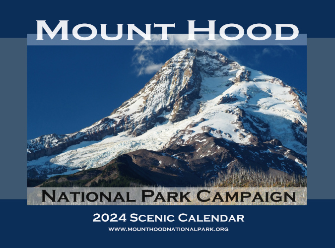
The 2024 Campaign Calendar is the twentieth edition!

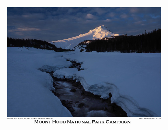
With the December holiday season comes my annual Mount Hood National Park Campaign calendar, but this year is a bit of a milestone: the 2024 calendar is the 20th edition since I began putting these together back in 2003! Much has changed over those years, so this article includes both a retrospective from the early calendars and highlights from the 2024 edition, so I hope you’ll indulge me!

The new calendars for 2024 are print-on-demand and available now from Zazzle. You can find them here:

See the 2024 Mount Hood National Park Campaign Calendar on Zazzle

Zazzle does excellent work and these can be shipped direct to anywhere. As always, all proceeds go to Trailkeepers of Oregon (TKO) for their crucial work in volunteer trail stewardship and advocacy.

Looking back to the very beginning…

It was back in 2003 when I kicked off the “idea campaign” for a Mount Hood National Park that encompasses Mount Hood and the Gorge. It’s an idea that has made it as far as legislation in Congress on several occasions as early as the 1890s, but never made it as far as the president’s desk to become law – usually due to moneyed interests in exploiting the mountain. Thus, the purpose of the “idea campaign” is to simply keep the national park idea alive.

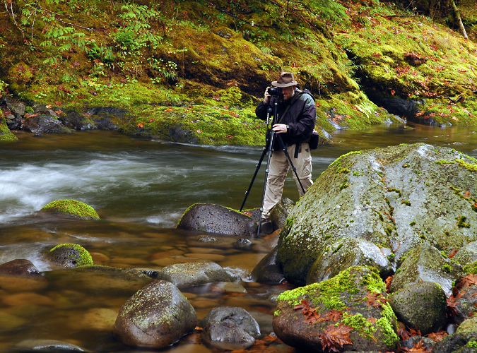
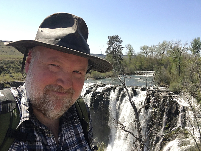
Shooting the Salmon River with my first digital camera in 2003 (Greg Lief)

I’ve been asked many times “do you really think Mount Hood will become a national park?” I do, of course. Eventually. Most of our national parks had a long and bumpy road to finally being established, often starting as a national monument or recreation area – but always because they had exceptional natural and cultural features unmatched elsewhere. That’s why I believe that Mount Hood will eventually join the ranks of Crater Lake, Mount Rainier and the Olympics and receive the level of commitment to both conservation and recreation that only the National Park Service can offer. In the meantime, this blog serves as place to celebrate those natural and cultural features that make Mount Hood and the Gorge unparalleled places worth protecting, while spotlighting threats to the mountain.

With this goal, the first calendar (below) was an outgrowth of the idea campaign as a visual way to celebrate the many places and landscapes that combine to make WyEast Country so exceptional. Back in 2004, there were also new technologies that helped make a custom calendar possible: I had recently purchased my first digital camera and CafePress had emerged as a quality on-demand printing service as part of the dotcom revolution. 

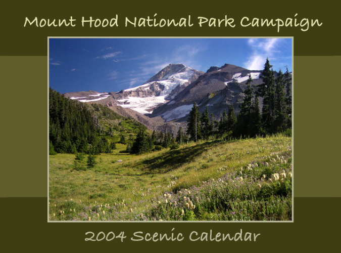
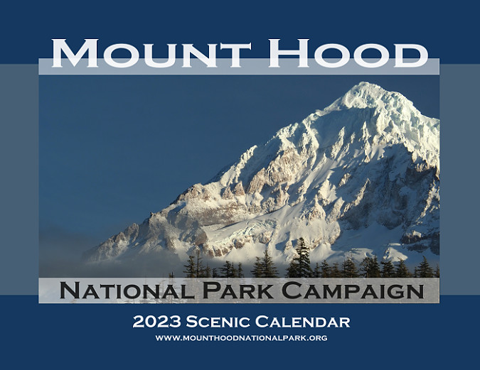
The first cover… back in 2004

The first calendar was modest – printed at 8.5×11 inches with color reproduction that was decidedly “approximate”, though still a big leap forward from color photocopies of the 1990s. The first edition featured a recurring, favorite spot of mine on the cover – Elk Cove on Mount Hood’s north side. 

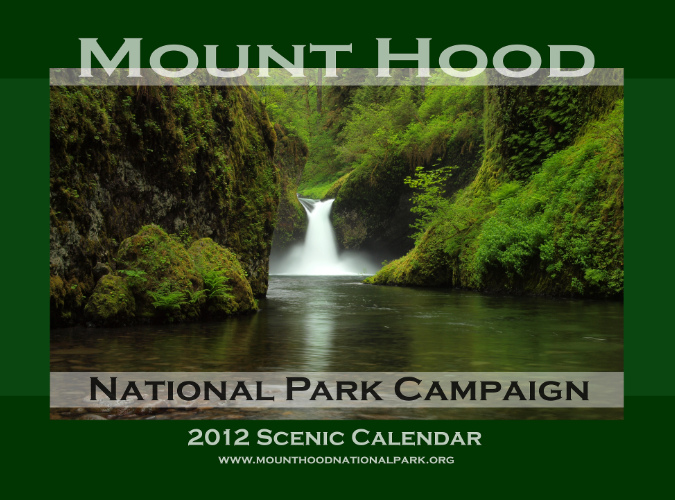
From this start, the calendar evolved over the next 20 years in technology, print quality and the landscapes I featured. This collage (below) of the 20 annual covers shows some of that evolution.

[click here for a large version]

Looking back, the two constants among cover subjects were waterfalls and the mountain, though the places and vantage points varied greatly. One of the best rewards in putting the calendars together has been the opportunity to explore different corners of the mountain and gorge, as I set a goal early on to feature new images taken during the previous year in each calendar. While there are a few spots I go back to nearly every year, I’ve also been able to feature new places and perspectives not seen elsewhere.

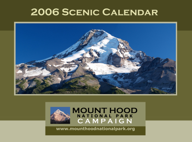
Looking across those old cover images, I’m also able to see how the cover design evolved. The first two calendars used a script font that looks ridiculous to me now, and by 2006 I had moved on to the “national park” fonts I use today – notably, Copperplate — along with the color scheme I had used on the (then) brand new Mount Hood National Park Campaign website. The graphic below the main image was from bumper stickers I also had printed at CafePress at the time.

Getting there… improved fonts in 2006

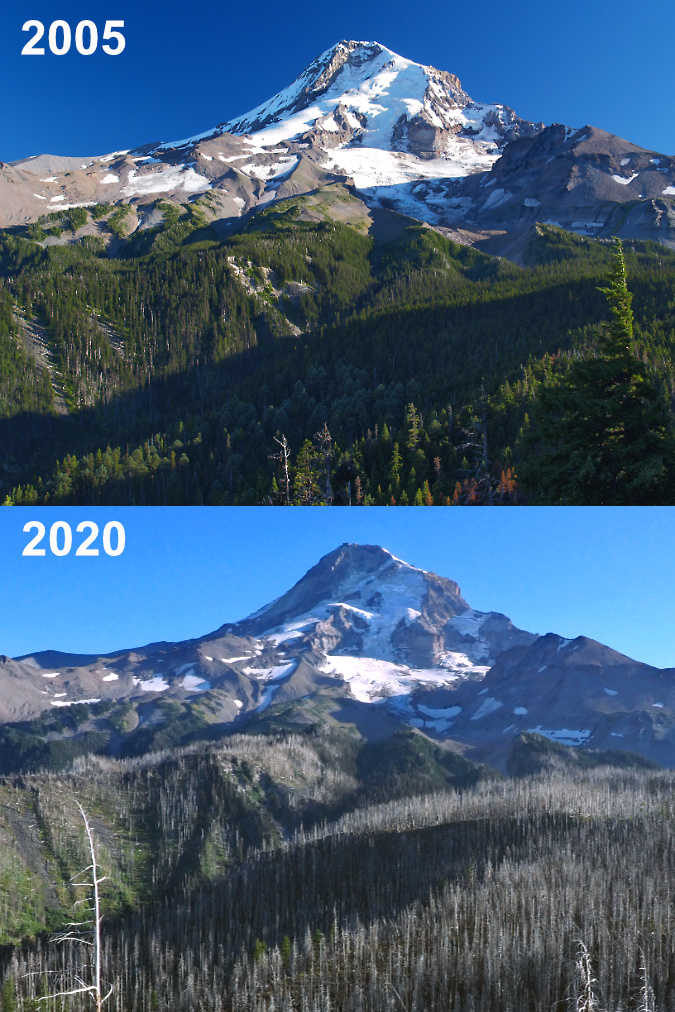
The cover of the 2006 calendar is the first in a series of reminder among the covers that there are no constants in WyEast Country. Everything changes, and lately, change seems to be accelerating, as the cover image of Mount Hood from the Elk Cove trail underscores. Just two years after I took this photo, the Gnarl Fire had roared across the east flank of the mountain, nearly engulfing Cloud Cap Inn. Then, three years after the Gnarl Fire, the Dollar Lake Fire had burned much of the forest on the north slope of the mountain shown in this image.

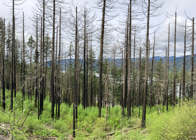
The 2011 Dollar Lake Fire started just below the rocky viewpoint where this cover photo was taken. Today, the sea of green Noble Fir and Mountain Hemlock that once covered the slopes has been replaced by a ghost forest of silver tree skeletons, with a new forest just getting underway in their. The following photo comparison from this viewpoint (below) shows the dramatic changes to the north side in stark contrast. 

The Dollar Lake Fire burned thousands of acres of subalpine forest on Mount Hood’s north slope in 2011

The Dollar Lake Fire brought an unexpected opportunity to witness and document the forest recovery, and without the assistance of man, as most of the fire was within the Mount Hood Wilderness. As such, the Forest Service has adopted a hands-off policy and is deferring to the natural forest recovery process. I’ve since posted several articles tracking the recovery:

“After the Dollar Lake Fire” (June 2012)

Dollar Lake Fire: Five Years After” (October 2016)

“10 Years After the Dollar Lake Fire” (November 2022)

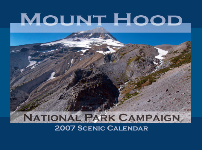
The 2007 calendar marked a technology change when CafePress began offering a much larger format, measuring 11×17”. This required a different photo aspect, but also gave sweeping vistas the space they need to be truly appreciated. Such was the case with the first calendar cover in this larger format in 2007, when the sprawling view of Mount Hood’s east face (below) from Gnarl Ridge was the cover image. This edition also featured what has become the basic design for the cover, along with a blue color scheme that I’ve alternated with the original green theme over the years.

Going ultra-wide with a new format in 2007

In 2008, I started this blog as an alternative to making constant updates to the campaign website. This  opened still more opportunities to explore and capture WyEast country in words and imagery, with deeper dives and more details in the long form that I prefer. As the blog shifted my focus toward emerging risks to Mount Hood and the Gorge, so my photography shifted, and the calendar began to include more remote and obscure places on the mountain.

There’s a story behind the nearly identical cover scenes of Upper McCord Falls (below) that appeared on both the 2011 and 2013 calendars. In 2012 I lost all of my original digital files from the 2011 calendar in a computer upgrade, and by 2013 I’d clearly forgotten what the earlier cover images was. Apparently, I liked that view of Upper McCord Falls enough to put it back on the cover — though I had also upgraded my camera between these covers, so at least the 2013 version was an improvement on the earlier take – to my eye, at least! (for this article, I recreated the 2011 cover from a printed copy of the calendar I saved).

Seeing double-double!

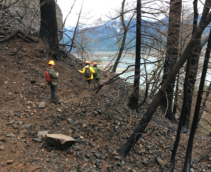
As with so many places in the Gorge that I had taken for granted in my life, it never occurred to me that the forests surrounding Elowah Falls and Upper McCord Falls would soon be completely burned, leaving a landscape will take generations to return to the lush, mature forests that I grew up with. As it turned out, Upper McCord Falls was the first trail I visited within the “restricted area” following the September 2017 Eagle Creek Fire. It was just five months after the fire when I headed up there in February 2018 with a Trailkeepers of Oregon (TKO) crew to survey the trail damage.

The devastation was much more extensive than I expected on what would be the first of many trips into the restricted area after the fire. I had hiked through the recent burns on Mount Hood in previous years, and was braced for seeing ancient trees reduced to burned snags, but what makes the aftermath of fire in the Gorge so unique is the terrain. The forest was playing  a greater role in holding the steep slopes of the Gorge together than I think anyone realized, and just five months after the fire the scale of erosion and ground movement was alarming.

Locating surviving trail tread after the fire at McCord Creek in early 2018

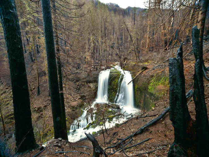
The scene at Upper McCord Falls was startling, as well. The burn was severe around the falls, killing the entire forest. The layers of green moss that survived the burn on the cliffs and boulders nearest the falls seemed like they had been hand-tinted onto the brown landscape, like an old postcard.

Upper McCord Falls in February 2018 (Randi Mendoza, Oregon Parks & Recreation) 

The trail seemed a total loss in several areas on that trip where sliding mud and rock had completely covered the tight series of switchbacks originally carved into the slope by the Civilian Conservation Corps back in the 1930s. In the years that followed the fire, TKO volunteers have removed tons of debris from the trail and reconstructed damaged stone walls built by the CCC, restoring the tread to nearly its original design today.

Upper McCord Falls a few months after the fire

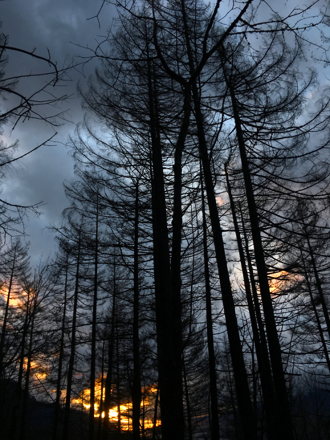
On the way out from that first visit after the fire, the clouds broke at the west end of the Gorge just as darkness was falling, creating the weird illusion that the charred forest silhouetted against dark the clouds and flaming sunset was still burning. As with all who love the Gorge, it was the beginning of a journey for me in accepting the reality of the fire – including the senseless act that started the blaze, as well as the inevitability of this fire being long overdue – and finally, a deeper appreciation for the resilience of our forests in which fire an essential destructive force.

Burned forests at McCord Creek on my first trip after the fire appeared to be on fire, once again, as a brilliant sunset lit up at the west end of he Gorge

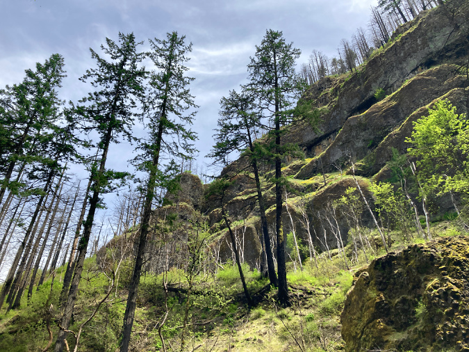
Revisiting the slopes leading to Upper McCord Falls last spring, the resurgence of the understory and beginnings of a new forest was inspiring after five summers of forest recovery. While I won’t live long enough to see big trees replace those that were killed in the fire, the surviving trees are bouncing back strongly, and watching the renewal of the Gorge forests is as inspiring in its own way as the big trees we lost. 

A stand of Douglas fir that survived the fire is surrounded by a thriving understory along the McCord Creek trail in Spring 2023

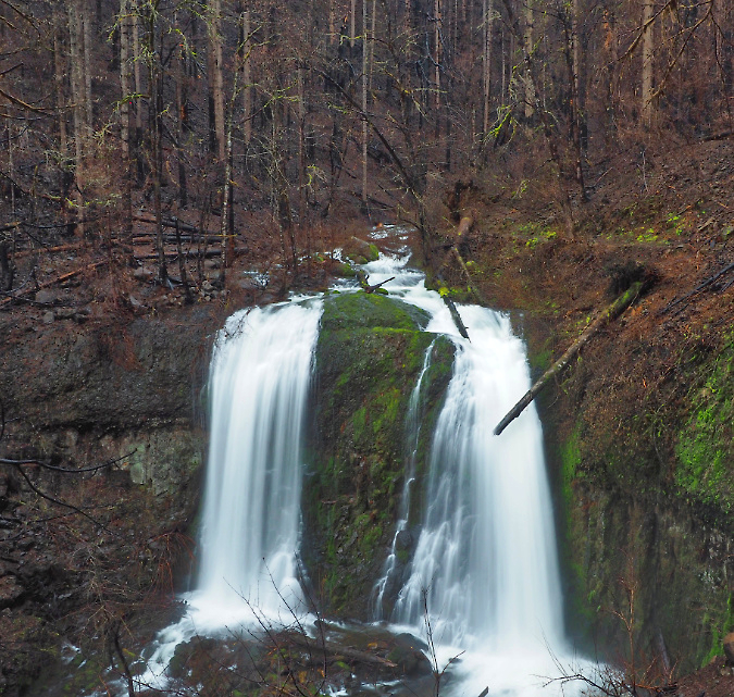
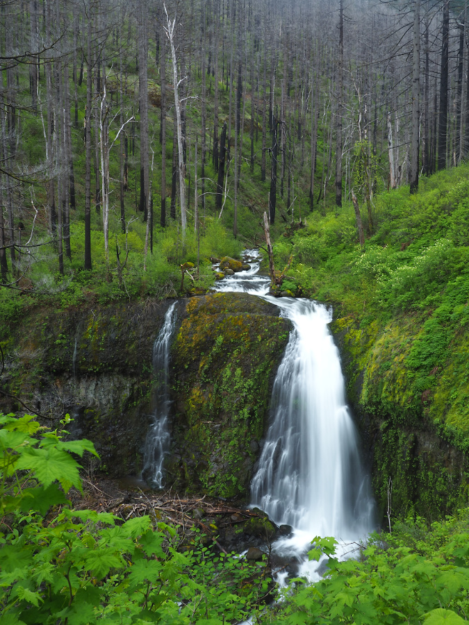
Meanwhile, Upper McCord Falls looks quite different five years later, as well (below). The understory has made a vigorous comeback, but more surprising is the east (left) segment of this twin falls, which appears to be plugged with debris released into McCord Creek from the fire – at least for now. Prior to the burn, the twin tier would have been flowing when I took this photo last spring, just as it was in the calendar covers in 2011 and 2013. 

Upper McCord Falls six years after the fire in Spring 2023

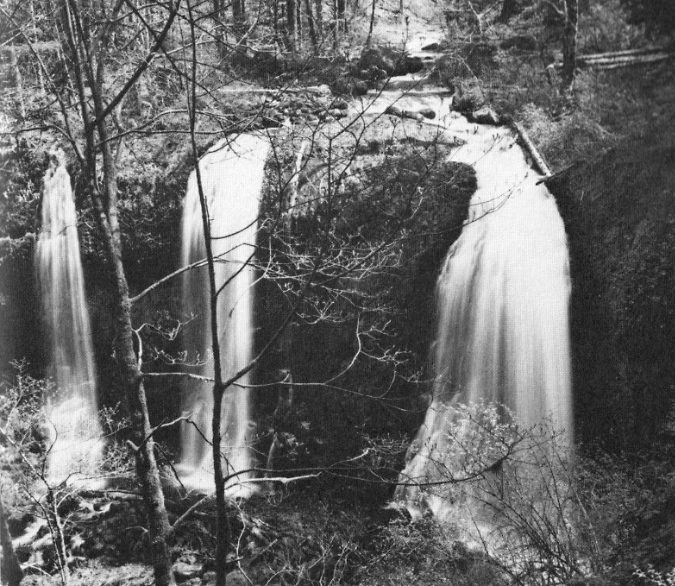
Upper McCord Falls has historically had as many as three segments cascading from the basalt ledge that forms the cascade (a third tier once flowed to the left of east tier as recently as the 1970s, as shown below), so in time, there’s no reason to assume the second (or even third) tiers will re-emerge. The defining factor is simply the amount of rock and log debris piled up on top of the basalt ledge. 

Since the 1970s, the debris had been further stabilized by a colony of Red Alder that was the main force holding the pile of boulders and debris together, eventually blocking the third tier of the falls completely. Today, those trees have been killed, and with the volatile flooding on Gorge streams since the fire, there’s good reason to expect McCord Creek to re-arrange the shape of Upper McCord Falls by removing some or all of the debris plugging parts of the waterfall.

Upper McCord was a triple falls in the 1970s! (Don Lowe)

Where the tree canopy along the McCord Creek trail system were completely burned (below), the forest recovery is now in full swing, choking the route in many spots with Thimbleberry, Vine Maple, Douglas Maple and many other understory plants whose roots survived the burn, allowing them to bounce back quickly.

Forest understory surging back after six years at McCord Creek

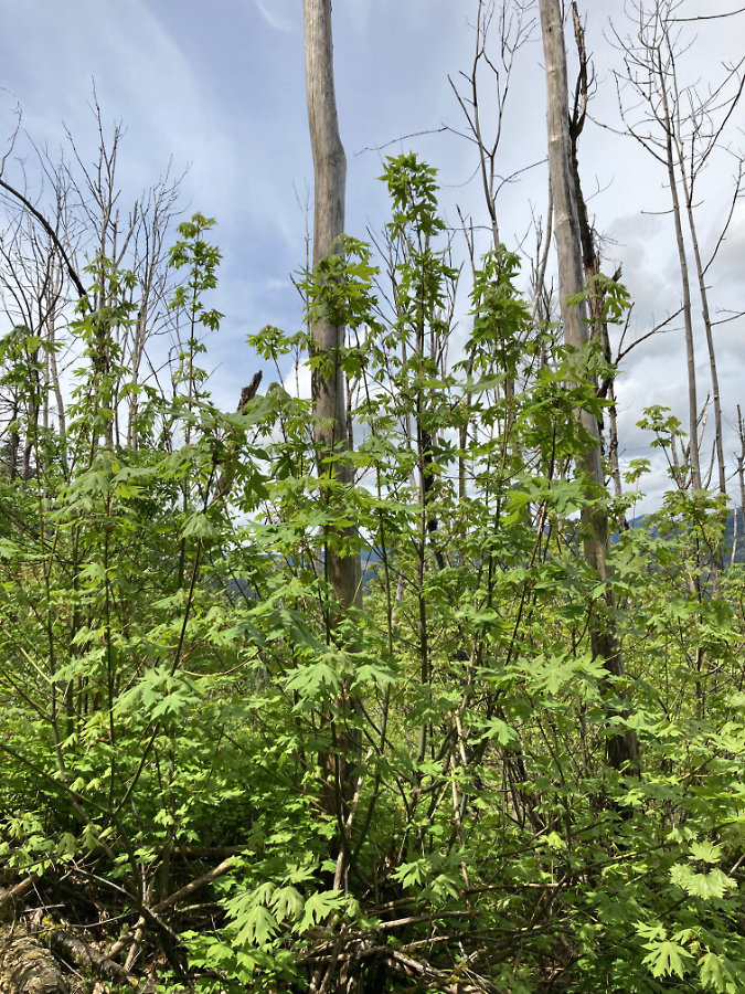
Bigleaf Maple are bouncing back in this way, too, pointing to a future deciduous forest canopy as the first phase of recovery in many of the burned areas. Along the lower sections of the McCord Creek trail, ten-foot shoots have exploded from the roots of Bigleaf maple trees whose killed tops still stand as bleached snags (below). Many of these recovering maples will become multi-stemmed trees, a familiar sight in Oregon’s forest and one answer as to why mature Bigleaf Maple so often have multiple trunks.

Bigleaf Maples regrowing from the base of burned trees whose roots survived the fire

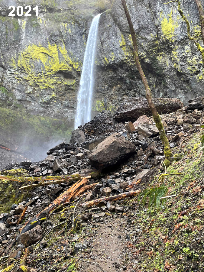
The drama at McCord Creek continued a few short years after the fire when the west cliff wall of the Elowah Falls amphitheater collapsed in the winter of 2021. There’s no science (yet) to make the connection, but the Gorge has seen a series of cliff failures since the 2017 Eagle Creek Fire. Could these events be linked to the loss of vegetation or corresponding runoff on Gorge slopes? Perhaps, but as I described in the previous article on the 1973 Tanner Creek landslide, there are unique forces at work in the Gorge that date back to the last ice age, so events like these are the norm, not the exception.

Elowah Falls cliff collapse in the spring of 2021 (Drew Stock, Trailkeepers of Oregon)

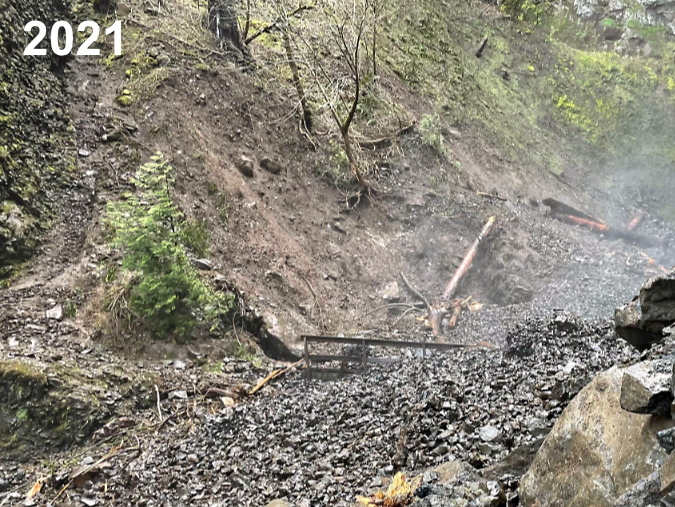
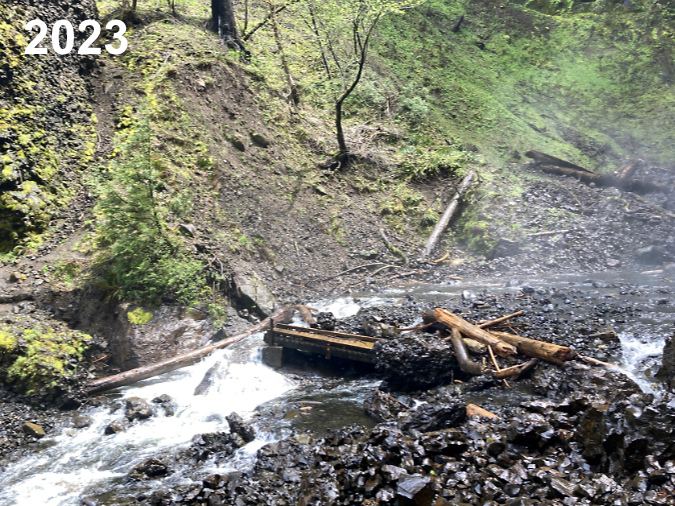
TKO volunteers discovered the Elowah Falls cliff collapse in 2021 and captured the dramatic photos shown here. In the immediate aftermath of the collapse, McCord Creek disappeared into the loose basalt cobbles that had filled the creek channel and buried the Trail 400 footbridge to its railings. That condition was temporary, however, as by last spring McCord Creek had already carried away much of the small debris and excavated the footbridge. The images below show the erosive power of the stream over a period of just two years.

Debris burying McCord Creek and its footbridge immediately after the collapse (Drew Stock, Trailkeepers of Oregon)

Elowah Falls footbridge excavated (and railings removed!) by McCord Creek after just two years

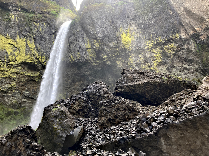
Like most cliff collapses in the Gorge, the jumbled debris fan at Elowah Falls is a mix of truck-sized boulders that managed to hold together amid a sea of smaller boulders and fractured basalt cobbles where parts of the once-solid rock face had simply crumbled during the event.

Large blocks of basalt mixed with smaller cobbles in the debris pile at the base of the collapsed cliff

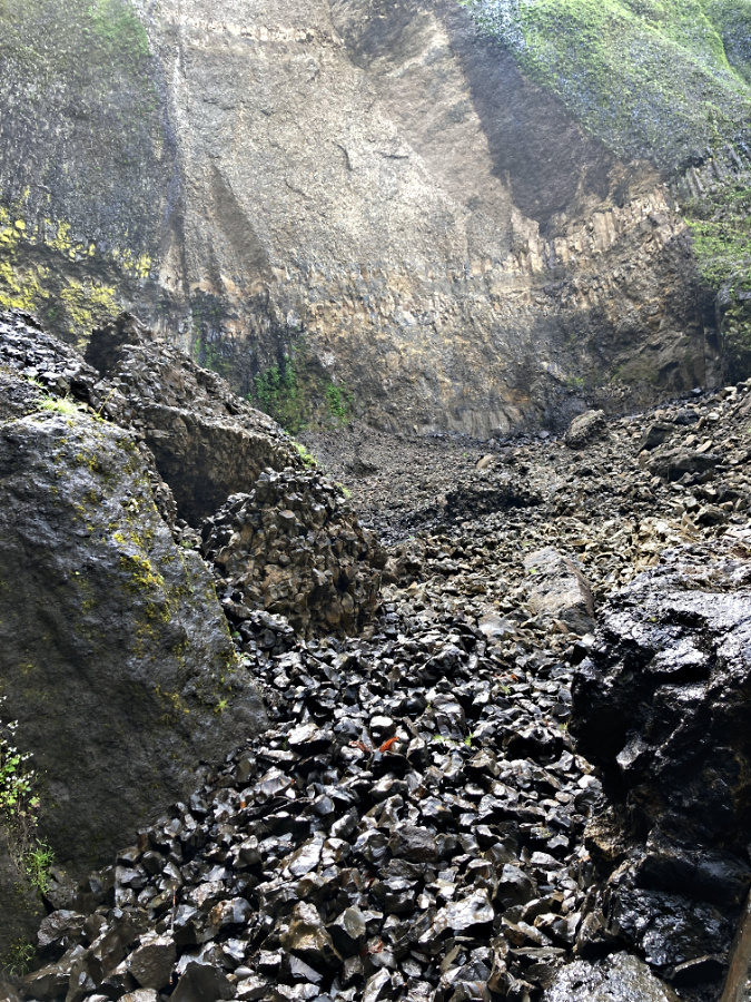
Today, a massive scar is still obvious on the cliff wall where the basalt gave way (below). In time, however, the evidence from event will be hidden under a fresh carpet of moss and Licorice Fern, once again giving that deceptive illusion of stability that has never really existed in the Gorge.

Looking up the debris fan at the massive scar left behind by the cliff collapse at Elowah Falls in Spring 2023

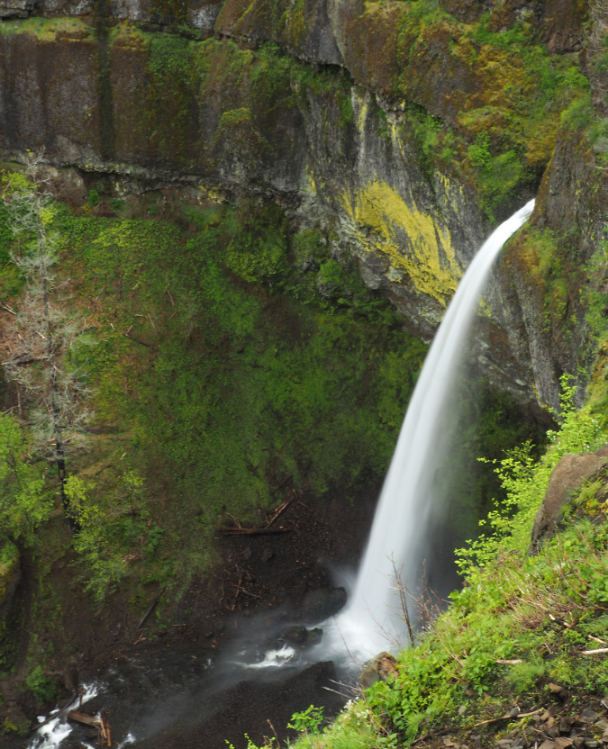
While the cliff collapse at Elowah Falls was massive in scale, it spared the spectacular trail to Upper McCord Falls where it is carved into the basalt walls 400 feet above the creek. In fact, hikers passing along this vertigo-inducing stretch of trail might not even notice that a large section of the wall directly below them had collapsed into the creek, as the impact is mostly hidden from this airy view (below).

Elowah Falls seems unchanged from above along the Upper McCord Trail

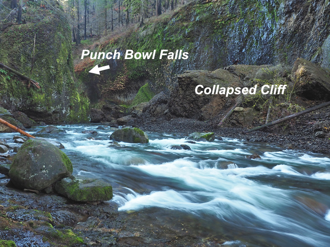
If the cliff collapse Elowah Falls was impressive to see, the earlier collapse at Punch Bowl Falls on Eagle Creek was downright shocking. After Multnomah Falls, and Crown Point, the view into the mossy cavern that holds Punch Bowl Falls might be the most iconic in the Gorge. The idyllic scene drew photographers from around the world before the fire, and even gave its name to the category of “punchbowl” waterfalls.

Punch Bowl Falls as it once appeared in 2012

I posted an extensive piece on this event when it showed up unexpectedly on a series of aerial surveys the State of Oregon had conducted to track landslides after the Eagle Creek Fire. The Punch Bowl collapse occurred just months after the fire, sometime in early 2018. The “restricted area” was still in effect at the time, so the first few people to see the aftermath in person were trail volunteers working to put the Eagle Creek trail back together. Today, you can see the re-arranged landscape by taking the Lower Punch Bowl spur trail down to the falls.

Aftermath of the 2018 cliff collapse at Punch Bowl Falls

Getting that classic shot of Punch Bowl Falls during spring runoff usually entailed wading knee-deep into Eagle Creek to get a look into the hidden cavern that holds the falls. The cliff collapse has since changed things a bit. For now, there are a pair of good-sized boulders that landed in the entrance to the cavern, blocking the traditional view. 

In time, Eagle Creek will dismantle much of the debris from the collapse, and even these boulders will eventually break apart or be pushed downstream by the enormous force of the stream during winter floods. This will be aided by the many fallen logs that have dropped into the stream since the fire, and now act as erosive battering rams and levers as they move downstream.

The ”modern” calendar design emerges in 2016

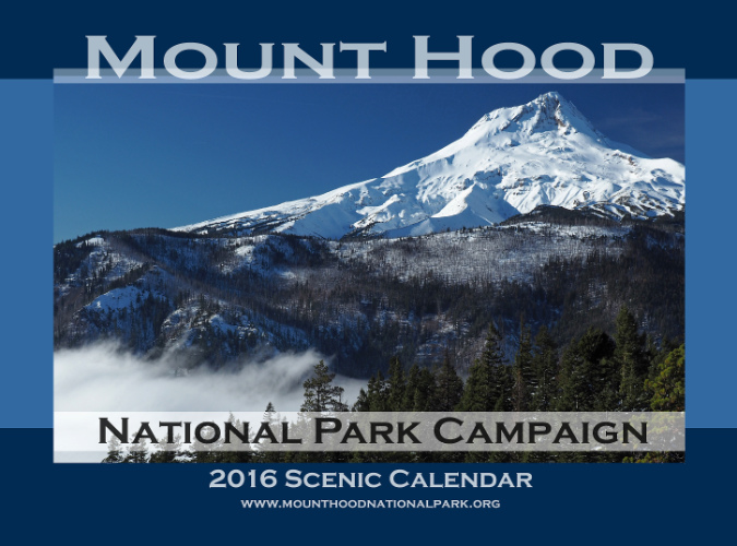
The final design and format emerged in 2016 with a switch in vendors

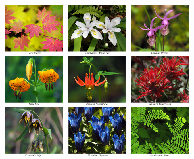
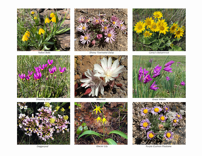
Year twelve in the calendar series brought a major shift and format and improved quality when I moved printing from CafePress to Zazzle. The image reproduction at Zazzle is excellent and the overall printing process much better, resolving some quality concerns that drove me to make the move. Zazzle also brought the added opportunity to have a printed back cover on the calendar, kicking off the grid of nine botanical photos that I continue to include each year. Like the scenic views in each calendar, the botanical images are captured over the course of the prior year on my forays into WyEast Country.

New with the 2016 calendar? A printed back cover!

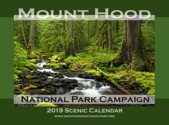
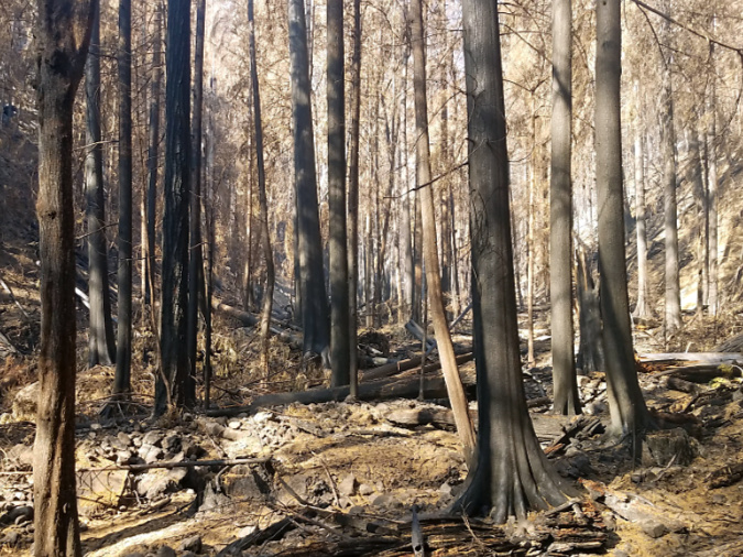
One last profile of note from past calendars is the 2019 edition, where lovely Whale Creek in the Clackamas River watershed is featured. This idyllic scene is – or was – typical of the beautiful rainforests there. Despite a long and frustrating history of aggressive logging over more than a past century, some of the finest ancient forests in the region survived here. Sadly, the Riverside Fire – yet another human-caused event – started just upstream from this spot along the Clackamas, and eventually burned 120,000 acres of forest, as well as numerous structures.

This scene from Whale Creek taken before the 2020 Riverside Fire was featured on the 2019 calendar

I’ve posted many articles on the necessity and benefits of wildfire in our forests, but the Riverside Fire underscores a few caveats to the science. As I described in this 2021 article, we are burning our forests faster than is sustainable. This stems from multiple factors adding up to a perfect storm: a century of fire suppression coupled with heavy logging has left us with thousands of old clearcuts packed with thickets of overplanted, fire-prone young trees and decades of fuel buildup. Add climate change, with our summers getting drier and hotter, and our forests have become a tinder box in most years, not just the occasional hot summer.

The same section of Whale Creek after the fire in 2020 (USFS)

Given this confluence of stresses on our forests, we’re doing an especially poor job preventing human-caused fires – they account for 70 percent of wildfires in Oregon! As I point out in the linked article, we’ll need to set some unwelcome limits on human behavior if we hope to slow down the burning to sustainable levels. So far, the Forest Service is moving very slowly in limited access during extreme fire danger, though successful liability lawsuits against power companies whose live lines triggered some of the 2020 fires may change that thinking.

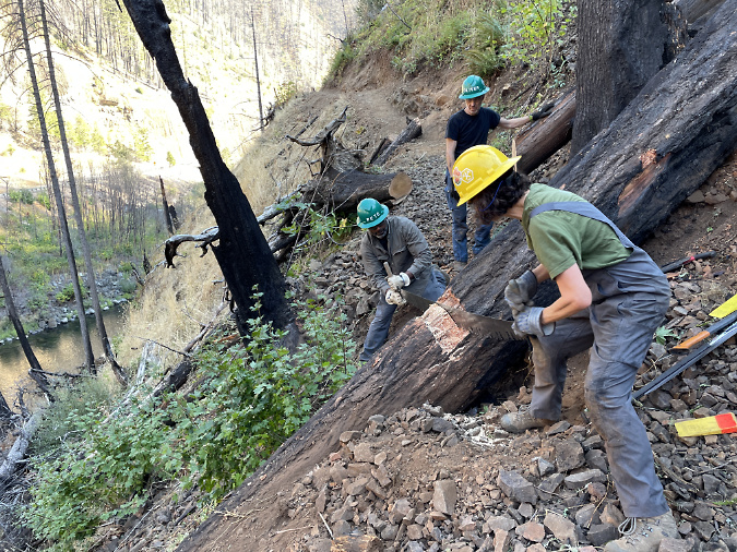
TKO crews clearing big logs on the Clackamas River Trail after the Riverside Fire

Some good news from the Clackamas? TKO crews have already been working on reopening trails damaged in the fire. Like the Gorge, the Clackamas River canyon is steep country, so keeping trails open as the forest recovers will be a long-term endeavor.

That’s a look back at 20 years of campaign calendars, and now…

…looking ahead to 2024!

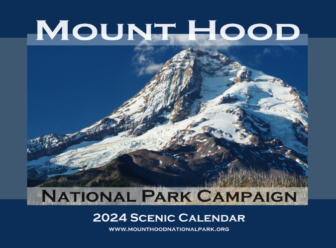
The view from Inspiration Point is the cover image for 2024

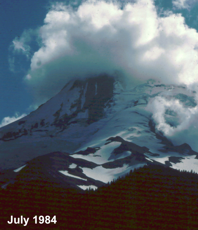
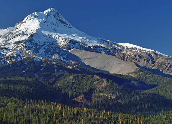
For the 2024 calendar cover, I selected an image of Mount Hood’s fearsome north face (above), as viewed from a tiny, unofficial trail that I maintain at Inspiration Point (located at the 3-mile mark on bumpy  Cloud Cap Road). How long have I been stopping here? I looked back at my photo archive, and the earliest I could find was a slide from the summer of 1984 – which means I’ll celebrate my 40th summer visiting this lovely spot when I stop at Inspiration Point next year!

Clouds capping the mountain on the road to Cloud Cap in this 1980s view from Inspiration Point

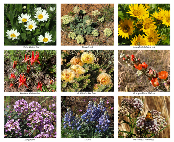
On the back cover of the new calendar, yet another collection of nine wildflowers that I photographed over the past year is featured – including a couple that were new to me. 

Back cover of the 2024 calendar

Putting it all together, here’s a jumbo collage of the 12 monthly images in the 2024 calendar, plus the covers and a snapshot of the page layout:

[click here for a large version]

For the January image in the new calendar (below), I selected a view of Mount Hood’s northwest side, with Cathedral Ridge and the Sandy Glacier Headwall covered in an early dusting of autumn snow. On this day last October, the mountain was emerging from the clouds after being socked in most of the day.

Northwest face of Mount Hood with early autumn snow

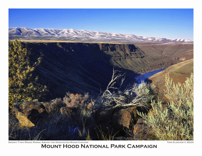
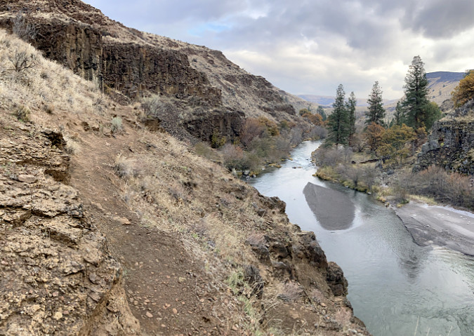
For the February image I thought I’d mix things up a bit with this view of the lower Deschutes River canyon at Oak Springs (below), a corner of WyEast Country that not many find their way to. On this day last winter, a dusting of snow had fallen on Tygh Ridge, the long fault scarp that rises in the distance – another lesser visited spot on this lonely, dry side of the mountain.

Lower Deschutes River and Tygh Ridge from above Oak Springs

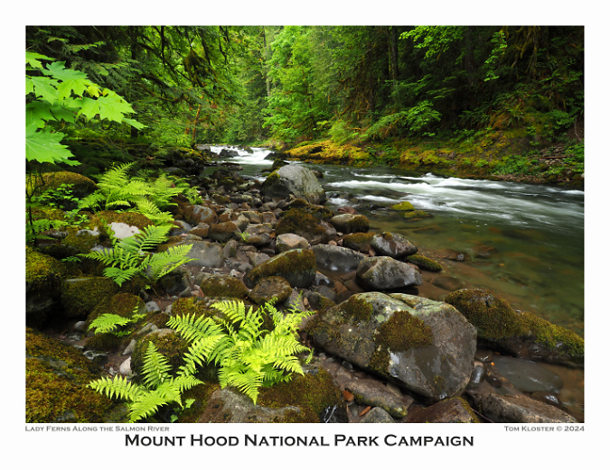
For March, a more familiar scene (below) along a quiet section of the lower Salmon River features a group of Lady Ferns. The Old Salmon River Trail follows this stretch of river through some of the best rainforest and oldest trees within easy reach of Portland.

Lower Salmon River in Spring

I chose another stream scene for April, though this one is less familiar to most. This is Viento Creek (below), in the east Gorge, just a few miles west of Hood River at Viento State Park.

Viento Creek in the East Gorge

There’s a backstory associated with this photo, as I’ve been working with TKO for the past few years to create a new family-friendly trail from the Viento Campground to a magnificent viewpoint on the Viento Bluffs. The new trail will someday pass the stream scene shown above, enroute to expansive views of the Columbia River – but with a short route that it will be welcoming to casual hikers and young kids. Watch this space for more news on this project!

TKO and State Parks crew surveying a new trail at Viento Bluff earlier this year

The picturesque view from Viento Bluff will someday become a family trail destination

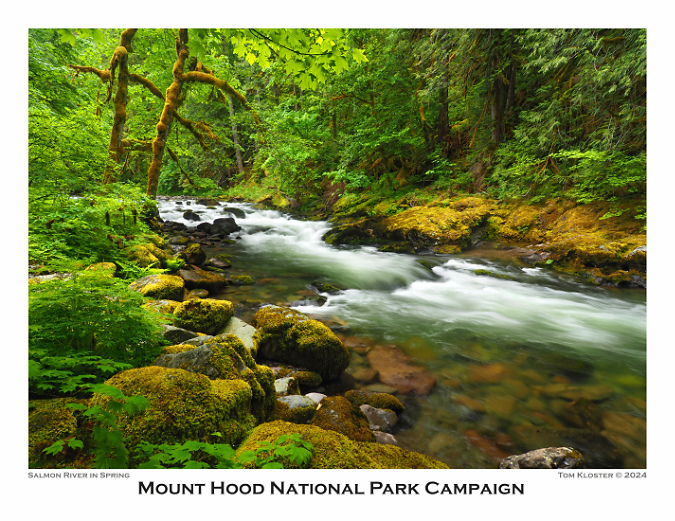
The May calendar image features another stretch of the Salmon River (below). This pretty cascade has become a popular spot for photographers in recent years. I included it in this year’s calendar partly for symbolic purposes, as this scene appeared in the very first calendar in 2004. This is also where Greg Lief’s image at the top of this article of me shooting photos was captured in 2003 – hard to believe that was 20 years ago!

Springtime on the Salmon River

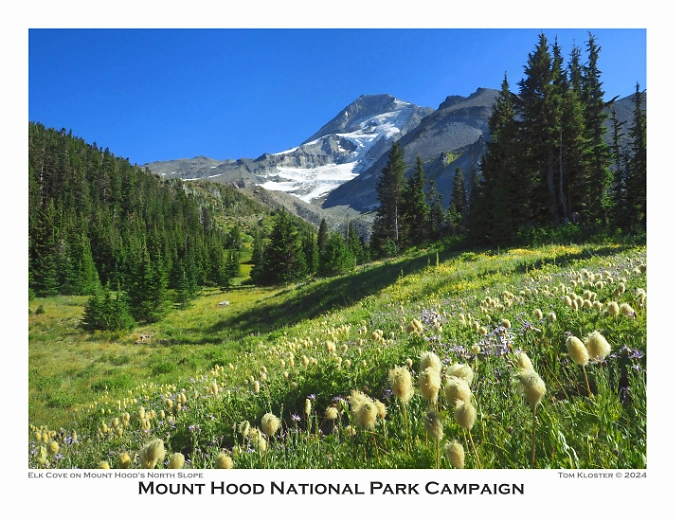
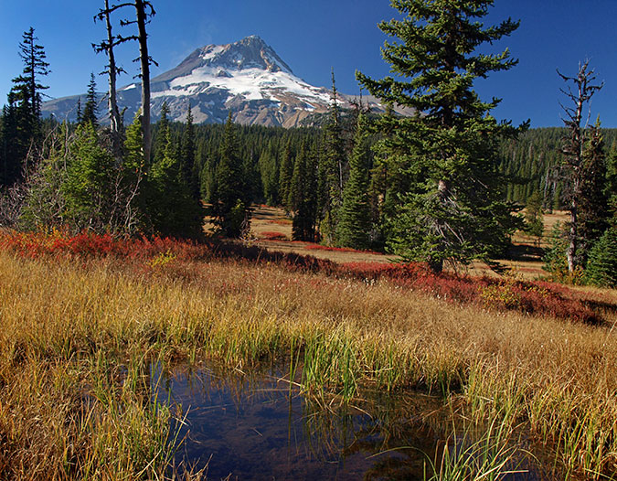
June brings another symbolic favorite, as Elk Cove appeared on the cover of the first calendar, and in several subsequent editions over the years – and almost always from this very spot (below) along the Timberline Trail. As much as the mountain has changed in recent years, this view remains a bit of a constant – always lovely, but especially the Western Pasqueflower are putting on their “Muppets of the Mountains” show.

Summer wildflowers putting on their annual show at Elk Cove

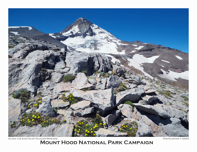
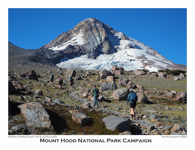
For July I selected another repeat spot, one of my favorite viewpoints of Mount Hood and the Eliot Glacier from the shoulder of Cooper Spur (below). I posted a look-back article on this area earlier this year to kick off a series of then-and-now photo retrospectives. 

Mount Hood and the Eliot Glacier from the Cooper Spur Trail

For the August image, I selected another scene from a blog article, in this case a view of the recovering Muddy Fork valley where a landslide swept through two decades ago. This event and several now-and-then photo comparisons are over here.

Muddy Fork of the Sandy River

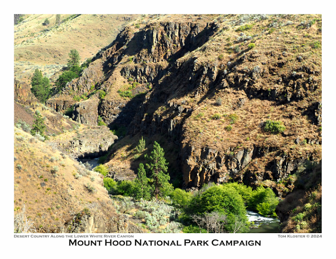
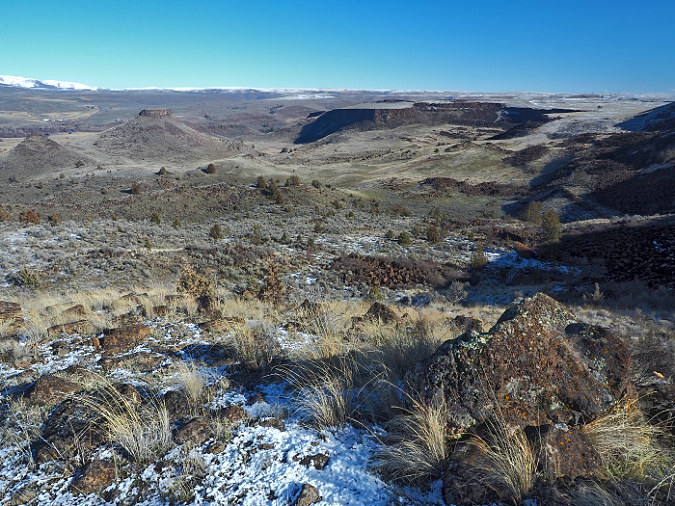
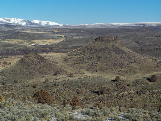
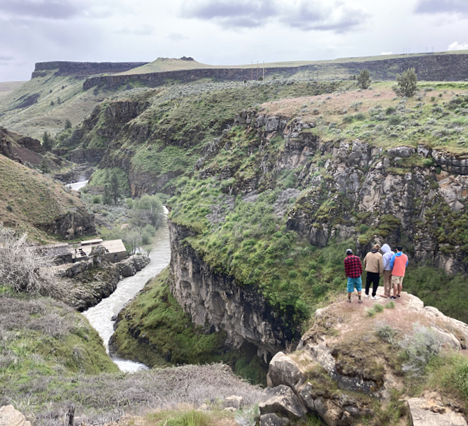
For September, I chose something a bit different, with a cliff-top view into the lower White River Canyon (below) at White River Falls State Park. So many things make Mount Hood unique (and worthy of national park protection!), but the compact collection of wildly different climate zones might be at the top of the list. There aren’t many places in the world where a 2-hour drive from the middle of a major metropolitan area takes you from rainforest to desert, with glacier-covered volcano rising above you the entire time!

Lower White River Canyon in desert country

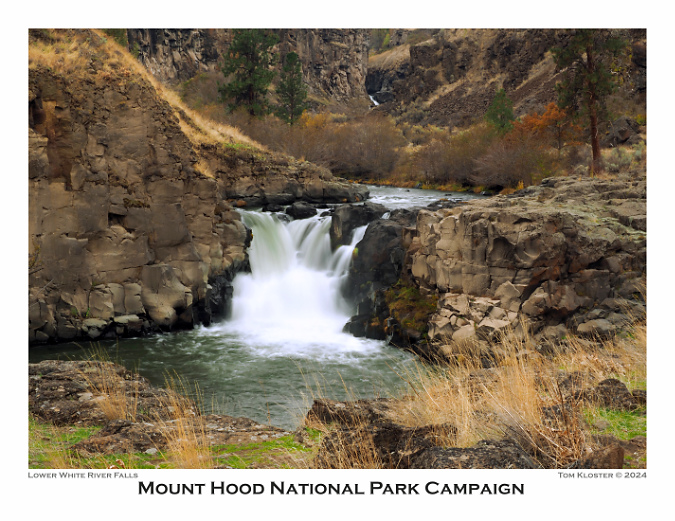
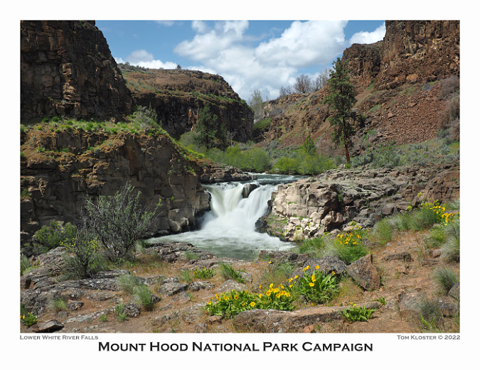
The October image stays with the desert theme, and features Lower White River Falls. In spring, this canyon lights up with desert wildflowers that I’ve included in previous calendar editions, but the tawny yellows, gold and reds of autumn create their own beauty in this rugged landscape.

Lower White River Falls in Autumn

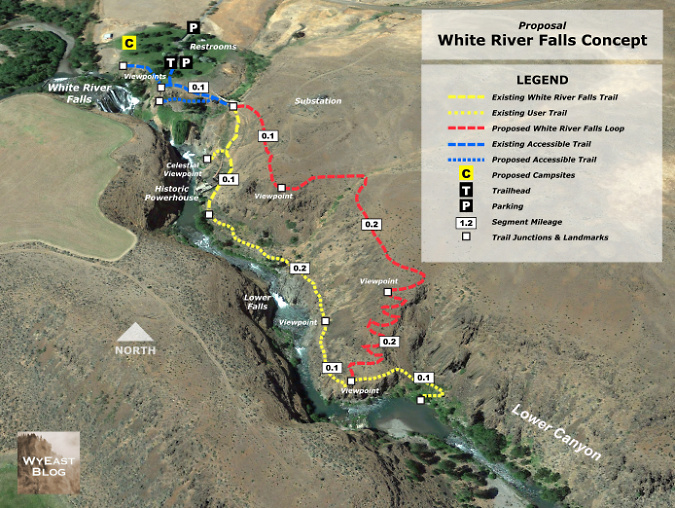
White River Falls State Park remains a diamond in the rough, with much potential for both improved recreation and conservation of the natural and cultural features in the park. The area is becoming more popular, and that has translated into some visible impacts – and therefore several proposals to respond to this increased demand are featured in this article from earlier this year.

Loop Trail concept for White River Falls State Park

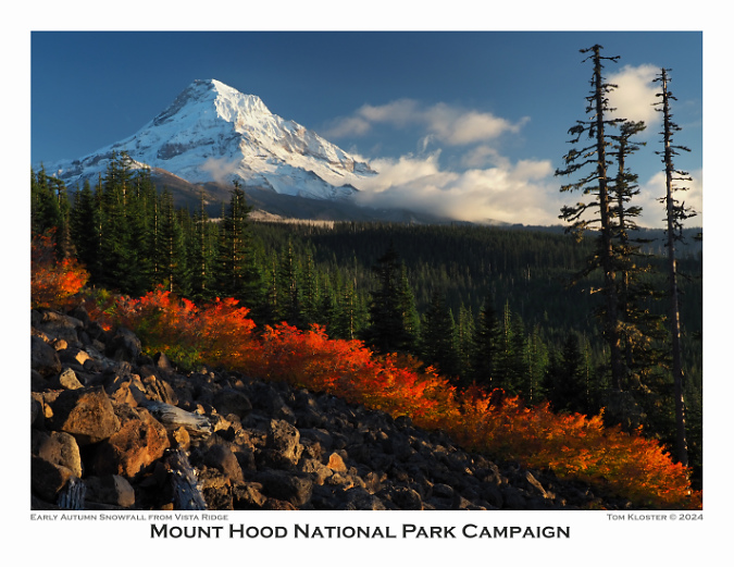
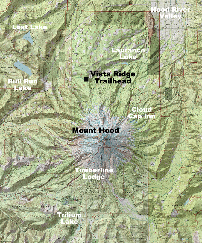
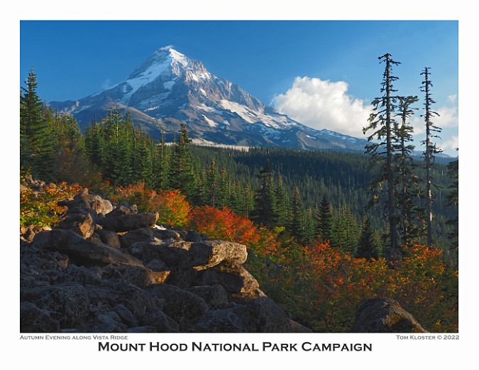
For November, fall colors along Vista Ridge and fresh snow on the mountain are featured (below). This scene is surprisingly easy to get to – it’s along the access road to the Vista Ridge Trailhead, another increasingly popular spot on the mountain. This article from last summer includes some proposals for managing the pressures the newfound popularity is bringing to Vista Ridge.

Brilliant fall colors on Vista Ridge

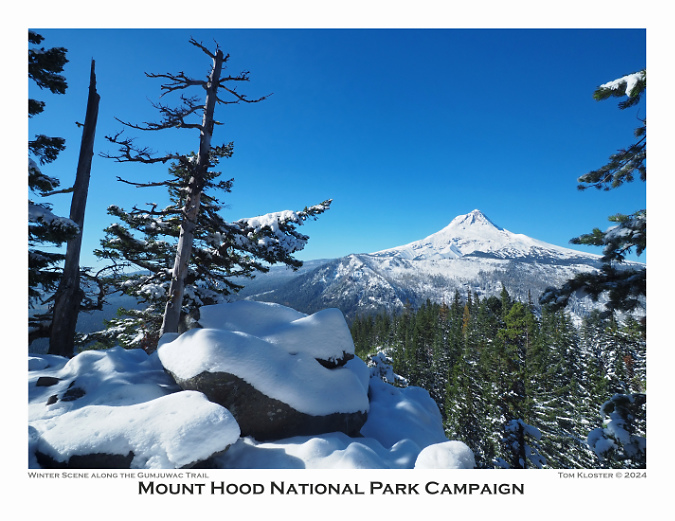
Finally, a view of the mountain after the first big snowfall of the season (below) from the lightly traveled Gumjuwac Trail, gateway to the Badger Creek Wilderness. My favorite viewpoint hikes are to “pocket views” – those spots where a steep talus slope or rocky outcrop provides an unexpected view – and this rocky crest just below Gumjuwac Saddle is among the best, and was featured on the front of the 2016 calendar, as well.

Pocket viewpoint along the Gumjuwac Trail in winter

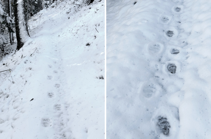
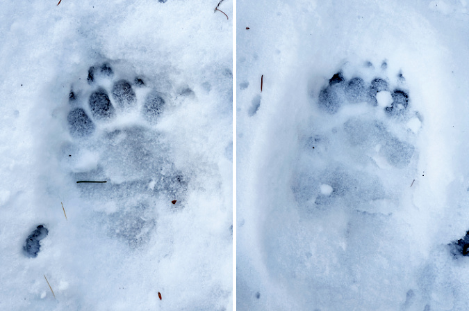
On the way up to the Gumjuwac viewpoint, I followed the chunky footprints of a Black bear for much of the route. Hiking in snow is a useful reminder that wildlife are always out there, even if we don’t have snow on the ground to record their travels. This is their home, after all, we are the visitors.

Bear tracks along the Gumjuwac Trail

Bear tracks in fresh snow on the Gumjuwac Trail

So, that’s it for my annual calendar review! If you made it this far and would like order one, they are available here – and all proceeds go to Trailkeepers of Oregon (TKO):

2024 Mount Hood National Park Calendar

As always, thanks for visiting the blog. Looking ahead to next year, I already have several articles underway, with the usual collection of deep dives, new proposals and reflections on the past. I hope you’ll continue to stop by!

The author at Owl Point in 2008 (Andy Prahl)

Best to you in the coming year – see you on the trail in 2024!

_______________ 

Tom Kloster | December 2023
Rx for the Vista Ridge Trailhead!

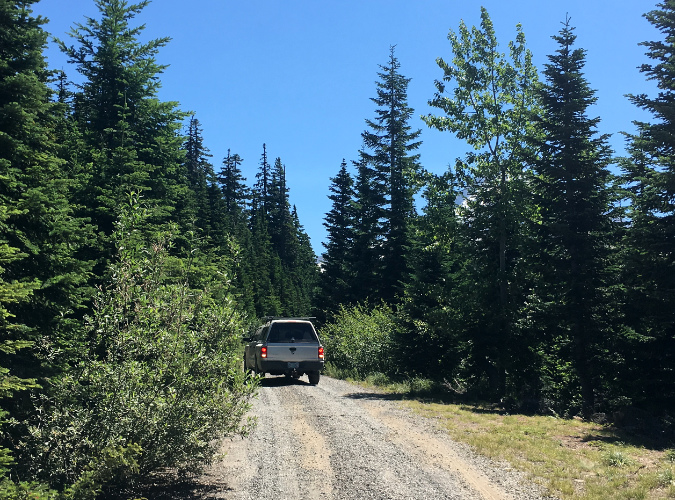
Mount Hood’s scenic wonders beckon on the final approach to the Vista Ridge trailhead on Forest Road 1650

Public lands across the nation experienced a big spike in visitors during the recent pandemic, continuing a growth trend that has been in motion for decades. In WyEast Country, this has placed an unprecedented burden on some of Mount Hood’s under-developed trailheads, like the one at Vista Ridge, on the mountain’s north side. 

The scenic gems within a few miles of this trailhead are among the mountain’s most iconic: Cairn Basin, Eden Park, Elk Cove, WyEast Basin and Owl Point draw hikers here, despite the washboards along the dusty final gravel road stretch – and the completely inadequate trailhead. 

The Vista Ridge is located on Mount Hood’s rugged north side and reached from Lolo Pass Road

The pandemic isn’t the only driver in the growing popularity of Vista Ridge. The 2011 Dollar Lake Fire torched Vista Ridge, leaving a vast ghost forest behind. In the years since, the forest recovery has featured a carpet of Avalanche Lilies in early summer that draws still more visitors to this trailhead. And since 2007, volunteers have restored the Old Vista Ridge trail to Owl Point, adding yet another popular hiking destination here.

It is abundantly apparent to anyone using the existing Vista Ridge trailhead that it was never designed or developed to be one. Instead, it was the result of a plan during the logging heyday of the 1960s to extend Forest Road 1650 over the crest of Vista Ridge and connect to the growing maze of logging roads to the east, in the Clear Branch valley. 

For reasons unknown, that never happened, and by the late 1960s the road stub defaulted into an unimproved trailhead for the Vista Ridge Trail when a short trail connection from the road stub to the saddle was built, instead. This new trail connection short-circuited the northern two miles of the Vista Ridge trail, but has since been restored reopened as the Old Vista Ridge trail. This is how today’s Vista Ridge trailhead came to be on a steep hillside at the abrupt end of a defunct logging spur.

The existing Vista Ridge trailhead is simply a logging spur that was abandoned mid-construction in the 1960s, and thus lacks even a simple turnaround

While it was still lightly used as recently as the early 2000s, the popularity of the Vista Ridge trailhead has grown dramatically over the past 15 years. Today, dozens of cars are shoehorned into this dead-end spur during the busy summer hiking season.

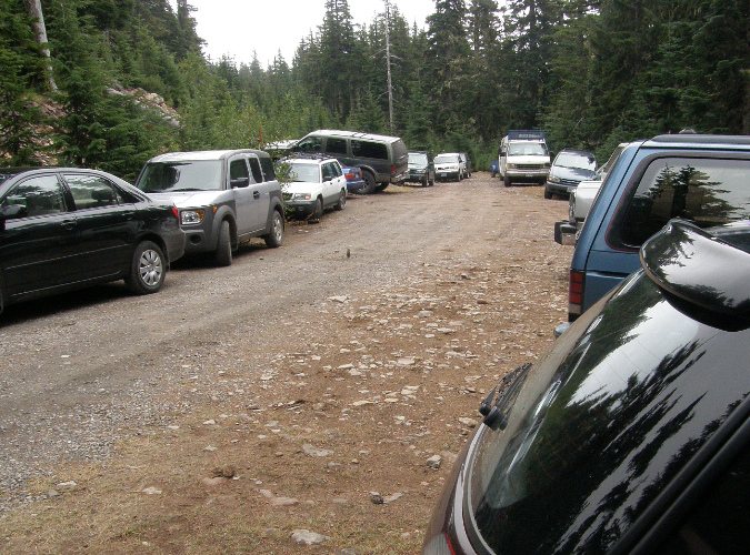
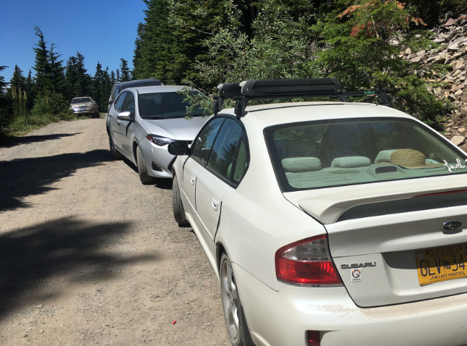
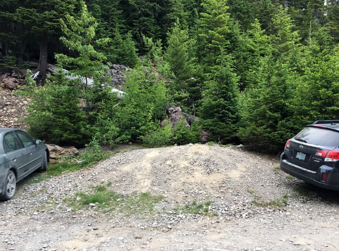
Parking at the trailhead is a haphazard affair, at best. There is room for about 6 cars along the south edge of the stub, though it was never graded for this purpose, and thus even these “spaces” are a minefield of sneaky, axel-cracking pits and oil-pan ripping boulders. These semi-organized spaces fill immediately on summer days, so most who come here end up parking at the stubbed-out end of the spur or spill out along the narrow final approach of Road 1650. 

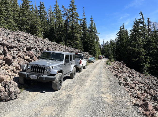
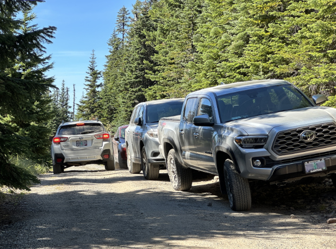
Overflow from the cramped existing trailhead routinely spills over to the narrow Road 1650 approach during the summer hiking season

Spillover parking on this section of Road 1650 is only unsafe for passing vehicles, it also impacts a resident Pika population living in these talus slopes

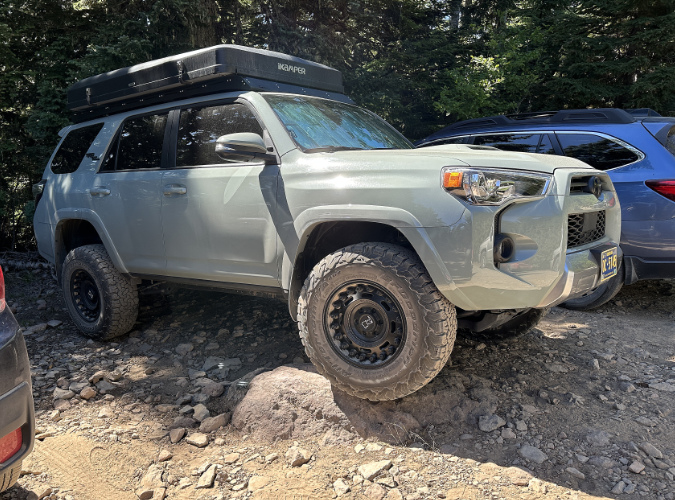
Because the existing trailhead was never designed or graded as a parking area, visitors must navigate large boulders and deep pits to find parking

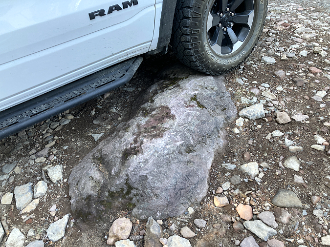
The scars on this boulder are testimony to the real damage caused by the lack of an improved parking surface at the existing Vista Ridge trailhead

The constrained, chaotic parking at the Vista Ridge Trailhead and resulting overflow on busy weekends is frustrating enough for visitors, but it also creates a safety problem for emergency response. This trailhead provides the best access to the northern part of the Mount Hood Wilderness, yet there is often no way to turn a vehicle around in summer, much less park a fire truck or ambulance here.

The overflow parking on the narrow access road is not only stressful an potentially dangerous for visitors to navigate, it also creates an access problem for larger emergency vehicles attempting to reach the trailhead

This visitor was forced to back nearly 1/4 mile down the access road after reaching the full parking lot and overflow shoulder parking that left no room to turn around

The origins of the short trail connector from today’s trailhead to the historic Vista Ridge Trail has unclear origins, it appears to have been built between 1963 and 1967, and it was clearly intended to replace the northern portion of the Vista Ridge Trail – the section that has since been restored as the Old Vista Ridge Trail.  

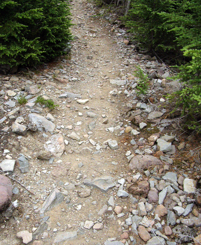
While most of the short connector trail is a well-constructed and graded route through dense forest, the first 200 yards are a miserable, rocky mess where the “trail” is really just a rough track that was bulldozed for a planned extension of the logging spur, but never fully graded. This sad introduction to the wonders that lie ahead is a frustrating chore to hike – and an ankle-twisting nightmare to re-negotiate at the end of your hike. 

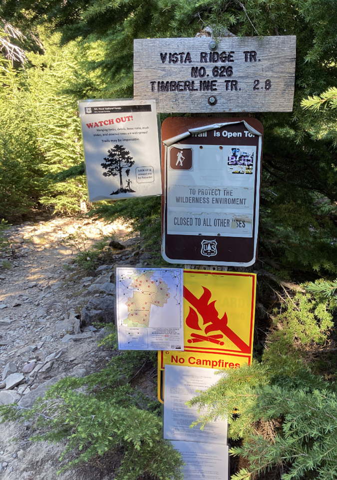
This signpost is the sole “improvement” at the Vista Ridge trailhead, leaving much room for improvement at what has become one of Mount Hood’s most popular trailheads

The first 1/3 mile of the Vista Ridge trail follows an abandoned, partially constructed section of logging spur that has significant surface and drainage problems that also leave much room for improvement as the gateway to this popular area

Add to these trailhead and trail condition woes an ongoing lack of proper signage to help people actually find Vista Ridge, and you have a discouraging start to what should be stellar wilderness experience for visitors – many from around the country and even the world. Thus, the following: a proposal to finally fix these issues at Vista Ridge and give this sub-par portal into the Mount Hood Wilderness the attention it has long deserved.

The Proposal…

The problems that plague the existing Vista Ridge Trailhead all stem from its accidental location on the steep mountainside. As a result, there is no way to safely accommodate needed parking, a turnaround or other trailhead amenities in the current location. The good news is that flat ground lies about 1/2 mile away, where Road 1650 passes an already disturbed site that was part of a recent logging operation.

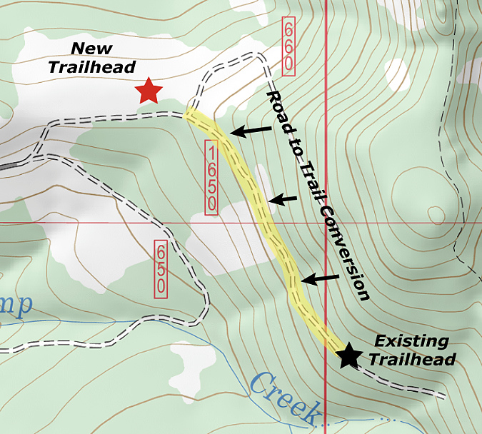
This map shows the proposed new trailhead site – roughly 1/2 mile northwest of the existing trailhead – and the section of existing road (highlighted in yellow) that would be converted to trail

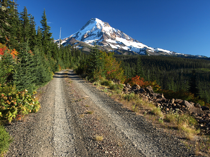
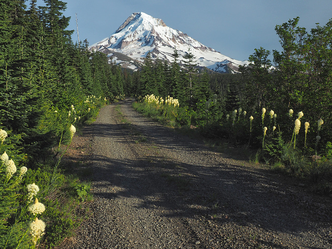
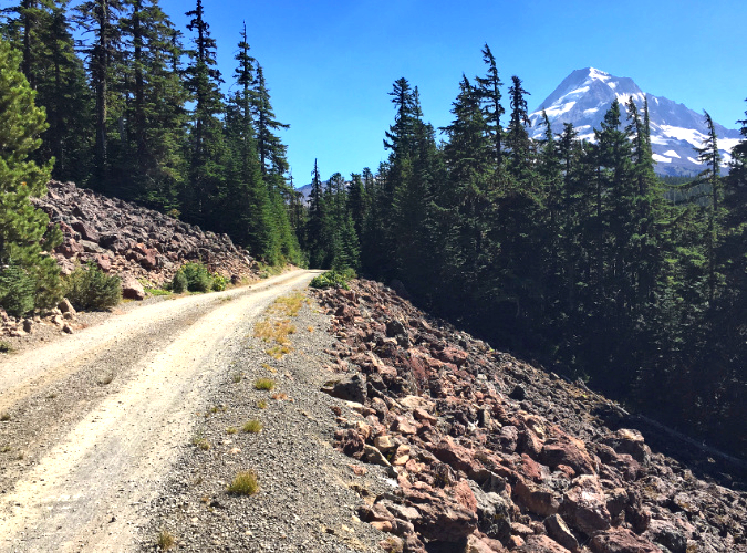
To make this new location work, the section of Road 1650 from the proposed new trailhead to the old (highlighted above in yellow) would be converted to trail. Normally, adding a half-mile of converted road to a hike would be a minus, but this segment of Road 1650 is stunning (see below), with spectacular views of Mount Hood. The talus slopes that provide these views are also home to colonies of Pika that provide their distinctive “meep!” as you pass through – something that can’t be appreciated from a car.

Converted roads don’t always make for great trails, but the approach to the existing Vista Ridge trailhead is exceptionally scenic and would make for a fine gateway trail to the Mount Hood Wilderness

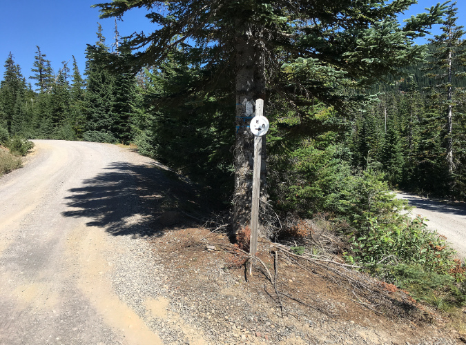
The first step in creating the new trailhead (and even without the new trailhead) would be restored signage to help visitors find their way from Lolo Pass Road to Vista Ridge, especially at the confusing fork (below) located just short of the proposed trailhead.

Finding the Vista Ridge trailhead is a challenge. The signpost at this crucial fork just below the trailhead had lost its sign in this view from two years ago, but the entire post has since disappeared. A new trailhead would include restoring directional signage to help visitors navigate the route

Next up, the obvious spot for the new trailhead (below) is a yarding area from a logging operation that was impacted more recently with a nearby thinning project. Dirt logging spurs radiate in all directions from this cleared area, allowing for new trailhead parking to incorporate these already impacted areas to minimize environmental impacts.

The proposed new trailhead site was previously disturbed with a logging operations

Until recently, the proposed new parking area faced a wall of trees to the south, but a tree thinning project on the opposite side of Road 1650 has suddenly provided a Mount Hood view (below). The purpose of the thinning was to enhance forest health by removing smaller, crowded plantation trees to promote huckleberries in the understory – an important first food harvested by area tribes. 

Should the huckleberries thrive as planned and bring berry harvesters to the area, this could be another benefit of providing trailhead parking here. For now, the thinning just provide a sneak-peak at the mountain that lie ahead for hikers or a backdrop for people using picnic tables at the trailhead (more about that in a moment).

The proposed new trailhead is directly across Road 1650 from a recently thinned area

It looks pretty grim now, but the tree thinning project across from the proposed is intended to spur the huckleberry understory to allow for berry harvesting… eventually

The concept for the new trailhead parking is to use an old dirt logging spur that splits off the Vista Ridge Road as the entrance to the parking loop. The existing Road 1650 would be closed and converted to trail from this point forward. The logging spur is shown on the left in the photo below, along with the portion of Road 1650 where the trail conversion would begin. The existing trailhead lies about 1/2 mile from this point.

The existing road conversion to trail would begin here, with the new parking access following the logging spur on the left

Roughly 200 yards beyond the proposed trailhead, the views open up along existing Road 1650 where it crosses the first of two talus slopes (below). This is one of those “wow!” spots that comes as a surprise to hikers as they drive to the existing trailhead. The right half (downhill) in this converted section of the existing road would be retained as trail, the left (uphill) side would be decommissioned.

The final 1/2 mile of Road 1950 is scenic in all seasons, with Beargrass blooms in early summer and brilliant fall colors emerging by late summer

How does this work? The decommissioning of the uphill half of the existing road could be accomplished by upturning the surface with a backhoe – a process used to decommission miles of logging roads in recent years around Mount Hood country. The scene below is a typical example from a decommissioned road near Black Lake, located a few miles north of Mount Hood, on Waucoma Ridge. In this example, the goal was to completely retire the road, though the same method can be used to convert a road to single-track trail.

This road near Black Lake was decommissioned in the early 2000s and is gradually revegetating

Just beyond the first “wow!” talus viewpoint, the mountain comes into view once again along the existing Road 1650 as it crosses the second talus slope, just before reaching the existing trailhead. This slope here is unique in that it consists of red lava (below), a somewhat uncommon sight around Mount Hood that adds to the scenic beauty. Like the first talus section, this slope is also home to Pika colonies, adding to the trail experience. The right half of the converted road would be retained as trail here, and the left (uphill) side decommissioned.

Without overflow parking blocking the view, the final stretch of the access road passes this scenic and somewhat unusual talus slope composed of red lava rocks

Beyond the practical benefits of moving the Vista Ridge trailhead to make it safer and more functional, there are also compelling conservation arguments for the move. First, it would allow the Forest Service to retire another segment of old logging road – and though only 1/2 mile in length, in its current state it nonetheless contributes to the massive backlog of failing roads built during the logging heyday that the agency can no longer afford to maintain.

There are also noisy (meep!) wildlife benefits, as the Pika colonies living in both talus slopes are likely impacted by the noise, vibration and pollution that the steady stream of hikers bring as they drive – and increasingly park – along this scenic section of road.

Because most road-to-trail conversions around Mount Hood have been driven by wilderness boundary expansions, washouts or other abrupt events, there aren’t many examples of intentional conversions to point to. Instead, most conversions are simply abandoned roadbeds that nature is gradually reclaiming, like the section of the Elk Cove trail shown below.

The lower section of the Elk Cove Trail follows an old logging road that was simply closed, but not formally converted to trail

Beyond often being a hot, dusty trudge for hikers looking for a true trail experience, old roads that aren’t intentionally converted also lack proper trail design features for stormwater runoff and drainage, as seen on the opening section of the existing Vista Ridge trail. Abandoned roads also lead to thickets of brush and young trees as the forest moves in, making maintenance of trails that follow these routes a constant chore. It simply makes more sense to undertake true conversions from road to trail on these routes in the long run.

Recently converted road-to-trail at Salmon Butte (Oregon Hikers)

There are very good examples of intentional conversions, and among the best is the Salmon Butte Trail, where the Forest Service decommissioned a section of road in 2010 and intestinally created meandering trail through mounds of earth along the old roadbed to further conceal evidence of the road from hikers. Just a few years after the conversion (above) the signs of the old road were already fading fast, creating a more authentic trail experience. Self-sustaining drainage features were also incorporated into the design. The same approach could be applied to decommission both the final road section and the current trailhead parking area at Vista Ridge.

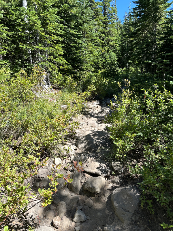
Finally, improvements to the opening stretch of the existing Vista Ridge trail that also follows old roadbed is in order. This short section (below) is typical of a road that wasn’t property converted to trail, and as a result suffers from serious runoff erosion during the winter and spring. The result is a cobbled mess that is hard on ankles and morale as hikers set off for their hike. 

If this looks like a dry streambed, that’s because it is! It’s also the opening 1/3 mile section of the Vista Ridge Trail where it follows an abandoned, partly constructed road bed that becomes a running stream in the winter months

There are some basic trail drainage features that could keep this section from becoming a river during the wet months. Next, some of the most miserably rocky sections could be covered with gravel – but from where? It turns out the Forest Service left a couple of large piles (below) where today’s trailhead is located when work on extending this road was abandoned more than 50 years ago. 

Northwest Youth Corps crew did just this about a decade ago, but because the drainage problem wasn’t addressed, most of that first layer of gravel has been washed away and their efforts long since erased.There are some basic trail drainage features that could keep this section from becoming a river during the wet months. Next, some of the most miserably rocky sections could be covered with gravel – but from where? It turns out the Forest Service left a couple of large piles (below) where today’s trailhead is located when work on extending this road was abandoned more than 50 years ago. 

Let’s put this leftover pile of gravel from the logging days to work!

How a parking loop would work…

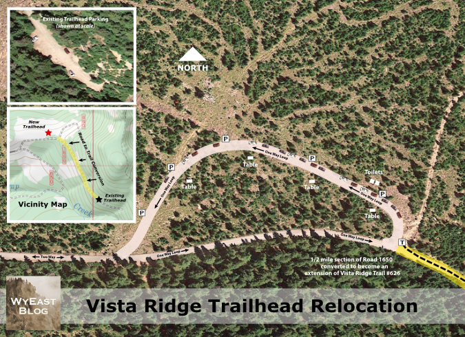
Putting it all together, this proposal (below) shows how the new trailhead parking could be accomplished as a parking loop, as opposed to a parking lot. The inset images include an aerial image of the current, dead-end trailhead parking at the same scale as the proposed loop map for direct comparison. The topographic inset map shows the proposed trailhead and parking loop, along with the proposed road conversion in relation to the existing trailhead (be sure to click on “large version” link below for a closer look!) 

[click here for a large version]

Why a loop? First, it’s the least impactful on the environment. Instead of clearing a wide area to provide room for cars to back in and out, the parking is simply provided along the right shoulder of the loop – like parallel parking in the city – but with nature left intact inside the “donut hole” of the loop.  

In this case, the loop would follow a series of old logging skid roads, further minimizing the impact on the forest. But perhaps most importantly from an environmental impact perspective, adding a couple hundred yards of new loop road here would allow a half-mile section of existing road to be retired and converted to trail, a clear net gain, overall.

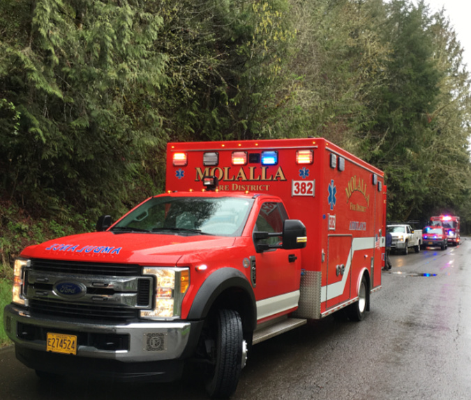
Busy trailheads call for amenities like improved signage and toilets – and space for emergency vehicles to have access. These vehicles were called to the trailhead where a hiker was injured in the Clackamas River area – fortunately, the trailhead was located along a paved forest road with ready access and space to turn around

Another important benefit of a loop is to provide a much-needed turnaround at the end of a dead-end road for forest rangers and emergency responders. This might be the most compelling reason to fix the Vista Ridge trailhead sooner than later, as today’s overflowing dead-end parking area is a disaster waiting to happen should fire trucks or other emergency vehicles need to access the Vista Ridge trail on a busy weekend.  

Designing the parking loop…

From a user perspective, a parking loop is efficient and easy to navigate. The one-way design ensures that people arriving here would always reach the closest available parking spot to the trailhead first. This is the opposite of the current dead-end trailhead, where hikers arriving later in the day often park in less-than-safe spots along the access road when they see overflow shoulder parking occurring, for fear of not being able to turn around in the cramped trailhead lot – often after spaces have opened up in the main parking area.

As shown in the parking schematic (above), the relocated trailhead would accommodate up to 30 vehicles along a 1,100-foot-long loop – or about three times what the current dead-end parking area allows. The loop would be gravel-surfaced, 16-feet wide and designed to flow one-way in a counter-clock-wise direction, with shoulder parking allowed on the right side.

The new trailhead could also be a Northwest Forest Pass site with the required toilets, picnic tables and welcoming signage for visitors, something that the space constraints at the current lot would not allow. These could be located in the “donut hole” center of the loop. Making this a forest pass site would also address one of the more dire needs at Vista Ridge – a toilet! The heavy use at the trailhead and steep terrain has turned a couple of more accessible trees adjacent to the parking area into de-facto toilets, with unpleasant results. 

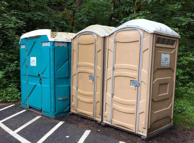
Industrial toilets at a busy trailhead in the Columbia Gorge – functional, but not exactly a complement to the outdoor experience!

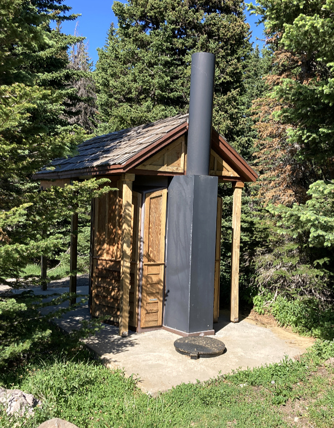
The Forest Service has upped its game with pit toilets in recent year at some Northwest Forest Pass sites, replacing industrial porta-potties (above) that are the last thing you want to see as you set off for a wilderness experience with more aesthetic toilets, like the one at the High Prairie trailhead (below), just east of Mount Hood. This would be a great choice for a new trailhead at Vista Ridge.

Rustic toilet design at the High Prairie trailhead, gateway to the Badger Creek Wilderness

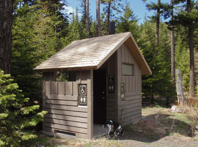
The are also more substantial examples around Mount Hood that are wheelchair accessible, like this one at the Billy Bob snow park near Lookout Mountain (below).

Accessible, rustic toilet design at the Billy Bob snow park near Lookout Mountain

Why an accessible toilet? Because there’s also an opportunity for the converted road section in this proposal to incorporate an accessible trail surface to at least one of the talus viewpoints along the way – like this well-photographed spot along the existing road (below), located just a few hundred yards from the proposed trailhead. 

This view is from the shoulder of the current access road, just a few hundred yards from the proposed new Vista Ridge trailhead. Converting the road to an accessible trail design and providing some simple amenities (e.g., a picnic table) would make this a welcome new destination for people with limited mobility or who use mobility devices

Accessible trail opportunities are in woefully short supply around Mount Hood, an unacceptable reality. There’s room at this viewpoint for an accessible picnic table, benches and perhaps interpretive signage — allowing for the extended Vista Ridge trail to serve a wider spectrum of visitors and abilities, not just able-bodied hikers heading into the wilderness.

What would it take?

There are two main parts to this proposal: (1) building the new parking loop and (2) converting the final half-mile section of Road 1650 to become a trail. The first part – the parking loop, pit toilets, picnic tables, signage and other trailhead amenities — would have to be built by the Forest Service. However, this work could likely be fast-tracked as an exemption under the environmental review process, since it involves relocating an existing parking area and would result in much less roadway than the current trailhead. That environmental analysis would also have to be completed by the Forest Service.

The second part of this proposal — the road-to-trail conversion — could be completed as a partnership between the Forest Service and volunteers, like Trailkeepers of Oregon (TKO), who already maintain the Old Vista Ridge and Vista Ridge trails. The Forest Service could complete the rough backhoe work to reduce the converted road to single track, and volunteer crews could finalize the tread and drainage on the converted trail. 

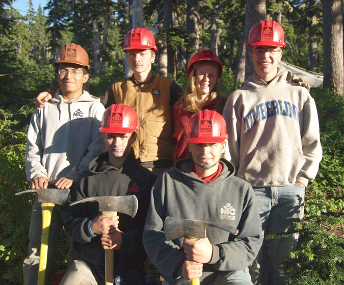
Volunteers could also install viewpoint benches and picnic tables for an accessible trail and trailhead signage at the new parking area. Some of the heavier work could be contracted to organizations like the Northwest Youth Corps, which has a long history of trail work around Mount Hood.

Northwest Youth Corp crew working on the Vista Ridge Trail

How could this concept move forward? Funding is always a concern for the Forest Service, but there’s also unprecedented funding coming online right now for the federal agencies from the 2022 Inflation Reduction Act. This project could compete for these funds, many of which are competitive, especially if it includes an accessible trail. Creating a new Northwest Forest Pass site would also generate revenue (in theory) to help maintain the new trailhead. 

Volunteer crews from TKO are already working from this trailhead every summer to maintain the Vista Ridge and Old Vista Ridge trails. The over-crowding at the existing trailhead has already made their work more difficult, so contributing to the trail conversion effort would be a natural fit for TKO volunteers to be part of.

The author on the Old Vista Ridge trail

In the meantime, if you want to experience the wonders of Vista Ridge and Old Vista Ridge, the best plan is to avoid this trailhead on Fridays, Saturdays and Sundays from July through mid-September. If you must go on those days, then it’s not a bad idea to simply park on the shoulder of Road 1650 where this new trailhead is proposed, and simply walk the scenic final half mile to the current trailhead. You’ll get mountain views, hear the local pikas calling out, avoid the stressful chaos of the existing trailhead – and with any luck, you’ll be getting a preview of things to come!

__________________

Tom Kloster | August 2023

White River Falls 3.0

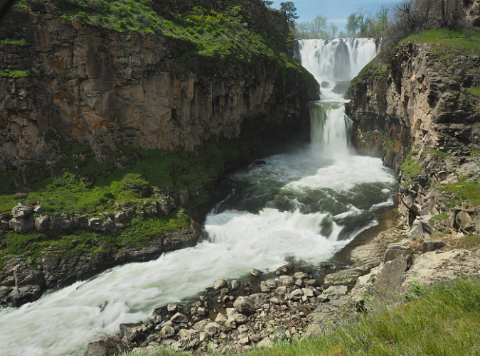
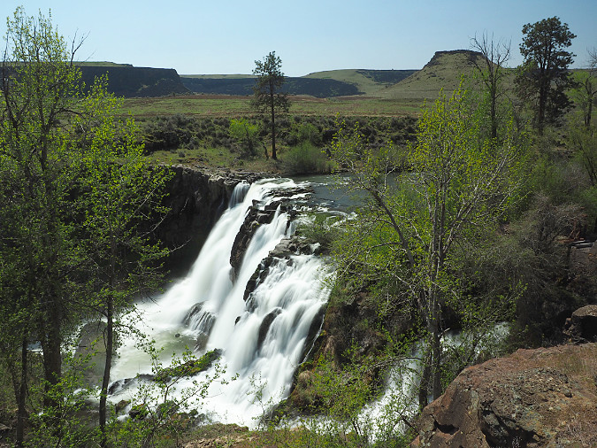
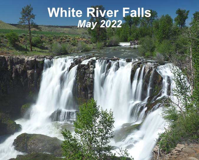
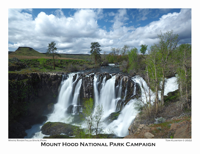
White River Falls during spring runoff

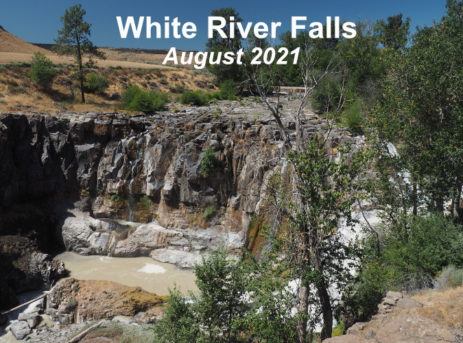
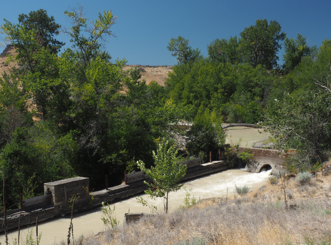
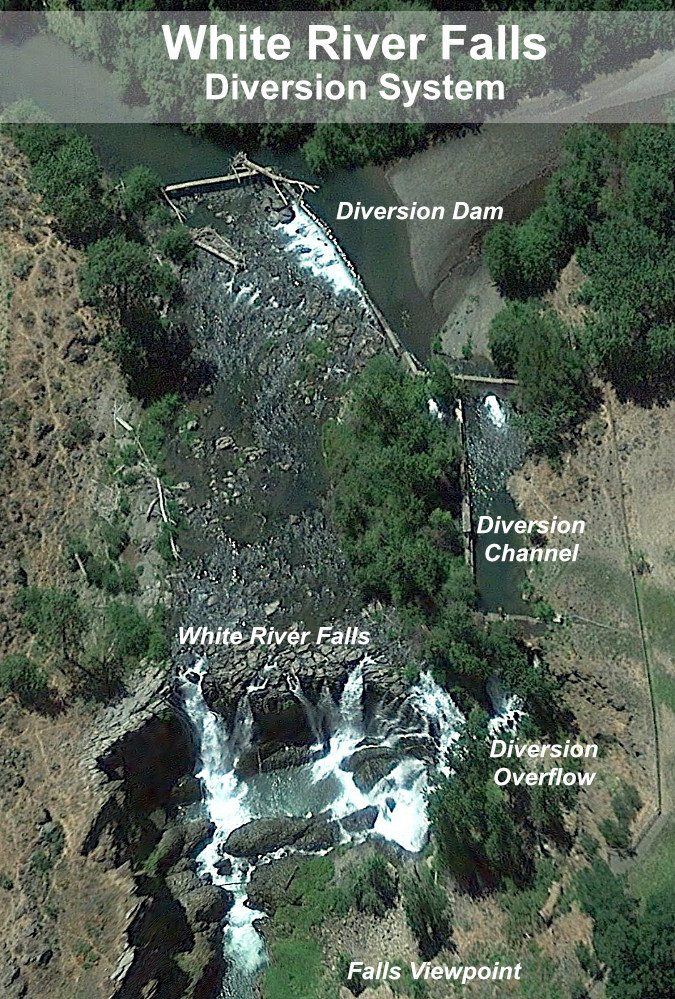
Every year, a growing number of summer visitors flock to White River Falls State Park to witness the spectacle pictured above, only to find a naked basalt cliff where the falls should be! The spring runoff has long since subsided by mid-summer, and field irrigation in Tygh Valley also draws heavily from the tributary streams that feed the river during the dry season. Worse, part of what’s left when this federally protected Wild and Scenic River finally reaches the park is diverted by a century-old waterworks into a side channel that bypasses the main falls. It’s a sad sight compared to the powerful show in winter and spring, but it doesn’t have to be this way.

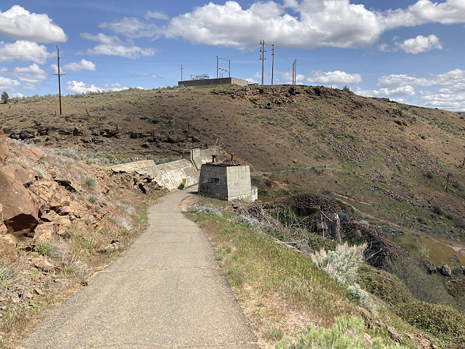
Many of these same visitors hike down to see the historic, century-old powerhouse at the base of the falls that once used the diverted river water to spin some of Oregon’s earliest hydroelectric turbines. Though mostly in ruins, the site is fascinating – yet the trail to it is a slick, sketchy goat path coming apart at the seams that hikers struggle with. This short hike doesn’t have to be this way.

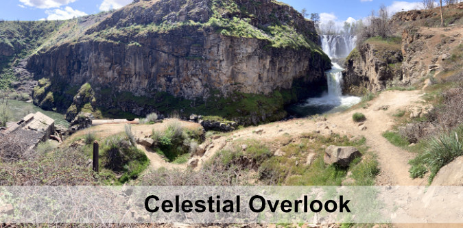
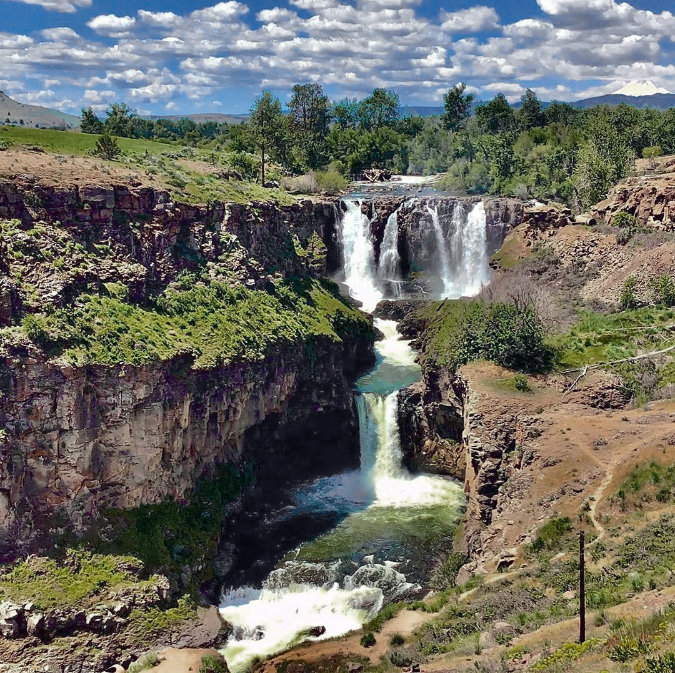
The hidden lower tier and punchbowl is called Celestial Falls

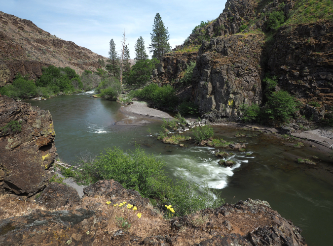
Lower White River Canyon

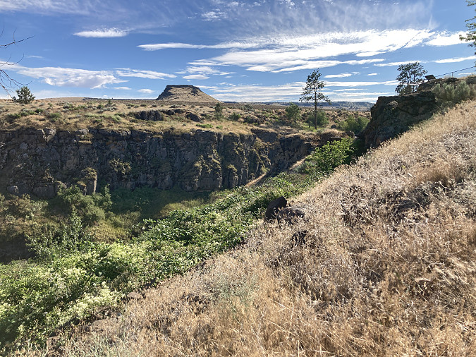
Some hikers push beyond the historic powerhouse to the lesser-known lower falls, and then still further, to a dramatic view into the lower White River canyon. Here, the river finally has carved a rugged path to its confluence with the mighty Deschutes, just a few miles downstream. It’s a striking and beautiful riverside hike, but the “trail” consists of a maze of user paths that are gradually destroying the drifts of wildflowers along the canyon floor. This trail doesn’t have to be this way, either.

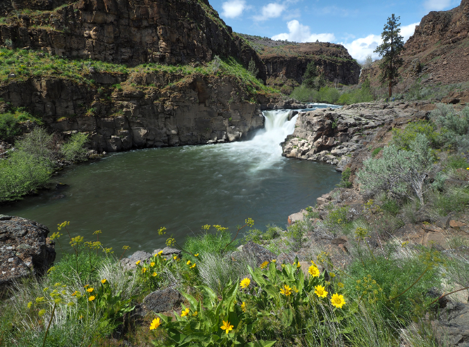
Lesser-known Lower White River Falls

In recent years, White River Falls State Park has also become a popular stop for cyclists touring the route from Maupin to Tygh Valley, then looping back through the Deschutes River canyon. While the park has an excellent restroom and day-use picnic area that would make for a terrific stopover, overnight camping is not allowed, even for cyclists camping in tents. This, too, does not have to be this way.

The increased popularity has begun to noticeably wear on the park. The good news is that in the past couple years Oregon Parks and Recreation (OPRD) rangers and the park’s  dedicated volunteer park hosts have stepped up their efforts to care for the park infrastructure and get a handle on vandalism (mostly tagging) that had plagued the historic powerhouse. Still, much more is needed to unlock the amazing potential this park holds as a premier destination. It’s time to reimagine White River Falls. 

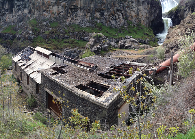
Historic White River Powerhouse just downstream from the falls

[click here for a larger view]

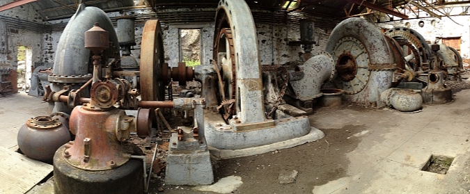
Turbines inside the powerhouse a few years ago, before vandalism began to take a heavy toll. Oregon State Parks has since closed off entry with heavy barriers

[click here for a larger view]

As it stands, the park lacks a comprehensive vision for how its natural and historic wonders can best be protected, while still keeping pace with ever-growing numbers of visitors. It’s a surprisingly big and mostly undiscovered place, and an updated blueprint could achieve both outcomes: protecting and restoring the natural and historic landscape for future generations, while also making it accessible for all to explore and enjoy. While the park includes a surprising amount of backcountry now, White River Falls also holds the potential to become a much larger park that restores and showcases the unique desert landscape and ecosystem found here.

This article includes several proposals for new trails and campsites to better manage the growing demand and provide a better experience for visitors, expanding the park to better protect the existing resources, and even a re-plumbing of the waterworks to allow White River Falls to flow in summer as it once did before it was diverted more than a century ago. 

An Unexpected Past

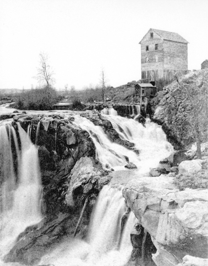
Grist mill at White River Falls in the late 1800s. This rare view reveals a northern cascading segment of the falls to have been part of the natural scene, and not created by the power plant diversion channel that was constructed in the early 1900s.

White River Falls was never envisioned as a park by the white migrants who settled in Tygh Valley and Wasco County in the mid-1800s. In their day, waterfalls were viewed mostly as obstacles to river navigation or power sources to run mills. The falls surely had a more spiritual and harmonious value to native peoples who had lived, fished and gathered along its banks for millennia before white settlers arrived. The Oregon Trail passed through Tygh Valley, and soon the new migrants had cleared the valley and began to build irrigation ditches to bring water to the cleared farmland. By the late 1800s, a grist mill was built at White River Falls, powered by the falling water.

By the early 1900s, the grist mill was replaced with a much more ambitious project, and the abandoned hydroelectric plant we see today was constructed at the base of the falls in 1910. A concrete diversion channel was built where the grist mill stood, and a low diversion dam brought a steady flow from the White River into a series of pipes and penstocks that powered the turbines below. Power from the new plant was carried north to The Dalles, one of the earliest long-distance hydroelectric transmission projects in the country.

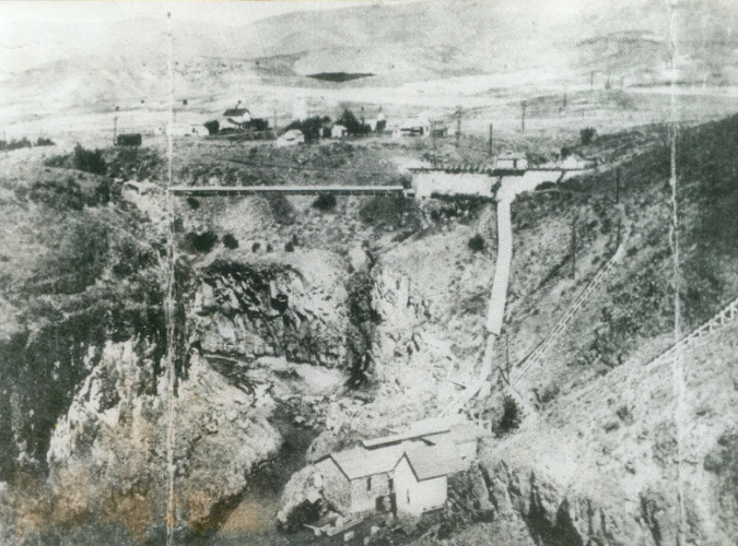
Aerial view of the White River Powerhouse and network of penstocks taken in the early 1900s. The group of structures at the top of the photo were located where today’s picnic area and restrooms are now. This photo also shows the concrete dam holding the settling pond, in the upper right. This structure still exists today. The diversion dam is partly visible at the left edge of the photo, with its diversion pipe leading first to the settling pond, then to the lower penstock pipe leading down to the powerhouse at the bottom of this photo.

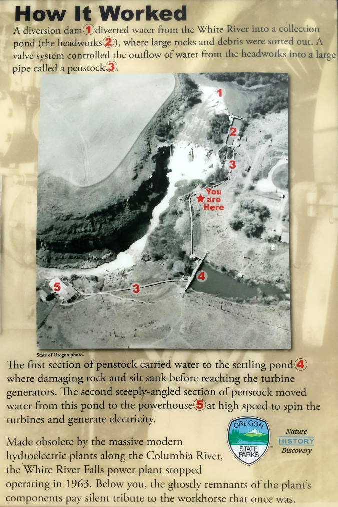
The White River is a glacial stream that flows from a glacier by the same name on Mount Hood’s south slope, just above Timberline Lodge. Because of its glacial origin, the hydro plant included a large settling pond to separate the fine, grey glacial till that gives the White River its name. The settling pond still survives today (albeit dry), along with the diversion dam and much of the pipe and penstock system. These features are all visible in the aerial photo (above) and described in the interpretive schematic (below) provided by Oregon State Parks.

[click here for a larger view]

After fifty years of operation, the powerhouse had become obsolete and fallen into disrepair, and by the early 1960s it was abandoned. Giant new dams on the Columbia and Deschutes rivers had long since eclipsed it, and the constant chore of separating glacial sediments from the river water made it costly to operate. 

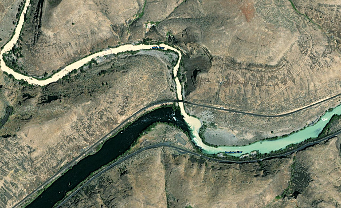
How white is the White River? This recent aerial view shows the White River flowing from the upper left corner toward its confluence with the Deschutes River, the wide, dark stream flowing from the lower left. When the crystal clear waters of the Deschutes mix with the silty glacial water of the White River during peak glacier melt in late summer, the result is a pale blue-green Deschutes River downstream from the confluence (flowing toward the middle right)

The site was an unlikely candidate for a new park, given the dilapidated buildings and pipelines scattered across the area. But thankfully, the raw power and beauty of White River Falls made the case for a second act as a public park and nature preserve borne from an industrial site. For many years, the reimagined White River Falls was simply the quiet “Tygh Valley Wayside”, and was way off the radar of most Oregonians. It only drew a few visitors and only the gravel parking area and main falls overlook were improved to a park standard.

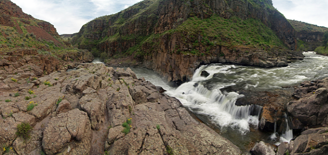
Panoramic view of Lower White River Falls during spring high water. The basalt bench to the left marks where flood events on the river have repeatedly overtopped this ledge, scouring the bedrock

The park had one (hopefully) final scare in its natural recovery just over a decade ago, when Wasco County pitched a new hydroelectric plant at the site, promising “minimal impact” on the natural setting. Thankfully, Oregon State Parks expressed major concerns and the proposal died a quiet death. You can read an earlier blog article on this ill-conceived proposal here.

Over the past two decades, growth in the Wasco County and increased interest from Oregon’s west side population in the unique desert country east of Mount Hood has finally put White River Falls on the recreation map. Today, the parking area overflows with visitors on spring and summer weekends, and the park has become a deservedly well-known destination. The rugged beauty of the area, combined with the fascinating ruins from another era make it one of Oregon’s most unique spots. These are the elements that define the park, and must also be at the center of a future vision for this special place.

A new vision for the next century: White River Falls 3.0

  1. New & Sustainable Trails

Weekend visitors skittering down the steep, slick path to the old powerhouse

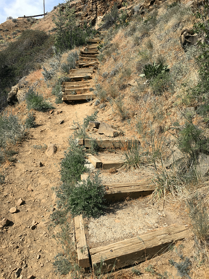
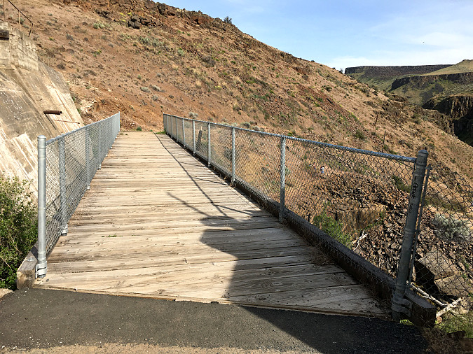
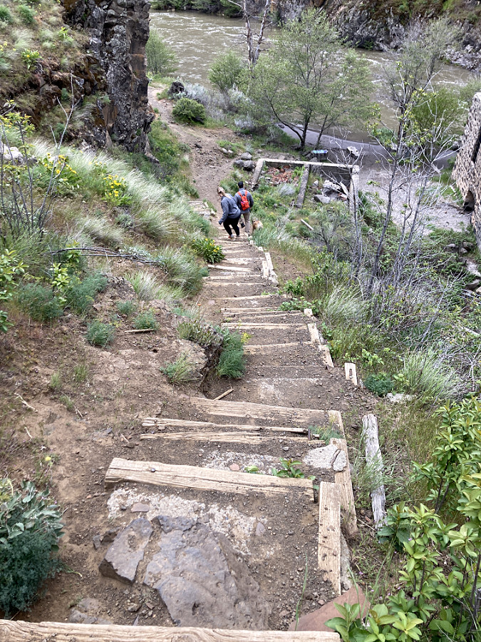
The trail into the canyon as it exists today is deceptive, to say the least. It beings as a wide, paved path that crosses an equally wide plank bridge below the old sediment pond dam. Once across, however, it quickly devolves. Visitors are presented with a couple of reasonable-looking dead-ends that go nowhere (I will revisit one of those stubs in a moment), while a much more perilous option is the “official” trail, plunging down a slippery-in-all-seasons (loose scrabble in summer, mud in winter) goat path. Still, the attraction of the river below — and especially the fascinating powerhouse ruins – beckon, so most soldier on.

Soon, this sketchy trail reaches a somehow steeper set of deteriorating steps, built long ago with railroad ties and concrete pads. And still, the river continues to beckon, so most folks continue the dubious descent. The “official” trail then ends abruptly at the old powerhouse, where a popular beach along the river is a favorite wading spot in summer. This is the turnaround spot for most visitors. The return up the steps and scrabble of the goat path is challenging in any season, but it’s particularly daunting in summer, when desert heat reflecting off this south-facing wall of the canyon is blazing hot.

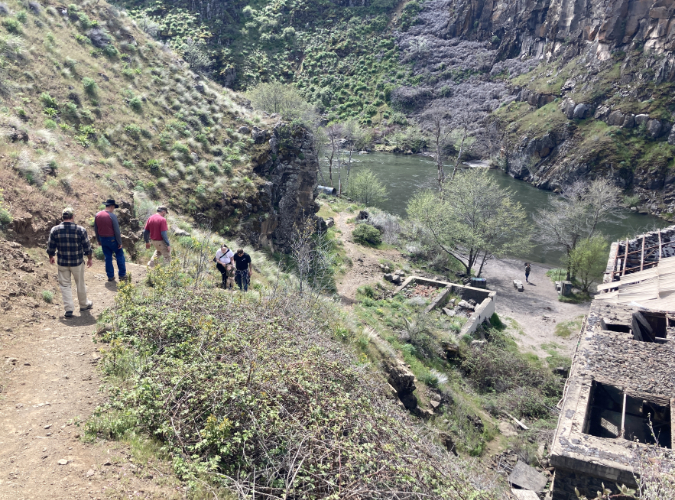
Hikers navigating the steep, deteriorating stairway section of the “official” goat path into White River canyon

Looking back at the loose cobbles and scrabble that make up the upper section of the “official” trail into the canyon. Two hikers at the top of the trail consider their fate before continuing the descent

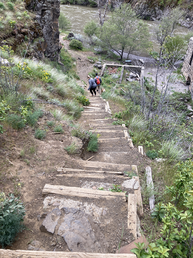
The stairway section has deteriorated enough that hikers are simply bypassing it, which is damaging the slope and causing the stairs to come apart still faster

The railroad tie steps were filled with poured concrete pads at some point, making this a very difficult repair job. In the long term, this section of the “official” trail simply needs to be bypassed with a properly graded route and the old goat path turned back to sagebrush

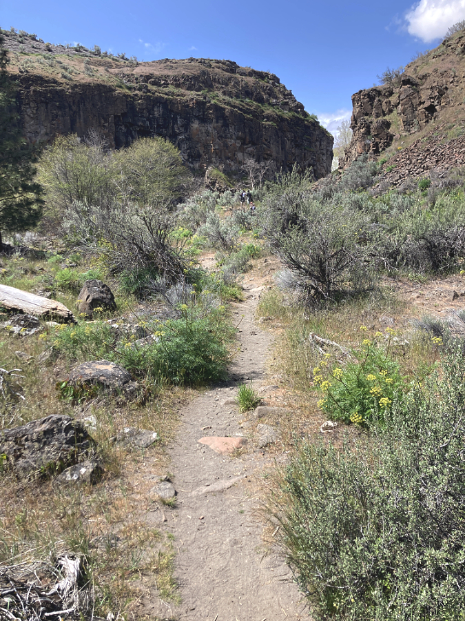
Beyond the “official” trail, a user path skirts a fenced river gauge, then slips through a patch of waist-deep sagebrush before dropping down to a beautiful streamside flat. Here, Ponderosa pine survive in the deep sand along the riverbank and rugged basalt cliffs soar above the trail. This path soon passes Lower White River Falls before ending at an impressive viewpoint looking downstream, where the White River tumbles another two miles through a deep canyon to its confluence with the Deschutes River.

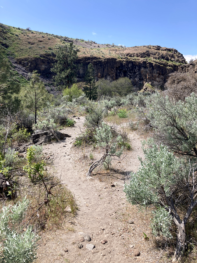
The “unofficial” trail below the powerhouse was little known just ten years ago, but today it is quickly devolving into a tangle of user paths as an increasing number of visitors push further into the canyon. The flat canyon floor is quickly becoming a maze of these social paths, greatly impacting the desert wildflowers that grow here.

In contrast to the “official” trail, the lower “unofficial” trail rambles at a pleasant grade along various user paths through a beautiful canyon floor framed by towering basalt cliffs

After flying under the radar, the lower canyon has been “discovered”, with a maze of new social paths forming in the past few years that are gradually expanding and destroying the wildflowers that grow here

So, how to fix this? The first step is to improve both the “official” and “unofficial” trail sections to something resembling proper trails. The official route is a tall order, and in the long term, it really needs to be retired and replaced with a correctly graded trail that can be safely navigated and doesn’t trigger heart attacks for visitors making their way back out of the canyon. In the near term, however, simply repairing the damaged stairs and adding a few more in a couple of especially steep sections would buy some time until a better trail can be built.

The unofficial, lower trail is a much easier fix. It simply needs a single route with improved tread and modest stone steps in a couple spots, while also retiring the many braided user paths that have formed. The new interest in the lower trail underscores a more significant need, however, and that’s the main focus of this trail proposal: this hike is simply too short to be satisfying for many visitors.

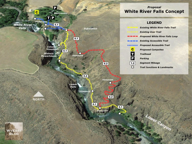
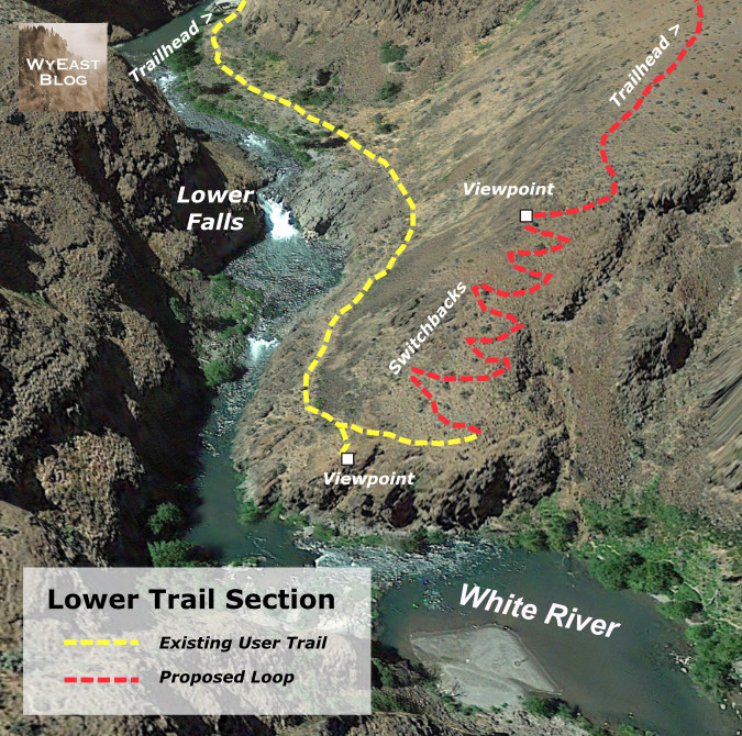
The solution? Build a return loop from the current terminus of the lower, unofficial trail that traverses the canyon rim back to the trailhead. This simple concept is shown in the map, below.

[click here for a larger view]

The proposed return trail (shown in red) would be approximately one-half mile long, making the new loop about one mile in length – short enough for families and casual hikers, yet long enough to make for a more immersive experience. The loop would also allow hikers to avoid climbing back up the goat path section of the existing trail, buying some time until that segment can be rebuilt. The upper end of the proposed loop would actually follow the well-defined game path that many hikers assume to be the main trail where it now connects at the top of the “official” goat path.

Another surprise feature of the loop? The new route would not only provide spectacular views into the canyon and its waterfalls from above, but Mount Hood also appears on the horizon, rising directly above White River Falls. While most hikers would likely continue to first follow the existing trail to the old powerplant, then complete the new loop from there, the rim trail could also work in reverse for hikers looking for big views without the challenging up-and-back climb and steep steps on the existing trail. The upper end of the new rim trail would traverse at a nearly level grade to a spectacular viewpoint (shown on the map, above) that would be a fine turnaround destination just one-quarter mile from the trailhead.

One important detail of this trail concept that should be completed in the near-term is a formalized spur trail to the Celestial Falls overlook. This is an irresistible, yet extremely dangerous overlook just off the main goat path section of the “official trail”, with abrupt, vertical drop-offs and another maze of sketchy social trails. 

The stunning overlook at Celestial Falls is a scary mix of ever-expanding social trails and abrupt vertical cliffs that needs near-term attention to be stabilized and made safer for hikers

[click here for a larger view]

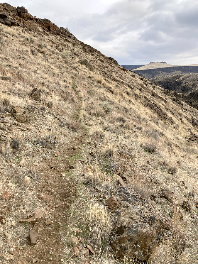
Much of the new return trail would follow game paths (like this one at the upper end of the proposed trail) that already traverse above the rim of the canyon.

The new rim trail would bring hikers to this spectacular birds-eye view of White River Falls and Mount Hood on the horizon (Oregon State Parks)

The crux to completing the new loop is a short section of new trail that would climb from the current terminus of the “unofficial” trail to the rim of the canyon, where the new route would then traverse at a nearly even grade back to the trailhead. The crux section follows a sloped ridge through a gap in the canyon rimrock, as is shown in the close-up map (below). 

[click here for a larger view]

The end of the user path in the lower canyon marks the start of the proposed new trail, where a set of switchbacks would ascend the slope to the left to the canyon rim and return to the trailhead

The crux section would require some switchbacks and thoughtful trail planning, but it is no steeper than the terrain covered by the “official” trail at the start of the hike. What would it take to make this trail vision happen? More on that toward the end of this article.

2. Accessible Trails

Did you know that rural Oregon has a higher percentage of elderly and mobility limited folks in its population than the state’s major urban areas? Yet, even in our most urban areas, Oregon is woefully short on accessible trails, and the gap is even greater away from major population centers. At White River Falls, there are building blocks for a new accessible trail system that could be phased in over time to become among the finest in the state.

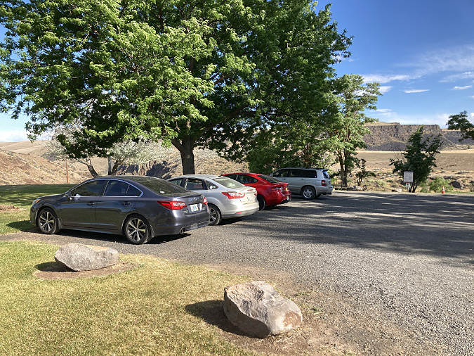
The existing parking area is gravel and would need at least a couple paved spots to be considered accessible

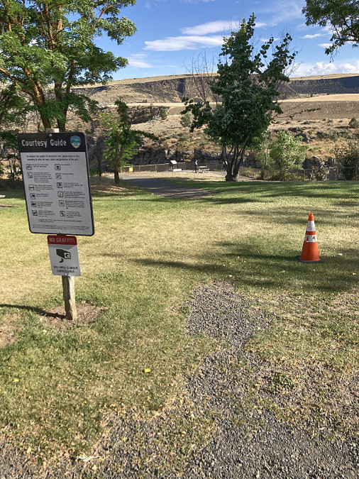
This paved path starts (inexplicably) about 50 feet from the edge of the gravel parking area and leads to the fenced, main viewpoint (in the distance)

Currently, the parking area and initial approach to the main falls overlook is a combination of gravel and mowed lawn that falls short of an accessible. Just a short distance from the gravel parking area, a paved path leads to the fenced overlook of the falls, where interpretive signs tell some of the unique history of the area. It wouldn’t take much to make this viewpoint fully accessible.

The wide plank bridge that crosses below the old settling pond dam (left) and marks the east end of the paved trail system at White River Falls. The “official” goat path down to the old powerplant begins at the far end of the plank bridge

From the main viewpoint, paved routes head off on two directions. The wide, gently sloping main route heads east, across the plank bridge and then ending abruptly where the goat path section of the main trail begins. Like the main viewpoint, this section could be curated to make the terminus at the bridge more interesting as a stopping point, including history of the concrete settlement pond dam that rises directly above the bridge and some of the penstock pipe remains that still survive here. This is also the point where signage marking the hiker trails ahead is sorely needed – including some cautions about the state of the goat path trail.

The west end of paved trail system ends here, at a profile view of the falls

Another paved trail spur heads west from the main viewpoint, along a fenced cliff to a fine profile view of the falls. The pavement ends here, and a user path continues along the fence to a view of the diversion canal that once fed river water into the old hydro plant. This section of the paved trail system is somewhat narrow and uneven, but it could also be improved with some relatively minor work, including improving the surface and creating a more intentional viewpoint of the falls.

From the end of the paving, the fencing continues west to a view of the diversion channel (center)

New interpretive signage could also be added here to tell the story of this part of the park, since this is where the original grist mill also stood. The views here include Tygh Valley, and new signage could also describe the natural history of the White River and the native peoples who lived here before white migrants settled in the area. 

Profile view of White River Falls from near the end of the paved section of the west spur. This is a fine viewpoint that could be improved to be a more accessible destination with interpretive stories about the surrounding area

Oregon State Parks has provided picnic tables at the main viewpoint in the past, but to make the existing paved routes more accommodating as accessible trails, several benches along the way would be an important addition. This is perhaps the most overlooked feature on accessible trails, yet they are especially important in a hot desert environment. The National Park Service sets the standard on this front in their parks across the American Southwest, where resting spots are prominent on all trails, especially where a spot of shade is available.

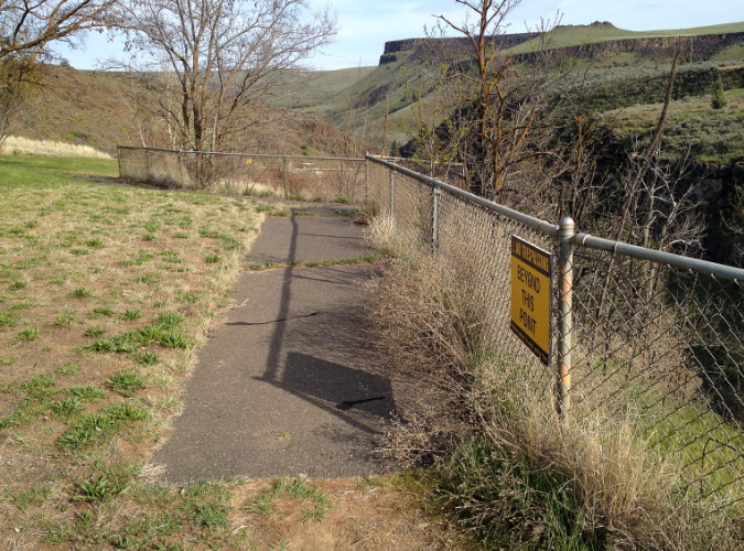
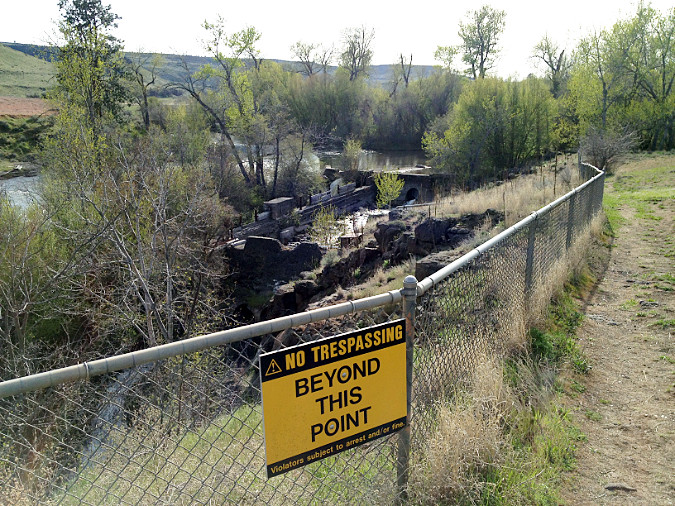
Thinking more boldly, a new accessible trail spur could be added along the nearly level grade below the main viewpoint that once carried water in huge steel pipes. Most of the pipes are gone, but a few remain to tell the story of the old power plant. This grade leads to a front-row view of the main falls that is close enough to catch spray during the spring runoff. It’s also an area where park visitors chronically (but understandably) ignore the many “AREA CLOSED” signs to take in this spectacular view. 

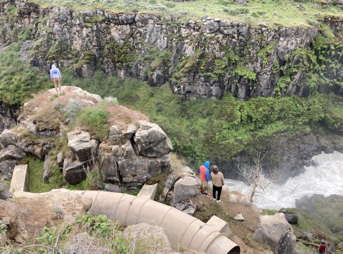
Fences and warning signs are no match for these Millennials, but they are right about the view: this lower viewpoint ought to be a spot that more people can enjoy

In this case, the scofflaws are right: this viewpoint ought to be open to the public, and an accessible trail spur would expand that to include all of the public. This proposed accessible spur is shown as the dotted blue line in the trail concept map (above).

Looking east along the existing paved spur to the settling pond dam and plank bridge; the proposed accessible spur trail to the lower falls viewpoint would follow a well-established bench that once held penstock pipe (now covered in blackberries in the lower right)

Another view of the proposed accessible trail spur from the plank bridge, looking west, and showing the blackberry-covered bench that the trail would follow. White River Falls is just beyond the rock outcrop in the upper right

There’s are chunks of penstock pipe along this route, and maybe these could become part of the interpretive history? This entire spur trail concept is possible only because the grade was blasted from basalt for the penstock pipes, which is a great way to connect the industrial history of the site to the park that exists today. From the lower viewpoint, those folks who we rarely provide great accessible trail experiences for would be rewarded with an exhilarating, mist-in-your-face view of White River Falls.

3. Walk-in Campsites

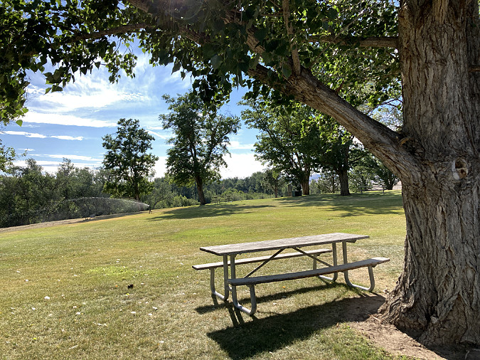
The word is out to cyclists that White River Falls is a perfect lunch spot on touring loops from Maupin and Tygh Valley. The restrooms were recently upgraded, the water fountain restored to include a water supply for filling bottles and there are plenty of shady picnic tables under the grove of Black Locust  and Cottonwood trees that surround the parking and picnic areas.

A growing number of these cyclists are “bikepackers” camping along a multi-day tour, often starting from as far away as Portland, and there’s new interest in bike-in campsites for these folks. Unlike a traditional car-camping format, these campgrounds require only a network of trails and simple tent sites with a picnic table. 

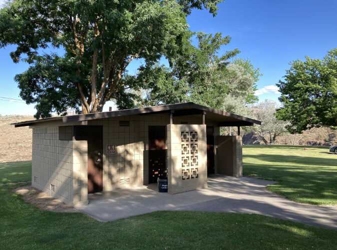
The modern restrooms at White River Falls State Park have been recently renovated to be accessible and are in top condition

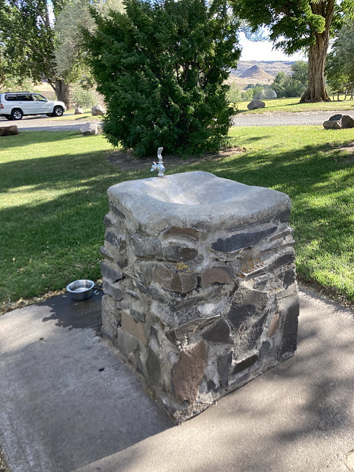
This newly restored water fountain has a handy spigot on the back for filling water bottles (and dog dishes, as seen here)

The park has a nice spot for exactly this kind of campground just to the west of the parking lot and picnic areas. Today, it’s just a very large, mowed lawn that slopes gently toward the White River, with a nice view of Mount Hood. Creating a bike-in campground here wouldn’t take much – no underground utilities or paving would be required, just some paths and graded camp spots. The park already has on-site hosts living here from spring through fall to keep an eye on things, and that coincides with the bicycle touring season.

The wide west lawn adjacent to the main picnic area (marked by the group of trees) at White River Falls State Park

Looking toward the west lawn (and riparian Cottonwood groves, beyond) from the picnic area

Perhaps most important would be to add some trees to shade this area. Right now, the west lawn is blazing hot in summer, so more of the tough, drought-tolerant Black Locusts that grow in the picnic area could provide needed shade without requiring irrigation. Even better, our native Western Juniper would provide some shade, as well as year-round screening and windbreaks.

4. Bringing Back the Falls

From roughly mid-July until the fall rains kick in, a visit to White River Falls can be a bit deflating. Instead of a thundering cascade, the main face of the falls is often reduced to a bare basalt cliff. 

White River Falls in full glory during spring runoff

White River Falls by late summer, when most of the flow diverted away from the falls by the old waterworks system

Why is this? In part, seasonal changes in the river from spring runoff to the summer droughts that are typical of Oregon. But the somewhat hidden culprit is the low diversion dam that once directed the White River to the penstocks that fed to the old powerhouse. The hydroelectric plant is now in ruins, but during the dry months the diversion dam still pushes most of the river  into a concrete diversion channel, which then spills down the right side of the falls.

The entire flow of the White River was channeled through the diversion channel on this summer day in August 2021. At this time of year, the glacial silt that gives the river its name is most prominent

The entirety of the diversion system is now a relic, and the old dam should be breached. There are more than aesthetics involved, too. White River Falls creates a whole ecosystem in the shady canyon below, with wildflowers and wildlife drawn to this rare spot in the middle of the desert by the cool, falling water. 

The earlier image of the original grist mill shows that a side tier of the falls always existed, even before the L-shaped diversion dam was built. However, as this aerial schematic (below) shows, the natural flow of the river is straight over the falls, not over the side tier.

The diversion system at White River Falls is simple. The low, L-shaped dam at the top of this aerial view directs water to the concrete diversion channel at the right. From here, river water once flowed into the metal penstock pipes and on to the hydroelectric works, below. Today, the diversion channel simply flows over a low cataract and back into the main splash pool of White River Falls. In this view, the river was high enough for water to still flow over the diversion dam and then over the falls, but by mid-summer, the dam diverts the entire river into the side channel, drying up the falls.

I have argued for restoring waterfalls to their natural grandeur before in this blog, and in this case the same rule applies: nature will eventually remove the diversion dam, but why not be proactive and do it now? Why deprive today’s visitors the experience of seeing the falls as it once was?

5. Thinking big… and bigger?

In an earlier article I imagined a much larger desert park centered on White River Falls. Just 100 miles and about two hours from Portland, it would become the most accessible true Oregon desert experience for those living on the rainy side of the mountains. 

That possibility still exists, thanks to several puzzle parts in the form land owned by the Oregon State Parks and Oregon Fish and Wildlife (both shown in purple on the map, below) and federal Bureau of Land Management (shown in orange) along the lower White River and its confluence with the Deschutes River.

[click here for a much larger view of this map]

There’s a lot of private land (shown in yellow on the map) in this concept of an expanded park, as well, most of it held by about a half-dozen land owners. Such is the nature of desert land holdings, where typical ranches cover hundreds (if not thousands) of acres. Why did I include these areas? Because area surrounding White River Falls includes one of the least-known and most fascinating landscapes in WyEast Country, and it that warrants long-term protection and restoration. 

Most notable is the ancient river channel to the south of the White River Falls that I’ve called “Devils Gulch” for lack of a proper (and deserved!) name, as it is adjacent to a pair of basalt buttes called Devils Halfacre. This dry channel was formed by a massive landslide along the south wall of Tygh Valley that is nearly five miles long and more than a mile wide, and has likely been moving for millennia. The landslide may have begun as a single, catastrophic event, then continued for move slowly over the centuries, eventually diverting the White River north to its current route over White River Falls. I’ll be posting a future, in-depth article on this amazing geologic feature in addition to the following photos and caption highlights (and if any geoscience graduate students are reading this, we could use research in the form of a thesis on this area!)

This is the fascinating view across a massive, jumbled landslide and into the former canyon of the White River before it was diverted by the landslide. Today, the river flows beyond the two flat-topped buttes known as Devils Halfacre, in the upper left corner of this photo, diverted from the dry “Devils Gulch” valley at the center of this photo

This is a closer look at the two buttes known as Devils Halfacre. They once formed the north side of the ancient White River canyon, but the debris in the lower third of the photo diverted the river north sometime in the distant past. Today’s White River flows where the ribbon of Cottonwoods marks the valley floor, beyond the two buttes. White River Falls is behind the larger butte in the center. Snowy Tygh Ridge is in the distance

Below the landslide, the floor of the ancient White River canyon is fully intact. Beyond these dry meanders where a river once flowed is today’s White River canyon, marked by the canyon wall in the upper right of this view

This view of the east end of the landslide shows distinct rows of basalt debris formed by the landslide known as transverse ridges. These ridges form perpendicular to the direction of flow, in this case from the cliffs in the upper right that formed the source of the landslide toward what was the ancient path of the White River, in the lower left

Basalt rimrock is a common sight in Oregon’s sagebrush country, but in this case, the cliffs are a scarp resulted from a massive landslide event, not gradual erosion

This view from just below the landslide scarp looks north, toward Tygh Ridge, and across more than a mile of landslide debris now covered in sagebrush and desert grasses. The landslide covers roughly the bottom two-thirds of this photo

Looking west along the landslide scarp, Mount Hood and the Cascades rise on the western horizon

Another mostly forgotten feature in this larger park concept is a 1.5-mile section of old Highway 197 that was bypassed in the 1950s when the modern route was constructed. Because the desert does a fine job in preserving things, this piece of old road looks as if it were closed yesterday, not a half-century ago. While much of the historic road was destroyed by the modern highway, this section provides a view-packed tour of the Tygh Valley landslide from this graceful old road, including views into Devils Gulch. 

The original highway from The Dalles to Maupin curved with the landscape, as compared to its 1950s-era replacement that used cut-and-fill design to make modern highways straighter and faster. This long-bypassed section of the old road is where the historic highway remnant makes a dramatic descent into the Tygh Valley. Surprisingly, even the painted centerlines still survive after more than 60 years of being abandoned!

Mount Hood rises above the highway for much of this lost highway, as well. If you simply enjoy following old routes like this, it’s a resource in its own right, but it could also be an excellent jumping-off point for hike or bike trails in an expanded park. Like accessible trails, mountain bike trails are lacking in Oregon, especially on the dry east side of the Cascades. For cyclists touring Highway 197, it could be an excellent, traffic-free alterative to a steep section along the modern highway alignment. 

Cracks in the old paving are quickly discovered by moss and grasses. After making a sharp turn in its descent into Tygh Valley, the surviving section of old road points toward Mount Hood for much of its remaining length

Hundreds of mysterious desert mounds dot the slopes of Tygh Ridge, including large swarm along the north rim of the White River Canyon, downstream from the falls

Finally, there are flat-topped bluffs above the White River gorge (one that I’ve called the Tuskan Table, others north of the river) that have never been plowed, and still hold desert mounds – another topic I’ve written about before. Left ungrazed, desert mounds function like raised wildflower beds, providing both wildlife habitat and a refuge for native desert plants that have been displaced by grazing.

This is private land, so I haven’t ventured to these spots along the White River rim, but there’s a very good chance they are home to a threatened wildflower species that grows here and nowhere else in the world – the Tygh Valley Milkvetch. Scientists have documented the greatest threat to this beautiful species to be grazing, and therefore the importance of setting some protected habitat aside for these rare plants as part of the larger park concept.

Tuskan Table is a stunning, flat-topped peninsula of basalt that separates the Tygh Valley from the Deschutes River. In this view the table forms the west wall of the Deschutes Canyon. The White River joins the Deschutes just beyond Tuskan Table, in the upper right of this view

As the name suggests, the beautiful and extremely rare Tygh Valley Milkvetch grows only here, and thrives in several of the areas proposed as part of the larger White River Falls park concept (photo: Adam Schneider)

It turns out there is quite a bit of movement toward expanding park and wildlife lands in the lower Deschutes area. A few miles to the north, the Oregon Department of Fish and Wildlife has acquired several thousand acres in recent years along the north slopes of Tygh Ridge, where a series of side canyons and ravines drop into the Deschutes River. 

The federal Bureau of Land Management has also been expanding its holdings to the south, along the Deschutes River, and upstream from Tygh Valley, where the White River flows through a deep basalt canyon. In both cases, these acquisitions have been through willing seller programs, often made possible through the federal Land and Water fund for public land purchases.

Making White River 3.0 happen..?

After some lean years in the 80s and early 90s, Oregon’s state park system has seen relatively stable funding thanks to a dedicated stream from the Oregon lottery approved (and later re-upped) by voters. This has allowed the state to open the first new parks in decades – Stub Stewart in the Portland Area and Cottonwood Canyon on the John Day River. Other parks have benefitted, too, with major upgrades at iconic spots like Silver Falls State Park. So, a refurbishing at White River is certainly within reach, if not a current priority.

Rugged canyon country in White River Falls State Park

The first step is a new park master plan. This is the document that guides park managers and volunteers toward a common vision and it is created through a planning effort that includes the public, area tribes and others interested in the future of the park. 

What would a new master plan look like? It might include ideas from this article, along with other ideas for accommodating the growing interest in the area and the need to actively manage the visitor impacts that are becoming visible. It would likely include plans to do nothing at all in places that should remain undisturbed, for ecological or cultural reasons. 

Mostly, a new park plan for White River Falls should go big – not simply be a property management plan, but one that seeks to assemble a complete snapshot of the unique desert ecosystem that surrounds White River Falls through an expansion of the park. Cottonwood Canyon State Park is a fine model, as it was once a private cattle ranch, and is now being restored to its original desert habitat.

_________

“Make no little plans. They have no magic to stir men’s blood and probably will not themselves be realized. Make big plans, aim high in hope and work, remembering that a noble, logical diagram once recorded will never die, but long after we are gone will be a living thing, asserting itself with ever growing insistency” (Daniel Burnham)

_________

Once a park master plan is in place, new trails are the easiest and most affordable first step, especially in desert country. Much of what I’ve described here could be built by volunteer organizations, like Trailkeepers of Oregon (TKO). A new tent campground might be as simple as grading and adding water lines, also a manageable cost. 

The White River has carved a deep gorge into hundreds of feet of Columbia River Basalt below the falls

Acquiring land for a greatly expanded park? There are plenty of tools and funding sources for this, but the first step is a vision described in a park master plan. The partners in making it happen would be public land agencies who already have holdings in the area, including Oregon State Parks, Oregon Department of Fish and Wildlife and the BLM. Tools for making it happen could range from outright purchase from willing sellers to conservation easements and wildlife easements. 

While researching the area, I discovered that a private, California-based hunting club has already leased hundreds of acres of private land within the expanded park concept for use by its members. Other land trusts may be interested in this unique area, as well, and could lead the way to an expanded park, as they have in other new parks in WyEast Country.

Winter sunset at White River Falls

And how about removing the diversion dam? This would be a more complex project that would probably require an environmental review, among other questions that would have to be answered. The actual removal is less an issue, as the dam is only a few feet tall and could easily be breached. Even without a plan for removal, the diversion dam is doomed. It hasn’t been maintained for decades and will eventually succumb to the wrath of the river. If we don’t remove the dam, the White River surely will!

I’ve written about the future of White River Falls in this article, but you don’t have to wait. You can enjoy it now! Here are some tips for visiting White River Falls: 

_____________ 

• for maximum waterfall effect and the best wildflowers, stop by in late April and throughout May, but consider a weekday – the secret is out!

• bring hiking poles for the trip into the canyon – you won’t regret it.

• factor summer heat into your trip – the hike out of the canyon can be grueling on a hot August day.

• watch for poison ivy on the boot path below the main falls – the leaves are similar to poison oak, but it grows as a low groundcover, often around boulders that might otherwise look like a great sitting spot!

• make a driving loop through the town of Maupin and a section of the Deschutes Canyon from Maupin to Sherars Falls part of your trip.

• stop at the Historic Balch Hotel in Dufur and a walk down Dufur’s main street to Kruger’s Grocery on your return trip. It’s always important to support local communities when traveling through WyEast Country.

• finally, for Portlanders, stop at Big Jim’s drive-in at the east end of the Dalles for cool milkshake (and crinkle fries?) on the long drive home

_____________ 

Enjoy – and who knows? I might even see you out on the trail!

Tom Kloster | February 2023

2023 Campaign Calendar!

It is that time of year, so I will indulge in my annual plug for the Mount Hood National Park Campaign Calendar, of which all proceeds go to benefit Trailkeepers of Oregon (TKO). This article covers this year’s calendar scenes with some of their backstory, but if you’re itching to get a calendar before reading any further, here’s the link to my Zazzle store:

2023 Mount Hood National Park Calendar

Zazzle does a truly amazing job with these. They are beautifully printed on quality paper and orders typically arrive within about 10 days or so. I’ll post another link at the bottom of this article if you’d like to learn more about the images, first.

Another Year in WyEast Country…

Starting with the cover image (above), I picked an scene captured this fall, near Lolo Pass, on Mount Hood’s northwest side. This is my favorite profile of Mount Hood – a nearly perfect pyramid seemingly cut from solid stone that belies its origin as a stratovolcano. While most big Cascade volcanoes are lumpy and dome-shaped, glaciers have sculpted Mount Hood to have the many distinctive faces that often bely its volcanic origin. The sheer, towering Sandy Headwall in this view is among its most impressive.

For January (above), I chose an image of a stunted group of Oregon white oak over on the east side of Mount Hood. Here, the forests transitions in the dry rain shadow of the Cascades from Ponderosa pine and Douglas fir at higher elevations, to short, tortured oaks that seldom exceed 10 or 15 feet in height – a tenth of what they might achieve under less harsh conditions. Eventually the oaks give way to the sagebrush hills of Oregon’s desert country.

Freezing fog crystals on Oregon white oak leaves

On this particular visit, freezing fog had hovered over the area for several days, leaving everything flocked in elaborate ice crystals. It’s one of my favorite weather phenomena, and it is surprisingly common in select spots on the east side of the mountain, where freezing fog often banks up against the Cascades in winter. 

Freezing fog crystals on an Oregon white oak

The February image (below) in the new calendar features the last light of a winter day on Mount Hood’s crater, as viewed on a snowshoe trick into the White River Canyon. From this perspective, you can visualize the extent of the mountain’s last major eruption in the 1790s. The smooth south slopes on the left that extend all the way from the crater area to Government Camp were formed by debris flows that streamed down the mountain as new lava poured out in the crater. Though it seems timeless, today’s Crater Rock — an 800-foot monolith guarding the left side of the crater — was formed during this event, and is just 230 years old!

This snowshoe trip was memorable for the changing conditions. It was a brief ray of winter sun between storms. It had been a cloudy day, with the mountain mostly hiding in the overcast. The next weather system was already moving in, but as evening approached, the clouds suddenly lifted from them mountain for about an hour. The image below was taken about 20 minutes before the calendar view, as the clouds were still lifting away from the summit. After the brief light show, sun dropped down and the mountain disappeared into clouds, once again.

Winter clouds lifting from the mountain in late afternoon

For March, I choose a sylvan scene at Columbia Hills Nature Preserve, on the north side of the Columbia River in the desert country east of Mount Hood. Here, the wildflowers were just beginning to bloom while the grove of Oregon white oak was still dormant after a cold, windy winter. The wispy spring clouds completed the scene! The Columbia Hills are a gem, and their transformation from cattle ranch to wildland over the past few decades is one of the great recent conservation stories in WyEast county.

While I was setting up this photo, a pair of Western fence lizards were courting on a stack of rocks, nearby. They had found a warm, protected spot on a brisk day and didn’t seem too concerned about me. Just two friends soaking up the sun, or was it a romantic interlude? Hard to say, but they clearly were enjoying the re-emergence of spring, too.

Just friends..?

…or maybe more..?

The April calendar image (below) is a bit of an abstract made possible by weird geology and the brilliant colors of spring in the desert landscape. These are the Ortley Pinnacles, a sharply tilted layer of flood basalts that has been so uplifted that the once liquid layers of rock now stand almost on end. The bright yellow patches are Bigleaf maple flowering on the steep talus and groves (still leafless in this view) of Oregon white oak can be seen in the upper left.

The scale of this image is a bit hard to appreciate, too, so this wider image (below) shows the river, a freight train and the 2,000-foot north wall of the Columbia River Gorge for reference. Though  beautiful at any time of the year, the rainbow of colors in the east Gorge are especially striking in mid-spring.

Freight train passing under the Ortley Pinnacles in the east Columbia River Gorge

Staying on the east side of Mount Hood, the May calendar image features another Columbia Hills Nature Preserve scene. This view, looking toward Mount Hood (and Mount Jefferson for the sharp-eyed), is across vast fields of yellow Arrowleaf balsamroot and blue Lupine that famously carpet the area in spring.

This is an increasingly popular place for hikers and photographers during the spring bloom, with people coming from all over the world to capture the spectacle of these meadows. 

While setting up another photo, I watched an unexpected drama suddenly unfold through my lens (below). A white SUV suddenly appeared, with the driver apparently unaccustomed to driving on backroads. Rounding the corner too fast, they skidded off the soft shoulder and were quickly stuck in the ditch. Another driver soon stopped, and everyone seemed to be okay. Later, I passed a tow truck from The Dalles finally arriving to pull them out. A memorable day for these visitors, but at least they had a lovely  backdrop while waiting for the tow!

If you’re doing to ditch your car, you might has well choose a scenic spot!

For June, an image of White River Falls in all its spring runoff glory is the featured image. This is a favorite spot I’ve been visiting since the early 1980s. Over those years, it has continued to recover from its industrial past to re-emerge as one of the most striking features in the desert country east of Mount Hood. Until 1960, a small hydroelectric plant built at the turn of the 20th Century operated here, and much of the old infrastructure still remains in place as sort of an industrial ruins.

As the park gathered popularity in the late 2000s, the interior of the old power house took a real beating, with lot of tagging and senseless vandalism. Like so many parks, the steep increase in visitation is also taking a toll on the trails at White River falls, with old staircases just wearing out from the heavy use and new user paths sprouting in all directions. 

In recent years, Oregon Parks and Recreation Department (OPRD) has stepped up their efforts at White River Falls, including securely enclosing the power house interior against further damage and increasing their efforts to managing tagging at the park. On-site park hosts now care for the park for from spring through fall, as well. Fact is, any park with a swimming hole is bound to deal with these issues, so it’ good to see OPRD beginning to get ahead of the problem.

These steps made of railroad ties and concrete slabs have seen better days at White River Falls

I continued the White River Falls theme in July, with a view of the lesser-known Lower White River Falls. This lovely spot is a short walk down the canyon from the historic powerhouse and is framed by desert wildflowers in early summer.

The trail to the lower falls – like most in the park – are social trails. Unfortunately, they are have become increasingly tangled and impactful as ever more new trails form with the growth in visitation. In desert environments, managing trail routes is especially important, as new user trails can leave tracks that last decades. 

The good news at White River Falls is that there is a lot of park and thus much potential to spread visitors out a bit with a modest expansion of the trail system. And, the trails in the impacted areas just need some care and management to become sustainable again. Much of the work could be done by volunteers, too. Given the relative remoteness of the park, one option could be “volunteer vacation” events where trail volunteers spend a week working at a site. This would take advantage of the new restrooms and other accommodations already at the park.

Keeping hikers on the few trails that exist at White River Falls is a challenge. These hikers walked right past a closure sign.

In the coming year I’ll be sharing some concepts for expanding trail opportunities at White River Falls with an eye toward accommodating the continued growth in popularity and preserving its beauty and history. Both can be accomplished with some thoughtful planning, much of the work by volunteers.

Moving to August, I made the unusual choice of an image with people in it! That wasn’t really the plan, but these hikers walked through my setup and so I captured a few images. I later decided they added to the story of the pilgrimage experience that hiking up the shoulder of Mount Hood offers so many – in this case, the venerable trail to Cooper Spur.

I had about a dozen images from this sequence and chose one that would be anonymous. However, another consideration was an off-leash dog with the lead group. I’m a dog-lover (I currently have three) and am of the view that dogs in wilderness should always be leashed. There are lots of good reasons for this, mostly for the benefit of both wildlife and the dogs. However, this is not the law, and even in the few National Forest areas where leashes are mandated, the U.S. Forest Service does little to enforce the rules.

Hikers (and a hiker’s best friend) on the trail to Cooper Spur

Given that reality, I’ve got a mostly-written piece on “dog etiquette for hikers” that I will eventually post on the blog. Dog owners are just looking for a great outdoor experience, after all, and mostly don’t realize the impact of off-leash pets, so in the end, managing how we take our pets into the wild really depends on awareness and culture change. I’m already seeing that happen, albeit slowly.

For September, I chose an image of the Eliot Glacier from the same Cooper Spur hike featured in the previous month. The Eliot remains Mount Hood’s largest glacier, and the view into its mass of crevasses and seracs is truly breathtaking from the upper reaches of Cooper Spur. Yet, for old timers like me, the changes in the glacier in recent years are increasingly worrisome. To put a face on the change over the past couple of decades, I’ll be posting an article soon that does exactly that: side-by-side comparisons of change over the past 20 years. The differences are startling, and hopefully helpful inspiration to do our part to address global climate change.

A pleasant surprise that September day on Cooper Spur were swarms of Ladybugs all along the crest! Entomologists have studied this phenomenon extensively, and the thinking is that when bugs from opposite valleys meet along ridgetops to mate, they are rewarded with genetic diversity. In the moment, however, it was just a wild and crazy party atmosphere among the little beetles!

Scenic spot for a Ladybug convention!

Lots of action, here – beetle romance in the air!

Moving on to October, I chose this image of Mount Hood from the shoulder of Vista Ridge. I’ve spent a lot of time on this side of the mountain over the past couple of decades, and like much of the mountain, this corner has seen a rapid increase in visitation. The Vista Ridge trailhead is really just a stubbed logging road, and thus ill equipped to handle the amount of traffic it sees, with cars park at crazy angles and backed up down the road on busy weekends.

Therefore, another piece I’m planning to post in the coming year is a new trailhead concept for Vista Ridge that I’m actively working on with Trailkeepers of Oregon (TKO) to advance. 

The idea is to solve the current trailhead crowding issues while also converting a section of the current access road to become an accessible trail – turning the roadside view captured above into a trail destination for less able-bodied visitors or those with mobility devices. Far too few of these opportunities exist on the mountain, so this seems like a good starting point.

Future Vista Ridge trailhead? Maybe…

The relocated Vista Ridge parking area would move downhill by a half mile to a recently logged area (above) that is already disturbed and better situated as a trailhead. Some of this work could be done by volunteers, but it will take a partnership with the Forest Service to make this happen. More to come on this concept!

For November, I chose a wintery scene from the Ponderosa pine country of Lookout Mountain, located just east of Mount Hood in the Badger Creek Wilderness. This image is from still another freezing frost event, along with a skiff of snow on the ground from an early winter storm.

The contrast of rust-colored Ponderosa bark to the cool blues and greens of frost-covered pine needles is truly striking during these events. The effect is also fleeting, as even a light breeze can shake the ice crystals loose in a miniature snow flurry, and a break in the clouds would quickly melt them away.

Freezing fog scene in a Ponderosa forest

Ice crystals decorating Ponderosa pine limbs

Last up, the December image is from another winter trek into the White River Canyon (below). On this quiet trip, I followed another snowshoer and her dog into the canyon on a weekday afternoon when crowds on the mountain were few. 

Heading into the White River Canyon in winter

On the way back down the canyon, I set up the camera for some evening views of the mountain using long exposures to capture the movement of the White River. This image (below) ended up being my pick for the calendar.

However, I wrestled between a couple of images from this trip for the calendar, both taken from exactly the same spot, though about 20 minutes apart. So, if you like pink alpenglow scenes, you’ll be disappointed in my choice of the previous photo for the calendar!  The image below was last light on the mountain that day.

Alpenglow along the White River

As with most years, I chose the 13 calendar images for 2023 from about 150 “keepers” that I had pulled aside over the year as favorites. The best thing about putting the calendar together each year is sharing my experiences in WyEast Country, while also challenging myself to see new places, or see familiar places in new ways. Every year I learn new so many new secrets about Mount Hood and the Gorge!
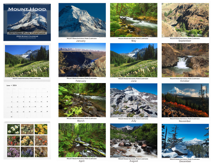
Also among the photos each year are nine wildflower images on the back of the calendar. My thanks to Paul Slichter’s for his terrific Flora and Fauna Northwest website and to the Oregon Wildflowers Facebook group administered by Greg Lief and Adam Schneider for their help on identifying several of these beauties.

So, there’s the backstory! If you’d like a calendar, they’re easy to order online from Zazzle – and to repeat, all proceeds go to Trailkeepers of Oregon (TKO), as always. Just follow this link:

2023 Mount Hood National Park Campaign Calendar
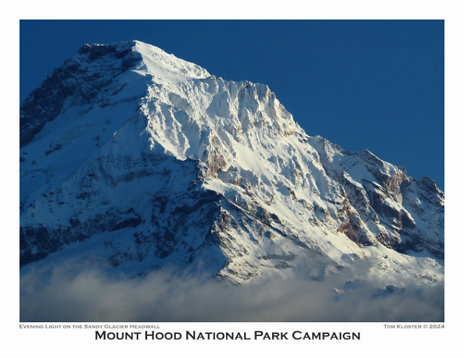
As always, thanks for following the WyEast Blog for another year. I hope to run into you on the trail sometime in 2023!

Tom Kloster | December 2022

Mount Hood National Recreation Area Legislation: 10 Things to know!

Mount Hood from Lolo Pass

After nearly ten years of informal meetings and town halls, Senator Ron Wyden and Rep. Earl Blumenauer recently released a much-anticipated framework for legislation that will fundamentally change the management direction for Mount Hood and expand protections for the Columbia River Gorge. 

The legislative details are forthcoming, but for now Sen. Wyden and Rep. Blumenauer are asking for public comment on a general legislative concept by January 7 – this Friday! That’s a very short comment period, but if you love WyEast Country (and you wouldn’t be reading this if you didn’t!) please consider weighing in, even if only to send a sentence or two on what is most important to you as this legislation takes shape.

Here are 10 things to know about this new proposal for Mount Hood and the Gorge:

1. It’s a very big deal for Mount Hood! At this time, it’s still a legislative concept, but it will frame the ultimate details of the legislation, and the scope of the concept is broad. This is the most sweeping legislation proposed for Mount Hood since the Oregon National Forest was created in 1908 (and later renamed the Mount Hood National Forest in 1924). This is a big deal for Mount Hood. More than the original Mount Hood Wilderness area created with the Wilderness Act in 1964, more than the subsequent wilderness additions in 1978, 1984 and 2009. And more than the Northwest Forest Act of 1992. 

Why? Because the legislation would shift the core function of the forest away from commercial logging and toward forest restoration and enhanced recreation. This is a sea change for the Forest Service – and for the mountain. The degree to which this pivot is enforced in law depends solely on what the coming legislation says, and therefore the importance of weighing in early and often (as Rep. Blumenauer likes to say).

2. It’s big deal for the Gorge, too! While the greatest impact of the proposed legislation would be on Mount Hood and the federal lands that surround the mountain, additional protections and recreation enhancements for the Gorge are part of the proposal. They represent the most important step forward since the Columbia River Gorge National Scenic Area was established in 1986.

Crown Point and the Columbia River Gorge

3. Say it with me: Mount Hood National Recreation Area! The central and most powerful feature of the legislative concept is a dramatic expansion of the Mount Hood National Recreation Area (NRA). “Expansion” you might ask? Since when has a Mount Hood NRA even existed? Since 2009, as it turns out – though few know this, and it’s understandable. The awkwardly titled “Lewis and Clark Mount Hood Wilderness” bill that President Obama signed into law in 2009 added new wilderness and a number of other protections for Mount Hood, but tucked into the bill were three small areas to the east and southeast of the mountain deemed the “Mount Hood NRA”. 

At the time, the creation of these NRA postage stamps was really just a consolation prize to mountain bikers who stood to lose access to trails falling inside the new wilderness areas. This is a frustrating and contentious issue among should-be conservation allies that was never anticipated when the Wilderness Act was signed into law in 1964 (bicycles are interpreted as mechanized, and thus excluded under the law). Though token as the original Mount Hood NRA units were, I wrote in this article several years ago that they also represented an opportunity to someday help Mount Hood achieve full recognition as a national treasure worthy of permanent protection. It was legislative foot in the door that may be about to open much wider.

The power of the NRA is clear in the legislative concept: it would encompass most of the Mount Hood National Forest north the Clackamas River, or roughly half the forest. The Forest Service would be thereby directed to write a new management plan for this vast area that focuses on forest restoration, recreation and watershed and water quality. This is a long-overdue change from the commercial logging mission that has hammered the mountain since the 1950s. As envisioned in the legislative concept, the new mandate would be to restore forest health and promote recreational activities that are in concert with a recovering forest that will be allowed to grow old, once again. 

Rainforest along Whale Creek on the Clackamas River Trail

Did you know the current plan guiding the Forest Service for their management decisions was adopted more than 30 years ago, in 1990? The Portland region, alone, has grown by well over 1 million residents in that time, but aside from expansion of the commercial ski resorts, recreation opportunities on Mount Hood haven’t expanded — with the resulting traffic and trailhead crowding we see as a familiar reminder. The legislative concept speaks directly to this crisis in management, with a clear directive to the Forest Service to change its focus to better reflect the interests and concerns of a changed region. This is a sea change for Mount Hood.

Conservationists remain wary of the NRA, however. Why? Because they rightly point to the fact that every NRA in this country is a bit different, each tailored to the specific area they were created for. In Oregon, this includes the Oregon Dunes and Hells Canyon, for example. While some NRAs are written with conservation in mind, others are relatively toothless and don’t give the Forest Service much direction in how to manage these areas. This is why the details in the legislative language matters. 

4. More Wilderness and Wild & Scenic Rivers. Senator Wyden has been particularly focused on expanding Oregon’s system of Wild & Scenic Rivers in recent years, a protection that mostly prevents rivers from being dammed, but also offers other protections intended to keep river corridors healthy and functioning for wildlife. The proposed legislation would add sections of the West Fork Hood River, Lake Branch, Coe and Eliot Branches, Cold Spring Creek and the Dog River to the Wild & Scenic River system in the Hood River basin, alone. On the west side of the mountain, sections of the Clear Fork of the Sandy River, Zigzag River and Still Creek would be added to the Wild & Scenic River system. The limit to this protection is that it only applies to public lands, and most of these streams flow through private lands, as well. These stretches located outside public ownership are not included in the legislative concept. 

Wilderness expansions are an expected part of any new conservation bill for Mount Hood and the Gorge, even though most of the truly wild areas have already protected through past legislation. Therefore, most of the new areas being proposed are expansions of existing wilderness, including Lost Lake Butte, the middle Coe and Eliot Branch canyons near Cloud Cap, popular Tamanawas Falls, the east side of Bluegrass Ridge, the Red Hill area along the Old Vista Ridge trail and several small expansions along the east end of the Salmon Huckleberry Wilderness.

Tamanawas Falls on Cold Spring Creek, one of the new wilderness areas in the proposed legislation

5. Moving trail stewardship up the Forest Service priority list? Ask someone who volunteers as a trail steward for one of the non-profits who work in WyEast Country (Trailkeepers of Oregon, Pacific Crest Trail Association, Mazamas, Backcountry Horsemen, Oregon Equestrian Trails, and Oregon Mountain Biking Coalition, to name among the most active) and they will tell you that one of the main obstacles in putting tools in the hands of volunteers on our trails is the Forest Service, itself. Compared to working with local and state land managers, navigating the Forest Service is a real challenge, even when you’re trying to bring needed resources in the form of volunteer labor.

The legislative concept builds on outreach conducted by Rep. Blumenauer’s staff to most of these groups to figure out what’s missing in the current Forest Service structure and what could be done differently to make trail stewardship volunteering easier. As written, the concept is a bit squishy, but the general themes of dedicating more Forest Service staff to serve as a coordination hub, and giving them new tools for coordinating virtually with volunteers is a good start. More thoughts on this topic follow in this article.

6. Talking with the tribes. This legislative concept has been in development for a while, and to the credit of Rep. Blumenauer and Sen. Wyden, it was slowed along the way to ensure meaningful consultation with affected tribes. As drafted, the legislative concept focuses on Forest Service obligations to better consult and coordinate with the tribes and to specifically to deliver on a first foods plan that would be added to the policies that guide forest management. More thoughts on this topic follow, as well.

Looking across the Columbia River to the town of Lyle from Rowena Plateau

7. Gorge Towns to Trails vision. Long advocated by Friends of the Columbia Gorge, this is a bold, long-term vision to create a European-style trekking network encircling the Columbia River Gorge National Scenic Area. The legislative concept gives a nod to the vision in all but name, along with a general direction to the Forest Service to develop a comprehensive system plan for all trails the Gorge. 

It’s no secret that in the past the Columbia Gorge Commission staff has viewed new trails in the Gorge quite negatively, and National Scenic Area staff have also been reluctant to consider trail expansion, as well. This, despite the overwhelming growth in demand and resulting overcrowding that is apparent to anyone who spends time in the Gorge. The proposed legislation would guide staff at both agencies with a clearer vision for how and where trails will be expanded in the Gorge, and how existing trails experiencing overuse can be better managed.

8. Improving Mount Hood & Gorge Transportation. Who can argue with this? It can only get better, right? And yet, this is perhaps the squishiest of the elements in the legislative concept, as most of what it calls for is already being provided and the concept simply calls for more – as in more public transit and transportation “options” (read: bikeways?), more rest areas, more law enforcement, more emergency response capacity. What the concept misses is that transportation, itself, is a recreation experience, not just a service. More thoughts on this topic follow below, as well.

The Dollar Lake Fire on Mount Hood (September 2, 2011)

9. Forest Fire “management”? Well, it’s safe to say that as a society we are beginning to grapple with the reality that a century of aggressive forest fire suppression coupled with a warming climate has set up an impossibly volatile circumstance in our forests. But I would emphasize the word “beginning”, because while the scientists and public agencies (and even a few politicians) understand the situation, there remains intense public pressure to somehow prevent forest fires – especially from people who live in the so-called “urban-rural interface”. This is policy jargon for people who live on private forested acreages abutting our public lands in places like the U.S. 26 corridor, and who are at real risk from catastrophic forest fires.

At best, we might be able to reduce the number of human-caused fires. These are still the majority, including the massive Riverside (2020) and Eagle Creek (2017) fires that scorched a large chunk of Mount Hood National Forest in the past five years. The proposed legislation tries to ease into this with by requiring the Forest Service to create a “mitigation and adaptation” plan for managing both fire risk and response. “Mitigation” would include prescribed burns and thinning crowded plantations on old clear cuts to improve forest health and fire resilience – two of the main ways the Forest Service is responding to the growth in catastrophic fires in the West. 

“Adaptation” is less defined in the proposed legislation, however. The elephant in the room are the thousands of homes and summer cabins (hundreds of them on federal land through 99-year leases) located in that “urban-rural interface”. Can they be protected? The fire that tore through the communities of Talent and Phoenix in Southern Oregon in 2020 didn’t stop at the urban-rural interface, they burned right in developed urban areas. “Adaptation” suggests that we might change how and where we live in relations to forests in the future, so what does that mean for the urban-rural interface, before or after fire? I don’t envy the Forest Service on this task, nor will this legislation solve the larger policy dilemma, but there’s no question it will need to be part of developing a Mount Hood NRA plan.

In a rare moment of justice, these target shooters were caught in a no shooting zone on Wildcat Mountain, and asked to clean up their trash while the deputy watched (2010)

10. Who isn’t for public safety in our forests? This is another topic the proposed legislation didn’t have much choice in acknowledging. Most who visit Mount Hood in the Gorge are keenly aware of the lawless activity that finds refuge in a vast area with little law enforcement presence. The legislative concept calls for more funding, including for local law enforcement, as well as “public education”. More thoughts on this topic follow, as well.

So, I’ve highlighted the main take-aways as a WyEast advocate who has long dreamed of a fundamental shift on management focus like this, but the legislative concept has more.

You can download the concept document here:

Draft Legislative Concept

You can also view and download the surprisingly detailed draft concept map here:

Draft Concept Map

And you can comment directly on the proposed Mount Hood NRA legislation here:

Public Comment Form

This will take you to an online form for sharing your thoughts. The following are what I plan to share during this comment period – and they might be useful to you, as well.

What’s Missing from the Concept?

Though there’s a looming comment deadline of January 7 (this Friday!), this legislative process is just getting started, and there will be more opportunities to weigh in while congressional staff drafts the actual legislation. With any luck (and some will be needed!) and enough support, this just might make it through the most divisive Congress in recent memory.

Here are a few things I’d like to see in the new Mount Hood legislation:

1. Restorative justice for the tribes. This means more than “living up to our statutory obligations”, as currently written in the legislative concept. Most of the statutes governing tribes in this country are rooted in our dark history of displacement and oppression of native populations, and the presumption that what was taken from the tribes must forever be lost. Restorative justice means to reverse the harm, and for Mount Hood and the Gorge might include restoring the ecosystems that provide first foods – as included in the legislative concept. But it might include dedicating or expanding public lands for the sole purpose of restoring exclusive tribal access to sacred places.

Restorative justice should include an inventory of interpretive and directional signage and symbols, too, to become inclusive of pre-white settlement history and customs, and reverse some of the cultural erasure caused by place names and white-centric written history. The most egregious examples are interpretive signs located along the Oregon Trail and Barlow Road. In my view, every one of these should include the perspective of native peoples who were pushed aside by westward expansion. But only the tribes can speak to this history from a perspective of cultural suffering, loss and continuing harm these migratory roads represent. 

Only by meaningfully engaging and listening to the tribes can the Forest Service know what a larger restorative justice commitment would look like, but it should be part of their mandate for the proposed Mount Hood NRA.

Restorative justice for tribes begins with never forgetting — nor accepting — the cultural harm to native peoples caused by white settlement in WyEast country (Celilo Falls in the late 1950s, a few years before it disappeared behind The Dalles Dam)

2. Making public lands truly public. Show up at a popular trailhead in the Gorge or on Mount Hood and you’ll immediately see that our public lands are an overwhelmingly white space. This is especially true for trails and campgrounds, as many recent studies have documented. Why is this? 

Ask a person of color, and researchers will tell you that white people who dominate the trails and campgrounds are a big part of the problem. The hostility ranges from outright and overt racist attacks to simple comments like “it’s so nice to see a person like you out here.” Well meant? Perhaps, but also unwelcome and uninvited when a simple “hello” is how a white person might have been greeted. Official signage at trailheads and campgrounds can be similarly hostile and unwelcoming in ways that are racist. It’s a problem that requires a plan of action to change.

Removing the barriers that make our public lands unwelcoming to people of color is within our reach, and must be at the core of how the proposed Mount Hood NRA is managed

The legislative concept should speak explicitly to this in the provisions required for the Mount Hood NRA management plan. As written, the concept vaguely mentions providing a “variety of recreational experiences to serve diverse users”. It should be more specific: our public lands have a racial diversity problem that implies specific bias that prevents black and brown Americans from sharing these special places equally. That’s unacceptable and should be a filter for everything in the new management plan.

Like the previous topic on restorative justice for tribes, this work must begin with the Forest Service directly engaging – and listening — to communities of color as they develop a plan of action. This conversation also means meeting black and brown communities where they are, not at a remote ranger station located miles from the nearest population center. It’s a long-overdue conversation and the proposed Mount Hood NRA is the perfect vehicle to begin this work.

3. Law enforcement without all the baggage? When I walked into White River Falls State Park last summer with a friend who is a young Black man, he groaned, cringed visibly and shook his head at a giant new sign (below) that the Oregon Parks and Recreation Department had placed at the trailhead. No doubt it was installed to deal with heavy vandalism in recent years to the historic structures in the park, but I’m quite sure the park managers didn’t intend the reaction my friend experienced. They message was intended to protect the very resources he came here to enjoy, but made him feel deeply unwelcome, instead.

This sign at White River Falls betrays a tone-deafness to how images of law enforcement might impact communities of color – in this case, literally the image a faceless authoritarian with a finger pointed at arriving visitors

It’s a painful fact that we live in fraught times with our law enforcement. So, when I read the public safety element of the legislative concept, I had that new sign at White River Falls in mind. What is the law enforcement issue there? Largely, young people tagging historic structures. I doubt the new sign with have much impact (except to become a new target for tagging?), but an occasional human law enforcement presence might help – or perhaps a security camera?

I don’t presume to know the answers, but having my own vehicles broken into a couple of times at trailheads — and having encountered much more troubling lawless behavior away from the more popular areas—I do think the idea of providing federal funding for expanded law enforcement through local counties is a good one. But given the times we live in, I’d also like to see that funding come with strings attached: the officers should be uniformed distinctly and differently from their local agency, as Mount Hood NRA officers. Creating a new, hybrid law enforcement identity would also be an opportunity to build some racial diversity in the generally rural law enforcement jurisdictions that would carry out this work.

I’m also quite open to security cameras at trailheads – as most hikers are (especially younger hikers). There was a time when this might have been controversial (say, ten years ago?) but today these are among the few public places that don’t have some sort of security monitoring, right down to our front doors, complete with doorbell cams. Lawless people know this, and it’s evidenced by the piles of broken glass than can be found throughout most of the major trailheads in the Gorge and on Mount Hood. 

Law enforcement on public lands is a thorny topic, indeed, but one that needs more thought and attention than is reflected in the current legislative concept.

Trailkeepers of Oregon (TKO) volunteers building new trail at Punchbowl Falls Park

4. Set benchmarks for recreation. You may know that Congress has a long history of setting annual logging quotas for the Forest Service that must be met. So, if the purpose of the Mount Hood NRA is to shift the management emphasis of the forest from commercial logging to forest recovery and recreation for Mount Hood and the Gorge, why not set quotas for recreation? 

This could be in the form of new trails and trailheads constructed, or the number of hikers who show up at trailheads – or both – measured per capita, as defined by the population living within 100 miles of the Mount Hood NRA, for example. Since the late 1960s, the Forest Service has acknowledged an ongoing growth in demand for trails, yet the system hasn’t grown, and what we have has increasingly fallen into disrepair. Why is this?

One of the greatest barriers to expanding trails is simply a mindset within the Forest Service. After decades of inadequate funding from Congress for trail construction and maintenance, the agency culture has been apprehensive to even talking about new trails. This, despite the obvious demand and overcrowding on the existing system. The problem also includes doing the needed planning, engineering and environmental assessments needed to advance new trail projects when funding does come – a critical obstacle that only the Forest Service can remove.

The proposed Mount Hood NRA provides an opportunity to link the new agency focus on recreation to both the growing interest in trails and sheer numbers of people living in proximity to the forest. If specific benchmarks were set up as funding incentive in the legislation, it could speed the transition of the Forest Service culture from logging to forest recovery and recreation, including making the planning work needed to move new trail projects from concept to construction a priority in agency budgets.

The opening segment of the new Mirror Lake Trail, the first accessible trail built on Mount Hood in decades

5. Accessible trails and trailheads are not a luxury. For too long our public land agencies have viewed recreation opportunities for people with disabilities as something outside the norm. The result is a woefully inadequate system of accessible outdoor trails for people who use walkers, wheelchairs or other mobility devices. As our population becomes increasingly older in coming years, and the share with disabilities grows, this unmet need for accessible trails will only accelerate.

There have been some shining successes – the Lost Creek nature trail and Little Crater Lake trail area couple of my favorites. But even these trails fail to get the basic maintenance needed to remain fully accessible. The legislative concept should include a specific provision that a complete system of accessible recreation facilities and sites be incorporated into the Mount Hood NRA plan and constructed as part of the benchmarked targets described above.

Who hasn’t stopped here to admire this roadside view?

6. Transportation IS a recreation experience! There’s a spot near Hood River, along the Mount Hood Loop, that I blogged about years ago. The view of Mount Hood and the upper Hood River Valley that unfolds there is world class. More often than not on a clear day, there’s a car or two pulled over, with someone taking photos with their phone. It’s not surprising, as since the original Mount Hood Loop was completed in the early 1920s, it has been a classic touring route. It just hasn’t been managed that way for many years.

It’s true that the modern Mount Hood Loop carries a lot of traffic, and the proposed legislation concept speaks to the basic transportation needs that exist – the lack of meaningful transit, the complete lack of a safe bikeway along Highway 35 and U.S. 26 and (less explicitly) the lack of what planners call “demand management” to promote incentives for visitors to use travel options like transit and visit outside of peak travel times. Demand management would include managing peak period parking at major trailheads and destinations in the Gorge and on Mount Hood – again, implied, but not specific.

These are all good things needed to make traveling around the mountain and through the Gorge a better experience, and less of a barrier to people who don’t have access (or prefer not to use a car), in particular. But the legislative concept should also call for the Oregon Department of Transportation (ODOT) and Forest Service to work collaboratively to create a transportation vision – a long-range plan to make the experience of traveling to and around the mountain a destination, in itself. 

Congress can’t directly regulate ODOT, but it can regulate an arm of the U.S. Department of Transportation known as the Western Federal Lands Highway Division. This is an agency with a regional office in Vancouver that has led several projects on Mount Hood in recent years, including the White River Bridge replacement, the historic Sahalie Falls Bridge restoration and designing and constructing the new Mirror Lake Trailhead. They have long worked with ODOT, and could be the avenue for the new legislation to be specific about improving the traveling experience on the mountain through a collaborative planning effort with ODOT.

ODOT’s designs for new structures in the Columbia Gorge draw from a carefully developed policy guidance developed by the agency (the new Fifteenmile Bridge on I-84)

Elements of a Mount Hood NRA transportation plan could build on the excellent design policy that ODOT has followed for the Columbia River Gorge National Scenic Area over the past two decades. This policy guides the design and maintenance details of I-84 and the Historic Columbia River Highway from the smallest details (did you know the back of freeway signs in the Gorge are painted “national park brown”?) to bold, as ODOT gradually replaces old slab-style concrete freeway bridges in the Gorge with handsome new structures that are a visual complement to scenic area (shown above).

A Mount Hood NRA transportation plan should also incorporate the re-imagining of several long- abandoned or bypassed sections of the old loop highway into a continuation of the world-class Historic Columbia River Highway State Trail that is nearing completion in the Gorge. ODOT has built the in-house expertise for this work, and will soon have the capacity once their work on the Gorge trail “final five” miles is completes over the new few years. I posted two articles on this concept for Mount Hood early in 2021 (and have also shared these with congressional staff – please feel free to mention them in your comments, too!)

Mount Hood Loop Highway State Trail Proposal – Part One

Mount Hood Loop Highway State Trail Proposal – Part Two

Another piece of the transportation puzzle that calls for a plan under the new Mount Hood NRA are the off-highway, paved forest routes, like Lolo Pass Road (FR 18/ FR 1810), Dufur Mill Road (FR 44) and White River Road (FR 48) that function as scenic drives, but suffer badly from disrepair and a complete lack of visitor amenities. Each of these routes needs a management plan and vision for making them the positive recreational experience that the public is already seeking when the venture on to these roads.

Which brings me to a final element of a Mount Hood NRA transportation plan – gateways, enhanced directional signage, waysides, pullouts and interpretive displays that tell the story of WyEast country to the traveling public. These are all things you would find in a parkway design in one of our national parks, and the Mount Hood NRA should have parkway designations for Highway 35, U.S. 26 and the off-highway routes mentioned above, too, with design guidelines to ensure a great travel experience as the system is developed over time. There are plenty of great parkway plans to draw from, the proposed legislation just needs to provide the mandate to do the work.

Civilian Conservation Corps crews building trail in the 1930s

7. The CCC? It was a great idea in 1932… And it’s still a great idea: the Civilian Conservation Corps (CCC) was created by President Franklin Delano Roosevelt to get young, idle men off the street and into productive work that would give them job skills, food, housing, clothing and a modest paycheck ($30/month, of which $25 was sent to their families!). It was among the most popular New Deal programs, but sadly, the CCC was disbanded in 1942 as our country went to war.

The proposed Mount Hood NRA provides a unique opportunity to revive the CCC model, but in modernized form. The benefits to the NRA are clear, with youth workers helping to restore, build and maintain trails, trailheads and campgrounds, along with habitat and forest restoration work – all things the original CCC did, and whose work still shapes what we see in our forests today.

A modern CCC would be open to all youth, not just young men, and compensation could include college tuition credits, along with a paycheck, room and board. Mount Hood already has Forest Service facilities that could (again) become CCC camps – Camp Zigzag, Timber Lake in the Clackamas River corridor and the Herman Creek work center in the Gorge, to name some of the more obvious options. 

The legislative concept hints at this possibility, but it should be fully incorporated as a core element of the vision for the Mount Hood NRA in order to drive the needed Congressional funding.

Badger Creek Wilderness and Mount Hood from the White River Wildlife Area

8. Let’s get the boundaries right. The overall scope of the Mount Hood NRA, as expressed on the draft map [link], is terrific. Notably, it includes both Forest Service and Bureau of Land Management (BLM) lands along the west edge (along the US 26 corridor), as well as the various pieces of federal land that frame the upper Hood River Valley. It would have been easy to leave these small parcels out, but they provide an important starting point for public land acquisition by the Forest Service to better define the Mount Hood NRA – though a directive to do this work should be included in the legislation. The now-permanent Land and Water Conservation Fund already provides an important funding conduit for these needed land acquisitions.

There are also a few pieces missing from the proposed Mount Hood NRA on the concept map. First, most of the Badger Creek Wilderness is excluded. This is a big oversight if the goal of the proposed Mount Hood NRA is to shift the Forest Service focus to recreation. Why? Because the Badger Creek Wilderness has a deep backlog of trail maintenance needs that are out of reach for urban volunteers doing day trips, as many of the Badger Creek trails are remote and require overnight crews.

Second, the nearby Dog River drainage that falls within The Dalles watershed management area is excluded. The Dog River is proposed to become a Wild and Scenic River in the legislative concept, and the Dog River basin already has a lot of recreation activity, as it is not a fenced watershed. Well-traveled Dufur Mill Road (FR 44) travels extensively through the watershed, and a number of other forest roads, hiking and biking trails are in or near the watershed, including the popular High Prairie trailhead. It makes sense to include Dog River in the Mount Hood NRA in order to more effectively manage these activities — and to ensure that recreation will continue to be allowed here.

Pup Creek Falls is excluded from the proposed Mount Hood NRA, along most of  the Clackamas River National Recreation Trail

A third map oversight is along the south edge of the proposed Mount Hood NRA, where the south half of the Roaring River Wilderness is left outside the proposed recreation area, along with a section of the Clackamas River that is traversed by the Clackamas River National Scenic Trail. Some of this area was burned in the 2020 Riverside fire, and that reality, alone, is reason enough to bring it into the NRA to direct resources toward rebuilding and restoring trails and campgrounds. While I would like to see the entire Clackamas basin brought into the NRA, that will have to wait for future legislation. For now, extending the proposed Mount Hood NRA boundary south to the Collawash River confluence would be a reasonable start.

The Upper Sandy Guard Station in better days. Today, it is on the brink of being unsalvageable, despite being on the National Historic Register

9. Don’t forget our history! Finally, an important missing element in the legislative concept is some sort of recognition that we are rapidly losing historic structures through the Mount Hood National Forest. The 2020 Riverside Fire destroyed several of these priceless buildings, so recognizing and preserving the remaining gems is even more urgent today. The Mount Hood NRA management plan should include an updated historic resources inventory and plan for capital investments needed to stabilize or restore sites and structures – ideally, in partnership with non-profit partners.

What can you do?

That’s a deep dive into the legislative concept, along with ways it might be improved. If you have read this far, kudos for being a friend of Mount Hood and the Gorge! The next step is to weigh in, and you’d be surprised how much your thoughts matter to congressional staff – they really do care! The timeline for commenting on the concept and map is short – they must be submitted by this Friday, January 7. Again, here’s the online form for commenting:

Mount Hood NRA Proposal — Public Comment Form

That said, if you’re not able to weigh in during this round, watch this space – I’ll post updates on the legislation as it (hopefully) moves forward. While there is a lot of major legislation churning through Congress right now, it’s entirely possible that this concept will get turned into a bill that makes it through both chambers… with a little luck and a push for all who love Mount Hood and the Gorge!

In the Realm of St. Peter

St. Peters Dome rising above the January 13 Bucher Creek debris flow that swept across I-84, killing one person (ODOT)
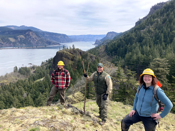
It seems a world away as we enter yet another summer drought, with record-breaking heat waves and an early wildfire season in WyEast country. Yet, just a few months ago, on January 13th, the tragic story of a Warrendale Resident being swept away in her car by a winter debris flow in the Columbia Gorge filled our local news. The event closed a 10-mile section of I-84 from Ainsworth State Park to Tanner Creek and the area was evacuated after the National Weather Service issued a flash flood warning. 

Some of the local media coverage also connected the dots, reporting on the long history of dangerous debris flows in this part of the Gorge. This was not a freak tragedy, but rather, a completely predictable event. The well-known hazard zone stretches from Ainsworth State Park on the west to Yeon State Park, five miles to the east, encompassing the hamlets of Dodson and Warrendale in its path. While the steep walls throughout the Gorge are infamous for producing rockfall and landslides, this stretch is notoriously active. Why?

Slip-sliding away…

Geoscientists don’t have a particular name for this geologically active area, but the unifying feature is a near-vertical wall that I will call the Nesmith Escarpment for the purpose of this article. The name that comes from Nesmith Point, which has the distinction of being the tallest feature on the Gorge rim, rising nearly 4,000 feet from the banks of Columbia River. The Nesmith Escarpment was largely created by the ancient, catastrophic Missoula Floods that shaped much of what we know as the Columbia River Gorge during the last ice, more than 13,000 years ago. These floods repeatedly scoured the Gorge with torrents hundreds of feet deep, often enough to overtop today’s Crown Point and Rowena Plateau.

Tumalt Creek is the largest of the volatile streams that flow from the towering, over-steepened Gorge walls of the Nesmith Escarpment(ODOT)

As the massive Missoula Floods cut into the slopes below Nesmith Point, the over-steepened terrain began to collapse into the river. It’s a process that continues to this day, gradually expanding the escarpment and leaving behind sheer basalt towers of resistant bedrock along the lower slopes. Of these, St. Peters Dome is the most prominent, along with Rock of Ages and Katanai Rock (the informal name for the impressive monolith that rises just east of St. Peters Dome).

The headwaters of Tumalt Creek flow from the highest walls of the Nesmith Escarpment, where the red, volcanic layers of the Nesmith Volcano that rests on the Gorge rim have been exposed by erosion  (ODOT)

Adding to the geologic uniqueness of the Nesmith Escarpment is Nesmith Point, itself. Located at the top of the escarpment, the familiar layer-cake stack of basalt flows that make up so much of the Gorge geology gives way at Nesmith Point to bright red and yellow layers of clay and cinders that reveal the uppermost part of the escarpment to be the remains of a volcano. The northern half of the volcano has been torn away over the millennia by the growing escarpment, leaving a visible cross-section of the volcanic dome. The surviving, southern half of the Nesmith volcano is gently sloping, like other dome volcanoes that line the Oregon side of the Gorge (the familiar peaks of Larch Mountain and Mount Defiance among them).

[Click here for a large version of the schematic]

The result of all this erosion is a 3-mile-long amphitheater of collapsing layers of volcanic debris and basalt walls resting uncomfortably and over-steepened upon ancient sediments at the base of the cliffs that make for a slippery, unstable foundation. Rain, winter freezes and gravity will therefore continue to chip away at the escarpment for millennia.

Over the many centuries since the Missoula Floods, this relentless erosion has built a huge apron of what geoscientists call an “alluvial fan” at the base of the Nesmith Escarpment. This name describes the flood debris that accumulates where canyon streams prone to flash-flooding suddenly reach a valley floor, slowing and depositing debris over time. The resulting layers typically form a broad, gently sloped wedge shaped like a fan. For the purpose of this article, the fan at the base of the Nesmith Escarpment will be referred to as the Nesmith Fan

(Source: State of Wyoming)

(Source: City of Scottsdale)

One of the defining features of an alluvial fan is the erratic, constantly shifting course of the streams that create them. Because of their shallow slope and the accumulation of debris, these streams continually change course as they spread their loads of rock and gravel on the fan.

If the Nesmith Escarpment and debris fan were located in a desert environment, these defining features would be exposed and easy to see. But in the forested western Gorge, the dense rainforest vegetation quickly covers debris flows with new growth, often within five or ten years, making it hard to recognize how active the geology really is. It’s therefore easy to understand why settlements like Dodson and Warrendale were built upon on the Nesmith Fan, where the fertile ground and gentle terrain were friendly to farming and home sites. The spectacular cliffs of the Nesmith Escarpment simply provided a beautiful backdrop for these communities. Yet, it’s also an increasingly hazardous place for anyone to live.

The image below shows the Nesmith Escarpment and debris fan in a way that wasn’t possible until LIDAR technology was developed. LIDAR allows highly detailed images of topography even in areas like the Gorge, where dense forests cover the terrain. The LIDAR view shows the steep walls of the escarpment in stark relief, including the hundreds of steep ravines that have formed along the escarpment.

Lidar view of the Nesmith Escarpment and debris fan

The LIDAR view also reveals the alluvial deposits that make up the Nesmith Fan to be a series of hundreds (or even thousands) of overlapping debris flows from the roughly dozen streams that flow from the Nesmith Escarpment, each helping to gradually build the enormous alluvial fan. The wrinkled surface of the fan reveals the hundreds of flood channels that have developed over the millennia as countless debris flows have swept down from the cliffs above.

This view (looking east toward Dodson from Ainsworth State Park) shows the vulnerability of I-84 and the Union Pacific Railroad where they cross the 3-mile-wide expanse of the Nesmith Fan. The 2021 debris flows and flooding damage to the Ainsworth interchange can be seen at the center of the photo, where the interstate was temporary closed by the event (ODOT)

[Click here for a large version of this image]

During the very wet winter of 1996, a series of major debris flow roared down from the Nesmith Escarpment, sweeping cars off I-84 and closing the freeway for several days. A train on the Union Pacific line was knocked off its tracks and many home were damaged.

During the event, debris from Leavens Creek, near St. Peters Dome, swept toward the Dodson area, eventually engulfing the Royse house, which was located near the Ainsworth interchange. The scene was shocking, burying the home in debris that rose to the second floor and destroying outbuildings on the Royse farm. You can read Carol Royse’s riveting account of the event on Portland State researcher Kenneth Cruikshank’s excellent web page describing the 1996 debris flows here.

The Royse House in Dodson (with St. Peters Dome beyond) after a series of debris flows on Leavens Creek engulfed the structure in 1996 (The Oregonian)

The Royse home stood half-buried and visible from the freeway for many years, becoming a prominent reminder of the power of the Gorge. By the mid-2000s, a new forest of Red alder and Cottonwood had already enveloped the debris path and the Royse home, eventually obscuring it from view until the Eagle Creek Fire destroyed both the structure and newly established forest in 2017. 

The more recent debris flows in January of this year struck some of the same spots that were impacted in the 1996 and 2001 events. The Tumalt Creek drainage was once again very active, sending debris onto I-84 and closing the freeway. To the west, the Leavens and Bucher creek drainages also sent debris onto the highway and the site of the former Royse home.

As jarring as these changes are to us, this cycle of destruction, rebirth and more destruction has unfolded hundreds of times on the Nesmith Fan. It’s simply part of the ongoing evolution of the landscape.

How do they start?

Debris flows are a mud and rock version of an snow avalanche. They typically begin with oversaturated soils on steep terrain that suddenly liquifies from its own weight. Once it begins to move, the flow can incorporate still more oversaturated soil as it gathers speed, just as a snow avalanche triggers downslope snow to move. The steepness of the terrain is a key factor in how fast a debris flow can move, and on very steep slopes they can reach as much as 100 miles per hour, though they typically slow as the debris reaches the base of the slope and spreads out to form alluvial fans.

These towering twin cascades where Bucher Creek originates along the Nesmith Escarpment rival Multnomah Falls in height. The impossibly steep terrain here is the source of both the debris and sudden flash floods that have helped build the Nesmith Fan, far below (ODOT)

A heavy rain event can also trigger a debris flow by creating stream flooding that erodes and undermines stream banks, causing debris to slide from canyon walls. This form of debris flow is common in the larger canyons in the Columbia Gorge, but less so on the Nesmith Escarpment, where most of the streams are small and only flow seasonally. Here, it’s the steepness of the slopes and the unstable geology that makes the area so prone to debris flows.

Debris flows are different from landslides. A debris flow is typically quite liquid and fast moving, like cake batter being poured into pan. Landslides are typically slow, with a large mass sliding as a whole, like an omelet sliding from a skillet onto a plate. In the Gorge, landslides are common and mostly occur where the underlying geology is oversaturated and allows the overlying terrain to move. The upper walls of the Nesmith Escarpment are scared by hundreds of landslides, and in the right conditions, these slide can trigger debris flows that spread far beyond the landslide.

What about fires and logging?

A third trigger for debris flows is the sudden removal of the forest overstory. The big trees in our Pacific Northwest forests capture and hold a tremendous amount of rain on their surfaces that never reaches the ground, with some of the moisture directly absorbed by the trees and much of it simply evaporating. Clear cut logging removes this buffer, allowing much more precipitation to suddenly reach the soil, triggering erosion, landslides and debris flows. 

Logging roads are especially impactful by cutting into the soil profile on steep slopes and allowing runoff to infiltrate under the soil layer and destabilized soils. This is well-documented as a source of major landslides in heavily logged areas. Thankfully, most of the forested western end of the Gorge is protected from logging, including the Nesmith Escarpment (though early white settlers logged these areas of the Gorge extensively)

The 2017 Eagle Creek Fire has not only destabilized steep slopes throughout the burn by killing the protective forest cover, it also revealed the tortured landscape of braided flood channels on the Nesmith Fan once hidden under dense vegetation. This image from just after the fire shows a volunteer trail crew scouting Trail 400 where it crosses the fan. The route curves in and out of the dozens of channels and debris piles formed by past flood events

Fire can have a similar effect on runoff when the forest canopy is completely killed. This is why new research shows that attempting to log recently burned areas can have serious effects by disturbing newly exposed soils and worsening the increased erosion that would already result from fires.

In the Gorge, the 2017 Eagle Creek Fire burned most of the Nesmith Escarpment, raising serious concerns about the debris flow activity accelerating here in the coming decades. The debris flows earlier this year may have been the first major events to have been triggered as much by deforestation from the fire as by oversaturated soils. The following photo pair shows the extent of the burn on the Nesmith Escarpment, with the first photo taken just a few weeks before the fire in 2017 and the second photo taken in 2018, when the fire’s impact was clearly visible.

The January 2021 debris flow

The Oregon Department of Transportation (ODOT) has been making regular flights over the Eagle Creek Fire burn since late 2017 to monitor for potential flooding and landslides. While the main purpose of these surveys is to anticipate impacts on the highway, ODOT is also amassing an invaluable library of historic photos that document the fire and resulting geologic events in a way that has never been done before.

Their most recent flight includes photos from the January 2021 debris flows that tell the story in a way that words cannot match:

This view looking west toward the Ainsworth Interchange shows how Bucher Creek had completely covered the south half of the interchange and sent mud and debris flowing east on the freeway, itself. The 1996 and 2001 debris flows impacted much of the same area (ODOT)

A closer look at the 2021 debris flows where the Ainsworth interchange was overwhelmed with debris. A green highway sign marks what used to be a freeway on-ramp (ODOT)

Bucher creek briefly pushed the lobe of mud and debris in the lower right of this view directly toward the home in the first photo, before changing direction to the path the creek is following in this photo. This is a good example of how accumulated debris regularly forces the streams that carry the debris into new channels. (ODOT)

This view looking back at the Bucher Creek debris flow lobe shows just how close it came to the home and outbuildings shown in the previous photo (ODOT)

The view down Bucher Creek debris flow toward St. Peters Dome and the Columbia River from near the crest of the Nesmith Escarpment (ODOT)

Landslide in burned timber near the crest of the Nesmith Escarpment. This landslide fed debris directly into the Bucher Creek debris flow, and onto the freeway more than 3,500 feet below (ODOT)

What to do?

It’s tempting to wish away future geologic hazards by taking comfort from what we perceive to be more predictable past. After all, the modern Gorge we know has been evolving for more than 13,000 years, and long periods of slope stabilization have marked recent centuries. But can we count on periods of stability in a future that will be shaped by global climate change? 

Almost surely not. All indications are for more volatility in both weather and flood events like those that have built the Nesmith Fan. Recent evidence increasingly supports the reality that our landscapes are changing along with the climate. In a 2016 report on landslide risks by Multnomah County, the number of events escalated over the past 25 years, including at the Nesmith Escarpment (see table, below).

The best path for adapting to this reality and becoming more resilient in response to future events is to accept the ongoing risk from the Nesmith Escarpment. In the near-term, this means regularly repairing I-84 and the parallel Union Pacific railroad after flood events that will become increasingly common and disruptive. It also means installing early warning systems along these routes for the traveling public and commers, as well as the residents of the area who live in harm’s way. 

The 2021 debris flow along Tumalt Creek during this year’s series of flood events on the Nesmith Fan was a textbook example of why adapting in the near-term to protect existing infrastructure is a tall order. The following images show just how unpredictable and unmanageable this steam has become for ODOT.

Once Tumalt Creek reaches the foot of the Nesmith Escarpment and begins to flow across the fan, its course continually shifts and changes, making it very difficult to predict where each debris flow event might be headed (ODOT)

A single culvert (above) carries Tumalt Creek under the freeway and frontage road, but the Nesmith Fan is a maze of shifting streambeds by definition, making it nearly impossible to force streams to obey culvert locations (ODOT)

The channel carrying the debris flow on Tumalt Creek that overwhelmed the frontage road and I-84 in February later dried up, with the creek shifting to another channel after the flood (ODOT)

This screen was installed at another culvert that Tumalt Creek has swept through in past debris flow eventsl. While this device might keep small debris flows from overwhelming the culvert, it has no chance against the increasingly large debris flows that we can expect on the Nesmith Fan (ODOT)

This is the view from the frontage road looking upstream at the large, main culvert intended for Tumalt Creek – though it had shifted out of the channel when this photo was taken a few months after the February event. The flatness of the terrain on the Nesmith Fan is evident here, with no obvious stream chanel except for the grading and contouring by highway crews (ODOT)

Adapting to a new reality

In the long term, coping with debris flows also means facing some tough questions for those who live on the Nesmith Fan. For some, it’s a place where families have settled for generations. For others, it’s a dream home they’ve put their life savings into on the Columbia River in the heart of the Gorge. But for anyone who lives here, the risks are real and growing – as the death of a local resident in this year’s debris flows reminds us.

Across the country, climate change and rising sea levels are impacting millions of homes and businesses built in floodplains formerly classified as “100-year”, but now seeing regular flooding. In the past, the U.S. Government has provided public flood insurance for those living or operating a business in a flood zone, but the increasing frequency of catastrophic events in flood and hurricane-prone regions like the Mississippi Valley, Texas, Florida and Carolina coasts is pushing federal flood insurance premiums sharply up. This does not bode well for those living and working in hazard zones in the Pacific Northwest, including the rural communities scattered across the Nesmith Fan.

Notices like this will become a way of life for Nesmith Fan residents in coming years

In some places along the Mississippi Valley, the federal government has begun simply relocating homes, and even whole towns, rather than rebuilding them in harm’s way. Could this be a model for the Nesmith Fan? Possibly, though most of the private homes in the path of debris flows are not in the flood plain, and may not be eligible for any form of subsidized federal insurance or assistance, short of a disaster.

A more direct approach that could be taken at the state level is a simple buy-out, over time. Where flood-prone areas in other parts of the country might simply have value as farm or grazing land, the Gorge is a world class scenic area, and both public land agencies and non-profits are actively acquiring land for conservation and public use. As Gorge locations go, it’s hard to find a spot as spectacular as the Nesmith Fan and the escarpment that rises above it.

Already, the Forest Service and Oregon State Parks have acquired land on the Nesmith Fan for recreation and to provide habitat under the Columbia River Gorge National Scenic Area provisions, including at least two parcels with coveted river access. Permanent funding of the federal Land and Water Conservation Fund last year should also help jump-start public acquisitions in the Gorge that have stalled in recent years, and could help spur land owners considering their options.

Katanai Rock (left) and St. Peters Dome (right) rise above orchards at Dodson in this 1940s view from the old Columbia River Highway

Recent events are surely changing the dynamic for landowners in the Gorge, as well. Would some residents living on the Nesmith Fan be more open to a buy-out after witnessing the devastation of last year’s debris flows, knowing that more are likely to come in the wake of the Eagle Creek Fire? Probably. Others – especially the string of luxury homes along the Columbia River – might be more motivated by legacy, and for these folks, non-profit conservation trusts and easements could be a tool for transitioning private land into public ownership over time.

In the meantime, expect more flooding, debris flows and periodic closures of I-84 during the rainy months. And probably more fires in summer, too. This is the new normal in the Realm of St. Peter, after all, and it’s a cycle that will continue for all our lifetimes, and beyond.

Gorge Roundup (addendum)

Tribal fishing platforms line the Columbia River as Mount Hood floats on the horizon at the proposed Columbia Hills pumped energy project site

A few folks had questions about the Goldendale Energy Project (what I called the “Columbia Hills Energy Project” in my last post), so I thought I’d post some resources for anyone looking to learn more about the project and how to help the coalition of opponents.

______________________

Recent coverage by Northwest Public Broadcasting:

‘It’s Irreversible’: Goldendale Green Energy Project Highlights a History of Native Dispossession

______________________

February 2020 letter to Governors Jay Inslee and Kate Brown from the coalition of opponents:

RE: Opposition to ​Rye Development’s proposed Goldendale Energy Storage Hydroelectric Project 

______________________

Columbia Riverkeeper statement and Q&A on the project:

Stand in Solidarity with Tribal Nations

______________________

November 2020 announcement of acquisition of the project by foreign investors:

Copenhagen Infrastructure Partners (CIP) Acquires Pumped Storage Project

______________________

Washington Department of Ecology website for the project:

Industrial Facilities Permits: Goldendale Energy

Pioneer Woman’s Grave

/Volumes/Tom/Desktop/20xxxx Pioneer Woman's Grave/PioneerGrave01.jpg

“The Barlow Cutoff” by William Henry Jackson (1930)

One of the loneliest landmarks in WyEast Country is approaching the century mark, and while the years have not been kind, it’s a spot that deserves to be preserved. The place is the Pioneer Woman’s Grave, located along a long-bypassed section of the original Mount Hood Loop Highway.

Roadbuilders discovered the grave in 1924 while building the original loop road. The grave was marked by an old wagon tongue and the remains of a woman were buried in a makeshift box built from wagon sideboards. Based on oral histories from Barlow Road tollgate operators, some historians believe this woman was survived by her husband and two young children, who continued on to the Willamette Valley after burying her here in the mid-1840s.

PioneerGrave01.jpg

The Pioneer Woman’s Grave is just off OR 35 where a surviving section of the original Mount Hood Loop Highway heads off into the forest

The grave is located just east of the busy US 26/OR 35 interchange, where a small, brown sign along modern OR 35 points to the historic site along a scenic and surprisingly well-preserved section of the original highway route. Today, the site is underwhelming, to say the least. The grave is marked by a haphazard pile of stones on the shoulder of the old road, and “graced” with all manner of ephemera left by visitors.

/Volumes/Tom/Desktop/20xxxx Pioneer Woman's Grave/PioneerGrave02.jpg

Pioneer Woman’s Grave in 2020

Several years ago, the Forest Service installed a new interpretive sign broadly describing the origins of the grave, but without much cultural context or detail. The sign is mounted in a heavy timber frame that gives a nod to a much larger, carved version built here in the 1930s.

/Volumes/Tom/Desktop/20xxxx Pioneer Woman's Grave/PioneerGrave03.jpg

Relatively new Forest Service interpretive sign at the Pioneer Woman’s Grave

A brass plaque near the grave was placed here by the Daughters of the American Revolution (DAR), a non-profit organization that maintains historic markers around Oregon (and the country). The original plaque was installed on the grave, itself. The current plaque was moved to a boulder a few feet from the grave in 1982.

/Volumes/Tom/Desktop/20xxxx Pioneer Woman's Grave/PioneerGrave04.jpg

D.A.R. plaque at the Pioneer Woman’s Grave

/Volumes/Tom/Desktop/20xxxx Pioneer Woman's Grave/PioneerGrave05.jpg

D.A.R. plaque at the Pioneer Woman’s Grave

Beyond the signs and plaques, the Pioneer Woman’s Grave historic site can only be described as rundown and shabby. The set of timber steps that climb a low berm that fronts the site is rotting away. Foot traffic has largely bypassed the crude steps and trampled whatever vegetation was once growing along the berm.

/Volumes/Tom/Desktop/20xxxx Pioneer Woman's Grave/PioneerGrave06.jpg

Crumbling wood steps at the grave memorial

The wood cross on the Pioneer Woman’s Grave is long gone, and the remaining pile of rocks doesn’t exactly inspire reverence and respect. The few who might notice the nearby dedication plaque and interpretive sign learn that this is a grave site, but the overall scene is haphazard and kind of sad.

Remembrances… or Disrespect?

In recent years, “offerings” left by visitors have escalated at the Pioneer Woman’s Grave. They range from flowers and sentimental toys to a few religious tokens left in earnest. But mostly, the memorial has become cacophony of random tchotchkes that have little to do with the site or respect for the human remains that lie beneath the stones. To give a sense of the scene, here’s recent sampling of these offerings from a few weeks ago:

/Volumes/Tom/Desktop/20xxxx Pioneer Woman's Grave/PioneerGrave07.jpg

Flowers, fir cones and a plastic robot…

/Volumes/Tom/Desktop/20xxxx Pioneer Woman's Grave/PioneerGrave08.jpg

…Teddy bear…

/Volumes/Tom/Desktop/20xxxx Pioneer Woman's Grave/PioneerGrave09.jpg

…cross pendant…

/Volumes/Tom/Desktop/20xxxx Pioneer Woman's Grave/PioneerGrave10.jpg

…rubber ducky…

/Volumes/Tom/Desktop/20xxxx Pioneer Woman's Grave/PioneerGrave11.jpg

…superhero metal CDs…

/Volumes/Tom/Desktop/20xxxx Pioneer Woman's Grave/PioneerGrave12.jpg

…Liberace tapes…

/Volumes/Tom/Desktop/20xxxx Pioneer Woman's Grave/PioneerGrave13.jpg

…bubble gum and taco sauce…

/Volumes/Tom/Desktop/20xxxx Pioneer Woman's Grave/PioneerGrave14.jpg

…Minions, ammunition and COVID masks…

/Volumes/Tom/Desktop/20xxxx Pioneer Woman's Grave/PioneerGrave15.jpg

…and a severed jumper cable clamp.

If the original intent of this roadside monument was to honor nameless migrants who perished along Oregon Trail, then today’s version has lost its way. The Pioneer Woman’s Grave deserves better, and even some modest improvements would bring needed dignity to the site. More about that in a moment, but first, there is inspiration to be gained from other historic burial sites along the Oregon Trail.

Remembering the dead along the Oregon Trail

The Oregon Trail was a dangerous, often deadly trip for white migrants crossing into the West, with an estimated 1 in 10 dying along the way. Most were buried where they died, and their surviving families simply continued their push westward. Many of these graves are now preserved and celebrated as part of our traditional view of white settlement of the West. 

In the early 1970s, one of these graves along a branch of the Oregon Trail, just east of Casper, Wyoming, was uncovered while a rancher was building a new road. Anthropology students from Casper College exhumed the remains and discovered this to be the burial place of 1852 pioneer Quintina Snodderly. 

/Volumes/Tom/Desktop/20xxxx Pioneer Woman's Grave/PioneerGrave16.jpg

Quintina Snodderly grave today (WyomingHistory.org)

For many years, the Quintina Snodderly story was a mystery until owners of the ranch tracked down a descendent living in Scio, Oregon. We know from her skeletal remains that she was likely crushed under a wagon wheel, perhaps stumbling or falling while walking aside a wagon. Most who arrived on the Oregon Trail walked much of the way to reduce the burden for ox teams pulling heavy wagons.

Quintina’s surviving husband Jacob and their eight children made it to Scio, in the mid-Willamette Valley of the Oregon Territory, by the fall of 1852. Jacob died in 1889 at the age of 78, thirty years after Oregon became a state in 1859, and is buried in Scio.

PioneerGrave17.jpg

Newly restored Quintina Snodderly grave as it appeared in 1987 (findagrave.com)

The Oregon-California Trail Association took the lead in reburying Quintina Snodderly’s remains in 1987, covering the grave with cobbles that replicated typical burials along the trail in the mid-1800s and surrounding the grave site with a wooden corral fence (above) to help preserve it. An interpretive marker (below) describes Quintina Snodderly’s journey and story.

PioneerGrave18.jpg

Quintina Snodderly plaque placed by the Oregon-California Trails Association (findagrave.com)

Not far from the Snodderly grave in the North Platte valley of Wyoming are the twin graves of Martin Ringo and J.P. Parker, who also died along the Oregon Trail. Parker was from Iowa and died in 1860, though nothing else is known about him. Martin Ringo died tragically from a self-inflicted shotgun injury that was graphically described in newspaper accounts of the day:

“Just after daylight on the morning of July 30, 1864 Mr. Ringo stepped out… of the wagon, as I suppose, for the purpose of looking around to see if Indians were in sight and his shotgun went off accidentally in his own hands, the load entering at his right eye and coming out at the top of his head. At the report of his gun I saw his hat blown up 20 feet in the air and his brains were scattered in all directions. I never saw a more heartrending sight, and to see the distress and agony of his wife and children was painful in the extreme. Mr. Ringo’s death cast a gloom over the whole company… He was buried near the place he was shot in as decent a manner as was possible with the facilities on the plains” (Liberty Missouri Tribune, 1864)

Martin Ringo’s legacy played out after his death when his grieving widow Mary pushed forward, eventually raising their children in California’s Central Valley. Their oldest son John, who was 14 years old when his father was killed, brought infamy to the respected family name. He emerged as an outlaw and gunfighter in Arizona, the man known as Johnny Ringo who was killed near Tombstone, Arizona. His murder is unsolved, but speculation has included a revenge killing by either Doc Holliday or Wyatt Earp, notoriety that Martin Ringo couldn’t have imagined for his son!

/Volumes/Tom/Desktop/20xxxx Pioneer Woman's Grave/PioneerGrave17.jpg

The J.P. Parker and Martin Ringo graves near Casper, Wyoming (WyomingHistory.org)

Like the Snodderly grave, the Ringo-Parker graves are located on private ranch land, but have been preserved with a simple metal rail fence and marked with an interpretive marker placed by the Oregon-California Trails Association.

The Pioneer Woman’s grave was discovered during construction of the original Mount Hood Loop Highway in 1924, and were later placed under a cobble grave by road workers, much as Oregon Trail migrants buried their dead along the trail. A small cross was added to the grave (below). This soon became a popular stop for motorists along the new loop highway.

/Volumes/Tom/Desktop/20xxxx Pioneer Woman's Grave/PioneerGrave18.jpg

First restoration of the Pioneer Woman’s Grave along the (then unpaved) Mount Hood Loop Highway in the early 1930s

According to the Forest Service, the restored Pioneer Woman’s Grave was formally dedicated in 1931 by Forest Supervisor Thomas Sherrard and members of the Portland Progressive Club. Based on the photo of the ceremony (below), the site wasn’t improved for visitors at the time, simply marked as a gravesite.

PioneerGrave22.jpg

Dedication of the restored Pioneer Woman’s Grave in 1931 (USFS)

In 1936, the DAR added a plaque to the grave, and shortly thereafter, Civilian Conservation Corps (CCC) craftsmen working with the Forest Service placed a large interpretive sign there that would stand for many years.

/Volumes/Tom/Desktop/20xxxx Pioneer Woman's Grave/PioneerGrave19.jpg

1930s view of the Pioneer Woman’s Grave with the large, carved Forest Service sign added to the site. Note the original DAR plaque installed on the grave, itself.

/Volumes/Tom/Desktop/20xxxx Pioneer Woman's Grave/PioneerGrave20.jpg

1930s postcard with the sign text replaced and reversed for easier reading!

The DAR has marked another “unknown” Oregon pioneer grave to the west, the Pioneer Child Grave in Multnomah County. This historic grave also survived highway builders, albeit on an epic scale compared to the Pioneer Woman’s Grave. In 1849 a family traveling the Columbia Gorge route of the Oregon Trail camped at a spring near today’s Wilkes School on their final push to Oregon City. That night, their 11-year-old daughter died, apparently after a long illness. She was buried there in the next day in a makeshift coffin and her parents moved on to Oregon City, never returning.

PioneerGrave23.jpg

The current location of the Pioneer Child’s grave memorial is at the corner of NE 169th and Wilkes Avenue in Gresham. 

The story of the Pioneer Child later caught the imagination of students at the original Wilkes School, located near the grave, and they took it upon themselves to build a picket fence around the site and tend to the grave. In 1949, the construction of the original Banfield Freeway threatened the grave, and a former student of Wilkes School began a campaign to mark the grave with a memorial to protect it from future freeway widening. Finally, in 1955 a large boulder brought in by the Union Pacific Railroad was placed at the grave and a bronze plaque describing the site history was installed and dedicated.

In 1989 a freeway widening project once again threatened the grave and memorial. The DAR worked with highway engineers to relocated the Pioneer Child memorial to the south side of the widened Banfield Freeway, at what is now the corner of 149th and Wilkes Road. The original grave site is also marked by a plaque set in concrete along the Union Pacific Railroad, on the opposite side of the freeway from the memorial and inaccessible to the public.

PioneerGrave24.jpg

The Daughters of the American Revolution placed this plaque on the Pioneer Child grave when the first Banfield Freeway was constructed in the early 1950s

Over the years volunteers have periodically tended to the grave, though the location in front of the freeway maintenance gate and adjacent, massive freeway sound wall still seems precarious. The monument is directly across from the modern Wilkes School, and perhaps someday the school grounds might make for a more respectful and protected location.

Telling the whole story

Romanticized scenes showing Indians and white migrants in peaceful interaction continue the myth that white settlement of Indian lands was a “manifest destiny”.

In recent years, our traditional view of the Oregon Trail has continued to evolve as white Americans have begun to acknowledge the role of white settlement in the West as a major contributor to the broader genocide of Native Americans who had lived here for millennia. For their part, Indians living along the migration route were largely friendly and helpful to white settlers. This, despite the threat the steady stream of migrants posed to their way of life and how white mythology portrayed “hostile Indians” in our history and arts. In fact, more Indians than whites were killed in trail conflicts between the migrants and the native peoples whose lands the Oregon Trail invaded.

This larger story deserves more attention as we continue to curate the history of the Oregon Trail along its route, not just the story of the white migrants who traveled it. Some newer interpretive signs have begun to acknowledge that white American myths celebrating the western migration completely ignore the devastating toll and continued trauma that genocide has wrought upon Native Americans. We still have a long way to go in our society reckoning. A simple start would be to include an Indian perspective at every site where more than a simple grave marker exists. 

What could the future hold for the Pioneer Woman?

/Volumes/Tom/Desktop/20xxxx Pioneer Woman's Grave/PioneerGrave26.jpg

1940s visitor and the massive Pioneer Woman’s Grave sign that was installed in the 1930s

Despite the somewhat new interpretive sign, the Pioneer Woman’s Grave on Mount Hood has become a sad and disrespectful eyesore. So, what could be done to improve it and pay more appropriate respect to the history of the site? The other Oregon Trail graves described in this article provide some working examples of how the site might be restored. 

But the Pioneer Woman’s Grave is different, since it lies along the final stretch of the migration route to Oregon. That these pioneers came close to their dream of reaching the Willamette Valley, only to fall short by a few days is especially poignant. Does a pile of rocks convey that cruel fate? Not really. But what about a more formal marker?

Pioneer cemeteries on both side of the Cascades include many white migrants who traveled the trail, and drawing from the period style of these cemeteries could be an appropriate way to bring more dignity to the Pioneer Woman’s Grave that a heap of stones. Fine examples exist in a pair of cemeteries located in the lonely Kingsley district, just off the original Barlow Road route, on the east side of Mount Hood (and featured in this recent article on Desert Mounds). These historic cemeteries are filled with pioneer graves, most in the Victorian-style of the mid-1800s. Many include wrought-iron fences to mark family plots, as seen in this example from the upper cemetery in Kingsley (below).

/Volumes/Tom/Desktop/20xxxx Pioneer Woman's Grave/PioneerGrave23.jpg

The Upper Kingsley Cemetery in the desert country east of Mount Hood lies along the Barlow Road and has many graves dating to the mid-to-late 1800s. This cemetery provides inspiration for period-specific grave fencing and monuments that could be appropriate for the Pioneer Woman’s grave.

Creating a fenced, mini-cemetery could be a historically accurate way to protect the Pioneer Woman’s Grave from foot traffic and bring a sense of dignity to the site. For example, the decapitated obelisk monument (perhaps it once had a cross on top?) shown below is also in the upper Kingsley Cemetery, and dates to the late 1800s. A monument like this could also provide a non-religious model for more formally marking the Pioneer Woman’s Grave in a period-specific manner. 

/Volumes/Tom/Desktop/20xxxx Pioneer Woman's Grave/PioneerGrave24.jpg

This century-old monument in the Upper Kingsley Cemetery lost its top, but could still be a model for a new marker at a rededicated Pioneer Woman’s Grave.

While these treatments would depart from the crude graves that were built along the Oregon Trail, they do represent what pioneers would have placed upon these graves if they’d had the means — and how they marked graves of the era in the pioneer settlements they created along the trail and in the Willamette Valley.

Other details at the Pioneer Woman’s Grave need attention, too. The crude timber steps placed in the road embankment don’t do justice to the site, nor do they help visitors. Most simply walk up the dirt slope. A low stone retaining wall with more substantial steps and a ramp would be a welcome addition in a site makeover.

A real missed opportunity at the current site is the proximity to one of the best-preserved sections of the original Barlow Road, located just a few yards from the Pioneer Woman’s Grave, where the trail fords a fork of the Salmon River. This could make for an excellent interpretive trail, perhaps built to be accessible so that visitors with limited mobility or using mobility devices could experience traveling in the path of pioneer wagons.

/Users/kloster/Desktop/PioneerGrave31.jpg

Deep ruts left by pioneer wagons are plainly visible just a few yards from the Pioneer Woman’s Grave and could be incorporated into the interpretive experience (Photo by John Sparks and OregonHikers.org)

Perhaps most importantly, the site needs context about the native people whose trails the Barlow Road borrowed as it was blazed over the shoulder of Mount Hood by Sam Barlow. Today’s tribes continue to fish and gather berries and other foods and plant materials from the forest, as they have for millennia. This is just one story from an Indian perspective that could be told as part of providing cultural context and acknowledging the ultimate cost of white migration to native peoples at the Pioneer Woman’s Grave.

How to Visit?

Though our forests are currently closed by fires, you can walk a section of the original wagon route from Barlow Road to the Pioneer Woman’s Grave describe in this Oregon Hikers Field Guide entry. And you can always simply stop by the grave by following the old highway segment west from the Barlow Pass trailhead or following signs on OR 35 just past the US 26 junction.

Let’s Take Back Wildcat Mountain!

Wildcat Mountain’s (now) forested summit as viewed from a surviving meadow along McIntyre Ridge

From Portland, the broad, densely forested slopes of Wildcat Mountain blend in with the surrounding Cascade foothills. The Mount Hood Loop Highway ruses past the northern foot of the mountain (the iconic Ivy Bear restaurant is located by Wildcat Creek, one of many streams that flow from the mountain). Wildcat Mountain Road (Forest Road 36) is the main access to the area, along with its extension, Forest Road 3626. Both are paved roads, and provide quick access from nearby communities to the west.

A century ago, the Wildcat Mountain was much different. Historic fires had repeatedly swept across the its slopes, creating sprawling Beargrass meadows along the broad northern shoulder of Wildcat Mountain known as McIntyre Ridge. Sheep were grazed here in the late 1800s and a fire lookout was constructed on the (then) bald, windswept summit of Wildcat Mountain in the 1930s.

White migrants to Oregon arriving along the Barlow Road in the mid-1800s made land claims to the lower slopes of Wildcat Mountain, logging the forests and clearing pastures that are still farmed today. The unclaimed upper slopes were eventually incorporated into the Cascade Range Forest Reserve in 1893, a predecessor of today’s Mount Hood National Forest. This marked the beginning of aggressive fire suppression in our national forests and heavy logging of the standing trees on the mountain.

This 1933 view from the (then open) summit of Wildcat Mountain shows the wide-open expanse of McIntyre Ridge spreading out to the north, thanks to repeated fires that maintained the extensive Beargrass meadows. Only fragments of these meadows survive today
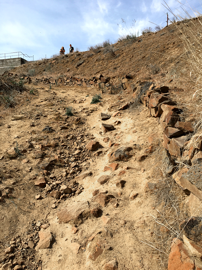
Most of the claimed lands on the lower slopes of Wildcat Mountain have since been acquired as corporate timber holdings, and these forests have been repeatedly logged since the mid-1900s. The Forest Service logged much of the unburned forest on public lands on the middle slopes of Wildcat Mountain from the 1950s through the late 1980s. Meanwhile, fire suppression was allowing the open, upper slopes on McIntyre Ridge to gradually reforest.

As recently at the late 1960s, when Don and Roberta Lowe’s classic “100 Oregon Hiking Trails” was published, the old lookout trail along McIntyre Ridge to the summit of Wildcat Mountain still passed through broad meadows. They described being able to pick out the downtown buildings of Portland from the open summit. And as recently as the early 1990s, Mount Hood could still be easily seen from the top of Wildcat Mountain, though a rising forest of Mountain hemlock and Noble fir were rapidly advancing toward the summit.

Roberta Lowe and friends enjoying the view that existed on Wildcat Mountain until forests overcame the summit in the 1990s (from “62 Trails Northern Oregon Cascades” by Don & Roberta Lowe)

Today, the view from the summit of Wildcat Mountain has all but disappeared, mostly overtaken by the advancing forest. If you know where to look, you can still find remains of the old forest lookout among the trees. McIntyre Ridge still has a few Beargrass meadows along the historic lookout trail, though most have also been overtaken by forest. But this is a temporary state, as recent wildfires in the Gorge and on Mount Hood have reminded us. Wildcat Mountain will burn again, and there’s good reason to believe that the summit and McIntyre Ridge burned fairly regularly in the past, before human fire suppression.

The Struggle for Wildcat Mountain

The changes to Wildcat Mountain’s forests and meadows over the past several decades are just part of the story. The area has also been a source of intense struggle over public land management. The Forest Service aggressively managed the forests here for log production well into the 1980s, and this helped trigger the creation of the 62,000-acre Salmon-Huckleberry Wilderness in 1984. Wildcat Mountain and McIntyre Ridge formed the western edge of the new preserve. At the time, the new wilderness was unique in that it focused primarily on protecting forests, whereas Oregon’s wilderness areas prior to 1984 were mainly “rock and ice” preserves centered on the big Cascade peaks, away from prime logging areas.

Mount Hood emerging from the clouds after a November snowfall on Wildcat Mountain. This scene was captured in 1989 as Pacific rhododendron and young Noble fir were beginning to overtake the once open summit

However, the creation of the Salmon-Huckleberry Wilderness did little to change Forest Service management of the public lands adjacent to the new wilderness, and the focus on logging continued on the remaining, unprotected slopes of Wildcat Mountain. The resulting tangle of logging roads on both public and private lands in this area became a magnet for illegal off-road vehicles and target shooting, largely because its close proximity to Portland. This has become a serious and ongoing challenge for forest managers and law enforcement.

Forest Service logging on Wildcat Mountain had mainly focused on areas below Forest Road 3626, which contours across the gentle west slope just above the 3,000-foot level. This did not go unnoticed by conservationists and the Oregon Congressional delegation, and in 2009, most of the remaining uncut forests on Wildcat Mountain were added to the Salmon-Huckleberry Wilderness by Congress, with Road 3626 serving as the expanded wilderness boundary.

Salmon-Huckleberry Wilderness boundary sign along the Douglas Trail

This more recent expansion of the wilderness has only added to tensions with target shooters and off-road vehicles. Both groups have had a heavy impact on the area in recent years, with shooting galleries littered with trash and large trees literally felled by overwhelming gunfire. Off-roaders have illegally pushed miles into the wilderness, creating new “roads” to bypass Forest Service barriers. Illegal dumping also become a problem, adding to the problems facing land managers.

Timber corporations have responded to the lawlessness by closing their lands to any shooting, and the Forest Service closed a 4-mile section of Forest Road 12 to target shooting, as well. This has had the unintended effect of pushing target shooters and off-roaders still further along Forest Road 3626, and into the Salmon-Huckleberry Wilderness.

Most of today’s shooters aren’t hunters. They’re usually young, suburban kids packing high-powered weapons and handguns and showing little respect for our public lands. These shooters were in a closed area immediately adjacent to Wildcat Mountain Road

Sadly, the lawlessness in the area has also had dampening effect on hikers, a negative feedback loop that only encourages more lawless behavior. Illegal target shooters, off-roaders and dumpers go to places where they think they won’t be seen. Bringing more hikers to Wildcat Mountain is one of the best and most sustainable ways to discourage these illegal activities. It’s a proven concept known as “eyes on the forest”.

But it’s going to take some work. Today, the vandalized trailheads, shot-up or missing signage and vanishing trail views on the mountain are combining to make this convenient, beautiful wilderness destination an afterthought for hikers as they head for already crowded, more distant options where they won’t have to confront these problems.

Bullet-riddled sign announcing the Forest Service ban on shooting along sections of Forest Road 3626 on Wildcat Mountain. This sign was eventually destroyed by shooters

Shooters along Wildcat Mountain Road and Road 3626 have toppled dozens of full-sized trees with thousands of rounds fired at targets attached to the trees, or simply in a deliberate effort to drop them

On a recent visit to the New McIntyre Trailhead, I pulled up behind a truck full of young shooters. I hopped out and said “hello” and began to pull out my pack and hiking poles. When they realized I wasn’t going anywhere soon, they abruptly packed up and left. Even better, three more groups of hikers arrived shortly thereafter — and I’m quite certain other shooters came upon this group of parked cars that day and reversed course, too. That’s how the “eyes on the forest” effect of positive, legal recreation can chase away lawless activity.

Off-roaders have been increasingly bold in crossing into the Salmon-Huckleberry Wilderness in the Wildcat Mountain area in recent years. When the Forest Service placed boulders at the New McIntyre Trailhead in the mid-2000s, off-roaders simply pushed through a new “road” through dense forest to skirt the boulders. This illegal road continues to be used by off-roaders to take their trucks and ATVs into the wilderness area today.

The “road” on the left was created illegally by off-roaders in jeeps and ATVs in the late 2000s to bypass barriers placed at the McIntyre Ridge Trailhead. The actual trail is on the right and leads to the trailhead

The lower portion of the McIntyre Ridge Trail travels through open forest on a very old forest road. This has allowed off-roaders to drive along the trail for nearly a mile into the wilderness area, damaging both the trail and the forest floor where they have simply created new routes where logs have fallen across the trail, blocking their path.

The McIntyre Ridge Trail is on the left, but off-roaders created the road on the right to bypass the two trees flanking the trail. This spot is one-half mile inside the Salmon-Huckleberry Wilderness

A tree dropped across the McIntyre Ridge Trail in 2019 and off-roaders simply plowed through the forest on the left to create a new route for their vehicles, This spot is well inside the wilderness boundary

Off-roaders have been chopping down trees to widen the McIntyre Ridge where the trail narrows about a mile from the trailhead, an outrageous violation of federal law in a protected wilderness area

Where the McIntyre Ridge Trail eventually narrows, off-roaders have even been cutting trees to push their vehicles further into the wilderness. This level of lawlessness has been happening for many years, and it long past time to finally shut it down.

This article contains a series of modest proposals for turning the situation around on Wildcat Mountain by making it preferred hiking destination through improvements to the trails and trailheads. These include new signage, improved trailheads and some creative trail re-routing to bring back the views that hikers look for in their trail experience. How can this be done? More on that at the end of this article.

The Trails

Wildcat Mountain will burn again, and if the series of large fires on Mount Hood and in the Columbia River Gorge are any indication, we will see fire much more frequently in this century as a result of heavy fire suppression in the 20th Century. Someday, Wildcat Mountain and McIntyre Ridge might even return to the expansive complex of meadows that once existed here over time.

Mount Hood from the lower McIntyre Ridge Trail

Until that day, there are still magnificent views to be had if you know where to look. On the existing McIntyre Ridge Trail to Wildcat Mountain, two prominent viewpoints remain — a pocket view of Mount Hood near the trailhead (pictured above) and a more sweeping view of the mountain from a surviving meadow further along the ridge.

This latter viewpoint is the focus for most who hike the McIntyre Ridge Trail. Some years ago, the Forest Service allowed a memorial bench to be installed here, and though it is gradually collapsing under the weight of winter snows, the view it was designed for survives. This spot is often called the “Bench Viewpoint”, and remains a popular hiking destination, despite the problems in the Wildcat Mountain area.

The “bench” viewpoint along the McIntyre Ridge Trail, the most common destination for hikers today

But it turns out that a couple more viewpoints are tucked into the forest just off the McIntyre Ridge Trail, and with some modest trail realignments they would make for a much more scenic gateway into the Salmon-Huckleberry Wilderness.

The first is a rocky wall called “Kinnikinnick Cliff”. It rises directly above the existing trail, and offers a commanding view of Mount Hood and the entire Hoodland corridor, 3,000 feet below. Mount Adams, Mount Rainier and the Goat Rocks can be seen to the north, and the rugged canyons and forested ridges of the Salmon-Huckleberry Wilderness spread out to the southeast. This viewpoint is just over a mile from the unofficial New McIntyre Trailhead and would offer a nice option for casual hikers who want to experience wilderness with big views.

Kinnickinnick Cliff is mostly unseen from the McIntire Ridge Trail, though it rises directly above it in a rugged wall with sweeping view

Mount Hood rises above the Salmon-Huckleberry Wilderness in this panoramic view from Kinnickinnick Cliff. Smoke from the White River fire is visible in this August 2020 view, partly obscuring the mountain. Mount Adams and Mount Rainier can also be seen also on the northern horizon

[click here for a large version of the panorama]

Rerouting the existing trail to visit Kinnikinnick Cliff also has the benefit of bypassing an especially tedious section along the existing trail that I call “Misery Hill”. Though not particularly long, it’s very steep and badly eroded, and there’s no way to fix this problematic section of trail without a major reroute. Thus, the concept of moving the trail to the top of Kinnikinnick Cliff to provide a better grade along with a spectacular new view.

The “Misery Hill” section of the McIntyre Ridge Trail interrupts and otherwise well-graded trail and should be bypassed

The second hidden viewpoint is also just off the existing trail, located south of Kinnikinnick Cliff and just north of the largest of the remaining Beargrass meadows along the trail. This view is from the top of a beautiful talus slope that drops down the east side of McIntyre Ridge. The vista extends across the remote Boulder Creek canyon, below, and into the heart of the Salmon-Huckleberry and Roaring River wilderness areas. Mount Hood also peeks between the trees along the north edge of the talus viewpoint.

The talus viewpoint is just a few yards off the existing McIntyre Trail and provides a view deep into the remote ridges and canyons of the Salmon-Huckleberry and Roaring River wilderness areas

[click here for a large version of the panorama]

Rerouting the trail to visit the Talus Viewpoint is straightforward. Though hidden from the existing trail, the viewpoint is only 100 feet away, separated from the exiting trail by a low ridge. A modest realignment in the trail would add the Talus Viewpoint as another scenic highlight and destination for hikers along the McIntyre Ridge Trail.

The following maps show these proposed trail concepts:

[click here for a large version of this map]

[click here for a large version of this map]

[click here for a large version of this map]

Taking hikers to new viewpoints is a great way to increase interest in the Wildcat Mountain area, as well as make the wilderness experience more satisfying for anyone hiking the McIntyre Ridge Trail. Just a few more law-abiding visitors to the area could have a big impact on pushing the unlawful activity away from Wildcat Mountain, too — a virtuous cycle that is within reach.

The Trailheads

Hikers will put up with a lot to reach a favorite trail, but they shouldn’t have to. Until just a few years ago, the McIntyre Ridge Trail was accessed from Highway 26, where an especially rough Bureau of Land Management (BLM) logging spur climbs the north end of the ridge. This miserable route ended abruptly in the middle of a clear cut, with little room for parking. Worse, shooters and vandals were trashing the area. Because of this, the BLM abruptly closed the access road in the mid-2000s, with no consideration for an alternative access to the McIntyre Ridge Trail.

Hikers at the unofficial New McIntyre trailhead on Wildcat Mountain

The current and unofficial “New McIntyre” trailhead is simply a turnaround at the end of a short logging spur at the north end of Forest Road 3626. From this turnaround, hikers are able to follow an old skid road a short distance to the McIntyre Ridge Trail, joining it about a mile above of the original trailhead. While not recognized by the Forest Service, this unofficial trailhead is now the de facto access to McIntyre Ridge.

In the beginning (in the late 2000s), this turnaround was lightly visited and made for an excellent and safe parking spot for hikers. The half-mile gravel spur road from Forest Road 3626 was in good condition and easily traveled by passenger cars. This didn’t last long. As private timber corporations began to gate their road network on the lower slopes of Wildcat Mountain, illegal shooting, dumping and off-road activity eventually “discovered” the New McIntyre Trailhead.

Shooters have “discovered” the New McIntyre trailhead as other shooting galleries on Wildcat Mountain have been closed

Shooters at the New McIntyre trailhead recently felled two mature trees used as targets and other trees have been seriously injured

This big tree has suffered collateral damage from target shooters at the New McIntyre because it stands just 20 feet behind one of the target trees. Its bark has been seriously compromised by stray gunfire, with pitch bleeding from much of its trunk. If the shooting stopped tomorrow, this tree might survive

Shooters don’t like to be seen. The young men in the pickup disappearing in the distance are making a hasty exit from the New McIntire Trailhead after I showed up and began to unload my hiking gear

The damage is discouraging. Trees are badly scarred by target shooters, with some already toppled by assault. Boulders placed by the Forest Service to keep off-road vehicles out of the wilderness have been vandalized by taggers and the OHVs have simply built a new road into the wilderness that bypasses the barriers. In the center of the turnaround, heaps of half-burned garbage, beer cans and shell casings are routinely scattered around a large bonfire pit. The access road has devolved into a chain of massive mud holes, thanks to OHVs using it as a “play” area.

On a recent visit to the New McIntyre Trailhead, I was pleasantly surprised to find a 2-person Forest Service crew there picking up the place. But without new users coming here to self-enforce this as a lawful recreation area, it will be an endless cat-and-mouse chase for the Forest Service. They simply don’t have the crews needed to heavily patrol Wildcat Mountain to keep up with the mess left behind by shooters and off-roaders.

Burned trash left by shooters at the New McIntyre Trailhead

There’s no question who left this burned garbage behind at the New McIntyre Trailhead. Alcohol containers are almost always mixed in with the shooter trash and vandalism

These Forest Service crews arrived at the New McIntyre trailhead on a recent July weekend to clean up after shooters. They reported cleaning up this spot before, along with other illegal shooting sites along Wildcat Mountain Road

Though the current situation is frustrating, the fix is straightforward. First, the Forest Service should formally recognize the New McIntyre Trailhead as the main access point for the McIntyre Ridge Trailhead. Next, the access road (Forest Road 108) and turnaround should be graded and graveled to improve both the appearance and accessibility for hikers.

Crucially, more barrier boulders should also be added to block the illegal OHV road that bypasses the old barrier. Finally, the tagging and vandalism on the old barrier rocks should be sandblasted from them, as painted messages on rocks only encourages more tagging and shooting.

Off-road vehicle “play” in recent years has turned the short access road to the New McIntyre trailhead into an obstacle course of mud pits and ruts

“No Shooting” stencils on the boulders placed around the New McIntyre trailhead were well-intended, by have only drawn more tagging and vandalism

This “No Shooting” stencil at the New McIntyre trailhead has drown gunfire at close range. Combined with empty beer trash scattered about, this spectacle stands as a reminder that today’s shooters are often both reckless and intoxicated, a dangerous combination

Finally, the New McIntyre Trailhead needs signage — a signboard with a map of the Salmon-Huckleberry Wilderness, a trailhead marker pointing to the McIntyre Ridge Trail and a wilderness entry marker that can be seen from the trailhead. Will these be shot up by the shooters? Initially, yes. They probably will. But if enough cars are parked at this trailhead, the shooters and off-roaders will eventually find another place to do their work.

Similar improvements are needed at the nearby Douglas Trailhead, as well. Though it was built less than 10 years ago, the off-roaders and shooters have already had a pretty big impact there, too. Today, the trailhead needs a cosmetic overhaul and the decommissioned road that leads to the old trailhead needs to be decommissioned — again.

The Douglas Trailhead was relocated a few years ago to reduce the amount of lawlessness, but shooters and off-roaders have continued their assault

This used to be the wilderness entry sign at the Douglas Trailhead, before shooters and vandals tagged the plexiglass sign cover, then shot it to pieces

The Douglas Trailhead used to be located at an old quarry that was a locus of illegal activity and closed off when the new trailhead was built. Off-roaders have since re-opened the road to the quarry and pushed past barriers placed by the forest service to continue their destruction here

This landscape island at the new Douglas Trailhead turnaround has become another OHV “play” feature, with jeeps and ATVs driving right over the top

The goal is simple: the Douglas and New McIntyre trailheads must feel safe and well-maintained for hikers to finally tip the scales on Wildcat Mountain toward lawful, low-impact recreation. This can be done with some modest improvements and some persistence by the Forest Service.

The Roads

The half-mile spur road to the New McIntyre Trailhead is an obvious liability for hikers attempting to visit the area, but Wildcat Mountain Road (Road 36) and Road 3626 both need help, too. The good news is that both are paved and in surprisingly good condition. The bad news is that signage is non-existent, thanks to shooters and other vandalism. This also undermines the sense of safety needed to draw hikers to the area, and it just makes the roads needlessly hard to navigate.

Shooters made a target out of this sign pleading with off-roaders to stay on the road. The obscure third bullet is meaningless, anyway, since the Salmon Huckleberry Wilderness boundary along Road 3626 are not marked

Today, much of Wildcat Mountain Road is already closed to target shooting, but you’d never know it on a summer weekend, when carloads of mostly young men continue to come here to shoot. Signs that once explained what was off-limits and what was still open for shooting have long since been shot to pieces and removed. Even with the signage, the partial closure was confusing and too difficult to enforce.

Instead, it’s time to close the entirety of the Wildcat Mountain Road system to target shooting, including the private timber holdings, since they have already closed their properties. There are plenty of other places for shooters to go, and even lawful target shooting is incompatible with the adjacent Salmon-Huckleberry Wilderness. The folks who live along the lower sections of Wildcat Mountain Road would certainly embrace a no-shooting policy, too, as they also suffer the brunt of lawless activity.

Shooter damage to a sign along Forest Road 2636

This hard-to-find sign buried in the brush along Wildcat Mountain Road (Road 26) is likely seen by none

One tool for enforcing a shooting closure would be to make good use of the steel Forest Service gate on Wildcat Mountain Road near the forest boundary. The gate is located just below the spur road to the Douglas Trailhead, and could simply be closed when the upper slopes of Wildcat Mountain are covered in snow — roughly November through April.

Forest Service gate on Wildcat Mountain Road (Road 26)

Why close the area in winter? It turns out that some of the worst vandalism and OHV use occurs during these months, when few hikers are here to provide eyes on the forest. This may not be a needed as a long-term solution, but it could help change behavior and begin to turn the tide in the near term.

Making it Happen

How can all of this happen? The good news is that it wouldn’t cost much. The Forest Service already has budgets for road maintenance, and repairs to the New McIntyre spur road and turnaround could be prioritized for those funds. Likewise, signage for the trailhead and wayfinding signs along Wildcat Mountain Road and Road 3626 could also be prioritized in existing Forest Service maintenance budgets.

Beargrass meadow in full bloom along the McIntyre Ridge Trail

Closing the area to target shooters? That’s an administrative action that can be done overnight, assuming the Forest Service is willing to make that call. It should be an easy one, as the damage left behind is harming the forest and already costing the agency to patrol and clean up. It’s a case that hiking and trail advocates will need to make in order to move the agency forward.

Designing new trails is often a heavier lift with the Forest Service, as this usually require an environmental analysis, planning and surveying. However, “realigning” an existing trail can often be done without an exhaustive environmental analysis, so the proposals in this article might be less problematic to move forward than a completely new trail.

July Beargrass blooms frame Mount Hood on McIntyre Ridge

Even better, both of the trail realignments proposed here are close to the trailhead and very close to Portland, making them excellent candidates for volunteer organizations like Trailkeepers of Oregon (TKO) to take on as day trips.

Can all of this really happen? The answer is “yes” if the problem statement is “how do we simultaneously improve access to the Salmon-Huckleberry Wilderness while ending lawless behavior in the area.” That’s a compelling and proven strategy. So, let’s take back Wildcat Mountain!


Tom Kloster
August 2020

Mount Hood’s Pint-sized Glaciers

Two of Mount Hood’s pint-sized glaciers are hidden in plain sight in this sunset view from the Mazama Trail

Officially, Mount Hood has twelve glaciers, though two — the Langille on the north side and Palmer on the south side — seem to have slowed to permanent snowfield status. The distinction comes from downward movement, which typically results in cracks, or crevasses, in the moving ice. Crevasses are the telltale sign of a living glacier.

Living glaciers are conveyor belts for mountain ice, capturing and compacting snowfall into ice at the top of the glacier, which then begins to flow downhill from the sheer weight of the accumulation. This downward movement becomes river of ice that carries immense amounts of rock and debris captured in the ice, eventually carving U-shaped valleys in the mountain.

Mount Hood’s largest glaciers carved the huge canyons we see radiating in all directions from the mountain today. These canyons were made when the glaciers were much larger, during the Pleistocene ice age that ended several thousand years ago. The ice on Mount Hood has since retreated, though today’s much smaller glaciers continue their excavating high on the mountain.

The dramatic retreat of the Eliot Glacier on Mount Hood over the past century is captured in these photo comparisons from 1901 and 2012 (Glacier Rephoto Database)

The smallest glaciers on Mount Hood are the Coalman Glacier, located high in the volcano’s crater, and the Glisan Glacier, located on the northwest shoulder of the mountain. They are tiny compared to the impressive Eliot, Ladd, Coe and Sandy glaciers, but these tiny glaciers are still moving, have well-developed crevasses and both are clearly separate from the larger glaciers. Thus, they were recognized as living glaciers in their own right when Mount Hood was being mapped more than a century ago.

Another tiny glacier is without a formal name, and would have been Mount Hood’s thirteenth glacier had it been mapped with the others in the early 1900s. Known informally as the Little Sandy Glacier, this small body of ice is perched on the rocky shoulder of Cathedral Ridge, near the Glisan Glacier. The Little Sandy hangs on cliffs high above the sprawling Sandy Glacier, which it drains into.

The map below shows each of Mount Hood’s glaciers, from the tiny Glisan to the massive Eliot, largest on the mountain:

[click here for a larger version of the map]

This article takes a closer look at these lesser-known, tiny glaciers. While small, all three have been surprisingly resilient in the era of climate change, when our glaciers are rapidly shrinking. Their tiny size and survival (so far) makes them helpful indicators of the long-term effects of global warming on Mount Hood, and a visual reminder of just how fragile our alpine ecosystems are as the planet continues to heat up.

The Coalman Glacier

The Coalman Glacier is located in Mount Hood’s crater, high above the White River Glacier

This glacier is known to few, and yet is probably the most visited on Mount Hood. The Coalman Glacier fills the crater of Mount Hood, extending from below the summit to Crater Rock, and is crossed by thousands of climbers following the popular south side route to the summit each year. Along their climb, they follow a ridge of ice along the glacier called “The Hogsback” to the Coalman Glacier’s “bergschrund”, the name given to a crevasse that typically forms near the top of most glaciers, and a common feature to many glaciers on Mount Hood. For climbers on Mount Hood, the bergschrund on the Coalman Glacier is simply called “The Bergschrund”, and it is the main technical obstacle on the south side route to the summit.

The entire Coalman Glacier lies above 10,000 feet, and as a result, this tiny glacier is well-situated to survive a warming climate. Historic photos (shown later in this article) suggest the Coalman Glacier was once connected to the White River Glacier, located immediately below, as recently as the late 1800s.

Mount Hood’s summit lookout in the 1920s

The Coalman Glacier was named for Elijah “Lige” Coalman, the legendary mountain guide who manned the former fire lookout on the summit of Mount Hood from 1915 to 1933. Lige Coalman climbed Mount Hood nearly 600 times in his lifetime, sometimes making multiple climbs in one day to carry 100 pound loads of supplies to the summit lookout. In Jack Grauer’s classic Mount Hood: A Complete History, he describes Lige Coalman’s legendary stamina:

“…The great vitality of Coleman was demonstrated by one day he spent in 1910. He and a climbing client ate breakfast at the hotel in Government Camp. They then climbed to the summit of Mount Hood and down to Cloud Cap Inn where the client wanted to go. After lunch at Cloud Cap, Lige climbed back over the summit and arrived for dinner at Government Camp at 5:00 p.m.”

The Coalman Glacier was formally recognized as a separate body of ice from the nearby White River and Zigzag glaciers in the 1930s. However, this tiny glacier went unnamed until Lige Coalman died in 1970, and the Oregon Geographic Names Board named the small glacier he had navigated hundreds of times in his memory. Fittingly, Lige Coalman’s ashes were spread on Mount Hood’s summit.

Lige Coalman (left) on the first summit lookout on Mount Hood in 1915 (from “Mount Hood: A Complete History” by Jack Grauer)

Though the south side route is considered the easiest way to the summit of Mount Hood, every route on the mountain is dangerous. Many tragedies have unfolded over the decades on the Coalman Glacier, when climbers have fallen into The Bergschrund crevasse or slid into the steaming volcanic vents in the crater. Perhaps most notorious was the May 2002 climbing disaster, when three climbers were killed and four injured by a disastrous fall into The Bergschrund.

1920s climbers on the Hogsback on the Coalman Glacier. The wide crevasse known as The Bergschrund lies ahead as they make their way toward the summit (USFS)

While the 2002 accident was tragic enough, it was the rescue operation that made the incident infamous when an Air Force helicopter suddenly crashed onto the Coalman Glacier, rolling several times before coming to a rest below the Hogsback. News cameras hovering above the scene broadcast the event in real-time, and the sensational footage was seen around the world. Though several Air Force crew were injured, nobody was killed in the helicopter crash.

The Glisan Glacier

The Glisan is Mount Hood’s smallest named glacier, tucked against Cathedral Ridge on the northwest side of the mountain. This tiny glacier is hidden in plain sight, located directly above popular Cairn Basin and McNeil Point, where thousands of hikers pass by on the Timberline Trail every year. It was named for Rodney Lawrence Glisan Jr. by the Oregon Geographic Names Board in 1938. The name was proposed by the Mazamas, Mount Hood’s iconic climbing club, following an expedition to the northwest side of the mountain in 1937.

Rodney Glisan Jr. in the late 1800s (Mazama Library and Historical Collections)

Glisan was a prominent Portland lawyer and civic leader in the late 1800s and early 1900s, and son of one of the founding fathers of the city. He served on the Portland City Council and in the Oregon Legislature, as well as other civic roles. But his passion was for the outdoors, and as a Mazama, Rodney Glisan climbed most of the major Cascade and Sierra peaks during his eventful life.

The glacier that carries Rodney Glisan’s name was once much larger, and its outflow carved a steep canyon lined with vertical cliffs that now form the shoulder of the lower ramparts of Cathedral Ridge. Today, this rugged canyon is without trails and unknown to most who visit the mountain.

Most hikers visiting McNeil Ridge wouldn’t know they’re looking at the Glisan Glacier as they make the final climb above the tree line, but the glacier’s outflow is a popular stop along the way. This beautiful stream flows through some of the finest wildflower meadows on the mountain (pictured above).

Oddly enough, this glacial stream is unnamed, though it’s much larger than many named streams on the mountain. In fact, it’s the only glacial outflow on the mountain that is unnamed. Thus, on my growing list of planned submissions to the Oregon Geographic Names Board is to simply name this pretty stream “Glisan Creek”, since it’s a prominent and helpful landmark along the Timberline Trail. Naming the creek might bring a bit more awareness and appreciation for the tiny Glisan Glacier, too!

As Mount Hood’s glaciers go, the Glisan isn’t much to look at today. The glacier is much smaller than when it was named in the 1930s, judging by topographic maps (below) that show a lower portion of the glacier that has since become a series of permanent snowfields that are no longer part of the glacier.

The Glisan Glacier also has an odd shape, wider than it is long. Presumably, this is due to both shrinking over the past century and possibly winter wind patterns affecting snow accumulation on this little body of ice. But it is moving, with a prominent series of crevasses opening up every summer on its crest. It’s also surprisingly resilient in its modern, shortened state, bucking the trend (for now) of shrinking glaciers throughout the Cascades.

Topographic maps created in the mid-1900s show the former extent of the Glisan Glacier

Topographic maps still show the former extent of the Glisan Glacier in the mid-1900s, when it extended to nearly 6,000 feet in elevation. Today, the glacier has retreated to about the 7,000-foot level.

The position of the Glisan Glacier on northwest side of the mountain could also be part of the explanation for its resilience. The glacier flows from the north side of Cathedral Ridge, where it is protected from the hottest late summer sun, and it also benefits from being in the direct path of winter storms that slam the west face of the mountain with heavy snowfall. Will the Glisan Glacier continue to survive? Possibly, thanks to its protected position and having already retreated to the 7,000-foot elevation. Time will tell.

The Little Sandy Glacier

This little glacier should have been Mount Hood’s thirteenth named glacier, but it has the misfortune of lying very close to the much larger Sandy Glacier and was passed over when the first topographic maps were created in the early 1900s. And yet, it was called out in Forest Conditions in the Cascade Range, the seminal 1902 original survey of the (then) “Cascade Forest Reserve”, the precursor to the national forests that now stretch the length of the Oregon Cascades:

It was tiny then, at just 80 acres. But at the time of the 1902 survey, the Reid, Langille, Palmer and Coalman glaciers had yet to be named, so this will be my argument in adding the Little Sandy Glacier to my (still!) growing list of name proposals for the Oregon Board of Geographic Names to consider.

Why is a name important for this tiny glacier? In part, because without names we tend to not pay attention to important features on our public lands, usually to their detriment. But in the case of the Little Sandy Glacier, there are some good public safety arguments, since the glacier is adjacent to a couple of the climbing routes used on the mountain. Formalizing its name could help search and rescue efforts compared to the informal use of the name today.

The Little Sandy Glacier is a heavily-crevassed body of ice perched on the cliffs of Cathedral Ridge, high above the much larger Sandy Glacier

Like the nearby Glisan Glacier, the Little Sandy is oddly shaped. Wider than it is long, it hangs seemingly precariously on a massive cliff and is heavily fractured with crevasses. In summer, meltwater from the Little Sandy cascades over long cliff and down a talus slope where it then flows under the Sandy Glacier, joining other meltwater streams there.

What does the future hold for the Little Sandy Glacier? Like the Glisan Glacier, it benefits from heavy snow accumulation where winter storms pound the west face of the mountain. Yet, unlike the Glisan, the Little Sandy Glacier hangs on a southwest-facing wall and is exposed to direct afternoon sun in summer.

Surprisngly, this doesn’t seem to have dramatically affected the size of the glacier over the years, perhaps because it sits so high on the mountain. The base of the glacier is at an elevation of about 8,400 feet (higher than Mt. St. Helens) and the upper extent of the glacier begins just above 9,000 feet. This combination of high elevation and heavy winter snowpack suggest the Little Sandy Glacier will continue to survive for some time to come, even as global warming continues to shrink Mount Hood’s glaciers.

Tracking Mount Hood’s Changing Glaciers

Mount Hood’s Eliot Glacier is impressive, but in truth is a fraction of its size just a few decades ago.

Who is tracking the changes in Mount Hood’s glaciers? The answer is a collection of federal and state agencies, university researchers and non-profits concerned with the rapid changes unfolding on the mountain.

The U.S. Geological Survey has the most comprehensive monitoring program for Mount Hood, though it is mainly focused on volcanic hazards presented by the mountain. From this perspective, the glaciers and permanent snowfields on Mount Hood represent a disaster risk in the event of renewed volcanic activity, as past eruptions have triggered massive mudflows when snow and ice were abruptly melted by steam and hot ash.

Mount Hood’s glaciers, as recognized by the U.S. Geological Survey (USGS)

The late 1700s eruptions that created today’s Crater Rock and the smooth south side that Timberline Lodge sits on also sent mudflows down the Sandy River to its confluence with the Columbia River. The delta of mud and volcanic ash at the confluence gave the river its name, when the Lewis and Clark Expedition reached the scene just a few years after the event, calling it the “quick sand river”. The potential reach of future mudflows is why the USGS continues to monitor Mount Hood’s glaciers.

The U.S. Bureau of Reclamation and other water resource and fisheries agencies are also tracking the glaciers from the perspective of downstream water supplies and quality. Mount Hood’s glaciers not only provide critical irrigation and drinking water for those who live and farm around the mountain, they also ensure cool water temperatures in summer that are critical for endangered salmon and steelhead survival.

In academia, Portland State University geologist Andrew Fountain has been a leading local voice in tracking change in our glaciers, collaborating with federal agencies to monitor glaciers across the American West. Several PSU students have completed graduate theses on Mount Hood’s glaciers under Dr. Fountain, including glaciologist Keith Jackson’s excellent research on the Eliot Glacier.

The once-mighty White River Glacier on Mount Hood has receded dramatically over the past century (Glacier RePhoto Databse)

Dr. Fountain’s research features photo pairing where historic images of Mount Hood’s glaciers have been recreated to show a century of change on the mountain. These images (above and at the top of the article) of the White River and Eliot glaciers are examples, and show the power of these comparisons in understanding the scale and pace of change.

The following is a shorter-term comparison of my own images of the Eliot Glacier, taken in 2002 and 2019 at about the same time of year (in late summer). Look closely, and the changes are profound even in this 17-year timeframe. Geologists call the boundary on a glacier where melting exceeds accumulation the “firn line”. Typically, glaciers appear as mostly ice and snow above the firn line compared to much more rock and glacial till below the firn line, where the ice is melting away and leaving debris behind.

In 2002, the firn line on the Eliot Glacier had risen the lower icefall as the glacier receded, as shown in the image pair, above. The 2002 firn line is indicated by the white and blue ice still dominating the lower icefall. But by 2019, the firn line had moved partway up the lower icefall, as shown in the second image. Over time, scientists expect the glaciers on Mount continue to gradually retreat in this way as they increasingly losing more ice than they gain each year in our warming climate.

What Lies Ahead?

Will Mount Hood’s glaciers completely disappear? Perhaps, someday, if global warming goes unchecked. If climate change can be slowed, we may see the glaciers stabilize as smaller versions of what we see today. While the few remaining glaciers in the Rockies are already very small and on the brink of disappearing, glaciers on the big volcanoes of the Cascades of Oregon and Washington are still large and active. They have advantage of a very wet and cool winter climate that ensures heavy snowfall at the highest elevations, even as the climate warms.

One way to preview the future of Mount Hood’s glaciers is to look south to California’s Mount Shasta, at the lower end of the Cascade Range. At just over 14,000 feet, Shasta is tall enough to have seven named glaciers, even in a much warmer climate — though only four seem to still be active. Compare that to Mount Rainier, in Washington, which is also a 14,000-foot volcano, but has 26 glaciers, with several very large, active glaciers that dwarf anything found on Mount Shasta or Mount Hood.

Despite its height, Mount Shasta’s glaciers only survive above 10,000 feet due to the mountain’s southern latitude in the Cascade Range

The difference is latitude, of course. Climate change is having the effect if sliding us gradually toward the warmer climate we see to the south today, at Mount Shasta, where glaciers are smaller, but still survive above the 10,000-foot level. If Shasta is an indicator, then glaciers will continue to flow for some time at the upper elevations of Mount Hood and the other big volcanoes in northern Oregon and Washington for some time to come, perhaps even surviving if climate change remains unchecked.

In the meantime, the changes on Mount Hood are just one more reminder of how climate change is impacting almost every aspect of our lives and our natural legacy, and why changing the human behavior that is driving climate change is the existential challenge of our time. Though time is short, we can still ensure that future generations will see spectacular glaciers flowing down Mount Hood’s slopes in the next century.

Proposal: Oneonta Loop Trail

Beautiful Middle Oneonta Falls

The Columbia River Gorge is so rich with natural beauty that it’s pretty hard to pick favorites. Yet, when it comes to graceful waterfalls cascading through verdant, rainforest canyons, Oneonta Creek is near the top of my list. A previous article on this blog presented a new vision for managing access to stunning Oneonta Gorge and restoring the historic Oneonta Tunnel. This article examines Oneonta Canyon above the Oneonta Gorge, where more waterfalls and rugged beauty brought thousands to the trails here before the 2017 Eagle Creek Fire.

Iconic Triple Falls on Oneonta Creek

The fire has since changed the Gorge landscape for most of our lifetimes, and the forest is just beginning a post-fire recovery cycle that has unfolded here countless times over the millennia. But while the starkness of the burned landscape is something that we are still adjusting to, the fire gives us a once-in-century opportunity to rethink and rebalance how we recreate in the Gorge.

Oneonta Creek experienced some of the most intense burning during the fire, and almost none of the dense forest canopy survived, and still the forest has already begun to restore itself. What can we do to restore our human presence at Oneonta in a way that will be sustainable for the next century, leaving a legacy for future generations like the one that we inherited?

Before the 2017 Fire: Signs of Stress

The spectacular scenery along the Oneonta Creek was already drawing huge, unsustainable crowds of hikers well before the Eagle Creek Fire roared through Oneonta Canyon, and the visible impacts were everywhere. Some of the impact was on the human environment, including the very trails and bridges that brought hikers into Oneonta Canyon. And some of the impact was on the land, itself, with hikers straying from developed trails to create destructive social paths and shortcuts in many spots. These informal trails had become badly eroded, often undermining the main trails, themselves. 

Social trail damage near the lower Oneonta Creek footbridge

One place where these impacts escalated alarmingly in the years before the fire was the lower footbridge on Oneonta Creek, located just above Oneonta Falls and just below Oneonta Bridge Falls. As shown in the photo above, crowds of hikers had carved a new path to a pool in the creek at the west abutment of the bridge, stripping away fragile vegetation and filling the pool with eroded debris.

The photo below shows how this social path has not only destroyed the thin layer of soil and forest understory on the slopes of Oneonta Creek, but was also undermining the main trail, itself, which was gradually sliding down the slope.

Social trail eroding both the slope and the shoulder of the main trail (on the left)

Even the lower Oneonta footbridge was in trouble before the fire. The Forest Service began posting a warning on the bridge a few years before the fire limiting it to one hiker at a time, yet another reminder of the serious disinvestment we have been making in our Gorge trails for the past thirty years. The rapid growth in visitors during this same period only increased the impact on structures like this, which were long overdue for repair or replacement.

Warning sign for hikers approaching the lower Oneonta footbridge

Meanwhile, at the east end of the lower Oneonta Bridge, curious crowds had pushed a new social path upstream, past Oneonta Bridge Falls (below). Social paths form when hikers head off-trail in search of a new viewpoint or water feature. When more hikers the steps of the first, the increasing foot traffic gradually formalizes social until they become hard to distinguish from legitimate trails — except that they are rarely “built” in a way that is sustainable, and often bring serious harm to the landscape.

Social trail heading toward Middle Oneonta Falls from the lower Oneonta Creek bridge

Meanwhile, things were getting worse on the east side of the lower Oneonta Bridge, too, where hikers had cut the short switchback just above the bridge (below) to the point that it began collapsing before the fire closed the area to the public. Why do people do this? Mostly, it’s ignorance, inexperience and overcrowding, and often by children who are not getting needed guidance from parents on why this is not okay.

Heavy damage from shortcutting on this switchback at the east end of the lower Oneonta Creek bridge

Heading beyond the lower Oneonta bridge, another major social path had formed on the west side of the creek (below), where hikers had created a long shortcut directly down the canyon slope where a long switchback exists on the main trail. The damage here was obvious and quite recent when this photo was taken about 18 months before the fire. When social paths become this prominent, the damage begins to spiral, with new or inexperienced hikers mistaking them for a legitimate route, and further compounding the problem with still more foot traffic. The overcrowding on the Oneonta Trail only added to the spiraling effect.

Hikers shortcutting this switchback have created a new social trail nearly as wide as the main Oneonta Creek trail

While hikers were causing the bulk of the impact before the fire, Mother Nature was busy in Oneonta Canyon, too. The photo below was taken after the 2017 fire, and reveals a major landslide that began moving years before the fire. The slide extends from Oneonta Creek (where it has left a pile of trees and debris visible in this photo) to the cliffs well above Oneonta Trail. A fifty-yard section of the trail was erased by the slide, with several efforts in the years just before the fire to stabilize a new route above the old trail.

Landslide along the middle section of Oneonta Creek that threatens long-term viability of the current trail

Here’s a view (below) of the landslide looking downhill toward Oneonta Creek from where the original Oneonta Creek Trail was once located. The big trees still standing in the path of the landslide in this view were burned in the fire, which will further destabilize this slope and allow the slide to accelerate in coming years.

Looking down the landslide toward Oneonta Creek in 2015, before the fire

When the original section of the Oneonta Trail was swept away by the landslide, the Forest Service built this set of stairs (below) to a new crossing of the slide, about 30 yards uphill from where the old trail had been.

Bypass trail built to temporarily navigate the Oneonta Trail landslide

This photo (below) shows the new, temporary crossing of the slide as it existed before the fire, but volunteer trail crews visiting the Oneonta Trail earlier this year report that this temporary route has also become eroded since the fire. The continued instability of the landslide raises real questions about whether a safe route can be maintained here in the near-term.

Wide angle view of the temporary route built across the landslide a few years before the 2017 Eagle Creek Fire

Landslides like this are an ongoing part of the Gorge geology, but in this case, it also marks a spot where an increasingly busy social path dropped down to Middle Oneonta Falls. The growing traffic to this off-trail falls was already taking its toll on the terrain before the slide. So, was the landslide triggered by erosion along the social path? There’s no way to know, but it’s certainly possible that the social path contributed to the sudden instability of the slope.

On my last visit to the upper Oneonta Canyon before the 2017 fire, I ran into bit of trail legend named Bruce, who was a longtime trail worker in the Gorge dating back to the 1980s. He was rebuilding the approach to the slide, and we talked about how Forest Service crews were struggling to simply keep pace with the impact of growing crowds and shrinking agency staff for basic trail maintenance. Major repairs, like those required the slide, were completely overwhelming his crews.

Gorge trail crew legend Bruce (now retired) working near the slide on the Oneonta Trail in 2014

Bruce was wistful about the situation, as he was planning to retire soon, and the trails he had worked so hard on were not faring well as he prepared to turn them over to a new generation of trail workers. 

Beyond the problematic landslide, the Oneonta Trail arrives at Triple Falls, an iconic destination that most hikers are coming here for. In the years before the fire, the overlook at Triple Falls was literally crumbling under the pressure from overuse. The photo below shows the view from the main trail, where a tangle of social paths cutting directly downslope to the badly eroded viewpoint can plainly be seen.

Widespread slope damage where a network of social trails has cut into the Triple Falls overlook

A well-graded spur trail provides access to the viewpoint, but few used it. Instead, most follow the steps of this hiker (below) and simply cut directly up the slope to rejoin the trail. Over the past decade, the damage from erosion here had increased alarmingly.

Another hiker adding to the impact of the social trails at the Triple Falls overlook in 2014

Earlier this year, the volunteer trail crews assessing the Oneonta Trail captured these views of the Triple Falls overlook, showing how the burned over landscape also offers a unique opportunity to rethink and rebuild this overlook trail before hikers are allowed to return.

The Triple Falls overlook was stripped bare by the Eagle Creek Fire (photo: Trailkeepers of Oregon)
Triple Falls after the Eagle Creek Fire (photo: Trailkeepers of Oregon)

Just beyond Triple Falls, the Oneonta Trail crossed the creek on this upper footbridge (below), installed by volunteers and Forest Service crews about ten years ago.

Upper Oneonta Creek footbridge before the 2017 Gorge Fire

 This year’s volunteer crews found that the 2017 fire hadn’t spared the upper bridge, as the photo below shows. This represents yet another opportunity to think about how the area will reopened. While the bridge provides critical link to the rest of the Oneonta Creek trail system, it also led to a growing network of eroding social paths on the east side of Triple Falls.

Upper Oneonta Creek Footbridge after the Gorge Fire (photo: Trailkeepers of Oregon)

Today, we have a unique opportunity for a reboot, with the canyon just beginning its post-fire recover and still closed to the public. As traumatic as the Eagle Creek Fire was for those who love the Gorge, having the forest burned away was like lifting a window shade on the terrain beneath the forest. Where the fire destroyed a dense forest, it also laid bare the underlying terrain and geology, providing a rare opportunity to plan for our Gorge trail system as it enters its second century.

For trail builders, it’s a perfect opportunity to take a good look at the land for opportunities to refine existing trails and to build trails for future generations of hikers. This includes adjusting existing trail alignments to more stable terrain and replacing social paths with sustainable trails that can help curious hikers explore the beauty of the area without harming it. The fire also cleared the forest understory, making trail building a lot easier.

A New Vision for Oneonta

With this unique opportunity in mind, this proposal focuses on a new loop trail along the middle section of Oneonta Canyon, where little known Middle Oneonta Falls has been hidden in plain sight over the century since the first trail was built here. Middle Oneonta Falls is among of the most graceful in the Columbia Gorge, and waterfall enthusiasts have long followed the steep, brushy social path that led to the falls. I made my first trip there in the late 1970s, when I was 16 years old, and returned many times over the years.

Though my photography skills were pretty rough 38 years ago, this is how Middle Oneonta Falls looked way back in 1982. This is also where the falls would first come into view on the proposed Oneonta Loop Trail 

It’s hard to know why the original trail builders passed by Middle Oneonta Falls, and chose to route the main trail high above the falls. The falls can plainly be heard thundering in the forest below, and from one spot on the trail, the brink of the falls can be seen. But for most hikers, Middle Oneonta Falls remained unknown.

This proposal would change that, with a new loop that would not only lead hikers to Middle Oneonta Falls on a well-designed trail, but also take them behindthe falls! More on that, in a moment. Here’s the general location of the proposed loop (shown in yellow) as it relates to the existing Oneonta and Horsetail Creek trails (shown in green):

[click here for a large map]

Why build a new loop trail at Middle Oneonta Falls? One reason is pragmatic: the word is out, and this beautiful waterfall is no longer a secret, as well-worn social paths prove. And, with the forest now burned away, the falls will be plainly visible from the main Oneonta trail, making it impossible to prevent new social paths from forming as curious hikers look for a way to reach the falls.

Given these realities, this concept also focuses on how to make a new loop trail to Middle Oneonta Falls one that provides a new and much-needed destination for casual hikers and families with young kids looking for something less strenuous than what a lot of Gorge hikes require. Loops are the most popular trail option for hikers, too, since they provide a continuous stream of new scenery and adventure.

In the long-term, loops also offer a management tool that is seldom used today, but has great merit in heavily traveled places like the Gorge: one-way trails. On crowded trails in steep terrain, one of the biggest impacts comes from people simply passing other hikers coming from the option direction, gradually breaking down the shoulders of trails over time. One-way trails eliminate this problem, and the provide a better hiking experience with less sense of crowding, too.

With these trail themes in mind, what follows is a tour of the proposed Oneonta Loop Trail, using an exceptional series of aerial photos captured by the State of Oregon in the aftermath of the Eagle Creek Fire. 

The first view (below) captures the existing Oneonta Canyon trail system from Oneonta Falls to Triple Falls, with the proposed new loop trail shown in yellow. The new loop trail would follow the more stable east side of Oneonta Canyon, avoiding the landslide on the west side (which is also shown on the map).

[click here for a large map]

As the above map shows, another benefit of the proposed loop is that it could also serve as a reroute for the existing Oneonta Creek Trail if it becomes impossible to maintain a trail across the landslide, as the new loop would connect to the main trail upstream from the slide.

The next series of maps walk through the proposed loop trail in more detail, starting at the bottom, where the new trail would begin where a social path already extends into the canyon from the lower Oneonta Bridge (below).

[click here for a large map]

From there, the route to Middle Oneonta Falls is surprisingly straightforward (below), and quite short — less than one-half mile. This would make the falls an easy destination for young families and hikers who don’t want to tackle the longer and more strenuous climb to Triple Falls.

[click here for a large map]

Once at Middle Oneonta Falls (below), the new trail would take advantage of the huge cavern behind the falls to avoid building and maintaining another trail bridge, and simply pass behind the falls, instead. 

[click here for a large map]

For hikers coming from the Horsetail Falls trailhead, this would also be the second behind-the-falls experience, having already passed behind Ponytail Falls along the way. This would make the hike to Middle Oneonta Falls a magnet for families with kids, as nothing quite compares with being in a cave behind a waterfall for young hikers!

After passing behind Middle Oneonta Falls, the new loop trail (below) would climb the west slope of Oneonta Canyon just upstream from the slide in a series of four switchbacks, and rejoin the main trail. From there, hikers could continue on to Triple Falls or turn back to the trailhead to complete the new loop.

[click here for a large map]

The next few schematics show how the trail would pass behind beautiful Middle Oneonta Falls. The first view (below) is from slightly downstream, and shows the forested bench opposite the falls where the new trail would descend toward the cave.

[click here for a large schematic]

The next view (below) is from the base of the cliffs at the west side of the falls. The big boulder shown in the previous schematic should help you orient this view, as it is marked in both schematics. This view provides a better look into the cave, which is made up of loose river cobbles and well above the stream level in all but the heaviest runoff. Note my fellow waterfall explorer behind the 90-foot falls (!) for scale. 

[click here for a large schematic]

A third schematic of the falls (below) is from further downstream. This view gives a better sense of the large bench in front of the falls where the approach trail would be located, and how the exit from the cave would navigate a narrow spot between the creek (by the “Big Boulder”) and cliffs on the west side of the falls.

[click here for a large schematic]

As the photos in these schematics show, this is an exceptionally beautiful spot, and though it is now recovering from the fire, it would still make for an easy and popular new destination in the Gorge. Would more visitors make it less pristine? Perhaps, but on my last trips to Middle Oneonta Falls I had to clean up campfire rings built directly adjacent to the creek and carry out beer cans and trash, so it’s also true that legitimizing the trail here would bring “eyes on the forest that would help discourage this sort of thoughtless damage.

Further upstream, there’s also work to do at Triple Falls. This map (below) shows how the main trail could be relocated to follow the existing (and seldom used) spur to the viewpoint and be extended to simply bypass the section of existing trail that drives creation of social trails.

[click here for a large map]

This would provide a long-term solution to the maze of social paths that have formed between the existing trail and the Triple Falls viewpoint. This is a very simple fix, and should be done immediately, while the area is still closed to hikers and the burned over ground and exposed rock make trail construction much easier.

What would it take?

The entirety of Oneonta Canyon is within the Mount Hood National Forest, but administered by the Columbia River Gorge National Scenic Area (CRGNSA) unit of the Forest Service. Despite the creation of the scenic area in 1986 as a celebration of the beauty of the Gorge, there have been no new trails on Forest Service lands in the western Gorge for more than three decades. In fact, the agency has periodically proposed abandoning some of the lightly used backcountry trails in the Mark O. Hatfield Wilderness that have fallen behind in maintenance. 

Oneonta Creek scene before the fire near Triple Falls

The Forest Service is reacting to a long period of strained recreation budgets dating back to the 1990s, but our recent history of disinvestment should not prevent us from looking ahead to the needs of this century. The lack of a future vision is part of what prevents new trails from being designed and built, as there are already plenty of ideas for new trails that could be sustainably built in the western Gorge to help take pressure off the existing system.

The last new trail built in this part of the Columbia River Gorge is the Wahclella Falls loop, completed in 1988. Today, this wonderful loop trail is iconic and among the most beloved in the Gorge. But until the 1980s, a brushy, sketchy user path is how hikers reached Wahclella Falls. Recognizing the need to formalize an official trail, the Forest Service worked with volunteers who completely rebuilt the old trail and added a new leg on the west side of the canyon, creating the well-designed, exceptional loop we know today.

Tiny Maidenhair spleenwort (for scale, the larger fronds at the top of Licorice fern!) are as uncommon as they are beautiful, and are found along the Oneonta Creek Trail near Triple Falls

This proposal for an Oneonta Loop trail would be a great candidate for a similar effort, with Forest Service and volunteer workers creating a new trail that would not only provide a much-needed trail option in the western Gorge, but that would also remedy the social trails that have developed and potentially serve as a new, main route if the landslide on the current trail cannot be stabilized. 

In the aftermath of the Eagle Creek Fire, now is a perfect time to reboot trail building in the Gorge and Oneonta would be the perfect spot to get started. The area is still closed to the public, and trail volunteers have already begin scouting the trail to assess fire damage and make plans for repairs. This scouting work could be expanded to site the new loop trail, and there’s no better way to bring volunteers to trail projects than to build new trails. 

Civilian Conservation Corps (CCC) crews building the cliff-hugging trail above Elowah Falls in 1936

And finally, consider this: almost all of the trails in the Columbia Gorge (and the rest of Mount Hood National Forest) were built over the course of just two decades, in the 1920s and 30s. Amazingly, the system we have today is less than half of what was existed before the industrial logging era began after World War II. And in that period of decline, few new trails were added.

While forest trails were initially built as basic transportation for forest rangers, the Great Depression brought a new focus on recreation and enhancing our public lands through the work of the Civilian Conservation Corps (CCA) and Works Progress Administration (WPA). Our best trails were built during this golden age of trail construction, when trails were designed to thrill hikers with amazing views and adventures. These federal workforce program were put in place under Franklin D. Roosevelt as part of the national recovery plan, when unemployment during the Great Depression exceeded 20 percent, with no end in sight.

Sound familiar? Our normally gridlocked U.S. Congress has just allocated nearly $4 trillion in emergency funding to shore up the country as an unprecedented Coronavirus pandemic takes hold. And congressional leaders are already proposing more stimulus funding in the form of public infrastructure to continue pumping money into the economy and creating work for the jobless. Are we on the brink of another trail-building renaissance in our national forests? Quite possibly — but only if we begin planning for that possibility now.

___________________

And one more thing…

There is a LOT of confusion about place names on Oneonta Creek. USGS topographic maps show only Oneonta Falls and Triple Falls, but Oneonta Falls is shown where Middle Oneonta Falls is located. This is clearly a map error, though one that has endured (and confused) for a very long time. In fact, Oneonta Falls is the tall, narrow falls at the head of Oneonta Gorge and is identified as such in early photos of the Gorge taken long before anyone knew much about the upper canyon.

A case of mistaken waterfall identity at Oneonta…

Meanwhile, there’s a small waterfall right in front of the lower Oneonta footbridge that is often called “Middle Oneonta Falls”, only because it’s in plain sight and so few know that there’s a much larger “Middle Oneonta Falls” just a half-mile upstream. Fortunately, the USGS got Triple Falls right!

So, for the purpose of this article (and in general), I refer to the small falls by the lower footbridge as “Oneonta Bridge Falls”, just to clear things up a bit. Creative, right? Well, neither is “Triple Falls”! Or “Middle Oneonta Falls”, for that matter! But at least we know which waterfalls we’re talking about. Remember, there’s no detail too small for THIS blog!

Thanks again for reading this far, folks!

___________________

Tom Kloster | May 2020

Who was Newton Clark?

The Newton Clark Glacier flows from Mount Hood’s east face

High on Mount Hood’s broad east face is the Newton Clark Glacier, third largest of the twelve named glaciers on the mountain. Many assume a hyphen must be missing in what appears to be two surnames, especially since the two major glacial outflows from this glacier are separately known as Newton Creek and Clark Creek. Who is this Newton character… and what about Clark?

Instead, it turns out that Newton Clark was just one man who made his place in local history as one of the early surveyors mapping the Mount Hood area. And in a rarity among place names in Oregon, his full name made it to our maps, where our modern naming rules limit honorary place names to surnames. It also turns out that nearby Surveyor’s Ridge, with its popular mountain biking trail, is also named for Newton Clark, albeit anonymously.

Topo map of the Newton Clark Glacier on Mount Hood’s east face

The sprawling glacier named for Newton Clark is unique among Mount Hood’s glaciers: it’s wider than it is long! While glaciers like the Eliot, White, Coe and Reid flow down the mountain in rivers of ice, the Newton Clark Glacier is draped like a big ice blanket on the east face of the mountain high atop a steep bench formed by the Newton Clark Prow, a massive lava outcrop that prevents the glacier from flowing any further down the mountain. 

The Newton Clark Prow splits the glacier into its twin canyons, Clark Canyon to the south and Newton Canyon on the north. At nearly 8,000 feet in elevation, this jagged rock outcrop once divided a much larger ice age glacier into two rivers of ice that left today’s massive Newton Clark Moraine behind, a medial moraine that once had rivers of ice as high as the moraine flowing on both sides (you can read more on that topic in this blog article). Today, the Newton Clark Prow forms the rugged head of Newton Canyon, with summer meltwater from the glacier tumbling over its cliffs in dozens of waterfalls.

The broad Newton Clark Glacier is bordered on the north by Cooper Spur, a long, gentle ridge that extends from Cloud Cap to the summit of Mount Hood. At 8,514 feet, the summit of Cooper Spur is among the highest points in Oregon that can be reached by trail, and one of the more popular hikes on the mountain. The view from the top of Cooper Spur provides a close-up look the rugged, crevassed surface of the Newton Clark Glacier.

The Newton Clark Glacier from Cooper Spur
Giant ice pinnacles known as seracs are pushed into the air by this icefall on the Newton Clark Glacier

From below, the Newton Clark Glacier actually looks stranded (below), sitting unusually high on the mountain, with its crevasse fields spreading out in multiple directions as the glacier sprawls above the cliffs of the Newton Clark Prow.

The Newton Clark Glacier and Prow as viewed from Newton Canyon
Rare, close-up view of the Newton Clark Prow (photo: Chip Down)

Downstream, the Newton and Clark canyons eventually merge at the southern foot of the Newton Clark Moraine, where the flat, mile-wide floor of the East Fork Hood River valley begins. Here, the arms of the ice age ancestor of the Newton Clark Glacier continued for miles down the mountain toward Hood River, creating the broad, U-shaped valley we travel today on the OR 35 portion of the Mount Hood Loop Highway.

Newton and Clark creeks don’t quite merge as the converge at the foot of the Newton Clark Moraine

Surprisingly, the two glacial outflows don’t merge on the valley floor. Instead, they each flow into the East Fork Hood River separately, about a mile apart. Both Newton and Clark creeks are notoriously volatile glacial streams, each changing course on the floor of the East Fork valley during recurring flood events.

Of the two outflows, Newton Creek is the largest and most volatile stream, repeatedly sending massive debris flows down the East Fork Hood River valley over the years and washing out OR 35 in the process (more on that later). Clark Creek is less violent, but still a powerful glacial stream that challenges Timberline Trail hikers attempting to ford it during the summer glacial melt.

Now that we’ve met the Newton Clark Glacier and its sibling streams, what about the man behind the name?

Who was Newton Clark?

Newton Clark in the 1880s

Newton Clark was born in Illinois in 1838 and soon moved as a child with his family to Wisconsin as pioneer settlers. Clark spent his youth there, becoming an exceptional student and later studying surveying at the Point Bluff Institute.

In October 1860, Newton Clark married Scottish immigrant Mary A. Hill, and the two resided in North Freedom, Wisconsin. Just one year later, in September 1861, 23-year old Newton enlisted in the 14th Volunteer Infantry, Company K Wisconsin volunteers of the Union Army. His company served in 14 battles under General Ulysses. S. Grant in Civil War battles across the south. 

Newton Clark in the early 1900s

Like so many in their Civil War generation, young Newton and Mary’s married life was put on hold during his four years of service. Mary remained in Wisconsin with their young daughter during Newton’s infantry service, undoubtedly anxious for her young husband’s return from our nation’s deadliest war. 

When he left for battle, Newton said “If I never come back remember that you have our little Minnie to live for, work for her and she will be a comfort to you.” Newton later returned from battle, but their little Minnie died during his time away at war.

Newton Clark served as Quartermaster during his Civil War enlistment, and he furnished the flag that was raised above the Vicksburg, Mississippi courthouse when the war was ended on May 9, 1865. After the war, Newton was an active veteran with the Grand Army of the Republic (G.A.R.) fraternal organization. The above portrait above was taken late in is life, and proudly shows his G.A.R. insignia.

Detailed view of the G.A.R. insignia worn in the late 1800s

The G.A.R. was much more than what we think of with today’s fraternal organizations. Following the Civil War, the G.A.R. emerged as among the first and largest advocacy group on the nation’s political scene, dedicated to both political causes and the benevolent interests of their veteran members.

The G.A.R. was an important arm of the Republican Party (at the time, the progressive party in American politics), and in this capacity the organization was deeply involved in the reconstruction that followed the war. Among their efforts, the G.A.R. actively promoted voting rights for black Civil War veterans. They also became a racially integrated organization at a time when the emerging Jim Crow era was about to stall civil rights in this country with another century of racial segregation and persecution of black Americans. At its political peak in the late 1800s, the G.A.R. had nearly half a million members.

The G.A.R. Monument in Washington, D.C., located on Pennsylvania Avenue across from the National Archives (Wikipedia)

The G.A.R. also focused on advancing Republican candidates to public office and promoted patriotism and veteran’s rights across the country. This included providing pensions for veterans, creating hundreds of war memorials so that the Civil War might never be forgotten and establishment of Memorial Day as a national holiday, a legacy many of us celebrate without knowing of its origins. 

In his later years, Newton Clark served as an officer in the Ancient Order of United Workmen (A.O.U.W.) for decades, a fraternal benefit society formed to provide mutual social and financial support for its membership after the Civil War. By the late 1800s, it was the largest fraternal organization in the country, and one that Newton continued to serve until his death.

Newton and Mary’s Life in the West

Newton Clark is identified in this photo taken at Twin Oaks Farm in the Hood River Valley in 1914 (back row, center, wearing a bow tie) (photo: Hood River History)

Soon after Newton’s return from his service in the Civil War, he and Mary moved west to the new Dakota Territory that had been created in 1861, just as the Civil War erupted. There, the Clarks farmed as pioneers in what is now the state of South Dakota. 

The old Dakota Territory was massive, encompassing today’s North and South Dakota, most of Montana and the north half of Wyoming until statehood came to Wyoming and the Dakotas in 1888-89, long after the Clarks had moved again, this time to Oregon. 

During their time in the Dakota Territory, Newton and Mary continued to have children, in the wake of losing their baby daughter Minnie, eventually adding two daughters and a son to their young family. The Clarks built the first frame house in Minnehaha County, where they farmed on a homestead located two miles from today’s town of Sioux Falls. Newton also worked as a surveyor of public lands for eight years, where he laid out the sections and townships in much of the Dakota Territory.

Newton Clark entered politics while in the Dakota Territory, too. He served as school superintendent, and was chairman of the board of county commissioners in Minnehaha county for several years before serving as a state legislator in the Dakota Territorial Legislator in the early 1870s. Newton Clark’s public service in the Dakota Territory put his name on the map of today’s South Dakota, with Clark County and the county seat of Clark, South Dakota named for him.

Mary Clark (on the far right) at a garden party in the 1910s (photo: Hood River History)

The grasshopper plagues that swept the high plains in mid-1870s eventually drove Clark from the Dakota Territory, and he continued his family’s migration west to Oregon in 1877. That year, he left Mary behind to care for the children in the Dakota Territory while he joined up his parents, Thomas and Delilah Clark, who had been living in Colorado. 

Together, Newton and his parents traveled three months overland in the summer of 1877, arriving in the Hood River area on September 1. Mary Clark and their three children, William, Jeanette and Grace, eventually joined Newton and his parents in 1878, settling into their new home in Oregon.

Newton later said “I tried farming on my homestead in Dakota, but after two years of successful crops of grasshoppers, I became a disgusted with that form of agriculture and struck for Oregon, driving a team overland.”

Closer view of Mary Clark enlarged from the previous photo (photo: Hood River History)

Newton and Mary Clark arrived in Oregon with almost no money to their name, and set about creating a new life in Hood River. They were among the first pioneers to settle there, and Newton initially found work cutting cordwood and splitting shingles for other valley settlers. By 1878, he was able to purchase 160 acres on the west side of the Hood River Valley, where they built their family home. Newton’s parents built their home on an adjoining parcel.

Newton Clark said later of their new home “We found the Hood River Valley as nature had designed it and habited by a handful of the pioneers… the salubrity of the climate, its freedom from storms of wind and lightning of summer and its frigid blizzards of winter as compared with the Dakotas, all delighted us.”

Newton soon began taking contracts with the federal government to survey public lands in the rugged western and southern parts of Hood River County, establishing the section lines in the Upper Hood River Valley and surrounding mountain country that are still the basis of our maps today. Most of these areas would become part of today’s Mount Hood National Forest. Loggers in the early 1900s were still reporting survey marks on trees left by Newton Clark’s crews more than 30 years later.

Many of the section lines (the grid system based on township and range) on this early 1900s map of the Hood River Valley were surveyed by Newton Clark in the 1880s

Like today’s immigrants to Oregon, Newton Clark was drawn to explore the unmatched scenery that we sometimes take for granted. He was among the first to summit Mount Hood and he was also a member of the first party of white men to set eyes on iconic Lost Lake. 

Surveying and exploring in Mount Hood country the 1880s was difficult and dangerous. Trips into the mountains took days, with Clark’s crews carrying heavy supplies on their backs and packhorses. There were few trails, so much of the travel was cross-country, through dense, virgin forests.

Though not identified on the image, Newton Clark and Mary clearly appear beneath the arched window on the right in this photo taken at the Riverside Congregational Church in 1913 (photo: Hood River History)
A closer view of the previous photo showing Newton Clark and Mary standing behind him, looking over his right shoulder (photo: Hood River History)
Comparison of the known image of Newton Clark in 1914 at Twin Oaks (right) and 1913 Riverside Church photos (left), and it’s clearly Newton Clark in the Riverside photo (photos: Hood River History)
Comparison of the early 1910s garden party photo (left) and 1913 Riverside Church photos (right), and we can clearly see Mary Clark standing just behind her husband (photos: Hood River History)

Like other pioneer explorers of Mount Hood, Clark eventually had a feature on the mountain named for him. For unknown reasons, his full name was used in naming the Newton Clark Glacier. Perhaps this was to prevent confusion with the many features in the West named for William Clark, of the Lewis and Clark Expedition? It remains among the few places in Oregon to feature the full name of its namesake.

The Clarks left Hood River in 1888 when Newton was elected Grand Recorder of the A.O.U.W., his beloved fraternal older, though he retained some of his property in the Hood River Valley until his death. He served in this capacity with the A.O.U.W. for the next 20 years, with the family living in downtown Portland in a house at “400 Broadway”. Under Portland’s historic address system, this would have been at the corner of Broadway and Stark, where the Hotel Lucia now stands today — in theory, as least.

This illustrated map from 1890 shows a home located at the southeast corner of Broadway and Start, a few blocks from the once iconic Portland Hotel that stood where today’s Pioneer Courthouse Square is located.

While the 1890 map seems to provide a plausible case for where the Clarks lived in Portland, the fact that today’s historic Hotel Lucia (once called the Imperial) was built in 1909 at this corner clouds that history. The Clarks moved back to Hood River that year, which might make a plausible case for a new hotel going up where home had been, but newspaper accounts show them living at the same home in Portland a few years later, with their daughter. So, more research is needed to know just where the Clarks lived in Portland.

The historic Hotel Lucia was originally the Imperial, built in 1909, a full nine years before Newton and Mary Clark lived on Broadway at the end of their lives

The family returned to Hood River in 1909 when Newton retired from his A.O.U.W. office and built a new home on a hill above town that became their retirement residence.

During these later years in Hood River, the Clarks spent summers at a cabin Newton built at Lake Lyttle on the Oregon Coast, in today’s town of Rockaway Beach. Unlike today’s travelers, they didn’t follow roads to Rockaway Beach. Instead, they took the new Oregon Pacific Railway that had recently opened a route through the Coast Range from Hillsboro to Tillamook

It’s unknown if Newton’s parents joined him when the Clarks moved to Portland in 1888, but his father died in 1892 and historic accounts show his mother living with the Clark family in Portland when she died in 1905, at the age of 98. So, one possibility would be that Delilah Clark joined her son’s family when Thomas Clark passed away in 1892, though there are no history accounts to confirm this. 

What is clear is that Newton was close enough to his parents to bring them west to Hood River with his family in 1877, and later, to bring his elderly mother into his home in Portland. Somewhere out there, a portrait of the extended Clark family exists, and I’m hopeful a reader of this article might be able to help with that.

Newton Clark’s Family

True to the era, less is known about Newton Clark’s wife, Mary, beyond her husband’s description of their life together. She was a native of Edinburgh, Scotland, and according to the historical accounts available, she shared Newton’s passion and determination in their adventurous life as pioneers. 

Two of Newton and Mary’s children died while the parents were still living, baby Minnie in the early 1860s, while Newton was serving in the Civil War and later, their adult daughter Grace (Clark) Dwinell, in 1910. 

Grace finished school in Portland after the family had relocated there in 1888, and became a West Side (now Lincoln) High School graduate. What history is recorded about Grace describes her as outgoing and with a beautiful singing voice that she would often entertain with at family gatherings. 

West Side (which later became Lincoln) High School was located at 14th and Morrison in downtown Portland, seven blocks from where the Clarks live on Broadway. The school was completed in 1885, and opened while the Clarks were living in the neighborhood.
The ornate, gothic-style West Side (later called Lincoln) High School as it appeared when Newton Clark and his family lived in the neighborhood. This impressive structure is among the many grand buildings built in downtown Portland in the 1800s that were later razed as the city continued its rapid growth.

Grace Clark met young Frank Dwinnell while on a trip to visit family in Wisconsin, and he followed her back to Portland, where the two married.  They moved back to Wisconsin for a time and started a family, but sometime in the late 1890s, Grace contracted tuberculosis — then called “consumption” and the leading cause of death at the turn of the century. 

At the time, Grace attributed her illness to the harsh climate in Wisconsin, and the family relocated back to Oregon. After initially recovering from the disease, her tuberculosis eventually returned and Grace died in 1910 at the age of 37. Her funeral was held at Newton and Mary’s new home overlooking Hood River. Frank Dwinnell later moved back to Wisconsin with their young son and daughter to be near his family.

Grace (Clark) Dwinnell’s grave in the Idlewild Cemetery in Hood River

Two of Newton and Mary Clark’s children survived them, including their son William Lewis Clark and daughter Jeanette (Clark) Brazelton. Jeanette’s life is the least documented of the three Clark children who survived childhood, except that she became Mrs. W.B. Brazelton and appeared to living with her parents in their Portland home at the time of their deaths in 1918. I was unable to discover more about her life or even where she was buried for this article, so hopefully a reader will have more of Jeanette’s history to share.

William Lewis Clark followed his father’s footsteps and became a prominent civil engineer in Oregon. William was eleven when the family moved west to Oregon, and after finishing school in Hood River, he worked on his father’s survey crews. At age 19, William went to work for the Northern Pacific Railroad and later the Southern Pacific, overseeing various construction projects across the West. 

William Lewis Clark sometime around the turn of the 20th Century

William married Mary Ann Mabee in 1880 (later records show her as Estella Mabee), and the two would later have a son in 1899, Newton Mabee Clark, who would become a third-generation engineer in the Clark Family. Newton Mabee Clark attended Stanford University, graduating in 1916. He was enlisted in Stanford’s elite Student Army Training Corps, a unit of the U.S. Marines, and served in World War I. Newton M. Clark died in Seattle in 1975 and had no children.

In 1900, the year after his only son was born, William Lewis Clark left the railroads and became the City of Portland’s district engineer for next seven years. William returned with his family to Hood River in 1907, shortly before his parents made their own return to Hood River from Portland. 

For the next ten years he worked in the flour and grain business for C.H Stranahan in Hood River before returning to public service in 1917 for the Oregon Highway Department, at a time when the Historic Columbia River Highway construction was in full swing.

William Clark’s grave in the Idlewild Cemetery in Hood River

William finished his career with the City of Hood River, serving as city engineer from 1922 to (apparently) his death in April 1930, at the age of 62. Mary Ann (also listed as Estella) Clark moved to Seattle sometime after William’s death, apparently to be near their own son. She died in 1950 at the age of 75.

Back to Portland to serve his beloved A.O.U.W

Historical accounts show that Newton and Mary had moved back to Portland in about 1914. He had been called back from retirement to once again serve Grand Recorder of his beloved A.O.U.W. in the wake of so many members of the organization being called to serve active duty in World War I. If this timeline is correct, the Clarks spent just five years in Hood River after their 1909 return, and the photos in this article of the Clarks taking part in community life in Hood River marked their final days living there.

Newton and Mary Clark both died in 1918, and remarkably, both were exactly 80 years and 24 days old at the time of their deaths. Newton died on June 21 of that year at his daughter Jeanette Brazelton’s home in Portland, which seems to be the home where Newton and Mary lived in during their previous 20 years in Portland. Despite a global influenza pandemic that year, Newton died of a “paralytic stroke”, according to historical new accounts. 

The Riverside Community Church in Hood River today

Newton’s death was widely covered by newspapers in Portland and Hood River, and his funeral at Riverside Congregational Church in Hood River drew a large turnout from the community, including many of the surviving pioneers who had known the Clarks since the mid-1800s. However, Mary Clark was in failing health when her husband died, and she was unable to travel to Hood River to attend his service.

The Hood River Glacier published this tribute to Newton:

________________

Newton Clark

“A soldier, and a fighting one, for four years of his early manhood, and then a frontiersman, he experienced life as men of the following generations could not. It was a privilege to hear him recount tales of the days of the past. As everlasting as the hills and mountain crags he loved were the principles and rugged honesty of Newton Clark. He was loyal to the things he believed in and fought untiringly for their accomplishment. 

“But few men knew that Mr. Clark had passed the age of 80 years. He walked with erectness and his step was firm. News of his death brought a shock of grief to all here last Friday. His comrades, men who knew him best, and loved him, and the families of pioneers, heard the sad news with pains of deepest regrets. 

“Another of our pioneers has gone on the long trail, and we will miss him.”

The Hood River Glacier, June 27, 1918

________________

After the shock of Newton’s death, Mary seemed to be recovering and traveled to Hood River with Jeanette to visit their old home, returning in “better health and good spirits” according to news accounts. But on the morning of July 20, Jeanette found that her mother had died in the night at her home in Portland, just a month after Newton has passed away.

This tribute was published in the Hood River Glacier as the community mourned the loss of two of its most prominent pioneers:

________________

Newton and Mary Clark

“Married at North Freedom, Wisconsin on October 17, 1860, Mr. and Mrs. Newton Clark, of this city, have trodden the pathway of life’s long journey together longer than the most couples of Oregon. Yet few men or women who have not yet reached the three-score-and-ten mark are more active or vigorous than this sturdy couple, a typical product of the frontier and pioneer life. 

“With all faculties alert and hale and hearty both are enjoying their old age. Both are possessed of an optimism and enthusiasm that youth might envy.”

The Hood River Glacier, April 6, 1916 

________________

Though Newton and Mary Clark spent most of their years in Oregon living in Portland, their hearts were clearly in Hood River, where they had first carved out a life as Oregon pioneers. Not only did they choose to retire to Hood River (however briefly before Newton was called back to service), they also chose to be buried there, just a few steps from where they had buried their daughter Grace eight years before, and where their son William would be buried just twelve years after they died.

Newton Clark’s grave in the Idlewild Cemetery in Hood River
Mary Clark’s grave in the Idlewild Cemetery in Hood River, adjoining her husband’s burial spot

As I researched this article, I grew increasingly dumfounded that Newton Clark isn’t more celebrated in our local history. True, he does have a spectacular glacier named for him, which sure beats a street or local park, but his commitment to service puts him in rare company among the early pioneers in Oregon. Fortunately, his contemporaries recognized this and there are excellent historical accounts of his life, if only we take the time to discover them.

For the direct quotes from Newton Clark used in this article, I turned to a front-page interview and profile published on April 6, 1916 by the Hood River Glacier, just two years before his death. I’ve created a PDF of the entire article that [link=]you can read here.[/link]

For additional history, I turned to other news accounts from the era, as well as an excellent oral history largely written by Newton Clark, himself, in the History of Early Pioneer Families of Hood River, Oregon, compiled in 1913 by Mrs. D.M. Coon. Had these two efforts to record his life in his own words not been made, much of Newton Clark’s extraordinary contribution to our history would have ben lost to time.

And now, some unfinished business…

A Modest Proposal…

Newton Clark Glacier and the Newton Clark Moraine (center) after an early autumn snowfall on Mount Hood

Call it a burr under my saddle, but when I learned decades ago that Newton Clark was one man, not a hyphenation, it bothered me that the two outflow streams were each given one half of his name. It struck me as a combination of historical ignorance and a degree of disrespect behind that decision, wherever it came from. So, where did it come from?

My guess is that these were lighthearted names attached by an early forest ranger, long ago, when most of the features in our national forests were casually named with little thought that these names would stick for centuries to come. Perhaps even Barney Cooper, the first district ranger for the Hood River area, named these streams in the early 1900s? And if Barney came up with the names, then surely he knew Newton Clark personally? After all, Hood River was a very small community in those early days. Perhaps it was Newton Clark, himself, who came up with these names while out on a survey? 

History doesn’t provide an answer, but a look at some of the earliest topographic maps (below) confirms that both Newton and Clark creeks were named by the 1920s, when the Mount Hood Loop Highway had been completed and visitors began pouring into the area.

1920s map of Mount Hood showing Clark and Newton Creeks already named at the time the Mount Hood Loop highway was completed (lower right corner)

Whatever the reason behind the names for this pair of streams, the fact is that place names are one of the best and most durable ways to preserve our history for future generations. That’s why the confusion these names might cause remains a problem, at least in my mind.

Thus, I have a modest proposal, and it’s quite simple: add one word to the name of each stream and you not only solve the potential confusion, you also give Mary Clark her due. After all, would Newton have managed his remarkable life without a remarkable partner like Mary? Of course not. 

Therefore:

• Newton Creek should become Newton Clark Creek

• Clark Creek should become Mary Clark Creek

See how easy that is? And there’s some logic behind it, too, since Newton Creek carries the majority of the outflow from the Newton Clark Glacier. 

Here’s how this would look on the topographic maps — easy fix!

A slightly modified map…

Of course, when it comes to geographic names, nothing is easy! The Oregon Geographic Names Board (OGBN) is a volunteer panel administered by the Oregon Historical Society that serves as the overseer of geographic names in our state. New names or changes to existing names must be approved by this panel, and among their various criteria are support for public agencies (in this case the Forest Service) and the following:

“If the proposed name commemorates an individual, the person must be deceased for at least five years; a person’s surname is preferred; and the person must have some historic connection or have made a significant contribution to the local area.”

The Clarks have certainly passed the 5-year requirement, 102 years after their deaths. The second part of this requirement could be more of a challenge, but the fact that the Newton Clark Glacier already contains the full name of a historic figure would be my argument for making another exception, here. The last part is easy, as the contribution the Clarks made to the area is undeniable and well documented. Most importantly, the proposed change would also clear up potential confusion, something the OGBN also factors into their decisions.

So, I’ve added this to my list of OGBN proposals that I’ll someday submit when I have a moment, and when I do, I will reach out to the Hood River History Museum and U.S. Forest Service for their endorsements of the proposal, as well.

Exploring Newton Clark Country

Now that we’ve met Newton Clark and his family, the following is a short tour of the places named for him in Mount Hood country.

The Newton Clark Glacier sprawls across Mount Hood’s east face in this classic view from Elk Meadows

For Portlanders, the Newton Clark Glacier is on the dark side of the moon — it’s on the east face of the mountain, hidden from view from the rainy, evening side of the Cascade Range. But from the morning side of the mountain it’s prominent, and dominates the east face of Mount Hood.

Most who see the Newton Clark Glacier up-close view it from the crest of popular Cooper Spur, from nearby Elk Meadows or from Lookout Mountain, due east by five miles, across the East Fork valley. But some of the best views are from Gnarl Ridge, on the Timberline Trail. Here, the impressive scale of the Newton Creek canyon and the full width of the glacier are in full view. In summer, a series of tall waterfalls cascade from the glacier over the Newton Clark Prow and into Newton Canyon.

Vast Newton Canyon as seen from Gnarl Ridge, among the most awesome viewpoints on the mountain. The Newton Clark Glacier fills the east face of the mountain with the layered, black lava cliffs of the Newton Clark Prow at the base of the glacier

True to its name, Gnarl Ridge is home to hundreds of ancient, gnarled Whitebark pine that have survived the harsh conditions here for centuries. There’s no easy way to Gnarl Ridge. Both approaches, either from Cloud Cap or Hood River Meadows, involve a lot of climbing, though the scenery is some of the finest in Oregon. One advantage of the Cloud Cap approach is that no glacial stream crossings are required. However, several permanent, and potentially treacherous snowfields must be crossed on this highest section of the Timberline Trail.

The trail to Elk Meadows is among the most popular on the mountain, and deservedly so, and it provides a photogenic view of Mount Hood’s east face. This is a good family hike for a summer day, but it does require crossing Newton Creek without the aid of a footbridge — which can be an exciting experience. By mid-summer, Timberline Trail hikers have usually stitched together a seasonal crossing with available logs and stones, but expect wet feet when the water is high!

Footbridge over Clark Creek on the trail to Elk Meadows. In summer, the outflow creeks from the Newton Clark Glacier are milky with glacial till.

For a more remote experience, following the Newton Creek Trail to either Newton Creek or Clark Creek (or both) has dramatic views and a lot of rugged mountain terrain to explore. The route to the Newton Clark Trail crosses Clark Creek on a log bridge that has somehow survived this rowdy stream, then turns north and travels along Newton Creek before making a gradual climb along the northeast shoulder of the Newton Clark Moraine.

At the junction of the Newton Creek Trail with the Timberline Trail you can go right for a visit to Newton Creek or left to head over to Clark Creek. Or both, which is how I enjoy doing this hike.

Where Newton Creek canyon is vast and awesome, Clark Creek canyon has a few surprises, including lovely, verdant Heather Canyon, a side canyon with a string of splashing waterfalls.

A lone hiker climbs the east slope of Clark Canyon on the Timberline Trail. The Newton Clark Moraine is the massive, gray ridge on the right. Verdant Heather Canyon is on the left

The Clark Canyon headwall is also unique. The receding Newton Clark Glacier has left a wide, scoured rock amphitheater behind that has dozens of tiny streams running across its face in summer. To skiers, this is known as the “Super Bowl”, and it’s impressive to see close-up.

The headwaters of Clark Creek are among the most remote on the mountain, and feature dozens of glacial streams cascading steep cliffs below the Newton Clark Glacier

Downstream from the bowl, Clark Creek drops over a major waterfall (visible from the Timberline Trail) before reaching the debris-covered floor of the valley. This is where the Timberline Trail crosses Clark Creek, so if you like to avoid glacial stream crossings, it’s a nice turnaround spot for lunch. But if you don’t mind the crossing, a pretty waterfall on Heather Creek lies just a quarter mile beyond the Clark Creek crossing and makes for an especially lovely stop.

Clark Creek on a summer afternoon, heavy with glacial till during peak runoff

Heading the other direction on the Timberline Trail from the Newton Creek Trail junction quickly takes you to Newton Creek, proper. In most years, an impromptu rope helps hikers navigate a washed-out bank as you approach the chaotic canyon floor, and this is a preview of what can be one of the more difficult glacial crossings on the Timberline Trail. 

Newton Canyon from the Newton Creek Trail, just below the Timberline Trail

Like Clark Creek, you can skip the crossing this glacial stream and simply enjoy a lunch atop one of the many table-sized boulders that fill Newton Canyon, with a fine view of the mountain. The Newton Clark Glacier is more prominent here, and the steep cliffs of Gnarl Ridge and Lamberson Spur rise along the far canyon wall. 

The formidable crossing of Newton Creek on the Timberline Trail, one of more difficult of the many glacial stream crossings on the circuit

Newton and Clark creeks are both thick with glacial till in summer, and don’t make good water sources, but Heather Creek runs clear and there’s a tiny creek flowing into Newton Canyon where the Timberline Trail approaches the canyon floor that provides both drinking water and a couple of shady campsites.

Exploring Surveyors Ridge

Before the era of mountain biking, Surveyors Ridge Trail was a lightly used, lesser-known trail on the mountain that had originally been built for early forest travel.

Though an anonymous tribute, Surveyors Ridge is also named for Newton Clark, and it’s well worth exploring. If you’re a mountain biker, I need say no more. You’ve been there and taken in the sweeping vistas!

But if you’re a hiker, I recommend making a trip to Bald Butte, which forms the northern end of Surveyor’s Ridge. It’s known to a few as “the other Dog Mountain” for its beautiful yellow balsamroot and blue lupine meadows in May and early June each year that echo the much more popular counterpart in the Gorge. Plus, the view of Mount Hood and the upper Hood River Valley from Bald Butte are stunning.

Surveyors Ridge is named for Newton Clark, albeit anonymously. In his lifetime, few trails existed here

There are a couple of ways to get to Bald Butte. If you’re up for a stiff climb, you can take the Oak Ridge Trail (the trailhead is just south of the Hood River Ranger Station, off OR 35). This steep but scenic trail switchbacks up an open slope of Oregon white oak and spring wildflowers before entering forest and joining the Surveyors Ridge Trail. Turn left and hike a couple more miles and you’re on top of Bald Butte.

If you don’t mind driving a bit and are looking for a shorter climb, you can also take Pinemont Drive from where it intersects OR 35 (at the obvious crest between the middle and upper Hood River valleys) and follow this road for several miles to the east shoulder of Bald Butte. Watch for a gravel spur road on the right, shortly after you pass under a swath of transmission towers, and follow the spur to a trailhead under the powerlines. 

The view from the trailhead is spectacular enough, but following the trail from here (which is really the old, primitive lookout road) to the summit of Bald Butte is even more sublime, passing several wildflower meadows that bloom in May and early June.

The Surveyors Ridge Trail ends at Bald Mountain, where yellow Balsamroot and blue Lupine cover the slopes in May and early June

When you make the final ascent of Bald Butte, it’s hard to ignore the impact that off-road vehicles are having on the butte. Hopefully, the Forest Service decision to close most areas in the forest to these destructive vehicles will eventually be enforced. In the meantime, there’s a bit more on the subject in this earlier blog article on the fate of Bald Butte.

For a completely different slice of the Surveyor’s Ridge Trail, you can simply ramble the section north of Shellrock Mountain, where there are several big views of the mountain, plus a look into the weird terrain of Badlands Basin, where an ancient layer of volcanic ash and debris that has been carved into fantastic shapes. You can hike to this area from the Gibson Prairie Horse Camp. 

Mount Hood and Shellrock Mountain from the Surveyors Ridge Trail

The trail spur is located across the road, and if you turn left on the Surveyors Ridge Trail you’ll be heading toward views of Shellrock Mountain and Badlands Basin. Several handy boulders in the steep meadow pictured above make for a good destination for this short, easy hike. Turn right on Surveyors Ridge Trail, and you can take a shorter hike to Rimrock, where the views are somewhat overgrown, but still nice.

The 2006 Floods

Visiting the twin canyons of the Newton Clark Glacier is a great way to appreciate the raw power of the floods it has generated over the years. While Clark Creek can certainly hold its own, Newton Creek is the most fearsome stream on Mount Hood’s east side. Views along the lower section of the Newton Creek Trail (below) tell the story, with truck-sized boulders and stacks of 80-foot logs tossed about in a quarter-mile wide flood channel. 

Much of the more recent devastation you see here occurred in the fall of 2006, when heavy rains fell on a blanket of early snow, and combined to send a wall of rock and mud down the canyon.

Truck-sized boulders and whole trees stacked like matchsticks are silent testimony to the power of Newton Creek in this scene several miles below the glacier, where flash floods have created a debris zone a quarter mile wide. This scene is along the lower part of the Newton Creek Trail.

The debris flow roared down to Highway 35, blocking culverts, covering the road with boulders and washing out large sections of road bed. A similar event was occurring on the White River at the same time, temporarily cutting off access to the Mount Hood Meadows resort from both east and west. As sudden and violent as this event seemed, in reality it was part of an ongoing erosional process as old as the mountain, itself.

We can see this ancient story playing out in new LIDAR imagery, a form of aerial radar used to map the earth’s surface in stunning detail, revealing landforms that could never be captured with conventional surveying. Over the past decade, the Oregon LIDAR Consortium has been working to bring this new mapping technology to a larger audience, including for the Mount Hood area. LIDAR has allowed geoscientists to map the history of faults, floodplains and landslides as never before. 

The map below is from the Oregon LIDAR project, and shows how Newton and Clark creeks emerge from their narrow, twin mountain canyons to spread out on the floor of the broad East Fork Hood River valley. The valley floor is made up of loose debris deposited from these floods over the millennia, and both Newton and Clark creeks have changed course in this soft material with regularity. 

Lidar imagery in recent years has unveiled a long and recurring history of big floods and shifting stream channels in the Newton Clark flood zone. The Mount Hood Loop Highway crosses dozens of these old channels where it crosses the zone.

(Click here for a larger view of the Newton Clark Flood Zone map)

You can see this history in the maze of braided channels that show up on LIDAR. Whereas topographic maps simply show a relatively flat, featureless valley floor here, LIDAR reveals hundreds of interwoven flood channels across what we now know as the Newton Clark flood zone. 

Many of these channels were formed centuries ago, and some in our lifetimes. Some may have flowed for decades without much change, while others may have formed in a single event, then went dry. Both Newton and Clark creeks are continually on the move, and so long as the main steam of the East Fork is on the opposite, and downhill side the Mount Hood Loop Highway (OR 35), both streams will continue to wreak havoc on the highway.

In 2012 the Federal Highway Administration (FHWA) and ODOT replaced the bridge at White River and built massive new culverts for Clark and Newton Creeks on the east side of the mountain (below). 

To contend with the frequent flooding of Newton and Clark creeks, the Federal Highway Administration and ODOT built these massive flood control structures on OR 35 in 2012. They haven’t been tested by a major flood event… yet…

The following are a few photos taken after the water subsided in the fall of 2006, and ODOT crews were assessing the damage to OR 35. The damage shown here occurred over a 24-hour span.

A flash flood from the Newton Clark Glacier in the fall of 2006 sent walls of boulders and ash down the mountain, covering portions of Highway 35 in eight feet of debris (ODOT)
With culverts blocked by debris during the 2006 event, Newton Creek simply flowed down OR 35 (ODOT)
In this view from 2006, a raging Newton Creek simply dissolved the road bed under OR 35, leaving slabs of asphalt hanging in the air (ODOT)

So far, the new flood structures at Newton Creek have not been tested by a major flood event. But when you consider the mosaic of old stream channels in the LIDAR imagery that have been created over the centuries by hundreds of flood events, these new structures are temporary, at best. It’s only a matter of time.

____________________

I’ve mentioned several hikes in this part of the article, and they can also be found in much more detail in the Oregon Hikers Field Guide at the links below. Enjoy!

Gnarl Ridge from Hood River Meadows Hike

Gnarl Ridge from Cloud Cap Hike

Elk Meadows Hike

Bald Butte Hike

____________________

Hood River History Museum (photo: Hood River History)

Special thanks to the Hood River History Museum for permission to include photos from their outstanding collection of historic images in this article. Like all museums, they are closed to the public until further notice because of the COVID-19 pandemic. This has an immediate impact on funding their operations, so please consider supporting the museum during this crisis with a donation. You can make one-time or ongoing monthly donations via PayPal, just go to the “donate” link on their website to support their valuable work.

And another special thanks to Oregon Hikers off-trail legend Chip Down for permission to use his photo of the Newton Clark Prow, one of the least-explored places on Mount Hood. You can read his trip report and see more of his outstanding photos of the Newton Clark backcountry over here.

______________

Postscript:this article was two years in the making (!), as the story of Newton Clark is told in bits and pieces in century-old sources. Despite the miracle of the internet and the astonishing information we have at our fingertips in our time, uncovering local history is still like peeling back the layers of an onion. With each new discovery, more mysteries are uncovered… and blog articles get a bit longer and a bit later!

In this spirit, please help me improve this short history of Newton and Mary Clark and their family where I’ve made errors or omissions. 

Thanks for stopping by and reading this especially long entry!

Tom Kloster | May 2020

A Second Chance and New Vision for Oneonta?

Oneonta Tunnel traffic jam at the west portal shortly after completion in 1916. The highway had not yet been paved when the tunnel opened.

In the span of just about a decade, the Oneonta Tunnel on the Historic Columbia River Highway (HCRH) has endured a wild ride. The tunnel had been closed since the 1940s when the old highway was rerouted around the cliffs of Oneonta Bluff, and for more than half a century lived only in memories and photographs. 

Then, the tunnel was carefully restored to its original glory in 2006 as part of the ongoing effort to restore and reconnect the HCRH. But within just few years, the beautiful restoration work was badly vandalized by uncontrolled mobs of thoughtless young people unleashed upon Oneonta Gorge by social media (see “Let’s Clear the Logjam at Oneonta Gorge). Then, in September 2017, the restored timber lining was completely burned away during the Eagle Creek Fire.

Today, the tunnel stands empty and fenced-off, waiting to be brought back to life, once again. But does it make sense to restore it as before, only to set this historic gem up for more vandalism? Or could it be restored in a different way, as part of a larger vision for protecting the history and natural beauty of both the tunnel and Oneonta Gorge, while also telling the story of the scenic highway, itself? More on that idea in a moment… 

First, a look at how we got here.

Before the dams and after the railroads…

Looking at Oneonta Tunnel today, it’s hard to understand why the original highway alignment went through Oneonta Bluff to begin with, instead of simply going around it? Why wasn’t it simply built in the current alignment of the historic highway, which curves around the bluff? The answer can be seen in this photo (below) taken before the old highway was built.

Oneonta Bluff before construction of the new highway and tunnel in 1916. The new road was squeezed on the uphill side of the railroad line in many spots in the Gorge, forcing creative solutions from the visionary road designer Samuel Lancaster.

It turns out the original railroad alignment crossed Oneonta Creek on a trestle where the current highway is located today, and was also built snug against the base of Oneonta Bluff. Why was it built this way? Because in the era before Bonneville and Grand Coulee dams were completed in the 1930s (along with the many dams in the Columbia basin that followed), the Columbia River fluctuated wildly during spring runoff. So, the original rail line was built to stand above seasonal flood levels of the time.

When Samuel Lancaster assessed the situation in the 1910s, the only options for his new highway were to move the railroad or tunnel through the bluff. As with other spots in the Gorge where the railroads were an obstacle for the new highway, the second option turned out to be the most expedient, and the Oneonta Tunnel was born. 

This close-up look (below) at previous photo shows a man standing on the railroad trestle crossing Oneonta Creek, pointing to what would soon be the west portal to the new tunnel, and I believe this to be Samuel Lancaster on a survey trip — though that’s just my speculation.

Close-up view of what might be Samuel Lancaster pointing at the future west portal at the Oneonta Tunnel site

When the original alignment of the old highway opened in 1916, the new road paralleled the old railroad grade closely, especially east of the tunnel (below), where a retaining wall and wood guardrail separated the somewhat taller road grade from the railroad.

The east portal of Oneonta Tunnel shortly after completion in 1916

Sometime after the original tunnel was built, possibly in the 1930s, the railroad was moved away from the bluff, perhaps because of falling debris from the Oneonta Bluff landing on the tracks, or maybe just part of modernizing the rail line over time. The flood control provided by dams on the Columbia River beginning in the 1930s (and especially the relatively stable “pool” created behind Bonneville Dam) allowed the railroads to move several sections of their tracks in the Gorge onto extensive rock fill during this period, often well into the river, itself. 

This photo (below) from the 1930s shows the west portal of Oneonta Tunnel after the railroad had been move northward, away from Oneonta Bluff, but before the highway had been realigned to bypass the tunnel.

West approach to the Oneonta Tunnel in the late 1930s after the railroad had been moved away from the bluff, opening the door for the highway, itself, to be routed around the bluff

The tunnel at Oneonta Bluff was one of several along the old highway, though it was easily overshadowed as an attraction by the famous “tunnel with windows” at Mitchell Point, to the east and the spectacular “twin tunnels” near Mosier. What made Oneonta Tunnel famous was the view into impossibly narrow Oneonta Gorge, which suddenly appears as you approach the west portal. 

Oneonta Gorge has been a popular tourist attraction since the old highway opened in 1916. For nearly a century, adventurers have waded up the creek to the graceful 120-foot waterfall that falls into Oneonta Gorge, about a mile from the historic highway bridge. Only in recent years has overcrowding presented a serious threat to both the unique cliff ecosystem and the historic highway features here.

Early visitors to Oneonta Gorge in the 1920s

In the 1930 and 1940s, the Oregon Highway Department began a series of projects in the Gorge aimed at “modernizing” the old highway as the dawn of the 1950s freeway-building loomed. A new river-level route was built to bypass the steep climb the original route takes over Crown Point, with the new route following what is today’s I-84 alignment. 

At Tooth Rock (above Bonneville Dam) a new tunnel was blasted through the cliffs to bypass the intricate viaducts built atop the cliffs by Samuel Lancaster. That tunnel still serves eastbound I-84 today, and has become a historic feature in its own right. And at Oneonta Bluff, a new bridge and tunnel bypass (below) took advantage of the relocated railroad, and was completed in 1948.

The (then) new highway bypass bridge under construction in 1948; the original bridge is to the left, and still remains today

When the new bridge and realigned highway section opened, the original bridge Samuel Lancaster built at Oneonta Creek was left in place, thankfully, and it survives today as a elegant viewpoint into Oneonta Gorge and gateway to the tunnel. The Oneonta Tunnel was also decommissioned at the time, with fill at both entrances (below). The tunnel remained this way for the next half-century, as a curiosity for history buffs but forgotten by most.

The realigned historic highway after 1948, with the tunnel (on the right) decommissioned with rock fill at both ends

The rebirth of Oneonta Tunnel began with a bold vision for restoring and reconnecting the surviving sections of the Historic Columbia River Highway as part of the landmark 1986 Columbia River National Scenic Area act, with this simple language: 

16 U.S.C. 544j Section 12. Old Columbia River Highway: The Oregon Department of Transportation shall, in consultation with the Secretary and the Commission, the State of Oregon and the counties and cities in which the Old Columbia River Highway is located, prepare a program and undertake efforts to preserve and restore the continuity and historic integrity of the remaining segments of the Old Columbia River Highway for public use as a Historic Road, including recreation trails to connect intact and usable segments.

And so began what will eventually be a four-decade effort to restore the old highway to its original grandeur, with many beautiful new segments designed as if Samuel Lancaster were still here overseeing the project. Work began elsewhere on the old route in the 1980s, but eventually came to the Oneonta Tunnel in 2006 (below). 

Restoration of the Oneonta Tunnel begins in 2006 (ODOT)

The restoration began with simply excavating the old tunnel, and later rebuilding the stone portals at both ends and installing cedar sheathing to line the interior. A new visitor’s parking area was created outside the east portal and the original white, wooden guardrails were also recreated.

Restored interior wood lining nearly complete in the Oneonta Tunnel in 2006 (ODOT)

For the next few years, the restored tunnel stood as a remarkable tribute to the work of Samuel Lancaster and our commitment to preserving the history of the Gorge. It was a popular stop for visitors and also served as fun part of a hiking loop linking the Horsetail and Oneonta trails.

Vandalism & Oneonta Gorge

Every new technology brings unintended consequences, and the advent of social media over the past two decades has been undeniably hard on our public lands. Where visitors once studied printed field guides and maps to plan their adventures, today’s decisions are more often based on a photo posted in some Facebook group or on Instagram, where hundreds will see it as the place to be right now. 

This has resulted in the “Instagram Effect”, where huge surges in visits follow social media posts, both in the immediate near-term for a given place, and in the long-term interest in hiking and the outdoors. According to a 2017 study by Nielsen Scarborough, hiking in the Pacific Northwest has nearly doubled in popularity the past ten years, with Portland and Seattle ranking second and third (in that order) in the nation for number of hiking enthusiasts — Salt Lake City took the top spot. 

Overall, that’s very good news for our society because hiking and spending time outdoors are good for all of us, and we live in a part of the world where we have some of the most spectacular places to be found anywhere in our own backyard. But the immediate effect of social media can often spell bad news when hordes of ill-equipped and ill-informed people descend upon a place that is trending on their phone.

Social media conga-line waiting to enter Oneonta Gorge in 2016 (Photo: John Speth)
Traffic jam at the Oneonta log jam in 2015 (Photo: TJ Thorne)
Traffic jam at the second Oneonta log jam in 2015 (Photo: TJ Thorne)
Cattle call at Oneonta Gorge in 2015 (Photo: TJ Thorne)

Oneonta Gorge is one of the special places that fell victim to the Instagram Effect, with huge crowds of young people overwhelming the canyon on summer days over the past decade. Sadly, the Forest Service did absolutely nothing to curb the invasion, despite the obvious threat to the rare ecosystem here, and hazardous conditions presented by the infamous log-jam that has blocked the entrance to the canyon since the late 1990s (see “Let’s Clear the Logjam at Oneonta Gorge).

And another unfortunate casualty of this unmanaged overcrowding was the Oneonta Tunnel, itself, when the Oneonta Gorge mobs stopped by to record themselves for posterity in the soft, brand-new cedar walls of the restored tunnel (below). While the vandalism was maddening, the lack of any sort of public response from the Forest Service or ODOT to stem the tide was equally frustrating.

The massive defacing of the restored Oneonta Tunnel interior…
…coincided with the explosive, unmanaged crowds that descended…
…upon Oneonta Gorge in the era of social media…

The vandalism didn’t stop with the destruction of the tunnel walls, however. The unmanaged crowds also tagged spots throughout the area with graffiti, and damaged some of the priceless historic features (below) left for us by Samuel Lancaster.

Damage to historic highway features like this staircase came with the disrespectful mobs of young people coming to Oneonta Gorge over the past decade

As discouraging as the damage at Oneonta was, it was also completely predictable. The idea of limiting access to popular spots in the Gorge is one that the public land managers at the state and federal level have been loath to consider, even when overuse is clearly harming the land and our recreation infrastructure. The problem is made worse by the crazy quilt of intertwined state and federal lands in the Gorge, complicating efforts to manage access, even if the will existed.

Then the fire happened in September 2017, changing everything…

The Fire

When the Eagle Creek Fire was ignited on Labor Day weekend in 2017 by a careless firework tossed from a cliff, few imagined that it would ultimately spread to burn a 25-mile swath of the Oregon side of the Gorge, from Shepperd’s Dell on the west to the slopes of Mount Defiance on the east. In the aftermath, the entire burn zone was closed to the public, and much of it still is. While the fire closure put enormous pressure on the few trails that remained open, it also opened the door to rethinking how we access to trails within the burn zone when they are reopened. How and when that happens remains to be seen.

At Oneonta Bluff, the images of the fire were dramatic and unexpected: the inferno spread to the interior of the restored tunnel and lit up the wood lining, completely burning it away like lit fuse. Local news affiliate KPTV published these views (below) taken by fire crews as the tunnel burned.

East portal view of the Oneonta Tunnel burning in September 2017 (KPTV)
West portal view of the Oneonta Tunnel burning in September 2017 (KPTV)

The Oregon Department of Transportation (ODOT) spent the weeks after the fire in 2017 assessing the damage to the historic highway, including these photos of the burned-out tunnel (below).

West portal view of the Oneonta Tunnel after the fire in 2017 (ODOT)
East portal view of the Oneonta Tunnel after the fire in 2017 (ODOT)

Today, the scene at Oneonta Tunnel hasn’t changed that much. ODOT eventually stripped the remaining, charred timbers from the tunnel and fenced off both portals to the public (below), though vandals have since pushed the fencing aside. The area remains closed indefinitely.

Charred reminders of the fire in 2020 at Oneonta Tunnel
East portal approach to the Oneonta Tunnel in 2020
East portal of the Oneonta Tunnel in 2020
Gated east portal of the Oneonta Tunnel in 2020, opened by vandals

Though it might be heresy to admit, my immediate reaction when I saw the images of the burning tunnel in 2017 was relief. There was no end in sight to the social-media driven vandalism, and the interior had pretty much been ruined at that point, so the fire presented an unexpected opportunity for a redo, someday. Quite literally, it’s an opportunity for Oneonta Tunnel to rise from the ashes, but perhaps in a new way this time.

Remembering what we lost

A new vision for restoring Oneonta Tunnel — and protecting Oneonta Gorge — begins with remembering the fine restoration work completed in 2006. What follows is a look back at what that looked like, before social media took its toll.

At the west portal to the tunnel (where the original Oneonta Bridge, with its graceful arched railings, still stands), the restoration included a gateway sign, restored, painted guardrails built in the style of the original highway and an interpretive display near the tunnel entrance (below). The design functioned as a wide, paved trail, with the idea that cyclists touring the historic highway would pull off the main road and ride through the short tunnel section on a path closed to cars.

West portal of the Oneonta Tunnel in 2008, shortly after the renovation

From the original highway bridge over Oneonta Creek, the view extended into Oneonta Gorge, but also down to this fanciful stairway (below) right out of a Tolkien novel. This feature of the original historic highway continues to take visitors down to the banks of Oneonta Creek (the landing Newell in the bottom center of the photo, at the base of the stairs, is the one broken by vandals in an earlier photo). Just out of view at the top of the stairs is a picturesque bench built into the mossy cliff.

Historic Oneonta Stairwell in 2008

The west portal restoration included new stonework around the timber frame that closely matched the original design (below). 

West portal of the restored Oneonta Tunnel in 2008

Inside, the restored tunnel was lined with cedar plank walls and ceiling, supported by arched beams (below).

Wood interior of the restored Oneonta Tunnel in 2008

The east portal was similar to the west end of the tunnel, with stone masonry trim supporting the portal timbers (below).

East portal of the restored Oneonta Tunnel in 2008

Like the west side, the east entrance approach (below) was designed for cyclists to leave the highway and tour the tunnel and historic bridge before returning to the main road. 

East portal approach to the Oneonta Tunnel in 2008

In practice, most of the traffic in the tunnel before the fire came from hikers and curious visitors parking on the east and west sides and walking the path to the viewpoint into Oneonta Gorge. This is partly because bicycle touring in the Gorge focuses on the extensive car-free-sections of the historic highway, though the shared-road portions of the old highway are expected to see continued growth in cycling as the entirety of the old route is fully restored.

A Fresh Start (and Vision)

Oneonta Gorge in about 1900, more than a decade before the first automobiles would travel through the Columbia River Gorge

The 2006 restoration of Oneonta Tunnel and its approaches was based on the idea of it simply serving as a bicycle and pedestrian path as part of the larger historic highway restoration project. But the tragic defacing of the newly restored tunnel is a painful reminder that it’s simply not safe to assume it will be respected if left open to the public, unprotected, as it was before. Even gates are not enough, as vandals have since demonstrated by tearing open the temporary fencing on the burned-out tunnel.

But what if we considered the tunnel and its paved approaches, including the historic highway bridge, as a useful space instead of a path? The tunnel is surprisingly wide, at 20 feet, and 125 feet long. That’s 2,500 feet of interior space! What if the tunnel were restored this time with the idea of using this as interior space? As a history museum, in fact? With the paved approaches as plazas with outdoor seating, tables and bike parking?

Though it’s not a perfect comparison, there is an excellent model to look to in southern Utah, just east of the town of Kanab, where the privately operated Moqui Cave Natural History Museum is built inside a sandstone cave. The cave was once a speakeasy, then a dance hall in the 1930s, before it was finally converted to become a museum in the 1040s.

Moqui Cave Museum near Kanab, Utah (Wikipedia)

While passing through Kanab on a recent road trip, the stonework blending with the standstone cave entrance at Moqui Cave (below) reminded me of the restored stonework at Oneonta tunnel portals, and how the entrances to the tunnel might be enclosed to create a museum space at Oneonta.

Moqui Cave Museum entrance (TripAdvisor)

Like our Oneonta Tunnel, Moqai Cave is mostly linear in shape (below), with displays of ancient Puebloan artifacts and fossil dinosaur tracks displayed along its sandstone walls.

Moqui Cave Museum interior (TripAdvisor)

These section of the Moqui Cave are roughly the same width and height of the Oneonta Tunnel, with plenty of room for both displays and walking space.

Other solutions for enclosing the entrance at Oneonta Tunnel could draw from our own Timberline Lodge, on Mount Hood. While the stone foundation for the lodge is man-made, it’s not unlike the basalt portals at Oneonta. This is the familiar main entrance on the south side of the lodge (below), showing how the massive wood entry doors are built into the arched stone lodge foundation.

Historic Timberline Lodge entrance door (Wikipedia)

About ten years ago, another entrance to Timberline Lodge was handsomely renovated (below) to become barrier-free, yet still the massive, rugged lodge style that was pioneered here. This updated design shows how modern accessibility requirements could be met at an enclosed Oneonta Tunnel.

Restored Timberline Lodge side entry door (Versatile Wood Products)

There are other examples for enclosing Oneonta Tunnel as a museum space, too. While it would be a departure from Samuel Lancaster original purpose and design to enclose the tunnel, I suspect he would approve, given how the Gorge has changed in the century since he built the original highway.

There are logistics questions, of course. Is the Oneonta Tunnel weatherproof? If the dry floors during winter the months after the 2006 renovation are any indication, than yes, having 150 feet of solid basalt above you provides good weather proofing! Does the tunnel have power? Not yet, but a power source is just across the highway along the railroad corridor. These are among the questions that would have to be answered before the tunnel could be used as a museum, but the potential is promising!

Getting a handle on parking…

One of the most vexing problems along the busy westerly section of the Historic Columbia River Highway is how to manage parking as a means for managing overall crowding. Today, parking is largely unmanaged in this part of the Gorge, which might sound great if you believe there is such a thing as “free parking” (there isn’t). But in practice, it has the opposite effect, with epic traffic jams on weekends and holidays, and travelers waiting wearily for their “free” spot at one of the waterfall pullouts.

Weekend traffic jams on the historic highway are the norm today, and result from unmanaged parking (KATU)

At Oneonta, the lack of managed parking is at the heart of the destruction that mobs descending on Oneonta Gorge brought to the area, including the defacing of the tunnel. Some simple, proven parking management steps are essential, no matter what comes next at Oneonta. First, parking spaces must be marked, with a limited number of spots available and enforced. Can’t find a spot? Come back later, or better yet, at a less crowded time. 

Second, the parking should be managed with time limits (30 minutes, 60 minutes and a some 120 minute spots for Oneonta Gorge explorers). Timed parking also allows for eventual parking fees during peak periods, which in turn, could help pay for badly-needed law enforcement in the Gorge. Eventually, it makes sense to meter all parking spots in the Gorge, but that’s going to take some a level of cooperation between ODOT, the Forest Service and Oregon State Parks that we haven’t seen before, so lots of work lies ahead on that front.

So, these are all basic tools of the trade for managing parking in urban areas, and the traffic in the Gorge is well beyond urban levels. It’s time to begin managing it with that reality in mind.

The east parking area (below) at the Oneonta Tunnel was rebuilt as part of the tunnel restoration in 2006, but is poorly designed, with a huge area dedicated to parallel parking. 

Unmarked, poorly designed shoulder parking at the new pullout east of the Oneonta Tunnel comes complete with a sidewalk, and could be easily be restriped and better managed with angled spaces

However, this relatively new parking area includes a (rarely used) sidewalk, and thus it could be striped with angled spaces that would make for more efficient parking and also include space for a tour bus pullout. ODOT would just need to take a deep breath, since this would involve visitors backing into the travel lane when exiting a spot — a bugaboo for old-school highway engineers. But drivers manage this all time in the city. We can handle it.

The west parking area (below) at Oneonta is an unfortunate free-for all, with an unmanaged shoulder that was ground zero for the huge social media crowds that began clogging Oneonta Gorge in the late 2000s. This area needs a limited number of marked, timed parking spots no matter what happens at Oneonta in the future. There’s also plenty of room for a sidewalk or marked path in front of the parking spaces, along the foot of the cliffs, similar to the new sidewalk built east of the tunnel. This would make for much safer circulation of pedestrians here.

The west parking area would also be the best place for accessible parking spaces, since it offers the shortest, easiest access to the tunnel and views of Oneonta Gorge from the historic bridge.

Looking west for inspiration… and operations?

Most who visit the iconic Vista House at Crown Point don’t know that the interpretive museum inside the building is operated as a partnership between the non-profit Friends of Vista House and Oregon State Parks.

Vista House rotunda (TripAdvisor)

The Friends formed in 1982, well before the Columbia River Gorge Scenic Area was created in 1986, and have done a remarkable job bringing the Vista House back from a serious backlog of needed repairs. Today, it is among the jewels that draw visitors to the Gorge.

Vista House interpretive displays and gift shop (TripAdvisor)

In their partnership with State Parks, the Friends operate a museum inside Vista House, as well as a gift shop and espresso bar in the lower level. Proceeds from the gift shop are directed to their ongoing efforts to preserve and interpret this structure for future generations.

Vista House interpretive displays (TripAdvisor)

The unique partnership between the Friends of Vista House and Oregon State Parks is a proven, successful model, and it could be a foundation for a museum in the restored Oneonta Tunnel. Could the Friends operate a similar facility at Oneonta as part of an expanded mission? Perhaps. Or perhaps another non-profit could be formed as a steward for the tunnel, in partnership with the U.S. Forest Service and State Parks? 

Crucially, having a staffed presence at Oneonta would allow for effectively managing access to Oneonta Gorge, itself, using a timed entry permit system. This is a proven approach to protecting vulnerable natural areas from overuse, and the Forest Service already uses timed permits elsewhere. Ideally, this permitting function would be funded by the Forest Service, and would include interpretive services for other visitors discovering the area, as well.

Focus on Sam Lancaster’s Road?

Samuel Lancaster, the dreamer behind the Columbia River Highway

On the cut stone wall of the Vista House, a bronze plaque honoring Samuel Lancaster provides a very brief introduction to the man. Displays inside Vista House, and elsewhere in the Gorge, also tell his story in shorthand. But Lancaster’s original vision and continued legacy in shaping how we experience the Gorge deserves a more prominent place. A converted Oneonta Tunnel Museum would be a perfect place to tell that story.

The walls of the tunnel provide a combined 250 feet of display space, which could allow visitors to have a detailed look at some of the secrets of Sam Lancaster’s amazing road. The State of Oregon has a rich archive of historical photos of the highway during its construction phase, mostly unseen by the public for lack of a venue. 

These include rare photos of spectacular structures now lost to time. Among these (below) is the soaring bridge at McCord Creek, destroyed to make room for the modern freeway, and the beautiful arched bridge at Hood River, replaced with a modern concrete slab in the 1980s.

The soaring, former McCord Creek Bridge under construction in 1915 (ODOT)
The graceful former Hood River Bridge in the 1920s, replaced with a freeway-style concrete slab in the 1980s (ODOT)

A new Oneonta Tunnel Museum could tell the story of Sam Lancaster’s inspiration for the famous windowed tunnel at Mitchell Point (below), another lost treasure along the old highway destroyed by modern freeway construction.

The former Mitchel Point Tunnel of many windows (ODOT)

A new museum at Oneonta could also tell the story of the surviving gems along the old road that are now part of the Historic Columbia River Highway State Trail. These include (below) the spectacular section between Hood River and Mosier, with its iconic twin tunnels, the beautifully crafted stone bridge at Eagle Creek and the graceful arched bridge at Shepperd’s Dell.

1920s scene along the spectacular Mosier Twin Tunnels section of the old highway
Eagle Creek Bridge construction in 1915 (note the group of stonemasons in the viewing alcove on the left)
Shepperd’s Dell Bridge on dedication day in 1916. Samuel Lancaster is riding in backseat of  the first automobile (photo trivia: the big Douglas fir at the far left in this image is still standing and survived the 2017 Eagle Creek fire with some scorching to its massive trunk!)

The story behind the building of the old highway extends beyond the genius of Samual Lancaster and the beauty of the design. The construction, itself, was a monumental undertaking, and the stories of the people who built this road deserve to be told in a lasting way for future generations.

The Lancaster story continues today, as well. Since the 1980s, ODOT, Oregon State Parks and scores of dedicated volunteers have steered the ongoing effort to restore and reconnect the old route, as called for when the Columbia River Gorge National Scenic Area Actwas signed into law in 1986.

Many of the restoration projects are epic achievements in their own right, and deserve to have their story told for future generations to appreciate. All are inspired in some way by Samuel Lancaster’s original vision for a road blended seamlessly into the Gorge landscape in way that allows visitors to fully immerse themselves in the scenery. These include handsome new bridges (below) at Warren Creek and McCord Creek, as well as a planned recreation of the Mitchell Pont Tunnel.

The new bridge over Warren Creek on the restored Columbia River Highway State Trail
The new bridge over McCord Creek on the restored Columbia River Highway State Trail

What would it take to create an Oneonta Tunnel Museum dedicated to Samuel Lancaster’s enduring vision? Capital funding, of course, but that will surely come at some point, given the current state of the tunnel after the fire. It would also take a willing non-profit partner and a strong interest from the Forest Service, ODOT and Oregon State Parks to try something different when it comes time to once again restore the tunnel. But the time to start that conversation is now, before the agencies start down the path of simply repeating mistakes from the past decade.

So, for now, this is just an idea. But in the meantime, if you’d like to learn more about Samuel Lancaster and his amazing highway, there are two books that should be in every Gorge-lover’s library. And they make for especially good reading in this time in which we’re not able to visit the Gorge! 

The first is Samuel Lancaster’s own book, The Columbia: America’s Great Highway, first published in 1916 by Lancaster, himself. This book is as eccentric and sweeping as Lancaster’s own imagination, and his love for the Gorge comes through in his detailed descriptions of the natural and human history. It’s easy to see how his vision for “designing with nature” grew from his intense interest in the natural landscape of the Gorge.

Lancaster’s original book was reproduced in 2004 by Schiffer as a modern edition, and is still in print. The modern version includes restored, full-color plates from the 1916 edition, as well as additional plates that were added to a 1926 version by Sam Lancaster.

Essential reading for any Gorge lover!

A wonderful bookend to Sam Lancaster’s classic is Building the Columbia River Highway: They Said it Couldn’t Be Done by Oregon author Peg Willis. This exceptional book focuses on the highway, itself, and the collection of characters who came together to make Samuel Lancaster’s bold vision become reality.

Peg’s book also includes a terrific selection of seldom-seen historic photos of the highway during it’s original construction, reproduced with fine quality. In fact, the stories and images in this book would a perfect blueprint for the future Oneonta Tunnel Museum… someday!

_________________

As always, thanks for stopping by and reading through yet another long-form article in our era of tweets and soundbites!

Special thanks to Oregon photographer TJ Thorne, who contributed photos of the Oneonta Gorge summer crowds for this article. Those were just a few snapshots from his iPhone, but please visit TJ’s website to see his amazing fine art nature photography from landscapes across the American West, and please consider supporting his work.

Oregon’s outdoor photographers serve as our eyes on the forest, taking us places we might otherwise never see. They help the rest of us better appreciate and protect our public lands through their dedicated work, but they need our support to continue their work. 

Thanks, TJ!

_________________

Tom Kloster • April 2020

The Waterfalls of “Heaven and Hell”

Mist Falls from Benson State Park

Hidden in plain sight near the west entrance to the Columbia River Gorge are a string of waterfalls that flow from the slopes of Devils Rest and Angels Rest, yet are virtually unknown. At least one of them, Dalton Falls, is named. But nobody seems to agree which waterfall is the real “Dalton”.

A closer look at a 1916 touring map (below) published when the original scenic highway opened in the Gorge shows this area in detail, including a few name changes: “Fort Rock” is now Angels Rest and the domed butte at the top center-right edge is Devils Rest, which forms the headwaters of well-known Wahkeena Falls — then known as “Gordon Falls”.

Multnomah, Mist Falls and Coopey Falls are also shown, and still carry their original names (Mist Falls is one of the few landmarks in the Gorge that still carries a name given by the Lewis and Clark expedition). But tucked between Coopey Falls and Mist Falls on this old map is “Dalton Falls”, shown to be flowing from a prominent canyon on the east flank of Angels Rest (then “Fort Rock”). 

This is where the confusion begins, as the stream in this canyon does have several small cascades, but nothing that could have been easily seen from below, along the old Columbia River Highway, which seems to argue against this falls being the real “Dalton Falls” Meanwhile, one of the lesser-known waterfalls in what I am calling the “Heaven and Hell” section of the Gorge is quite prominent, and to many waterfall admirers is the rightful “Dalton Falls”. 

The photo below is from state aerial surveys taken after the Eagle Creek Fire in 2018, and shows both the familiar Mist Falls and nearby “Dalton Falls”, just to the west. 

Like Mist Falls, Dalton Falls is a two-tiered waterfall with a total height of 350 feet — not as tall as nearby Mist Falls at 520 feet, but quite tall compared to other waterfalls in the Gorge. In most years, Dalton Falls is seasonal, going dry in late summer. This is has been the main argument against this waterfall being the “real” Dalton Falls in the many debates that have unfolded over the years.

A Closer Look at Heaven and Hell

The Eagle Creek Fire and the State of Oregon’s aerial surveys that followed have pulled back the curtain on this area. With much of the once-dense forest canopy burned away, waterfall lovers can finally see just how many waterfalls have been hiding here. The following panorama is stitched together from several of these aerial photos and reveals a labyrinth of deep canyons and cliffs that make up the “Heaven and Hell” Gorge face, between Devils Rest and Angels Rest:

[click here for a very large version of the panorama]

Mist Falls is just beyond the left edge of the panorama and Coopey Falls just beyond the right side of this view. But beginning with Dalton Falls on the east, the composite photo reveals a total of seven unnamed waterfalls that can now be clearly seen in aerial images. For the sake of describing them, I’ve attached informal names to the most notable cascades (which I will explain, for better or worse).

This topographic map shows the same “Heaven and Hell” section of the Gorge face with the location of each of these waterfalls identified. Some are on seasonal streams while some some flow year-round, though even the perennial streams are not mapped in most cases. So, I’ve added them to this map, as well, for clarity:

[click here for a large version of the map]

Given the general location of these waterfalls, here’s a closer look at each one, as  captured in the State of Oregon surveys, starting from the west. The first is Foxglove Falls, located near Angels Rest (below).

“Foxglove Falls” is a working name I attached to this falls several years ago after first hearing it from Angels Rest, then getting a few glimpses of falling water through the trees. The name comes from a trail by the same name, and crossing this stream just upstream from the falls. Waterfall explorers have since scrambled down to Foxglove Falls and found a modest 50-foot cascade among a string of smaller drops as Foxglove Creek bounds down the very steep ravine below Angels Rest. 

The old Gorge touring map suggests that Foxglove Falls might be the illusive “Dalton Falls”, but it’s clearly too small and out of view to have been given this name. 

Moving east along the Gorge face, another very small, unnamed falls forms a seasonal cascade just beyond Foxglove Creek. I’ve simply labeled this as a “falls” on the panorama, as it’s one of dozens (perhaps hundreds) of seasonal falls of this scale that appear throughout the Gorge. 

Moving just a bit further east in the panoramic view, a more impressive falls emerges, with an upper tier of perhaps 80 to 100 feet in height and a lower tier of 150-200 feet. I’ve given this one the working name of “Chalice Falls” (below) for the distinct shape of the bowl carved into the basalt cliffs by the falls, which, combined with the basalt layer below, looks like a chalice to my eye. 

This is a chalice… can you see it in the carved basalt?

The lower tier of “Chalice Falls” is quite prominent, leaping out into space in a cascade that can easily be seen from below. For this reason, this is probably the best alternate candidate as the “real” Dalton Falls. However, this stream appears to be seasonal in most years, and has a smaller drainage than the suspected Dalton Falls to the east, so I’m still convinced that the presumed Dalton Falls is the real thing.

Heading east from Chalice Falls, another small waterfall appears that I’ve simply called “falls” on the panoramic view, before a much more pronounced canyon appears below the northwest slopes of Devils Rest. Most of the forest canopy survived here, so the secrets of this remote canyon aren’t revealed as readily as the rest of the “Heaven and Hell” section, but two large waterfalls are easily seen. I’ve given these the working name of “Lucifer” (with a nod to Devils Rest, upstream), with distinct upper and lower waterfalls (below).

Of the two Lucifers, the upper falls is the most interesting. Though it is partly hidden in the mist in this photo, the main Lucifer Falls (below) has a beautiful, spreading upper tier and horsetail-shaped lower tier that combine for a height of perhaps 150-200 feet.

Lower Lucifer Falls (below) is more of a long cascade, but has a tall upper tier of perhaps 70-100 feet that kicks off as much as 300 feet of continuous cascades. 

The two Lucifer waterfalls are quite hidden from view from below in a deep, forested canyon, so while this appears to be a year-round stream, it doesn’t seem like a likely candidate for as the “real” Dalton Falls, either.

Moving east from Lucifer Falls, the next prominent waterfall in the “Heaven and Hell” section leaps off a very tall basalt cliff in several twisting tiers that could easily combine for a height of 250-300 feet. I’ve given this falls the working name “Cordial Falls” for tall alcove the stream has carved here, resembling a glass cordial to my eye (below). Cordial Falls is quite graceful, fanning out along the basalt layers as it cascades down the Gorge cliffs.

This is a cordial… okay, maybe a bit of a stretch on this one..!

Look closely to the right of Cordial Falls and you can see a sizable landslide, with whole trees scattered in its wake. This event made it all the way down to the Historic Columbia River Highway, temporary blocking the road in the months after the Gorge fire.

Cordial Falls occurs on a stream that might flow year-round, so it’s possible that this stream could be the “real” Dalton Falls. But like the Lucifer waterfalls, it’s also somewhat hidden in its alcove, surrounded by big conifers. It therefore seems like another unlikely candidate for being named in those early days in the Gorge.

Which leaves the next falls to the east as the “real” Dalton Falls (below), and the State of Oregon aerial photos provide terrific detail of this very tall, two-tiered waterfall. The falls can also been seen prominently from below, along the Historic Columbia River Highway and modern I-84.

Just off to the left of the panoramic view is another falls on Dalton Creek. Lower Dalton Falls (below) is easily seen from the Historic Columbia River Highway, dropping from a cliff just west of Mist Creek, near a wide pullout on the highway.

So, there you have it — the “Heaven and Hell” waterfalls of the Columbia River Gorge. You might be able to glimpse them during the winter months from I-84 (so long as you’re not doing the driving!), but for the most part these are “hidden” gems… in plain sight!

What’s in a Name?

So, why map obscure waterfalls in the Columbia River Gorge? Party, because it’s fun and interesting to make new discoveries in places we think we know so well. But it’s also true that knowing (and naming) these places can help us better care for them and protect our public lands. 

In recent years, a new generation of waterfall enthusiasts has uncovered hundreds of “new” waterfalls in the Gorge and throughout Mount Hood country. Part of this new era of discovery comes from new tools, like detailed satellite images and LIDAR mapping now freely available online. But finding these hidden gems still requires old-fashion exploring on the ground, ensuring that most of these off-trail waterfalls will continue to be known first-hand to just a few.

Off-trail waterfalls like these are being discovered throughout Mount Hood country by a new generation of waterfall explorers, helping us better understand what is at stake for our unprotected public lands

Scores of these “new” waterfalls are in places like the Clackamas River basin, where the forest is still recovering from brutal logging and road construction that swept through Mount Hood country from the 1950s through the early 1990s. Had we known these waterfalls (and so many other magical places) existed when industrial logging was underway on our public lands, would we have tolerated the massive clear cuts and logging roads that marred these beautiful places? Perhaps. 

But it’s also possible that better public understanding of what was at stake might have slowed the bulldozers and chainsaws long enough to spare just a few of these places. These threats still exist for much of Mount Hood country, so long live the modern era of exploration and true appreciation for what is at stake!

___________________________

The author practicing responsible social distancing in the Gorge on March 15, before our State and Federal lands were closed to recreation by the COVID-19 pandemic

Postscript on COVID-19 from the author: we’ve all heard the words “unprecedented” and “challenging” too many times over the past few weeks, though both words do aptly describe our lives under a global pandemic. And with our public lands closed and Oregonians ordered to stay at home, you’ll be seeing few more articles on this blog. 

However, I don’t plan to tie blog themes to the global health crisis in any way, as I’m quietly honestly enjoying the opportunity to focus on something other than the crisis. Hopefully that won’t seem disrespectful or insensitive to readers. That is certainly not my intent. Instead, I hope the blog can provide a temporary distraction from the truly “unprecedented and challenging” situation that we’re all struggling through, something I think we can all use.

As always, thanks for taking the time to stop by, and of course, stay safe!

Tom Kloster | March 2020

Proposal: Historic Mount Hood Loop Highway State Trail (Part 2 of 2)

Yellow paint still marks the old centerline of an abandoned section of the historic Mount Hood Loop highway, nearly covered with more than 60 years of moss and ferns.

Part 1 of this article introduced the idea of restoring the surviving sections of the old Mount Hood Loop Highway to become part of a world-class cycle tour along this historic route. Part 2 focuses on these surviving historic sections of the old road, from Zigzag on the west side of the mountain to the Sherwood Campground on the east side, and how to bring this vision to reality.

________________

THE CONCEPT

In the near-century since the original Mount Hood Loop was completed in early 1920s, the old route has gradually been replaced with straighter, faster “modern” highways. In areas outside Mount Hood National Forest, the bypassed sections of the old road are mostly still in use, often serving as local roads. But inside the national forest, from Zigzag to Sherwood Campground, long sections of the old road were simply abandoned, left to revert to nature when new, modern roads were built in the 1950s and 60s. Some bypassed sections are still in use, though mostly forgotten.

This is 1930s-era map (below) shows the original alignment of the Mount Hood Loop highway in red and the approximate location of the modern highway alignments of US 26 and OR 35 superimposed in black:

[click here for a large version of this map]

The concept of reconnecting these forgotten sections of historic road is straightforward, building on the example of the Historic Columbia River Highway (HCRH) in the Columbia Gorge. As in the Gorge, places where modern highways on Mount Hood simply abandoned or bypassed the old route, the surviving segments of the old road would be the historic building blocks for creating a new “state trail”, which is simply a paved bicycle and pedestrian path closed to automobiles. 

Sections where the historic route was completely destroyed by modern highways would be reconnected with new trail, like we see in the Gorge, or with protected shoulder lanes on quiet sections of the modern highway in a couple areas.

This map shows the overall concept for restoring the route as the Historic Mount Hood Loop State Trail:

[click here for the 11×17″ JPG version]

[click here for the 11×17″ PDF version]

Segments shown in blue on the concept map are where bypassed sections of the old highway still survive and segments shown in red are where new trails would connect the surviving historic segments. All of the new trail sections are proposed to follow existing forest roads to minimize costs and impacts on the forest. 

The concept map also shows several trailheads along the route where visitors would not only use to access the trail, but would also have trail information and toilets. These trailheads already exist in most cases, with several functioning as winter SnoParks that could be used year-round as part of the new trail concept.

Six Forest Service campgrounds (Tollgate, Camp Creek, Still Creek, Trillium Lake, Robinhood and Sherwood) already exist along the proposed route and two long-forgotten campgrounds (Twin Bridges and Hood River Meadows) are still intact and could easily be reopened as bikepacking-only destinations.

EXPLORING THE ROUTE

The next part of this article explores the scenic and historic highlights of the historic highway in three sections, from Rhododendron on the west side of the mountain to the Sherwood Campground and East Fork Hood River on the east side.

West Section – Rhododendron to Government Camp

The historic bridge over the Little Zigzag River survives, marking the beginning of a gracefully, winding ascent of Laurel Hill along the old loop highway

Beginning at the tiny mountain community of Zigzag, it’s possible to follow a couple bypassed segments of the old loop highway, notably along Faubion Road, but most of this section would follow a new, protected path on US 26 to Rhododendron, where the off-high trail concept begins. 

Part 1 of this article outlined the economic benefits of cycle touring, and by anchoring the west end of the new trail in Rhododendron, this small community would benefit from tourism in a way that speeding winter ski traffic simply doesn’t offer. The gateway trailhead would be located at the east end of Rhododendron, connecting to the Tollgate Campground, the first camping opportunity along the proposed route

The Barlow Road Tollgate near Rhododendron in the 1880s

From Tollgate, the new route would follow the Pioneer Bridle Trail for the next two miles to the Kiwanis Camp Road junction, on US 26. This is a lightly used section of the Pioneer Bridle Trail, which was built by the Civilian Conservation Corps from Tollgate to Government Camp in the 1930s. This part of the corridor follows the relatively flat valley floor of the Zigzag River, so there is plenty of room for a new trail to run parallel to the Pioneer Bridle Trail, as another option.

Pioneer Bridle Trail east of Tollgate

Once at the Kiwanis Camp Road junction, the new route would share this quiet forest road for the next next couple miles. Kiwanis Camp Road is actually a renamed, surviving section of the old highway and still provides access to the Paradise Park and Hidden Lake trails into the Mount Hood Wilderness. 

The Zigzag River passing through the old Twin Bridges campground site

Along the way, this section of old highway passes the site of the long-abandoned Twin Bridges campground, where a surviving bridge also forms the trailhead for the Paradise Park Trail. This shady old campground is quite beautiful, with the rushing Zigzag River passing through it. It could easily be reopened as a bikepacking-only camping spot along the tour.

Little Zigzag Falls

This operating section of old highway soon ends at the Little Zigzag River and the short spur trail to pretty Little Zigzag Falls. The enormous turnaround here once served as a rock quarry for the original loop highway, and has plenty of room serve as trailhead for the new state trail

From here, the old road begins an ascent of Laurel Hill, one of the most scenic and fascinating sections of the old highway. Large boulders now block the old highway at the historic bridge that crosses the Little Zigzag River, and from there, an abandoned section of the old road begins the traverse of Laurel Hill.

Abandoned historic highway section near the Little Zigzag crossing

This abandoned section of historic road crosses the upper portion of the Pioneer Bridle Trail where an unusual horse tunnel was constructed under the old highway as part of creating the Bridle Trail. It’s hard to imagine enough highway traffic in the 1930s to warrant this structure, but perhaps the trail builders were concerned about speeding Model As surprising visitors crossing the road on horseback? Whatever the reason, the stone bridge/tunnel structure is one of the many surviving gems hidden along the old highway corridor.

Pioneer Bridle Trail tunnel under an abandoned section of the historic loop highway

From the Pioneer Bridle tunnel overcrossing, the old road soon dead-ends at a tall embankment, where modern US 26 cuts across the historic route. The spot where the modern highway was built was once one of the most photographed waysides along the old highway, appearing in dozens of postcards and travel brochures. It was the first good view of the mountain from the old highway as it ascended from the floor of the Zigzag Valley to Government Camp (below).

While much of the old road has survived, the modern alignment of US 26 cut through this spot on the old loop, creating one of two gaps on Laurel Hill that will require significant structures to reconnect

Although almost all of the old highway survives where it climbs the Laurel Hill grade, this spot marks one of the two major gaps along the way that would require a significant new structure to reconnect the route. A second gap occurs at the crest of Laurel Hill, to the east, where the modern highway cuts deeply through the mountain. This map shows the surviving, abandoned sections of the historic highway along the Laurel Hill grade and upper and lower gaps that must be bridged:

[click here for a large version of this map]

On the ground, the lower Laurel Hill gap looks like this:

The lower Laurel Hill gap is at a well-known spot where a history marker points toward a short trail to one of the Barlow Road “chutes” that white migrants on the Oregon Trail endured in their final push to the Willamette Valley. 

ODOT has made this section of highway much faster and more freeway-like in recent years in the name of “safety”, but in the process made it impossible for hikers to cross the highway from the Pioneer Bridge Trail to visit the Barlow Road chute. A freeway-style median now blocks anyone from simply walking across the highway and cyclone fences have been added to the north side to make sure hikers get the message.

Given this reality, both of the Laurel Hill gaps would be great candidates for major new crossings, along the lines of work ODOT has done in the Gorge to reconnect the HCRH. This viaduct (below) was recently built by ODOT at Summit Creek, on the east side of Shellrock Mountain, where the modern I-84 alignment similarly took a bite out of an inclined section of the old highway, leaving a 40-foot drop-off where the old road once contoured downhill. This sort of solution could work at the lower Laurel Hill gap, too.

This new bicycle and pedestrian viaduct reconnects surviving segments of the original highway near Summit Creek along the Historic Columbia River Highway State Trail.

Beyond the Laurel Hill history marker on the south side of the modern US 26, a set of 1950s stone steps (below) leads occasional visitors up to the next section of abandoned Mount Hood Loop highway, where the old route continues its steady climb of Laurel Hill.

Stone steps leading from US 26 to the Barlow Road “chute” on Laurel Hill

This section of the abandoned route is in remarkably good shape, despite more than 60 years of no maintenance, whatsoever. It also briefly serves as the trail to a viewpoint of the Barlow Road chute — a footpath to the top of the chute resumes on the opposite side of the old highway, about 100 yards from the stone steps.

Abandoned section of the loop highway near the Barlow Road chute

When the historic highway was built in the 1920s, the Barlow Road was still clearly visible and only a few decades old. Despite the care they used elsewhere to build the scenic new road in concert with the landscape, there was no care given to preserving the old Barlow Road. Thus, the historic highway cut directly across the chute, permanently removing a piece of Oregon history. 

Today, the footpath to the top of the chute still gives a good sense of just how daunting this part of the journey was (below). This short spur trail, and others like it along the surviving sections of the old highway, would be integrated into the restored Mount Hood Loop route, providing side attractions for cyclists and hikers to explore along the way.

Looking down the Barlow Road chute from the interpretive trail

Beyond the Barlow chute, the old highway enters a very lush section of forest, where foot traffic from explorers continues to keep a section of old pavement bare (below). Scratch the surface, and even under this much understory, the old highway continues to be in very good condition and could easily be restored in the same way old sections of highway in the Gorge have been brought back to life as a trail.

Abandoned section of the old loop highway near Yocum Falls

Some of the foot traffic along the abandoned Laurel Hill section of the old loop road is headed toward a little-known user path that drops steeply down to Yocum Falls, on Camp Creek. This is a lovely spot that deserves a proper trail someday, and would make an excellent family destination, much as the Little Zigzag Falls trail is today.

Yocum Falls is mostly forgotten since the construction of the modern highway, but remains as beautiful as when it was featured on postcards in the 1920s

Yocum Falls was once well known, as the full extent of this multi-tiered cascade could be seen from along the old highway. As this old postcard from the 1920s shows (below), Camp Creek also served as a fire break for the Sherar Burn, which encompassed much of the area south of today’s US 26 in the early 1900s. You can see burned forest on the south (right) side in this photo and surviving forest on the north (left) side:

Yocum Falls in a 1920s postcard view from the original Mount Hood Loop Highway

The fire also created this temporary view of the falls in the early 1900s, but the forest has since recovered and obscured the view. Today, the short hike down to the falls on the user path is required for a front-row view of Yocum Falls.

Beyond the falls, the abandoned highway makes a pronounced switchback and begins a traverse toward the crest of Laurel Hill. Here, the vegetation becomes more open, and road surface more visible (below).

Abandoned section of the old highway as it approaches the crest of Laurel Hill

Soon this abandoned section of old road makes another turn, this time onto the crest of Laurel Hill. When the historic highway was built, this stretch was still recovering from the Sherar Burn, and the summit was dense with rhododendron and beargrass that put on an annual flower show each June. This was perhaps the most iconic stop along the old route, appearing on countless postcards, calendars and print ads (below).

1940s tourism ad featuring the (then) famous view of Mount Hood from Laurel Hill

Today, most of this section has reforested, but there are still views of the mountain and opportunities for new viewpoints that could match what those Model A drivers experienced in the early days of touring on Mount Hood.

Soon, this abandoned section of old road on Laurel Hill reaches the upper gap, where ODOT has recently made the yawning cut through the crest of the hill even wider. This schematic is a view of the cut looking north (toward the mountain), with the stubs of the historic highway shown: 

If there is any good news here, it is that the modern highway cut is perpendicular to the old loop highway, making it possible to directly connect the surviving sections of the old road with a new bridge. This view (below) is from the eastern stub of the old route, where it suddenly arrives at the modern highway cut. The stub on west side of the cut is plainly visible across US 26:

This panoramic view (below) from the same spot gives a better sense of the gap and the opportunity to bride the upper Laurel Hill gap as part of restoring the old route as a trail. A bonus of bridging the upper gap would be an exceptional view of Mount Hood, which fills the northern skyline from here.

The upper gap is about 250 feet across and 40 feet deep, so are there any local examples of a bridge that could span this? One historic example is the old Moffett Creek Bridge on the HCRH, pictured below while it was being constructed in 1916. This bridge measures about 200 feet in length with a single arch.

Moffett Creek Bridge construction along the Columbia River Highway in 1916

The City of Portland recently broke ground on the new Earl Blumenauer Bridge, a bicycle and pedestrian crossing over Sullivan’s Gulch (and I-84) in Portland. This very modern design (below) might not be the best look for restoring a historic route on Mount Hood, but at 475 feet in length, this $13.7 million structure does give a sense of what it would take to span the upper gap at Laurel Hill. 

The City of Portland recently broke ground for this new bicycle and pedestrian bridge over Sullivan’s Gulch, linking the Lloyd District to Portland’s Central Eastside (City of Portland)

That sounds like a big price tag, but consider that ODOT recently spent three times that amountsimply to add a lane and build a concrete median on the Laurel Hill section of US 26. It’s more about priorities and a vision for restoring the old road than available highway funding. More about that in a moment.

Moving east from the upper Laurel Hill gap, the abandoned section of the old highway continues (below) toward Government Camp, eventually reaching the Glacier View trailhead, where the surviving old highway now serves as the access road to this popular, but cramped, SnoPark.

Abandoned section of the loop highway near Government Camp

Sadly, the Forest Service recently destroyed a portion of the abandoned loop highway just west of the Glacier View trailhead, leaving heaps of senselessly plowed-up pavement behind. While destroying this section of historic road was frustrating (and possibly illegal), it can still be restored fairly easily. But this regrettable episode was another reminder of the vulnerability of the old highway without a plan to preserve and restore it.

Piles of paving line a short section of the abandoned loop highway near Government Camp where the Forest Service recently destroyed the road surface with no consideration of its historic value — a senseless reminder of the vulnerability of this precious route

From the Glacier View trailhead, the old road become an operating roadway once again, curving south to another junction with US 26, across from the new Mirror Lake trailhead, where a major new recreation site completed in 2018. This trailhead provides parking, restrooms and interpretive displays for visitors to the popular Mirror Lake trail, and is immediately adjacent to the Mount Hood Ski Bowl resort and lodge.

Plans call for a new bicycle and pedestrian bridge over US 26 at the Mirror Lake trailhead, spanning one of the critical gaps necessary to reconnect the old highway route

Crossing the US 26 at this junction is a sketchy, scary experience, especially on foot or a bicycle. Fortunately, the 2014 Mount Hood Multimodal Plan, adopted jointly by the Forest Service and ODOT, calls for a major bicycle and pedestrian bridge here to allow for safe crossing by hikers, cyclists, skiers and snowshoers, so a plan is already in place to resolve this obstacle.

Middle Section – Government Camp to Barlow Pass

Mount Hood mirrored in one of the ponds at Multorpor Fen (State of Oregon)

From the Mirror Lake trailhead, the old highway loops through today’s parking lot at the Mount Hood Ski Bowl resort, then crosses US 26 again to loop through the mountain village of Government Camp. These graceful curves in the old route were bisected when the modern US 26 was built in the 1950s, leaving them intact as local access roads. However, because the Government Camp section of the old road serves as the village main street, the concept for a Mount Hood Loop Highway State Trail parallels the south edge of US 26 along a proposed new trail section, and avoids two crossings of the modern highway in the process. 

However, a more interesting (but complicated) option in this area is possible along the south edge of the Multorpor Fen, an intricate network of ponds, bogs and meadows sandwiched between the east and west Mount Hood Ski Bowl resort units. The remarkable view in the photo above shows one of the ponds along this alternate route, far enough from the modern highway to make traffic noise a distant hum. However, this route would also require crossing a section of private land at Ski Bowl East. The mountain views and buffer from the highway make this an option worth considering, nonetheless.

Both options are shown on the concept map at the top of this article, and either route through the Government Camp area leads to the northern foot of Multorpor Mountain, where the concept for the state trail is to repurpose a combination of existing and abandoned forest roads as new trail to historic Summit Meadow and popular Trillium Lake, where the second and third campgrounds along the proposed trail are located.

Historic Summit Meadow, a crucial resting spot for white Oregon Trail migrants in the 1840s along the old Barlow Road
Mount Hood from Trillium Lake

From Trillium Lake, the new trail would follow existing forest roads toward Red Top Meadow, to the east, then follow a new route for about a mile to the continuation of the historic loop highway, just east of the US 26/OR 35 junction. Here, a surviving section of the old road is maintained and remains open to the public, passing the mysterious Pioneer Woman’s Grave site as it climbs toward Barlow Pass. 

Surviving section of the old loop highway near Barlow Pass that is still open for use
This massive, carved history marker once stood at the Pioneer Woman’s Grave along the old loop highway, near Barlow Pass
The badly neglected Pioneer Woman’s Grave site today

When the original highway was completed in the 1920s, a viewpoint along this section of the road was called “Buzzard Point” and inspired postcards and calendar photos in its day. Few call this spot Buzzard Point anymore, but the view survives, along with a rustic roadside fountain built of native stone and still carrying spring water to the passing public. In winter, this section of the old road is also popular with skiers and snowshoers.

This 1920s view from Buzzard Point was well-known in the heyday of the old loop highway
This surviving stone water fountain near Buzzard Point is still flowing nearly a century after it was built!

This section of the old route continues another mile or so to the large SnoPark at Barlow Pass, another important trailhead that serves both the loop highway corridor and the Pacific Crest Trail.

East Section – Barlow Pass to Sherwood Campground

Barlow Road history sign at the Barlow Pass trailhead, where the Pacific Crest Trail crosses the historic loop highway

From Barlow Pass, the trail concept calls for a protected bikeway on the shoulder of OR 35, where it crosses the White River and climbs to Bennett Pass. It would be possible for the trail to take a different route along this section, but the traffic volumes and speed on OR 35 are much less intimidating than those on US 26, especially from spring through fall, when ski resort traffic all but disappears. There is also plenty of room to add protected bike lanes along this section of OR 35, including on the new bridge over the White River that was completed just a few years ago.

The Mount Hood Loop trail concept would follow this section of OR 35 as a protected bikeway from Barlow Pass to the White River and Bennett Pass
The White River crossing has always been a popular stop along the Mount Hood Loop Highway. In the early days, motorists could stop here to picnic and pick up souvenirs at “White River Park”
The White River is a notoriously wild glacial stream that has a long history of washing out the loop highway bridges — this was the first bridge to span the river as it appeared in the 1920s
This is a 1930s version of the White River Bridge, one still constructed of logs and planks
Franklin and Eleanor Roosevelt stopped at the White River crossing in 1937 on their famous tour of the Mount Hood Loop Highway and dedication of Timberline Lodge

Upon reaching Bennett Pass, the proposed route would once again follow an especially scenic section of bypassed historic highway, with views of waterfalls, alpine meadows and the mountain towering above.

Mount Hood from the original Mount Hood Loop Highway at Bennett Pass in the 1930s
1950s view of the Mount Hood Loop Highway at Bennett Pass before the modern highway was constructed

Of the many scenes along the old road that were postcard favorites, the view of the Sahalie Falls Bridge, stone fountain and falls in the background was among the most popular. The bridge was the largest structure on the original loop highway, and a scenic highlight (you can read more about the history of the bridge in this 2013 blog article “Restoring the Sahalie Falls Bridge”)

The graceful Sahalie Falls bridge is the architectural highlight of the old loop highway, and was restored in 2013
The Sahalie Falls Bridge under construction in the 1920s
Popular postcard view of the Sahalie Falls Bridge and stone fountain from the 1920s

Today, the bridge is once again in excellent condition, having been restored by the Federal Highway Administration in 2013. For years, the bridge had been closed to automobiles because of its state of disrepair, but today it stands as perhaps the most significant historic highway feature along the old road.

From Sahalie Falls, the historic road curves east through subalpine forests before arriving at Hood River Meadows, among the largest on Mount Hood and another spot that was featured in countless postcards and advertisements during the heyday of the old road. 

1920s view of the old loop highway at Hood River Meadows. This nearly forgotten section of the old highway still operates today.

The long-abandoned Hood River Meadows campground also survives here, along the east side of the meadows, and is still in excellent condition. This site could be reopened as a second bikepacking-only camping spot along the proposed trail. 

1940s tourism ad featuring Mount Hood from the loop highway at Hood River Meadows

Next, the historic road curves toward OR 35 where it also serves as the resort access road for the Hood River Meadows ski complex. From the spot where the old road meets OR 35, there are a couple more abandoned road sections along the north edge of OR 35 that could be reconnected as part of the Loop Highway trail concept, but this is the last of the surviving sections of the old road on this part of the mountain.

From here, the trail concept would connect a series of old forest roads on a gradual descent of the East Fork Hood River valley, toward Sherwood Campground, located along the East Fork, and completing the Mount Hood Loop Highway State Trail.

East Fork Hood River near Sherwood Campground in winter

Sherwood Campground is a very old, still operating campground that includes another stone fountain from the old highway, located near the campground entrance. The campground is also a jumping off point for the popular trail to Tamanawas Falls. Nearby Little John SnoPark would serve as the main eastern trailhead for the new trail, with a short connecting route the main trail. 

Historic stone fountain from the original loop Highway at Sherwood Campground
Tamanawas Falls, just off the loop highway near Sherwood Campground

Sherwood Campground would form the eastern terminus of the historic section of the proposed Loop Highway State Trail. From here the larger Mount Hood scenic loop route would follow OR 35 through the narrowing canyon of the East Fork to the wide expanse of the upper Hood River Valley. 

This narrow section of the loop highway is where a safe, protected bikeway will need to thread the needle between cliffs and the East Fork Hood River

The canyon section along the East Fork is a crux segment for the loop route, with the modern highway wedged between the river and a wall of steep cliffs and talus slopes. Engineers designing a safe bikeway through this section of road could take some inspiration from the Shellrock Mountain in the Gorge, where the HCRH State Trail threads a similar corridor between I-84 and the talus slopes of Shellrock Mountain. This crux section along the East Fork is about a mile long.

WHERE TO START?

Touring the upper Hood River Valley in the 1950s

What would it take for this concept to become a reality? A crucial first step would be a feasibility study inspired by the HCRH State Trail, with an emphasis on the potential this example offers for restoring and reconnecting historic sections of the old Mount Hood Loop Highway on Mount Hood. 

Rock crusher along the original loop highway during its construction in the 1920s

An obvious sponsor for this work would be the Oregon Department of Transportation, working in partnership with the U.S. Forest Service. These agencies have worked together to bring the Historic Columbia River Highway State Trail to reality and have both the experience and capacity to repeat this success story on Mount Hood. The following outline could be a starting point for their work:

Mount Hood Loop Highway State Trail Feasibility Study 

Purpose Statement

Restore and reconnect surviving sections of the historic Mount Hood Loop Highway from Rhododendron to Sherwood Campground as a paved state trail the combines shared right-of-way and non-motorized trail experiences.

Feasibility Study Objectives

  • Identify new, paved trail segments needed on public land to complete the loop using existing forest road alignments whenever possible.
  • Identify surviving historic resources and new interpretive opportunities along the trail.
  • Identify multimodal trailhead portals at the trail termini and at major destinations along the trail, including Rhododendron and Government Camp.
  • Identify bike-and-hike opportunities that build on soft-trail access from a new, paved state trail.
  • Coordinate and correlate route and design options and opportunities with the 2014 Mount Hood Multimodal Transportation Planand the Mount Hood Scenic Byway Interpretive Plan and Design Guidelines.
  • Identify an alternate bicycle route for the Mount Hood Scenic Byway from Sandy to Rhododendron that does not follow the US 26 shoulder.
  • Identify design solutions for designing a protected shoulder bikeway in the crux section of OR 35 in the East Fork canyon.
  • Engage public and private stakeholders and the general public in developing the feasibility study.

But what would it really take..?

Railing and sidewalk repairs underway to the historic Sahalie Falls Bridge in 2013

While ODOT has directly managed construction of the HCRH State Trail in the Gorge, a lesser-known federal agency has been taking the lead in recent, similar projects on Mount Hood. A little-known division of the Federal Highway Administration known as Federal Lands Highway is gaining a growing reputation for innovative, sustainable designs in recent projects on our federal public lands. 

On Mount Hood, Federal Lands Highway oversaw the restoration of the Sahalie Falls Bridge in 2013, a long-overdue project that rescued this priceless structure from the brink of oblivion. Like any highway agency, they excelled at the roadway element of the project, like restoring the bridge and related structure. Other opportunities were missed, however, including improving the adjacent parking areas and providing interpretive amenities for visitors. 

Forms for new railing caps on the Sahalie Falls Bridge in 2013
Federal Lands Highway rebuilt the footing for the historic water fountain at Sahalie Falls as part of the bridge restoration project
The newly restored Sahalie Falls Bridge and fountain in 2014

Federal Lands Highway also completed a major reconstruction of OR 35 at Newton Creek in 2012. This project was in response to massive flooding of this surprisingly powerful glacial stream in 2006. Their work here shows some of the negatives of a highway agency taking the lead, with a very large footprint on the land and a big visual impact with over-the-top, freeway-style “safety” features that are old-school by today’s design practices.

The mega-culvert project built by Federal Lands Highway at Newton Creek in 2012

In 2012, Federal Lands Highway also completed (yet another!) bridge replacement over the White River, which was also damaged in the 2006 floods. The massive new bridge is similarly over-the-top to their work at Newton Creek, but Federal Lands Highway deserves credit for rustic design features that blend the structure with the surroundings, including native stone facing on the bridge abutments.

Western Federal Lands completed the new White River Bridge in 2012

The most promising recent work on Mount Hood by Federal Lands Highway is the completion of the new Mirror Lake Trailhead in 2018. This project involved a significant planning effort in a complex location with multiple design alternatives. Their work here involved the public, too, something their earlier work at White River, Sahalie Falls and Newton Creek neglected.

The new Mirror Lake Trailhead was completed in a partnership of Federal Lands Highway, the Forest Service and ODOT in 2018

The final result at Mirror Lake is an overall success, despite the controversy of moving the trailhead to begin with. The new trailhead is now a prototype of what other trailheads along a restored Mount Hood Loop Highway State Trailcould (and should) look like, complete with restrooms, interpretive signs, bicycle parking and accessibility for people using mobility devices.

New shoulder swales along US 26 were part of the Mirror Lake trailhead project, helping to protect water quality of Camp Creek from highway runoff
The new Mirror Lake Trailhead plaza includes restrooms, interpretive signage, bike parking and seating for visitors

Beyond the hardscape features at the new trailhead, Federal Lands Highways worked with the Forest Service to replant areas along a new paved section of trail. This work provides another useful template for how the two federal agencies could work together with ODOT in a larger restoration of the old Loop Highway as a new trail.

Though it looks a little rough, this area along the new, paved section of the Mirror Lake Trail was landscaped with native materials as part of the new trailhead project
Landscape restoration at the new trailhead included woody forest debris, native understory starts and hydro-seeding to protect newly planted areas from erosion

One of the compelling reason for Federal Lands Highway to take a leading role in a Loop Highway trail project is the unfortunate fact that ODOT has ceded the right-of-way for several of the abandoned sections of the old road to the Forest Service. This would make it difficult for ODOT to use state funds to restore these sections without a federal transportation partner like Federal Lands Highway helping to navigate these jurisdictional hurdles. 

However, governance hurdles like this existed in the Gorge, too, and state and federal partners simply worked together to resolve them, provided they had a clear mandate to work toward.

Getting behind the idea… and creating a mandate

The original Mount Hood Loop Highway in the Hood River Valley in the 1930s

Bringing this trail concept to reality will take more than a feasibility study, of course — and even that small step will take some political lifting by local officials, cycling advocates, the local tourism community and even our congressional delegation. While the money is clearly there for ODOT to begin this work, it would only happen with enough political support to begin the work.

The good news is that Oregon’s congressional delegation is increasingly interested in outdoor recreation and our tourism economy, especially when where a coalition of advocates and local officials share a common vision. With the HCRH State Trail in the Gorge nearing completion after more than 30 years of dedicated effort by advocates and ODOT, it’s a good time to consider completing the old loop as the next logical step in restoring a part of our legacy.

The idea of loop around Mount Hood began as soon as the Columbia River Highway was completed in 1915. This article in The Oregon described the first documented trip around the mountain using a patchwork of roads that existed before the Mount Hood Loop was constructed in the 1920s (large PDF versions of this article can be viewed at the links, below)

1915 Article – Page 1 (PDF)

1915 Article – Page 2 (PDF)

Rumor has it that new legislation is in the works to ramp up protection and improve recreation opportunities for Mount Hood and the Gorge. Including theMount Hood Loop Highway State Trail concept in new legislation would be an excellent catalyst for moving this idea from dream to reality. 

But could this really happen in today’s fraught political environment in Washington D.C.? Don’t rule it out: President Reagan was notorious for his hostility toward public lands, and yet he infamously “held his nose” and signed the Columbia River Gorge legislation into law in 1986, including the mandate to devise a plan to restore surviving sections of the HCRH as a trail. 

So, could this happen in the era of Trump for Mount Hood? Stay tuned…