Oneonta Gorge at 125 years… and an uncertain future?

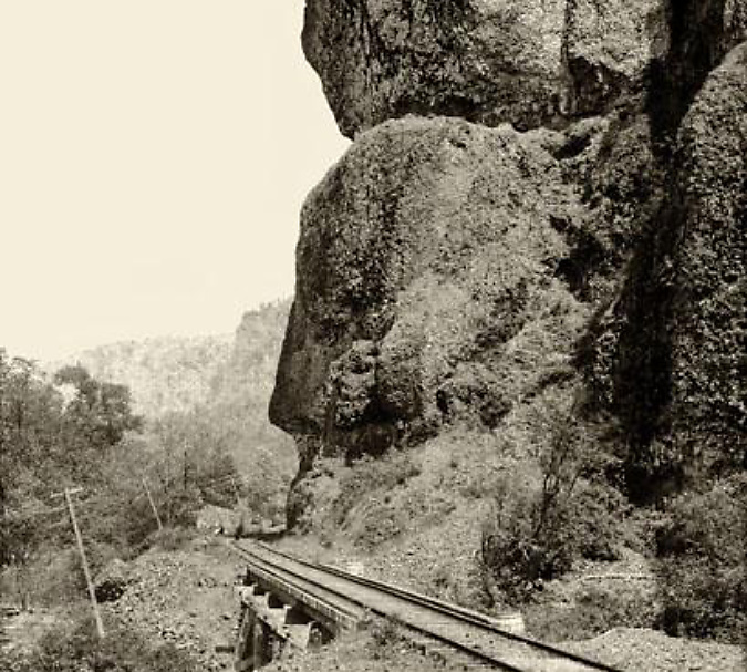
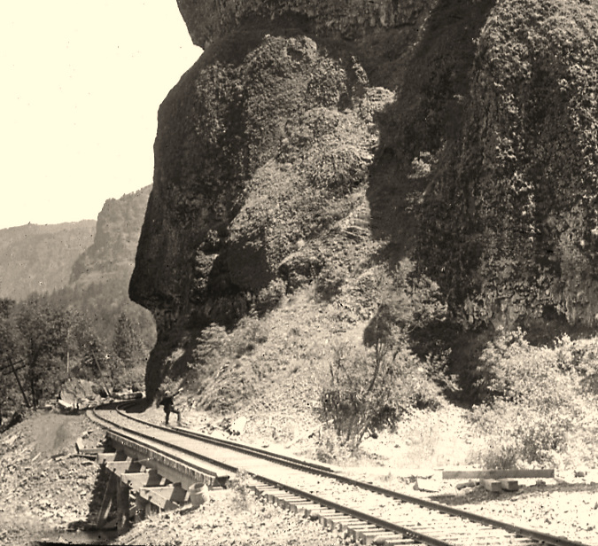
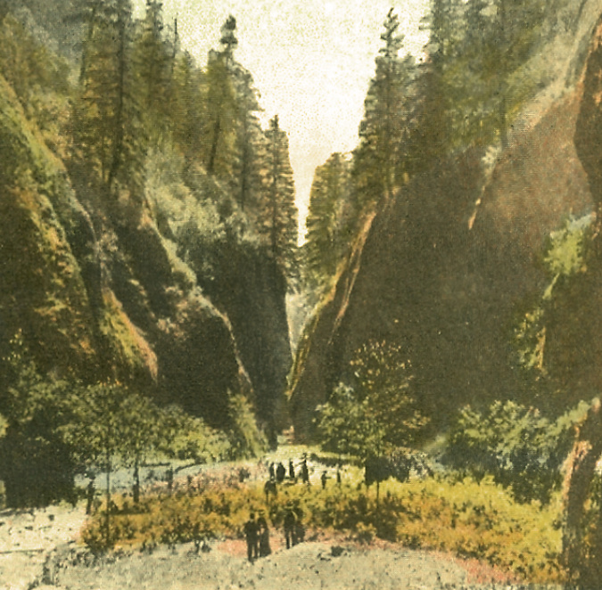
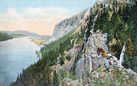
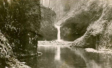
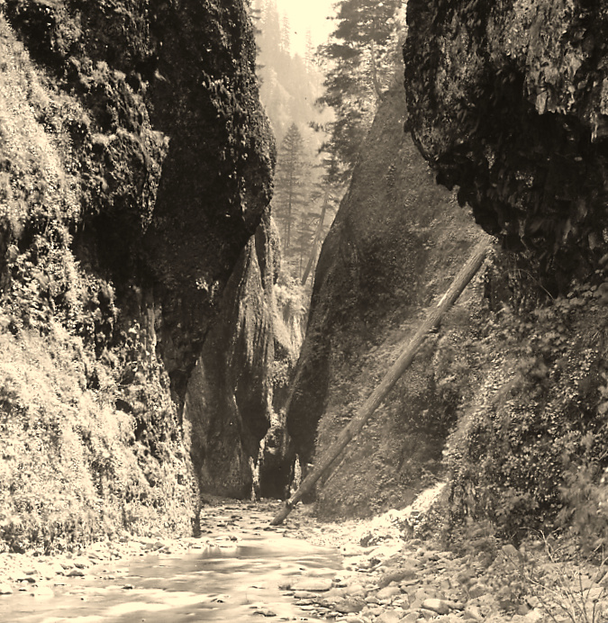
Oneonta Gorge in the 1890s

Oneonta Gorge has been around since the ice age Missoula Floods shaped much of the modern landscape in the Columbia River Gorge 14,000 years ago.  Yet, in the past 125 years this exquisite work of nature has endured new threats brought on by the explosion of an especially pernicious invasive species: us! 

The past two decades have been especially unkind to Oneonta Gorge, with a massive wave of flip-flop wearing visitors drawn here by the invention of social media, followed by a catastrophic human-caused fire in 2017. This article is a retrospective on how we arrived at this crossroad, and what the future might hold for beautiful Oneonta Gorge.

1900-1940s: Early days at Oneonta…

Railroad tracks had arrived at Oneonta Bluff by the 1880s

First peoples in the Pacific Northwest populated the Columbia River Gorge by the thousands for millennia, and they no doubt knew about and visited places like Oneonta Gorge, just as we do today. But it wasn’t until the transcontinental railroad was connected through the Gorge on the Oregon side in 1882 that white settlement began in earnest. Most of the early focus was on logging the big trees grew on the Gorge slopes and harvesting the seemingly endless salmon runs in the river. 

That changed in the 1890s when a new stream of visitors began to follow the rails into the Gorge. Tourists, mostly from Portland, seeking the scenic wonders at each of the train stops along the way. In fact, some of the earliest parks in the Gorge were originally owned and operated by the City of Portland (including Multnomah Falls) to serve the growing interest.

Highway surveyor – possibly Samuel Lancaster, himself –pointing to the site of the future Oneonta Tunnel in the early 1910s

The trickle turned to a tidal wave in the early 1900s, when local entrepreneur Sam Hill and his visionary road designer Samuel Lancaster opened the world-class Columbia River Highway to automobiles. Known today as the Historic Columbia River Highway, the artfully designed new road brought visitors to the Gorge by the thousands by the time it was completed in 1922, with dozens of roadside inns and restaurants springing up to serve the steady stream of motorists.

At Oneonta Gorge, Samuel Lancaster navigated a pinch point where the railroad tracks crowded the base of Oneonta Bluff by blasting a tunnel through the cliff for the new road. From the bridge at the west approach to the new tunnel, visitors also had a stunning view directly into Oneonta Gorge from their automobiles. As with other scenic spots along the road, Lancaster designed a pullout and even engineered a short, winding staircase down to the cool waters of Oneonta Creek that he knew tourists would want to explore.

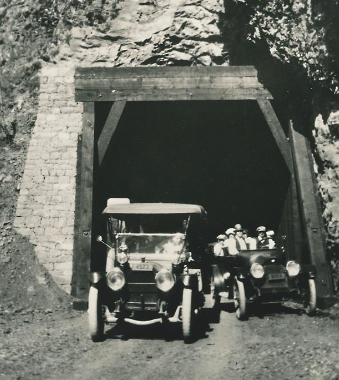
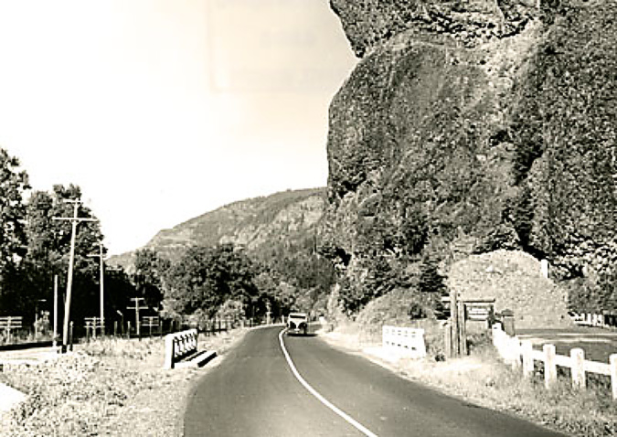
Motorists emerging from the Oneonta Tunnel in the late 1910s

The east portal to the Oneonta Tunnel in the 1920s shows how the new highway was threaded between the vertical walls of Oneonta Bluff and the railroad – the pinch point that required construction of the tunnel

Curiosity inspired more intrepid visitors to wade into Oneonta Gorge, discovering that at the south end of the 1/3 mile long box canyon you are rewarded with a rare view of beautiful Oneonta Falls. Soon, the word was out, kicking off would be become a century of weekend adventurers making their way through the narrow gorge.

Despite its unique beauty and proximity to the new road, Oneonta Gorge was spared commercial development in the early days of motorists flocking to the new highway, when tourist stops dotted the route at many of the popular scenic spots. 

In the 1920s and 30s, most of the forest trails we know today were constructed by the Forest Service and Civilian Conservation Corps (CCC) to bring hikers to the series of waterfalls in the upper canyon of Oneonta Creek. These trails offered  new views into Oneonta Gorge from above, though wading the creek remained the only way to reach Oneonta Falls.

Visitors at Oneonta Gorge in the early 1900s

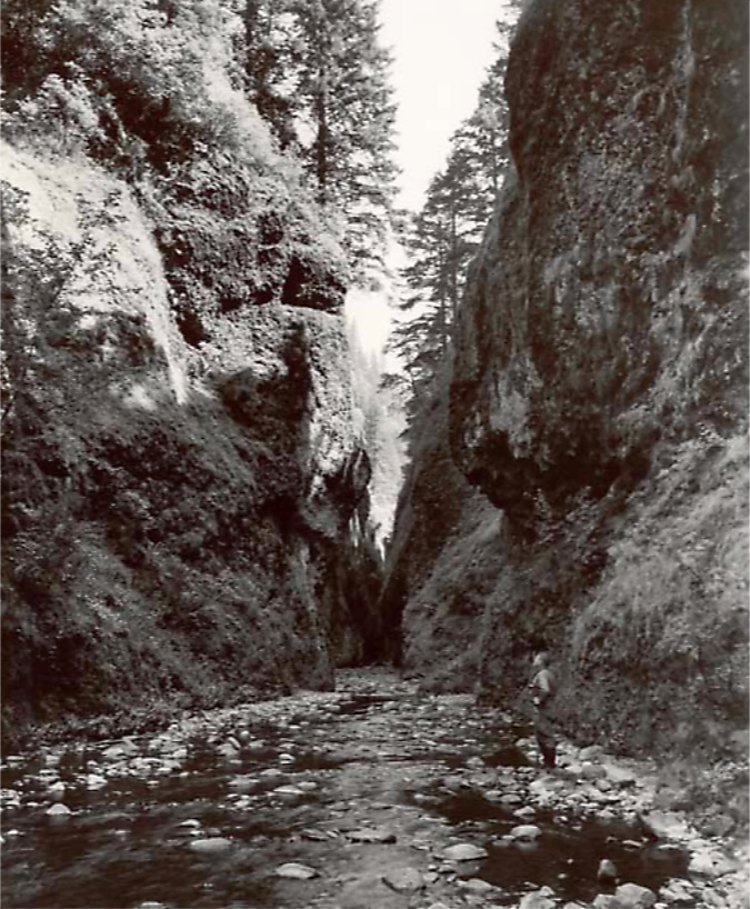
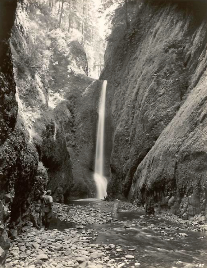
As the popularity of the area grew, the first photos from within Oneonta Gorge and of Oneonta Falls begin to appear in postcards, travel guides and tourist folios from this era. The pair that follow from the 1930s track a hiker (perhaps the photographer?) exploring Oneonta Gorge in late summer, when the water levels are typically low. Well into the 1990s, the trip through Oneonta Gorge was much like this, with just a few knee-deep pools to navigate in reaching the falls.

Oneonta Gorge and hiker in the 1930s

Oneonta Falls and hiker in the 1930s

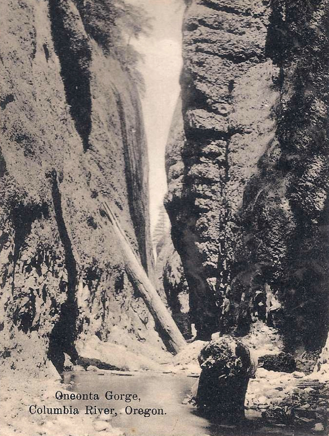
This postcard view (below) from the 1930s is notable in showing boulders and a large log blocking Oneonta Gorge. From my own experiences there, the route was clear of debris on this scale from the mid-1970s until the rockfall that triggered the modern logjam in the late 1990s.  What happened to the debris in this photo? They were simply broken up and swept away.

1930s postcard showing boulders and logs in Oneonta Gorge similar to today

Oneonta Gorge was created by a perpetual cycle of erosion, with the stream continually undercutting the vertical basalt walls, then clearing boulders and debris that periodically collapses into the stream. During high runoff events from November through March, Oneonta Creek can become a raging torrent, with enormous hydraulic force that can easily move whole trees and large boulders downstream, eventually breaking them apart into smaller, even more easily transported rock and debris the process (more on that toward the end of this article).

The tunnel at Oneonta Creek was an uncomfortably tight squeeze for passing vehicles from the beginning, so when the railroads moved their tracks away from cliffs of Oneonta Bluff sometime in the early 1940s, ODOT took the opportunity to move the road and bypass the old tunnel.

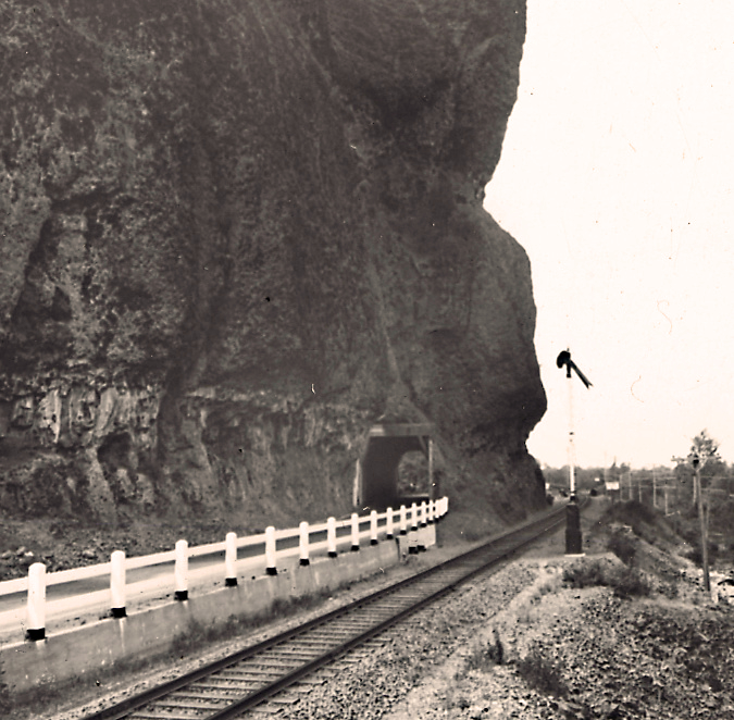
Oneonta Tunnel in the early 1940s with the relocated railroad line already away from the bluff

The tunnel bypass involved constructing a new bridge over Oneonta Creek (below), immediately adjacent to the old bridge. Both bridges survive today, with the newer bridge serving as the Historic Columbia River Highway route and the original bridge leading pedestrians and cyclists to the restored Oneonta Tunnel. 

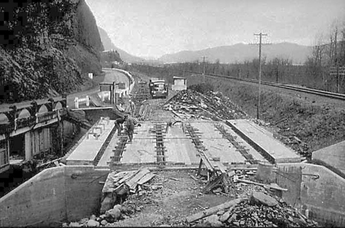
“New” highway bridge bypassing the Oneonta Tunnel under construction in 1948. The original bridge can be seen on the left

The tunnel bypass was completed in 1948 (below), and both ends of the Oneonta Tunnel were blocked with fill to prevent access. The original highway stub over the old bridge was left in place as a wayside for visitors to Oneonta Gorge.

The completed bypass in the early 1950s with the old tunnel blocked with fill

The Oneonta Tunnel bypass in 1948 was part of a larger effort by the Oregon Highway Division to realign the original Columbia River Highway as a river-level route, completely bypassing whole sections, including the famous loops that climb over Crown Point and Rowena Crest. 

Much of this work was completed by the early 1950s, but in 1956 the federal Interstate and Defense Highways Act set construction of today’s Interstate-84 in motion, relegating the original versions of the Columbia River Highway to scenic routes in some areas, and being completely abandoned in others.

That might have been the end of the story for the mothballed Oneonta Tunnel, save for the following provision in the 1986 Columbia River Gorge National Scenic Area legislation:

This unique provision was way ahead of its time in our country by recognizing the historic and recreation value of old, “obsolete” roadways. Since then, ODOT has steadily worked toward this bold vision with a string of exceptional restoration projects. As we approach the 40th anniversary of the scenic area legislation, a completely restored and reconnected historic route from Portland to The Dalles is on track to become a reality.

2003-09: Restoring the Oneonta tunnel and bridge

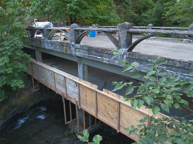
ODOT renovated the original Oneonta Bridge in the 2003

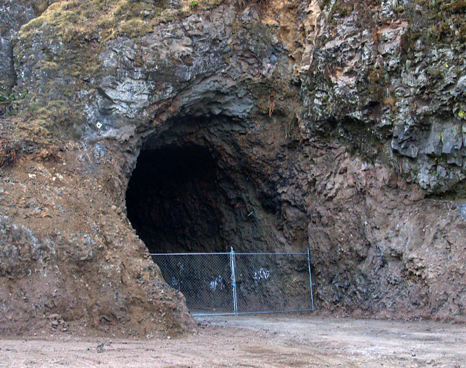
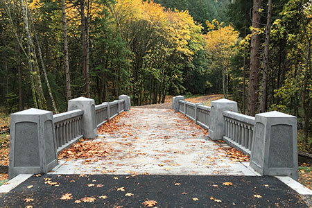
At Oneonta, the historic highway restoration included renovating the original highway bridge (above) and reopening the Samuel Lancaster’s original tunnel (below) after fifty years of closure. The 1948 tunnel bypass allowed for this segment to be reimagined as a pedestrian route, bringing visitors through the restored tunnel to a dramatic view from the historic bridge into Oneonta Gorge.

The newly excavated Oneonta Tunnel in 2006

Restoration of the east portal to the Oneonta Tunnel in 2006

Restoration of the west portal to the Oneonta Tunnel in 2006

The tunnel restoration included recreating the stonework surrounding both portals and a completely rebuilt, wood tunnel lining (below). 

Construction of the wood interior lining in the restored Oneonta Tunnel

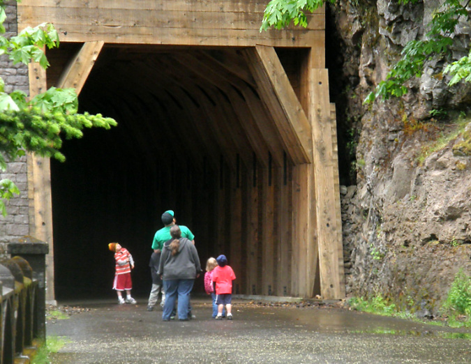
The newly restored tunnel was opened to the public in 2009. For hikers, the new route connected a hiking loop between the Oneonta and Horsetail trail systems. For motorists, it was a new place to explore among the traditional stops along the historic highway.

Hikers using the newly restored Oneonta Tunnel in 2009

Family exploring the newly restored Oneonta Tunnel in 2009

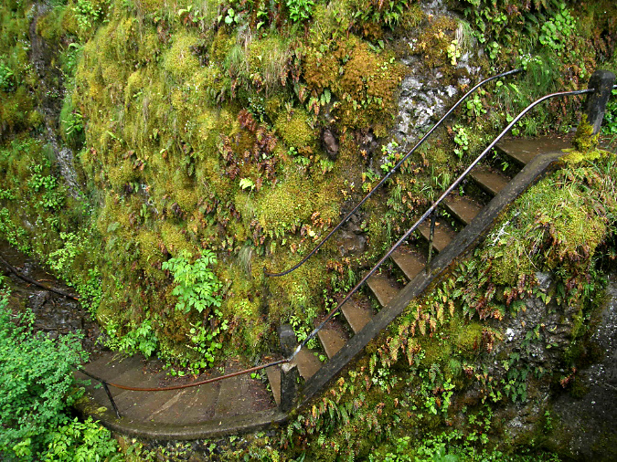
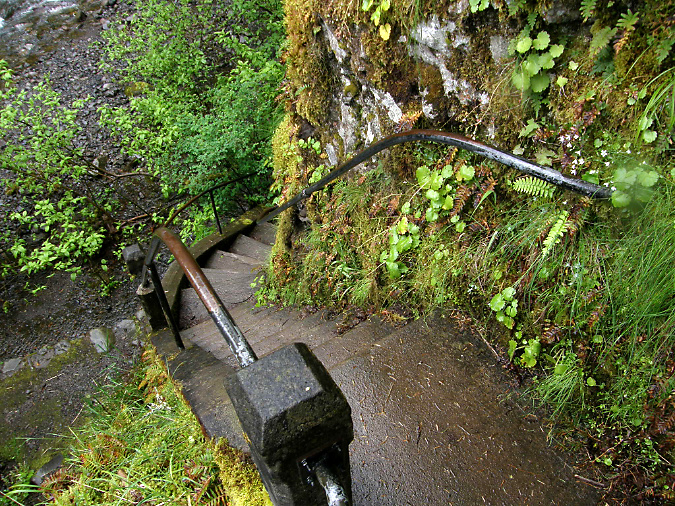
The Oneonta Bridge restoration included work at the west abutment, where a small alcove with an ornate bench from the original design was refurbished. This unassuming spot is one of the most delightful features in Samuel Landcaster’s vision for the highway. Knowing that visitors would want to explore, he built a tiny, winding staircase that hugs the cliff as it descends from the alcove to Oneonta Creek (below). The stairway is a fun surprise for visitors who stop, as it is not visible from the road.

Restored alcove and bench at the head of the winding staircase to Oneonta Creek in 2009

Historic winding staircase at Oneonta Creek in 2009

Looking down the historic winding staircase at Oneonta Creek in 2009

When these carefully crafted restoration efforts at Oneonta were finally opened to the public in 2009, few could imagine the impact that social media was about to unleash in the Gorge. Facebook had been founded in 2004, but only began its explosive growth in 2007, doubling from 50 million users to 100 million in 2008. It would reach a staggering 1 billion users by 2012. Instagram soon added to the impact after it was founded in 2010, reaching 10 million users within a year and 1 billion users by 2018. 

2010: The logjam + social media era… 

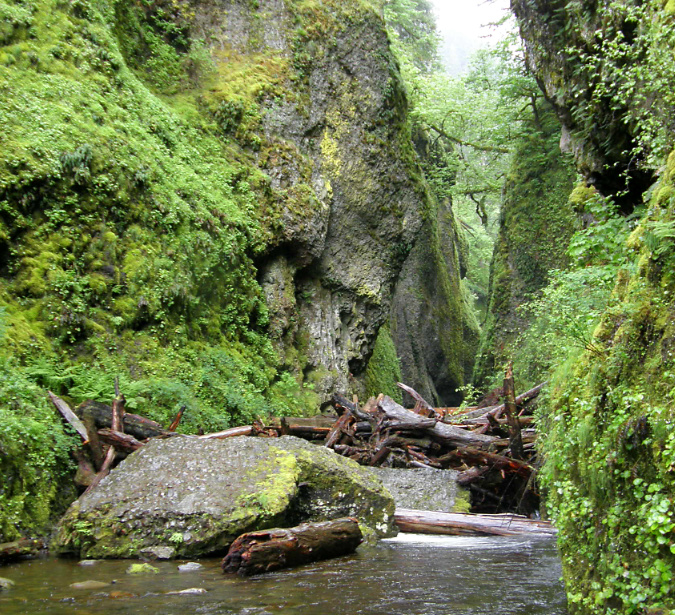
The Oneonta logjam in 2011

When you consider the recreation infrastructure in the Gorge – the trails, campground, picnic sites, scenic highway, Vista House and the lodge at Multnomah Falls – are much the same as they were in the 1930s, it’s surprising that the exponential growth in visitors in recent decades hasn’t been more destructive. That said, the arrival of social media, and its ability to concentrate large crowds overnight, impacted the Gorge, and especially Oneonta, like no nothing before. 

Compounding the “Instagram-effect” of social media in the years that followed reopening of the tunnel, the pair of van-sized boulders that had collapsed into the lower entrance to Oneonta Gorge in the late 1990s had stacked up enough logs to become a true hazard to cross. In the beginning, the boulders themselves weren’t difficult to navigate, but as log pile continued to grow, crossing the obstacle became a risky venture for social media novices drawn here by nothing more than a viral Instagram selfie. 

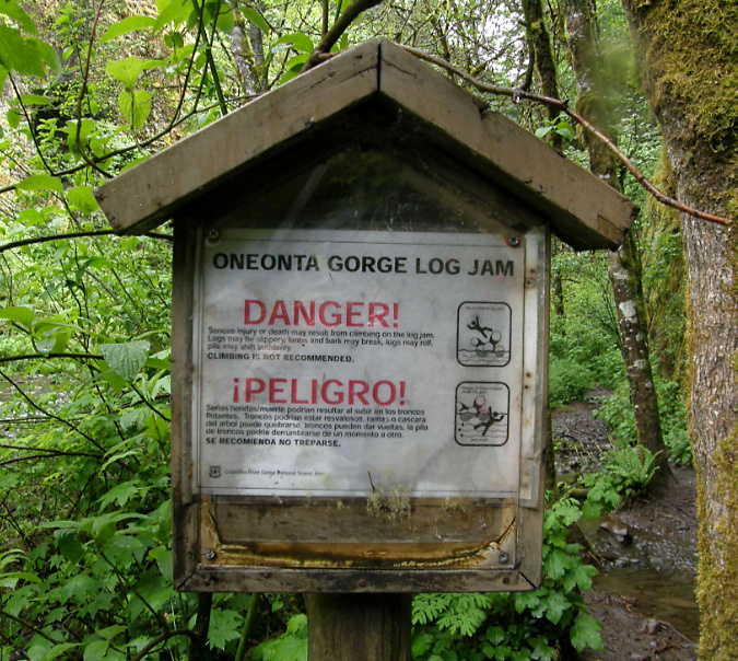
The Forest Service had posted a hazard warning around 2010, but Oneonta Gorge remained opened to the crowds that were growing exponentially each summer, and the signs went completely unnoticed by the growing horde.

Logjam warning sign in 2011

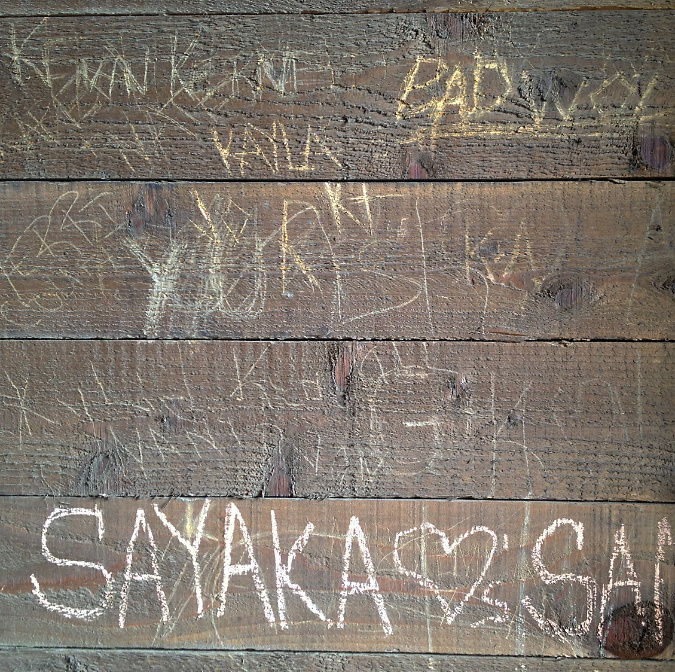
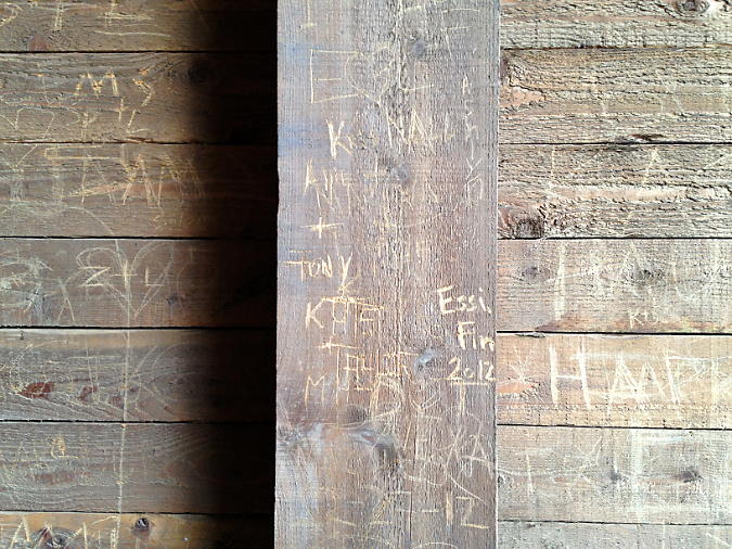
The growing summer crowds at Oneonta Gorge were beginning to impact the newly restored Oneonta Tunnel, as well. For anyone who loves the Gorge, it was maddening to see vandalism to the pristine wood lining in the tunnel when it started to appear in 2012. The heavy crowds eventually impacted other features, including damage to the railing on the historic, winding staircase (below) and the fragile ecosystem of Oneonta Gorge, itself. It was a classic tragedy of the commons in the making, with the Forest Service seemingly paralyzed from intervening.

Vandalism began to appear in the Oneonta Tunnel by 2013

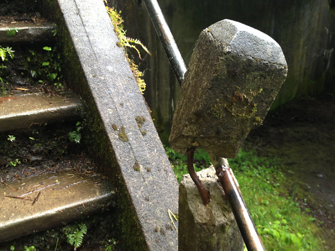
Damaged staircase railing at Oneonta in 2013

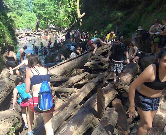
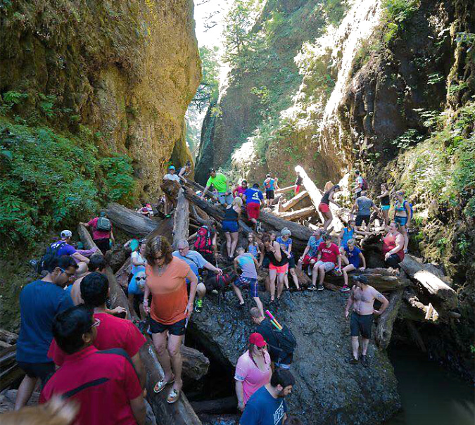
By 2015, the full brunt of social media – now including still more youth-oriented online platforms, like SnapChat and Reddit – was all too apparent at Oneonta Gorge. Summertime traffic came to a standstill on the old highway, with parked cars lining the shoulders in both directions and overflowing into the nearby Horsetail wayside. 

Oregon photographer extraordinaire T.J. Thorne (and a friend of the blog!) captured the following images that summer that describe the mayhem in ways words cannot match.

Social media crowds overwhelming Oneonta Gorge in the summer of 2015 (T.J. Thorne)

Crowds at Oneonta Gorge in the summer of 2015 (T.J. Thorne)

Vandalism in the tunnel spiked with the mobs, too, and by 2015 the beautifully restored walls had been almost completely destroyed by the thoughtless members of the summer crowds. Still more discouraging is that the damage was largely wrought by Millennials – a generation supposedly more in touch with environmental awareness, sustainability and mutual respect than any before it.

Vandalism overwhelmed the Oneonta Tunnel by 2015

Heavy vandalism to Oneonta Tunnel in 2015

Tragically, at least one person was killed while crossing the log jam during this unhinged period, and there’s no way to know how many were injured – nor what the environmental price to the unique ecosystem in Oneonta Gorge has been from so many people pouring into this relatively tiny space. Yet, there was still no effort by the Forest Service to limit or manage access… that is, until the Eagle Creek Fire in 2017.

2017: Gorge Fire… and the future?

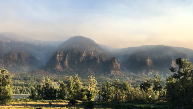
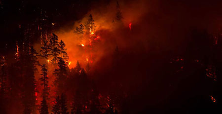
The Eagle Creek Fire as viewed from the Washington side of the Gorge in September 2017

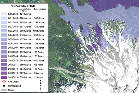
The Eagle Creek Fire in 2017 reset everything in the Gorge. It was the first major fire since around 1900, yet was also somewhat typical of fires that have always burned in the Gorge. The only thing new about the event was the level of human development and activity that has come to the Gorge since the last big fire, underscored by the fact that it was a human-caused fire set off by a young hiker lighting fireworks on the Eagle Creek Trail.

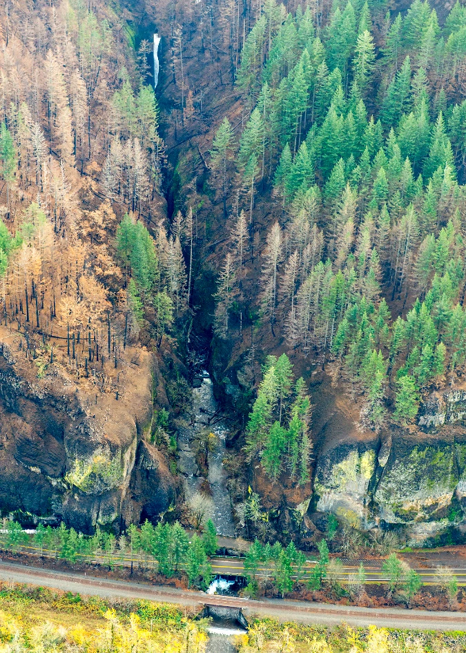
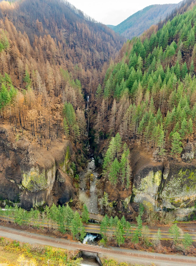
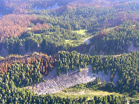
The Oneonta Creek watershed was hit especially hard by the fire, with much of the upper basin completely burned. The immediate aftermath of the burn was a lot of surface erosion and falling trees killed by the fire. More locally, the fire killed trees and loosened rocks and debris along the rim of Oneonta Gorge, creating an immediate hazard to anyone below.

Aerial view of the fire impact along Oneonta Gorge in late 201. Oneonta Falls can be seen at the far end of the gorge in this view

Aerial view of fire impact to Oneonta Gorge and the larger watershed in the distance in 2017

Over time, the extensive burn upstream has released hundreds of logs into Oneonta Creek, with many more to come. It didn’t take long for winter storms to carry these logs and other debris downstream to Oneonta Gorge, where the logjams have now grown to epic proportions.

Forest Service crew documenting the growing, post-fire logjams in Oneonta Gorge in 2023 (USFS)

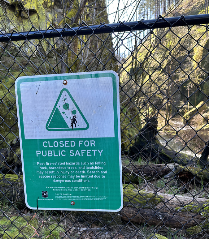
Most of the burn was immediately closed to the public after the fire, but the Forest Service has gradually reopened much of the area as trails are cleared and the forest recovery takes hold. An exception is Oneonta Gorge, however, where the agency continues to prohibit public access.

That’s a good thing, and overdue. Nobody knows how long it will take for Oneonta Creek to clear the logjams from Oneonta Gorge, but the hazards they create should at least help the Forest Service take the time to enact a new access policy that limits when and how many people are allowed to enter the gorge. 

Oneonta Gorge sign announcing indefinite closure following the 2017 fire

Statesmen Journal outdoor reporter (and another friend of the blog!) Zach Urness recently reported on Forest Service plans to consider reopening Oneonta Gorge later in this decade. According to Zach’s reporting, the agency will consider these options for the future:

1) Unrestricted access

2) Complete closure to access

3) Seasonal public access outside of salmon and steelhead spawning

4) Open or seasonal public access with trigger points to limit use

My hope is that something like the fourth option will be pursued in the interest protecting Oneonta Gorge from being loved to death in the future. The Forest Service planning effort will begin later this year.

The Oneonta Tunnel became an inferno during the 2017 Eagle Creek Fire (USFS)

The fire had a devastating impact on the Oneonta Tunnel, as well. When I saw the above image of the tunnel in flames during the 2017 Eagle Creek Fire, I had mixed emotions: the first was sadness over the loss of this beautifully restored piece of our history, and the second was a sense of opportunity. If the tunnel were restored again, perhaps this time it could be more closely managed to prevent the grotesque scale of vandalism that had defaced it before the fire?

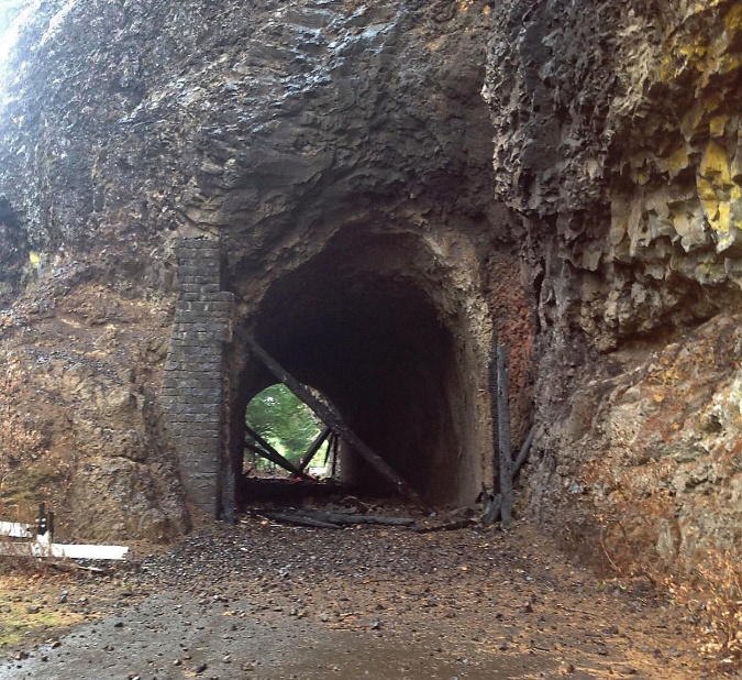
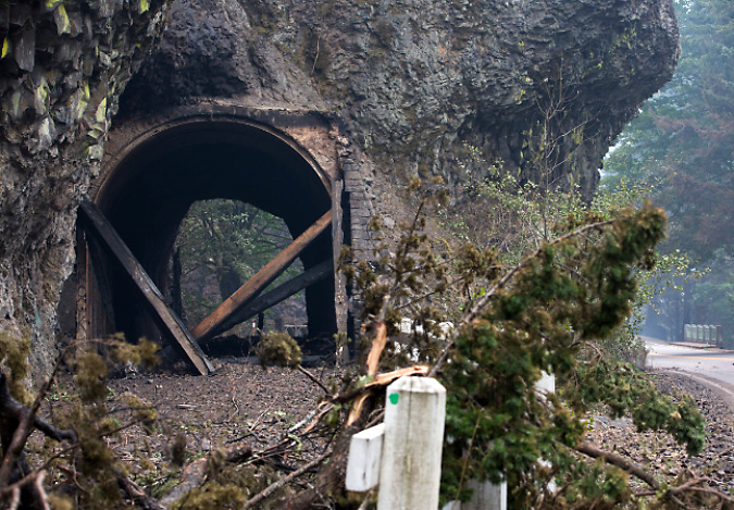
West portal to the Oneonta Tunnel immediately after the 2017 fire (ODOT)

East portal to the Oneonta Tunnel immediately after the 2017 fire (ODOT)

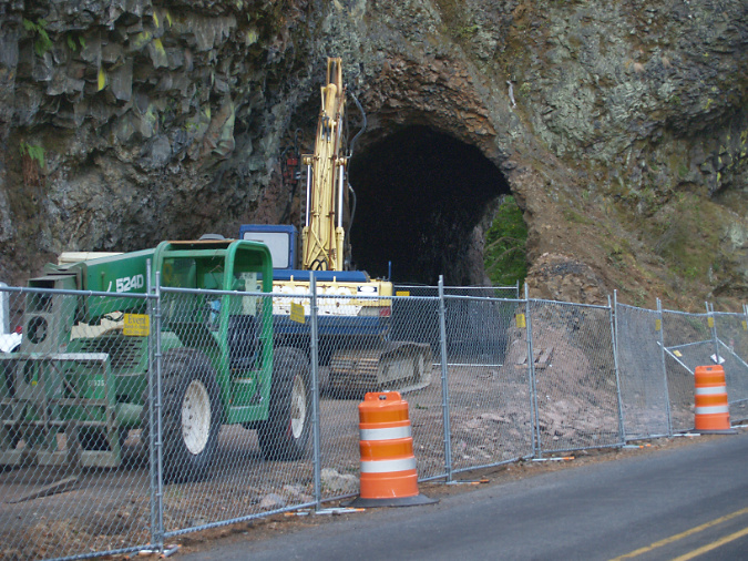
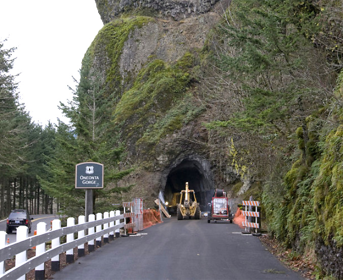
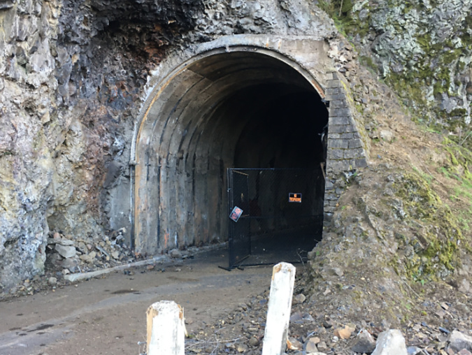
In 2020, ODOT began repairs to the Oneonta Tunnel, once again bringing it back to its original glory with a wood-lined interior. The re-restored tunnel reopened to the public in May 2021.

Oneonta Tunnel cleared and ready for repairs 2020

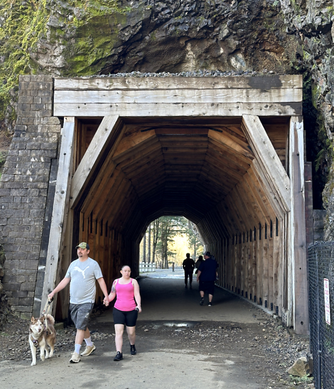
Re-restored the Oneonta Tunnel in 2024

Visitors exploring the reopened Oneonta Tunnel in 2024

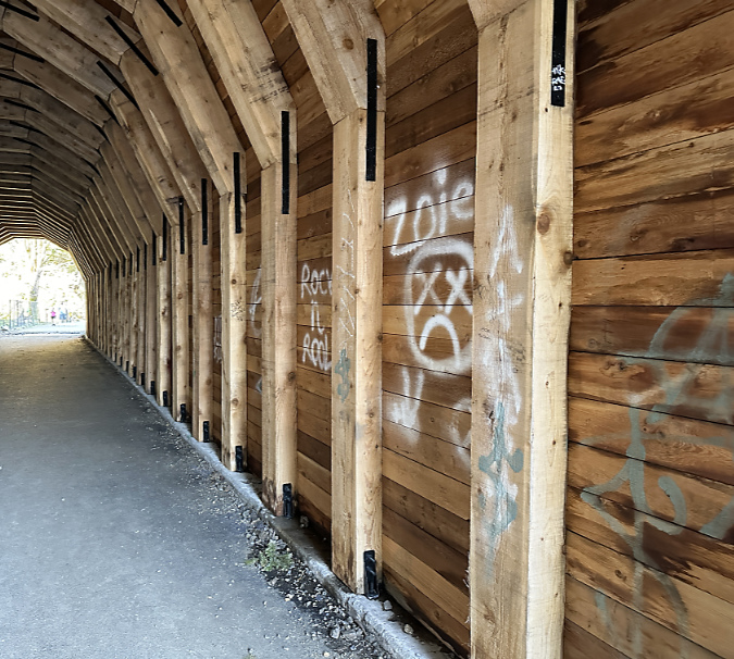
Though the Oneonta Gorge flip-flop crowds are no longer here, vandalism in the newly reopened tunnel continues, albeit at a more manageable pace. While much of the damage before the fire was from names and messages being carved into the soft wood, most of the new vandalism is in the form of spray paint tagging that bedevils our society pretty much everywhere these days. While frustrating, this damage is somewhat easier to repair – assuming ODOT has the capacity and makes it a priority to do so.

When the agency was drawing up plans for the restoring the tunnel a second time, after the fire, I testified to the steering committee that oversees the Historic Columbia River Highway restoration work to consider gating both ends of the tunnel and having State Parks rangers lock it during off-peak hours. I still think this could dramatically reduce vandalism in the tunnel.

Vandalism in the tunnel continues in 2024, despite the Oneonta Gorge closure

Oneonta Tunnel vandalism in 2024

What’s next for Oneonta Gorge? Mostly, a much-needed break from humanity, at least in the near-term. Hopefully, the Forest Service will opt for a long-term plan that places the ecological health of this place at the forefront, but nature has no timeline for clearing out the logs that are making it impassible right now. Over time, the force of water will win out, but that could be decades from now, perhaps longer.

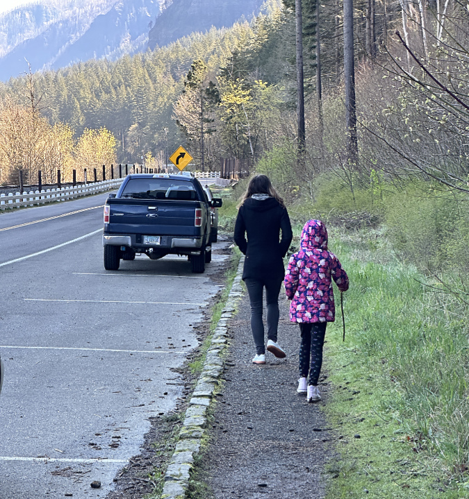
Visitors walking the muddy shoulder to the east portal parking pullout in 2024

I’m also hopeful that ODOT will not only take action to keep pace with vandalism to the tunnel, but also continue to make minor improvements for visitors stopping to explore the tunnel and take in the view of Oneonta Gorge. One that stands out to me when I visits is the surprising lack of even a gravel path to serve the parking pullout near the east tunnel portal (above). A boot path has formed, of course, but I watched several visitors with young kids struggle between the choices of a muddy, narrow boot path and walking adjacent to traffic along the fog line of the eastbound highway lane. 

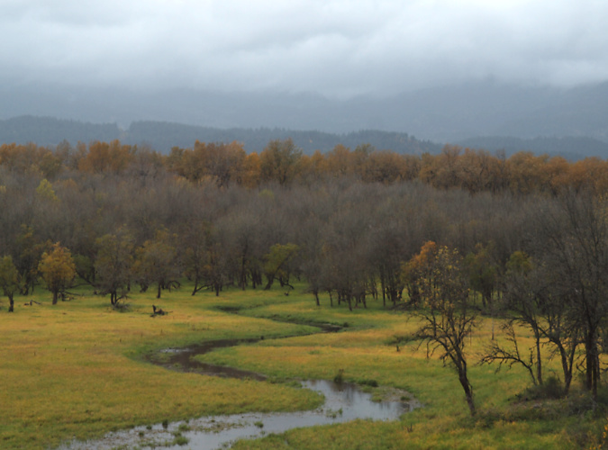
Horsetail-Oneonta wetlands in 2024

If you have followed this blog, you know I’ve posted several articles on Oneonta over the years. This piece surely won’t be the last! For past reads on this magical spot, here are some links:

Let’s Clear the Logjam at Oneonta (2011)

Oneonta Loop Trail (2020)

A Second Chance and New Vision for Oneonta? (2020)

If you’d like to hear a recent interview I had with Zach Urness on the future of Oneonta Gorge, you can listen here:

Explore Oregon Podcast: The ballad of beloved Oneonta Gorge

(…and yes, it’s true –I took my wife of nearly 40 years to wade Oneonta Gorge on our first date, way back in September 1981! She didn’t hold it against me…)

________________

Tom Kloster | April 2024
The Campaign Calendar at 20 Years!

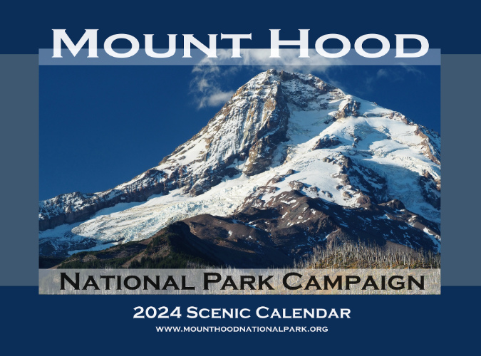
The 2024 Campaign Calendar is the twentieth edition!

With the December holiday season comes my annual Mount Hood National Park Campaign calendar, but this year is a bit of a milestone: the 2024 calendar is the 20th edition since I began putting these together back in 2003! Much has changed over those years, so this article includes both a retrospective from the early calendars and highlights from the 2024 edition, so I hope you’ll indulge me!
The new calendars for 2024 are print-on-demand and available now from Zazzle. You can find them here:
See the 2024 Mount Hood National Park Campaign Calendar on Zazzle
Zazzle does excellent work and these can be shipped direct to anywhere. As always, all proceeds go to Trailkeepers of Oregon (TKO) for their crucial work in volunteer trail stewardship and advocacy.

Looking back to the very beginning…

It was back in 2003 when I kicked off the “idea campaign” for a Mount Hood National Park that encompasses Mount Hood and the Gorge. It’s an idea that has made it as far as legislation in Congress on several occasions as early as the 1890s, but never made it as far as the president’s desk to become law – usually due to moneyed interests in exploiting the mountain. Thus, the purpose of the “idea campaign” is to simply keep the national park idea alive.

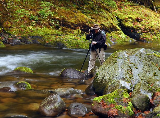
Shooting the Salmon River with my first digital camera in 2003 (Greg Lief)

I’ve been asked many times “do you really think Mount Hood will become a national park?” I do, of course. Eventually. Most of our national parks had a long and bumpy road to finally being established, often starting as a national monument or recreation area – but always because they had exceptional natural and cultural features unmatched elsewhere. That’s why I believe that Mount Hood will eventually join the ranks of Crater Lake, Mount Rainier and the Olympics and receive the level of commitment to both conservation and recreation that only the National Park Service can offer. In the meantime, this blog serves as place to celebrate those natural and cultural features that make Mount Hood and the Gorge unparalleled places worth protecting, while spotlighting threats to the mountain.

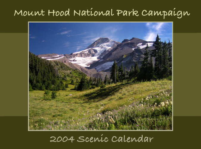
With this goal, the first calendar (below) was an outgrowth of the idea campaign as a visual way to celebrate the many places and landscapes that combine to make WyEast Country so exceptional. Back in 2004, there were also new technologies that helped make a custom calendar possible: I had recently purchased my first digital camera and CafePress had emerged as a quality on-demand printing service as part of the dotcom revolution. 

The first cover… back in 2004

The first calendar was modest – printed at 8.5×11 inches with color reproduction that was decidedly “approximate”, though still a big leap forward from color photocopies of the 1990s. The first edition featured a recurring, favorite spot of mine on the cover – Elk Cove on Mount Hood’s north side. 

From this start, the calendar evolved over the next 20 years in technology, print quality and the landscapes I featured. This collage (below) of the 20 annual covers shows some of that evolution.

[click here for a large version]

Looking back, the two constants among cover subjects were waterfalls and the mountain, though the places and vantage points varied greatly. One of the best rewards in putting the calendars together has been the opportunity to explore different corners of the mountain and gorge, as I set a goal early on to feature new images taken during the previous year in each calendar. While there are a few spots I go back to nearly every year, I’ve also been able to feature new places and perspectives not seen elsewhere.

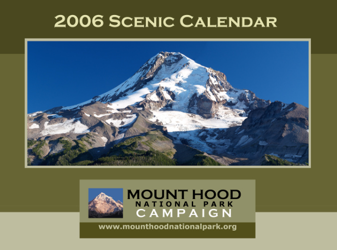
Looking across those old cover images, I’m also able to see how the cover design evolved. The first two calendars used a script font that looks ridiculous to me now, and by 2006 I had moved on to the “national park” fonts I use today – notably, Copperplate — along with the color scheme I had used on the (then) brand new Mount Hood National Park Campaign website. The graphic below the main image was from bumper stickers I also had printed at CafePress at the time.

Getting there… improved fonts in 2006

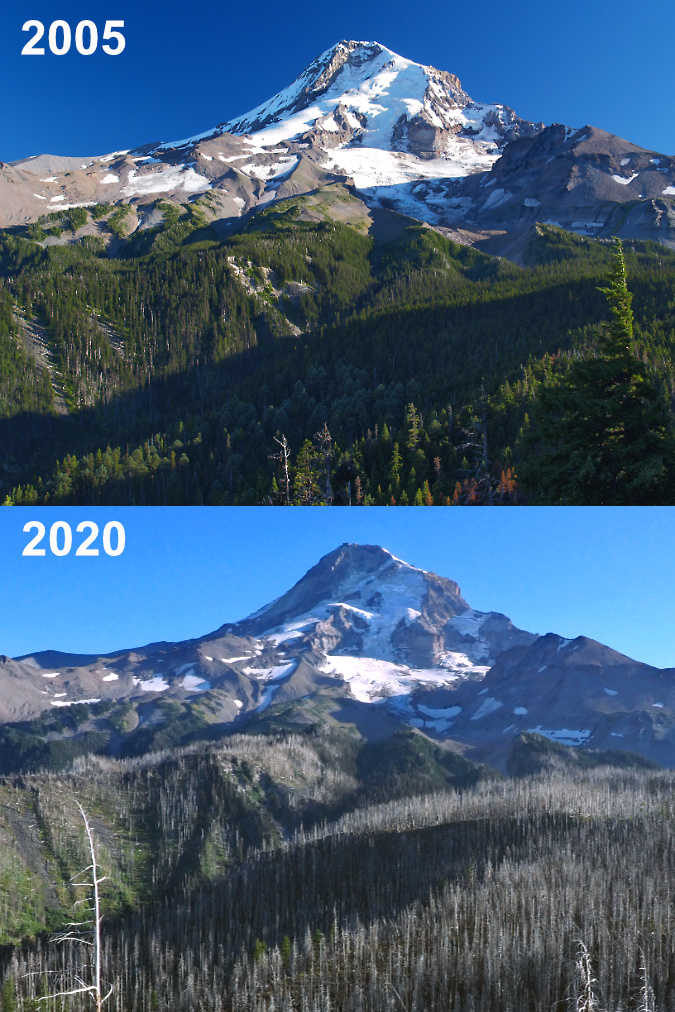
The cover of the 2006 calendar is the first in a series of reminder among the covers that there are no constants in WyEast Country. Everything changes, and lately, change seems to be accelerating, as the cover image of Mount Hood from the Elk Cove trail underscores. Just two years after I took this photo, the Gnarl Fire had roared across the east flank of the mountain, nearly engulfing Cloud Cap Inn. Then, three years after the Gnarl Fire, the Dollar Lake Fire had burned much of the forest on the north slope of the mountain shown in this image.

The 2011 Dollar Lake Fire started just below the rocky viewpoint where this cover photo was taken. Today, the sea of green Noble Fir and Mountain Hemlock that once covered the slopes has been replaced by a ghost forest of silver tree skeletons, with a new forest just getting underway in their. The following photo comparison from this viewpoint (below) shows the dramatic changes to the north side in stark contrast. 

The Dollar Lake Fire burned thousands of acres of subalpine forest on Mount Hood’s north slope in 2011

The Dollar Lake Fire brought an unexpected opportunity to witness and document the forest recovery, and without the assistance of man, as most of the fire was within the Mount Hood Wilderness. As such, the Forest Service has adopted a hands-off policy and is deferring to the natural forest recovery process. I’ve since posted several articles tracking the recovery:

“After the Dollar Lake Fire” (June 2012)

Dollar Lake Fire: Five Years After” (October 2016)

“10 Years After the Dollar Lake Fire” (November 2022)

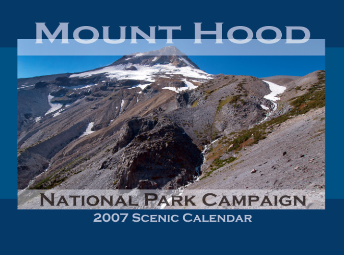
The 2007 calendar marked a technology change when CafePress began offering a much larger format, measuring 11×17”. This required a different photo aspect, but also gave sweeping vistas the space they need to be truly appreciated. Such was the case with the first calendar cover in this larger format in 2007, when the sprawling view of Mount Hood’s east face (below) from Gnarl Ridge was the cover image. This edition also featured what has become the basic design for the cover, along with a blue color scheme that I’ve alternated with the original green theme over the years.

Going ultra-wide with a new format in 2007

In 2008, I started this blog as an alternative to making constant updates to the campaign website. This  opened still more opportunities to explore and capture WyEast country in words and imagery, with deeper dives and more details in the long form that I prefer. As the blog shifted my focus toward emerging risks to Mount Hood and the Gorge, so my photography shifted, and the calendar began to include more remote and obscure places on the mountain.

There’s a story behind the nearly identical cover scenes of Upper McCord Falls (below) that appeared on both the 2011 and 2013 calendars. In 2012 I lost all of my original digital files from the 2011 calendar in a computer upgrade, and by 2013 I’d clearly forgotten what the earlier cover images was. Apparently, I liked that view of Upper McCord Falls enough to put it back on the cover — though I had also upgraded my camera between these covers, so at least the 2013 version was an improvement on the earlier take – to my eye, at least! (for this article, I recreated the 2011 cover from a printed copy of the calendar I saved).

Seeing double-double!

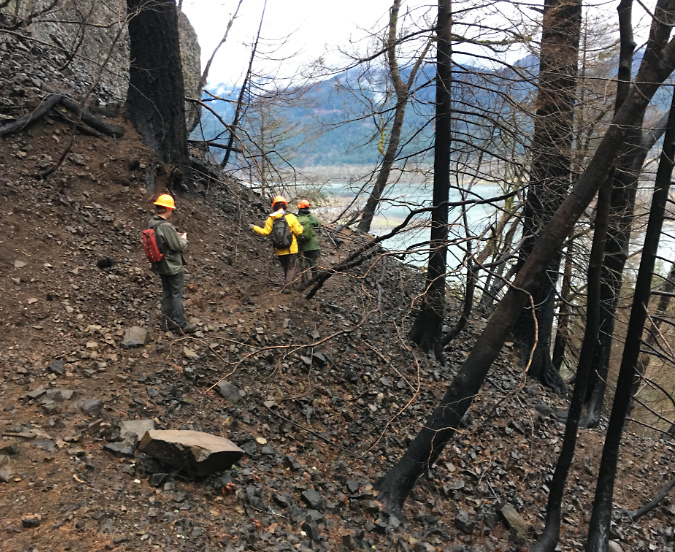
As with so many places in the Gorge that I had taken for granted in my life, it never occurred to me that the forests surrounding Elowah Falls and Upper McCord Falls would soon be completely burned, leaving a landscape will take generations to return to the lush, mature forests that I grew up with. As it turned out, Upper McCord Falls was the first trail I visited within the “restricted area” following the September 2017 Eagle Creek Fire. It was just five months after the fire when I headed up there in February 2018 with a Trailkeepers of Oregon (TKO) crew to survey the trail damage.

The devastation was much more extensive than I expected on what would be the first of many trips into the restricted area after the fire. I had hiked through the recent burns on Mount Hood in previous years, and was braced for seeing ancient trees reduced to burned snags, but what makes the aftermath of fire in the Gorge so unique is the terrain. The forest was playing  a greater role in holding the steep slopes of the Gorge together than I think anyone realized, and just five months after the fire the scale of erosion and ground movement was alarming.

Locating surviving trail tread after the fire at McCord Creek in early 2018

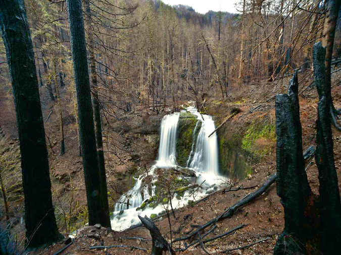
The scene at Upper McCord Falls was startling, as well. The burn was severe around the falls, killing the entire forest. The layers of green moss that survived the burn on the cliffs and boulders nearest the falls seemed like they had been hand-tinted onto the brown landscape, like an old postcard.

Upper McCord Falls in February 2018 (Randi Mendoza, Oregon Parks & Recreation) 

The trail seemed a total loss in several areas on that trip where sliding mud and rock had completely covered the tight series of switchbacks originally carved into the slope by the Civilian Conservation Corps back in the 1930s. In the years that followed the fire, TKO volunteers have removed tons of debris from the trail and reconstructed damaged stone walls built by the CCC, restoring the tread to nearly its original design today.

Upper McCord Falls a few months after the fire

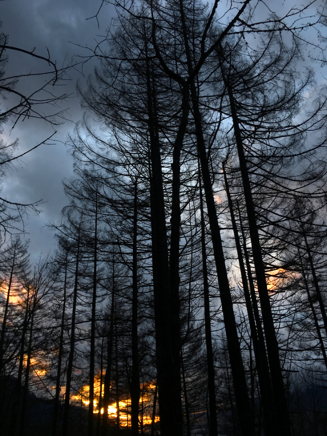
On the way out from that first visit after the fire, the clouds broke at the west end of the Gorge just as darkness was falling, creating the weird illusion that the charred forest silhouetted against dark the clouds and flaming sunset was still burning. As with all who love the Gorge, it was the beginning of a journey for me in accepting the reality of the fire – including the senseless act that started the blaze, as well as the inevitability of this fire being long overdue – and finally, a deeper appreciation for the resilience of our forests in which fire an essential destructive force.

Burned forests at McCord Creek on my first trip after the fire appeared to be on fire, once again, as a brilliant sunset lit up at the west end of he Gorge

Revisiting the slopes leading to Upper McCord Falls last spring, the resurgence of the understory and beginnings of a new forest was inspiring after five summers of forest recovery. While I won’t live long enough to see big trees replace those that were killed in the fire, the surviving trees are bouncing back strongly, and watching the renewal of the Gorge forests is as inspiring in its own way as the big trees we lost. 

A stand of Douglas fir that survived the fire is surrounded by a thriving understory along the McCord Creek trail in Spring 2023

Meanwhile, Upper McCord Falls looks quite different five years later, as well (below). The understory has made a vigorous comeback, but more surprising is the east (left) segment of this twin falls, which appears to be plugged with debris released into McCord Creek from the fire – at least for now. Prior to the burn, the twin tier would have been flowing when I took this photo last spring, just as it was in the calendar covers in 2011 and 2013. 

Upper McCord Falls six years after the fire in Spring 2023

Upper McCord Falls has historically had as many as three segments cascading from the basalt ledge that forms the cascade (a third tier once flowed to the left of east tier as recently as the 1970s, as shown below), so in time, there’s no reason to assume the second (or even third) tiers will re-emerge. The defining factor is simply the amount of rock and log debris piled up on top of the basalt ledge. 

Since the 1970s, the debris had been further stabilized by a colony of Red Alder that was the main force holding the pile of boulders and debris together, eventually blocking the third tier of the falls completely. Today, those trees have been killed, and with the volatile flooding on Gorge streams since the fire, there’s good reason to expect McCord Creek to re-arrange the shape of Upper McCord Falls by removing some or all of the debris plugging parts of the waterfall.

Upper McCord was a triple falls in the 1970s! (Don Lowe)

Where the tree canopy along the McCord Creek trail system were completely burned (below), the forest recovery is now in full swing, choking the route in many spots with Thimbleberry, Vine Maple, Douglas Maple and many other understory plants whose roots survived the burn, allowing them to bounce back quickly.

Forest understory surging back after six years at McCord Creek

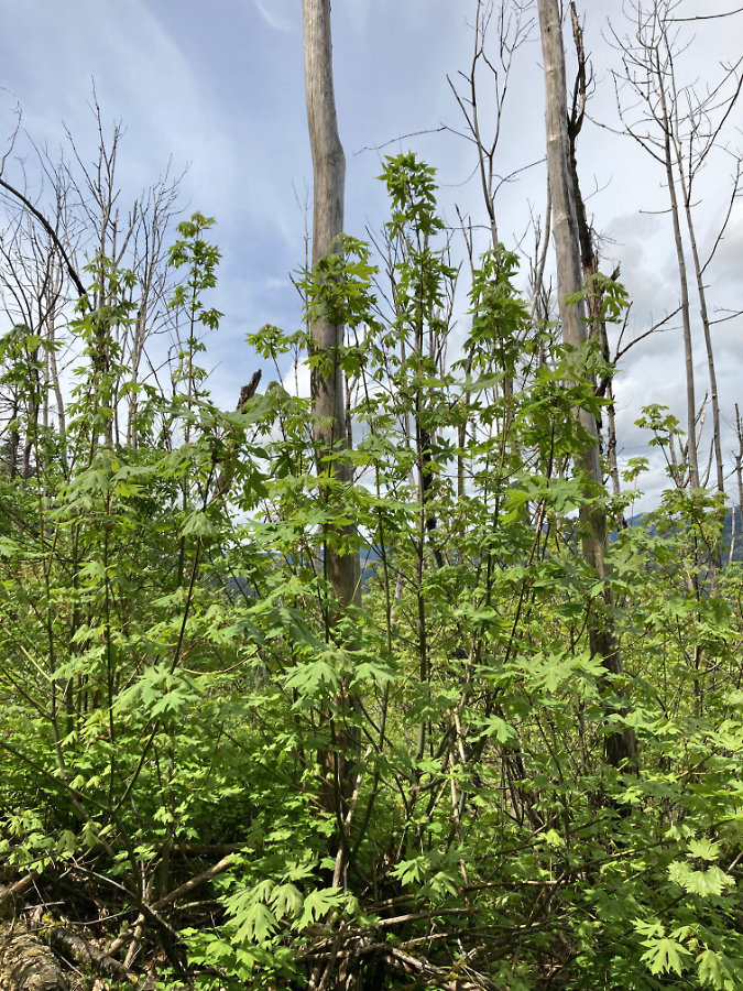
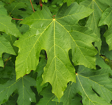
Bigleaf Maple are bouncing back in this way, too, pointing to a future deciduous forest canopy as the first phase of recovery in many of the burned areas. Along the lower sections of the McCord Creek trail, ten-foot shoots have exploded from the roots of Bigleaf maple trees whose killed tops still stand as bleached snags (below). Many of these recovering maples will become multi-stemmed trees, a familiar sight in Oregon’s forest and one answer as to why mature Bigleaf Maple so often have multiple trunks.

Bigleaf Maples regrowing from the base of burned trees whose roots survived the fire

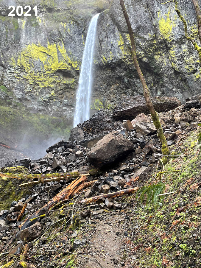
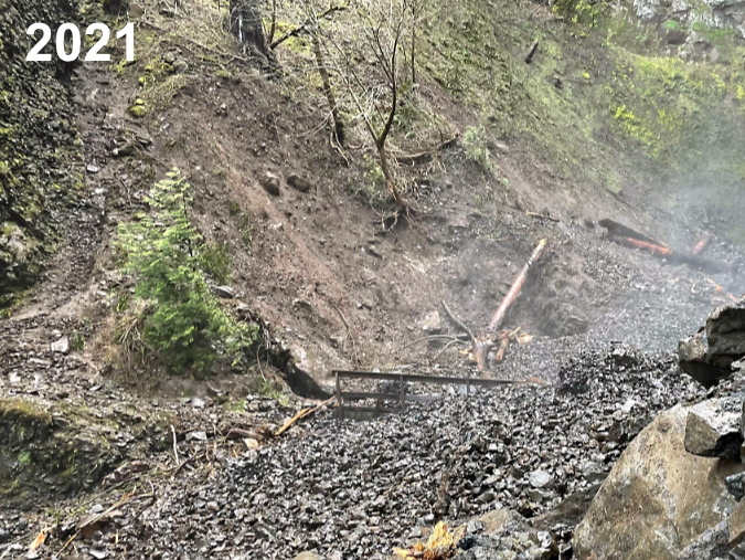
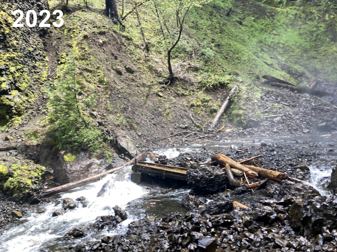
The drama at McCord Creek continued a few short years after the fire when the west cliff wall of the Elowah Falls amphitheater collapsed in the winter of 2021. There’s no science (yet) to make the connection, but the Gorge has seen a series of cliff failures since the 2017 Eagle Creek Fire. Could these events be linked to the loss of vegetation or corresponding runoff on Gorge slopes? Perhaps, but as I described in the previous article on the 1973 Tanner Creek landslide, there are unique forces at work in the Gorge that date back to the last ice age, so events like these are the norm, not the exception.

Elowah Falls cliff collapse in the spring of 2021 (Drew Stock, Trailkeepers of Oregon)

TKO volunteers discovered the Elowah Falls cliff collapse in 2021 and captured the dramatic photos shown here. In the immediate aftermath of the collapse, McCord Creek disappeared into the loose basalt cobbles that had filled the creek channel and buried the Trail 400 footbridge to its railings. That condition was temporary, however, as by last spring McCord Creek had already carried away much of the small debris and excavated the footbridge. The images below show the erosive power of the stream over a period of just two years.

Debris burying McCord Creek and its footbridge immediately after the collapse (Drew Stock, Trailkeepers of Oregon)

Elowah Falls footbridge excavated (and railings removed!) by McCord Creek after just two years

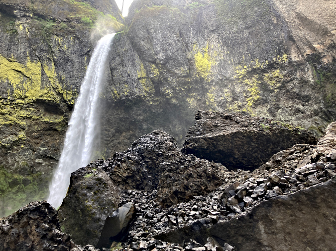
Like most cliff collapses in the Gorge, the jumbled debris fan at Elowah Falls is a mix of truck-sized boulders that managed to hold together amid a sea of smaller boulders and fractured basalt cobbles where parts of the once-solid rock face had simply crumbled during the event.

Large blocks of basalt mixed with smaller cobbles in the debris pile at the base of the collapsed cliff

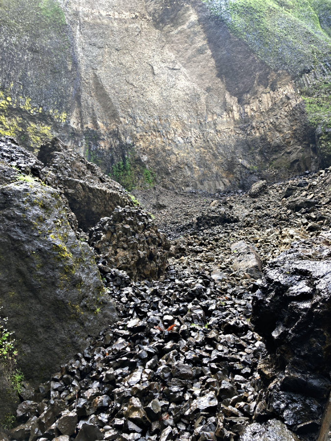
Today, a massive scar is still obvious on the cliff wall where the basalt gave way (below). In time, however, the evidence from event will be hidden under a fresh carpet of moss and Licorice Fern, once again giving that deceptive illusion of stability that has never really existed in the Gorge.

Looking up the debris fan at the massive scar left behind by the cliff collapse at Elowah Falls in Spring 2023

While the cliff collapse at Elowah Falls was massive in scale, it spared the spectacular trail to Upper McCord Falls where it is carved into the basalt walls 400 feet above the creek. In fact, hikers passing along this vertigo-inducing stretch of trail might not even notice that a large section of the wall directly below them had collapsed into the creek, as the impact is mostly hidden from this airy view (below).

Elowah Falls seems unchanged from above along the Upper McCord Trail

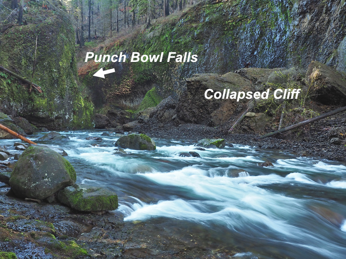
If the cliff collapse Elowah Falls was impressive to see, the earlier collapse at Punch Bowl Falls on Eagle Creek was downright shocking. After Multnomah Falls, and Crown Point, the view into the mossy cavern that holds Punch Bowl Falls might be the most iconic in the Gorge. The idyllic scene drew photographers from around the world before the fire, and even gave its name to the category of “punchbowl” waterfalls.

Punch Bowl Falls as it once appeared in 2012

I posted an extensive piece on this event when it showed up unexpectedly on a series of aerial surveys the State of Oregon had conducted to track landslides after the Eagle Creek Fire. The Punch Bowl collapse occurred just months after the fire, sometime in early 2018. The “restricted area” was still in effect at the time, so the first few people to see the aftermath in person were trail volunteers working to put the Eagle Creek trail back together. Today, you can see the re-arranged landscape by taking the Lower Punch Bowl spur trail down to the falls.

Aftermath of the 2018 cliff collapse at Punch Bowl Falls

Getting that classic shot of Punch Bowl Falls during spring runoff usually entailed wading knee-deep into Eagle Creek to get a look into the hidden cavern that holds the falls. The cliff collapse has since changed things a bit. For now, there are a pair of good-sized boulders that landed in the entrance to the cavern, blocking the traditional view. 

In time, Eagle Creek will dismantle much of the debris from the collapse, and even these boulders will eventually break apart or be pushed downstream by the enormous force of the stream during winter floods. This will be aided by the many fallen logs that have dropped into the stream since the fire, and now act as erosive battering rams and levers as they move downstream.

The ”modern” calendar design emerges in 2016

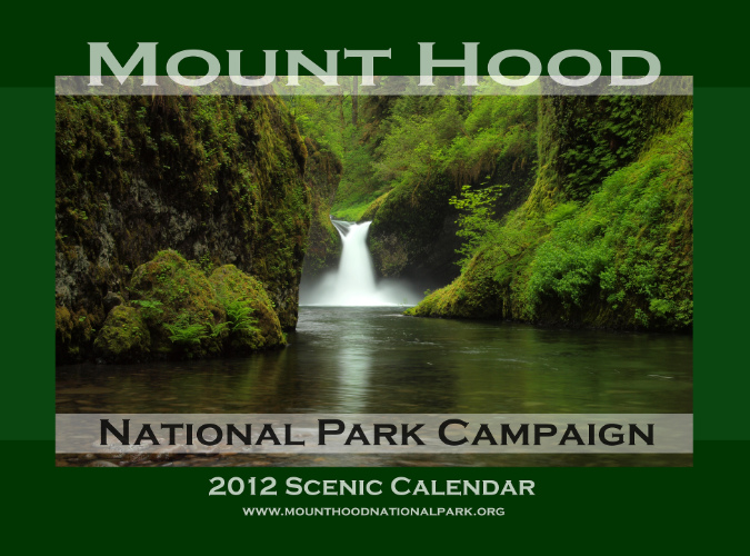
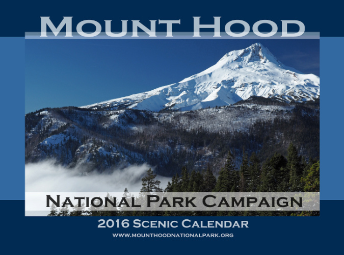
The final design and format emerged in 2016 with a switch in vendors

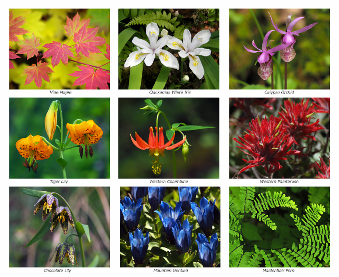
Year twelve in the calendar series brought a major shift and format and improved quality when I moved printing from CafePress to Zazzle. The image reproduction at Zazzle is excellent and the overall printing process much better, resolving some quality concerns that drove me to make the move. Zazzle also brought the added opportunity to have a printed back cover on the calendar, kicking off the grid of nine botanical photos that I continue to include each year. Like the scenic views in each calendar, the botanical images are captured over the course of the prior year on my forays into WyEast Country.

New with the 2016 calendar? A printed back cover!

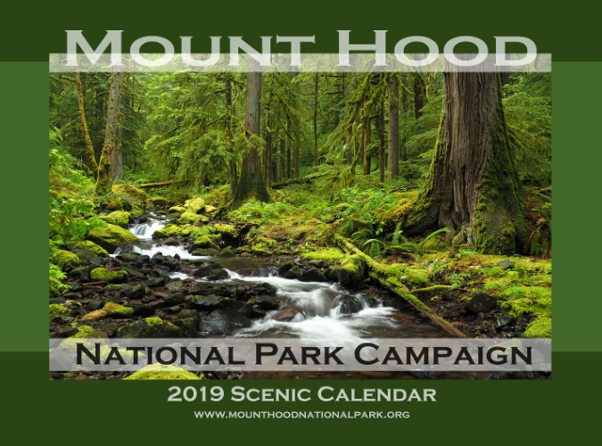
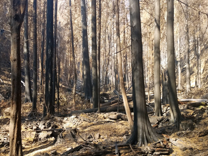
One last profile of note from past calendars is the 2019 edition, where lovely Whale Creek in the Clackamas River watershed is featured. This idyllic scene is – or was – typical of the beautiful rainforests there. Despite a long and frustrating history of aggressive logging over more than a past century, some of the finest ancient forests in the region survived here. Sadly, the Riverside Fire – yet another human-caused event – started just upstream from this spot along the Clackamas, and eventually burned 120,000 acres of forest, as well as numerous structures.

This scene from Whale Creek taken before the 2020 Riverside Fire was featured on the 2019 calendar

I’ve posted many articles on the necessity and benefits of wildfire in our forests, but the Riverside Fire underscores a few caveats to the science. As I described in this 2021 article, we are burning our forests faster than is sustainable. This stems from multiple factors adding up to a perfect storm: a century of fire suppression coupled with heavy logging has left us with thousands of old clearcuts packed with thickets of overplanted, fire-prone young trees and decades of fuel buildup. Add climate change, with our summers getting drier and hotter, and our forests have become a tinder box in most years, not just the occasional hot summer.

The same section of Whale Creek after the fire in 2020 (USFS)

Given this confluence of stresses on our forests, we’re doing an especially poor job preventing human-caused fires – they account for 70 percent of wildfires in Oregon! As I point out in the linked article, we’ll need to set some unwelcome limits on human behavior if we hope to slow down the burning to sustainable levels. So far, the Forest Service is moving very slowly in limited access during extreme fire danger, though successful liability lawsuits against power companies whose live lines triggered some of the 2020 fires may change that thinking.

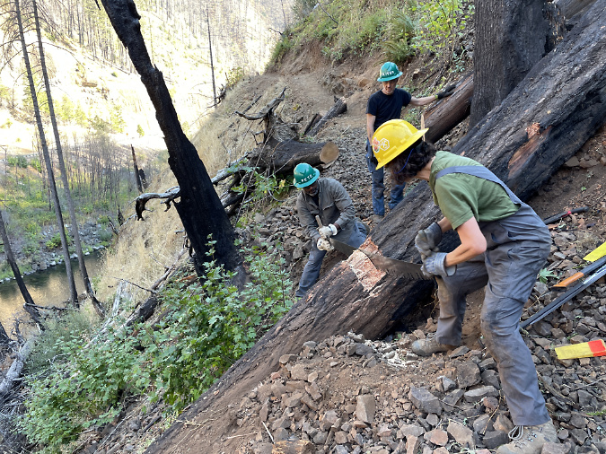
TKO crews clearing big logs on the Clackamas River Trail after the Riverside Fire

Some good news from the Clackamas? TKO crews have already been working on reopening trails damaged in the fire. Like the Gorge, the Clackamas River canyon is steep country, so keeping trails open as the forest recovers will be a long-term endeavor.

That’s a look back at 20 years of campaign calendars, and now…

…looking ahead to 2024!

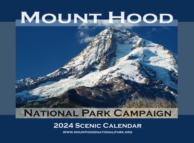
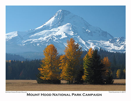
The view from Inspiration Point is the cover image for 2024
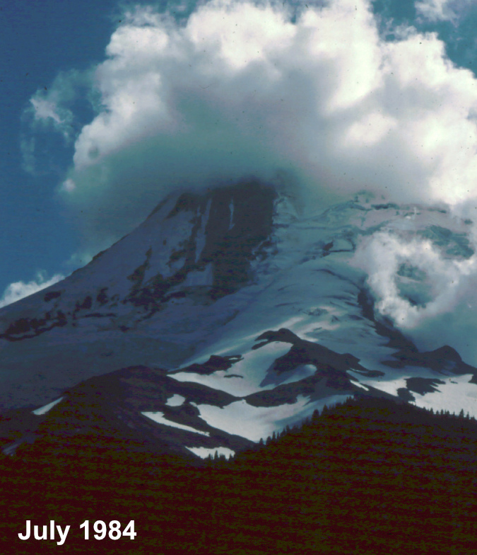
For the 2024 calendar cover, I selected an image of Mount Hood’s fearsome north face (above), as viewed from a tiny, unofficial trail that I maintain at Inspiration Point (located at the 3-mile mark on bumpy  Cloud Cap Road). How long have I been stopping here? I looked back at my photo archive, and the earliest I could find was a slide from the summer of 1984 – which means I’ll celebrate my 40th summer visiting this lovely spot when I stop at Inspiration Point next year!
Clouds capping the mountain on the road to Cloud Cap in this 1980s view from Inspiration Point

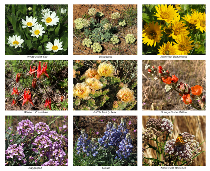
On the back cover of the new calendar, yet another collection of nine wildflowers that I photographed over the past year is featured – including a couple that were new to me. 

Back cover of the 2024 calendar
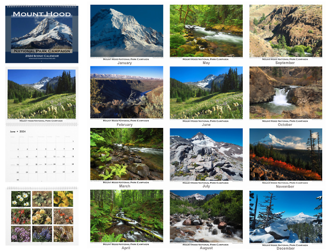
Putting it all together, here’s a jumbo collage of the 12 monthly images in the 2024 calendar, plus the covers and a snapshot of the page layout:

[click here for a large version]

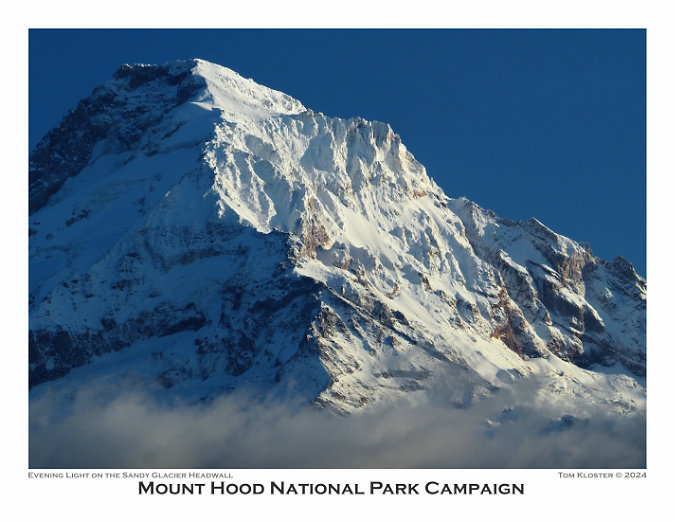
For the January image in the new calendar (below), I selected a view of Mount Hood’s northwest side, with Cathedral Ridge and the Sandy Glacier Headwall covered in an early dusting of autumn snow. On this day last October, the mountain was emerging from the clouds after being socked in most of the day.

Northwest face of Mount Hood with early autumn snow

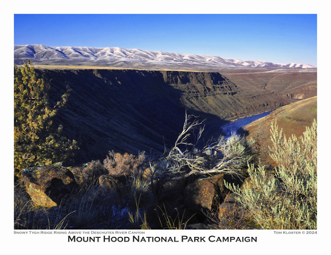
For the February image I thought I’d mix things up a bit with this view of the lower Deschutes River canyon at Oak Springs (below), a corner of WyEast Country that not many find their way to. On this day last winter, a dusting of snow had fallen on Tygh Ridge, the long fault scarp that rises in the distance – another lesser visited spot on this lonely, dry side of the mountain.

Lower Deschutes River and Tygh Ridge from above Oak Springs

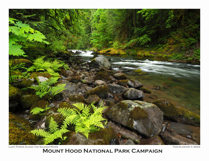
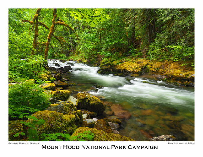
For March, a more familiar scene (below) along a quiet section of the lower Salmon River features a group of Lady Ferns. The Old Salmon River Trail follows this stretch of river through some of the best rainforest and oldest trees within easy reach of Portland.

Lower Salmon River in Spring

I chose another stream scene for April, though this one is less familiar to most. This is Viento Creek (below), in the east Gorge, just a few miles west of Hood River at Viento State Park.

Viento Creek in the East Gorge

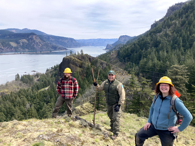
There’s a backstory associated with this photo, as I’ve been working with TKO for the past few years to create a new family-friendly trail from the Viento Campground to a magnificent viewpoint on the Viento Bluffs. The new trail will someday pass the stream scene shown above, enroute to expansive views of the Columbia River – but with a short route that it will be welcoming to casual hikers and young kids. Watch this space for more news on this project!

TKO and State Parks crew surveying a new trail at Viento Bluff earlier this year

The picturesque view from Viento Bluff will someday become a family trail destination

The May calendar image features another stretch of the Salmon River (below). This pretty cascade has become a popular spot for photographers in recent years. I included it in this year’s calendar partly for symbolic purposes, as this scene appeared in the very first calendar in 2004. This is also where Greg Lief’s image at the top of this article of me shooting photos was captured in 2003 – hard to believe that was 20 years ago!

Springtime on the Salmon River

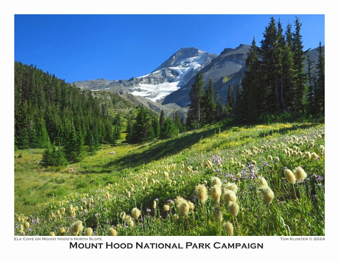
June brings another symbolic favorite, as Elk Cove appeared on the cover of the first calendar, and in several subsequent editions over the years – and almost always from this very spot (below) along the Timberline Trail. As much as the mountain has changed in recent years, this view remains a bit of a constant – always lovely, but especially the Western Pasqueflower are putting on their “Muppets of the Mountains” show.

Summer wildflowers putting on their annual show at Elk Cove

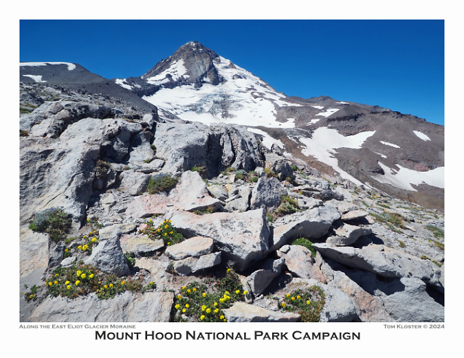
For July I selected another repeat spot, one of my favorite viewpoints of Mount Hood and the Eliot Glacier from the shoulder of Cooper Spur (below). I posted a look-back article on this area earlier this year to kick off a series of then-and-now photo retrospectives. 

Mount Hood and the Eliot Glacier from the Cooper Spur Trail

For the August image, I selected another scene from a blog article, in this case a view of the recovering Muddy Fork valley where a landslide swept through two decades ago. This event and several now-and-then photo comparisons are over here.

Muddy Fork of the Sandy River

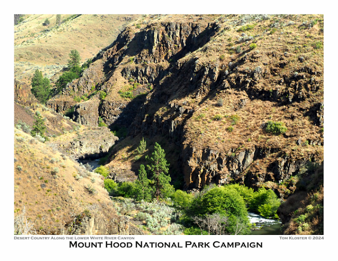
For September, I chose something a bit different, with a cliff-top view into the lower White River Canyon (below) at White River Falls State Park. So many things make Mount Hood unique (and worthy of national park protection!), but the compact collection of wildly different climate zones might be at the top of the list. There aren’t many places in the world where a 2-hour drive from the middle of a major metropolitan area takes you from rainforest to desert, with glacier-covered volcano rising above you the entire time!

Lower White River Canyon in desert country

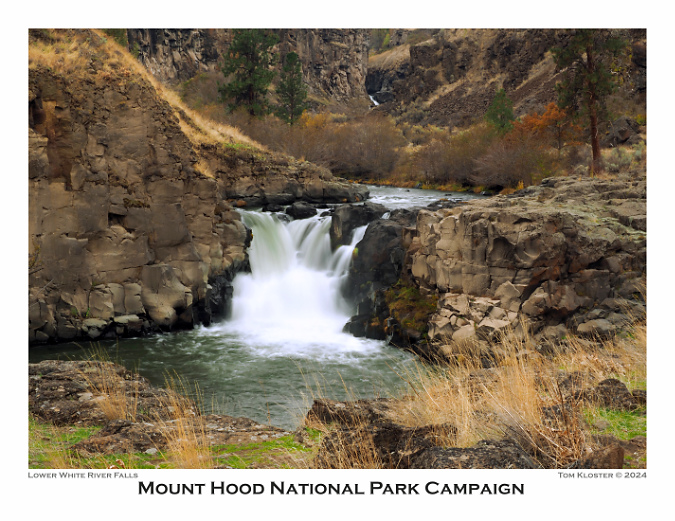
The October image stays with the desert theme, and features Lower White River Falls. In spring, this canyon lights up with desert wildflowers that I’ve included in previous calendar editions, but the tawny yellows, gold and reds of autumn create their own beauty in this rugged landscape.

Lower White River Falls in Autumn

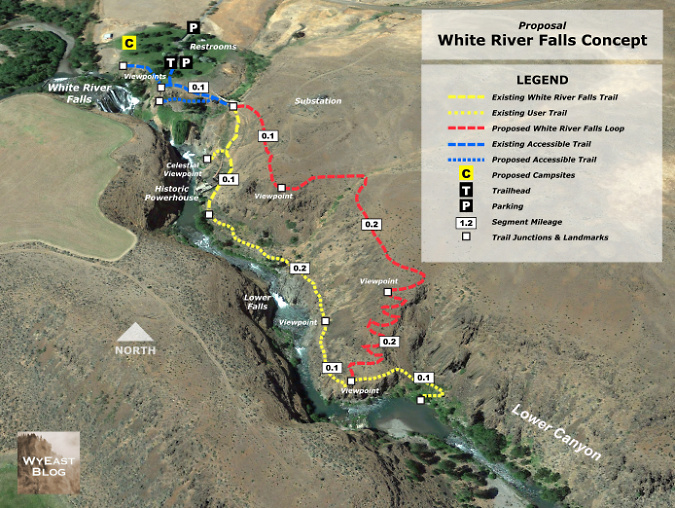
White River Falls State Park remains a diamond in the rough, with much potential for both improved recreation and conservation of the natural and cultural features in the park. The area is becoming more popular, and that has translated into some visible impacts – and therefore several proposals to respond to this increased demand are featured in this article from earlier this year.

Loop Trail concept for White River Falls State Park

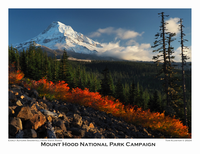
For November, fall colors along Vista Ridge and fresh snow on the mountain are featured (below). This scene is surprisingly easy to get to – it’s along the access road to the Vista Ridge Trailhead, another increasingly popular spot on the mountain. This article from last summer includes some proposals for managing the pressures the newfound popularity is bringing to Vista Ridge.

Brilliant fall colors on Vista Ridge

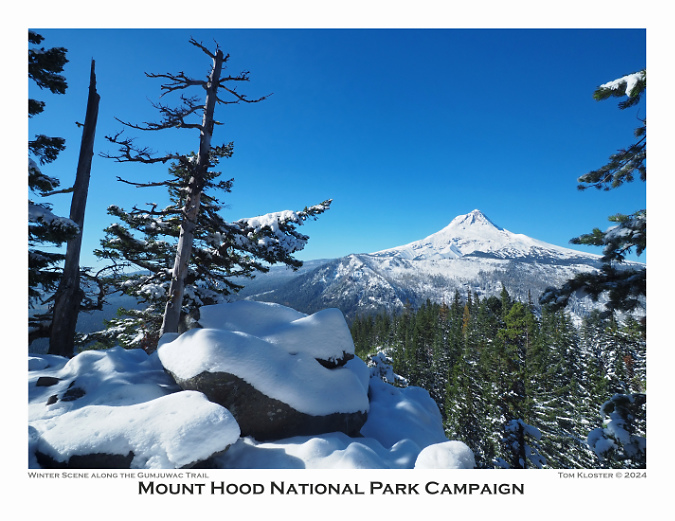
Finally, a view of the mountain after the first big snowfall of the season (below) from the lightly traveled Gumjuwac Trail, gateway to the Badger Creek Wilderness. My favorite viewpoint hikes are to “pocket views” – those spots where a steep talus slope or rocky outcrop provides an unexpected view – and this rocky crest just below Gumjuwac Saddle is among the best, and was featured on the front of the 2016 calendar, as well.

Pocket viewpoint along the Gumjuwac Trail in winter

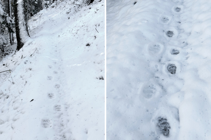
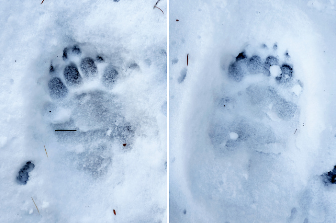
On the way up to the Gumjuwac viewpoint, I followed the chunky footprints of a Black bear for much of the route. Hiking in snow is a useful reminder that wildlife are always out there, even if we don’t have snow on the ground to record their travels. This is their home, after all, we are the visitors.

Bear tracks along the Gumjuwac Trail

Bear tracks in fresh snow on the Gumjuwac Trail

So, that’s it for my annual calendar review! If you made it this far and would like order one, they are available here – and all proceeds go to Trailkeepers of Oregon (TKO):

2024 Mount Hood National Park Calendar

As always, thanks for visiting the blog. Looking ahead to next year, I already have several articles underway, with the usual collection of deep dives, new proposals and reflections on the past. I hope you’ll continue to stop by!

The author at Owl Point in 2008 (Andy Prahl)

Best to you in the coming year – see you on the trail in 2024!

_______________ 

Tom Kloster | December 2023

Tanner Creek Landslide at 50 years

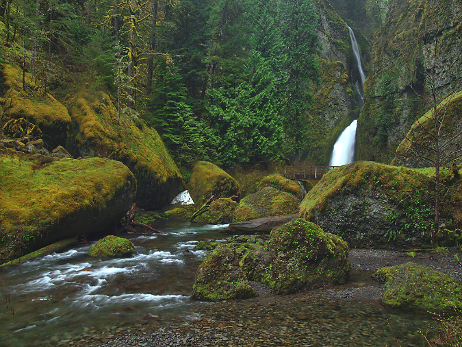
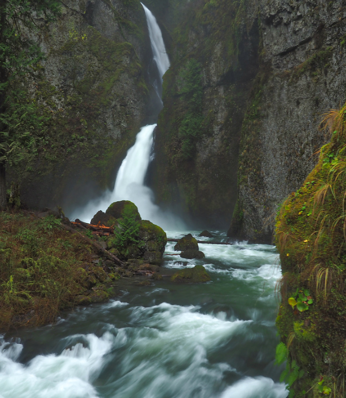
Beautiful Wahclella Falls in the massive rock cathedral that Tanner Creek has sculpted

Fifty years once seemed like a very long time to me – half a century! Fifty years before I showed up on this planet (in 1962) human flight had barely been mastered and automobiles had just begun to replace the horse and buggy. Looking back today upon the past fifty years, things seems less changed from the perspective of a 61-year-old (though it’s true that without the arrival of personal computers and the internet, I wouldn’t be posting this article!) Our sense of passing time is warped by our own very short lives.

That’s the gift of witnessing the natural world around us moving forward at its own pace, as it has for millennia. Fifty years is a fleeting moment in time to our mountains and forests, where the only constant is change and the seemingly endless repetitions in the of cycle life that plays out on the landscape. Seeing these larger systems at work is a reassuring escape from our daily lives driven by deadlines and chores, and a reminder of the larger natural order that we belong to.

Tanner Creek weaving through the mossy boulder gardens below Wahclella Falls

This article is a 50-year snapshot of a catastrophic landslide in the Columbia River Gorge that perfectly illustrates these forces at work, right before our eyes. The landslide took place in the lower gorge of the Tanner Creek canyon in 1973, triggering a cascade of events that are still playing out today. It might have gone unnoticed at the time by all but a few avid hikers had there not been an earlier human presence at Tanner Creek dating back to very start of the 20thcentury. 

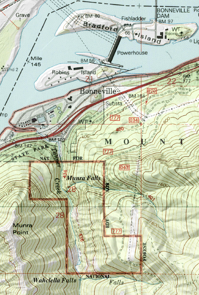
The story begins at the Bonneville Fish Hatchery, located at the mouth of Tanner Creek. Built in 1909, it remains as one of the oldest hatcheries in the State of Oregon’s system, and was established as a place to breed salmon fry to be shipped to other hatcheries around the state.  The map below shows the proximity of Tanner Creek to the Columbia River, Bonneville Dam and today’s Interstate 84.

The Tanner Creek gorge is located on the south side of the Columbia River at Bonneville, in the heart of the Gorge

The Bonneville Hatchery opened five years before the Historic Columbia River Highway arrived at Bonneville, when Gorge travel was still by train or boat. It was completed nearly 30 years before Bonneville Dam was constructed, though expanded as part of the dam construction project. Over its nearly 125 years of operation, The Bonneville Hatchery has been expanded and upgraded several times in an attempt to keep pace with continued dam building upstream on the Columbia River. The hatchery continues to be a popular tourist attraction, with stocked ponds and interpretive displays.

Construction of the hatchery diversion dame on Tanner Creek in about 1907 – note two men standing on the pipeline intake structure (OSU Archives)

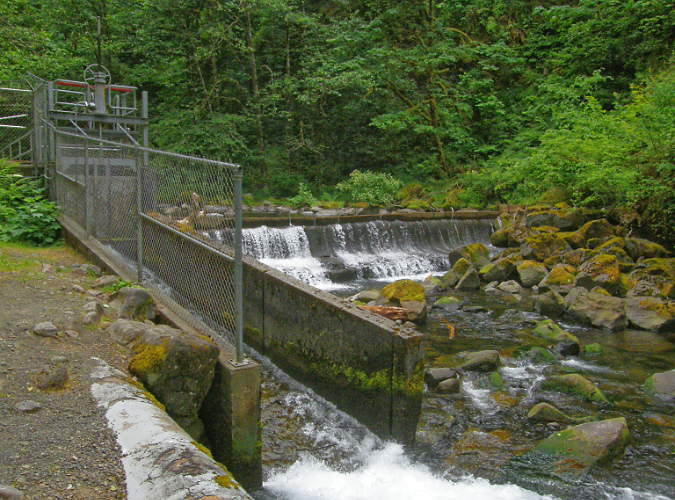
The hatchery diversion dam today

The Bonneville Fish Hatchery originally depended on the cold, clear mountain water of Tanner Creek for its existence. When the hatchery was constructed in 1908, a small diversion dam was built one-half mile upstream from the main hatchery and a supply pipeline was built along the west bank of Tanner Creek to carry stream water to the hatchery ponds. The original diversion dam still exists today, though most of the hatchery water now comes from wells. The old pipeline has since been replaced, and is now buried under the short access road that hikers follow to the old dam and the start of the Wahclella Falls trail.

The original pipeline that carried Tanner Creek water to the Bonneville Fish Hatchery nearing completion in about 1908

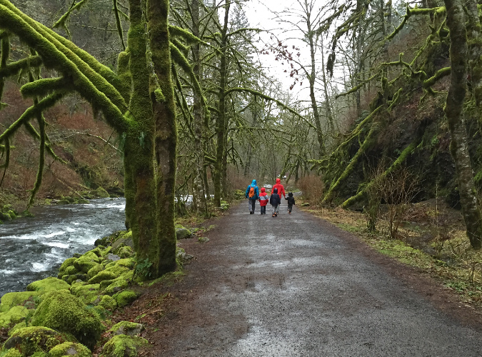
Today’s access road to the diversion dam replaces the old water supply pipeline, and doubles as the first half mile of the Wahclella Falls Trail. This view is in roughly the same spot as the previous historic photo

When the Tanner Creek landslide occurred in 1973, it was first noticed by hatchery workers after the water supply suddenly stopped flowing. An investigation upstream revealed a massive cliff collapse along the west all of the canyon, just below Wahclella Falls. The resulting landslide had completed blocked Tanner Creek, temporarily blocking the streamflow below the landslide.

There was a rough user trail to Wahclella Falls in the days of the landslide, but it was a sketchy affair, crossing several treacherous, small landslide chutes on the east side of the canyon. Hikers parked at a gravel turnaround by the access road gate (located at today’s Wahclella Falls parking area) to reach the trail. By the late 1980s, the modern trail we know today was conceived, with much of it built by volunteers. When the new loop trail was completed in the early 1990s, the landslide was deemed stable enough to be traversed by the new trail. This has allowed countless hikers over the past 30 years to see the spectacle close-up.

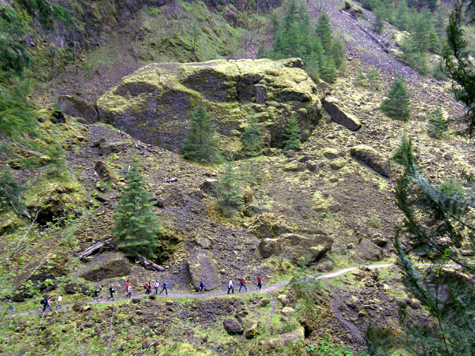
Hikers are dwarfed by the Tanner Creek landslide debris – especially the house-sized boulder in the middle of the debris field

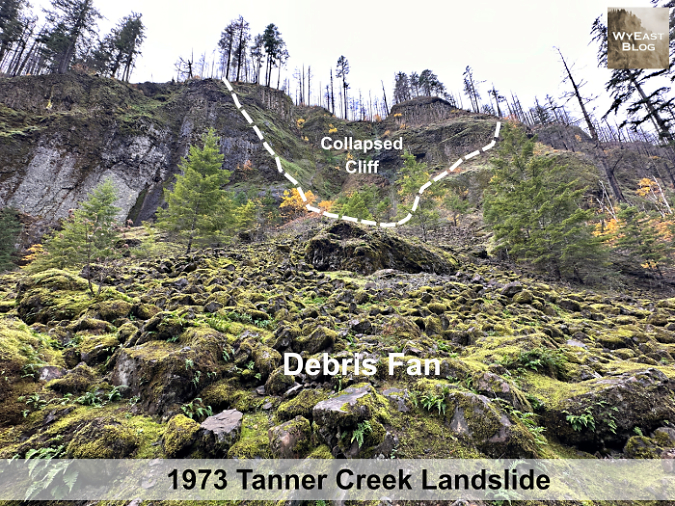
Loose material from a landslide typically forms a steep, cone-shaped pile at its terminus, known as a debris fan. Today, the landslide debris fan from the 1973 landslide appears as a green, moss and fern-covered talus slope with a few young trees gradually becoming established in the rubble. A few truck and house-sized boulders poke through the surface of the smaller talus. Below the talus slope, Tanner Creek has stripped away much of the small debris, exposing several of these giant basalt boulders in a dramatic rock garden that the stream continues to shape and shift.

What caused the landslide?

Three epic geologic events continue dominate how the Gorge is shaped today, including the 1973 landslide at Tanner Creek and the many smaller cliff collapses and landslides that occur every year. The first event created the underlying geology of the Gorge, and dates back about 17 million years. On the Oregon side of the river, ancient layers of volcanic ash and debris (similar to what Mount St. Helens produced in the 1980 eruption) accumulated to form the loosely consolidated geologic foundation, and is visible at river level. This unstable base is known as the Eagle Creek Formation.

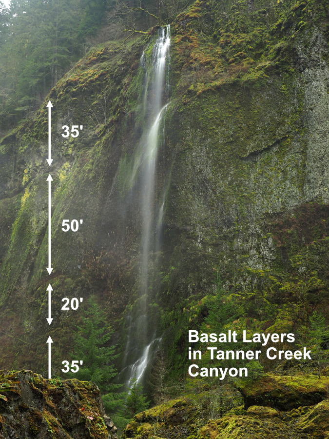
The second event occurred between 12 and 16 million years ago, when hundreds of epic lava flows originating near today’s Steens Mountain flooded much of Oregon, leaving behind thousands of feet of “flood basalts” in stacked layers. These are collectively known as the Grande Ronde Formation and make up the layers we can plainly see in the towering cliffs that make dominate the Gorge landscape today. For this article, they will simply be referred to as Columbia River Basalt. 

Thick layers of ancient Columbia River Basalt make up the steep walls of Tanner Creek canyon and much of the surrounding Gorge landscape. Individual basalt layers can range from a few feet to 50 feet or more in depth

The underlying ash and debris layers of the Eagle Creek Formation are less obvious than the overlying basalt, but this formation is familiar to hikers. Named for Eagle Creek in the Gorge, hikers slip and slide during the wet months on the muddy trail surface where the first mile or so of the famous Eagle Creek Trail is built across this material. 

Compared to the hard, black layers of basalt that form the bulk of the overlying geology, the Eagle Creek formation is very unstable, especially when exposed to weathering or stream erosion. And though the overlying layers of basalt are comparatively hard and durable, their weakness comes from the extensive fractures that form when basalt lava flows cool, creating the familiar columns that are common throughout the Gorge (more about that weakness in a moment).

Loosely consolidated volcanic avalanche debris known as the Eagle Creek Formation underlies thousands of feet of basalt layers in the Gorge, making for an unstable, easily eroded foundation

Eagle Creek Formation makes up this wall along the lower section of the Tanner Creek Trail

The third epic event came long after the volcanic ash and lava had cooled and at the end of last ice age. During a period from about 13,000 to 15,000 years ago, a series of catastrophic floods from collapsing glacial lakes in today’s western Montana and northern Idaho and Washington rushed across the landscape of the Columbia Basin, then pushed through the Columbia River Gorge toward the Pacific Ocean. Compared to the volcanic episodes that created the Eagle Creek Formation and Columbia River Basalts, the glacial floods occurred yesterday, by geologic standards, and their impact is still playing out today.

The floodwaters were an astonishing 800 to 1000 feet deep as they rushed through the Gorge, carving the steep, dramatic gorge we know today. These are now known as the Bretz Floods, and scientist now believe there were over 40 separate flood events over the course of this period. The floods named for Harlen Bretz, a brilliant, visionary geologist who bravely persevered against intense criticism of his theory behind these events before they were finally accepted by the scientific community in the 1960s and 70s.

The trademark waterfalls of the Gorge are a product of the Bretz Floods where the stacked layers of ancient flood basalts were stripped of loose slopes and debris, revealing the soaring, vertical cliffs and dramatic waterfalls we see today. Where these waterfalls occurred on larger, more powerful streams like Tanner Creek, time and constant erosion has gradually migrated them upstream and away from the Columbia River over the millennia.

The succession of massive ice age floods known as the Bretz Floods easily topped Crown Point, stripping away all but the basalt cliffs, just as the floods shaped the sheer cliffs we see throughout the Gorge today

Since the great floods, Tanner Creek has persistently swept away debris from each successive landslide and cliff collapse, continually eroding the heavy basalt layers from below and setting the stage for the next landslide event. The underlying Eagle Creek formation speeds up this process because it lies at river level in the Gorge, allowing both the Columbia River and its tributary streams to actively undercut the towering basalt walls that rest upon this unstable, underlying layer.

Today, Wahclella Falls marks the current spot where Tanner Creek continues to carve its own, ever-longer gorge, now more than a mile long from where it began after the floods. Seen in this timeframe, the 1973 landslide at Tanner Creek was just one event in hundreds of similar cliff collapses and landslides over time that continue to shape the Gorge we know today. 

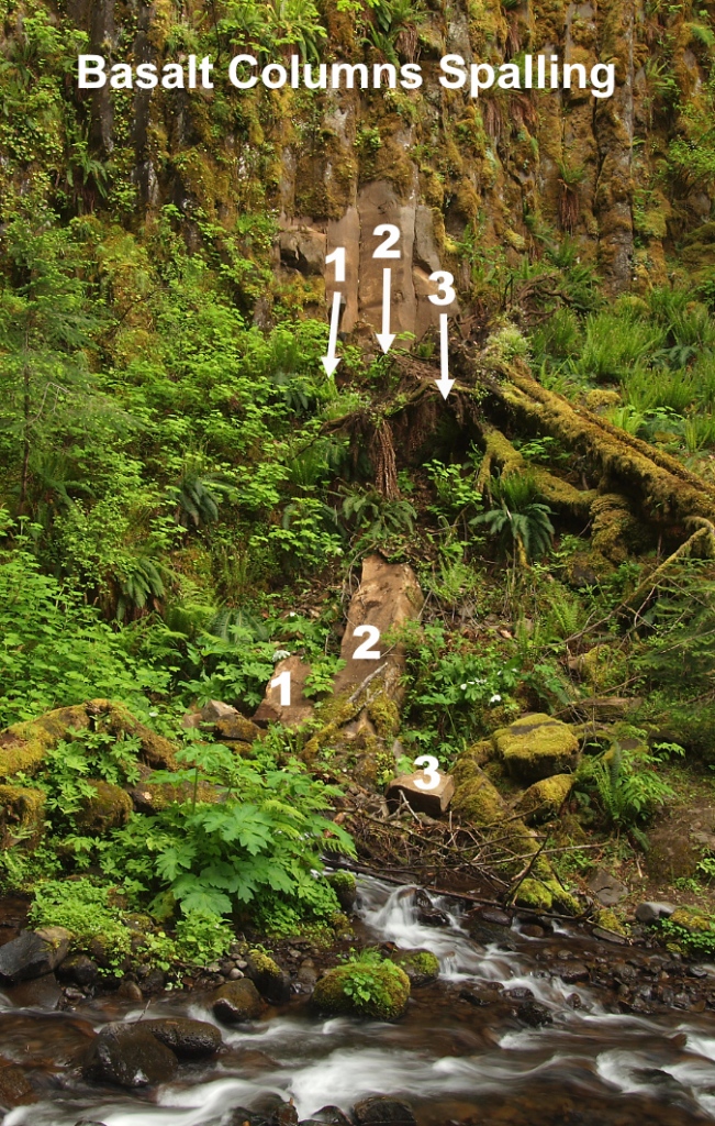
Weathered basalt often spalls according to the cooling cracks that formed when the lava flows cooled, creating the familiar stone columns common in the Gorge.

The cooling cracks in the basalt layers help, too, as they allow slabs of basalt to continually calve off where the cliffs have been undercut by erosion (see the photo, above). The cracks that form the columns in basalt also allow water to seep in when exposed to weather, and when the water freezes it expands, eventually splitting the rock. While most basalt columns are 5-sided, they may have anywhere from 3-7 sides or be less organized in their cooling patterns. As the example above shows, the columns typically break into pieces on impact when they fall, turning them into the smaller blocks of sharp-cornered basalt. When these blocks make it into a large stream like Tanner Creek, they are further tumbled and broken down into smaller pieces and moved downstream.

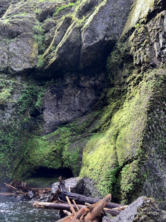
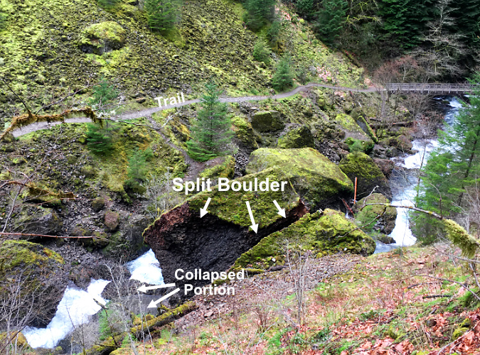
Whole chunks of basalt also split off when fractures in the rock are expanded by repeated freezing and thawing of water that seeps into the cracks. The raw, dark area at the center in this view just downstream from Wahclella Falls mark the spot where the boulders at the base of the cliff split off a few years ago. Moss will soon cover the evidence of this collapse.

The spalling process is underway on every sheer basalt face in the Gorge, and most of the steep talus slopes in the Gorge were created this way, gradually growing over time as new basalt chunks drop onto the rock slope from spalling cliffs above. This phenomenon occurs at scales both small and large throughout the Gorge, from individual columns spalling off to entire rock slabs and cliff faces that also break up into smaller pieces on impact. It was basalt wall collapse like this that triggered the 1973 Tanner Creek landslide.

The monumental crash nobody heard…

The sole known account of the 1973 landslide at Tanner Creek comes from Don and Roberta Lowe, legendary hiking guide pioneers in Oregon. Their first guide to trails in the Columbia River Gorge was published in 1980, and included this description of the event:

_________________

“In 1973, attendants at the Bonneville Dam Fish Hatchery were surprised, puzzled and alarmed when the water supply to the facility by Tanner Creek abruptly stopped. When the flow did not resume after a short time, the men became worried, as hatcheries require constant supply of fresh water, so they hiked up Tanner Creek to learn what had happened. 

“The canyon was filled with an eerie calm and almost unearthly ambience. A short distance before Wahclella Falls, they found the answer: several hundred cubic yards of the west wall had fallen away and blocked the stream, forming a small lake behind the dam. Fortunately, water began flowing through the debris before any damage was done in the hatchery. The lake (although not as large as it was soon after the landslide) and the slide area still can be seen from the trail – an intimidating view.”

-From “35 Hiking Trails: Columbia River Gorge” by Don and Roberta Lowe (1980)

_________________

The Lowe guide goes on to describe the very rustic trail to Wahclella Falls as it existed in the 1970s, a slippery boot path the Lowes describe as “tricky” during the wet season, including a rock-hop along Tanner Creek near the trailhead – a far cry from today’s well-graded, family friendly trail.

It’s hard to imagine what the scene must have been like when the basalt cliffs gave way along Tanner Creek in 1973, but it must have been extraordinarily loud! Dozens of massive, house-sized boulders managed to roll all the way to Tanner Creek, several hundred feet below, part of a huge debris fan that measures more than a quarter mile across. What we can’t know is whether it happened as a single event, or series of collapses over hours, or even days, though the complete damming of Tanner Creek – a sizable stream with a powerful flow — suggests a single, catastrophic event.

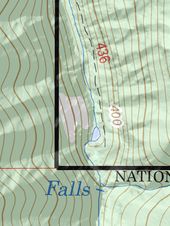
The temporary lake behind the landslide debris lasted long enough to make it onto U.S. Geological Survey maps that were being updated in the 1970s. The bare slopes of the debris fan were also shown on the new maps. Part of the lake persisted well into the 1980s, when I made my first trip into the canyon. Photos from the trip that I have included in this article show just how raw the landslide area continued to be more than a decade after the collapse.

The tiny, temporary lake resulting from the landslide was timed perfectly to be included on USGS maps. Tanner Creek has since carved through the landslide debris and the lake is no longer

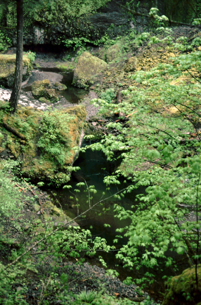
The tiny lake on Tanner Creek persisted into the 1980s – this view is from 1986

In preparing this article, I searched for official accounts of the landslide event and historic photos of the west wall of the canyon from before the landslide, but found neither.  Therefore, the following schematics are based upon visual evidence on the surviving cliff face above the landslide and the sheer amount of debris that came down. It must have been involved a very large section of the canyon wall. Another guide for these schematics was the recent pair of cliff collapses at nearby Eagle Creek (described in this article), where the “before” conditions were well-documented could be easily compared with the amount to debris produced in these similar, though somewhat smaller events.

Visualizing the landslide aftermath

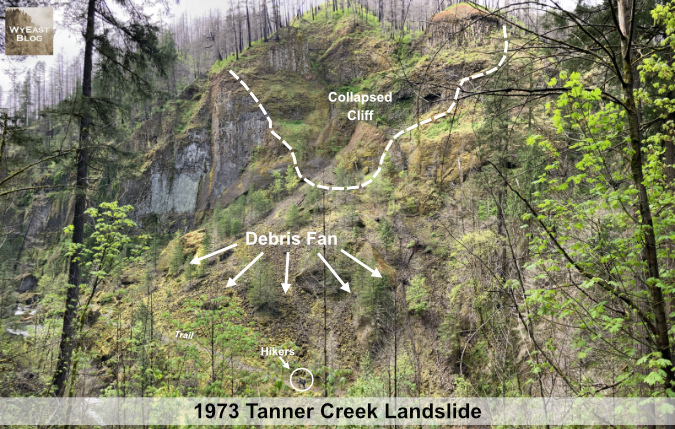
The first schematic view of the landslide is from high on the east slope of Tanner Creek Canyon, where the modern trail approaches a footbridge over a tributary stream (below). Wahclella Falls is just out of view to the left, and Tanner Creek can be seen in the lower left of this view. The dark cliffs on the left side of the photo were not involved in the collapse, so they provide a reasonable sense of what the west wall must have looked like before the 1973 collapse and landslide. 

[click here to open a large version in a new tab]

The dashed line shows the extent of the collapse, where the canyon wall gave way. Large, intact slabs of basalt that were once part of the wall poke through the loose debris of the fan, below. This is common when basalt cliffs collapse, as the amount of fracturing within the layers of rock determines whether the individual layers hold together in large chunks as they fall, or complete disintegrate into the loose talus rock that makes up most of the Tanner Creek debris fan. The arrows show the direction in which rock from the collapse tumbled, creating the debris fan we see today. The circled hiker on the lower leg of the loop trail provides a sense of scale against the massive slide area.

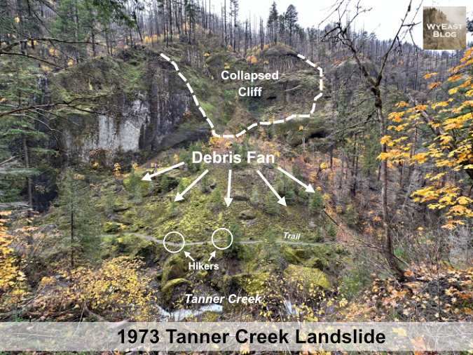
This schematic view (below) is from farther upstream on the main trail, just below Wahclella Falls and directly opposite the landslide. It provides a better sense of what the west wall might have looked like before the collapse, based on the intact wall to the left. The collapsed area is now a hollowed amphitheater in the wall of the canyon, and it still sends rocks and debris down to the fan each year as the new cliff face continues to weather and spall from exposure to the elements. The stand of mature Douglas fir to the right survived the event, marking the edge of the new debris, though these trees also grow on a talus slope created by some earlier event in Tanner Creek’s continued evolution. Two groups of hikers are circled to provide scale.

[click here to open a large version in a new tab]

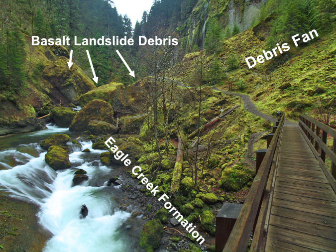
Tanner creek can also be seen at the bottom of the schematic, where it tumbles through house-sized chunks of collapsed cliff that rolled into the stream during the event. At the time of the collapse, smaller, loose debris filled the voids between these giant boulders in the same way the large boulders remain buried in smaller material in the debris fan today. Tanner Creek quickly carved into the smaller material, clearing it away over the past 50 years and stranding the giant boulders in the creek bed. 

The next schematic of the landslide (below) is from the lower part of the loop trail, where it crosses the debris fan and where the hikers appear in the previous schematic. This view gives a better sense of the smaller debris, from small, loose basalt fragments to boulders ranging from a foot across to as much as 25 feet across. The amphitheater formed in the cliff wall is more evident from this perspective, as well.
Over the half-century since the collapse, this part of the debris field has settled into a talus slope and is now fairly stable where it is out of reach of Tanner Creek.

[click here to open a large version in a new tab]

Along with the moss and Licorice Fern that now carpet much of the talus in the debris fan, a few Douglas Fir have become established over the half-century since the collapse, along with scattered understory plants like Ocean Spray and Snowberry. Despite fifty years passing, however, the landslide remains a raw, rocky place that tells us the full recovery will take many more decades for the forest to fully reclaim this slope.

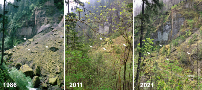
The following photo sequence shows the progressive forest recovery on the landslide from just 13 years after the event, when moss was just beginning to take hold, to 2011, when the east wall of the canyon had stabilized enough to become dense with young deciduous trees like Bigleaf Maple and Red Alder. The most recent view shows a thinned forest recovering from the Eagle Creek Fire that swept through in 2017, moderately burning several sections of the Tanner Creek canyon, including this slope. 

Forest recovery over the years on the Tanner Creek landslide

[click here to open a large version in a new tab]

The arrows in this photo comparison show common reference points, each marking one of four very large boulders that haven’t moved since the 1973 event. Surprisingly, the tall Douglas fir along the left edge of these photos is the same tree, and one that has survived the many changes to the area over the past half century – though leaning toward Tanner Creek a bit in recent years.

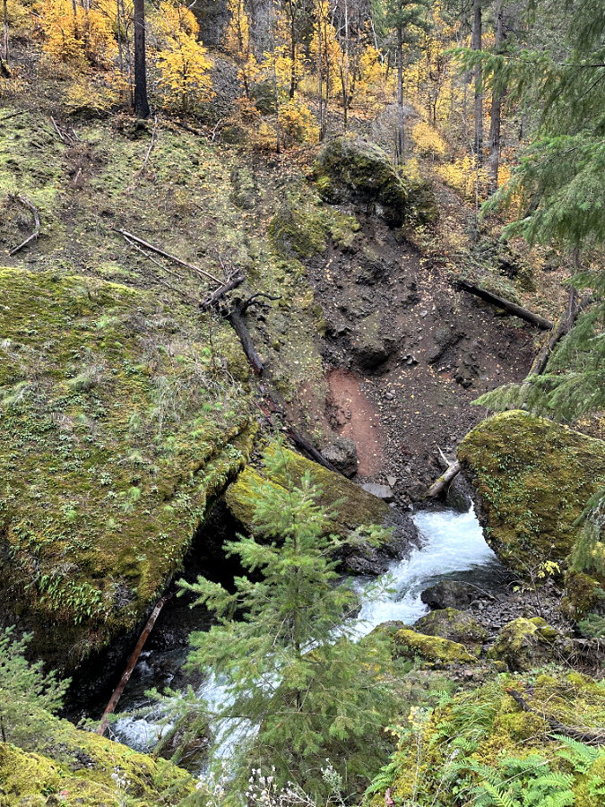
Why was the east wall of the canyon affected by a landslide on the west side? That traces to the dammed-up stream and subsequent erosion as Tanner Creek worked its way around the pile of debris the landslide had pushed against the east slope. As constant stream erosion has gradually uncovered the massive boulders that line the creek, the boulders have forced the creek against the edges of the stream channel, undercutting slopes on both sides of the canyon as the channel continues to deepen. 

The lower bridge on the Tanner Creek loop trail crosses the stream where soft Eagle Creek Formation is overlain by solid basalt flows and loose basalt debris

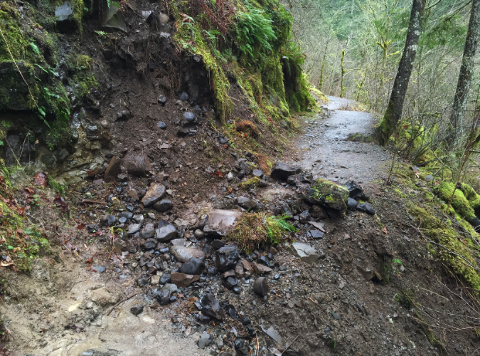
Though they seem immovable by their sheer size, Tanner Creek continues to gradually shift the giant boulders over time, as they lie directly on unstable Eagle Creek Formation that forms the creek bed. This soft, underlying formation can be easily seen from the lower footbridge (above) along the Wahcella Falls trail, with the collection of basalt landslide boulders resting on top of the formation where it has been exposed by the creek. As the creek erodes soft Eagle Creek Formation material under these boulders, they shift, which in turn shifts Tanner Creek, as well. This continually shifting action continues to actively undercut slopes on both sides of the canyon, triggering smaller active landslides in several spots. 

This effect can be seen in the following view of the east slope showing one of several small landslides that has been triggered over the years as the Tanner Creek banks against the foot of the east slope to move around the boulder in the lower right.

Active landslide on the east side of the canyon where Tanner Creek has been pushed against the slope, undercutting it

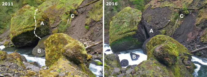
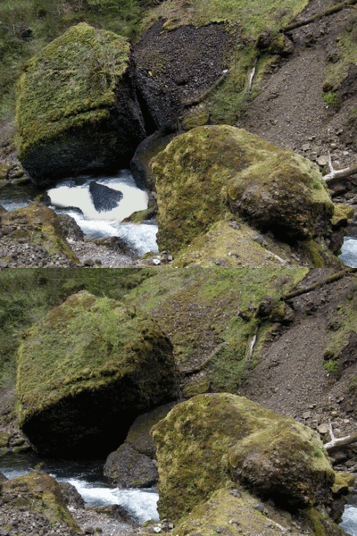
Over time, even house-sized basalt boulder fall apart, and this is on display at Tanner Creek, too. The giant boulder shown in this image (below) split sometime in the early 2010s. By 2016 a large piece had split off and partially crumbled, falling off into the stream in several pieces. While weathering like this typically results from cracks in the basalt that are expanded over time by freezing and thawing, the uneven erosion of the underlying Eagle Creek Formation likely destabilized this boulder further, with the sheer weight of the rock eventually pulling it apart at the seams.

This giant boulder was split apart in the early 2010s when Tanner Creek eroded the Eagle Creek Formation material underneath

This comparison view (below) of the boulder in 2011 and 2016 shows the extent of the weathering that occurred, as well as how the collapse of the east portion of this boulder allowed Tanner Creek to more aggressively undercut the east slope of the canyon, behind the boulder, expanding an active landslide. The letters in this graphic mark reference points for comparing the views. 

Split boulder comparison from 2011 and 2016

[click here to open a large version in a new tab]

This animation (below) of the same before and after views of the boulder give a better sense of how the adjacent slope on the east wall was destabilized when the boulder split, leaving the slope unsupported and exposing it to undercutting by Tanner Creek. This weather and erosion sequence might seem unusual to us, but it is a constant in the geologic shaping of the Gorge, playing out countless times along Tanner Creek and along other streams that continue to carve their way through layers of basalt.

Animated split boulder comparison from 2011-16

The 2017 Eagle Creek Fire introduced yet another erosional force to the Gorge streams by producing thousands of fallen trees that quickly became driftwood as they fell or were carried downhill by landslides. During high water season, Tanner Creek and other large streams in the Gorge are fully capable of moving mature logs down their course, often piling them in huge log jams along the way. In a powerful stream, these join with the current when the streams are raging to become battering rams and pry bars against the boulders they encounter along their path.

Tanner Creek is especially wild and wooly in the winter, easily capable of moving whole logs down its channel

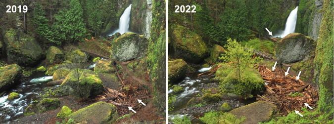
Such is the case at Wahclella Falls, where an enormous jam of several hundred logs has piled up since the fire in the side channel just below the falls (next to the “Wahclella Cave”). These comparison photos (below) shows how dramatically the log jam has grown over subsequent years, from a 25-foot wide pile two years after the fire in 2019 to a 120-foot long pile just five years in 2022. A smaller logjam has since formed inside the splash pool, as well (indicated by the arrow near the falls in the second photo). 

Despite the size of these log piles, they are temporary and will eventually be on the move. Their next stop will be the boulder garden created by the landslide, just out of view to the left, where they could significantly alter the changing stream channel there, once again.

Growth of the post-Eagle Creek Fire logjam at Wahcella Falls

[click here to open a large version in a new tab]

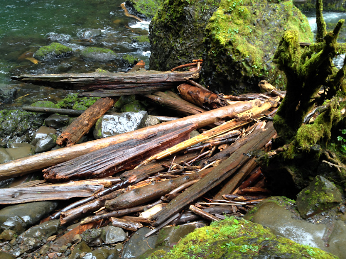
This view (below) of the main logjam at Wahclella Falls is looking downstream from the upper footbridge and shows the obstacle course of huge landslide boulders in the distance that these (and other) logs will eventually work their way through. When logs form a jam, the combination of their sheer weight and the water pressure building behind them can move very large boulders or simply divert Tanner Creek in a way that accelerates erosion under boulders resting in the streambed.

Post-fire logjam below Wahclella Falls

This view (blow) of the smaller logjam inside the Wahclella Falls splash pool shows these forces at work, with Tanner Creek continuing to add new logs and woody debris to the gap between these large boulders, where the stream once freely flowed. The hydraulic pressure behind these jams is immense during high water, allowing the logs to incrementally pry even large boulders like these loose, and thus rearrange the stream channel.

Smaller logjam within the Wahclella Falls splash pool

Logjams like these will continue to appear and grow for decades to come in the post-fire period in the Gorge. The very good news is that woody debris like this is an essential ingredient to healthy fish habitat for salmon and steelhead, a fairly recent discovery by stream biologists. The lack of fire in the Gorge over the past century has had the effect of starving streams of woody debris, so the new conditions that we are witnessing are, in fact, very old. This is what these streams had always looked like for millennia, before fire suppression began in the early 1900s.

What about the boulders at Wahclella Falls?

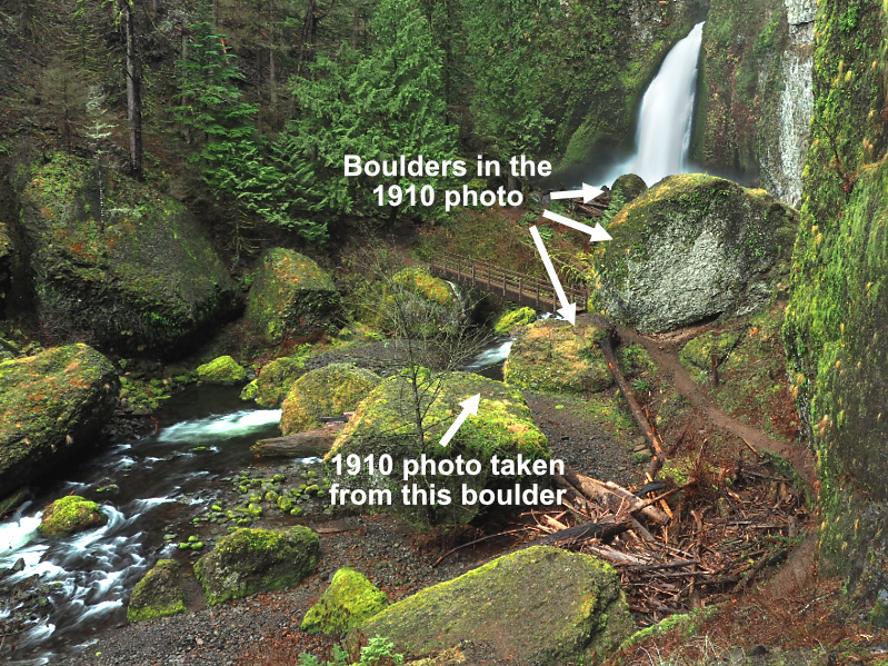
In writing this article, I’ve attempted to map the areas impacted by the 1973 landslide, including the many large boulders left behind in Tanner Creek. Without photos from before the slide, I’m not able to fully answer whether the iconic boulders immediately below the falls (as seen in the logjam comparisons, above) were part of the event, as some believe. However, I’m fairly certain they were not, and instead that they came from earlier, similar cliff collapse events long ago.

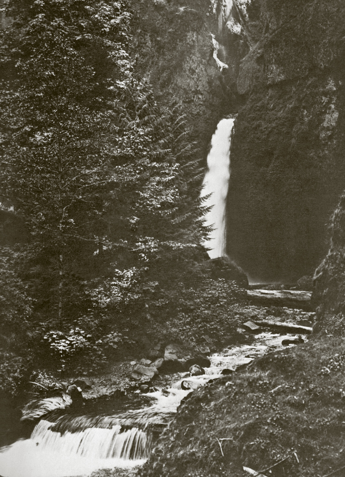
I do have a single historic photo of Tanner Creek (below), titled “Tanner Creek Falls in 1910”. If this is an image from a century ago, then it shows most of the boulders located immediately below Wahclella Falls to have been in place long before the 1973 landslide. The timing of the photo corresponds to construction of the Bonneville Fish Hatchery and accompanying diversion dam on Tanner Creek, so there’s a good chance it was captured during that period of intense activity in the area.

Wahclella Falls in 1910

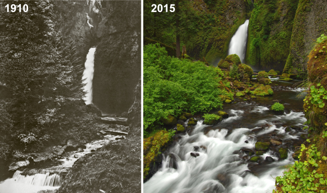
While the 1910 photo doesn’t show much of the surrounding landscape, it does show the edge of a very large boulder that guards the west approach to the falls, immediately adjacent to the modern trail. The following comparison shows the edge of the same boulder on the right, as well as a pair of boulders in front of the falls that also appear to date back to the 1910 photo. 

Wahclella Falls over the course of a century – 1910-2015

[click here to open a large version in a new tab]

The angle of the 1910 photo also suggests that the flat-topped “island” boulder bounded by the side channel (and now by the logjam) is where the photographer was standing, since the rock in the lower right foreground of the 1910 photo is where the west end of the footbridge is located today. This is shown in the following image of the boulders surrounding Wahclella Falls, with at least four of these present at the time of the historic photo. 

Are these boulders from the 17973 cliff collapse? Unlikely

Based on the shape of the debris fan (just out of view to the left in the above photo), I believe all of the large boulders in this view pre-date the 1973 cliff collapse and landslide, though I will continue to look for historic photos that can document what really happened!

After the fire… and the future of Tanner Creek?

Since the fire in 2017, landslides have been active throughout the Eagle Creek Fire burn area. With no forest cover to moderate runoff, tributary streams flood more frequently, and as the killed trees begin to decay, their roots will no longer hold the steep Gorge slopes in place. Fortunately, the forest is already bouncing back, and these erosion effects will eventually fade, but in the meantime slides and erosion will continue to have a real impact – especially on hiking trails.

Small post-fire landslides like this one on the Wahclella Falls trail are keeping trail volunteers busy throughout the Gorge

What is less known is whether the loss of forest cover will trigger much larger events – like the massive cliff collapse that occurred at Punch Bowl Falls on Eagle Creek shortly after the fire. Given the amount of earth movement already happening on a smaller scale throughout the burn, it does seem likely that something larger might also be triggered. Perhaps this will happen at Tanner Creek? So far, there’s no way to know or predict future events of this scale.

Larger landslides like this one on the Wahclella Falls trail are moving whole trees burned in the fire into the stream

Meanwhile, Gorge visitation has never been greater, especially in the years after the pandemic, when interest in hiking soared across the country. At Tanner Creek, the combined effect of post-fire erosion and record crowds year-around has taken a visible toll on the landscape. Though the area was added to the Mark O. Hatfield Wilderness in 2009 to better protect it, Tanner Creek feels more like the popular state parks in “waterfall alley” on busy days than a “wilderness”. Large groups that greatly exceed the wilderness party limit of 12 are commonplace, and the small parking area at the trailhead overflows year-round, with cars parked along the freeway off-ramp on especially busy weekends.

Weekend crowds at the upper footbridge on the Wahclella Falls trail

For its part, the Forest Service has expanded amenities somewhat at the trailhead, including a growing collection of portable toilets and even periodic law enforcement visits in response to frequent car break-ins. So far, the hiking experience remains exceptional, despite the crowds and their visible impacts. The trail to Wahclella Falls is considered family-friendly, so many of the visitors here are children who (hopefully) will come back to this as their own cherished spot for decades to come. That is perhaps the best way to ensure places like this are well-cared for in the future.

Contractors servicing the array of portable toilets at the Wahclella Falls trailhead

In addition to the parking area basics like toilets, I would like to see more interpretive information on the 1973 landslide provided at Wahclella Falls. The wilderness designation means that any signage along the trail must be minimal and rustic in design, but there is plenty of space at the parking area or the formal trailhead near the hatchery dam to provide more information on both the unique natural history of the area and a simple map of the trail – many hikers I encounter here don’t realize it’s a loop, and I finding them standing puzzled at the unsigned loop junction, unsure of which way to go (“take the lower trail, it’s a loop” I tell them).

Lines form for selfie photos in front of Wahclella Falls on busy days

Looking to the broader future, my hope is that new trails and destinations will be opened in the Gorge to take some pressure off places like Tanner Creek. I’ve posted some ideas here over the years, and I will continue to make the case for more trails (including expanding the trails at Tanner Creek to new destinations upstream… watch for a future article on that topic!)

I’ve been hiking in the Gorge since I was in kindergarten, so I have the benefit of seeing the many changes to the area over time – whether they be natural events like the Tanner Creek landslide, or human-caused. That’s why this quote in the 1980 Lowe field guide caught my eye:

_________________

“The serene glade of cedar at the base of the Wahclella Falls is ample reward for the precarious stretches. You’ll probably want to spend extra time enjoying the sylvan setting.”

_________________

This description then came to mind when I was preparing this article, and ran across an image (below) from a hike to Wahclella Falls some 21 years ago, taken with my first digital camera in the fall of 2002. It was truly “serene glade” back then, and it still is – despite some signs of overuse that have since appeared.

Wahclella Falls in 2002 when the impact of hikers was still minimal

We don’t know what the forces of nature have in store for Tanner Creek in coming years, but the landscape continues to be in a state of dynamic change fifty years after the great landslide in 1973, and it will continue to change. But as the landscape continues to recover from the landslide – and now, the 2017 fire – we can do our part to ensure that this remarkable spot continues to be a place where we can watch the recovery unfold while also managing our own impacts, and allow some of the scars humans have caused to heal, as well.

________________  

Tom Kloster | November 2023

The Noblest of Firs

Forests of Noble fir forests spread out to the horizon along the crest of Waucoma Ridge, just north of Mount Hood (Mount Adams in the distance)

We’re coming into another holiday season when millions of Americans will set up a Christmas tree cut in Oregon. There’s a good chance it will be a Noble fir, long prized as the most beautiful and durable of Christmas trees, representing about a third of the cut tree industry here. 

There was a time when Noble fir grown as holiday trees were left in their natural state, which features elegant tiers of symmetrical branches and soft, deep green, upwardly curving needles. In recent years, Nobles grown for mass-market consumption have increasingly been sheared to produce a densely branched, unnatural thicket (acknowledging my bias, here!) in the same way that Douglas fir have long been cultivated in the Christmas tree trade. Still, the un-sheared Nobles remain the gold standard, and they sell for gold-standard prices at tree lots, too.

New grown emerging on Noble fir boughs

Noble fir cones

In Oregon, families also have the option of cutting their own Christmas trees at U-cut tree farms, a popular benefit of living in a region that produces millions of holiday trees for the nation. It’s also possible to cut your own tree on National Forest land, a tradition that dates back a century or more. Though more regulated today by the U.S. Forest Service, families looking for a more adventurous option than local tree lot can head up to designated areas on the mountain (typically powerline corridors or recovering clear cuts) and bring home their own cut tree.

The author at age 11 (second from left) with family and friends on a 1973 trip to Lolo Pass to cut Christmas trees. Noble fir were always the goal, but in those days of heavier mountain snows, simply reaching the Noble fir zone in December was an adventure!

Christmas trees are pretty much the extent of public knowledge of the noblest of our true firs. As the common name might suggest, noble fir is the largest of all true firs. Their name was given in the fall of 1825 by botanist David Douglas when he ventured into the high country above the Columbia River River Gorge, in the vicinity of today’s Cascade Locks. Though he wasn’t specific about the peak he climbed on the north side of the river, it is believed to be today’s Table Mountain. A few days later, he climbed to a high point on the Oregon side, most likely today’s Benson Plateau.

On this pair of climbs, he came upon magnificent, old-growth stands of Noble fir, and gave them their well-deserved name. While they are undeniably beautiful as young trees, old-growth Noble fir are a sight to behold. Like many of our Pacific Northwest conifers, these trees grow to be giants, with the largest on record reaching nearly 300 feet in height and nearly 10 feet in diameter.  

Old-growth Noble fir forests near Mount Hood’s Bennett Pass

An ancient Noble fir giant towers above the surrounding forest canopy near Bennett Pass

Noble fir are also unique to the Pacific Northwest, with a range that extends from just above of Snoqualmie Pass in Washington south to the Siskiyou Mountains in Southern Oregon and the Trinity Alps region along the northern edge of California. In their southern extent, they are known to hybridize with California’s Shasta fir, a variety of the Red fir that grows in the Sierras and extends into the southern fringe of the Noble fir range.

Despite their willingness to grow in planted rows as farmed Christmas tree seedlings in the hot, dry summers of the Willamette Valley floor, Noble fir are a subalpine species. They typically grow at elevations of 3,500 feet to 5,500 feet, where they are long-lived and acclimated to the harsh winters of our mountains. Not surprisingly, they grow more slowly under these conditions, but they are tremendously adaptable, and often grow on very steep mountain slopes and exposed, rocky ridgetops.

Centuries-old Noble fir giant near Bennett Pass

Noble fir is a sun-loving pioneer species in our forests, quickly colonizing in burn areas to form pure, long-lived stands. Hike through one of the towering old-growth stands found in the high country of the Columbia Gorge or on the peaks surrounding Mount Hood, and you’re likely walking through an old burn, with the age of the trees as a good indicator of when fire last roared through, long ago. That’s because they are not only post-fire colonizers, but also highly susceptible to fire as mature trees, as they lack the protective bark of fire-adapted conifers like Ponderosa pine and Western larch.

This cycle of burn-and-rebirth in our Noble fir forests is on full display today on the north slopes of Mount Hood, where the 2011 Dollar Lake Fire burned through sprawling stands of subalpine Noble fir. These forests were almost entirely killed where the fires swept through, yet today, the forest recovery is already well underway, with young Noble fir seedlings leading the way among other post-fire pioneer species.

Ghost forest of Noble fir skeletons where the Dollar Lake Fire swept through a decade ago

Ancient Noble fir killed by the Dollar Lake Fire will provide wildlife habitat for many decades to come as a new forest grows here

Noble fir seedling emerging from the charred ashes of the Dollar Lake Fire

Meanwhile, across the Clear Branch canyon on the north of the mountain, the forests along the crest of Blue Ridge and at Owl Point (along today’s Old Vista Ridge Trail) are made up almost entirely of Noble fir that had colonized an earlier burn there, one that occurred sometime in the early 1900s. This pair of photos (below) from Owl Point shows how the foreground was burned and just beginning to recover in 1952, while 70 years later the scene is reversed: the forests along Blue Ridge and Owl Point have largely recovered, while the north slope of the mountain is just beginning its recovery from the 2011 Dollar lake Fire.

When our Noble fir forests are spared of fire and logging, individual trees can easily live up to 400 years.  The oldest known Noble fir have reached 600 to 700 years, though trees of this age are exceedingly rare after more than a century of commercial logging in the Pacific Northwest. 

In the early days of extensive logging, in the late 1800s and early 1900s, true firs were considered a lesser wood, so the timber industry marketed the massive, old-growth Noble firs as “Larch”. This explains two Larch Mountains in the Columbia River Gorge, one on each side of the river, and each the site of extensive turn-of-the-century logging in the early 1900s. The better-known Larch Mountain is on the Oregon side, and its broad, high elevation slopes provided a perfect habitat for Noble fir.

Loggers felling a massive Noble fir on Larch Mountain in 1905

By the early 1900s, the Bridal Veil Mill on the Columbia River had established an upstream sister mill in the heart of these Noble fir forests, where the trees were hundreds of years old, having been spared by fire for many centuries. The upstream mill was known as the Palmer Mill (and later, New Palmer Mill, after the first mill burned), and a road on Larch Mountain still carries its name. 

Loggers carried giant Noble fir cut on the slopes of Larch Mountain to the New Palmer Mill on logging railroads. This scene is from 1905

Old-growth Noble fir logs were milled at the original Palmer Mill site on the north slope of Larch Mountain. This scene is from 1896, when logging of the virgin Noble fir forests there was in its heyday

Palmer Mill was attached to the main mill by a long flume that followed Bridal Veil Creek, and it was the hub for a massive logging enterprise on Larch Mountain that felled most of the virgin Noble fir forests. Huge logs were first sent to Palmer Mill on a branched system of logging railroad spurs, then milled into rough lumber that was floated down the flume system to the Bridal Veil Mill for finishing into construction grade lumber.

Today, all but a few traces of the Palmer Mill are gone, and many of the Noble fir forests on Larch Mountain are approaching 100 years in age. The area somehow dodged the 2017 Gorge Fire that swept through vast areas of the Gorge, burning through thousands of acres of Noble fir forests in the Gorge high country. 

Noble fir in the age of Climate Change

Today, Noble fir country in the western Oregon Cascades is a checkerboard of clear cuts that mark the advent of National Forest logging that began on a commercial scale in the late 1940s. When these trees were cut, the catch phrase used to justify logging ancient forests was “sustained yield”, though sustained yield forestry never envisioned restoring ancient forests to their natural state. Instead, the management philosophy was to provide a continual supply of 60-100 year-old trees from plantations that could be repeatedly logged via a vast network of logging roads built in our forests from the late 1940s through the early 1990s.

When 7.5 minute USGS maps were created in the 1950s and early 60s, there were already thousands of clear cuts on Forest Service lands that showed up on the new maps as a checkboard in heavily logged areas like Mount Hood’s Blue Ridge (shown here). Many more clear cuts followed, and sixty years later, these clear cuts are often overcrowded plantations of conifers that the Forest Service is now thinning through new timber sales

Despite the early bias against true firs, the wood produced by Noble fir eventually came to be valued for being light and strong, and was used during World War II in aircraft, as well as more common construction uses in windows, doors and paper production. This led to aggressive logging in the later years of the commercial timber boom of the 1950s-90s, when lower elevation forests had already been logged over, and high-elevation Noble fir forests were increasingly targeted. 

The Pacific Crest Trail follows the crest of this ridge near Lolo Pass, where heavily logged, high-elevation Noble fir forests have been slow to recover. These clear cuts are now 40-50 years old, and yet the stunted, crowded young plantation trees are still dwarfed by the groves of big, old-growth trees that were spared the chainsaw

Clearcutting on the steep, mountainous terrain where Noble fir grow was never sustainable, at least as measured in human lifetimes. The big, high elevation Noble fir forests sold off by the Forest Service were often hundreds of years old, with even the smaller-diameter trees well over a century old. There was never a chance to produce a rotating “crop” of trees at these elevations large enough to justify logging for generations to come, but that didn’t slow the rush to log these forests.

Instead, the logging boom finally peaked with the listing of the Spotted Owl and subsequent “timber wars” in the early 1990s, and it has never fully recovered, though some logging on our national forests continues today.

This Noble fir fell across the Timberline Trail recently, and was sawed out by trail crews. While it is only about 15” in diameter, a count of the annual growth rings revealed this tree to be over 160 years old, demonstrating how elevation and mountain conditions slow the growth of these trees

It’s easily to lose perspective on just how old the trees in our mountain forests really are. The above is a timeline of human events that unfolded since this tree took root as a Noble fir seedling on Mount Hood until a windstorm knocked it down in 2020. This tree is approximately 14 inches in diameter and 160 years old.

These stumps near Bennet Pass mark some of the oldest and largest Noble fir ever logged near Mount Hood, with some of these trees approaching 300 years old when they were cut. These stumps look like they might be a couple years old, with bark still intact. In fact, these trees were logged about 30 years ago, yet the Noble fir seedlings growing in this recovering clear cut are barely six feet tall

This is the same stump that appears in the foreground in the previous photo, with approximate dates according to tree rings. When it was cut, it has lived through more than a quarter of the first millennium.

The Bennett Pass clear cut (shown above) might look recent, given the intact condition of the stumps and the young Noble fir trees just getting established. Yet, this forest was cut nearly 30 years ago, as shown in the aerial photo pair (below). Thanks to its high elevation at over 4,000 feet, and resulting slow forest recovery, this logged area is still just beginning to reforest.

After nearly 30 years, this clear cut in an old-growth Noble fir forest near Bennett Pass is only beginning to recover

These examples are typical of logged Noble fir forests throughout the Mount Hood National Forest. They simply haven’t recovered at the pace the Forest Service assumed when logging was still king. Noble fir seedlings in these cut-over areas have often grown very slowly, reaching just 6 or 8 feet in height after 30 or 40 years of post-logging recovery. The slow recovery has also compounded the fragmentation effect on wildlife that depend on uninterrupted old-growth forest habitat.

Today, the Forest Service is grappling with the perfect storm of an aging, overbuilt system of spur roads from the heyday of commercial logging coupled with increasingly catastrophic forest fires resulting from climate change and a century of fire suppression. This is especially true in high-elevation Noble fir country, where clear cut plantations are especially vulnerable to summer drought and fire, and logging roads are impacted by severe winter conditions.

To meet these challenges, along with Congressional quotas for timber production that have always been unsustainable, the Forest Service has pivoted to forest thinning the thickets of young plantation trees in previously logged areas. It’s arguable that this strategy will help restore forests to a healthy state, but sadly, the Forest Service mission isn’t to restore a mature, healthy forest. Their goal is to bring more marketable logs to maturity, the primary management objective for much of Mount Hood National Forest.

Forest thinning operation on Butcher Knife Ridge, north of Mount Hood, where roughly one third of the trees have been removed from a clear cut plantation to encourage a more diverse forest structure

Forest thinning typically produces massive piles of woody debris, as seen here on Blue Ridge, just outside the Mount Hood Wilderness. Logging debris was historically burned as “slash”, though new uses are under development to make better use of this material as we enter the age of widespread forest thinning

The jury is out as to whether forest thinning improves the health of crowded plantations better than simply doing nothing, given the impact of heavy equipment on tree root systems and the forest understory.  The science does suggest that thinning can help as a preventative means for reducing forest fire severity, since it removes potential fuel from the forest. The benefit of thinning Noble fir plantations is less clear, however, since the species is already more vulnerable to fire than other conifers, and seldom survives fire.

Noble fir also tolerate crowded conditions better than other conifers, presumably because these trees are so effective at colonizing burns and often form nearly pure stands in the process. Young Noble fir forests often have little understory beyond a carpet of beargrass because the trees are so closely spaced. But these pure stands have also evolved to self-thin over time, maturing to a more open canopy that allows huckleberry, rhododendron and other mountain understory species to thrive among more widely spaced, mature trees. In these forests, young Noble fir are also part of the understory, as the forest canopy continues to regenerate.

The following images show self-thinning in a young (about 80 years old) Noble fir forest on Bald Mountain, along the Timberline Trail. A recent windstorm selectively toppled the weakest among these trees, a timeless process that Noble fir don’t need our help with.

Recent downfall in a young stand of Noble fir on Bald Mountain are part of an ongoing, self-thinning process these trees have evolved for

Recent self-thinning event in a pure Noble fir stand on Bald Mountain. If it doesn’t burn, this protected forest inside the Mount Hood Wilderness will continue to self-thin, becoming an old-growth Noble fir forest in time

With logged high-elevation forests recovering very slowly, and high-elevation spur roads failing especially badly, and the mounting negative impacts of clear cutting, continued logging of our Noble fir forests simply isn’t a sustainable practice. A new management philosophy that centers on forest restoration and climate adaptation over timber extraction is long overdue.

Instead of waiting a century or more to produce marketable Noble fir saw logs, these recovering forests could be sold for credits on the carbon market, using their gradual recovery as carbon offsets for polluting industries. Over the long term, Noble fir have immense capacity for carbon capture and storage. Scientists studying the ancient Noble fir forests at the Goat March Research Natural Area, near Mount St. Helens, have determined this forest to have a biomass second only to the coastal Redwood forests of Northern California.

A mature, thriving Noble fir forest at the 4,000 elevation on Mount Hood, with a diverse mix of mature and younger trees, and a few wildlife snags 

Such a shift in Forest Service philosophy would not only help the global response to climate change, it would also yield a host of other benefits that high elevation forests in our region provide – a list that include critical wildlife habitat, cooler and more stable stream runoff for endangered salmon and steelhead and crucial water supplies for nearby communities that depend on mountain snowpack that forests help retain.

Mature Noble fir forest on Mount Hood, with towering old-growth trees mixed with younger trees and a dense understory

Such a shift in focus would also allow for the Forest Service to retire many of its deteriorating logging spur roads, and revenue from the sale of carbon credits could provide needed funding to do the work. Beyond the escalating cost to maintain them, these roads are notorious for triggering landslides and dumping sediments into streams when cut-and-fill roadbeds fail from plugged culverts or landslides. They also represent an increasing hazard in the form of human-caused forest fires and illegal dumping, as some of the worst lawless activity occurs on these remote roads where law enforcement simply cannot have a meaningful presence.

This road decommissioning work has already begun in the Mount Hood National Forest, though only in fits and starts, as it has thus far been driven by declining agency budgets more than an eye toward forest recovery and restoration. A focus on the broader outcomes of climate, water quality and fish habitat could speed up this important work with a new sense of urgency.

Where to see Noble fir

Want to see some of these trees close-up? One of the best and most accessible places is the short trail to Sherrard Point, which is the rocky summit pinnacle of Larch Mountain. The road to the summit picnic area and Sherrard Point trail is gated in the winter, but usually opens by early June. An easy, paved trail and series of stairsteps leads to the viewpoint.

Noble fir giants at sunset in WyEast country

If you’d like a longer hike, the short, steep climb to the summit of Bald Mountain, near Lolo Pass, leads through some of the best old growth Noble fir in the Mount Hood area:

Bald Mountain from Top Spur

For an even longer hike, start from Lolo Pass and follow the Pacific Crest Trail to Bald Mountain, with much of the route through Noble fir forests:

Bald Mountain from Lolo Pass

Perhaps the best Noble fir forests in the Cascades are at Goat Marsh, near Mt. St. Helens. A short trail takes you into this fascinating research area and some of the largest known Noble fir trees in the world:

Goat Marsh Lake

Bald Mountain and Goat Marsh are snowed in during the winter months, but typically open by early June.

Enjoy!

_________________

Tom Kloster | November 2021

The Four Horsemen of the (WyEast Country) Apocalypse..?

Trail hazards of Biblical proportions? Not quite… but still worth avoiding! (“Four Horses of the Apocalypse” by Viktor Vasnetsov)

As our public lands begin to reopen this spring, a “revelation” (…ahem!) occurred to me that I should post a reminder of the four notable hazards that explorers in WyEast Country should be aware of as they head into the wilds — especially the Columbia River Gorge. 

Though not quite on the epic scale of the Biblical quartet of Death, Famine, War and Conquest (arriving on horseback!), these trail threats are real for hikers and should (and can easily) be avoided. I’ve written detailed articles on a couple of our local “horsemen” in the past, and you’ll find links within this article if you’re looking for a deeper dive. The fourth “horseman” is lesser known, will likely be a surprise to you, so read on!

The First Horseman: Ticks

Several tick species are expanding their range in Oregon, so it’s a fact of life that we all need to accept and build health and safety routines into our outdoor activity. I posted this longer article on ticks several years ago:

Ticks! Ticks! 10 Common Myths

This article continues to be the most-read post on the blog, viewed 185,000 times and counting! That’s a good sign that people are aware of the threat and becoming more knowledgeable. Unfortunately, it’s also true that a LOT of misguided and potentially dangerous misinformation and folklore about ticks is out there, so that’s why I posted the original piece.

Wood tick “questing” for CO2 emissions betraying a potential host (Bay Area Lyme Foundation)

While tick bites can be painful and become infected, the more serious concern is Lyme Disease. Not long ago, it was a distant worry for Oregonians, but over the past decade several cases have been reported from tick bites in Oregon, including in the eastern Columbia River Gorge. Therefore, every hiker should become familiar with the symptoms of Lyme Disease and how to react if they appear after a tick bite — this is also covered in my earlier article on Ticks.

How to avoid: Ticks are thick in the dry forests and open meadows of the Columbia River Gorge, mostly east of Cascade Locks. They seem to be most abundant in the area between Hood River and The Dalles. When hiking in this area, always wear long pants, ideally tucked into your socks, long sleeves and avoid lingering in tall grass or brush, as this is prime tick habitat. 

Ticks find us by detecting the CO2 we emit, and they simply wait on a stem of grass or twig for us (or a deer, or any other red-blooded host) to pass by, and jump on when we brush against them. Ticks are in the arachnid family, and like their spider cousins, have eight legs. Through a behavior known as “questing”, ticks hold their front legs up to function as CO2 antennae when stalking a host (below), and simply climb on when one wanders by.

Deer Tick “questing” (University of Rhode Island)

Once onboard, ticks move quickly to locate uncovered skin and latch on to their host to feed on blood. While you might notice a tick biting you, you’re more likely to discover them when you get home from a hike, firmly embedded. So, everyone should do a complete body scan (with a hand mirror) followed by a shower after spending time in the Gorge, Clackamas Country or the sagebrush country east of Mount Hood.

Should you discover a tick, I recommend using the “Pro-Tick Remedy” tool (below) to remove it. I’m an infamous “tick magnet” and have pulled many of these unwelcome guests over the years. This simple tool works best, and it’s cheap — under $10 online. I carry one in every pack and even when I’m traveling. Tiny and effetive.

Forget the tweezers and folklore about burnt matches or kerosene, this little tool is optimized for tick removal — and comes with an attached magnifier for old folks like yours truly!

By the way, if you want to ensure you’ll bring ticks home from your next hike in the east Gorge, bring your dog! You probably won’t notice the ticks until they’re crawling around the car on the drive home, and even dogs with Advantix or similar protection can still carry plenty of ticks on their fur. I have three wonderful dogs, but I leave them home when I’m in tick country. It’s just safer for my pups and me!

The Second Horseman: Poison Oak

A beautiful and adaptive plant, our native Poison Oak occurs throughout the Columbia River Gorge, in Clackamas country and along Mount Hood’s east slope. We could even use this elegant plant in our gardens if… oh, right… it’s toxic! I posted this blog article on Poison Oak several years ago:

10 Common Poison Oak Myths

 This piece continues to get heavy traffic every year, and it’s right behind the tick article as a most-read article, with over 84,000 views and counting! That’s good news, as awareness of its appearance and habitat is everything in coping with this plant. 

“Leaves of three, let it be!” A lush patch of Poison Oak along the Wahkeena Falls trail.

Unlike ticks, Poison Oak is not stalking you… though sometimes it can feel that way when you find yourself in a dense thicket! But once you know how to spot the oak-shaped leaves, grouped in threes, it’s easy to spot and avoid. Poison Oak plant has three growth forms that are also important to recognize: it can grow as a low groundcover, in a thicket as a dense shrub and as a vine, climbing 30 feet or more up a tree trunk. All three forms develop from the same species and have the same leaf form, they are just adaptations of Poison Oak to its conditions. 

Poison Oak prefers open forests, and especially forest margins along meadows or rocky outcrops. It can almost always be found among our iconic Oregon White Oak stands in the Gorge, where its leaves are easy to confuse with the true oaks. So, when hiking in White Oak country, just assume there’s Poison Oak, as well, and tread mindfully.

Poison Oak has oils on its leaves and in its stems (and roots) that are the source of skin reactions for so many of us. The plants are deciduous, so you’re much less likely to have a reaction during the winter months, though some have reported a reaction to even the bare stems. They are most toxic in spring, when their emerging, new foliage shines with oil.

Poison Oak along the McCord Creek Trail growing in the groundcover form

How to avoid: I’ve been hiking in the Gorge for the better part of a half-century, and have never had a reaction to Poison Oak. What does this mean? For starters, I know what it looks like, where it grows and I’m careful to avoid it, and I also wear long pants and long sleeves in Poison Oak country. But it could be that I’m immune — some people are. After all, I’ve certainly come in contact with Poison Oak many times, despite my best efforts to avoid it.

However, evidence suggests that once you do develop a skin reaction to Poison Oak, you are more likely to react from future exposure. This is at odds with one of the most pervasive (and dangerous) folklore remedies out there that you can create an immunity by intentionally developing a rash. Quite the opposite, and that’s good motivation for learning what Poison Oak looks like, avoiding it, and always washing up when you get home from a day in the Gorge. 

Poison Oak on the McCord Creek Trail growing as vines that can climb thirty feet into the tree canopy

Research shows that plain old soap and water is just as effective in removing toxic oils as expensive chemicals sold as poison oak “cures”. The key is to act soon in removing any oils you might have picked up on exposed skin. I carry baby wipes in the car and to do a quick pass on exposed skin before the ride home, where I immediately take a soapy shower (after a tick check) to remove any remaining residue. All clothing from the hike goes straight to the wash with regular detergent. These simple steps are good prevention for both Poison Oak and ticks, so well worth incorporating into your hiking routine.

Did you know you can develop a Poison Oak reaction without ever touching a plant? It’s true. Just take your dog into Poison Oak country — especially off-leash, where you can’t monitor where Fido has been. Dogs aren’t so worried about counting those “leaves of three”, and why should they? Dogs (and cats) are immune to the oils. But the DO pick it up on their fur, later transferring it to unsuspecting owners on the ride home, or even days later to other people they encounter. So, it’s a good idea to leave your dog home when hiking in areas where Poison Oak is abundant.

The Third Horseman: Rattlesnakes

Our Western Rattlesnakes are a maligned lot. But as our only venomous snake, they are under-appreciated for the role they play controlling rodent populations. While Western Rattlesnakes occur throughout the Columbia River Gorge and much of WyEast country, they’re most common in the east Gorge and high desert country on the east slopes of the Cascades. The fear factor associated with rattlesnakes has led to these beautiful and beneficial creatures being heavily exterminated where their habitat overlaps ours, and they are losing that battle.

Bites from Western Rattlesnakes are rare, as these quiet predators are generally shy and avoid people. Most encounters come when hikers aren’t watching the trail ahead or traveling cross-country in rattlesnake country, and surprise or even step on one. Their strikes are almost always defensive, and preceded by a warning rattle. And they are often “dry” strikes without venom. While painful, their bites rarely cause serious tissue damage if treated within 18 hours, and death from a Western Rattlesnake bite is exceptionally rare. 

Western Rattlesnake among the spring wildflowers at Dalles Mountain Ranch State Park

The Western Rattlesnake in the above photo was resting in patch of Lupine at Dalles Mountain Ranch when I came across him (her?) while exploring cross-country a few years ago. I was still at least six feet away when the rattling alerted me of its presence, and had time to set up my camera for a photo. I was never closer than four feet, and the rattlesnake simply waited me out. It was a typical encounter with this quiet species.

How to avoid: Rattlesnakes spend most of their daylight hours coiled up in a protected spot — near their dens, which are typically under a rock, log or sagebrush. When hiking (especially off-trail), simply watch your feet when you’re stepping over these natural protections. Even if you do encounter a Western Rattlesnake, you’re more likely to get an impressive warning rattle and a defensive, coiled posture than a strike. Only by stepping on one or deliberately provoking it are you likely to trigger a strike. Decent boots, boot socks and long pants are always a good idea when hiking. Rattlesnakes are just one more reason why, though quite low on the threat list compared to ticks and Poison Oak.

The Fourth Horseman: Green Blister Beetles

Here’s one you didn’t see coming! Sure, there are plenty of bugs that can bite or sting you in the outdoors, but if you don’t have bee allergies, these are mostly an itchy nuisance. But, then there’s the Green Blister Beetle. You’ve heard of these, right? 

Green Blister Beetles in a Lupine meadow near Tygh Valley

Well, me neither — but I learned about them after encountering some in the field recently, and they have quite a storied AND toxic history. From the National Poison Control Center:

“Blister Beetles excrete a toxic blistering agent called cantharidin, which can cause irritation and blistering when it comes in contact with the eyes, skin, mouth, throat, or digestive tract. The irritation and blisters that form can be painful but usually are not life-threatening. Blister Beetles are notorious for their ancient use as an aphrodisiac. Not only is such use groundless, it can also be fatal.”

Cantharidin is also known as Spanish Fly, and has a long and deadly history of use as both a medicine and supposed aphrodisiac. When I encountered hundreds of Green Blister Beetles in a lupine meadow among sagebrush, near Tygh Valley, they struck me as both beautiful and interesting. But I’m glad I didn’t think to touch one, as I later learned how they earned their name. It’s worth reading the full warning at the National Poison Control center if you spend time hiking in east side meadows and sagebrush country:

Blister Beetles: Do Not Touch!

How to avoid: Green Blister Beetles are easy to avoid. They’re not out to get you, and for the most part ramble around on vegetation stalking other bugs as prey. Like most beetles, they can fly short distances when disturbed, and in the off-chance one lands on you, the Poison Control Center recommends gently blowing it off (vs. flicking or picking it off) and washing any exposed skin it might have come in contact with.

Green Blister Beetles mating near Tygh Valley

But more importantly, I’ve included Green Blister Beetles as the Fourth Horseman because they are quite beautiful, and a natural magnet for young kids looking to catch bugs. The Poison Control Center warning includes a sobering story of a 10-month old infant becoming dangerously ill from eating one. So, if you’re taking youngsters on hikes on the east side, it’s an opportunity to teach them about these beetles and why they should never be handled… along with how to recognize Poison Oak!

Honorable Mention – Northwest Forest Scorpion

There’s only room for four “horsemen” here… but I couldn’t resist an honorable mention for our fearsome-looking Northwest Forest Scorpion here. While these rarely-seen creatures can have an uber-primal effect on people, our native species is relatively harmless. They just look scary! Biologists equate it to a bee sting which rarely requires medical attention — a welcome alternative to its deadly cousins found around the world!

Scorpion along the Tamanawas Falls Trail — intimidating to see, but not a serious hazard for hikers

Northwest Forest Scorpions are nocturnal, so you’re unlikely to ever encounter one. They belong to the Arachnid family, and spend their nights preying upon small bugs. Scorpions live in forested canyons throughout WyEast country, typically near water, and spend their days resting under rocks or logs. I came across the scorpion in the above photo while clearing a couple of large rocks from the Tamanawas Falls trail, and found this 4-inch specimen curled up underneath.

In recent years, a thriving colony of scorpions at the top of Angels Rest were spotted, and images and videos have been making the rounds in social media, triggering reactions from fascination to horror. But unless you handle or provoke one, the risk of a sting from our native scorpion is minimal.

________________________

So, why the menacing title for this article? Mostly for fun, but also because the word Apocalypse comes from the Greek language, and describes “an unveiling of things not previously known.” Hopefully, this article has been a pint-sized “apocalypse” by that definition! 

And while our four “horsemen” are certainly consequential hazards worth avoiding in WyEast Country, they shouldn’t stop anyone from enjoying the outdoors. Simple awareness and a few precautions do the job, and besides… that long highway drive to the trailhead is infinitely more dangerous than what you might encounter along the trail!

______________

Tom Kloster | WyEast Blog

The Waterfalls of “Heaven and Hell”

Mist Falls from Benson State Park

Hidden in plain sight near the west entrance to the Columbia River Gorge are a string of waterfalls that flow from the slopes of Devils Rest and Angels Rest, yet are virtually unknown. At least one of them, Dalton Falls, is named. But nobody seems to agree which waterfall is the real “Dalton”.

A closer look at a 1916 touring map (below) published when the original scenic highway opened in the Gorge shows this area in detail, including a few name changes: “Fort Rock” is now Angels Rest and the domed butte at the top center-right edge is Devils Rest, which forms the headwaters of well-known Wahkeena Falls — then known as “Gordon Falls”.

Multnomah, Mist Falls and Coopey Falls are also shown, and still carry their original names (Mist Falls is one of the few landmarks in the Gorge that still carries a name given by the Lewis and Clark expedition). But tucked between Coopey Falls and Mist Falls on this old map is “Dalton Falls”, shown to be flowing from a prominent canyon on the east flank of Angels Rest (then “Fort Rock”). 

This is where the confusion begins, as the stream in this canyon does have several small cascades, but nothing that could have been easily seen from below, along the old Columbia River Highway, which seems to argue against this falls being the real “Dalton Falls” Meanwhile, one of the lesser-known waterfalls in what I am calling the “Heaven and Hell” section of the Gorge is quite prominent, and to many waterfall admirers is the rightful “Dalton Falls”. 

The photo below is from state aerial surveys taken after the Eagle Creek Fire in 2018, and shows both the familiar Mist Falls and nearby “Dalton Falls”, just to the west. 

Like Mist Falls, Dalton Falls is a two-tiered waterfall with a total height of 350 feet — not as tall as nearby Mist Falls at 520 feet, but quite tall compared to other waterfalls in the Gorge. In most years, Dalton Falls is seasonal, going dry in late summer. This is has been the main argument against this waterfall being the “real” Dalton Falls in the many debates that have unfolded over the years.

A Closer Look at Heaven and Hell

The Eagle Creek Fire and the State of Oregon’s aerial surveys that followed have pulled back the curtain on this area. With much of the once-dense forest canopy burned away, waterfall lovers can finally see just how many waterfalls have been hiding here. The following panorama is stitched together from several of these aerial photos and reveals a labyrinth of deep canyons and cliffs that make up the “Heaven and Hell” Gorge face, between Devils Rest and Angels Rest:

[click here for a very large version of the panorama]

Mist Falls is just beyond the left edge of the panorama and Coopey Falls just beyond the right side of this view. But beginning with Dalton Falls on the east, the composite photo reveals a total of seven unnamed waterfalls that can now be clearly seen in aerial images. For the sake of describing them, I’ve attached informal names to the most notable cascades (which I will explain, for better or worse).

This topographic map shows the same “Heaven and Hell” section of the Gorge face with the location of each of these waterfalls identified. Some are on seasonal streams while some some flow year-round, though even the perennial streams are not mapped in most cases. So, I’ve added them to this map, as well, for clarity:

[click here for a large version of the map]

Given the general location of these waterfalls, here’s a closer look at each one, as  captured in the State of Oregon surveys, starting from the west. The first is Foxglove Falls, located near Angels Rest (below).

“Foxglove Falls” is a working name I attached to this falls several years ago after first hearing it from Angels Rest, then getting a few glimpses of falling water through the trees. The name comes from a trail by the same name, and crossing this stream just upstream from the falls. Waterfall explorers have since scrambled down to Foxglove Falls and found a modest 50-foot cascade among a string of smaller drops as Foxglove Creek bounds down the very steep ravine below Angels Rest. 

The old Gorge touring map suggests that Foxglove Falls might be the illusive “Dalton Falls”, but it’s clearly too small and out of view to have been given this name. 

Moving east along the Gorge face, another very small, unnamed falls forms a seasonal cascade just beyond Foxglove Creek. I’ve simply labeled this as a “falls” on the panorama, as it’s one of dozens (perhaps hundreds) of seasonal falls of this scale that appear throughout the Gorge. 

Moving just a bit further east in the panoramic view, a more impressive falls emerges, with an upper tier of perhaps 80 to 100 feet in height and a lower tier of 150-200 feet. I’ve given this one the working name of “Chalice Falls” (below) for the distinct shape of the bowl carved into the basalt cliffs by the falls, which, combined with the basalt layer below, looks like a chalice to my eye. 

This is a chalice… can you see it in the carved basalt?

The lower tier of “Chalice Falls” is quite prominent, leaping out into space in a cascade that can easily be seen from below. For this reason, this is probably the best alternate candidate as the “real” Dalton Falls. However, this stream appears to be seasonal in most years, and has a smaller drainage than the suspected Dalton Falls to the east, so I’m still convinced that the presumed Dalton Falls is the real thing.

Heading east from Chalice Falls, another small waterfall appears that I’ve simply called “falls” on the panoramic view, before a much more pronounced canyon appears below the northwest slopes of Devils Rest. Most of the forest canopy survived here, so the secrets of this remote canyon aren’t revealed as readily as the rest of the “Heaven and Hell” section, but two large waterfalls are easily seen. I’ve given these the working name of “Lucifer” (with a nod to Devils Rest, upstream), with distinct upper and lower waterfalls (below).

Of the two Lucifers, the upper falls is the most interesting. Though it is partly hidden in the mist in this photo, the main Lucifer Falls (below) has a beautiful, spreading upper tier and horsetail-shaped lower tier that combine for a height of perhaps 150-200 feet.

Lower Lucifer Falls (below) is more of a long cascade, but has a tall upper tier of perhaps 70-100 feet that kicks off as much as 300 feet of continuous cascades. 

The two Lucifer waterfalls are quite hidden from view from below in a deep, forested canyon, so while this appears to be a year-round stream, it doesn’t seem like a likely candidate for as the “real” Dalton Falls, either.

Moving east from Lucifer Falls, the next prominent waterfall in the “Heaven and Hell” section leaps off a very tall basalt cliff in several twisting tiers that could easily combine for a height of 250-300 feet. I’ve given this falls the working name “Cordial Falls” for tall alcove the stream has carved here, resembling a glass cordial to my eye (below). Cordial Falls is quite graceful, fanning out along the basalt layers as it cascades down the Gorge cliffs.

This is a cordial… okay, maybe a bit of a stretch on this one..!

Look closely to the right of Cordial Falls and you can see a sizable landslide, with whole trees scattered in its wake. This event made it all the way down to the Historic Columbia River Highway, temporary blocking the road in the months after the Gorge fire.

Cordial Falls occurs on a stream that might flow year-round, so it’s possible that this stream could be the “real” Dalton Falls. But like the Lucifer waterfalls, it’s also somewhat hidden in its alcove, surrounded by big conifers. It therefore seems like another unlikely candidate for being named in those early days in the Gorge.

Which leaves the next falls to the east as the “real” Dalton Falls (below), and the State of Oregon aerial photos provide terrific detail of this very tall, two-tiered waterfall. The falls can also been seen prominently from below, along the Historic Columbia River Highway and modern I-84.

Just off to the left of the panoramic view is another falls on Dalton Creek. Lower Dalton Falls (below) is easily seen from the Historic Columbia River Highway, dropping from a cliff just west of Mist Creek, near a wide pullout on the highway.

So, there you have it — the “Heaven and Hell” waterfalls of the Columbia River Gorge. You might be able to glimpse them during the winter months from I-84 (so long as you’re not doing the driving!), but for the most part these are “hidden” gems… in plain sight!

What’s in a Name?

So, why map obscure waterfalls in the Columbia River Gorge? Party, because it’s fun and interesting to make new discoveries in places we think we know so well. But it’s also true that knowing (and naming) these places can help us better care for them and protect our public lands. 

In recent years, a new generation of waterfall enthusiasts has uncovered hundreds of “new” waterfalls in the Gorge and throughout Mount Hood country. Part of this new era of discovery comes from new tools, like detailed satellite images and LIDAR mapping now freely available online. But finding these hidden gems still requires old-fashion exploring on the ground, ensuring that most of these off-trail waterfalls will continue to be known first-hand to just a few.

Off-trail waterfalls like these are being discovered throughout Mount Hood country by a new generation of waterfall explorers, helping us better understand what is at stake for our unprotected public lands

Scores of these “new” waterfalls are in places like the Clackamas River basin, where the forest is still recovering from brutal logging and road construction that swept through Mount Hood country from the 1950s through the early 1990s. Had we known these waterfalls (and so many other magical places) existed when industrial logging was underway on our public lands, would we have tolerated the massive clear cuts and logging roads that marred these beautiful places? Perhaps. 

But it’s also possible that better public understanding of what was at stake might have slowed the bulldozers and chainsaws long enough to spare just a few of these places. These threats still exist for much of Mount Hood country, so long live the modern era of exploration and true appreciation for what is at stake!

___________________________

The author practicing responsible social distancing in the Gorge on March 15, before our State and Federal lands were closed to recreation by the COVID-19 pandemic

Postscript on COVID-19 from the author: we’ve all heard the words “unprecedented” and “challenging” too many times over the past few weeks, though both words do aptly describe our lives under a global pandemic. And with our public lands closed and Oregonians ordered to stay at home, you’ll be seeing few more articles on this blog. 

However, I don’t plan to tie blog themes to the global health crisis in any way, as I’m quietly honestly enjoying the opportunity to focus on something other than the crisis. Hopefully that won’t seem disrespectful or insensitive to readers. That is certainly not my intent. Instead, I hope the blog can provide a temporary distraction from the truly “unprecedented and challenging” situation that we’re all struggling through, something I think we can all use.

As always, thanks for taking the time to stop by, and of course, stay safe!

Tom Kloster | March 2020

2020 MHNP Campaign Calendar!

2020 MHNP Campaign Calendar Cover

The coming year marks the 16th annual scenic calendar that I’ve assembled for the Mount Hood National Park Campaign, with each calendar drawing from photos from the previous year of Mount Hood country. In the beginning, the proceeds helped defray the costs of the campaign website and (beginning in 2008) the WyEast Blog. But for the past several years, all proceeds have gone to Trailkeepers of Oregon (TKO), our premier trail stewards and advocates in Oregon (more on that toward the end of this article).

Looking back, the early calendars were more than a bit rough, especially given the clunky on-demand printing options in those early days of the internet and the emerging state of digital cameras, too! This is the “homey” inaugural cover that featured Elk Cove as it appeared way back in 2004:

The first calendar! Way back in 2004… a bit rough…

Over the years, the calendar has evolved, and on-demand printing quality has become downright exceptional. Each year I set aside my favorite photos over the course of the year, typically a few dozen by the time calendar season rolls around. Then the hard part begins: picking just 13 images to tell the story of Mount Hood and the Gorge. And as in years passed, this blog article tells a bit of the backstory behind images in the new calendar and includes a few photos that didn’t make the calendar.

________________

For 2020, the cover image is from a favorite spot on Middle Mountain, the rambling series of forested buttes that separate the upper and lower portions of the Hood River Valley. The sylvan view of Mount Hood from here is hard to match:

The stunning view of the Upper Hood River Valley frm Middle Mountain

But the story of Middle Mountain is a bit less idyllic. Though most of the mountain is owned by Hood River County, the agency still hasn’t gotten the memo on modern, sustainable forestry and continues to aggressively log these public lands with old-school clearcuts. 

This makes for low (or at least lower) taxes for Hood River County residents, but at the expense of future sustainability of the forest — which means future generations in Hood River are really paying the tab. This rather large clearcut (below) appeared this year, just east of the spot where the cover image for the calendar was captured, on a climate-vulnerable south-facing slope. 

Still doing 1950s forestry practices in Hood River County…

Will the forest recover here once again, as it always has before? Probably. But Pacific Northwest forest scientists are warning Oregonians not to take our low-elevation Douglas fir forests for granted, as they may not return, especially on hot south and west-facing slopes. Consider that just uphill from this spot some slopes on Middle Mountain are already too dry to support conifers, and are home to a few scattered Oregon white oak trees. Now would be a good time for Hood River County to adopt a longer view of its forests, and begin planning for more selective, sustainable harvests that don’t put the survival of their forests at risk.

For the January calendar image, I chose a close-up of the Sandy Headwall, which forms Mount Hood’s towering west face. This is a favorite spot for me after the first big snowfall of the year, when the mountain is suddenly transformed into a glowing white pyramid:

January features the Sandy Headwall on Mount Hood’s west face

I have a little secret to share about this view, too. It turns out I’m not much of an “alpenglow” fan, which is downright sacrilegious for a photographer to admit! So, you’re unlikely to see one in the annual calendar. I just prefer the long shadows and shades of blue and ivory that light up in the hour beforesunset that are featured in the January image.

If you’re not familiar, alpenglow is that rosy cast that often appears at or just after sunset, and pictured on waytoo many postcards and calendars — at least for my taste! But my other little secret is that I still capture plenty of alpenglow photos, too. Who knows, maybe my tastes will change someday? 

The following image didn’t make the calendar, but it shows the transformation from the above view that unfolded over the course of 30 minutes or as sun dropped over the horizon that cold, October evening:

Some people really like Alpenglow… apparently…

February also features another snow scene, this time along the White River, when the stream nearly disappeared under ten feet of snow last winter:

February features the White River smothered in winter snow

But the White River photo came courtesy of an aborted snowshoe trip that day at nearby Pocket Creek. My plan was to hike up to a view of Mount Hood and Elk Mountain from the north slopes of Gunsight Ridge. I had made the trip about ten years ago and liked the sense of depth that having Elk Mountain in front of Mount Hood created from this angle. Instead, here’s what I found when I reached the viewpoint:

Erm… what happened to my view..!?

This isn’t the first viewpoint that has disappeared behind growing forests in my years of exploring Mount Hood, nor am I sad that the view went away. After all, this one came courtesy of a 1980s Forest Service clearcut, and while the view was nice, a recovered forest is even better. And besides, I still have this photo from 2009 to remind me of view that once existed here:

The view in 2009 was a bit more expansive!

So, I returned to the trailhead that day and headed over to the White River for a short snowshoe trip in the evening light. While I picked a photo of the river and mountain for the calendar, there were some very pretty views unfolding behind me, too. These images capture the last rays of winter sun lighting up the crests of Bonney Butte and Barlow Butte. They may not be calendar-worthy, but are lovely scenes, nonetheless:

The frosted crest of Bonney Butte lights up as the sun goes down
Snowy Barlow Butte at sunset

For the March calendar image, I picked a scene from Rowena Plateau, a spot famous for its spectacular displays of yellow Balsamroot and blue Lupine. The calendar view looks north across the Columbia River to the Washington community of Lyle, a town that nests seamlessly into the Gorge landscape, thanks in large part to the protections of the Columbia River Gorge National Scenic Area:

March features the annual flower spectacle on the Rowena Plateau

But the view behind me that day was pretty nice, too, though it didn’t make it into the calendar. This image (below) looks south toward McCall Point from the same vantage point, with still more drifts of wildflowers spreading across the terraced slopes:

Wildflower drifts on the slopes of McCall Point

For April, I chose a popular scene along the Old Salmon River Trail on Mount Hood’s southwest side just as the bright greens of spring were exploding in this rainforest. Here, a grove of 600-year old Western red cedar and Douglas fir somehow avoided several cycles of logging in the 1800s and 1900s to survive as the closest ancient forest to Portland:

April features ancient rainforests along the Old Salmon River Trail

How big is that Western red cedar on left? I’ve been asked that question a few times, and short of actually measuring it, I stepped in front of the camera to serve as a human yardstick (well, two yards, as I’m exactly six feet tall). Subtract a few inches for my hat, and I’d estimate the trunk to be about 15 feet across at the base and about 10 feet thick a bit further up. 

What do you think?

Ancient hiker among the forest ancients…

One thing is for sure, we’re so fortunate that these old sentinels have survived to give us a glimpse into what many of our rainforest valleys used to look like. 

Further down the trail, I also captured this scene (below) of a pair of leaning giants that mark the spot of an ancient nurse log, long since rotted away and revealing the roots that once anchored these trees to the nurse log when they were youngsters. Someday, they will fall and become nurse logs, too, repeating the rainforest cycle.

Nurse log babies a century later…

This unique pair of trees is easy to find if you’re exploring the Old Salmon River Trail. They’re located right along the river (below), at a scenic spot just off the trail where there are plenty of boulders for picnics and even a tiny beach in summer. It’s just beyond one of the rustic footbridges along the trail, and downstream from the ancient tree grove.

The Salmon River along the Old Salmon River Trail… alas, this photo didn’t make the calendar!

For May, I chose another photo from the Rowena Plateau, partly because it was such a good bloom this year, but also for the gnarled Oregon white oak that grows on this little knoll (below).

May features White oaks at Rowena surrounded by bouquets of Balsamroot and Lupine

After exploring Rowena that day, I crossed the river and spent the evening over at Columbia Hills State Park, in Washington. While this sprawling preserve is certainly no secret these days, you can still count on it being pretty lonely once you hike into the vast meadows along the park’s trails. 

This is the scene looking back toward The Dalles and Mount Hood as the sun dropped over the horizon on that lovely spring day:

Vast wildflower meadows sweep toward the Columbia River and Mount Hood at Columbia Hills State Park

For June, I selected an old standby, the understated but elegant Upper Butte Creek Falls (below), located in the Santiam State Forest. I visit Butte Creek at least twice each year, just because the area is so delightful, and also because it’s a showcase of what Oregon’s state forests could be.

The Oregon Department of Forestry has gradually expanded recreation opportunities throughout the state forest system over the past couple of decades, in recognition of growing demand for trails in our state. It’s an uphill battle, as state forests have generally been viewed by our state and local governments as a cash register, thanks to 1930s era laws that have traditionally been interpreted as promoting logging above all else. 

June features lovely Upper Butte Creek Falls in the Santiam State Forest

Today, a group of Oregon counties are actually suing the state for “retroactive” payments based on this interpretation, though it’s an absurd and misguided case of robbing Peter to pay Paul. If successful, the “state” (that’s you and me) could pay over $1 billion to a handful of counties (possibly you, possibly me) to right this purported wrong. This power play further underscores the need to radically rethink how we manage our state forests in an era of climate change and changing values among the public.

While the area along the Butte Creek trail remains a verdant rainforest, it’s really just an island, with much of the surrounding public forest logged in the past, and planned for more logging. Adjacent private timberlands are faring even worse, with companies like Weyerhaeuser liquidating their holdings with massive clear cuts in the lower Butte Creek canyon.

The changing climate is starting to take its toll here, too. This view of Butte Creek Falls was taken on the same visit as the June calendar image, but as the photo shows, the creek is running at perhaps a third of its “normal” June flow after dry spring this year, with much of the falls already running dry. We’re learning that “normal” is no longer as drought years continue to become the new normal.

Low water in June at Butte Creek Falls

The warning signs of the changing climate are already showing up on the rocky viewpoint above Butte Creek Falls, where several Douglas fir (below) finally succumbed to the stress of summer droughts this year on the thin, exposed soils of this outcropping. 

Early victims of climate change above Butte Creek

This is how climate change is beginning to make its mark throughout our forests, with trees growing in poor or thin soils lacking the groundwater moisture to make it through summer droughts. These trees are often further weakened and eventually killed by insects and diseases that attack drought-stressed forests. 

The good news is that a new generation of forest scientists is sounding the alarm and as we’ve seen, a new generation of young people are made climate change their rallying cry. So, while we’re very late in taking action, I’m optimistic that Oregon will emerge as a leader in tackling climate change, starting with our magnificent forests.

For July, I chose another waterfall scene, this time in the sagebrush deserts east of Mount Hood, where the White River crashes over a string of three waterfalls on its way into the Deschutes River canyon (below).

July features thundering White River Falls

Most people hike the paved trail into the rugged canyon, which begins an impressive, but partly obscured view of the dramatic upper falls. But few follow the fenced canyon rim upstream to this nice profile (below), just a short distance off the paved route. From here, the basalt buttes and mesas of Tygh Valley fill the horizon and remnants from the early 1900s power plant that once hummed here are visible on a side channel, below. 

A different take on White River Falls

In 2011, I posted this article with a proposal for expanding tiny White River Falls State Park to save it from the kind of development it had just dodged at the time. Hopefully, we’ll eventually see White River Falls better protected and some of its history restored and preserved!

The August image in the new calendar is from my beloved Owl Point, a spot on the north side of Mount Hood that I visit several times each year as a volunteer for Trailkeepers of Oregon (TKO). In this view (below), evening shadows were starting to reach across the talus slopes below Owl Point, where low mats of purple Davidson’s penstemon painted the summer scene. 

August features Owl Point in the Mount Hood Wilderness… of course!

I was alone that day, scouting the trail for an upcoming TKO volunteer work party, so I had the luxury of spending a lot of time just watching the evening unfold through my camera. For photographers, clouds are always the unpredictable frosting that can make (or break) a photo, and the lovely wisps in the calendar image floated in from nowhere to frame the mountain while I sat soaking in the view. 

I joined a TKO trail crew the next weekend for our second year of “officially” caring for the Old Vista Ridge Trail to Owl Point since TKO formally adopted the trail from the Forest Service in 2018. We had a great turnout, with crews clearing several logs with crosscut saws and doing some major rock work (below) where TKO will be realigning a confusing switchback along the trail.

TKO volunteers doing some serious rock work on the Old Vista Ridge Trail
TKO crews at Owl Point in August, celebrated a day of successful trail stewardship

For September, something a little different for the calendar: Sawmill Falls on the Little North Fork of the Santiam River (below). This is a well-known spot on the Opal Creek trail, but the surprise is that I’d somehow never hiked this trail, despite growing up in Portland and having spent a lot of time exploring nearby Henline Creek over the past several years. But my explanation is fairly simple: this has been among the most notoriously crowded trails in Oregon for many years, and I’ve always just shied away.

September features Sawmill Falls in the Opal Creek Wilderness

Then my friend Jeff e-mailed to remind me that we were way overdue for a hike, and so we picked Opal Creek as one that neither of us had checked the box on before. It turned out to be a lovely day on a very pretty trail, and because we had picked a weekday, it was surprisingly quiet, too.

The photo of Sawmill Falls gives a better sense of the weather that day — lots of sun, and so this image is among a very few long-exposure waterfall scenes I’ve attempted in full sun. It’s also a blended image from three separate exposures, which is a lot of work to capture an scene! One benefit of shooting in the sun was the opportunity to include some puffy clouds and blue sky as a backdrop, making this a very “summery” image.

Here’s a secret about my good friend Jeff: he’s the founder of TKO!

The conditions were more forgiving that day when we reached the bridge above Opal Pool, as a nice bank of clouds floated over and provided the kind of overcast that I’m normally looking for with long-exposure waterfall photos. Here’s a view (below) of Opal Creek taken from the footbridge that didn’t make the calendar:

Opal Creek cascade from the bridge above Opal Pool

The October image in the new calendar is from a roadside pullout that nobody seems to stop at, and yet it provides a very nice view of Mount Hood and the East Fork Hood River (below). This spot is on a rise along Highway 35, just south of the Highway Department maintenance yard. 

October features the East Fork Hood River and Mount Hood after an early snowfall

If you stop here in mid-October, you’ll enjoy quite a show, with brilliant Cottonwood lighting up the valley floor in shades of bright yellow and gold and Oregon white oak in the foreground providing orange and red accents. And if you pick a clear day after the first snowfall, Mount Hood will light up the horizon with a bright new jacket of white. 

How bright are the fall colors? Here’s the exact scene a few months earlier, for comparison:

The East Fork overlook as it appears for most of the spring and summer…

Like the earlier scene near Bennett Pass, this viewpoint is gradually becoming obscured, too. You can see the difference in the two Ponderosa pines on the left side of the photo. The larger, more distant tree (at the edge of the photo) hasn’t changed as visibly, but the younger Ponderosa (second from left) is quickly blocking the view of the river. 

For comparison, here’s a photo from 2008 showing just how much the younger pine has grown, along with the Oregon white oak in the right foreground:

…and the East Fork overlook in 2008, when the trees were much smaller!

In this case, however, the East Fork Hood River is on the side of tourists and photographers. The river is famously volatile, thanks to its glacial origins on Mount Hood, and periodically undercuts the steep banks here, taking whole trees in the process. This is a scene of almost constant change, and I won’t be surprised if the younger Ponderosa nearest the river eventually becomes driftwood on its way downriver!

The October image is also from the Hood River Valley, and also a roadside view. This well-known scene is located on Laurance Lake Drive, just off Clear Creek Road, near Parkdale. Thanks in no small part to Oregon’s statewide planning laws, this remains an operating farm more than a 170 years after the area was first cleared by white settlers.

November features Mount Hood from the road to Laurance Lake

The patch of Cottonwoods at the center of the field that provide the fall color show have been growing there for some time, too — or at least they are descendants from an earlier grove. This view (below) from the 1940s shows how the area appeared when most of the roads were still gravel and twenty years before the reservoir we know as Laurance Lake was even constructed. This image is from the Oregon State Archives, and staged for tourism ads, as you might guess!

1940s tourism stock photo from the same spot as the November calendar image!

Here’s a tip if you’re exploring the Hood River Valley in October and the Cottonwoods have turned. At about the same time the Western larch along the upper stretches of the East Fork and east slopes of Mount Hood area also turning to their fall shades of yellow and gold.

In fact, the November calendar photo was just a stop on the way for me as I headed up to the mountain to take in the Western larch colors. These photos feature the east side of Mount Hood and its many groves of Larch as viewed from the slopes of Lookout Mountain, and are among those that didn’t make the calendar this year.

Western larch lighting up the east slopes of Mount Hood
Mount Hood framed by golden Western Larch on the slopes of Lookout Mountain

For December, I chose another scene along the East Fork Hood River, albeit lesser known. This spot (below) is near the confluence of the East Fork with Polallie Creek, and was captured after a couple days of freezing fog in the upper Hood River Valley:

December features this frosty scene along the East Fork Hood River

This is one of my favorite times to be in the forest, though it can be a bit treacherous! The unmatched scenery makes the slippery trip worth it, as the frosted forests combine with the fog to create a truly magical scene. 

Here are a couple more images from that day in the freezing fog that didn’t make the calendar:

East Fork Hood River freezing fog event
Frost-flocked Douglas fir and Ponderosa pine on the slopes above the East Fork

Since switching to Zazzle to produce the annual calendars, I’ve had a back page to work with, and I have used this space to feature a few wildflower photos from the past year (below).

Nine wildflower shots from hikes throughout Mount Hood country this year fill in the back cover of the calendar

Each wildflower image has a story behind it, and among the most memorable is the Buckwheat in the lower right corner. This little plant was growing at the summit of Lookout Mountain (below), in the Badger Creek Wilderness, east of Mount Hood. 

Buckwheat adding color to the rocky summit of Lookout Mountain

Buckwheat is a tough, low-growing, drought tolerant wildflower that thrives in the rocky soils there, but what made the spot memorable were the thousands (millions?) of Ladybugs swarming on the summit that day. Entomologists tell us that several inspect species migrate to ridges and mountains from adjacent valleys to mate, keeping their gene pool stable and healthy in the process, but I’m thinking they might just enjoy the mountain views, too? 

Hard to photograph, but picture this on every surface on the summit of Lookout Mountain!

The Wild rose in the top row is also in foreground of this image of Crown Point and the Columbia River Gorge (below). I considered this image for the calendar, but skipped it until I can capture a more prolific flower display in the foreground… maybe next year!

Gorgeous Gorge! But the Wild rose blooms..? Meh…

Finally, the white Mockorange in the center of the bottom row was captured at this somewhat obscure spot along Butcher Knife Ridge (below), in the West Fork Hood Valley. This was another also-ran as a calendar image, but watch for some exciting news in a future blog story about this corner of Mount Hood country!

Mount Hood rising above the West Fork valley and framed by Mockorange blossoms

If you’d like a calendar, they’re easy to order online for $25 from Zazzle. Just follow this link:

2020 Mount Hood National Park Campaign Calendar

They’re beautifully printed by Zazzle, ship quickly and make nice gifts! And I’ll also be donating all proceeds to Trailkeepers of Oregon (TKO).

_______________________

If you’ve followed the WyEast blog for a while, you probably noticed that things look a bit different around here, as of this month. It’s true, a mere eleven years after I made this first post…

You know, that first article was just weird..!

…I’ve changed the WordPress theme for the blog. But I do admit that I didn’t have much choice. My most recent posts were having serious formatting problems, as in my last post (below) where the column text and photos were out of alignment. Other less obvious problems were popping up when publishing new posts, making what for a very cumbersome process.

Alert! Formatting unraveling! Abort! Abort!

In digging through pages of tedious WordPress documentation to figure out what was up, I finally came across this unwelcome message:

Aargh!!

What? My theme is retired? Since when..?  And who says! 

Ah, the pace of progress. So, recognizing that things would only get worse, I’ve spent the past couple weeks customizing a “modern” theme called “Hemingway” to retain as much of the look and readability of the blog as I can. I’ll probably need to continue tweaking the settings, so thanks in advance for your patience!

If you’re wondering about the new banner, the backstory is that I originally created banner below. However, it didn’t work well with the new theme, which resizes the banner for whatever device the user is viewing, and decapitated Mount Hood in the process! Aargh!

Sigh… the one that didn’t work out…

So, I opted to continue the “misty forest” look from the original banner, which was from a scene captured in 2008 near Horsetail Creek in the Gorge. The new banner draws from image captured of Horsetail Creek, Katanai Rock, located in Ainsworth State Park.

The original Katanai Rock image was taken several years ago, on a spring day as storm clouds were just clearing from the walls of the Gorge, creating a mystical scene that Tolkien might have dreamed up:

Mists on Katanai Rock as a storm clears…

To create the banner, I converted the original image to sepia and did some toning to soften the shadows a bit:

…and the sepia version…

[click here for the large view of Katanai Rock]

Look closely at the large view and there’s a wispy waterfall floating down the west side of Katanai Rock and lots of massive old trees wrapped in mist… it’s Rivendell!

Finally, the new banner incorporates just the top of Katanai Rock in a crop that allows it to adjust to anything from an iPhone to a 27″ monitor like the one I’m working on, right now:

…which becomes the new banner!

So, that’s how the new look came about! And as with each of the previous 11 years on the blog, I’m looking forward to another year of articles. I’ve got lots of topics in the hopper, and hopefully some that you will enjoy and find worth reading.

Thank you for stopping by over the past year, and thank you for being a friend of Mount Hood and the Columbia River Gorge!

I’ll see you on the trail in 2020!

Tom KlosterWyEast Blog

After the Fire: What Recovery Looks Like

PCTA trail volunteers at Tunnel Falls in July (Photo: Nathan Zaremskiy)

Rock-star trail volunteer (and friend of the WyEast Blog!) Nate Zaremskiy has shared another update on the forest recovery in the upper Eagle Creek canyon, at the heart of the 2017 Eagle Creek Fire in the Columbia River Gorge (see Nate’s first batch of images in this earlier blog article). Nate captured these images in July as part of a Pacific Crest Trail Association (PCTA) trail stewardship effort to continue restoring the Eagle Creek trail.

We’ll start with a visual rundown of some of the waterfalls that draw hikers to Eagle Creek from around the world. First up is Sevenmile Falls, a lesser-known falls at the head of the series of cascades on Eagle Creek. The fire was less intense here, with some of the forest canopy and intact and riparian zone along Eagle Creek rebounding quickly (below).

Fire recovery at Sevenmile Falls (Photo: Nathan Zaremskiy)

Moving downstream, the area around spectacular Twister Falls is recovering more slowly. The fire burned intensely on the rocky slopes flanking the falls, though many trees in the riparian strip upstream from the falls survived the fire (as seen in the distance in the photo, below).

Fire recovery at Twister Falls (Photo: Nathan Zaremskiy)

Tunnel Falls (opening photo) appears almost as if there had never been a fire, with the cliffs around the falls green and verdant. But a wider view of this spot would show an intensely burned forest above the falls that is only beginning to recover, as we saw in Nate’s earlier photos.

Continuing downstream, the next waterfall in the series is Grand Union Falls, a thundering just below the confluence of the East and main forks of Eagle Creek. The forest here largely dodged the fire, with many big conifers surviving along the stream corridor (below).

Restored “basalt ledge” trail section above Grand Union Falls (Photo: Nathan Zaremskiy)

The handiwork of the PCTA crews can be seen in the above view of the infamous “basalt ledge”, where the Eagle Creek Trail is blasted uncomfortably through solid basalt columns along a sheer cliff face. The fire triggered a cliff collapse here, burying the trail in tons of rock. Over the past several months, PCTA volunteers meticulously cleared this section of trail, tipping huge boulders over the edge on at a time.

Nate’s photo update of the upper waterfalls ends here, but his new images also reveal an encouraging recovery underway in the burned forests of the upper Eagle Creek canyon. In moist side canyons the understory is rebounding in abundance, with familiar forest plants like Devils club, Sword fern and Lady fern covering the once-burned ground (below).

Lush understory recovery in a moist side canyon on the upper Eagle Creek Trail (Photo: Nathan Zaremskiy)

Along other, drier canyon slopes Fireweed (or “Firestar”? See “A Rose by any other name” on this blog) has exploded on the landscape, blanketing the burned soil as would be expected from this ultimate pioneer in forest fire recovery. Nate and his volunteers were sometimes shoulder-deep in Fireweed as they hiked along the upper sections of the Eagle Creek Trail (below).

Fireweed leading the recovery on the upper Eagle Creek Trail (Photo: Nathan Zaremskiy)

Shoulder-high Fireweed on the upper Eagle Creek Trail (Photo: Nathan Zaremskiy)

In other parts of the burn, the unburned roots and stems of the understory that survived the fire underground are now pushing new growth above the burned soil. Even in areas where no trees survived the flames, understory survivors like Vine Maple, Thimbleberry and Oregon grape can be seen in abundance in views like this (below):

Recovering understory in a heavily burned section of the upper Eagle Creek canyon (Photo: Nathan Zaremskiy)

Even the most intensely burned areas in the upper reaches of the Eagle Creek canyon are showing signs of life, with Oregon Grape, Salal and Ocean Spray emerging from roots that survived beneath the ashes (below).

Recovery is slower in the most intensely burned areas, but is still underway (Photo: Nathan Zaremskiy)

The forest recovery in the Eagle Creek burn is just beginning a cycle that has played out countless times before in Western Oregon forests, especially in the steep, thin-soiled country of the Columbia River Gorge. So, what can we expect as the recover continues to unfold? It turns out we have a good preview of things to come with a pair of recent burns in the Clackamas River canyon, fifty miles to the south, where the forests and terrain are very similar to the Gorge.

What’s next? Learning from the Clackamas Fires

Two recent fires have swept through the steep-walled canyon of the lower Clackamas River. In 2014, the 36 Pit Fire burned 5,524-acres in the canyon. This was a scary September blaze that drew required 1,000 fire fighters to contain the fire from burning utility lines and toward homes near the town of Estacada. The 36 Pit Fire burned much of the South Fork Clackamas River canyon, a newly designated wilderness area, as well as several miles of the main Clackamas River canyon.

Forest recovery following the 36 Pit Fire the Clackamas River Canyon

Like Eagle Creek, the 36 Pit Fire burn was the result of careless teenagers, in this case started by illegal target shooters. Five years later, this gives us a look at what the Eagle Creek burn will look like in another 3-4 years. The view below is typical of the 36 Pit Fire, with broadleaf understory species quickly recovering in the burned canyon.

In this view (below) a trio of maples — Bigleaf maple, Douglas maple and Vine maple — dominate the recovery along a canyon slops. Most are growing from the surviving roots of trees whose tops were killed in the fire. This ability to recover from surviving roots gives broadleaf trees a leg up over conifers like Douglas fir.

Five years of slope recovery after the 36 Pit Fire

Another scene (below) from the canyon floor shows how areas with more ground moisture have fared five years after the 36 Pit Fire. Here, the conifer overstory largely survived the fire, and even some of the broadleaf trees have survived, in part because the were less drought-stressed than trees higher up the slopes when the fire swept through. This is typical of burns and can be seen throughout the Eagle Creek burn, as well, with well-hydrated trees in moist areas better able to withstand the intense heat of the fire.

Here, Bigleaf maples on either side of the view are sprouting new growth from midway up their partially burned trunks. These damaged trunks of these trees may not survive over the long term, but most are also sprouting new shoots from their base — an insurance policy in their effort to survive. The understory throughout this part of the canyon floor is exploding with new growth from roots that largely survived the fire and benefit from the moisture here in their recovery. Thimbleberry (in the foreground) is especially prolific here.

Understory growth has exploded along the moist canyon floor

The following scene (below) is also typical of the 36 Pit Fire at five years, with the conifer overstory mostly surviving the fire on this low slope, and the understory rejuvenated by the burn. When scientists describe a “beneficial” fire, this is an example of the benefits. Beneath the surviving conifers in this view, the white, skeletal trunks of burned Vine Maple and Red alder rise above vibrant new growth emerging from the roots of these trees. This lush new growth provides browse for deer, elk and other species, and new habitat for small wildlife, while also protecting the steep forest soils from erosion.

Vine maple emerging from surviving roots of tops killed by the 36 Pit Fire

In September 2002, the much smaller Bowl Fire swept through 339 acres of mature forest along the west end of the Clackamas River Trail, just upstream from Fish Creek. Like the Eagle Creek and 36 Pit fires, the relatively small Bowl Fire was human-caused, with the ignition point along the Clackamas River Trail, likely by a hiker. More than 300 firefighters were called out to fight this blaze.

Fifteen years of recovery has transformed the canyon slopes burned in the Bowl Fire from black to lush green

Today, The Bowl Fire provides a look 15 years into the future for the Eagle Creek burn, and the rate of recovery here is striking. These views (above and below) from the heart of the Bowl Fire show 20-25 foot Bigleaf maple and Red alder thriving among the surviving conifers and burned snags. Vine maple, Douglas maple, Elderberry and even a few young Western red cedar complete this vibrant scene of forest rejuvenated by fire.

The forest recovery from the Bowl Fire give us a glimpse of what the burned areas of the Gorge will look like in another 10-12 years

Growing up in Oregon, I was taught that many of these broadleaf tree species that are leading the fire recovery in the Clackamas River canyon and at Eagle Creek were “trash trees”, good for firewood and little more. But as our society continues our crash course in the folly of fire suppression and ecological benefits of fire, these species are emerging as hard-working heroes in post-fire forest recovery.

The Unsung Heroes of Fire Recovery

It’s worth getting to know these trees as more than “trash trees”. Here are five of the most prominent heroes, beginning with Bigleaf maple (below). These impressive trees are iconic in the Pacific Northwest, and highly adaptable. They thrive as towering giants in rainforest canyons, where they are coated in moss and Licorice fern, but can also eke out a living in shaded pockets among the basalt cliffs of the dry deserts of the eastern Columbia River Gorge. Their secret is an ability to grow in sun or shade and endure our summer droughts.

Forest recovery hero: Bigleaf Maple

As we’ve seen in the Gorge and Clackamas River canyon burns, Bigleaf maple roots are quite resistant to fire. Throughout the Bowl Fire and 36 Pit Fire, roots of thousands of burned Bigleaf maple have produced vigorous new shoots from their base, some of which will grow to become the multi-trunked Bigleaf maple that are so familiar to us (and providing some insight into how some of those multi-trunked trees got their start!). Their surviving roots and rapid recovery not only holds the forest soil together, their huge leaves also begin the process of rebuilding the forest duff layer that usually burns away in forest fires, another critical role these trees play in the fire cycle.

Vine maple (below) are perhaps the next most prominent tree emerging in the understory of the Bowl Fire and 36 Pit Fire. Like Bigleaf maple, they emerge from surviving roots of burned trees, but Vine maple have the added advantage of a sprawling growth habit (thus their name) when growing in shady forest settings, and these vine-like limbs often form roots wherever they touch the forest floor. When the exposed limbs are burned away by fire, each of these surviving, rooted sections can emerge as a new tree, forming several trees where one existed before the fire. Vine maples are abundant in the forest understory throughout the Cascades, so their survival and rapid recovery after fire is especially important in stabilizing burned slopes.

Forest recovery hero: Vine maple

Douglas maple (below) is a close cousin to Vine maple and also fairly common in the Clackamas River canyon and Columbia River Gorge. What they lack in sheer number they make up for in strategic location, as these maples thrive in drier, sunnier locations than Vine maple, and these areas are often the slowest to recover after fire. Douglas maple emerging from the roots of burned trees on dry slopes can play an important niche role in stabilizing slopes and helping spur the recovery of the forest understory.

Forest recovery hero: Douglas Maple

Red elderberry (below) are a shrub or small tree that is a common companion to the trio of maples in the recovering understory of the Clackamas River canyon. Like the maples, they often emerge from the surviving roots after fire. Elderberry also thrive in disturbed areas, so this species is also likely emerge as seedlings in a burn zone, as well.

Forest recovery hero: Elderberry

This is probably as good a place as any to point out that the red berries of Red elderberry are not safe to eat. They contain an acid that can lead to cyanide poisoning in humans (did that get your attention?). However, the berries and leaves are an important food source for birds and wildlife, another important function of this species in a recovering forest.

One of the most prolific species emerging in the Clackamas River burn zone is Thimbleberry (below), a dense, woody shrub related to blackberries and another important food source for birds and wildlife after a fire. Their soft, fuzzy berries are also edible for humans, as most hikers know. Thimbleberry also appear in many of the recovery photos of the upper Eagle Creek canyon that Nate Zaremskiy shared.

Forest recovery hero: Thimbleberry

Finally, a less welcome “hero” in the post-fire forest recovery (to us humans, at least) is Poison oak. This amazingly adaptable, rather handsome shrub (and vine — it can grow in both forms) is found throughout the Columbia River Gorge as well as the lower Clackamas River canyon. In this view (below), Poison oak is emerging in the Clackamas burn zone alongside Thimbleberry, shiny with the oil that causes so much havoc in humans.

Like the other pioneers of the recovery, Poison oak grows from surviving roots and seems to benefit from fire with renewed growth and vigor. Poison oak also likes filtered sun in forest margins, so a tree canopy thinned by fire can create a perfect habit for this species. Like Thimbleberry and Elderberry, Poison oak is (surprisingly) an important browse for deer in recovering forests.

Forest recovery (gulp!) “hero”..? Poison oak!

Many other woody plants and hardy perennials also play an important role in the recovery of the forest understory, including Ocean spray, Oregon grape, Fireweed, ferns, and native grasses. These fast-growing, broad leafed plants are critical in quickly stabilized burned slopes, rebuilding a protective duff layer and providing shade and cover for wildlife to return.

So, if forests are so good at recovering from fire, can they recover from logging in much the same way? Read on.

Learning to be Part of the Fire Cycle?

If logged-over forests were left to their own recovery process, they would follow much sequence as a burned forest, with the understory rebounding quickly. However, fire usually leaves both surviving overstory trees and standing dead wood that are critical in the recovery by helping regenerate the forest with seedlings from the surviving trees, habitat in the form of standing snags and by providing nutrients from fallen, decaying dead wood. But even with the overstory cut and hauled away as saw logs, a clearcut could still recover quickly if the understory… if it were simply allowed to regenerate this way.

“It became necessary to destroy the forest in order to save it..?”

And therein lies the rub. Time is money to the logging industry, and they still view the broadleaf species that lead our forest recovery as “trash trees”, something to be piled up and burned in slash piles. So, the standard practice today is to shortcut the natural recovery process our forests have evolved to do, and simply kill the understory before it can even grow.

This is done by repeated helicopter spraying of clearcuts with massive amounts of herbicide after a forest has been cut, typically a year or two after the logging operation. This produces the brown dead zone that we are sadly familiar with in Oregon. Having killed the entire understory, cloned plantation conifers are then planted among the stumps with the goal of growing another round of marketable conifers in as short a period as possible. Time is money and trees are a “farm” not a forest to the logging industry.

These Douglas fir cultivars were bred for rapid growth and planted to shortcut a necessary stage in the recovery process, which is great for the corporate timber shareholders but very bad for forest health.

It doesn’t take a scientist to figure out that shortcutting the natural recovery process after logging also shortchanges the health of the forest over the long term, robbing the soil of nutrients that would normally be replaced in the recovery process and exposing the logged area to erosion and the introduction of invasive species (a rampant problem in clearcuts). Destroying the understory also robs a recovering clearcut of its ability to provide browse and cover for wildlife — ironically, one of the selling points the logging industry likes to use in its mass marketing defense of current logging practices.

In Oregon, this approach to fast-tracking forests is completely legal, though it is clearly very bad for our forests, streams and wildlife. As Oregon’s economy continues to diversify and become less reliant on the number of raw logs we can cut and export to other countries to actually mill (also a common practice in Oregon), cracks are beginning to form in the public tolerance for this practice. Most notably, private logging corporations are increasingly being held accountable for their herbicides entering streams and drifting into residential areas.

The understory in the uncut forest bordering this corporate logging operation shows what should be growing among the stumps, here. Instead, tiny first seedlings were planted after herbicides were used to kill everything else on this slope directly above the West Fork Hood River. This is standard forest practice in Oregon, sadly.

So, there’s some hope that the logging industry can someday evolve to embracing a natural recovery strategy, if only because they may not be able to afford the legal liability of pouring herbicides on our forests over the long term. Who knows, maybe the industry will eventually move to selective harvests and away from the practices of clearcutting if herbicides are either banned or simply too expensive to continue using?

The recent fires in the Columbia River Gorge, Mount Hood Wilderness and Clackamas River canyon may already be helping change industry our logging industry practices, too. These fires have all unfolded on greater Portland’s doorstep and have engulfed some of the most visited public lands in the Pacific Northwest.

While the initial public reaction was shock at seeing these forests burn, we are now seeing a broad public education and realization of the benefits of fire in our forests, with both surprise and awe in how quickly the forests are recovering.

Skeletons from the 1991 Multnomah Falls fire rise above recovering forests in this scene taken before the 2017 Eagle Creek Fire, when part of this forest burned again to continue the fire and recovery cycle in the Gorge.

That’s good news, because a public that understands how forests really work is a good check against the corporate interests who fund the steady stream of print and broadcast media propaganda telling us how great industrial logging really is for everyone.

Are we at a tipping point where science and the public interest will finally govern how the logging industry operates in Oregon? Maybe. But there’s certainly no downside to the heightened public awareness and appreciation of the role of fires in our forests. We do seem to have turned that corner…

WyEast Blog at 10 years! (and counting!)

00_2018DufurMillRoadHoodFramed

First snow of autumn 2018 on Mount Hood as seen from Dufur Mill Road

Last November marked 10 years since I started the WyEast Blog, way back in 2008. It was a pretty hopeful year, as you may recall, followed by some very progressive reforms for how our public lands are managed.  And my, how things can change — elections do have consequences! So, as always, the work continues as we weather another round of political attacks on our hard-fought protections for public lands.

Much has changed in WyEast country over the past 10 years, too, but certainly not my commitment to a better future for Mount Hood and the Columbia River Gorge. I’m frequently asked “do you reallythink Mount Hood will become a national park?” and my response is always the same, “a little more every day!”Why? Because despite the currently bleak situation in Washington D.C., we’re (finally) witnessing the start to a changing of the guard in generational leadership at all levels of our society. The Millennials are here!

01_TomEagleCreek

Author on my last visit to Eagle Creek, about a year before the September 2017 fire

What will history say about the Baby Boomers as they (reluctantly) hand over the reins to a younger generation? For all they have given us in their epic contributions to art and culture, they have also been surprisingly awful when it comes to conservation, woefully lacking in both courage and imagination. It’s true the Millennials are overdue in taking the reins, but since twice delivering the first African American to the U.S. presidency (a man who the Boomers voted overwhelmingly against, history shall note), they have steadily expanded their presence on the local, state and national political scenes. The 2016 elections represented the beginning of what will become a tidal wave in coming years, too.

By wide margins, Millennials are genuinely committed to conservation and sustainability, more balanced in their personal lives in how they manage ambition and status, and much less materialistic and consumptive than their elders. The numbers prove this. And thus my confidence that the Millennials’ turn at governance can (and will) return us to the bold conservation legacy of past eras and previous generations of leadership. The pendulum will swing, once again, and I believe that expanding our national park system will be part of that renaissance.

In the beginning…

Ten years ago, I started this blog with a rather obscure look at a couple of dead trees at a favorite roadside viewpoint of mine, along Dufur Mill Road. Here’s what that spot used to look like:

02_2008DufurMillRoad

The two snags featured in the very first article on this blog… but what about the big fir on the right?

Sometime that year, both snags on the left side of the photo were felled, possibly for firewood, a common activity in that area. At the time I was dismayed at the senseless loss of a couple of valauble and (to me) beautiful snags. Mount Hood’s old ghost trees are essential for wildlife and forest health, after all! And thus, my first article began what would become many looks at the lesser-known and under-appreciated corners of WyEast country, all in celebration of our magical mountain and gorge!

Today, the view from this spot on Dufur Mill Road is still much the same, minus the old snags. Here’s what it looked like a couple of weeks ago (below), where you can pick out individual trees in the background that appear much the same. The large Douglas fir on the right side of the original photo still stands, too, but what about the apparent change in height of this tree between the above and below photos?

03_2018DufurMillRoad01

Today the two snags are long gone, but the big Douglas fir is still standing

Yes, the old fir did grow, but not by that much. It turns out that in the 10 years since the original photo was taken, a young Douglas fir has grown from just a few feet tall to nearly 20 feet — blocking the original view! Here’s what today’s scene looks like as viewed from the exact spot as the 2008 photo:

04_2018DufurMillRoad02

The only true constant in the forest… is change!

The changes in this favorite spot of mine are a good metaphor for so many places on Mount Hood and in the Gorge over the past ten years, where the only constant is change. This article explores some of the changes, plus a rundown of the most read and least read articles on the blog. Hope you enjoy the look back!

The Articles

Including this retrospective, I’ve posted 184 articles on the blog since November 2008, ranging from the incredibly obscure (my favorite!) to the surprisingly popular.

In the first five years, visitors grew gradually to a couple thousand annually, then abruptly jumped to 30,000 in 2013 and 60,000 in 2014! Since then, visitors have hovered between 70,000 and 90,000 annually. A decent share also click through to the Mount Hood National Park Campaign website, and who knows? One of those visitors might be the future congresswoman or senator who introduces a bill to make Mount Hood and the Gorge a national park! That’s the goal of an “idea campaign”, after all — and why I started the blog.

But blog metrics don’t really tell the full story, as a select few posts have been the major drivers in visits over the years. These posts continue to pop up each week in the blog stats, years after they were first published.

At the top of that list is an article debunking the many persistent myths about ticks that continue to circulate among the hiking community. I published “Ticks! Ticks! (10 Common Myths” in April 2013, and it’s the main reason for the big jump in traffic that year that has since continued. The article now has 173,000 views and counting — and that’s great news, as ticks present a growing health risk in the Gorge now that Lyme disease has spread to our region.

05_Ticks!Ticks!

Nobody likes ticks… but people do like this article!

Right behind ticks in our apparent collective anxiety is poison oak, and a companion piece called “10 Common Poison Oak Myths” is thus the second most read article on the blog. A lot of bad information circulates online among hikers on both the risks and treatment for poison oak exposure. This article was posted in 2012, before the tick article, but caught fire after the piece on ticks began to drive search engines toward the blog. Today, the poison oak article has had 78,000 visitors and shows up every week in blog stats.

06_10PoisonOakMyths

I’d been itching to write the sequel to this one…

The 2017 Eagle Creek Fire kicked off a series of articles covering the aftermath of the fire. The first article featured some of the earliest views into the burn as seen from the Washington side of the Gorge, just after the smoke had cleared. This article was widely shared in social media, with 23,000 views and counting.

08_FirstLookGorgeFire

The first look into the smoky aftermath…

Later articles spotlighting the burn were based on State of Oregon aerial reconnaissance photos that provided exceptional detail of the devastation at iconic places in the Gorge and the nearly immediate signs of recovery that was already underway. One of these revealed a massive cliff collapse at Punch Bowl Falls in early 2018, just a few months after the fire.

07_CliffCollapse

Perhaps more shocking than the Eagle Creek Fire, itself, were the dual cliff collapses at Metlako Falls and Punchbowl Falls on Eagle Creek.

We will never know if the cliff collapse resulted from the effects of the fire, but when the State of Oregon aerial surveys revealed the collapse, it came as a shock to anyone who knew this spot. More than 25,000 readers have viewed the article and it continues to be visited regularly.

While it’s great to see a big response to an article, truth be told, my favorite posts are among the least read. This describes mostof the posts on the blog, of course!

One of these lesser-read pieces was in 2010, when I posted a proposal to restore Warren Falls, a virtually unknown spot near Starvation Creek that had been brutally altered by Highway Department engineers in the 1930s. I had long been saddened to see how this beautiful spot had been manhandled by the same Highway Department that had gracefully navigated other waterfalls in the Gorge with beautiful bridges, viaducts and overlooks, and hoped that ODOT might incorporate restoration of the falls into a major effort to reconnect the original Historic Columbia River Highway.

09_RestoringWarrenFalls

This became a bit of a crusade for a few years, including a featured spot on OPB’s Oregon Field Guide, but in the end, ODOT wasn’t interested in owning up to their crime against nature (and as I pointed out in one of the follow-up articles, the diversion was a clear violation of state statute, too!). Score another one for the highway builders, but I remain hopeful that someday we will undo this travesty.

10_RestoringWarrenFalls

Warren Falls comes (briefly) alive in 2014!

In the meantime, a vestige of the original falls appears a few times each winter when ODOT’s diversion dam and bypass tunnel are overwhelmed by high runoff, bringing Warren Falls back to life, if only briefly.

And while ODOT once again turned its back on Warren Creek, Mother Nature may bring her wrath upon the diversion structures in the aftermath of the Eagle Creek Fire. Ironically, the original project was in response to Warren Creek carrying heavy rock and wood debris onto the old highway following an early 1900s burn in the upper canyon Eighty years later, the upper canyon has burned again, and another cycle of heavy debris flows is likely in coming years. She does bat last, after all…

In happier ODOT news, an August 2012 article proposing a “Boot Loop” transit service around the mountain and through the gorge seemed far-fetched at the time, but ODOT has since operated transit in the west end of the Gorge and helped fund transit to Timberline Lodge. Currently, a “round the mountain” transit study is underway to explore the potential for completing the loop. That’s great news!

11_BootLoop

Not such a goofy idea after all..?

The Gorge Express and Mount Hood Express bus lines are general purpose, too, whereas the “Boot Loop” idea was more narrowly aimed at recreation. The broader transit service we’re now seeing on the ground is far better, providing essential service to places where basic transit connections were long overdue. Kudos to ODOT for moving beyond their highway roots and bringing much-needed transportation alternatives to the mountain and gorge!

10 years of Big Changes

Mount Hood and the Columbia River Gorge have seen some epic changes over the past 10 years, perhaps most notably the Dollar Lake Fire on Mount Hood’s north slope in 2012 and the Eagle Creek Fire that burned much of the Oregon side of the Gorge in 2017. But there were many other significant changes, too, albeit somewhat overshadowed by the big fire events. The following are a few “then and now” highlights of these notable changes in WyEast country over the past ten years.

Global warming? Absolutely. Despite the frustrating, science-defying (and completely cynical) state of denial coming from the White House and Republican Party, bright red warning flags are showing up all around us, including on Mount Hood. As the photo pair below shows, the Eliot Glacier continues to recede at an alarming rate, as do the rest of Mount Hood’s twelve glaciers. I’ve marked a couple of prominent rock outcrops adjacent to the lower Eliot Galcier icefall to show how the “firn” line has retreated. The firn line is the point in a moving glacier that marks equilibrium, with the glacier is accumulating ice above the line and losing ice (melting) where it flows below the firn line.

12_2008EliotMoraine

Blue ice still spilled over the lower Eliot Glacier icefall in 2008

As the photos show, the lower icefall (just above and left of the outcrop marked “A”) is notably smaller and darker, with debris carried within the glacier now exposed by melting at this level due to the rising firn line. Both photos were taken in late summer, when summer melting was at its peak.

13_2018EliotMoraine

Global warming is rapidly changing the once-mighty Eliot Glacier

The once-permanent snowfields on the margins of the glacier are also noticeably smaller and seem doomed in the near future. Permanent snowfields are the most vulnerable ice features on the mountain and a good visual indicator of the speed in which global warming is melting our glaciers.

While future generations may forgive us for failing to actually slow or stop global warming, they surely will never forgive us for willful denial of its existence as a human-caused crisis of our own making. Let’s hope we can make up some lost ground in the near future, with the Millennial generation finally taking charge.

The changes to the Eliot Glacier are also being felt downstream, no more so than in the upper reaches of the Eliot Branch canyon, where a more volatile glacial outflow is rapidly carving into the once glacier-covered valley floor, constantly changing the landscape. In 2006, the stream flooded once again, greatly deepening the canyon and making it unsafe to cross for hikers on the Timberline Trail. This situation languished for nine years, with many hikers choosing to scale the crumbling canyon wall (shown below) with the aid of a worn rope anchored to a boulder!

14_2014EliotMoraine

The ever-deepening canyon on the upper reaches of the Eliot Branch

This blog played a small part in helping the Forest Service move forward with a new crossing of the Eliot Branch when a ranger from the Hood River District read this 2014 article and reached out to discuss options for a new, downstream crossing. Along the way, I updated the map from the blog article to align with Forest Service and Trailkeepers of Oregon (TKO) plans for the restored crossing, and it even made the cover of a local newspaper in Hood River! (…okay, so it’s an advertising tabloid…!)

15_2018EliotMoraine

Not exactly the New York Times, but I’ll take it!

The newly reconnected trail drops steadily from Cloud Cap Inn to a section of the raging Eliot Branch that has (somewhat) stabilized, and can be reasonably crossed in the summer months. Though there are no immediate plans for a trail bridge here, the Forest Service moved large boulders in the stream to serve as stepping stones, hopefully making the crossing a bit safer for hikers. The restored trail opened in 2017.

16_EliotCrossingUSFS2017

The newly constructed Timberline Trail just above the Eliot Crossing (photo: USFS)

Moving down to the Hood River Valley, the iconic view of Mount Hood from this field along Laurance Lake Road (below) looks much the same today as it did in 2008, albeit with some logging on private land in the distance. What you can’t see in the 2008 view is that it was captured just a year after voters approved Measure 49, which reversed 2004’s deceptive Measure 37. This earlier measure would have almost certainly brought resort development and luxury McMansions to the Hood River Valley.

17_2008UpperHoodValley

The timeless view of Mount Hood from Laurance Lake Road

18_2018UpperHoodValley

…still pretty much the same ten years later!

Even better, this farm has since come under the ownership of a member of the Parkdale Valley Land Trust, and is now even more likely to remain unchanged for the foreseeable future. Which, in turn, means that a spot that hasn’t change since the 1950s (below) might look much the same in the 2050s. That’s a great legacy being carried forward to future generations.

18a_1950sUpperHoodValley

Maybe past really can be prologue..? (photo: State Archives)

Here’s another view of the Parkdale area in the Upper Hood River Valley from Middle Mountain, a mostly county-owned forested ridge that separates the upper and lower valleys. From this spot, the most notable change is a silver band of ghost trees marking the 2012 Dollar Lake burn, clearly visible along the northern shoulders of the mountain.

19_2008MiddleMountain

The upper Hood River Valley ten years ago…

20_2018MiddleMountain

…and earlier last year…

The Dollar Lake Fire was the third in rapid succession (following the Bluegrass Fire in 2006 and Gnarl Ridge Fire in 2008) to burn the slopes of Mount Hood. As jarring as the changes may be, these new burns provide a front-row seat to the rapidly recovering forest, a timeless and essential cycle that has been disrupted by the Forest Service policy of aggressive fire suppression over the past century.  State and federal land agencies have only just begun to rethink their approach to fire moving forward, a change in culture that will take many years to fully achieve, especially in the era of climate change.

21_VistaRidgeBurn2016

Huckleberries sprouting from the base of a burned snag in the Dollar Lake Burn

One unexpected benefit of the fires on Mount Hood was preparing those (like me) who love the mountain and gorge for the devastating Eagle Creek Fire that raged through the western Columbia River Gorge in September 2017. The Mount Hood fires helped many who understood the abstract benefit of forest fires come to grips with the emotional reality of seeing a favorite place changed, and begin to appreciate the stark beauty in the burned landscape and witness the unfolding forest rebirth.

For the past year, thousands of volunteers with organizations like Trailkeepers of Oregon (TKO) have been working with the Forest Service and Oregon State Parks to begin digging out miles of burned trails in the gorge. Last November, the Forest Service officially opened the first of these cleared trails, including the iconic Larch Mountain Trail that follows Multnomah Creek, giving hikers their first look at the changed landscape, and a chance to expand their own understanding and acceptance of fire in our forests.

Earlier last year, I joined TKO crews to work on the trail and capture photos of familiar scenes as they now appear, after the fire. This set shows Weisendanger Falls from the same spot before and after the fire:

22_2008WeisendangerStreamView

Weisendanger Falls on Multnomah Creek ten years ago…

23_2018WeisendangerStreamView

…and in spring 2018, after the Eagle Creek Fire swept through

While the area below Weisendanger Falls shows signs of the fire — notably , more logs in the creek — this photo pair shows the extent of the burn above the falls, where the forest was more substantially impacted:

24_2008WeisendangerPortrait

Weisendanger Falls before…

25_2018WeisendangerPortrait

…and after the fire, in spring 2018

Similar scenes can be found throughout the Eagle Creek Burn, where the fire generally left a beneficial “mosaic” pattern, with heavily burned areas mixed with largely intact forest. These areas are expected to recover quickly, with healthy patches of surviving forest helping adjacent burned areas recover by reseeding, providing cover for wildlife and creating shade. But there are exceptions, especially Oneonta canyon, where the burn was especially catastrophic. The recovery in these places will span decades.

* * * * *

Thus far in this 10-year retrospective article, the focus has been on big changes brought by nature (albeit with an assist from man), but there have been plenty of changes brought by humans over the past ten years, too — both good and bad.

Let’s start with the bad (and ugly). Tragically, corporate timber behemoth Weyerhaeuser became the major private land owner in the West Fork Hood River valley over the past decade, taking ownership of private forests that had long been held by Longview Fibre (and then briefly by a Canadian equity trader). Though Longview Fibre had greatly accelerated logging in the 2000s, Weyerhauser has ramped up the destruction and embarked on a complete liquidation of the forests along a West Fork. Their purported “sustainability” mission is laughable in the modern area of chasing stock prices with massive, unsustainable clear cutting.

This scene is along the spectacular West Fork canyon, just above the Lake Branch confluence. It’s a crime against nature that any private entity should own land of this scenic and ecologic value, and Weyerhauser’s recent “stewardship” is proof:

26_WestForkCanyon2008

Weyerhauser didn’t own it yet, but the assault had begun…

27_WestForkCanyon2018

…but Weyerhauser greatly accelerated the deforestation of the West Fork

Not seen in these photos are the miles of shoddy logging roads cut into steep slopes in order to haul out the logs and the millions of gallons of liquid herbicide sprayed on the slopes of the West Fork canyon to kill whatever vegetation managed to survive the logging show. Modern corporate logging is about exterminating native forests and replacing them with hybridized tree farms, make no mistake about it.

Some of the more appalling Weyerhaeuser logging practices are on display along the canyon section of the West Fork, where the river cascades beneath towering basalt cliffs where the scenery would merit park status anywhere else in the country. In this spot, a healthy forest directly adjacent to the canyon wall was cut in 2016 and sprayed with herbicides in 2017, with no regard to the river corridor, directly below:

28_WestForkCanyonBluff2008

A forested bluff above the West Fork canyon ten years ago…

29_WestForkCanyonBluff2018

…and in 2018 after Weyerhaeuser had “sustainably managed” it…

While it’s tough to see healthy forests cut on such a reckless scale, it’s also possible that Weyerhaeuser’s new lust for quick profits over sustainability could tempt the company to sell their cut over lands to the public in the interest of protecting the West Fork valley over the long term. After all, it will take decades for these forests to recover, and Weyerhaeuser seems to have lost patience with timelines on that scale. The sooner we can reclaim these precious lands for the public, the better.Watch for a future blog proposal on that subject!

On to more positive developments!  2018 also marked the grand re-opening of the Old Vista Ridge Trail, a wonderful “lost” trail that winds north from the Vista Ridge Trailhead to a dramatic view of Mount Hood’s north side from a rocky spur known as Owl Point. The trail was unofficially reopened in 2007 by volunteers from the Oregon Hiker’s forum and maintained ever since, a project that led to the formation of Trailkeepers of Oregon (TKO).

30_OwlPointSign2008

User-made trail signs ten years ago…

Over that time, it became clear that the trail needed to be officially recognized by the Forest Service in order to be properly maintained over the long haul. After much discussion, the agency signed an agreement with TKO in 2017 to adopt the trail, caring for it in perpetuity.

The grand re-opening was originally planned for the fall of 2017, but the Eagle Creek Fire intervened, with much of the north side of Mount Hood closed to the public for fear of the fire moving south into the West Fork valley and toward the mountain.

31_ForestServiceTrailSigns2018

…replaced with official Forest Service signs last summer!

In July of last year, the rescheduled re-opening finally happened, with an official “cutting of the survey tape” with loppers and a log saw by TKO’s executive director Steve Kruger and Hood River District Ranger Janeen Tervo. A celebratory stewardship day followed on the trail, and so began a new era for this wonderful trail. TKO and the Forest Service are planning other new trails in the area, so hopefully Old Vista Ridge marks the beginning of a trail renaissance on Mount Hood.

32_OldVistaDedication

Making it official!

33_OldVistaRidgeGroup

TKO volunteers celebrate at Owl Point on dedication day

The Old Vista Ridge Trail is snowed in for the winter, now, but you can visit most years from mid-June through October to admire the view and the new, official trail signs! Read more about the trail in the Oregon Hikers Field Guide.

Not far from Old Vista Ridge, another “lost” spot was saved in 2015 when the Western Rivers Conservancy rescued it from Weyerhauser through a direct land purchase. Western Rivers later sold the land to Hood River County at a deep discount, thanks to a Oregon Parks and Recreation Grant, which in turn was submitted on behalf of the county by another non-profit, Thrive Hood River (then called the Hood River Valley Residents Committee). Trailkeepers of Oregon (TKO) was in the mix, too, offering to build a trail system in the new county park as part of matching contribution toward the state grant.

34_PunchbowlSign2018

This sign marks a new era for Punchbowl Falls

Sound complicated? It was! But the good news today is that most of the trails envisioned in the original park concept are now complete, and can be explored today. There are still a few finishing touches (notably, trail signs, which are currently in progress thanks to a Hood River scout troop — this is very much a DIY park!), but the main pieces to this new nature park are in place for all to enjoy.

The main focus of the new park is dramatic Punchbowl Falls, a powerful waterfall on the West Fork of the Hood River that has carved an enormous amphitheater from solid basalt. The area just below the falls is also reserved for tribal fishing, a native tradition here that spans millennia and continues to plays a central cultural and economic role for local tribes.

35_PunchbowlFalls

The massive basalt amphitheater at Punchbowl Falls

When the new trail network at Punchbowl Falls Park was first scouted in 2016, great care was taken to respect fishing paths used by the tribes to access the falls, while also providing a way for park visitors to enjoy the many views in this beautiful canyon. Another goal was to consolidate the confusing maze of user trails in the area. All of the work was completed by volunteers from 2016 through last fall.

36_ScoutingTrip2016

Volunteers scouting the proposed trail network

37_DogwoodTrail2017

Building the Dogwood Trail in 2017

38_AHS_BeforeAfter

Building the lower Yew Trail last year

The newest trail was completed last November, and follows the West Fork to the confluence of the East and West Forks of the Hood River, another popular feature in the park. Though the trails won’t be signed until early next year, they’re easy to follow and explore, and the park is especially peaceful in winter if you’re looking for a quiet walk in the forest. You can read about the hike here in the Oregon Hikers Field Guide.

39_WestForkTrail2018

The completed Yew Trail along the West Fork this fall

The new Punchbowl Falls Park spans roughly two miles of river, forever protecting land that had been left to the mercy of private timber corporations for more than a century. As if to underscore this point, Weyerhauser promptly logged off an entire hillside that rises directly above the new park before the site had even been transferred to county ownership.  Thankfully, they spared the Punchbowl property from a similar fate before selling it to Western Rivers.

40_WeyerhauserClearcutBridgeView

Thanks for the new view from Punchbowl Bridge, Weyerhauser…

Another big change over the past decade came to perhaps the most popular trail on Mount Hood, the venerable Mirror Lake trail, located near Government Camp. For nearly a century, this beloved trail to a small mountain lake was a “first hike” to thousands visiting the mountain for the first time, including me!

41_MirrorLakeHood2008

One last snowshoe trip to Mirror Lake before ODOT closed winter access

A series of early articles in this blog focused on an ill-conceived ODOT project to widen Highway 26 in the Laurel Hill section, just west of Government Camp. The original Mirror Lake trailhead was part of the collateral damage of this now-completed road widening project. Even before the widening project, ODOT began closing the old trailhead during the winter months, cutting off access to legions of snowshoers and skiers who had used it for years. Later, the widening project finished the job permanently, and the old trailhead is now closed – including removal of the old footbridge over Camp Creek.

42_MirrorLakeSnoPark2008

Dogged snowshoers were not easily deterred by the winter closure in 2010

While ODOT focused on highway widening, a little known federal highway agency known as the Federal Lands Division worked with the Forest Service to design and build a new Mirror Lake trailhead at the west end of the Mount Hood Ski Bowl parking lot. This arm of the Federal Highway Administration also oversaw the recent replacement of the White River Bridge and restoration of the Historic Sahalie Falls Bridge, near Hood River Meadows. The new Mirror Lake Trailhead opened just a few weeks ago, and was immediately filled to overflowing with visitors.

43_NewMirrorLakeTrailhead01

The new Mirror Lake Trailhead

44_NewMirrorLakeTrailhead02

The new trailhead features toilets and handsome stone work

I’ll post a proper review of the new trailhead and trail once the snow melts this year, but perhaps the best outcome is restored winter access to the Mirror Lake area. Another important element of the project is a barrier-free design from the trailhead to a new footbridge over Camp Creek, a much-needed addition to the very limited number of accessible trails in the Mount Hood area.

45_NewMirrorLakeTrailhead03

Paved, barrier-free section of the new Mirror Lake Trail

One of the more profound changes of the past ten years came when President Obama signed a major wilderness bill into law in 2009 that greatly expanded wilderness protection in the Gorge and around Mount Hood. That law protected several small areas on the margins of existing wilderness that had been left out of earlier legislation. One such area is along the western margins of the lightly visited Salmon Huckleberry Wilderness, which ironically is the closest designated wilderness to the Portland metropolitan area. The expanded boundary incorporates forested slopes of Wildcat Mountain and McIntyre Ridge that had long been tempting targets for Forest Service timber sales.

At about that time in the late 2000s, the Bureau of Land Management abruptly closed a northern access point to the Salmon-Huckleberry Wilderness, where an old logging spur provided access to the McIntyre Ridge Trail. Hikers soon discovered a new way to access McIntyre Ridge from another logging spur located on Forest Service land, which in turn led to an ancient roadbed from a long-ago era when a forest lookout tower stood on Wildcat Mountain.

46_NewMcIntyreTrailhead01

This section of the McIntyre Ridge Trail follows a former lookout access road

The Forest Service still has not embraced the “New McIntyre Trailhead”, as it is known to hikers, but this unofficial trailhead has restored public access to this newly protected corner of the Salmon Huckleberry Wilderness. More importantly, this is an area where “eyes on the forest” are especially important, as the Wildcat Mountain area has a long history of lawlessness and abuse from shooters, dumpers and 4-wheelers.

47_NewMcIntyreTrailhead02

Blaze along the McIntyre Ridge Trail

48_NewMcIntyreTrailhead03

Shooters can’t seem to resist destroying public property… and anything else they can shoot

The good news is that hikers have continued to use the McIntyre Ridge trail over the ensuing years, though there are still too many reports of illegal activity. Just last summer, a local hiker came across a pair of pickups that had driven at least a mile into the Salmon Huckleberry Wilderness along McIntyre Ridge and set up a camp in the middle of the trail! Worse, off-roaders have cut completely new roads into the wilderness on the margins of the Salmon Huckleberry, especially in this area. These are federal crimes, of course, though Forest Service resources for enforcing the law are minimal.

49_NewMcIntyreTrailhead04

Rogue off-roaders well inside the Salmon Huckleberry Wilderness earlier this year (photo: Walrus)

Fortunately, public land law-breakers are well aware of their illegal behavior and tend to shy away from busy recreation areas. Therefore, my hope is that the Forest Service will eventually recognize and champion the New McIntyre trailhead as for protecting the wilderness through “eyes on the forest”. More to come in future articles on this little corner of Mount Hood country..

And the next 10 years..?

Looking at the many profound changes in the Gorge and around Mount Hood over the past ten years, it’s easy to feel a bit overwhelmed and discouraged by the pace and scale of change. The 2017 Eagle Creek Fire was especially traumatic for so many who love the Gorge. But the changes are also a reminder of the ongoing need for vigilance in protecting these special places and the role we all have to continue moving Mount Hood and the Gorge toward a new vision of restoration and renewal and away from our exploitive, often destructive past.

I’m optimistic that we’ll continue making progress in coming years, just as we have over the past decade that I’ve documented with this blog.  I plan to continue posting articles here to track the changes and make regular deep dives into the lesser known corners of the Gorge and Mount Hood. And I’ll also dream a bit about how we might better care for these places that we all love while making our public lands more accessible to everyone.

50_TomDarlene1974

Hiking with Mom on Park Ridge in my formative years!

Over the course of the past ten years, I’ve tried to post at least once per month, but you might have noticed that I haven’t quite kept that pace over the past year or two.  That’s largely due to the fact that my elderly folks have suddenly needed more help as they both struggled with failing health. In September, my mom passed away after a long and cruel struggle with memory disease, so we’ve now shifted to supporting my 89-year old dad as he adjusts to suddenly living alone after 68 years of marriage.

While sorting through family memories of Mom, I came across a photo (above) from a family backpack through the Mount Jefferson Wilderness, way back in 1974 when I was 12 years old. I was already an experienced hiker and backpacker at that point in my life, thanks to the love of the outdoors my Iowan parents shared in their beloved, adopted Pacific Northwest.

51_TomCarolDarlene1975

Me (standing on the rock, of course!) with my mom and sister on a Timberline Trail backpack in 1976

That’s a precious gift my folks gave to me and I’m thankful every day for my good fortune to have been raised with boots on my feet and a pack on my back! Too many in our spectacular corner of the world take our public lands for granted, and barely make the time or effort to explore them, often because they don’t really know how to. That’s another motivation for the blog and the Mount Hood National Park “idea campaign”. Our public lands are a gift for all of us, and I’ll also continue to post articles that celebrate this legacy and provide tips for how to explore the lesser-known corners of WyEast country.

52_TomRiversideTrail2007

Older, grayer but ready for another 10 years of celebrating WyEast!

Well, that’s probably more than enough for this retrospective article. But if you’re read this far, thank you for taking the time to visit the blog and especially those who’ve reached out with a comment or e-mail over the years. Much appreciated! I’ve got a bunch of articles and a few surprises in the works heading into 2019, and I’m looking forward to another 10 years!

I hope to see you here along the way — and on the trail, too!

_________________

Tom Kloster • January 2019

2018 Mount Hood National Park Calendar!

00aCoverHoodLoloPassEvening

Mount Hood’s imposing west face is featured on the cover

[click here for a large image]

Each year since the Mount Hood National Park Campaign began in 2004, I’ve published a wall calendar to celebrate the many reasons why Mount Hood and the Columbia River Gorge should be our next national park. You can pick up this year’s calendar here:

2018 Mount Hood National Park Campaign Calendar

The monthly layout remains the same as last year, with a classic “grid” design that serves nicely as a working calendar for kitchens or offices. The finished calendar hangs 14 inches wide by 22 inches tall, with a white wire binding, and the print quality of the photos is excellent!

00bSamplePage

In the past I’ve used calendar sales help cover some of the modest costs of keeping the campaign website and WyEast blog up and running, but beginning this year I will shift to sending all proceeds to Trailkeepers of Oregon, and in turn, TKO’s coming efforts to help recover our Columbia River Gorge trails from the impacts of the 2017 Eagle Creek Fire.

The great thing about putting these calendars together is that it ensures I continue exploring new places in the gorge and on the mountain, as each calendar consists exclusively of photos I’ve taken over the previous year. In this year’s calendar article, I’ll provide some of the stories behind the photos in the new Mount Hood National Park Campaign Calendar — sort of a visual year-in-review!

The WyEast Year in Images

The following is a rundown of the 12 images inside the calendar by month, with a link to a large version of each image, too (you can see them by clicking the link beneath each preview image).

The 2018 calendar begins with the cover image (at the top of the article), featuring the steep Sandy Headwall on Mount Hood’s imposing west face. This is the view Portlanders have of their mountain from afar, but a close-up look from along the Timberline Trail reveals the crevassed Sandy and Reid glaciers tumbling down the slopes and the deep Muddy Fork canyon, almost directly below. This is Mount Hood’s “tallest” side, with a vertical rise of more than 7,000 feet from the Muddy Fork valley floor to the 11,250-foot summit.

The January image in the new calendar features a chilly Cold Spring Creek on Mount Hood’s east slope:

01aColdSpringCreekScene

Cold Spring Creek in Winter

[click here for a large image]

Only a few years ago, the snowshoe hike along Cold Spring Creek to Tamanawas Falls was completely off the radar for most, but in recent years its popularity has soared, and the trailhead is now packed on winter weekends.

One twist this year was a Forest Service noticed tacked up at the trailhead:

01bColdSpringCreekScene

Hmm…

As it turned out, what apparently was a difficult rock fall to negotiate over the summer was much easier to travel with a couple feet of snow covering the debris. The rocks fell in a section of canyon just below the falls that experienced an enormous cliff collapse in the early 2000s, and continues to be active.

For February, I selected a photo from a near-perfect winter day in the upper White River Canyon, along the popular Boy Scout Ridge snowshoe route:

02aWhiteRiverCanyon

Upper White River Canyon

[click here for a large image]

The day began with clear blue skies, which is glorious, of course, but not so great for photography. After reaching a favorite viewpoint in the upper canyon, though, bands of clouds began floating in, making for some memorable scenes of a cloud-framed mountain. The photo below was taken on the way out that day, as evening shadows began to stretch across the lower canyon.

02bWhiteRiverCanyon

White River and Mount Hood

[click here for a large image]

As covered in previous articles, fire in the Columbia River Gorge is as much a part of the ecology as the trees, themselves. But if you had told me the extent of the Eagle Creek Fire last spring, I wouldn’t have believed you.

For hikers, it’s almost like the Eagle Creek Fire was connecting dots among favorite Columbia River Gorge beauty spots, with only a few of the iconic waterfalls that make the Oregon side of the Gorge famous escaping the flames. So, even knowing and accepting that fire is a necessary and beneficial part of the ecosystem still doesn’t blunt the harsh reality that this fire felt personal. And it’s going to take awhile to heal.

As the fire raged west toward Portland last September, my immediate thought was Tanner Creek, the next drainage to the west of Eagle Creek and directly in the path of the inferno. If I had to pick a spot that embodies almost everything that defines the Columbia River Gorge, Tanner Creek’s lower canyon is it, culminating with spectacular Wahclella Falls.

This canyon is as fine a temple as nature can create, and it’s a sanctuary I visit many times each year. This is my most treasured place in the Gorge… and now I wondered “Would it burn?”

03aWahclellaFallsWide

Wahclella Falls on Tanner Creek

[click here for a large image]

03bWahclellaFallsWide

Waterfall enthusiasts visiting the altar at Wahclella Falls last spring

I didn’t know the answer to that question until a week or two ago, when I came upon some aerial photos of the Gorge taken sometime this fall. My scientific acceptance — embrace, in fact — of fire in our forests aside, I was selfishly relieved to see that the deep gorge surrounding Wahclella Falls had somehow been missed by the fire. Or had simply resisted it.

This photo shows Wahclella Falls and its iconic grove of Western Red Cedar mostly intact, though much of the surrounding Tanner Creek canyon was severely burned:

03cWahclellaFallsWide

Wahclella Falls after the fire

Wahclella Falls is at the bottom of the photo, and Tanner Creek’s lesser-known upper gorge and the string of waterfalls that continue above Wahclella Falls can also be seen in this view. This is a place where I hope to see a trail, someday. Maybe in the destruction of the forest we’ll see new trails to places like this, where we take in new sights while also watching our Gorge recover?

For the March image, I selected another Gorge waterfall. This is the last in a string of waterfalls on Moffett Creek, located immediately to the west of Tanner, Creek. This falls is generally known as Moffett Creek Falls or simply Moffett Falls:

04aMoffettFalls

Moffett Falls

 [click here for a large image]

This waterfall is off-trail, and requires walking a mile or so up the streambed of Moffett Creek to reach it. I first visited this falls in the early 1980s, and have returned several times over the years. Sometime in the late 1980s or early 1990s, a massive rock fall occurred here, and completely changed the landscape below the falls and the canyon slopes to the west.

Before the fire, the scene was already one of recovering forests, with young groves of Red Alder flanking the falls and lining the rearranged creek for 100 yards downstream. The Eagle Creek fire was just the most recent calamity to sweep through this spot, and such is the dynamic, often cataclysmic nature of the Columbia River Gorge.

04bMoffettFalls

Snowdrifts on Moffett Creek in mid-April!

Our trip last April was complicated by an extremely late snowpack, following a very wet and snowy winter in the Gorge. The canyon, itself, was a tangle of downfall from the harsh winter, making it a rough trip compared to previous years.

How did the fire affect Moffett Falls? Much more significantly than Wahclella Falls, on nearby Tanner Creek. Like Tanner Creek, Moffett Creek is located just west of Eagle Creek and was in the direct path of the fire during its most explosive, early phase. As this aerial photo taken sometime this fall shows, the entire forest around Moffett Falls appears to have been killed by the flames:

04cMoffettFalls

Someday, I hope to see a trail to Moffett Creek’s waterfalls, too. Who knows, maybe the changes wrought by the fire will allow the Forest Service to consider that possibility? It turns out this idea isn’t new, at all. In fact, it was proposed in January 1916, when the brand new (now historic) Columbia River Highway was about to open:

04dMoffettFalls

Excerpt from The Oregonian (January 30, 1916)

04eMoffettFalls

Map excerpt from The Oregonian showing the proposed Moffett Creek Trail (January 30, 1916)

More about that trail concept, and the need for a long-term trail plan for the Gorge in a future article…!

Did you know that today’s Silver Creek State Park has been proposed to become a national monument or park at least a couple of times in the past? It makes sense, given the spectacular concentration of waterfalls within this beautiful preserve, and especially with the legacy of trails and lodges left by the Civilian Conservation Corps (CCC) during their 1930s heyday. Many believe it to be a national park or monument today!

With this in mind, I selected a scene from a May visit to Silver Creek’s North Fork as a reminder that there are more than simply the show-stopper waterfalls to this amazing place:

05aSilverCreekBoulderScene

North Fork Silver Creek

[click here for a large image]

While our current regime in Washington D.C. is more focused on tearing away protections from our public in order to sell our resources off to corporate interests at bargain prices, it’s also true that the exploitation/conservation pendulum in our country swings both ways.

In some ways, the outrageous anti-environment, anti-science and anti-public lands extremism we’re seeing with the Trump administration has already kicked off a counter-movement. It can’t come soon enough, and hopefully you’ve joined in the opposition, too.

05bSilverCreekBoulderScene

Misty Silver Creek Forest

Someday, when the pendulum does swing, Silver Creek would make an excellent unit of a future Mount Hood National Park. Why? Because the current park contains just a small slice of Silver Creek’s larger ecosystem, and today’s beautiful scenes of waterfalls and mossy glades are increasingly threatened by upstream development and industrial-scale logging. Watch for a future article on this topic, too!

While on the subject of threatened places, the June image in the 2018 calendar captures another such spot on the other side of Mount Hood: Bald Butte, located along the east wall of the Hood River Valley:

06aBaldButteSouthSlopeHood

Mount Hood in late May from Bald Butte’s sprawling meadows

[click here for a large image]

This lovely butte rises directly above the Hood River Ranger Station, so close that Forest Service workers can enjoy the expansive wildflower spectacle from their offices, about a mile-and-a-half away as the crow flies, and some 2,200 vertical feet below.

You’d think being at the Forest Service’s front door would give pause to those who view our public lands as their personal playground to destroy. But Hood River County has a lot of off-highway vehicle (OHV) enthusiasts, and some in that community make a point of illegally driving their jeeps, quads and dirt bikes up the fragile slopes of Bald Butte — despite prominent signage prohibiting their use and periodic efforts to block them.

This is an ongoing battle with rogues that will someday be won, but it will take the OHV community policing itself to make the change happen. There will never be enough Forest Service crews to fill that void.

06bBaldButteSouthSlopeHood

Growing OHV damage to Bald Butte

How bad it is? Well, the old lookout track that serves as the hikers trail to the summit has become deeply rutted by illegal jeep and motorcycle users, which in turn, has inspired them to form parallel tracks on the open wildflower slopes (above). It will take decades for the damage to recover, even if the law breakers were stopped today.

Meanwhile, dirt bikers have hauled in chainsaws in order to carve new trails through the forests on the east slopes of Bald Butte. It’s not a pretty picture, and so far, nobody in the OHV community seems to be stepping up to confront the lawlessness.

06cBaldButteSouthSlopeHood

Dirt bike tracks don’t lie…

The Forest Service has indicated an interest to work with trail organizations (like TKO) to step up the efforts to keep OHV vandals out of Bald Butte, but in the meantime, they’re doing a lot of damage — which, in turn, is a black eye for anyone who enjoys using OHVs responsibly. Let’s hope they will join in the effort to protect Bald Butte, too.

For more about Bald Butte, and comparison photos that show the rapid progression of the OHV damage there, please see this earlier article on the blog – you can read it here.

For the July calendar image, I picked this 3-part composite of the Muddy Fork and Mount Hood. Look closely and you can see the series of towering waterfalls that drop from the hanging valleys on Yocum Ridge, in upper right. This is one of Mount Hood’s most rugged and untamed spots:

07aMuddyForkPanorama

Mount Hood’s Muddy Fork canyon

[click here for a large image]

Though we had a decent snowpack in the Cascades in 2017, it melted fast when summer arrived, and many trails on Mount Hood’s west slopes were opening by late June. So, when college friends David and Robin, from Colorado, called to say they would be in Portland and wanted to spend a day on the mountain, the hike to the Muddy Fork Crossing was the perfect choice!

07bMuddyForkPanorama

Old friends and The Mountain

It turned out to be a bluebird day, but what I found most interesting as we caught up on our parallel lives was their reaction to being in Pacific Northwest alpine country, again. Though David grew up here, he still marveled at the magnificence of our forests, especially the huge Noble fir groves we passed through, and Robin was especially taken with the amount of water, everywhere!

It was a timely reminder for me to never take our unique ecosystems for granted. Colorado has more big peaks than most any state of the country, but we are unique in our abundance or water and the verdant landscape it brings, from our rainforests, streams and lakes to the glaciers that hang from our peaks.

As we head into the uncertainty of climate change in coming decades, we’ll need to learn to view these seemingly abundant resources as precious and threatened, and no longer something to take for granted.

07cMuddyForkPanorama

Finally!

Another surprise along the hike was a new sign — finally! — marking the well-trod “cut off” that shortcuts the Timberline Trail where Bald Mountain (not to be confused with Bald Butte) meets McGee Ridge. I’m sure there was some official slight-of-hand required for the Forest Service to post this junction, as it is simply a user trail, and thus unsanctioned. But it’s a good call that will help hikers better negotiate the maze of trails in this area.

For August, I selected a photo from a favorite meadow perched along a ridge I call the White River Rim. A fragile island of Whitebark Pine, Mountain Hemlock and Subalpine Fir groves grow here, hemmed in on both sides by deep, perpetually eroding canyons of loose sand and boulder.

08aHoodWhiteRiverRimLowerMeadow

Lupine fields on the White River Rim

[click here for a large image]

To the east of the rim is a maze of deep ravines that make up the White River Canyon. As the White River continues to cut into the loose volcanic slopes, here, whole sections of the ridge-top forests and wildflower meadows perched on the rim slide into the canyon.

The Salmon River is gradually eroding the rim from the west, as well, though less voraciously than the White River. In some spots, the flat ridge top is just a few feet wide, and losing ground fast. This is one of the most dynamic areas on the mountain.

The image below is also from along the rim above the White River, looking south and away from the mountain. This view captures the skeleton of a magnificent Mountain Hemlock and its still-surviving grove companions:

08bHoodWhiteRiverRimLowerMeadow

Sentinel Whitepark Pine on the White River Rim

[click here for a large image]

Mountain Hemlock often growth in tight, circular groves, and I suspect botanists will someday discover that these groves communicate in some way as part of their collective strategy for survival, just as Douglas Fir are now known to communicate. Forest ecologist Suzanne Simard summed it us this way:

“I wondered, could Douglas fir recognize its own kin, like mama grizzly and her cub? So we set about an experiment, and we grew mother trees with kin and stranger’s seedlings. And it turns out they do recognize their kin. 

“Mother trees colonize their kin with bigger mycorrhizal networks. They send them more carbon below ground. They even reduce their own root competition to make elbow room for their kids. When mother trees are injured or dying, they also send messages of wisdom on to the next generation of seedlings.

“So we’ve used isotope tracing to trace carbon moving from an injured mother tree down her trunk into the mycorrhizal network and into her neighboring seedlings, not only carbon but also defense signals. And these two compounds have increased the resistance of those seedlings to future stresses. So trees talk.”

Botanists once viewed a dying or dead tree in a grove like this as one whose biomass had grown too large to support in drought periods, but could another explanation be that the larger tree simply opted to turn over the future of the grove to its younger siblings? We still have so much to learn from our forests…

The September image in the new calendar captures an intersection of three threads of good fortune: an afternoon away form work to visit the mountain, clear weather after an early autumn snowstorm and moonrise over Illumination Saddle, the narrow ridge that connect Illumination Rock to the main summit ridges of Mount Hood.

09aHoodWestFaceMoonrise

Moonrise over Illumination Saddle

[click here for a large image]

Time off from work on a clear autumn day was by design, but the moonrise was pure luck. While there are web tools for figuring out celestial paths from any point on the ground, I do confess that I’m not likely to use them. I simply sat at a favorite spot on the summit of Bald Mountain (not Bald Butte!) for an hour or so, waiting for the sunset, and was suddenly treated to the moon emerging over the saddle as an unexpected surprise!

So, why not use the modern tools? Partly, it just seems like a chore in what should be an enjoyable hobby. But I’d also be turning what was a wonderful surprise into one more thing to worry about — and that’s not why I head into the woods, after all. There’s something to be said for turning over the keys to Mother Nature, right?

And on that point, perhaps the best memory from that cold evening on Bald Mountain last fall was watching the sun set through the trees on the hike back down through the ancient Noble Fir forest.

09bHoodWestFaceMoonrise

Winter sunset in the Noble forest

This grove of 300-year old giants somehow escaped the chainsaws when the Clear Fork valley, below, was logged in the 1960s, 70s and 80s. It remains as a rare reminder of what used to be — and what will be again, if we allow it.

For the October image, fall colors were in order, and with the Gorge trails mostly closed by the Eagle Creek Fire, I headed south to Butte Creek, located just north of Silver Falls State Park in the Santiam State Forest. I picked a serene scene along the creek…

10aButteCreekScene

Butte Creek in autumn

[click here for a large image]

…though this peaceful spot is just 100 yards or so above Butte Creek Falls, which was raging that day, after a series of Pacific fronts had rolled through.

Butte Creek Falls is among my favorites, anywhere, and I’ve included it in past calendars. So, thus the quieter stream scene for 2018, but here’s a look at the high water at the falls that day:

10bButteCreekScene

Butte Creek Falls

[click here for a large image]

Even more than nearby Silver Falls State Park, the Butte Creek canyon (and its twin, Abiqua Creek, just over the ridge) is in desperate need of a better management vision, and would make for an excellent extension of a future Mount Hood National Park. More about that in a future article, as well..!

Though I’ve hiked the short loop trail at Butte Creek many times, the fire in the Gorge had forest ecology and the role of fire in my mind on this visit, and noticed a small army of “legacy trees” throughout the rainforest here.

10cButteCreekScene

The skeletons of Butte Creek’s “legacy trees” are hiding in plain sight

These ancient stumps and snags are from the last big fire to come through the area are called “legacy trees” for the benefits they bring from the old forest to the new. This area likely burned more than a century ago, yet the skeletons of the old forest still serve a crucial role in the health of the new forest.

As they slowly decay, old snags and stumps provide habitat for birds and other wildlife, and once fallen, they become “nurse logs”, upon which new trees grow. They also provide nutrients to the precious mountain soil as they decay — something a log hauled off to become lumber or cardboard can never do.

For November in the new calendar, I selected an image from the upper Hood River Valley, with Mount Hood rising above fields owned by a family that has continuously farmed the valley since the 1800s. On this day in late October, the Cottonwood grove at the center of the photo was in peak form, and the fresh coat of snow on the mountain was softened by a light haze in the air from farmers burning orchard trimmings.

11aClearCreekFieldsHood

Upper Hood River Valley in autumn

[click here for a large image]

But this wasn’t my first attempt at the photo! As shown below, I’d stopped here a couple of weeks earlier, after another early snowfall had blanketed the mountain. At that point, the Cottonwoods were still in their summer green, but what a different two weeks makes! I’ve cropped images from both visits identically for comparison:

11bClearCreekFieldsHood

Hood River Valley scene in mid-October…

11cClearCreekFieldsHood

…and two weeks later!

Notice how much sharper the mountain was on the earlier visit? It could have been wind conditions sweeping away smoke from orchard fires that day, or perhaps the burning season hadn’t begun, yet? Nonetheless, I liked the depth created by the haze in the second view, too.

For the December image, I picked this view of Tamanawas Falls on Cold Spring Creek, captured the same day as the opening photo of the creek in the January image. This is always a magical spot, but I’ll share a couple of details about the trip that made the day memorable.

12aTamanawasStreamWide

Tamanawas Falls on Cold Spring Creek

[click here for a large image]

First, it’s always an icebox in Cold Spring Canyon in winter. Why? Because the low sun angle in winter months can’t reach the canyon floor due to the steep terrain in all directions. So, while the above image looks like it was taken on an overcast day, the view straight up was of a bright blue sky.

The image below shows the cliff section where the recent rock fall occurred, and you can see that the trees on the canyon rim are basking in sun and have shed much of their snow.

12bTamanawasStreamWide

Sunshine above, icebox below…

For slow shutter speed waterfall photographers (like me), this icebox canyon effect means a perpetually cold canyon in winter, but also very good photo conditions. There is one exception to the shady icebox, and that’s when the sun very briefly finds its way through the upper canyon of Cold Spring Creek and lights up the top of the falls for a few minutes. Here’s what that looked like on a trip in 2015:

12dTamanawasStreamWide

Patience pays if you want to catch the winter sunburst at Tamanawas Falls!

The other story behind this photo is found in the following image. The black metal wand is actually part of a tripod leg (and possibly a piece of my pride, too) that snapped off when I took a fairly long, unscheduled slide down the ice-covered slopes near the falls that day.

12cTamanawasStreamWide

Winter gear, somewhat intact…

My mistake was trying to get a little too close for a different angle on the falls, and my humility was only magnified by the fact that a young snowshoeing family watched the whole thing unfold in front of them. As I pretended to calmly fold up my mangled tripod as if it were all a planned event, I overheard their young son say to his parents “Woah! Did you see that man crash and burn??” Yes, I’m afraid everyone did..!

The Zazzle calendar format I’ve been using for the past couple of years also offer a back page, so I’ve continued to use that for wildflower photos that otherwise wouldn’t make it into the calendar.

From the top left for the 2018 calendar, reading right, they are Arrowleaf Balsamroot, Mariposa Lily, Oregon Sunshine, Bicolor Triteleia, Paintbrush, Lupine, Tiger Lily, Larkspur and Bleeding Heart:

13BackCover2018

[click here for a large image]

That’s it for the 2018 calendar, but what about the photos I couldn’t fit in..?

One that didn’t make it…

14aElkCoveHood

Elk Cove on Mount Hood’s north side

[click here for a large image]

I’ve made at least one trip to Elk Cove every summer for as long as I can remember, and have a particular spot that I always shoot from (though I also try new spots each year, too!). It’s a favorite scene, but has also been in many calendars in past years, so Elk Cove is taking the year off from the 2018 calendar.

But worse, it seemed like bad luck to use this photo, given the somewhat scary tumble I took on the way back to the trailhead later that day.

It began with staying too late on the mountain for that gorgeous early evening light, then getting waylaid on the way down the Vista Ridge Trail trail by (more!) plump huckleberries. I filled another water bottle, then hoofed it at high speed in the growing darkness, hoping to avoid digging that annoying headlamp out of my pack.

That was my final error. Just 3/4 mile from the trailhead, where the Vista Ridge Trail crosses a rocky, dusty section in the Dollar Lake Burn, I tripped on a particularly sneaky rock and went airborne, crashing into the base of a bleached snag. Fortunately for my head, I had put my arm out ahead of me in the fall. Unfortunately for my arm, it took the brunt of the blow.

It hurt a LOT, and I just laid there for a moment, trying to figure out if I was seriously hurt. Nope, all parts seemed to be functioning… except better my better judgment, of course!

14bElkCoveHood

Ridiculous… but functional!

What followed was a frantic search, first for my tripod (which I had hurled into the ravine below the trail during the fall), then in my pack for my headlamp (where WAS it?) as my right forearm ballooned up to alarming dimensions. Then came a very long 3/4 mile down the trail to the car.

Once there, I was further chagrined to see that I was, in fact, the last person on the trail that day… more humble pie on the menu! Fortunately, I wasn’t more seriously injured in the fall, or worse, knocked unconscious. Gulp. I ran through a list of the emergency supplies I keep in my pack in my mind…

Meanwhile, my bloated arm was now turning purple, so I turned an extra boot sock into a makeshift wrap and packed a couple of ice bricks from the cooler. I feared a broken arm — after all, I’d broken this arm twice as a kid (don’t ask). The long drive down the mountain was “interesting” without the benefit of an opposing thumb on my sore arm, and I let out a big sigh of relief when I finally arrived at home later that night.

14cElkCoveHood

The radiologist remarked on my unusually curvy bones, courtesy a pair of childhood breaks… but no break this time!

X-rays a few days later confirmed that I just had a very deep bruise (to both forearm AND pride, it turns out), and several weeks of alternating hot and cold packs followed as things gradually got back to normal.

But MORE importantly, I was able to return to the scene of the crash a couple weeks after the event and recover my tripod — yes, the tripod I purchased to replace the one I smashed at Tamanawas Falls!

Here are a couple of schematics that tell the embarrassing story:

14dElkCoveHood

The scene of the crash…

14eElkCoveHood

…and my poor tripod!

The Elk Cove trip was my most painful fiasco of 2017, but not the only one over the past summer. The other would belong to…

…an epic eclipse fiasco!

15aEclipe

Recon data for the eclipse!

You may have heard: we experience a total eclipse in WyEast Country last August! I thought long and hard about setting up camp somewhere south of Mount Hood, in the path of totality, but having taken just one day off work, decided to avoid the predicted crowds and traffic jams (which did happen!)

Instead, I set up at my beloved Owl Point, on the north edge of the Mount Hood wilderness, and just outside the path of totality (as shown in the map, above). I’m not sure what I expected, but I came prepared with two cameras and two tripods (below) to document the scene at five-minute intervals. I left home at 5 AM and was on the trail by 7:30, anticipating great things!

15bEclipe

Dual camera setup, weird light underway

It did turn out to be a memorable experience, but certainly not the beautiful spectacle I had imagined.

First, the strange light during the eclipse was not really pleasant — more just weird and eerie. It made sense to me later, that simply blocking out the sun mid-day would create a cast more like what we see when there’s heavy forest fire smoke in the atmosphere — harsh reddish-yellow — as opposed to the soft colors we see at sunset, when the sun’s rays are filtered through a lot more atmosphere.

I also learned what the scientists had been telling us: that even with near totality, the sun is blindingly powerful, so from this point just outside the path of totality, it was more “dimmed” than “dark” outside. That said, the birds did go quiet, as advertised. That part was surprisingly creepy.

While I plunked away at intervals with my big cameras, I also captured a few with my phone — including this panorama as totality approached. An eerie scene, yes, but what really jumped out is that I also captured the image of the sun in the lens reflections. I’ve enlarged a section, below:

15cEclipe

Just short of totality… note the blue dots!

15dEclipe

Close-up of blue dots reveals the to be reflections of the eclipse in the camera lens!

The following views capture the scene just before and during totality from Owl Point:

15eEclipe

The view from Owl Point just before totality… weird!

15fEclipe

The view from Owl Point at totality… kinda creepy!

What I found most interesting (beyond the weird colors) is that I could see the far side of the path of totality over the west shoulder of the mountain during totality. That gave me the best sense of what the event was all about, and I was glad to have experienced it, though it was definitely not what I was expecting. Just a very interesting experience.

On the way out that day in August, I took the opportunity to pick a water bottle full of plump huckleberries, and also some time to reflect on my place in the universe. I had lost a close family member in July, and a day alone on the mountain was just what I needed to sort out my feelings and replay some good memories in my mind.

15gEclipe

Tasty consolation prize!

The mountains are great for that sort of thing, and we’re so lucky to live in a place where we have that luxury right in our backyard.

And the huckleberries? They were converted into tasty muffins the next day!

Looking ahead to 2018

I’m looking forward to posting a few more articles in the coming year than has been my recent pace. There’s a lot to cover on the WyEast beat, and I’ll be refocusing my volunteer efforts a bit more on advocacy this year, including this blog.

The Eagle Creek recovery effort will be a recurring theme, of course. There is so much to learn from the fire, and there are many crucial choices ahead for land management, too. In particular, I’ll be weighing in on a few topics that I think our non-profit advocates have a blind spot for, or perhaps are shying away from.

16AbiquaFallsTom

The author at Abiqua Falls a week or so ago…

Most importantly, I’ll spend as much time as I can out in WyEast Country, exploring, documenting and celebrating our precious public lands. As always, thanks for reading the blog, and I hope to see you out there, too!

See you on the trail in 2018!

Tom Kloster

WyEast Blog

Fire in WyEast Country

01MirrorLakeHood1920s

Scorched Mirror Lake just beginning to recover from the Sherar Burn in early 1900s

Oh, if only our lives spanned 800 years instead of 80! No doubt we would see (and zealously protect) our world differently with the benefit of that long perspective. And it turns out that Bowhead whales, Greenland sharks and even pond Koi can live well beyond two centuries. Heck, the lowly Icelandic clam can live up to 500 years! The advantage these creatures have over humanity is the ability to see the cycles of life as a perpetual rhythm, not simply discrete events.

Which brings us to the deep sadness that so many of us are experiencing with Eagle Creek Fire of 2017 in the Columbia River Gorge. To so many of us, losing the lush green forests that framed the waterfalls and cliff-top vistas in the Gorge is like losing an old friend.

Yet, with a bit more longevity, we’d be able to see the cycles of fire and recovery repeat in succession, and we could even look forward to walking again among 200 year old forest giants along today’s scorched trails in the Gorge. Oh, to be an Icelandic clam…

02YocumFallsTomDickMountain1936

Yocum Falls and Tom Dick and Harry Mountain as they appeared after the Sherar Burn in the early 1900s

[click here for a larger view]

For many of us, the Eagle Creek Fire of 2017 feels like a redux of 2008 and 2011, when the Gnarl Ridge and Dollar Lake fires burned off forests on the east and north sides of Mount Hood, respectively. Just as fire crews worked this month to protect Multnomah Falls Lodge and the Vista House at Crown Point from fire in the Gorge, crews in 2008 and 2011 scrambled to protect iconic Cloud Cap Inn, the nearby Snowshoe Lodge and the many historic CCC structures at Tilly Jane from the fires.

For those of a certain age, the hike to Mirror Lake on Mount Hood once involved walking beneath hundreds of bleached snags reaching to the sky. These were the remnants of the Sherar Burn that scorched the entirety of Tom Dick and Harry Mountain, along with the upper Still Creek valley and points south in the early 1900s. The visible traces of this fire lasted prominently well into the 1980s, though the forest has largely recovered today.

03PunchbowlFalls1920s

The prominent gravel bar at the base of Punch Bowl Falls on Eagle Creek in the early 1900s resulted from erosion from a nineteenth century fire.

The Eagle Creek Fire of 2017 in the Columbia Gorge will also follow this timeless sequence of destruction and renewal. There’s also some comfort to be gained from knowing that we’ve had a steady stream of fires in the Gorge, even in the very short timeframe of white settlement:

1902 – Yacolt Fire (238,000 acres)

1910 – Carson Fire (2,716 acres)

1917 – Stevenson Fire (7,606 acres)

1927 – Rock Creek Fire (52,500 acres)

1929 – Dole Valley Fire (202,500 acres)

1936 – Born Fire (7,897 acres)

1949 – Beacon Rock Fire (3,658 acres)

1952 – Skamania Fire (1,057 acres)

1991 – Wauna Point (375 acres)

1991 – Multnomah Falls Fire (1,200 acres)

1997 – Eagle Creek Fire (7 acres)

2000 – Oneonta Fire (5 acres)

2003 – Herman Creek Fire (375 acres)

2017 – Eagle Creek Fire (33,000+ acres)

The Forest Service reports that nearly all of the reported Gorge fires in recent decades (98%) have been human caused, but that certainly doesn’t mean the Gorge wouldn’t have burned without human behavior. The Forest Service describes the uniquely explosive fire conditions in the Gorge as follows:

“From early September through mid-October the west end of the gorge offers the best of all worlds from a fire’s perspective. The tremendous fuel loading of a west side forest coupled with hot and dry wind and incredibly steep terrain make for some of the most spectacular burning conditions the Pacific Northwest has to offer.”

Early white settlers to the Gorge called this “the Devil Wind” after the inferno that was the Yacolt Fire burned a quarter million acres on the north side of the river in less than 36 hours.

1991 Gorge Fires

04WaunaFire1991

Wauna Fire burning above Eagle Creek in 1991

Few remember it today, but in 1991 a pair of fires burned a sizeable stretch of the Oregon side of the Columbia River Gorge. The Multnomah Falls fire was a spectacular event, burning 1,200 acres along the Gorge wall from Multnomah Falls to Angels Rest, and nearly burning the historic Multnomah Falls Lodge. Sound familiar?

05MultnomahFallsFire1991

Multnomah Falls fire in 1991

The Multnomah Falls burn of 1991 has recovered quickly, and few hikers realize that the young forests along the popular Angels Rest trail were the direct result of the burn, though bleached snags still stand to tell the story. Visitors to Multnomah Falls still walk along the jumbo-size debris nets installed below the Benson Bridge to catch debris from the burned slopes of the 1991 fire, above. A major casualty of the 1991 fire was the beloved Perdition Trail that once connected Multnomah Falls to Wahkeena Falls on a route etched into the Gorge cliffs.

In 1991, the smaller Wauna Fire also burned 375 acres on the slopes directly above the west bank of Eagle Creek, below Wauna Point. This area has also largely recovered in the years since.

Early Fires in the Gorge

06TripleFallsOneonta1890s

This unusual photo of Triple Falls from the 1890s shows snags from an earlier fire in Oneonta canyon in the background.

Early photos show that fire has been a routine part of the Columbia River Gorge ecology. That pattern changed with fire suppression efforts in the 20th century, which in turn, set the conditions for the catastrophic Eagle Creek Fire of 2017. Photos from Oneonta canyon (above) in the 1890s show slopes covered in bleached snags, suggesting a major fire sometime in the 1800s.

07ShellrockMountain1950s

Shellrock Mountain’s east and south slopes were still recovering from fire in this 1940s view from the old Columbia River Highway.

Further east, places like the east slopes of Shellrock Mountain (above) were much less forested than today, thanks to repeated fires in the Gorge.

08BridgeOfGodsWaunekaPoint1930s

Snow covers the burned east slopes of Wauneka Point, the ridge that divides McCord and Moffett Creeks, in this 1930s view from Bridge of the Gods. This ridge burned again in the 2017 Eagle Creek Fire.

[click here for a larger view]

The above photo of the (then) new Bridge of the Gods in the early 1930s also shows large open slopes on Wauneka Point in the background, marked by winter snow. These slopes had largely reforested in subsequent years, but burned again in the Eagle Creek Fire of 2017, repeating a timeless cycle.

09BonnevilleAldrichHamilton1936

Burned over Aldrich Mountain and Hamilton Mountain in 1936.

[click here for a larger view]

Construction-era photos of Bonneville Dam in the late 1930s also provide detail on the state of the forests in Gorge at that time. The view north (above) shows burned-over Aldrich and Hamilton Mountains, both completely burned in the catastrophic Yacolt Burn.

10BonnevilleConstruction1935

Burned over Ruckel Ridge and Benson Plateau in 1937.

[click here for a larger view]

Looking to the southwest from the dam site, Ruckel Ridge and Benson Plateau (above) were also largely burned over in the late 1930s. These areas burned again in the Eagle Creek Fire of 2017.

1931-34 Lookout Survey: A History of Fires

Given that we’re stuck with relatively short stints on this planet, we humans do have the unique ability to record history for the benefit of our descendants. And it turns out that in the 1930s and early 1940s, early forest rangers in WyEast country did just that with a series of lookout tower panoramas.

This rich photographic resource was mostly forgotten until just a few years ago, when caches of these images archived in university photo collections were scanned and uploaded to the web in high resolution. They provide an astonishing, invaluable amount of detail, most from the years 1930-36.

Ironically, these panoramic images were captured as part of the massive U.S. Forest Service effort to prevent fires, with each set providing a 360-degree survey from the hundreds of lookout sites that were developed on public lands across the country.

In the Pacific Northwest, the panoramic photos provide an excellent glimpse into the way our forests had evolved for millennia, and before fire suppression took hold. The following are a few clips from this archive for places through the Mount Hood country and in the Columbia River Gorge.

Basin Point (1933)

11BasinPointNorth1933

Mount Hood from obscure Basin Point, now overgrown with trees.

[click here for a larger view]

Basin Point is largely forgotten today, but at one time this high spot north of today’s Timothy Lake provided a lookout location for the upper Oak Grove Fork basin. This lookout site probably wouldn’t have been used had it not been for a fire that had fairly recently swept over the butte, burning away a young forest that was still getting established here. The view is from the south edge of the Sherar Burn, a fire that swept across a large area south of Government Camp sometime in the late 1800s or early 1900s.

Buck Peak (1933)

12BuckPeakNorth1933

This view is from Buck Peak toward the burned-over Eagle Creek and Tanner Creek Valleys.

[click here for a larger view]

Today, Buck Peak is known for its sweeping views of Mount Hood and Lost Lake, but view (above) to the north from the former lookout site also shows the burned over Eagle Creek and Tanner Creek Valleys, with burned Tanner Butte as the prominent peak left of center. The upper slopes of the mostly unburned Lake Branch valley, to the right, also show signs of fire.

Bull of the Woods (1934)

13BullofWoodsEast1934

The view looking southeast to Mount Jefferson from Bull of the Woods lookout shows a healthy mosaic of recent burns and recovering forest in the 1930s.

[click here for a larger view]

Fires have returned in recent years to Bull of the Woods, thanks in part to its wilderness protection that puts the land off-limits to timber harvesting (and thus “okay to burn” from a fire suppression perspective). This view looking toward Mount Jefferson shows a mosaic of recent burns and recovering forest, a healthy pattern that is returning with new fires in recent years.

Chinidere Mountain – North (1934)

14ChinidereNorth1934

This view looking north from Chinidere Mountain into the Herman Creek valley shows much of the drainage burned in the 1930s.

[click here for a larger view]

Today, the view to the north from popular Chinidere Mountain is gradually being obscured by recovering forests. This 1934 view shows the large burn that extended across the Herman Creek drainage at the time, from Benson Plateau (left of center) over Tomlike Mountain (right of center) toward Green Point Mountain (left edge of this photo). Though the forest here had almost completely recovered, much of the area in this view was burned again in the Eagle Creek fire of 2017.

Chinidere Mountain – West (1934)

15ChinidereWest1934

This view west from Chinidere Mountain shows recovering forests in the Eagle Creek drainage.

[click here for a larger view]

This view looking west from Chinidere Mountain into the Eagle Creek drainage shows a recovering forest in the upper valley and on the adjacent slopes of Indian Mountain (to the left) and Tanner Butte (right of center).

This area was at the heart of the Eagle Creek and Indian fires in 2017, and much of the area shown in this view burned.

Devils Peak (1933)

16DevilsPeakNorth1933

This 1930s view from Devils Peak shows an extensive burn on Zigzag Mountain and lower slopes of Devils Peak.

[click here for a larger view]

The old lookout tower still survives on Devils Peak, located within the Salmon-Huckleberry Wilderness, but the view of Mount Hood has nearly disappeared behind the recovering forest. This 1930s view shows the extensive burn that encompassed the long ridge of Zigzag Mountain (center, in the distance) and lower slopes of Devils peak, in the foreground. Both areas have since mostly reforested in the era of fire suppression.

The west end of Tom Dick and Harry Mountain is the burned-over ridge extending below Mount Hood in this photo, part of the late 1800s Sherar Burn. The burned lower slopes of Devils Peak and upper Still Creek valley were also burned in this historic fire.

Green Point Mountain (1934)

17GreenPointWest1934

This view from Green Point Mountain shows an extensive pattern of fires in the upper Herman Creek Valley.

[click here for a larger view]

In this view from Green Point Mountain, evidence of a mosaic burn stands out, with completely burned forest near the summit and surviving forest just below. The heavily burned slopes of Tomlike Mountain (center) and Chinidere Mountain (left of center) are in the distance are part of a wide mosaic of burns in the upper Herman Creek valley.

Old growth trees along Herman Creek today are proof that even large fires here didn’t completely burn the drainage. The Eagle Creek fire of 2017 burned a significant part of the Herman Creek drainage, and it is unknown how the old growth stands fared in the face of this recent fire.

High Rock (1933)

18HighRockNorth1933

The Abbott Burn encompassed the area surrounding High Rock, including the upper Roaring River drainage.

[click here for a larger view]

The view from High Rock looking north to Mount Hood was once surrounded by the extensive Abbott Burn, which engulfed much of the Roaring River watershed and part of the Salmon River backcountry sometime in the 1800s or early 20th century.

In the 1930s, a Civilian Conservation Corps (CCC) camp was established on the shoulder of High Rock, and a small army of CCC workers planted thousands of trees across the Abbott Burn. Many survived, and much of the reforestation in the Roaring River valley resulted from this forest intervention effort. But the rocky high country of Signal Buttes and other nearby ridges are still largely open and covered in fields of huckleberries, with the forest recovery advancing much more slowly.

This pattern of open, regularly burned peaks and ridge alternating with lush canyon floors is the natural state of our forests. Lightning-caused fires regularly burn away forests surviving on the thin, dry soils found higher slopes and ridges, and larger trees in moist soils on lower slopes and canyon bottoms are better able to survive natural fires.

Lost Lake Butte (1933)

19LostLakeButteWest1933

The burned upper slopes of Lost Lake Butte as they appeared in the 1930s, with Lost Lake in shimmering the distance.

[click here for a larger view]

Though the old-growth giants on the shores of Lost Lake have dodged or resisted fire for centuries, the forests on the dry, upper slopes of Lost Lake Butte were burned sometime in the late 1800s in a classic mosaic pattern that can be seen in the 1930s panoramic photos.

In the photo above, strips of larger, surviving trees can be seen within the burn, and a distinct line between the young,recovering forest in the burn area and larger trees that survived the fire is clearly visible along the near shore of Lost Lake. Raker Point (featured in the next photo) is visible as the open spur at the far right edge of the Lost Lake Butte panorama.

Raker Point (1933)

20RakerPointWest1933

Hundreds of snags along the crest of Sawtooth Ridge and Raker Point (in the distance) show the extent of fire on the north side of Lost Lake, sometime in the late 1800s or early 1900s.

[click here for a larger view]

Raker Point is a little known peak located just north of Lost Lake, on the west end of Sawtooth Ridge (Raker Point is the distant open spur right of center in this photo). The ridge and Raker Point were burned sometime in the late 1800s or early 1900s, possibly in the same fire that scorched Lost Lake Butte. The recovery on Raker Point was well under way in the 1930s photos, with 10-20 year old seedlings rising up among the hundreds of bleached snags left from the fire.

Lost Lake was one of the earliest recreation destinations in WyEast country, with hardy visitors from the Hood River Valley making their way to campsites along the lake shore as early as the 1890s. In the 1920s, a “modern” dirt road was finally completed to Lost Lake, roughly along the same route as today’s paved highway.

Signal Buttes (1933)

21SignalButtesNorth1933

Located west of High Rock, the Signal Buttes were completely burned in the Abbott fire of the early 1900s, and are still recovering today.

[click here for a larger view]

Today, the Signal Buttes are at the heart of the Roaring River Wilderness, and as described above, are still slowly recovering from the Abbott Burn fire that swept the area, despite efforts by the CCC in the 1930s to replant the forest here. The patch of unburned forest on the floor of the Roaring River valley (in the low area of the photo, below Mount Hood) are old growth Douglas fir and Western red cedar that survived the Abbot Burn — and likely many fires before that, as trees more than 1,000 years old are found here.

It’s also likely that the Signal Buttes will continue to be an open expanse of Beargrass meadows and Huckleberry fields if fires are allowed to burn here, once again. In this way, the Roaring River Wilderness is well on its way to a more natural condition of open ridges and a mosaic of old and recovering forests on the canyon floor and walls. Because the area was permanently protected as wilderness in 2009, future generations will have an opportunity to watch the forest here continue to evolve with fire, once again.

The rugged ridges and peaks just beyond Signal Buttes in this panorama are the high country of today’s Salmon-Huckleberry Wilderness. In contrast to the Signal Buttes, this northern extent of the Abbott Burn has largely recovered, with just a few peaks and ridgetops remaining as open Beargrass and Huckleberry fields.

Tumala Mountain (1933)

22SquawMtnEast1933

This view looking east from Tumala Mountain shows the burned ridges of the Salmon River and Roaring River high country in the 1930s. Mount Hood is on the extreme left.

[click here for a larger view]

This remarkable panorama from Tumala Mountain shows a burned-over landscape in much of what are today’s Salmon-Huckleberry (areas to the left) and Roaring River (areas to the right) wilderness areas. Most of this landscape is now heavily forested, with the exception of a few ridge tops and the crest of the Signal Buttes, described earlier and visible as the completely burned ridges in the upper right of this photo.

This photo also shows a healthy mosaic burn pattern on the nearby mountains immediate slopes, with bands of trees surviving between burned strips. This more natural fire pattern creates a rich habitat that, in combination with the series of lakes in the glacial valley at the foot of the peak, makes for an ideal landscape for wildlife.

You may notice that the photo markings on the left identify this as “Squaw Mountain”. In 2007, the Oregon Geographic Names Board renamed this peak out of respect for indigenous peoples, as the term “squaw” is considered derogatory. This change is part of a larger effort to rename other landmarks using “squaw” across the state. The word Tumala means “tomorrow” or “afterlife” in Chinook jargon, and is an apt name for this idyllic spot in WyEast country.

Summit Meadows (1930)

23SummitMeadowsNorth1930

This 1930 view of Summit Meadows shows signs of an extensive fire along the south slopes of Mount Hood in the vicinity of Government Camp.

[click here for a larger view]

Early photos of Government Camp and Summit Meadows on Mount Hood’s south side show thousands of bleached snags marking a fairly recent fire in the area. These could mark a series of discrete fires or could be related to the larger Sherar Burn or the fires that swept Zigzag Mountain in roughly the late 1800s.

23aGovernmentCamp1915

Extensive burns on Mount Hood above Government Camp in 1915 (Courtesy: History Museum of Hood River County)

The extent of the historic fires on Mount Hood’s south side is especially interesting given the degree of resort development here in the century since fire suppression began. The volcanic soils on Mount Hood’s south shoulder are among the youngest on the mountain, as much of the area was buried in fresh volcanic debris from eruptions that occurred in the late 1700s.

This makes the forests here especially vulnerable to fire because of the poorly developed soils, southern exposure and late summer stress from seasonal drought. Yet, the degree of development on this side of Mount Hood also makes it unlikely that forest fires will ever be allowed to burn naturally. Instead, these forests are good candidates for prescribed, controlled burns that could restore the forests to a more natural state while also protecting the hundreds of structures located here.

Tanner Butte (1930)

24TannerButteWest1930

This 1930 view from massive Tanner Butte looks west through charred forests toward Tanner Creek canyon, the Bull Run Watershed (on the left) and Larch Mountain (on the right horizon).

[click here for a larger view]

Tanner Butte and its long northern ridge is a prominent landmark in the backcountry of the Columbia River Gorge, dividing the Eagle Creek and Tanner Creek drainages. The panoramic photos from 1930 show a heavily burned landscape in this area, and longtime hikers can still remember when the ridges around Tanner Butte were still covered with open meadows, as recently as the 1970s.

More recently, the forests had recovered across almost all of the burned areas shown in this panorama, but the Eagle Creek Fire of 2017 appears to have hit the Tanner Creek basin especially hard. This could be a result of the relatively young, even-aged forest here, but fire suppression almost certainly played a role in this fire becoming catastrophic.

Much of the area visible here is within the Mark O. Hatfield Wilderness, and will provide yet another laboratory for future generations to watch and learn from as the forest recovers.

Wildcat Mountain (1933)

25WildcatMtnNorth1933

The view from Wildcat Mountain toward McIntyre Ridge and Portland in the far distance.

[click here for a larger view]

Wildcat Mountain lies at the western edge of the Salmon-Huckleberry Wilderness, and Portland’s downtown high-rises are visible from its summit. Or, at least they were a couple of decades ago, before the recovering forests here enveloped the summit with a stand of Noble fir and Mountain hemlock.

Broad McIntyre Ridge (pictured in the distance in this photo) still has a few open Beargrass meadows with sweeping views of Mount Hood, but even here the forest is advancing rapidly.

The 1930s panoramic view shows a completely different landscape, with mixed stands of forests in the valleys below the Wildcat Mountain and its ridges that suggest a long history of mosaic burns. Without fire suppression, McIntyre Ridge and Wildcat Mountain would likely have burned again since the 1930s.

Since 1984, this area has been protected as wilderness, so future fires will likely be allowed to burn. If the recent Eagle Creek fire in the Gorge is any indication, the young forests that have grown since this panorama was taken are likely to be the first to burn, as we saw in the Tanner Creek and Eagle Creek areas.

Wolf Camp Butte (1933)

26WolfCampButteEast

This view doesn’t exist anymore, thanks to a completely recovered forest on Wolf Camp Butte.

[click here for a larger view]

Wolf Camp Butte is another lookout site made obscure by the recovering forest that has completely covered the summit. More of a high spot than a peak, this 1933 view from the former lookout site provides us with an excellent look at the extent of the Sherar Burn. The canyon in on the right holds the Salmon River, descending from the Palmer Glacier on Mount Hood (just out of view to the left).

This fire burned north to present-day Government Camp and south to at least the Salmon River, encompassing a very large area. Parts of the Sherar Burn may have been replanted by the CCC in the 1930s, and the area is almost completely reforested today.

Wauna Point (1936)

27WaunaPointNorth1936

This view is from Wauna Point on the Oregon side of the Gorge, looking toward Table Mountain on the Washington side.

[click here for a larger view]

This view from Wauna Point, directly above Eagle Creek, shows a long history of fire in the Gorge, with a mosaic forest pattern on the slopes of Table Mountain on the far side of the river that extends eastward toward Wind Mountain. The big trees on the Oregon side mark the Eagle Creek campground, a section of forest that also survived the recent catastrophic fire. The spot where this panorama was taken burned in the small 1991 Wauna Fire, and has since largely recovered.

1940s Gorge Lookout Surveys

In the years following completion of Bonneville Dam in 1937, a series of panoramic lookout photos were made from spots around the dam. Like the earlier 1930s panoramas, these photos provide a valuable snapshot of the state of forests in the Gorge at a time when fire suppression had just begun. They’re also nicely annotated with major landmarks identified!

Aldrich Butte – North (1941)

28AldrichButteNorth1941

[click here for a larger view]

Like the view from Wauna Point on the Oregon side, this view toward Table Mountain shows a healthy blend of big trees that have survived periodic fires and more recently burned slopes covered on meadows and recovering forest.

Aldrich Butte nearly burned again in 2017, when embers from the Eagle Creek Fire floated more than a mile across the Columbia River and ignited a small fire here.

Aldrich Butte – South (1941)

29AldrichButteSouth1941

The view south from Aldrich Butte toward Bonneville Dam and Oregon side of the Gorge.

[click here for a larger view]

This expansive view from Aldrich Butte shows the complex mosaic forest patterns created by repeated fires on Benson Plateau and “County Line Ridge”, which is now more commonly known as Wauna Ridge or Tanner Ridge.

This amazing photo not only shows how fire has shaped the forests on the upper slopes and ridges of the Gorge, but also how big trees in the canyons and at river level have often dodged or resisted fire.

Aldrich Butte – West (1941)

30AldrichButteWest1941

The view west from Aldrich Butte shows Hamilton Mountain (in Washington) and the steep wall of the Oregon side of the Gorge in the distance.

[click here for a larger view]

Like the view of Benson Plateau on the Oregon side, this view of Hamilton Mountain from Aldrich Butte shows a complex mosaic of forest types and ages that resulted from fire. On the far side of the river, the burned slopes of Wauneka Point can also be seen on the far left. Wauneka Point and the steep face of the Oregon side of the Gorge was heavily burned in the Eagle Creek fire of 2017.

Our Next Century with Fire?

There are so many variables at work in how we move from a century of forest fire suppression to — hopefully — an era where we learn to live with and appreciate the role of fire.

Will the public accept the inevitability of forest fires, and the implicit need to rethink building vacation homes and resorts in our forests? Will a return to sustainable, beneficial fires resume quickly, or will the catastrophic fires that suppression has set the stage for continue for decades or even centuries?

An even larger question is whether climate change will significantly accelerate the number of catastrophic fires? And how will climate change affect the ability for forests to regenerate in burned areas?

These are the difficult questions that future generations will be grappling with for decades to come.

31DollarLakeMosaicPattern

Parts of the 2011 Dollar Lake Fire in the Mount Hood Wilderness burned in a beneficial mosaic pattern, as seen here at Eden Park. This is the goal of restoring the role of fire in our forests.

But signs of a shift in thinking are encouraging, starting with a broad consensus among forest scientists that fire suppression has been disastrous over the long term. Good public lands policy is always rooted in good science, and some of our scientists have also emerged to become influential leaders of agencies like the U.S. Forest Service and National Park Service, too. Let’s hope that continues.

Events like the Eagle Creek Fire of 2017 are also important learning opportunities for the general public. Over the next several decades, the millions who treasure the Columbia Gorge as their own “backyard” will have an unprecedented opportunity to better understand the role of fire in the Gorge ecosystem. Gorge land managers and advocates are already telling this story, as are local media outlets. That’s encouraging.

32DollarLakeFireProgressionMap

New mapping tools allowed land managers to document the daily progression of the 2011 Dollar Lake Fire with unprecedented detail. This information will be a gift to future generations of scientists and land managers.

New mapping tools that allow us to document fires in astonishing detail are also helping scientists better understand the dynamics of fires and forest recovery. This new level of documentation will help us move back to a sustainable relationship.

Even better, the flood of new fire mapping and data will be our gift to the future, helping future generations continue to better understand our forests, just as the lookout panoramas from the 1930s are helping us today. Hopefully, our actions now will ensure that future generations inherit forests that look more like those 1930s panoramas, as well.

33DollarFireRecovery

From death comes renewal: huckleberry seedling growing from the bark of a tree in the burn area of the 2011 Dollar Lake Fire.

There’s good news on that front, too. Our youngest generations who had their first outdoor experiences on Mount Hood and in the Gorge will also be the scientists and policy makers of the future, and will steer public lands policy.

Their close-up experiences with fire in their formative years will surely drive their passion to move our forests back toward a health relationship with fire, so long as we all continue to learn and appreciate the essential role of fire in WyEast country.

First Look at the Gorge Fire

GorgeFire01

Eagle Creek Fire during the initial, explosive phase (US Forest Service)

Officially the Eagle Creek Fire in the Columbia River Gorge is still fully involved, now at 35,000 acres and just 10 percent contained by firefighters. Rain in the forecast for the coming week suggests that the fire will continue to slow as October approaches, and our attention will turn toward the changes that fire has once again brought to the Gorge.

The Gorge is a second home for many of us, and in some ways the fire was akin to watching our “home” burn. But that’s a human perspective that we should resist over the long term if we care about the ecological health of the Gorge. Fire is as natural and necessary as the rain in this amazing place, though that’s a truth that we have been conditioned to resist. I’ll post more on that subject in a subsequent article.

GorgeFire02

Surreal Gorge landscape under smoky skies from the Eagle Creek Fire (US Forest Service)

For now, we’re just beginning to learn about the impact of the fire, even as it continues to burn. Thankfully, no lives have been lost, no serious injuries reported and very few structures have been lost. That’s a testament to our brave emergency responders (many of them volunteers) and the willingness of most Gorge residents to abide by evacuation orders. It has surely been a frightening and stressful time for those who call the Gorge home.

The impact on public lands is still largely unknown, but the Oregon side of the Columbia River Gorge has one of the most concentrated, most heavily used trail systems in the world, and the damage to trails is likely to be significant. The Forest Service is likely to close affected trails for months or even years in order to assess the damage and determine how best to restore them.

GorgeFire03

1930s hiker at a viewpoint along the Perdition Trail (with Multnomah Falls beyond)

If you’ve lived here for awhile, you’ll also recall that we lost the Perdition Trail, an iconic, prized connection between Wahkeena Falls and Multnomah Falls, to the 1991 Multnomah Falls Fire. The reasons were complex, and it will tempting for the Forest Service to let some trails go, given their shrinking trail crews. We should not allow this to happen again.

Every trail should be restored or re-routed, and new trails are also needed to spread out the intense recreation in the Gorge. Trails advocates will need to work together to ensure this. Trailkeepers of Oregon (TKO) has set up a mailing list dedicated to Gorge trail restoration, if you’re interested in working on future volunteer projects. You can sign up for periodic updates and events here.

______________________

On September 10, I drove SR 14 on the Washington side of the Gorge for my first look at the fire, starting in Hood River. Below each of the following annotated photos, I’ve linked to much larger versions that I encourage you to view if you’re reading this on a large monitor, as they provide a better sense of the fire’s impact.

As hoped, much of the burn is in a patchy “mosaic” pattern, a healthy and desirable outcome for the ecosystem. This is how fires used to occur in our forests, before a century of suppression began in the early 1900s. Mosaic burns allow for mixed forest stands and exceptional wildlife habitat to evolve, even as we might mourn the loss of familiar green forests.

The wind pattern on Sunday had shifted from westerly to a northwesterly direction, producing a bizarre effect: smoke from the fire hugged the vertical wall that is the Oregon side of the Gorge, while the Washington side was cleared of smoke and under a bright blue sky. The view, below, shows this split-screen effect from near Wind Mountain.

GorgeFire04

(Click here for a large view)

Moving west, the combination of ongoing wildfire and back-burning by firefighters was producing a continuous plume along the base of the Oregon cliffs, from Herman Creek east to Shellrock Mountain, as seen below. The Pacific Crest Trail traverses this section, and is undoubtedly affected by the fire.

GorgeFire05

(Click here for a large view)

From the Bridge of the Gods wayside, opposite Cascade Locks, the impact of the fire on the canyons that fan out from Benson Plateau is visible. Some areas (below) show a healthy mosaic burn, while some of the upper slopes show wider swaths of forest impacted. The alarming proximity of the fire to the town of Cascade Locks is also evident in the scorched trees visible just above the bridge in this view. This was a close call for those who live here.

GorgeFire06

(Click here for a large view)

Turning further to the east from the Bridge of the Gods wayside (below), the ongoing wildfire and back-burning shown in the previous photos can be seen in the distance, beyond the town of Cascade Locks.

GorgeFire07

(Click here for a large view)

The scene at the Bridge of the Gods bridgehead (below) is an ongoing reminder that we’re a long way from life returning to normal for Cascade Locks residents. For now, I-84 remains closed and this is the only route into town, and only open to those with proof of residency.

GorgeFire08

(Click here for a large view)

Moving further west, the 2000-foot wall of cliffs in the St. Peters Dome area that stretches from McCord Creek to Horsetail Creek (below) come into view.

Here, the fire has also burned in mosaic pattern, with many patches of green forest surviving. But the frightening effects of the firestorm that occurred in the first days of the fire is also evident, with isolated trees on cliffs hundreds of feet above the valley floor ignited by the rolling waves of burning debris that were carried airborne in the strong winds that initially swept the fire through the Gorge.

GorgeFire09

(Click here for a large view)

A second view (below) of the St. Peters Dome area shows the burn extending toward Nesmith Point, nearly 4,000 vertical feet above the Gorge floor.

GorgeFire10

(Click here for a large view)

Moving west along SR 14 to the viewpoint at Cape Horn, the impact of the fire on areas west of Horsetail Falls comes into view (below), along with a better sense of the mosaic pattern of the burn. This view shows the Horsetail Creek trail to be affected by the first, as well as the slopes on both sides of Oneonta Gorge.

In this earlier piece on Oneonta Gorge, I described the dangerous combination of completely unmanaged visitor access and an increasingly dangerous logjam at the mouth of the Gorge. The fire will almost certainly trigger a steady stream of new logs rolling into Oneonta Gorge and adding to the massive logjam in coming years.

GorgeFire11

(Click here for a large view)

Moving further west, the area surrounding iconic Multnomah Falls and Wahkeena Falls comes into view (below). As with other areas, the fire burned in vertical swaths along the Gorge face, leaving more mosaic patterns in the burned forest. From this view, trees along the popular 1-mile trail from Multnomah Falls Lodge to the top of the falls looks to be affected by the fire, as are forests above Wahkeena Falls.

GorgeFire12

(Click here for a large view)

This wide view looking east from above Cape Horn (below) shows most of the western extent of the fire, with the north-facing slopes of Angels Rest heavily burned, while the west and south-facing slopes were less affected.

GorgeFire13

(Click here for a large view)

A closer look at Angels Rest shows that the burned area in the current fire closely matches the area that burned in the 1991 (below), along with slopes on the opposite side of Coopey Falls. The Angels Rest Trail was heavily impacted by the 1991 fire, and will clearly need to be restored after this fire, as well.

GorgeFire14

(Click here for a large view)

I’ve marked an approximation of the 1991 fire extent at Angels Rest in this closer look (below) at the summit of Angels Rest, based on tree size. Tall conifers burned in today’s Eagle Creek fire survived the 1991 fire, and mark the general margins of that earlier fire.

Areas within the 1991 burn were still recovering and consisted largely of broadleaf trees, like Bigleaf and Vine maple. Depending on the heat of the fire and whether their roots survived, these broadleaf trees may be quick to recover, sprouting from the base of their killed tops as early as next spring.

The recurring fires at Angels Rest offer an excellent case study for researchers working to understand how natural wildfires behave in successive waves over time. This, in turn, could help Gorge land managers and those living in the Gorge better plan for future fires.

GorgeFire15

(Click here for a large view)

Finally, a look (below) at the western extent of the fire shows a few scorched areas in Bridal Veil State Park, including the forest around the Pillars of Hercules. Bridal Veil Canyon appears to have escaped the burn, though some trees near Bridal Veil Falls may have burned.

GorgeFire16

(Click here for a large view)

I’ve titled this article as my “first look” because the story of the Eagle Creek fire is still being written. Only after the fall rains arrive in earnest will we have a full sense of the scale of the fire.

As new chapters in the Eagle Creek saga unfold, I’ll continue to post updates and share perspectives on this fire and our broader relationship with fire as part of the natural systems that govern our public lands. With each new fire in close proximity to Portland, we have the opportunity to expand and evolve how we think about fire, and hopefully how we manage our public lands in the future.

More to come…

2017 Campaign Calendar!

mhnp_calendar01

[click here for a large image]

Each year since the Mount Hood National Park Campaign began in 2004, I’ve published a wall calendar to celebrate the many reasons why Mount Hood and the Columbia River Gorge should be our next national park. You can pick up a calendar here:

 2017 Mount Hood National Park Campaign Calendar

The calendar sales help cover some of the costs of keeping the campaign website and WyEast blog up and running. More importantly, they ensure that I continue to explore new places in the gorge and on the mountain, as each calendar consists exclusively of photos I’ve taken in the previous year. In this article, I’ll provide some of the stories behind the photos in the new Mount Hood National Park Campaign Calendar.

 The Calendar

Beginning in 2016, I’ve published the calendar at Zazzle, where the quality of printing and binding is much better than my former printer. The excellent print quality shows in the front cover (above), a view of the northwest face of Mount Hood from Cathedral Ridge where the color accuracy does justice to the vibrant cliffs on this side of the mountain.

An added bonus with Zazzle is the ability to include a full-color spread on the back of the calendar. As with the 2016 calendar, I’ve used this space to show off some of the flora I’ve photographed over the past year – and this year, I added berries and a butterfly to the mix, too:

mhnp_calendar02

[click here for a large image]

The monthly layout remains the same as last year, with a classic design that serves nicely as a working calendar for kitchens or offices:

 mhnp_calendar03

The finished calendar hangs 14 inches wide by 22 inches tall, with a white wire binding.

 The Images

The following is a rundown of the 12 images inside the calendar by month, with a link to a large version of each image, too. This year, I’ve posted especially large versions to allow for a closer look at these scenes (in a new window), and you can see them by clicking the link beneath each preview image.

The 2017 calendar begins with a chilly Tamanawas Falls for the January image. This impressive waterfall is located on Cold Spring Creek on Mount Hood’s east slope:

mhnp_calendar04

Tamanawas Falls in winter clothes

 [click here for a large image]

This popularity of this trail in winter has ballooned in recent years, from almost no visitors just a decade ago to traffic jams on winter weekends today.

The scenery explains the popularity. While the trail is lovely in the snow-free seasons, it’s downright magical after the first heavy snows in winter. The scene below is typical of the many breathtaking vistas along the hike during the snow season.

mhnp_calendar05

Cold Spring Creek gets just a little bit colder

It’s still possible to have the place to yourself, however. Go on a weekday, and you’re likely to find just a few hikers and snowshoers on the trail. Thus far, no Snow Park pass is required here – though that will surely come if the weekend crowds continue!

For February, I picked an image of Mount Hood’s steep north face, featuring the icefalls of the Coe and Ladd glaciers:

mhnp_calendar06

Mount Hood’s mighty north face from Owl Point

[click here for a large image]

This view is unique to the extent that it was taken from the Old Vista Ridge trail to Owl Point – a route that was reopened in 2007 by volunteers and provides a perspective of the mountain rarely seen by most visitors.

 For March, I selected an image of Upper Butte Creek Falls:

mhnp_calendar07

Lovely Upper Butte Creek Falls in spring

[click here for a large image]

This is on the margins of Mount Hood country, but deserves better protections than the Oregon Department of Forestry (ODF) can ever provide, given their constitutional obligation to log state forests to provide state revenue.

While ODF has done a very good job with the short trails that reach the waterfalls of Butte Creek, the bulk of the watershed is still heavily managed for timber harvests. Who knows, someday maybe it will be part of a Mount Hood National Park? It’s certainly worthy.

On this particular trip last spring, I returned to the trailhead to find these notes on my windshield:

mhnp_calendar08

Our future is in good hands!

Not much damage to the car, and the note more than made up for it! I did contact Jesse, and ended up speaking to his dad. I thanked him for being an excellent parent. With dads (and moms) like this, our future is in good hands!

For April, I picked this scene from Rowena Crest at the height of the Balsamroot and Lupine bloom season:

mhnp_calendar09

Rowena Crest in April splendor

[click here for a large image]

Just me and a few hundred other photographers up there to enjoy the wildflowers on that busy, sunny Sunday afternoon! Look closely, and you can see a freight train heading west on the Union Pacific tracks in the distance, lending scale to the enormity of the Gorge.

For the May image, I chose the classic scene of Punch Bowl Falls along the popular Eagle Creek Trail in the Gorge:

mhnp_calendar10

Punch Bowl Falls in spring

 [click here for a large image]

The spring rains faded quickly this year, resulting in much lower flows along Eagle Creek by the time spring greenery was emerging, making it less chilly to wade out to the view of the falls. To the right of the falls you can also see the latest downfall to land in front of the falls. To my eye, this adds to the scene, so I see it as a plus.

This isn’t the first big tree to drop into the Punch Bowl in recent years. In the mid-2000s, another large tree fell directly in front of the falls, much to the frustration of photographers:

mhnp_calendar11

Punch Bowl Falls in 2006 with an earlier fallen tree in front of the falls

 That earlier tree was flushed out a few years ago, only to be replaced by the current, somewhat less obtrusive downfall a couple of years ago. Here’s a wider view showing this most recent addition, including the giant root ball:

mhnp_calendar13

Gravity at work once again at Punch Bowl Falls

This pattern will continue as it has for millennia, as other large Douglas fir trees are leaning badly along the rim of the Punch Bowl. They eventually will drop into the bowl, too, frustrating future generations of photographers!

 The Punch Bowl, itself, changes over time. This early view from the 1920s shows a lot more debris inside the bowl compared to recent decades, possibly from erosion that followed an early 1900s forest fire in the Eagle Creek canyon:

mhnp_calendar12

Punch Bowl Falls in the 1920s

Look closely and you can see flapper-era hikers on the rim of the bowl and several rock stacks left by visitors on the gravel bar – some things never change!

The June image in the new calendar is the opposite of Punch Bowl Falls. While thousands visit Eagle Creek each year, the remote spot pictured below is rarely visited by anyone, despite being less than a mile from Wahtum Lake and the headwaters of Eagle Creek. This view is from a rugged, unnamed peak along Waucoma Ridge, looking toward another unnamed butte and snowy Mount Adams, in the distance:

mhnp_calendar14

A place of ancient significance, yet lost in our modern time

[click here for a large image]

For the purpose of keeping track of unnamed places, I’ve called the talus-covered butte in the photo “Pika Butte”, in honor of its numerous Pika residents. The peak from which the photo is taken is an extension of Blowdown Ridge, a much-abused, heavily logged and mostly forgotten beauty spot that deserves to be restored and placed under the care of the National Park Service.

The view of “Pika Butte” was taken while exploring several off-trail rock knobs and outcrops along Blowdown Ridge, but what made this spot really special was stumbling acxross a cluster of Indian pits (sometimes called vision quest pits). One pit is visible in the lower left corner of the wide view (above) and you can see three in this close-up view from the same spot:

mhnp_calendar15

If only these stones could tell us the story behind the mystery!

Nobody really knows why ancient people in the region made these pits, but it’s always a powerful experience to find them, and imagine the lives of indigenous peoples unfolding in the shadow of Mount Hood. These pits had a clear view of the Hood River Valley, with the Columbia River and Mount Adams in the distance. Indian pits often feature a sweeping mountain or river view, adding to the theory that they were built with a spiritual purpose.

For July, another photo from Owl Point along the Old Vista Ridge trail. This wide view shows some of the beargrass in bloom on the slopes of Owl Point on a sunny afternoon in July:

mhnp_calendar16

Mount Hood fills the skyline from Owl Point

[click here for a large image]

Since this historic trail was adopted by volunteers in 2007, it has become increasingly popular with hikers. Several geocaches are located along the way, as well as a summit register at Owl Point with notes from hikers from all over the world. A few recent entries among hundreds in the register show the impact that this amazing “new” view of Mount Hood has on visitors to Old Vista Ridge:

mhnp_calendar17

mhnp_calendar18

mhnp_calendar19

In a few months I’ll share some exciting news about the Old Vista Ridge Trail, Owl Point and the surrounding areas on Mount Hood’s north slope. Stay tuned!

For August, I picked another scene on the north side of the mountain, this time at iconic Elk Cove along the Timberline Trail:

mhnp_calendar20

Swale along Cove Creek in Elk Cove

[click here for a large image]

The hiker (and his dog) approaching me in this photo stopped to chat, and I was surprised to learn that he was a regular reader of this blog!

As we talked about the changes to the cove that came with the 2011 Dollar Lake Fire (that burned the north and west margins of the cove), he mentioned finding the foundation from the original Civilian Conservation Corps (CCC) shelter in the brush near Cove Creek! We crossed the creek and in a short distance, came to the unmistakable outline of the shelter:

mhnp_calendar21

The old Elk Cove shelter foundation is surprisingly intact – but hidden

This structure was once one of several along the Timberline Trail, but fell into disrepair following avalanche damage sometime in the 1950s or early 1960s. This image is apparently from the mid-1960s, showing the still somewhat intact ruins of the shelter:

mhnp_calendar22

The beginning of the end for the Elk Cove shelter in the 1960s

The location of the shelter was a surprise to me, as I had long thought the building was located near a prominent clearing and campsite near the middle of Elk Cove. Now that I know the exact location, I plan to reproduce the 1960s image on my next trip to the cove, for comparison.

For September, I chose a quiet autumn scene along Gorton Creek, near the Wyeth Campground in the Columbia Gorge (below). This is a spot I’ve photographed many times, just downstream from popular Emerald Falls:

mhnp_calendar23

Pretty Gorton Creek in the Wyeth area of the Gorge

[click here for a large image]

This area has a fascinating history, as today’s Wyeth Campground is located on the grounds of Civilian Public Service Camp No. 1, a World War II work camp for conscientious objectors. The men serving at this camp built roads and trails throughout the Gorge, in addition to many other public works projects. The camp operated from 1941-1946. You can learn more about the Wyeth work camp here.

The October scene is familiar to anyone who has visited the Gorge. It’s Multnomah falls, of course, dressed in autumn colors:

mhnp_calendar24

A bugs-eye view of Multnomah Falls?

[click here for a large image]

If the photo looks different than your typical Multnomah Falls view, that’s because I blended a total of eight images to create a horizontal format of this very vertical falls to better fit the calendar. Here’s what the composite looked like before blending the images:

mhnp_calendar25

To young photographers of the digital age, blending photos is routine. But for those of us who started out in the age of film photography and darkrooms, the ability to blend and stack images is nothing short of magical – and fun! While younger photographers are increasingly exploring film photography as a retro art, the digital age is infinitely more enjoyable than the days of dark rooms, chemicals and expensive film and print paper for this photographer.

I paused before including a winter-season photo of Wahclella Falls for the November calendar image (below). Why? Because I’ve used a photo from this area in nearly every calendar since I started assembling these more than a decade ago. It’s my favorite Gorge hike – I visited Tanner Creek and Wahclella Falls five times in 2016 – and have photographed this magnificent scene dozens of times, and yet it never gets old.

mhnp_calendar26

Wahclella Falls is a winter spectacle!

[click here for a large image]

I decided to include this Wahclella Falls scene because it captured a particularly wild day on Tanner Creek last winter. The stream was running high, filling the canyon with mist and seasonal waterfalls drifted down the walls of the gorge on all sides.

The huge splash pool at the base of the falls was especially wild – more like ocean surf than a Cascade stream, and if you look closely, you can also see a hiker braving the rain and cold to take in this view:

mhnp_calendar27

Roaring falls, big boulder… and tiny hiker

I also liked the turbulent stream below the falls, which also boiled more like ocean surf than a mountain stream:

mhnp_calendar28

Tanner Creek comes alive in winter

 So, another calendar featuring Wahclella Falls? Yes, and it certainly won’t be the last. This is among the most magical places in the Gorge – or anywhere!

 Finally, for the December image I selected a photo from my first official attempt at capturing the Milky Way over Mount Hood. This view is across Laurance Lake, on the north side of the mountain:

mhnp_calendar29

Milky Way rising over Laurance Lake and Mount Hood

[click here for a large image]

The glow on the opposite side of the lake is a campfire at the Kinnikinnick Campground, and was just a lucky addition to the scene. While we waited for the Milky Way to appear, there were several campers arriving, making for some interesting photo captures. With a 30-second exposure set for stars, this image also captures the path of a car driving along the south side of the lake to the campground:

mhnp_calendar30

Headlights and campfires in a Laurance Lake time exposure

My tour guide and instructor that evening was Hood River Photographer Brian Chambers, who I profiled in this WyEast Blog article in June. Thanks for a great trip, Brian!

mhnp_calendar31

The author with Brian Chambers somewhere under the Milky Way

So, if you’re looking to support the blog and Mount Hood National Park campaign or just have an ugly fridge to cover, you can order the new calendar on Zazzle.

_________________

…and finally, given the unusual events in our recent national election, some reflections on what it might mean for Mount Hood and the Gorge…

Post-election deju vu: back to the future..?

mhnp_calendar32

Viewed through the lens of protecting public lands and the environment, the presidential election results on November 8 are discouraging, at best. For those of us who have voted in a few elections, it feels a lot like the Reagan Revolution of 1980.

So, the following is a bit of speculation on what lies ahead based upon what we’ve been through before, but with the caveat that unlike that earlier populist surge against government, the environmental agenda of the coming Trump administration is somewhat less clear and appears less ideologically driven.

Ronald Reagan’s vision for government brought a very specific mission to dismantle environmental regulations and open up public lands to commercial interests. To carry out the mission, President Reagan appointed the highly controversial James Watt to head the Department of Interior, and the nearly as controversial Anne Gorsuch to run the EPA. John Block was tapped to head of the Department of Agriculture (which oversees the U.S. Forest Service). Watt and Gorsuch were attorneys, Block a farmer who had entered politics as an agriculture administrator in the State of Illinois.

mhnp_calendar33

James Watt’s radical vision for our public lands threatened to derail Ronald Reagan in his first term

Watt and Gorsuch became infamous for their open disdain for conservationists and the agencies they were appointed to administer. Watt was the Reagan administration’s sympathetic gesture to the original Sagebrush Rebellion. Block focused primarily on an ideological rollback of farm subsidies and programs that dated to the Dust Bowl, and that would eventually be his downfall.

The important lesson is that all three rode in with a “revolution” mandate, and over-reached in their zeal to rewrite American policy overnight. The blowback was instant, and though they did harm our conservation legacy during their embattled tenures, they didn’t have the lasting impact many had feared. Both Watt and Gorsuch were forced to resign before the end of President Reagan’s first term, and Block resigned in the first year of Reagan’s second term.

mhnp_calendar34

Even Readers Digest covered the EPA Superfund scandal that drove Anne Gorsuch out of office!

Gorsuch was eventually pushed out by Reagan for attempting to conceal EPA Superfund files from Congress as part of an unfolding scandal, becoming the first agency head to be cited for contempt of Congress. Before the scandal drove her from office, Gorsuch became Anne Gorsuch Burford when she married James Burford, Reagan’s Bureau of Land Management (BLM) chief, further fueling concern about whether environmental protections could be objectively enforced on BLM lands.

John Block lasted five years, but was pushed out in early 1986 as the worst farm crisis since the Great Depression unfolded under his tenure. Watt left in more spectacular fashion after stating (apparently a joke) that an ideally balanced advisory panel would include ”a black, a woman, two Jews and a cripple.” (and in the age of Google, he has been deservedly forgotten, with the more consequential James Watt – inventor of the steam engine – reclaiming his name in history).

mhnp_calendar35

Bloom County has some fun with Oregon’s Rajneeshee saga… and Ronald Reagan’s failed cabinet appointees

Will history repeat itself? We’ll see, but there is no reason to assume that the conservation community – and, importantly, the American public – will be any less motivated to speak out if the Trump administration attempts a similar rollback on public land and environmental protections to what the Reagan Administration attempted.

Yes, there will be lost ground, but there will also be unexpected gains. That’s our system. Recall that the same President Reagan who brought James Watt to the national stage also signed the Columbia River Gorge Scenic Area Act into law thirty years ago, on November 17, 1986 (famously “holding his nose”, in his words). In his first term, President Reagan signed the Oregon Wilderness Act into law on June 26, 1984, creating 22 new wilderness areas covering more than 800,000 acres.

As President Obama said in his reflection on the election, “democracy is messy”. He also reminded the president-elect that our system of governance is more cruise ship than canoe, and that turning it around is a slow and difficult process, no matter what “mandate” you might claim. That is by design, of course.

…and the WyEast Blog in 2017..?

Looking ahead toward 2017, I hope to keep up my current pace of WyEast Blog articles as I also continue my efforts as board president for Trailkeepers of Oregon, among other pursuits. And spend time on the trail, of course!

mhnp_calendar36

The author somewhere in Oregon’s next national park…

As always, thanks for reading the blog, and especially for the kind and thoughtful comments many of you have posted over the years. The blog is more magazine than forum, but I do enjoy hearing different perspectives and reactions to the articles.

Despite the election shocker this year, I’ve never felt better about Mount Hood and the Gorge someday getting the recognition (and Park Service stewardship) they deserve! That’s because of a passionate new generation of conservations are becoming more involved in the direction of our nation and our public land legacy. The 2016 election seems to have accelerated the passion this new generation of stewards brings to the fight.

Our future is in very good hands, indeed.

 See you on the trail in 2017!

 Tom Kloster | Wy’East Blog


Warren Falls: A Postscript (Part 2 of 2)

hcrh_review01a

The first part of this article focused on the missed opportunity to restore Warren Falls as part of construction of the most recent phase of the Historic Columbia River Highway (HCRH) State Trail. This article takes a look at this newly completed section of trail.

_________________

hcrh_review01b

Congressman Peter DeFazio at the grand opening of the new HCRH segment in October (ODOT)

In October, the Oregon Department of Transportation (ODOT) opened the latest section of the HCRH State Trail, a segment stretching from the trailhead at the Starvation Creek wayside west to Lindsey Creek. A portion of this newest section follows the original highway grade where it passes Cabin Creek Falls, but most of the route is a completely new trail – or more accurately, a paved multi-purpose path open to both hikers and cyclists.


hcrh_review01c

The newly revamped Starvation Creek Trailhead

The new HCRH trail segment begins in a small plaza constructed at the south edge of the Starvation Creek wayside. Early plans called for a complete reconstruction of the parking area, but budget constraints intervened, and most of the work here is along the margins of the existing parking lot. The trailhead plaza features some to-be-installed interpretive signs in the shade of a group of bigleaf maple trees, a pleasant meeting spot for hikers or cyclists.

Missing from the revamped trailhead is the original Forest Service trailhead sign that once pointed to Warren Falls (below). It’s unclear if this sign will be reinstalled, but given that Warren Falls, itself, was not “reinstalled” as part of this project, the chances are probably slim.

hcrh_review01d

This sign has gone missing!

The sign actually referred to what is now called Hole-in-the-Wall Falls, where Warren Creek emerges from the diversion tunnel built by ODOT in 1939. The unintended reference to the original falls made for an inspiring Forest Service gaffe for advocates of restoring Warren Falls!

The first few yards of the new trail generally follows the existing route along the Starvation Creek wayside freeway exit ramp. It’s still a noisy, harsh walk through this area, but ODOT has dressed up this section with a sturdy cobble wall and new paving.

hcrh_review01e

Cobble retaining wall near Starvation Creek

The trail concrete barricades along this section that protect the trail from freeway traffic also feature the same decorative steel fencing found elsewhere on the HCRH State Trail, giving a bit more sense of separation from speeding vehicles. The new trail is also slightly elevated here, reducing the noise impacts somewhat from the old trail that was mostly at the ramp grade.

hcrh_review01f

Decorative steel fencing near Starvation Creek

Soon, the new trail drops to the only original section of Columbia River Highway on this restored section of trail, where the old road passed in front of Cabin Creek Falls. An elegant but confusing signpost has been added at the junction with the Starvation Ridge Cutoff trail, pointing to Gorge Trail 400, which currently does not exist in this section of the Gorge.

I didn’t hear back from ODOT as to whether a trail renumbering is in the works that would extend the Gorge Trail to Starvation Creek, but it may be that the Forest Service is planning to stitch together a extension of the Gorge Trail from pieces of the Starvation Ridge and Defiance Trails. That would be a welcome development!

hcrh_review02a

Trail 400..? Is a trail re-numbering in the works?

The location of the new sign almost suggests that the infamous Starvation Cutoff trail – one of the steepest in the Gorge – would be renumbered as the Starvation Ridge trail, with the bypassed section of the current Starvation Ridge trail becoming Trail 400.

Confused..? So are many hikers who visit the area with its already confusing trail network. So, keep your fingers crossed that the Forest Service is rethinking trail numbers and signage in conjunction with the new HCRH trail.

For now, the actual Starvation Cutoff Trail has not changed, though HCRH workers added a nice set of steps at the start of this very steep route.

hcrh_review02b

New steps at the otherwise humble Starvation Cutoff trailhead

The old pavement in this original highway section was resurfaced with new asphalt as part of the project, but otherwise the route here is much as it was when the highway opened in 1916, including a roadside view of Cabin Creek Falls. However, ODOT missed an opportunity to organize the hordes of visitors who now scramble to the falls along a cobweb of boot paths.

Formalizing a single spur with a properly constructed trail (below) would be a great project for a non-profit like [link]Trailkeepers of Oregon (TKO)[/link] in conjunction with Oregon Parks and Recreation (OPRD), who now manage the trail and adjacent park lands.

hcrh_review02c

Cabin Creek could use a formal path to the falls… and a new sign

[click here for a large version]

Cabin Creek Falls is popular with families (where kids can safely play in the basalt-rimmed splash pool) and photographers (who love this delicate, mossy falls). For many casual visitors, this is already the turn-around point on their walk from the trailhead, with Cabin Creek being the highlight of their experience, so a spur trail would be a nice addition to allow visitors to get off the pavement and explore a soft trail.

hcrh_review02d

Cabin Creek Falls up close

ODOT also cleaned out the large, stone culvert (below) where Cabin Creek flows under the HCRH State Trail. This display of original dry masonry was mostly buried in debris and undergrowth until the trail project was constructed, so the restoration provides a nice look at the craftsmanship of the original highway.

hcrh_review02e

Original dry masonry culvert survives at Cabin Creek

As the new trail route reaches the west end of the original highway section, ODOT thoughtfully place a small memorial (below) in the paving – a nice historic reference to the original highway.

hcrh_review03a

HCRH plaque marks the original highway route near Cabin Creek Falls

As the new route leaves the beautiful, forested section of original highway at Cabin Creek, it suddenly follows the freeway for about 200 yards due to steep slopes along the Gorge wall. This jarringly noisy section could use some replanting to at least create a visual buffer from freeway traffic.

hcrh_review03b

Noisy, barren stretch of the new trail west of Cabin Creek

Soon, the new HCRH route thankfully curves back into the forest on a surprisingly massive structured fill. This structure was required to maintain the modest trail grade as the route climbs from the freeway shoulder to a slight rise near Warren Creek.

This section is bordered with stained wood guardrails, a new design that departs from the vintage-style white guardrails in other sections of the restored highway, but provides a nice aesthetic that will also be easier to maintain.

hcrh_review03c

This large, structured fill west of Cabin Creek was required to maintain the trail grade for bicycles

This following view shows the same spot in July, at the height of construction, and before the fill was completed:

hcrh_review03d

Structured fill near Cabin Creek during construction last July

ODOT was careful to document cultural resources along the route when designing the new trail, including a set of stone ovens built by the original highway masons who camped here during highway construction in the early 1900s. The historic ovens are better protected than before by the raised trail design and guardrails (below), though still fully visible for those who know what they’re looking for.

hcrh_review03e

The historic stone ovens can be seen from the elevated trail section west of Cabin Creek… if you know where to look

One disappointing detail along this section of trail is a long gabion basket wall (below), apparently constructed to catch loose debris from an adjacent slope. The steel cages holding this wall together will hopefully be covered in moss and ferns in time, but for now it’s an eyesore on an otherwise handsome section of the trail.

hcrh_review03f

Would Sam Lancaster have approved of a wire mesh gabion wall..?

Another sore thumb in this forest section is a rusty mesh fence (below) along the freeway right-of-way that should have at least been painted, if not completely replaced as part of the project. Maybe ODOT still has plans to replace this eyesore?

hcrh_review03g

Nope, Sam Lancaster wouldn’t go for this…

As the new section of the HCRH State Trail approaches Warren Creek, it enters a significant cut section to maintain its gentle grade. Thankfully, a huge anthill along this section was spared, one of the interesting curiosities along the former soft trail that used to pass through this forest.

hcrh_review03h

Hydro-seeded cut slope and the big anthill near Warren Creek

This following view is from July, when construction was still underway and the ant colony was no doubt thankful for the protective fence:

hcrh_review03i

The giant anthill lives!

The view below was taken during the construction looks east at the cut section along the new trail. Because the rustic forest trail that once passed through this area was completely destroyed by the new HCRH trail, the reconfigured landscape will be a shock for hikers who hiked the trail in the past. Though hydro-seeded with grass, this section could benefit from some re-vegetation efforts to further speed up healing.

hcrh_review03j

The cut grade near Warren Creek under construction in July

Beyond the cut section, the new route crosses the original channel of Warren Creek, and for those with a sharp eye, a pair of cobble foundations for early homesteads that once lined the creek. Here, the trail reaches a half-circle bench where an all-access side trail curves up to the viewpoint of Hole-in-the-Wall Falls (more on that later in this article).

hcrh_review04a

Half-circle bench serves as the jump-off point to the Hole-in-the-Wall viewpoint

It’s unclear if interpretive signs will be added to this area, but at one time the story of how Warren Creek was diverted in 1939 was planned for the spot where the new trail crosses the old, dry creek bed.

Another new trail sign is also located at the all-access spur trail to Hole-in-the-Wall Falls, as this is also the route to the Starvation Ridge and Defiance Trails. This sign also includes a mysterious reference to Gorge Trail 400, further suggesting that a re-numbering of trails in the area is in the works. A large, multi-trunked bigleaf maple was also spared at this junction.

hcrh_review04b

Bigleaf maple spared… and another mystery reference to Trail 400..?

The following view is looking from the new HCRH State Trail toward the Hole-in-the-Wall spur trail, showing the proximity to Warren Falls. The green hydro-seeded area in the photo is where the construction staging area for the project, underscoring the missed opportunity to restore Warren Falls as part of the project – it was just a few yards beyond the staging area.

hcrh_review04c

So very close: Warren Falls from the main construction staging area

hcrh_review04d

Staging area during construction in July – the last time we’ll see heavy equipment this close to Warren Falls for generations?

The humble elderberry (below) in the middle of the staging area was spared by ODOT, a nice consideration in a project that did impact a lot of trees. Hopefully, there are plans to expand native plantings here, as this area was covered with invasive Himalayan blackberries for decades before the trail project and will surely revert to invasive species without a deliberate restoration effort.

hcrh_review04e

This apparently well-connected elderberry dodged the ODOT bulldozers!

Moving west, the new HCRH State Trail segment passes through another forested section where the trail rises on fill necessary to bring it to grade with a handsome new bridge over Warren Creek (visible in the distance in the view, below). This is an especially attractive section of trail.

hcrh_review05a

Looking west along the attractive new trail section approaching the Warren Creek Bridge

For some reason, many of the trees that were cut for this new section of trail were left piled along the base of the fill (below). The fill slope has been hydro-seeded, so it seems unlikely that the more work is planned to remove or repurpose the log piles, so apparently the were left in this manner on purpose?

hcrh_review05b

Piled logs along the elevated grade approaching Warren Creek Bridge

Looking back to the construction period last summer, you can also see the good work ODOT did to cut back English ivy that was rampant in this area. While ivy was left intact on the forest floor, it was cleared from dozens of trees in this section of the trail.

hcrh_review05c

Invasive English ivy was trimmed from dozens of trees near Warren Creek

The highlight of the new HCRH trail segment is where the route crosses Warren Creek. Here, a handsome new bridge faithfully echoes the design ethic of Samuel Lancaster, but is probably more elaborate than the original bridge constructed at Warren Creek in 1916. Lancaster’s bridge was destroyed when the first version of the modern highway was built in 1950.

hcrh_review05d

The handsome new Warren Creek Bridge is the jewel of the new trail segment

Though no visual record exists, the original Warren Creek Bridge was modest in length, at just 18 feet, and likely resembled the surviving bridge at Gorton Creek to the west, or possibly the original bridge at Viento Creek to the east (shown below).

hcrh_review05e

The original Warren Creek Bridge probably followed one of these designs

The design of the original Warren Creek Bridge inadvertently helped lead the Highway Department to bypass Warren Falls, as stream debris was clogging the bridge opening. The 1941 project files also describe the original bridge being “replaced in a different location” as part of the diversion project, so there may have been two version of the original bridge over Warren Creek before the modern highway was constructed in the 1950s.

hcrh_review05f

Warren Creek Bridge under construction in July

hcrh_review05g

Pavement texture samplers being tested for the project

hcrh_review05h

Looking west across the new Warren Creek Bridge

hcrh_review05i

Railing detail and the view downstream from Warren Creek Bridge

Construction of the new HCRH bridge over Warren Creek was an involved undertaking, with the surprisingly wide span leaving plenty of room for a (someday) restored Warren Falls to move 70+ years of accumulated rock and woody debris down the stream channel.

hcrh_review05j

Built to last, with plenty of room for Warren Creek to once again move rock and log debris down its channel… someday…

There’s nothing natural about Warren Creek in this area, as it looks (and is) more like a drainage ditch. This is because original streambed is now a dry ravine several hundred yards to the east, and the current streambed is where the Highway Department moved the creek decades ago, when the modern highway was first built in the 1950s.

hcrh_review05k

Ditch-like, man-made channel of Warren Creek as viewed from the new bridge

As described in the first part of this article, the someday restoration of Warren Falls will once again allow rocks and woody debris to migrate into the lower channel, eventually transforming the “ditch” into a healthy stream (below) that can fully support endangered salmon and steelhead.

hcrh_review05l

What a healthy Warren Creek might look like from the bridge, someday…

[click here for a larger version]

While ODOT missed the larger opportunity to help this stream restoration along when it declined to restore Warren Falls, the agency also missed the easy opportunity to simply add a few boulders and logs to the section of Warren Creek near the bridge when heavy equipment was in the area. That’s too bad, but perhaps the OPRD will someday enhance this stream section as part of managing the new trail.

hcrh_review06a

Looking west from near the Warren Creek Bridge to the Lancaster Falls viewpoint

From Warren Creek, the new trail follows another fill section to a mostly obstructed viewpoint of Lancaster Falls on Wonder Creek from a small seating area. This viewpoint (below) could use some light pruning to reveal the falls, and perhaps something that’s still in the works by OPRD.

hcrh_review06b

Lancaster Falls viewpoint

One oddity about Wonder Creek is that it mostly disappears into ground before reaching the culvert that carries Warren Creek under I-84 and to the Columbia River. This is partly due to the modest flow from spring-fed Wonder Creek, but also because the slopes below the falls are mostly composed of unconsolidated talus covered with a thin layer of soil and vegetation. So, most of the time the stream is simply absorbed into the water table below the falls.

Yet, in high runoff periods, the new state trail will accommodate the flow with extensive drainage features designed to carry Wonder Creek under the fill section and to the Warren Creek freeway culvert.

hcrh_review06c

Trail construction near the Lancaster Falls viewpoint in July

hcrh_review06d

Lancaster Falls viewpoint under construction in July

Another oddity of Lancaster Falls is its illusive nature. Though thousands of hikers each year view the modest, 20-foot lower tier of the falls where it spills across the Defiance Trail, few know of it’s full extent – and perhaps wonder why Samuel Lancaster wasn’t honored with a more spectacular landmark.

This is the view (below) of Lancaster Falls that most hikers see today, and this this is also the portion of the falls that can be glimpsed through the trees from the new HCRH trail viewpoint:

hcrh_review06e

Lancaster Falls as most know it, along the Defiance Trail

But viewed from across the Columbia River, along Washington’s Highway 14, Lancaster Falls takes on a completely different scale. This view shows the lower 20-foot tier that most know as “Lancaster Falls” completely dwarfed by the towering 300-foot extent of the falls:

hcrh_review06f

The full extent of Lancaster Falls as viewed from the Washington side of the Columbia

While it’s possible to scramble to the base of the main tier of Lancaster Falls, the slopes are unstable and already being impacted by off-trail visitors, so it’s probably best that only a most portion of the falls is (somewhat) visible from the new HCRH route. Hopefully, interpretive signage is in the works for the viewpoint that tells the story of Samuel Lancaster..?

hcrh_review06g

1920s view of the HCRH from Lindsey Creek looking toward Wind Mountain

From the Lancaster Falls viewpoint, the new trail heads west to a section where it once again follows the shoulder of I-84 to Lindsey Creek and the end of new construction. ODOT is working the next trail segment, which will connect from Lindsey Creek to the Wyeth Campground, crossing the base of famously unstable Shellrock Mountain along the way.

Hole-in-the-Wall Falls Spur Trail

hcrh_review07a

Original concept for the Hole-in-the-Wall Falls viewpoint

One of the design highlights of the new HCRH trail section is a short all-access spur tail to an overlook of Hole-in-the-Wall Falls, the man-made outflow tunnel that continues to drain Warren Falls of its water. The completed overlook has been scaled back from its original design (shown above), and now features one of the signature circular seating areas, complete with a picnic table (below).

hcrh_review07b

Hole-in-the-Wall Falls viewpoint

A small plaque at the viewpoint identifies Hole-in-the-Wall Falls, which until now has not been an officially recognized name or has appeared on any official maps. A nice nod to the origin if the “falls” is the byline “Created 1939”. Hopefully, there will be future interpretive displays here, as the story of Warren Falls would be a great addition to this overlook.

hcrh_review07c

Hole-in-the-Wall Falls viewpoint

hcrh_review07d

Hole-in-the-Wall Falls plaque

hcrh_review07e

Hole-in-the-Wall Falls viewpoint under construction in July

The Starvation Ridge Trail picks up from the south side of the Hole-in-the-Wall Falls overlook, heading across a footbridge over Warren Creek.

A closer look near the footbridge (below) reveals a surprising disappointment: the stump of a streamside Douglas fir cut improve the view of the falls. It’s too bad that the tree wasn’t simply limbed to provide a view, as it was one of the few larger trees stabilizing the banks of Warren Creek.

hcrh_review07f

Hole-in-the-Wall Falls bridge… and stump?

hcrh_review07g

Unfortunate remains of the offending Douglas fir along Warren Creek

While it’s disappointing to think about the opportunities missed at Warren Falls, the Hole-in-the-Wall Falls overlook and beautiful new Warren Creek Bridge, are still a big a step in the right direction toward someday moving Warren Creek from neglected afterthought to a valued resource that deserves to be restored. ODOT deserves major kudos for their thoughtful work on this section of trail!

“Love what they’ve done with the place…”

hcrh_review08a

Heavy construction of the new “trail” in July looked more like a road to many hikers

Last summer I encountered another hiker while surveying the progress of the new HCRH trail in the Warren Creek area. He was making his way to the Defiance Trail, and when he saw me taking photos, shouted angrily “Love what they’ve done with the place!”

I’ve heard this reaction to the State Trail from many hikers over the years, as avid hikers are often aghast at what they see as more of a “road” than trail. The scope of construction impacts on the natural landscape of the Columbia River Gorge National Scenic Area (CRGNSA) and the millions in public funds being spent on the project rankles hikers who don’t see themselves actually using the trail.

Many hikers are also mystified as to how this project can received tens of million in funding while other, heavily overused Gorge trails are falling apart for lack of adequate funding.

hcrh_review08b

Extensive cut and fill necessary to maintain trail grade meant a wide construction swath

These reactions are understandable, if misguided. The restoration of the surviving HCRH and the future trail segments that will soon complete the original route from Troutdale to The Dalles is an epic effort of ambition and vision in an era when both are rare quantities.

When the route is completed, it will become a world-class cycling attraction, and it is already drawing visitors from around the world. Guided bicycle tours have become a thriving business in the Gorge because of ODOT’s commitment to bringing the HCRH State Trail vision to reality, and businesses in Gorge towns are already seeing the benefits.

Other projects to promote the trail are also in the works. ODOT’s Gorge Hubs project is a new partnership with six cities in the Gorge to provide traveler information for trail users and boost the local economy. The Friends of the Gorge have launched the Gorge Towns to Trails project, a complementary effort to the HCRH State Trail to connect Gorge communities to public lands via trails.

hcrh_review08c

Tourism in the Gorge is as old as the historic highway, itself. This is the Lindsey Creek Inn that once stood where the newly completed HCRH State Trail approaches Lindsey Creek

Plenty of local visitors will continue to use the HCRH State Trail as the project nears completion over the next few years, but the real benefit for Gorge communities is from visitors coming from outside the region. Unlike local visitors, tourists coming from elsewhere will book hotel rooms, purchase meals and take home locally-made products and art from the Gorge to memorialize their trip. These visitors make a much larger contribution to the Gorge economy than a local visitor who might stop by a brewpub on the way back from a day trip.

hcrh_review08d

Gorge sunset from near Starvation Creek along the newly completed HCRH State Trail

A 2011 National Park Service study of tourism dollars shows outside visitors spending anywhere from 7 to 12 times the amount that local visitors spend on a visit to a given park, bringing hundreds of millions to local economies at many parks. There’s no reason why the Gorge can’t better manage the our already heavy demand from local visitors to the Gorge to allow for more outside visitors drawn by the HCRH State Trail to spend their dollars here.

The bigger picture is that anyone opposed to seeing casinos or bottled water plants in the Gorge should be part of supporting a tourism economy that builds on the scenery. Yes, tourism impacts must be managed to protect the Gorge for future generations, but the health of the Gorge economy is the essential ingredient to providing these protections over the long term.

The HCRH State Trail is part of that formula, and it deserves enthusiastic support from anyone who loves the Gorge. If you own a bicycle (or pair of walking shoes), give it a try — and then recommend it as an exciting new vacation destination to distant friends and family!

Meet Brian Chambers!

BrianChambers01

Editors note: periodically, I feature local artists and writers in this blog. Brian Chambers is a local photographer in Hood River who has been capturing stunning images of Mount Hood and the Columbia River Gorge. Here’s a recent conversation with Brian.

Brian has also offered to donate a portion of any sales resulting from this interview to the Friends of the Gorge, Trailkeepers of Oregon (TKO) and the Columbia Land Trust, so be sure to mention the blog if you purchase Brian’s photos! (more info following the interview)

_______________

WyEast Blog: Great to meet you, Brian! How long have you been shooting landscape photography in the area?

Brian Chambers: I first came to Hood River on vacation in 1996. I immediately fell in love with the place and had moved here within one year. That was back in the old days of film. I had done a ton of photography way back in high school and had my own darkroom but did less and less as I got older. I was doing a little bit of photography when I moved here but it wasn’t until I bought my first DSLR in 2008 that my hobby became a full-blown addiction.

BrianChambers02SevenmileHill01

Mount Hood from the Eastern Gorge

(click here to view a large version in Brian’s gallery)

WyEast: What are your favorite Gorge locations for shooting – the ones you go back over and again?

Brian: It changes so much from year to year. I tend to find a new location and maybe pre-visualize some images in my mind. I will go back over and over until I am satisfied with the images I can capture with my camera. I will keep trying until I get that special combination of light and composition that really matches what I had seen in my mind.

The thing I like the most about the gorge is the variety. If I had the energy I could shoot a fresh snow fall on a mountain stream at sunrise, at lunch take on moss covered waterfall, at sunset capture the most amazing wildflower scene, and a midnight capture an abandoned house in the middle of a wheat field. I really feel the options are arguably the best in the country.

BrianChambers03UpperHoodValley

Upper Hood River Valley orchards at sunrise

 (click here to view a large version in Brian’s gallery)

Some of my favorites include shooting the orchards of Hood River, Hood River itself with the river in the foreground and the mountain behind it, the view down the gorge anywhere there is exciting light from places like Rowena, Underwood viewpoint, Mitchell point. I have been heading to some of the more off-trail waterfalls and really enjoying the exploring aspect of that. I love Mt Adams in the fall for the color. I could go on all day.

Early in the spring I am really drawn to the east hills. A few years ago it was the Rowena crest, then it was Dalles Mountain, then it was the Memaloose Hills Hike area.

BrianChambers04RowenaSunrise

Sunrise a Rowena Crest

(click here to view a large version in Brian’s gallery)

WyEast: What makes those locations special?

Brian: One big factor is the flowers. Especially this year, although it was an early bloom, it was off the charts good. I don’t think I have ever seen it that good. I love the openness of the land, being able to see the light interacting with terrain. The different compositional options, with 360 degree views and the amazing mountain and gorge views in the background. Sitting in a field of wildflowers all alone watching the rising sun dancing with Mount Hood and lighting up the flowers. It doesn’t get much better than that.

WyEast: What about your favorite Mount Hood locations?

Brian: Well in the winter I spent a ton of time snowshoeing up the White River. It has such an easy access to an amazing mountain view with the river in the foreground. I am almost embarrassed to say how many times I have gone up there looking for the perfect light. I finally got a couple of images I am pretty happy with this year. Persistence can pay off.

BrianChambers05WhiteRiverSunrise

Sunrise on Mount Hood and the White River

 (click here to view a large version in Brian’s gallery)

In the summer I often am heading up to the WyEast Basin and Cairn Basin area. I like that you can take several different trails to get there and it is this wonderful mix of high alpine, lush wildflowers, refreshing streams and small waterfalls with some of the best close-up views of the mountain. The number of great subjects in such a small area is almost mind-boggling.

WyEast: Some of your most stunning photos are shot during the golden hours of early morning or evening – do you have any tips for shooting in those conditions?

Brian: Getting up earlier and staying out later is usually the simplest thing people can do to greatly improve their photography. It is very difficult to get as compelling a photo in the middle of the day. The rapidly changing light around sunrise and sunset can really add a ton of interest, color and excitement to your images. Watch the sky, satellite images and weather forecasts to see if there is going to be enough clouds to make the sky interesting but not too many so that the sun is blocked.

BrianChambers06CairnBasin

Late afternoon wildflowers near Cairn Basin on Mount Hood

 (click here to view a large version in Brian’s gallery)

A tripod is critical for getting clear shots when it is darker. I suggest shooting in RAW not JPEG and bracketing your exposures to capture all of the detail in the brightest and darkest parts of the image.

Be Patient. I can’t tell you the number of times I have been taking pictures and all the other photographers have left and 10 minutes after a boring sunset the sky just lights up.

BrianChambers07AdamsSunset

Autumn sunset at Mount Adams

(click here to view a large version in Brian’s gallery)

That being said, I would be lying if I didn’t say I am just like everyone else in that I sometimes can’t pull myself out of bed in the early morning and I sometimes head to the brewpub at sunset rather than out to shoot. My family is pretty tolerant of me heading out to shoot but I try to balance life and responsibility with photography. Find the balance that makes you happy.

WyEast: You also have some amazing photos that feature the night sky. How exactly do you capture those images?

Brian: It is surprisingly easy if you have a fairly new digital camera. Have a solid tripod. I suggest getting to your location before it gets dark. Set up all your gear, compose your image and focus. Cameras are unable to auto-focus in the dark so you need to focus before it gets too dark and then set your camera to manual focus so it will not try to refocus.

Start taking pictures before it is totally dark and see what happens. Learn how to adjust your camera in manual exposure. Set your aperture to wide open (the smallest number possible), your shutter speed to around 20 or 30 seconds. Crank your ISO up to 800 or 1600 or even higher and fire away. The beauty of digital is it doesn’t hurt to mess up. If it is too dark crank up your ISO higher or lengthen your shutter speed. If it is too bright turn your ISO down.  Look at your results and see what works and what doesn’t. Play and have fun.

BrianChambers08CooperSpurStars

Milky Way and Mount Hood from below Cooper Spur

 (click here to view a large version in Brian’s gallery)

WyEast: Those are great tips! Some of your images of Mount Hood and the Gorge also feature lightning, which seems especially challenging to capture. Other than not standing on high ground – which, actually, it looks like you were – what can you tell us about getting a great lightning photo?

Brian: First of all be safe. I think a lot photographers tell stories of risking life and limb to “get the shot”. Probably not worth it and often just an embellishment to make it sound more dramatic. I like to find a place where I can shoot while sitting in the car or at least find shelter immediately.

BrianChambers09EastGorgeLightning

Thunderstorm lighting up the East Gorge

(click here to view a large version in Brian’s gallery)

It helps to have a cable release or some other way of triggering your camera like a remote control. That allows you to be safe in the car while the camera is outside. If it is dark and you can use a long exposure you can just set the camera to shoot continuously. Sort of a “spray and pray” method but there is nothing worse than missing that solitary lightning bolt.

If it is daylight, the “spray and pray” method doesn’t work because most cameras get bogged down and stop shooting after 20 seconds or so. In that case you can just watch and try to push the button with every strike. It sounds impossible but it can work with a little practice. We don’t get much lightning here so I have yet to invest in a lightning trigger but it’s a device that senses the lightning and takes the photo for you. Pretty handy if you do a ton of lightning shots.

BrianChambers10LostLakeLightning

Lightning at Mount Hood and Lost Lake

 (click here to view a large version in Brian’s gallery)

I have a couple of apps that show you live lightning hits so you can see if it’s worth heading out. And be ready if the conditions change. One of my favorite lightning shots at Lost Lake (above) was purely luck. I was there to take a photo of the sunset when a small storm popped up. I kept taking pictures until I got my shot.

WyEast: You’re based in Hood River, Brian. I’m wondering where you see the fine art scene going in the Gorge over the long term? Do you see art becoming a significant part of the Gorge and Mount Hood economy in the future?

Brian: It is definitely growing. I don’t think there were any art galleries in town when I moved here in 1997. Now it seems like there is one on every block. Many restaurants and breweries also display local artists. Hood River has over 20 new outdoor works of art on display around town. There are so many talented artists in the gorge. I think people are drawn to the quality of life and inspired by amazing beauty at our doorstep.

BrianChambers11StormyGorge

Stormy Gorge evening

(click here to view a large version in Brian’s gallery)

Art can play a significant part in the economy. It is just one more great reason for people to visit the gorge and it fits well with the winery and brewery tours, the Fruit Loop orchard tour and outdoor recreational tourism that the gorge is so rightly known for. I think the artwork can be a long-term reminder of the specialness of the area and for both tourists and people who live here. I love when people look at one of my pictures and it reminds them of some special times they have had here.

BrianChambers12SpiritFalls

Spirit Falls on the Little White Salmon River

(click here to view a large version in Brian’s gallery)

One thing that I am very excited about is helping to organize a temporary art gallery event in downtown Hood River on July 1st -3rd week. Eighteen local artists, including myself, have banded together to showcase and hopefully sell our work. We are having beer and wine and small plates of food, with an opportunity to view work from wide variety of different types of artists.

We will all be on hand all three days to discuss our artwork. The event will be at 301 Oak Street in downtown Hood River. I encourage anyone interested to stop in and say “hello”!

WyEast: That sounds like a great event, Brian! As an artist working in the Gorge, what are some of the challenges you’ve faced in becoming established?

Brian: It has been a slow steady process. Sometimes it seems agonizingly slow.  When I first started taking pictures I didn’t dream that people would want to purchase them. I looked around and saw so many great photographers.

BrianChambers13DufurHomestead

Abandoned homestead near Dufur, Oregon

 (click here to view a large version in Brian’s gallery)

Early in my progression as a photographer I was lucky enough to be accepted into the Columbia Center for the Arts. At that time it was a critical place of support for me. They encouraged me and treated me as a true artist so that I began to think of myself that way. I started to sell some work and began to grow in confidence. Every year they would have a photo contest and I was fortunate enough to win first place among hundreds of entries, including some really talented photographers.

That was a big step for me. Then I branched out and started displaying my work in local bakeries, restaurants and brewpubs. I started to gain more followers and confidence. In the last year or so, I have started to post more consistently on Facebook (www.facebook.com/BrianChambersPhotography/) and connect with people there.

BrianChambers14GorgeHike

Brian teaching photography on a recent Friends of the Gorge outing

I have also begun teaching a little (including the Friends of the Gorge hike where we met). It is something I really enjoy and want to get better at, and something I have considered doing more frequently in the future.

Hood River is full of talented photographers and artists and most of them have been really supportive and welcoming to me.

WyEast: When we met recently on that Friends of the Gorge hike, we talked about the controversy over oil and coal trains traveling through the Gorge. Since then, of course, a worst-case scenario unfolded when an oil train derailed in Mosier on June 3 of this year. What are your thoughts on the oil and coal trains moving through the Columbia River rail corridor?

Brian: That was a real eye opener for me.  I had been out for a road bike ride in the exact location ½ hour before the accident. When I heard about it I actually went to take pictures from across the river. You can see a time lapse I took on my Facebook page. Just watching all the black smoke block out the view of Mt Hood was really a horrible sight.

BrianChambers14OilTrainStill

Brian captured this video of the June 3rd oil train crash in Mosier, Oregon

 (click here to view a large version of this video in Brian’s gallery)

I got stuck in a traffic jam heading home. It took me 2 hours to get home when it would normally take me 10 or 15 minutes. It really made me think about how the unique geography and infrastructure of the Gorge can really amplify any disaster. There are very limited driving options, and if one or two roads are closed people can become trapped.

I also think the accident was not a worst-case scenario. It was lucky it didn’t happen in the center of Mosier or Hood River, where there is a lot more potential for damage and it was lucky it happened on an unusually light wind day. If it had been windy I can only imagine how bad the fire could have been.

WyEast: You’ve hiked the trails of Mount Hood and the Gorge and have seen the growing crowds. Many are concerned that the area is being loved to death. What are your thoughts?

Brian: Wow, what a question. This is something I think about almost daily. Even in my short time here I have seen a tremendous change in the volume of hikers to areas that were once quiet and relatively unknown, like the Columbia Hills Park and Memaloose Hills. I used to go there in the spring and see almost no one. This year they were just packed with people. Which, on one hand, is wonderful that people are out there learning to love the gorge and discovering new places. It is great for society that people are out exercising and recharging in nature. I feel like people will fight to save places once they see how special they are.

BrianChambers16ColumbiaHills

Columbia Hills State Park in spring

 (click here to view a large version in Brian’s gallery)

On the other hand, overcrowded trails and unsafe parking lots are a real concern and take away from everyone’s enjoyment.  As a photographer, I am always looking for the un-crowded wild places and I am afraid as I share them I might be contributing to them becoming crowded and over used.

There is an area near The Dalles that I am just in love with right now and I went there more than a dozen times the last couple years during the wildflower bloom and saw less than a handful of other hikers, and usually didn’t see anyone. Although part of the reason for that is starting my hike before 5 AM! I am torn between never telling anyone about it and wanting everyone to know how amazing it is. The word is already getting out and I suspect it will be packed in a couple years.

BrianChambers17SevenmileHill02

Mount Hood from an “undisclosed location”…

 (click here to view a large version in Brian’s gallery)

I guess I am an optimist. Nature seems to have the ability to not just heal people, but also itself. Just last week I was walking through the Dollar lake fire on Mt Hood. A few years ago it was a scene of total destruction. Everything dead and blackened. Now it’s hard to see the ground due to the huge number of flowers. If we can just try to get out of the way the land can usually do amazing things to recover from damage.

BrianChambers18GorgeSunset

Gorge Sunset near Mitchell Point

 (click here to view a large version in Brian’s gallery)

Ultimately, I think the best answer is more trails. That is why I fully support the work you and others like you are doing. Saving the remaining wild places and creating sustainable hiking trails. I hope as the crowds worsen that will become a bigger priority for more and more people.

WyEast: Last question, and one you probably knew was coming: you’re a veterinarian by trade, so I’m wondering if you’d like to weigh in on bringing dogs into the Gorge? And in particular, what are some tips you would offer for keeping dogs (and people) safe, based on your experiences as a care giver?

Brian: Well, one disease that people new to the area may not have heard of is salmon poisoning. Don’t let your dog eat raw salmon or steelhead. It can cause severe vomiting and diarrhea that can be fatal. As I am sure all hikers already know, there are a few ticks in the area! There are plenty of good tick control medications available for your dog.

BrianChambers19GorgeRainbow

East Gorge rainbow

 (click here to view a large version in Brian’s gallery)

There are lots of dangers out on the trails and roads most of which can be avoided by keeping your dog on a leash and using common sense. I just recently saw a dog that was bitten by a rattlesnake on Dog Mountain. I have seen dogs killed by heat stroke, dogs killed by trains, falls from cliffs, cuts caused by skis, dogs lost in the wilderness, attacked by coyotes and other wild animals, falls from the back of pickup trucks, and too many hit by cars to count.

We also have a lot of poison oak in the Gorge. Keeping your dog on a leash is also a good way to make sure he stays out of poison oak, which can also be transferred to you from your dog’s coat.

BrianChambers20McCallSunset

Spring sunset in the Gorge from Memaloose Hills

 (click here to view a large version in Brian’s gallery)

Lastly, just like you and I, you should avoid overdoing the activity level for your dog’s fitness level. If you have an out of shape dog that doesn’t exercise, don’t start with a long bike ride on a hot day. As your dog starts to age you need to start to reduce the length of the hikes and bikes to ones that will not cause them pain or distress.

It can be hard to do because the dogs often want to go, even when their body is unable. Talk with your vet if your dog is slowing down or seeming stiff and sore, as there are plenty of options to help with that.

WyEast: That’s great information! Thanks for taking the time to chat, Brian – and for celebrating the Gorge and Mount Hood with your amazing photography. We look forward to seeing more of your work!

Brian: It really was my pleasure.

_______________

You can support Brian Chambers’ photography by following him on Facebook:

Brian Chambers Photography on Facebook

Through July 15th, Brian will be donating 20% of proceeds from photos he sells to people who mention this article to the Friends of the Gorge, Trailkeepers of Oregon (TKO) and the Columbia Land Trust, so it’s a great time to support him! (please note that this excludes the July 1-3 pop up gallery)

 Check out more of Brian’s images at:

Brian Chambers Gallery on Zenfolio

 And you can contact Brian directly through e-mail by clicking here.

And finally, learn more about the July 1-3 pop up art gallery in Hood River at:

Art in the Gorge on Facebook