Google Earth Engine is a cloud-based geospatial analysis platform that enables users to visualize and analyze satellite images of our planet. Scientists and non-profits use Earth Engine for remote sensing research, predicting disease outbreaks, natural resource management, and more. Your students can access this information to join the discussion and become data scientists themselves.
Earth Engine’s Timelapse
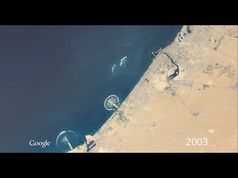
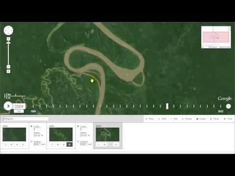
Google Earth Engine brings together more than 40 years of historical and current global satellite imagery, along with the tools and computational power necessary to analyze and mine that vast data warehouse. As a planetary-scale platform for environmental data analysis, it is an invaluable tool for students to deepen their knowledge of the implications of climate change, and much more. The Timelapse project shows the power of Earth Engine by creating an interactive viewer showing cloud-free, global land coverage changes across 32 years.
Earth is Beautiful
Earth Engine can used to view satellite images as art. See past entries and winners from the Earth Engine User Summit art contests.
Did you know...
A team of researchers at the University of Minnesota used Google Earth Engine to track the changes to all critical tiger habitats over a 14-year period (and across 13 countries). They discovered that with effective forest protection and management, it is possible to achieve the international goal of doubling the wild tiger population by 2022.
Telling Your Story Through Images
The Timelapse project used Carnegie Mellon University CREATE Lab's “Time Machine”, technology in conjunction with Earth Engine’s processing power to create zoomable and pannable videos over space and time, with billions of pixels of resolution. The CMU Timelapse Tour Editor creates tours in Timelapse consisting of keyframes for dates and locations on the globe, plus the transitions between those keyframes.
“It is not down in any map. True places never are” - Herman Melville


